
Click on a thumbnail graphic to view a gallery of drought data from the US Drought Monitor website.
Click the link to go to the US Drought Monitor website. Here’s an excerpt:
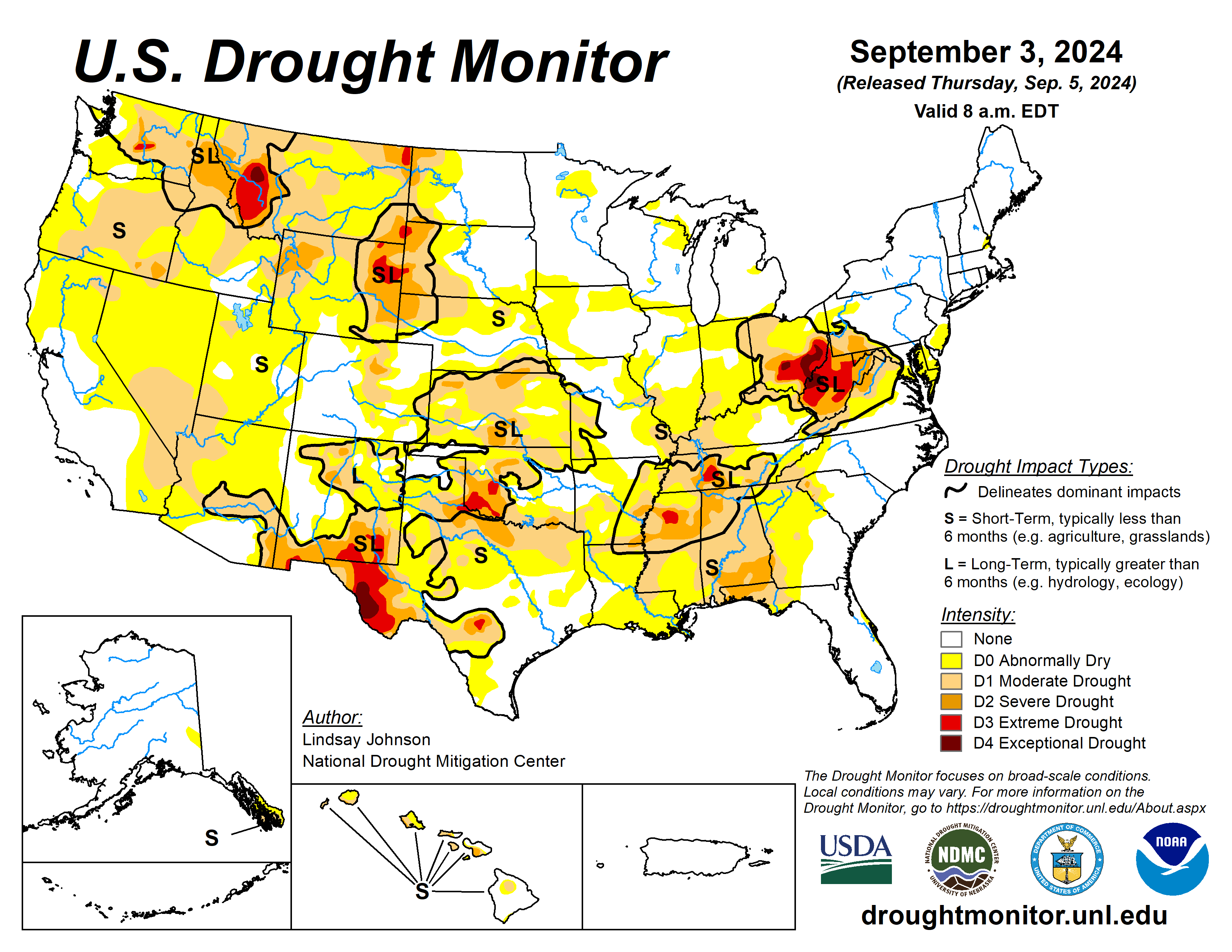
This Week’s Drought Summary
From Aug. 27 to Sep. 3, above-normal temperatures dominated the eastern United States, with areas along the Ohio River seeing temperatures upwards of 6 degrees above normal. The West and High Plains were a patchwork of above-, near- and below-normal temperatures. Isolated areas of southern New Mexico experienced temperatures of 5 degrees below normal. Overall, precipitation for most of the United States was within 1 inch of above- or below-normal conditions. This combination of hot and dry conditions led to continued drying in the Ohio River Basin, where conditions are dire. From Lake Superior southward to Alabama, drought conditions expanded with top and mid soil moisture and streamflow struggling. Texas and the western Gulf Coast saw over 8 to 10 inches of rain in some areas, quickly improving recent drying trends. In the West, there were dry conditions in the south and improving conditions in the Northwest…
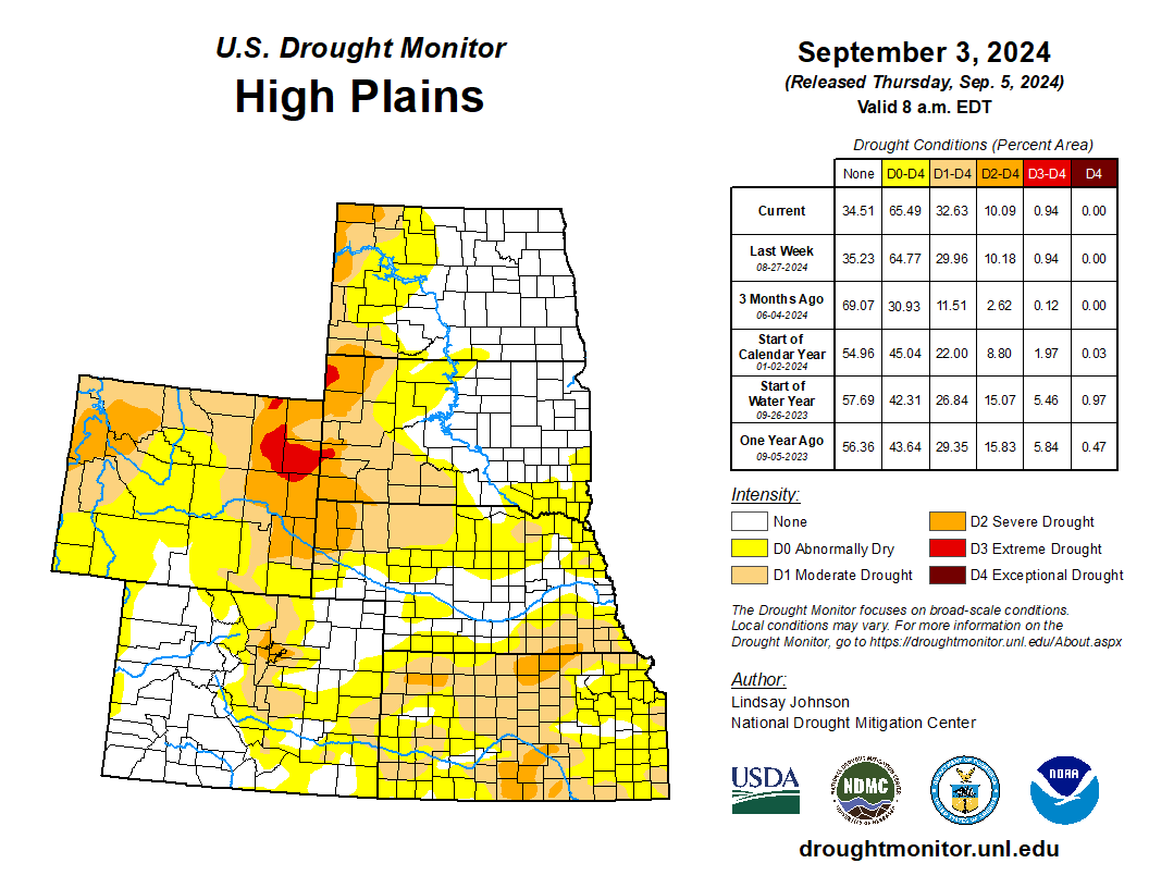
High Plains
Parts of the eastern High Plains received precipitation. The areas of North Dakota and South Dakota in need of precipitation missed the 1 to 3 inches that fell in the central and eastern parts of the states. Abnormal dryness spread towards central Nebraska as the precipitation this week was very spotty. Southeast Nebraska into north-central and northeast Kansas saw both abnormally dry and moderate drought conditions expand despite precipitation this week, due to longer-term dryness. Southwestern Kansas has been seeing conditions continue to improve, leading to the trimming of abnormally dry, moderate and severe drought. The eastern foothills and plains of Colorado experienced little to no rain this week, leading to the expansion of moderate drought. Along the western Colorado border with Utah, abnormal dryness was removed with increased streamflows aiding conditions…

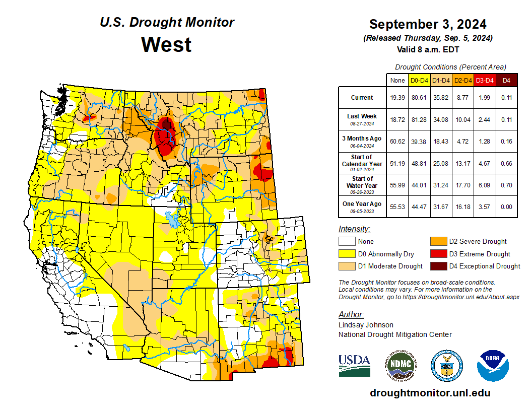
West
The West was a mixture of improvements in the northwest and Four Corners areas and degradations in in the desert areas of Nevada, Arizona, and California, plus isolated areas of the northern Rockies. South and central New Mexico received moisture, allowing some of the longer-term impacts to improve slightly. Utah saw some improvements on the eastern border with Colorado but did see abnormally dry conditions expand in Juab County and Millard County. In the Southwest, along with southern Nevada, western Arizona and southern California, abnormally dry and moderate drought conditions expanded. Moisture deficits continued in these areas, with not enough precipitation to aid in current dry conditions. Conditions from northwestern Washington southward along the Pacific Coast into northern California have seen improvements in short-term dryness, with streamflows and soil moistures improving. In central and northern Washington, there is still some lingering long-term drought but these, similarly to areas of short-term drought, are showing improvement…
South
Massive amounts of precipitation fell over Texas and along the Gulf Coast of Texas and Louisiana. Parts of central Texas saw 8 to 12 inches of rain. This moisture reversed much of the abnormally dry conditions introduced last week in central and southeastern Texas and western Louisiana. Northern Texas and Oklahoma missed out on meaningful precipitation, and with persistent dry conditions saw expansion of moderate and severe drought along the Texas-Oklahoma border. Precipitation deficits and drying soil moisture led to Tennessee seeing eastward expansion of abnormal dryness and moderate drought…
Looking Ahead
Over the next five days (September 4-9) the West and High Plains are likely to see little to trace amounts of precipitation, except for areas in the higher elevation of the southern Rocky Mountains. There is a better chance for precipitation in the Great Lakes region. There are three tropical waves in the Atlantic, with two having a 40 to 60% chance of developing into a tropical or sub-tropical cyclone within the next seven days. With these tropical waves the Gulf Coast states are likely to see 2 to 3 inches of rain.
The National Weather Service Climate Predication Center’s 6-10 day outlook heavily favors above-normal temperatures from the north-central Canadian border to Arizona-Mexican border. Surrounding areas to the west and east are leaning towards above-normal temperatures. From western Texas into Maryland the temperatures are expected to be near normal, with slightly increasing probability of cooler temperatures southward. Central and southern Florida are likely to see warmer-than-normal temperatures, along with the northern part of Alaska. The 6-10 day precipitation outlook is similar to the temperature outlook, though slightly shifted to the east. Areas of the northern Midwest are likely to see below-normal precipitation, with probability decreasing into the Rocky Mountains and Appalachian Mountains. There is a stronger probability that the Pacific Northwest and eastern Gulf Coast will see above normal precipitation. Hawaii and Alaska are also leaning toward above-normal precipitation.
Just for grins here’s a gallery of early September US Drought Monitor maps for the last few years.

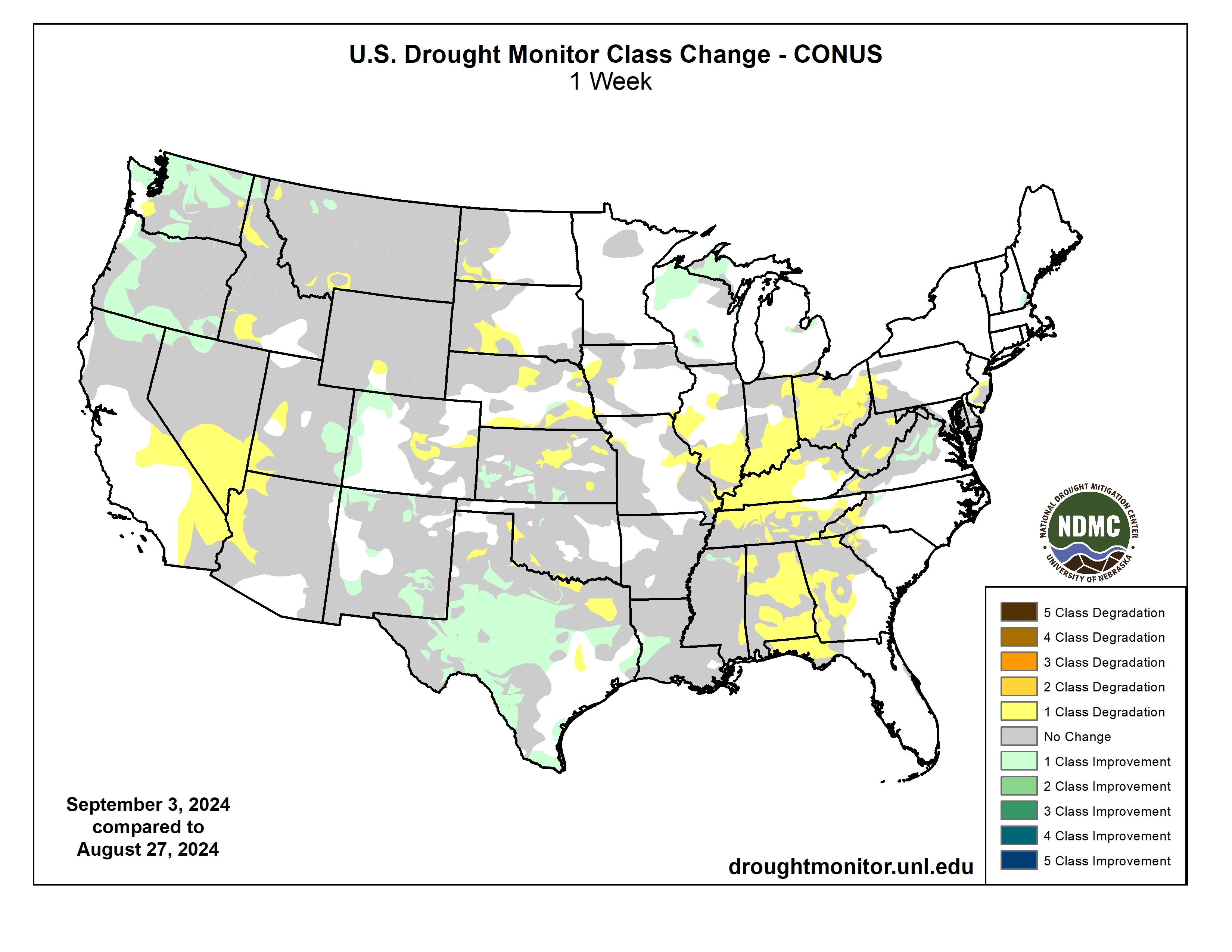
US Drought Monitor map September 3, 2024. 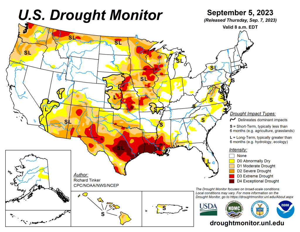
US Drought Monitor map September 5, 2023. 
US Drought Monitor map September 1, 2022. 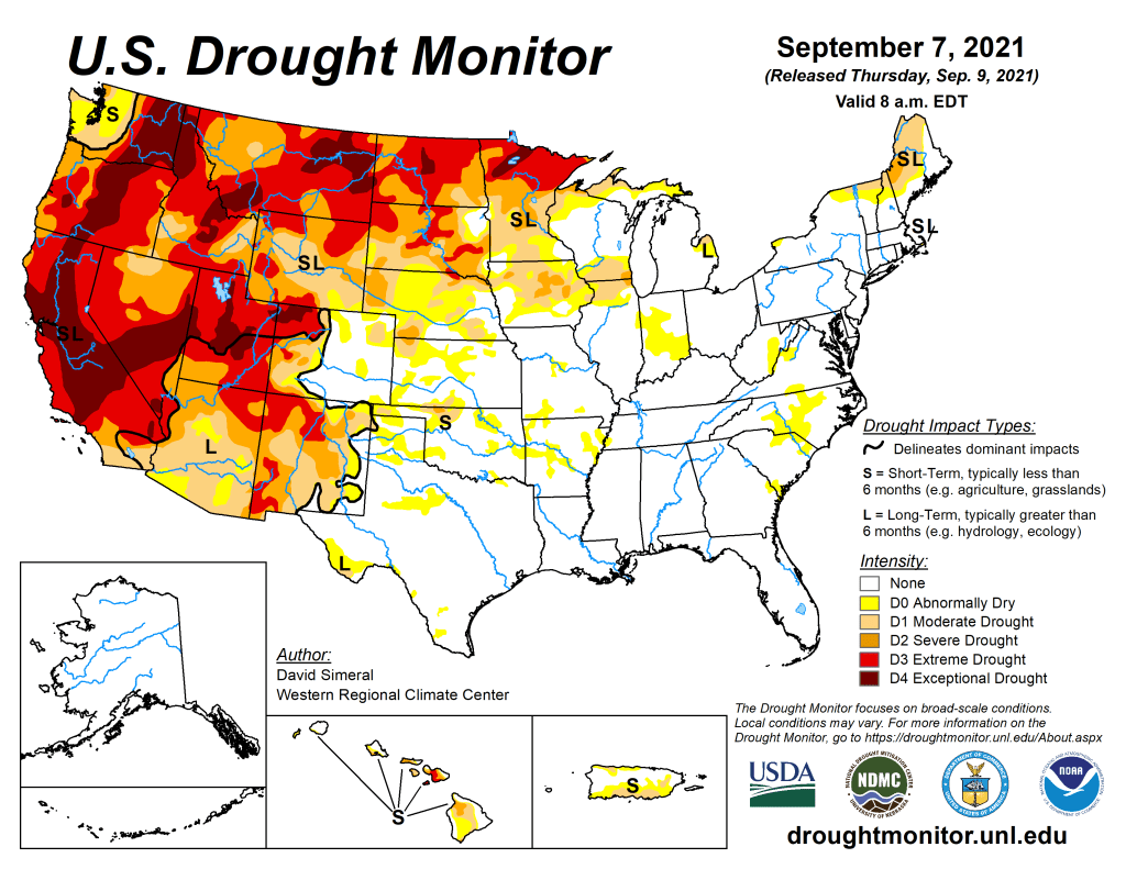
US Drought Monitor map September 7, 2021. 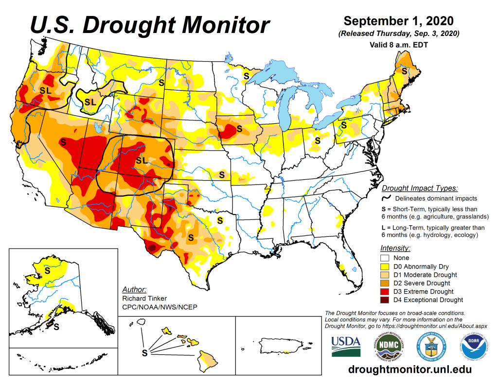
US Drought Monitor September 1, 2020. 
US Drought Monitor September 3, 2019. 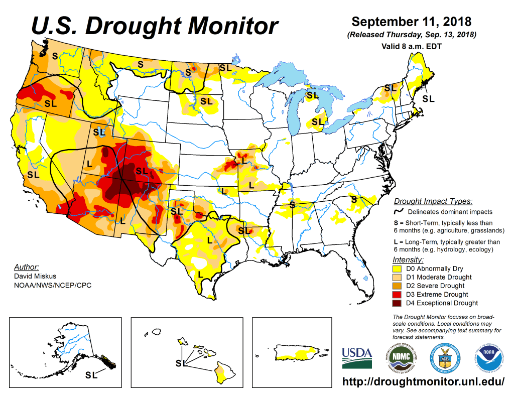
US Drought Monitor September 11, 2018. 
US Drought Monitor September 5, 2017. 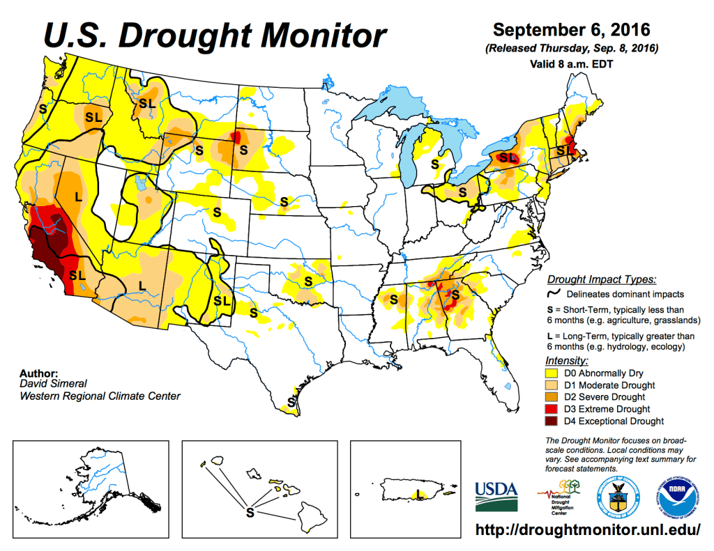
US Drought Monitor September 6, 2016. 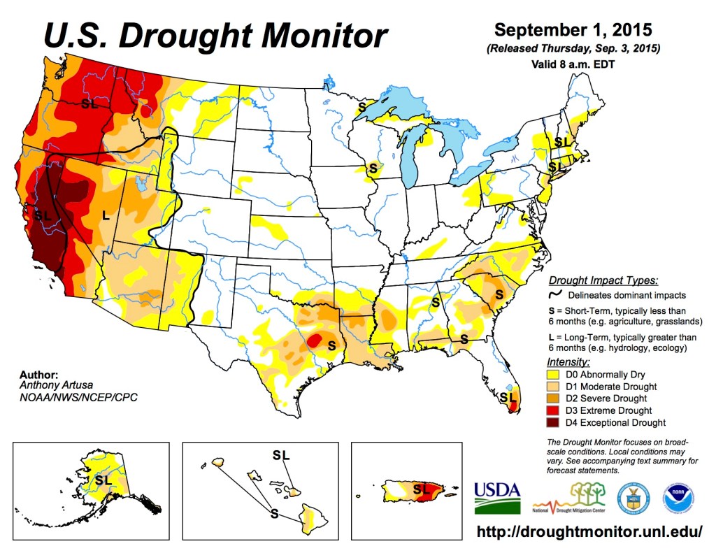
US Drought Monitor September 1, 2015 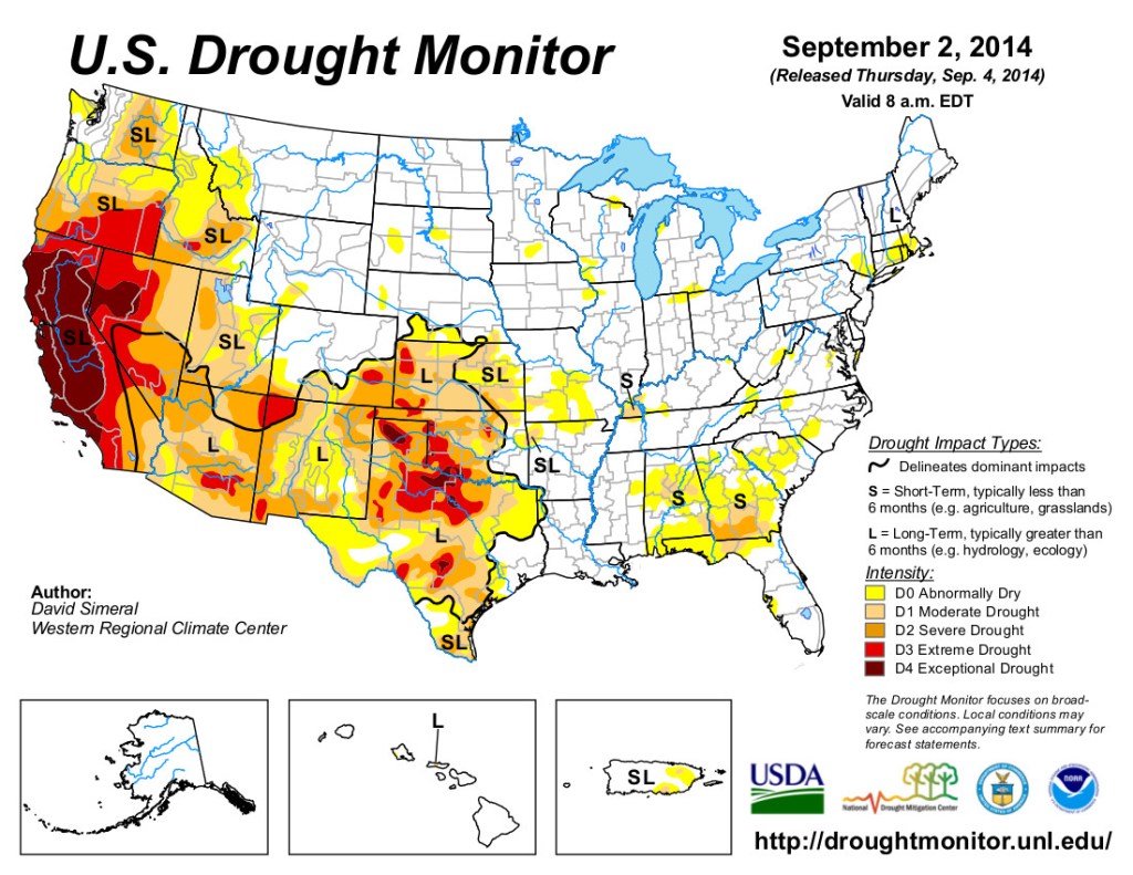
US Drought Monitor September 2, 2014 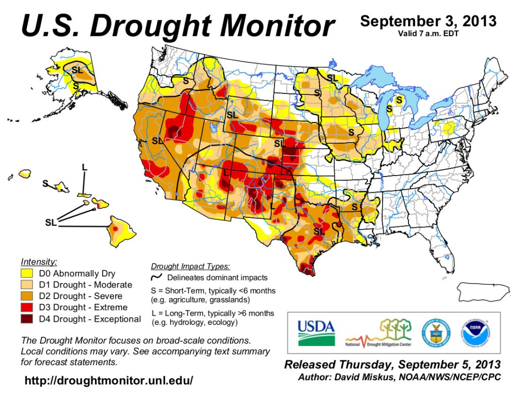
US Drought Monitor map September 3, 2013. 
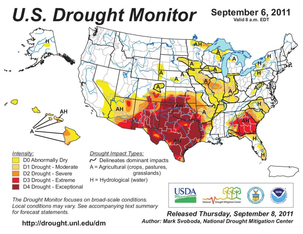
US Drought Monitor map September 6, 2011. 
US Drought Monitor map September 14, 2010.