
Click the link to read the briefing on the Western Water Assessment website:
June 8, 2025 – CO, UT, WY
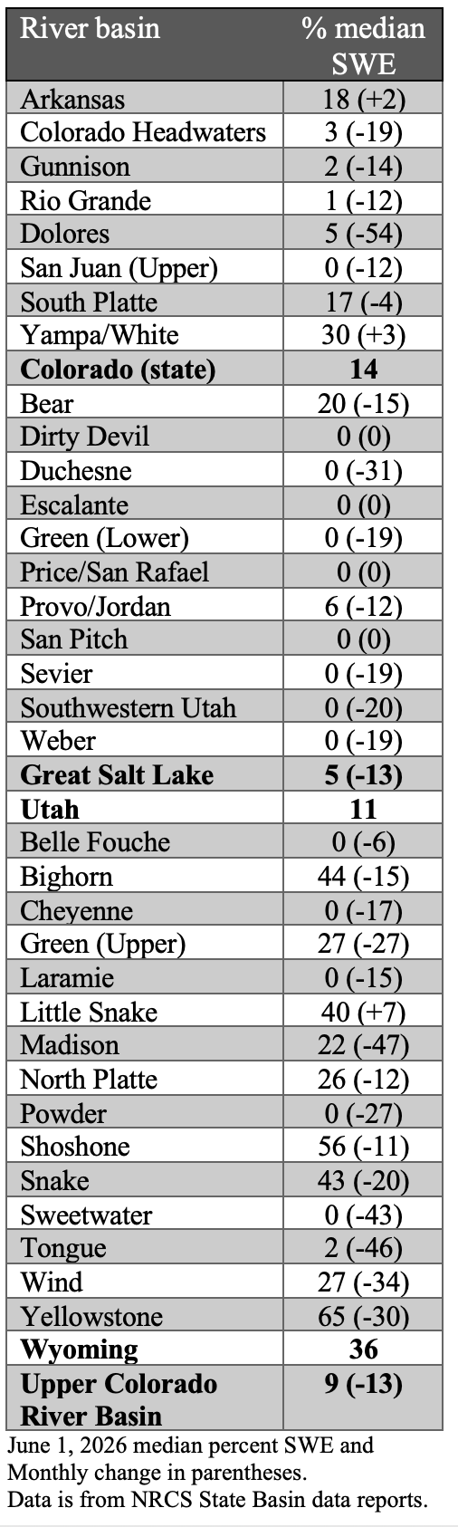
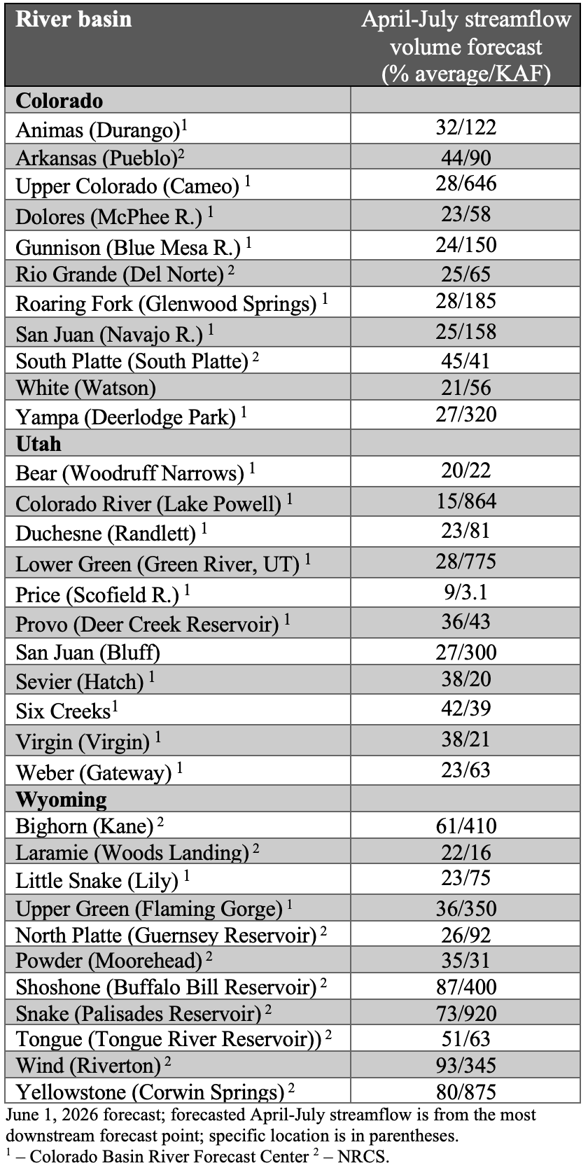
May precipitation was generally below average, except for portions of northern and eastern Colorado, and temperatures were slightly above average. Snowpack conditions continued to deteriorate compared to average during May, and June 1 SWE conditions were near record-low in Colorado (14% of median), Utah (11%), and the Upper Colorado River Basin (9%). Except for northern Wyoming river basins, April – July streamflow volume forecasts are less than 50% of average, and record-low streamflow volumes are forecasted for the Bear, Upper Colorado, White, and Yampa River Basins.
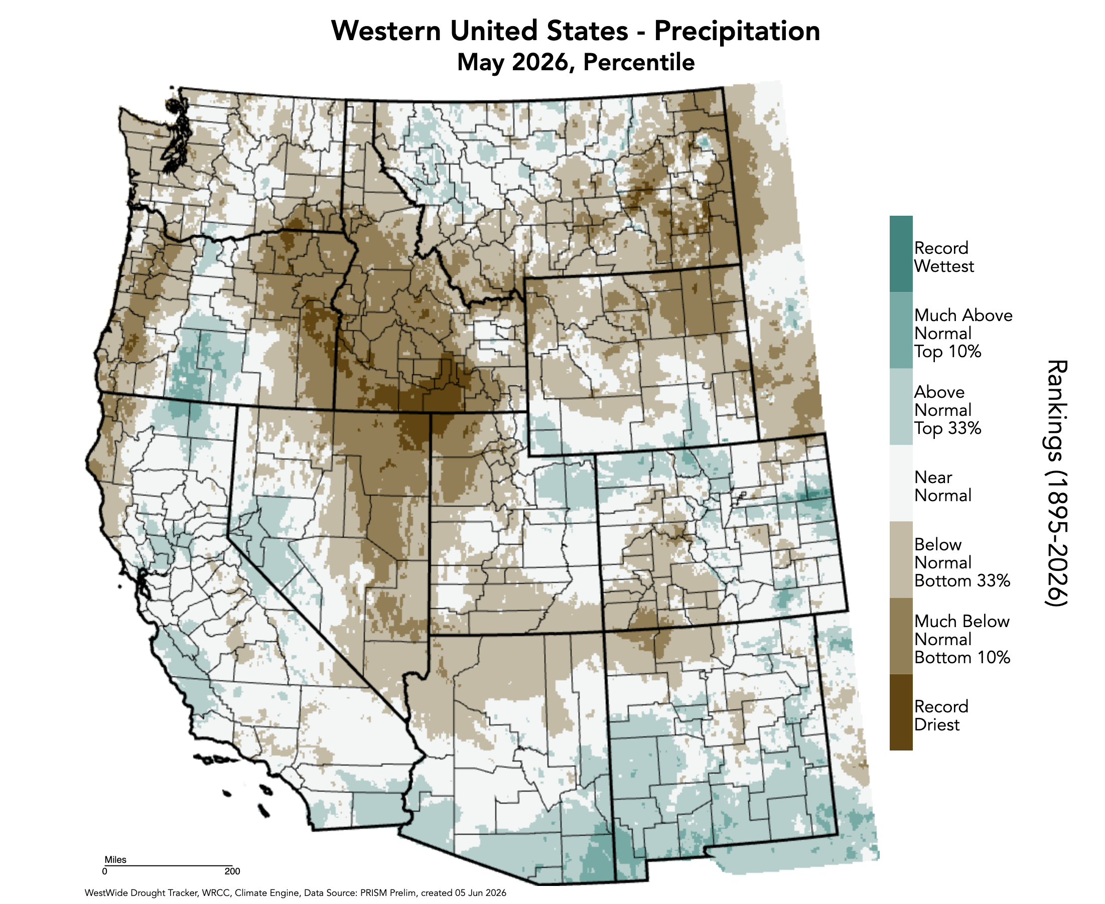
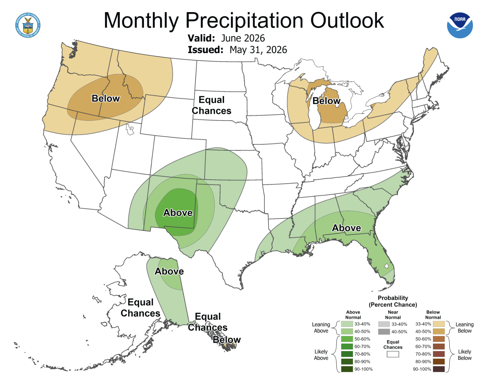
May precipitation was below average for much of the region, with large areas receiving less than half of average precipitation. Southwestern Colorado, southern and western Utah, and northern Wyoming were the driest locations during May. Above average precipitation fell in northeastern Utah and southwestern Wyoming, as well as across a broad swath of northern and eastern Colorado.

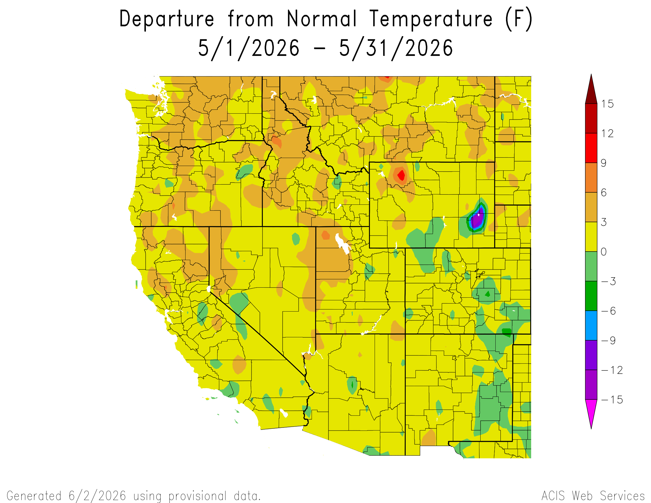
After a relatively cool April, temperatures were up to three degrees above average for much of the region during May. Temperatures in western Utah and northwestern Wyoming were 3-6ºF above average, and isolated areas of Colorado and Wyoming were up to three degrees below average during May.
June 1 snow water equivalent (SWE) remained near record-low in Colorado (14% of median), Utah (11%), and the Upper Colorado River Basin (9%), and slightly above record-low SWE in Wyoming (36%). An early May storm brought some accumulating SWE to Colorado and Utah, and a late May storm bolstered SWE slightly in Wyoming. Percent median SWE worsened during May in all river basins except the Arkansas, Little Snake, and Yampa River Basins. Snow has completely melted from all sites in the Dolores, Escalante-Sevier Lake, Lower Green, Jordan, Powder, and Upper San Juan River watersheds. Cooler conditions during April and some accumulating May snow caused SWE conditions in most river basins with remaining snowpack to improve slightly compared to record-low April 1 SWE.

April-July streamflow volume forecasts were much below average with some basins forecasted at record-low streamflow volumes. Regional seasonal streamflow volume forecasts were less than 50% of average for all river basins except the Wind (93%), Shoshone (87%), Yellowstone (80%), Snake (73%), and Bighorn (61%) River Basins. Record-low April-July streamflow is forecasted for the Bear River (21% of average), Colorado River at Cameo (29%), Lake Powell (15%), White River (19%), and Yampa River (28%). Peak streamflow on regional rivers was extremely low to record-low. Unless a secondary peak in streamflow occurs during June or from monsoonal rains, record-low peak annual streamflow will be observed for the Arkansas, Colorado, Rio Grande, and San Juan Rivers during 2026.


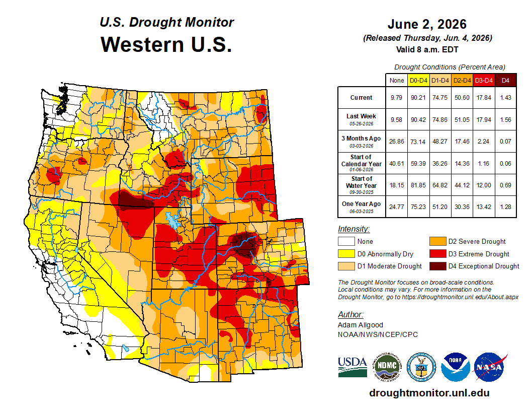
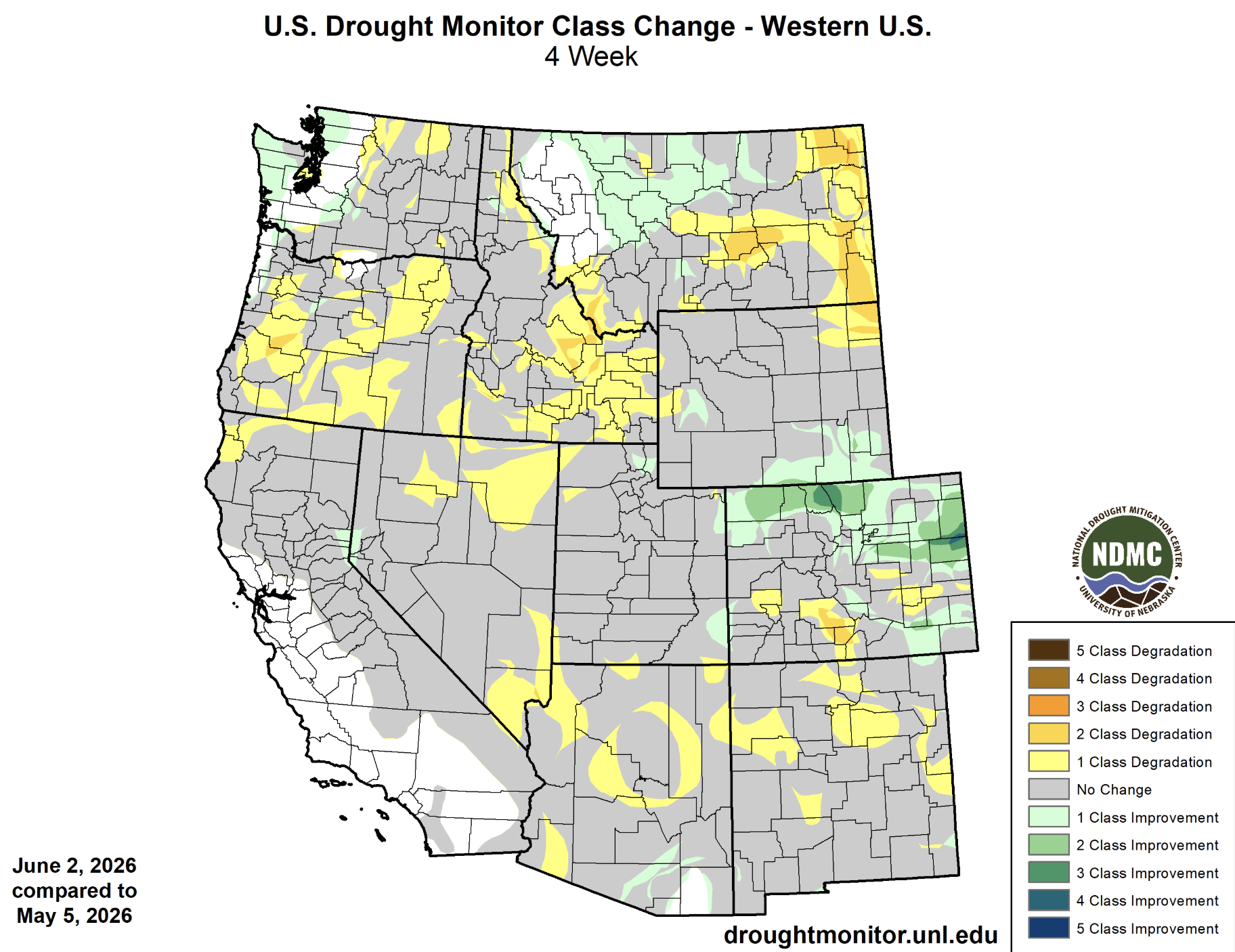
Regional drought coverage decreased slightly during May and now covers 97% of the region. Extreme drought covers 41% of the region and exceptional drought encompasses the Colorado River Headwaters. Above average May rainfall in northern and eastern Colorado caused a 2-3 category improvement in drought conditions, though drought conditions still persist.
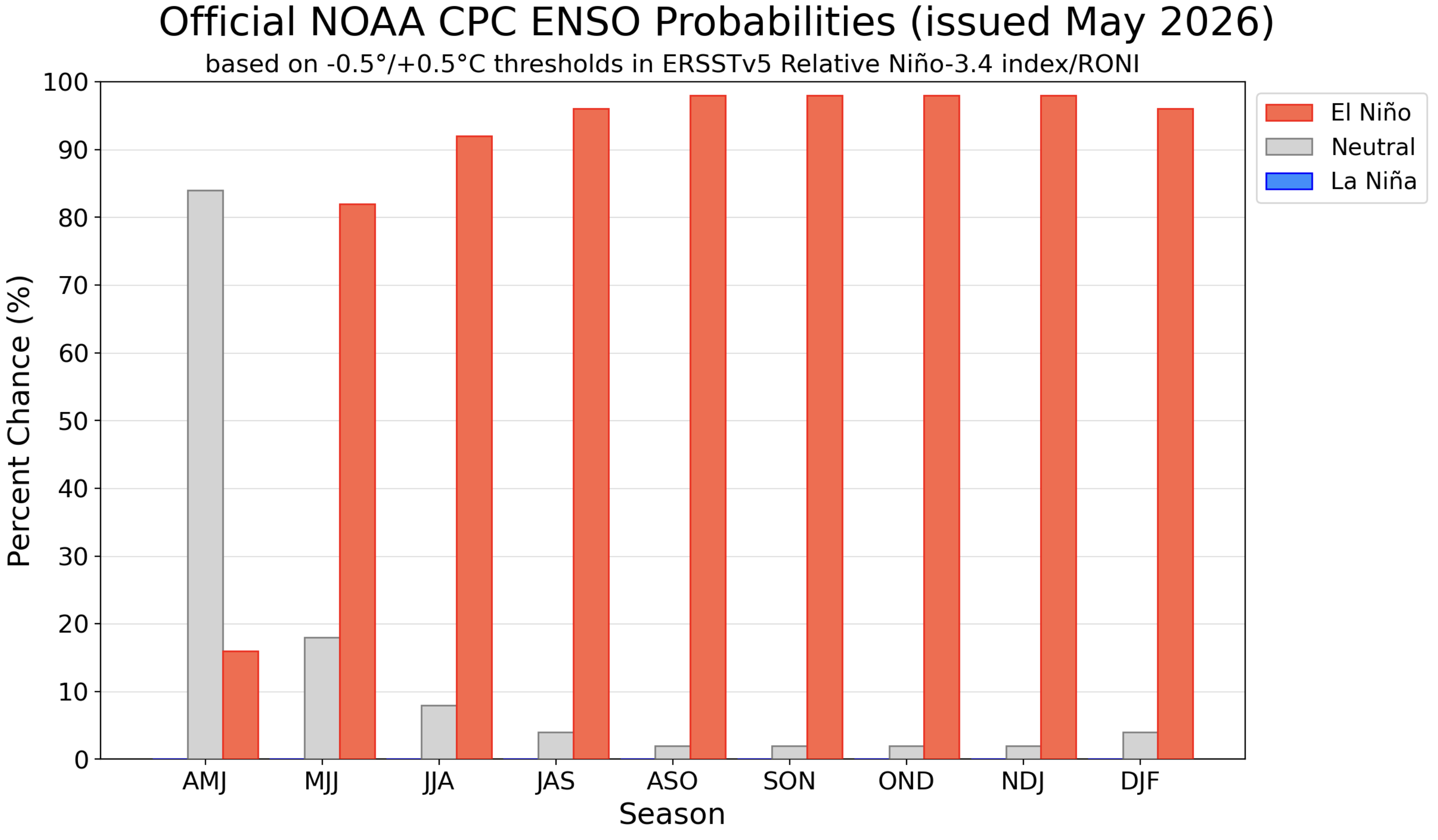
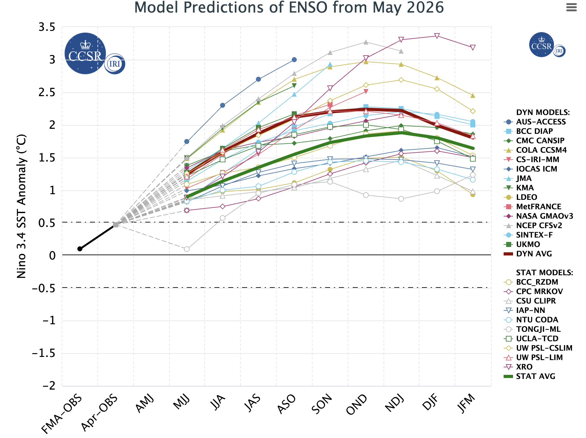
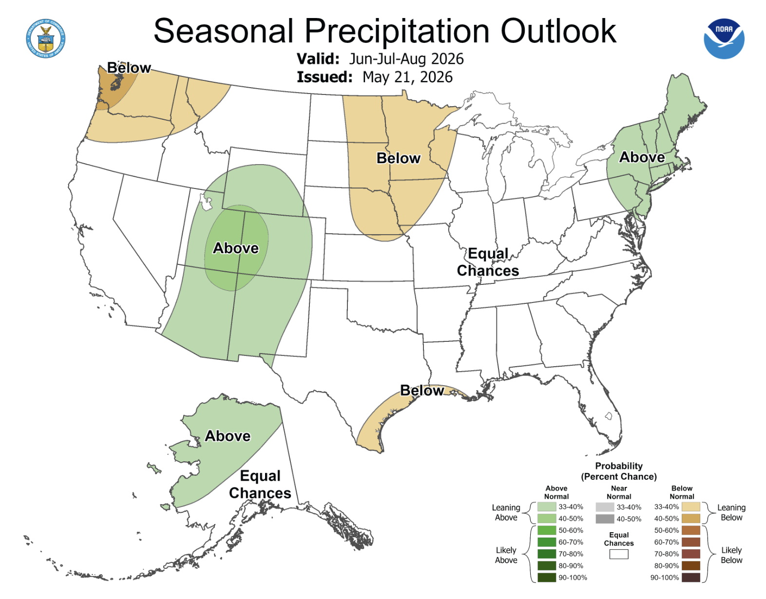
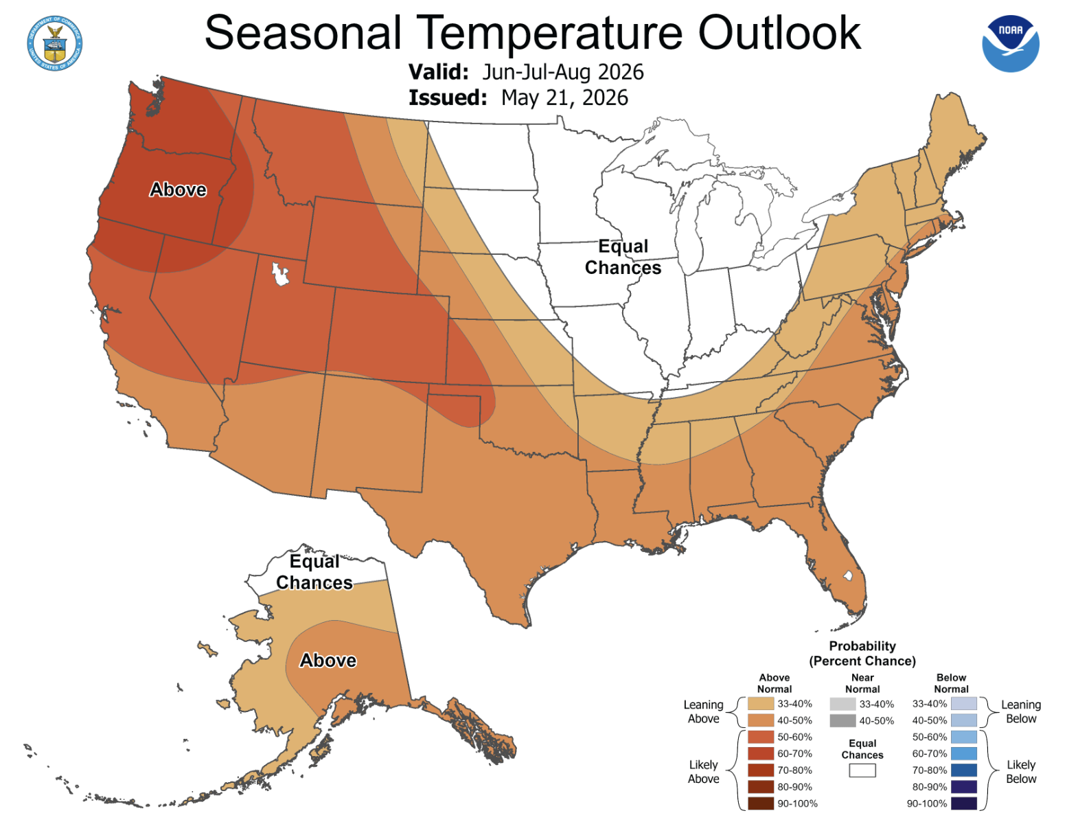
Pacific Ocean temperatures warmed to near El Niño levels, and long-term forecasts suggest a 90-98% chance of El Niño conditions forming by June-August and persisting through mid-winter. Pacific Ocean temperature models project sea surface temperatures to warm to 2 degrees Celsius above average by early 2027, potentially causing a strong El Niño. NOAA precipitation forecasts suggest an active monsoon season with an increased probability of above average precipitation during May for southern Colorado and an increased probability for above average precipitation for most of the region during June–August. NOAA seasonal forecasts suggest an increased probability of above average temperatures for June-August.
Significant May weather event. Up to three feet of snow fell on May 5-6 along the northern Front Range of Colorado and southeastern Wyoming. Estes Park and Rocky Mountain National Park saw snowfall totals from 2 to 3 feet. Cheyenne, Wyoming experienced its largest snowfall of the year with 11.6” while Boulder recorded 11” and Denver International Airport recorded 5.8”. Despite the significant snowfall in parts of Colorado and Wyoming, the storm did little to relieve persistent regional drought conditions.