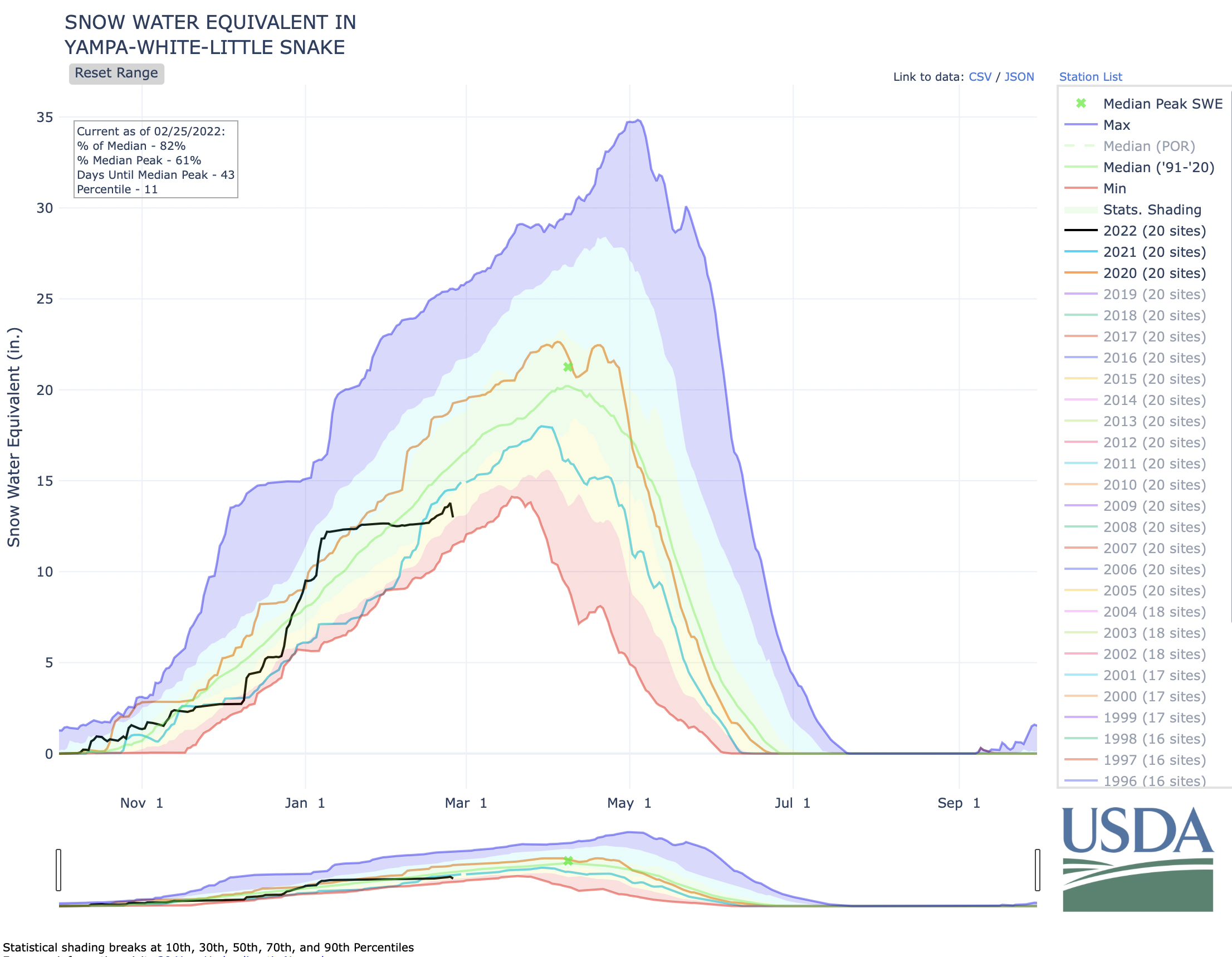
Updated Colorado River 4-Panel plot thru Water Year 2022 showing reservoirs, flows, temperatures and precipitation. All trends are in the wrong direction. Since original 2017 plot, conditions have deteriorated significantly. Brad Udall via Twitter: https://twitter.com/bradudall/status/1593316262041436160
Rising temperatures have sucked more than 10 trillion gallons of water out of the Colorado River Basin between 2000 and 2021.
“Water in western Colorado is not a partisan issue,” said Andy Mueller, the executive director for the Colorado River District. “We have some of the most liberal counties in America, but we also have some of the most conservative counties in America, and yet when they come together — their representatives who employ me — 90% of the time they agree on water policy issues. And it is the one area in today’s really divided political discourse where we see some united discussion.”
A new study out of UCLA shows the Colorado River has lost 10% of its water since the 1950s due to rising temperatures. Along parts of the Colorado, that loss is due to lessened snowpack as the area becomes more arid, but in others it’s due to evaporation as the temperatures cause the water to change to a gas more quickly.
Denver Water is helping ensure its future water security with the Gross Reservoir Expansion Project. When the project is complete, it will nearly triple the Boulder County reservoir’s capacity to 119,000 acre-feet. CREDIT: HEATHER SACKETT/ASPEN JOURNALISM
Climate change is robbing the Colorado River of water and threatening water security for 40 million people living in the Southwest. But prominent Colorado water managers, citing political concerns, are shying away from action on climate, favoring instead adaptation to rising temperatures and sustainability in their own operations.
The climate news surrounding the river is often grim. Scientists have shown that flows have declined nearly 20% from the 20th century average and that human-caused higher temperatures are responsible for about one-third of that. They have also shown that every 1 degree Celsius of warming results in a 9% reduction in flows. A record-setting snowpack this past winter led to above-average runoff conditions, but that good news follows the fact that water levels in the nation’s two largest reservoirs, Lake Powell and Lake Mead, dropped to historic lows early this year.
And it is predicted to get worse. Scientists at the World Meteorological Organization said last month that we are more than likely headed for a period of warming in the next four years, driven by El Nino, that will see record-breaking heat. This will push the Earth 1.5 degrees Celsius (2.7 degrees Fahrenheit) above pre-industrial levels for at least one year between now and 2027. The 1.5-degree Celsius mark is a major threshold; experts have warned that this amount of warming will result in far more impacts such as droughts and heatwaves.
Yet, despite a cleareyed recognition of the scale of the climate problem, Colorado water managers have done remarkably little when it comes to pushing for climate action on a main cause of water shortages: rising temperatures caused by humans burning fossil fuels such as coal, oil and natural gas. Experts agree the world needs to quickly transition away from fossil fuels to renewable sources of energy such as solar and wind power.
Managers instead have focused almost entirely on climate resilience and adaptation by funding programs that help water users adjust to the impacts of shortages and, in some cases, have worked to reduce their own carbon footprint and increase sustainability in their operations. “Climate resilience” and “drought resilience” have become popular buzz phrases in the Colorado water world.
But experts say these approaches don’t address the root cause of the problem and that water managers have a responsibility to pivot from climate adaptation to mitigation. According to the Intergovernmental Panel on Climate Change (IPCC) — an arm of the United Nations representing 195 countries and considered an international authority on climate change — adaptation and mitigation are necessary to avoid the worst losses and damages.
“This is their resource,” said John Berggren, a water policy analyst with Western Resource Advocates, referring to Colorado River water managers. “It’s not disconnected, it’s not tangential. Climate change is impacting their ability to provide water, and therefore I think they have a responsibility to be advocating for policy change at every level of government.”
Climate scientist Brad Udall has been beating the drum on this issue for years. Udall’s 2017 paper with researcher Jonathan Overpeck was one of the first to illustrate just how much of an effect rising temperatures were having on the Colorado River. A hotter atmosphere can hold more water through evaporation, and plants suck up more water as heat increases. Udall and Overpeck’s research found that an average of one-third of the declines in flows can be attributed to human-caused higher temperatures.
September 21, 1923, 9:00 a.m. — Colorado River at Lees Ferry. From right bank on line with Klohr’s house and gage house. Old “Dugway” or inclined gage shows to left of gage house. Gage height 11.05′, discharge 27,000 cfs. Lens 16, time =1/25, camera supported. Photo by G.C. Stevens of the USGS.
Source: 1921-1937 Surface Water Records File, Colorado R. @ Lees Ferry, Laguna Niguel Federal Records Center, Accession No. 57-78-0006, Box 2 of 2 , Location No. MB053635.
Udall’s family is steeped in the history of the Colorado River. As he writes in the forward to the book “Cornerstone at the Confluence: Navigating the Colorado River Compact’s Next Century” (2022),his father, Morris, was a U.S. congressman from Arizona who shepherded the Colorado River Basin Project Act through the House of Representatives in 1968 and his uncle Stewart was secretary of the interior during the 1960s, who promoted the U.S. Bureau of Reclamation’s vision for the river. His great-great-grandfather John D. Lee founded the famous Lee’s Ferry, now the dividing point between the upper and lower Colorado River basins.
Udall, a senior water and climate research scientist at Colorado State University, has been one of the loudest voices in recent years calling for audacious leadership on issues of climate change and the river. He often says that climate change means water change. He said water managers have a responsibility to address climate change and that it’s frustrating to watch people retreat to their silos.
“It’s disheartening to me, the idea that it’s somebody else’s problem and the potential for disaster that exists because people are just focused on their little areas of expertise and what they think is their responsibility as defined by their job title versus what I would argue is their responsibility to humanity as a whole, which might not be in their job title but should be,” Udall said.
During his presentation at the 2019 Upper Colorado River Commission meeting in Las Vegas, Udall told water managers that adapting to impacts doesn’t go far enough, and he suggested tools for mitigation such as carbon pricing and tax credits for renewable energy. He said not nearly enough is being done.
“How many times can we say this is a full-on, five-alarm fire that we’ve got to address immediately and yet nothing happens?,” Udall said. “It’s kind of as if people don’t understand the historic times in which we are operating right now. This is a once-in-human-history pivot point.” [ed. emphasis mine]
Water and climate scientist Brad Udall speaks at the annual Colorado Law Conference on Natural Resources at the University of Colorado Boulder last week. Udall has been one of the loudest voices calling for audacious leadership on issues of climate and the Colorado River. Photo credit: Heather Sackett/Aspen Journalism
Hot-spot mission scope
When General Manager Andy Mueller was hired at the Colorado River Water Conservation District in 2017, he told his new board the two biggest challenges facing the district were its anemic bank account and climate change. The money problem was largely remedied in 2020 when voters throughout the 15-county district overwhelmingly approved ballot measure 7A, raising an additional $5 million a year for the River District. The majority of that new taxpayer money now goes to fund water projects, many of which are aimed at helping water users across the Western Slope adapt to the impacts of climate change.
The River District has funded projects that create a redundant water supply so that cities aren’t at risk if a wildfire affects one water source; projects that help farmers and ranchers figure out how to still grow crops with a smaller supply of water; and projects that try to predict water availability such as soil moisture monitoring and remote-sensing snowpack monitoring. Mueller said adapting to climate change underlies everything they do at the River District.
Andy Mueller, the general manager of the Colorado River District, speaking at the district’s annual seminar on the Colorado RIver, on Sept. 14, 2018 in Grand Junction. Muller expressed concerns about how the state of Colorado might deal with falling water levels in Lake Powell and Lake Mead. Photo credit: Brent Gardner-Smith/Aspen Journalism
“Conversations today are largely driven by the fact that climate change has impacted the availability of water,” Mueller said. “Everything we think about at the River District is how do we prepare our water users and how do we help protect our water users in our communities from that hotter and drier future from the water-security perspective.”
The area covered by the River District is feeling climate change impacts more acutely than other areas in the West. According to a 2020 analysis by The Washington Post, a cluster of counties on the Western Slope has warmed more than 2 degrees Celsius (3.6 degrees F), which is double the global average. The hot spot spans more than 30,000 square miles; is the largest hot spot in the contiguous United States; and includes some of western Colorado’s largest irrigation districts in the Grand Valley and Uncompahgre River Valley.
It’s likely that the River District’s mission — to lead in the protection, conservation, use and development of Colorado River water for the welfare of the district — will be made all the more challenging in years to come as rising temperatures cause flows to decrease even more. But Mueller said he sees addressing the causes of climate change — humans burning fossil fuels — as outside the scope of that mission. The River District hires lobbyists and has staff focused on government relations, but it does not push for climate policies that aim to curb carbon emissions.
Turning from adaptation to prevention is a massive lift and one that would change the focus of the organization, Mueller said. Add to that the fact that some of the counties represented on the district board have economies still partly dependent on extracting oil, gas and coal and it becomes even harder to take action.
“I think we have a responsibility to give voice to what climate change is doing to our communities and our water supply, and I do think the River District does a good job with that,” he said. “Do we have an obligation to lead in the prevention of climate change? I would say no, we don’t … . We have identified climate change as a threat, but the idea that we have the ability to meaningfully prevent the root cause of climate change isn’t within our traditional abilities and our mission.”
The trust of the customer
Denver Water is Colorado’s oldest and largest public water utility, supplying water to 1.5 million people. The water provider gets about half of its supply from the Colorado River through transmountain diversions that take from the headwaters to the Front Range via a system of pumps, pipes, tunnels and reservoirs. Its operations and water quality have been impacted by climate-change-fueled wildfires in the watersheds where it draws this water, with post-fire debris and ash being washed into reservoirs and clogging infrastructure.
Denver Water’s departing CEO, Jim Lochhead, who has led the utility since 2010, is an attorney and the former head of Colorado’s Department of Natural Resources. He has received a Water Leader of the Year award from the Colorado Water Congress.
Lochhead and Denver Water are powerful political players in Colorado. For example, after he and heads of other water utilities that pull some of their supply from the Colorado River testified at a state Senate hearing this year, lawmakers added more seats for Front Range water providers to a drought task force.
Lochhead said that every aspect of Denver Water’s operation is impacted by climate change and that climate change, population growth and the resulting impact on the Colorado River are the utility’s greatest challenges. He said Denver Water walks the talk by doing stream-restoration projects in the headwaters to mitigate the impacts of its diversions and forest health initiatives that mitigate impacts of wildfires. The utility is preparing for a future with a less consistent water supply through increased efficiency, water recycling and projects such as the expansion of Gross Reservoir in Boulder County. That project is raising the height of a dam in the foothills west of Boulder by 131 feet, nearly tripling the reservoir’s capacity from 42,000 to 119,000 acre-feet.
Denver Water CEO/Manager Jim Lochhead accepts the 2021 AMWA Sustainable Water Utility Management Award from AMWA President Angela Licata and AMWA Vice President John Entsminger, at the group’s annual meeting in early October, 2021 in Denver. Photo credit: Denver Water.
Lochhead said Denver Water is addressing climate change in a major way: through sustainability, water conservation and energy efficiency efforts at its new campus, which has solar panels, blackwater reuse and rainwater capture for irrigation, LED lighting and has been awarded multiple LEED Green Building certifications.
“We wanted it to be a vision of the future and a vision of sustainability,” Lochhead said. “This is the most sustainable campus that has been developed in Colorado.”
Denver Water’s goal is to reduce by 2025 overall energy use and greenhouse gas emissions by 50% from a 2015 baseline, and Lochhead said they are on track to meet that goal.
But addressing the root cause of warming is a bridge too far for Lochhead, as it is for Mueller and the River District. Lochhead called climate change “a hot-button political issue.”
“We are created to be nonpolitical, and part of the trust our customers have for us is that we are nonpolitical,” he said. “To the extent that we are operating politically or we have stepped out of that role, we actually risk losing some of the trust of our customers.”
Last year, Denver Water joined a memorandum of understanding with other large municipal water providers to commit to reducing nonfunctional turf grass — a major water hog — by 30% and other efficiency upgrades. This type of collective action, along with promoting an ethic of sustainability, is how Lochhead sees Denver Water’s role in the climate crisis.
“There hasn’t been, to my knowledge, a collective discussion around reducing carbon emissions,” he said.
A POW delegation in front of the U.S. Capitol in this 2013 photo includes Roaring Fork Valley leaders including Gretchen Bleiler, far left, Penn Newhard, fourth from left, Chris Davenport, far right, and Auden Schendler, fifth from right.
Making the shift to activists
Auden Schendler, vice president of sustainability at Aspen Skiing Co. and a thought leader on climate issues in the ski industry, said water managers need to engage in solving climate change not just in their own operations but at the policy level.
A water utility getting its own sustainability house in order doesn’t do enough to make a difference and takes the blame off of where it belongs: the fossil fuel industry, which has long misled the public about the impacts of burning its products, Schendler said.
“By definition, it doesn’t do the things that fossil-fuel-industry people fear,” Schendler said. “What do they fear? Active voters, movements, legislation, public shaming, public exposure — that kind of thing. The fact that very powerful entities, businesses, water districts and trade groups won’t speak up is an astounding win for the fossil fuel status quo power structure … . I would argue that it’s negligent for a water district to not engage in those things.”
In recent years, SkiCo has become a leader on climate, aligning itself with Protect Our Winters, a group that harnesses the power of outdoor athletes and recreationists to solve the climate crisis. POW focuses on large collective action and political action for systemic change, an approach that the IPCC says can work.
“Effective climate action is enabled by political commitment, well-aligned multilevel governance, institutional frameworks, laws, policies and strategies and enhanced access to finance and technology,” reads the latest IPCC assessment report.
SkiCo has made the shift from a business that merely worked to make its operations “green” to climate activists promoting policies that combat climate change. Schendler said SkiCo’s role is to wield power, model solutions, lobby, help build movements, get involved in politics and basically engage in civics. So far, water managers have not made a similar shift, even though rising temperatures represent as much of a threat to their mission as they do to the snowy winter slopes relied upon by ski resorts.
Although things can often look grim, one of the points stressed in the latest report from the IPCC is that there is still time to avoid the worst impacts if people act now to limit warming. The window to secure a livable and sustainable future is rapidly closing, but there is a window nevertheless. Seeing climate change only as an inevitability that is global in nature can contribute to inaction, said Berggren, of Western Resource Advocates.
“Sure, maybe you as a water provider aren’t going to be writing or developing international climate policy, but as a water provider whose entire mission is dependent on a resource that is being negatively impacted by this issue, … you do have maybe even a moral obligation to be advocating for our national elected leaders to do something.”
During Aspen Journalism’s interviews with a wide swath of Colorado River experts, politics emerged again and again as the main barrier for the water community taking action on climate change. Most experts echoed the conclusions reached by Mueller and Lochhead: Climate action is perceived as a liberal issue, and taking more aggressive action is seen as an overreach.
The future of water in the West may depend on shifting those perceptions. With the Colorado River crisis making international headlines, many are looking to see what water leaders will do during this pivotal time.
“It’s a moral obligation on the part of leaders in our community to depoliticize climate,” Schendler said. “If water districts can’t think 100 years in the future, who can?”
Colorado River “Beginnings”. Photo: Brent Gardner-Smith/Aspen Journalism
Click the link to read the article on the Sky-Hi News website (Kyle McCabe). Here’s an excerpt:
The river district’s Public Relations Director Marielle Cowdin spoke about the district’s work. She highlighted the Colorado River’s crisis, saying that the increased precipitation over the last year will not save the river…Cowdin talked about the water consumption differences between the upper and lower basin states, highlighting that upper basin states make cuts more effectively because they do not have massive reservoirs like Lake Mead or Lake Powell to rely on in drier years.
“Between 2020 and 2021, the four upper basin states cut our water consumption by 1 million acre-feet — just on our own because the water wasn’t there,” Cowdin said. “Instead of about 4.5 million acre-feet of water use, in that year timeframe, we only used 3.5 (million).”
The lower basin states’ 2020-21 consumption went up 600,000 acre-feet from their average use, Cowdin said. The annual water usage split between the states has been about 60%, or around 8.8 million acre-feet, used by the lower basin versus 30%, or around 4.4 million acre-feet, used by the upper basin, with the remaining water going to Mexico…
The next speaker, Rebecca Mitchell, the Colorado Water Conservation Board director and Colorado’s commissioner to the Upper Colorado River Commission, was the special guest at the event. She spoke about the Bureau of Reclamation’s Draft Supplemental Environmental Impact Statement (SEIS) and news that broke about it the day of the meeting. Mitchell explained that the bureau’s SEIS came after the lower basin states did not respond to the bureau’s June 2022 announcement that states needed to cut 2-4 million acre-feet. That announcement, she said, was not a surprise to those working on the Colorado River…Differences between the upper and lower basin states came up several times in Mitchell’s talk. She mentioned that the six-state plan, which included all states besides California, acknowledged that the upper states have shortages annually because, unlike the lower states, they do not have huge reservoirs from which to draw…On May 22, the day of the meeting, the bureau announced a pause on the SEIS. Mitchell explained that the lower basin states had presented a plan which included temporary cuts that would amount to 3 million acre-feet from 2024-26 but provided few details on how cuts would be enforced.
“Instead of coming up with 2-4 million on an annual basis, they were like, ‘Hey, there’s all this money … we can kick the can a little bit more, and we can use this money and make some temporary changes,” Mitchell said of the lower basin states.
Colorado River “Beginnings”. Photo: Brent Gardner-Smith/Aspen Journalism
Click the link to read the article on the Water Education Website (Jerd Smith):
A new, late-session bill creating a statewide task force designed to shore up the state’s Colorado River drought protection efforts will be heard this week by Colorado lawmakers, with the Senate Agriculture and Natural Resources Committee considering the bill today.
The Colorado General Assembly adjourns May 6, giving lawmakers just days to deliberate on the bill.
Senate Bill 23-295 is sponsored by Sen. Dylan Roberts, D-Avon; House Speaker Julie McCluskie, D-Summit County; Sen. Perry Will, R-New Castle; and Rep. Marc Catlin, R-Montrose. It would create a task force that has six months to come up with ways to protect the state from water shortages due to the ongoing megadrought in the Colorado River Basin, and to ensure that efforts to temporarily fallow West Slope farms and ranches to help keep more water in the Colorado River don’t impose undue burdens on West Slope farms and ranches and other water users.
“This legislation … will bring us one step closer to addressing one of the most pressing issues our state has ever faced – the endangered Colorado River – and ensure every Colorado community has access to the water resources they need now and into the future,” Roberts said in a statement.
The Colorado River Basin covers seven states. The Lower Basin is made up of Arizona, California and Nevada, and the Upper Basin comprises Colorado, New Mexico, Utah and Wyoming.
The majority of the river’s supplies are generated here in the Upper Basin, with Colorado being the largest contributor to the system.
And the majority of the river’s water, roughly 80%, is used to grow food. If states can find ways to reduce agricultural water use, it would help rebalance the system. But it is a complicated undertaking, and could harm rural farm economies and food production if not done properly.
Map credit: AGU
Major water districts on Colorado’s West Slope, including the Glenwood Springs-based Colorado River District, as well as the Durango-based Southwestern Water Conservation District, represent many growers who rely on the Colorado River. They have been frustrated by what they say is a failure by the state to include them in decision making about new federal farm fallowing pilot programs, among other things. The proposed task force would be charged with devising a formal structure for including water districts and other interested parties.
Last month these districts were alarmed when the Colorado Water Conservation Board, the state’s lead water policy body, opted not to give them the opportunity to review fallowing proposals submitted to the Upper Colorado River Commission as part of what is known as the System Conservation Pilot Program (SCPP), a short-term initiative that would pay growers to voluntarily fallow their fields, or switch crops, or use other techniques to reduce their use of Colorado River water.
Steve Wolff is general manager of the Southwestern Water Conservation District. He said state water officials need to be more inclusive and transparent about decisions being made about the Colorado River.
Wolff said the CWCB’s decision to exclude the water districts from the SCPP review process is an example of the lack of transparency that is driving concern on the Western Slope.
He said the task force bill is a major undertaking and may not be finished before the session ends.
“It’s moving very fast,” he said.
The CWCB did not immediately respond to a request for comment. But CWCB Director Becky Mitchell has acknowledged previously that the SCPP initiative was rolled out very quickly, and its processes could be improved. Mitchell also represents Colorado on the Upper Colorado River Commission.
This year, due to historically deep mountain snows in Colorado and elsewhere, lakes Powell and Mead, the two largest reservoirs in the Colorado River system, will see more water flowing in than they have in decades. But because both reservoirs have sunk to less than 30% full, the bountiful runoff won’t be enough to restore the system.
In the coming weeks, major decisions loom on how to restore the river and to sustain it as climate change and lingering drought continue to sap its flows.
This week, for instance, the Upper Colorado River Commission, which represents the four Upper Basin states, will likely make decisions about which growers will participate in the $125 million SCPP.
Later this summer, the U.S. Bureau of Reclamation will announce how much Lower Basin states will have to cut their water use and which states will take the largest cuts.
Last summer, U.S. Bureau of Reclamation Commissioner Camille Touton ordered the seven states to cut 2 million to 4 million acre-feet of water this year, but negotiations have failed to produce a consensus.
The Upper Basin states, along with Nevada and Arizona, have agreed to a six-point plan that includes the SCPP, as well as a longer-term plan to create a special protected drought pool in Lake Powell, an initiative known as demand management. At the same time, California has offered its own plan that proposed cuts that are largely opposed by Arizona.
The new Colorado task force, if approved, would include West Slope and Front Range water district members, as well as environmental, agricultural and industrial interests.
Brad Wind is general manager of the Berthoud-based Northern Colorado Water Conservation District. It is one of the largest users of Colorado River water on the Front Range, and serves hundreds of farmers and more than a million urban water users.
He said his board won’t have time to take a formal position on the bill, but he said he’s concerned that it favors West Slope districts over those on the Front Range.
“There will be a lot more work between now and then [the end of the session],” Wind said. “It’s going to be a lively discussion.”
Jerd Smith is editor of Fresh Water News. She can be reached at 720-398-6474, via email at jerd@wateredco.org or @jerd_smith.
Denver Water is one of 18 partners who signed the Colorado River Cooperative Agreement in 2013, ushering in a new era of cooperation between the utility and West Slope stakeholders, all with the vested interest in protecting watersheds in the Colorado River Basin.
As part of that agreement, a process called “Learning by Doing” was created, which has helped the utility stay better connected on river conditions in Grand County. The partnership is a collection of East and West Slope water stakeholders who help identify and find solutions to water issues in Grand County.
“Denver Water has been part of Grand County for over 100 years, and we understand the impact our diversions have on the rivers and streams,” said Rachel Badger, environmental planning manager at Denver Water.
“Our goal is to manage our water resources as efficiently as possible and be good stewards of the water — and Learning By Doing helps us do that.”
Click the link to read the article on the InkStain website (John Fleck):
I’ll need a few more days to digest all 476 pages of the Department of Interior’s Colorado River Draft Supplemental Environmental Environmental Impact Statement, but the top line numbers are worth sharing right away. The DEIS includes a couple of action alternatives, which I’ll briefly describe below, but what’s immediately striking to me is that Interior’s cuts are significantly less ambitious than the states’. Here’s a quick update of the table I built back in January comparing the proposal submitted by Arizona/Nevada/Utah/Colorado/New Mexico/Wyoming, and the California plan.
As you can see, the states were far more willing to cut more quickly, and more deeply, than the federal alternatives. The numbers are cuts, in thousands of acre feet, from the old pre-chaos baselines of 4.4 maf for California, 2.8 maf for Arizona, 300kaf for Nevada.
Tier
Elevation
6-state
California
DEIS 2024
DEIS 2025-26
Tier 0
1090
1,784
1,241
400
400
Tier 1
1075
2,156
1,613
1,066
1,066
Tier 2a
1,050
2,918
1,721
1,234
1,234
Tier 2b
1045
2,918
2,013
1,734
1,734
Tier 2c
1040
2,918
2,071
2,083
2,083
Tier 2d
1035
2,918
2,129
2,083
2,250
Tier 2e
1030
3,168
2,188
2,083
2,500
Tier 3a
1025
3,168
2,525
2,083
3,000
Tier 3b
1020
3,368
2,675
2,083
3,333
Tier 3c
1015
3,368
2,875
2,083
3,333
1,010
3,368
3,125
2,083
3,333
1,005
3,368
3,325
2,083
3,333
In addition to the, “whatever, let’s just crash the system”, the DEIS includes two alternatives….
PRIORITY ADMINISTRATION
Alternative one would allow the cuts in my “DEIS” column based on the priority system. This plan is similar to California’s, in that the brunt of deep cuts falls on others. At current reservoir levels, Arizona would be required to cut 1.2 million acre feet, while California cuts nothing.
SHARING THE IMPACTS OF CLIMATE CHANGE
Alternative two would spread additional needed cuts based on a pro-rata share of 2021 water use among all the users. At current levels, Arizona would cut 1.025 million acre feet, California would cut 1.067.
HOW IT PLAYS OUT
Contrary to that crazy New York Times headline (click soon, it’ll certainly change!) Interior isn’t picking a preferred alternative. These are really just starting points for a push toward a seven-state negotiation between now and summer.
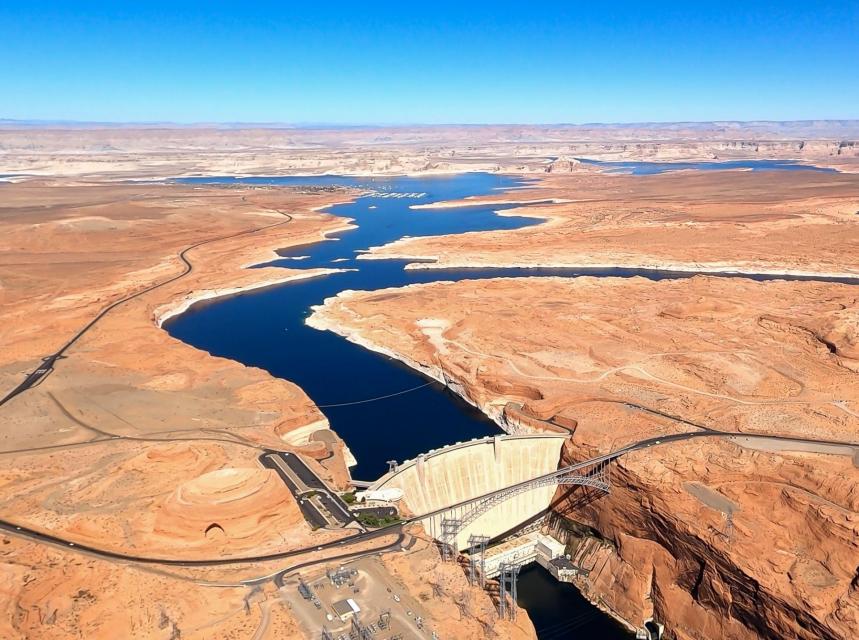
Wahweap Marina on Lake Powell at low water. Lake Powell will recover some storage thanks to the spectacular runoff predicted for this year. Jonathan P. Thompson photo
Calling this year’s forecasted Colorado River streamflows a “a once-in-a-century” event, water officials are warning decision makers not to squander the river’s surprising 2023 bounty.
The drought-strapped Lake Powell could see new supplies of more than 10 million acre-feet this year, 2 million more than had been forecast just one month ago, according to the Colorado River Basin Forecast Center.
Due to drought, and climate-driven reductions in mountain snows, Lake Powell hasn’t been full in 20 years and plummeted to just 23% full last year. It holds roughly 26 million acre-feet when it reaches maximum storage capacity. One acre-foot equals 326,000 gallons.
“It’s a tremendous gift. Our challenge is to not squander it,” said Chuck Cullom, director of the Upper Colorado River Commission, which represents the four Upper Colorado River Basin states of Colorado, New Mexico, Utah and Wyoming. Arizona, California and Nevada comprise the Lower Basin.
Cullom’s comments came March 31 at a seminar by Colorado’s Southwestern Water Conservation District in Ignacio, Colorado.
Screenshot of the Colorado Basin River Forecast Center streamflow forecast April 7, 2023.
With the new streamflow forecasts, reservoirs are expected to recover dramatically. Upper Colorado River water officials say the water needs to be held in the Upper Basin to improve the health of the system and to help cope with future drought years and reduced mountain snowpacks.
Even with the unexpected surge in new water supplies, Powell is only expected to recover slightly this year. Another bad year could throw the river back into crisis, officials said.
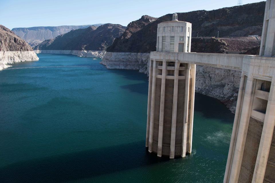
The seven-state Colorado River basin has been mired in a drought for more than 22 years, a dry spell widely believed to be the worst in more than 1,200 years. Lake Powell and Lake Mead, the largest reservoirs in the nation, have dropped to record lows, threatening water supplies to millions of people and jeopardizing the U.S. Bureau of Reclamation’s ability to generate low-cost, renewable hydropower for thousands of electric utilities across the West.
In 2019, in response to the ongoing drought and an alarming drop in storage levels at Powell and Mead, all seven states agreed to an historic set of drought contingency plans, which include cutbacks in use in the Lower Basin, as well as emergency releases from Utah’s Flaming Gorge Reservoir and Colorado’s Blue Mesa in the Upper Basin, to bolster Powell.
Those emergency plans were activated in the summer of 2021. Since then roughly 600,000 acre-feet of water has been released from Flaming Gorge and Blue Mesa, with the majority coming from Flaming Gorge.
Just a few weeks ago it wasn’t clear that any of the actions taken would be enough to keep Powell and Mead from dropping into crisis territory, where power generation would stop and deliveries out of Lake Mead to Lower Basin states would not be enough to satisfy demand.
But now, because of the surprising depth of mountain snows, suddenly there will be water and Reclamation has pledged to hold as much of it as it can in the Upper Basin to restore levels in Flaming Gorge and elsewhere, Cullom said.
In the coming weeks, the seven states have critical decisions to make about how the system will operate for the rest of this year, including how much water will be released from Powell and from Mead.
Andy Mueller, general manager of the Colorado River District, which oversees the river across a 15 county region in western Colorado, said he is grateful for the watery surge, but he said the Upper Basin states will push hard to limit releases from Powell and Mead this year and in years to come.
Climate stripes through 2022. Credit: Ed Hawkins
“We have to recognize that the water supply has changed underneath our feet. Yes, this year is a good year, and we appreciate that. What we have to remember is that one good year means the weather was good. It doesn’t mean the climate is going to go back to what we experienced in the 1970s or before,” Mueller said.
“The current guidelines have been focused on crisis management … We can’t continue to do that if we are going to get out of this problem,” he said, referring to the drought contingency plans and current guidelines for reservoir operations.
Manuel Heart is chairman of the Ute Mountain Ute Tribe in southwestern Colorado. The tribe is a major agricultural producer in the region. In 2021, the tribe received just 10% of its Colorado River water allocation due to the drought. Fields went dry and workers were laid off.
Now, along with other Colorado River farmers and ranchers, the tribe is looking for ways to adapt to a drier climate.
But this year, Heart said he is enjoying this remarkable wet season.
“Our prayers got answered this year,” he said. “It’s good to see the mountains the way they are supposed to look. I like to see the rivers flow and our lands green.”
Jerd Smith is editor of Fresh Water News. She can be reached at 720-398-6474, via email at jerd@wateredco.org or @jerd_smith.
Navajo Mountain March 2023. Jonathan P. Thompson photo.
The main boat ramp at Wahweap Marina at Lake Powell was unusable in December 2021 due to low water. The Colorado River District says it’s impossible to provide meaningful review of system conservation applications. CREDIT: HEATHER SACKETT/ASPEN JOURNALISM
Upper Colorado River Basin water managers have released little information so far about the Colorado proposals submitted for a conservation program, raising concerns about the approval process of the program, which aims to dole out $125 million in federal taxpayer money.
The Colorado Water Conservation Board on March 22 posted on its website the heavily redacted applications for 22 projects that meet the preliminary criteria for approval in a rebooted System Conservation Program (SCP). But in addition to redacting the applicants’ personal identifying information, nearly everything else has been blacked out as well: the location of the projects, such as which streams and ditches are involved; details of the water rights involved; and how much the applicants are asking to be paid for their water. (Here is an example of one of the applications.)
The Colorado River Water Conservation District wrote a memo and discussed the issue at a board meeting Thursday. The state and the Upper Colorado River Commission, which is administering the program, had invited the River District and the public to provide input on the project proposals. But with so little information available, the River District said that is impossible.
“Most, if not all, substantive details are blacked out,” the memo reads. “Thus, it is not possible to provide meaningful analysis of the applications, including whether implementation of the individual proposals would cause injury to other West Slope water users.”
River District General Manager Andy Mueller said his organization, which advocates for water users across 15 Western Slope counties, has concerns about the lack of a public process.
“At this point, that program is not something the district is going to have the capacity to weigh in on in any substantive manner,” he said. “We are proceeding to prepare comments from the district to the UCRC in terms of our concerns about how this process happened… It’s not the way we wish it had been to say the least.”
Becky Mitchell, CWCB executive director and state commissioner to the UCRC, had promised that the River District and Southwestern Water Conservation District would have a say in the approval of project proposals within their boundaries. The River District then developed criteria to evaluate projects, which included who could benefit from program money and preventing too much participation in a single basin. But on March 10, Mitchell walked back her commitment, saying only the UCRC could approve projects, using its own criteria.
The SCP was restarted this year as part of the UCRC’s 5-Point Plan, which is aimed at protecting critical elevations in the nation’s two largest and depleted reservoirs, Lake Powell and Lake Mead. The program will be paid for with $125 million in federal funding from the Inflation Reduction Act and will pay water users in the upper basin states — Colorado, Utah, New Mexico and Wyoming — to cut back. The original SCP, which ran from 2015 to 2018, saved an estimated 47,000 acre-feet of water, at a cost of about $8.6 million. For the renewed program, the UCRC set a baseline price of $150 per acre-foot of water saved, but applicants can ask for more.
Paying water users to irrigate less has long been controversial on the Western Slope, with fears that these temporary and voluntary programs could lead to a permanent “buy and dry” situation that would negatively impact rural farming and ranching communities.
Scott Hummer, water commissioner for District 58 in the Yampa River basin, checks out a recently installed Parshall flume on an irrigation ditch in this August 2020 photo. A handful of West Slope agricultural water users have submitted proposals to be paid to use less water as part of a rebooted system conservation program. CREDIT: HEATHER SACKETT/ASPEN JOURNALISM
Officials say more information to come
CWCB and UCRC officials say more details of the projects will be made available after they are approved and contracts are in place. The UCRC is set to consider the proposals at an April 10 meeting.
The decision to redact nearly all the information in the applications was a result of a conversation among the UCRC commissioners, said UCRC Executive Director Chuck Cullom.
“There was a discussion, and that’s what the four state commissioners were comfortable sharing at this time,” Cullom said.
According to Amy Ostdiek, CWCB section chief for Interstate, Federal and Water Information, the final implementation agreements and verification plans might look different — after analysis, revisions and back-and-forth with UCRC consultant Wilson Water Group and the applicant — from what was initially proposed. That is part of the reason the information in the proposals is not yet public, she said.
“We, frankly, didn’t want to make a bunch of personal information about our water users or their property, their water rights or how they value them public until we knew we were moving forward with the project,” Ostdiek said. “If they are providing a lot of information that doesn’t get incorporated,… we didn’t want to release that personal information when it wouldn’t be part of a project anyway.”
Ostdiek said the UCRC received more than 80 proposals for projects across the upper basin states. Thirty-six of those were in Colorado, and 22 so far have been given preliminary approval. Those 22 projects (one of which involves land in Wyoming) are estimated to involve 5,800 acres of land and save up to 9,618 acre-feet of water. Most propose halting irrigation for at least part of, if not the entire, season. Ostdiek said the state and division engineers at the Department of Water Resources are reviewing the proposals to make sure projects don’t cause injury to other water users.
Ostdiek said the approval process by the UCRC would be different from that of CWCB, which was narrow and simply designated SCP as a “state-approved conservation program” so that participants could be protected from Colorado’s “use it or lose it” law.
“(The UCRC) will be looking at individual projects,” she said. “It will be a different process than what our board did.”
Both Ostdiek and Cullom said more information will be publicly available after the approval process, but exactly what information that will be is unclear.
“We need to coordinate with the other three upper division states,” Ostdiek said. “We are still kind of working through these issues, but I think it’s fair to say more information will be available once these projects are contracted.”
Aspen Journalism covers water and rivers in collaboration with The Aspen Times.
This hayfield near Rifle is irrigated with water from a tributary of the Colorado River. West Slope water managers say they are being left out of the process to review and approve applications of a water conservation program. CREDIT: HEATHER SACKETT/ASPEN JOURNALISM
West Slope water managers say they are being cut out of the process to review and approve applications for a federally funded conservation program, even though a state official had previously promised they could participate.
Colorado Water Conservation Board (CWCB) Executive Director and Colorado commissioner to the Upper Colorado River Commission (UCRC) Becky Mitchell had assured the Glenwood Springs-based Colorado River Water Conservation District and the Durango-based Southwestern Water Conservation District that they would have a say in reviewing and approving projects for the rebooted System Conservation Program within their boundaries. But it now appears that the districts’ role will be limited to providing input to the UCRC on the applications, for which limited public information has been released.
The Colorado River Water Conservation District spans 15 Western Slope counties. Voters across the district are considering a mill-levy increase that would raise the River District’s budget by $5 million, funding a variety of water-related projects.
Colorado River District/Courtesy image
A Dec. 6, 2022 email from Mitchell to Southwestern’s General Manager Steve Wolff and River District General Manager Andy Mueller said that in the event a “prospective applicant’s SCPP project is located within the boundaries of the district, enrollment in the SCPP will be subject to approval of the application by both the CWCB and the District.”
Mitchell had also said publicly at meetings and conferences that the conservation districts would have a say on projects within their boundaries, and a Jan. 23 CWCB memo says that “Commissioner Mitchell and staff will work closely with the conservation and conservancy districts within which projects are located in the project approval process.”
In anticipation of reviewing project applications, the River District developed its own set of criteria on which to evaluate them. Those criteria go further than the UCRC’s in specifying who would benefit from the SCP program payments and preventing too much participation in a single basin. The River District works to protect and develop water within its 15 Western Slope counties.
But in a March 10 letter to both conservation districts, Mitchell walked back her promise of their significant involvement. She said only the UCRC’s criteria — not the criteria developed by the River District — can be used in considering project approval.
“I recognize the attention that the Colorado River District staff and the Southwestern Water Conservation District staff have given to these issues,” the letter reads. “However, to ensure compliance with reauthorizing federal legislation, the only criteria that may be applied are contained in the Funding Agreement and Request for Proposals. Further, it is the UCRC that is required to determine whether a project meets those criteria.”
The River District discussed the issue at a board meeting Thursday.
“I think that was disturbing to us because it was a reversal of a commitment that had been made in early December by the commissioner,” Mueller said. “There is a complete lack of process within our state reviewing this program or the potential impacts to other water users. … There is no analysis done whatsoever to protect communities.”
Paying water users to irrigate less has long been controversial on the Western Slope, with fears that these temporary and voluntary programs could lead to a permanent “buy and dry” situation that would negatively impact rural farming and ranching communities.
River District staff said they have still not seen any completed SCP applications for projects within their boundaries.
The River District board on Thursday voted that if and when the project applications become publicly available, the River District will review them and provide feedback that the UCRC criteria does not go far enough to consider the impacts within the state of Colorado. The board also voted to provide a response to Mitchell’s March 10 letter.
Wolff replied to Mitchell’s letter asking her to reconsider her position and reaffirm her commitment to the districts that they would have a meaningful role in the approval process.
“(We) have not found anything to support the position described in your letter,” Wolff’s response reads. “To the contrary, the UCRC Facilitation Agreement and related documents appear to provide a robust role for each state for evaluating projects within its boundaries…”
Water levels in Lake Powell, seen here in May 2022, have fallen to historic lows. A water conservation program run by the Upper Colorado River Commission is aimed at boosting reservoir levels. May 2022 photo/Allen Best
CWCB approval
The Colorado Water Conservation Board voted unanimously on Wednesday to designate projects that are participating in the rebooted SCP as falling under the umbrella of a “state-approved water conservation program.” That means that water users who choose to get paid to cut back won’t see their water right affected for participating. Under Colorado’s abandonment or “use it or lose it” principle, water rights holders must continue to put their water to beneficial use if they want to keep their water right.
The System Conservation Program was restarted as part of the UCRC’s 5-Point Plan, which is aimed at protecting critical elevations in the nation’s two largest and depleted reservoirs, lakes Powell and Mead. The program will be paid for with $125 million in federal funding from the Inflation Reduction Act and will pay water users in the upper basin states — Colorado, Utah, New Mexico and Wyoming — to cut back.
The UCRC is a Salt Lake City-based interstate water administrative agency established by the 1948 Upper Colorado River Basin Compact. Its role is to ensure the appropriate allocation of water from the Colorado River to the upper basin states and compliance with the 1922 Colorado River Compact.
The UCRC unveiled its 5-Point Plan in July in response to calls for conservation from the federal government to address the crisis on the Colorado River and plummeting reservoir levels that threaten the ability to make hydroelectric power. The Bureau of Reclamation designated the UCRC as the administrator of the rebooted conservation program and it began accepting applications in December.
The scope of what CWCB approved this week was narrow; they did not approve the individual applications for the SCP. That responsibility for final approval, as Mitchell’s March 10 letter notes, lies solely with the UCRC.
Mitchell said at Wednesday’s CWCB meeting that although the conservation districts would not be approving projects, she would still take input from them. Her March 10 letter invites the districts to participate in the approval process under the same narrow scope as CWCB by designating the SCP as a “state-approved water conservation program,” which protects against abandonment.
Mitchell added that she has requested that the meeting where the UCRC makes the decisions about which projects to approve be open to the public and that the applications be made publicly available, with personal information of applicants redacted. The status of that request was unclear as of Friday afternoon.
“If we were to do this again… I would ask that the applications be transparent from the beginning with the personal information redacted,” Mitchell said. “That is not the way we did it this time.”
At Wednesday’s CWCB meeting, River District General Counsel Peter Fleming asked the board to postpone the approval that protects water users from abandonment by two weeks. He added that there were “heated controversies” about system conservation in western Colorado and that the tight timeline has put everyone in a pressure cooker.
He said the criteria the UCRC is using to evaluate applications is focused on getting water downstream, not on preventing issues within Colorado like potential injury to other water users.
“Our view is that both the water conservation board and the districts have a higher level of input and activity than simply the determination as to whether the proposed system conservation projects fall within the (definition of a state-approved conservation program),” he said. “The delay would give us a little time to work that through in cooperation with the CWCB for the benefit of the entire state and our shared constituents.”
Beth Van Vurst, counsel for Southwestern Water Conservation District, said the district needs additional information on the project proposals.
“We haven’t seen the applications, we haven’t seen any operating plans, we haven’t seen any details,” she said. “Without that information, I don’t know how the Southwest board could determine whether or not these projects warrant protection under state law.”
Raymond Langstaff irrigates his fields outside of Rifle in May 2022. A water conservation program that pays irrigators to use less water from the Colorado River will have little oversight from West Slope water managers.
CREDIT: HEATHER SACKETT/ASPEN JOURNALISM
Crop switching proposals
The CWCB released some details related to the 36 Colorado project applications that are currently being reviewed by the UCRC. Those which have preliminary approval from UCRC could save up to 9,618 acre-feet of water, according to a March 15 memo. Of the 36 proposals, 19 propose to halt irrigating for the entire season and nine propose to stop irrigating for part of the season, according to a CWCB breakdown.
Eight of the proposed projects are in the southwest corner of the state, within the bounds of the Southwestern Water Conservation District, and get their irrigation water from the Dolores Project. These projects are proposing switching crops from thirsty alfalfa to other forage crops like Sudan grass that use less water. Altogether, the eight projects are estimated to save 791 acre-feet of water.
Greg Peterson, executive director of the Colorado Ag-Water Alliance, organized the Dolores projects and helped irrigators submit applications. He said they are asking for $200 per acre-foot of water, which is calculated to represent the cost of switching crops. If the new forage crops end up being as profitable or more profitable than alfalfa, irrigators will probably make the switch permanent, Peterson said.
“If they can go back and look at the costs and revenues associated with it, they don’t need to be paid again to do this,” he said. “They will just do it because it’s profitable for them. We are paying for them to take a risk.”
Some irrigators with the Dolores Project, which delivers water stored in McPhee Reservoir to the Dove Creek area, Montezuma Valley and Ute Mountain Ute Indian Reservation, have experienced water shortages in recent drought years. In 2021, some farmers received only 10% of their water allocation. Switching to less thirsty crops helps them to adapt to an increasingly water-short future under climate change, Peterson said.
“They are in a pretty rough situation,” Peterson said. “Long-term it’s looking like you might not get the water in that system that you’re used to. In the southwest particularly it’s become a really rough climate for alfalfa if you don’t have the water.”
Aspen Journalism covers water and rivers in collaboration with The Aspen Times.
In Colorado, farmers must enroll in a four-state program by March 1, if they want to get paid for fallowing their fields perhaps the best option to plump up the Colorado River’s giant reservoirs, Mead and Powell.
Andy Mueller, the general manager of the Colorado River District, speaking at the district’s annual seminar on the Colorado RIver, on Sept. 14, 2018 in Grand Junction. Muller expressed concerns about how the state of Colorado might deal with falling water levels in Lake Powell and Lake Mead. Photo credit: Brent Gardner-Smith/Aspen Journalism
Not everyone is a fan, including Andy Mueller, director of the Colorado River District. He doesn’t like programs that pay farmers to stop farming. Mueller also didn’t ask for the Inflation Reduction Act’s $125 million to pay the farmers he represents. Mueller’s organization exists to keep Western Colorado’s rural water away from growing cities across the Rockies.
State Sen. Dylan Roberts, D-Avon, who chairs the Committee for Agriculture and Natural Resources, has a more nuanced view. He says he understands that rural communities fear a “buy and dry” scenario. Where annual leases become routine, and once-verdant fields and farms wither. He insists that any water leasing must be temporary, voluntary and well compensated.
A water-leasing program called demand management was created for Colorado irrigators under former Colorado Gov. John Hickenlooper — it was tested, but never used. It would have allowed farmers to lease and store their water in a Lake Powell account under state control. Under Gov. Jared Polis’ administration, however, demand management was quietly shelved.
Now, this new, multi-state program for leasing agricultural water, called a “system conservation pilot program,” isn’t getting much traction. The program was announced two and a half months ago by Utah, Colorado, New Mexico, and Wyoming.
Its major drawback, says Tom Kay, an organic farmer in western Colorado, is that the Upper Colorado River Commission is offering a “stupid price of $150 an acre-foot.”
“Farmers like to farm; you have to pay them more than they make farming to interest them,” Kay adds. He gets around $650 per acre-foot of water growing mostly organic corn and dry beans on his 350-acre farm near the town of Hotchkiss.
Kay says he recently toured California’s Imperial Valley, where farmers are getting $679 an acre-foot. They sell their 200,000 acre-feet of Colorado River to the San Diego County Water Authority and consider the price reasonable.
Water prices are also rising. In California last summer, when the Bureau of Reclamation was looking hard for water, large irrigation districts in the Lower Basin were asking $1,500 per acre-foot to lease their water to cities, reported Janet Wilson of California’s Desert Sun.
If farmers got more money for their water under the new pilot program, says State Sen. Roberts, Colorado “could get more participation (and) show the federal government we are doing our part.” He also says that many state legislators think California and Arizona should bear the brunt of water cuts.
Getting farmers to fallow their land could build resilience in the Colorado River Basin, says Aaron Derwingson of The Nature Conservancy. A few years ago, he worked with grower Kay and Cary Denison, formerly of Trout Unlimited, to develop an “organic transition” program whose concept was simple: Lease two-thirds of your water for three years so pesticides and fertilizers leach off the land, then apply for organic certification. The demand management trial was largely funded by the Bureau of Reclamation.
So the question remains: Why is the Upper Colorado River Commission offering farmers so little for their irrigation water? The commission’s executive director, Chuck Cullom, explains: “$150 per acre-foot was chosen to discourage drought profiteering.”
Kay guesses that the low price was set to discourage participation. While $150 is the floor, and farmers can negotiate for more, commission representatives haven’t gone to agricultural communities to beat the drum for its program.
Kay says, “That $125 million is a lot of money, and it belongs to Upper Basin farmers.”
Meanwhile, in mid-November, 30 western cities agreed to cut “non-functional” turf grass by up to 36%, including big water guzzlers such as Utah’s Washington County, which wants to siphon more water out of Lake Powell.
What’s unclear is how much water from not watering grass stays in the river. Mueller points out that Aurora, a fast-growing Denver suburb, “is cutting water to sell more water taps. They’re building more houses.”
Kay admires Mueller’s rural leadership but thinks the way forward is clear: “Denver has a junior water right. Why isn’t it paying us in western Colorado to fallow ground, just like what Los Angeles and San Diego are doing?”
Dave Marston is the publisher of Writers on the Range, writersontherange.org an independent nonprofit dedicated to spurring lively conversation about the West. He owns a small, irrigated parcel in Western Colorado.
The Government Highline Canal flows past Highline State Park in the Grand Valley. The Grand Valley Water Users Association is proposing that participants in a System Conservation Program be paid per acre of land taken out of production instead of per acre-foot of water conserved. CREDIT: BETHANY BLITZ/ASPEN JOURNALISM
Water managers in Western Colorado are helping to shape a water conservation program with policies they say are aimed at protecting water users.
Last week, board members of the Glenwood Springs-based Colorado River Water Conservation District unanimously approved criteria that the organization will use to evaluate applications for the System Conservation Program.
To gain approval from the River District — whose mission is to protect, conserve, use and develop water in the 15 Western Slope counties that it covers — an applicant must be a farm operator, not just a landowner. And the entire payment must go to the farm operator — an increase from the 40% of the payment the River District initially proposed.
This is intended, in part, to prevent a situation where a landowner enters their acres in the fallowing program, leaving a tenant farmer with no land to farm and the resultant loss of their livelihood.
“This is a fairly simple situation where it would just be paid to the farm operator and we stay out of the contractual relationship between the owner and the farm operator,” said River District General Manager Andy Mueller.
The policy also says that no more than 30% of the irrigated land in any one sub-basin and no more than 30% or 240 acres, whichever is less, of land owned by a single entity or person shall be fallowed in any given year. For small farm operations with less than 100 irrigated acres, participants can fallow up to 50% of their land.
In December, the Upper Colorado River Commission (UCRC) announced details of a restarted System Conservation Program (SCP) that aims to lessen the impacts of drought and to boost depleted reservoirs by paying Colorado River water users in the upper basin states (Colorado, Utah, New Mexico and Wyoming) to cut back.
The program initially ran from 2015 to 2018, saving about 47,000 acre-feet of water at a cost of about $8.6 million. An acre-foot is the amount of water needed to cover an acre of land to a depth of one foot.
Applications for the 2023 program will have to be approved by the UCRC, the Colorado Water Conservation Board and, for those within its boundaries, the River District.
The SCP will be funded with $125 million of federal funding from the Inflation Reduction Act and proposes to pay water users a starting price of $150 per acre-foot of saved water.
The rebooted program is one arm of the UCRC’s 5-Point Plan, released in July, which is aimed at protecting critical elevations at the nation’s two largest reservoirs: Lake Powell and Lake Mead.
Fueled by a two-decade drought and climate change, the reservoirs have fallen to historically low levels, threatening the ability to make hydroelectric power at the dams.
The Grand River Diversion Dam, also known as the “Roller Dam”, was built in 1913 to divert water from the Colorado River to the Government Highline Canal, which farmers use to irrigate their lands in the Grand Valley. Water Asset Management owns land irrigated by the water in this canal.CREDIT: BETHANY BLITZ/ASPEN JOURNALISM
Grand Valley Water Users Association proposes alternative framework
The Grand Valley Water Users Association (GVWUA) is rejecting the concept of paying farmers based on an amount of unused water, even as the association’s board voted to participate in the rebooted program. Instead, the association is proposing to pay farmers for each acre they take out of production, thereby tying the payments to the land.
According to an information sheet for water users, “cooperators” would get $1,306 for each acre fallowed for the entire 2023 irrigation season. Fallowing from the beginning of the season through Sept. 30 would get $1,237 per acre; fallowing through Aug. 31 would get $1,073 per acre; and fallowing just through the summer season, from May 15 to Aug. 31, would get $686 per acre.
“We are really hesitant on anything that would make it appear we are removing that water right from the land or even using verbiage that hints at that,” GVWUA General Manager Tina Bergonzini said. “The way we put it in our application (to the UCRC) is we would be requesting a certain amount of money per acre that’s not farmed. We basically are telling them: We are not accepting your $150 per acre-foot; we are basing it on per acre.”
A maximum of 1,000 acres of the association’s roughly 24,000 would be enrolled in this year’s program and farmers would have to go through GVWUA; they cannot submit applications on their own. If the applications total more than 1,000 acres, the association will hold a drawing to choose participants.
Applicants must meet the definition of “actively engaged in farming” as defined by the U.S. Department of Agriculture Farm Service Agency and be farming a minimum of 30 irrigated acres within the GVWUA service area. There is a minimum of 15 acres and maximum of 240 acres that one applicant can enroll, and enrolled acreage cannot exceed 50% of the applicant’s acreage.
The GVWUA application must be approved by the UCRC, the CWCB and the River District before its proposed program is implemented.
The Grand Valley, where the 55-mile-long Government Highline Canal snakes through farmland, turning the desert green, has been ground zero in recent years for discussions about water conservation and the speculation concerns that come with it. New York City-based private equity firm Water Asset Management (WAM) has been acquiring land in the Grand Valley and fueling fear that speculative outside investors could be seeking to profit from Colorado’s water.
Bergonzini said that WAM’s farmers, who she said irrigate around 1,200 acres of GVWUA system lands, are invited to apply for the program through the association just like any other water user.
She said the issue of whether GVWUA should participate in SCP was contentious and the nine-voting-member board was split 5-4 in favor.
Fruita farmer and GVWUA board member Tom Wood voted against participation because he said the tight timeline doesn’t give water users enough time to plan for this irrigation season. Wood said he participated in the original pilot program but is undecided if he will do so this time.
“It’s not that I’m against the program,” he said. “I just didn’t think the timing was right for this year. If people are going to participate, they probably need a little more time to consider their cropping sequence.”
The deadline for applications, originally set for Feb. 1, has been extended to March 1.
WAM bought this 57-acre parcel as part of a $6 million deal in January 2020, leading some to suspect the company was engaging in investment water speculation. WAM’s activity in the Grand Valley helped prompt state legislators to propose a bill aimed at curbing speculation.
CREDIT: BETHANY BLITZ/ASPEN JOURNALISM
Bringing balance to the river
The Grand Valley is well positioned for a water conservation program because water left in the river at this location near the state line is almost certain to reach Lake Powell; there are few major diversions between there and the nation’s second-largest reservoir.
But water managers caution that using SCP to boost water levels in Lake Powell is not a guarantee. Unlike the much-studied and conceptually similar “demand management” program, SCP does not have a dedicated pool in Lake Powell for the upper basin states to store water and there is no mechanism to “shepherd” conserved water past downstream users and into depleted reservoirs.
Any water saved by Western Slope water users will probably end up being used by the lower basin states (California, Arizona and Nevada) instead of bolstering reservoirs, Mueller said. He said just because the River District has created a policy for approving SCP applications doesn’t mean it endorses the program.
“I don’t think that it’s a well-designed program to actually achieve the stated goal, which is to assist in bringing balance to the river,” Mueller said. “Any water produced under system conservation — to the extent it makes it past your neighbor’s headgates and makes it into Lake Powell — is going to get sucked right through the Glen Canyon Dam and into Mead and right through Hoover and on to some lawn or swimming pool in Southern California or Arizona. And I don’t think that’s a great idea.”
Upper basin water managers have called on the lower basin states to bear the brunt of the cuts needed to sustain the system, given that the lower basin regularly uses its full annual appropriation of Colorado River water, while the upper basin uses far less overall.
Bergonzini said it’s not up to GVWUA to fix a problem they didn’t create. But she said the association stands in solidarity with the state of Colorado and the UCRC on the 5-Point Plan.
“We are trying to show the state we have their back in negotiations with the lower basin to try to come to a conclusion that supports some stability in the Colorado River,” she said. “That’s the biggest reason why we are doing this.”
Aspen Journalism covers water and rivers in collaboration with The Aspen Times.
A lateral brings water from the Grand Valley Irrigation Company canal to this parcel of land, which is owned by private equity firm Water Asset Management, a company that has been accused of water speculation. A state work group has released its report on investment water speculation, but failed to come to a consensus and did not make recommendations to lawmakers.
CREDIT: BETHANY BLITZ/ASPEN JOURNALISM
About three-quarters or more of those polled identified as extreme or serious problems issues such as the levels of water in Colorado rivers, lower snowpack, availability of water for farming and ranching, wildfire conditions, and more frequent drought…Eight-four percent of respondents said they viewed out-of-state investment firms and hedge funds buying Colorado water rights, as has happened in Mesa County, as being very threatening to water availability on the Western Slope, and the same percentage consider out-of-state water interests like California to be very threatening. Seventy-eight percent said they consider foreign governments buying Colorado water rights to be very threatening, and 62% view water users from other parts of the state such as Denver and the Front Range as being very threatening…Four out of every five respondents said they would support a small tax increase dedicated to the river district to use easements to protect water, by employing land conservation agreements to pay willing agricultural producers to preserve their water right and keep that water in western Colorado…
Weigel said 53% of respondents in the eastern part of the district said water users from other parts of the state are very much a threat, even though it didn’t rank among their top-five perceived threats.
Click the link to read the article on the Big Pivots website (Allen Best):
Let me give you a precise example of what we’re talking about. An infill housing development took shape a couple of years ago near the Arvada High School in metropolitan Denver.
My midnight walks—it’s safer to walk then—often take me up that hill above the baseball diamond where grass was planted next to a row of mini-mansions. Rarely, if ever, will anybody set foot on that basketball court-sized plot of grass save to mow it.
Why was the turf planted? Likely because that’s the way it was always done. What I know with greater certainty is that roughly 75% of the water for this municipality comes from tributaries of the Colorado River. And I also know that these water rights—Arvada gets water from Denver Water—are junior to the 1922 Colorado River Compact. Water did not begin flowing through the Moffat Tunnel until 1936.
Huffing up the hill past this ornamental turf, I ask myself, “Don’t they know that adding turf in metro Denver or, for that matter, Grand Junction, during this time of rapid climate change is deeply problematic? Doesn’t this qualify as either terribly ignorant or, just perhaps, arrogant?”
In Colorado, we’ve resumed our conversation about how we use water and, more broadly, the type of development we want to see. Gov. Jared Polis made housing a central portion of his state-of-the-state address in early January—and he cycled around again and again to frame it within an ecosystem of impacts and goals, including water. He mentioned water 24 times in his address:
“Let me be clear – housing policy is climate policy.
Housing policy is economic policy.
Housing policy is transportation policy.
Housing policy is water policy.”
On Jan. 26, in an address to the Colorado Water Congress, Polis made it a little more clear what he has in mind. He called for a “comprehensive approach to housing to preserve our water resources.” He cited multiple benefits for revised land-use policies: reduced traffic, saved money for consumers and – most important, he added, it “limits demand on water resources.”
Polis said the Colorado Water Conservation Board will lead a study on integrating land use and water demand.
Front yard in Douglas County’s Sterling Ranch are sparse on turf. Houses use well below the average volumes for Colorado. Photo/Allen Best
This 21-member Urban Landscape Conservation Task Force is to include representatives from 8 water utilities, 2 conservation districts, 2 environmental NGOs, with the balance to come from areas of expertise and interests such as stormwater, equity, and urban planning.
Looming over the three-day Water Congress conference was the future of the Colorado River. Attorney General Phil Weiser and Becky Mitchell, the director of the Colorado Water Conservation Board, both spoke from the same script. They said Colorado has kept within its limits as specified by the compact. The problems of the Colorado River are due very fundamentally to overuse by the lower-basin states, particularly California.
“Denial is not just a river in Egypt,” Weiser said.
Mitchell reported that Colorado and the three other upper-basin states in 2020 used altogether 3.5 million acre-feet compared to the 7.5 million acre-feet Colorado River Compact apportionment. The lower-basin states used on the order of 10 million acre-feet. The upper basin states live within what the climate delivers, she said, while the lower-basin states have lived beyond their means, steadily draining the federal reservoirs, both big and small. “They must do something, they must do it now,” Mitchell said.
On Jan. 30, an agreement was announced among six of the seven states – California was the hold-out. It didn’t impress many people.
“Let’s cut the crap,” Brad Udall, who has emerged in the last decade as one of the most insightful observers of the Colorado River, told The Denver Post. “We don’t have elevation to give away right now,” a reference to elevations of the two big reservoirs, Mead and Powell.
Some homes in Erie have almost football field-sized back yards. Photo/Allen Best
Sounds simple enough. We wear the white hats. Yet Eric Kuhn, a former long-time manager of the Colorado River Water Conservation District, said it’s not really that simple. He’s parsed the agreements at length in a book he co-authored called “Science Be Dammed,” a history of the Colorado River Compact, as well as various other papers and studies.
Kuhn said it’s not a given that Colorado municipal water providers—most of whom have water rights junior to the Colorado River Compact—will always be able to access the Colorado River and its tributaries. And having no water is not an option.
“Curtailment of those junior users is not acceptable at any time in the future,” said Kuhn.
But the only logical place for growing towns and cities to expand their water portfolios is from water users with senior appropriations, namely agriculture.
When we spoke several days after the water conference, Gimbel reminded me that it was written for a business audience understanding that it needed to include the water community. “It was our opportunity to tell the business community ‘pay attention, because what happens with water is going to affect our economy one way or another.’”
This is from Big Pivots 67, a reader-supported e-journal covering climate change and the resulting energy and water transitions in Colorado.
Useful to this understanding is the Common Sense Institute’s mission statement:
“Common Sense Institute is a non-partisan research organization dedicated to the protection and promotion of Colorado’s economy. CSI is at the forefront of important discussions concerning the future of free enterprise in Colorado and aims to have an impact on the issues that matter most to Coloradans.”
The report cites the need for demand-mitigation measures such as removing non-functional turf in new development. They cite the examples of Sterling Ranch, a tiny project in Douglas County where the developers, because they had little water, were forced to figure out how to minimize water use. They also cite Aurora, which last year adopted regulations that dramatically ratchet down water for new development.
They say this must become more common as Colorado’s population grows.
“Lacking statewide or regional standards, home developers are free to choose cities with less strict conservation standards,” they wrote. “Regional approaches are needed.”
They suggest regional conservancy and conservation districts might be a vehicle in lieu of statewide standards. They also cite WISE, the project in metro Denver and several of its suburban water providers, particularly those on the south side.
Lake Powell has been about a quarter-full. The snowpack looks strong now, but it’s anybody’s guess whether there will be enough runoff come April and May to substantially augment the reservoir. May 2022 photo/Allen Best
The report, if broad-ranging and data-rich, also has a vagueness to it on this point. Gimbel says that lack of specificity was intentional. “The idea of demand-management measures in the report was left vague for a reason,” she says. “We purposefully did not develop it more, to allow discussion already taking place to maybe morph into broad action.”
“We have to do more with less,” said Kuhn. He cited projected population growth of 1.6 to 1.8 million new residents by 2050, most along the Front Range, but also the probability that the warming climate will make less water available, particularly from the Colorado River.
At several times during their Water Congress presentation, Gimbel and Kuhn acknowledged that state-wide standards would be an uphill struggle. In Colorado, towns, cities, and counties have traditionally called their own shots on land use and other development questions.
This is starting to shift, though. It is clear in Colorado’s agenda on reducing greenhouse gas emissions. But even here, there’s a balancing act. Legislators—with the consent of Polis—have told the investor-owned utilities they must meet carbon reduction goals. They have delivered the same mandate to Tri-State Generation and Transmission, which operates in ways that somewhat resemble those of Xcel.
But legislators left alone the municipal providers and the independent electrical cooperatives, instead choosing to persuade. It always helps, though, when the market is marching at a fast pace in the same direction.
In what I see as a direct parallel, the state recently has started to apply pressure to local jurisdictions to get ready for electrification in their building codes. There’s some wiggle room for local jurisdictions, but it’s not the free-for-all of yesteryear. Climate change forces a more urgent focus on issues we would have faced anyway but for other reasons.
Colorado has been having this water conversation for a while. In 2014, Ellen Roberts, then a state senator from Durango, and Don Coram, then a state representative from Montrose, introduced a conservation bill called “Limit Use of Ag Water for Lawn Irrigation.”
Local governments didn’t want the state stepping in. And there was pushback from the ag sector. “If it’s water intensive, are you going to tell us that we can’t grow that?” one agriculture sector representative responded.
In the end, the bill became a study bill, the idea directed to an interim committee for further study. That, notes Roberts, is where bills commonly get sent to die. In this case, though, the conversation continued—and that was what she had intended all along.
“My concern was that if we waited for that to happen naturally, it might never happen or it would be so slow that it would have no meaningful impact,” she says.
If the proposal was watered down, so to speak, even some legislators from the Western Slope who might not vote for it were “appreciative that somebody was willing to walk the plank on the topic.” In Durango itself, support ranged from those on the far left to those on the far right of the political spectrum.
The same issues that Roberts encountered are still very much alive.
Aurora, if lately a shining light for advocates of demand-management policies, harbors skepticism of mandates. “Aurora must retain control of what our city looks like,” says Greg Baker, the city’s spokesman. Guidelines could be acceptable—and smaller water municipalities could very well use help in delivering incentives.
This said, Aurora is open to discussion “and it needs to be a proportional discussion,” says Baker. “We don’t want to tell agriculture how to use their water, but they account for 85% of water use in this state.”
On Jan. 31, in a legislative forum sponsored by Empower our Future, a Boulder County energy-focused organization, I asked State Sen. Fenberg, the Senate president, if the legislative broad brushes to advance the Polis land-use agenda could be described. He didn’t deliver specifics, but he did a good job of describing the dynamics of what he called a “third-rail issue.”
“It will come down to what things should stay at the local level and I think the vast majority will remain at the local level.” That said, he continued, the question remains of how we go about this in ways to advance Colorado’s other goals.
More issues have become statewide in nature. More state funding has been advanced for funding to expand housing. Water use is associated with housing, so the state has a connected interest, he suggested.
“Because of that, I think people have started asking more questions. If it is a state problem, shouldn’t the state be more involved in either solving the problem or stopping the problem from getting worse?”
It will be, he concluded, a “tough conversation.” Laws governing water move slowly, and speakers at the Water Congress repeatedly said it is wise to move cautiously. Can the rapidly changing water story in the Colorado River Basin and the changing climate that is producing the crisis abide caution?
Click the link to read the article on the Aspen Daily News website (Austin Corona). Here’s an excerpt:
An ongoing water case in Colorado’s Division Five water court in Glenwood Springs could impact a vital source of water for users across the Western Slope. The case developed from a dispute between the Snake River Water District in Summit County and the state’s Division 5 Engineers regarding administration of Green Mountain Reservoir’s Historic User Pool. The case could affect thousands of water users in Colorado’s portion of the Colorado River Basin, including many in the Roaring Fork Valley, who rely on releases from Green Mountain Reservoir. Snake River and the Division 5 Engineers of the Colorado Division of Water Resources disagree on whether Snake River can benefit from water in Green Mountain’s Historic User Pool. Snake River relies on water from the HUP to replace the water it removes from the Snake River system with several wells…
The HUP was created to compensate Western Slope users for water transferred out of the Colorado River Basin to the Front Range. While the HUP itself was only created in 1983, Western Slope water users have been relying on water from Green Mountain since the 1950s. The HUP, along with other allotments of water in the reservoir, were legally designated in order to ensure that Green Mountain would continue as a critical resource for the Western Slope. Snake River is one of thousands of Western Slope water users who rely on the HUP to replace water diverted from the Colorado River and its tributaries.
The Division 5 Engineers challenge Snake River’s ability to benefit from the HUP because Snake River also receives replacement water through an augmentation plan. Augmentation plans are court-approved plans that also replace water diverted by users, but they are not necessarily linked to Green Mountain, and using them is not free. Because Snake River can already replace its diversions during a call with augmentation water, the engineers say it cannot benefit from HUP coverage…Snake River sued the engineers in Colorado’s Division 5 water court in hopes of retaining its HUP benefits. If it loses its HUP coverage, Snake River claims it could cost $800,000 to rely exclusively on its augmentation plan. Snake River argues that coverage from an augmentation plan does not legally disqualify a water user from also being covered by the HUP.
A herd of elk feast on a sprinkler-irrigated meadow in the Starwood subdivision. The area is irrigated with water from Hunter Creek via Red Mountain Ditch.
CREDIT: HEATHER SACKETT/ASPEN JOURNALISM
A Western Slope water conservation district has released a draft of the rules it plans to use to guide a program paying water users to cut back.
The Glenwood Springs-based Colorado River Water Conservation District Board of Directors discussed the policy at its quarterly meeting this week. In December, the Upper Colorado River Commission unveiled details of a rebooted water conservation program, which originally ran from 2015 to 2018 and paid water users to use less Colorado River water.
Along with state officials, it will be up to the River District to approve or deny applications for the restarted program within its 15-county boundary, with the aim of preventing speculation and permanent damage to the Western Slope’s agricultural communities.
“While we didn’t come up with the idea of system conservation and certainly didn’t ever endorse the idea that $125 million should be made available for this particular system conservation program, we recognize that we need to act to protect our communities and our water supply here,” said Andy Mueller, general manager of the River District.
According to the River District’s criteria, an applicant must prove saving water will not injure other water users. In a given year, no more than 30% of the land owned by a single person or entity can be dried up and no more than 30% of the irrigated land in any sub-basin can be dried up.
The policy says that Front Range water providers — which in total take about 500,000 acre-feet of Colorado River water each year across the Continental Divide to growing cities and for agriculture — must also contribute their fair share of water. The River District will only approve contracts so long as there are no new transmountain diversion projects or expansion of an existing TMD project — at all.
“We are not going to ask our water users to cut back when what that means is essentially making room for new transbasin diversions,” Mueller said.
The policy also recommends that if the farm operator is not the owner of the land, that 40% of the federal payments go to the operator.
“Should all the funds go to landowners and not the farm operators, we may see families leave the area or be forced to switch professions,” Mueller said. “That’s a real potential negative of a program like this.”
The restarted System Conservation Pilot Program — which the River District is referring to as just the System Conservation Program, dropping the “pilot” since it’s no longer new — will pay water users a starting price of $150 per acre-foot of saved water. It will be funded with $125 million of federal funding from the Inflation Reduction Act. The deadline to submit applications is Feb. 1 and the UCRC expects to award contracts in March to begin conserving water during the 2023 irrigation season.
The goal of the SCP is to reduce Colorado River water use in the upper basin states (Colorado, Wyoming, Utah and New Mexico) to lessen the impacts of long-term drought and depleted reservoirs. The program is one arm of the UCRC’s 5-Point Plan, released in July, which is aimed at protecting critical elevations at the nation’s two largest reservoirs, Lake Powell and Lake Mead.
Fueled by a two-decade drought and climate change, the reservoirs have fallen to historically low levels, threatening the ability to make hydro-electric power at the dams. Upper basin water managers have called on the lower basin (California, Arizona and Nevada) to bear the brunt of the cuts needed to sustain the system, given that the lower basin regularly uses its full annual appropriation of Colorado River water, while the upper basin uses far less overall.
River District board members will provide feedback on the policy and could approve a final draft at a meeting in two weeks.
The original SCPP saved about 47,000 acre-feet of water at a cost of about $8.6 million over four years. UCRC officials have repeatedly said they cannot put a number on how much water they expect to be conserved in the new iteration of the program.
The UCRC held a webinar on Wednesday [January 15, 2022] to provide additional information to applicants and walk through the review process and timeline. According to UCRC Executive Director Chuck Cullom, the webinar had more than 120 participants.
Cullom said the UCRC, which has just three employees, will be looking to contractors and state leaders to get the program up and running.
“In order to engage in something as regionally diverse as system conservation requires a team,” he said. “So we are engaging with a consultant who will provide technical and administrative support work as well as the leadership and work from each of the four states.”
Aspen Journalism covers water and rivers in collaboration with The Aspen Times.
Map of the Colorado River drainage basin, created using USGS data. By Shannon1 Creative Commons Attribution-Share Alike 4.0
Volunteers learn how to measure how much water is contained in the snowpack, known as snow-water equivalent (SWE) at the SNOTEL site at the top of McClure Pass in March 2018. Water managers are gaining a better understanding that what happens in the weeks after peak snowpack in the spring can have an outsize influence on the year’s water supply. CREDIT: HEATHER SACKETT/ASPEN JOURNALISM
Water managers in the Colorado River basin are gaining a better understanding that what happens in the weeks after peak snowpack — not just how much snow accumulated over the winter — can have an outsize influence on the year’s water supply.
Water year 2021 was historically bad, with an upper basin snowpack that peaked around 90% of average but translated to only 36% of average runoff into Lake Powell, according to the U.S. Bureau of Reclamation. It was the second-worst runoff on record after 2002. One of the culprits was exceptionally thirsty soils from 2020’s hot and dry summer and fall, which soaked up snowmelt before runoff made it to streams. But those dry soils are only part of the story.
A new paper from the Desert Research Institute, a nonprofit science arm of the Nevada university system, found that heat waves in April 2021 drove record snowmelt rates at about 25% of snow-telemetry (SNOTEL) sites looked at across the West. SNOTEL is a network of remote sensing stations throughout the West’s mountainous watersheds that collect weather and snowpack information.
A heat wave that was concentrated over the Rocky Mountains on April 1-7 contributed to record snowmelt at 74 stations, including areas that feed the Colorado River.
A few different agencies release monthly water-supply forecasts for April through July, including the National Resource Conservation Service, the Bureau of Reclamation and the Colorado Basin River Forecast Center. The April forecast is the first prediction of how streamflows will shape up for the year.
But according to the paper, in 2021, “rates of snowmelt throughout April were alarming and quickly worsened summer runoff outlooks which underscores that 1 April may no longer be a reliable benchmark for western water supply.”
The paper did not quantify what exactly the record melt speed meant for water supply, but paper author and associate research professor of climatology Dan McEvoy said it definitely contributed to the poor inflow into the nation’s second-largest reservoir in 2021. It also shows there are many more factors relevant to predicting the water supply than just how much water is in the snowpack, a metric known as snow-water equivalent (SWE), which is measured by SNOTEL sites.
“There was a combination of things that was contributing to this really low runoff in places like the Colorado River basin,” McEvoy said.
Some of these other factors include very little April precipitation and warm nighttime temperatures, which didn’t allow the snowpack to get into the daily freeze-thaw cycle that’s common in the spring. Persistent high pressure kept skies clear and sunny, which meant that more of the snowpack sublimated, evaporating instead of turning into liquid.
“When it’s sunnier and warmer, you can lose some of that water directly to the atmosphere,” McEvoy said. “It doesn’t even get to melt and go into the runoff.”
These rapid melting events could also help set up prime conditions for wildfires, he said, something he wants to continue studying.
“When you have the snow disappear earlier there’s more time with the ground exposed, which contributes to drying out the vegetation in the spring and summer and an earlier onset to wildfire season,” McEvoy said.
After peak snowpack
Climatologists at Colorado State University are working on a similar study that looks at how factors such as precipitation after peak snowpack affect spring runoff. Their findings underscore how important the conditions of the six to eight weeks after peak snowpack are for predicting streamflows.
“One of the things we found that was crystal clear from the study was that one of the major sources of water-supply forecast error is what happens after peak snowpack,” said Peter Bennett Goble, a climatologist at CSU who is working on the study. “Just knowing how much uncertainty is still out there on April 1 or even April 15 probably allows water managers to be a little more cautious, maybe hold a little bit more back, especially if it looks like it’s going to be an early runoff.”
Predicting whether reservoirs will fill — and therefore how much water to release to make room for the inflow — can be tricky. Some municipal water providers use the Colorado Airborne Snow Measurement Program — with its lidar-equipped planes — to more accurately measure snowpack. For example, Denver Water has used CASM to see how much snow is in the headwaters of the Blue River basin, which feeds Dillon Reservoir, its largest storage bucket.
But aside from this technology, which is expensive and not yet available everywhere, water managers rely heavily on data from the SNOTEL sites to make streamflow forecasts. This method has limitations, providing just a snapshot of conditions at one location.
These limitations can be seen in recent years’ forecasts for Ruedi Reservoir, on the Fryingpan River. Initial forecasts in April 2021 projected Ruedi could probably fill to its entire 102,373-acre-foot capacity, but the reservoir ended up only about 80% full that year. In 2020, each of the three main forecasting agencies also overpredicted Ruedi inflow for the months of April, May and June. (An acre-foot covers 1 acre to a depth of 1 foot.)
Tim Miller, a hydrologist with the U.S. Bureau of Reclamation who manages operations at Ruedi, said his models predicted a 2021 Ruedi inflow of 111,000 acre-feet, but only 77,000 acre-feet actually flowed in. That the models are based on historical SNOTEL data from past decades is a drawback as climate change progresses, but it’s the best we have, Miller said.
“It makes the assumption that what we have seen in the past is what we will see in the future, which is a really poor assumption when you’re in the middle of a change in the climate,” Miller said. “We will probably see events like we haven’t seen in the future and we are using what we’ve seen to predict them.”
Dave Kanzer, director of science and interstate matters for the Glenwood Springs-based Colorado River Water Conservation District, said people often look for a single explanation when streamflows don’t match predictions. The River District owns and operates Wolford Mountain Reservoir, near Kremmling, and stores water in Ruedi Reservoir. But there is often a whole host of compounding factors that water managers will have to begin weighing more heavily as the climate warms.
“It’s not just about soil moisture, it’s not just about solar radiation, it’s not just about temperatures, it’s not just about the winds — it’s everything,” Kanzer said. “In some cases, like 2021, you get what some people like to call the perfect storm.”
Aspen Journalism covers water and rivers in collaboration with The Aspen Times.
Fountains shoot water from the Colorado River into the air outside of Caesar’s Palace in Las Vegas Friday. The resort hosts the annual Colorado River Water Users Association conference. CREDIT: HEATHER SACKETT/ASPEN JOURNALISM
Upper Colorado River basin officials seemed to inch closer to implementing a demand management program, the heart of which involves paying agricultural water users to use less, at the Colorado River Water Users Association conference this week.
At the annual gathering of water managers and experts in Las Vegas — which sold out for the first time ever with over 1,300 attendees — the Upper Colorado River Commission (UCRC) released more details of a rebooted “system conservation pilot program” (SCPP). It originally ran from 2015 to 2018 and paid water users to use less Colorado River water.
The restarted program comes with $125 million of federal funding from the Inflation Reduction Act, with the goal of reducing Colorado River use and mitigating the impacts of long-term drought and depleted reservoirs.
A request for proposals released Wednesday set a price of $150 per acre foot of conservation. But applicants could be paid more if they can justify a higher price for their conservation project. The UCRC expects to award contracts in March to begin conserving water during the 2023 irrigation season.
The UCRC has also been studying the feasibility of a demand management program, which would also pay water users on a temporary and voluntary basis to use less water.
Discussion of the two water conservation programs comes at a moment when the nation’s two biggest reservoirs, lakes Powell and Mead, are at historically low levels. Their combined storage is at just 26% of capacity, according to numbers provided Thursday by Bureau of Reclamation officials.
The annual gathering has traditionally included finger-pointing among different water use sectors, but federal appointee and chair of the UCRC Anne Castle cast the real villain as climate change in her opening remarks at Wednesday’s board meeting.
“The real enemy here is not the other basin, it’s not another state, it’s not alfalfa, it’s not golf courses,” she said. “The common cause we have to address is climate-change-induced lower flows and that’s what we have to work on together.”
This field is irrigated with water from the Roaring Fork River, under a senior water right. The upper Colorado River Basin seems to be inching closer to implementing a demand management program, the heart of which is paying agricultural water users to cut back.
CREDIT: BRENT GARDNER-SMITH/ASPEN JOURNALISM
SCPP versus demand management
Conceptually, the SCPP and demand management are the same: paying water users — mostly agricultural water users who are the biggest water users in the basin by far — to cut back.
The major difference between the two is that water saved from a demand management program would be legally set aside in a 500,000-acre-foot pool in Lake Powell to protect the upper basin against a compact call. A compact call could occur if the upper basin states (Colorado, Wyoming, Utah and New Mexico) can’t deliver the 7.5 million acre-feet of water per year to the lower basin states (Arizona, California and Nevada) as required by the 1922 Colorado River Compact.
As climate change continues to rob the Colorado River basin of streamflows, the threat of a compact call becomes increasingly likely. The framework for a demand management program was set out in the 2019 Drought Contingency Plan.
Any water conserved through the SCPP would simply flow downstream, becoming “system” water to be picked up by water users in the lower basin.
“If we are going to do it, I would much rather see it done in a demand management program where we can save the water, bank the water in our storage account in Blue Mesa, Lake Powell, Navajo and Flaming Gorge,” said Colorado River Water Conservation District General Manager Andy Mueller. “It’s much more in our interest in western Colorado that we keep that water to protect our interests and obligations under the compact.”
Officials said on Thursday that the SCPP program could eventually be rolled into a demand management program.
“We believe (the SCPP) can easily be transitioned into demand management as we learn about that,” Gene Shawcroft, general manager of the Central Utah Water Conservancy District and commissioner to the UCRC, said in a Thursday CRWUA conference panel. “There are steps being taken to move toward (demand management), one of which is the SCPP.”
The state of Colorado conducted an in-depth study of demand management feasibility, convening nine workgroups to investigate different aspects of a potential program like impacts to the environment and agriculture and how to monitor and verify water savings. Earlier this year the CWCB placed it on the back burner to focus on a “drought resiliency toolkit” while officials waited for the report from the UCRC’s interstate demand management feasibility investigation, which was released Wednesday.
A summary of the 63-page report says that next steps will include a committee drafting a program concept to present at the June 2023 UCRC regular meeting. Commissioners could consider approval of a demand management program at this June meeting.
“I think if a demand management program is approved, then we will definitely use the lessons learned from the pilot program,” said Becky Mitchell, executive director of the Colorado Water Conservation Board and commissioner to the UCRC. “The difference from this pilot program versus the last one is the funding. We’ve never had this kind of funding before.”
The original SCPP saved about 47,000 acre-feet of water in the upper basin at a cost of about $8.6 million over the four years.
Colorado Water Conservation Board Executive Director and commissioner to the Upper Colorado River Commission Becky Mitchell, center, speaks on a panel with representatives of each of the seven basin states at the annual Colorado River Water Users Association conference in Las Vegas Thursday. The UCRC released additional details of a water conservation program this week.
CREDIT: HEATHER SACKETT/ASPEN JOURNALISM
River District involvement
The Glenwood Springs-based Colorado River Water Conservation District, which covers 15 counties on the Western Slope, will play a key role in approval of projects enrolled in the renewed SCPP. Both the CWCB and River District will have to sign off on projects within the district’s boundaries. Durango-based Southwestern Water Conservation District will also be involved in the approval of projects in its district, according to general manager Steve Wolff.
River District General Manager Andy Mueller has long said that a demand management program could pose risks to Western Slope communities and should have sideboards to mitigate any negative impacts. Mueller said he did not yet know what exactly the River District project approval process would look like.
Along with the state of Colorado, the River District has been a leader in looking into a demand management program. The district developed its own conceptual framework for a program and was one of several entities that commissioned a study on the potential secondary economic impacts of a program. It showed a small number of jobs would be lost if some water users were paid to fallow fields.
Upper basin officials say they will scrutinize project proposals for evidence of those trying to unfairly profit from the sale of water. Third-party agents will be a red flag, UCRC Executive Director Chuck Cullom said.
“One of the clues to speculation is compensation to a third party to help you,” Cullom said. “The other thing is the compensation relative to the activity. So if you have a corn operation and you’re asking $1,000 an acre-foot, that seems like that’s out of sync with a reasonable return on your typical corn crop.”
But preventing speculation may be easier said than done. The state of Colorado convened a workgroup to explore how to do that, but the group did not come up with any recommendations because members couldn’t reach consensus. State lawmakers also gave up on an effort to enact anti-speculation legislation after it was met with resistance from agricultural water users. An amendment to the draft legislation floated by the River District also failed to gain traction.
Upper basin officials have consistently pushed back on questions of how much water can be saved through conservation programs, saying there are too many uncertainties to offer a number or make guarantees. Mitchell said she would rather under-promise and over-deliver.
“It’s hard to predict what we can do next year, because the predictions have consistently failed,” Mitchell said. “We have planned on a river that is not there so for us to make a commitment… is not a gamble I would take.”
Ruedi Reservoir, near the headwaters of the Fryingpan River, was still frozen in early April 2021. CREDIT: HEATHER SACKETT/ASPEN JOURNALISM
From email from the Colorado Water Trust (Kate Ryan, Rick Lofaro, Brendon Langenhuizen, and Rob Viehl):
Colorado Water Trust and Roaring Fork Conservancy have teamed up with the Colorado River Water Conservation District (Colorado River District) and the Colorado Water Conservation Board to purchase and release water from Ruedi Reservoir to mitigate the impacts of anchor ice on the Fryingpan River. On Friday, December 16, the first release of water from Ruedi Reservoir will begin. The project aims to release 1.26 billion gallons of water (or 3,866 acre-feet) between December 16, 2022, and March 1, 2023, to the Fryingpan River, maintaining flows around 65 cubic-feet-per-second (cfs) in order to diminish ice buildup.
Anchor ice is a natural occurrence, but can have serious consequences on the hydrology of the river and the health of the ecosystem within. When there are low flows in the river during the cold winter months, large amounts of anchor ice can form on the bottom of the river, negatively impacting fish and macroinvertebrate function and diversity. Maintaining minimum winter flows between 60 to 70 cfs increases ecological resilience in the river through mitigating the formation of the anchor ice, and improving recovery from previous anchor ice impacts.
The partners will monitor the flow levels in the Fryingpan River, water temperature, air temperature, and anchor ice presence, from December through March. Anchor ice survey results will be compared to previous two years to continue to observe trends and build a long- term data set. “Roaring Fork Conservancy’s unique anchor ice monitoring program will allow us to objectively document anchor ice over time. This allows us to continue to promote management of Ruedi Reservoir with local benefits in mind” says Rick Lofaro, Executive Director of Roaring Fork Conservancy.
At this morning’s [December 14, 2022] Upper Colorado River Commission (UCRC) meeting held in concert with the Colorado River Water User’s Association (CRWUA) Conference, the Commission formally released a Request for Proposal re-initiating a System Conservation Pilot Program (SCPP) beginning spring 2023. The Program aims to reduce consumptive use through temporary, voluntary, and compensated measures across the Upper Division States and allocates up to $125 million for the re-initiation with the potential to increase in scale. This action implements the first element of the UCRC’s 5-Point Plan released in July 2022.
Colorado River District General Manager Andy Mueller responded that a program of this scale and speed poses as much risk and opportunity as a Demand Management program, therefore it is critical how the program is implemented.
“It is vital to the health of our communities and our agricultural industry that the River District have a decision-making role in this program, consistent with past implementation of a previously-authorized System Conservation Pilot Program, and we want to thank Commissioner Mitchell for her commitment to recognize the River District’s role in that effort,” Mueller said.
Commissioner Mitchell provided a written commitment stating that “in the event the source of the water and the place of beneficial use of a prospective applicant’s SCPP project is located within the boundaries of the District, enrollment in the SCPP will be subject to approval of the application by both the Colorado Water Conservation Board (CWCB) and the District.”
In Commissioner Mitchell’s own release today, she stated, “We must continue to live within the means of what the river provides year to year and we ask others to do the same. This is the only way the system will continue as we know it into the future.”
The Crystal River runs low outside of Carbondale on September 1, 2020. With average temperatures warming in summer months by as much as 3.5 degrees since the 1950s in Garfield County, streamflows are trending down as peak runoff comes earlier and more water is sucked up by evaporation and dry soils, stressing available water supplies in late summer and fall. Photo credit: Dan Bayer/Aspen Journalism
A study of a water replacement plan on the Crystal River is looking at nature-based solutions, but experts say some type of storage will also probably need to be built to solve shortages in dry years.
Wendy Ryan, an engineer with Colorado River Engineering who is heading up an analysis of a basin-wide backup water-supply plan, gave a progress update at the Colorado Basin Roundtable meeting this week. The study was funded largely by a state grant and undertaken by the Colorado River Water Conservation District and the West Divide Conservancy District.
“We have a couple landowners near Marble we are working with to see if we can put storage supplies on their properties,” Ryan said in response to a question asking her what solutions she had found. “We don’t have any shovel-ready projects. We did a lot of work upfront, and now it’s simply trying to find what we can build.”
During the hot, dry summer of 2018, the Ella Ditch, which pulls water from the Crystal River and irrigates hayfields south of Carbondale, placed a call for the first time. That means the Ella Ditch wasn’t getting the full amount to which it is entitled and upstream junior water users had to stop taking water so that the Ella could get its full amount.
The Ella Ditch has water rights that date to 1902, and any water rights younger than that — including those held by the town of Carbondale, the Marble Water Company and several residential subdivisions along the Crystal River — were technically supposed to be shut off under a strict administration of the river by the state Division of Water Resources. Under Colorado’s system of water law known as prior appropriation, those with the oldest water rights have first use of the river.
Most junior water rights holders have what’s known as an augmentation plan, which allows them to continue using water during a call by releasing water from a backup source, such as a nearby reservoir. The problem on the Crystal is that several of these residential subdivisions don’t have an augmentation plan.
Engineers from Division 5 of the Colorado Division of Water Resources have said that if water users work together to find solutions and come up with an augmentation plan, they won’t shut off indoor residential water use if the call happens again. Outdoor watering could still be shut off.
The first phase of the study, which River District representatives presented to Pitkin County commissioners in June 2021, was a demand quantification, which put numbers on the amount of water needed at different times of year.
Engineers found 90 structures — many of them wells for in-house water use — that take water from the river system and which would need to be included in the augmentation plan. These structures deliver water to 197 homes; 80 service connections in Marble; about 23 irrigated acres; Beaver Lake and Orlosky Reservoir in Marble; 16,925 square-feet of commercial space; and livestock.
In order for these water users to keep taking water during a downstream call by an irrigator, they would have to replace about 113 acre-feet in the Crystal River per year. (An acre-foot is the amount of water needed to cover an acre of land to a depth of 1 foot and can typically meet the annual needs of one or two families.) The amount of extra flow that would need to be added to the river is small — just .58 cubic feet per second during July, the peak replacement month.
The Ella Ditch, in the Crystal River Valley, placed a call for the first time ever during the drought-stricken summer of 2018. That meant the Town of Carbondale had to borrow water from the East Mesa Ditch under an emergency water supply plan. Photo credit: Brent Gardner-Smith/Aspen Journalism
Wild & Scenic jeopardized?
Ryan and staff from the River District have said they are not considering storage on the mainstem of the Crystal River, which could jeopardize a federal Wild & Scenic designation, a long-sought-after goal of Pitkin County, local environmental groups and some residents. A Wild & Scenic standing would mean no dams or out-of-basin diversions.
“We were never going to consider any mainstem storage on the Crystal River,” Ryan said. “We don’t want to do anything to jeopardize that potential designation on the Crystal, and what we are looking at shouldn’t.”
But Pitkin County Commissioner Kelly McNicholas Kury said it’s hard to see how upstream storage and a Wild & Scenic designation won’t conflict.
“It troubles me to hear the engineers say it’s hard to envision a solution that doesn’t involve storage,” she said. “So that’s just a red flag. It’s always been a red flag for Pitkin County.”
McNicholas Kury and two other roundtable members voted in 2019 against funding the study unless storage was off the table.
The Crystal River at the fish hatchery just south of Carbondale was running at about 10 cubic feet per second on Oct. 13, 2020, much lower than the state’s instream flow standard of 60 cfs. Rivers in the Roaring Fork watershed have seen below-average streamflows in water year 2020, which ended Oct. 1, despite a slightly above-average snowpack. Dry soil conditions threaten to bring a similar scenario in water year 2021. Photo credit: Heather Sackett/Aspen Journalism
Nature-based solutions
A parallel study, undertaken by the River District and environmental-and-recreation advocacy group American Rivers, is looking at nature-based solutions. The idea is that by keeping water on the landscape higher in the basin, it could recharge aquifers and boost river flows in late summer.
“We have been analyzing whether the reconnection of floodplains can assist with aquifer recharge and natural water storage while also improving the resilience of watersheds and potentially contributing to later-season flows,” said Fay Hartman, American Rivers conservation director for the Southwest region.
According to Zane Kessler, the River District’s director of government relations, there are four potential areas for nature-based projects: the Coal Basin area; Avalanche Creek upstream of its confluence with the Crystal; the Janeway area, downstream of the confluence of Avalanche Creek and the Crystal; and the confluence of Thompson Creek and the Crystal. But none of the sites are perfect, Kessler said.
“The River District and American Rivers are partners in this effort investigating whether turning back the clock on past alterations that have degraded the Crystal River can help recapture some of the climate resilience we have lost,” he said. “Improving the storage in floodplains and wetlands I think we see as an innovative and lower-impact approach to meeting late-season water needs than dams or storage in the headwaters.”
Findings and recommendations from the nature-based solutions analysis are expected by the end of the month. But Ryan said some kind of storage is still needed because nature-based solutions will still not be enough to meet the supply-demand gap in dry years, according to her analysis.
“It might meet a portion of our demands, but it’s not going to meet all our demands,” she said.
Project 7 Water Authority scored another grant to help it add critical infrastructure. The Colorado River District’s Accelerator Grant program awarded Project 7 $46,600, to be used in developing a competitive federal funding application.
Project 7 provides drinking water for about 60,000 people in the Uncompahgre River Valley and is in the process of developing a backup treatment facility to deliver treated water from Ridgway Reservoir. Currently, Montrose, Delta and Ouray counties’ drinking water comes from a single treatment plant, using water from Blue Mesa Reservoir that is delivered via the Gunnison Tunnel.
The Colorado River District funding will help pay for a feasibility study and a grant application to the U.S. Bureau of Reclamation for funding to treat hard water with high levels of minerals in Ridgway Reservoir. This study and application will include the results of a pilot project that tested out different means of softening and filtration so that when the backup plant is built, the water it treats will be of the same quality as the current treatment plant. Once the study is accepted by BuRec, Project 7’s Regional Water Supply & Resiliency Program is eligible to apply for federal funding through the bureau’s Title XVI Water Reclamation and Reuse grant opportunity. Earlier this year, Project 7 secured $612,059 from BuRec’s Desalination and Water Purification Research Program, which paid for the pilot project (with a funding match from Project 7).
The push for a second treatment facility is on, because the current, single source puts the region’s drinking water supply at greater risks from wildfire, drought and infrastructure failure. Having a second treatment plant will provide another source of drinking water (from Ridgway Reservoir) and provide a backup option in the event of infrastructure failure at the current plant.
In early November, the U.S. Supreme Court agreed to hear a case brought by the Navajo Nation that could have far-reaching impacts on tribal water rights in the Colorado River Basin. In its suit, the Navajo Nation argues that the Department of Interior has a responsibility, grounded in treaty law, to protect future access to water from the Colorado River. Several states and water districts have filed petitions opposing the tribe, stating that the river is “already fully allocated.”
The case highlights a growing tension in the region: As water levels fall and states face cuts amid a two-decade-long megadrought, tribes are working to ensure their water rights are fully recognized and accessible.
On average, 15 million acre-feet of water used to flow through the Colorado River every year. For scale, one acre-foot of water could supply one to three households annually. A century ago, states reached an agreement to divide that water among themselves. But in recent decades, the river has supplied closer to 12 million acre-feet. Scientists say water managers in the basin need to plan for closer to 9 million acre-feet per year, a 40 percent decrease in a water source that supports 40 million people, due to climate change and aridification.
No states have made plans to accommodate this drop. Meanwhile, tribal nations are legally entitled to between 3.2 and 3.8 million acre-feet of ground and surface water from the Colorado River system.
There are 30 federally recognized tribes in the river’s basin, and 12 of them, including Navajo Nation, still have at least some “unresolved” rights, meaning the extent of their rightful claims to water have yet to be agreed upon.
Grist / Jessie Blaeser / Amelia Bates
Ultimately, Indigenous nations in the Colorado River Basin could be serious power brokers in crucial water negotiations to come — but they face historical, legal and practical obstacles. The Navajo Nation, for example, has rights to almost 700,000 acre-feet of water annually across New Mexico and Utah, along with unresolved claims in Arizona. But, because of a lack of infrastructure, up to 40 percent of Navajo households don’t have running water. For the Navajo Nation and other tribes with allocations in the basin, building and improving infrastructure means providing citizens with access to a fundamental human right: water.
But tribal water use is taken out of state allocations, meaning the more water tribes use, the less states have. It also means that states have less incentive to work with tribal leaders or recognize pending water rights claims. This conflict is not new. It has been built into a century of policies that have excluded and divested from Indigenous nations. Read Next
Tribes often hold senior water rights, meaning their allocations are the last to be cut in a shortage, and states in the basin are beginning to reckon with this fact. A fundamental shift in how the river is governed — to a system that acknowledges tribes’ sovereignty and gives them greater say — will be key to sustainably and equitably distributing water in the years to come.
Tribes “need to be included in every one of those conversations and considered just like a state or the federal government,” Southern Ute Tribal Council Member Lorelei Cloud said at the annual Colorado River District Seminar in September. “You cannot discount us.”
Grist / Jessie Blaeser / Amelia Bates
One barrier to equitable distribution is a glaring information gap: There is no definitive source of data on water usage among tribes in the Colorado River Basin. Historically, federal surveys have ignored tribal water use, and though tribal-led studies have begun to fill these gaps, the lack of data makes planning for a future river with shrinking flows impossible.
“If you know how much water everyone has or is allocated, then you can come up with a comprehensive solution — not just management of the river but responses to climate change,” Heather Tanana (Diné), a professor of law at the University of Utah, said in an interview.
In Arizona, for example, nearly 70 percent of the state’s water allocation belongs to tribes, and nearly all the tribal nations with unresolved water rights in the basin have at least some territory in the state. According to a joint study by tribal nations and the federal government, 10 tribes in the basin, which hold the bulk of the recognized tribal water rights, are diverting just over half of what they’re entitled to — most of which is used for agriculture. It’s unclear what water availability would look like if these tribes had basic infrastructure to get water to their citizens, or if all tribes with unresolved rights settled their cases.
Grist / Jessie Blaeser / Amelia Bates
“My experience of negotiating water rights settlements in Arizona is that the state of Arizona very much approaches them as a zero-sum game,” said Jay Weiner, water counsel for the Quechan Indian Tribe and the Tonto Apache Tribe, which has been in settlement negotiations since at least 2014. That combative approach, he said, has persisted regardless of governor or political party. “It is something that seems to be deeply embedded in the fabric of Arizona and how it approaches Indian water rights settlements.”
In February, the federal government announced $1.7 billion for tribes to use for water settlements. That means more tribal citizens and communities could have access to water. It also means that states will have to work with tribes to plan for the future and adapt to climate change. Read Next
In some places, tribes and communities have already been moving in that direction, working together to find place-based solutions that use the resources and infrastructure at hand. The Pascua Yaqui Tribe and the city of Tucson, Arizona, have an intergovernmental agreement for Tucson to store and deliver potable water for the tribe, which doesn’t have the infrastructure to do so on its own. Such partnerships will only become more essential as drought and aridification continue to stress the region.
“If folks work together and partner together, the opportunity to solve the problem, I think, is enhanced,” said Robyn Interpreter, an attorney who represents the Pascua Yaqui Tribe and the Yavapai-Apache Nation in their water rights claims.
Grist / Amelia Bates / Jessie Blaeser / Joseph Lee / Anna Smith
The federal Navajo-Gallup Water Supply Project, which is building $123 million in infrastructure, is another promising example. The goal of the project is to construct water plants and a system of pipes and pumps that will deliver water to the Navajo Nation, the Jicarilla Apache Nation, and the city of Gallup, New Mexico. Crystal Tulley-Cordova, a principal hydrologist for the water management branch of the Navajo Nation Department of Water Resources, said in an interview there is a new willingness to collaborate, owing to both the severity of the situation and non-tribal water users’ realization that they must work with tribes. “Now there’s a greater desire to be able to work together. So I’m encouraged by that,” she said.
Meanwhile, tribal nations are also making progress in securing their access to water. In May, the Navajo Utah Water Rights Settlement Act was finalized, granting the Navajo Nation 81,500 acre-feet of water in Utah and authorized $220 million in federal funds for water infrastructure projects. “Our families celebrate this moment in history after decades of fighting for the Navajo Utah Water Rights Settlement,” Navajo Nation Council Delegate Charlaine Tso said in a statement at the time. “It is clear drought conditions are affecting water levels across the country. Many of our elders haul drinking water from miles away while we work to get proper water infrastructure projects completed. This settlement allows us to begin connecting our water lines to the most rural areas.”
However, tribes still have no direct means of governance over the river, and, as seen in the Navajo water rights case headed to the Supreme Court, states continue to fight tribal communities seeking access to water.
Last fall, more than 20 tribes signed a letter to Interior Secretary Deb Haaland in which they pressed for direct, sustained involvement in re-negotiating the guidelines that manage the river, which are set to expire in 2026. In Albuquerque, New Mexico, last March, Haaland and Bureau of Reclamation leadership met with tribal leaders and “committed to transparency and inclusivity for the Tribes when work begins on the post-2026 operational rules,” according to a spokesperson for the Department of the Interior.
“It’s the job of political imagination to see what’s possible,” Andrew Curley (Diné), an assistant professor of geography at University of Arizona, said in an interview. “That’s something that we collectively, not just Native nations but led by Native nations, can start to articulate. What is a different vision of the river than what has been put into law and these congressional acts and Supreme Court decisions over the years?”
The All-American Canal conveys water from the Colorado River to the Imperial Valley in Southern California. The Imperial Irrigation District is the largest user of Colorado River water. CREDIT: HEATHER SACKETT/ASPEN JOURNALISM
Staff and board members from the Glenwood Springs-based Colorado River Water Conservation District, along with other water managers from across western Colorado, this month visited the lower basin states — Nevada, Arizona and California — on what they called a fact-finding trip.
The tour took participants by bus from Las Vegas though the green alfalfa fields of the Fort Mohave Indian Reservation, past the big diversions serving the Central Arizona Project and Metropolitan Water District of Southern California, and to the hot, below-sea-level agricultural expanse of the biggest water user on the river: the Imperial Irrigation District. Among the about 50 participants on the three-day tour were Kathy Chandler-Henry and Steve Beckley, River District board representatives from Eagle and Garfield counties. Pitkin County representative John Ely did not attend.
The River District’s mission is to protect, conserve, use and develop the waters within its 15-county area of western Colorado and to safeguard the water to which the state is entitled.
With the nation’s two largest reservoirs — Lake Powell and Lake Mead, which store Colorado River water — at record-low levels that threaten hydropower production, and calls for conservation coming from the federal government, it’s more important than ever for western Colorado residents to understand how water is used in the lower basin, said River District general manager Andy Mueller.
“We have to be able to understand (lower basin) interests and their needs so that we can find ways to meet their interests while protecting our own,” he said. “There’s a system at risk of collapse, and we are an integral part of that.”
The Metropolitan Water District of Southern California diverts water from Lake Havasu on the Colorado River at the Whitsett Pumping Plant. Water is then taken 242 miles through the Colorado River Aqueduct to urban Southern
CREDIT: HEATHER SACKETT/ASPEN JOURNALISM
One in 17 people
An often-repeated fact about the Colorado River is that it provides water to 40 million people in the Southwest. But perhaps an even more salient statistic is that 1 in 17 people in the U.S. — about 19 million — get their water from the Metropolitan Water District of Southern California. About half of that comes from the Colorado River.
A map of the Aqueduct route from the Colorado River to the Coastal Plain of Southern California and the thirteen cities via the Metropolitan Water District of Southern California.
Since 1941, MWD’s Whitsett Pumping Plant has taken water from Lake Havasu and pumped it into the Colorado River Aqueduct, where it then travels 242 miles to urban Southern California. The water district spans 26 municipalities and six counties.
The future of providing enough water to all these urban customers may be something called direct potable reuse — MWD calls it raw-water augmentation — which would allow them to recycle wastewater into drinking water instead of discharging it into the ocean. MWD is testing this concept with its Pure Water Southern California demonstration facility, located in Carson, Calif., which was the last stop on the tour.
Graphic by Chas Chamberlin, Source: Western Resource Advocates
Direct potable reuse takes sewage, treats it using sophisticated — and expensive — filtering and disinfection techniques and returns it to taps as drinking water without first diluting it in a larger body of water. Last month, Colorado’s Water Quality Control Commission gave preliminary approval to regulate direct potable reuse.
MWD is working toward using the recycled water for industrial purposes and groundwater recharge, and it eventually hopes to deliver it to residents’ taps. The water provider could have a preliminary portion of the project online by 2028. This new supply of recycled water could meet about 10% of MWD’s demands, according to Rupam Soni, MWD’s community-relations team manager.
“It provides us with so much operational flexibility and water reliability because this supply is available to us rain or shine, it’s climate resilient, and that’s really important to us right now, with climate change and the challenges it’s imposed on our imported supplies,” Soni said.
Rupam Soni, MWD’s community-relations team manager, gives a tour of MWD’s Pure Water Southern California demonstration facility. MWD is hoping to soon use recycled wastewater, known as direct potable reuse, to augment its supplies from the Colorado River.
CREDIT: HEATHER SACKETT/ASPEN JOURNALISM
Forage crops are No. 1
Although it’s true that much of the country’s winter produce, especially lettuce, comes from lower basin farmers, the No. 1 thing grown with Colorado River water is forage crops: alfalfa and different types of grasses to feed livestock.
Southern California water agencies have agreed on a deal to cut back on the amount of water they use for the Colorado River, some of which is used to grow crops in the Imperial Valley. Ted Wood/The Water Desk
The Imperial Irrigation District uses 3.1 million acre-feet a year of Colorado River water. By comparison, the entire upper basin (Colorado, Utah, New Mexico and Wyoming) uses between 3.5 and 4.5 million acre-feet per year from the Colorado River. An acre-foot is the amount of water needed to cover an acre to a depth of one foot and is enough to supply one or two families for a year.
IID’s No. 1 crop is alfalfa and represents almost 31% of the acres grown. Bermuda grass and Sudan grass are second and third, respectively. These top three crops account for about 56% of the acres grown in IID.
Forage crops comprise the majority of what is grown in the upper basin, too. But growers in Colorado’s high-elevation valleys can expect about two cuttings a year, while much of the lower basin grows hay year-round, getting seven to nine cuttings. That means switching to less-thirsty forage crops in the lower basin could have a greater impact on the amount of water used.
In Colorado, some irrigators are experimenting with growing forage crops that use less water in an effort to adapt to a hotter, drier future.
Rancher and fly fishing guide Paul Bruchez’s daughter and nephew sit in a hay field at the family ranch near Kremmling. Bruchez is helping spearhead a study among local ranchers, which could inform a potential statewide demand management program. Photo credit: Paul Bruchez via Aspen Journalism
Kremmling rancher Paul Bruchez, a representative on the Colorado Water Conservation Board, is trying out test plots on his family’s ranch. He’s growing sainfoin, a legume with a nutritional value similar to that of alfalfa. Bruchez, a participant on the tour, said some lower basin water managers and growers have expressed interest in meeting with him to learn more about growing less-thirsty crops.
Bruchez stressed that switching forage crops in the upper basin is not about propping up Powell and Mead with water saved from agriculture, especially since there isn’t currently a demand-management program in place to account for that water savings. It’s about survival.
“People just don’t have enough water to irrigate the way they used to irrigate,” he said. “They are just trying to make a living and stretch their water to go further.”
A tractor sits in the fields of the Imperial Irrigation District in Southern California. The district is the largest water user on the Colorado River.
CREDIT: HEATHER SACKETT/ASPEN JOURNALISM
Upper basin bears brunt of climate-change impacts on streamflows
Over the past two decades, the Colorado River has lost nearly 20% of its flows. Part of that is because of the ongoing drought, the worst in 1,200 years, which means less precipitation. But according to researchers, about one-third of that loss can be attributed to hotter temperatures driven by climate change. Decreased river flows mean that less water ends up in Lake Powell and Lake Mead.
These reduced streamflows in the upper basin mean water users may have to adapt their operations because less water is available to them. If there’s less water in the stream, junior users may get cut off and senior users may not be able to take their full amount. Streamflows can be particularly inadequate during the late-summer and early-fall irrigation season and some water users are at the mercy of dry local conditions.
Brad Udall: Here’s the latest version of my 4-Panel plot thru Water Year (Oct-Sep) of 2021 of the Colorado River big reservoirs, natural flows, precipitation, and temperature. Data (PRISM) goes back or 1906 (or 1935 for reservoirs.) This updates previous work with @GreatLakesPeck. Credit: Brad Udall via Twitter
Upper basin water managers like to point out that this isn’t the case in the lower basin. Although western Colorado has thousands of small-scale water users diverting from dwindling rivers, the lower basin has just a handful of large-scale water users who have the benefit of two huge upstream storage buckets that release the water exactly when it’s needed.
“Our farmers in particular live within that hydrology in flux and we have learned how to adapt to climate change,” Mueller said. “In the lower basin, their agriculture and outdoor landscaping are absorbing more water because of the hotter temperatures, so they just call for more from the reservoirs.”
The Las Vegas wash is a 12-mile-long channel that returns the valley’s excess water to Lake Mead. The Southern Nevada Water Authority has recommended that lower basin contractors be charged for evaporative losses, something upper basin water managers have been saying for years.
CREDIT: HEATHER SACKETT/ASPEN JOURNALISM
Evaporation loss not accounted for in lower basin
The thing about building giant reservoirs in the desert is that a portion of the water evaporates into the hot, dry air. In the upper basin, these evaporative losses from the reservoirs of the Colorado River Storage Project are accounted for and charged as part of the consumptive use to each state depending on their allocation of water.
For example, as laid out in the 1948 Upper Colorado River Compact, Colorado’s allocation of upper basin water is 51.75%. Therefore, the state takes 51.75% of the evaporative losses for Blue Mesa, Flaming Gorge and Lake Powell. Such is not the case in the lower basin, where evaporative losses in reservoirs remain unaccounted for.
Upper basin water managers have long said this accounting is unfair and enables overuse in the lower basin.
“We are asking for (the lower basin) to be treated the same way we are so the system and the playing field is even,” Mueller said. “Once we are on an even playing table, then we can address the way we work in the future, but it’s really hard to do that when the rules they play by down here enable so much more water use than what we have in the upper basin.”
The upper basin may finally be making progress on this point, for at least one lower basin water provider has taken up the rallying cry. In an August letter to federal officials, Southern Nevada Water Authority’s John Entsminger recommended that each lower basin contractor be charged for evaporation losses so that “the lower basin can reduce its reliance upon excess water from the upper basin to balance reservoirs.”
Lees Ferry streamgage and cableway downstream on the Colorado River, Arizona. (Public domain.)
A subsequent study by SNWA found about 1.5 million acre-feet in evaporation and transit losses each year downstream of Lee Ferry, the dividing line between the upper and lower basins that is just downstream of Lake Powell’s Glen Canyon Dam.
“We divorced the water use in the lower basin from the hydrology,” Mueller said. “When you have 50 years of reliable water supply, you don’t think about the fragility of the natural system that’s providing that water.”
Aspen Journalism covers rivers and water in collaboration with The Aspen Times.
Colorado River Allocations: Credit: The Congressional Research Service
What we need now is your help; I invite you to join us for the West Slope Water Summit on Nov. 10 at the Montrose County Event Center. Even though we are a small community on the western slope, arming our community members with knowledge, encouraging conservation, and researching potential solutions is a role that we all play in the Colorado River system. In its fourth year, the West Slope Water Summit’s theme is “troubled waters” featuring an impressive number of prominent water and conservation experts.
The program begins with Andy Mueller, Executive Director of the Colorado River District, who will address adapting the 1922 Compact to today’s reality. Next, Don Day, Meteorologist Day Weather Inc., is presenting on the State of the Weather: the good, the bad, and the ugly.
Before the free lunch, our local Uncompahgre Valley Water Users Association Manager Steve Pope will provide an update to the Colorado River Basin Drought Response as part of a panel of water user board members.
Spots are still available — we recently moved from the conference room to the arena to accommodate a larger crowd. Register at westslopewatersummit.com
River Bottom Park Uncompahgre River. Photo credit: PhilipScheetzPhoto via the City of Montrose
During the Fourth Quarterly General and Enterprise Meeting of 2022, the Board of Directors approved $195,293 for four new Community Funding Partnership projects. In less than two years of operation, the Community Funding Partnership has supported over 60 projects and awarded over $5.6 million to benefit West Slope water, according to Amy Moyer, Director of Strategic Partnerships.
Two of the most recent board-approved projects represent critical steps forward in accurately forecasting water supplies in the Colorado River Basin.
The Airborne Snow Observatory (ASO) Snow Mapping in the Roaring Fork and Fryingpan Watersheds, and the Roaring Fork Basin – Evaluation of Soil Moisture for Water Planning will increase the precision, reliability, and understanding of snowpack and soil moisture measurements, respectively.
According to the project summary provided by the Aspen Global Change Institute (AGCI) in its application, “In the Colorado River Headwaters Basin in 2021, a March snowpack of around 91% of average translated into only 54% of average streamflow by end of June (data from NRCS), contributing to severe deficits in the water supply and creating challenges for water managers.”
Devices such as SNOTel (snow telemetry) sites have been used for decades to measure snowpack levels. The data gathered from SNOTEL sites combined with 30-year climate averages predict how much water will likely end up in the river after the snow melts. While the sites accurately reflect snow conditions in a localized area, they are limited in scope and struggle to account for variability between drainages within the same river basin. Soil moisture measurement stations are even more sporadic across the River District’s fifteen counties. The data and analyses gathered by ASO and AGCI will create a more comprehensive picture of the overall health of the snowpack and its transition to streamflow by leveraging new technology and real time measurements.
A large part mission of the Colorado River District is to ensure that policymakers and water managers have accurate and up-to-date data and modeling. Over 65% of the Colorado River’s natural flow originates within the District’s fifteen counties making decision-support tools a critical need for water managers across the West.
Funded Projects
Airborne Snow Observatory Snow Mapping in the Roaring Fork and Fryingpan Watersheds – Water Year 2023
Project Applicant: Airborne Snow Observatory, Inc. Approved Amount: $75,000 Location: Eagle, Pitkin Counties
Initially a program within NASA, Airborne Snow Observatory, Inc. (ASO) is a Colorado Public Benefit Corporation that combines state-of-the-art remote sensing tools with snowpack modeling and fast data processing to deliver snow measurements of high accuracy, high resolution, and full-watershed coverage. The proposed project will support ASO snow mapping flights during winter/spring 2023 in the Upper Fryingpan and Roaring Fork watersheds. This project will provide an unparalleled inventory of the mountain snowpack that supplies the majority of runoff in the Roaring Fork River system.
Roaring Fork Basin – Evaluation of Soil Moisture for Water Planning
Project Applicant: Aspen Global Change Institute Approved Amount: $60,293 Location: Garfield, Pitkin Counties
The Aspen Global Change Institute manages the Roaring Fork Observation Network (also known as iRON) to collect and share data on soil moisture, climate, and ecology in the Colorado River headwaters basin. The iRON program centers around data collected by ten stations at different elevations and ecosystem types across the Roaring Fork Watershed. This project responds to a community need to better understand how soil moisture data can be effectively leveraged to better understand the relationship between snowpack, soil moisture, and streamflow in Western Colorado and beyond.
GVIC ML 260 Lateral Piping Project
Project Applicant: Grand Valley Irrigation Company Approved Amount: $40,000 Location: Mesa County
The Grand Valley Irrigation Company owns and operates the ML 260 lateral, which includes a 3,540-foot stretch that remains an open, trapezoidal ditch comprised of aging concrete. The project will pipe the remaining portion of the lateral resulting in a completely enclosed system. Piping will greatly reduce maintenance, such as monthly silt and root removal and concrete work to patch the ditch, while improving flows by eliminating silt deposition. Additionally, piping will prevent approximately 153 tons of salt from entering the Colorado River and reduce seepage losses that are currently estimated at 45 AF per year.
Increased pressure on the Fryingpan River due to growing population, recreation, and climate change has led to the need for strategic management of Ruedi Reservoir to ensure long-term ecological health and viability of the fishery. Maintaining minimum winter flows at 60-70 cfs increases ecological resiliency through mitigating the formation of anchor ice, which can negatively impact macroinvertebrate community function and diversity. Roaring Fork Conservancy, along with Colorado Water Trust, will partner with the Colorado Water Conservation Board and local entities to fund the release of 25 cfs from Ruedi Reservoir to supplement winter flows on the Fryingpan River. The Fryingpan River, a Gold Medal Stream, hosts thousands of anglers a year. Based on a 2015 Economic Impact study, the river accounts for over $3 million in economic output.
Dave Kanzer, director of science and interstate matters for western Colorado’s Colorado River District, told the district’s board at its recent meeting that the recently concluded water year was an average one overall, but was punctuated by dry and wet months, with monsoonal moisture in July and August helping the state to get through a difficult year.
“But it didn’t take care of our water supply issues, which are still very dire,” he said.
ENSO plume September 2022.
The immediate future doesn’t look all that promising either, heading into what is expected to be a third winter in a row of La Niña climate conditions, something Kanzer called a “triple-dip.”
La Niñas are associated with cooler surface water conditions in the eastern equatorial Pacific Ocean. They tend to bring less winter moisture to the Southwest and more in the Northwest.
While there’s a lot of uncertainty about what to expect in the case of a rare “triple-dip” La Niña, federal Climate Prediction Center forecasts point to above-average odds of southern Colorado being in for below-normal precipitation through January, and odds leaning toward below-normal moisture for all of the state but northwestern Colorado between February and April. It’s looking like temperatures may be above normal in the state this fall and winter, too…According to a Natural Resources Conservation Service presentation prepared in September for the state Water Availability Task Force, the state’s precipitation was much improved thanks to the summer rains, but “the bulk of streamflow annual volume comes from seasonal mountain snowmelt, which was poor this year. Improvements from the monsoon this year (were) still only a smaller few drops in the bucket when considered as a total of the entire water year budget.”
The structural deficit refers to the consumption by Lower Basin states of more water than enters Lake Mead each year. The deficit, which includes losses from evaporation, is estimated at 1.2 million acre-feet a year. (Image: Central Arizona Project)
The general manager of the West Slope’s Colorado River District says proposed cuts by California entities in river water use are much less than is needed from that state, and their implication that other states need to step up with similar reductions fails to account for uncompensated, naturally occurring cuts that already impact users in the river’s Upper Basin…He was reacting to an Oct. 5 letter by officials with California water entities using Colorado River water, including the Metropolitan Water District of Southern California and Imperial Irrigation District, proposing to conserve up to an additional 400,000 acre-feet of water in Lake Mead annually from 2023-36…
Mueller said in his memo, “California continues to take the position that it will do so only on a voluntary, temporary, compensated basis and that their participation is contingent upon the federal government paying their water users an acceptable level of compensation and the implementation of additional conservation measures from the other Basin States (including Colorado)…
Mueller and some other Colorado and Upper Basin water officials contend that while Lower Basin water users have been able to rely on water storage in Mead and Powell, Upper Basin water users are subject to varying hydrology that in some years results in users coping with cuts in use. In some years, such as 2014, water users in Colorado reduced consumption by a million acre-feet, or about 28%, Mueller says…
He says the California entities also don’t want the Bureau of Reclamation to start accounting for evaporation and transit loss in the Lower Basin that amounts to 1.2 million acre-feet a year. Reclamation has committed to address that, but Mueller thinks it is afraid to do so out of fear of litigation from Lower Basin states. At a recent river district water seminar in Grand Junction, he contended that while everyone in the basin needs to come up with solutions for reducing usage, the evaporation/transit losses must be addressed first.
As the first installment of the Summit County government’s new County 101 series, community members gathered to hear from local water leaders about the state of the Colorado River drought and how it affects local headwaters. Representatives from the Colorado District, Colorado Division of Water Resources, Blue River Watershed Group and High Country Conservation Center gave presentations about local waters and how community members can understand recent reporting about drought across the river basin…
On Oct. 12, the Biden administration designated at least $500 million from the Inflation Reduction Act to go toward the Upper Colorado River Basin, which includes Colorado, for “investments in conservation and long-term system efficiency,” according to a release from the White House.
Brad Udall: Here’s the latest version of my 4-Panel plot thru Water Year (Oct-Sep) of 2021 of the Colorado River big reservoirs, natural flows, precipitation, and temperature. Data (PRISM) goes back or 1906 (or 1935 for reservoirs.) This updates previous work with @GreatLakesPeck. Credit: Brad Udall via Twitter
“(Drought and climate change are) something here in the headwaters we live with — our hydrology. We see it happening. We see less snow. We see the dry soils that are absorbing what runoff we do have,” said Marielle Cowdin, director of public relations at the Colorado River District. “For every 1 degree Fahrenheit rise in average temperature, stream flow is reduced between 3% to 9%, with most studies actually leaning toward that 9%.”
Like other parts of the Upper Colorado River Basin, the Blue River has faced changes in the past decade as a result of climate. This includes less snowpack for spring runoff, drier soils and warmer summer temperatures.
“It’s my belief that these bigger-picture issues that are brought up and that we’re all facing, they’re coming down the pike,” Troy Wineland, water commissioner for Summit County, said. “And believe me, they’re coming. We’ve got two of the largest reservoirs in the country sitting about 24% capacity. If that’s not the kind of writing on the walls, I don’t know what it is. So outreach and education to me is critical.”
On a day in late May [2022] when wildfire smoke obscured the throat of an ancient volcano called Shiprock in the distance, I visited the Ute Mountain Ute farming and ranching operation in the southwestern corner of Colorado. Photo credit: Allen Best/Big Pivots
Click the link to read the article on the Big Pivots website (Allen Best):
The river is in deep doo-doo, and worse may very well come. So why such a sluggish reaction?
On a day in late May when wildfire smoke obscured the throat of an ancient volcano called Shiprock in the distance, I visited the Ute Mountain Ute farming and ranching operation in the southwestern corner of Colorado. It was my first visit.
Turning off the paved highway, I drove about 10 miles around the toe of Sleeping Ute Mountain, past a few irrigation ditches, one carrying water, and a lot of fields and center-pivot sprinklers. I knew the runoff the San Juan Mountains, the source of water for the 7,700-acre farming operations by the Utes, was bad. I didn’t realize just how bad it was.
Unlike many tribal rights in the Colorado River Basin, the water rights of the two Ute tribes in Colorado were negotiated in 1986. The agreement resulted in delivery of water to Towaoc, where I ate at the casino restaurant twice on that trip. Before, potable water had to be trucked in.
Mike Preston, filling in for a Ute leader at the Colorado Water Center conference this week, remembers a time before that delivery of water. “There were stock tanks sitting in people’s yards, and a water truck would back up and fill those tanks, and people would go out with buckets to get their potable water.”
The Utes got other infrastructure, too, including water from the Dolores River stored in the new McPhee Reservoir that allows the Utes to create a profitable farm enterprise. But to get the use of McPhee water, the Utes conceded the seniority of their water rights. It worked well for a lot of years, but now in a warmer, drier climate, it leaves the Utes in a hard, dry place: They got 10% of their full allocation in 2021 and 40% this year.
They have been forced to adapt. Instead of planting alfalfa, they planted corn and other crops that use less water and can be fed to cattle. They culled cattle from their herd of 650. The tribe – as are others in Colorado – is exploring the viability of kernza, a new perennial grain created at The Land Institute in Kansas.
Still, some adaptation is impossible. The agricultural enterprise has laid off about half of its employees. And last year, despite securing all available government grants created to allow farmers to make it through hard times, the operation lost $2 million.
On a day in late May when wildfire smoke obscured the throat of an ancient volcano called Shiprock in the distance, I visited the Ute Mountain Ute farming and ranching operation in the southwestern corner of Colorado. Photo credit: Allen Best/Big Pivots
Listening to that story related by Preston in a video feed to the conference on the campus of Colorado State University, I wondered whether this was a metaphor for what faces the 40 million people who, in one way or another, depend upon water from the Colorado River.
During this same conference, “Living with the Colorado River Compact: Past, Present and Future,” I heard allusions to hospital emergency wards and over-drafted bank accounts. The latter came from Jim Lochhead, who had several decades of Colorado River experience before arriving at Denver Water as chief executive in 2010.
“No wonder Lakes Powell and Mead are in the condition that they are in today,” he said after accounting the over-drafting of the two big reservoirs, now down to 24% and 26% of storage respectively. “The bank account has been drawn down,” he said, “and we’re looking at a zero balance with no line of credit.”
By now, the 21st century story of the Colorado River has become familiar in its broadest outlines, part of the national narrative of despair. The pivoting reality came on hard in 2002, when the Colorado River carried just 4.5 million acre-feet of water.
Brad Udall: Here’s the latest version of my 4-Panel plot thru Water Year (Oct-Sep) of 2021 of the Colorado River big reservoirs, natural flows, precipitation, and temperature. Data (PRISM) goes back or 1906 (or 1935 for reservoirs.) This updates previous work with @GreatLakesPeck. Credit: Brad Udall via Twitter
To put that into perspective, as Eric Kuhn, co-author of “Science Be Dammed,” did at this conference, those who framed the Colorado River Compact in 1922 assumed 20.5 million acre-feet as they went about apportioning the river’s flows. In the 21st century, the river has averaged 13 million acre-feet.
Alarm has been sounded but…
Now, scientists are warning that river managers should plan for no more than 11 million acre-feet, a reflection of the new hotter, and in some places, drier climate. Some think that figure is overly optimistic.
The seven basin states – particularly the thirsty states of California and Arizona – have cinched their belts with various agreements. But they have not responded in ways proportionate to the risk they now face. There is a very real danger of the reservoirs dropping to just puddles of dead pool, too little to be released downstream. Imagine the Grand Canyon without water. Imagine no water below Hoover Dam. Do these images leave you dumbstruck?
A public official on the Western Slope recently confided to me that he and others had grown weary of what they called “drought, dust and dystopia” stories. That troubled me, leaving me to wonder how my own stories are being received.
At the conference this week on the campus of Colorado State University in Fort Collins, I heard something of the same self-doubt.
“With all due respect to my fellow panelists, I live in an area where some of the topics that are mentioned, we’re not uniformly and broadly received,” said Perry Cabot, the lead researcher at Colorado’s State University’s Western Colorado Research Center near Grand Junction. “I think as researchers, we tend to believe that just more educating is going to change the dynamics of the narrative.”
Other panelists agreed with Cabot’s observation that new narratives, not just information, would better convey the gravity of the situation.
“I think the scientific community has gotten its head handed to itself,” said Brad Udall, who has dome some of the pioneering research that shows that “aridification” – as much or more than drought itself – is driving the reduced flows. Drought ends, but aridification resulting from atmospheric greenhouse gases? Not any time soon.
That has gone against the grain of water managers. A decade ago, there was still skepticism about climate change, and water always has been variable. Surely, good winters would return in the mountains of Colorado and other upper basin states that produce 90% of the river’s flows. Colorado alone is responsible for 60%.
After all, every batter goes through slumps, every best-selling author can tell of rejection slips.
By now, however, a clear trend has become evident. Even in good snow years, the runoff lags.
Andy Mueller, general manager of the Colorado River Water Conservation District, described various outcomes of a river with continued declines in flows. Photo/Allen Best
At the Colorado River Water Conservation District’s annual seminar in Grand Junction, Brendon Langenhuizen offered no hope for refilling the glass that is now far less than half-full in the coming year. It will be the third La Nina in a row, he pointed out, likely producing above-average temperatures and hence below-average precipitation.
Even so-so precipitation has been coming up as something worse. For example, the snowpack in the Gunnison River watershed last year was 87% of average, but the runoff was only 64%.
Dry soils have sopped up moisture, and then there is the heat. The last year has been among the six warmest in the last century in Colorado, said Langenhuizen, a water resources engineer for the River District. Summer rains the last two years have helped. Still, the reservoir levels drop, the seven basin states so far unable to apportion demand to match supply. After all, there’s money in the bank, and for probably a year more, enough water in the reservoirs to generate electricity.
At water meetings, an element of collegiality has remained, at least until recently. Testiness has crept in, an element of what Andy Mueller, the general manager of the Glenwood Springs-based River District, calls finger-pointing.
Colorado water officials, Mueller included, are doing some of that themselves.
They point out that Colorado and the other upper-basin states get nicked for 1.2 million acre-feet in evaporative losses in their delivery of water to Lake Mead, outside of Las Vegas. California, Arizona, and Nevada do not. “It’s like running two sets of books,” said Mueller.
Mueller was negotiating with the U.S. Bureau of Reclamation on the day of the conference in Fort Collins. His stand-in, Dave Kanzer, explained that the Law of the River —the Colorado River Compact and other agreements – don’t necessarily apply anymore. It is “based on long-term stable water supply, and we no longer have that,” he said.
Herbert Hoover presides over the signing of the Colorado River Compact in November 1922. Members of the Colorado River Commission stood together at the signing of the Colorado River Compact on November 24, 1922. The signing took place at the Palace of the Governors in Santa Fe, New Mexico, with Secretary of Commerce Herbert Hoover presiding (seated). (Courtesy U.S. Department of Interior, Bureau of Reclamation)
Renegotiate the compact?
The Colorado River Compact assumed too much water and also used precise numbers when ratios would have been better, Mueller has observed. Instead, those who gathered in Santa Fe in November 1922 apportioned
7.5 million acre-feet to each of the two basins, upper and lower. In practice, the lower-basin states have been using twice as much water as Colorado and other upper-basin states.
Colorado’s average annual consumption from the Colorado River and its tributaries is 2.5 million acre-feet. In terms of the compact, what mattes entirely is when the diversion began, before or after the compact.
About 1.6 million-acre feet- mostly older agriculture rights – are pre-compact, but 900,000 acre-feet came later. This includes water for Western Slopes cities and the nearly all of the 500,000 acre-feet diverted across the Continental Divide to cities along the Front Range and farms in the South Platte and Arkansas River valleys. This water is most imperiled.
Kuhn, the former general manager of the Colorado River District, said he does not believe it’s practical to attempt to amend or renegotiate the Colorado River Compact.
“But within a few years, maybe after we have figured out how to get out of the current crisis, we’re going to essentially ignore all of the provisions of the compact except perhaps article one, which defines the purpose and the signatures page.”
Lochhead has much the same opinion about the much-disputed element of the compact about the obligations of Colorado and other upper basin states to deliver water. It really won’t matter, he said. The real problem is that the basin states need to align demand with supply that, during the last few years, has been close to 11 million acre-feet. (Keep in mind, the compact assumed more than 20 million acre-feet).
“We’re literally in a situation of triage,” said Lochhead. “Something needs to be done in the very near term to lay a foundation for actions that can be taken in the medium and longer term to manage the river to a sustainable condition.”
The feds need to step up
Lochhead outlined three possibly overlapping alternatives.
First: involuntary regulations and restrictions. The federal government – although it has been using it with restraint – does indeed have authority to regulate use of water that enters into Mead. The U.S. Supreme Court has characterized its power as such. The Bureau of Reclamation must be seen as delivering a coherent threat.
“That gives the U.S. government enormous authority over what happens in the lower basin,” Lochhead said. This is unlikely to happen until after the November election, he said, but it absolutely must happen.
Voluntary agreements must also occur. The Bureau of Reclamation imposed an August 2022 deadline for agreements. If the deadline had been a hard one, the states would have failed. Lochhead said it came down to finger pointing. Arizona and California “stared across the river at each other, seeing who’s going to blink first.”
The federal government has now put $4 billion on the table – through the Inflation Reduction Act —to “grease” the skids in terms of voluntary agreements. (Think, perhaps voluntary retirement of water rights). “They’re going to have to buy down demands in the lower basin,” said Lochhead, conjecturing on deals involving the Imperial Irrigation District, the giant ag producer just north of the border with Mexico.
We will need to sort through what grasses we want and can afford, both in residential settings and in pubic areas, such as Colorado Mesa University, above. That will extend to grasses grown to feed livestock. Top, the Colorado River at Silt, Colo. on Sept. 17. Photo/Allen Best
Lochhead also described the need for reductions in water use in the municipal sectors. Denver Water and several other water agencies in Colorado – but also in Nevada and California and Arizona—announced an agreement in August in which they will try to pare their consumption. For example, Denver wants to end irrigation of medians along roads and highways and crimp the amount of water used for turf. But Denver and other cities need to continue to have trees, said Lochhead.
More cities will join this pact to reduce water use for residential consumption in coming weeks and months, Lochhead said.
But he said Colorado may need state legislation to ensure that real-estate developers can’t create landscaping in the future that requires lots of water, offsetting these gains.
That brings me back to the Ute Mountain Ute lands that I visited in May. By virtue of their 1986 agreement, reality has smacked them hard. There is pain, but there is also adjustment. They have had to adjust.
Something of the same thing must occur in the broader Colorado River Basin. So far, it’s easier to postpone action. But another so-so year – or worse? While the states are trying to make the cuts necessary for a river that is delivering 12 million acre-feet per year, Mueller warns that the plans must contemplate a 9 million acre-foot river, as some scientists have said may come to pass.
But in Grand Junction, one of the scientists pointed out to me that it’s just possible the river may deliver 7 million acre-feet – and that could be next year and the year after.
Then, we may need a new metaphor, something worse than an empty bank account.
Sunset on the Colorado River at Silt September 2022. Photo credit: Allen Best/Big Pivots
Click the link to read the article on the Big Pivots website (Allen Best):
We really would rather be getting news about another Super Bowl triumph or the end of the 55-year drought in Denver Nuggets championships. But the Colorado River is rapidly nearing total disfunction. It is the story du jour.
Rivers and streams on Colorado’s Western Slope chattered excitedly with runoff during mid-September after several days of rain, softening landscapes that had turned sullen after another hot summer.
The water was a blink of good news for a Colorado River that needs something more. It needs a long, sloppy kiss of wetness.
Hard, difficult decisions have almost entirely lagged what has been needed during the last 20 years of declining reservoir levels and rapidly rising temperatures. Hope has lingered stubbornly. After all, every batter has slumps. And maybe next winter and spring it will snow hard and long in Colorado, source of 60% of the river’s water, instead of getting unseemly warm come April and May, as has mostly been the case.
This glass half-full hopefulness has left the two big reservoirs, Mead and Powell, at roughly 25% of capacity. To prevent worse, the smaller savings accounts near the headwaters – Navajo Reservoir in New Mexico, Blue Mesa in Colorado, and Flaming Gorge on the Utah-Wyoming border – have been pilfered. Little remains to be tapped.
Even threats from the Bureau of Reclamation this year failed to spur definitive action. “We can’t keep doing this,” said Andy Mueller, general manager of the Glenwood Springs-based Colorado River Water Conservation District, a major water policy agency for the Western Slope.
Difference from average temperature in the top 300 meters (~984 feet) of the tropical Pacific between June 7 and August 1, 2022. A deep pool of cooler-than-average water (blue) spread eastward and will continue rising to the surface in coming months, feeding the current La Niña. Animation by NOAA Climate.gov, based on data from NOAA Climate Prediction Center.
Recently at the River District’s annual seminar in Grand Junction, Brendon Langenhuizen offered no hope for recovery this coming year. It will be the third La Nina in a row, he pointed out, likely producing above-average temperatures and hence below-average precipitation.
Even so-so precipitation comes up as something less. Yampa River Valley snowpack last winter was 84% of average; runoff lagged at 76%. The Gunnison River watershed figures were even worse; snowpack of 87% yielding runoff of 64%.
Dry soils have sopped up moisture, and then there is the heat. The last 12 months have been among the six warmest years in the last century in Colorado, said Langenhuisen, a water rights engineer. Summer rains the last two years have helped. Still, the reservoir levels drop, the seven basin states so far unable to agree on cuts that would match demand with supply.
It’s tempting to accuse the states of being caught up in century-old thinking. After all, they nominally operate under provisions of the 1922 Colorado River Compact. They have taken steps but they insufficiently acknowledge the shifting hydrologic reality. Instead of delivering an average 20.5 million acre-feet, as the compact assumed, the river has delivered 13 million acre-feet in the 21st century. In the last few years, it’s been worse yet, about 12 million acre-feet.
How low can it go? Mueller talked about learning to live within 9 million acre-feet, as some climate scientists have warned may be necessary. Climate scientists have built up some credibility as their forecasts have been, if anything, a tad conservative.
A scientist I talked with in Grand Junction suggested potential for an even starker future. What if the river delivers just 7 million acre-feet a year for the next two or three years?
One of my acquaintances, a county official on the Western Slope, recently confided weariness with the now familiar narrative of “drought, dust, and dystopia” on the Colorado River. Understood. We all want to see the Broncos and Avs win. More instructive may be the Denver Nuggets, who are now in a 55-year championship drought.
We will need to sort through what grasses we want and can afford, both in residential settings and in pubic areas, such as Colorado Mesa University, above. That will extend to grasses grown to feed livestock. Top, the Colorado River at Silt, Colo. on Sept. 17. Photo/Allen Best
Jim Lochhead, chief executive of Denver Water, likens the situation on the Colorado River to a bank account that has been drawn down. “And we’re looking at a zero balance with no line of credit,” he said this week at the Colorado Water Center conference in Fort Collins.
What is needed? From a perspective in Colorado, Lochhead argues for a stronger, more assertive federal role. Lochhead was for many years a lawyer based in Glenwood Springs who represented Colorado in river issues.
Map credit: AGU
Everybody that depends upon Colorado River water from northeastern Colorado to Los Angeles and San Diego will have a role, he says. Denver for example, wants to crowd out grass from medians and incentivize turf removal.
Lower-basin states use about twice as much as the upper basin states, and there the cuts must be more radical. Lochhead wants to see the federal government, through the Bureau of Reclamation, more assertively force the lower-basin states to make those hard decisions. Federal authority over water entering Lake Mead has been upheld by the U.S. Supreme Court, he points out, and he suggests the agency may use that power after the November election.
The broad theme will be reducing water used for low-value grasses. That takes in suburban lawns but also the water-greedy grasses grown for livestock, including corn and alfalfa. Hard choices, but they must be made. What more warning do we need?
Brad Udall: Here’s the latest version of my 4-Panel plot thru Water Year (Oct-Sep) of 2021 of the Colorado River big reservoirs, natural flows, precipitation, and temperature. Data (PRISM) goes back or 1906 (or 1935 for reservoirs.) This updates previous work with @GreatLakesPeck. Credit: Brad Udall via Twitter
A view looking down the Wolf Creek valley toward the White River. The proposed off-channel dam would stretch between the dirt hillside on the right, across the flat mouth of the valley, to the hillside on the left. CREDIT: BRENT GARDNER-SMITH/ASPEN JOURNALISM
U.S. Bureau of Land Management officials have decided to increase the opportunities for members of the public to weigh in on a controversial reservoir project in northwest Colorado with an additional round of public engagement.
Members of the BLM’s Northwest Resource Advisory Council last week expressed support for early public engagement on the Wolf Creek reservoir project between Meeker and Rangely in Rio Blanco County. This will be an extra opportunity for interested people to get involved, in addition to the scoping, public comment and protest periods of the normal National Environmental Policy Act permitting process.
Some pointed out that the Wolf Creek project is sure to get lots of scrutiny and, perhaps, national attention, especially with the current spotlight on the declining reservoirs of the Colorado River system. RAC member Jeff Comstock, who represents the Moffat County Natural Resources Department, said he is very much in support of additional public sessions.
“Moffat, myself, most of your collaborators … have always been requesting public involvement prior to Notice of Intent,” Comstock told BLM staffers at the Thursday meeting in Glenwood Springs. “I am a big supporter of having those meetings.”
The project applicant, the Rio Blanco Water Conservancy District, is proposing an off-channel reservoir with a dam 110 feet tall and 3,800 feet long, with water that will be pumped from the White River. In January 2021, the district secured a water right for 66,720 acre-feet, which can be used for municipal purposes in the downstream town of Rangely, for mitigation of environmental impacts, for recreation, for fish and for wildlife habitat.
The BLM is overseeing the NEPA process because the federal agency would need to amend its resource management plan and grant a right of way to build Wolf Creek reservoir since the project site is on BLM land. The formal NEPA process is on a tight timeline, and once the BLM issues the Notice of Intent, it has two years to enter a Record of Decision on whether to allow the right of way. The additional public engagement may delay the start of this timeline, but it is unclear by how long.
This map shows the location of the proposed Wolf Creek reservoir in northwest Colorado. The BLM is moving forward with an additional early public engagement process, prior to the NEPA permitting process, on the Wolf Creek Reservoir project.
Grave concerns
[Two] people who oppose and have concerns about the reservoir project spoke during the public comment portion of the meeting. Matt Rice, Southwest regional director at environmental group American Rivers, encouraged BLM staff to focus on as much public participation as possible.
“We have grave concerns about this project,” Rice said. “As everybody is aware, the Colorado River is in crisis. … This project is going to be extremely controversial.”
[…]
Deirdre Macnab, whose 4M Ranch is adjacent to the reservoir site, also spoke and gave her reasons for opposing the project. She said a new reservoir in the proposed location would lead to water loss through evaporation.
“Now is not the time to facilitate new reservoirs in hot, dry, desert areas,” she told RAC members. “Consider the ramifications of this proposal for future generations and just say no.”
Securing the water right for the project took longer than the conservancy district expected because for five years, Colorado’s top engineers at the Department of Water Resources argued the project was speculative because Rio Blanco could not prove a need for the water. The water right was eventually granted after years of back and forth in water court, and the decree came after an 11th-hour negotiation right before the case was scheduled to go to trial. The water right gave Rio Blanco the amount of water it was seeking, but it does not allow the district all the water uses that it initially wanted, including for irrigation or Colorado River Compact compliance.
What the additional public engagement will look like remains unclear. BLM staff will now refer the project to their Collaborative Action and Dispute Resolution Program to figure out the best strategy.
“One thing we want to avoid is just doing what we typically do for scoping twice,” said Heather Sauls, BLM project manager and planning and environment coordinator. “Whether we would have public meetings or workshops to talk about focused topics, I don’t know the answers to that yet.”
Rio Blanco Water Conservancy District General Manager Alden Vanden Brink was unavailable for comment.
The BLM plans to create a webpage about the project. Those who want to join the mailing list and get alerts about future public-engagement opportunities can email BLM_CO_Reservoir@blm.gov.
Colorado and three other Upper Colorado River Basin states have, for the first time in history, embarked on a series of formal meetings to find a way to negotiate jointly with some of the largest owners of Colorado River water rights: tribal communities.
The states, which include New Mexico, Utah, Wyoming and Colorado, began meeting with six tribes several weeks ago, according to Rebecca Mitchell, director of the Colorado Water Conservation Board who also represents Colorado on the Upper Colorado River Basin Commission.
The tribes are the Jicarilla Apache Nation in New Mexico, the Navajo Nation in New Mexico and Utah, the Ute Indian Tribe of the Uintah and Ouray Reservation, and the Paiute Tribe in Utah, as well as Colorado’s Ute Mountain Ute Tribe, based in Towaoc, and Southern Ute Indian Tribe, whose lands lie in and around Ignacio.
“We have four Upper Basin states and the six Upper Basin tribes, 10 sovereigns, in the room together saying that the table that is set is not the table that works for all, and we are going to create our own table. They are really focused on solutions and being part of the burden and part of the success,” Mitchell said.
The six tribes are among 30 tribal communities in the seven-state Colorado River Basin, which, combined, have paper water rights to roughly 25% to 30% of the river’s flows, more than 3.2 million acre-feet of water.
The news came Sept. 16 at the Colorado River District’s Annual Seminar in Grand Junction. The river district represents 15 counties on Colorado’s West Slope and is responsible for policy and managing the river within those boundaries.
For more than 100 years, modern water management in the American West has been conducted by the federal and state governments, without formal tribal leaders.
Under Western water law, water has to be measured, its historical use rates certified, and it has to be diverted so that it can be put to beneficial use. Tribal water rights are treated differently. Tribes’ water rights date back to the time when the reservations were created, based on a law that was applied retroactively – many reservations were established before the law existed and so the amount of water they received was never quantified or adjudicated. For this reason, many tribes have had to settle their water rights within the state or states where their reservation lies— some of those negotiations remain unsettled. Many tribes have never measured their water use and, even among those tribes with quantified water rights, many have never had the money to build the dams, pipelines and reservoirs that allow them to put the resource to use.
Roughly 60% of the water the tribes legally possess has never been developed or integrated into the region’s hierarchy of water rights, though they are often some of the oldest, according to tribal estimates.
Daryl Vigil, Jicarilla Apache Nation Water Administrator, said tribal leaders want the federal government to create a new framework to right past wrongs and establish a process for tribes to participate in critical river negotiations.
For too long, he said, “The policy-making process has been left up to the seven basin states and the federal government. We want to speak on behalf of our own water. We’ve heard a whole lot about scarcity and pain,” he told the Grand Junction audience of roughly 400 people. “And we know a whole lot about that. We’re asking, we’re demanding participation because it is a basic human right.”
During the past five years, as the Colorado River has sunk deeper into crisis, the tribes have begun working together and asserting their right to negotiate with federal, state and local water agencies to determine how their water will be used, how badly needed tribal water systems can be built, and how tribes can be fairly compensated for the water that has long been used by others.
Despite increased public pressure to recognize the tribes’ water rights and to include them in critical negotiations and decision-making processes, they continue to be shut out, including in the most recent talks over how to achieve the 2 million to 4 million acre-feet of cuts that U.S. Bureau of Reclamation Commissioner Camille Touton ordered back in June in order to keep lakes Mead and Powell operating.
Another set of critical talks set to begin in the near future still has no mechanism for including the tribes. These are talks that will determine how to operate the river well into the future, after the current framework for river operations, known as the 2007 Interim Guidelines, expires at the end of 2026. Tribes were not included in the talks leading up to the 2007 agreement either.
Lorelei Cloud, a member of the Southern Ute Tribal Council, said traditional water users in the Colorado River Basin won’t survive unless tribal waters are legally recognized, developed and put to use by tribes and other users in the basin.
“We are a sovereign government. We should be considered just as a state would be. If you think that we shouldn’t be involved, then don’t include our 30% allocation for anyone else’s use … We need to be included in every one of these conversations. My reservation was established in 1868. We are first in time first in line. You cannot discount us,” she said.
Jerd Smith is editor of Fresh Water News. She can be reached at 720-398-6474, via email at jerd@wateredco.org or @jerd_smith.
Native land loss 1776 to 1930. Credit: Alvin Chang/Ranjani Chakraborty
Brad Udall: Here’s the latest version of my 4-Panel plot thru Water Year (Oct-Sep) of 2021 of the Colorado River big reservoirs, natural flows, precipitation, and temperature. Data (PRISM) goes back or 1906 (or 1935 for reservoirs.) This updates previous work with @GreatLakesPeck. Credit: Brad Udall via Twitter
Click the link to read the article on the Colorado Public Radio website (Rachel Estabrook and Michael Elizabeth Sakas). Here’s an excerpt:
Water leaders, agricultural producers, environmentalists and others from across the drought-stricken river basin met Friday for the Colorado River District’s annual water seminar to discuss the historic-low levels in the river’s biggest reservoirs — and the need to cut back usage from Wyoming to California. While the problems the basin faces were apparent in the day-long discussions about the state of the river, solutions were not. The event’s host, Colorado River District General Manager Andy Mueller, told attendees that scientists now recommend that water managers plan for the river to provide just 9 million acre-feet of water annually. That’s a reduction of about a quarter from the amount used in 2021 by U.S. states, Native American tribes and Mexico. In an interview, Mueller said the Friday seminar was held to educate attendees on the seriousness of the Colorado River situation. Still unanswered is what the states and tribes represented in the room will do to drastically curtail use.
While the representatives for the governments agreed that solutions need to be collaborative, no one offered to be the first to make big cuts. However, representatives from nearly every state stressed that they have already cut back on the amount of water they’re legally allowed to use.
The All American Canal carries water from the Colorado River to farms in California’s Imperial Valley. The Imperial Irrigation District holds more rights to Colorado River water than any other user in the basin. Photo credit: Adam Dubrowa, FEMA/Wikipedia.
“I think the honest answer is right now there is no plan,” J.B. Hamby of the Imperial Irrigation District in California said in response to a question from the audience about how significant cutbacks would be achieved.
The Imperial district’s farms use millions of acre-feet of water a year to produce massive portions of the national food system. Hamby said water managers along the Colorado River have been distracted by incremental “dumpster fires,” and are not adequately focusing on the need for a new long-term plan that accounts for reduced water in the river.
The theme [of the seminar “Overdrawn”] refers to the emergency status of the Colorado River and its biggest reservoirs: Lake Powell and Lake Mead. Mead, on the border of Nevada and Arizona, has dropped so low that there’s fear that turbines at Hoover Dam won’t have enough water to keep spinning and generating hydroelectric power for millions of people…
Throughout the seminar sessions Friday, upper-basin managers said lower-basin states need to take the lead in the water savings. Asked why the upper basin wouldn’t put out a plan first to get the entire river system closer to a solution, Mueller with the Colorado River Water Conservation District said in the interview with CPR News that the state of Colorado is working on specific conservation plans but doesn’t intend to release them until the lower-basin states act…Meanwhile, lower-basin water managers attending the Friday conference stressed the water savings they have made in the past and asked that states like Colorado stop waiting for the lower-basin to act.
Colorado River Allocations: Credit: The Congressional Research Service
Click the link to read “Cutting river usage: Is first move up to Lower Basin?” on the Grand Junction Daily Sentinel website (Dennis Webb). Here’s an excerpt:
Andy Mueller, general manager of western Colorado’s Colorado River District, said at the annual water seminar that his entity puts on that everyone in the basin needs to come to the table with solutions for reducing usage. But before that can occur, he said the federal Bureau of Reclamation needs to address the fact that the way river water is currently divvied up between Upper and Lower Basin states doesn’t account for evaporation and transit loss in the Lower Basin that amounts to 1.2 million acre-feet a year.
“The key here is getting the accounting fixed and then recognizing that we all have an obligation to participate (in conservation measures) as well,” Mueller said.
He warned that alternatively the river district may consider pursuing litigation to make that fix happen.
Friday’s event at Colorado Mesa University comes as the Colorado River Compact that divvies up river water between the Upper and Lower basins turns 100 years old this year. Drought and a warming climate have reduced precipitation and streamflows in the basin during the last 20 or so years that the compact has been in effect. While it allocated 7.5 million acre-feet a year to each of the basins, the watershed doesn’t produce that volume of water. Water levels in Lake Powell and Lake Mead are at less than a quarter of what they can hold, which is threatening their ability to produce hydroelectric power and raising the prospect of them reaching “deadpool” and being no longer functional.
While overall demand on the Colorado River trended upward from 1970 to the late 1990s, it plateaued when the region entered the current megadrought. Although this data only goes to 2010, the plateau has pretty much held. But at over 14 MAF per year, demand is significantly higher than what the river has supplied most years. Note that more water is lost to reservoir evaporation than is sent to Mexico. Source: USBR Colorado River Basin Water Supply and Demand Study.
The Lower Basin has been using more water than allocated to it under the 1922 compact, and the Upper Basin, far less than its share. In addition, Mueller said, evaporation of water in federal Upper Basin reservoirs such as Powell, Flaming Gorge and Blue Mesa gets attributed to the usage by the Upper Basin, which he said makes sense. But evaporation and transit losses aren’t calculated into Lower Basin usage, which Mueller, an attorney, said is “probably illegal in the context of the river.” He said the Bureau of Reclamation needs to fix that, but doesn’t want to because of the pain it would cause in the Lower Basin and the potential for resulting litigation…
Mueller then added, “I just want to be clear, from my perspective and the river district’s, there very well may be litigation if they don’t fix this problem, from us, because if their threat is to come after our federal projects in the Upper Basin we will defend those projects.”
Already, the Bureau of Reclamation has been making some water releases from Upper Basin federal reservoirs such as Flaming Gorge and Blue Mesa to try to shore up levels in Lake Powell.
Houseboats on Lake Powell on Dec. 13, 2021, near Wahweap Marina, where the quarter-mile-long boat ramp is unusable due to low water levels. The Bureau of Reclamation Commissioner has said 2 to 4 million more acre-feet of conservation is needed to protect the system, leaving water managers wondering what authority the feds have over upper basin water projects. CREDIT: HEATHER SACKETT/ASPEN JOURNALISM
As the deadline approaches for the seven Colorado River basin states to come up with a plan to conserve water, some Colorado water managers are asking what authority the federal government has in the upper basin and which water projects could be at risk of federal action.
U.S. Bureau of Reclamation Commissioner Camille Touton sent water managers scrambling when she announced in June that they had a 60-day window to find another 2 to 4 million acre-feet of water to conserve or the federal government would step in to protect the system. With many reservoirs, transbasin diversion systems and irrigation projects in Colorado tied in one way or another to the Bureau of Reclamation, some are asking if the water in these buckets could be commandeered by the feds to make up the shortfall.
“I think that there’s probably a good argument that the Secretary (of the Interior) has some authority under those projects,” said Eric Kuhn, Colorado River author and former Colorado River Water Conservation District general manager. “The projects on the Western Slope and in the upper basin states that are owned by the federal government and are ultimately under the authority of the Secretary of the Interior, those are the projects at risk.”
Mcphee Reservoir
Paonia Reservoir. Photo credit: The College of New Jersey
Rifle Gap Reservoir via the Applegate Group
Taylor Park Reservoir
Ridgway Dam via the USBR
Ruedi Reservoir. Photo credit Greg Hobbs
There are many dams and reservoirs across Colorado that are tied to the Bureau of Reclamation’s 20th century building frenzy to impound water and “reclaim” arid regions through irrigation. On the Western Slope, some of the well-known projects include the Fryingpan-Arkansas Project (Ruedi Reservoir), Dallas Creek Project (Ridgway Reservoir), the Dolores Project (McPhee Reservoir), Paonia Reservoir, the Grand Valley Project, the Silt Project (Rifle Gap Reservoir), the Uncompahgre Project (Taylor Park Reservoir) and more.
In general, the local entities like conservancy districts, irrigators and municipalities who use the water are responsible for repaying the Bureau for the cost of the project. But the infrastructure is owned by the Bureau of Reclamation. Some projects are operated by Reclamation and some are operated by a local entity. Many also have a hydropower component.
“I think each project operator is having to look at their contractual obligations with the Bureau and their attorneys are going back over those with a fine tooth comb to see if the arm of the Bureau can reach up through Lake Powell and into the upper basin states,” said Kathleen Curry, a rancher and Gunnison County representative on the Colorado River Water Conservation District. “All of the upper basin projects are going to need to look real hard at what authority the Bureau has.”
Last year Reclamation made emergency releases out of Blue Mesa, Flaming Gorge and Navajo reservoirs to prop up Lake Powell. In this instance their authority was not questioned since these reservoirs are, along with Lake Powell, the four initial reservoirs of the Colorado River Storage Project. They store what’s called “system water,” which is used specifically to help the upper basin meet its delivery obligations to the lower basin.
But water managers still don’t know exactly what, if anything, Reclamation is allowed to do with the water contained in other reservoirs with Reclamation ties.
The crest of the dam across the Fryingpan River that forms Ruedi Reservoir, which can hold 102,373 acre-feet of water. Some Western Slope water managers are asking what authority the Bureau of Reclamation has over water projects with Reclamation ties in the upper basin. CREDIT: PHOTO: COURTESY OF BUREAU OF RECLAMATION
No answers from officials
At the River District’s third quarterly board meeting in July, board members repeatedly tried to pin down answers from federal and state officials without much luck.
Montrose County representative and state Rep. Marc Catlin asked state engineer Kevin Rein where he stood on whether the Bureau of Reclamation could make reservoirs with Reclamation ties release water downstream to Lake Powell to meet the 2 to 4 million acre-feet conservation goal.
“If the Bureau of Reclamation comes into the state of Colorado and says it wants to move water… down to Lake Powell, what’s the state engineer going to do?” Catlin asked. “Are those water rights under state law or federal law?”
Rein did not know the answer.
“I’m not sure what authority — this is not one of those rhetorical ‘I’m not sure,’ I really am not sure — what authority the Bureau of Reclamation would have to induce a federal project with state water rights to release them to get to Powell,” Rein said.
Later in the meeting, Katrina Grantz, the Bureau of Reclamation’s Upper Colorado Basin Assistant Regional Director, gave a presentation and took questions from board members. Curry asked if changes could be proposed to the operation of projects within the 15 counties represented by the River District with federal ties to get closer to the 2 to 4 million acre-feet. Grantz side-stepped the question.
“At this point we are not looking at specific locations,” she said. “I would turn it around and say: Are there areas where you locally think there might be areas to conserve?”
River District General Counsel Peter Fleming said the authority of the feds in the upper basin is untested. This is partly because the upper basin has dozens of small Reclamation projects as well as thousands of individual water users on private ditch systems that are not affiliated with the federal government. Colorado has generally been left alone to administer this complex system of water rights under the state doctrine of prior appropriation, which means older water rights get first use of the river.
The lower basin, in contrast, has only about 20 diversions — and only six or so big ones — from the Colorado River. And each entity that uses water from Lake Mead has to have a contract with Reclamation, meaning the federal government is directly involved with water deliveries.
“The reason I think these issues are untested is historically the secretary’s role in the upper basin has been different than the secretary’s role in the lower basin,” Fleming said. “It’s much more hands-off. The difference in river administration is huge.”
Fleming said that the River District does not have advice for its water users on the situation, other than to reiterate the upper basin stance that the responsibility to come up with the 2 to 4 million acre-feet lies overwhelmingly with the lower basin.
“At the end of the day I think there will be a big effort to try to resolve things through agreement and I believe the secretary will exercise her authority to the greatest extent she can without triggering litigation,” Fleming said.
Water managers may not have to wait long to get some clarity. The deadline for the states to come up with a conservation plan before the feds take action to protect the system is fast approaching. The upper basin states, through the Upper Colorado River Commission, have put forward a 5 Point Plan, which lays out actions they say are designed to protect the reservoirs.
Amee Andreason, public affairs specialist with the Bureau of Reclamation, said officials may answer the question of federal authority in the upper basin at a media event on Aug. 16 that coincides with the release of the August 24-month study, which lays out reservoir operations for the following water year.
If the feds end up curtailing uses in the lower basin, it could set a precedent that would strengthen the argument that they can do the same in the upper basin, Kuhn said.
“That’s one I think is the elephant in the room,” he said. “The fact that the River District board was asking about authorities tells you people are thinking about it.”
This story ran in the Aug. 4 edition of the Sky-Hi News.
Lees Ferry streamgage and cableway downstream on the Colorado River, Arizona. (Public domain.)
September 21, 1923, 9:00 a.m. — Colorado River at Lees Ferry. From right bank on line with Klohr’s house and gage house. Old “Dugway” or inclined gage shows to left of gage house. Gage height 11.05′, discharge 27,000 cfs. Lens 16, time =1/25, camera supported. Photo by G.C. Stevens of the USGS. Source: 1921-1937 Surface Water Records File, Colorado R. @ Lees Ferry, Laguna Niguel Federal Records Center, Accession No. 57-78-0006, Box 2 of 2 , Location No. MB053635.
Click the link to read the article on the KUNC website (Luke Runyon). Here’s an excerpt:
State engineer Kevin Rein oversees the state’s water rights system. In a meeting with the Colorado River District board on Jul. 19, Rein assured members he would not be mandating conservation among their municipal, industrial and agricultural users. The district covers 15 counties in Western Colorado.
“There is nothing telling me to curtail water rights. There’s nothing telling me that I should encourage people to conserve,” Rein said…
Colorado officials have argued the blame for the river’s supply-demand imbalance rests with California, Arizona and Nevada. Some doubt the federal government’s authority to demand the states use less water. The 1922 Colorado River Compact, a document that inflated available water within the entire basin, apportioned 7.5 million acre-feet of water to the river’s Upper and Lower Basins, respectively. In recent decades Lower Basin uses have exceeded that amount, while Upper Basin uses have remained below the apportionment.
“We’re way under our allocation of 7.5 million acre-feet a year,” Rein said. “So what does that mean? ‘We need to conserve.’ To me, that means that we don’t change our administration at the state engineer’s office.”
Rein said he has mandated water use reductions in other Colorado watersheds under the compact administration legal process. But the Colorado River has avoided that fate so far, he said. Without a solid legal basis, Rein said his hands are tied.
“If you have a beneficial use for water and you have a right to water and the right is physically and legally available, then I would encourage people to use your water right. It’s a public resource. It’s a property right. It’s part of our economy. It’s part of your livelihood,” Rein said.
“Somebody might tell me I’m wrong someday, but right now, I don’t see a legal basis for asking people to curtail,” Rein said…
Colorado River District general manager Andy Mueller said he wanted to know how the federal government was planning to tighten how it accounts for water use in the Lower Basin, including evaporation from reservoirs, a longtime complaint of Upper Basin leaders.
“It is extremely frustrating to see system water utilized for the benefit of the three Lower Basin states and us taking a hit for it. And now we are for the first time, frankly, about to be injured by it,” Mueller said.
Upper Basin leaders have resisted calls for specific amounts of conservation on the Colorado River. In a plan released last week, the four Upper Basin states — Colorado, Wyoming, New Mexico and Utah — instead call for the reinstatement of a conservation program that paid farmers to forgo water supplies, first tested in 2014.
Arizona monsoon cloud with lightning striking the beautiful Sonoran desert in North Scottsdale. Photo by James Bo Insogna. Title: Arizona Monsoon Thunderstorm. Taken on August 15, 2016. Used under a Creative Commons license.
Don Meyer, Sr. Water Resource Specialist, and Dave “DK” Kanzer, Director of Science and Interstate Matters, gave a thorough hydrological report to the Board on July 20th. Their report focused on the current, productive monsoon cycle, storage in local reservoirs, and the low flows and high water temperatures observed in the Upper Colorado River headwaters.
Monsoons
“We’ve been enjoying some moisture from this monsoonal flume,” said Meyer. “It seems almost weekly.”
These frequent, often fast-moving bouts of moisture have improved soil moisture across the District and helped farmers and ranchers by also providing cloud cover which decreases evaporation and soil temperature.
“Is it helping with the overall drought conditions?” Kanzer asked. “Well, the answer is sort of. It’s not doing much for the Colorado River Basin system as a whole, but those afternoon rain showers have done wonders for our local water users.”
Reservoir Storage
Wet and cool conditions in April sustained the snowpack which also helped local reservoirs with water storage.
“The longer runoff is delayed, the more water ends up in the system,” Meyer said. “However, we are still below average.”
Water managers across the West Slope depend on higher flows during the spring runoff to fill reservoirs for release during hotter, drier months later in the summer. Healthy river ecosystems depend on high flows to flush sediment, however, so often larger amounts of water are passed during the natural runoff window to support fish health. Choosing how much and when to fill a reservoir of any size involves accounting for myriad variables. Accurate predictions and streamflow forecasts are an essential part of getting this balancing act right.
Meyer shared how Elkhead Reservoir, one of the two reservoirs managed by the River District, was a study in this complex process this summer. “Elkhead fill was a bit of a nail-biter this year.” Meyer said. “We were operating to reduce downstream erosion. To do this we try to store peak flows and release a lower, steadier amount of water, but we had some issue with the forecasts. In early May, we realized that we weren’t going to get those big, forecasted peaks, so we had to quickly reduce releases. Incorrect forecasts were really detrimental.”
No forecasts for streamflow or storage on the West Slope are above 80% for this summer.
“We often talk about the importance of accurate science and forecasts,” said Andy Mueller, General Manager of the River District. “Not having accurate data does have major impacts for the health of streamflow and the human communities.”
Director Kathleen Curry from Gunnison County shared the dire conditions facing Blue Mesa Reservoir which is barely half full after last year’s Drought Operations release to Lake Powell and this year’s unimpressive runoff.
“The whole system is really stressed.” Curry said. “Blue Mesa is filled with algae, and the river above that is warm and bright green. The fish from the 15-mile reach are so stressed, they are coming up the Gunnison to just below the Redlands Canal. It’s become very difficult for the system to meet all the needs.”
The 15-mile reach is a section of the Colorado River where streamflow in the summer is reduced by more than half due to agriculture and municipal diversions in Grand Valley.
High Water Temperatures
“This is a tale of two years,” said Meyer “In 2021, we had some really hot, unusual temperatures. Last year it was in June, and this year, they were just as bad, but came later in July.”
In mid-July, temperatures in the Colorado River between Kremmling and Catamount (two USGS gages which provide data on streamflow, water temperature, dissolved oxygen and particulate matter) indicated that the water temperature was well outside a healthy range for fish. In response to the spiking temperatures, Colorado Parks and Wildlife issued multiple voluntary fishing closures not only for stretches of the Upper Colorado River, but also for sections of the Eagle, Roaring Fork, Fraser, and Yampa Rivers to protect already-stressed, cold-water fish like trout.
Wolford Mountain Reserovir, and the Gore Range. Photo: Brent Gardner-Smith/Aspen Journalism
Anticipating these conditions, the Colorado River District chose to release approximately 200 acre-feet of water from Wolford Mountain Reservoir. The low streamflow conditions are due in part to climate change and earlier, hotter summer temperatures, inaccurate streamflow forecasts, and trans-basin diverters who continue to fill their reservoirs regardless of the hydrological conditions on the Western Slope.
“The issue is not our ag producers,” said Andy Mueller, General Manager of the River District. “The issue is that Front Range diverters continue to take their water no matter what the snowpack looks like. Streamflow drops, raising the temperature of the river and damaging the fish health and the economy of the West Slope.”
Marc Catlin, Director from Montrose County shared his perspective as well. “There is no one at this table who is doing as well as they are. They divert 100% of their right now matter what, no matter what the snowpack.”
According to Brendan Langenhuizen, Director of Technical Advocacy, local anglers and residents of Grand County were deeply appreciative of the District’s efforts to lower water temperatures. “I’ve received several voicemails. One was from an angler in the Vail Valley. He talked about the real economic impacts due to high water temperatures. Once the fishing closures go into place, they can’t run their business.”
District calls on Front Range diverters to assist in prevention of further fish kills, economic impairment.
Low flows and high water temperatures are creating critical conditions on the Upper Colorado for the second consecutive year, triggering fishing closures amidst reports of struggling and dying fish. Anticipating these conditions, the Colorado River District chose to release water from an already-reduced Wolford Mountain Reservoir last weekend. This voluntary release generated approximately 200 acre-feet of water to protect the health of the river – and by extension, local economies and downstream water users. District staff, however, says further action is needed.
“Our constituents are seeing fish floating by belly-up and struggling to survive current hot temperatures,” said Brendon Langenhuizen, the River District’s Director of Technical Advocacy. “We’ve also received reports of dead fish along the riverbanks. Since the beginning of July, these new-normal conditions are having major impacts on the Upper Colorado River ecosystem. Colorado Parks & Wildlife’s fishing closures are symptomatic of a larger issue that needs the attention of all water users. Our District has and will continue to do our part with voluntary releases when water is available from our limited resources at Wolford Mountain Reservoir.”
Wolford Mountain Reserovir, and the Gore Range. Photo: Brent Gardner-Smith/Aspen Journalism
Recent monsoonal rains are bringing some relief, but soil moisture issues and hot, dry conditions forecasted for early next week have prompted a need for direct action. In response, the River District began releasing an additional 50 cubic feet-per-second (cfs) Friday morning, July 15, and will continue through Sunday, July 17, providing another 300 acre-feet of water for the river by Monday morning. Limited West Slope water supplies will inhibit the River District’s ability to fully address temperature and flow issues, however.
“We can’t fix this situation alone,” Langenhuizen stated. “Our constituents are asking for help to address the river’s unhealthy conditions causing fish kills. They’re wondering why large Front Range providers are not reducing their transmountain diversions to join the River District in aiding Colorado’s namesake river and the livelihoods it supports.”
The River District urges these water providers to act in partnership with West Slope water users to protect the health of the Upper Colorado River.
Colorado River just after crossing under highway 34. Photo credit: Colorado River District
Blue Mesa Reservoir is the largest storage facility in Colorado in the Upper Colorado River system. Prolonged drought and downriver demand is shrinking the reservoir. Credit: Tom Wood, Water Desk
Click the link to read the article on The Montrose Press website (Katharhynn Heidelberg). Here’s an excerpt:
Bureau of Reclamation Commissioner Camille Touton in June 14 remarks to the U.S. Senate said the ongoing drought has put the Colorado River Basin at “the tipping point.” According to published reports, she also called on the basin states to reduce water use by 2 million to 4 million acre feet over the next 18 months and told the states to come up with a plan to do so in the next 60 days…
State Rep. Marc Catlin, a Colorado River District board member, is alarmed by the timeline — 60 days from Touton’s request is in mid-August.
“Historically, we haven’t been able to decide the shape of the table in 60 days,” Catlin said of talks between the basin states. “I really think what we’re looking at is more of what the water plan will be in water year 2023.”
[…]
BuRec is attempting, under drought response actions announced May 3, to boost storage in Powell by about 1 million af by next April. Flaming Gorge Reservoir will release 500,000 af, as called for by the drought contingency plan. Additionally, BuRec is reducing Glen Canyon Dam’s annual release volume from 7.48 million af to 7 million af.
A view looking up the Colorado River from the pedestrian bridge over the river, just upstream of the river’s confluence with the Roaring Fork River. The location is one of three sites where the City of Glenwood Springs plans to build a whitewater park using a water right for recreation. CREDIT: BRENT GARDNER-SMITH/ASPEN JOURNALISM
The tax-funded West Slope entity has launched a special round of “Accelerator Grant” opportunities aimed at providing support for grant-writing, feasibility evaluation, design, preliminary environmental review, benefits analysis, and engineering to support applications for federal funding made available by the law. The district will consider paying for up to 85% of the funding needed by an applicant to pursue the federal funds. It also is planning a free online webinar June 29 to help Western Slope water users navigate the funding opportunities provided by the law and discuss the Accelerator Grant program. District staff will discuss federal funding categories for water projects, how to put together a successful federal grant application, and how to leverage other grant opportunities to maximize funding and project impacts…
The financial aid the river district is offering to help entities apply for federal funding is made possible by a tax measure that voters in its 15 counties approved in 2020. Some of the tax revenues go toward the district’s operations, but most of it, more than $4 million a year, goes to support entities on a range of water-related projects.
The deadline to apply for Accelerator Grants is Aug. 1. More information may be found by visiting https://www.coloradoriverdistrict.org/ and clicking on the Community Funding Partnership link.
The Colorado River Water Conservation District spans 15 Western Slope counties. Voters across the district are considering a mill-levy increase that would raise the River District’s budget by $5 million, funding a variety of water-related projects. Colorado River District/Courtesy image
Click the link to read the article on the Summit Daily website (Eliza Noe). Here’s an excerpt:
Community Funding Partnership’s accelerator grants are designed to help Western Slope water users build a competitive application for federal funding. This includes support in grant-writing, feasibility, design, preliminary environmental review, benefits analysis and engineering. The Colorado River District will consider supporting up to 85% of funding needs for this limited funding opportunity.
Grant deliverables must include a timely application to a federal funding opportunity that must be submitted by Dec. 31, 2023 and in no cases later than Dec. 31, 2024. Priority will be given to applications targeting a 2023 federal funding round. For more information, visit http://ColoradoRiverDistrict.org.
Applications for the Community Funding Partnership grants are due Aug. 1.
The Roaring Fork River just above Carbondale, and Mt. Sopris, on May 3, 2020. Photo credit: Brent Gardner-Smith/Aspen Journalism
Click the link to read the article on Sopris Sun website (James Steindler). Here’s an excerpt:
Becky Bolinger, the assistant state climatologist at the Colorado State University Climate Center, was the first presenter. She explained that snowpack determines the rivers’ flows. “Even though we’re doing okay with snowpack, we really needed above average snowpack to get the inflows back to where they need to be,” she stated.
West Drought Monitor map May 3, 2022.
“We are still struggling through this long-term drought situation,” Bolinger stressed. “The summer heat is a big concern and what the precipitation does is also going to be a big concern.”
[…]
[Linsay DeFrates] further stated that with every 1% rise in temperature, streamflow is reduced by 3-9%. “Last year, we ended at 89% snowpack, but we only had 32% inflow into Lake Powell,” DeFrates explained. She referred back to Bolinger’s presentation, stating that “thirsty soils are going to drink the snowmelt first, before it becomes streamflow.”
She continued, “As we go forward, it’s going to take organization nights like this where voices are brought to the table who might not have been there before. … It’s going to take recognizing that we can’t just wish away our reality anymore.”
An irrigation ditch on Orchard Mesa in the Grand Valley, bringing water from the Colorado River to orchards and fields. The Grand Valley has been the center of discussions and a legislative effort around investment water speculation. CREDIT: BRENT GARDNER-SMITH/ASPEN JOURNALISM
Colorado lawmakers have suspended an attempt to prohibit outside investors from profiting off the state’s water.
On Thursday, the Senate Agriculture & Natural Resources Committee voted 5 to 2 to approve an amendment sending Senate Bill 29 back to the interim Water Resources Review Committee for more study and input from water users. However, at the end of Thursday’s hearing, Sen. Jerry Sonnenberg, acting as chair, decided to “lay over” the bill, meaning the committee would take it up at another time.
But with the 2022 legislative session ending on May 11, there is probably neither time nor the desire from lawmakers to push the bill through, meaning that, to all appearances, the legislation is dead. The Senate Agriculture & Natural Resources Committee would now have to take the measure back up and move it along to the full Senate and then to the House in order for it to go back to the interim committee.
Sonnenberg, R-Sterling, and Sen. Kerry Donovan, D-Eagle County, who initially proposed the back-to-interim-committee amendment and is a sponsor of the bill, were the two votes against sending the issue back to the interim committee. It’s unclear why Donovan, who did not return a call for clarification as of presstime, voted against her own amendment.
“We gave it a heck of a college try,” said Donovan, the twice-elected representative for Senate District 5, which includes Pitkin County, who will be stepping down at the end of the year due to term limits. “And I think we continued an important conversation. Water always takes a long time to figure out and I was certainly hopeful that by having a bill we would force conversation.”
Senate Bill 29, with Western Slope sponsors Donovan and Sen. Don Coram, R-Montrose, was an attempt to stop out-of-state investors in agricultural water from making a profit off a public resource that grows scarcer in a water-short future driven by climate change.
Many say investment water speculation is a threat, but few agree on what should be done about it. A legislative fix, despite several attempts at tweaks with amendments throughout the session, failed to gain support from the constituency the bill aimed to protect: agricultural water users. Although some agricultural water rights holders recognize there could be negative impacts to their communities if water is sold to investors, they don’t want the state making the process of selling their ranch harder, placing restrictions on who they can sell to or limiting their ability to make a profit.
The original bill would have given the state engineer at the Department of Water Resources the ability to investigate complaints of investment water speculation and fine a purchaser of water rights up to $10,000 if they determine speculation is occurring.
That version failed to gain traction, as did a handful of proposed “strike-below” or “strike-through” amendments, including one put forth by the Colorado River Water Conservation District, which would have addressed speculation using the abandonment principle by saying that if someone was getting paid to not use their water, they could be punished by losing their water right.
Donovan then floated the most recent amendment that would have sent the issue back to the interim Water Resources Committee for further study and input from water users, a move Coram said was kicking the can down the road.
Lawmakers scolded some in the water community for what they said was a lack of cooperation and communication around developing legislation aimed at preventing speculation.
“We have an ineffective water group that won’t have a conversation with lawmakers anymore,” Sonnenberg said. “When we have a bill they just take a position and quit working with people.”
WAM bought this 57-acre parcel as part of a $6 million deal in January 2020, leading some to suspect the company was engaging in investment water speculation. WAM’s activity in the Grand Valley helped prompt state legislators to propose a bill aimed at curbing speculation. CREDIT: BETHANY BLITZ/ASPEN JOURNALISM
Bill opposition
At Thursday’s hearing, several people testified in opposition to the bill. Colorado Water Congress, Colorado Farm Bureau, Rocky Mountain Farmers Union, as well as three Grand Valley water providers, among others, were opposed to the bill.
Former state representative from Gunnison County Kathleen Curry works as a lobbyist on behalf of the Orchard Mesa Irrigation District, Grand Valley Water Users Association and the Ute Water Conservancy District, organizations that provide agricultural and domestic water to the Grand Valley. She said her clients would support taking more time to consult with experts and stakeholders.
“My folks have two major concerns regarding the legislation as it was introduced and as it’s been contemplated so far,” she said. “One has to do with the additional time needed to obtain feedback from the affected parties and water rights owners and secondly, they are still a bit unclear about the need for legislation, and the scope of potential impacts to water rights owners remains a concern.”
Bicycling the Colorado National Monument, Grand Valley in the distance via Colorado.com
The Grand Valley has been the center of investment water speculation concerns, where New York City-based private-equity firm Water Asset Management has been acquiring irrigated farmland. WAM is now the largest landowner in the Grand Valley Water Users Association. But as long as WAM keeps putting the water to beneficial use and keeps the land in agricultural production — which it appears to be doing — it doesn’t count as speculation.
Still, the threat from out-of-state, urban interests loomed large at Thursday’s hearing.
“We were hearing across our districts and state about a new type of player in the water world,” Donovan said. “And that player was custom suits and shiny shoes that call big cities home. … There was concern from many in the water world that probably an investment firm was not going to be the best partner moving forward.”
In an attempt to address the issue in 2020, legislators convened a workgroup, made up of water managers and policy experts across sectors to explore ways to strengthen the state’s anti-speculation laws. Saddled with the incredibly complex task of figuring out how to protect Colorado’s water from profit-seeking investors without infringing on private property rights, an August 2021 report from the workgroup did not give recommendations to lawmakers because they could not come to a consensus about which concepts to implement. The group’s report did, however, lay out potential avenues new regulations to prevent investment water speculation could take.
For Loma rancher, workgroup member and President of GVWUA Joe Bernal, the lack of consensus meant that lawmakers should not move forward with any legislation.
“Our group found it very important that more information be gathered from landowners and stakeholders,” he told the committee Thursday. “I find it very concerning that bill sponsors moved forward with the crafting of an anti-speculation bill when there seems to be very little support from the people and the citizens it seems the sponsors are trying to protect.”
An irrigated field in the Grand Valley, near Grand Junction made green by water diverted from the Colorado River. Grand Valley water user groups were opposed to Senate bill 29, which was aimed at preventing investment water speculation. CREDIT: BRENT GARDNER-SMITH/ASPEN JOURNALISM
Threats to agriculture
The concern at the heart of the speculation issue is not that investors could profit off of Colorado’s water. Underneath, there is a broader fear about the loss of agricultural land and with it, a way of life and a part of Colorado’s history, culture and identity. The work group identified the large-scale, permanent dry-up of agricultural lands as the No. 1 risk from speculators.
For Bernal, the bigger threat to Colorado agriculture comes from developers who would subdivide the land for houses and ranchettes and take it out of agricultural production. The acres that were sold to WAM, which are still being farmed, could have been sold instead to developers, an outcome he doesn’t want to see.
“I think it could be studied further, but at this point we don’t have a problem yet,” Bernal said. “I’m not saying I’m glad WAM is here, but it seems to be the lesser of two evils. Given the choice of having the land developed, it’s a better option.”
Aspen Journalism covers rivers and water in collaboration with The Aspen Times. This story ran in the April 23 edition of The Aspen Times.
Click the link to read the article on The Denver Post website (Conrad Swanson). Here’s an excerpt:
In short, the kind of clouds that create snowstorms contain massive amounts of super-chilled water vapor, Rickert said. Left alone, those clouds can release some snow and retain the rest of their water vapor. Cloud seeders look to agitate those super-chilled water particles, causing them to freeze inside the cloud. From there they form snowflakes and fall to the ground, Rickert said. Seeders can agitate those particles by plane or from machines on the ground, both processes typically use a silver iodide compound. Airplanes will “pretty much fly right through the cloud,” spraying the compound across a flame, and spreading it throughout the air, sparking the chemical reaction, Rickert said. Ground generators do the same except they use wind drafts to carry the compound into the clouds, he said. he end result? Up to a 12% increase in snowfall for a particular storm, [Andrew] Rickert said…
Seeding efforts in central Colorado are working well too, according to Dave Kanzer, director of science and interstate matters for the Colorado River District, which helps manage the program in Eagle, Grand, Pitkin and Summit counties. Water from the extra snowfall eventually melts, flowing down Colorado’s rivers and streams and eventually out of state, Rickert noted, so downstream states like Arizona, California, Nevada and New Mexico all chip in to the state’s $1.5 million budget. But there’s a catch, Kanzer added. Cloud seeding can’t create snow storms out of nowhere. They can only enhance existing storms…
“It’s the only option for physically augmenting snowpack,” Rickert said. “And the only way to actually create and add water to the system.”
After two years of virtual and hybrid gatherings, the Colorado River District will once again host in-person State of the River events across the West Slope throughout spring 2022. Twelve events across the 15-county River District will bring District staff, local partners, hydrologists, and water users together to discuss and address the most pressing water issues facing West Slope communities today.
Each State of the River event is hosted in partnership with a local organization, with each agenda designed to address local challenges and the regional issues affecting all Western Coloradoans. Cornerstone presentations will include river basin hydrology and water forecasts from state and federal experts, local water-related efforts by partner organizations, and opportunities for funding multi-benefit projects.
“Whether you’re an irrigator, angler, boater, skier, energy provider, or simply a West Slope resident, we all have a vested interest in water – it’s the common thread that binds us all,” said Marielle Cowdin, Director of Public Relations at the River District. “State of the River events not only bring water experts to your doorstep, they also bring the ear of the River District. Our staff wants to hear from you and understand your needs and concerns. Together, we can find innovative solutions for a hotter, drier future. We hope you’ll join us.”
All State of the River events are free and include a light dinner. Registration is required. Local events by river basin are below, with details to come for later dates. Find agenda details and RSVP links online at: http://www.coloradoriverdistrict.com/state-river-meetings-2022/
Map of the Colorado River drainage basin, created using USGS data. By Shannon1 Creative Commons Attribution-Share Alike 4.0
The passing of ballot measure 7A continues to pay dividends to communities across the fifteen counties of the Colorado River District through the Community Funding Partnership (CFP). The Community Funding Partnership program closed its inaugural year with nearly $3 million distributed to 23 multi-benefit water projects, six of which were fully completed within a year after funding.
“We continue to be humbled by the creativity and resilience of our West Slope water users as they move ideas into action and confront the realities of a hotter and drier future,” said Amy Moyer, Director of Strategic Partnerships at the River District.
Community Funding Partnership grants have also aided recipients in leveraging over $40 million from other funding sources. With the passing of the Infrastructure Investment and Jobs Act in late 2021, even more federal funding will be available for projects which prioritize infrastructure upgrades and water quality. Given these new opportunities and the Community Funding Partnership’s increased notoriety across the District, staff anticipates increased demands and applications in 2022.
“I am glad to see that awareness of this program is growing throughout our district,” said Moyer. “We are looking forward to working with new partners on projects of all scopes in this upcoming year.”
At the recent Special Joint Board meeting on February 9, Moyer presented four new projects to the Board of Directors for funding approval. The approved projects total over $1 million in new grants to start off the CFP program’s second year. A fifth project, which did not require board action, was approved shortly thereafter.
Minturn Storage Tank Project, Town of Minturn
$250,000 awarded, Eagle County
At 25 –years-old, the Town of Minturn’s existing water tank is deteriorating and experiencing active water leaks. This project seeks to upgrade the Town of Minturn’s water infrastructure to address existing water loss rates, increased wildfire risk in the area, and preparations to meet the community’s development demands.
Fruitgrowers Reservoir
Fruitgrowers Dam Outlet Gates Improvement Project, Orchard City Irrigation District
$225,000 awarded, Delta County
The Orchard City Irrigation District (OCID) has partnered with the U.S. Bureau of Reclamation, owners of the Fruitgrowers Reservoir, to plan for upgrades to the reservoir’s control gates. The project modernizes an irrigation dam and reservoir that has been used continuously since 1937, while allowing for more accurate flow monitoring and water releases.
A gaging station in the Yampa River near Maybell has documented 1.5 million acre-feet a century ago to 1.1 million acre-feet now, with one recent year showing only 500,000 acre-feet. Photo/Allen Best
Maybell Diversion and Headgate Modernization Project, The Nature Conservancy
$500,000 awarded, Moffat County
This proposed project involves reconstructing the historic Maybell diversion and modernizing the headgate in the lower Yampa River. The project will improve drought resilience and habitat connectivity in at least 20 miles of the Yampa River, while supporting the recovery of endangered fish and meeting water users’ long-term irrigation needs.
Laying pipe near Crawford, Colorado. Photo credit: USBR
West Slope Growing Water Smart Projects, The Sonoran Institute
$102,000 awarded, District-wide
This project will deliver a Growing Water Smart training and assistance program for five to seven West Slope communities in the fall of 2023. The program aims to catalyze implementation of water conservation measures and the wise use of our water assets through land use planning. The project focuses on strengthening local land-use policies that influence water demand and to support communities as they manage their water resources into the future.
The Schatz Ditch irrigates nearly 70 acres of land south of Silt, according to a ditch inventory by Colorado River Engineering. The ditch is one of 59 inventoried in the Middle Colorado region of western Colorado. CREDIT: HEATHER SACKETT/ASPEN JOURNALISM
Silt Preserve Water Rights and Pond Delivery, Middle Colorado Watershed Council
$8,250 awarded, Garfield County
In 2008, the Aspen Valley Land Trust worked with the Town of Silt and other community partners to purchase and permanently conserve the 132-acre Silt River Preserve. Once heavily grazed and later part of a proposed 2,000‐unit development, this land has the restoration potential to become a natural, riverside park that incorporates innovative agricultural projects. Funds will support restoration opportunities to re-establish high-quality riparian and transitional upland areas.
Lake Powell could soon see its level drop below the critical elevation where the Glen Canyon Dam stops being able to generate power.
In the weeks since, however, snowfall throughout the watershed has been at a record or near-record low. Lake Powell, which is filled to just over a quarter of its capacity, could soon see its level drop below the critical elevation where the Glen Canyon Dam stops being able to generate power, even after this week’s storms…
Snowpack in the upper Colorado River basin was above average after big December storms, but an exceptionally dry January and February has water managers worried about levels in Lake Powell and other reservoirs…
Heather Patno, a hydrologist with the Bureau of Reclamation, which oversees operations at Lake Powell, compared the snow season to a yo-yo or a roller coaster that has required forecasts to be repeatedly revised.
The latest projections, Patno told a Glen Canyon Dam working group earlier this month, predicted runoff into the Colorado River will be around 76% of average, and, unless more storms arrive soon, that could drop to 59% of average…
The low range of probable forecasts, Patno said, show that hydropower generation at the dam may become impossible before the end of 2022, marking an uncertain new reality for the 40 million people who rely on Colorado River water between Denver and Tijuana…
Brad Udall: Here’s the latest version of my 4-Panel plot thru Water Year (Oct-Sep) of 2021 of the Colorado River big reservoirs, natural flows, precipitation, and temperature. Data (PRISM) goes back or 1906 (or 1935 for reservoirs.) This updates previous work with @GreatLakesPeck.
In a letter sent to Reclamation last month, John Weisheit and Robin Silver, co-founders of Living Rivers and the Center for Biological Diversity respectively, wrote that demand for water in the basin has outpaced supply for over two decades as the Southwest has been locked in a cycle of megadrought.
The ultimate goal of water managers, according to Weisheit and Silver, should be to “balance the water budget” by immediately reducing consumptive water use in the basin by 20%. Temporarily tweaking release schedules from Lake Powell, the letter said, will not solve the underlying issue that the basin states are using more water than is actually available in the river.
Click the link to read the article on The Craig Press (Eliza Noe). Here’s an excerpt:
As industries across the Western Slope continue to watch snow and water levels as the days until summer close in, the Colorado River District hosted water experts Tuesday to discuss what certain data points mean and how they reflect the current state of Colorado’s water levels…
Before Monday, snow in 2022 had been sparse for the northwest corner of the state. According to the USDA’s Natural Resources Conservation Service, the White and Yampa River Basin is currently at 86% of the median snowpack level since 1991. To get this median, the NRCS takes all of the snow patterns over the past 30 years and finds the middle of all of the peaks and snowpack levels. This median is often used as a standard to measure how dry a year is…
This winter, snow water equivalent (SWE) levels for the White-Yampa Basin are currently at 13.4 inches as of Tuesday (the latest available data). SWE is a commonly used measurement used by hydrologists and water managers to gauge the amount of liquid water contained within the snowpack. In other words, it is the amount of water that will be released from the snowpack when it melts.
The SWE median for that same date is 15.5 inches, and this year is slightly behind last winter’s levels, which was at 14.4 inches. The median peak of these levels (meaning the highest amount of SWE levels before they dip) usually happens around April 8. During the most recent drought, this peak has happened earlier in the year, and it sometimes does not reach that average peak, either. In 2021, the peak of snowpack happened during the last week of March, topping at 18 inches. The median peak is 23.1 inches…
“One thing to keep in mind is that the percentage of normal numbers based on the SNOTEL network and snow course measurements are used for runoff prediction,” [Jeffrey] Deems said. “They are not a SWE volume measure. And so they’re used in a statistical forecasting method by the NRCS to project April through July runoff.”
A stock pond that is normally full of water stands dry because of drought on the Little Bear Ranch near Steamboat Springs, Colo., on Aug. 11, 2021. Due to low snowpack, warming temperatures and dry soil during the past two years, followed by the same in 2021, Northwest Colorado is in a severe drought. Credit: Dean Krakel, special to Fresh Water News.
[…]
Across the entire western part of the United States, the trend of a multi-decadal drought is continuing. Gov. Jared Polis visited Craig last summer to speak with local ranchers about the drought’s impact on the Yampa Valley. Currently, agriculture workers in different facets of the industry are looking to see if 2022 might provide some relief.
The Government Highline Canal flows past Highline State Park in the Grand Valley. Water Asset Management, a New York City-based hedge fund, has been buying up parcels of land that are irrigated with water from the canal. CREDIT: BETHANY BLITZ/ASPEN JOURNALISM
An organization that works to keep water on the Western Slope is taking a stab at rewriting an unpopular piece of proposed legislation aimed at preventing speculators from profiting off of water.
The Colorado River Water Conservation District board of directors voted at its quarterly January meeting to present to legislators an amendment to Senate Bill 29, which addresses investment water speculation. The River District is attempting to use the abandonment principle of water law to address investment water speculation. Invoking the well-known adage of “use it or lose it,” the amendment says that if someone is getting paid to not use their water, they could be punished by losing their water right.
Every 10 years, engineers from Colorado’s Division of Water Resources review every water right to see if it has been used at some point in the previous decade. If it hasn’t, the water right could end up on the abandonment list and the owner has to oppose the listing in water court to try to keep the water right. In Colorado, a user must put their water to “beneficial use,” meaning using the water for what it was decreed for, such as growing crops.
The River District is proposing that someone’s water right could be considered abandoned in much less time than 10 years — perhaps only a matter of days — if they are being paid to not use their water. The concept would not apply to approved water conservation programs, such as those set up by state officials.
“The amendment that we are talking about basically creates a penalty for someone who is not using water if they are being paid to do so and it is outside of a state-sanctioned program,” said River District general manager Andy Mueller. “We have to make sure people are using or not using their water rights for purposes they are not decreed for, and that’s really where we see the speculation potential threat coming in.”
As an example, Mueller said municipal providers in the water-short lower basin states such as Arizona, could pay farmers in western Colorado to let their water run downstream for the benefit of Arizona water users. He said he has not yet seen any lower basin entities paying to reduce water use in Colorado, but that it could happen in the future.
“Our concern is focused on how do you prevent that or have a penalty that’s meaningful, and the abandonment statute seems like a really great way to do that,” he said.
The “strike-through” amendment, if legislators accept it, would essentially replace the current version of the bill.
Mark Harris, General Manager of the Grand Valley Water Users Association, checks on the entrance to Tunnel 3, where water in the Government Highline Canal goes through the mountain to Palisade, continuing to Grand County. Photo credit: Bethany Blitz/Aspen Journalism
Opposition from agriculture
The River District’s amendment is an attempt to revise the current proposed legislation, which has not found support from agricultural water users. Even the bill’s Western Slope sponsors — Kerry Donovan, a Democrat from Eagle County, and Don Coram, a Republican from Montrose — acknowledge it is imperfect.
The bill as currently proposed aims to prevent a buyer of agricultural water rights from profiting on the increased value of the water in a future sale by giving the state engineer at the Department of Water Resources the ability to investigate speculation claims and levy fines. Lawmakers are trying to prevent out-of-state investors from making a profit off a public resource that grows scarcer in a water-short future driven by climate change.
The bill has been introduced in the Senate and will be considered by the Agriculture and Natural Resources Committee.
But it has been met with opposition from agricultural producers, one of the very groups that it is trying to protect and who say they don’t want the state peering into their private property transactions.
Although some agricultural water rights owners recognize there could be negative impacts to their communities if water is sold to investors, they don’t want the state making the process of selling their ranch harder or placing restrictions on whom they can sell to or their ability to make a profit. This leaves some posing the question: Whom is the bill for?
“Why are people running a bill if the constituency is not interested and they don’t feel the bill is properly vetted?” asked Joe Bernal, a Loma farmer and president of the Grand Valley Water Users Association, an organization that provides irrigation water to farmers in the Fruita area.
The Colorado Farm Bureau, too, has concerns about the bill and, in a letter sent in October to the Water Resources Review Committee, says the bill could unintentionally negatively impact farmers and ranchers. Farm Bureau State Affairs Director Austin Vincent said the organization is aware of the River District’s proposal but has not taken a position on it.
The Glenwood Springs-based River District represents 15 counties on the Western Slope and often advocates for agricultural water interests. The organization has historically taken an active lobbying role. Some board members thought it better to oppose the bill or ignore it altogether — with the assumption that it, as currently written, will die on its own — rather than try to rewrite the legislation.
The board was split 8-5 in favor of presenting the amendment to lawmakers. Pitkin County Attorney and River District representative John Ely voted against advancing the amendment.
“I thought it was just cleaner to oppose something you feel is poorly written than try to amend it,” he said. “It’s a lot of work to rewrite a bill.”
State Rep. Dylan Roberts, second from left and State Sen. Kerrys Donovan, second from right, both who represent Western Slope districts, participate on a panel at Colorado Water Congress in January. Donovan is a sponsor of a bill that aims to tackle investment water speculation. CREDIT: HEATHER SACKETT/ASPEN JOURNALISM
Speculation concerns
Last year, lawmakers tasked a work group composed of water managers and policy experts from across water sectors with exploring ways to strengthen the state’s current anti-speculation laws. The group, which included Bernal and River District general counsel Peter Fleming, came up with a list of eight concepts on how to prevent water investment speculation. But the group did not give clear recommendations to legislators because they could not come to a consensus about which concepts to implement.
That inability to find consensus and make recommendations, to Bernal, meant that lawmakers should drop their attempts to put forward a bill.
“It seems to me that this legislation has taken on a life of its own. For what reason, I don’t know,” he said at last month’s Colorado Water Congress conference in Aurora. “I would like to know why legislators are not listening to the team of experts.”
But Donovan said it is now the job of legislators to delve into the report and figure out how to navigate from there. She said lawmakers will get input from stakeholders about next steps.
“A lot of us acknowledge that it’s going to be hard to advance this session an anti-investment speculation bill, but enough of us have heard from our constituents that it’s an important enough issue that we at least need to try,” she said. “My goal this year is to just keep the conversation going.”
The anti-speculation bill is, in part, an attempt by lawmakers to address concerns in the Grand Valley, where a New York City-based private-equity firm has been acquiring irrigated farmland. Water Asset Management is now the largest landowner in the Grand Valley Water Users Association. But under Colorado water law, as long as WAM keeps putting the water to beneficial use by keeping the land in agricultural production — which it appears to be doing — it doesn’t count as speculation.
Even though Bernal doesn’t support the proposed anti-speculation bill, he is still wary of WAM.
“I am concerned about outside interests buying up property in the valley and large blocks of it,” Bernal said. “We as a community are keeping our eyes wide open.”
Aspen Journalism covers water and rivers in collaboration with the Vail Daily. This story ran in the Feb. 4 edition of the Vail Daily.
Tanya Trujillo, Assistant Interior Secretary for Water and Science (Source: U.S. Department of the Interior)
From the Water Education Foundation (Douglas Beeman):
Western Water Q&A: Tanya Trujillo brings two decades of experience on Colorado River issues as she takes on the challenges of a river basin stressed by climate change
For more than 20 years, Tanya Trujillo has been immersed in the many challenges of the Colorado River, the drought-stressed lifeline for 40 million people from Denver to Los Angeles and the source of irrigation water for more than 5 million acres of winter lettuce, supermarket melons and other crops.
Trujillo has experience working in both the Upper and Lower Basins of the Colorado River, basins that split the river’s water evenly but are sometimes at odds with each other. She was a lawyer for the state of New Mexico, one of four states in the Upper Colorado River Basin, when key operating guidelines for sharing shortages on the river were negotiated in 2007. She later worked as executive director for the Colorado River Board of California, exposing her to the different perspectives and challenges facing California and the other states in the river’s Lower Basin.
Now, she’ll have a chance to draw upon those different perspectives as Assistant Secretary of the Interior for Water and Science, where she oversees the U.S. Geological Survey and – more important for the Colorado River and federal water projects in California – the Bureau of Reclamation.
Lake Powell, a key reservoir on the Colorado River, has seen water levels drop precipitously as a result of two decades of drought. (Source: The Water Desk and Lighthawk Conservation Flying)
Trujillo has ample challenges ahead of her. For two decades, drought – fueled in no small part by climate change – has gripped the Colorado River Basin, starving the huge reservoirs of Lake Powell and Lake Mead of runoff. Drought plans in place since 2019 failed to stop the decline of these critical reservoirs. New operating guidelines for the river are now being discussed and the Basin’s 30 tribes, which have substantial rights to the river’s waters, want to make sure they get a seat at the negotiating table.
The Department of Interior faces still other water challenges: For example, in southeastern desert of California, the ecologically troubled Salton Sea has nearly upended past Colorado River negotiations involving drought contingency planning.
Trujillo talked with Western Water news about how her experience on the Colorado River will play into her new job, the impacts from the drought and how the river’s history of innovation should help.
WESTERN WATER: You’ve worked on Colorado River issues for years, both in the Upper Basin (as a member of New Mexico’s Interstate Stream Commission) and Lower Basin (as executive director of the Colorado River Board of California). How is that informing your work now on Colorado River Basin issues?
TRUJILLO: I’m very appreciative of having had several different positions that have allowed me to work on Colorado River issues from different perspectives. As the general counsel of the New Mexico Interstate Stream Commission, we were finalizing the 2007 Interim Guideline process [for the Colorado River] and I very much had an Upper Basin hat on at that time. That was also right in the middle of our work in New Mexico on negotiating the Indian water rights settlements with the Navajo Nation. Both the Guidelines and the Navajo settlement work really expanded the notion of flexibility in the Basin with respect to the existing statutes and the existing regulations.
I had a Lower Basin perspective when I was working for the state of California on Colorado River issues with the Colorado River Board of California although I was working with a lot of the same people and there were a lot of familiar legal and operational questions. But for the other half of the job, I was brand new to California and was having to learn the whole Lower Basin perspective from scratch.… It was great just to learn the perspective of the Lower Basin and because there are quite a few challenges just within the Lower Basin that are independent of what’s going on in the Upper Basin.
WW:It’s pretty clear the Colorado River Basin is in trouble – too little snowpack and runoff, too little water left in Lakes Powell and Mead. Are we headed toward a Compact call? Or are there still enough opportunities to protect Powell and Mead and meet obligations to the Lower Basin and Mexico without draining upstream reservoirs?
More than two decades of drought in the Colorado River Basin have left Lake Mead, the nation’s largest reservoir, at just 34 percent of capacity. (Source: U.S. Bureau of Reclamation)
TRUJILLO: I think in some respects it’s the wrong way to think about this question…. A better approach is to focus on the strategies the Upper Basin develop to continue to protect the water resources and communities and economies that rely on that water. There’s a lot to build off of.
Going back to the ‘07 guidelines, we were thinking about building off of the existing regulations that described the operating criteria. We were thinking about how to protect those resources in the Upper Basin, even when there is a drought, even when there is less water that’s naturally occurring in the system on a continual basis.
But that translates into concerns about how to protect the system in the context of the lower reservoir levels, including the impact on hydropower generation. Each of the Upper Basin states is carefully watching that not only from a power supply perspective, but because if there’s less [hydropower] production, there’s less funding coming in and the funding supports programs that are very important and beneficial to the Upper Basin, like the salinity control program and the [endangered] species recovery programs in the San Juan Basin and the Colorado Basin.
So I know those are concerns that the states have, to protect the elevations at Lake Powell. And another important concern that we specifically agree on is the need to be very careful with respect to the infrastructure and the structural integrity of the [Glen Canyon] dam itself. We may have to operate the facilities at levels that we haven’t experienced before. So we have no operational experience with how the turbines are going to function – and not only the turbines but also how the structures are going to function if we have to use the jet tubes if the turbines are not available.
WW: So there’s concern about how the structures function in terms of getting water from one side of the dam to the other? Or in terms of the physical structure itself?
TRUJILLO: I’m a lawyer and not going to be opining on the actual engineering situation. But we have lots of people who are working in the Upper Basin and Denver Technical Center who are dam safety engineers and they have not had experience in working at this facility under those low water levels. And so that’s where there’s uncertainty. We don’t know how the structures will function under those conditions and that means that people are concerned about that uncertainty because that’s such a critical piece of the infrastructure. [That is] additional motivation among the Upper Basin states for trying to think proactively about how to make sure that the supply and the flows that extend down to Glen Canyon Dam can be maintained.
WW: Given how drought and climate change have left far less water in the Colorado River than the 1922 Compact assumes, is it time to rethink that Compact? Or do you think the Compact and the rest of the Law of the River has the flexibility to accommodate the current realities? And how?
TRUJILLO: I might take the liberty of quarreling a bit with the context of the question because I think the focus should be a forward-looking focus as opposed to rethinking the situation that existed 100 years ago. Even just looking at the past 20 years, we’ve been able to be very innovative and very focused on continued efforts to improve the [weather] prediction capabilities and continued efforts to make sure we have additional flexibility, additional tools, and additional conservation options that can help us work at a multi-faceted level. There are multiple layers of innovations and flexibilities that we have been able to successfully pull together, and my expectation and hope is that will be the same kind of approach that we will continue to work through.
WW: In July, you toured portions of western Colorado to discuss drought and water challenges across the Upper Colorado River Basin. What did you hear? What did you tell them?
TRUJILLO: That was a great trip. The basis of that trip was a listening session that was co-hosted with the governor of Colorado and our Interior Secretary, Deb Haaland. It was an opportunity to hear updates and perspectives from a wide variety of water users in Colorado…. I personally was able to visit quite a few communities in the West Slope, starting in Grand Junction, and see some of the innovative agreements that are coming together in that area with respect to some upgraded hydropower facilities. So it’s great to have the aging infrastructure issues being addressed in that area.
Tanya Trujillo, assistant secretary of the Interior, speaks speaks during a stop while on a tour of Colorado this summer with Interior Secretary Deb Haaland (second from left). (Source: U.S. Department of the Interior)
There is obviously a lot of strong, productive agricultural communities that are clearly watching with respect to any drought developments. I was also able to visit the Colorado River District board meeting and heard a discussion about the different perspectives relating to support for additional infrastructure and funding different infrastructure projects. There was a USGS proposal that was being approved by the River District, and they were able to really showcase the tremendous contribution that USGS is able to provide to some of their cooperative investigations. I also met with representatives from Northern Water and the Arkansas Valley Conduit Project, so it was a great opportunity to get an overview of the many important projects that are underway in Colorado.
WW: Did they tell you anything that surprised you?
TRUJILLO: No, I don’t think so. I have a pretty good base of background with some of the challenges that exist in that area. Maybe one way to sum up that that week of visits is that the broad variety of examples there in Colorado can be replicated in other states as well. It was great to just see a diversity of projects that are that are in place there. I would go back there in a second. It was the first trip for me in my tenure as assistant secretary and it was very informative.
WW: As you know, the Salton Sea has been a festering environmental problem for years, and it threatened to upend California’s participation in the 2019 Lower Basin Drought Contingency Plan when Imperial Irrigation District insisted that the sea’s ills needed to be addressed as part of the DCP. What can — or should — Interior and the Bureau of Reclamation do to help find a sustainable solution for the Salton Sea?
TRUJILLO: The Salton Sea has had a long history over the past century and is a dynamic and changing terminal lake. For decades there has been a recognition that the changing conditions at the Salton Sea needed to be addressed. The Bureau of Reclamation, other entities within the Department of the Interior and other federal agencies have been involved in the Salton Sea for many decades.
The receding Salton Sea exposes large swaths of playa that generate harmful dust emissions. (Source: Department of Water Resources)
There are various types of federal lands surrounding the Salton Sea, the Sonny Bono National Wildlife Refuge provides a sanctuary and breeding ground for migrating birds, and Reclamation plays an important role as a partner with respect to ongoing habitat and air quality projects in support of the state of California’s Salton Sea Management Program and the Dust Suppression Action Plan. Reclamation also works in partnership with Imperial Irrigation District to implement the Salton Sea Air Quality dust control plan. Since 2016, for example, Reclamation has provided approximately $14 million for Salton Sea projects, technical assistance and program management. Reclamation and its federal partners participate in a number of state-led committees and processes, providing technical expertise on activities related to the long-term restoration of the sea.
Nathan Bell, a consultant with the Silt Water Conservancy District points to the sediment built up where the canal that takes water from the Colorado River feeds into the pump house. An upstream water quality monitoring project, which received funding approval from the Colorado Basin Roundtable, could help alert the district when mudslides occur in Glenwood Canyon. CREDIT: HEATHER SACKETT/ASPEN JOURNALISM
Water managers are dealing with the after effects of the Grizzly Creek Fire and subsequent mudslides in Glenwood Canyon by continuing a water quality monitoring program.
The Middle Colorado Watershed Council received funding approval this week for the second phase of a program that will continue to collect and distribute data about weather and river conditions downstream of the Grizzly Creek burn scar. The Colorado Basin Roundtable approved $72,200 in state grant money for continued data collection at seven rain gauges in Glenwood Canyon, which will provide information to the National Weather Service, an automatic water quality sampler, soil moisture sensors, a new stream gauge and water quality monitoring station in the Rifle/Silt area and a data dashboard for easy access of the information.
The first phase of the project, which was implemented early last summer before the monsoons, addressed immediate water quality issues, collecting data at the rain gauges every 15 minutes.
The second phase of the project amounts to an early warning system that will let water users downstream of Glenwood Canyon know when dirty water from mudslides is headed their way. The MCWC hopes to have all the pieces in place before spring runoff.
“With the way post-fire events happen, we are going to be looking at impacts for the next two to five years,” said Paula Stepp, executive director of the Middle Colorado Watershed Council. “The part I’m really excited about is the cooperation between stakeholders and downstream users.”
On July 29, a heavy rainstorm triggered mudslides in Glenwood Canyon, which left some motorists stranded overnight, and closed Interstate 70 for weeks. Because soils scorched by the 2020 Grizzly Creek Fire don’t absorb moisture, the rain sent rocks, sediment and debris flowing down drainages, across the highway and into the Colorado River.
But the mudslides didn’t just affect the river at the site of the rainstorm. The cascade of dirty water also had impacts to agricultural and municipal water users downstream in Silt, whose only source of water is the Colorado.
The sediment-laden water caused problems for the town of Silt’s water treatment plant, which had to use more chemicals to get the sand to settle out. The increased manganese and iron suspended in the water gave it a brownish tint at taps. It also fouled a set of filters, which the town spent $48,000 to replace. The filters normally last four to five years, but had to be replaced after just one, said Trey Fonner, public works director for the town.
“If we knew what was coming down the river, we could shut off the intake and we could let the river clean up a little bit before we turned it back on,” Fonner said. “If our tanks are full, we can shut off and let the worst part of it go by.”
Town of Silt Public Works Director Trey Fonner points out how the water treatment plant’s filters were affected by turbid water from the mudslides in Glenwood Canyon last summer. The town had to replace them at a cost of $48,000. CREDIT: HEATHER SACKETT/ASPEN JOURNALISM
Conservancy district impacts
The mudslides also created challenges for the Silt Water Conservancy District, which delivers water from the river to about 45 headgates via a canal and pumphouse. Although the town can temporarily shut down its intake because it has about a three-day supply of water in storage, the conservancy district pumps water continuously and shutting off for a brief period of time is difficult.
“It’s not really a system that can be shut down easily,” said Nathan Bell, a consultant for the district and roundtable member. “It’s extremely cumbersome. It’s a nightmare.”
The main problem for the district is that the earthen canal which takes water from the river to the pump station silts up. The turbid water also acts like sandpaper, causing more wear and tear on the machinery and reducing its lifespan. The district is planning on more frequent canal cleanings and installing drop structures to catch the mud before it makes it to the pump house.
The data generated from the monitoring project will allow the district to better plan and budget for the inevitable increased maintenance and repairs, Bell said.
“It reduces the variables you’re having to manage,” he said. “It lets us get ahead of the game.”
The data dashboard will let downstream users and the general public set up text alerts for when a parameter of interest is too high or outside a specific window. Silt water users, for example, could set an alert for when rain gauges in Glenwood Canyon record a certain amount of rain, which increases the likelihood a plume of dirty water is headed their way.
The total cost of phase two of the project is nearly $1.3 million. The watershed council is asking the Colorado Water Conservation Board for about $650,000 in grant money and they also expect funds from the U.S. Geological Survey. Garfield County has committed to $15,000 over the next three years and the Colorado Department of Public Health and Environment will contribute $50,000.
Aspen Journalism covers rivers and water in collaboration with The Aspen Times. This story ran in the Dec. 4 edition of The Aspen Times and the Glenwood Springs Post-Independent.


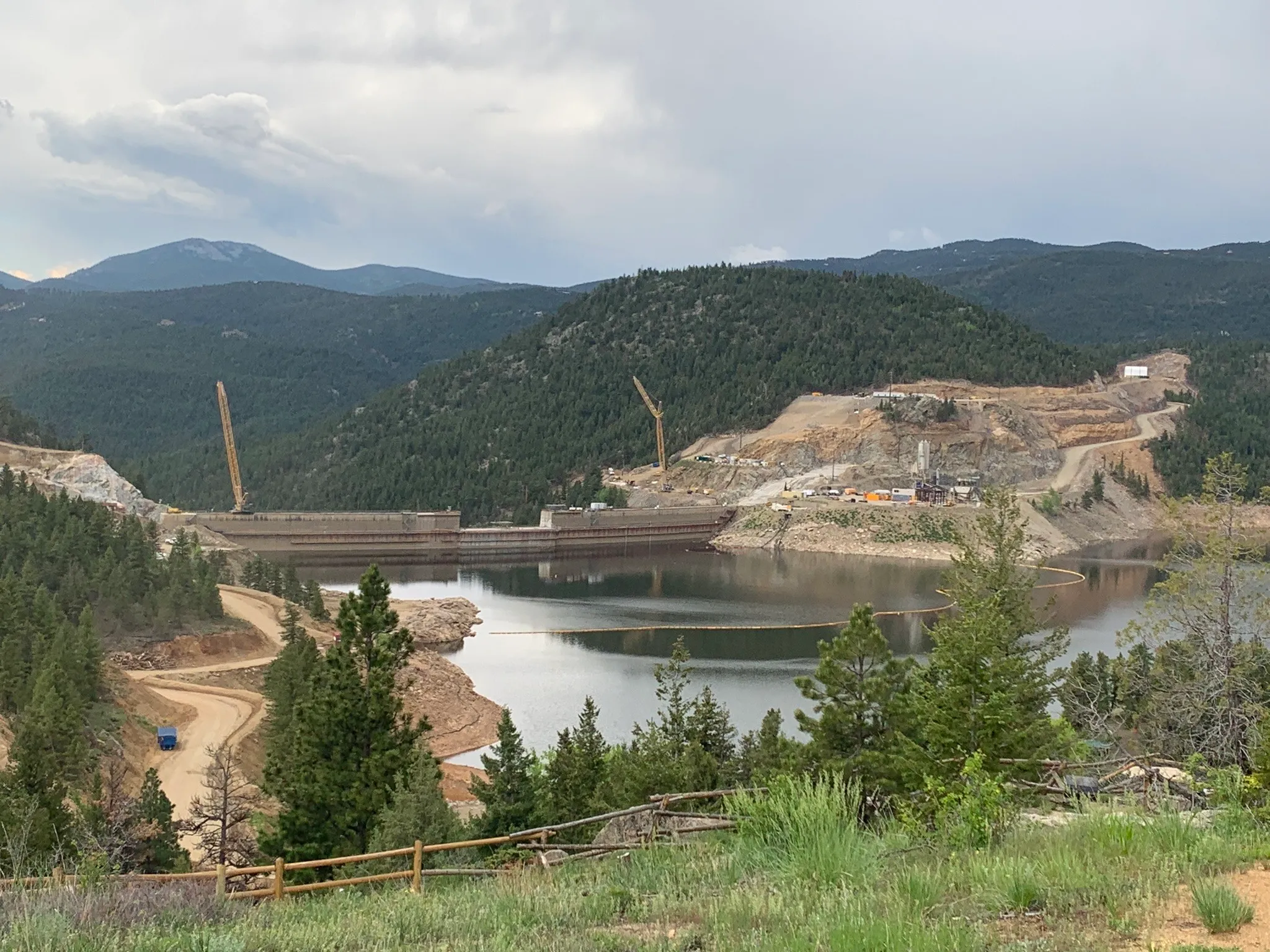

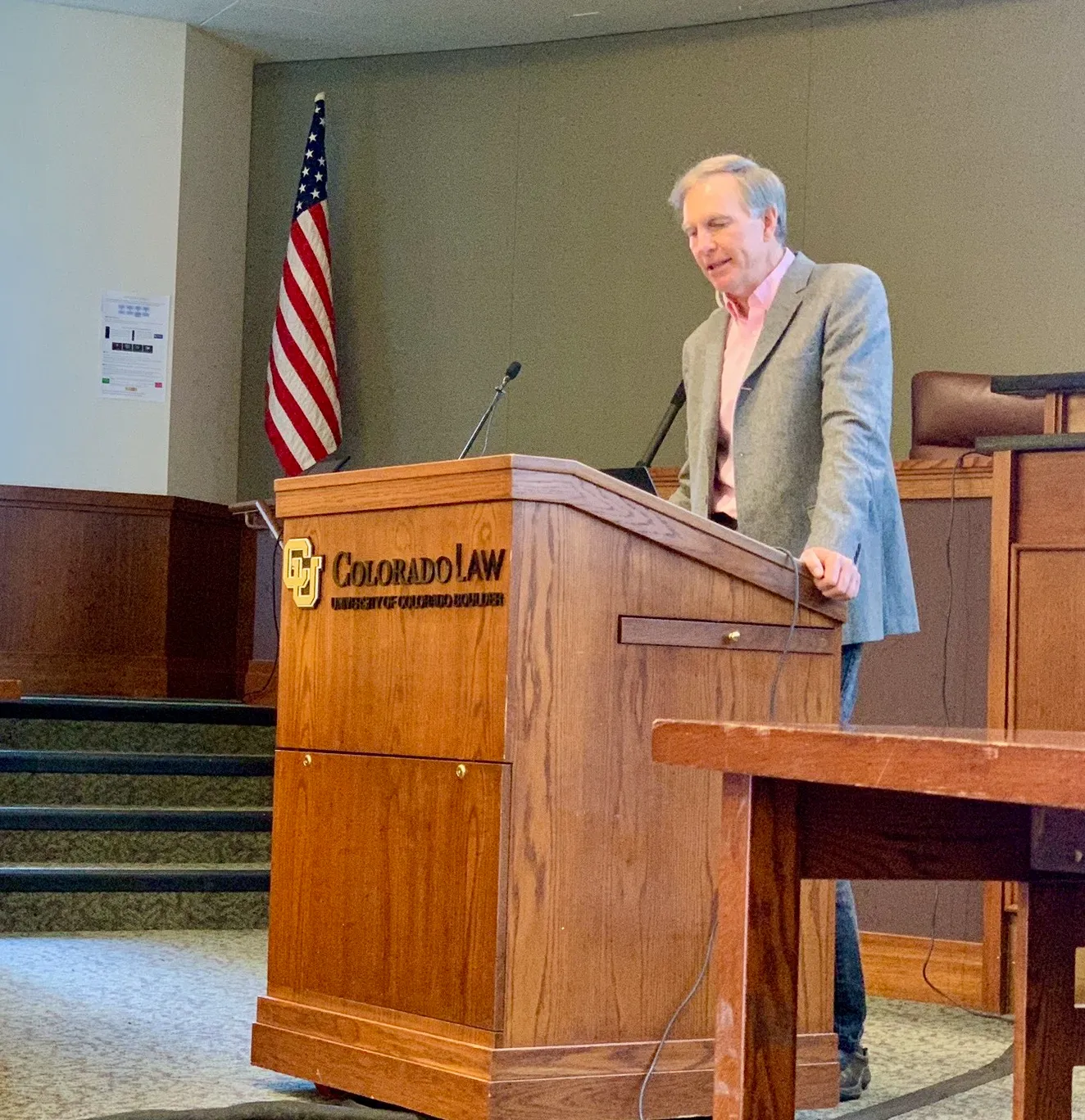
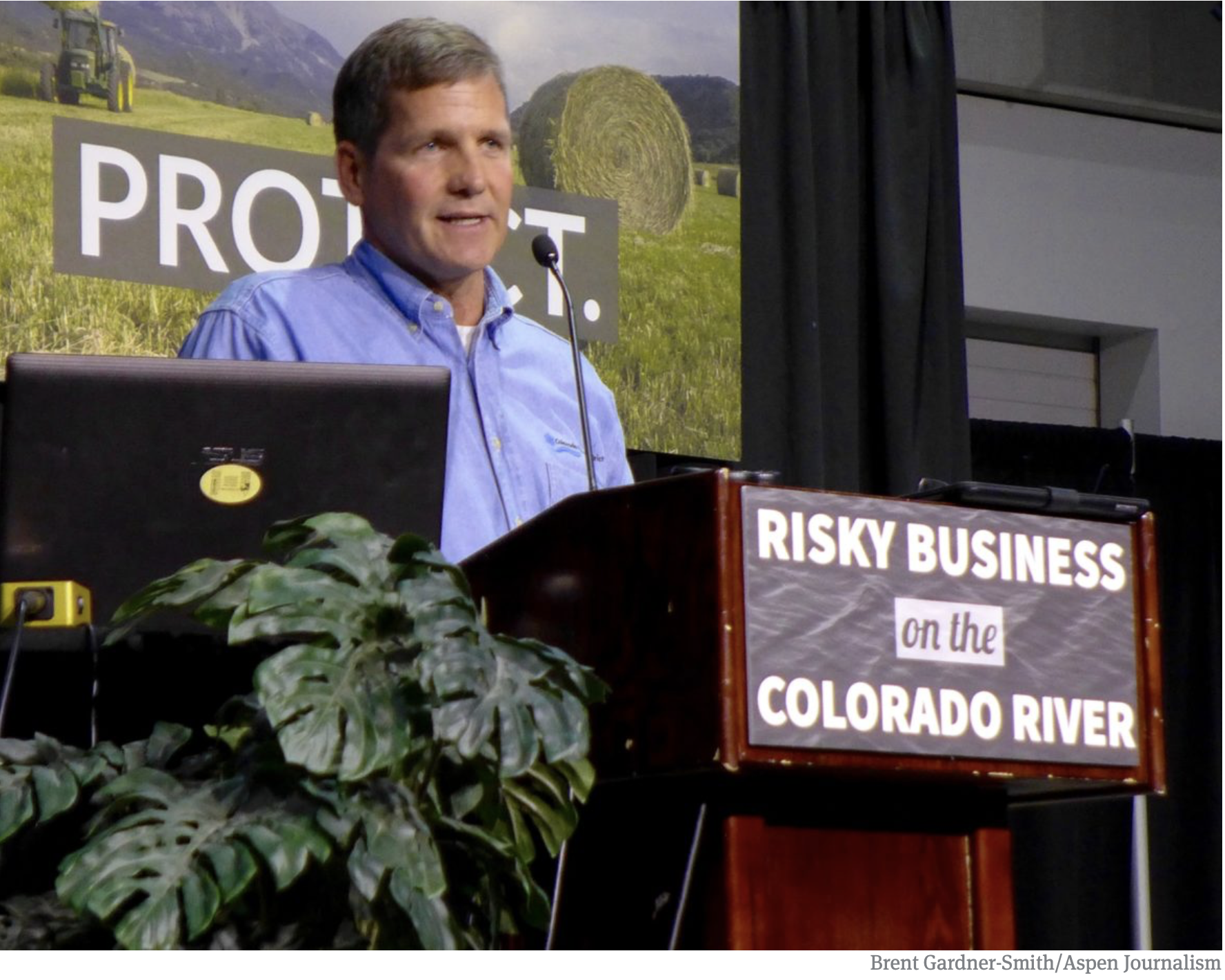
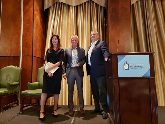
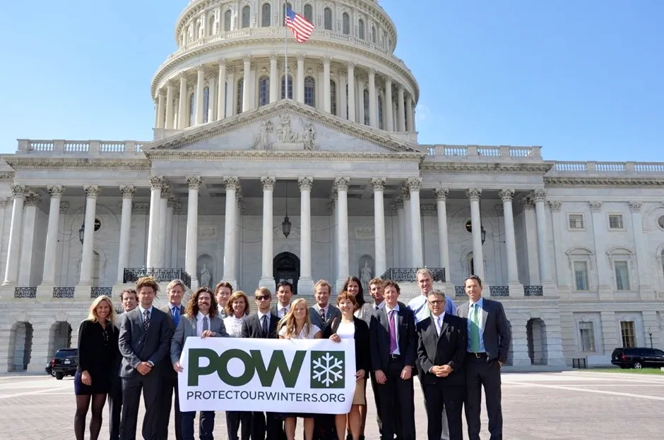

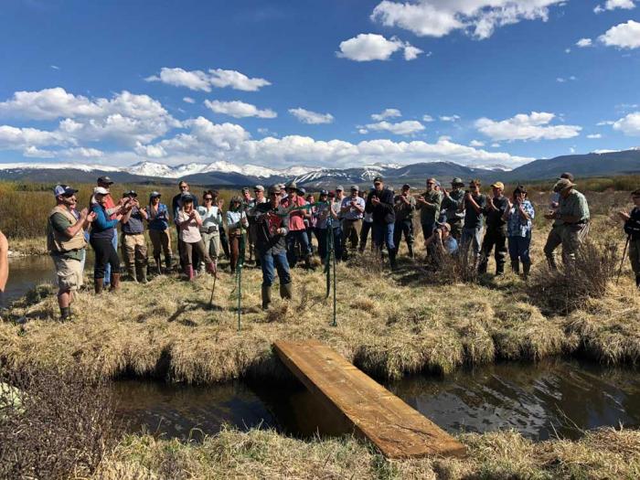
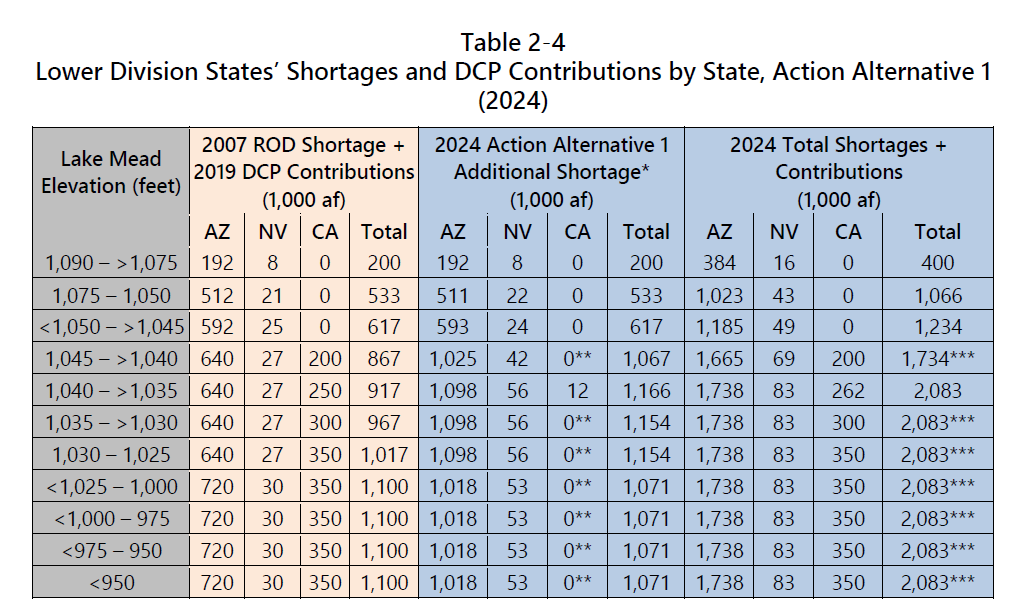
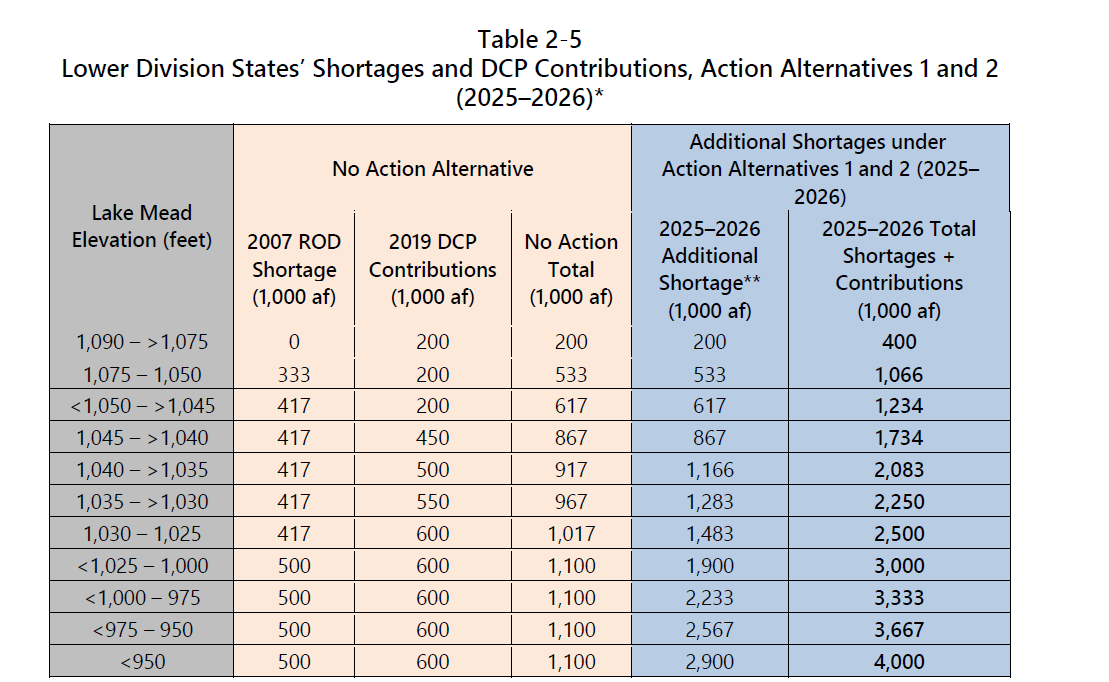

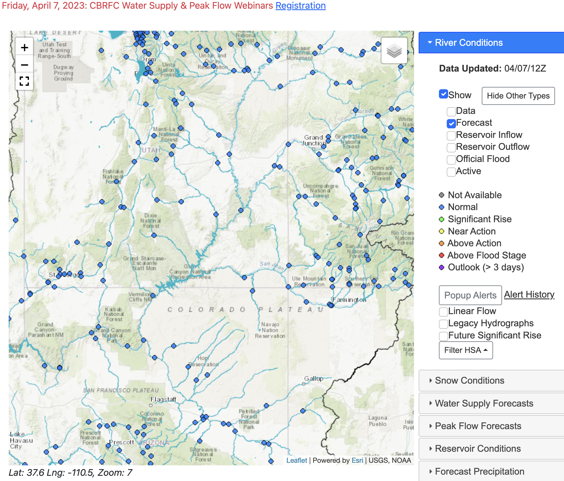

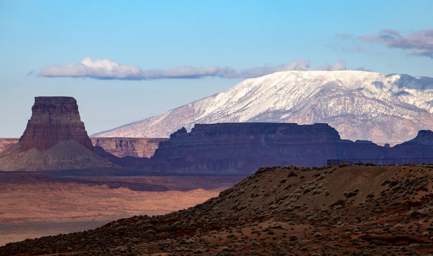


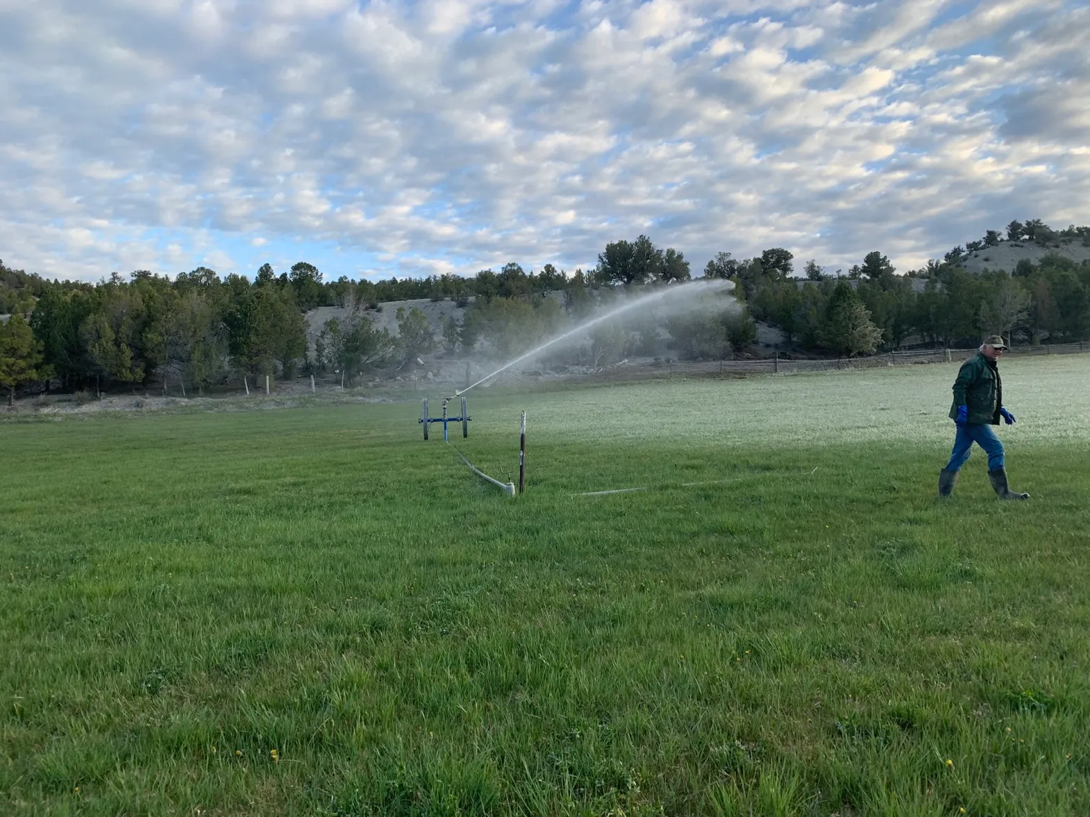
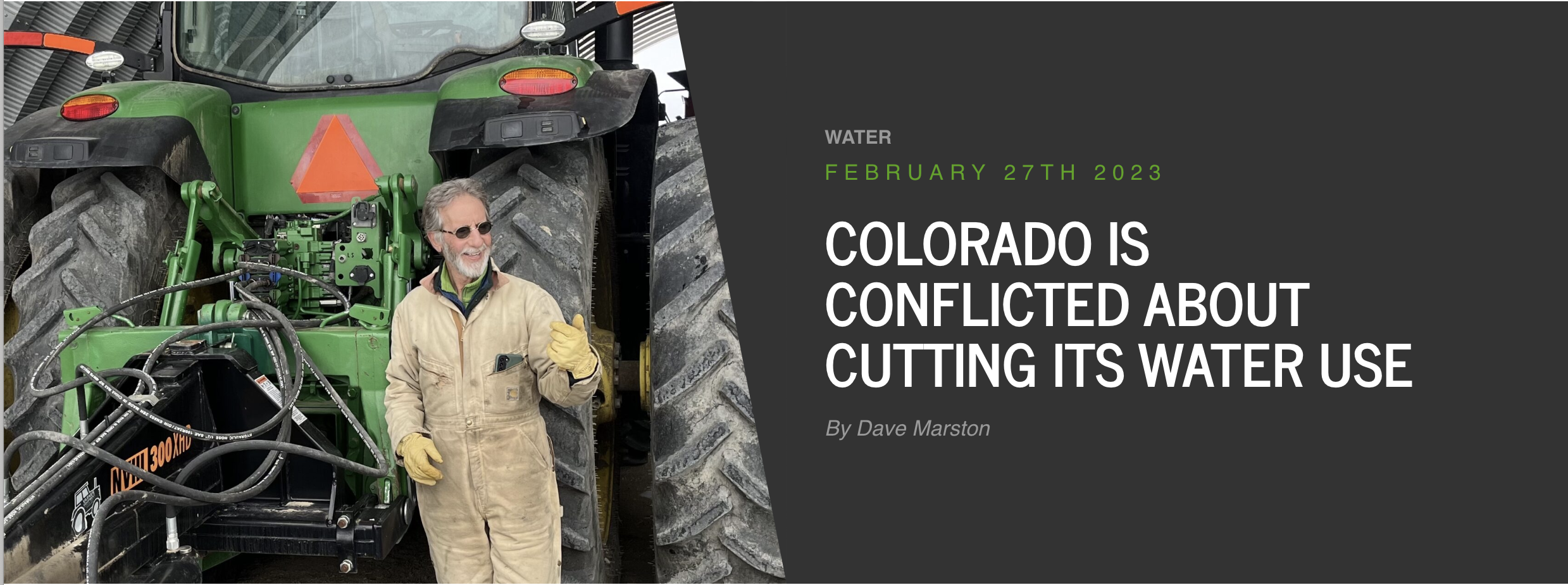


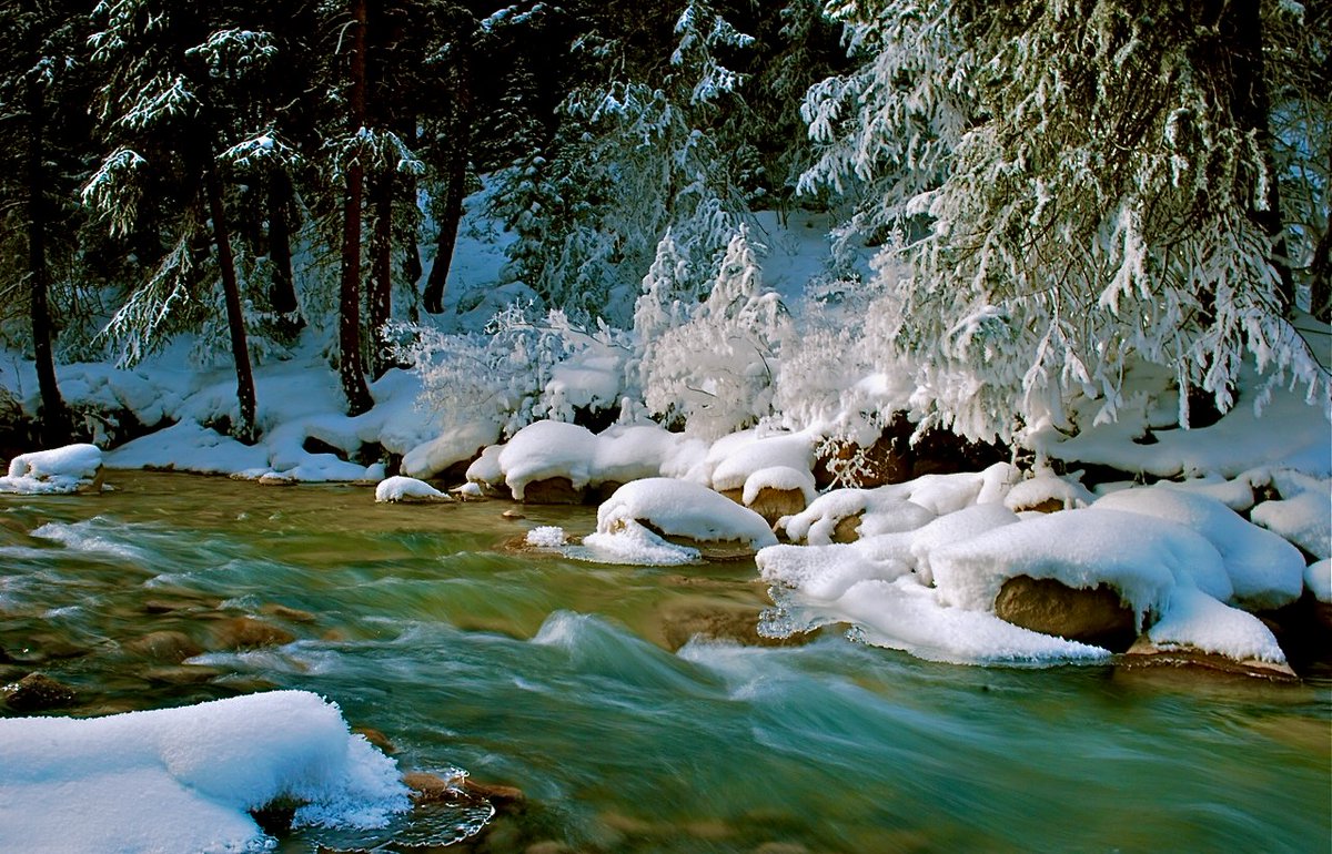


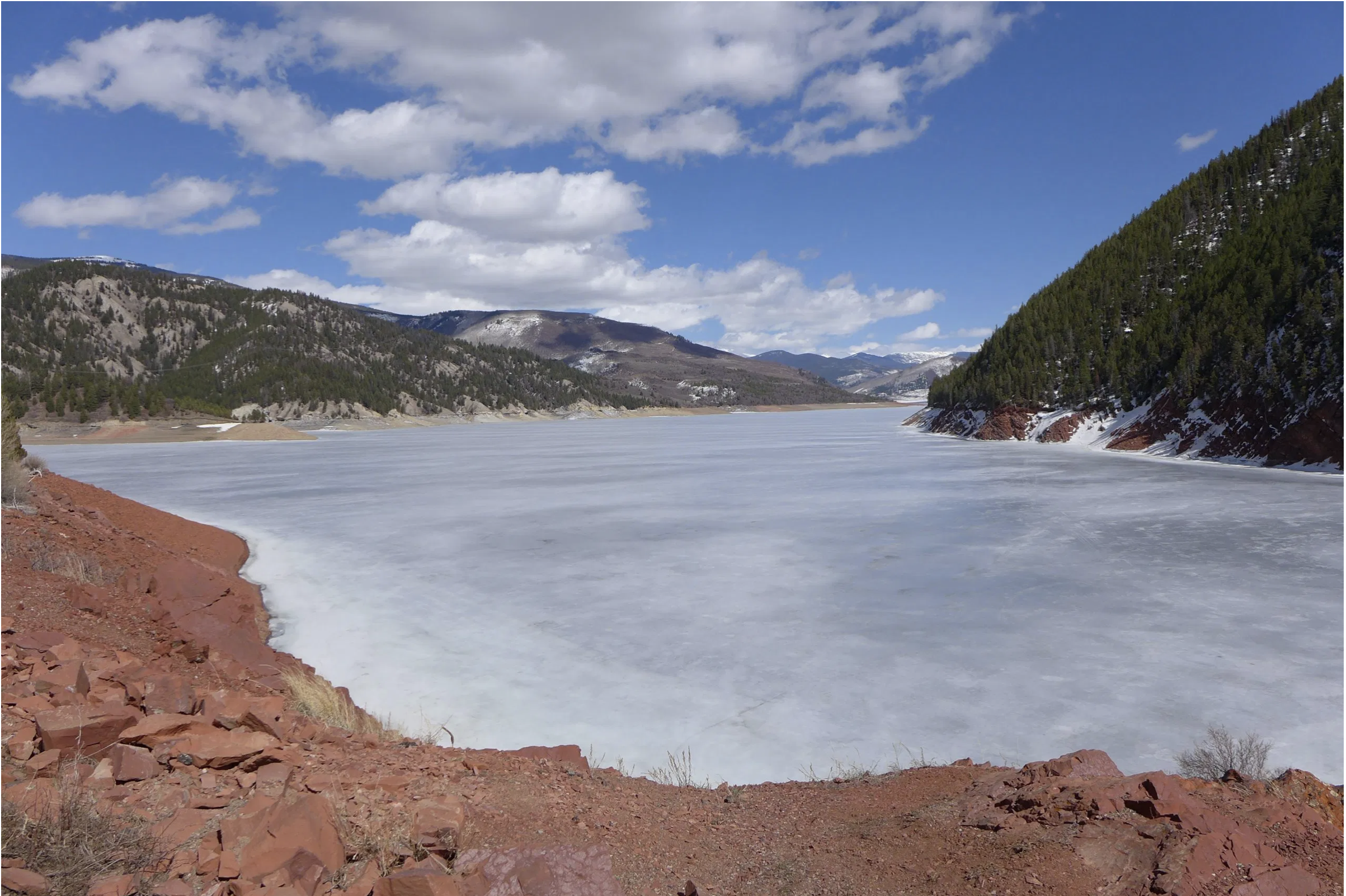
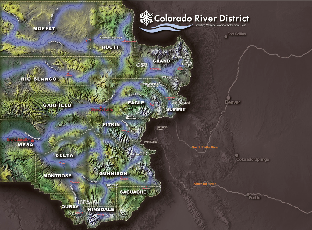
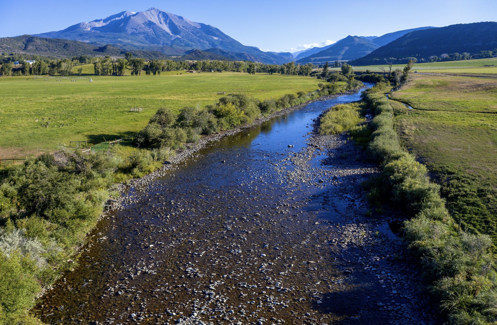
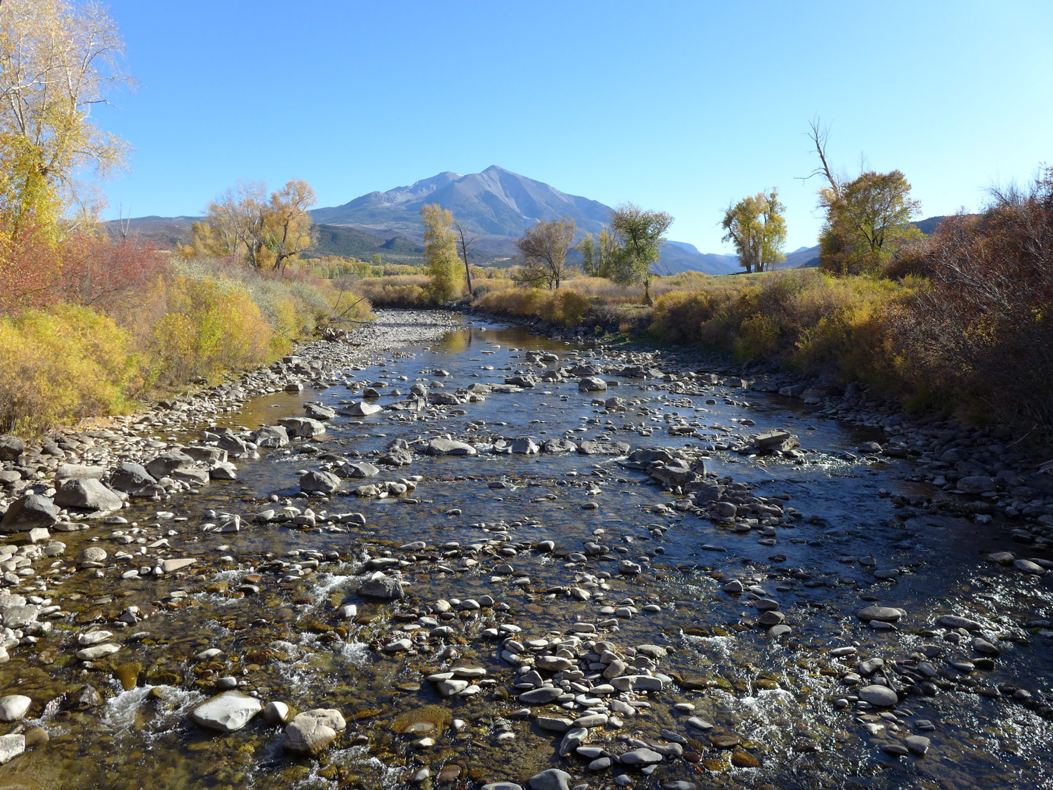

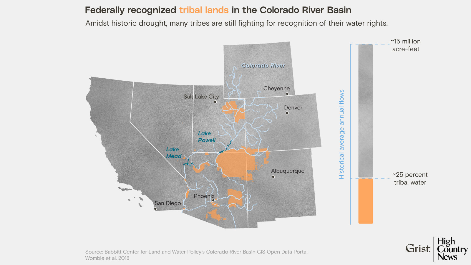
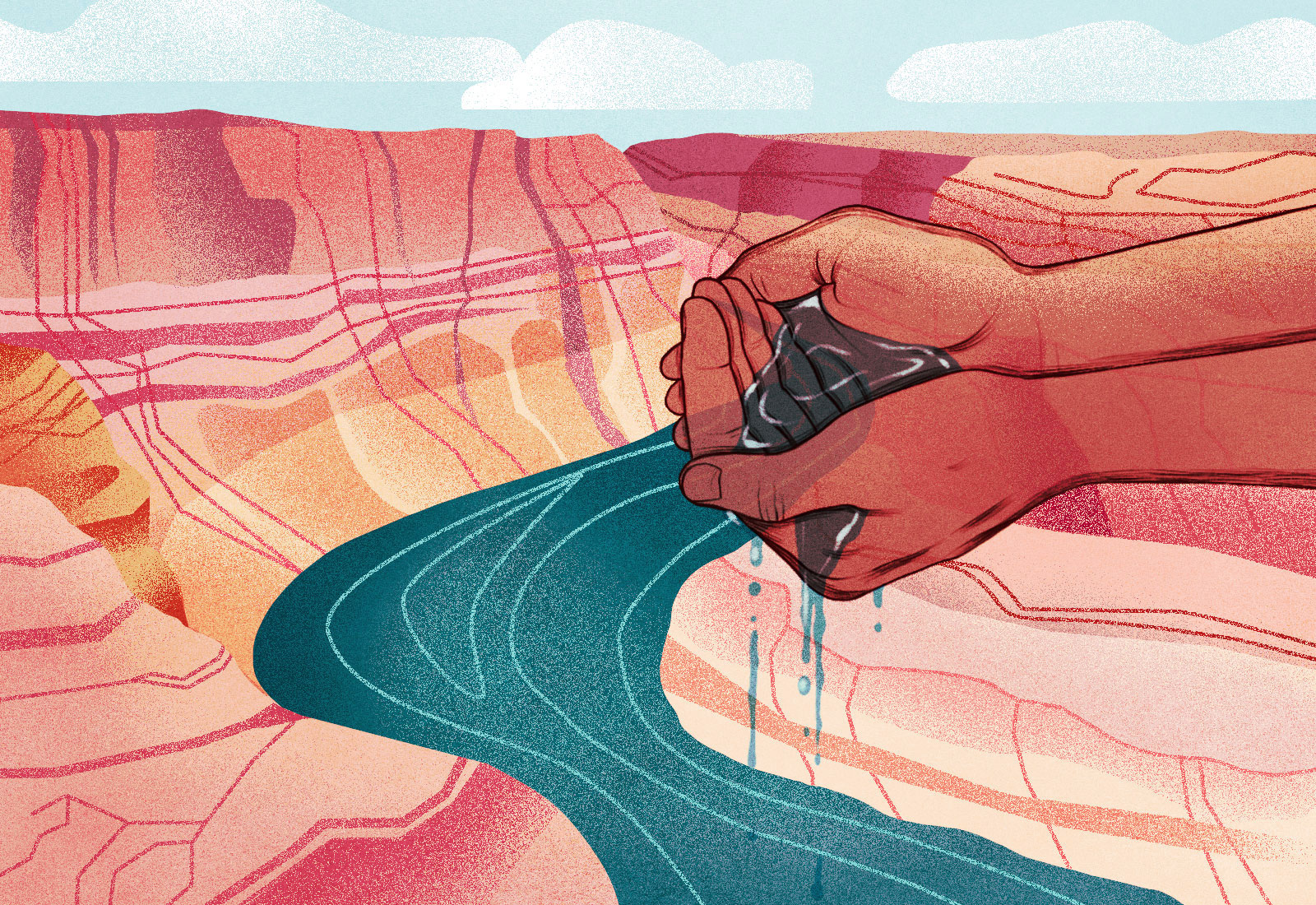
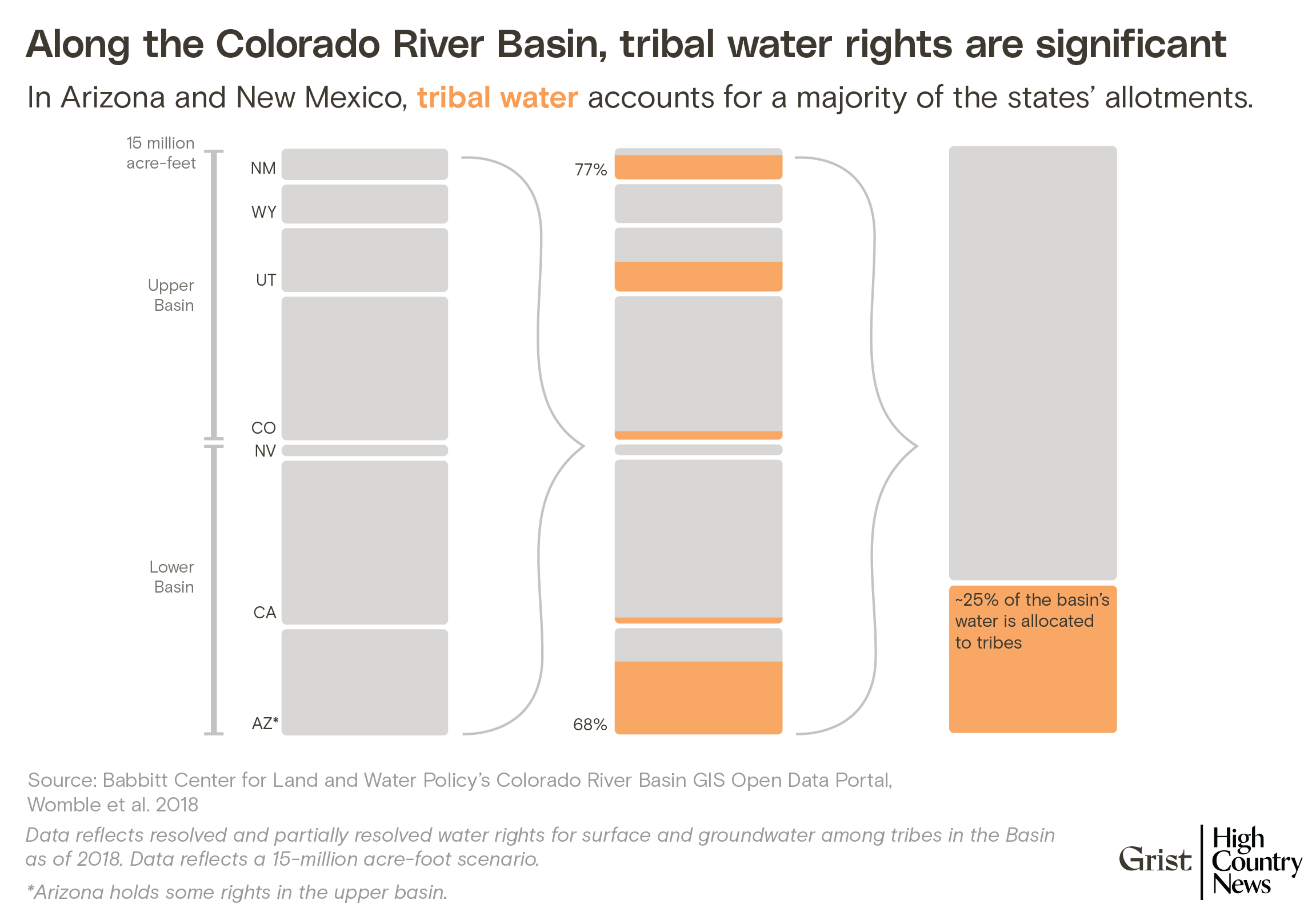
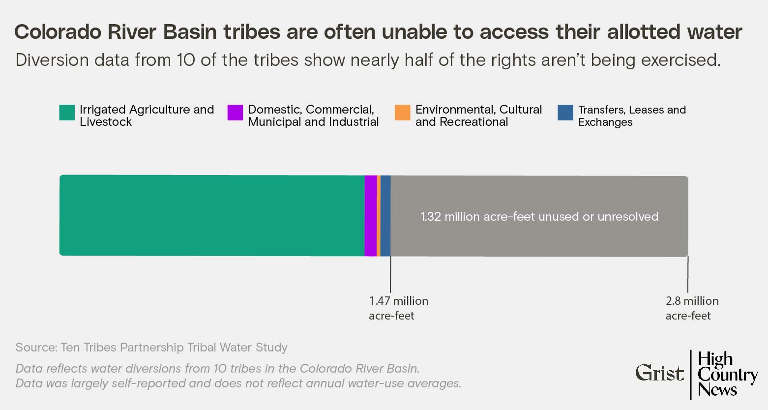
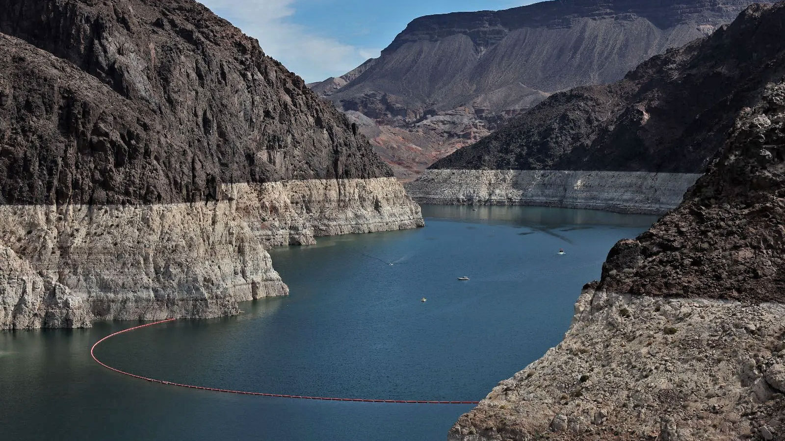
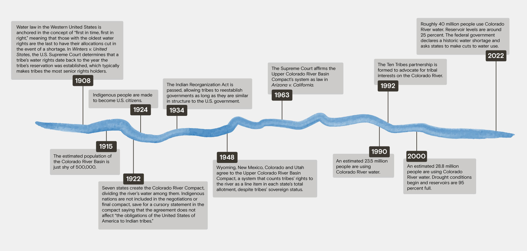

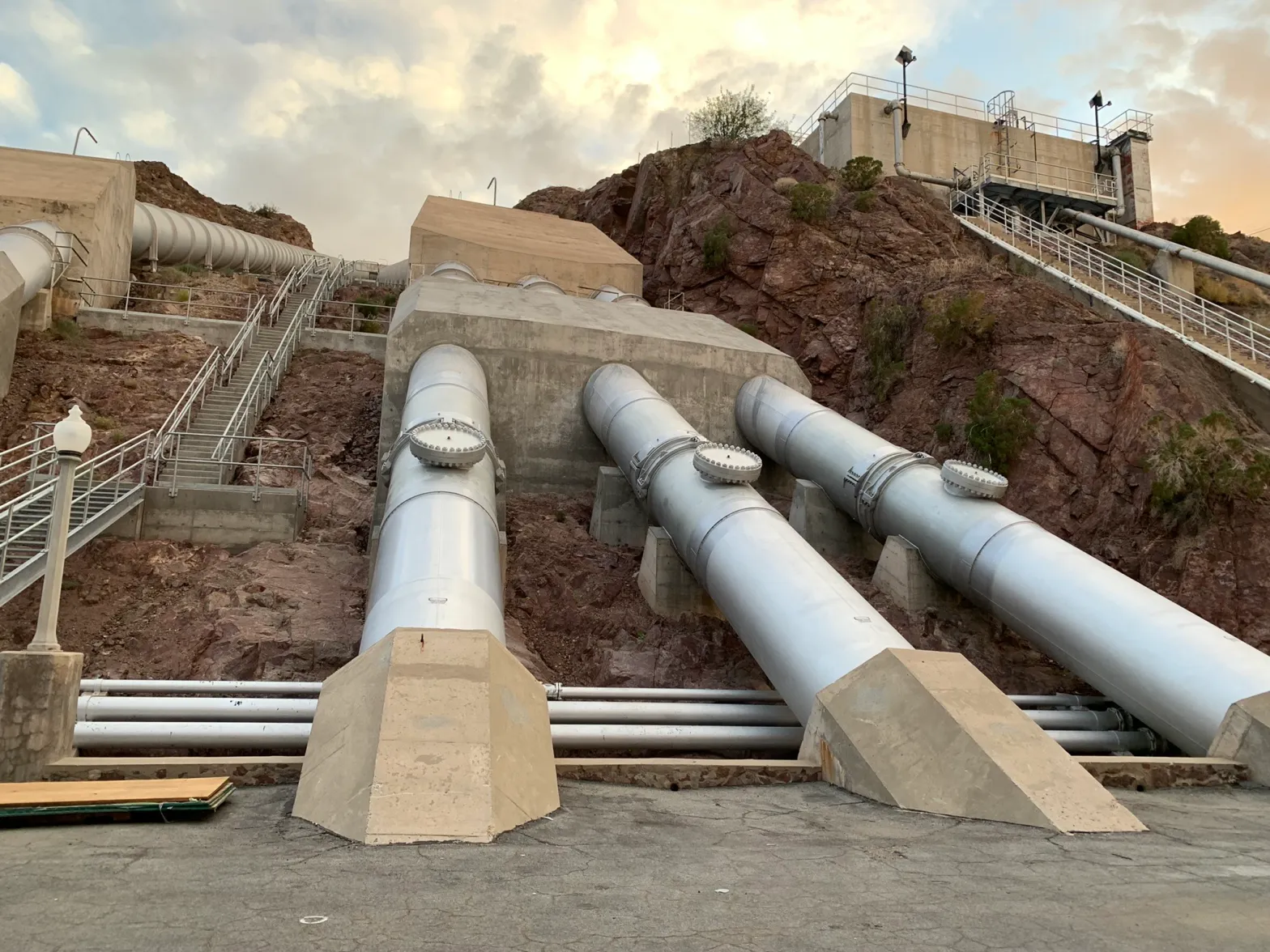


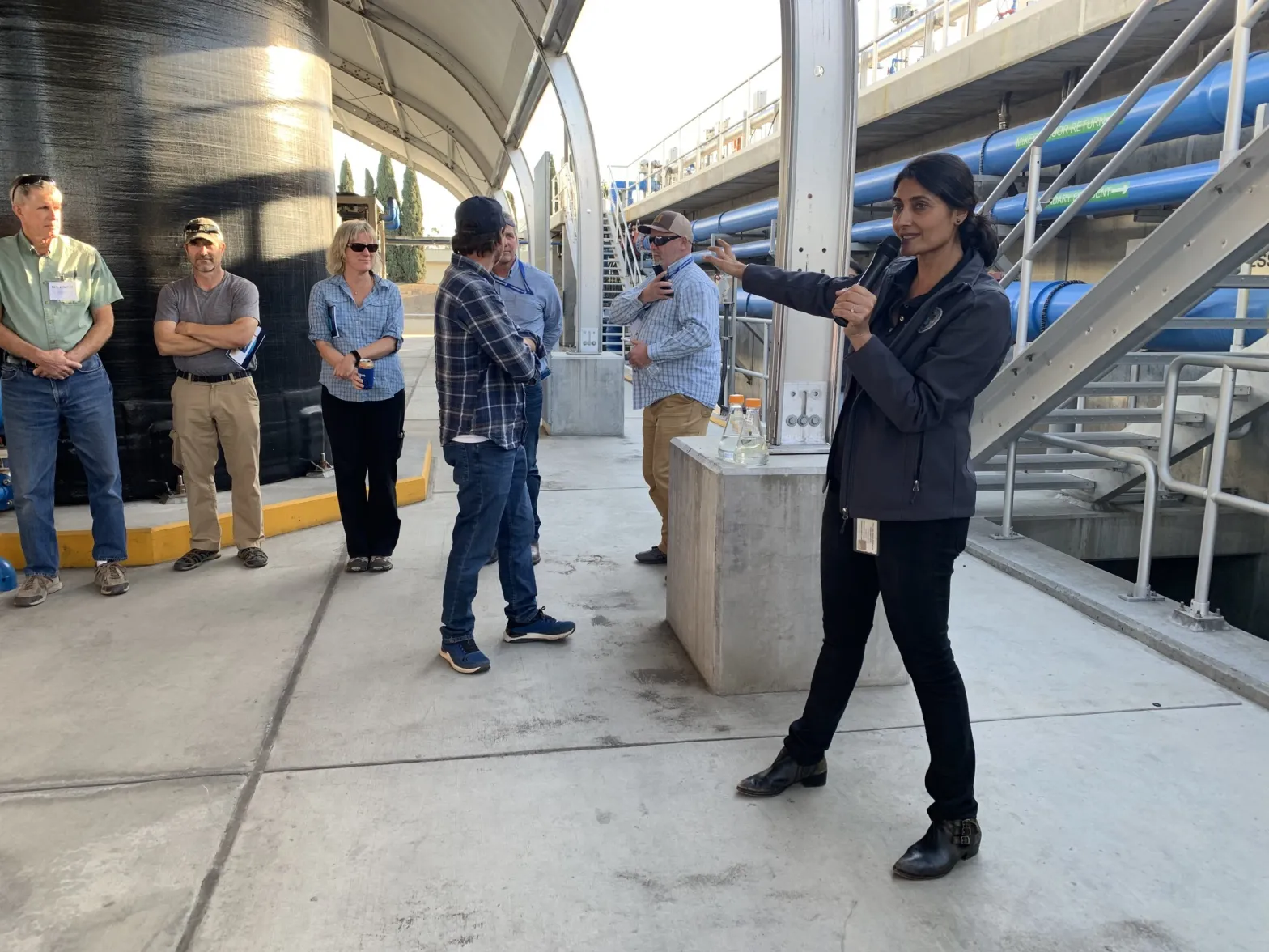


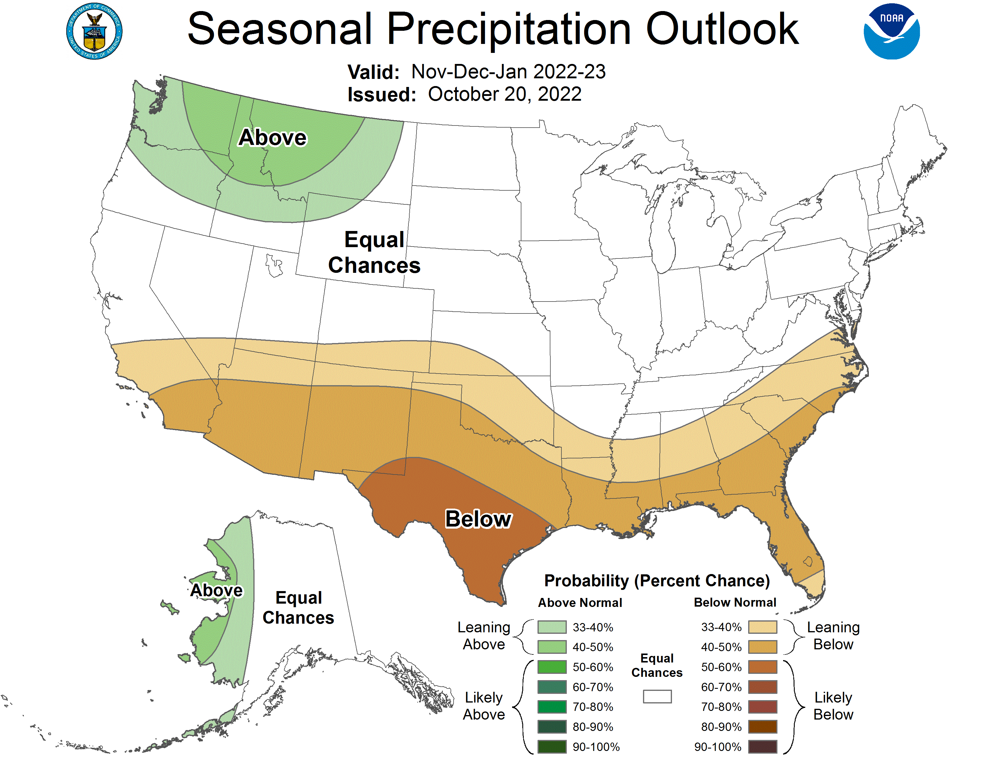
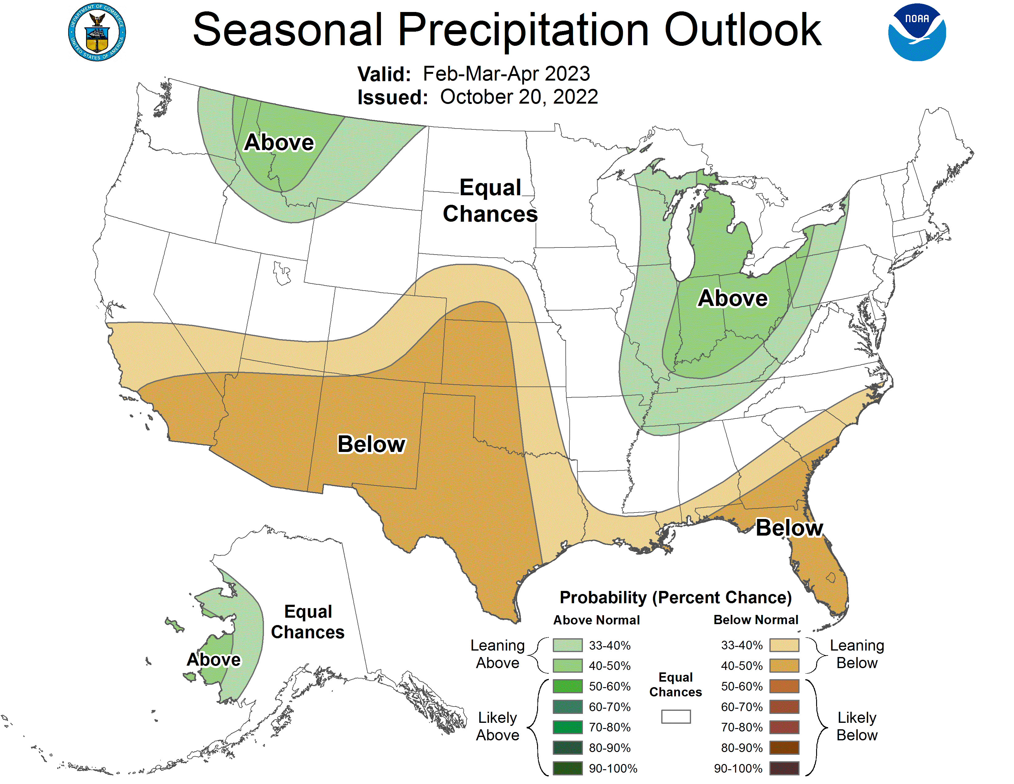
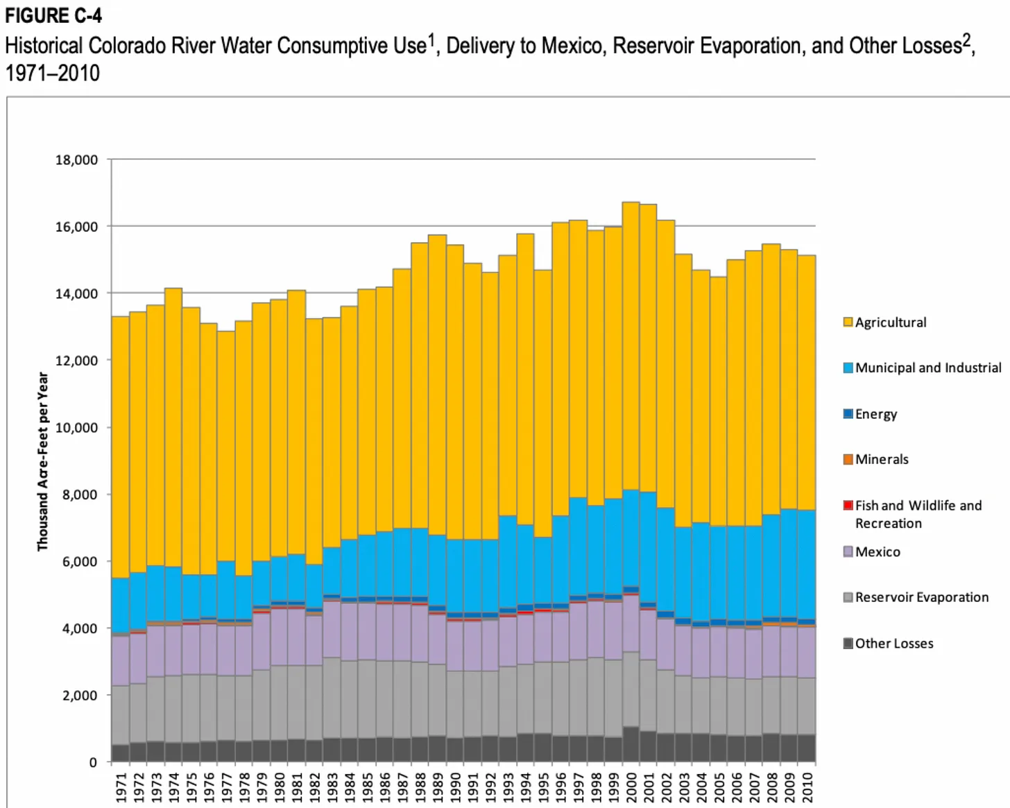


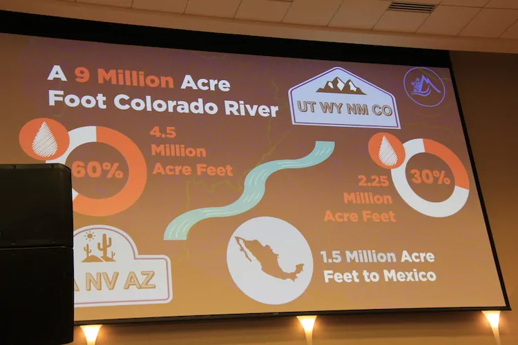

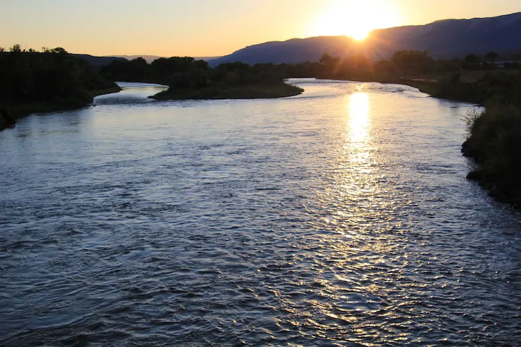
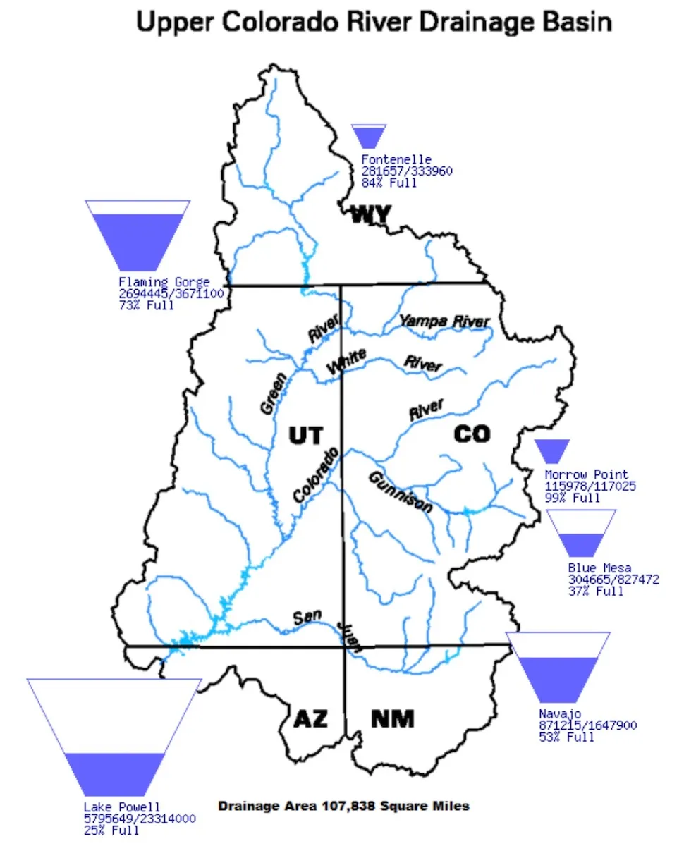
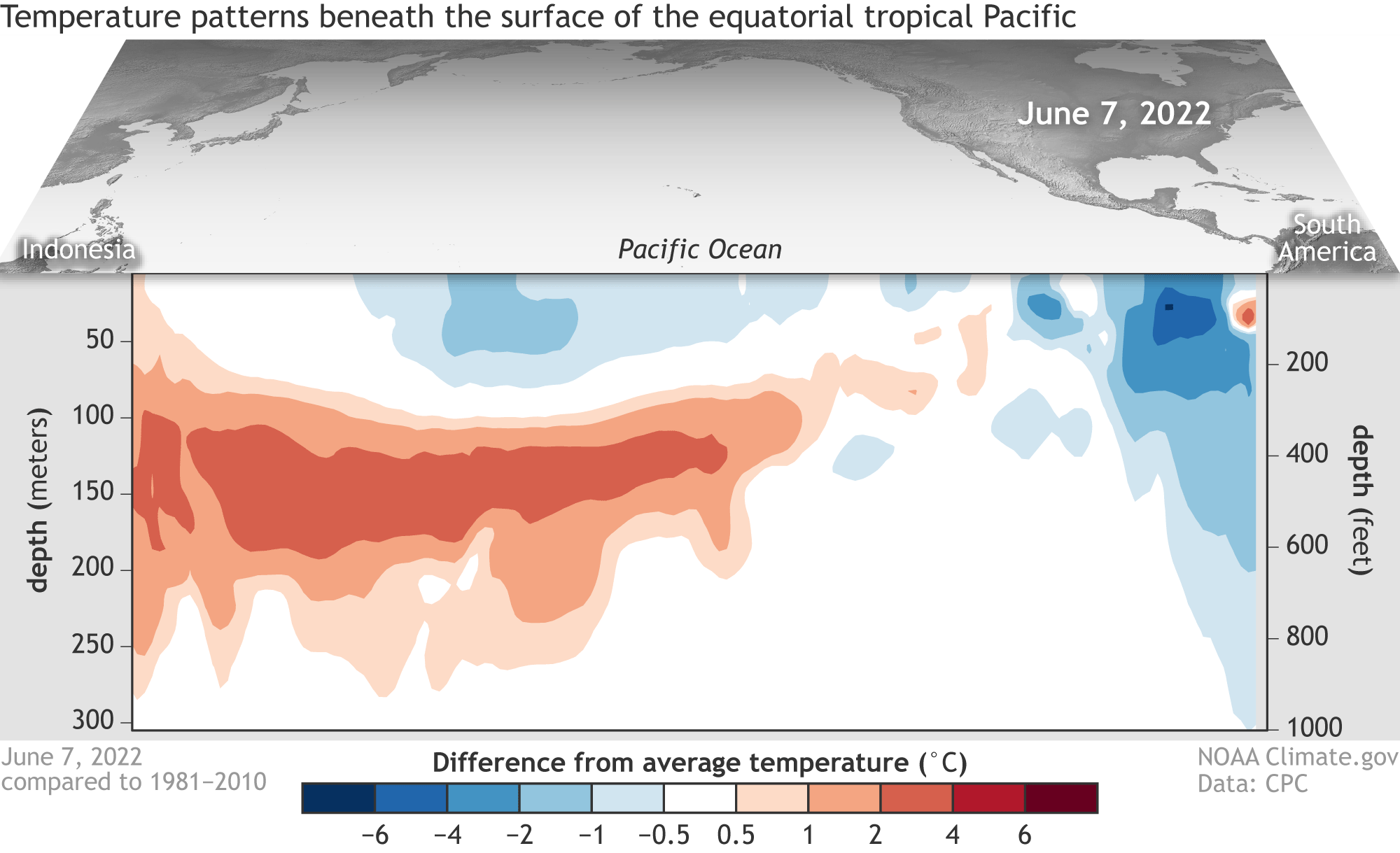
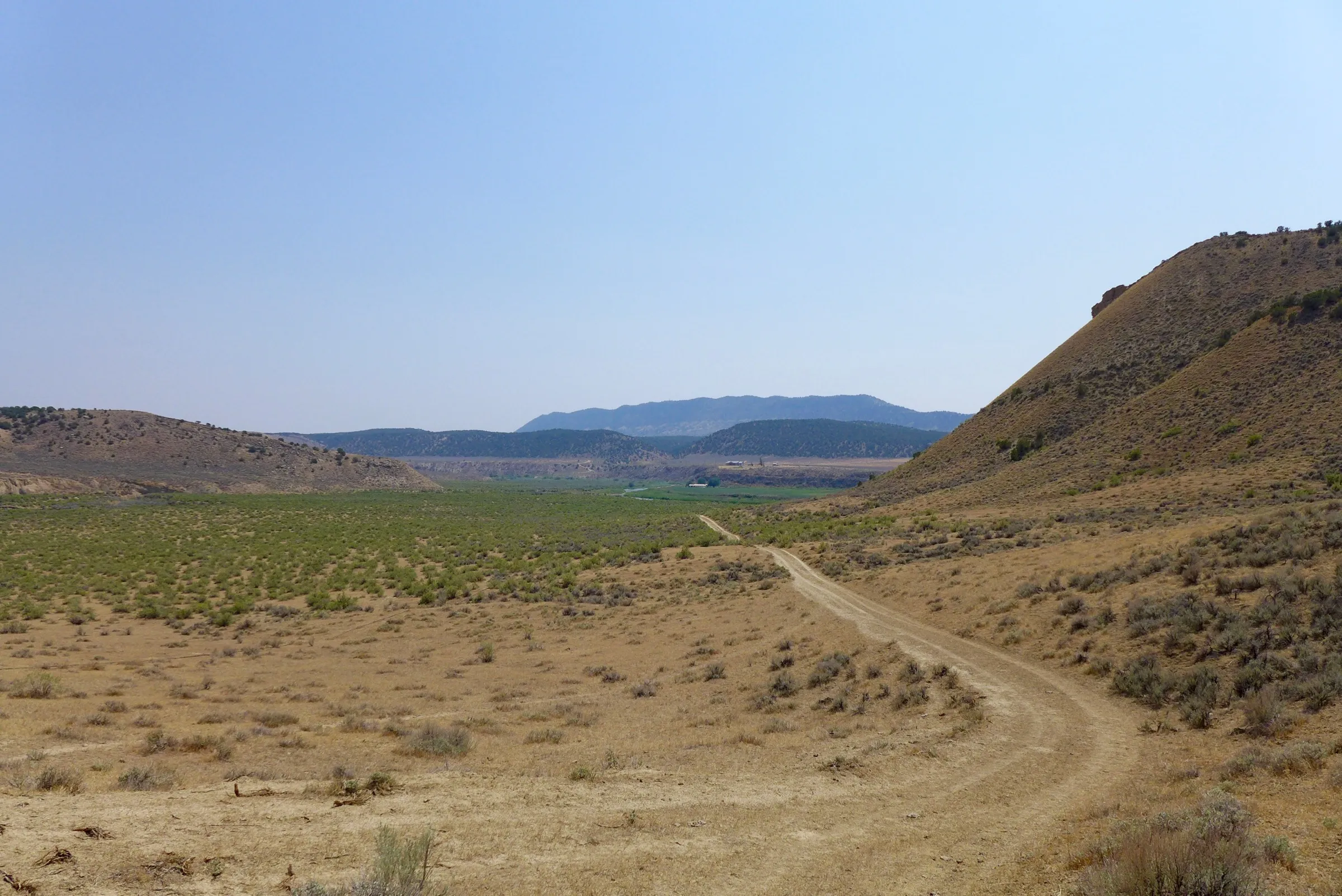
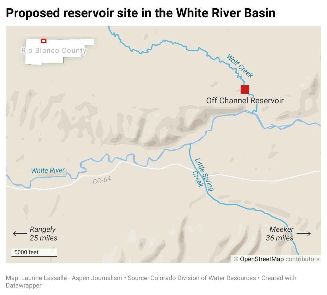


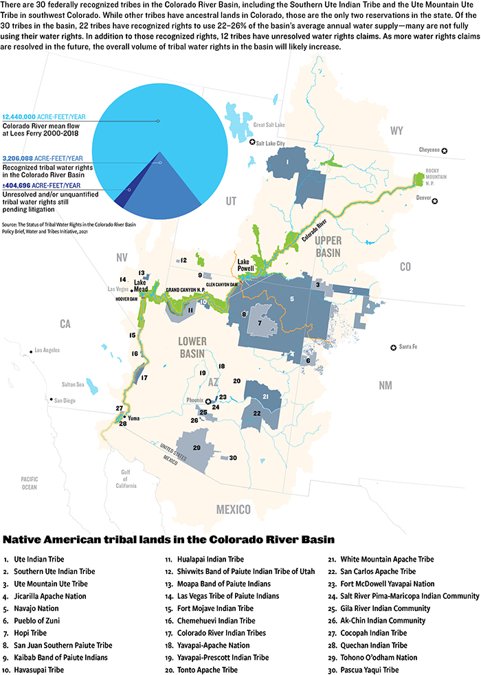


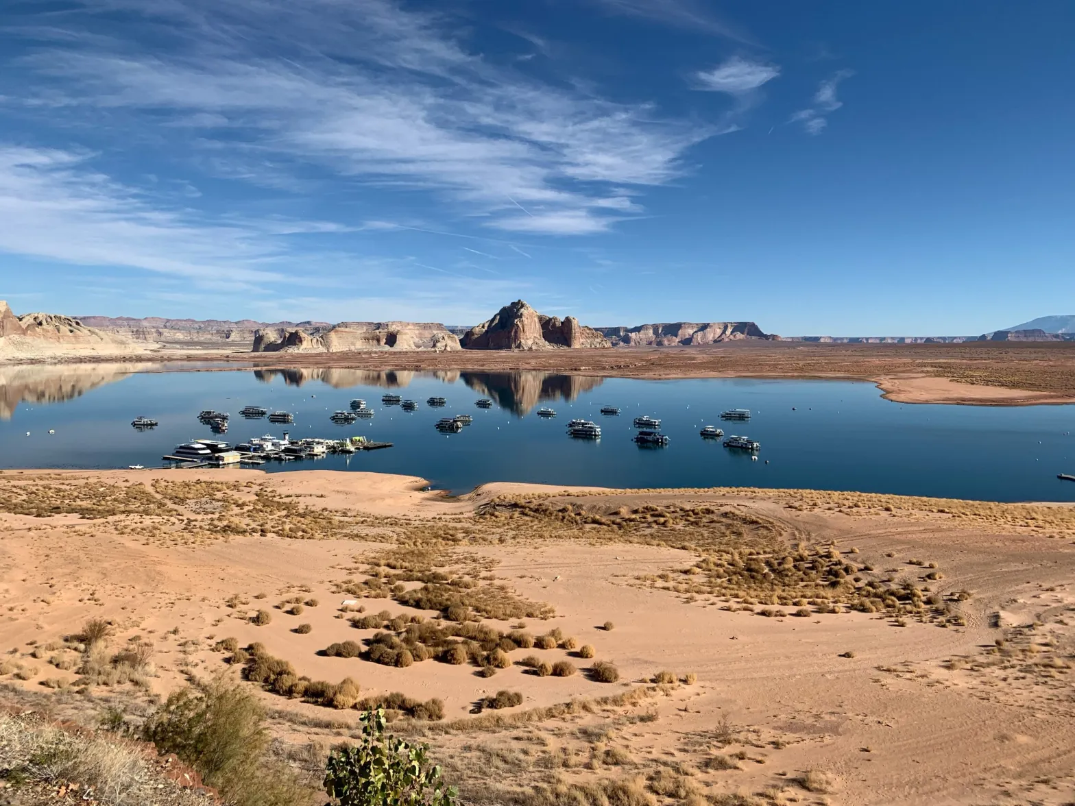


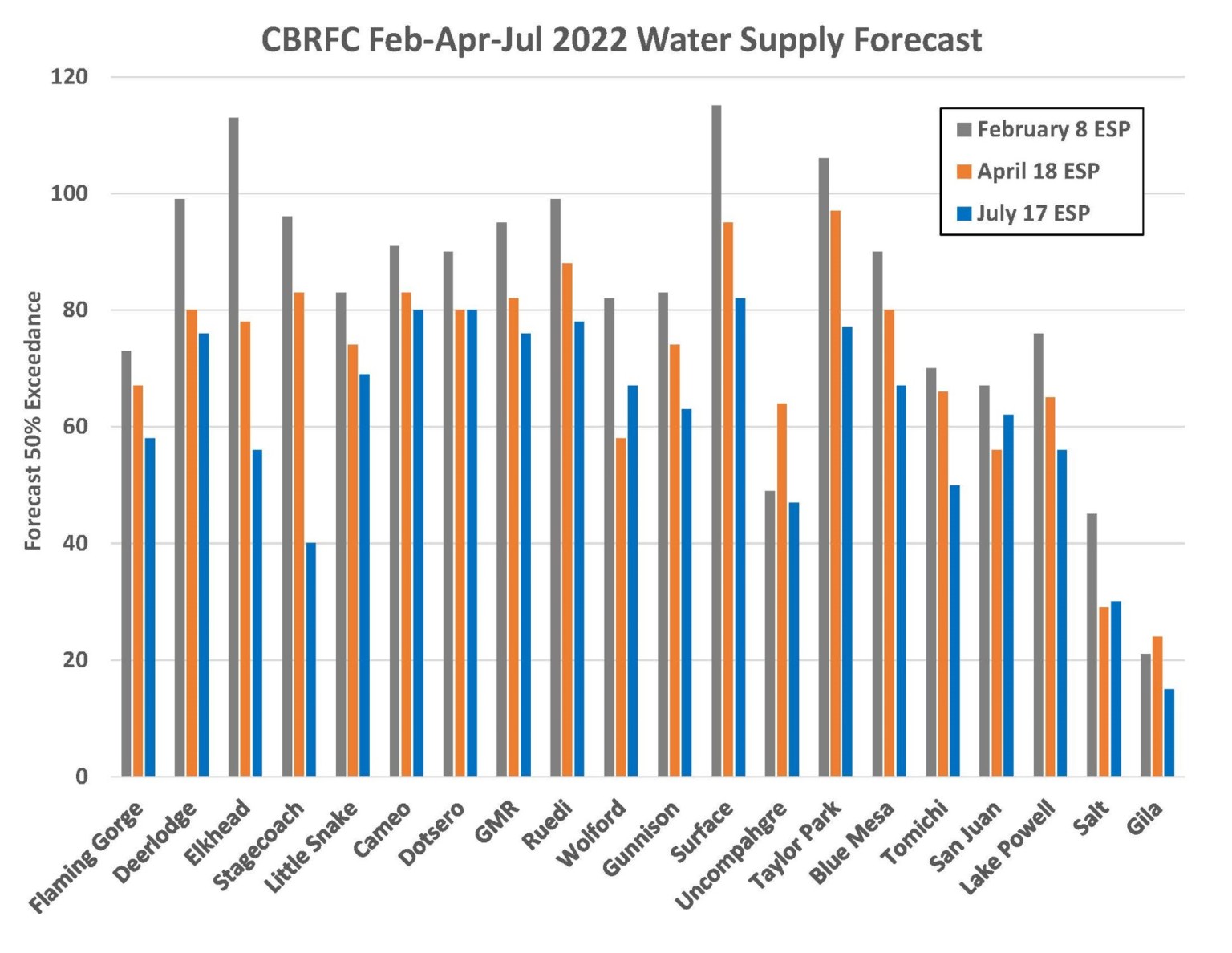
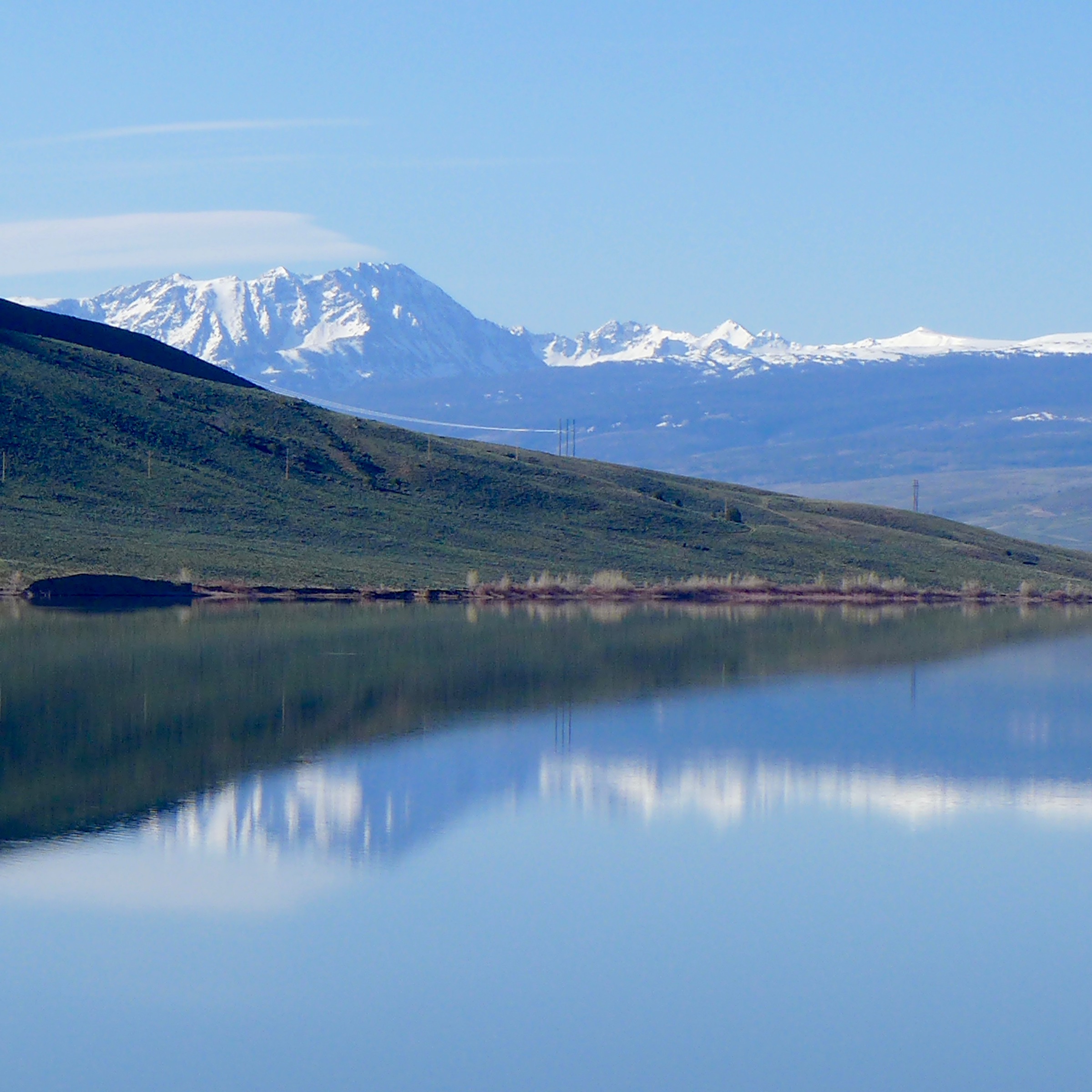
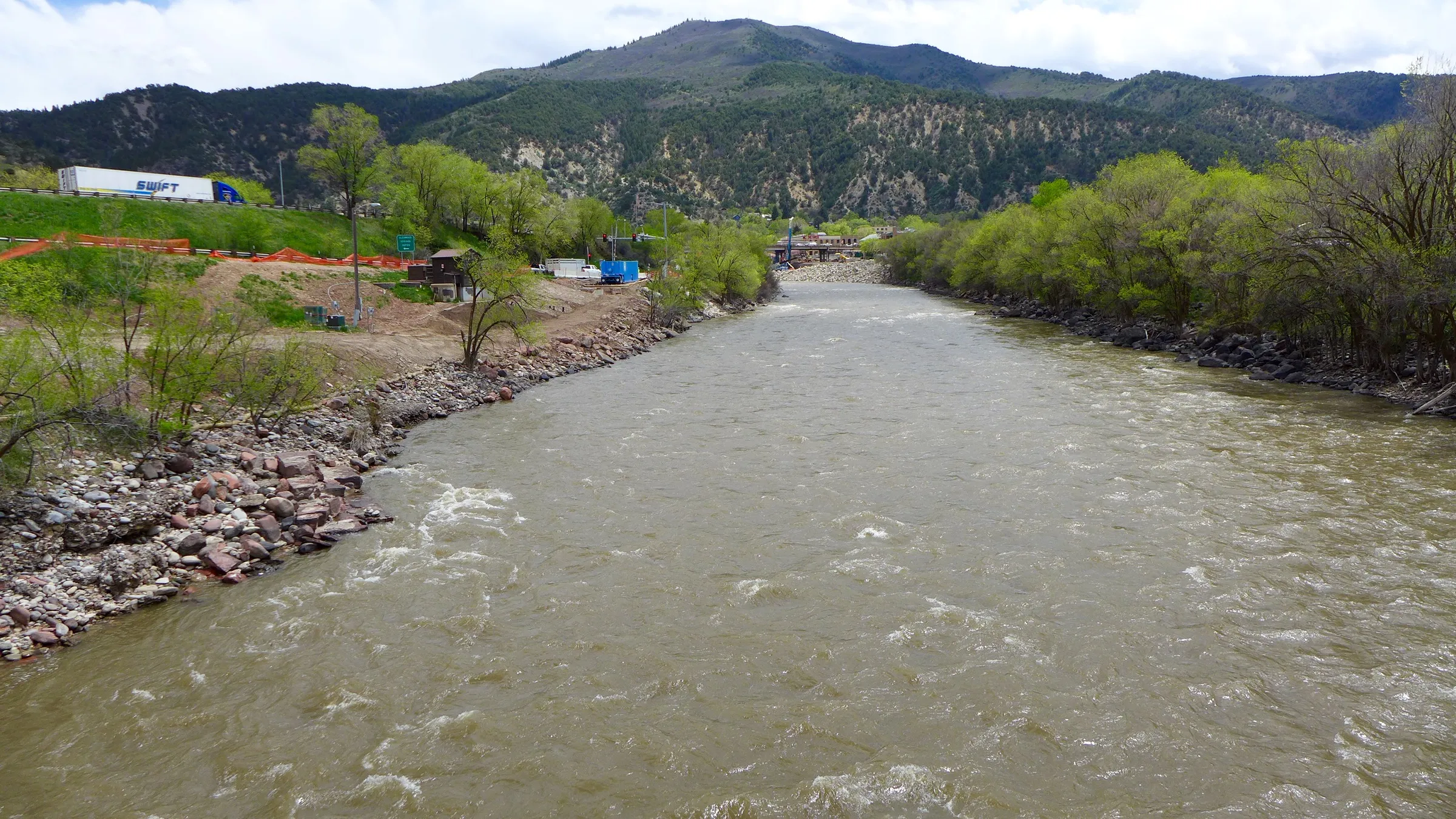
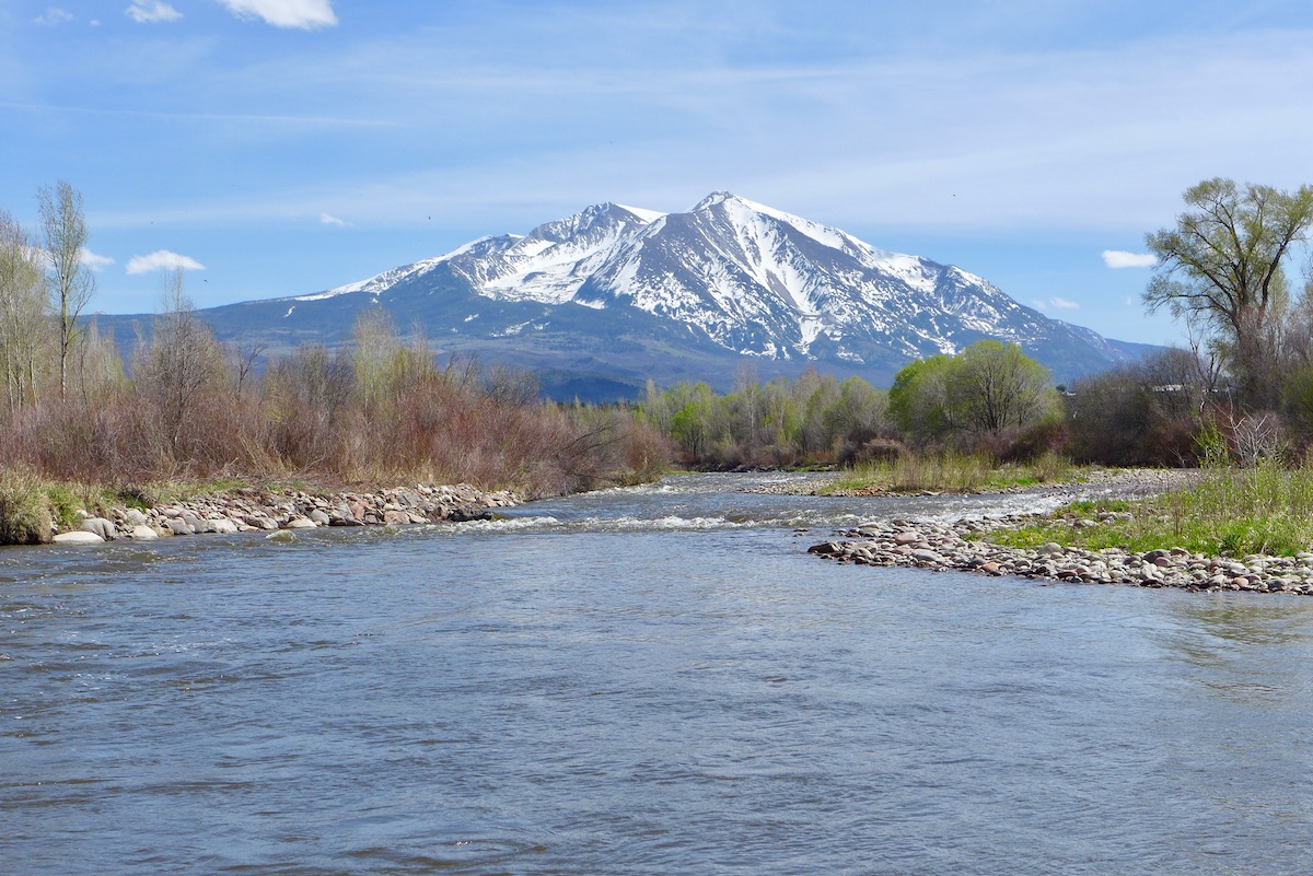
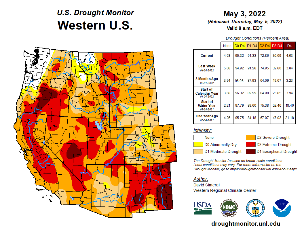
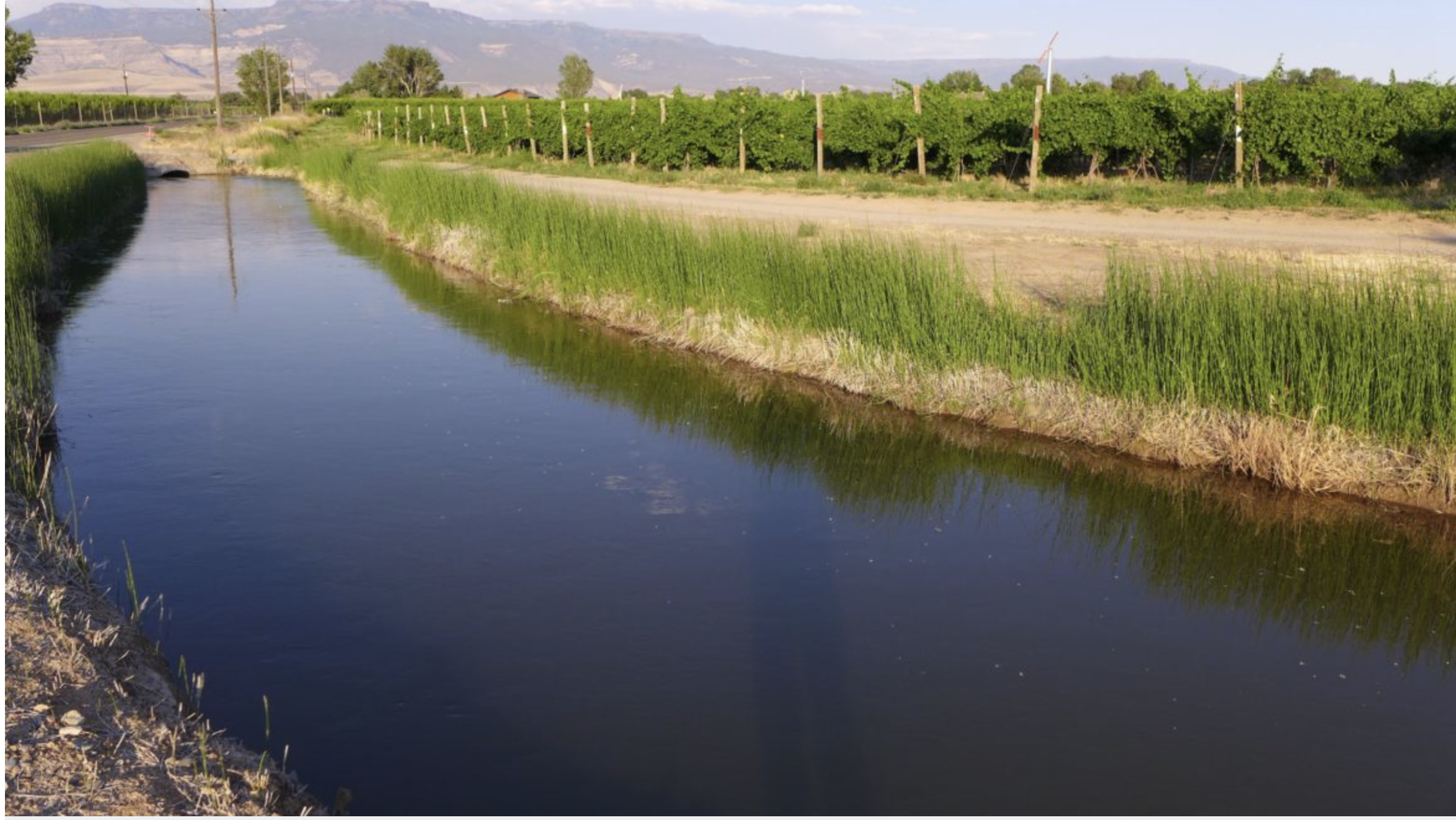

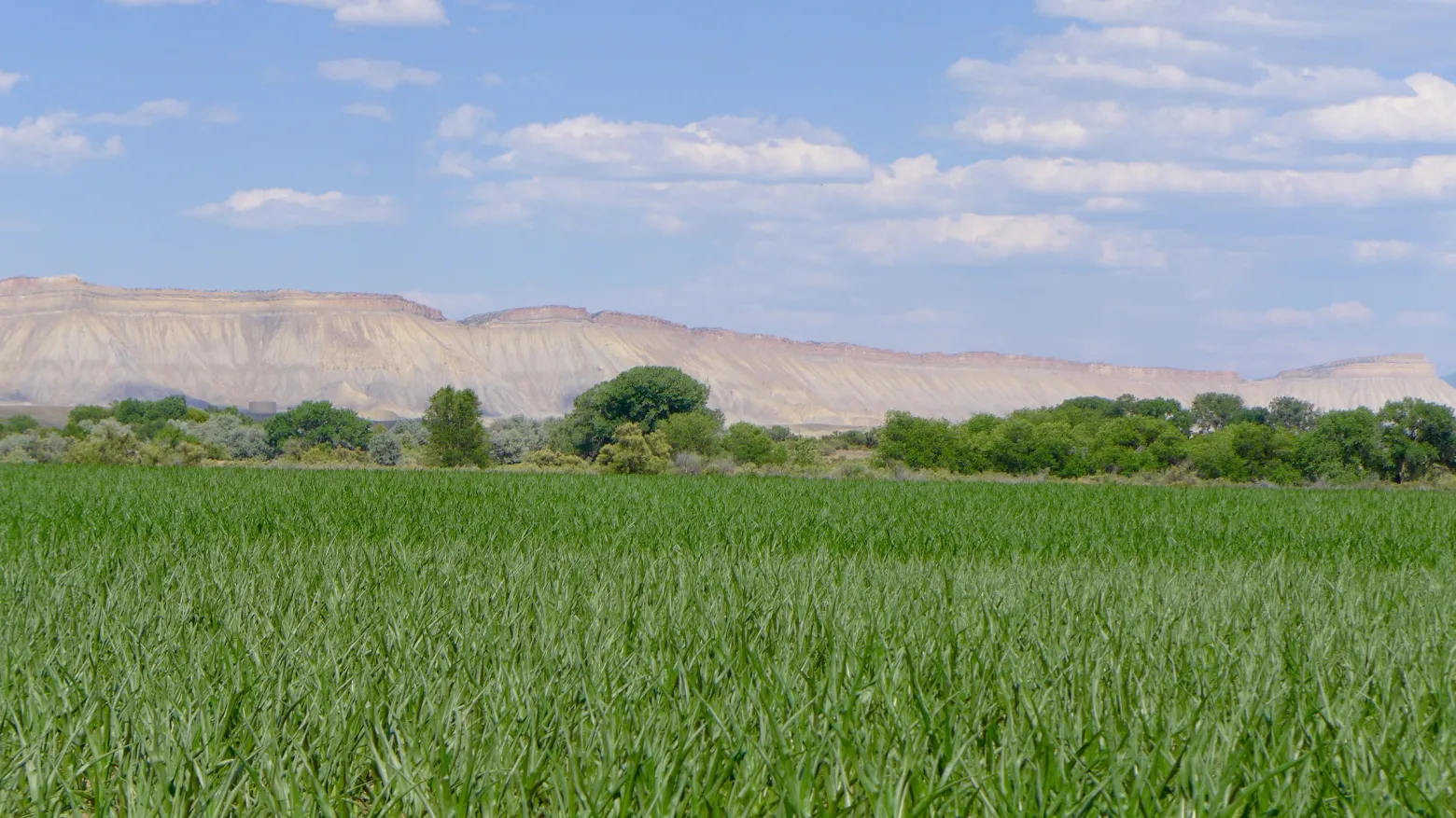


_basin_map")