They’re seeking opportunity, fairness, and a voice in decision making after a century of exclusion
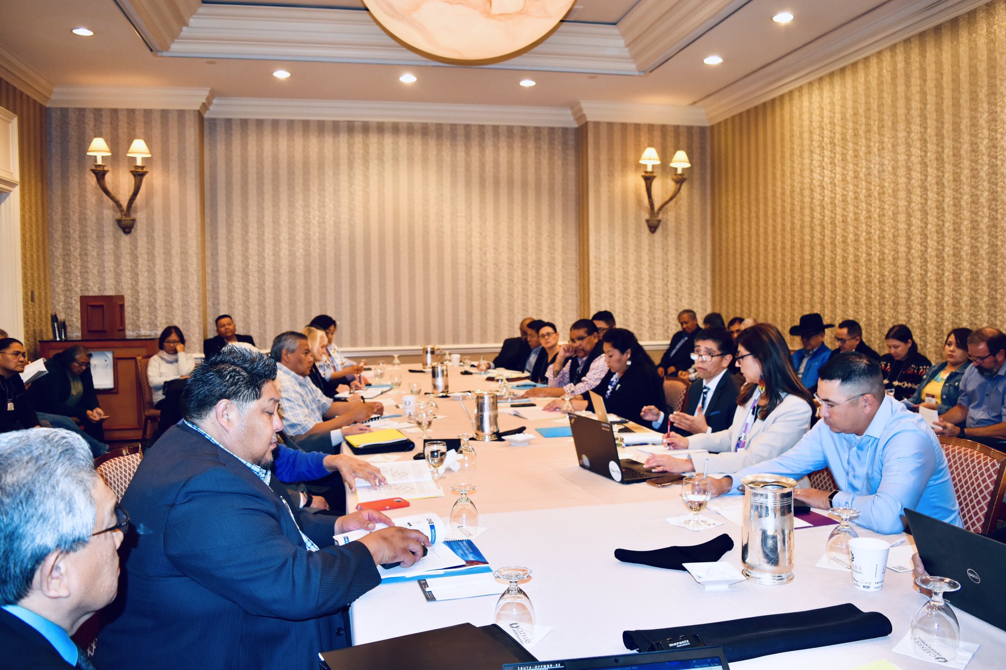
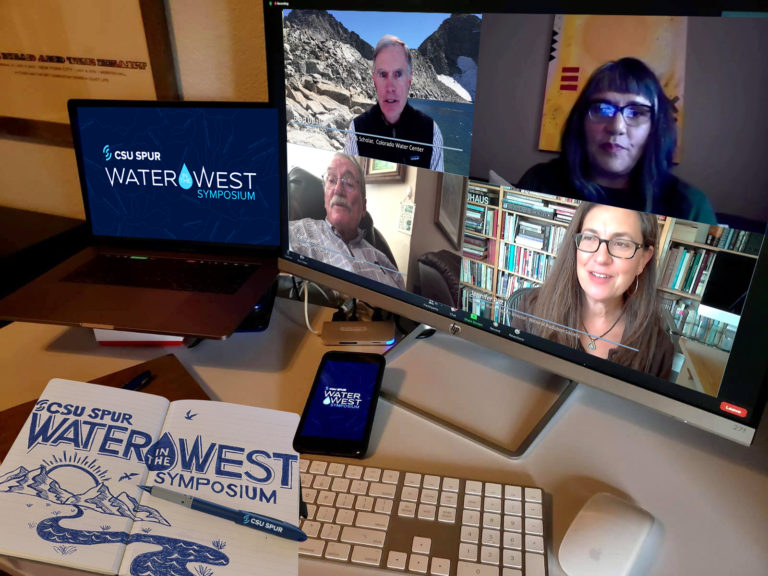
Mid-morning in early September 2020, leaders from eight tribal nations met with Arizona state legislators, water engineers and policy experts via Zoom. One by one, each recounted their tribe’s history and efforts to secure water for their citizens. Half of the tribes in Arizona have unresolved claims to water. Of the 30 federally recognized sovereign tribal nations in the U.S. segment of Colorado River Basin, the vast majority, 22, are in Arizona.
Meeting that day was the Arizona Governor’s Water Augmentation, Innovation and Conservation Council, a committee of state legislators and water policy experts convened to plan for Arizona’s share of diminishing resources in the Colorado River Basin.
Not quite a year later, in August 2021, federal officials issued the first-ever shortage declaration on the river, resulting in substantial cuts to Arizona’s share of Colorado River water. The state has been working with some of the tribes with resolved, adjudicated water rights to help make up for low water levels.
On that September morning in 2020, two things had become clear: First, tribes like the Navajo Nation, Pascua Yaqui Tribe, and Yavapai-Apache Nation have found a couple of conditions in Arizona’s policy toward negotiating Indian water settlements unacceptable, thus their water rights remain unsettled. And second, tribal nations had been collaborative partners to surrounding communities and were, and continue to be, positioned to play an increasingly pivotal role throughout the basin as more tribal water rights are settled and basin-wide water supplies continue to decline.
Tribes have played a pivotal role in leasing water to support other water users and states as they cope with water shortage, for example. But with so many tribes who still have unsettled water rights and Colorado River flows declining, big questions remain for the 40 million people spread throughout the basin in seven U.S. States and Mexico—many of those questions center around the tribes.
Ticking Clock
Everyone in the basin can hear the clock, ominously dripping time like a leaky faucet. Drip: There is less water than ever before with the basin ensnared in a 22-year megadrought, the worst in the past 1,200 years, according to a recent study published in the journal Nature Climate Change. Drop: Without swift action to conserve water under the growing pressure of demand, the basin may be hurtling toward a water crisis. Drip: The basin’s existing water shortage management framework is set to expire in 2026 so negotiations to craft the next framework are underway; will tribal nations be included in those negotiations? Drop: How will water shortages affect the tribal nations in the Colorado River Basin and what role will those tribes play as all water users cope with shortage?
Generally, the Colorado River Basin’s tribes have some of the senior-most water rights on the river, based on federally “reserved” water rights with priority dates aligned with the dates reservations were established, some as early as 1865.
But even today, 12 of the basin’s tribes (most in Arizona) have unresolved water rights claims, and eight of those 12 have unquantified rights—meaning the amount of water they have a right to is not yet determined. Simply securing those water rights remains a time-consuming and arduous endeavor, in costly settlement negotiations amidst a scrum of other water users staking claims.
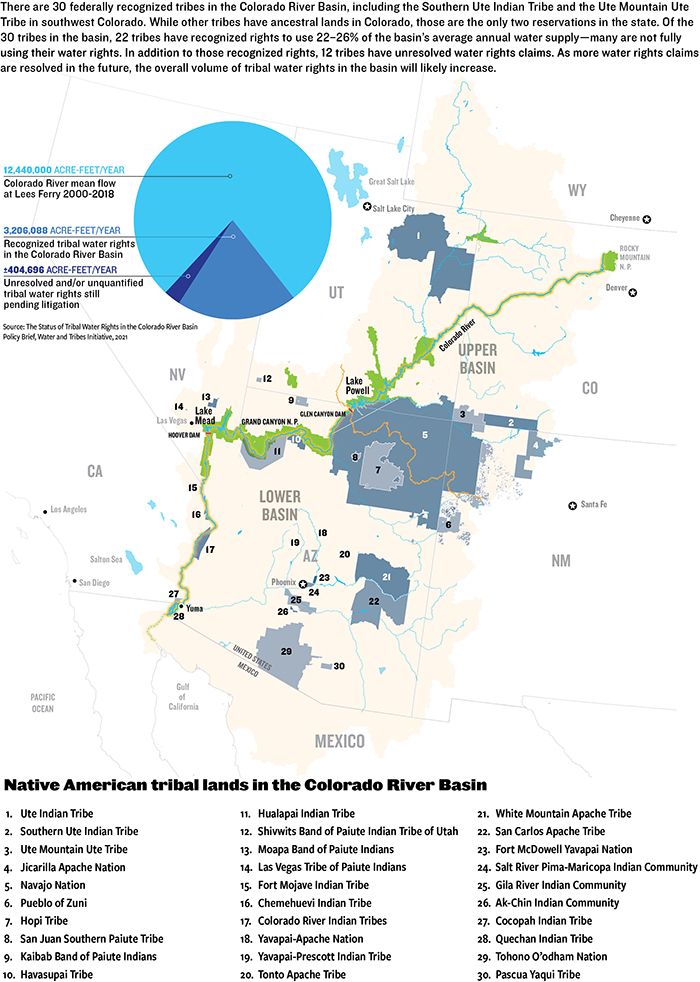
The water held by the basin tribes who have legally quantified water rights amounts to no small sum: 22 tribal nations retain 3.2 million acre-feet of water, or an estimated 22% to 26% of all annual water supplies in the basin, according to a 2021 brief from the Water and Tribes Initiative. This amount will likely increase over the years once more tribal water claims are resolved.
Even for tribes with settled or adjudicated water rights, some can’t access the full extent of that water because of lack of infrastructure or funding, or both. In total, just under half, or 1.5 million-acre-feet, of settled or adjudicated tribal rights have not yet been put to use by the tribes.
When adding together that unused water and unquantified water, and considering that tribes plan to fully develop and use their water, other water users in the basin wonder how it will look to integrate expanded tribal water use with existing water uses as water supplies continue to dwindle.
Lack of Representation
In one blinding instant, a flashbulb floods the adobe-walled room, illuminating a row of stoic men: seven state water commissioners standing behind then-Secretary of Commerce Herbert Hoover who sat at a desk. In front of them lies the 1922 Colorado River Compact, the formative agreement to carve up flows of the Colorado River. Within the Palace of the Governors in Santa Fe, N.M., these men divided the river into an upper and lower basin, apportioning the rights to consume 15 million acre-feet of water—their estimation of average annual river flow at the time—between the seven U.S. basin states: Colorado, New Mexico, Utah and Wyoming of the upper basin, and Arizona, California and Nevada of the lower basin, with the opportunity for lower basin states to develop an additional 1 million acre-feet from tributaries below Lee Ferry, Ariz.
The compact ushered in a new era of water management for the Colorado River Basin. But now, 100 years later, when facilitator of the Water and Tribes Initiative, Daryl Vigil, peers at this photograph of Hoover and the state water commissioners, he sees an “all monochromatic photo of older white gentlemen” who made no plan for apportioning any share of water to Native American tribes.
Herbert Hoover presides over the signing of the Colorado River Compact in November 1922. Members of the Colorado River Commission stood together at the signing of the Colorado River Compact on November 24, 1922. The signing took place at the Palace of the Governors in Santa Fe, New Mexico, with Secretary of Commerce Herbert Hoover presiding (seated). (Courtesy U.S. Department of Interior, Bureau of Reclamation)
Since the beginning of U.S. tribal water law, sovereign tribal nations in the basin have been excluded from cornerstone water management decisions despite having senior title to water. Native American water rights were first officially recognized in 1908, over a decade before the Colorado River Compact was signed, with the U.S. Supreme Court’s Winters v. United States decision. The court found that when the federal government “reserved” territories known as reservations, it too had “reserved” sufficient water to fulfill the purposes of the reservations—these water rights are considered established at the date when the reservation was created, making them senior to all uses that came later. But having the right to reserved water didn’t mean that the tribes had access to actual “wet” water or the legal representation to quantify their water rights.
When the 1922 compact was signed, tribes were surviving a multitude of disastrous living conditions and forced assimilation produced by federal Indian policy, established after U.S. violent colonial expansion. Indigenous peoples weren’t recognized as U.S. citizens until 1924, tribal governance wasn’t federally recognized until 1934, and Native Americans couldn’t vote in every state until the 1960s. “We were surviving here on government rations in 1922 when the Law of the River was created,” says Vigil.
A 1928 survey entitled “The Problem of Indian Administration” found that 26 Western Native American reservations and their economic bases were crumbling under management of the U.S. Department of the Interior (DOI), asserting that colonialism largely destroyed their ability to hunt, gather and fish.
The report recommended educating tribes to effectively use their land and water rights, saying that administrators “should be given the duty of seeing that the Indians secure their rightful share of water.” This recommendation was not enough. Assigning concrete legal title to tribal water succumbed to federal delay—a defining feature of water rights disputes for all tribal nations.
Tribes gained some ground when, in 1963, tribal water policy and Colorado River policy intersected in the U.S. Supreme Court’s Arizona v. California decision. Lengthy litigation led up to the decision, with Arizona filing suit in the U.S. Supreme Court to determine how much Colorado River water it could use. To answer that question, the U.S. found it had to assess what reserved water rights were needed for some of the tribes in the lower basin. A special master for the case determined the future needs of each reservation by assessing the amount of practicably irrigable acres and reserving water to irrigate that land rather than considering the reservations’ populations. In his proposed decree, which was upheld by the Supreme Court, the special master entered a quantified water right for five reservations on the mainstem of the Colorado River, granting 905,496 acre-feet of water for 135,636 irrigable acres.
After the case established the standard of quantifying the tribal reserved water right as looking at the amount of water required to irrigate the irrigable acreage on the tribal land, the push to quantify more tribal water rights ensued. But Supreme Court rulings “grew more negative,” according to a presentation from DOI. In 1989, DOI adopted the policy to resolve Indian water disputes through settlement rather than litigation, creating the Secretary’s Indian Water Rights Office. To reach agreement, Indigenous nations must negotiate their rights within a massive tangle of other users staking claims to water within the state where their reservation is located, which can take decades. Once all parties concur, Congress must approve the agreement by passing legislation to fund any tribal water infrastructure projects.
As federal tribal water policy evolved, so too did Colorado River policy. After the 1922 compact, a series of layered agreements—including Arizona v. California and other court decisions, congressional acts, legal settlements, treaties and compacts—known collectively as the “Law of the River” have come to govern the way water is managed and divided throughout the basin.
The latest layers of the Law of the River have been implemented since 2000, in response to years of drought. In 2007, the U.S. Secretary of the Interior adopted the Interim Guidelines for Lower Basin Shortages and Coordinated Operations for Lake Powell and Lake Mead. The Interim Guidelines outline a method to balance the amount of water available between the upper and lower basins. In 2019, upper and lower basin Drought Contingency Plans (DCPs) were developed as additional frameworks to address water shortages and water-saving rules.
The upper basin continues to “equalize” the contents of Lake Powell and Lake Mead per the 2007 guidelines, and continues to pursue water augmentation activities such as cloud seeding. It is also exploring the possibility of developing a demand management program in which water saved or not used in the upper basin could be stored in Powell as a 500,000 acre-foot drought pool, though the Colorado Water Conservation Board put a “hard pause” on Colorado’s demand management investigation in March 2022. For the lower basin, the DCP, a Binational Water Scarcity Contingency Plan with Mexico, and the 2007 guidelines lay out cuts in water deliveries from the Colorado River, triggered by projections of Lake Mead storage elevations. The interim guidelines already outlined cuts but the DCP added additional delivery reductions for the lower basin states and Mexico to absorb. The greatest cuts to lower basin water use will come from Arizona and California but the entire lower basin, including Mexico, will share in scarcity.
When these guidelines and plans were crafted, all but the Lower Basin DCP received little to no tribal input. These plans will expire in 2026, and negotiations for the next phase of shortage-sharing agreements are just beginning.
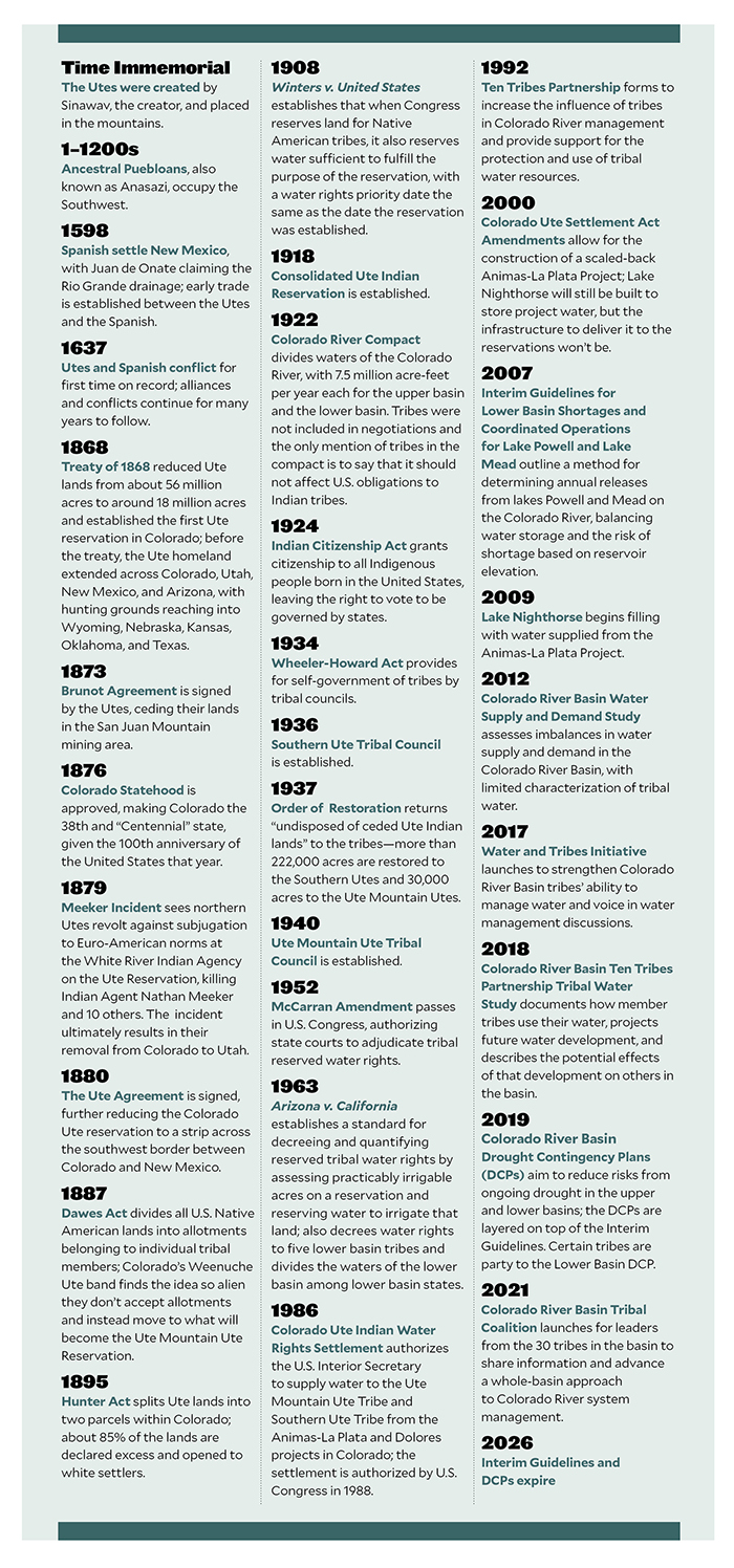
Native American Timeline. Credit: Water Education Colorado
Vigil, who is also water administrator for the Jicarilla Apache Nation from New Mexico, joined the Water and Tribes Initiative in 2017 to facilitate tribal discussions, protect water rights, and unify tribal interests within the Colorado River Basin. Their tribal leader forums helped spur a coalition of the tribes in the basin to call for inclusion in water framework negotiations.
When new guidelines are developed to govern river management beyond 2026, how will they affect existing tribal water rights or unresolved water claims? “Those are questions that are not yet clear to the Ute Mountain Ute Tribe and probably other tribes,” says Leland Begay, water attorney for the Ute Mountain Ute Tribe, which has adjudicated water rights in Colorado but has not yet resolved its water rights in New Mexico and Utah.
Settled Water Rights for the Colorado Ute Tribes
During the hot summers of his childhood, Lyndreth Wall of the Ute Mountain Ute Tribe would take refuge on Ute Mountain in southwestern Colorado, herding livestock at his grandparents’ sheep camp. They spoke only Ute to him, which he picked up fast, at least conversationally. In those days, the 1970s, the water on Ute Mountain was delicious. “The tribe took care of the water there,” Wall says. But his home tap water in Towaoc tasted like metal. It was “disgusting,” he says, and could make you sick. In White Mesa, their western tribal community in Utah, the water was worse—contaminated by radioactive waste.
For young Wall, his neighbors, family and livestock, the journey to procure drinkable water would be a 30- to 120-mile round trip excursion from Towaoc to Cortez or Mancos, even Durango, Colo. Wall remembers his parents packing buckets in their family pickup—the Wall’s buckets mixed with those of neighbors. This supply would last a few days before they would need more.
Today, more Ute Mountain Ute tribal members have water for drinking and irrigation thanks to the 1986 Colorado Ute Indian Water Rights Final Settlement Agreement, followed two years later by a federal settlement act, and by amendments in 2000, all of which they share with the Southern Ute Indian Tribe. The settlement places the Colorado Ute tribes among the four tribes in the upper Colorado River Basin that have completed water rights settlements, which also means that the State of Colorado is no longer negotiating any tribal settlement agreements.
For the Ute Mountain Ute Tribe, the settlement meant access to Dolores Project water, an entitlement to Animas-La Plata Project water, and rights to over 27,000 acre-feet of water from rivers that flow near or through their reservation. Most years, the Ute Mountain Ute Tribe can access their 25,100 acre-foot water storage allocation from the Dolores Project’s McPhee Reservoir in southwestern Colorado. Water from McPhee began to flow to the Ute Mountain Ute Tribe in 1994 delivering clean drinking water to the tribe for the first time in their history and supporting the development of a hotel, travel center and casino, which provide vital tribal employment and income. The tribe’s new irrigation water from the Dolores Project, up to 23,300 acre-feet per year, supported the development of the highly productive 7,700-acre Ute Mountain Ute Farm and Ranch Enterprise and Bow and Arrow corn mill.
For the Southern Ute Indian Tribe, the settlement wasn’t quite as momentous. “We have seven sources of water, seven rivers, that run to the tribe, so the tribe had been accessing those waters pre-settlement,” says Kathy Rall, head of the water resources division for the Southern Ute Indian Tribe. Before the settlement, the tribe didn’t have quantified rights to that water, Rall says. “Those rights were hammered out and solidified through the settlement,” she says. The Southern Ute Indian Tribe also received an allocation of Animas-La Plata Project water—but the infrastructure was never built for either tribe to access that water.
“Ever since [the Animas-La Plata Project] was constructed, we’ve never used a drop of it, yet we have a certain percentage, not only to us, but also our sister tribe, the Southern Ute,” says Wall, who is now a tribal councilman for the Ute Mountain Ute Tribe. The project allocated more than 60,000 acre-feet per year of municipal and industrial water to the Ute Mountain Ute Tribe and the Southern Ute Indian Tribe, but a series of obstacles has made this water inaccessible.
Lake Nighthorse and Durango March 2016 photo via Greg Hobbs.
The settlement authorized the construction of Lake Nighthorse, just south of Durango, to store Animas-La Plata water for tribal water uses. The project was envisioned to bring water for irrigation, municipal and industrial uses to the tribes and non-tribal water users. But environmental and fiscal concerns resulted in the project being downsized.
A lawsuit halted the construction of Lake Nighthorse’s Ridges Basin Dam in 1992. Groups including the Environmental Defense Fund, Sierra Club, and the Taxpayers for the Animas River argued the dam’s cost was an undue burden for taxpayers and that its construction would threaten the Colorado pikeminnow fish population, which was federally listed as endangered at the time. Christine Arbogast, lobbyist for the Ute Mountain Ute Tribe, Southern Ute Indian Tribe, and neighboring water districts and municipalities, remembers a meeting where an environmental advocate said that with the amount of funding required to build the reservoir project, they could supply the tribe with bottled water for life. “That was the kind of mentality on the side of the environmental community,” says Arbogast.
As project proponents tried to advance Lake Nighthorse, part of the permitting requirement was to propose alternatives to the project. To address the endangered fish issues, the U.S. Fish and Wildlife Service approved an alternative that would allow for reservoir construction but with certain requirements, including a new San Juan River Basin Recovery Implementation Program. The recovery program would go on to manage the river to recover the endangered Colorado pikeminnow and the razorback sucker while allowing water development to continue.
To carry out the Animas-La Plata Project, a 2000 settlement amendment restricted the water in Lake Nighthorse to municipal and industrial use, excluding irrigation. Now referred to as “Animas-La Plata Lite” there was no longer any plan to construct the irrigation canals that would have connected Lake Nighthorse to the tribes and even neighboring water districts and municipalities that were counting on these water supplies throughout the negotiations. The tribes scrapped their plans to expand farmlands as a result. “It was heartbreaking to every single one of them, including the tribes, when we had to make the decision to shelve the irrigation component in order to get this settlement,” Arbogast says.
Some positive outcomes resulted from the settlement, including quantified and adjudicated water rights for the Southern Ute Indian Tribe, access to Dolores Project water for the Ute Mountain Ute Tribe, and funding for both tribes, Rall says. But ongoing lack of access to water stored in Lake Nighthorse and the inability to use that water, if accessed, for irrigation, was “disastrous” she says.
When the project was downsized to the “lite” version “we just kind of said, ‘OK, we’re going to get what we get,’” Rall says. “The tribe went, ‘If we don’t settle now, who knows what we’ll end up with.’”
The settlement means that the tribes’ water allocations are protected, which “does offer the tribes a measure of security in their water rights,” says Amy Ostdiek, head of the Colorado Water Conservation Board’s Interstate and Federal Section. “But there are still critical needs in terms of infrastructure and access to clean drinking water.”
As the settlement stipulates, the moment the tribes begin to use water from Lake Nighthorse, they will each inherit an annual bill of around $800,000 in operations and maintenance costs for the dam and pumping facilities that the federal government is currently footing. At the moment, there is still no infrastructure to deliver the water to the tribes, and the tribes are not prepared to take on those costs, so they haven’t used any of their water. This may change due to the $2.5 billion earmarked in the 2021 Infrastructure Investment and Jobs Act for completion of authorized Indian water rights settlements. Both Colorado Ute tribes are pursuing that funding, with full support from the State of Colorado, according to the Colorado Water Conservation Board (CWCB), but whether they will receive it remains to be seen. Information sessions on the bill between tribal nations and DOI are ongoing.
“We’re trying to find alternatives and ways that we can utilize our water in [Lake] Nighthorse. We want it and it seems like we’re having a water war,” says Wall. “What’s rightfully ours is ours by God. We need to continue to save it for the future of our tribe.”
Water or Land, Not Both
Settling and quantifying tribal water rights claims isn’t just beneficial to tribal nations. The state in which a reservation is located and other water users there benefit from the certainty of knowing how much water is allocated to the tribes so they can make plans to live within and stretch their own share or to work together to send water where it’s most needed.
But Arizona is home, at least partially, to 11 of the 12 tribal nations in the basin who still have unresolved claims to Colorado River water—resulting in uncertainty for the state and the tribes. Many tribal leaders are frustrated by the state’s unprecedented condition for tribes to secure their water rights: In exchange, tribal nations must surrender their right to freely enter fee lands into trust, an essential administrative program of the Bureau of Indian Affairs that lets tribes recover their ancestral homelands. Instead, tribes would need congressional approval to have the Interior Secretary take lands into trust.
“We just believe that the congressional process is a more equitable forum for the discussion of those lands into trust,” says Tom Buschatzke, director of the Arizona Department of Water Resources. He cites the importance of hearing from local communities that could be impacted when the tribes bring additional ancestral homelands into trust and ensuring “politically elected leaders get to make the decision.”
That stipulation is a nonstarter for many tribes, and puts them in a precarious position, weighing their right to re-acquire their ancestral homelands against securing water for their people.
“That’s something we will never agree to,” Yavapai-Apache Nation Chairman Jon Huey told the Governor’s Water Augmentation Innovation and Conservation Council during that September 2020 meeting. The Yavapai-Apache Nation plans to bring land into trust, re-acquiring its homeland to build housing for the growing tribal population.
Already, leaders from the Navajo Nation, Tonto Apache Tribe, Yavapai-Apache Nation, and Pascua Yaqui Tribe in southern Arizona have worked for decades with the state and other water districts to reach a settlement. For example, the Navajo Nation has been in recurring negotiations since 1993.
Tribes also object to a condition proposed by Arizona officials that they waive their right to object to future off-reservation groundwater pumping.
Despite hearing from leaders like Huey, the state has not changed its position. Buschatzke says these conditions are just part of the “give and take” nature of settlements. “Some things you give more of, some things you give less of,” he says. “And the whole package has to fit together for both sides at the end of the day in a way that they can live with it and in a way that they believe, hopefully, that they’re better off with the package than they are without the package.”
DOI remains dedicated to facilitating settlement discussions and is aware of the tribal concerns toward Arizona’s anti-fee-to-trust policy. “We are working from the federal perspective closely with tribal partners and with non-federal entities like the State of Arizona to bring these issues to conclusion and resolution,” says Tanya Trujillo, assistant secretary for water and science at DOI, who has been part of these tribal settlement discussions.
Working Together in Shortage
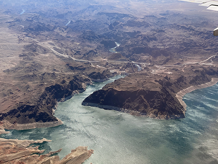
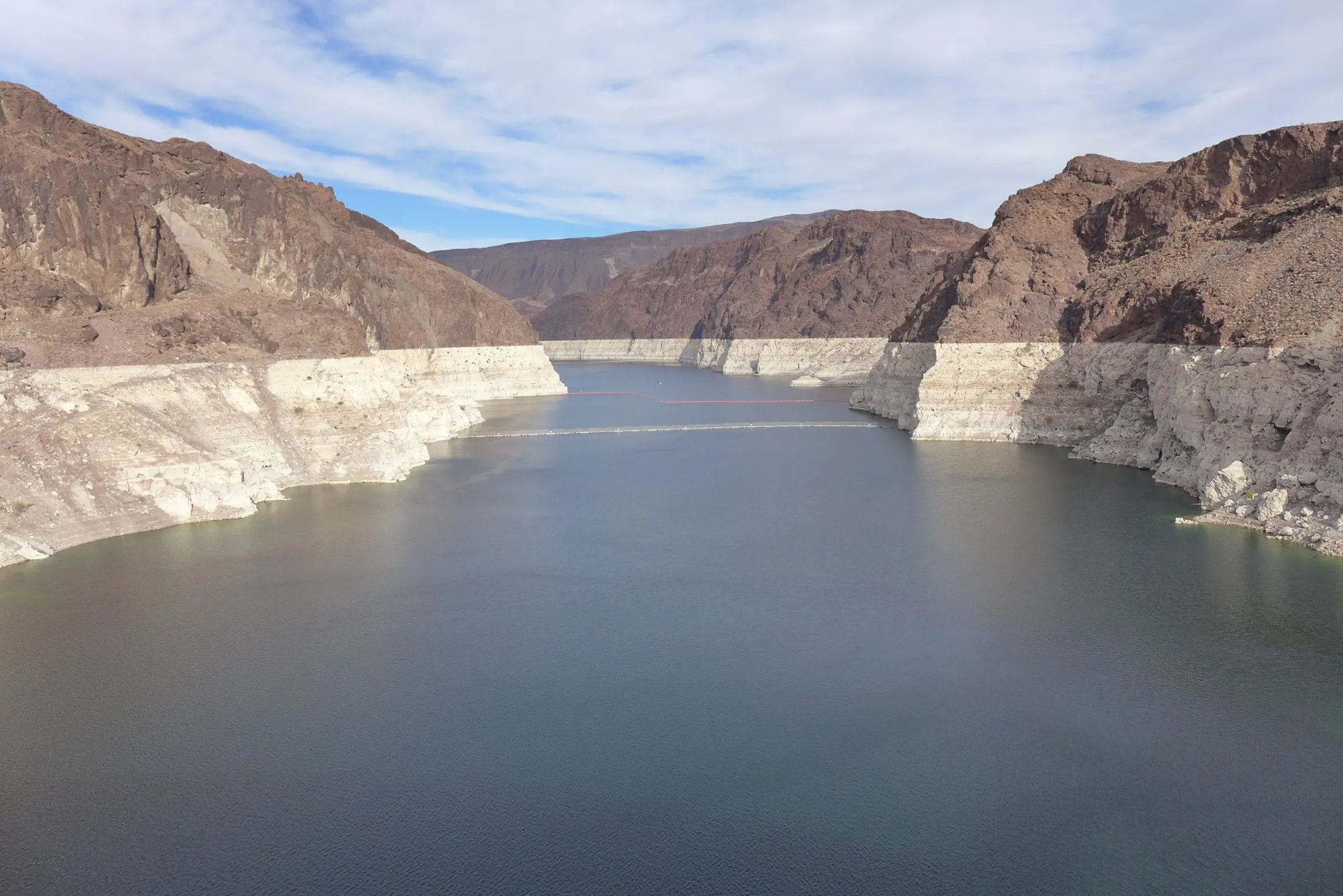
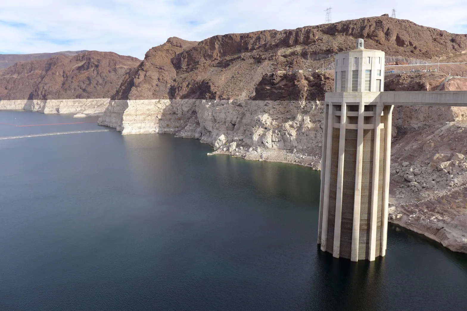
Water levels in Lake Mead have dropped to historic lows over the past year, triggering a shortage declaration on the Colorado River. Some of the frameworks that govern how the river is managed are set to expire in 2026. As states and stakeholders negotiate the next management framework, tribal nations want to make sure they have a seat at the table. Photo by Jeffrey Hayes / Flickr
Despite some of the barriers to settlement, Buschatzke concedes that settlements provide certainty for tribes and other water users, as well as a way to work collaboratively. And now more than ever, the need to collaborate with tribes has hit harder than in the past.
September 21, 1923, 9:00 a.m. — Colorado River at Lees Ferry. From right bank on line with Klohr’s house and gage house. Old “Dugway” or inclined gage shows to left of gage house. Gage height 11.05′, discharge 27,000 cfs. Lens 16, time =1/25, camera supported. Photo by G.C. Stevens of the USGS. Source: 1921-1937 Surface Water Records File, Colorado R. @ Lees Ferry, Laguna Niguel Federal Records Center, Accession No. 57-78-0006, Box 2 of 2 , Location No. MB053635.
The upper basin states are subject to fluctuations in hydrology, which determine the amount of Colorado River water available for their use. While the 1922 compact allocated the consumptive use of 7.5 million acre-feet of water per year to each the upper and lower basins, the upper basin regularly uses less Colorado River water than agreed to—about 4 million acre-feet per year since 1990. That’s, in part, because the upper basin hasn’t fully developed reservoirs to store extra water in times of plenty and to use its full allocation. Per the compact, upper basin states cannot deplete the river at Lee Ferry, the dividing point between the upper and lower basins, below a certain amount. That non-depletion requirement means the upper basin will likely shoulder the burden of declining flows into the future, and may have to continue to use less water.
Lower basin states rely on supplies stored in Lake Mead, the basin’s largest reservoir, which reached a historic low of just 35% of capacity in August 2021. As Mead’s water level has receded, the lower basin has begun to take cuts to the amount of water it’s drawing from the reservoir, as outlined in the 2019 Drought Contingency Plans. The first big cuts are coming from Arizona—this year it will take 18% less Colorado River water, coming almost entirely from the Central Arizona Project (CAP), slashing its CAP water use by about 30%. The CAP pipes Colorado River water to Phoenix and Tucson, and to irrigators and tribal nations in central and southern Arizona. Agricultural water users will be the first to feel these water reductions, with CAP agricultural water deliveries, mostly in Pinal County, reduced by 65%.
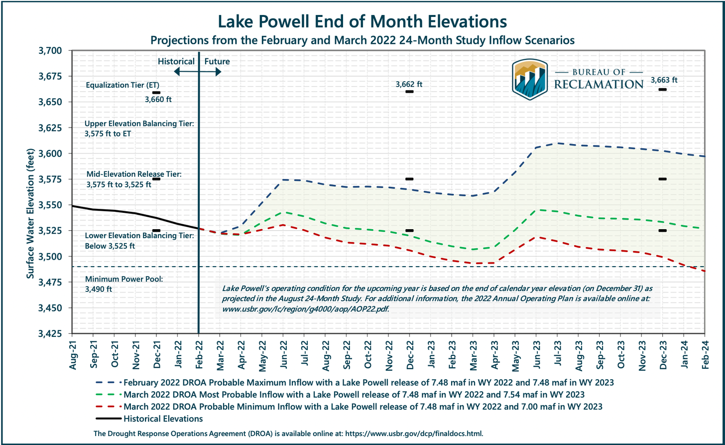
If Lake Mead levels continue to fall, deliveries to lower basin states will continue to be reduced, eventually affecting all lower basin states and Mexico. In February 2022 the U.S. Bureau of Reclamation projected that the reservoir level could likely drop by another 30 feet or so over the next two years, reaching new shortage tiers and triggering more cuts to lower basin states.
Tribes play a critical role in all of this: As Colorado River water supply diminishes, and as more tribes settle their water rights, those tribal water rights could comprise a larger percentage of available senior Colorado River water resources. Take the Colorado River Indian Tribes, consisting of four tribes, the Mohave, Chemehuevi, Hopi and Navajo, with a reservation along the Colorado River at the border between Arizona and California. These tribes hold rights to more than 700,000 acre-feet of mainstem Colorado River water, with more than 660,000 acre-feet of that water in Arizona. These are the most senior water rights in the lower basin, making them the most secure in times of shortage.
Starting in 2016, the Colorado River Indian Tribes entered a short-term pilot project with Reclamation, in which they were compensated for fallowing more than 1,500 acres of farmland so that water could be left in Lake Mead. Those pilot project numbers were upped in 2018. The following year, in 2019, the tribes worked with the State of Arizona on a much larger agreement, as part of the Drought Contingency Plan, committing to fallow farmland and forego water deliveries to the tune of 150,000 acre-feet over three years to help maintain levels in Lake Mead. In exchange for this contribution of water, the tribes are paid $38 million. Now, the tribes are looking to be able to lease their water—something that wasn’t authorized in the Arizona v. California opinion that established their water rights. A bill introduced to the U.S. Senate in December 2021 could allow the tribes to lease part of their water allocation to individuals, businesses, municipalities, governments and others for off-reservation uses to provide additional drought relief and protect natural habitats in Arizona.
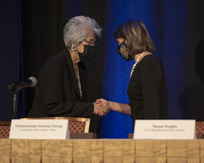
Colorado River Indian Tribes Chairwoman Amelia Flores greets Tanya Trujillo, the Interior Department’s assistant secretary for water and science, at the Colorado River Water Users Association December 2021 conference. Photo courtesy U.S. Bureau of Reclamation / Flickr
A January 2022 agreement on the Colorado River in New Mexico does just that. The Jicarilla Apache Nation, New Mexico Interstate Stream Commission and The Nature Conservancy announced a new deal to lease up to 20,000 acre-feet of water per year from the Jicarilla Apache Nation to the stream commission to support threatened, endangered and vulnerable fish and to increase water security for New Mexico. The tribal nation subcontracts some of its other water to users outside the reservation, providing a valuable source of income.
The Colorado Ute tribes and the State of Colorado are wondering whether a similar agreement or lease deal could put their unused Animas-La Plata Project water to work, says Peter Ortego, general counsel for the Ute Mountain Ute Tribe. (Ortego also serves on the Water Education Colorado Board of Trustees.) “The tribes have been eager to see solutions to these problems and the state has been helpful in working with us to find a consumptive use for that water,” says Ortego.
Talks are preliminary and confidential, and the tribes’ settlement legislation is somewhat narrow, Ortego says, specifying that the tribes water can be leased but must be used for municipal or industrial needs within Colorado. Because Lake Nighthorse is in the southwest corner of the state, so close to the border with New Mexico, that doesn’t leave room for a lot of Colorado users to step in and lease water. However, some nearby communities are running short on water and could benefit from the supplies stored in Lake Nighthorse, if an agreement is reached. “I think we’re starting to understand now that if we can all work together to utilize that water, it will be best for the entire region,” Ortego says. “The ultimate goal is to basically keep water in Colorado to help Colorado meet its other obligations.”
More of this water sharing and leasing work could be coming. “We are very open to more discussions with tribes about what additional opportunities may exist,” says Trujillo, who has met with tribes on their ability to contribute water and receive compensation. “I think there is a lot of interest from several different angles to try to do more of that.”
Tribes Unifying in Negotiations
When he became water administrator for the Jicarilla Apache Nation, Vigil began to see how excluded tribal nations were from river management decisions.
From the 2018 Tribal Water Study, this graphic shows the location of the 29 federally-recognized tribes in the Colorado River Basin. Map credit: USBR
No tribes were invited to provide input to the 2007 Interim Guidelines, which dictate reservoir operations in the event of water shortages. The guidelines were negotiated by representatives from each basin state, federal agencies, and with Mexico through the International Boundary and Water Commission—tribal water use was the responsibility of the state that the tribe resided in, so the tribes were treated as stakeholders within the states, not as sovereigns themselves. In 2012, when Reclamation completed the basin-wide Colorado River Basin Water Supply and Demand Study, tribes called attention to the fact that there was no meaningful inquiry into tribal water. It was only after pressure on Reclamation that the agency funded the Colorado River Basin Ten Tribes Partnership Tribal Water Study, which, in 2018 assessed water supplies for a coalition of 10 tribal nations in the upper and lower basins that had previously come together in 1992 to push for more tribal voices in basin water management. The study was not comprehensive of all basin tribes but gave a stronger sense of tribal water supplies. In developing the 2019 DCP, which outlined water-saving plans between the seven U.S. basin states and Mexico, Reclamation consulted with only a few lower basin tribes.
At this Ten Tribes Partnership Meeting in 2018, Southern Ute Indian Tribe councilwoman Lorelei Cloud approved publication of the Tribal Water Study. Photo courtesy of the Southern Ute Indian Tribe
This neglect from state and federal agencies prompted the creation of the Water and Tribes Initiative in 2017. Aiming to support tribes and give them a stronger voice in water management discussions in the region, various leaders formed the initiative, including tribal representatives, policy experts, researchers, conservation groups, state and federal officials and others, co-convened by Vigil and Matt McKinney, co-chair of the University of Montana’s Natural Resources Conflict Resolution Program. “Why wouldn’t you include 30 [tribal] sovereigns who own 25% of the volume of the Colorado River?” says Vigil. “Why wouldn’t you include 30 tribal sovereigns who have been here for millennia?”
As water managers begin to plan, negotiate and draft the next river management framework that will be implemented as the Interim Guidelines and DCP expire in 2026, many tribes are actively trying to gain a seat at the negotiating table. Twenty of the basin tribes have formed an ad hoc group for all 30 of the tribes in the basin called the Colorado River Basin Tribal Coalition. As the most substantive negotiations in developing the next river management framework are likely to unfold over the next two years, the coalition is calling to work together with federal agencies and states as soon as possible. While the next set of guidelines will not affect the status of settled tribal water entitlements, many tribes are concerned that they could affect unresolved water claims, which could still take decades to settle, and their ability to plan for their future.
Rebecca Mitchell, director of the CWCB, has been meeting with the Ute Mountain Ute and Southern Ute Indian Tribes to develop a sovereign-to-sovereign framework, a process for tribes and the State of Colorado to engage on equal ground throughout water management negotiations.
“The scope of the interim guidelines will be limited to operations of the major reservoirs, so it is important to recognize that we cannot resolve all of the issues in the basin throughout that negotiation process,” Mitchell wrote in a statement via email. “Still, it will be imperative to include tribal nations in the process.”
That relationship between the Colorado Ute tribes and state has been great, says Rall with the Southern Ute Indian Tribe. “[Mitchell] is trying to lead the way for other states to do the same, hoping that other states will enter into sovereign-to-sovereign agreements with their tribes to have a seat at the table.”
For Leland Begay with the Ute Mountain Ute Tribe, early involvement in Reclamation’s next framework for managing water shortage is going to be critical for tribes to determine their future—to participate in decisions they were excluded from in years past. “In the past, there’s been a lot of shortcomings on behalf of the Bureau of Reclamation in engaging with tribes at an early stage,” says Begay. “This is an opportunity for Reclamation to meaningfully engage with tribes on how the interim guidelines impact tribes and their water rights and their land.”
It’s difficult not to view the Colorado River Compact in a global colonial context. When the compact was signed in 1922, European colonial powers were still carving up African territories, exploiting resources like copper or rubber. The U.S. empire carved up the Colorado River, splitting it among seven states, dispossessing tribes from their natural relationship with the river, with no plan to deliver them water. While the historical Law of the River can’t be removed from this context, its next era could be one where federal, state and local agencies work collaboratively with tribal nations.
Vigil has a gentle, impassioned cadence when he speaks. The river, he says, has given him a calling, a voice. Tribal nations in the basin are in a much better position today to advocate for their water interests, but it took years—a whole century really—to reach this point. It’s left him wondering: Where are we headed if we don’t start to build a collaborative framework that includes tribes?
While he talked, Vigil would occasionally chuckle or laugh in disbelief, especially about the history of tribal water rights. “I think [the laughter] is a, you know, it’s a Native thing. It’s like a way to deal with the absurdity and like the massive amount of grief that comes with having to acknowledge this and where we’re at. Like every single time.”
Kalen Goodluck is a Diné, Mandan, Hidatsa and Tsimshian journalist and photographer based in Albuquerque, N.M. His work has appeared in High Country News, The New York Times, Popular Science, National Geographic – Travel, NBC News and more.
North American Indian regional losses 1850 thru 1890.
Click the link to read the article on the Colorado Public Radio website (Michael Elizabeth Sakas). Here’s an excerpt:
Colorado’s water leaders have released an updated blueprint detailing how the state will manage and conserve water supplies as climate change and population growth strain the system in unprecedented ways…
In the years since, continued warming, poor snowpack and low river flows have devastated available water supplies for farmers and ranchers. The reservoirs on the Colorado River, which starts in the mountains of Colorado and supplies more than 40 million people in the West with water, have hit critically low levels in the last year. The emergency has prompted the federal government to step in and demand the use of less Colorado River water…
The new analysis in the draft version of the new Colorado Water Plan, which was written by a team overseen by the Colorado Water Conservation Board, finds that cities, towns and industries in Colorado could be short 230,000 to 740,000 acre-feet of water annually by the year 2050 — enough water, depending on different drought and climate scenarios, to supply between 500,000 and 1.5 million homes. As the state faces warmer temperatures and less water, analysis in the draft plan finds that statewide water use in towns, cities and industries will climb between 35 percent and 77 percent by 2050…
The plan calls on leaders of Colorado’s nine river basins — known as roundtables — to identify local needs and projects that the Colorado Water Conservation Board can fund. Right now, about 1,800 such projects have been identified, a running list in various stages of readiness that comes with a hefty price tag: about $20 billion in funding to be fully completed. Some of the proposed projects include building new reservoirs and expanding old ones, watershed improvements, environmental restoration projects and infrastructure improvements.
The pie chart shows how much water each sector uses in Colorado, as well as how much water originating here leaves the state. CREDIT: COURTESY COLORADO WATER PLAN
Crystal River rancher Bill Fales stands at the headgate for the Helms Ditch, with Mount Sopris in the background. As part of an agreement with the Colorado Water Trust, Fales could be paid to reduce his diversions from the ditch when the river is low. CREDIT: HEATHER SACKETT/ASPEN JOURNALISM
A Crystal River Valley rancher and a nonprofit organization are teaming up for the second time to try to leave more water in a parched stream.
Cold Mountain Ranch owners Bill Fales and Marj Perry have inked a six-year deal with the Colorado Water Trust to voluntarily retime their irrigation practices to leave water in the Crystal River during the late summer and early fall, when the river often needs it the most. In addition to a $5,000 signing bonus, the ranchers will be paid $250 a day up to 20 days, for each cubic foot per second they don’t divert, for a maximum payment of $30,000.
The water would come from reducing diversions from the Helms Ditch and could result in up to an additional 6 cfs in the river. The agreement would become active in the months of August and September any time streamflows dip below 40 cfs and once becoming active, will extend through October. The agreement will lift if streamflows rise above 55 cfs.
The goal of the program is to use voluntary, market-based approaches to encourage agricultural water users — who often own the biggest and most senior water rights — to put water back into Colorado’s rivers during critical times.
The program has the hallmarks of demand management, a much-discussed concept over the past few years at the state level: it’s temporary, voluntary and compensated. Other pilot programs that focus on agricultural water conservation usually involve full or split-season fallowing of fields, but with this agreement Fales still intends to get his usual two cuttings of hay.
“The idea is to find something that is a flexible way for water rights owners to use their water in years where it makes sense for something different than strictly agricultural practices,” said Alyson Meyer-Gould, director of policy with the Colorado Water Trust. “It’s another way to use their water portfolio.”
The pie chart shows how much water each sector uses in Colorado, as well as how much water originating here leaves the state. CREDIT: COURTESY COLORADO WATER PLAN
Click the link to read the article on the KRDO website (Mallory Anderson). Here’s an excerpt:
A draft of the 2023 Colorado Water Plan has been released and outlines what the state needs to do in order to conserve resources as rivers, lakes, and reservoirs dry up…
A new analysis by the Colorado Water Conservation Board (CWCB) says up to 740,000 additional acre-feet of water could be needed by 2050 to meet community and industrial demands. For agriculture, an even bigger number. An estimated 2.6 to 3.5 million acre-feet of water is needed.
“I think we’re presenting a very honest view of where things are at,” said Russ Sands, Section Chief for Water Supply Planning with the Colorado Water Conservation Board. “It’s going to be tough. We can’t change things like mega-fires. We can’t stop the drought. But, we can do a lot of things to work together to mitigate the worst impacts of what is headed our way.”
[…]
A major way the Colorado Water Plan hopes to mitigate impacts is through local projects the CWCB is ready to give grants to…The Water Plan estimates that $20 billion is needed to address the water crisis…Despite the high price, the CWCB is staying positive when looking towards the future of water in our state…Public comment is now open for the Water Plan draft and closes on September 30, 2022.
A turbine whirls on a farm east of Burlington, Colo. Colorado’s eastern plains already have many wind farms—but it may look like a pin cushion during the next several years. Photo/Allen Best
The plan contains no silver bullet for the challenges facing cities, farms, forests, recreation and conservation areas in the state. It does lay out the challenges and points toward potential solutions to a future far shorter on water than what the recent past has experienced.
As noted in a quotation from former Colorado Justice Gregory Hobbs in a preamble to the document, “The 21st Century is the era of limits made applicable to water decision making. Due to natural western water scarcity, we are no longer developing a resource. Instead, we are learning how to share a developed resource.”
The plan picks up Hobbs’ “sharing” advice with a call for greater collaboration between the water basins and water decision makers in the state and beyond.
Headwinds in the use of Colorado water include multiple factors:
The population is growing. It’s nearly 6 million now and will be 8.5 million by 2050.
Nineteen other states plus Mexico also depend upon water that originates in Colorado.
It’s getting hotter. Average temperatures are up 2 degrees Fahrenheit in the past 30 years.
Rainfall is coming less often. It’s been below average since 2000.
Yet some progress in meeting challenges has been made, the report said.
Conservation efforts have reduced per capita water consumption by 5% since 2000.
Cities have worked collaboratively to lease 25,000 acre feet of agricultural water since then, instead of buying-and-drying.
About 400,000 acre feet of storage has been created since the turn of the century, too.
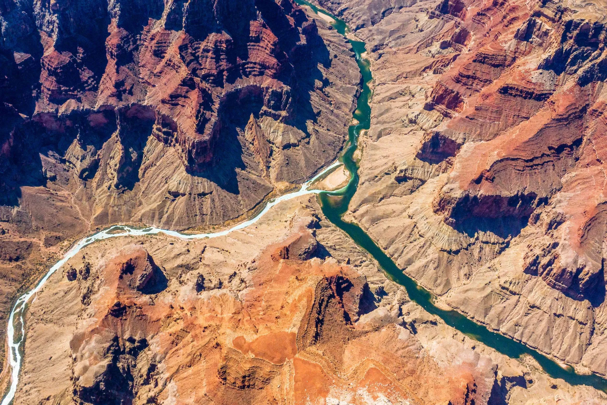
The confluence of the Colorado and Little Colorado rivers in the Grand Canyon, shown here in a September 2020 aerial photo from Ecoflight, represents an area where the humpback chub has rebounded in the last decade. That progress is now threatened by declining water levels in Lake Powell, which could lead to non-native smallmouth bass becoming established in the canyon. CREDIT: JANE PARGITER/ECOFLIGHT
Colorado has no plans to make additional cuts to water use next year to meet the Bureau of Reclamation’s demand to conserve millions of acre-feet of water, a step needed to preserve power production in Lake Powell and Lake Mead. Instead, Colorado officials insist that other states should do the cutting.
“I think that at this point, we stand ready to hear what the Lower Basin has in mind,” said Amy Ostdiek, a section chief with the Colorado Water Conservation Board.
Ostdiek told The Gazette the Upper Basin states — Colorado, New Mexico, Wyoming and Utah — dramatically reduced their water use in 2021 because of drought conditions. Specifically, they cut 1 million acre-feet in use in 2021 compared with 2020, bringing it down to 3.5 million acre-feet. But, at the same time, total water use in the Lower Basin has not been cut enough to preserve levels in the lakes, said Ostdiek, who is chief of the Interstate, Federal, and Water Information Section. She said water users in Colorado cut their consumption to meet the obligations of the 1922 river compact that governs use between the seven states and Mexico, who all share the river.
“The most impactful thing we can do is live within the means of the river,” she said.
Map of the Colorado River drainage basin, created using USGS data. By Shannon1 Creative Commons Attribution-Share Alike 4.0
Some of the snowmelt flowing in the Blue River as it joins the Colorado River near Kremmling, Colo., will reach the Lower Basin states. Dec. 3, 2019. Credit: Mitch Tobin, the Water Desk
Click the link to read the article on the Summit Daily website (Eliza Noe). Here’s an excerpt:
The plan focuses on four “interconnected action areas,” including resiliency planning, thriving watersheds, robust agriculture and community. It describes 50 “partner actions,” or project ideas that could be supported by Water Plan grants, as well as 50 “agency actions,” to support local projects, conservation and wise-water development. Overall, however, basin roundtables and stakeholders identified more than 1,800 potential future projects statewide, and 321 are in the Colorado Basin with 36 being in Summit County. In total, over $20 billion would be spent on the projects by 2050. Russ Sands, senior program manager of water supply planning for the Colorado Water Conservation Board, said that projects in the database are designated as near-term, midterm or long-term when it comes to getting them done. They’re also not all infrastructure projects. Some may work toward water conservation and others may be educational projects or environmental…
According to the plan, the Colorado Basin — which includes Summit County and the Blue River — faces issues such as competing resources for agriculture, tourism, protection of endangered species and potential for Colorado River Compact administration. The basin encompasses about 6% of the state’s population, and between 2015 and 2050, population is expected to increase 48-88%. Flows are also projected to be variable over the next several decades. Decreased peak flows across the basin create risks for wetland plants and fish habitats. Instream flows and recreational in-channel diversions may not be met if summer flows decrease due to climate change. Each year, water providers in the South Platte and Arkansas Basins export approximately 480,000 acre-feet each year from the Colorado Basin for eastern slope agricultural, municipal and industrial uses. Across the basin, as much as 70% of the river’s water flows out of Colorado…
The pie chart shows how much water each sector uses in Colorado, as well as how much water originating here leaves the state. CREDIT: COURTESY COLORADO WATER PLAN
“(June 30) opens up the 90-day public comment period,” Rebecca Mitchell, director of the Colorado Water Conservation Board, said. “This updated new and improved Water Plan is designed to meet today’s water challenges and builds on the legacy that we have in Colorado of collaborative statewide water planning.
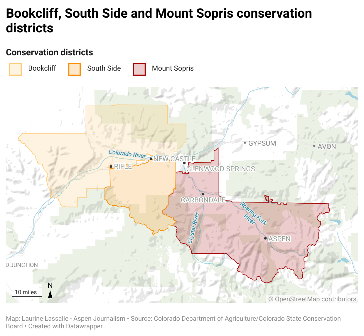
Raymond Langstaff, a rancher and president of the Bookcliff Conservation District, irrigates a parcel north of Rifle. The 2023 Water Plan update says agriculture could experience an even bigger water supply gap in the future. CREDIT: HEATHER SACKETT/ASPEN JOURNALISM
State officials are hoping dire climate predictions and water shortages will convince Coloradans to get involved in planning how to share a dwindling resource.
Colorado Water Conservation Board staff released the second iteration of the Colorado Water Plan on Thursday, which is now open for public comment. The first version of the plan was implemented in 2015.
Words from the late water expert and former Colorado Supreme Court Justice Greg Hobbs set the tone on page 1 of the document: The 21st century is no longer about developing a resource, it is now an era of limits and learning how to share a developed resource.
“I think we get to educate and engage and inspire and be an example and I think that’s the benefit,” said CWCB Executive Director Becky Mitchell. “I think when we are given the opportunity to lead, Coloradans do that.”
The updated plan lays out four interconnected areas for action: vibrant communities, robust agriculture, thriving watersheds and resilient planning. Although municipal and industry does not currently experience a gap, the plan predicts a 230,000 to 740,000 acre-foot shortfall for cities and industries by 2050. According to the plan, about 20% of agriculture diversion demand is currently not met statewide, and that gap could grow to a 3.5 million acre-foot shortfall by 2050 under the “hot growth” scenario that would see temperatures rise 4.2 degrees Fahrenheit.
Meeting these supply-demand gaps will require hundreds of water projects throughout Colorado’s eight river basins, and carries a price tag of $20 billion. These projects, many of which have benefits to more than one water-use sector, are laid out in each roundtable’s Basin Implementation Plan.
Boaters float the Yampa River. According to the updated state Water Plan, summer recreation flow needs may not be met in the future due to lower peak flows, fueled by climate change. CREDIT: HEATHER SACKETT/ASPEN JOURNALISM
Backdrop of climate change
The 239-page document is set against the backdrop of climate change, which plays a bigger role in this water plan than in the 2015 version. The first water plan did not include projections of future climate change in its analyses. Three of the five planning scenarios now include assumptions of hotter conditions in the years to come.
According to the plan, Colorado has had three of the top five driest years on record since 2000 and has experienced a 2 degree Fahrenheit increase in average temperature. The state may see an additional 2.5 to 5 degree warming by 2050. Most projections show a decline in spring snowpack and more frequent heat waves, drought and wildfire, all of which have implications for water.
Environmental and recreation water needs could see the worst impacts since those uses generally have the most junior water rights.
“Peak runoff may shift as much as one month earlier, which could lead to drier conditions in summer months and impact storage, irrigation and streamflow,” the plan reads. “Decreased peak flows across the basin create risks for riparian/wetland plants and fish habitat. Instream flows and recreational in-channel diversions may not be met if June-August flows decrease due to climate change.”
The pie chart shows how much water each sector uses in Colorado, as well as how much water originating here leaves the state. CREDIT: COURTESY COLORADO WATER PLAN
Old tensions and trends
The new plan addressed a tension from the first plan: Front Range water providers would like the ability to develop new transmountain diversions in the future, while Western Slope stakeholders say not to look to the Colorado River basin for more water for thirsty cities. Colorado’s Front Range currently takes about 500,000 acre-feet of water a year from the headwaters of the Colorado River basin across the Continental Divide.
The plan stopped short of a detailed analysis of transmountain diversions because of ongoing litigation and permitting processes, but promised that state staff would facilitate discussions about transmountain diversions before the next update to the plan.
“Our promise to West Slope folks was when we could get past those legal barriers, we would take an honest look at trying to have a better conversation,” said Russ Sands, senior program manager for the CWCB’s water supply planning section. “I think we owe it to our stakeholders to try and focus on analysis.”
The plan says Colorado will continue the slow but steady transformation of moving water from agriculture — by far the largest water user — to cities, with nearly 14,000 acres of irrigated land expected to be urbanized, one-third of that in the Grand Valley. Stakeholders estimate the loss of irrigated land to “buy-and-dry” to be even greater at 33,000 to 76,000 acres, which is three times higher than the 2015 Water Plan estimate.
But this could be eased by innovative and flexible agreements between water users that allow the temporary transfer of water from one use to another. Formerly known as Alternative Transfer Methods, state officials have rebranded them Collaborative Water Sharing Agreements, which allow water sharing, but prevent the permanent removal of water from the land.
The Crystal River wends its way downstream along the flanks of Mount Sopris to its confluence with the Roaring Fork River near Carbondale. State officials have released an update to the 2015 Water Plan, which includes hotter and drier future planning scenarios. CREDIT: HEATHER SACKETT/ASPEN JOURNALISM
Equity and engagement
State officials have also made an effort to be more inclusive this time around and in March 2021 convened a Water Equity Task Force to help shape a guiding set of principles around equity, diversity and inclusion to inform the water plan. Abby Burk, the western rivers regional program manager with Audubon Rockies, was an equity task force member.
“People are engaging and leaning into the space other than just the water right owners,” she said. “We are all supported by water every single day. How do we expand this decision-making to include more voices? How do we open our arms and encourage more people to come into this space?”
The 2015 Water Plan racked up more than 30,000 comments and state officials are hoping Coloradans become even more involved this time around. The plan lays out three levels of engagement citizens can take and encourages Coloradans to promote water conservation, join water-focused stakeholder groups and coordinate with local leaders to advance water policy.
And there is a small bright spot that shows the potential for change when citizens get engaged: The plan says that Coloradans have reduced their per-person water use from 172 to 164 gallons a day, a 5% reduction in demand since 2008, mainly due to conservation efforts.
Sands said the tough conditions can open people’s minds and make them more willing to come to the table to talk.
“I think we are actually going to see more collaboration than ever,” he said.
The update to the Colorado Water Plan is open for public comment until September 30 and CWCB staff will also hold four online listening sessions. The plan is scheduled to be finalized by the CWCB in January 2023.
Aspen Journalism covers water and rivers in collaboration with The Aspen Times.
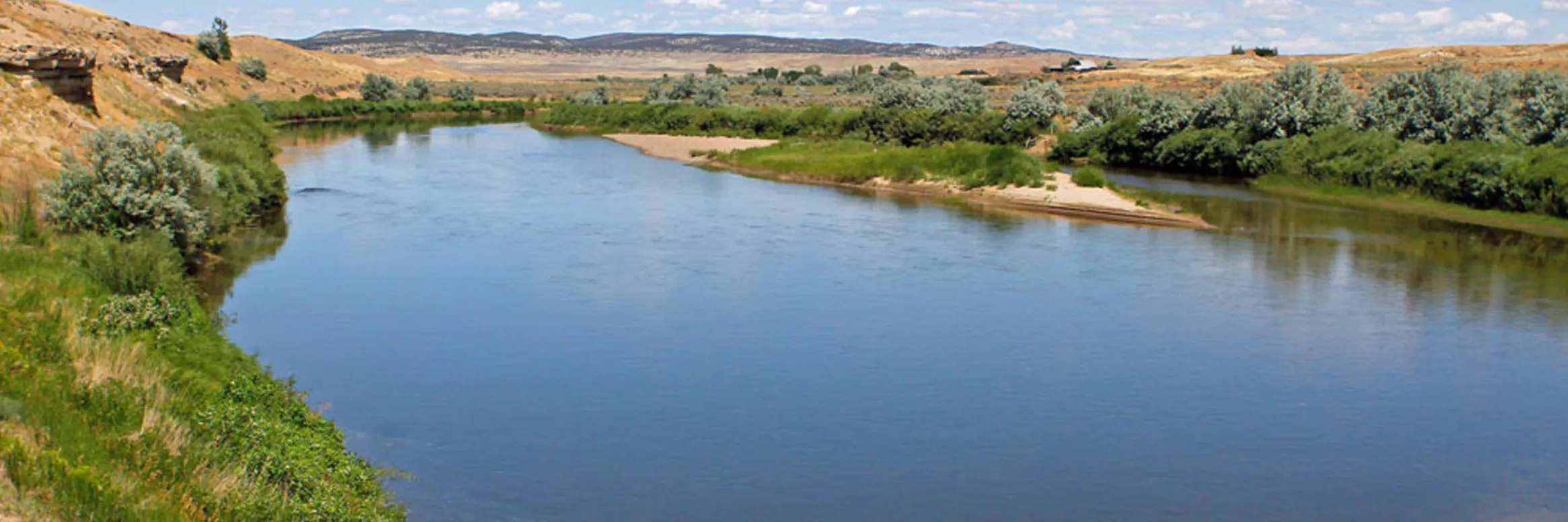
Colorado River “Beginnings”. Photo: Brent Gardner-Smith/Aspen Journalism
Click the link to read the article on the Colorado Public Radio website (Michael Elizabeth Sakas). Here’s an excerpt:
The mid-August deadline is quickly approaching for the states — Colorado, Utah, Wyoming, New Mexico, California, Nevada and Arizona — to figure out how to cut water usage down by 2 to 4 million acre-feet. For context, the entire state of Arizona is allowed to use 2.8 million acre-feet of river water each year.
Becky Mitchell, the commissioner of the Colorado Water Conservation Board, represents Colorado at the planning table with other states in the basin. Right now, her work is focused on collaborating with the other states in the upper part of the river basin — Utah, Wyoming and New Mexico — to come up with a list of ways their states can cut down on how much water they use. In a conversation on CPR’s Colorado Matters, Mitchell said most of that responsibility should be on the states in the lower part of the river basin: Arizona, Nevada and California.
“They’re using more than mother nature provides,” Mitchell said.
Mitchell said the states in the upper part of the river basin had been forced to use less water because of ongoing drought worsened by climate change. The states in the lower basin use water stored in Lake Powell and Lake Mead, the two largest reservoirs in the U.S., which she said has allowed those states to increase their water usage in the last few years. Mitchell said water stored in Lake Powell and Lake Mead allows the lower basin states to use more water than the river can provide, which has significantly dropped after decades of ongoing drought and the impacts of climate change.
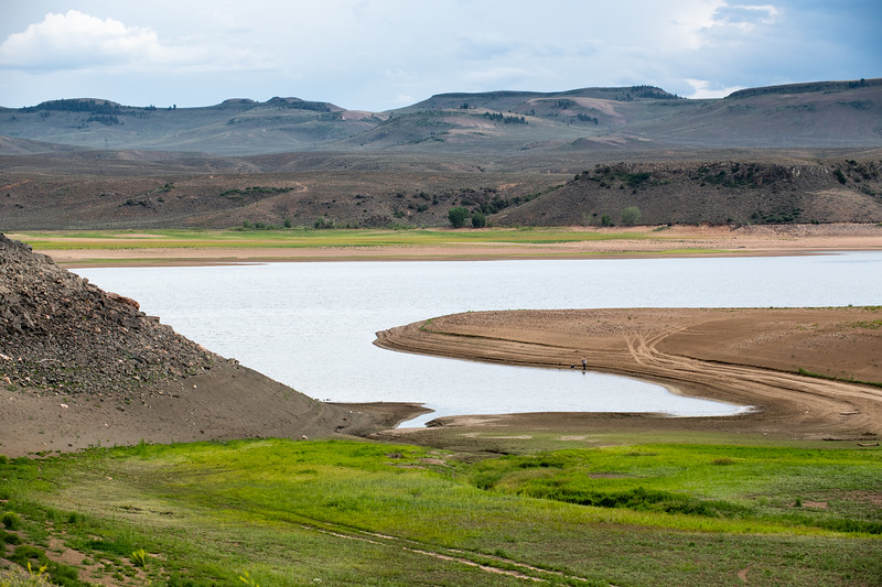
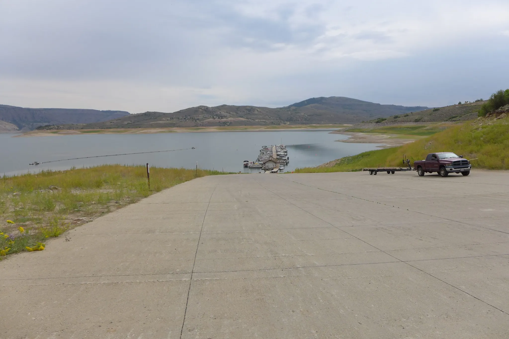
Blue Mesa Reservoir is the largest storage facility in Colorado in the Upper Colorado River system. Prolonged drought and downriver demand is shrinking the reservoir. Credit: Tom Wood, Water Desk
Click the link to read the article on the KUNC website (Luke Runyon and Alex Hager). Here’s an excerpt:
Colorado’s water shortages are not relegated to the distant future. Water supplies cannot meet current demands in many communities, and are only likely to worsen as climate change heats up and dries out the state’s cities and farms. That message is front and center in the Colorado Water Conservation Board’s first draft of a comprehensive update to the Colorado Water Plan, originally passed in 2015. Its initial creation was spurred by then-governor John Hickenlooper.
The plan anticipates a supply-demand gap of 240,000 to 740,000 acre-feet for cities and industries by 2050…For agricultural users, shortages are already a way of life. The plan projects that an existing shortfall of 2.6 million acre-feet for farmers and ranchers could increase to 3.5 million acre-feet by the middle of this century.
The plan is candid about the harsh effects of climate change, and the likelihood that Colorado’s water future will be shaped by warming and drying patterns. This includes acknowledgements of “aridification” – the idea that the West is not just experiencing the normal ebb and flow of drought, but instead becoming permanently drier. Climate scientists broadly agree that rising temperatures are driving a batch of changes that result in a shrinking water supply for much of the Southwest.
Today, the Colorado Water Conservation Board (CWCB) released the draft update of the Colorado Water Plan for a 90-day public comment period. The plan, originally developed in 2015 under the direction of Governor John Hickenlooper, is meant to address growing water scarcity in Colorado and ensure the state has a sustainable water future that meets the needs of a wide range of water uses by all Coloradans. In response to the release of the updated plan, Water for Colorado has issued the following statement.
“We appreciate all of the hard work by CWBC staff and board members and Department of Natural Resources to prepare a draft update to the Colorado Water Plan. We have already begun our thorough and detailed review and we look forward to providing comments. Our coalition was founded seven years ago to help influence the development of the 2015 Water Plan through providing technical review and driving civic engagement. We will submit comments and engage in a robust conversation with stakeholders on how we can best protect Colorado’s watersheds and rivers for all Coloradans and for future generations. We look to this Water Plan update to improve water security throughout the state by equitably addressing many of our watershed and water conservation needs.
This revision of the Colorado Water Plan will certainly play an important role in advancing our water goals throughout the state. But it alone will not be sufficient to meet the growing water challenges we face. This was further emphasized by recent statements by federal officials about the need for substantial water reductions by all states and in all water sectors to avoid critically low levels in the Colorado River basin’s largest reservoirs. Worsening hydrology and increased demands placed on dwindling water resources guarantee that additional, urgent actions will need to be taken to ensure a secure water future for Colorado. Governor Polis has called 2022 the “year of water” for Colorado, and we look forward to working with Governor Polis and his administration, other elected officials, Basin Roundtables, and communities on the critically important issues facing our state in 2022 and beyond. We must meet this pivotal moment in a way that positions Colorado as a leader in collaborative water management — our state’s future depends on it.”
The coalition has spokespeople available for comment now and in the coming 90 days, during which both partner organizations and the public have a vital opportunity to ensure that their voices are heard, that their interests are considered, and that Colorado’s water plan is truly that — a plan for the entire state.
Click the link to go to the Colorado Water Plan website:
The Colorado Water Plan provides a framework for helping Colorado meet its water challenges through collaborative action around water development and water conservation. The plan includes a range of collaborative partner actions that stakeholders can advance through grant funding & local projects, as well as specific actions the Colorado Water Conservation Board and other agency partners will commit to in order to advance the plan. The plan guides future decision-making and supports local actions to address water challenges with a collaborative, balanced, and solutions-oriented approach that builds resilience.
The Colorado Water Plan uses state-of-the-art data and tools to analyze the state’s water issues, including adapting to aridification and climate change, embracing innovative ideas and new technology that align with Colorado’s evolving water goals. The Plan includes four main focus areas that work together for a stronger state: Vibrant Communities, Robust Agriculture, Thriving Watersheds, and Resilient Planning.
Colorado Water Plan grants support a range of multi-beneficial projects for water storage, water conservation, the water-land use nexus, agricultural efficiency, water education and awareness, watershed health, and outdoor recreation. The Colorado Water Plan’s focus areas will address overlapping themes to address identified risks and challenges: funding, supply, equity, climate change, land use planning, storage, efficiency, education, and forest health.
Wildlife biologist Bill Vetter and Western Rivers Regional Program Manager with Audubon Rockies Abby Burk walk along an irrigation ditch in Grand County. An avian monitoring program aims to learn more about how birds use irrigated agriculture. CREDIT: HEATHER SACKETT/ASPEN JOURNALISM
It should come as good news then that the bipartisan infrastructure package Congress passed last fall appropriated a landmark $8.3 billion for investment in western water, along with $50 billion earmarked for projects to bolster resilience to climate change. Collectively, the infrastructure package is the largest investment in water infrastructure and the resilience of physical and natural systems in American history. Additionally, last year’s American Rescue Plan Act delivered $3.8 billion to Colorado, a portion of which will fund necessary and overdue investments in projects to protect sources of drinking water, increase resilience to climate-driven drought, and provide capital for critical infrastructure that would finally deliver safe, reliable drinking water to Tribal communities.
While these historic federal investments have been made, the equally vital work of putting them to use has only just begun. Given the high demand and the competitive nature of the funding available through the federal infrastructure bill, Colorado must take proactive steps to secure these federal funds. As two Western Slope residents — one a former state senator and CWCB director, one the Western Rivers Regional Program Manager for Audubon Rockies — we thank the general assembly and Governor Polis for making Colorado more competitive by passing and signing into law HB22-1379 and SB22-215 this past legislative session. This is a down payment toward a more secure water future…
The billions of dollars that have been set aside for western water and climate resilience in the infrastructure package represent an unparalleled opportunity for state decision makers to advance implementation of Colorado’s Water Plan. The coalition members of Water for Colorado, along with our partners across the state, stand ready to help the administration expedite the pace and scale of efforts to fund and implement water projects across Colorado. Our investment in these efforts now will pay dividends to strengthen Colorado’s communities and protect Colorado’s water resources for future generations.
Capturing these federal funds isn’t a given. It necessitates a concerted effort and leadership from local governments and state agencies such as the Colorado Water Conservation Board, Colorado State Forest Service, Department of Agriculture, and Department of Public Health and Environment to apply for federal infrastructure funds and work with eligible entities to move swiftly, implementing projects that protect our water resources. Additionally, in many cases, access to funds is contingent upon being matched by state or private dollars, making it critically important that money appropriated toward that end from HB1379 — Wildfire Prevention Watershed Restoration Funding and SB216 — Responsible Gaming Grant Program reaches its goals. Multi-benefit projects that support healthy watersheds, protect rivers, enhance climate resilience, accelerate urban water conservation and work toward a future in which everyone has access to clean, reliable water supplies are within reach if we meet this moment.
Water supports the lives of birds and people every day and was a high, bi-partisan priority for Colorado lawmakers during the 2022 legislative session. The General Assembly wrapped up the 120-day session on May 11. Audubon and our partners were active in securing several wins for water, our most precious natural resource. Funding for water projects, watershed resilience, and capacity are through lines for these wins. Here are a few highlights.
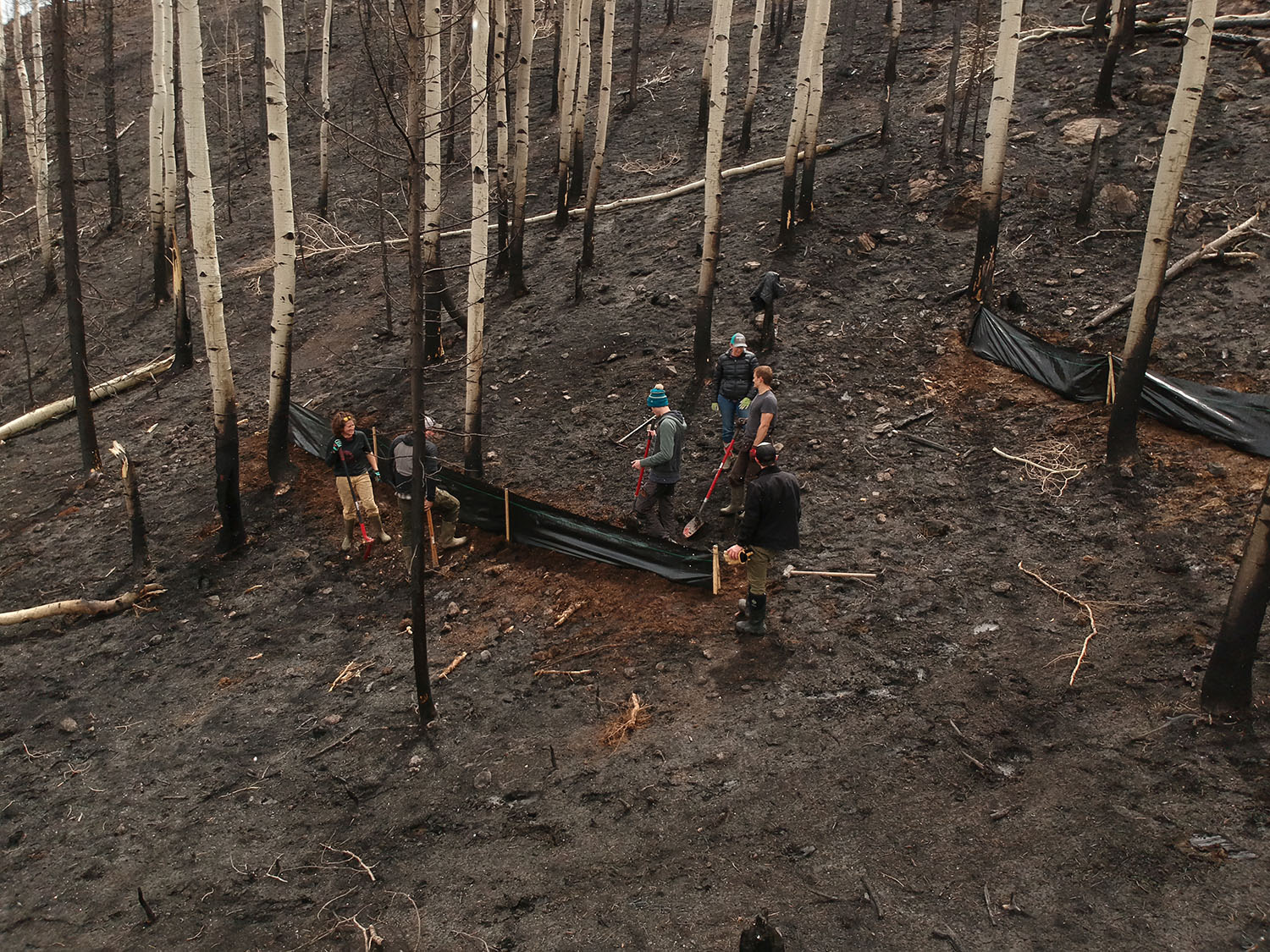
Watershed Assessment Vulnerability Evaluation (WAVE) volunteers work to install silt fencing immediately above Northern Water’s Willow Creek Reservoir. Photo by Emanuel Deleon, Colorado State University
Wildfire Prevention Watershed Restoration Funding, HB22-1379 appropriates $20 million from the Economic Recovery and Relief Cash Fund for projects to protect watersheds and river resiliency from wildfire impacts. The funding breaks down as $2 million to the Wildfire Mitigation Capacity Development Fund, $3 million to the Healthy Forests and Vibrant Communities Fund, and $15 million to the Colorado Water Conservation Board to fund watershed restoration projects with a boost for capacity to assist in applying for natural resource management federal grants. The Audubon network activated and supported HB-1379 by submitting 2,468 supportive responses!
Water infrastructure as sidewalk art
Infrastructure Investment And Jobs Act Cash Fund, SB22-215 creates a new cash fund that allows the state or local governments to receive federal funds for certain categories of infrastructure projects allowed under the Infrastructure Investment and Jobs Act (IIJA). For Colorado to be competitive for this once-in-a-lifetime funding under IIJA, it is necessary to have funds available as nonfederal match. SB-215 requires the state treasurer to transfer $60 million to the fund. Among the winners, 25 percent of this fund will be used toward water, environmental, and resiliency programs. The money in this fund is appropriated by the general assembly and the governor. Audubon and our partners met with decision makers and applaud bill sponsors for the foresight in creating this fund.
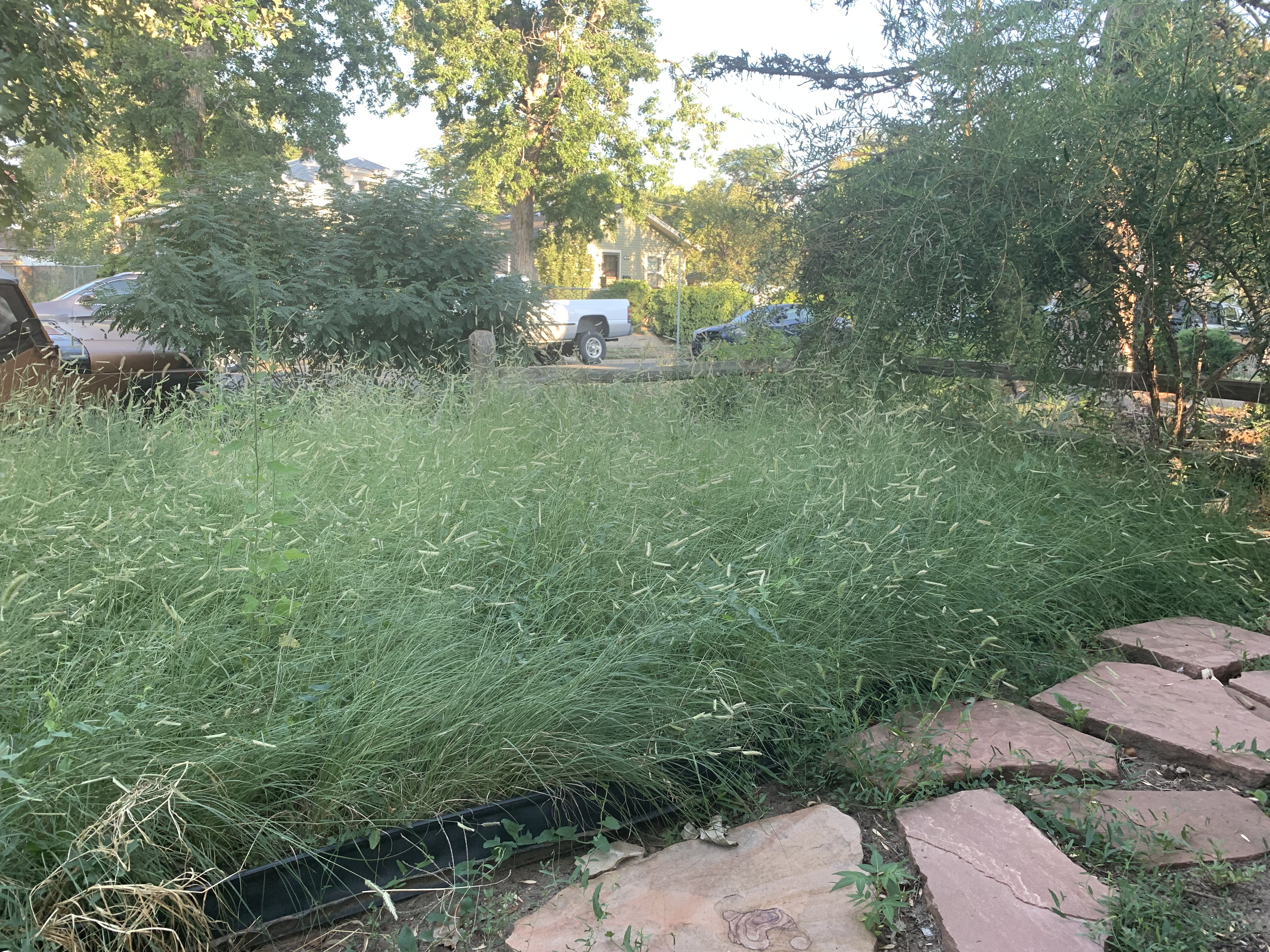
Mrs. Gulch’s Blue gramma “Eyelash” patch August 28, 2021.
Turf Replacement Program, HB22-1151 creates a program to incentivize water-wise landscapes. Irrigation of outdoor landscaping accounts for nearly half of the water use within cities and towns and is mostly used for nonnative turf grass. Voluntary and incentivized replacement of nonessential irrigated grass turf with water-wise landscaping increases communities’ resilience regarding drought and climate change, reduces the sale of agricultural water rights to municipal demand, and helps protect river flows. The bill defines water-wise landscaping as a water- and plant-management practice that emphasizes using plants that need less water. To learn more about native plants that support birds and pollinators, visit Rockies’ Habitat Hero program. Audubon thanks Habitat Hero Ambassador Don Ireland for his influential testimony in support of this bill.
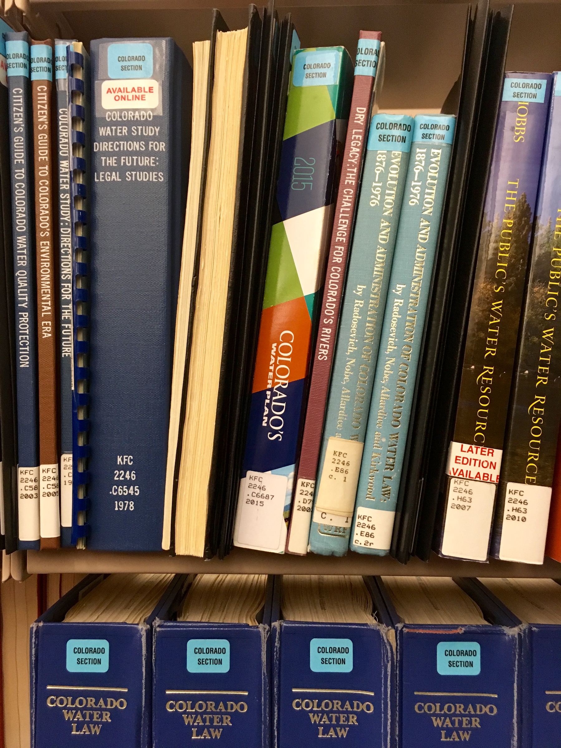
The 2015 Colorado Water Plan, on a shelf, at the CU law library. Photo: Brent Gardner-Smith/Aspen Journalism
Colorado Water Conservation Board Construction Fund Project, HB22-1316 appropriates $8.2 million from the Colorado Water Plan implementation cash fund to the Colorado Water Conservation Board for grant-making for projects that assist in implementing the Colorado Water Plan. Water Plan grants serve as the bridge for Coloradans to implement actions within the plan. The Plan contains actions that can improve river health and support clean, reliable drinking water for communities and flourishing economies. Without a strong plan and funding for implementation, Colorado’s birds, rivers, and people will face a problematic water future with unacceptable consequences.
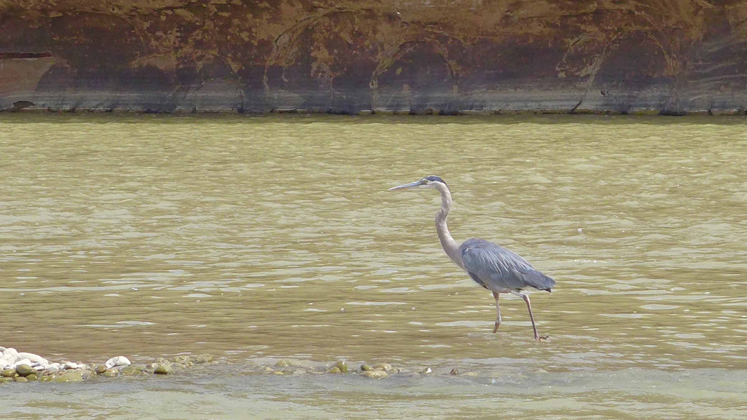
Heron wading in the Colorado River. Photo credit: Brent Gardner-Smith
Thank you for your engagement during the 2022 Colorado legislative session! Great Blue Herons, Yellow Warblers, and American Dippers depend on you to support our healthy rivers, wetlands, and watersheds for all of us. Audubon will continue to work with lawmakers and partners to prioritize water security for people, birds, and the healthy freshwater ecosystems that we all depend upon.
How water works: An important series by the Rio Grande Basin Roundtable
The Rio Grande Basin Roundtable does a great job of explaining how water works in the San Luis Valley and across Colorado with a running series of articles that are published monthly on AlamosaCitizen.com. The latest article looks at the Yampa River. Past articles have gone in depth on water augmentation in the San Luis Valley and work being done to improve snowpack and refined streamflow forecasting.
You can find all the articles here and watch for more each month. They are educational and beneficial in understanding the water puzzle of the Upper Rio Grande Basin and other critical river basins in the state.
A kayaker runs the 6-foot drop of Slaughterhouse Falls on the Roaring Fork River in June 2021. River recreation and conservation groups are pushing a bill that aims to establish a recreational in-channel values reach designation, which would create a legal mechanism to lease water for river recreation. CREDIT: HEATHER SACKETT/ASPEN JOURNALISM
Colorado Water Conservation Board Seeking Water Success Stories
As part of the larger Colorado Water Plan update process, the Colorado Water Conservation Board has launched a new online portal for members of the public to submit their success stories on how they are building a stronger water future for Colorado. To learn more and submit a story, visit engagecwcb.org. The Colorado Water Plan draft is set for release for public comment on June 30.
The Colorado General Assembly adjourned its 2022 session on May 11. Among the water bills that passed, four share a common theme—funding. A rare confluence of new revenue sources led to strong bipartisan support of bills dealing with groundwater compact compliance and sustainability, state water plan projects, wildfire mitigation and watershed restoration, and urban turf replacement. A bill designed to strengthen Colorado’s water speculation laws failed.
An orangethroat darter, one of the nine remaining native fish species in the Arikaree River. Photo: Jeremy Monroe, Freshwaters Illustrated.
Groundwater compact compliance and sustainability
Senate Bill 28 creates a Groundwater Compact Compliance and Sustainability Fund to help pay for the purchase and retirement of wells and irrigated acreage in the Republican and Rio Grande basins in northeast and south-central Colorado. It appropriates into the fund $60 million in federal American Rescue Plan Act (ARPA) revenue that had been transferred into the state’s Economic Recovery and Relief Cash Fund. The Colorado Water Conservation Board (CWCB) will distribute the money based on recommendations from the Republican River Water Conservation District and the Rio Grande Water Conservation District, with approval by the state engineer. These are one-time dollars that must be obligated by the end of 2024; if not spent by then, they will be used to support the state water plan.
The bill seeks to reduce groundwater pumping connected to surface water flows in the Republican River to comply with a compact among Colorado, Kansas and Nebraska. It will also help meet aquifer sustainability standards required by state statute and rules in the Rio Grande Basin, home to the San Luis Valley. To achieve those goals, 25,000 acres of irrigated land must be retired in the Republican Basin, and 40,000 acres in the Rio Grande, by 2029. If the targets are not met, the state engineer may have no choice but to shut down wells without compensation.
Water sustains the San Luis Valley’s working farms and ranches and is vital to the environment, economy and livelihoods, but we face many critical issues and uncertainties for our future water supply. (Photo by Rio de la Vista.)
Sen. Cleave Simpson, R-Alamosa, general manager of the Rio Grande Water Conservation District, noted that agricultural production coming out of the two basins benefits the overall state economy, not just the local communities. “The state has some skin in the game,” he said, and the availability of ARPA revenue “presented a once-in-a-lifetime opportunity” to support the districts.
Simpson emphasized that neither district is looking for a handout. The Republican has already assessed its water users over $140 million since 2004 to retire irrigated land and purchase or lease surface and groundwater to meet Colorado’s water delivery obligations. The Rio Grande district has taxed its farmers nearly $70 million since 2006 to take irrigated land out of production and has cut groundwater pumping by a third. Simpson requested $80 million from the Economic Recovery Task Force and, by demonstrating the interconnectivity between the state and local economies and the commitment already shown by the districts—along with strong bipartisan support from legislators—was able to secure the $60 million appropriation.
State water plan projects
Each year the Colorado General Assembly considers the CWCB’s “projects bill,” which, among other things, has included appropriations from CWCB’s Construction Fund to support grants for projects that help implement the state water plan in recent years. The funding source for those grants is different this year, with gambling revenue from Proposition DD, which the electorate passed in 2019, becoming available for the first time. Proposition DD legalized sports betting and levied a 10% tax on sports betting proceeds, with the majority of that revenue going into the Water Plan Implementation Cash Fund.
House Bill 1316 appropriates $8.2 million from the fund for grants to help implement the state water plan; $7.2 million of that amount is from sports betting revenue. Rep. Marc Catlin, R-Montrose, said, “This is the first appropriation of funds from Proposition DD … and it looks like it’s starting to grow into what we had hoped.”
The bill also appropriates $2 million to CWCB from its Construction Fund to help the Republican River Water Conservation District retire irrigated acreage. Rod Lenz, district president, said the district has doubled its water use fee on irrigators but that “we’re in need of short-term funding while we wait for that rate increase.” The $2 million in state revenue will help the district meet its 2024 interim target of retiring 10,000 acres of the 25,000 acres necessary to comply with the Republican River Compact by 2029. This is on top of the funds the district will receive from Senate Bill 28.
A forest fire next to the Bitterroot River in Montana. UCLA-led research revealed that larger fires tend to be followed by larger increases in streamflow. | Photo by John MacColgan/Creative Commons
Wildfire mitigation and watershed restoration
Like Senate Bill 28, House Bill 1379 takes advantage of ARPA revenue by appropriating $20 million from the Economic Recovery and Relief Cash Fund for projects to restore, mitigate and protect watersheds from damage caused by wildfire-induced erosion and flooding. Testimony on the bill in the House Agriculture, Livestock & Water Committee emphasized how investing mitigation dollars now helps avoid spending even more on very expensive recovery efforts later.
The bill allocates $3 million to the Healthy Forests and Vibrant Communities Fund to help communities reduce wildfire risks by promoting watershed resilience. It moves $2 million into the Wildfire Mitigation Capacity Development Fund for wildfire mitigation and fuel reduction projects. And $15 million goes to CWCB to fund watershed restoration and flood mitigation projects, and to help local governments and other entities apply for federal grants under the Infrastructure Investment and Jobs Act related to water and natural resources management.
Mrs. Gulch’s Blue gramma “Eyelash” patch August 28, 2021.
Turf replacement
While most of the focus at the Capitol in reducing water use has been on agriculture through retiring irrigated farmland, House Bill 1151 elevates urban turf replacement in importance. The bill requires CWCB to develop a statewide program to provide financial incentives for residential, commercial, institutional and industrial property owners to voluntarily replace non-native grasses with water-wise landscaping. It appropriates $2 million in general funds to a newly created Turf Replacement Fund and authorizes local governments, nonprofits and other entities to apply to CWCB for grants to help finance their programs. Landscape contractors, to whom individuals can apply for money to replace their lawns, are also eligible.
Rep. Catlin pointed out that “50% of the water that comes from the tap and goes through the meter and into the house is used outside.”
“We’re building ourselves a shortage,” he warned, “by continuing to use treated water for irrigation.” Rep. Dylan Roberts, D-Avon, added, “For too long the Western Slope and the Eastern Plains have borne the brunt of water conservation … but this is a bill that will give the tools to metro areas for them to play their fair part in this problem that is our drought.”
WAM bought this 57-acre parcel as part of a $6 million deal in January 2020, leading some to suspect the company was engaging in investment water speculation. WAM’s activity in the Grand Valley helped prompt state legislators to propose a bill aimed at curbing speculation. CREDIT: BETHANY BLITZ/ASPEN JOURNALISM
Investment water speculation
Senate Bill 29 was an attempt to strengthen protections against investment water speculation, defined as the purchase of agricultural water rights “with the intent, at the time of purchase, to profit from an increase in the water’s value in a subsequent transaction, such as the sale or lease of the water, or by receiving payment from another person for nonuse of all or a portion of the water.” It was aimed at curbing outside investors who may have little or no interest in agriculture from using the water right to maximize its value as the price of water increases during drought. It authorized the state engineer to investigate complaints of investment water speculation and, if found, to levy fines and prohibit the buyer from purchasing additional water rights for two years without the state engineer’s approval.
The 2021 interim Water Resources Review Committee recommended the bill, but it was never viewed as more than a “placeholder.” Sen. Kerry Donovan, D-Vail, a co-sponsor of the bill, expressed her disappointment that the bill did not generate more engagement between the water community and policymakers. “I was certainly hopeful that by having a bill we would force conversation,” she said, “but it did not result in having some forthright ‘let’s get around a table and hammer this out.’” Members struggled with trying to balance concerns over speculation with protecting property rights. Sen. Don Coram, R-Montrose, the other co-sponsor of the bill, emphasized, “We are certainly not trying to take a farmer’s or rancher’s ability away from selling that water. In many cases that is their 401K, their retirement.”
Opposition from water user groups in the Senate Agriculture & Natural Resources Committee sent a clear message: Existing legal requirements provide the necessary safeguards to address water speculation. Travis Smith, representing the Colorado Water Congress, said what’s needed is “having more voices, taking more time.”
Senate Bill 29 was amended to strike the language in the bill and refer the issue to interim study. Sen. Jerry Sonnenberg, R-Sterling, who was chairing the committee, expressed his frustration: “We have an ineffective water group that won’t have a conversation with lawmakers anymore. When they have a bill they just take a position and quit working with people.”
With that said he carried the bill over for further consideration, effectively killing it since this was the last committee meeting of the year. It’s unclear whether the issue will be studied this interim since it’s an election year and fewer committee meetings will be held.
Larry Morandi was formerly director of State Policy Research with the National Conference of State Legislatures in Denver, and is a frequent contributor to Fresh Water News. He can be reached at larrymorandi@comcast.net.
Colorado’s drought situation is a little better than it was a year ago, but warm temperatures, windy conditions in April and almost no precipitation in parts of the state means the snowpack is melting a couple of weeks sooner than most water watchers would prefer. The state’s Water Availability Task Force met on April 19 to look at the most recent numbers from the Colorado Climate Center at Colorado State University and the Natural Resources Conservation Service, which is a part of the U.S. Department of Agriculture…
From October to March — the first six months of a water year that started Oct. 1 — it’s been much drier than average in southern Colorado, the San Luis Valley and Rio Grande River basin, and on the Eastern Plains, but wetter than normal in northwestern Colorado, Peter Goble said. April ends the wet season for the mountains and begins the wet season for the Eastern Plains. But the moisture has stayed away from the Eastern Plains, Goble said…
Colorado Drought Monitor map April 26, 2022.
According to the U.S. Drought Monitor, which reports drought conditions weekly, while the entire state is in some level of drought, compared to a year ago Colorado is not seeing the worst levels, known as exceptional drought. That’s particularly true for the Western Slope, with snowpack in better shape now than a year ago, Goble said. The next six weeks will be critical for the Eastern Plains, he added…
NRCS hydrologist Karl Wetlaufer offered slightly better news when it comes to the state’s water supply, including for reservoir storage. While not a drought buster, water storage is substantially better than it’s been the last couple of years, he said. The expectation is that snowmelt is ramping up and unfortunately sooner than hoped for, he said…
The state’s trouble spots are in the Upper Rio Grande and in the lower Arkansas, according to Wetlaufer’s data. The Rio Grande is already seeing substantially earlier snowmelt, he said. It’s unlikely there will be enough precipitation to gain even average streamflows in the river, he said. That’s going to be a problem for the streamflow in areas like the southern Sangre de Cristos, and that in turn will affect compacts tied to the lower Rio Grande, which flows into New Mexico.
Wildlife biologist Bill Vetter and Western Rivers Regional Program Manager with Audubon Rockies Abby Burk walk along an irrigation ditch in Grand County. An avian monitoring program aims to learn more about how birds use irrigated agriculture. CREDIT: HEATHER SACKETT/ASPEN JOURNALISM
Click the link to read the article on the Sky-Hi News website (Meg Soyars). Here’s an excerpt:
If the lake does drop lower than 3,490 feet, it is uncertain how much water, if any, will be delivered to the communities that rely on it. Lake Powell doesn’t only supply water to millions of Americans, it also provides power through turbines at the Glen Canyon Dam. Below 3,490 feet, the dam will not be able to provide hydropower. All Colorado Basin states receive power from the dam. Kirk Klancke, president of the Colorado River Headwaters Chapter of Trout Unlimited, explained that the emergency at Lake Powell may seem far removed from Grand County, but it’s closely connected. Forty million people, from Wyoming to Mexico, rely on water from the Colorado River, including every Grand County resident. When someone turns on the tap here, they are getting the same water that will eventually get sent down to Lake Powell for a California (or other regional) resident…
Klancke feels the Lower Basin is demanding too much water from Lake Powell, and this may decrease the water supply of Upper Basin states like Colorado.
“My concern for Grand County is that our water rights will be cut into to make up the difference,” he said. “I worry they might go after our agricultural rights first … and (agriculture) makes up a huge part of our economy.”
Flaming Gorge Reservoir July 2020. Photo credit: Utah DWR
Click the link to read the article on the 9News.com website (Cory Reppenhagen). Here’s an excerpt:
The Upper Basin Drought Response Operations Agreement (DROA) identifies an elevation of 3,525 feet as a target level to take action because a level of 3,490 feet would threaten the infrastructure and hydropower resources at Glen Canyon Dam.
“We are concerned, we are watching,” said Becky Mitchell, the director of the Colorado Water Conservation Board and Governor Polis’s representative on the Upper Colorado River Commission. “There are significant challenges facing the Colorado River system.”
She said that two unprecedented measures are being taken to help prevent Lake Powell from hitting that critical level of 3,490 feet. One, which has already been approved, is to move an unprecedented 500,000 acre-feet of water out of the Flaming Gorge Reservoir in northern Utah and southern Wyoming, into Lake Powell over the next 12 months. A second proposal, which [was approved by the basin states this week], is to withhold nearly 480,000 acre-feet of water that is scheduled to be released from Lake Powell and sent to Lake Mead.
The amount of information Colorado water managers have about the state’s crucial snowpack is poised to swell exponentially over the next two years.
In mid-March, the Colorado Water Conservation Board, which aims to help water managers conserve, develop, protect and manage Colorado’s water, approved a $1.9 million grant to help pay for a plane stuffed with high-tech equipment to fly over Colorado’s mountains and measure the snowpack below.
Denver Water used Airborne Snow Observatory, or ASO, flights in 2019 and 2021 to gather data on the snowpack above Dillon Reservoir, the utility’s largest reservoir.
The information helps forecast how much water is expected to come tumbling down the mountain during the spring runoff — a critical time for collecting and storing water for the utility’s 1.5 million water users across metro Denver.
“Getting more and better information about the snowpack improves the accuracy of our spring runoff forecasts, and that helps us in many ways,” said Nathan Elder, water supply manager for Denver Water.
“With better information, we have a better idea of how the spring runoff could impact the environment and recreation, and whether we might have to go on watering restrictions during the summer. It also helps inform us on how we should manage all of water resources,” he said.
This year, in addition to getting ASO data about the snow in the Blue River Basin above Dillon, Denver Water also will get information about the snowpack in the Fraser, Granby and Willow Creek watersheds. Flights are scheduled for April and May, weather permitting.
The blue areas in the map above are where the Airborne Snow Observatory flights are scheduled to collect information about the snowpack in 2022. The light tan areas will be flown this summer and fall to collect baseline information about the ground when it is free of snow. Image credit: Lynker.
Based on NASA-developed technology, LiDAR equipment carried by the ASO planes use beams of light to measure the depth of the snow across entire watersheds and capture reflections from the frozen surface. Data from the flights over the snow-covered watersheds is compared to data collected when the same watershed is free of snow.
The resulting information from comparing the two sets of data tells water managers how much snow is on the ground and how much water it holds, augmenting data collected from SNOTEL sites, which also measure snowpack at selected sites, and decades of historical statistics.
The path of an ASO flight over the Blue River Basin, which flows into Dillon Reservoir, on Monday, April 18, 2022. Image credit: FlightAware.
“We see these ASO flights as a climate adaptation strategy,” said Taylor Winchell, a water resource engineer at Denver Water who works on climate change adaptation and water supply planning issues.
“As our snowpack changes with the changing climate, being better able to measure that snowpack becomes more important as more snow falls as rain, as the timing of the spring melt changes and as snow falls at ever-higher elevations because of warming. We can’t rely as much on historical snowpack datasets to understand the new snowpack reality.”
Winchell worked with water managers throughout Colorado to develop support for the state grant and create a collective known as CASM, short for the Colorado Airborne Snow Measurement group, that grew to include members from federal, state and local government levels, academia, the recreation industry and agriculture industries, as well as local nonprofits and environmental advocacy organizations.
The ASO flight path over the Fraser River, Willow Creek and Granby watersheds on Tuesday, April 19, 2022. Due to a state grant, this is the first year that airborne data from these watersheds will be available for water managers to study. Image credit: FlightAware.
“We had 37 letters of support for the initiative. To have that many groups supporting a water project, that’s unprecedented for a water project in Colorado. It’s rare to see so many people agree on something — but more accurate data helps everyone,” Winchell said.
In addition to flights over snow-covered mountain watersheds, the grant also will help pay for flights over snow-free ground — collecting essential baseline information that can be used to expand the snow-on flight areas even more next year and beyond, Winchell said.
In this digitized image of the April 2021 snowpack above Dillon Reservoir, red splashes of color show where the snow was the deepest. The line of dots down the mountain is a ski run at Breckenridge Ski Resort where snow-making machines have added snow to the ground. Image credit: Airborne Snow Observatory Inc.
Work also will be underway this year to figure out how to continue the CASM program in the future, as the state’s grant is a one-year grant, Winchell said.
Denver Water managers are looking forward to seeing more ASO information about its watersheds, and also those throughout the state.
“How much snow falls outside our watersheds can affect Denver Water’s supply and operations just like the amount of snow that falls inside our watersheds,” Elder said.
“With this starting to become a statewide program, with data collected from more areas and that data being shared among the partners, it will help everyone better manage Colorado’s water supply.”
Click the link to read the newsletter on the Middle Colorado Watershed Council website (Click through and volunteer to do some sampling or whatever.). Here’s an excerpt.:
The Colorado Water Conservation Board (CWCB) has granted three more years of funds to the Middle Colorado Watershed Council (MCWC) to continue the United States Geological Survey (USGS) water quality and rain gauge monitoring set up in 2021, adding new mid-stream water quality monitoring stations between South Canyon and Cameo, soil moisture monitoring, and a dashboard notification system for downstream municipalities.
The Colorado River District has agreed to serve as fiscal agent for the USGS in a three-year cooperative agreement with MCWC. The $583,396 CWCB grant will be matched with in-kind labor and cash from the USGS, Garfield County, the Glenwood Canyon Restoration Alliance, and coordinated project funding from the Colorado Department of Public Health and Education (CDPHE) for a total project cost of $1.3 million over the next three years.
Funding secured from CDPHE, $206,600, will be used to purchase the additional equipment needed for the new mid-stream water quality station, soil moisture monitors, and the user-friendly dashboard for downstream users to monitor changes in water quality and rainfall information. The CDPHE funding will also support pre-fire mitigation planning and allow the Silt Water Conservancy District to complete repair work from damage due to the continual impact of high amounts of sediment in the Colorado River in 2021.
Since early 2021, the Middle Colorado Watershed Council has coordinated post Grizzly Creek Fire water quality and rain gauge monitoring to set up a regional notification system and lessen the impact on downstream water users. MCWC received the first year of funding from CWCB, CDPHE and the Colorado River District’s Community Partnership Funds.
Using services from the USGS Colorado Water Science Center, the USGS Next Generation Water Observing System (NGWOS), and SGM, an engineering firm acting as MCWC’s technical advisor, water quality and precipitation information networks were set up in canyon drainages and on the Middle Colorado river corridor. Seven rain gauges were deployed throughout the Grizzly Creek burn area and a 6-parameter data sonde water quality monitoring station was set up at No Name.
During the summer of 2021, summer monsoons caused flooding, debris flows and highway infrastructure damage in Glenwood Canyon as a result of the 2020 Grizzly Creek fire burn scar and a 500-year-rain event. MCWC and other stakeholders expect continued problems with flooding and debris flows from these canyon drainages over the next few years and sought the additional funding to continue and expand monitoring in 2022 through 2024.
Four times this spring, local resident and Desert Research Institute scientist Rosemary Carroll will aid Rocky Mountain Biological Laboratory (RMBL) field scientists, Alex Newman and Curtis Beutler. They will perform ground surveys as airplanes use high resolution lasers to measure the depth of the snowpack and snowpack reflectivity, or albedo. They will dig snow pits for detailed measurements of snow depth, hardness and density. In addition, they will look at snow grain size and shape and note any dust layers. The data helps determine the accuracy of the measurements conducted by the air.
“These airborne data collection efforts provide a map of our snowpack at high-spatial resolution from the mountain tops to the valley bottom. When ASO (Airborne Snow Observatory) is combined with ground surveys and snow observations over time at our snow telemetry (SNOTEL) network, we can better track our snowpack and manage our water resources,” Carroll explained. “As climate changes, stream water forecasting models built on historical precedence, are not able to adequately predict stream runoff. The ASO methodology has been shown effective in California for improving stream water forecasting…The state of Colorado has recently allocated nearly $1.9 million to track snow using ASO.
One of the two Twin Otter aircraft used by the Airborne Snow Observatory mission to study snowpack in the Western U.S. Credit: NASA
Carroll explained that ASO flies a fixed-wing aircraft across the basin using LiDAR (Light Detection and Ranging) with no snow, and then again with snow. The difference between the two data sets produces a snapshot in time of snow depth every three meters. ASO also uses a spectrometer to measure snow reflectivity. New snowfall has a very high reflectivity, while older snow or snow with dust has a lower reflectivity. Less reflective snowpack will melt more quickly than high reflective snowpack. The resulting ASO data helps to generate precise readings on the amount of water in the snow and guide estimates on where and when this snow may melt soonest. ASO not only quantifies total snow volume but also indicates where snow has moved across the landscape through things like avalanches and wind. ASO-informed stream water forecasts have been shown to have accuracy rates of close to 98% or almost double traditional forecasts…
Carroll is also managing a local stream discharge network so that there is high spatial and temporal data of streamflow across the smaller-order streams in the East River. She has stream gauges on Quigley, Rustlers, Rock and Copper Creek, to name a few. She currently manages 13 stream gauges. By measuring streamflow across the upper East River and in combination with the stream gauges maintained by the U.S. Geological Survey (USGS), she can monitor sub-watershed response to different snow conditions…
Carroll emphasized that mountain snowpack is a critical water resource globally and is also extremely sensitive to climate change. “The East River is emblematic of these mountain systems, and it has become the largest field observatory for integrated mountain hydroclimate and biogeochemical response,” she said. “Work between entities like the Department of Energy, NASA, NOAA, the USGS and others, and with help from RMBL, the research in the East River is critical to understanding how mountain systems store and release water and solutes. It is extremely exciting!”
Brad Udall: Here’s the latest version of my 4-Panel plot thru Water Year (Oct-Sep) of 2021 of the Colorado River big reservoirs, natural flows, precipitation, and temperature. Data (PRISM) goes back or 1906 (or 1935 for reservoirs.) This updates previous work with @GreatLakesPeck.
Click the link to read the article on the Colorado Water Conservation Board website (Chris Arend):
The U.S. Department of the Interior has proposed a reduction in the annual release volume from Lake Powell from 7.48 to 7.0 million acre-feet for water year 2022. This is based on the Department’s determination that additional actions are needed to protect dam operations and hydropower production, and to address public health and safety concerns.
Below is a statement from Colorado River Commissioner Becky Mitchell:
“Colorado understands the unprecedented challenges facing the Colorado River Basin and will work collaboratively to protect critical infrastructure at Lake Powell. While we support the Assistant Secretary’s proposal, we also acknowledge that this is a temporary solution and that it is incumbent on all who rely on the Colorado River to develop longer-term solutions that address the imbalance between supply and demand in the Basin.”
Colorado Water Conservation Board to Focus on Water Resilience within the State as Demand Management Investigation Paused
In March, the Colorado Water Conservation Board (CWCB) decided to pause its Demand Management Feasibility Investigation in Colorado. Demand Management is the concept of temporary, voluntary, and compensated reductions in the consumptive use of water in the Colorado River Basin. Colorado has been a leader among the Upper Basin States in the feasibility investigation, gathering information from Colorado water users, stakeholders, and the public since 2019, and developing a Roadmap for answering questions in the future. CWCB stands ready to continue its investigation when more information becomes available from the ongoing feasibility investigations in the other Upper Basin States. All Upper Basin States would need to agree to a program if it is to be established, and any such program would depend upon a storage pool in Lake Powell, which could only be used to ensure ongoing Compact compliance. This pause provides an opportunity for CWCB to focus on what can be done in the more immediate future within Colorado. CWCB will consider a full range of mechanisms that would not be dependent on other states or the broader Colorado River System and could be implemented by and within Colorado, with the purpose of protecting Colorado’s water users through increased hydrologic shortage and variability.
Lake Powell boat ramp at Page, Arizona, December 17, 2021. Photo credit: Allen Best/Big Pivots
Click the link to read the article on the Salt Lake Tribune website (Zak Podmore). Here’s an excerpt:
The reservoir could drop below the level needed to generate power at the Glen Canyon Dam this year if other ways of increasing the elevation of the lake aren’t used
…water managers in Colorado announced last week that they will stop exploring one proposal to prop up the rapidly depleting levels in Lake Powell. The plan — known as demand management — would compensate farmers and ranchers for voluntarily stopping irrigation on a temporary basis, sending water that would have been used for agriculture to the reservoir. A drought contingency plan developed in 2019 by Utah, Colorado, New Mexico and Wyoming identified demand management as one method that could be used to keep the water level in Lake Powell above 3,525 feet in elevation, around a quarter of its capacity, in order to protect electricity generation. The four-state demand management proposal was met with suspicion by agricultural interests, according to Anne Castle, a senior fellow at the University of Colorado Law School who previously worked on Colorado River issues under the Obama administration. Skeptics of the plan feared it could “wipe out irrigated agriculture” in parts of the river basin and fundamentally alter rural economies, Castle said at a recent University of Utah symposium hosted by the Wallace Stegner Center. She said those fears were “not unfounded” and “they would have to be dealt with in an equitable demand management program.”
[…]
Utah still supports a four-state demand management program, said Amy Haas, executive director of the Colorado River Authority of Utah, but it is also prepared to move forward with water conservation pilot projects and potentially pursue a smaller-scale demand management program on its own. She pointed to Utah’s investments in water measuring infrastructure, studies looking at switching to crops that require less water and other programs…
The Bureau of Reclamation recently announced that it is studying modifications to the Glen Canyon Dam that would allow for power generation at lower water levels. That could include installing turbines on bypass tubes that are located below the current hydropower intakes…
But Brad Udall said finding the political will and leadership at federal and state levels to permanently reduce demand is difficult.
“My biggest fear,” Udall said, “is that it’s easier to let the system crash than it is to find the painful solutions that are needed.”
He defined a system crash as letting the two largest reservoirs in the U.S. — Lake Mead and Lake Powell — empty because of an inability to respond to declining flows. Udall added there have been incremental, positive solutions implemented in the basin over the last two decades, but he said future solutions have to be “more than incremental” to deal with the crisis.
Brad Udall: Here’s the latest version of my 4-Panel plot thru Water Year (Oct-Sep) of 2021 of the Colorado River big reservoirs, natural flows, precipitation, and temperature. Data (PRISM) goes back or 1906 (or 1935 for reservoirs.) This updates previous work with @GreatLakesPeck.
Click the link to read the article on The Denver Post website (Conrad Swanson). Here’s an excerpt:
In short, the kind of clouds that create snowstorms contain massive amounts of super-chilled water vapor, Rickert said. Left alone, those clouds can release some snow and retain the rest of their water vapor. Cloud seeders look to agitate those super-chilled water particles, causing them to freeze inside the cloud. From there they form snowflakes and fall to the ground, Rickert said. Seeders can agitate those particles by plane or from machines on the ground, both processes typically use a silver iodide compound. Airplanes will “pretty much fly right through the cloud,” spraying the compound across a flame, and spreading it throughout the air, sparking the chemical reaction, Rickert said. Ground generators do the same except they use wind drafts to carry the compound into the clouds, he said. he end result? Up to a 12% increase in snowfall for a particular storm, [Andrew] Rickert said…
Seeding efforts in central Colorado are working well too, according to Dave Kanzer, director of science and interstate matters for the Colorado River District, which helps manage the program in Eagle, Grand, Pitkin and Summit counties. Water from the extra snowfall eventually melts, flowing down Colorado’s rivers and streams and eventually out of state, Rickert noted, so downstream states like Arizona, California, Nevada and New Mexico all chip in to the state’s $1.5 million budget. But there’s a catch, Kanzer added. Cloud seeding can’t create snow storms out of nowhere. They can only enhance existing storms…
“It’s the only option for physically augmenting snowpack,” Rickert said. “And the only way to actually create and add water to the system.”
Local leaders are celebrating a win this week, after learning last Friday that the Norwood area was awarded a $110,000 grant for water. The Wright’s Mesa Water Planning and Prioritization Project (WMWPPP) partners are the recipients, and they were supported in the application process by the West End Economic Development Corporation (WEEDC)…
WMWPPP is a group that includes the Town of Norwood, San Miguel County, WEEDC, Norwood Water Commission, Farmers Water Development, the Lone Cone Ditch Company, the Norwood Fire Protection District, and the San Miguel Watershed Coalition.
The idea to go for funding came together in the summer of 2021, when Norwood Town Trustee Candy Meehan and District 3 Commissioner Holstrom were both students in Water Education Colorado’s program “Water Fluency.” One session in Water Fluency was focused on funding, and learning about the availability of funds for just the type of infrastructure needed in the local region “lit a fire” for Meehan and Holstrom. Meehan spearheaded the grant application effort, and she and Holstrom worked with Deanna Sheriff, of WEEDC, and April Montgomery, of the Telluride Foundation, to flesh out their idea of looking for ways to get some of the $80 million in monies available for known water projects identified by the Southwest Basin Roundtable…
With funding secured, an engineering firm will be chosen to conduct a collaborative water infrastructure planning and prioritization analysis for all of Wright’s Mesa…
Though this winter appears to be looking good regarding snowpack, the local region is still classified in drought — with a changing climate, the need for housing and development, and the critical need for repairing and updating the town’s current water infrastructure…
The Colorado Water Conservation Board made its decision to fund Norwood during its March 15 meeting and announced the decision on March 18.
Click the link to read the article on the CWCB website:
During its March meeting, the Colorado Water Conservation Board (CWCB) – a group of 15 governor-appointed representatives from each major Colorado river basin with expertise in water policy and planning – approved 52 grants through the Water Plan Grant Program.
“The Colorado Water Conservation Board is pleased to approve more than 50 projects this month to help advance the Colorado Water Plan, many of which are a direct result from recent stimulus funding approved by Governor Polis,” said CWCB Chair Jackie Brown. “We also look forward to utilizing funding from sports betting as enacted by Proposition DD in the near future to make an even bigger impact. And as we prepare to release the next Water Plan, securing future funding will become increasingly important for our water future.”
This grant program provides critical funding for multi-beneficial water projects in all eight river basins that advance actions outlined within the Colorado Water Plan.
Colorado and othehr Western states are hoping to increase the use of Aerial Snowborne Observatories to better measure the water content in moutain snowpacks. Credit: NASA Hydrological Services
Colorado has approved a $1.9 million snow measuring initiative based on NASA technology that will help communities across the state better measure and forecast how much water each winter’s mountain snowpack is likely to generate, using planes equipped with sophisticated measuring devices.
The Colorado Water Conservation Board (CWCB) has been testing the accuracy of the flight-based data measuring work since 2015, according to Erik Skeie, who oversees the program for the CWCB. The board approved funding for the new $1.9 million initiative at its March 16 board meeting.
The new collective, known as Colorado Airborne Snow Measurement group, includes utilities, irrigation districts and environmental groups, including Northern Water, Denver Water and the Dolores Water Conservancy District, among others. In all, 37 water-related groups wrote letters in support of the grant and the measuring program, Skeie said.
Northern Water, which supplies more than 1 million residential, commercial and farm customers on the Northern Front Range, is hopeful the grant will help create an annual monitoring and measurement effort.
”I think it’s a really good program if we can make it sustainable into the future,” said Emily Carbone, water resources specialist at Northern Water.
This map shows the snowpack depth of the Maroon Bells in spring 2019. The map was created with information from NASA’s Airborne Snow Observatory, which will help water managers make more accurate streamflow predictions. Jeffrey Deems/ASO, National Snow and Ice Data Center
Airborne Snow Observatory technology uses planes equipped with LiDAR, a pulsing radar, to develop a grid that contains a deeply detailed picture of the ground when it isn’t covered by snow. Then, during the winter months, those planes fly the same terrain once or more each month when it is covered with snow. In this way, the instruments are able to measure snow depth and snow reflectivity. These data, combined with computer-based models, allow the ASO to generate precise readings on when the snow will actually melt and how much water the snowpack in different regions actually contains.
Traditional forecasts can be off by as much as 40%, and sometimes more. But ASO forecasts have been shown to have accuracy rates of 98%.
As the megadrought in the Colorado River Basin has intensified, and climate change has altered snowfall and traditional patterns of snowmelt, finding better ways to measure the water content of snow has become critical, said Taylor Winchell, a climate adaptation specialist at Denver Water who is overseeing the utility’s flight data program.
A flight from NASA’s Airborne Snow Observatory gathers data about the snowpack above Dillon Reservoir on a flight. Information gathered from the flight helped Denver Water manage reservoir operations. Photo courtesy of Quantum Spatial
Denver Water began using the technology in 2019.
“As the snowpack is changing, the more accurate measurements that we can have help us adapt our operations to a new water future and it helps us make the most of every drop in the system,” Winchell said.
Since the early 1930s, snowpacks have been measured manually and via remote ground-sensing by the federal Natural Resources Conservation Service. Colorado and other Western states use a network of dozens of snotel sites to collect on-the-ground data, but forecasts can change dramatically if the weather becomes volatile, as has been the case more often in recent years.
That volatility and the ongoing drought have made water forecasting even more critical for water agencies. If water supplies come in lower than forecasts indicated, cities and irrigation districts can come up short of water, causing disruptions in deliveries, among other problems.
But ASO technology is expensive. Denver Water spends about $145,000 for two flights, a cost that includes subsequent modeling as well. But the forecasts have proved to be so accurate that the utility is committed to its ongoing use.
California is spending roughly $7 million annually and that cost could grow to more than $20 million if the golden state opts to expand the geographic reach of its ASO program, according to Tom Painter, a former NASA scientist who helped develop the ASO technology and who is now the CEO of Airborne Snow Observatories Inc., the NASA spinoff that is commercializing the technology.
A similar program in Colorado, one expansive enough to cover all the critical mountain watersheds, could cost as much as $15 million annually, Painter said.
The work would include flying some 10 flights per year per river basin during January, February, March and April, with additional flights in late spring as the snow begins to melt. Then flight data would be incorporated into forecast models.
Predicting snowmelt and its water content as warm weather arrives has been a tricky issue for researchers and water utilities because it becomes highly variable.
“That’s when traditional models start to fall apart,” Painter said. “They can’t hold onto the snowpack well enough. So having the data from ASO is nice to keep the forecast accurate. It’s like looking at your checking account balance a couple of times a month.”
Skeie, of the CWCB, said the new approach to measuring what’s known as snow water equivalent, or the amount of water contained in the snow, will take much of the guess work out of annual water forecasts.
And he’s hopeful that the multi-million price tag can be covered by an array of agencies, including the water utilities, the U.S. Bureau of Reclamation and state governments, among others.
“It’s going to take all of that to make it sustainable,” Skeie said. And with the backing of the Colorado Airborne Snow Measurement group, it’s more likely to occur than it has been before.
Using ASO, in combination with snotel data, “is the difference between having someone describe a picture to you, and being able to see it in 4D,” he said. “It’s incredibly useful.”
Jerd Smith is editor of Fresh Water News. She can be reached at 720-398-6474, via email at jerd@wateredco.org or @jerd_smith.
Lake Powell just north of Glen Canyon Dam. January 2022. Jonathan P. Thompson photo.
Click the link to read the article on the Land Desk website (Jonathan Thompson):
Lake Powell surface level dropped below the critical 3,525-foot mark sometime on the Ides of March. You’ve probably already read that somewhere, since the national media can’t seem to get enough of the slow motion desiccation of one of the nation’s largest reservoirs. And what’s so critical about 3,525 feet?
Nothing, really.
The real critical number is 3,490 feet, otherwise known as the “minimum power pool.” When Lake Powell sinks below that elevation, Glen Canyon Dam can no longer produce hydropower. That’s a big deal because Lake Powell really only serves two purposes these days: recreation and hydropower generation (the water storage component becomes somewhat irrelevant when Lake Mead is as low as it is now). Not only are the dam’s turbines a significant source of power for the Western Grid, but they also provide resilience for the grid in a way that other generators cannot.
Lake Powell has officially dipped just below 3,525 feet in elevation, reflecting the Colorado River Basin’s dry winter season. The elevation is expected to climb back above 3,525 feet over the course of spring runoff. More info: https://t.co/IobOBURhqH#drought#coloradoriver
Water managers had hoped to keep the level at least 35 feet above minimum power pool, i.e. above 3,525 feet, so they’d have a bit of a buffer to work with. Now the level is inside the buffer zone, which is reason for concern but not immediate alarm. While the rate of decline has prompted officials to issue a more pessimistic outlook for the reservoir, they don’t expect a loss of hydropower anytime soon. Snowpack levels in the watersheds that feed Lake Powell are slightly below average for this time of year, but are tracking about 7 percent ahead of last year’s levels. Spring runoff will soon begin, inflows will increase, and the lake should begin rising again, staving off the turbine shutdown—for now.
Let’s get to the data:
3,569 feet above sea level: Lake Powell’s surface level on March 9, 2021.
3,524.9 feet: Level on March 15, 2021.
-44 feet: Twelve-month change.
3,490 feet: Level at which Glen Canyon Dam stops producing hydropower.
384 billion gallons: Amount by which Lake Powell’s storage has declined since November 2021.
855,656 megawatt hours: August 2021 output of Four Corners Power Plant.
309,640 megawatt hours: August 2021 output of Glen Canyon Dam
Lake Powell storage in acre-feet. 1 acre-foot = 325,851 gallons. USBR.Glen Canyon Dam’s power output roughly correlates with storage levels, but also varies month to month according to demand. USBR.As water levels drop there is less pressure to turn the dam’s turbines, so less power is generated per unit of water released.
Glen Canyon Dam, January 2022. Jonathan P. Thompson photo.
Click the link to read the article “Lake Powell hits historic low, raising hydropower concerns” on the Associated Press website (Sam Metz and Felicia Fonseca). Here’s an excerpt:
Lake Powell’s fall to below 3,525 feet (1,075 meters) puts it at its lowest level since the lake filled after the federal government dammed the Colorado River at Glen Canyon more than a half century ago — a record marking yet another sobering realization of the impacts of climate change and megadrought. It comes as hotter temperatures and less precipitation leave a smaller amount flowing through the over-tapped Colorado River. Though water scarcity is hardly new in the region, hydropower concerns at Glen Canyon Dam in Arizona reflect that a future western states assumed was years away is approaching — and fast.
“We clearly weren’t sufficiently prepared for the need to move this quickly,” said John Fleck, director of the University of New Mexico’s Water Resources Program.
Federal officials are confident water levels will rise in the coming months once snow melts in the Rockies. But they warn that more may need to be done to ensure Glen Canyon Dam can keep producing hydropower in the years ahead…About 5 million customers in seven states — Arizona, Colorado, Nebraska, Nevada, New Mexico, Utah and Wyoming — buy power generated at Glen Canyon Dam. The government provides it at a cheaper rate than energy sold on the wholesale market, which can be wind, solar, coal or natural gas. For the cities, rural electric cooperatives and tribes that rely on its hydropower, less water flowing through Glen Canyon Dam can therefore increase total energy costs. Customers bear the brunt…
Nick Williams, the bureau’s Upper Colorado Basin power manager, said many variables, including precipitation and heat, will determine the extent to which Lake Powell rebounds in the coming months. Regardless, hydrology modeling suggests there’s roughly a 1 in 4 chance it won’t be able to produce power by 2024.
The boat ramp at the Lake Fork Marina closed for the season on Sept. 2 due to declining reservoir levels. The Bureau of Reclamation is making emergency releases out of Blue Mesa Reservoir to prop up levels in Lake Powell and preserve the ability to make hydropower. CREDIT: HEATHER SACKETT/ASPEN JOURNALISM
Click the link to read “Lake Powell drops below critical threshold for the first time despite attempts to avoid it” on the Colorado Public Radio website (Michael Elizabeth Sakas). Here’s an excerpt:
The reservoir is the second-largest in the U.S., and it’s a key piece of the Colorado River storage and supply system. Powell is fed mostly by snowmelt that collects in Colorado’s Rocky Mountains. A 20-year megadrought and a hotter climate, fueled primarily by greenhouse gas emissions from fossil fuels, has contributed to Powell’s levels dropping to all-time lows…
Colorado and the other states that share the Colorado River agreed to work together to keep Powell above this critical threshold with the Congressionally approved 2019 Drought Contingency Plan. That agreement creates a 35-foot buffer of water before the reservoir hits “dead pool,” when reservoir levels are so low, the hydroelectric generators can no longer produce energy. Water levels in Powell quickly started to drop after years of back-to-back drought. In response, the federal government in 2021 took emergency action and sent water from reservoirs in Colorado and other states to prop up supplies in Powell. Blue Mesa Reservoir outside of Gunnison lost eight feet of water as a result. Ultimately, those releases did not prevent water levels from dropping below the critical threshold. But U.S. Bureau of Reclamation hydraulic engineer Heather Patno said the additional release did add about six feet of water to Powell, and any extra buffer helps protect Powell’s ability to produce energy. Patno said the drop should be temporary as the snow in the mountains starts to melt and recharge the river and reservoirs. She said 2021 was the second-driest year on record for the Colorado River basin, and a very dry first few months of 2022 eroded the snowpack collecting in the mountains…
New research suggests there might be even less Colorado River water in the future than what’s forecasted.
A recent report from the Center for Colorado River Studies found that the U.S. Bureau of Reclamation’s projections can be too optimistic, partly because it’s based on the average water inflow into Powell from 1991-2020, a period that includes an abnormal decade in the 90s that was much wetter than the last 20 years. Patno said those findings are important, and it and other studies should be considered when federal and state governments decide how to adapt their water operations to drought. She said Powell projections did improve when the bureau recently switched to using the last 30-year average, but that Powell forecasts rely on models that have a level of risk and uncertainty.
Powell’s worst-case projections show its level could drop below 3,525 feet again as early as August of this year. Patno said emergency water releases from Blue Mesa and other reservoirs might be needed again as one of the tools to keep Powell propped up, especially as the current snowpack continues to decline. Inflow forecasts into Powell expect about 69 percent of average. The ongoing drought also means dry soil will soak up a lot of that water before it reaches rivers and lakes, Patno said.
Commissioner Mitchell (CWCB) Statement on Lake Powell Elevation 3525′:
As of March 15, Lake Powell, a major reservoir that feeds water to the Lower Colorado River Basin, fell below elevation 3525 feet. This is the target elevation identified within the Drought Contingency Plan that provides a buffer to hydropower.
The decline in Lake Powell was caused by over 20 years of low inflows in the Colorado River System, coupled with depletions that exceeded supplies. The imbalance between depletions and available River flows has historically been compensated by taking water from storage in Lake Powell and Lake Mead to provide for downstream depletions, thus causing declines in reservoir elevations.
Below is a statement from Colorado River Commissioner Becky Mitchell:
“Lake Powell hit elevation 3525 feet this week, which is a direct result of depletions from our major reservoirs over the last 20 years coupled with low flows into Lake Powell. As Lake Powell and Lake Mead have declined, water users in the Upper Colorado River Basin have been living on the front lines of climate change. The Upper Basin states of Colorado, New Mexico, Utah, and Wyoming have been taking water cuts for 20 years due to prolonged drought, while continuing to meet our Compact obligations. On top of this, water has been provided from Flaming Gorge and Blue Mesa Reservoirs in an effort to protect Lake Powell. Going forward, all who rely on the Colorado River System must learn to live with what the River provides and adapt to variability of water supply.”
For more information and updates, visit the Commissioner’s Corner on the Colorado Water Conservation Board website.
The Chaffee County Risk Mapping, Assessment and Planning (Risk MAP) Study is underway across the county through the Colorado Water Conservation Board (CWCB). The Chaffee Risk MAP Study will collect data on field conditions in areas of the county believed to be at risk for impacts from future flooding, erosion, debris flow, or related hazard events. This information will be used to update flood risk information and floodplain mapping in certain watersheds and create tools that provide a data-driven framework for land use and other decision-making in affected areas. The study is funded by the Federal Emergency Management Agency (FEMA).
Buena Vista
The Local Risk
Based on assessments performed for the 2021 Chaffee County Hazard Mitigation Plan, overall flood risk is an important consideration due to precipitation and snowmelt runoff, and is categorized as medium to high risk in most populated areas of Chaffee County. Countywide, an estimated $34.5 million in property losses is at risk to a one-percent annual chance flood hazard. The unincorporated areas of the county together make up the majority of this exposure, with an estimated $26.7 million in losses at risk. Of the municipalities in Chaffee County, Buena Vista is at the highest risk with $6.1 million in estimated losses in a one-percent annual chance flood, followed by Poncha Springs and Salida with approximately $1.1 million and $460,000 in estimated losses respectively.
Floodplain survey activities are currently planned between March and June
The survey work will be focusing on several flooding sources in all of the incorporated communities and the unincorporated county areas. According to the CWCB, the survey crews will be collecting elevation and other basic information on the land around the waterways being studied, and will not dig around nor disturb the areas…Wood and Merrick & Company are the floodplain mapping and field surveying contractors working with CWCB for Chaffee County’s study. Wood is also familiar with Chaffee County through their work with the 2021 update of Chaffee County’s Hazard Mitigation Plan.
Paul Bruchez speaking from his ranch in Grand County to the Colorado River Water Users Association Annual Convention December 16, 2021. Governor Polis has nominated Bruchez to the Colorado Water Conservation Board as the mainstem Colorado River representative.
Click on the link to read the article at Aspen Journalism (Heather Sackett):
Gov. Jared Polis has appointed a Kremmling rancher to replace former state Sen. Gail Schwartz on the state’s top water board.
Paul Bruchez will now represent the main stem of the Colorado River on the Colorado Water Conservation Board. Bruchez, 40, currently serves as the agriculture representative and vice chair of the Colorado Basin Roundtable.
Rancher and fly fishing guide Paul Bruchez’s daughter and nephew sit in a hay field at the family ranch near Kremmling. Bruchez is helping spearhead a study among local ranchers, which could inform a potential statewide demand management program. Photo credit: Paul Bruchez via Aspen Journalism
Along with his family, Bruchez runs Reeder Creek Ranch, a 6,000-acre cattle and hay operation, about five miles east of Kremmling, which is irrigated with water from the headwaters of the Colorado River. Bruchez is also a fly-fishing guide and has been active since about 2012 in state-level water management discussions. He is a governor appointee to the Inter-Basin Compact Committee and is on the board of the Colorado Water Trust.
“For the last 23 years, everything Colorado River and water has touched and impacted my life substantially, as well as my entire family,” he said. “We all live and breathe Colorado River issues.”
This mowed hay field is part of Reeder Creek Ranch, owned by the Bruchez family near Kremmling. Little data exists on the impacts of reducing irrigation water on higher elevation pastures like this one, but Paul Bruchez and a group of local ranchers have volunteered their fields for a study that will help scientists learn more about what happens to pastures that receive less irrigation water. Photo credit: Paul Bruchez via Aspen Journalism
Bruchez is also spearheading a project with other neighboring irrigators to see what happens when water is temporarily removed from high-elevation hay meadows. The results of the state grant-funded study could have implications for demand management, a program state officials are exploring, designed to save water by paying irrigators to temporarily fallow fields.
The Morrisania Mesa Ditch runs through agricultural land south of Battlement Mesa. The ditch was part of a ditch inventory in western Colorado paid for, in part, with state grant money. CREDIT: HEATHER SACKETT/ASPEN JOURNALISM
Inventories of irrigation ditches across the Western Slope have become common in recent years and water managers say they have merit.
But there is no requirement that the individual studies — which look at things such as efficiency and opportunities for repairs and upgrades — be made public, even though they are often paid for with public money. This doesn’t sit well with some who say the public has a right to know exactly how taxpayer dollars are being spent and how one of the West’s most precious and dwindling resources is being used.
“(Agriculture) is where 80% to 90% of the water gets used, and if we were more efficient, we could leave more water in the river — that’s the bottom line,” said Ken Ransford, recreation representative to the Colorado Basin Roundtable and who also acts as Aspen Journalism’s legal adviser. “If you can’t see how 80% to 90% of the water is being used, then you will never be able to say whether you’re using water efficiently or not.”
Ditch-inventory projects have the support of many water-user groups and, in recent years, have been done in several Western Slope river basins and sub-basins: the Yampa, the Eagle and the Colorado. Agricultural groups say they are necessary to assess the needs of irrigators and connect them with resources should they want to improve and upgrade their infrastructure. Environmental organizations say they have value because the more improvements there are to irrigation efficiency, the more water that can be left in the stream to the benefit of the ecosystem.
In some ways, the issue boils down to whether one sees water as a private property right or a public resource. In Colorado, it’s both. The right to use water is treated as a private property right. People can buy and sell water rights as part of a real estate transaction and change what the water is allowed to be used for, as long as a water court approves. And to maintain a water right’s value, the water must be put to use.
But the right to use water isn’t the same as owning the resource itself, which belongs to the people of Colorado. Ransford said there’s an obligation for water users to use it responsibly and efficiently.
“To say nobody has a right to see how it’s being used when it’s a public resource, there’s a conflict there,” he said. “We all own the water. It’s a public good.”
The Bookcliff, South Side and Mount Sopris conservation districts, took part in a project to inventory some of the ditches in their boundaries. Because they are not available to the public, it’s unclear exactly which ditches were included. CREDIT: LAURINE LASSALLE/ASPEN JOURNALISM
Middle Colorado ditch inventories
In 2018, the Colorado Basin Roundtable recommended approval of a $100,000 funding request from the Book Cliff, Southside and Mount Sopris conservation districts for an agricultural water plan for Garfield County. It was part of a larger stream-management plan, undertaken by the Middle Colorado Watershed Council. The 2015 Colorado Water Plan calls for developing stream-management plans on 80% of rivers in the state.
The funding for the agricultural portion — part of an overall $330,000 budget for the plan — was approved by the Colorado Water Conservation Board, the state entity charged with protecting and developing Colorado’s water.
As part of the agricultural water plan, the conservation districts hired Rifle-based Colorado River Engineering to conduct ditch inventories, which provide water rights owners with an overall assessment of their diversion infrastructure, measuring devices and conveyance channel. The study focused on ditches that have old and large water rights — prior to the 1922 Colorado River Compact — and carry more than 10 cubic feet of water per second. The goal is for owners to use the inventory as a tool to prioritize projects on the ditches and aid in securing funding for future ditch improvement projects.
In October, the conservation districts submitted to the CWCB a final report, which includes a broad overview of the project. The 59 individual inventories completed were not included in the information submitted to the state, although each water rights owner got a copy of their own inventory. It is not clear which ditches across the three conservation districts were inventoried as part of the project.
Aspen Journalism began making inquiries about seeing the completed inventories in March, and the conservation districts made one inventory available: the study of the Schatz Ditch on Dry Hollow Creek near Silt, which irrigates 69 acres of grass pasture. The ditch has two water rights, which date to 1965, and are decreed for 2.5 cfs each.
The 44-page inventory includes information about the water rights associated with the ditch, publicly available diversion records from the state Division of Water Resources database, and many pages of historic decrees and documents associated with the ditch. It does not include names of ditch owners, water rights owners or water users.
It lists main concerns as a lack of current diversion records after 2001, overgrowth of vegetation and unstable soils near the end of the ditch. Potential treatment includes removing overgrowth, routine maintenance, lining or piping the ditch, and self-reporting diversions to the Division 5 Water Resources office.
The inventories are a good way to maintain institutional knowledge and keep track of historic ditch information when there is a change in ownership, said Emily Schwaller, manager of the conservation districts. She said the districts made the Schatz inventory available because the owner or owners gave permission for the information to be public, but she declined to disclose who the owners are.
“Our hope is that these binders are living documents that get updated and maintained by the ditch companies and owners,” Schwaller said in an email. “These inventories give the (ditch owners) a baseline of the condition of the ditch and are a start of the background of the ditch that will be used by future generations and ditch owners.”
The Schatz Ditch irrigates nearly 70 acres of land south of Silt, according to a ditch inventory by Colorado River Engineering. The ditch is one of 59 inventoried in the Middle Colorado region of western Colorado. CREDIT: HEATHER SACKETT/ASPEN JOURNALISM
CORA request denied
But neither the CWCB nor the Colorado Basin Roundtable has a policy that allows the public to have access to the inventories, even when public money is used to fund their creation.
In May, Aspen Journalism submitted a Colorado Open Records Act request to see the rest of the 59 inventories. The conservation districts denied the request, saying a federal law supersedes the state’s sunshine laws. Because the conservation districts partnered with the National Resources Conservation Service on the inventories and a federal law protects personal and geospatial information of property owners who work with NRCS, the districts said they would have to review what information could be released and redact any private information.
CORA lets the public inspect records of state and local government entities — unless inspection is prohibited by a state law or a federal statute or regulation. The 2008 Farm Bill may prohibit the release of information regarding agriculture practices.
“It’s not clear what information in the ditch inventories can and cannot be provided to the public under the 2008 Farm Bill,” said Jeff Roberts, executive director of the Colorado Freedom of Information Coalition, a nonprofit group that works to ensure the transparency of state and local governments by promoting freedom of the press and open access to government records. “The conservation districts should explain this in more detail, and the best way to do that is with an example ditch inventory and a log that describes why each redaction is required by federal law.”
After working with the boards to get a cost estimate for redacting, Schwaller on Dec. 13 provided a cost estimate of nearly $2,200 for redacting the engineering reports and almost $16,400 for the engineering reports and records. Aspen Journalism has asked Schwaller for a cost estimate for redacting the Schatz Ditch inventory to see an example of what information would be left after redacting and whether it would be worth it to pay for the rest of the documents with redactions. Schwaller had not replied to multiple requests as of press time.
Sara Leonard, director of CWCB marketing and communications, said that it would be inappropriate for the state to ask for a ditch owner’s personal information and that the state and roundtables support property rights and landowner privacy.
“The state’s role here is to provide funding and help identify the best projects, as supported by the basin roundtables,” Leonard said in an email. “We look for collective results and analysis of individual data to show the success of a project, but we don’t require individual data points as they are not needed by the state (in this case, individual ditch inventories).”
Dylan Roberts, who represents Eagle and Routt counties in the Colorado legislature and sits on the Water Resources Review Committee, said it sounds like the inventories have incredible merit and could be useful. If the state has decided to put money behind them, then the public should have access to them, he said.
“As a matter of principle, if public money is being used, there absolutely should be some level of transparency and public access to any data or information that is generated from these surveys,” he said.
An irrigation expert with NRCS talks with water users about the irrigation infrastructure on the Morrisania Mesa Ditch. Conservancy districts hope ditch inventories, which have become increasingly common in recent years, will result in improvement projects for irrigation infrastructure. CREDIT: HEATHER SACKETT/ASPEN JOURNALISM
Summary outlines ditch problems
According to the final report from the three Colorado conservation districts submitted to the CWCB in October, 59 ditches were inventoried on the section of the Colorado River and tributaries from Glenwood Canyon to De Beque. The individual inventories include a summary of the water rights, diversion records, irrigated acreage, a list of concerns, potential treatments and funding opportunities to address those concerns. This information is withheld from public view.
The report listed main areas of concern, including erosion prevention; seepage; aging infrastructure; routine maintenance; diversion/lateral structural improvements; phreatophytes, which are sometimes-invasive, water-sucking vegetation with deep roots; and bank stabilization.
According to a report produced last year as part of the Middle Colorado Integrated Water Plan on agricultural water use, engineers recommended phreatophyte removal for 71% of the inventoried structures; piping or lining ditches for 55% of them; and bank stabilization for 51%. Improvements to measuring devices were recommended for 35% of the ditches inventoried.
Though broad generalizations, these findings in the summary report and the Middle Colorado plan hint at widespread issues with the region’s irrigation ditches, headgates and canals.
“We have a huge issue with aging infrastructure here on the Western Slope,” said Jason Turner, chair of the Colorado Basin Roundtable and senior counsel with the Colorado River Water Conservation District. “There are billions of dollars’ worth of projects in the Colorado basin alone, and I bet that doesn’t even scratch the surface.”
Privacy maintained
These types of inventories have a history of being shielded from public view, even though they are paid for with state grant money.
In 2016, the Eagle County Conservation District conducted what it called an irrigation-asset inventory of 25 ditches within the district’s boundaries. It was funded with a $54,000 grant from the CWCB. Although a summary report of the findings was made public, the 25 individual binders with information specific to each ditch went to the ditch owners and were not, despite a request from Aspen Journalism under CORA. The summary said irrigators in the district were dealing with problems such as rusted, leaking and clogged culverts, unstable headgates, sinkholes and erosion.
Proponents say the promise of privacy is often key to getting irrigators to participate in these studies. Maintaining privacy is important for irrigators because they may not want to invite what they feel is unfair scrutiny — and, perhaps, criticism — of their operations.
“I think the only way these guys are going to participate in these kinds of things is if they feel like their information is not going to be shared everywhere,” Turner said. “They recognize that they own and use the lion’s share of water in Colorado, and it just seems like they feel heavily scrutinized for what they feel is their best ranching practices for their piece of property.”
The report from the inventories in the Book Cliff, Southside and Mount Sopris conservation districts said this culture of privacy is a challenge. Earning the trust of water rights owners so that they would give their permission to do the ditch inventories took additional time and was a larger factor than originally anticipated.
“Another noteworthy obstacle was obtaining permission from water and landowners to walk the ditch and develop the inventories,” the report reads. “This ranged from not having up-to-date records of owners, neighbor conflict and a general distrust in allowing outside eyes on the properties.”
This Parshall flume measuring device is being installed on a ditch on Morrisania Mesa. Ditch inventories, funded in part with state grant money, are becoming popular in western Colorado. CREDIT: HEATHER SACKETT/ASPEN JOURNALISM
Yampa River assessments
On the Yampa River, environmental organizations have acknowledged the potentially problematic lack of transparency that comes from paying for private inventories with taxpayer money and have taken steps to skirt the issue by directly funding the studies themselves. Trout Unlimited and The Nature Conservancy paid nearly $68,000 to do an assessment of diversion infrastructure on the Yampa with the goal of identifying places for multibenefit projects.
“We were aware of the Eagle River situation, but there are a bunch of reasons (that environmental groups) took the lead on the assessment,” said Brian Hodge, northwest Colorado director for Trout Unlimited and the environmental representative to the Yampa/White/Green Basin Roundtable.
Of 45 irrigation structure owners who participated in the study, 36 opted to make those reports public. The other nine chose to keep their reports confidential, citing disagreement with the structure assessment or discomfort with the process. A few structure owners did not respond to outreach after their report was delivered.
In a final report, produced by Wilson Water Group and JUB Engineering, the structures were scored based on the opportunities for improvements for four categories: current use, fish passage, recreational boating and river health. Each category had a maximum score of 5 for a total possible structure score of 20. The higher the score, the greater the opportunity for a multibenefit improvement project. The Lower Yampa reach of the river had the most room for improvement overall, with a total score of nearly 8.
Dry Hollow Creek winds its way through fields near Silt. The Schatz Ditch pulls water from Dry Hollow Creek. CREDIT: HEATHER SACKETT/ASPEN JOURNALISM
Improvement projects not publicly tracked
It is also not always clear whether these studies actually result in improvements to irrigation infrastructure, which is listed as an end goal. In some cases, neither the conservation districts nor the funding organizations keep track of how many subsequent projects come about as a direct result of the inventories.
And unless the ditch owner comes back to a granting organization, such as the roundtable, with a request for funding, there is no way to know whether ditch owners actually use the inventories to improve their operations, especially if they pay for upgrades out of their own pocket.
Turner said the roundtable would have no way of knowing unless an irrigator referenced the inventory in a subsequent grant application.
Leonard, the CWCB spokesperson, said she is not aware of anyone tracking projects that come out of the inventories.
“Again, potential projects that will likely come out of the inventory assessment will hopefully lead to multipurpose/multibenefit projects that can be supported by CWCB funding, but we don’t mandate projects as a result of investigations we fund,” she said in an email.
The report from the Book Cliff, Southside and Mount Sopris conservation districts said ditches with completed inventories have applied for funding from several different sources: the Colorado River Water Conservation District, the state of Colorado, National Resources Conservation Service, and the conservation districts’ cost-share program. Water rights owners have also hired engineering firms to complete the recommendations in the inventories and used the inventories while requesting letters of support from county commissioners, according to the districts. But conservation district representatives did not have a count of exactly how many projects have come about as a direct result of the inventories.
Eagle County Conservation District also does not have a count of projects that resulted from their 2016 inventories, but there is at least one. The Highland Meadow Estates at Castle Peak Ranch Homeowners Association in Eagle County received $25,000 in state money to improve the Olesen Ditch by installing a pipeline.
Mount Sopris Conservation District board member Cassie Cerise owns a ranch outside of Carbondale. She did not participate in the ditch inventory project, but she thinks the inventories were useful for ditch owners and she expects resulting projects to trickle out over the next few years.
“First, the issues can be identified, and second, they can find out about all the different programs that are offered as far as cost share and all the things that could help implement a fix,” she said.
The Schatz Ditch irrigates nearly 70 acres of land south of Silt, according to a ditch inventory by Colorado River Engineering. The ditch is one of 59 inventoried in the Middle Colorado region of western Colorado. CREDIT: HEATHER SACKETT/ASPEN JOURNALISM
Privacy was a roundtable topic
The issue of privacy for landowners when it comes to these ditch inventories was a topic of discussion at the Colorado Basin Roundtable meeting in October. Some said the public may be critical of how ditches are operated.
“There may be reasons why a landowner may not want the public looking at a ditch on their property,” said Carlyle Currier, a rancher in Molina who is president of the Colorado Farm Bureau and has a seat on the roundtable. “It certainly opens the door to some mischief.”
Ransford, the recreation representative to the Colorado Basin Roundtable, said that since water is a public good, there should be a public means of funding irrigation-improvement projects.
“I’ve long thought what we should do is pass a special-district kind of a tax to pay to modernize irrigation structures,” he said. “I don’t think the irrigators should have to do it. It’s expensive. But if we had a public source of funds dedicated to this, to me, that is the bigger picture.”
Some say the end justifies the means. Richard Van Gytenbeek is the environmental representative to the Colorado Basin Roundtable. In his work as Colorado River basin outreach coordinator for Trout Unlimited, one of his goals is to work on collaborative efforts with the agricultural community to keep more water in rivers. He said if the inventories can help do that by facilitating irrigation-efficiency projects, then he doesn’t have a problem with the information remaining private. Trout Unlimited often works with irrigators on projects that benefit the landowner as well as fish and stream health.
“I’ve seen some ditches that are just horrendous, and if we were able to get in there and fix them, people wouldn’t have to take out nearly as much water,” he said. “We are trying to think of ways to have (water) never leave the channel in the first place. Getting people to collaborate and cooperate, it’s the linchpin.”
Aspen Journalism collaborates with The Aspen Times on coverage of water and rivers. This story ran in the Feb. 6 edition of The Aspen Times and the Feb. 7 edition of the Vail Daily.
The South Platte Hotel building that sits at the Two Forks site, where the North and South forks of the South Platte River come together. Photo: Brent Gardner-Smith/Aspen Journalism
From FromThe North Platte Telegraph (Todd von Kampen):
Here’s the other question: “Where’s the water coming from?”
That may be the greater mystery in Keith and Lincoln counties, whose residents usually see bare trickles in the South Platte — except for four floods since 1995 — and know it’s due to Colorado agriculture and ever-growing Denver and the Front Range.
Despite all that growth, Nebraska and Colorado water officials agree, there’s still South Platte water to talk about.
Counting “return flows” from upstream irrigators, a recent Colorado study contended, Nebraska receives enough South Platte water at the state line northeast of Julesburg to fill Lake Maloney 15 times…
The Legislature’s Natural Resources Committee will hold a public hearing at 1:30 p.m. CT Wednesday [Februay 9, 2022] on Legislative Bill 1015. It would set aside $500 million to finish the Perkins canal, whether or not Nebraska routes it into Perkins County.
Its hearing follows the Colorado Legislature’s introduction of a bill late last week to make South Platte water storage that state’s top priority for water projects.
Senate Bill 22-126 says it’s intended to boost “the beneficial consumptive use of Colorado’s undeveloped waters to which Colorado is entitled under the South Platte River Compact,” as well as to reduce the need for transferring water east across the Rockies…
Jesse Bradley, assistant director of the Nebraska Department of Natural Resources, said his department has barely begun to explore how such a canal gets built in 2022.
But the evidence suggests Nebraska should invoke its compact rights before it’s too late, Bradley said…
Rein and Lauren Ris, deputy director of the Colorado Water Conservation Board, said their state’s water officials are still seeking to clarify Nebraska’s concerns. Both spoke with The Telegraph before Colorado lawmakers introduced their bill to make South Platte projects the state’s top priority.
Ris said the 282-project list comes from her board’s online database of hoped-for water projects by local “roundtables” in each of Colorado’s nine river basins…
But the vast majority of those, she said, are studies and other projects that won’t sink a well or move dirt for a new water project.
Very few of them — and none between Brush and the Nebraska line — are even close to seeking major funding, Ris added…
The far larger Parker project, touching both Logan and Washington counties, would create two reservoirs as well as a pipeline. Parker lies about 107 miles southwest of Sterling and 89 miles southwest of Akron, the counties’ respective seats.
Some of the snowmelt flowing in the Blue River as it joins the Colorado River near Kremmling, Colo., will reach the Lower Basin states. Dec. 3, 2019. Credit: Mitch Tobin, the Water Desk
Fifteen years ago, deeply worried that a continued drought on the Colorado River would cause a crisis sooner rather than later, the seven U.S. states that share the river’s flows made a historic agreement to jointly manage reservoirs and share shortages that might arise.
The agreement, known in shorthand as the 2007 interim guidelines, is set to be renegotiated beginning this year, ahead of its expiration in 2026.
Another critical set of agreements, known as the 2019 drought contingency plans, are also being re-examined this year as the crisis on the river deepens.
“We’re about to engage in some very difficult discussions,” said Rebecca Mitchell, director of the Colorado Water Conservation Board and the state’s representative on the Upper Colorado River Commission.
Mitchell’s comments came Jan. 26 at the annual convention of the Colorado Water Congress, which represents hundreds of Colorado water users and utilities, in Aurora.
The Colorado River Basin includes the Upper Basin states of Colorado, New Mexico, Utah and Wyoming, and the Lower Basin states of Arizona, California and Nevada. It also includes 30 tribal nations and Mexico.
“One of the keys to our success is going to be that we are in line with the other basin states and the U.S. Department of the Interior, but that we are also working with other sovereigns and stakeholders to find solutions,” Mitchell said.
Mitchell and others credit the two agreements with keeping the system operational for much of the past 15 years.
“They were successful in that they slowed down the decline of the reservoirs and bought some time to see if hydrology improved,” she said. “News flash: It did not.”
Climate change, the 20-year megadrought affecting the basin, and population growth have super-charged the crisis, causing the river’s flows to decline faster than anyone anticipated, and lakes Mead and Powell to record their lowest levels since they were built, respectively, in the 1930s and 1960s.
The river system has deteriorated so quickly that last July the U.S. Bureau of Reclamation moved, within a matter of days, to begin emergency releases of water from Utah’s Flaming Gorge, Colorado’s Blue Mesa, and New Mexico’s Navajo reservoirs.
These turbines at Lake Powell’s Glen Canyon Dam are at risk of becoming inoperable should levels at Powell fall below what’s known as minimum power pool due to declining flows in the Colorado River. Photo courtesy U.S. Bureau of Reclamation.
The goal was to protect Lake Powell’s ability to produce hydropower, a green source of electricity that supplies more than 50 cities and electric companies in Colorado alone.
In addition, Lower Basin states have committed to reducing outflows from Lake Mead, a move that reduces some of the pressure on Lake Powell to the north. But few believe these actions will be enough to protect the river system as the weather forecast continues to deteriorate.
The majority of the mountain snows that feed the Colorado River fall in the Upper Basin. Although recent conditions have improved slightly, with snowpack reaching average or above average levels in the western half of Colorado, climate scientists say the runoff forecast is not matching up and attribute lower forecasts to the impact of badly depleted soil moisture caused by prolonged drought.
That has left Upper Basin state water officials wondering how much more water they will have to sacrifice to protect Lake Powell.
“The Secretary of Interior took action to release 150,000 acre-feet of water from Upper Basin reservoirs to protect Lake Powell levels. 36,000 acre-feet of that came from Blue Mesa. It left that unit at 27% full. We saw the harm that caused,” Mitchell said. “It’s difficult to think how much more we can provide.”
Lain Leoniak, an attorney and negotiator from the Colorado Attorney General’s office, said officials are hopeful that the new interim guidelines will contain a road map that hinges less on operating rules and more on weather forecasts.
Brad Udall: Here’s the latest version of my 4-Panel plot thru Water Year (Oct-Sep) of 2021 of the Colorado River big reservoirs, natural flows, precipitation, and temperature. Data (PRISM) goes back or 1906 (or 1935 for reservoirs.) This updates previous work with @GreatLakesPeck.
“We’re going to have to find a way to be responsive to extreme variability in hydrology,” Leoniak said. “We need flexibility built into any post-2026 guidelines, but we don’t want to be engaging in renegotiations every two to three years. That doesn’t work either.”
As teams from across the basin prepare to begin negotiating, Mitchell said Colorado and other Upper Basin states would push to ensure that no one state has to take on more of the burden than another, that all states, and such sovereign nations as the tribal nations and Mexico, as well as other parties, such as environmental groups, would be full participants in the negotiations.
Mitchell also said her negotiating team would push to ensure the Upper Basin states weren’t forced to give up more water than the downstream users on the system.
Under the terms of the 1922 Colorado River Compact, the Upper Basin and Lower Basin states are each entitled to 7.5 million acre-feet of water annually. But any excess water received, or left unused, in the Upper Basin flows to the Lower Basin because much of it cannot be stored here. That situation has given Lower Basin states access to surplus water over the years that they have become reliant on, a fact that Mitchell and others say has to change if the river is going to be brought into balance in this drier world.
“The compact’s intention was that we all had that equal footing. The fact that there have been states that have been able to overuse while we are using less than our apportionment … we don’t want them to get used to that overuse. We have to be focused on making sure that they adjust to what is available to them,” Mitchell said.
As the 1922 compact approaches its 100th anniversary in November, Mitchell said she was hopeful that agreements will be reached in the coming months that will help balance the river and allow it to function well for the next century.
“Hopefully people will be sitting here in 100 years saying [of the negotiators], ‘They did a good job.’”
Jerd Smith is editor of Fresh Water News. She can be reached at 720-398-6474, via email at jerd@wateredco.org or @jerd_smith.
Current statewide drought conditions for Colorado have improved since October 2021. The first quarter of water year 2022 was above normal in terms of temperature. As of mid-January a rough divide appeared in Colorado with regard to precipitation, with western slope generally experiencing wetter conditions, while the eastern slope generally continues in drought conditions. La Niña is currently in effect and projections show somewhat equal chances for above or below average precipitation moving into the spring. La Niña years in Colorado tend to result in smaller, drier storms overall.
Colorado Snowpack basin-filled map February 1, 2022 via the NRCS.
Statewide snowpack as of January 16 is 119% of median, setting the state up well going into the spring. A significant and much-needed increase in snowpack occurred from Dec 1 – Jan 6, which translated to a 7.1 inch increase in water. Precipitation in December was 193% of average. Statewide, year-to-date (Jan 16) precipitation is currently at 112% of average. Overall, conditions are some of the best we have seen at this point in the year, especially when compared to the last few years. All major river basins show above normal snow water equivalent, with the exception of the Arkansas (89% of normal) and the Upper Rio Grande (90% of normal).
State drought response remains in Phase 3 activation though both agricultural and municipal water provider task forces have reduced their meeting frequency to monitor conditions through the winter season. Learn more about these coordination groups, outlined in the Colorado Drought Plan at cwcb.colorado.gov/drought.
The January 18 U.S. Drought Monitor recorded extreme (D3) drought conditions across 19.7% of the state, primarily on the eastern slope and Rio Grande Basin. Severe (D2) drought covers about 46% of the state, while moderate (D1) drought holds in 22% of the state. About 11% of the state is experiencing abnormally dry (D0) conditions.
The 90-day Standardized Precipitation Index (SPI) values from Oct 23 to Jan 20 highlight dry conditions in the southeastern and eastern parts of the state.
The NOAA Climate Prediction Center three month outlook maps indicate increased chances for above average temperatures into February, March, and April with below average precipitation probabilities.
Statewide reservoir storage is currently at 74% of normal. Streamflow forecasts are generally near to or slightly above normal come spring and summer. East of the divide, streamflow forecasts are projecting about 100% of average and the forecasts improve to the west.
eople work on the Perkins County Canal in the 1890s. The project eventually was abandoned due to financial troubles. But remnants are still visible near Julesburg. Perkins County Historical Society
It seems to be a striking proposal: That Nebraska could use eminent domain in Colorado and build a canal that diverts water from the South Platte River for irrigation in Nebraska.
But the idea — floated earlier this month by Gov. Pete Ricketts and other Nebraska officials — is laid out in a compact agreed to by the two states and approved by Congress almost 100 years ago.
Nebraska officials want to invoke the 1923 South Platte River Compact to build that canal and a reservoir system, and ensure Nebraska continues receiving water that they say is at risk as the population on Colorado’s Front Range booms.
But with a $500 million estimated price tag, a history of failed attempts, confusion from Colorado, the potential for lawsuits and a stream of unknown details, one fundamental question hangs over the proposal: Would it be worth it?
Canal idea predates compact
Even in communications between Delph Carpenter, who negotiated the compact for Colorado, and then-Nebraska Gov. Samuel McKelvie, the canal project was referred to as “old.”
“The old Perkins County canal was projected in the early (1890s) with the object of diverting water from the South Platte some miles above Julesburg, within the State of Colorado, for the irrigation of lands in Nebraska lying south of the river and particularly of that beautiful area of land in Perkins County between Ogallala (sic) and Grant,” a 1921 letter from Carpenter reads.
Construction efforts had started in 1891, according to the Nebraska Department of Natural Resources. But it was abandoned due to financial troubles.
Remnants of the abandoned ditch are still visible near Julesburg.
Another effort to pursue the canal, this time by the North Platte-based Twin Platte Natural Resources District, was derailed in the 1980s because it didn’t comply with requirements of the Nongame and Endangered Species Conservation Act.
The compact, borne out of a desire to resolve litigation, is more than the canal…
Current director Tom Riley told The World-Herald that flows drop below 120 cfs nearly every year at times during that time period. When it happens, Nebraska calls Colorado and it addresses the issue by limiting its users who are subject to the compact.
Another part of the compact would allow Nebraska to also claim water outside that growing season — provided there’s a canal.
The canal could run from near Ovid, Colorado, east near the route of the abandoned “Perkins County Canal,” it says. And Nebraska could buy land or even use eminent domain to make it happen.
With such a canal, the state would be entitled to divert 500 cfs for irrigation between Oct. 15 and April 1.
However, data from the Julesburg gage suggests Nebraska has been getting about that much from Colorado for the last 10 years of record during the non-irrigation season, Riley said. The goal of the project would be to keep it that way.
Asked how the state would avoid what happened in the ‘80s, Riley pointed out that was 40 years ago. And, as he understands it, those proponents chose not to try to comply with endangered species requirements…
Colorado disputes Nebraska’s rationale
In revealing his desire to resurrect the plan, Ricketts earlier this month sounded alarm bells that without the project, agriculture, drinking water across the state, power generation and the environment could be affected…
Colorado Gov. Jared Polis and the state’s Department of Natural Resources said they learned of the situation the same day Ricketts announced it publicly…
Since then, officials haven’t shared a vision of an exact route for the newly proposed Perkins County Canal, nor details of the reservoir system it would feed into.
Despite its colloquial name, the canal wouldn’t be located in Perkins County, according to the Governor’s Office. It could be on or close to the county’s northern border, though.
The general manager of the Twin Platte Natural Resources District, Kent Miller, has been promoting the project for over 25 years…
Ninety-eight of the [Colorado Water Plan] projects are in process or complete, according to Sara Leonard, spokesperson for the Colorado Water Conservation Board. But not all are construction projects. Some are water conservation projects, she said, and environment and recreation enhancements.
Joe Frank, a roundtable member and general manager of the Lower South Platte Water Conservancy District in Colorado, said he hadn’t sorted through how many of the projects would even impact the flow of the river, but said that many of them would not…
As for Nebraska’s assessment that flows could be restricted by 90%, he can’t understand how that figures.
A Nebraska Department of Resources fact sheet features that projection. That sheet shows the 90% was inferred from a 2017 Colorado report on water storage options along the South Platte to capture flows that would usually leave Colorado “in excess of the minimum legally required amounts.”
But Frank said that level of restriction could never actually happen…
More important than the straight cost estimate, though, may be another question: Would the water Nebraska actually gets out of this be worth the cost?
Anthony Schutz, a law professor at the University of Nebraska-Lincoln, and Dave Aiken, longtime water and agricultural law specialist at UNL, both pointed out it’s uncertain how much water Nebraska could get out of such a canal…
Colorado would have dibs on some water before Nebraska, even if it were to build the canal. Colorado has the right to divert the first 35,000 acre-feet of water for its own off-season storage, Aiken said, even if it cuts into what Nebraska wants to divert…
Schutz pointed out that there are other water users in line ahead of Nebraska’s canal in the compact, too — anything on the “upper” part of the river, and uses in place before Dec 17, 1921…
Could canal lead to a court battle?
There’s some ambiguity in the compact, Aiken said, and people have built projects and invested in them in the years since it was signed. The states could resolve any differences by negotiation, or by litigation…
Riley, with DNR, said that Nebraska’s approach will be to work collaboratively with Colorado, and that he expects Colorado to comply without a need for court action. If disagreements aren’t resolved, though, he said interstate compacts and conflicts like that are addressed by the U.S. Supreme Court…
The question still remains, though: How much water would Nebraska actually get out of this? Riley didn’t give an estimate, but said actual yield would vary year to year.
The South Platte River Basin is shaded in yellow. Source: Tom Cech, One World One Water Center, Metropolitan State University of Denver.
Enjoy that snow you see now, because the spring is likely to be warm and dry.
Colorado’s statewide snowpack stands at 119% of average, a welcome break in the state’s prolonged dry spell.
“This is well above what we were seeing last year at this time. It’s awesome,” said Brian Domonkos, snow survey supervisor for the Lakewood-based Natural Resources Conservation Service (NRCS).
Colorado snowpack basin-filled map January 14, 2021 via the NRCS.
Domonkos’ comments came Tuesday at a meeting of the state’s Water Availability Task Force, a group charged with monitoring water supplies and forecasts.
In Colorado, and other Western states, mountain snow levels are closely watched because when they melt in late spring, they supply the majority of water for cities and farms.
Staggered by a 20-year drought cycle, the latest forecasts, despite the recent snow, offer little hope of a break in this historic dry spell, considered by many to be the worst in 1,200 years.
The latest predictions indicate that Colorado is still at the mercy of a weather pattern known as La Niña, which this year, for the second year in a row, is expected to bring dry conditions through March to much of the state, according to Peter Goble, a climate specialist with Colorado State University’s Colorado Climate Center.
“Right now the tilt is toward a drier spring,” Goble said.
Holiday snowstorms delivered welcome relief to mountains with six of the state’s eight major river basins now seeing above-average snowpack. The Rio Grande Basin, in south-central Colorado, and the Arkansas Basin, in the southeastern corner of the state, continue to see below-average snowpacks, registering at 80% and 90% respectively.
But that didn’t dampen the relief among water officials, who’ve been coping with severe, back-to-back drought for much of the past three years.
“It’s great to have some good news for a change,” said Tracy Kosloff, deputy state engineer at the Colorado Division of Water Resources.
Now forecasters and water managers are turning their attention to a relatively new phenomenon, the impact of ultra-dry soils on water runoff forecasts.
Last year, though the statewide spring snowpack measured at 90% of average by late spring, streamflows were dramatically lower, registering below 30% in many of the state’s stream systems, according to the NRCS.
Prior to this 20-year drought cycle, streamflow forecasts closely followed the snowpack, but that link has been severed.
Now dry soils are absorbing melting water at high rates, throwing critical water supply forecasts off.
This year the situation should improve, Domonkos said.
“Our Jan. 1 forecasts are really showing some great potential runoff scenarios. But we’re not going to take this for granted. Things can change if it dries out significantly.”
Jerd Smith is editor of Fresh Water News. She can be reached at 720-398-6474, via email at jerd@wateredco.org or @jerd_smith.
South Platte River Storage Study Area. Illustration shows water availability, in blue circles, compared with demand at various places along the South Platte River. The yellow area is the study area. (Illustration by Stantec).
Governor Ricketts is an elected official who I have always thought does a good job – especially for agriculture – and someone that I tend to support. With that said, he blew it earlier this month when he made some bold and inaccurate statements regarding Colorado’s water.
The fact is, Colorado is in compliance with our South Platte Interstate Compact.
Our compact says that we must deliver 120 cubic feet per second to Nebraska between April 1 and October 15. We do that and we do our best to not send them more than is required because of our needs as a state with both populous urban areas and a vital agriculture industry based in rural Colorado.
The compact also says that Colorado has full and uninterrupted use and benefit of the water in the river the rest of the time… except…
The exception is that 99 years ago there was a potential ditch near Ovid that Nebraska wanted to try to use for additional irrigation but abandoned and they referenced that ditch and future construction in the compact. They can complete that ditch anytime but in order to do so, Nebraska would have to buy land in Colorado, or try to use eminent domain and just take it. Rest assured, that won’t go any better for the Big Red Bureaucrats riding in to Colorado than it would in western Nebraska with any of their own land owners.
Governor Ricketts claims that our plans in Colorado could reduce water flows into his state by as much as 90%. Give me a break. I don’t know where his advisors learned their math but perhaps their schools teach that your answer is never wrong if you feel good about it.
On average over the last couple of decades, Colorado has allowed around 350,000 acre feet annually to leave our state over and above the requirements of the compact. Water that could be used in Colorado by Coloradans.
The consequences of this is that after all the court battles and millions spent on attorneys, if – and it is a big if – Nebraska would win, augmentation would be called out of priority. In other words, much of the farm ground along our South Platte River in Logan and Sedgwick counties would dry up. It would also destroy what Colorado accomplishes to meet our requirements for Endangered Species Protections.
So what is the answer?
We finally have an issue in which all of Colorado can unite behind. Governor Polis in his State of the State address this year vowed to fight Nebraska over their claims. The way we do this is water storage.
The compact says that before Nebraska can take a drop of additional water, all of the water rights have to be satisfied upstream of basically the Prewitt Reservoir which means that if we build a reservoir in Morgan County, we could fill it before downstream uses and then utilize agreements and exchanges to allow our current augmentation to continue.
That same compact also gives Colorado the first 35,000 acre feet of water that passes the gauging station near the Prewitt Reservoir so let’s build a 35,000 acre feet reservoir near the state line.
It is interesting that if Nebraska builds this ditch and diverts water in the winter months, where will they go with it and what will they use it for. They attached a $100 million price tag for the entire project which doesn’t get them much in a consistent source of water.
Screen shot of the site of the Narrows Dam which was proposed to be built on this Weldon Valley land located one-half mile below the Narrows Bridge. (Fort Morgan Times photo)
I have a better idea. We in Colorado will work with Nebraska and partner in the cost of storage along the South Platte so both of us can benefit from a consistent source of water. The average 350,000 acre feet that we lose to Nebraska each year could be stored in Colorado and we can use a large portion of that to relieve the pressures from our urban cousins to dry up farm ground so they can water their lawns.
No matter what the outcome of their bizarre claim, we would be well advised to unite as Colorado residents and build that water storage with or without Nebraska’s help so that Denver, our wildlife that depends on the river and the farmers and ranchers that feed the world, have access to all the water we are entitled to use.
Jerry Sonnenberg represents Senate District 1 in the Colorado Senate.
This photo from December 2021 shows the famous “bathtub ring” at Lake Mead due to declining water levels. The lower basin states are planning to save water in the reservoir through the 500 + Plan. CREDIT: HEATHER SACKETT/ASPEN JOURNALISM
Some Colorado River scholars say that a plan by the lower-basin states to leave more water in Lake Mead embodies a principle they explore in a recently published article: Dropping reservoir levels have opened a window of opportunity for water-management policies that move the river system toward sustainability.
In December, water managers from California, Nevada and Arizona signed a memorandum of understanding, or MOU, to spend up to $200 million to add 500,000 acre-feet of water in both 2022 and 2023 to Lake Mead, the nation’s largest reservoir, which has dropped precipitously low due to climate change and drought.
Water managers developed the program, known as the 500+ Plan, in just four months — lightning speed for something that requires the cooperation among — and millions of dollars from — each participant.
Water experts say part of the reason the plan came together so quickly is because it got a push from last year’s record-bad conditions. Water managers have watched reservoir levels in lakes Powell and Mead slowly dwindle for the past two decades, but 2021 was a wake-up call for many. A near-normal snowpack translated to just 31% of normal runoff, which was the second-worst inflow into Lake Powell ever.
“We had no idea how bad 2021 hydrology would be,” said Bill Hasencamp, manager of Colorado River resources for the Metropolitan Water District of Southern California. “We knew it was a dry year, but when it turned out to be 31%, it was an eye-opener.”
It wasn’t until June that water managers realized how bad the situation was, and talks about the 500+ Plan began in August, Hasencamp said. That quick turn-around tracks with the findings of a new article by John Fleck, a writer-in-residence at the Utton Center at the University of New Mexico, and Anne Castle, senior fellow at the Getches-Wilkinson Center at the University of Colorado. Their paper, “Green Light for Adaptive Policies on the Colorado River,” was published in December.
The paper says that frenzied media attention, dramatically dropping reservoirs to their lowest levels ever and the first-ever shortage declaration by federal water managers created an opening for the political will necessary for an innovative solution. Rapidly dropping reservoirs create a “green light” scenario for river management where conditions shift from a situation to be monitored to a problem that needs to be solved.
“That visceral experience we have with low reservoirs and seeing the snowpack not end up in them last year is part of what’s created this moment of opportunity,” Fleck said. “When we look at those reservoirs — which have been our safety for a long time, they have been our security blanket — and they’re gone, you see political leadership lurching to the issue.”
Click the image to go to the interactive Tableau version on Aspen Journalism’s website.
500+ Plan builds on previous work
But since political will can be fickle and fleeting, it’s important that policy solutions — usually the product of years of careful crafting — are ready to be implemented quickly when the timing is right and the “green light” window of opportunity opens. Although formal discussions about the 500+ Plan were only four months long, much of the groundwork had been laid over previous years.
“We know the technocrats behind the scenes, the people working at NGOs and government offices, they are thinking about this stuff and producing policy before we need it so they can attach it onto a problem when a problem arises,” said Elizabeth Koebele, a researcher at the University of Nevada and who studies how government policies get made collaboratively.
The lower basin is taking action after modeling showed that Lake Mead’s surface elevation could drop below 1,030 feet, which is a critical threshold identified in the 2019 Drought Contingency Plan. The reservoir is currently at 1,066 feet elevation.
The basic way the program will work is by municipal water providers paying irrigators to not use water so it can be stored in Lake Mead. It will be funded by $40 million from the Arizona Department of Water Resources; $20 million each from the Central Arizona Project, Metropolitan Water District of Southern California and Southern Nevada Water Authority; and $100 million in matching funds from the federal government.
The 500+ Plan is resonant of the System Conservation Pilot Program, which ran from 2015 to 2018 and paid upper-basin farmers and ranchers to voluntarily fallow fields in order to boost levels in Lake Powell.
“These were ideas they didn’t have to make up from scratch,” Fleck said. “I was amazed at the speed with which (the 500+ Plan) came together. It was very impressive because it built on work that had been going on behind the scenes for a long time.”
This photo from December 2021 shows one of the intake towers at Hoover Dam. California, Nevada and Arizona recently penned a deal to keep 500,000 acre-feet of water in Lake Mead to boost the declining reservoir levels. CREDIT: HEATHER SACKETT/ASPEN JOURNALISM
Upper-basin lessons?
Rebecca Mitchell, director of the Colorado Water Conservation Board and Colorado’s representative to the Upper Colorado River Commission, said in an email that she generally supports the lower basin’s efforts to take less water out of Lake Mead.
She pointed out challenges with shortages and water saving in the upper basin: Water users don’t have large reservoirs on which to rely the way that the lower basin does. Emergency releases from upper basin reservoirs last summer and fall to prop up Lake Powell and preserve the ability to make hydropower have harmed local businesses and left the reservoirs low, she said.
“Given the drastic shortages already occurring in the upper basin, coupled with these emergency releases, it is unclear how much more Colorado can provide,” Mitchell said.
Mitchell said that the upper basin states only use about half of what they are entitled to under the Colorado River Compact and that the lower basin states use far more than their share.
But with climate change continuing to rob the river of flows, the amount of water promised to each basin in the century-old agreement may no longer exist. Fleck said the other reason why the lower basin was able to come up with the 500+ Plan seemingly quickly is because water managers there have been having difficult conversations for years that acknowledge the river’s hugely diminished flows — something upper basin water managers still seem averse to.
“(The upper basin states) have to have those difficult conversations with water users who don’t want to hear it, but they might not get what the compact promised,” he said. “Those are conversations we just need to be having in the upper basin right now, and we are not having them.”
Aspen Journalism covers water and rivers in collaboration with The Aspen Times.
Lees Ferry streamgage and cableway downstream on the Colorado River, Arizona. (Public domain.)
The 99-year-old South Platte River compact between the two states does outline plans for such a project, according to Anthony Schutz, an associate law professor at the University of Nebraska Lincoln. But the project was started and abandoned decades ago and the question of starting it up again might have to be decided in a costly and lengthy court battle.
Even if the canal is built, it’s unclear how much extra water it would yield to Nebraska or for what it could be used, Schutz said…
[State] Sen. Jerry Sonnenberg, R-Sterling, said the Nebraska governor must be mistaken. That list of projects comes from a report generated by legislation Sonnenberg helped pass in 2016, the senator said. And it outlines possible water projects around the state, not work that is actively being proposed…
Colorado Gov. Jared Polis said in a statement, Ricketts’ plans “seem to reflect a misunderstanding of Colorado’s locally driven water planning process.”
Officials in Colorado will look to more fully understand Nebraska’s “concerns and goals, as so far those concerns and goals are quite simply hard to make sense of,” Polis continued…
Sonnenberg said that likely means the two states will end up in court to determine whether Nebraska can use eminent domain to build the canal or whether it can take more water out of the South Platte if it’s built…
Currently, Colorado is meeting all its water obligations to Nebraska, said state Engineer Kevin Rein. During the irrigation season, April 1 to Oct. 15, the South Platte must flow at 120 cubic feet per second into Nebraska. That flow is measured at a water gate in Julesburg, just south of the Colorado border, Rein said.
Should flows dry below that threshold, Colorado officials must curtail water use in certain areas for water rights holders whose rights were established after 1897, Rein said. But Colorado has no additional obligation to increase flows.
During the non-irrigation season, there is no such requirement for Colorado and its officials believe the state has uninterrupted water rights for the South Platte, Rein said.
There is no set volume Colorado must allow to flow into Nebraska every year, Rein said.
The Platte River is formed in western Nebraska east of the city of North Platte, Nebraska by the confluence of the North Platte and the South Platte Rivers, which both arise from snowmelt in the eastern Rockies east of the Continental Divide. Map via Wikimedia.
From the CBS Denver Youtube channel:
Colorado’s governor is warning he will “protect and aggressively assert” his state’s water rights after Nebraska Gov. Pete Ricketts announced a plan to spend $500 million on a canal and reservoir project.
FromOmaha World-Herald (Nancy Gaarder) via The Lincoln Journal-Star:
Colorado Gov. Jared Polis said Wednesday that his state would work to protect its water rights in light of Nebraska’s proposal to build a canal in his state to pull water from the South Platte River.
In a statement, Polis said Colorado would “protect and aggressively assert Colorado’s rights under all existing water compacts.”
[…]
Ricketts said the canal is needed because Colorado is planning “nearly 300 projects and over $10 billion of expenditures to ensure no ‘excess’ water leaves its state.”
If those proposals are carried out, Ricketts estimates, there would be a 90% reduction in flows coming into Nebraska.
Polis said Ricketts’ comments reflect a “misunderstanding of Colorado’s locally driven water planning projects.”
[…]
Polis said Colorado has used roundtable discussions to generate grassroots ideas for solutions to Colorado’s water needs. These brainstorming ideas “should not be taken as formally approved projects.”
[…]
Colorado, he said, has complied with the South Platte Compact for its 99 years and continues to respect the agreement. “We hope that our partners in Nebraska will show they share that respect.”
In response, Ricketts issued a statement saying he “welcomes future conversations with Gov. Polis as we move forward to secure Nebraska’s access to water.”
Any project involving U.S. waterways typically faces rigorous scrutiny. Polis said any project by Nebraska in Colorado would have to comply with the compact, private property rights, state and federal laws and regulations, including environmental ones.
On Dec. 21, 2021, the Archuleta County Board of County Commissioners (BoCC) committed $10,000 through a letter of commitment to be used as part of the cash match for the Town of Pagosa Springs and the Upper San Juan Watershed Enhancement Partnership’s ( WEP) grant application for the south Yamaguchi Park project.
The funds will be taken from the county’s Conservation Trust Fund, which can only be used for outdoor recreation purposes.
The grant being applied for will be dispersed by the Colorado Water Conservation Board (CWCB) next March.
WEP representative Al Pfister first approached the BoCC in regard to the matching fund request on Dec. 7, 2021.
Pfister previously explained that the total cost of the project is just over $664,000, with more than $500,000 coming from the grant.
The WEP needs a 25 percent cash match, or just over $166,000, to be awarded the grant. Six other entities have been asked to com-mit funds including the Town of Pagosa Springs, San Juan Water Conservancy District, Trout Unlimited, Friends of the Upper San Juan, The Nature Conservancy and Weminuche Audubon.
County Attorney Todd Weaver noted that “it’s a community col- laborative effort.”
The letter of commitment sent to the CWCB reads, “This project is part of the Upper San Juan Basin Integrated Water Management Plan and would create various new and/or improved river access points and channel features for the San Juan River, thereby enhancing recreation options at various river flows, reducing access conflicts, create diverse aquatic habitat to support fisheries, and develop a more resilient river facing changing hydrology and temperatures in the future.”
Commissioner Warren Brown mentioned he felt it was a “worthwhile” project to support, noting it will likely have a positive impact on tourism in the community.
Commissioner Ronnie Maez mentioned the project will be a “huge improvement.”
Commissioner Alvin Schaaf noted it will serve as a benefit “to all of the community.”
The letter of commitment of funds was approved unanimously.
Del Norte Riverfront Project. Photo credit: Rio Grande Basin Roundtable
From The Rio Grande Basin Roundtable via The Alamosa Citizen:
THE Rio Grande Basin Roundtable (RGBRT) began its water advocacy efforts in 2005 as a result of the Colorado Water for the 21st Century Act. This act created nine Roundtables across the state to represent the eight major river basins and the Denver metro area.
Rio Grande Basin Reservoir release. Photo credit: Rio Grande Basin Roundtable
Like all the state’s roundtables, the RGBRT is run by local stakeholders and is focused on local community values and water issues. Funding for roundtable project implementation comes from through the Colorado Water Conservation Board. With these state funds, each Roundtable can financially support local projects that further the goals laid out in the Colorado Water Plan and the respective Basin Implementation Plan.
Since its inception in 2005, the RGBRT has helped fund more than 50 projects, including Irrigation Infrastructure, Reservoir Improvements, River and Watershed Restoration, Conservation Easements, Water Education, Water Management and Water Research Projects. These projects addressed a variety of uses in every corner of the San Luis Valley.
This didn’t stop in 2021. Despite the pandemic, work continued – allowing five amazing projects to be completed. These projects demonstrate the power that can be garnered when groups come together and create projects that benefit many users, including irrigation, water administration, recreation, the environment, municipal needs and education. The projects and their purposes are listed below.
Del Norte Riverfront Project
The Del Norte Riverfront Project was a community-led effort to improve public access, create recreation infrastructure, and enhance aquatic and riparian habitat along the Rio Grande in Del Norte. The overall purpose of the project was to create connectivity between the communities and visitors of the SLV and the river that sustains it. The new Riverfront Park includes a whitewater playwave, boat ramp, fish habitat structures, pedestrian river access, parking area, an ADA accessible picnic shelter, and interpretive signage. The project has provided a significant positive benefit to the community of Del Norte and the San Luis Valley by creating a welcoming, safe space for community members, boaters, and anglers, while also improving river health. The Del Norte Riverfront Project was made possible through collaboration between the Rio Grande Headwaters Restoration Project (RGHRP), Town of Del Norte, Del Norte Trails Organization, Riverbend Engineering, Trout Unlimited, San Luis Valley Water Conservancy District, Colorado Parks and Wildlife (CPW), local businesses, and countless community members.
Rio Grande Cooperative Project
The Rio Grande Cooperative Project improved infrastructure and optimized management on the Rio Grande. Both Rio Grande and Beaver Creek Reservoirs were repaired to address seepage issues and improve outlet works. With upgraded infrastructure for the storage and release of water, stakeholders on these reservoirs came together to develop a management strategy that maximizes the benefits of timed reservoir releases, resulting in optimized flows that benefit aquatic habitat, irrigation supplies, augmentation demands, and Rio Grande Compact compliance. The project was a partnership between the San Luis Valley Irrigation District, CPW, and the Colorado Water Conservation Board.
Conejos Meadows Resilient Habitat Project
The Conejos Meadows Resilient Habitat project, which was identified in the Conejos River Stream Management Plan (SMP), enhanced habitat on 9,200 linear feet of the Conejos River below Platoro Reservoir, greatly improving connectivity and habitat complexity. During low flow time periods such as winter months and during droughts, the improved instream habitat provides a low flow channel to maximize available habitat and water delivery conveyance. Additionally, the project added rocks and large wood to existing deep pool habitat features in the area, providing increased winter and refuge habitat for the high value recreational fishery. The project is a partnership between Trout Unlimited, the Conejos Water Conservancy District (CWCD), CPW, the Rio Grande National Forest, and Riverbend Engineering. The project complements the Winter Flow Program led by Trout Unlimited and the CWCD, which is an effort to increase stream flows on this section of the Conejos River during the non-irrigation season.
Conejos River Partnership Project
The Conejos River Partnership Project (CRPP) was born out of the Conejos River Stream Management Plan (SMP) and has brought together the CWCD, RGHRP, CPW, Division of Water Resources, Bureau of Land Management, private landowners, and water users to address irrigation infrastructure and riparian and aquatic habitat degradation on the Conejos River. This multi-phased project helps meet aquatic habitat needs on the Conejos River through the rehabilitation of irrigation infrastructure, enhancement of aquatic habitat, and restoration of riparian and wetland habitats. The CRPP includes six sites along the Conejos River between Mogote and the confluence with the Rio Grande. In 2021, construction was completed at the Sabine Ditch to replace the diversion structure and headgate, revegetate and stabilize upstream streambanks, and reconnect the river with its floodplain. Construction will continue in 2022 at additional project sites.
Rio Grande Basin Conejos River Partnership Project Construction. Photo credit: Rio Grande Basin Roundtable
Alamosa River Water Delivery Improvement Project
The Alamosa River Water Delivery Improvement Project was a collaborative effort between the Terrace Irrigation Company and the Alamosa-La Jara Water Conservancy District. Many diversions along the Alamosa River are manually diverted with headgates that are out-of-date and deteriorated. This project resulted in the replacement of the headgate on the Main Canal, installation of automatic controllers on the Main and Creek Canal, and installation of satellite recording devices on 5 of the larger upstream diversion structures. As a result of this project, the Alamosa River will be administered more accurately for the benefit of all stakeholders involved, including the Alamosa River Keepers, Colorado Parks and Wildlife, Division of Water Resources, the Town of Jasper, Expo Inc., and other water users along the river.
The Rio Grande Basin Roundtable continues to work on collaborative and innovative solutions that will keep the Rio Grande Basin water here and working for our communities. We want to thank the Colorado Water Conservation Board and their incredibly dedicated staff, along with other project funders that include Foundations, Agencies, Organizations and contractors who all work passionately to help us create a sustainable water future. We wish you all a Happy New Year and invite you to join us at our monthly RGBRT meetings.
During a work session held by the Archuleta County Board of County Commissioners (BoCC) on Dec. 7, the board heard from Al Pfister with the Upper San Juan Watershed Enhancement Program (WEP) in regard to a matching fund request for the south Yamaguchi Park project.
The WEP is requesting $10,000 in matching funds. The funds would come from the county’s Conserva- tion Trust Fund (CTF), which can only be used for outdoor recreation purposes.
The total cost of the project is estimated at just over $664,000, with more than $500,000 coming from the grant.
The WEP needs a 25 percent cash match, or just over $166,000 to be awarded the grant.
Pfister explained the WEP is a stakeholder group that was formed to develop a stream management plan for the upper San Juan River basin…
He explained the WEP is working under the Colorado Water Plan and the Southwest Basin Roundtable Implementation Plan (SWBIP), “which sets the framework for how water issues are going to be addressed throughout the state.”
He mentioned that, currently, the SWBIP is being revised and should be coming out for public comment in January 2022.
As part of that plan, the WEP is applying for a matching grant from the Colorado Water Conservation Board (CWCB), Pfister noted…
He explained that the project objectives are to enhance the recreational experience for both anglers and river enthusiasts, improve pub- lic access to recreational features, improve fish habitat quality and pro- mote sediment movement through this section of the San Juan River.
“Everybody in the county is going to see some benefit from it, even if they don’t get in the river,” Commissioner Alvin Schaaf said.
During a work session held by the BoCC on Dec. 14, County Attorney/ Interim Administrator Todd Weaver indicated that the county does have sufficient funds in its CTF to commit $10,000 to the WEP out of the 2021 budget.
He noted the BoCC will likely vote on the matter at its next regular meeting scheduled for 1:30 p.m. on Dec. 21at 398 Lewis St., in the commissioners’ room.
North American Indian regional losses 1850 thru 1890.
Here’s the release from the Colorado Water Conservation Board:
Tuesday, December 14, 2021
The 2021 Colorado River Water Users Association (CRWUA) Annual Conference kicked off on December 14 in Las Vegas, Nevada, gathering water leaders and stakeholders from across the Colorado River Basin. During the Upper Colorado River Commission meeting, Colorado Commissioner Rebecca Mitchell reaffirmed the state’s commitment to create a framework for meaningful and effective engagement with the Southern Ute and Ute Mountain Ute Tribes throughout the negotiation process for post-2026 reservoir operations of Lake Powell and Lake Mead (see Interim Guidelines background). Commissioner Mitchell announced that she will begin implementing the framework in Spring 2022.
Statement from Commissioner Mitchell on Tribal Engagement:
“In recognition of their status as fellow sovereigns, I believe that a critical element as we move into negotiations for post-2026 reservoir operations interim guidelines is meaningful engagement with the Tribal Nations in the Colorado River Basin, and that creating a framework for this engagement should be the first step as the negotiations begin.”
Commissioner Mitchell Statement on Upper Basin Shortages and the Need for Fair, Sustainable Solutions:
“As our water users in the Upper Basin states have faced shortages every single year for more than 20 years and have used roughly three million acre-feet less than their compact apportionment every year, the Lower Basin states have benefitted from certainty and security in their water deliveries due to large releases from Lake Powell.”
“It is incumbent on all who rely on the Colorado River to take a hard look at potential solutions and consider whether those solutions address the root causes of problems that we face in the Colorado River Basin. Colorado looks forward to working collaboratively with all Basin states, Tribal Nations, water users, and NGOs towards developing and implementing fair, effective, and sustainable future actions to manage the Colorado River in the coming months and years.”
While facing significant shortages, the Upper Basin states are implementing the 2019 Drought Contingency Plan. This has included the release of over 150,000 acre-feet of water from Upper Basin reservoirs in an effort to protect Lake Powell. A Drought Response Operations Plan will be released for public comment in early 2022.
Upper Colorado River Basin states include Colorado, New Mexico, Utah, and Wyoming. Lower Colorado River Basin states include Arizona, California, and Nevada. Rebecca Mitchell serves as the Governor-appointed Commissioner representing Colorado on all Colorado River matters, as well as the Director of the Colorado Water Conservation Board.
Forest health is an important driver of overall watershed health and is a focus area in the Colorado Water Plan. A recent “Forest Health Study: 10 Takeaways to Inform the Colorado Water Plan” was completed by the Colorado Water Conservation Board (CWCB) to evaluate relevant forest health research, identify active workgroups focused on watershed and forest health, and assess modeling and analysis tools for critical decision making. The study was based off interviews with 30 subject matter experts on forest and watershed health and it identifies ten major takeaways that emerged from the research and interviews conducted in the study.
This effort will inform statewide dialogue around challenges and opportunities in forest health. This document can guide stakeholders in their local forest health and/or watershed health enhancement efforts and will be used to inform the Colorado Water Plan update.
Ouray County Water Users Association wants to build Ram’s Horn Reservoir on the upper reach of Cow Creek, shown here. Ouray County has requested that the CWCB delay a filing for an instream flow water right below this reach. CREDIT: HEATHER SACKETT/ASPEN JOURNALISM
Ouray County is asking the state water board to delay a water court filing designed to protect streamflows so it can try to resolve issues in a separate but related water court case.
In July, the Colorado Water Conservation Board approved an instream flow water right on Cow Creek, a tributary of the Uncompahgre River, and asked staff to file for the right in water court by the end of this year. Instream flow rights are held exclusively by the state with the goal of preserving the natural environment to a reasonable degree. The state board, which is charged with protecting and developing Colorado’s water supply, holds instream flow rights on about 1,700 stream segments and 9,700 miles of stream throughout the state.
Now, Ouray County is asking the CWCB to delay the filing by six months so that the two governmental entities can try to work out the board’s opposition to a reservoir and pipeline project on Cow Creek on which the county is a co-applicant. CWCB directors will consider the request at their regular meeting Thursday.
In a November letter to Ouray County, Robert Viehl, the CWCB’s chief of the Stream and Lake Protection Section, noted that state statutes set clear rules and timelines for commenting and making hearing requests, and that the county’s request to delay the filing falls outside of those parameters.
“Any entity had the opportunity to state concerns with the Cow Creek appropriation and filing of the water right at the CWCB’s March, May and July 2021 meetings, when the appropriation was noticed before the board,” the letter reads. “This request by Ouray County is outside of the set administrative process for the appropriation and filing on instream flow water rights.”
The CWCB, at the recommendation of Colorado Parks & Wildlife, is seeking instream flow protections for a 7.4-mile reach of Cow Creek — from its confluence with Lou Creek to its confluence with the Uncompahgre River, downstream of Ridgway Reservoir. CPW says this reach contains important fisheries, including the last-known remnant population of bluehead sucker in the upper Uncompahgre River basin.
From the Rio Grande Basin Roundtable via The Alamosa Citizen (Chris Lopez):
THE 2015 Colorado Water Plan (CWP) was developed in response to Gov. John Hickenlooper’s 2013 Executive Order and is focused on strategies to address the state’s growing water demands. Alongside the CWP, eight Basin Implementation Plans (BIPs) were also developed in 2015 by the state’s basin roundtables to identify short- and long-term objectives and projects that are critical to meeting each basin’s current and future water challenges.
The original 2015 Rio Grande BIP, developed by the Rio Grande Basin Roundtable (Roundtable), identified several goals aimed at addressing the basin’s major water challenges. Another key focus of the 2015 BIP was identification of projects that would help meet the basin’s water needs and have multiple benefits for water users and the environment.
As conditions change from year to year, updates to the BIP are important. In 2019, the Colorado Water Conservation Board (CWCB) worked with the state’s basin roundtables to initiate the first update to the original BIPs. and the roundtables are currently in the final stages of completing this update. The Rio Grande Basin Roundtable selected a local nonprofit watershed group, the Rio Grande Headwaters Restoration Project (RGHRP) to facilitate the BIP Update process. Led by the RGHRP, the Roundtable formed BIP Update subcommittees, made up of diverse local stakeholders, from local, state, and federal agencies to nonprofits, landowners, and community members. The subcommittees were tasked with developing strategies to meet the basin’s water needs, from agricultural and municipal/industrial water use to water administration and water resources education.
The updated Rio Grande BIP features project accomplishments since 2015, new data and analyses related to the basin’s current and future water use, projects and strategies to meet the basin’s water needs, and updated basin goals. Since the publication of the 2015 BIP, a variety of projects have been completed, many of which were funded in part by the Roundtable. During the BIP update process, more accurate agricultural and municipal water use data and well defined environmental and recreational attributes allowed the Roundtable to identify strategies to meet these water needs. Finally, the updated goals center around healthy watersheds and sustainable surface and groundwater that supports the basin’s communities.
CWCB and the Roundtable are seeking feedback on the draft BIP Update, which is currently available on the website: http://engagecwcb.org This public comment period will remain open through Nov. 15.
The Crystal River widens and becomes shallower just before it passes under the southern bridge into River Valley Ranch. A group of local organizations is working to restore both the stream and the banks. CREDIT: WILL GRANDBOIS / ASPEN JOURNALISM
The town of Carbondale and the Roaring Fork Conservancy are finalizing funding to restore a half-mile stretch of the Crystal River and 18 acres of riparian habitat — provided they can convince Colorado Parks and Wildlife that it can be done with a light touch.
The location, next to the River Valley Ranch subdivision on the south side of town, is the ideal spot for the effort due to Carbondale’s Riverfront Park on the west side and the headgate for the town-owned Weaver Ditch on the east side, with some associated in-stream impacts.
As spelled out in a Water Plan grant request to the Colorado Water Conservation Board — originally slated for consideration in September but since pushed back to January — improvements will include streambank stabilization and river channel restoration, plant diversification and better access to the park as well as an automated ditch headgate. Efficiency work is ongoing on the ditch itself, but it is not officially part of the project.
The cost of the whole effort was originally estimated at $1,466,478, with roughly half hinging on the Water Plan grant. The multifaceted nature of the project lends itself to a wide array of sources to pay for the rest.
At least eight other agencies have committed funding or are considering grant applications. This includes $100,000 awarded from the Colorado River Water Conservation District in October. Other agencies partnering in the project include the Pitkin County Healthy Rivers Program, Great Outdoors Colorado, Colorado Parks and Wildlife’s Fishing Is Fun Program and the Aspen Valley Land Trust. Carbondale has committed at least $220,000 toward the effort to improve the reach of river described in the Water Plan grant application as “severely to unsustainably degraded.”
The project’s many layers make it a perfect fit for the Roaring Fork Conservancy (RFC), according to Heather Lewin, director of Watershed Science & Policy.
“You’ve got so many different things that we’re interested in doing — a flow issue, a riparian corridor, this older ditch outtake and the potential for efficiencies within the ditch itself,” she said.
Although better access and an outdoor classroom are part of the plan, the majority of the property will remain relatively rustic to provide an authentic outdoor experience and good wildlife habitat. CREDIT: WILL GRANDBOIS / ASPEN JOURNALISM
Screenshot from the Water in the West Symposium November 3, 2021.
Here’s the release from Colorado State University (Tiana Kennedy):
One key takeaway: The situation around water is dire – more dire than it has ever been before.
Yet, as the Fourth Annual CSU Spur Water in the West Symposium convened experts from across the country on Wednesday, the focus was on learning from one another’s successes and finding solutions at-scale to water issues.
“As in past years, the Symposium will touch on the challenges that face us in water, but we won’t dwell there – instead we’ll spend most of our time on the solutions to these challenges. This year we have the opportunity to link these solutions to one another in specific ways – across scales at which these solutions have been applied to-date,” said Dr. Tony Frank, Chancellor of the CSU System. “Our hope is that today you will listen with an ear toward features of water solutions that you might be able to apply at the scale at which you work.”
The Water in the West Symposium was launched in 2018 as an early offering of the CSU Spur campus, set to open its first public-facing building in Denver this January. The Symposium is an example of the kinds of convenings and conversations that will happen at the CSU Spur campus.
The 2021 Symposium, hosted virtually, began with CSU Native American Cultural Center Director Ty Smith sharing the CSU land acknowledgement, recognizing that the lands of the university’s founding came at a dire cost to Native Nations, and sharing a commitment toward education and inclusion.
Rancher Bryan Bernal irrigates a field that depends on Colorado River water near Loma, Colo. Credit: William Woody
Water is a common thread
Water connects all things, all people, all lands. It’s at the heart of basic human needs of water, food, habitability, equity … and there is much work to be done.
Keynote speaker Tanya Trujillo, assistant secretary for Water and Science for the U.S. Department of the Interior, noted that nearly 90% of the West is experiencing some level of drought conditions – with Lake Mead and Lake Powell making recent headlines for being at all-time lows – and that water issues require collaborative solutions and solutions that have a “solid foundation in science.”
Water solutions also require ongoing optimism, perseverance, patience, and a focus on relationship building – “we’re looking for win-wins and patience,” she said.
“We have seen over the past 20 years great examples of being able to work among constituencies in individual states and to determine solutions to conflicts from an interstate perspective,” Trujillo said.
“The Colorado River Basin is one where we have been able to bring diametrically opposed perspectives together.”
Climate challenges and equity often go hand-in-hand, and Symposium panelists reiterated that water is no different.
Adel Hagekhalil, general manager of the Metropolitan Water District of Southern California, outlined the efforts of Metropolitan and noted the focus on sustainability and climate resiliency and efforts to build the plans into a holistic One Water infrastructure. Water recycling is the future, he noted – showcasing that they are building one of the largest water recycling programs in the nation – recycling, reusing, and returning water to the ground – which will create 150 million gallons of recycled water a day, equivalent to water for 500,000 households. It’s a regional solution that California, Southern Nevada, and Arizona are collaborating on, and the federal government is helping to fund.
Metropolitan covers 5,200 square miles and six counties, which include diverse and underserved communities.
“I believe strongly that we need to do something that can help everyone. And to me the future is One Water — One Water is a holistic solution, a solution that brings everyone together,” Hagekhalil said.
Andrew Lee, acting general manager, Seattle Public Utilities, reiterated that point.
“Community centered, One Water, zero waste, that’s the heart of our statement. We believe that water and wastewater services are a platform for greater social good,” Lee said, acknowledging that equity work is a constant learning process of empowering voices, listening to people, and finding places where underrepresented communities have power to make decisions that impact them.
“Equity is at the heart of all of it,” he continued.
Water, while seemingly accessible to all, is actually an area where equity is a large issue.
Native American homes are 19 times more likely than white homes to lack indoor plumbing; Black and Latinx homes are twice as likely to not have drinking water, said Bidtah Becker, associate attorney of the Navajo Tribal Utility Authority. She noted that there have been some successes when it comes to Tribal water but shared that she has unprecedented hope for the future.
In addition to subsidizing residential water usage, the biggest outcomes can come through policy changes, John Entsminger, general manager of the Southern Nevada Water Authority, noted. He said that Nevada expects its gallons per capita/day to increase by nine gallons, simply due to the increasing temperatures.
“We’ve added over 800,000 new residences to Southern Nevada, using 23% less water in that same timeframe— and we’re not done yet,” he said. “In the next five years, the Nevada Legislative Assembly Bill 356 will prohibit the use of Colorado River water for watering nonfunctional turf.”
Jennifer Pitt, Colorado River program director of the National Audubon Society, showed a photo of the dried-up Colorado River Delta.
“Not everyone fully appreciates that the Colorado River trickles to its end in the sand between the U.S. and Mexico,” Pitt said. “It’s the beginning of the end of the Colorado River’s Delta.”
The 2015 Colorado Water Plan, on a shelf, at the CU law library. Photo: Brent Gardner-Smith/Aspen Journalism
The Colorado Water Plan brings a shared vision to water and water in Colorado, which is designed to be a living document that will seek input on its next version in June 2022.
“We did imagine that the future would look different than the past,” said Director of the Colorado Water Conservation Board Becky Mitchell. “Colorado has to come together to solve its challenges.”
“These are challenging times,” Mitchell said. “[For instance] we also want to avoid the risk of curtailment in the upper Basin, because if there is a curtailment situation on the Colorado River, every Coloradan will be affected whether they know it or not. That would have a heavy impact economically, socioeconomically.”
While the issues are clear and vast, panelists – whether from national, regional, state, or local interests – reiterated the importance of innovating on the path toward increasingly smarter and more sustainable solutions, and of working together and using learnings from each other to scale these solutions.
“By putting more than just the usual suspects … by including other stakeholders at the table, the solution sets grew because we had more to talk about,” Pitt said. “Adaptation in this Basin, creating climate resilience, is going to take a generational investment, no question about it.”