@coloradogov: Study to rank dams with highest risk potential — TheDenverChannel.com

Strontia Springs Reservoir started spilling on May 2, 2015. Between 1,200 and 1,700 cubic feet per second has been flowing out of the spillway since that time.

From TheDenverChannel.com (Ryan Luby):

Colorado environmental officials are planning to spend tens of thousands of dollars studying the state’s 400 “high hazard” dams to map where floodwaters might go in the event of heavy rain and snow melt.

The dams are classified by the state as high hazard not because they are in poor condition or likely to fail, but because a failure would likely cost people their lives.

State officials say the dams are all well-maintained and inspected, but flooding in 2013 and 2015 linked to historic heavy rains and snow melt pointed out a vulnerability in the state’s dam safety system.

“We found that the spillways flowed, the dams operated just fine, they performed as we expected them,” explained Bill McCormick, chief of the state’s dam safety branch. “But the flows that went through the spillways in some cases created dangerous conditions and did damage downstream anyway.”

McCormick said the state does not have maps that predict where such overflows might go in the future, but hopes to address that problem with the study.

“People downstream might not expect the flows. They think the dams are flood control dams, but really these dams are storage reservoirs — they store the snow melt that we see, they’re going to store this for use next year. And so the owners of those like to keep those full,” McCormick said.

By the end of the six-month study, the state hopes to rank and prioritize which dams and reservoirs could cause the most problems, and how to address those potential problems.

State officials are still seeking a vendor to conduct the study, but expect the project will cost less than $100,000 from both state and federal funding sources.

Proposals to conduct the study are due by Dec. 16.

#RioGrande: Tackling The Mosaic Puzzle of a Fragile Ecosystem — Water Deeply

Rio Grande and Pecos River basins

Here’s an interview with Luzma Nava from Matt Weiser and Water Deeply. Click through and read the whole thing. Here’s an excerpt:

IF THERE’S EVER been a river at the mercy of international politics, it would have to be the Rio Grande.

The river begins in southern Colorado, flows the length of New Mexico, then forms the entirety of the border between Texas and Mexico. As such, the Rio Grande (known as the Rio Bravo in Mexico) is not only the subject of water battles but also disputes involving public access, legitimate international trade, illegal drug trafficking and, of course, illegal immigration…

Several treaties govern the flow of water in the Rio Grande, as well as trade and travel across the international border. Because of intense water development and diversion, parts of the river are completely dry and fishless for hundreds of miles during much of the year. The treaties ensure that everyone who is entitled to water gets their share, on both sides of the border.

Forgotten in all this is what’s best for the river itself – its wildlife and its habitats – and for the people who simply want to enjoy a wet river. Luzma Nava recently explored this problem in a study published in the journal, Water. The study was completed while Nava was a postdoctoral fellow at the International Institute for Applied Systems Analysis, an independent think-tank based outside Vienna, Austria.

Nava, a native of Guanajuato, Mexico, is now completing a doctoral degree in international studies at Laval University in Quebec. For the Rio Grande study, Nava conducted more than 70 interviews with people involved in Rio Grande water management, on both sides of the border, and concluded that it is possible to amend the Rio Grande treaties to free up water for environmental purposes. Nava spoke recently with Water Deeply about her work…

Water Deeply: What is the condition of the river today?

Rio Grande Silvery Minnow via Wikipedia

Nava: If I have to answer in one word, I would say fragile. The main issue is the lack of water. Also the water quality is in danger. And when water quality of the river is not good enough, then we have ecological issues as a consequence.

The fact we don’t have enough water translates into other issues that depend on the quantity of water. There is a loss of habitat, water quality degradation, pollution, salinization, sedimentation. The community of fish is very, very low. In terms of water quality, the more fish we find in the river, the better the quality of the water. But in the case of the Rio Grande, it doesn’t work like that because there are no fish in the river. They have disappeared because there is not enough water.

#coleg: @CWCB_DNR hopes to score $25 million for watershed plans @COWaterPlan

Yampa River
Yampa River

From The Denver Post (Bruce Finley):

A Colorado Water Conservation Board proposal, sent to state lawmakers last week, recommends the stream-saving action to meet state environmental and economic goals. It remains unclear who would enforce the community watershed plans.

But there’s little doubt streams statewide are strained by thirsts of a growing population expected to double by 2060, according to state officials. And a Denver Post look at the latest water quality data found that 12,975 miles of streams across Colorado (14 percent of all stream miles) are classified as “impaired” with pollutants exceeding limits set by state regulators.

Creating local watershed plans to save streams is essential, said James Eklund, the CWCB director and architect of the year-old Colorado Water Plan. Eklund pointed to low-snow winters and drought in California’s Sierra Nevada, where 2015 snowpack at 5 percent of average forced a declaration of a state of emergency requiring 25 cuts in urban water use.

“When our Colorado mountain snowpack drops below 60 percent of average, we get nervous. If it happens in the Sierras, it can happen in the Rockies,” he said. “We need to protect certain streams before a crisis. We have got to get on this quickly.”

No single agency oversees waterway health. State natural resources officials monitor flow levels in streams and rivers. They run a program aimed at ensuring sufficient “in-stream flow” so that, even during drought, streams don’t die.

Meanwhile, the Colorado Department of Public Health and Environment sets standards on maximum levels of pollutants that people and companies are allowed to discharge into waterways. In 2015, only 51.6 percent total stream and river miles in Colorado met quality standards, and 30.1 percent of lake surface acres met standards, according to a CDPHE planning document.

“If stream flows are low, there is less dilution in the stream to handle the addition of pollutants through permitted discharges,” CDPHE water quality director Pat Pfaltzgraff said in responses sent by agency spokesman Mark Salley.

Yet CDPHE officials do not make recommendations to natural resources officials about water flows necessary to improve stream health.

The health department has made separate “watershed plans.” CDPHE officials “are considering broadening the division’s watershed plans to include ecosystem health that might be more consistent with stream management plans.”

Pfaltzgraff declined to discuss stream health…

CWCB chairman Russ George supported the push to create local watershed plans, to include detailed maps covering every stream.

“Every stream and tributary needs to be inventoried. … It should have been done a long time ago,” George said in an interview last week.

“We have kind of hit the population and demand place where we have to do it. We didn’t have to do it for the first part of history because the population was small and there wasn’t the impact of all the issues we are getting into now,” he said.

The CWCB voted unanimously last month to ask lawmakers to approve $5 million a year for up to five years to launch local stream planning.

Basin roundtable boundaries

The plans are to be developed within the eight river basin “roundtable” forums that Colorado has relied on for addressing water challenges. These groups draw in residents with interests in stream health who helped hash out the Colorado Water Plan, which was finalized last year and calls for statewide cuts in per person water use by about 1 percent a year.

Conditions along Colorado streams vary, said Bart Miller, healthy rivers program director for Boulder-based Western Resource Advocates. “There are plenty of streams that have problems.”

While state natural resources officials run the program aimed at keeping at least some water in heavily tapped streams, survival in a competitive environment is complex. Leaving water in streams for environmental purposes often depends on timing, when the mountain snowpack that serves as a time-release water tower for the West melts, the amount of snowpack, and needs of cities, pastures and farms.

Collaborative local forums to find flexibility to revive streams “is a great approach.” However, state officials eventually may have to play a central role converting plans into action, Miller said.

“The state should help both in funding the planning but also in implementing the plans,” he said. “We have a lot of work to do. This matters because this is about ‘the Colorado brand.’ Everyone depends on healthy rivers.”

The roundtable forums in communities draw in diverse stakeholders from cattlemen to anglers.

Irrigators and other water users west of Aspen already have created a “stream management plan,” for the Crystal River, seen as a model local effort. Their planning included an assessment of watershed health that found significant degradation above the confluence with the Roaring Fork River. They set a goal of reducing the estimated 433 cubic feet per second of water diverted from the river by adding 10 to 25 cfs during dry times. They’re developing “nondiversion agreements” that would pay irrigators to reduce water use when possible without hurting agriculture, combined with improving ditches and installation of sprinkler systems designed to apply water to crops more efficiently.

Enforcement of plans hasn’t been decided. “We’d like to see more enforcement” of measures to improve stream health, Rocky Mountain Sierra Club director Jim Alexee said. “We definitely think there’s room to do more. We also want to be respectful of the governor’s watershed process.”

Colorado has no history of relying on a central agency to enforce water and land use, CWCB chairman George pointed out.

“When you have a system designed to have everybody at the table, what you’re doing is recognizing there is a finite resource that is shared by everybody. And impacts are shared by everybody statewide. In order to keep from having some force dominate in ways that would not account for all statewide impacts, you need to diffuse the conversation into all areas. That is what roundtables do,” he said.

“When you do that, you’re going to get a better statewide result over time. … It is a process that is designed to get as many interests into the decision-making as you can. … It gets harder, of course, as the supply-demand makes pinches. For the rest of our lives, it is going to be that way.”

#Snowpack news: Upper #ColoradoRiver, Laramie and North Platte basins = 86% of normal (best in state)

Here’s the West-wide basin-filled map from the NRCS:

Westwide SNOTEL basin-filled map December 11, 2016 via the NRCS.

And here’s the statewide basin-filled map from the NRCS:

Statewide snowpack December 11, 2016 via the NRCS.

#ClimateChange: All the extreme weather we’ve had lately isn’t anything new, right? — Katherine Hayhoe #keepitintheground

Here’s the link to Hayhoe’s Global Weirding YouTube channel.

EPA rejects $20.4 million in requests for mine spill costs — @AP

The Animas flows orange through Durango on Aug. 7, 2015, two days after the Gold King Mine spill. (Photo by Esm Cadiente www.terraprojectdiaries.com)
The Animas flows orange through Durango on Aug. 7, 2015, two days after the Gold King Mine spill. (Photo by Esm Cadiente http://www.terraprojectdiaries.com)

From the Associated Press (Dan Elliott):

The Environmental Protection Agency said Friday it will pay $4.5 million to state, local and tribal governments for their emergency response to a mine spill that the EPA triggered, but the agency turned down $20.4 million in other requests for past and future expenses.

The EPA provided the figures to The Associated Press a day after informing two Indian tribes and more than a dozen state and local agencies in Colorado and New Mexico…

The EPA said in a statement Friday it is following federal law that dictates what it can pay…

The EPA said the Navajo Nation had requested $1.4 million and would be reimbursed $603,000. The difference in the EPA and Navajo figures couldn’t immediately be reconciled.

Navajo Nation officials had no immediate comment Friday on the EPA’s reimbursement decisions.

Among the Navajos’ costs that EPA rejected was more than $250,000 to haul drinking water to replace supplies taken from the San Juan. The EPA did agree to pay more than $90,000 to transport water to two areas until early September 2015 but said the river quality had returned to pre-spill levels by then.

The EPA turned down requests from several local and tribal governments to be repaid for such spill-related expenses as attorney fees, future water quality monitoring and travel to testify before Congress.

The EPA agreed to pay New Mexico $1.1 million but rejected $236,000 in requests. The reimbursements are for the San Juan County cities of Aztec and Farmington, and 11 state agencies.

State Environment Secretary Butch Tongate said he was pleased the EPA was repaying the costs and said the state will pursue reimbursement for long-term monitoring as well.

The EPA’s reimbursement decisions can be appealed. None of the governments reached Friday had decided whether to do so.

La Plata County, Colorado, may decide next week, County Manager Joe Kerby said.

“We are extremely disappointed in their response,” Kerby said. “Disappointed but not surprised.”

EPA rejected some of the county’s costs because they came after Oct. 31, 2015, the day the EPA closed down its incident command center. But Kerby said the county kept accumulating response costs after that.

Kerby said the EPA has repaid the county about $377,000, and he believes the agency owes it another $29,000 in expenses.

Poem: Nicole — Greg Hobbs

CFWE's executive director, Nicole Seltzer

Nicole

Your favorite place?

Any place along, beside, within, upon the waters
with others you have helped get there!

You joined us nine full years ago when
our boat seemed as if to splinter on the rocks.

Your righted us! Woman at the oars
and a legacy of leadership to carry on!

Your smile, when you let it go when your
eyes dance, goes the killer mile.

And so, in all, we’ve watched you coax, cajole,
implore, extend the most worthy of all Colorado

Conversations. How to become in grace and
beauty a person whose water heart belongs

Among us.

Greg Hobbs

Nicole Seltzer is leaving the Colorado Foundation for Water Education and moving to the Yampa valley. Here’s her announcement from the October edition of Headwaters Pulse:

The time I’ve spent at the helm of the Colorado Foundation for Water Education has given me so much more than I would have ever expected. As the organization grew, so did my leadership and management skills, my community of friends and colleagues and my knowledge of Colorado water issues. I have the utmost respect for this organization, its staff and board, and the village of people who support us both intellectually and financially. Being CFWE’s executive director has been the best job I could have asked for, no question, and I am eternally grateful to the board who, 9 years ago, took a chance on me.

And yet, with all that, I still know that it’s time to turn over the reins to someone new. Someone who can take what we’ve built, infuse it with new energy and ideas, and write the next great chapter for Colorado water education. I am excited to see where CFWE goes next, and what possibilities new leadership will unearth.

Good luck from Coyote Gulch Nicole!

The Yampa River flows through the Carpenter Ranch. Photo courtesy of John Fielder from his new book, “Colorado’s Yampa River: Free Flowing & Wild from the Flat Tops to the Green.”

#ENSO: The latest discussion is hot off the presses from the Climate Prediction Center

midnovember2016plumeofensopredictions

Click here to read the discussion. Here’s the synopsis:

ENSO Alert System Status: La Niña Advisory

Synopsis: La Niña conditions are present, with a transition to ENSO-neutral favored during January-March 2017.

La Niña conditions persisted during November, with negative sea surface temperature (SST) anomalies present across most of the central and eastern equatorial Pacific. The Niño indices remained negative during November, except for the Niño1+2 index which reflected near-average SSTs in the extreme eastern Pacific late in the month. Also, the upper-ocean heat content remained below average in association with cooler temperatures at depth, although this cooling lessened somewhat during the month. Atmospheric convection remained suppressed over the central tropical Pacific and enhanced over part of Indonesia. The low-level easterly winds remained enhanced in the west-central tropical Pacific, and upper-level westerly winds persisted across the tropical Pacific. However, these signals were masked at times by intra-seasonal activity. Overall, the ocean and atmosphere system during November reflected a continuation of weak La Niña conditions.

The multi-model averages favor La Niña (3-month average Niño-3.4 index ≤ -0.5°C) to continue through December – February (DJF) 2016-17. Given the current conditions and the model forecasts, the forecaster consensus also favors the continuation of weak La Niña conditions through DJF 2016-17.

In summary,LaNiñaconditionsarepresent,withatransitiontoENSO-neutralfavoredduring January – March 2017 (click CPC/IRI consensus forecast for the chance of each outcome for each 3- month period).

La Niña is anticipated to affect temperature and precipitation across the United States during the upcoming months (NOAA’s 3-month seasonal outlook will be updated on Thursday December 15th). The current seasonal outlook for DJF 2016-17 favors above-average temperatures and below-median precipitation across much of the southern tier of the U.S., and below-average temperatures and above- median precipitation in portions of the northern tier of the U.S.

The latest briefing from Western Water Assessment is hot off the presses

Upper Colorado River Basin precipitation as a percent of normal November 2016 via the Colorado Climate Center.

Click here to read the latest briefing. Here’s an excerpt:

Latest Monthly Briefing – December 8, 2016

  • November was drier than normal for most of the region, with wetter spots in central and southern Wyoming, southern Utah, and eastern ColoradoWestern US Seasonal Precipitation. Statewide, Wyoming was in the 32nd percentile for precipitation, Colorado was in the 39th percentile, while Utah was in the 52nd percentile.
  • November continued what has been an extremely warm fall seasonWestern US Seasonal Precipitation, with most of the region coming in at 4-8°F above normal for the month. Colorado, Utah, and Wyoming each had their 3rd-warmest November on record.
  • Since early November, there has been some additional degradation of drought conditions in eastern Colorado and southern and eastern Wyoming US Drought Monitor. Colorado has D1 or D2 conditions over 38% of the state, compared to 15% in Utah and 14% in Wyoming.
  • The pattern change in mid-November finally opened the door to more storms and a big boost in snowpack conditions. As of December 8, most basins across the region have 55-80% of median SWE Western US Seasonal Precipitation. Central and southern Utah and northeastern Wyoming have near- or above-normal SWE.
  • Weak La Niña conditions are just hanging on in the tropical Pacific ENSO Nino Regions Sea Surface Temperature Anomalies. The ENSO forecast models are now tipped towards a return to ENSO-neutral conditions by late winter ENSO Prediction Plume. NOAA CPC seasonal forecasts show a wet tilt in the odds for Wyoming over the next three months 1-month precip forecast, 0.5-mo lead 3-mo precip forecast, 0.5-mo lead.
  • #California #Drought is a U.S. Problem — AGPRO #ColoradoRiver #COriver

    West Drought Monitor December 6, 2016.
    West Drought Monitor December 6, 2016.

    From AGProfessional.com (Rhonda Brooks):

    Dreams were made and lost in the 1840s by prospectors looking to make it big in the California Gold Rush. Today, people there prospect for a liquid gold that’s even more valuable. It’s water, and the lack of it is slowly strangling agriculture in the state.

    The U.S. Drought Monitor shows the state has suffered from drought conditions for five years. But that’s only part of the story, says Steve Runyan, a farm and rural real estate appraiser based in Bakersfield. The other parts of the story have to do with water use and distribution problems.

    Runyan addressed California’s water woes during the annual meeting of the American Society of Farm Managers and Rural Appraisers (ASFMRA), earlier this month, in Indian Wells, Calif. He says a big issue is there’s water in the northern half of the state, while a large portion of production agriculture is in the southern half.

    He explains the snow melt from the Sierra Nevada mountain range each spring flows into rivers, streams and reservoirs. A good portion of the runoff also winds up in the Pacific Ocean. Many farmers would like to see more of the water captured and used for crop production. But an aging infrastructure, long-held water rights and political red tape (not to mention push-back from environmentalists with their own agendas) are preventing that.

    For now, many farmers in the Golden State are staying in business by pumping groundwater to keep their fruit, nut and vegetable crops alive. But that can’t continue forever. Without intervention from government agencies, the long-term future for farming looks bleak in California–currently the No. 1 agricultural state in the U.S. and the fifth-largest agricultural producer in the world.

    As goes California. If what’s happening in California doesn’t worry you, it should, says Matt Marschall, senior vice president for CBRE, Inc., a real estate firm in San Diego. He says the state’s water issues are germane to the rest of the country.

    Other individuals and organizations hold similar views. In April 2015 the U.S. Government Accountability Office (GAO) reported that “40 out of 50 states have at least one region that’s expected to face some kind of water shortage in the next 10 years.”

    Specific to California, Marschall says the cost of production in parts of the state have become so high that he anticipates some vegetable and fruit crops grown there will soon be produced in the Midwest.

    That’s already happening in Michigan, according to Mark Williams, ARA, and president of the real-estate firm Value Midwest, Marlette, Mich. Williams says some of his farmer clients say the soil quality, water supplies and lower costs—relative to California—make Michigan an ideal state to pick up additional acres of fruits and vegetables.

    “We have several areas with muck soils that are a great fit for cucumbers, tomatoes and celery,” he says, for example.

    At first blush, some producers and retailers in the Midwest might expect to simply profit from California’s misfortunes. But Williams’ perspective is that the regulations California is experiencing—not to mention its water woes–are likely to reach the rest of the U.S. as well.

    #Snowpack news: Snowing N and Central today, good snowfall expected this weekend

    Statewide snowpack map December 9, 2016 via the NRCS.
    Statewide snowpack map December 9, 2016 via the NRCS.
    Westwide SNOTEL basin-filled map December 9, 2016 via the NRCS.
    Westwide SNOTEL basin-filled map December 9, 2016 via the NRCS.

    #AnimasRiver: House OKs bill that would speed claims from #GoldKingMine spill — The Durango Herald

    On April 7,  2016, the Environmental Protection Agency proposed adding the “Bonita Peak Mining District” to the National Priorities List, making it eligible for Superfund. Forty-eight mine portals and tailings piles are “under consideration” to be included. The Gold King Mine will almost certainly be on the final list, as will the nearby American Tunnel. The Mayflower Mill #4 tailings repository, just outside Silverton, is another likely candidate, given that it appears to be leaching large quantities of metals into the Animas River. What Superfund will entail for the area beyond that, and when the actual cleanup will begin, remains unclear. Eric Baker
    On April 7, 2016, the Environmental Protection Agency proposed adding the “Bonita Peak Mining District” to the National Priorities List, making it eligible for Superfund. Forty-eight mine portals and tailings piles are “under consideration” to be included. The Gold King Mine will almost certainly be on the final list, as will the nearby American Tunnel. The Mayflower Mill #4 tailings repository, just outside Silverton, is another likely candidate, given that it appears to be leaching large quantities of metals into the Animas River. What Superfund will entail for the area beyond that, and when the actual cleanup will begin, remains unclear.
    Eric Baker

    From The Durango Herald (Alejandro Alvarez):

    The U.S. House of Representatives approved a provision Thursday aimed at speeding up the process for damage claims from last year’s Gold King Mine spill into Cement Creek, a tributary of the Animas River.

    The provision would require the Environmental Protection Agency to submit all claims from states, local governments and tribes within 180 days of the bill being enacted. Part of a broader legislative package addressing improvements to the nation’s water infrastructure, it also would authorize federal funding for a water quality monitoring program for bodies of water contaminated by the August 2015 mine spill. The plume of toxic sludge traveled from the mine down the Animas and into the San Juan River, affecting communities in four states.

    The goal of the provision is to establish a quicker procedure for reimbursing claimants on damages resulting from government negligence under the Federal Tort Claims Act. The EPA has admitted responsibility for the accident and has already granted more than a quarter million dollars to state and local officials to cover cleanup costs…

    The water infrastructure act, which also includes emergency funding for the drinking water crisis in Flint, Michigan, and drought relief, moves to the Senate for a vote expected before the end of the year.

    Two small steps that add up to big water savings

    @GreatOutdoorsCO awards $6.6 million for land conservation, protecting 13,000 acres of land

    Finishing up the stemming with many classic climbs to the right and left. Photo credit MountainProject.com.
    Finishing up the stemming with many classic climbs to the right and left. Photo credit MountainProject.com.

    My plan for retirement is to win the Lottery or Powerball. Odds are I’ll be working well into the future but nevertheless I am tickled with how my few bucks a week are being spent.

    Here’s the release from Great Outdoors Colorado:

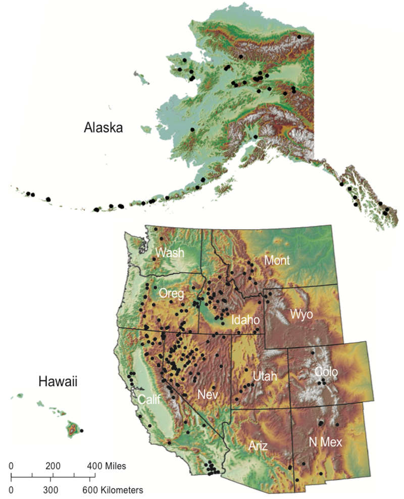
    Today the Great Outdoors Colorado (GOCO) Board awarded $6.6 million in grants as part of its open space grant program, conserving more than 13,000 acres of land on 11 different properties.

    GOCO’s open space grant program funds public and private land conservation, with projects that sustain local agriculture and economies, give outdoor recreationists a place to play (or simply enjoy the view), protect wildlife habitat, and safeguard the state’s water supply.

    This round of projects will leverage $17.2 million in matching funds, more than $7 million of donated land value from landowners, and create or maintain public access on several projects.

    GOCO also offered two new funding opportunities as part of the fall 2016 grant cycle. Grantees were able to request up to $10,000 of their grant budget for communications and storytelling purposes, as well as an additional $5,000 line item for connecting youth to the outdoors on the property being conserved.

    Funded projects are as follows:

    Baker’s Peak Ranch Conservation Easement Project, $625,000 to Colorado Open Lands in partnership with Colorado Parks and Wildlife

    Just south of the Wyoming border, Baker’s Peak Ranch is a 7,311-acre working cattle ranch that is also home to abundant wildlife. Permanently conserving the property will protect wildlife habitat, encourage further conservation in the area, preserve public hunting access, sustain local agriculture, protect scenic views from adjacent BLM land, and connect to other nearby public lands.

    Doig Homestead Open Space, $675,000 grant to Summit County

    The Doig Homestead, located just north of Silverthorne, is in the only remaining part of Summit County that is still home to active agricultural production. The project will also preserve scenic views from Highway 9 and protect habitat for deer and elk. The county will continue leasing the land for agricultural use and is considering opening a portion to public access to reach the surrounding United States Forest Service trails.

    Farmland Acquisition, $487,690 grant to the City of Brighton (partial award)

    In partnership with The Conservation Fund, Brighton will acquire 64 acres within an agricultural and agritourism district planned through a partnership between the city and Adams County.

    The property is essential to preserving Brighton’s rich agricultural history and is part of a valuable farming area in the region thanks to fertile soil and significant water rights. The property was at risk of development, but Brighton saw the need to see it instead conserved for local food production, scenic views, and public open space.

    Johnson Ranch – Glade Park, $308,500 grant to Mesa Land Trust

    GOCO funding will enable Mesa Land Trust to continue a conservation effort 50,000 acres in the making on Glade Park; the 680-acre Johnson Ranch will be the latest property permanently conserved and will serve as an example for nearby landowners to protect critical wildlife habitat while allowing ranching to continue. The cattle ranching family currently leasing the property also plans to continue to allow public access for local Boy Scout troops.

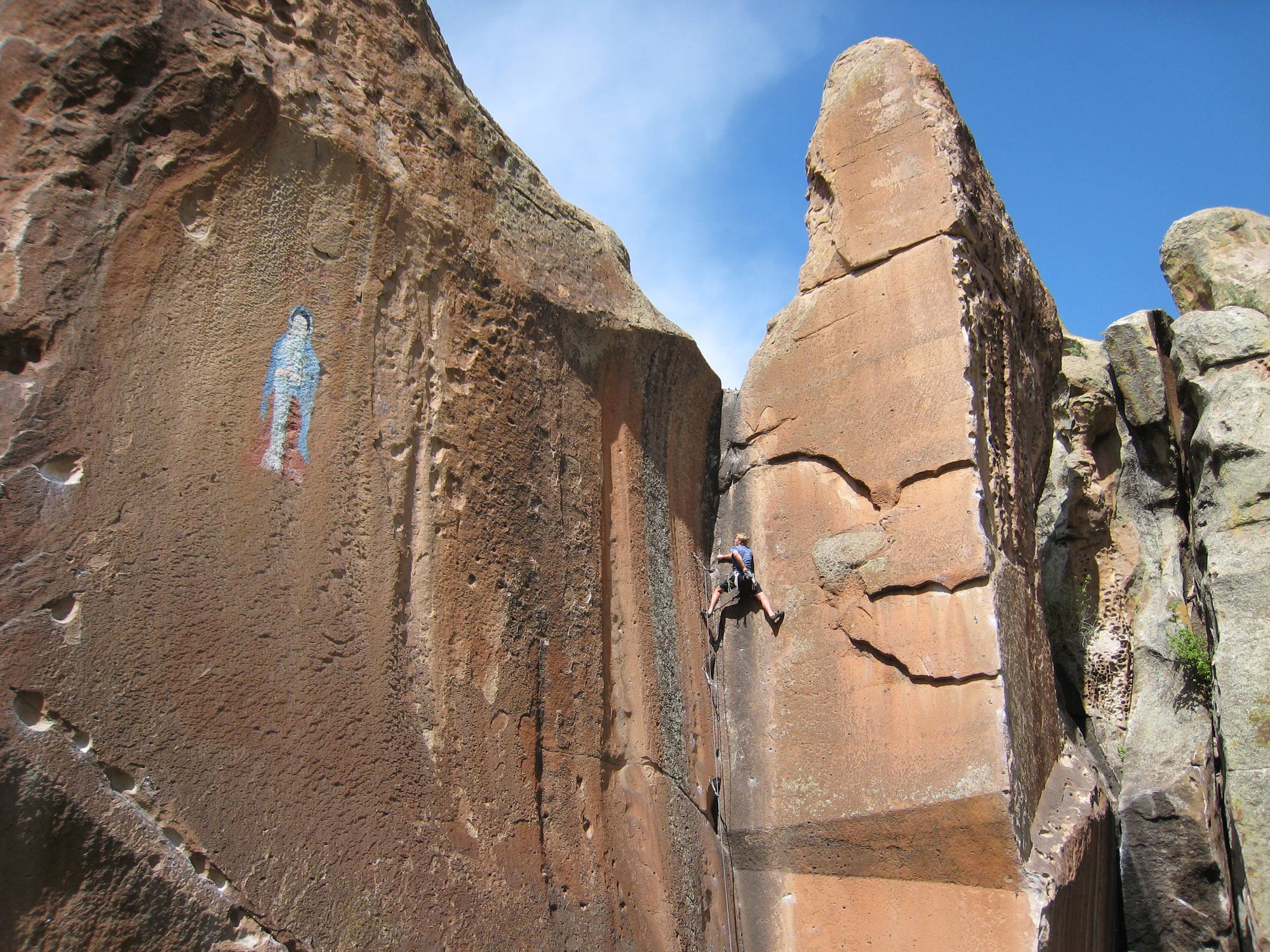
    La Garita Creek Ranch Conservation Easement, $376,500 grant to Rio Grande Headwaters Land Trust (RiGHT)

    La Garita Creek Ranch is a 460-acre guest ranch outside of Del Norte that provides critical water access and habitat for a variety of wildlife and contains early Native American archaeological features that will be permanently protected. The conservation of La Garita will also create new climbing and bouldering access near Penitente Canyon. RiGHT was successful in applying for storytelling funds for this project.

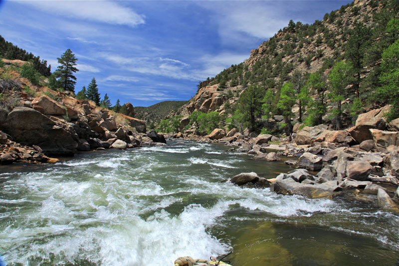
    Maverick Ranch, $1,056,000 grant to The Trust for Public Land (TPL)

    Maverick Ranch is a 204-acre property outside of Salida with Gold Medal fishing on the Arkansas River. Once conserved, it will open to the public for fishing access, creating the longest span of public access on the river. The ranch also provides important wildlife habitat and connects to surrounding Bureau of Land Management land.

    TPL was successful in applying for $10,000 for storytelling efforts and will also partner with Denver’s Environmental Learning for Kids after receiving an additional $5,000 for connecting youth to the outdoors.

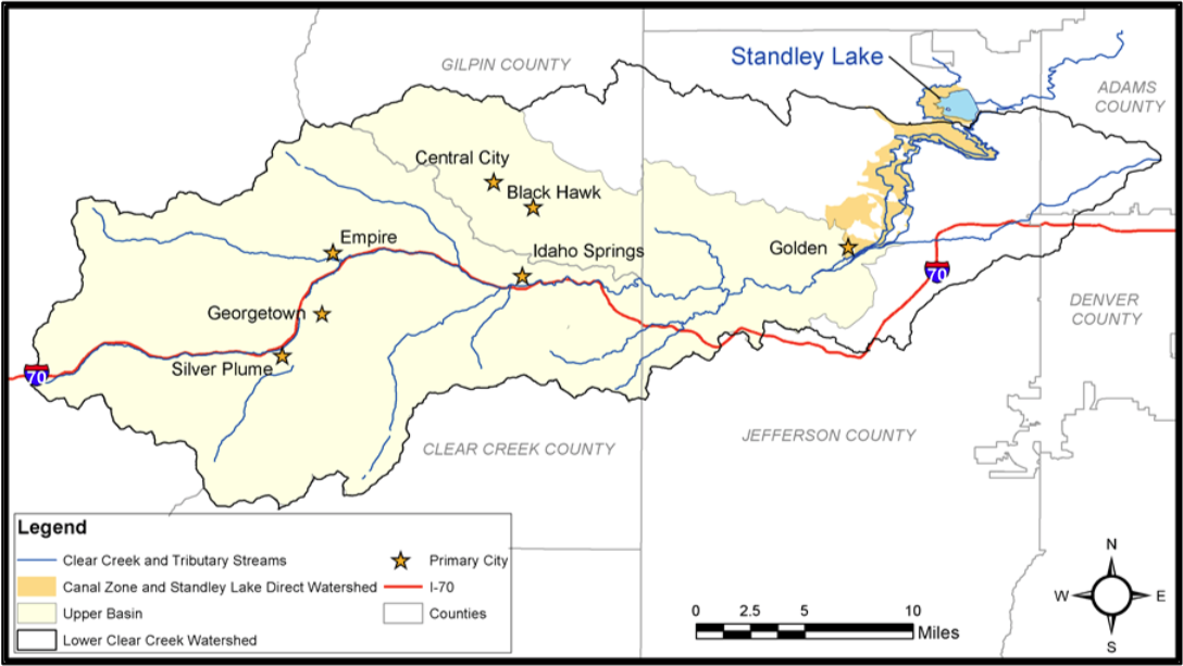
    North Floyd Hill, $545,000 grant to The Trust for Public Land (TPL), in partnership with Mountain Area Land Trust (MALT)

    Acquiring the 109-acre North Floyd Hill property will create a new gateway on I-70 for Coloradans to access 12,000 acres of trails and public open space in Clear Creek and Jefferson counties. The project will ultimately connect to the Peaks to Plains trail, protecting the highly visible property from development and permanently conserving it for public outdoor recreation.

    TPL and MALT were also successful in receiving $5,000 for connecting youth to the outdoors through this project.

    Poudre Valley Community Farms: A Pilot Project for Community Investment in Local Food, $639,750 grant to Colorado Open Lands (COL)

    COL will conserve a 52-acre property between Fort Collins and the Town of LaPorte to add to the popular local Native Hill Farm, which supports a year-round community-sustained agriculture (CSA) program, a farm stand, and several restaurants in Fort Collins with local produce. The Poudre Valley Community Farms Co-op will lease the land to Native Hill for organic vegetable production, pioneering a new model for community investment in local food.

    COL was successful in applying for the storytelling funding opportunity.

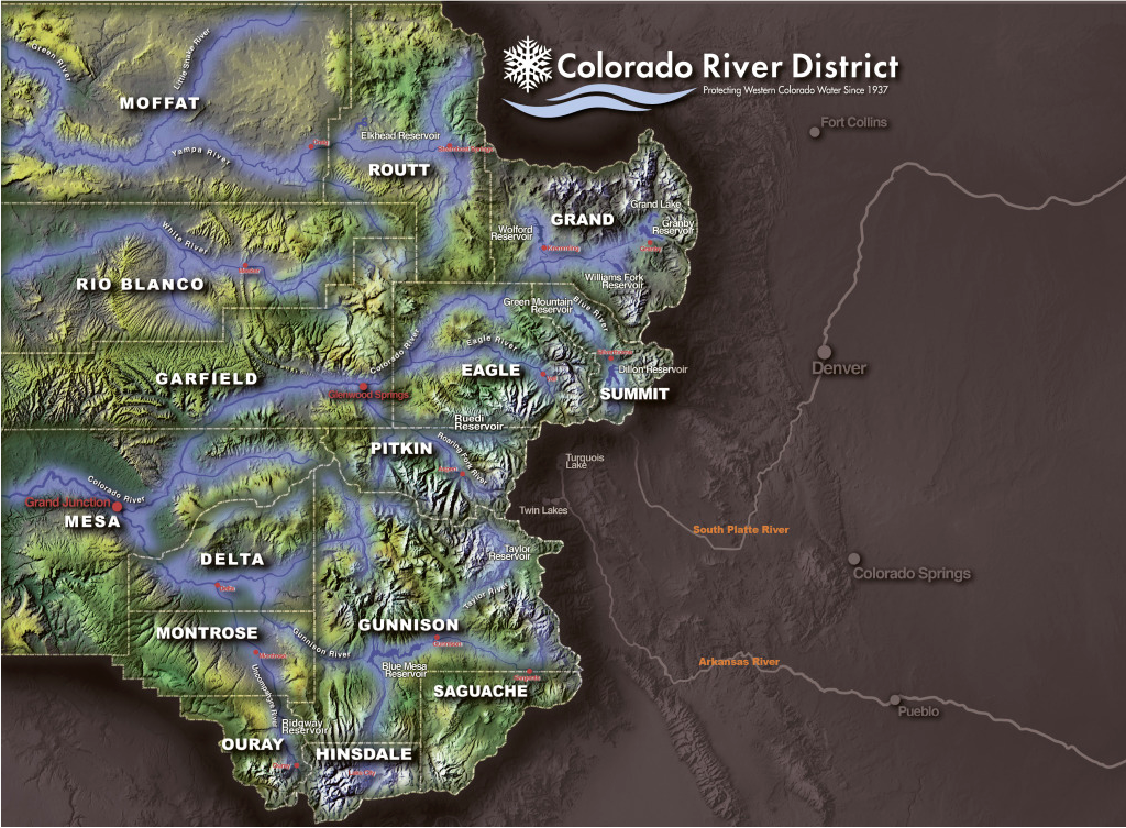
    Sunfire Ranch, $1 million grant to Pitkin County

    Pitkin County will permanently conserve 1,240 acres of the Sunfire Ranch, the largest ranch still unprotected in the Crystal Valley. The property has been owned by the Sewell Family since 1880. Conserving Sunfire will fill in extensive landscape of other conserved land on the Thompson Divide in addition to protecting wildlife habitat, sustaining local agricultural and environmental education, preserving scenic views, and protecting one mile of Thompson Creek.

    The Nature Center at Butler Corner, $264,560 grant to Montezuma Land Conservancy

    Montezuma Land Conservancy will conserve the 263-acre property outside of Dolores known as The Nature Center at Butler Corner. Several hiking trails and a temporary outdoor classroom are already in place and serving school groups and local families. The conservancy foresees using the property as part of its Community Conservation Initiative to increase local awareness of conservation efforts.

    Yust Ranch, $697,000 grant to The Conservation Fund

    The Yust Family has ranched in Grand County since 1884, and their property provides habitat to some of the largest herds of big game species as well as greater sage grouse. The project will contribute to the statewide conservation efforts for the Colorado River and protect scenic views enjoyed by the outdoor recreationists who fuel the regional economy.

    Great Outdoors Colorado (GOCO) invests a portion of Colorado Lottery proceeds to help preserve and enhance the state’s parks, trails, wildlife, rivers, and open spaces. GOCO’s independent board awards competitive grants to local governments and land trusts, and makes investments through Colorado Parks and Wildlife. Created when voters approved a Constitutional Amendment in 1992, GOCO has since funded more than 4,800 projects in urban and rural areas in all 64 counties without any tax dollar support. [ed. emphasis mine] Visit http://GOCO.org for more information.

    Southeastern water district approves $30 million budget — @ChieftainNews

    Fryingpan-Arkansas Project via the Southeastern Colorado Water Conservancy District
    Fryingpan-Arkansas Project via the Southeastern Colorado Water Conservancy District

    From Southeastern Colorado Water Conservancy District via The Pueblo Chieftain:

    A $30 million budget was approved Thursday by the Southeastern Colorado Water Conservancy District board of directors.

    The budget is the largest in the history of the district because it reflects spending $12 million in the first phase of a hydropower project at Pueblo Dam. The board is scheduled to consider approval of that project at a special meeting later this month.

    “This is an exciting time for the district, with many new opportunities coming to fruition after years of effort by the district board and staff,” said Jim Broderick, executive director. “Every day we are coming closer to fulfilling the vision of those who came before us almost 60 years ago when the district was formed.”

    The hydropower project now includes the district and Colorado Springs. The Pueblo Board of Water Works pulled out as partners last month, because it would realize few benefits from the project. When completed, the $20 million project will generate 7.5 megawatts of electric power and become a source of revenue for the district’s Water Activity Enterprise.

    The budget’s other large-ticket items include repayment of federal funds for construction of the Fryingpan-Arkansas Project, $7 million, and Fountain Valley Conduit, $5.8 million.

    About $24 million is still owed for construction of the Fryingpan-Arkansas Project, which began in 1965. The project includes Ruedi Reservoir, a collection system in the Hunter Creek-Fryingpan River watersheds, the 5.4-mile Boustead Tunnel that brings water across the Continental Divide, Turquoise Lake, the Mount Elbert Forebay and Power Plant, Twin Lakes and Pueblo Reservoir.

    The Fry-Ark debt is repaid through a 0.9-mill property tax in the nine-county area covered by the district.

    The Fountain Valley Conduit serves Colorado Springs, Fountain, Security, Stratmoor Hills and Widefield, which pay a special property tax.

    The operating fund of the district will be $2.3 million, and is funded by a 0.03 mill levy and transfers from the Enterprise fund. The Enterprise operating fund will be $1.8 million, and is mostly funded by fees and surcharges on water activities.

    Other than hydropower, the Enterprise will administer excess-capacity storage contracts for district participants for the first time in 2017. The Enterprise also expects the federal feasibility study for the Arkansas Valley Conduit and an interconnection of the north and south outlets on Pueblo Dam to be completed later in 2017. The feasibility study is the final step that must be taken before construction begins.

    “Water Research Foundation Day” Proclaimed by Colorado Governor Hickenlooper

    waterdrop

    Here’s the release via BusinessWire.com:

    The Water Research Foundation (WRF), a leading sponsor of innovative research supporting the water community, is pleased to announce that December 5, 2016 was proclaimed Water Research Foundation Day by Colorado Governor John W. Hickenlooper. Originally based in New York, WRF has been a member of the Colorado business community since 1974.

    First envisioned in 1955, WRF was officially incorporated on December 5, 1966. In 1968, the first research project was funded by the Federal Water Pollution Control Administration (FWPCA). In 1986, the subscription program for water utilities began, an innovation that has allowed WRF to become the industry leader in water research.

    Over the past 50 years, WRF has provided its subscribers with the highest level of research and tools to solve the most complex challenges of the water community. Today, WRF subscribers include over 1,000 water and wastewater utilities located throughout the world, as well as consulting firms and manufacturing companies. Additionally, 31 water and wastewater utility subscribers are based in Colorado.

    “The Water Research Foundation is honored to receive this proclamation by the state of Colorado,” said Rob Renner, CEO of WRF. “By working with the water community in Colorado, the United States, and throughout the world, we’re able to leverage our knowledge and resources to the benefit of public health and the environment.”

    About the Water Research Foundation

    The Water Research Foundation is the leading not-for-profit research cooperative that advances the science of water to protect public health and the environment. Governed by utilities, WRF plans, manages, and delivers scientifically sound research solutions on the most critical challenges facing the water community in the areas of drinking water, wastewater, stormwater, and reuse. Over the last 50 years, WRF has sponsored nearly 1,500 research projects valued at $500 million, and serves more than 1,000 subscribing organizations. For more information, go to http://www.WaterRF.org.

    @USBR Releases Water Markets Report

    watermarketsreportusbr122016

    Here’s the release from the US Bureau of Reclamation (Peter Soeth/Martin Doyle):

    The Department of the Interior and the Bureau of Reclamation released a report this week reviewing the role of Reclamation in water markets. For decades, water users in the West have used many different approaches to address water needs particular to their location. In some instances, these approaches have created market conditions in which buyers and sellers voluntarily trade water rights. Such water market transactions can often involve Reclamation facilities.

    This new report, “Water marketing activities within the Bureau of Reclamation,” highlights the ways Reclamation has partnered with water users to enable such transactions. The report reviews a series of case studies which illustrate a tremendous amount of locally-led innovation. The cases also illustrate how locally-led transactions have created collaborations and programs that enable greater flexibility in the use of project water or facilities.

    Reclamation Commissioner Estevan López said, “States and local water users are quietly solving water resource challenges in the West through market-based agreements. This report will help us identify ways that Reclamation can enable and support continued innovation in the face of increasing pressures on scarce water supplies.”

    Reclamation is continuing its role in supporting locally led water markets through a new grant program. Starting in Fiscal Year 2017, the WaterSMART grant program will provide grants to conduct planning activities to develop water marketing strategies to establish or expand water markets and water marketing transactions. Reclamation will make available $3 million for this program. This new funding opportunity is expected to be posted in February 2017.

    Going forward, Reclamation will continue to work with states and local water users to promote innovation through water markets in order to provide flexibility, promote conservation and stretch scarce water supplies.

    #Drought news: Expansion of D1 and D2 in eastern #Colorado, winter wheat germination spotty

    Click here to go to the US Drought Monitor website. Here’s an excerpt:

    Summary

    During the past 7-days, several frontal systems moved across the contiguous United States. Heavy precipitation (generally 2-6 inches, locally 10 inches or more) fell from southern Texas east-northeast across the Gulf Coast states and the Tennessee Valley. Two inches of precipitation (liquid equivalent) or more was also reported across portions of the Northeast and the Pacific Northwest. Within the first 48 hours of the new drought week (which started at 7am EST Tuesday, Nov 29), there were approximately 215 preliminary, filtered reports of severe weather across this region, as indicated by the Storm Prediction Center in Oklahoma. Most of the remainder of the Lower 48 states reported light to moderate precipitation (less than 2 inches)…

    Northern and Central Great Plains

    Recent snowstorms played a key role in the removal of moderate drought (D1) in south-central North Dakota, where AHPS 14-day departures from normal precipitation (DNPs) span 2-4 inches. In the past month, conditions have generally improved over most of the state. The exception is in extreme southwest North Dakota, where D0 was expanded slightly northward, and D1 was introduced to Bowman County, based on precipitation data and anecdotal testimonies. In nearby South Dakota, northeast portions of the state were improved by a category, based on 30-day DNPs. However, some degradations were made to the depiction in the southwest portion of the state based on precipitation deficits and abnormally warm temperatures, particularly over the last 30-days. Other considerations that went into the changes were the 1-month SPEI (Standardized Precipitation Evapotranspiration Index) for November, seasonal snowfall maps, and current VIC (Variable Infiltration Capacity) soil moisture conditions…

    Southern Great Plains

    In Texas, a reassessment of drought conditions was made to incorporate the latest precipitation data, and many smaller-scale changes were made. AHPS 14-day DNPs reveal precipitation departures on the order of 1-5 inches in south-central and southern Texas, and 2-10 inches in eastern Texas. Small-scale changes were also made to the depiction in north-central Oklahoma (Counties of Garfield, Noble, Kingfisher, Logan, Oklahoma and Lincoln), where farmers and livestock operators reported instances of failed wheat, very dry conditions, and low farm ponds…

    Rockies and Intermountain Region

    The only changes rendered to this portion of the national drought depiction was made in the High Plains of eastern Colorado. In northern Prowers County (extreme southeast part of state), moderate drought (D1) was expanded due to a dry autumn making its mark on local vegetation, while in the eastern portion of adjacent Kiowa County, a small patch of severe drought (D2) was introduced due to lower precipitation and grasses in poor shape. In the northeast part of the state, D1 was expanded into northern Washington County, northeast Yuma County, Phillips County, and eastern Logan County. This is to account for very spotty winter wheat germination…

    California

    No changes were deemed necessary to the depiction this week…

    Looking Ahead

    During the next 5 days (December 8-12), moderate precipitation (0.5-1.5 inches) is anticipated from Tennessee through the Great Lakes region, which will at least help preclude additional deterioration for the Tennessee and Ohio Valleys. For most other areas east of the Rockies, precipitation amounts are expected to be less than a half-inch. Locally heavy amounts of precipitation (liquid equivalent of 2-4 inches) are predicted for the higher elevations of the Rockies. Most of the expected precipitation for the Pacific Coast states is forecast to fall in areas that are not currently in drought, with the exception of the Sierras where up to 7 inches (liquid equivalent) is anticipated.

    For the ensuing 5-day period (December 13-17), odds favor above-median precipitation across approximately the northern and eastern halves of the contiguous U.S., while odds favor below-median precipitation from Arizona eastward to the southern Great Plains, and Alaska.

    A new short film highlights the joys and challenges of being a young farmer in the arid West — NYFC

    From the National Young Farmers Coalition (Chelsey Simpson) via Alternet:

    A new short film, Conservation Generation, offers a look into the lives of four young farmers and ranchers in Colorado and New Mexico who are following their passion for agriculture amidst historic drought, climate change, development, and heightened competition for water.

    Fifteen percent of all U.S. crops are grown with irrigation water that originates in the Colorado River Basin, making Western agriculture an issue that is crucial to the lives and dinner plates of all Americans. Many of the holiday meals consumed in the coming weeks will include produce grown by farmers in the arid West.

    Despite the importance of Western agriculture, farmers are in increasingly short supply. The average age of the American farmer is 58, and farmers over 65 outnumber farmers under 35 by a ratio of six-to-one. According to the National Young Farmers Coalition (NYFC), the nonprofit organization that produced Conservation Generation as well as a report by the same name, lack of access to affordable land and water are two of the biggest issues preventing more young people from succeeding in agriculture.

    “There are a number of challenges faced by young farmers, but in the West, all of those issues are compounded by the increasing demands on water,” says Kate Greenberg, western water program director for NYFC. “As the film shows, young farmers face these challenges with a spirit of innovation and a deep commitment to conservation and place. A good sense of humor helps, too.”

    According to the report produced by NYFC, 97 percent of young farmers surveyed considered water conservation important and 94 percent reported using some form of conservation on their farms.

    Conservation Generation features four young farmers in Colorado and New Mexico:

  • Harrison Topp of Topp Fruits in Paonia, Colorado and Fields Livestock in Montrose, Colorado
  • Tyler Hoyt of Green Table Farm in Mancos, Colorado
  • Nery Martinez of Santa Cruz Farm & Greenhouses in Espanola, New Mexico
  • Casey Holland of Red Tractor Farm in Albuquerque, New Mexico
  • Each of the farmers has also been blogging about the joys and challenges of farming in the arid West; view the film and read their stories at http://youngfarmers.org/conservationgeneration.

    Creede receives state funding to fix 66-year-old flume — @ChieftainNews

    Typical Erosion along the Left and Right Toes of the Willow Creek Flume. Credit Bohannan-Huston Engineering.
    Typical Erosion along the Left and Right Toes of the Willow Creek Flume. Credit Bohannan-Huston Engineering.

    From The Pueblo Chieftain (Matt Hildner):

    The historic mining town west of the San Luis Valley is in line for a long-awaited fix to the flume that carries Willow Creek through town.

    The Colorado Department of Local Affairs awarded $1 million to the town of Creede Tuesday to fix the stone-masonry structure whose potential failure was regarded as a flood threat to much of the town of 425 people.

    “This is something we wanted for a long, long time,” Town Manager Clyde Dooley told The Chieftain Wednesday.

    The 1.1-mile flume that catches the creek as it tumbles out of a steep canyon was built in 1950 by the U.S. Army Corps of Engineers.

    Homes and businesses back onto the flume. Four street bridges, eight foot bridges and water mains also cross the flume’s path.

    In a 1989 report, the corps found the structure was nearing the end of its life cycle, with deterioration along the flume’s toe — where the side walls meet the bottom of the flume.

    But the town struggled to find matching funds for repairs in the 1990s and when the corps made its regulations more strict following Hurricane Katrina, the deteriorated state of the flume left it outside the agency’s funding stream.

    The town also made an unsuccessful attempt to insert a fix into a 2010 federal bill for water projects.

    Enter the state’s Department of Local Affairs.

    “This just turned out to be perfect timing,” Dooley said. “DOLA is the hero here.”

    Dooley also credited Randi Snead, the town’s clerk and treasurer, for developing the current proposal.

    The town will contribute $520,000 from reserve funds for construction in addition to budgeting $5,000 annually in the future to meet maintenance demands.

    The repairs will fill voids and cracks in the flume and see the installation of concrete curbing along the toes of the channel.

    The town hopes it can complete the repairs in August and September to avoid spring runoff and impacting the bulk of summer tourists.

    #Snowpack news: San Juan, et. al = 73% of normal, #ColoradoRiver = 66%

    Below is the Westwide SNOTEL basin-filled map from this morning.

    Westwide SNOTEL basin filled map December 7, 2016 via the NRCS.
    Westwide SNOTEL basin filled map December 7, 2016 via the NRCS.

    The data below is from Sunday and yesterday, before the storms this week.

    @ColoradoClimate: Weekly Climate, Water and #Drought Assessment of the Upper #ColoradoRiver Basin #COriver

    Upper Colorado River Basin precipitation as a percent of normal November 2016 via the Colorado Climate Center.
    Upper Colorado River Basin precipitation as a percent of normal November 2016 via the Colorado Climate Center.

    Click here to read the current assessment. Click here to go to the NIDIS website hosted by the Colorado Climate Center.

    Yampa River saw lean autumn flows in 2016 — Steamboat Today

    28-Day low flows in Upper Colorado River Basin. Credit @USGS via @ColoradoClimate.
    28-Day low flows in Upper Colorado River Basin. Credit @USGS via @ColoradoClimate.

    From Steamboat Today (Tom Ross):

    The Routt County Board of Commissioners agreed Dec. 6 to renew its $9,660 commitment in 2017 to the water quality monitoring that has been ongoing in the Upper Yampa River Basin since 2011, with the support of the U.S. Geological Survey and other local agencies…

    Under the testing regimen, six different sites on the river are tested four times annually to establish the baseline for a healthy river.

    In addition, Cowman said the Yampa has been found to have a temperature impairment, and consistent water quality testing over time will help the entities involved in the testing make the case that they’ve been responsive to that condition when the Colorado Water Quality Control Division next focuses on the Yampa.

    Steamboat Today reported Dec. 7, 2015, that some high water temperature readings in the river west of Hayden have the potential to lead to a big shift in how a 57-mile stretch of the river is regulated by the state of Colorado.

    After a summer of sparse moisture in 2016, the Yampa, where it enters Stagecoach Reservoir, was flowing at 22 cubic feet per second on Sept. 23, representing an historic low, based on 27 years of record.

    Managers of the Stagecoach and Catamount dams timed their seasonal draw-down of their reservoirs to benefit the Yampa downstream. And the city of Steamboat and the Colorado Water Trust both arranged to release stored water to boost the river’s flow by 10 cfs well into autumn.

    The cost of the water testing in 2017 is up about 2 percent, with the USGS contributing $14,631, or 30 percent, of the total cost of $48,443. Joining the county in contributing 20 percent of the total are the city of Steamboat Springs and the Upper Yampa Water Conservancy District.

    The Mount Werner Water and Sanitation District and Morrison Creek Water and Sanitation District are each contributing $2,415, or 5 percent, of the total.

    Breckenridge puts new water plant on hold after getting $50 million estimate — Summit Daily News

    This beautiful pattern emerges in clouds when two different layers of air in the atmosphere are moving at different speeds.  Where the two layers meet, another 'sheer' layer is created that becomes unstable due to the changes in speed. Pictured are Kelvin-Helmholtz clouds recently seen over Colorado Read more: http://www.dailymail.co.uk/sciencetech/article-3301225/What-caused-strange-clouds-form-Colorado-Scientists-explain-weather-pattern-creates-ocean-sky.html#ixzz3qSbT51xB  Follow us: @MailOnline on Twitter | DailyMail on Facebook
    This beautiful pattern emerges in clouds when two different layers of air in the atmosphere are moving at different speeds. Where the two layers meet, another ‘sheer’ layer is created that becomes unstable due to the changes in speed. Pictured are Kelvin-Helmholtz clouds recently seen over Colorado
    Read more: http://www.dailymail.co.uk/sciencetech/article-3301225/What-caused-strange-clouds-form-Colorado-Scientists-explain-weather-pattern-creates-ocean-sky.html#ixzz3qSbT51xB
    Follow us: @MailOnline on Twitter | DailyMail on Facebook

    From The Summit Daily News (Kallyn Lamb):

    During the budget retreat meeting on Oct. 25, the [Breckenridge Town Council] decided to postpone construction on what would be Breck’s second water plant, in favor of getting more information. Bids originally came in for the plant at around $30 million, but increased to $52 million for the official 2017 budget.

    “Everybody was fairly shocked at the bid,” said the town’s mayor, Eric Mamula.

    Breck’s town manager, Rick Holman, said that cost of construction has been going up continually year after year, which contributed to the increased cost for the project. Until the town gets the new breakdown in mid-January, Holman said the town is in “wait-and-see mode.” He added that it’s difficult to wait on construction projects because predicting costs can be a roll of the dice.

    “When you’re spending that kind of money I think that a second opinion is a smart thing for the government to have,” Holman said.

    While the water plant is something the town needs to continue providing for ever-increasing local population and tourist demand, Holman said that the town must find a balance between need and cost.

    Mamula said that the council is at a standstill, since they can’t make any decisions on how to move forward until they’ve seen the new plan…

    Should the town council decide to move forward with the plant after seeing the new plan in January, Holman said that the 2017 budget would have to be amended. The town is looking at ways to fund the plant, but Holman added that there could be a rise in water rates if the town decided to go ahead with construction.

    The Gary Roberts Water Treatment Plant, the town’s current water source, does not have the space for expansion, Holman said. The town will still invest in repairing the 50-year-old plant.

    Kim Dykstra, the director of communications for the town, said that the age of plant makes it more likely that it could break down.

    The Gary Roberts plant was originally constructed in 1971 and receives its water from snow melt from above the Goose Pasture Tarn Reservoir that flows into the Blue River. After expansions in the late ’80s, the plant had the capacity to run 5 million gallons of water daily.

    Dykstra said that the idea for a second water plant was first floated after the Hayman Fire in 2002…

    A water task force was created in 2011, but it wasn’t until 2013 that the town did an official feasibility study to try to find the best way to address water use. Dykstra said that the town already possesses the water rights that would enable it to build a second plant because of progressive town council decisions that started as early as the 1950s.

    The Gary Roberts plant services around 13,000 single-family-home equivalents in Breckenridge. The new plant would add availability for another 2,000, Dykstra said. While permanent residents are the biggest users of water in the town, she said that tourists make up for a big portion of usage as well. An increasing amount of tourists coming to the town, whether it’s for a day trip or longer, means more demand for water.

    Dykstra stressed that part of the reason to add the plant now is to get ahead of water demand.

    The feasibility study, released in early 2014, recommended that the second plant operate at 3 million gallons a day to meet the projected demand, with the water intake coming from the Blue River near Lake Dillon.

    Breckenridge looked at five different properties for construction of the plant and ultimately decided on the McCain property located north of the town along Highway 9. Since it was land the town already owned, and it was close to an established pipeline, it meant fewer initial costs for taxpayers according to Dykstra.

    #Arctic and #Antarctic #SeaIce hit record lows

    Here’s the release from the National Snow and Ice Data Center:

    The National Snow and Ice Data Center (NSIDC) is part of the Cooperative Institute for Research in Environmental Sciences at the University of Colorado Boulder. NSIDC scientists provide Arctic Sea Ice News & Analysis content, with partial support from NASA.

    Unusually high air temperatures and a warm ocean have led to a record low Arctic sea ice extent for November, according to scientists at the National Snow and Ice Data Center (NSIDC). In the Southern Hemisphere, Antarctic sea ice extent also hit a record low for the month, caused by moderately warm temperatures and a rapid shift in circumpolar winds.

    Arctic sea ice extent averaged 9.08 million square kilometers (3.51 million square miles) for November, 1.95 million square kilometers (753,000 square miles) below the 1981 to 2010 long-term average for the month. Although the rate of Arctic ice growth was slightly faster than average, total extent actually decreased for a brief period in the middle of the month. The decrease in extent measured 50,000 square kilometers (19,300 square miles) and was observed mostly in the Barents Sea, an area of the Arctic Ocean north of Norway, Finland, and Eastern Russia. NSIDC scientists said the decrease in extent is almost unprecedented for November in the satellite record; a less pronounced and brief retreat of 14,000 square kilometers (5,400 square miles) happened in 2013.

    The graph above shows daily Arctic sea ice extent as of December 5, 2016, along with daily ice extent data for four previous years. 2016 is shown in blue, 2015 in green, 2014 in orange, 2013 in brown, and 2012 in purple. The 1981 to 2010 average is in dark gray. The gray area around the average line shows the two standard deviation range of the data. Sea Ice Index data. High-resolution image. Credit: National Snow and Ice Data Center.
    The graph above shows daily Arctic sea ice extent as of December 5, 2016, along with daily ice extent data for four previous years. 2016 is shown in blue, 2015 in green, 2014 in orange, 2013 in brown, and 2012 in purple. The 1981 to 2010 average is in dark gray. The gray area around the average line shows the two standard deviation range of the data. Sea Ice Index data. High-resolution image. Credit: National Snow and Ice Data Center.

    November 2016 is now the seventh month this year to have hit a record low extent in the 38-year satellite monitoring period. The November extent was 3.2 standard deviations below the long-term average, a larger departure than observed in September 2012 when the Arctic summer minimum extent hit a record low.

    Arctic sea ice is still in the early stages of winter freeze-up and is expected to continue expanding until it hits its maximum extent around March next year.

    NSIDC scientists said unusually high temperatures over the Arctic Ocean, persistent winds from the south, and a warm ocean worked together to drive the record low Arctic extent. Extending from northeast of Greenland towards Svalbard and Severnaya Zemlya, air temperatures at the 925 hPa level (about 2,500 feet above sea level) were up to 10 degrees Celsius (18 degrees Fahrenheit) above the 1981 to 2010 long-term average for the month. Sea surface temperatures in the Barents and Kara Seas remained unusually high, up to 4 degrees Celsius (7 degrees Fahrenheit) above average around Novaya Zemlya and Svalbard, preventing ice formation. These high temperatures reflected a pattern of winds from the south, which also helped to push the ice northward and reduce the ice extent.

    NSIDC scientist Julienne Stroeve was in Svalbard during November and noted the lack of sea ice. “Typically sea ice begins to form in the fjords at the beginning of November, but this year there was no ice to be found,” she said.

    “It looks like a triple whammy—a warm ocean, a warm atmosphere, and a wind pattern all working against the ice in the Arctic,” said NSIDC director Mark Serreze.

    In the Southern Hemisphere, sea ice surrounding the continent of Antarctica declined very quickly early in the month, and remained far below the range of past November daily extents. The average extent for the month of November was 14.54 million square kilometers (5.61 million square miles), 1.81 million square kilometers (699,000 square miles) below the 1981 to 2010 average. This was more than twice the previous record departure from average set in November 1986 and was 5.7 standard deviations below the long-term average.

    This photograph from NASA Operation IceBridge shows broken floes of sea ice floating in the Weddell Sea. A large area of open water can be seen on the horizon. Credit: J. Beitler/National Snow and Ice Data Center.
    This photograph from NASA Operation IceBridge shows broken floes of sea ice floating in the Weddell Sea. A large area of open water can be seen on the horizon. Credit: J. Beitler/National Snow and Ice Data Center.

    NSIDC scientists said that higher than average air temperatures and a rapid shift in Antarctic circumpolar winds appears to have caused the rapid decline in Antarctic sea ice.

    Air temperatures 2 to 4 degrees Celsius, or 4 to 7 degrees Fahrenheit higher than average and an earlier pattern of strong westerly winds worked to create a more dispersed sea ice pack in the Antarctic. A rapid shift to a more varied wind structure, with three major areas of winds from the north, rapidly compressed low-concentration sea ice around Wilkes Land, Dronning Maud Land, Enderby Land, and the Antarctic Peninsula. Moreover, several very large polynyas (areas of open water within the pack) have opened in the eastern Weddell and along the Amundsen Sea and Ross Sea coasts.

    NSIDC lead scientist Ted Scambos said, “Antarctic sea ice really went down the rabbit hole this time. There are a few things we can say about what happened, but we need to look deeper.”

    NASA scientist and NSIDC affiliate scientist Walt Meier said, “The Arctic has typically been where the most interest lies, but this month, the Antarctic has flipped the script and it is southern sea ice that is surprising us.”

    See the full analysis and relevant graphs and images in the NSIDC Arctic Sea Ice News & Analysis page.

    See the NASA Earth Observatory story.

    Years with sea ice above and below the median are displayed in the grid view. The eight panels show the November extent roughly every five years since 1978, when satellites started monitoring sea ice. Every November is different, as freeze-up is influenced by factors such as water temperature, air temperature, and wind patterns. All three factors played a role in the November 2016 record low.
    Years with sea ice above and below the median are displayed in the grid view. The eight panels show the November extent roughly every five years since 1978, when satellites started monitoring sea ice. Every November is different, as freeze-up is influenced by factors such as water temperature, air temperature, and wind patterns. All three factors played a role in the November 2016 record low.

    Years with sea ice above and below the median are displayed in the grid view. The eight panels show the November extent roughly every five years since 1978, when satellites started monitoring sea ice. Every November is different, as freeze-up is influenced by factors such as water temperature, air temperature, and wind patterns. All three factors played a role in the November 2016 record low.

    From The Independent UK (Andrew Griffin):

    The amount of sea ice at both the Antarctica and the Arctic has hit record lows, leading scientists to worry that the effects of global warming might be far worse than previously thought.

    The worrying findings come after an area roughly the size of India melted away because of rising global temperatures and bizarre weather.

    Despite global warming and melting elsewhere, ice in the Southern Ocean off Antarctica has tended to expand.

    But it is now quickly shrinking at both ends of the planet, leading scientists to worry that the effect of global warming might be worse than perviously thought.

    This time series of daily global sea ice extent (Arctic plus Antarctic, month and first day of month on the x axis) shows global extent tracking below the 1981 to 2010 average. Sea Ice Index data.
    This time series of daily global sea ice extent (Arctic plus Antarctic, month and first day of month on the x axis) shows global extent tracking below the 1981 to 2010 average. Sea Ice Index data.

    #AnimasRiver #GoldKingMine: Navajo Nation files $160 M claim with EPA over mine spill — The Denver Post

    The orange plume flows through the Animas across the Colorado/New Mexico state line the afternoon of Aug. 7, 2015. (Photo by Melissa May, San Juan Soil and Conservation District)
    The orange plume flows through the Animas across the Colorado/New Mexico state line the afternoon of Aug. 7, 2015. (Photo by Melissa May, San Juan Soil and Conservation District)

    From the Associated Press via the The Denver Post:

    The Navajo Nation has submitted a claim of more than $160 million in damages to the federal government over last year’s mine waste spill that fouled rivers in three western states.

    A cleanup team led by the U.S. Environmental Protection Agency triggered the August 2015 spill while working at the Gold King Mine near Silverton, Colorado.

    The 3-million-gallon blowout tainted rivers in Colorado, New Mexico and Utah with tons of toxic heavy metals including arsenic, mercury and lead.

    In a letter Monday to the EPA, attorneys say the tribe still awaits more than $3 million in unreimbursed expenses for costs through Sept. 30 to deal with the spill that contaminated the San Juan River.

    The tribe also is seeking $159 million for 10 years of health monitoring and other assessments.

    CWCB and city of Aspen oppose Maroon Creek Club water rights application

    A map showing the location of four ponds on the Maroon Creek Club's golf course for which the club is seeking refill rights. The ponds are located between Maroon Creek and Buttermilk Mountain.
    A map showing the location of four ponds on the Maroon Creek Club’s golf course for which the club is seeking refill rights. The ponds are located between Maroon Creek and Buttermilk Mountain.

    By Brent Gardner-Smith, Aspen Journalism

    ASPEN – The Colorado Water Conservation Board and the city of Aspen are objecting to an effort by the Maroon Creek Club to broaden a 1989 water right so it can refill four ponds on its private golf course as it sees fit.

    Both the CWCB and the city have filed statements of opposition in the water court case, which was filed in Division 5 Water Court on Aug. 10.

    Maroon Creek LLC has told the court it is not asking to expand the 1989 water right, but is instead seeking “determination of surface water rights” regarding potential refill rights for four ponds, arguing that the 1989 right includes a refill option.

    The ponds are usually filled once a year with water diverted from Maroon and Willow creeks, via the Willow Creek Ditch and the Herrick Ditch under the club’s 1989 water right.

    But both the state and the city are concerned that in seeking such a determination, the club will actually expand its water right, and do so despite an earlier settlement agreement that sets a cap on the amount of water that the ponds can store in a year.

    The four ponds can hold between 4.7 acre-feet to 13.6 acre-feet of water and altogether can store 35.1 acre-feet.

    Two of the ponds are on the Buttermilk Mountain side of Highway 82 and two are on the clubhouse, or north, side of the highway. The ponds were built in the 1990s when the club’s golf course was shaped by a fleet of earthmovers.

    Overall flow into the ponds, per the club’s 1989 water right decree, is not to exceed 4 cubic feet per second at any one time from the two irrigation ditches that feed them.

    The Willow Creek Ditch can divert 10 cfs from Willow Creek, a tributary of Maroon Creek that enters at T-Lazy-7 Ranch. And the Herrick Ditch can divert 60.86 cfs from Maroon Creek, which is a tributary of the Roaring Fork River.

    Maroon Creek LLC concedes the original decree is silent as to refill rights, but points to an amended 
application from the 1989 case that says “the reservoirs will be filled and refilled, in priority, as needed.”

    “The explicit reference to reservoir refill indicates the original applicant’s intent to alter the presumptive one-fill rule with respect to the reservoirs,” states the “application for a determination” from Maroon Creek LLC. “Further, the reservoirs are on-ditch structures and are part of the greater Maroon Creek Club golf course. Keeping the reservoirs full through refill is ‘consistent with and implicit in the normal operation’ of key golf course ponds, which provides further evidence that reservoir refill was intended to be a part of the final decree in the original case.”

    Attorneys with Garfield and Hecht in Glenwood Springs prepared the water court filing. And Andrew Hecht, a founder of and a partner in Garfield and Hecht in Aspen, is the manager of Maroon Creek LLC.

    Looking over the Maroon Creek Club golf course from Tiehack on Dec. 5, 2016. One of four ponds on the course is visible, barely, in the foreground.
    Looking over the Maroon Creek Club golf course from Tiehack on Dec. 5, 2016. One of four ponds on the course is visible, barely, in the foreground.

    City and state file statements

    The Colorado Water Conservation Board, which owns instream flow rights in Maroon Creek and the Roaring Fork and Colorado rivers, filed a detailed statement of opposition in the case on Oct. 27.

    “The principle that reservoirs are limited to one fill per year is well-established in Colorado water law,” states a filing from the CWCB, prepared by attorneys general for the state of Colorado. “Therefore, absent specific language in a decree to the contrary, a decreed right to fill a reservoir is limited to a single filing per year.”

    The CWCB argues that the 1989 water rights held by the Maroon Creek Club were the result of a stipulated agreement in the water court case that created the rights, and as such are explicitly limited to a single fill of each of the four reservoirs.

    “The decree unambiguously awards a single fill,” the CWCB says.

    And addressing any potential decision to the contrary, the CWCB told the court it “should reject an interpretation which is contrary to the long-accepted single-fill rule.”

    The CWCB holds instream flow rights on Maroon Creek and on the Roaring Fork and Colorado rivers.

    Water attorneys for the city of Aspen also filed a statement of opposition in the case.

    “Aspen owns numerous water rights decreed for diversion from Maroon Creek and the Roaring Fork River and its tributaries, including certain water rights that Applicant [Maroon Creek LLC] has contracted for use on the property that is the subject of this application, which may be injured by the requested determination of surface water rights,” the city told the court.

    As such the city says Maroon Creek LLC “must prove that the request for determination of surface water rights does not create a new water right or expand the decreed amount of use of the water rights” from the 1989 decree.

    A status conference in the case is set for Dec. 22.

    Editor’s note: Aspen Journalism, the Aspen Daily News, and Coyote Gulch are collaborating on coverage of water and rivers. The Daily News published this story on Monday, Dec. 6, 2016.

    CFWE Board Member Lisa Darling to Head South Metro Water Supply Authority

    @USGS: Assessment of Moderate- and High-Temperature Geothermal Resources of the United States

    Map showing the location of identified moderate-temperature and high-temperature geothermal systems in the United States. Each system is represented by a black dot. Credit USGS.
    Map showing the location of identified moderate-temperature and high-temperature geothermal systems in the United States. Each system is represented by a black dot. Credit USGS.

    Here’s the release from the USGS:

    Scientists with the U.S. Geological Survey (USGS) recently completed an assessment of our Nation’s geothermal resources. Geothermal power plants are currently operating in six states: Alaska, California, Hawaii, Idaho, Nevada, and Utah. The assessment indicates that the electric power generation potential from identified geothermal systems is 9,057 Megawatts-electric (MWe), distributed over 13 states. The mean estimated power production potential from undiscovered geothermal resources is 30,033 MWe. Additionally, another estimated 517,800 MWe could be generated through implementation of technology for creating geothermal reservoirs in regions characterized by high temperature, but low permeability, rock formations.

    Proposed constitutional amendment would limit Denver-area housing growth — Denver Business Journal

    Denver photo via Allen Best
    Denver photo via Allen Best

    From The Denver Business Journal (Ed Sealover):

    Dismayed by highway congestion and hamstrung government budgets, the author of Golden’s 21-year-old housing-growth limitations has submitted an initiative for the 2018 ballot that would cap the number of new homes and apartments going up along most of the Front Range.

    Daniel Hayes’ effort must be categorized, at least for now, as a long shot.

    Not only has he not solicited funders or backers for the campaign, but he said in an interview Thursday that he plans to file a lawsuit challenging the constitutionality of the recently passed Amendment 71, arguing that it would be nearly impossible to meet the new threshold of 55 percent approval to pass a constitutional amendment like his.

    But local economic-development leaders are already concerned about the implications of any such proposal on being able to attract more jobs and workers if the supply of housing dries up.

    And Hayes said he believes he can tap into a growing sentiment among Colorado residents that people should be able to control the amount of new housing before its effects and the effects of a booming population weigh even further on the crowding of highways, schools and other infrastructure.

    “The growth is completely out of control. And it’s costly,” Hayes told the Denver Business Journal. “Excessive growth will bankrupt the state. There’s already no money for highways.”

    The U.S. Census Bureau estimates that Colorado’s population grew 8.5 percent between 2010 and 2015, reaching a level of nearly 5.5 million people. The growth rate is one of the fastest in the country during that time period, and roughly two-thirds of the growth comes from in-migration rather than the natural cycles of state residents’ birth over death, studies have shown.

    Hayes’ proposed constitutional amendment would, beginning in 2019, limit the number of new residences in the seven-county Denver metro area and in El Paso, Larimer and Weld counties to no more than 1 percent growth per year. Homes would be counted as one structure in that calculation and each apartment in a new apartment building would also be counted as one structure.

    In addition, the proposal would allow residents of any other city or county government to petition to put a similar growth limitation on their local ballot. And it would allow growth limitations to be amended or repealed by initiative or referendum beginning in 2021.

    Grand Valley farmers participate in drought planning — The Glenwood Springs Post Independent

    West Drought Monitor November 29, 2016.
    West Drought Monitor November 29, 2016.

    From the Hutchins Water Center at Colorado Mesa University (Hannah Holm) via The Glenwood Springs Post Independent:

    It’s been very dry in Colorado’s mountains this fall. It’s still early, and the snowpack could catch up to “normal,” but when I flew over those mountains on Nov. 15, they were brown. Just the barest dusting of white covered the highest ridges and north-facing slopes.

    This delayed onset of winter provided a sobering backdrop to ongoing discussions about what to do if the Colorado River Basin slips back into severe drought with Lakes Powell and Mead, the two largest reservoirs in the basin, already half-empty.

    If Lake Mead drops too low, farms and cities in the lower basin that have become accustomed to steady water supplies will have to drastically cut back. If Powell drops too low, Glen Canyon Dam will be unable to keep generating power or maintain sufficient releases to honor the 1922 agreement between the states that share the river.

    No one knows exactly how upstream water users would be affected in that scenario, but if it’s a crisis reaction, it’s unlikely to be pretty. The environment could take a hit as well because low lake levels would make it impossible to conduct periodic high releases designed to mimic historical floods in order to benefit habitat conditions in the Grand Canyon.

    In the lower Colorado River Basin, discussions among Arizona, California and Nevada have centered on who will cut their water use, by how much, and at what “trigger” levels in Lake Mead. This is necessary even without an intensified drought, because lake levels keep falling even with normal water deliveries from Lake Powell. The degree of drought just ratchets the urgency up or down.

    In the upper Colorado River Basin, which straddles Colorado, Utah, Wyoming and New Mexico, there is no single outlet at the top of the system that can be cranked up or down. Instead, there are thousands of drainages feeding into the Colorado River, with widely dispersed ranches, farms and communities taking sips and gulps along the way, including some sizeable straws pulling water across the Continental Divide to Colorado’s Front Range.

    A recent modeling effort coordinated by the Colorado River District concluded that if we were to experience another drought like the one of the early 2000s, with the reservoirs levels as low as they are now and without any additional conservation, Lake Powell could essentially be drained in just a few years.

    Efforts are underway to figure out how to craft a demand management system that can entice upper basin water users to voluntarily dial back their consumption and get paid for it, in order to keep Powell from falling to critically low levels.

    That’s complicated. For an agricultural demand management system to work for farmers, it needs to provide adequate compensation, not impede long-term operations, have simple paperwork and not put water rights at risk. For irrigation providers, it needs to pay its own way, be easy to manage, and not put water rights at risk. And for such a system to work for communities, you can’t have large swaths of fields left brown and unkempt, supply dealers left without customers and farmworkers left jobless.

    GRAND VALLEY ACTIVITIES

    A pilot project in Western Colorado’s Grand Valley is testing an approach to cutting back agricultural water use that seeks to work for everyone.

    The location, just east of the Utah state line, is significant. About half of the water that flows into Lake Powell flows through Colorado’s Grand Valley first, some of it flowing through the river, and some detouring through irrigation ditches and farm fields before returning. Much of the water diverted does not return, of course, instead getting transpired through leaves of alfalfa, corn or grass, or plumping up peaches and wine grapes.

    The Grand Valley Water Users Association (GVWUA), the biggest irrigation provider in the valley, is managing the pilot project to reduce that water consumption. At an October meeting to explain the pilot program to other regional water managers and irrigators, GVWUA manager Mark Harris said that the potential for future water shortages is driving the organization’s participation in the pilot.

    For the 2017 irrigation season, GVWUA will conduct the $1 million pilot with funding from the Colorado Water Conservation Board, the Nature Conservancy and the Water Bank Work Group.

    In 2017, 10 farm operators dispersed across the valley, each with 120 or more acres under irrigated cultivation, will participate in the GVWUA program.

    The total reduction in water consumption achieved by the GVWUA pilot is predicted to be 3,200 acre feet, only a drop, but an important first drop to test the system. So far, the project appears to be on course work well for the participating farmers and the GVWUA. There is adequate compensation, management isn’t too complicated and water rights are protected.

    Making the program acceptable for the rest of the community isn’t too complicated at this small scale, although some eyebrows may be raised at the odd brown field in the spring. If brought to sufficient scale to meaningfully benefit Lake Powell, however, this would become a more significant consideration.

    In the meeting about the GVWUA program, several people voiced concern that agriculture was being expected to shoulder the burden of bringing supply and demand back into balance in the Colorado River Basin. Some cities are, in fact, also participating in programs to cut diversions to protect the reservoirs, and most have made large strides in conservation in recent decades. However, there is still a feeling that they can do more, particularly in the area of integrating land use and water planning.

    If snow piles up in the mountains at reasonable levels over the next few years, it will buy time to fine tune and gradually scale up programs like the one GVWUA is testing, as well as experiments underway in other settings and on other crops, like high mountain hay meadows. Bolstering administrative capacity to coordinate a broad suite of such programs and developing legal mechanisms to ensure that conserved water reaches Lake Powell without being intercepted by other users must occur before such programs can be effective at a large scale.

    If a moderate amount of conserved water is sent to Lake Powell each year or retained in upstream reservoirs, it will reduce the chances that more drastic cuts will be needed in any one year – avoiding the deepest impacts to agriculture and communities.

    If the mountains keep staying brown late into the fall, however, the upper basin’s demand management efforts will have to accelerate significantly. Under that scenario, it will be harder to keep everyone happy.

    Hannah Holm is coordinator at the Hutchins Water Center at Colorado Mesa University.

    Rifle: Near the end of a long road for Graham Mesa water treatment plant

    The water treatment process
    The water treatment process

    From The Rifle Citizen-Telegram (Ryan Hoffman):

    After a decade of debate and two years of construction, the city is nearing the end of construction on the Rifle Regional Water Purification Facility.

    The approximately $30 million water treatment plant, consisting of eight above-ground structures on an approximately 5 acre campus, will replace both the Graham Mesa plant and the Beaver Creek plant after it comes online.

    As things stand, that will likely occur toward the end of the first quarter of 2017.

    “All the support systems have to come on before water can begin to flow, so water will begin to flow, we hope, in January,” Jim Miller, Rifle’s utilities director, said after a tour of the grounds in mid-November. “It will still be several months after that before customers would notice anything.”

    Ultimately what Rifle municipal water customers will notice starting this summer, according to Miller, is clearer water with significantly less iron and manganese, which will make it better tasting.

    Aside from improved water, completion of the plant will largely close the door on Rifle’s largest capital project ever — a matter that garnered a great deal of attention, and at times scrutiny from community members, over the past 10 years and particularly in the past seven when initial plans were first hatched…

    The city decided to switch from the “design-bid-build” approach, opting instead for a “construction manager-general contractor” method.

    Later in 2014, the city selected Moltz Construction Inc. as its contractor — a decision that Miller says has been instrumental in progressing the project forward.

    That change allowed for flexibility and cost saving measures that, excluding design and consultant fees for the redesigned project, are expected to total $30.5 million, according to Miller’s memo.

    Walking through the facilities, Miller says there are a number of cost savings born out of the value engineering that was possible by switching to the construction manager-general contractor approach.

    A tank, known as a clean-in-place tank, was initially going to be 6 feet taller, which would have raised the roof of the entire building it’s housed in another 6 feet. The team was able to get a shorter tank that was wider and had the same capacity — effectively keeping the building at the previous height and saving money.

    Miller admits that the approach can be confusing at times for those not directly involved on the project, especially with all the numbers and variables involved.

    “It may not be the most transparent thing, but it is efficient.”

    Along the way, Miller has had to address arguments, such as those suggesting the Graham Mesa plant should have been upgraded, rather than building an entirely new facility from scratch.

    The Graham Mesa plant is aging and incapable of meeting certain regulatory standards. Further, it simply does not have the space that would allow for upgrades while having a functional treatment plant — a major flaw in the Graham Mesa plant is the absence of redundancy in the systems.

    “They don’t know what they’re talking about,” Miller said of those who argue that the city should have stuck with the Graham Mesa plant.

    The new facility will fall just a little short of 8 MGD, much more than the 4 to 5 MGD at Graham Mesa and the ½ MGD at Beaver Creek. Ultimately the plant can be brought to 8 MGD, but some pieces were left out as a cost-saving measure.

    Having that flexibility to keep up with population growth is another important feature of the new facility.

    @NatlParkService: The Second Century Will Be A Lot Different Than the First — Climate Central

    Click here to read “This is What The Future of National Parks Looks Like In the Face of Climate Change” from Brian Kahn writing for Climate Central. Click through for the full text and the photos. Here’s an excerpt:

    “The Yosemite, the Yellowstone, the Grand Canyon are national properties in which every citizen has a vested interest.” — Stephen Mather in 1920

    NEARLY A CENTURY LATER, the words of Stephen Mather, the first director of the National Park Service, still ring true. The big three parks — as well as the 412 (actually make that 413 as of Wednesday!) other National Park Service sites — are something all Americans are vested in.

    Maybe it’s because those park sites are home to cherished memories — a favorite fly fishing trip, hiking a mountain trail or a picnic under a canopy of ancient trees. Maybe it’s because of a summer job or that Junior Ranger badge still in a box under your bed. Or maybe it’s just the lure of some future adventure.

    Whatever the reason, we have a huge stake in the present and future health of national parks because ultimately, these cherished places are a reflection of who we are as individuals, and as a nation.

    In this, the 100th year of the National Park Service, there’s a lot to laud about the agency’s accomplishments and the role of parks in our cultural consciousness. Since Mather’s report, the number of annual visitors has risen to 300 million from 1 million and there are 377 more parks, monuments and other sites under the agency’s domain than there when it was born on August 25, 1916.

    But after Thursday’s official celebration has passed, there will still be an incredible array of challenges ahead for this disparate collection of national treasures to remain viable in the 21st century.

    There’s no bigger task than dealing with climate change. Well, tasks actually. There’s no single solution to combatting climate change in national parks (aside from cutting fossil fuels, of course) and many of the remedies being pursued or discussed have never before been tried on such a large scale.

    “In order for us to cope with climate change, we have to change the way we think about conservation, protecting nature and national parks,” said Jon Christensen, an environmental historian at UCLA.

    Poem: I’m a creature light upon the water — Greg Hobbs

    I’m a creature light upon the water

    I’m a creature light upon the water.

    I have the gift of wings, of winged companions notching the waters.

    Some mornings, though, I feel I’m clutching for a foothold.

    I want to tuck my head amongst my feathers and hold myself off.

    That’s when the ripples others make gather me up.

    Greg Hobbs — December 3, 2016

    Lower Ark district joins federal lawsuit against #Colorado Springs — @ChieftainNews

    From The Pueblo Chieftain (Peter Roper):

    The Lower Arkansas Valley Water Conservancy District has joined a federal lawsuit against Colorado Springs for not controlling stormwater flooding and discharging pollutants into Fountain Creek and the Arkansas River.

    The lawsuit was filed last month in U.S. District Court in Denver by the Environmental Protection Agency and the Colorado Department of Health and Public Environment.

    Essentially, the suit argues that Colorado Springs has continued to violate federal clean water standards with discharges into Fountain Creek that sometimes contain high levels of E. coli bacteria and fecal coliform.

    The lack of stormwater controls isn’t in question. Colorado Springs officials have negotiated a deal with Pueblo County to spend $460 million over 20 years on flood control.

    When the lawsuit was filed, Colorado Springs Mayor John Suthers complained that any money the city spends fighting lawsuits over stormwater flooding would be better spent on fixing the problems.

    But the Lower Arkansas board decided last month that too little has been done. Its lawyers urged the board to join the lawsuit to make certain the district participates in any negotiated settlement with Colorado Springs over flooding problems on Fountain Creek.

    The Fountain Creek Watershed is located along the central front range of Colorado. It is a 927-square mile watershed that drains south into the Arkansas River at Pueblo. The watershed is bordered by the Palmer Divide to the north, Pikes Peak to the west, and a minor divide 20 miles east of Colorado Springs. Map via the Fountain Creek Watershed Flood Control and Greenway District.
    The Fountain Creek Watershed is located along the central front range of Colorado. It is a 927-square mile watershed that drains south into the Arkansas River at Pueblo. The watershed is bordered by the Palmer Divide to the north, Pikes Peak to the west, and a minor divide 20 miles east of Colorado Springs. Map via the Fountain Creek Watershed Flood Control and Greenway District.

    #ColoradoRiver District: The 2017 Grant Program cycle opened December 1, 2016 — @ColoradoWater

    Deadline for submission of a grant application is January 31, 2017

    Grant applications for projects that protect, enhance or develop water resources in the 15-county area covered by the District are eligible for funding consideration. This includes all watersheds in north- and central- western Colorado, except the San Juan River basin.

    Colorado River District land area.
    Colorado River District land area.

    Eligible projects must achieve one or more of the following:

  • develop a new water supply
  • improve an existing water supply system
  • improve instream water quality
  • improve water use efficiency
  • reduce sediment
  • implement watershed and riparian management actions
  • Past projects have included the construction of new water storage, the enlargement of existing water storage or diversion facilities, rehabilitation of non-functioning or restricted water resource structures, implementation of water efficiency measures and other watershed improvements. Such projects that utilize pre-1922 water rights will be given additional ranking priority over similar projects that do not. Each project will be ranked based upon its own merits in accordance with published ranking criteria.

    Annual Grant Program Standard Guidelines and Criteria

  • 2017 Grant Program Application (PDF fillable)
  • 2017 Grant Program Application (PDF printable)
  • For more information please contact Dave Kanzer or Alesha Frederick at 970-945-8522; Colorado River District, 201 Centennial St., Glenwood Springs, CO 81601 or by e-mail to grantinfo@crwcd.org.

    Please note: The River District is not responsible for lost and/or undelivered applications. The sponsor of the application will receive a confirmation from the River District when an application is received.

    CDPHE: Water Quality Information Bulletin

    Click here to read the bulletin. There will be an informational briefing concerning Clear Creek at the December 12, 2016 meeting.

    Clear Creek, Standley Lake watersheds including the Standley Lake Canal Zone via the Clear Creek Watershed Foundation.
    Clear Creek, Standley Lake watersheds including the Standley Lake Canal Zone via the Clear Creek Watershed Foundation.

    @EPA to require mines to offer cleanup assurances — @DenverPost

    The Cripple Creek & Victor Gold Mine, formerly and historically the Cresson Mine, is an active gold mine located near the town of Victor, in the Cripple Creek mining district in the US state of Colorado. It is the largest current producer of gold in Colorado, and produced 211,000 troy ounces of gold in 2014. Photo credit Wikimedia.
    The Cripple Creek & Victor Gold Mine, formerly and historically the Cresson Mine, is an active gold mine located near the town of Victor, in the Cripple Creek mining district in the US state of Colorado. It is the largest current producer of gold in Colorado, and produced 211,000 troy ounces of gold in 2014. Photo credit Wikimedia.

    From the Associated Press (Matthew Brown) via the The Denver Post:

    The Environmental Protection Agency on Friday said it plans to require mining companies to show they have the financial wherewithal to clean up their pollution so taxpayers aren’t stuck footing the bill.

    The proposal follows a 2015 court order for the government to enforce a long-ignored provision in the 1980 federal Superfund law.

    The requirement would apply to hardrock mining, which includes mines for precious metals, copper, iron, lead and other ores. It would cover mines in 38 states, requiring their owners to set aside sufficient money to pay for future clean ups.

    The EPA is considering similar requirements for chemical manufacturers, power generation companies and the petroleum refining and coal manufacturing industries.

    From 2010 to 2013, the EPA spent $1.1 billion on cleanup work at abandoned hardrock mining and processing sites across the U.S. [ed. emphasis mine]

    The new rule “would move the financial burden from taxpayers and ensure that industry assumes responsibility for these cleanups,” EPA Assistant Administrator Mathy Stanislaus said.

    Contaminated water from mine sites can flow into rivers and other waterways, harming aquatic life and threatening drinking water supplies. Companies in the past avoided cleanup costs in many cases by declaring bankruptcy…

    The National Mining Association said the new rule was “unnecessary, redundant and poorly constructed,” because existing programs prevent mines from becoming Superfund sites.

    The group accused government officials of overstating the potential risks from modern mining techniques, in a rushed attempt to put a new rule in place before President Barack Obama leaves the White House next month.

    U.S. House Natural Resources Committee Chairman Rob Bishop of Utah and Energy Committee Chairman Fred Upton of Michigan voiced similar concerns. The Republicans said programs in place at the state level already ensure the environment is protected and predicted the EPA proposal would result in a multibillion dollar obligation for the mining industry.

    In documents released with the new rule, the EPA said that since 1980, at least 52 mines and mine processing sites using modern techniques had spills or other releases of pollution.

    There are about 300 hardrock mines in the U.S. Combined they produced about $26.6 billion worth of metals last year, according to mining association Senior Vice President Ashley Burke. Of those mines, the EPA said 221 would be subject to the rule.

    The agency took the first step toward seeking financial assurances on cleanups from hardrock mining companies in 2010 in response to a lawsuit from environmental groups.

    In 2014, frustration with the agency’s slow progress prompted the Sierra Club, Earthworks and other groups to file a second suit that resulted in last year’s court order. A subsequent order in that case requires the EPA to finalize its rule by Dec. 1, 2017.

    #ColoradoRiver: @USBR Lake Estes and Olympic Dam operations update #COriver

    First water through the Adams Tunnel. Photo credit  Northern Water.
    First water through the Adams Tunnel. Photo credit Northern Water.

    From email from Reclamation (Peter Soeth):

    On Monday at 5:30 pm of this week diversions through the Adams Tunnel to the east slope of the Colorado-Big Thompson Project began. While this picks up, Lake Estes will rise slightly and is expected to be return to typical levels by next mid-week.

    The Olympus Dam slide gate remains set to release low-level winter flows to the Big Thompson River.

    This rate of fill will be maintained for several days to ensure safe operations below the Estes Power Plant. The majority of the water in Lake Estes enters through the power plant via the C-BT Project.

    Track Lake Estes’ water elevation at our tea cup page: http://www.usbr.gov/gp-bin/arcweb_olydamco.pl

    Olympus Dam photo via the US Bureau of Reclamation.
    Olympus Dam photo via the US Bureau of Reclamation.

    #Snowpack news: SW basins best in state = 80% of normal, sorry South Platte = 44%

    Click on a thumbnail graphic below to view a gallery of snowpack data from the NRCS.

    And here’s the Westwide Basin-Filled SNOTEL map from December 1, 2016:

    Westwide Basin-Filled snowpack map December 1, 2016 via the NRCS.
    Westwide Basin-Filled snowpack map December 1, 2016 via the NRCS.

    Hidden underground, and ready to go with the flow

    The CWCB Confluence — @CWCB_DNR @ColoradoWaterPlan

    Colorado Water Plan website screen shot November 1, 2013
    Colorado Water Plan website screen shot November 1, 2013

    Click here to read the newsletter. Here’s an excerpt:

    Colorado’s Water Plan turned one year old in November.
    This CWCB Confluence issue is dedicated to celebrating the work of Coloradans across the state to implement the plan and ensure that the state’s most valuable resource is protected and available for generations to come.

    November Election Recap — Colorado Central Magazine

    Browns Canyon via BrownsCanyon.org
    Browns Canyon via BrownsCanyon.org

    Here’s my column from the latest issue of Colorado Central Magazine:

    November Election Recap

    Normally this column deals with water issues and water folks in Central Colorado, but in the aftermath of the weirdest election season in my lifetime this iteration will take on a statewide and national flavor.

    Del Norte rancher Travis Smith, currently serving on the Colorado Water Conservation Board, likes to remind folks in the water business, that “We are more connected than we’d like to admit.”

    With all the uncertainty before us, is it possible to glean some idea of the effects the voters have wrought upon themselves?

    President-elect Trump is rumored to be about to install a non-scientist, Myron Ebell, as the head of the Environmental Protection Agency. Mr. Ebell has spoken out against the “hoax” of global warming, and many hail his ascension as necessary to clip the wings of a federal government run wild under President Obama.

    Martha Henriques writes in The International Business Times, “Climate deniers have been on the sidelines for years. What will happen now they’re in charge?”

    A lot will happen no matter who is in power. Chris Mooney writes in The Washington Post:

    “It’s polar night there now – the sun isn’t rising in much of the Arctic. That’s when the Arctic is supposed to get super-cold, when the sea ice that covers the vast Arctic Ocean is supposed to grow and thicken.

    “But in fall of 2016 – which has been a zany year for the region, with multiple records set for low levels of monthly sea ice – something is totally off. The Arctic is super-hot, even as a vast area of cold polar air has been displaced over Siberia.”

    Local Environmental Protection Agency Projects

    The Arkansas headwaters up at Leadville were an acid mine drainage collection system in the days before the EPA’s California Gulch Superfund designation. Now there is a treatment plant run by the U.S. Bureau of Reclamation at the mouth of the Leadville Mine Drainage Tunnel and a gold medal trout stream below the site.

    There was a massive fish kill in the Alamosa River downstream from the gold cyanidation operation at Summitville.

    Some folks blame their cancer and loss of friends and family down the Arkansas River at Cañon City where the Cotter Mill uranium processing operation polluted the groundwater.

    These are Environmental Protection Agency Superfund sites, all of them. The Feds are the only organization capable of this type of cleanup. Colorado can’t afford projects of this magnitude due to the restraints of TABOR, and most counties are clipping off workers or freezing payroll just to keep plowing snow and managing roads.

    The EPA took a beating from Republicans after the Gold King Mine Spill into the Animas River in 2015. The agency always admitted that opening up the mine was a mistake and they’ve steadily worked on mitigation planning and water quality control.

    “San Juan County Administrator Willy Tookey, too, heaped praise on the EPA for reimbursing the more than $349,000 the county spent in response to the spill, as well as contributing to the local economy,” – The Durango Herald.

    The recreation economy has benefitted from EPA projects and the Clean Water Act, so a dismantling of the regulations adds to business uncertainty and environmental angst.

    State Control of Water Resources

    Every candidate from the top of the Colorado ballot to the bottom stood firm regarding water resource administration. Colorado water rights law and administration should be continued as controlling over federal water rights, they say.

    Amendment 71 and Power to the People

    There may some certainty with respect to Amendment 71. Colorado may not see another citizen initiative due to it. The oil and gas industry and Denver politicians hoodwinked Coloradans into giving up power. Here’s what the Colorado Legislative Council had to say before the election:

    “Amendment 71 adds a requirement that signatures be collected statewide for the citizen-initiative process and increases the percentage of votes required to adopt changes to the constitution in most situations …

    “Of the total required signatures, some must be collected from each of the state’s 35 senate districts in an amount of at least two percent of the registered voters in each district.”

    The new signature requirement will be quite a trick to pull off. The last time that many registered voters agreed on something was while voting down Referendum A in 2003. The referendum would have established a two billion dollar fund for water projects to ease some of the pain incurred during the historic 2002 drought. Proponents didn’t have a project list and the referendum failed in all 64 counties.

    The opponents of the oil and gas industry could have roped in the entire industry with their 5,000-foot setback requirement initiative and they may be back. I wonder if two percent of Weld, Routt, or Moffat will sign on?

    Watershed Health and Fire Sharing

    The U.S. Forest Service budget has been taking a beating with the massive wildfires in the West over the past few seasons. As we go to press the new administration has not named their choice for Interior Secretary.

    State governors are stepping up to advocate against “fire borrowing” in the new administration. The Western Governors’ Association recently wrote:

    “Western governors have urged timely action by Congress to end the practice of ‘fire borrowing’ used by the U.S. Forest Service and the Department of the Interior to fund wildfire suppression activities.

    “We strongly urge Congress to resolve this enduring issue as among its highest priorities when it returns to complete the business of the 114th Congress.

    “Fire borrowing is a budgetary practice that occurs when federal agencies divert funds from forest health and fire prevention programs to fight wildfires.”

    John Orr lives in Denver. He became interested in writing the “rough” history of Colorado water after the failure of Referendum A during the November 2003 election. No one was aggregating water news for Coloradans so John stepped into the void. He works as a water resources administrator for a Front Range utility when he isn’t linking and writing. http://www.coyotegulch.net.

    Support Colorado independent media, please click here to subscribe to Colorado Central.