Click on a thumbnail graphic to view a gallery of drought data from the US Drought Monitor website.

Click the link to go to the US Drought Monitor website. Here’s an excerpt:
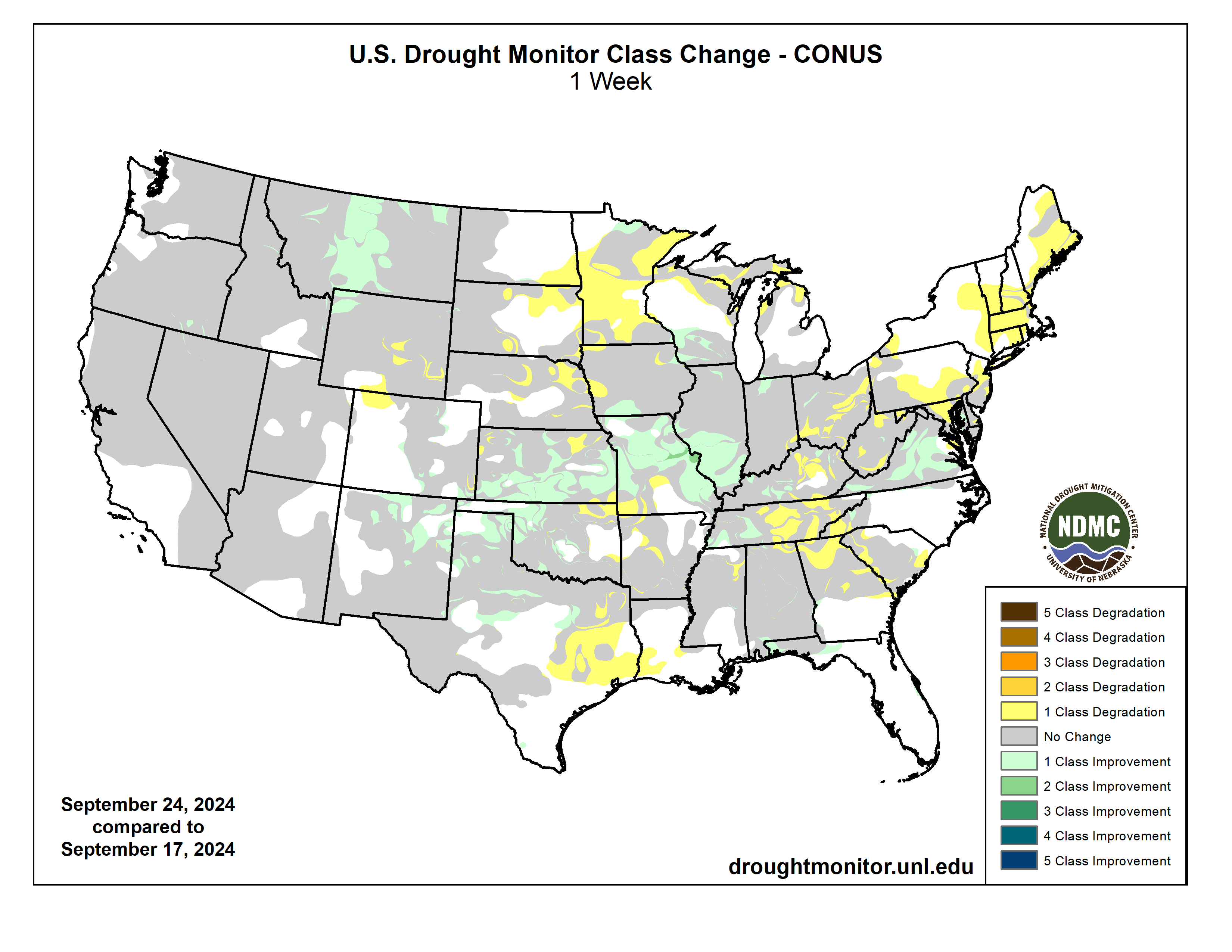
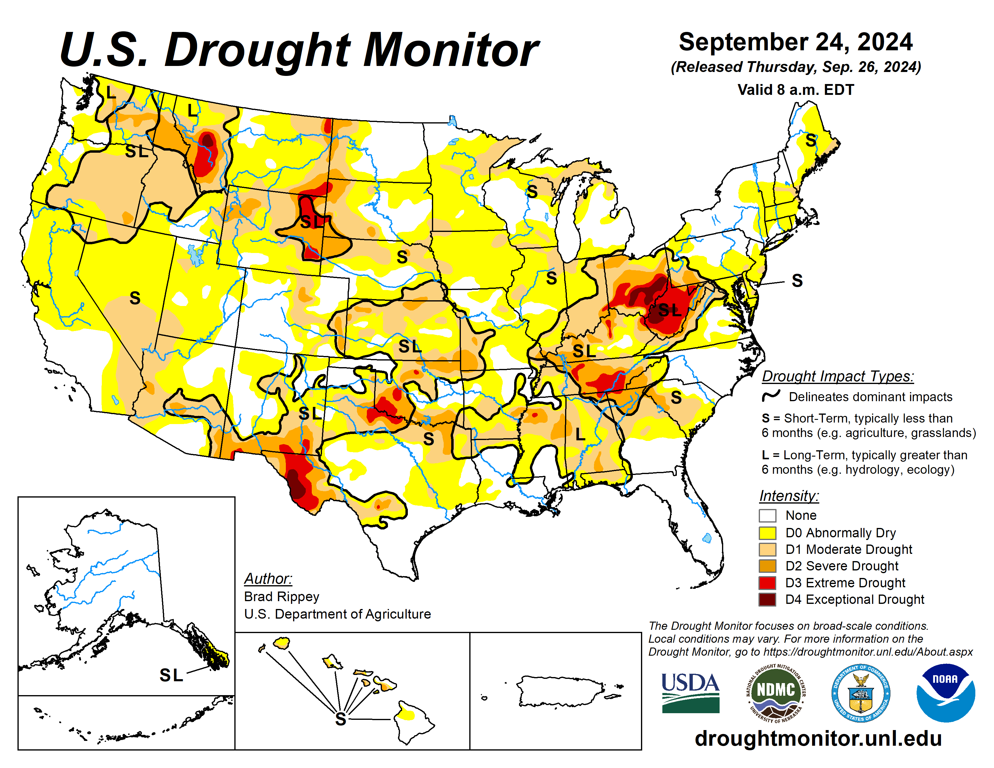
This Week’s Drought Summary
Following the previous drought-monitoring period’s extensive rainfall associated with Hurricane Francine and Potential Tropical Cyclone Eight, drought-easing precipitation developed farther west, across portions of the central and southern Plains and the middle Mississippi Valley. Another area of significant precipitation fell across the northern High Plains and environs, including parts of Montana. However, large sections of the country remained dry, with worsening drought conditions. Some of the most notable increases in the coverage of dryness and drought occurred in the upper Midwest and the Northeast, as well as parts of the western Gulf Coast region and the interior Southeast. Nationally, nearly one-half (45%) of the rangeland and pastures were rated in very poor to poor condition on September 22, according to the U.S. Department of Agriculture, up from an early-summer minimum of 19%…
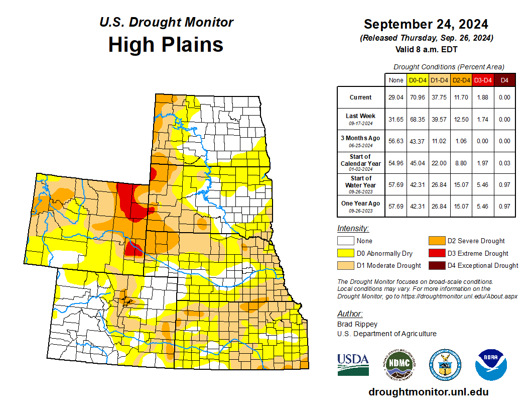
High Plains
Aside from Kansas, where rainfall provided widespread drought relief, most of the High Plains experienced unchanged or worsening drought conditions. On September 22, topsoil moisture rated very short to short ranged from 29% in North Dakota to 84% in Wyoming, with values also above 50% in Colorado, Kansas, and Nebraska. Wyoming led the region on that date with 68% of its rangeland and pastures rated very poor to poor, followed by South Dakota at 44%…
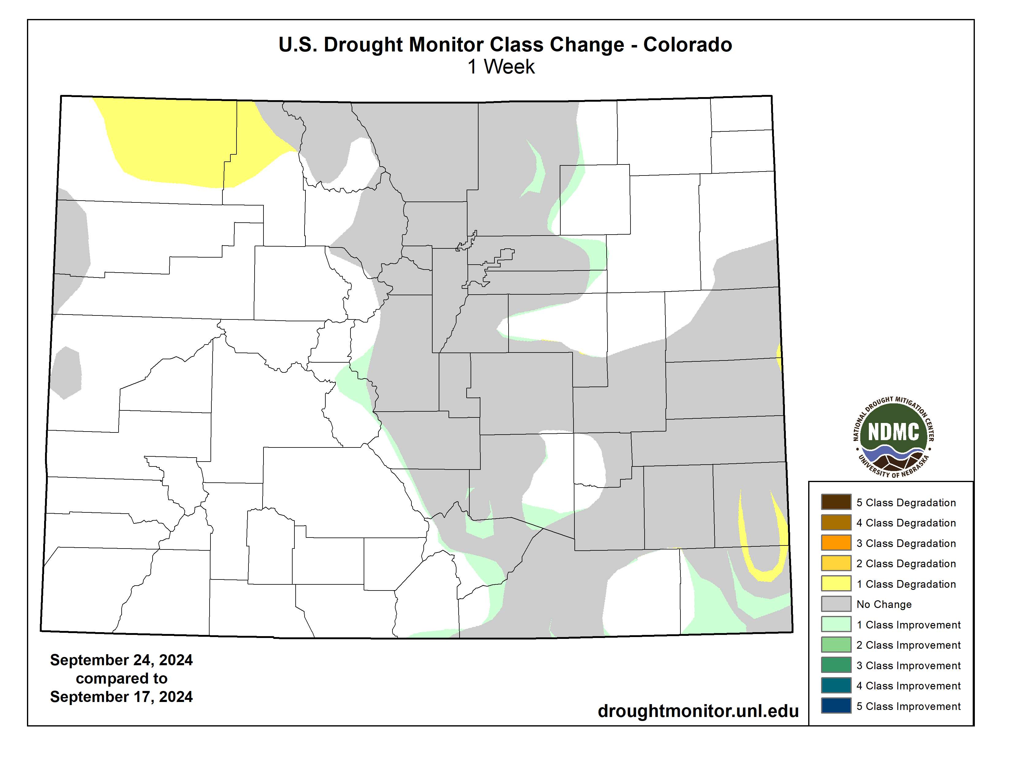
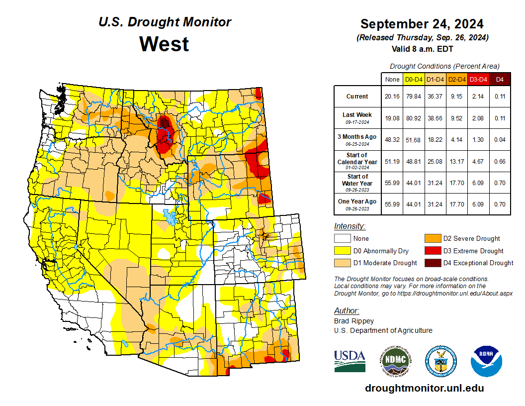
West
There were only minor changes in the Western drought depiction, aside from improvement due to heavy precipitation in parts of Montana. Dry conditions remained a concern in many areas, with statewide topsoil moisture rated very short to short on September 22 as high as 84% in Montana and 74% in Oregon. Northwestern rangeland and pastures remained largely in terrible shape, following a hot, dry summer, and by September 22 were rated more than 60% very poor to poor in Montana, Oregon, Washington, and Wyoming. Dry conditions also favored winter wheat seeding, with Washington leading the nation on September 22 with 54% of its intended acreage planted…
South
The South remained an odd mix of drought improvement and deterioration. Tennessee and Texas were notable for seeing large drought changes in both directions, with Tennessee noting drought deterioration in central and eastern areas and improvement in the west. Similarly, Texas saw improvement in some northern and central areas, along with a large expansion of abnormal dryness (D0) in the east-central part of the state. Oklahoma led the region on September 22 with statewide topsoil moisture rated 57% very short to short, followed by Texas and Tennessee both at 49%. Meanwhile, at least one-half of the rangeland and pastures were rated in very poor to poor condition in Tennessee (53%) and Texas (50%). Texas also led the U.S. with 48% of its cotton rated in very poor to poor condition on that date, well above the national value of 33%…
Looking Ahead
Hurricane Helene is forecast to strike Florida’s Big Bend late Thursday, with an intensity and pre-landfall path similar to that observed with Category 3 Hurricane Idalia, on August 30, 2023. Less than 2 months ago, Category 1 Hurricane Debby also moved ashore in the same general area of Florida. With Helene, a potentially catastrophic storm surge may occur along and to the east of where the eye crosses the Gulf Coast, with notable surge-related impacts also expected along the west coast of Florida’s peninsula. In addition, a significant inland push of hurricane-force winds (74 mph or greater) is expected across north-central Florida and southwestern Georgia, with likely impacts on timber and crops such as cotton and pecans. Damaging winds could reach higher elevations of the southern Appalachians. After punching inland, Helene should veer northwestward and decelerate due to interaction with a disturbance over the lower Mississippi Valley, heightening the risk of Southeastern flooding. Storm-total rainfall could broadly reach 6 to 12 inches, with locally higher amounts. During the next 5 days, much of the remainder of the country will experience warm, dry weather, ideal for summer crop maturation and harvesting, as well as winter wheat planting. However, lack of soil moisture for the establishment of winter grains and cover crops will remain a concern in drought-affected areas.
The NWS 6- to 10-day outlook for October 1 – 5 calls for near- or above-normal temperatures nationwide, with the Southwest having the greatest likelihood of experiencing warm weather. Meanwhile, near- or below-normal precipitation across much of the country should contrast with wetter-than-normal weather a few areas, including western Washington, peninsular Florida, and much of the Northeast.