
Click on a thumbnail graphic to view a gallery of drought data from the US Drought Monitor website.

Click the link to go to the US Drought Monitor website. Here’s an excerpt:
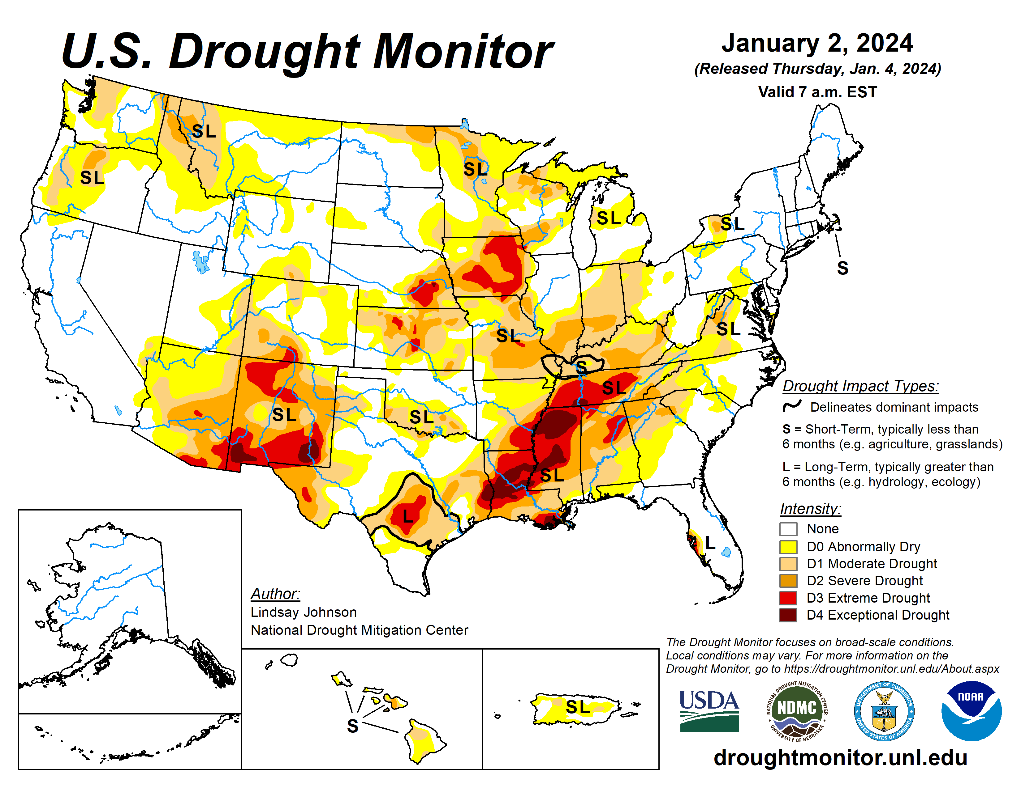
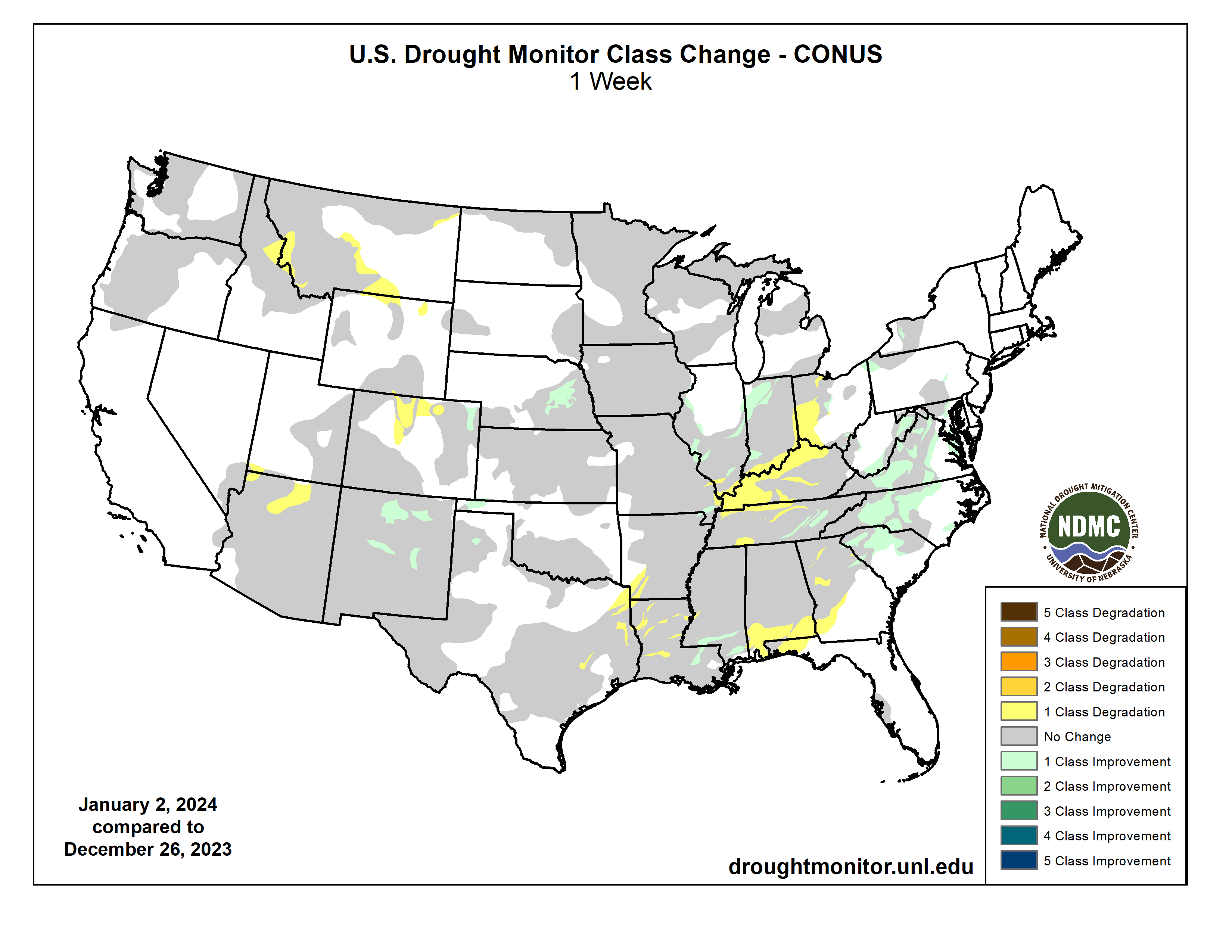
This Week’s Drought Summary
A large storm system brought rain and snow to the Pacific and Atlantic coasts along with rain and snow in the eastern High Plains and Midwest. The Northeast remained largely unchanged from last week, with minor improvements in western New York, Pennsylvania and central Maryland where precipitation was 150% to 300% of normal. Further south along the Mid-Atlantic, 150% to 300% of normal precipitation fell, bringing improvements in Virgina, North Carolina and South Carolina. The southern part of the Southeast did not benefit from any of the precipitation that fell elsewhere along the Atlantic coast, bringing further degradations to an already very dry part of the country. The South remained the same as last week, with small areas of deterioration from northeast Texas into southwestern Arkansas, and north and central Louisiana.
A small part of southeastern Louisiana and southern Mississippi saw minor improvements. The High Plains benefited from a rain and snow weather system that moved through the area before the new year. Northeastern Colorado into eastern Nebraska had some improvement. Northern Colorado and Wyoming experienced deterioration without the benefit of the precipitation that fell further east and low snow water equivalent (SWE). The north-central Midwest had some improvements from the same storm that benefited the High Plains. Central, eastern and southern Midwest largely missed precipitation, causing deterioration in eastern Ohio, southern Indiana and Illinois, and eastern and northern Kentucky where groundwater and streamflow remain low. The West saw few improvements, except for New Mexico. Lack of precipitation and low SWE in higher elevations have left areas of Montana and Arizona worse off than last week…
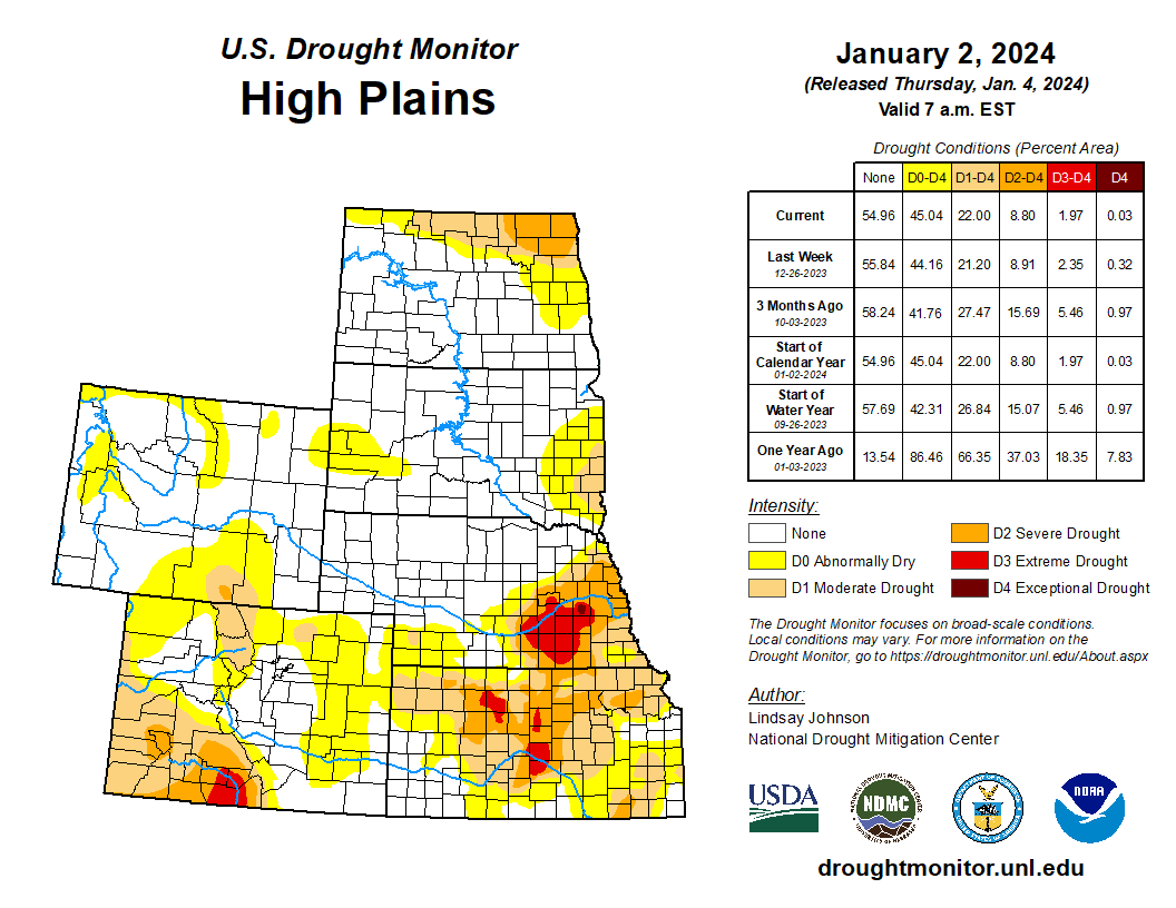
High Plains
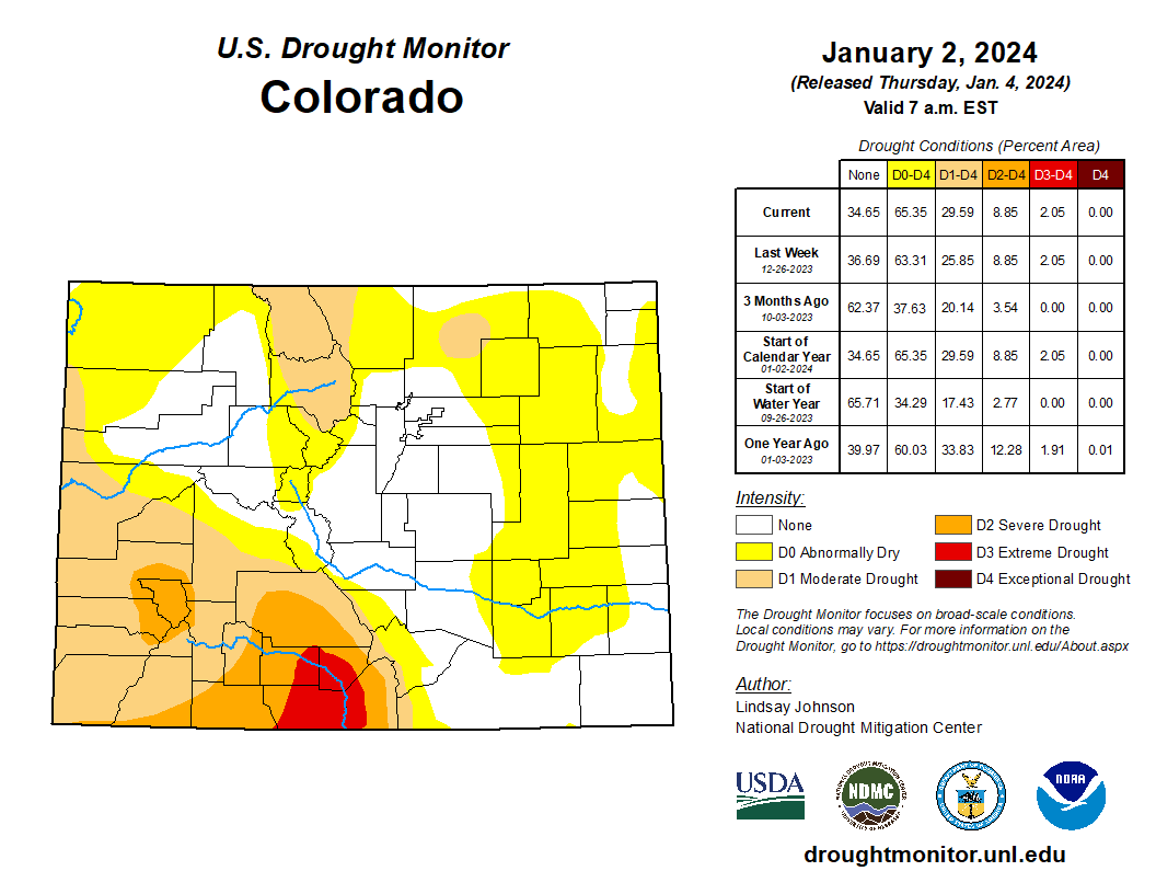
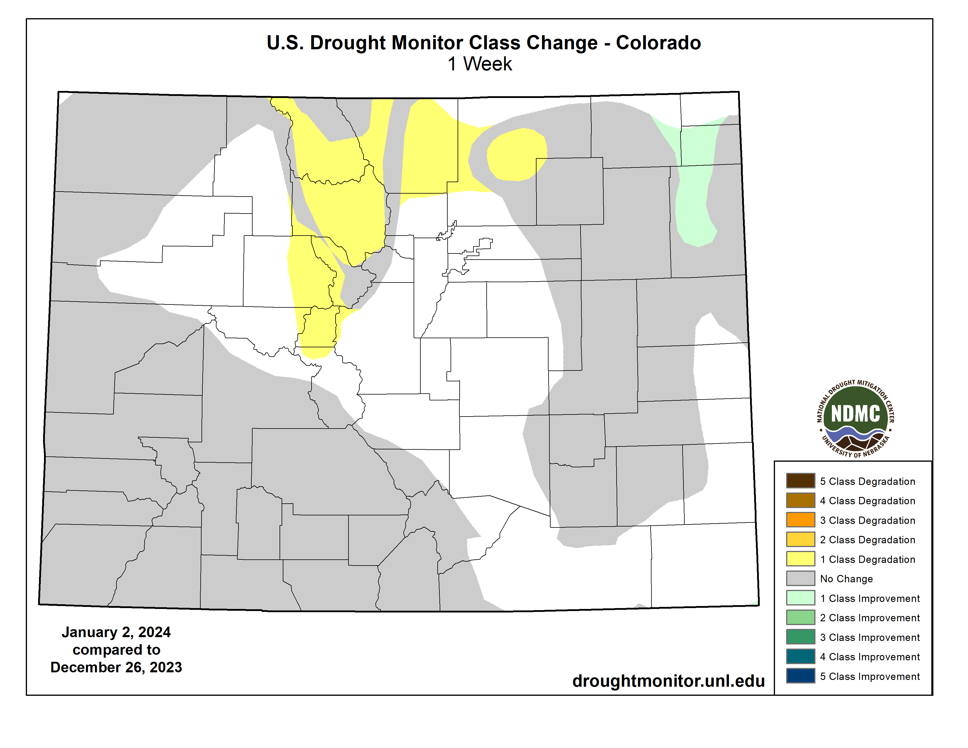
A weather system bringing rain and snow moved through the High Plains midweek last week. Central and northern states experienced up to 400% of normal precipitation. Northeastern Colorado and eastern Colorado saw improvements in Exceptional (D4), Extreme (D3), and Severe (D2) drought conditions. These improvements are a continuation of improvements seen last week. The weather system that brought improvements to much of the High Plains largely missed north-central Colorado. Conditions worsened, introducing abnormal dryness and degrading from Abnormally Dry (D0) to Moderate Drought (D1). Northern Wyoming experienced similar conditions to Montana, leading to small Abnormally Dry (D0) and Moderate Drought (D1) expansions along the northern border with Montana…
West
Much of the West remains status quo for the week. Precipitation fell across much of the Pacific coast from Vancouver southward into central California. Montana has not benefitted from the recent precipitation, causing small degradations along its border with Idaho, Wyoming and North Dakota. Precipitation continues to miss Arizona, mainly the north. Over the past few months Abnormal Dry (D0) conditions expanded northward into southern Utah. New Mexico did see improvements in Extreme (D3), Severe (D2) and Moderate (D1) drought conditions in the interior northwest…
South
Little reprieve occurred across much of the South, with only 5% of normal precipitation falling. Western and central Texas remained unchanged, with a small improvement of Moderate Drought (D1) to Abnormally Dry (D0) conditions in the Panhandle. Parts of southeast Louisiana and Mississippi had small improvements with streamflows slightly improving. This is not the case for much of the South where short- and now long-term conditions continue to decline. Streamflow and groundwater continue to counteract what precipitation is received. Eastern Texas into western Louisiana and southwestern Arkansas saw 1-category degradations for all drought categories. Central Louisiana had Extreme drought (D4) conditions expand northward into Catahoula, Winn, Richland and Concordia parishes. Moderate Drought (D1) in northwest Louisiana extended west into eastern Texas and southwestern Arkansas. Mississippi stayed largely unchanged aside from the slight reduction of Moderate Drought (D1) in the far south. Tennessee saw improvements in the east, with improving soil moisture and benefits from the precipitation experienced in the Mid-Atlantic region. Central and eastern Tennessee, on the other hand, saw Severe Drought (D2) expand northward into Kentucky. Exceptional Drought (D4) was introduced in the South at the tri-boundary with Mississippi and Alabama due to the continued lack of precipitation for the past few months…
Looking Ahead
During the next five days (Jan. 2-7, 2024), more heavy precipitation is expected for the central and northern Pacific coast, with some areas of higher elevation also seeing some moisture. The Gulf Coast and southern Atlantic regions are expected to see heavy precipitation. This centers around southern Louisiana, Mississippi and Alabama.
The National Weather Service Climate Prediction Center’s 6-10 day outlook (valid Jan. 3-9, 2024) favors above-normal precipitation for most of the country, with high probabilities found in the intermountain West, east of the Ohio and Mississippi River Valleys, Alaska and Hawaii. Only southern Texas is expected to have below-normal precipitation. There is an increased probability of below-normal temperatures west of the Rockies, particularly in the southwest. Following the precipitation trend, areas of probable heavy precipitation in the east also have the probability of being warmer than normal. The Northeast has the largest probability of having above-normal temperatures.
Just for grins here’s a slide show of early January US Drought Monitor maps for the past few years.

US Drought Monitor map January 2, 2024. 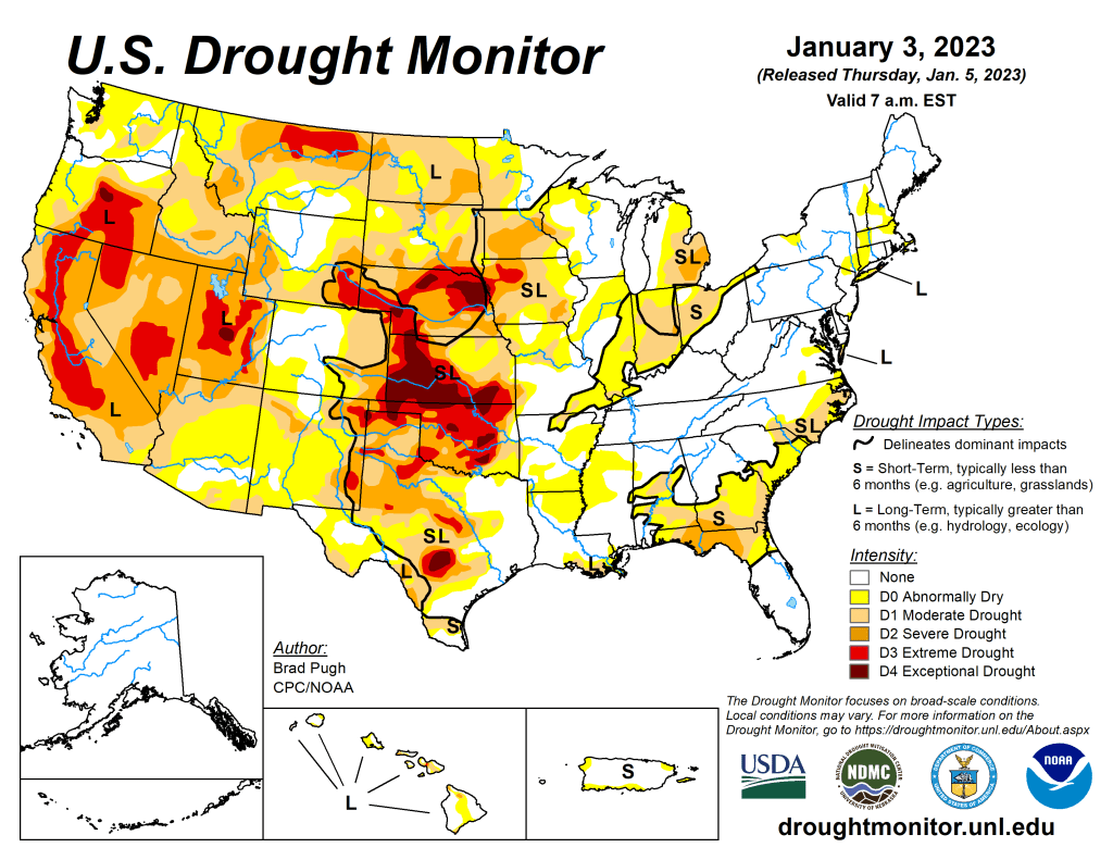
US Drought Monitor map January 3, 2023. 
US Drought Monitor map January 4, 2022. 
US Drought Monitor January 5, 2021. 
US Drought Monitor January 7, 2020. 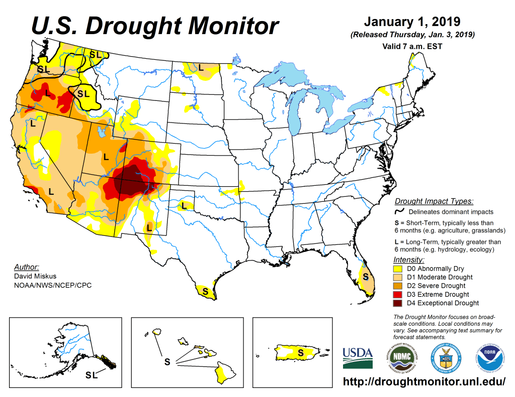
US Drought Monitor January 1, 2019. 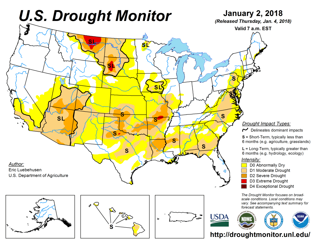
US Drought Monitor January 2, 2018. 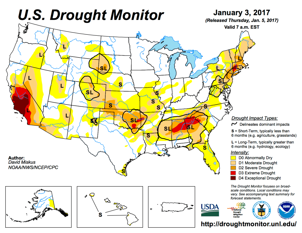
US Drought Monitor January 3, 2017. 
US Drought Monitor January 5, 2016 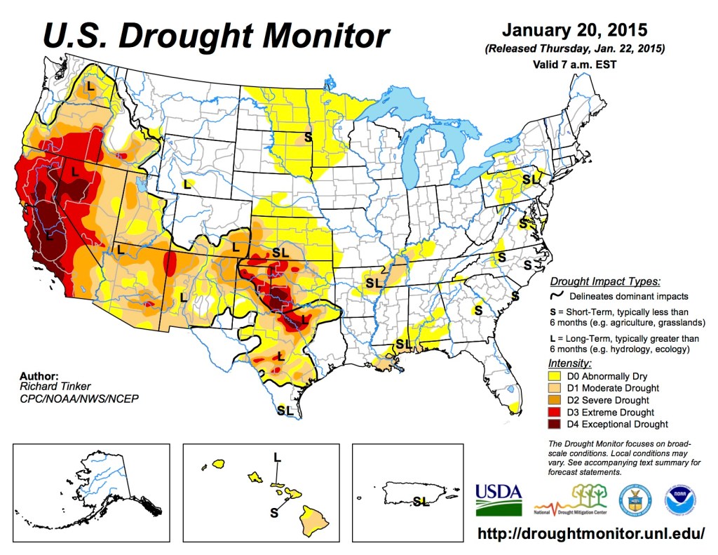
US Drought Monitor January 20, 2015 
US Drought Monitor January 7, 2014 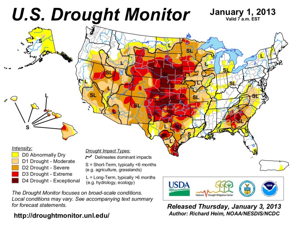
US Drought Monitor January 1, 2013. 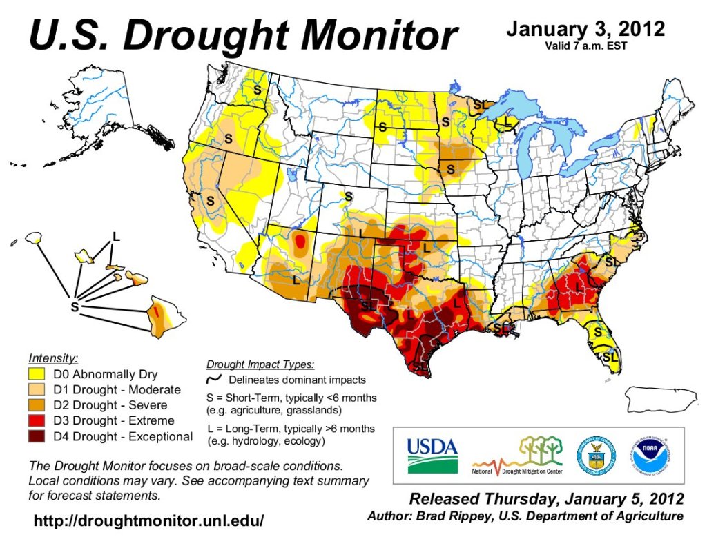
US Drought Monitor January 3, 2012. 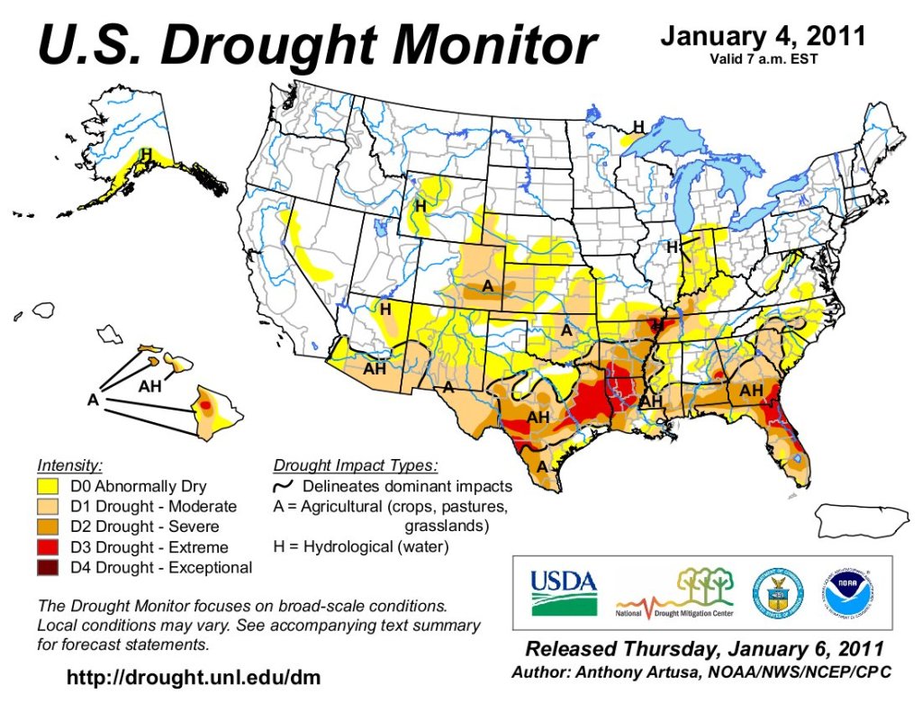
US Drought Monitor January 4, 2011.