Click the link to read the article on the Summit Daily website (Robert Tann). Here’s an excerpt:
January 17, 2024
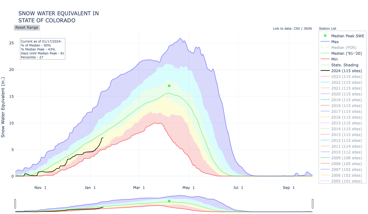
According to data from the U.S. Department of Agriculture, Colorado’s snowpack is at 90% of the 30-year-median as of Tuesday, Jan. 16. It marks a major turnaround from the beginning of the month, when statewide snowpack hovered between 60% and 70% of the median.
“It’s been pretty significant, the jump that we’ve received in the last roughly week or so,” said James Heath, division engineer for the Colorado Division of Water Resources.
Before this past week, “We were tracking alongside some of our worst years for snowpack,” such as 2002, 2012 and 2018, Heath said. But double-digit snowfall, which for some mountain areas translated to multiple feet of snow, caused snowpack levels to surge.
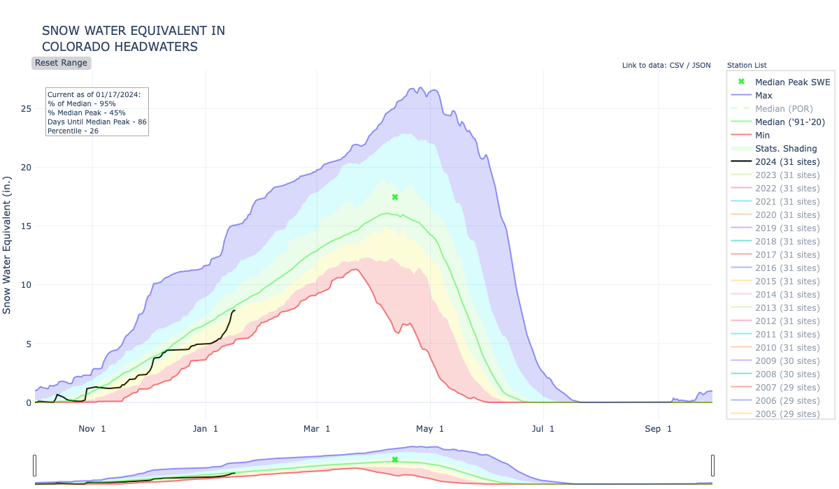
Some regions are trending above the state average, such as the Colorado Headwaters River Basin, which includes central and northern mountain areas. As of Tuesday, the basin was at 96% of the average…Snowpack measures the amount of water held in the snow, which is referred to as the snow water equivalent. In an average season for the Colorado Headwaters, the snow water equivalent will peak at 17.5 inches, representing the amount of water predicted to melt and become runoff in the late spring and early summer. Within the past week, the snowpack netted roughly 2 inches of water, rising from 5.4 inches on Jan. 9 to 7.7 inches on Jan. 16. Tracking the snow water equivalent can be a critical indicator for how full reservoirs will be come summer…
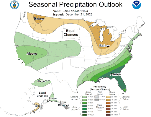
Longer-range forecasts show elevated precipitation in the weeks and months ahead. According to projections from the National Oceanic and Atmospheric Administration, Colorado has a 33% to 40% chance of more precipitation than is usual for the months of January, February and March.