
Click the link to read the article on The Denver Post website (Elise Schmelzer). Here’s an excerpt:
January 22, 2024
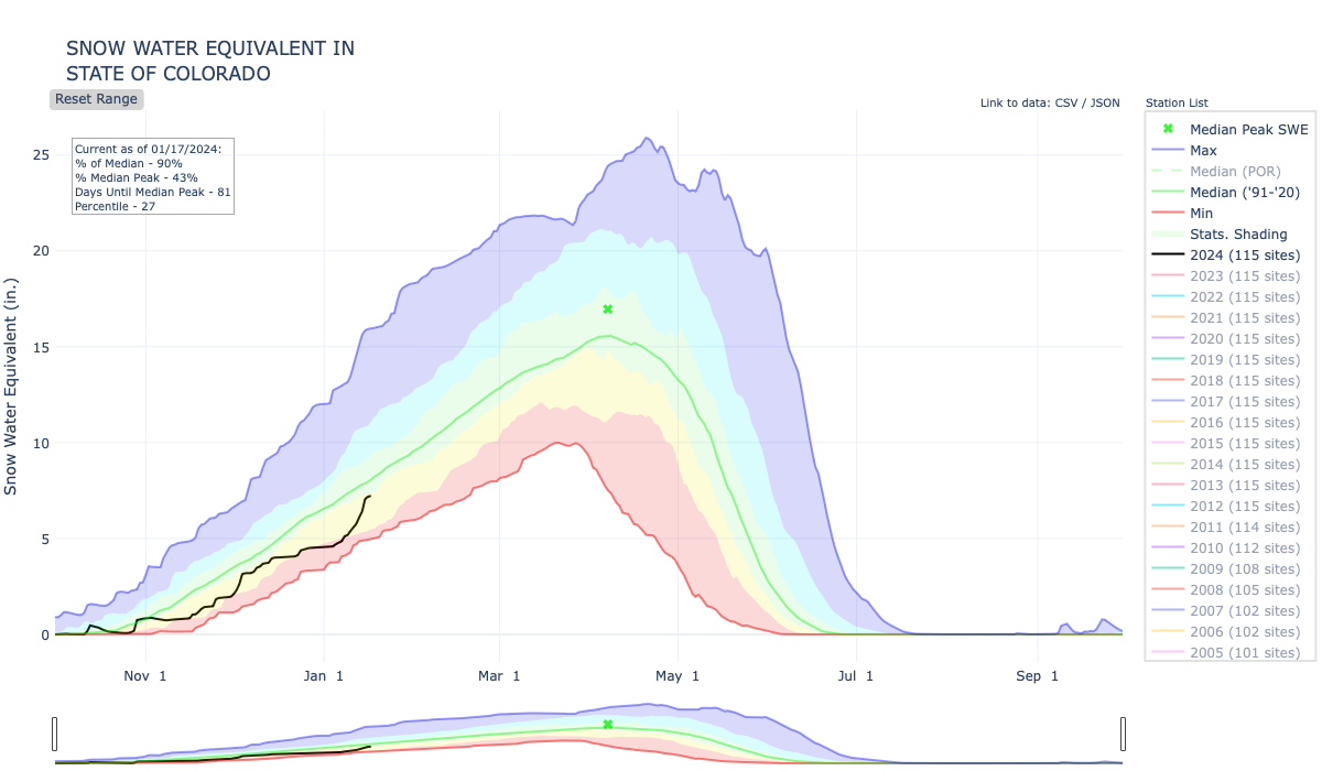
Statewide, the snowpack sat at 92% of the 30-year median on Monday, according to the National Water and Climate Center. That’s a significant improvement from the beginning of January, when the snowpack was sitting at just below 70% of the median. The storms from Jan. 11 to Jan. 15 dumped feet of snow on Colorado’s mountains, finally covering ski slopes that had been patchy with grass and closing highways across the state.
“This was a hugely beneficial storm cycle over the last couple of weeks, both with respect to the water situation and outdoor recreation,” said Russ Schumacher, the state climatologist and the director of the Colorado Climate Center. “Colorado looks a lot better than it did a couple of weeks ago.”
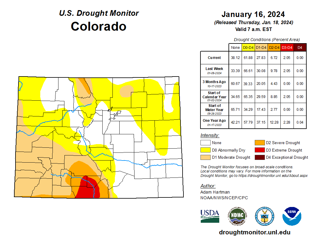
Sixty-two percent of the state was in drought last week, according to the most recent data released by the U.S. Drought Monitor. That’s a slight improvement from 67% before the storms…Not all areas of the state are faring the same. While the snowpack in the Yampa and South Platte river basins are sitting at 98% of median levels, the amount of snow in the Upper Rio Grande basin is at 69% and the snowpack in the San Juan basin is at 80% of median…A swath of land in southern Colorado — including Conejos, Costilla, Rio Grande and Alamosa counties — remained in severe or extreme drought, representing 9% of the state.

The snowpack in the Colorado River headwaters measured 99% of the median on Monday.