#Colorado Parks & Wildlife provides update on the discovery of zebra mussel veligers in the #ColoradoRiver and Government Highline Canal #COriver

Mark Harris, General Manager of the Grand Valley Water Users Association, checks on the entrance to Tunnel 3, where water in the Government Highline Canal goes through the mountain to Palisade, continuing to Grand County. Photo credit: Bethany Blitz/Aspen Journalism

Click the link to read the release on the Colorado Parks & Wildlife website (Rachael Gonzales)

July 26, 2024

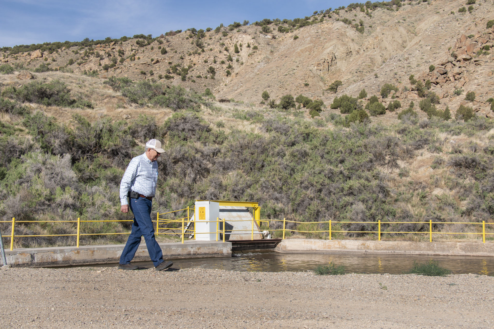
Colorado Parks and Wildlife (CPW) announces additional zebra mussel veligers found in the Colorado River and Government Highline Canal after increased testing. With these additional detections, both the Highline Government Canal and the Colorado River meet the criteria for being considered “positive” for zebra mussels.

After the discovery of zebra mussels in the Government Highline Canal and Colorado River, CPW initiated an Invasive Species Rapid Response Plan and increased sampling efforts in the Colorado River from Glenwood Springs down to the Colorado/Utah border and within the Highline Government Canal. 

Through these sampling efforts, one additional zebra mussel veliger was discovered and confirmed in the Government Highline Canal and two additional veligers were discovered and confirmed in the Colorado River at two separate locations between Deb Beque and Grand Junction. There have been no veligers found upstream of the Beavertail Mountain Tunnel in the De Beque Canyon nor have any adult mussels been found in the Colorado River or the Government Highline Canal.

“These results will help guide us on the next steps as we continue working closely with our partners to work on a plan to protect our natural resources and infrastructure crucial to the Grand Valley, including our goal of locating the source,” said CPW Director Jeff Davis.

CPW Aquatic Nuisance Species (ANS) and Northwest Region aquatics staff, along with our partners at the U.S. Fish and Wildlife Upper Colorado Native Fish Recovery Program and U.S. Bureau of Reclamation will continue sampling efforts in the Colorado River and Grand Valley canal systems over the next several weeks. The goal of these efforts is to locate the source of the zebra mussel veligers.

In addition to sampling, CPW continues the increased education efforts on the Colorado River, including voluntary watercraft inspections. From Friday, July, 19 through Sunday, July 21, CPW worked with our local government and the BLM partners to post signage and conduct education outreach at multiple water access points from the De Beque boat ramp to the Westwater boat ramp in Utah. During this three-day operation, ANS and Grand Junction area parks and wildlife staff talked to close to 600 people regarding the importance of cleaning, draining, and drying their watercraft and equipment. 

CPW is continuing to evaluate options for the future management of Highline Lake based on this new information. Updates regarding access, fishing regulations, and water management will be provided once those decisions have been made.

The #EagleRiver Water & Sanitation District and Upper Eagle Regional Water Authority decline to participate in another #PFAS settlement — The #Vail Daily

Eagle River Basin

Click the link to read the article on the Vail Daily website (Zoe Goldstein). Here’s an excerpt:

July 28, 2024

Little is known about the full impact of so-called ‘forever chemicals,’ and settlement would prevent participants from suing in the future

In the fall, the district and authority declined to participate in two PFAS-related settlements. Last month, district staff received information about a new settlement the district and authority could elect to participate in, with similar terms to those in the fall, and lower compensation. During their regular meetings on Thursday, July 25, the district and authority boards reviewed and declined the new settlement proposal, and authorized district staff to make decisions about similar settlements going forward…

The district and authority have conducted three studies to sample the water they provide for PFAS over the last five years. Data from the most recent study, conducted in 2023, shows that PFAS have been detected in five out of 11 of the two water providers’ sources, with four detections within the authority, and one in the district. All five detections were below the maximum contaminant level of four parts per trillion. For reference, one part per trillion is the equivalent of one drop of water in 20 Olympic-sized swimming pools…

Part of the challenge of sampling for PFAS is that technology has not caught up to the chemicals — though there are thousands of PFAS chemicals, only 29 can currently be detected. At the moment, not all labs in the United States can test for PFAS, and the testing is very expensive. The district and authority will next sample for PFAS in 2025.

San Miguel County Commissioners support preserving Shoshone water rights: #ColoradoRiver Water Conservation District working to ensure water stays in the river — The #Telluride Daily Planet #COriver #aridification

View of Shoshone Hydroelectric Plant construction in Glenwood Canyon (Garfield County) Colorado; shows the Colorado River, the dam, sheds, a footbridge, and the workmen’s camp. Creator: McClure, Louis Charles, 1867-1957. Credit: Denver Public Library Digital Collections

Click the link to read the article on the Telluride Daily Planet website (Sophie Stuber). Here’s an excerpt:

July 27, 2024

The San Miguel Board of County Commissioners (BOCC) voted on Wednesday, July 24, to sign onto the Western District (Colorado Counties) letter to preserve Shoshone water rights. The letter, addressed to Colorado Senators Michael Bennet and John Hickenlooper, is in support of the Colorado River Water Conservation District’s aim to acquire and permanently protect the Shoshone water rights. The Shoshone Power Plant, off Interstate 70 near Glenwood Springs, possesses the oldest senior water rights directly on the Colorado River in Colorado. The plant generates 15 megawatts of electricity. This flow from Shoshone is critical in helping avoid low water levels further down the river…

The Colorado River Water Conservation District has spent more than 20 years fighting to permanently preserve the Shoshone water flow along with a coalition of western Colorado governments and water entities.

At the end of 2023, the Colorado River Water Conservation District and Xcel Energy formalized an agreement for the district to buy water rights for the Shoshone Power Plant from Xcel if the group was able to secure $99 million in funding. The agreement is part of a decades-long effort to help establish stable water flows below the power plant and to the Utah border…With the agreement, Colorado River Water Conservation District will own the water rights and lease them back to Xcel to create hydroelectric power…Colorado River Water Conservation District is also working to ensure that Shoshone’s water stays in the river and is not diverted even when the power plant is not generating hydropower. The district is in negotiations with the Colorado Water Conservation Board. Even after reaching an agreement between the district, the board and Xcel Energy, the case will still have to go through court to legally update the water rights.

New data enters #ColoradoRiver negotiations — #Aspen Daily News #COriver #aridification

Water from the Roaring Fork River basin heading east out of the end of the Twin Lakes Tunnel (June 2016), which is operated by the Twin Lakes Reservoir and Canal Co., a member of the Front Range Water Council. Photo: Brent Gardner-Smith/Aspen Journalism

Click the link to read the article on the Aspen Daily News website (Austin Corona). Here’s an excerpt:

July 28, 2024

Two prominent water researchers and the state of Colorado disagree on the significance of new water use data published by the federal government in June. The state claims the data confirms its argument that headwaters states use less Colorado River water during dry years. Meanwhile, former Colorado River Water Conservation District general manager Eric Kuhn and Utah State University professor Jack Schmidt say the data paints a more complex picture.

“Reclamation has worked extremely hard to bring the best cutting-edge science they can to a better and more accurate estimate of agricultural water use,” Schmidt said. “It’s just that the relationships that arise from better data are just as murky.” 

The June data details the “consumptive” water use by “Upper Basin” states (Colorado, New Mexico, Utah and Wyoming) since 1971. It is meant to quantify all the water those four states have consumed in that period (see footnote * at story’s end). The Bureau of Reclamation, the federal agency that manages most of the large dams on the Colorado River, has updated the data in five-year reports since 1971, but June’s report is different. This time, the bureau collected the data using a new methodology.  The results are notable — past data seemed to indicate that Colorado and other Upper Basin states used more Colorado River water during dry years, directly contradicting Colorado’s arguments about its use. According to the state, the new data corrects that inconsistency. This conclusion could be vitally important for Upper Basin states. The relationship between the Upper Basin’s water use and the natural water supply is a central component of its position in interstate negotiations over the river…

Located at the river’s headwaters, Colorado and other Upper Basin states argue that they already take “natural” water cuts in dry years. Without a large upstream reservoir to fall back on, these states say they rely heavily on yearly precipitation for their water supply, meaning drought years are already tough…The argument foundered on the fact that the reclamation bureau’s consumptive use data didn’t support it. In 2022, three notable water researchers — Kuhn, Schmidt and University of New Mexico professor John Fleck — published a blog post laying out the disconnect between the federal government’s numbers and Colorado’s claims. In their piece, the three researchers wrote that while certain parts of the Upper Basin certainly cut their use in dry years, the basin’s overall use did not reflect that anecdotal reality…

*** One way for the Upper Basin states to make their case stronger is to change the way the Bureau of Reclamation accounts for consumptive use in transmountain diversions, or TMDs — the tunnels that carry water from inside the Colorado River Basin to cities and farms outside the basin (there are two that take water out of the Roaring Fork watershed and send it to the Front Range). There is a gray area in which the actual “consumption” takes place for TMDs that have storage reservoirs at their intakes. Colorado and Upper Basin states would like to say consumption occurs when they take water from the river system and put it in the reservoirs while the reclamation bureau currently sees consumption occurring when the water leaves the reservoir and enters the tunnel. Using the Upper Basin states’ preferred method, the basin’s consumptive use changes to 4.5 million acre-feet in wet years, 4.1 in average years and 3.9 in dry years, making a much stronger case for the argument that the basin uses less in dry years.