Click the link to read the assessment on the Western Water Assessment website:
May 13, 2026 – CO, UT, WY
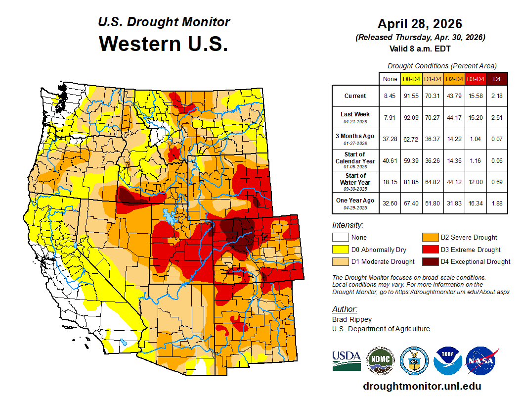
The region generally experienced drier conditions east of the Continental Divide, and wetter conditions west of the Divide in April. Temperatures were near to above average for most of the region. As of May 1, statewide percent median SWE was 18% in Colorado, 22% in Utah, and 44% in Wyoming. Regional streamflow volume forecasts are below to much below average, with 13% of average inflow forecasted for Lake Powell. Drought conditions cover 99% of the region as of April 28. ENSO forecasts predict an 88% chance of El Niño conditions developing during May-July and continuing through the end of 2026.
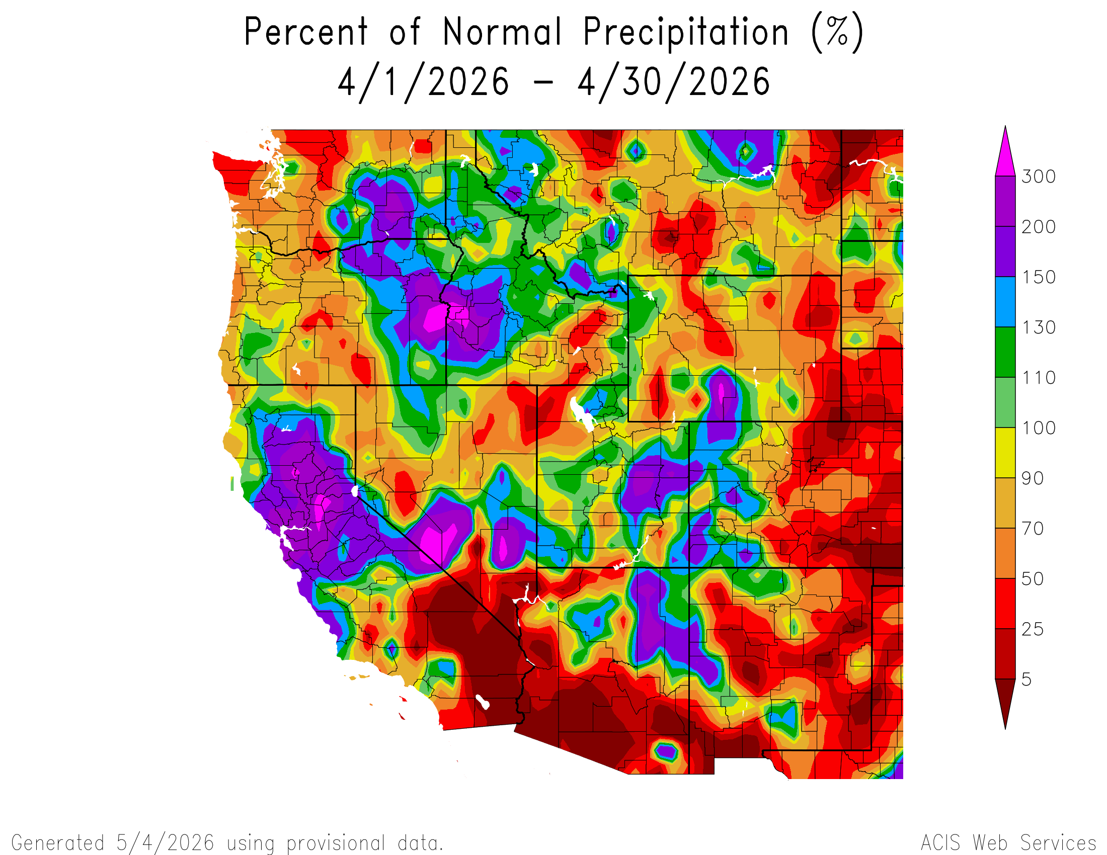
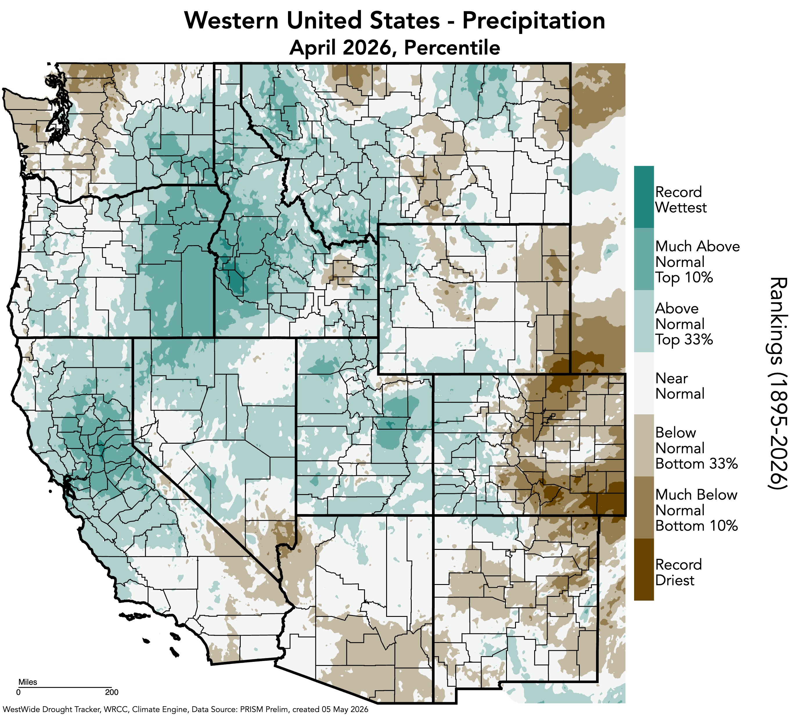
Regional precipitation was variable in April, ranging from below average conditions in eastern Colorado and much of Wyoming to above average conditions in western Colorado, much of Utah, and south-central Wyoming. Much below average April precipitation occurred in eastern Colorado, northwestern Utah, and eastern and western Wyoming, with large pockets of less than 25% of average conditions in southeastern Colorado and southeastern Wyoming into northeastern Colorado. Record-dry conditions occurred in southeastern and northeastern Colorado, and southeastern Wyoming. Record-wet conditions occurred in Carbon County, Utah.
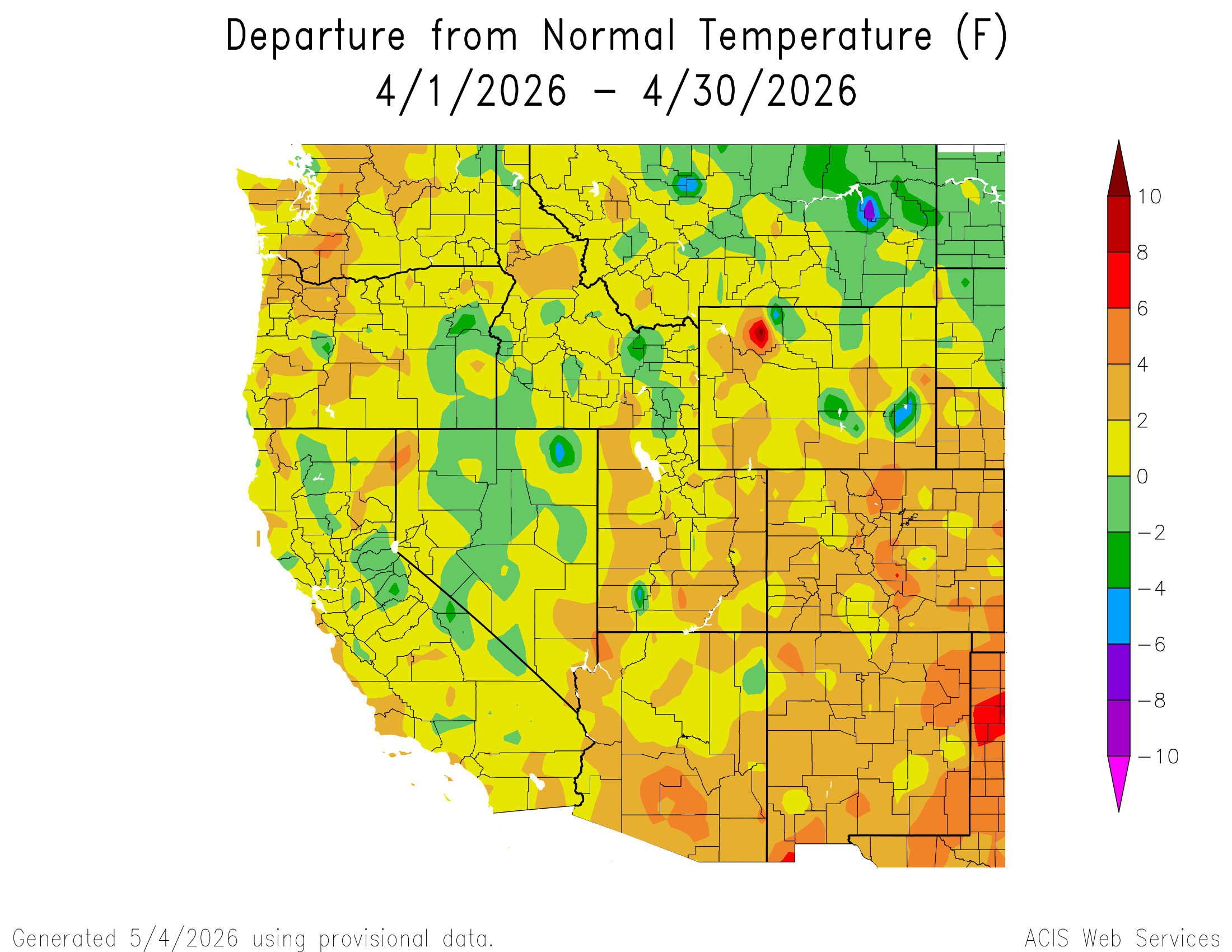
Regional temperatures were near to above average in April. Much of Colorado, Utah, and southern and western Wyoming experienced 2-4°F above average temperatures, with pockets of 4-6°F above average temperatures along the northern and southern Front Range of Colorado, and in eastern Colorado. A few pockets of 2 to 4°F below average temperatures occurred in northwestern and southeastern Wyoming, and one pocket in southwestern Utah, and one area of 4 to 6°F below average temperatures occurred in Platte County, Wyoming.

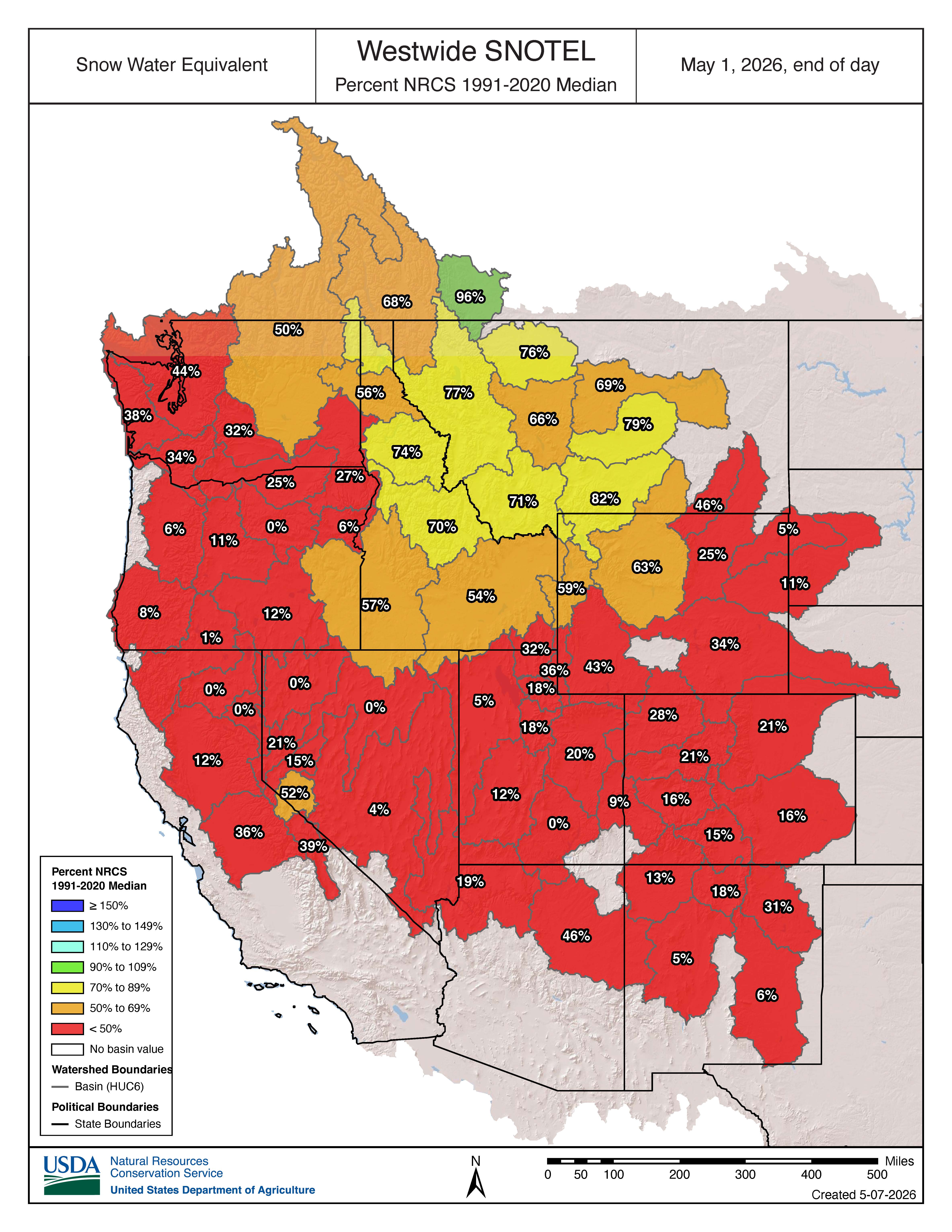
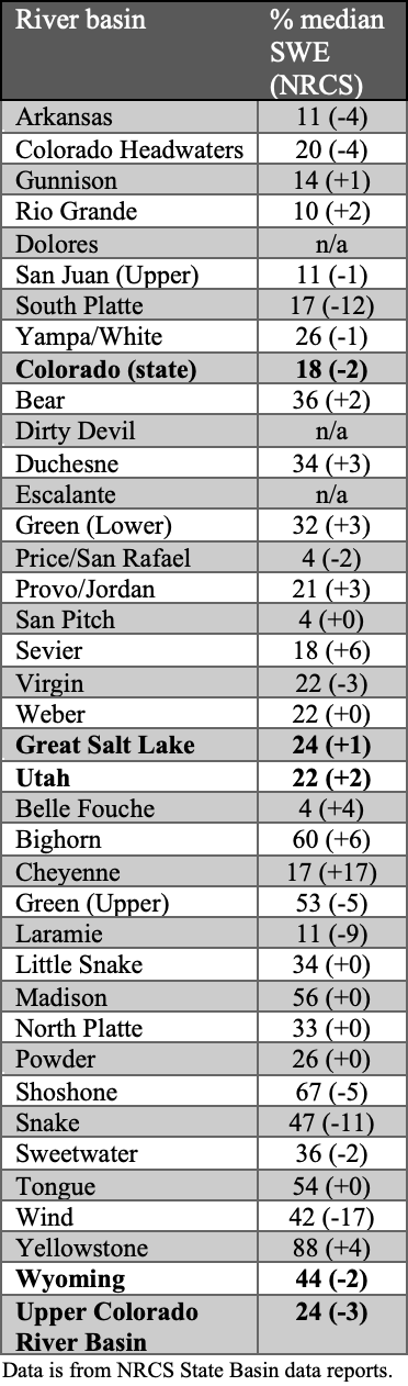
Below to much below normal snow-water equivalent (SWE) continues throughout the region as of May 1. All river basins in Colorado, Utah, and eastern Wyoming observed 50% or less of normal SWE. The only river basins with above 50% of normal SWE were in western Wyoming, including the Yellowstone (88%), Shoshone (67%), Big Horn (60%), Madison (56%), Tongue (54%), and Upper Green (53%) River Basins. The Dolores River Basin in Colorado and the Dirty Devil and Escalante River Basins in Utah have melted out as of May 1. As of May 1, statewide percent median SWE was 18% in Colorado, 22% in Utah, and 44% in Wyoming. Peak SWE was observed on March 12 for Colorado (51% of median peak), March 9 for Utah (52% of median peak), and March 17 for Wyoming (69% of median peak)
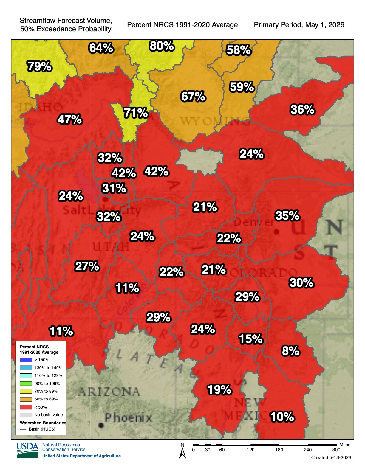
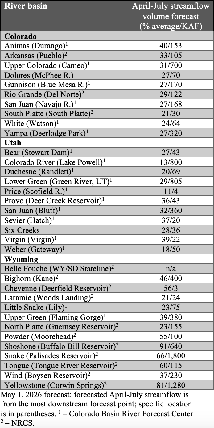
Seasonal streamflow volume forecasts for all river basins in the region are below to much below average. In Colorado, seasonal streamflow volume forecasts suggest 20-40% of average runoff for all major river basins. In Utah, seasonal streamflow volume forecasts suggest 10-40% of average runoff for all major river basins. In Wyoming, streamflow forecasts were more variable, with a near average forecast for the Shoshone River Basin (91%), below average forecasts for the Yellowstone (81%), Snake (66%), Tongue (60%), Cheyenne (56%), and Powder (55%) River Basins, and forecasts below 50% of average in the remaining major river basins. Much below average inflow is forecasted for many regional reservoirs, including Flaming Gorge (39%), Boysen (37%), Deer Creek (36%), Navajo (27%), McPhee (27%), Blue Mesa (27%), Guernsey (23%), and Lake Powell (13%).

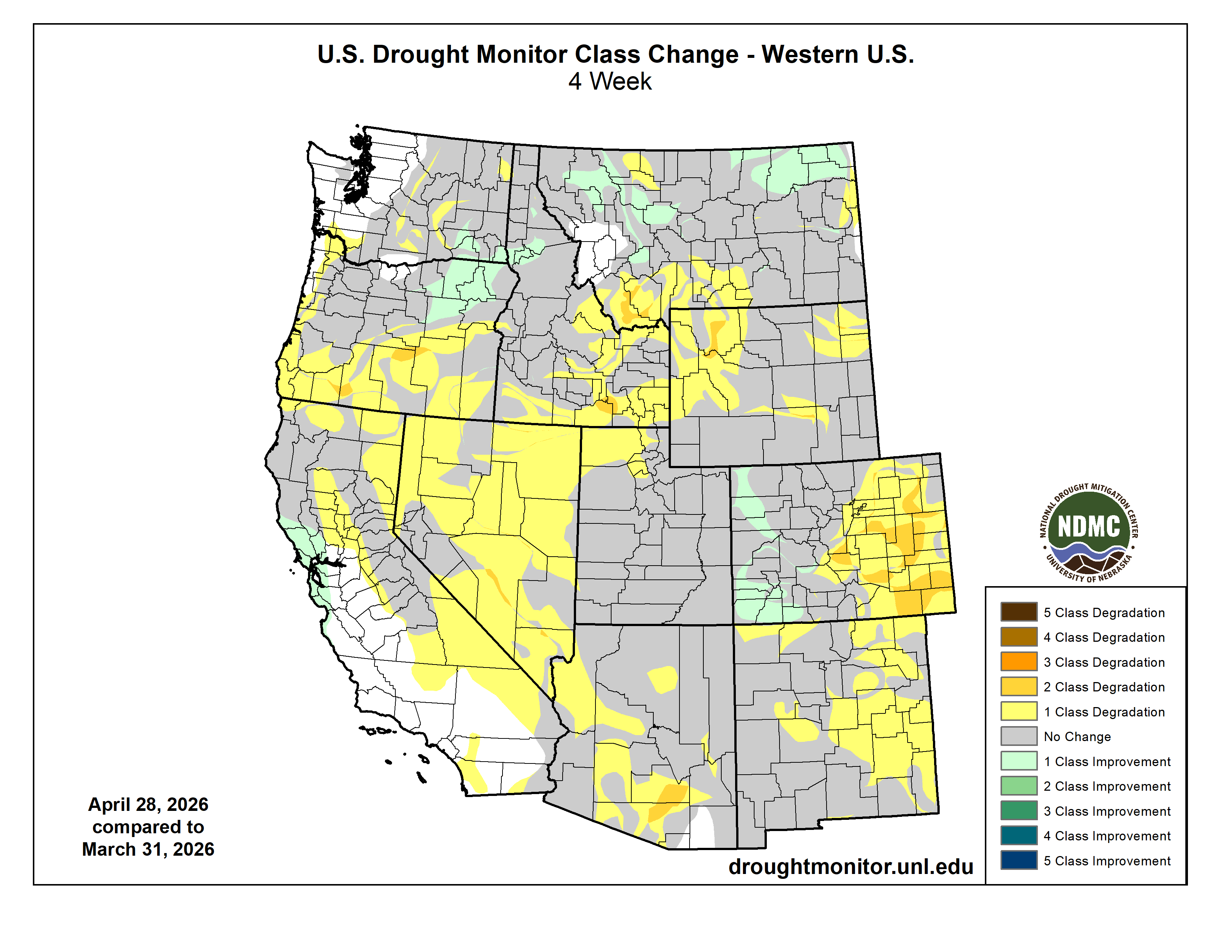
Regional drought coverage increased during April and covered 99% of the region by April 28 (drought covered 93% of the region on March 31). Drought conditions deteriorated in Colorado, where moderate (D1) drought now covers the entire state, severe (D2) drought coverage increased by 25%, and extreme (D3) drought coverage increased by 10%. In Utah, D1 drought still covers the entire state, and D2 drought coverage increased by 10%. In Wyoming, D1 drought coverage increased by 6%, D2 drought coverage increased by 17%, and D3 drought coverage increased by 5%. Exceptional (D4) drought coverage decreased by 4% in the West Slope of Colorado.
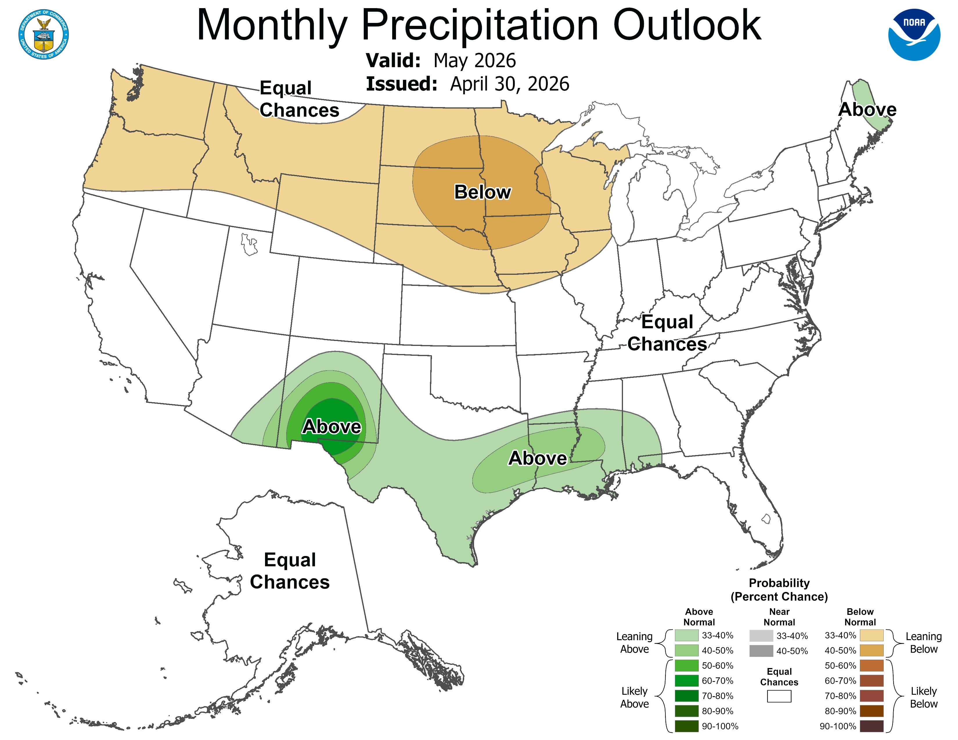
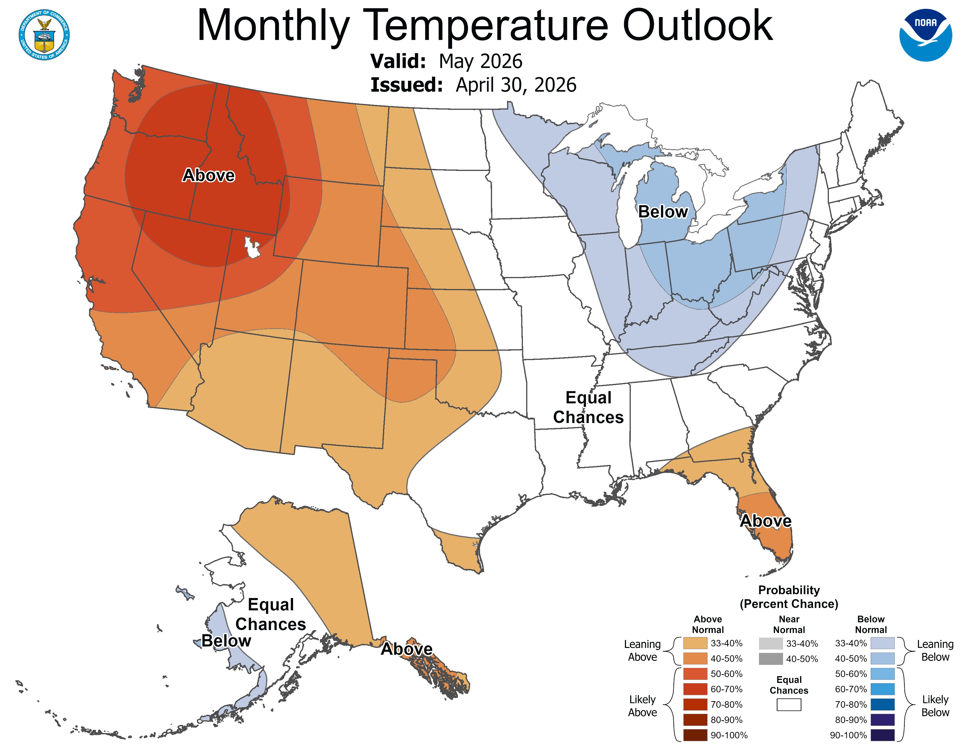
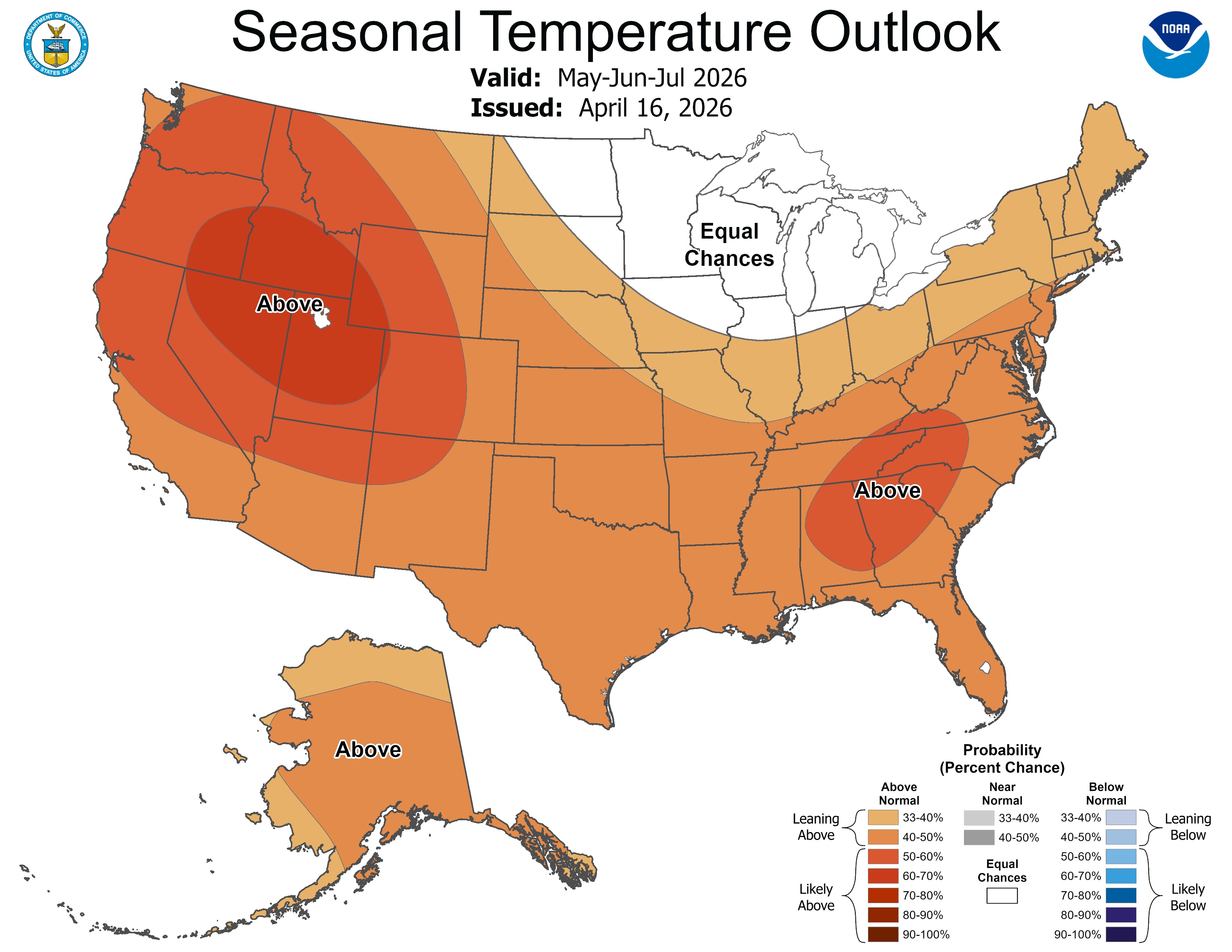
As of mid-April, the equatorial Pacific Ocean was in an ENSO-neutral state but is rapidly transitioning toward El Niño. ENSO forecasts predict an 88% chance of El Niño conditions developing during May-July and continuing through the end of 2026. NOAA monthly forecasts for May suggest an increased probability for below average precipitation in Wyoming and above average temperatures for the entire region, particularly in northern Utah and western Wyoming. NOAA seasonal forecasts for May-July suggest an increased probability for below average precipitation in Wyoming, northern Utah, and northern Colorado, and above average precipitation in southern Colorado. Above average temperatures are forecasted throughout the region, particularly in Utah and southwestern Wyoming.


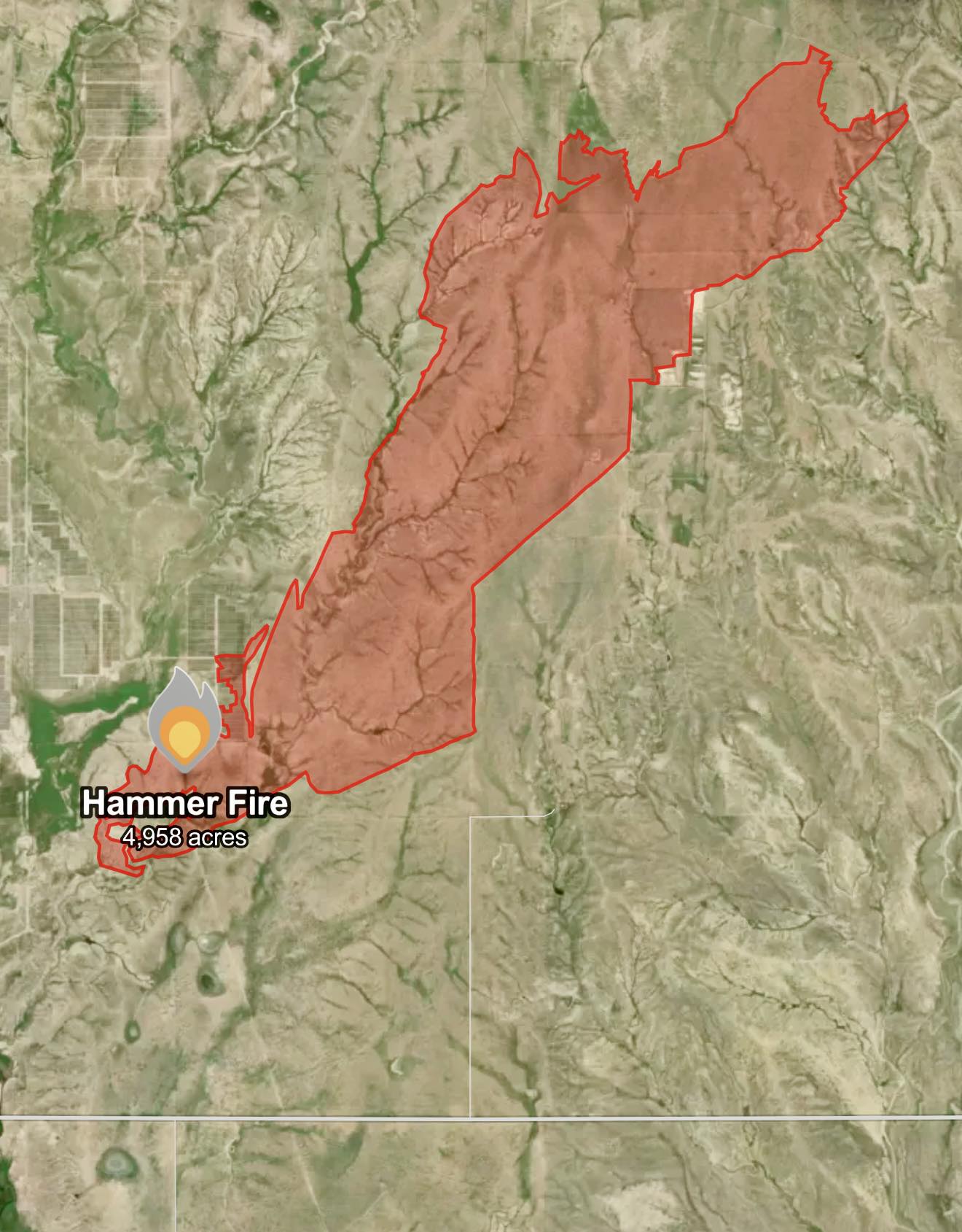
Significant weather event: Hammer Fire. The Hammer Fire started on April 22 in El Paso County near the community of Hanover, Colorado, southeast of Colorado Springs. There were extreme fire conditions on April 22, with strong winds and very low humidity, causing the fire to grow quickly. Mandatory evacuations were issued for nearby residents, and schools were closed in Hanover School District 28. The fire started in the afternoon and rapidly grew from 200 acres to over 4,000 acres within hours due to the strong wind gusts that day. The wildfire was contained on April 24 and burned approximately 4,958 acres, making it the second-largest wildfire in Colorado in 2026, only behind the 24 Fire that burned 7,404 acres from March 18-April 2 southwest of Colorado Springs.