The health of our waters is the principal measure of how we live on the land — Luna Leopold
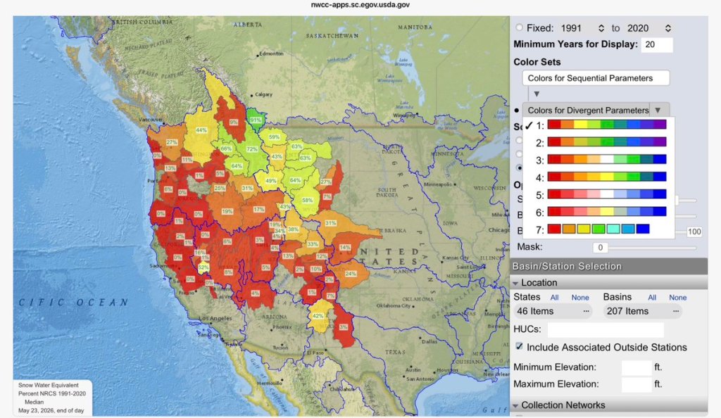
West SNOTEL map (May 23, 2026): “changed colour scale and set range 0-100%, so that not it’s not all red, allows you to see where the problem is most severe”– Daniel A. Walker