2024 #COleg: #Colorado’s new wetlands protections lead the nation 1 year after EPA rules were struck by Supreme Court — Fresh Water News

Autumn view of the wetlands and cottonwood groves in the Yampa River basin at Carpenter Ranch, located west of Steamboat Springs, Colorado. Photo courtesy of The Nature Conservancy

Click the link to read the article on the Water Education Colorado website (Jerd Smith):

One year after  the U.S. Supreme Court removed federal regulations protecting wetlands and streams from development pressures in its Sackett v. the EPA decision, Colorado is the first state in the nation to pass legislation replacing those regulations, according to a new national report.

The report, by the Clean Water For All coalition and Lawyers for Good Government, shows that eight other states have taken action to restore some level of protection or are trying; five launched failed attempts to impose further cutbacks; and one state, Indiana, rolled back protections further. Thirty-five states have taken no action.

Environmentalists say the spotty response is a clear indication that Congress must intervene to create consistent, clearly defined protections that work for all states, and which protect rivers and wetlands that cross state boundaries.

“Different states are struggling to see how to respond to it,” said Kristine Oblock, senior campaign manager for the Clean Water for All coalition. “And the state-by-state solutions are not going to be enough to protect our waters. … Our goal is to restore federal protections.”

The problem is particularly acute in Colorado and other Western states, where vast numbers of streams are temporary, or ephemeral, flowing only after major rainstorms and during spring runoff season, when the mountain snow melts. The Sackett decision said, in part, that only streams that flow year-round are subject to federal oversight. It also said that only wetlands that had a surface connection to continually flowing water bodies qualified for protection. Many wetlands in Colorado have a subsurface connection to streams, rather than one that can be observed above ground.

The Sackett decision came after decades of federal court battles over murky definitions about which waterways fall under the Clean Water Act’s jurisdiction, which wetlands must be regulated, and what kinds of dredge-and-fill work in waterways should be permitted. There also were long-running disputes over what authority the act had over activities on farms and Western irrigation ditches, and what activities industry and wastewater treatment plants must seek permits for.

Finding a clear, bipartisan solution that Congress might embrace isn’t likely to be easy. “It’s only been a year, so a lot of different entities are still working out the path forward,” said Jonathan Wood, vice president of law and policy at Montana-based Property and Environment Research Center, or PERC, a conservative think tank that filed a brief supporting the Sacketts, in last year’s Supreme Court case. The Sacketts are private landowners.

“It’s possible that Congress could act,” Wood said. “I think there is an appetite for it but it seems unlikely. And if the suggestion is to just go back to how it was applied pre-Sackett, I don’t see a path forward for that.”

Polls in Colorado and nationwide show majority support among Democrats, Republicans and independents for restoring protections.

Colorado lawmakers were able to win bipartisan backing for their bill after weeks of intense negotiations. Whether the same thing could occur at the national level is a big question.

“Bipartisan is easier at the state level because you aren’t trying to regulate different hydrologies across the country. Any time you’re trying to establish a rule that applies to New England and the West, it is difficult,” Wood said. That Colorado lawmakers were able to agree on regulatory exemptions for agriculture, developers, some cities and other industries also likely helped propel the measure to passage, Wood said.

And there are other options besides Congress. PERC’s mission is to find free market solutions to environmental problems. Wood said PERC would like to see incentives for private landowners to protect wetlands, something Indiana lawmakers approved this year, even after removing other protections. PERC would also like to see industry held accountable for paying the costs of restoring the wetlands that have already been lost.

“Wetlands reduce pollution from someone else, so why not make the polluters pay,” Wood said. “These kinds of opportunities all provide a path forward that is less conflict ridden than the Clean Water Act regulations that have applied for the last several decades.”

Still, environmentalists plan to keep their eyes on Congress, said Josh Kuhn, senior water campaign manager for Conservation Colorado.

“It’s clear that there is bipartisan support for this effort from the public and we need them to make their voices heard,” Kuhn said. “Doing so will create the political will to address the threat of deteriorating water quality and the impacts of climate change,” Kuhn said.

More by Jerd SmithJerd Smith is editor of Fresh Water News. She can be reached at 720-398-6474, via email at jerd@wateredco.org or @jerd_smith.

Mystery of the Disappearing #Snowpack: Why the gap between deep winter snows and low summer flows? A 21st century hydrologic whodunnit — Allen Best (@BigPivots)

Click the link to read the article on the Big Pivots website (Allen Best):

May 14, 2024

Ranchers in Colorado’s Yampa River Valley traditionally measured the severity of winters by snow accumulation on their stock fences. Plentiful accumulation put the snow at the top wire, making it a three-wire winter. Four wires have become the norm on stock fences. No matter. By early March 2023, those wires at the foot of Rabbit Ears Pass were covered too. The Yampa Valley was sublimely white. It was a winter like the old days.

As expected, runoff was big and thrashing. Creeks tumbling through Steamboat Springs in May spilled over their banks. Downstream 75 miles, the Yampa River at Maybell peaked on May 18 at 16,500 cubic feet per second, more than 200% the average peak streamflow at that gauging station.

What happened afterward was very different. By July, the Yampa’s meager flows in Steamboat so concerned water managers that they nearly closed the warming river to recreationists in order to protect fish.

Snow topped the stock fences at the foot of Rabbit Ears Pass on March 4, 2023. Photo/Allen Best

That big snowpack that resulted in head-high snowbanks along the streets in Steamboat? It produced a big runoff. But thievery had also occurred. Who or what absconded with the water? And how?

This mystery was not entirely new. April 1 snow depth in the Yampa and most of Colorado’s river basins has rarely correlated perfectly with runoff. Whether spring weather turns wetter and cooler or hotter and drier can alter the runoff dynamics. “There is always that component of what the temperature and precipitation regimes are from April 1 through July,” says Karl Wetlaufer, a hydrologist and assistant supervisor at the Natural Resource Conservation Service, the federal agency that delivers the longest-running and most-used runoff forecasts. “They really drive a lot of what those forecast errors end up being.”

SNOTEL automated data collection site. Credit: NRCS

Then, too, the traditional methods for measuring snowpack have fallen short. Data from snow telemetry (SNOTEL) sites, is collected automatically from stations across Colorado. But those stations are relatively few compared to the complex geography. One station provides insights about one station, not a whole hillside or mountain. They provide an index.

A climate that has turned warmer and some say weirder during the last 10 to 20 years has some water managers wanting new tools. Whether in the San Luis Valley or the Yampa River Valley, what lies on the ground on April 1 remains the best predictor of river flows come July, August and September.

Water managers, from ranchers and farmers to reservoir operators and city staff, though, want improved models and data that more completely reveal the complexity of what is happening. They want to better understand why a huge snowpack can, by July and August, be such a dud.

What’s up with soil cracks and a changing climate? 

Patrick Stanko, at his ranch four miles downstream from Steamboat Springs, has been puzzling over changes since he was a boy in the 1970s and 1980s. Summers have become hotter, winters less cold. Snow is gone sooner.

“The big snow banks of winter just disappear,” says Stanko. Water disappearing into the atmosphere is not a new process. But higher temperatures exacerbate it, whether that loss is to sublimation, where snow transforms directly into a gas, or evaporation, where snow melts and that water enters the atmosphere as a gas.

Milk Creek, which flows through the ranch that has been in his family since 1909, had become intermittent in its flows. Late-season grasses that his 100 head of cattle graze have become sparser with lessening summer rains.

Most striking are cracks in the ground that Stanko has noticed in recent years. He believes they have something to do with the shifted summer dynamics — dynamics that have implications into the next year’s runoff.

North American Monsoon graphic via Hunter College.

“We don’t get the rains that we used to get,” he says. “You used to be able to set your clock by the monsoon that would come.”

Haying in the Yampa River and other high country locations traditionally began in July or early August. Rain storms arrived almost simultaneously. If the rain forced ranchers to leave the grasses to dry, it was also helpful. Stanko says hay is best with 10% to 14% moisture content. Now, the timothy hay, brome grass and dryland alfalfa he grows on his 600 acres is often too dry after being cooked by hot winds.

Alfalfa growing on the Ute Mountain Ute land in southwestern Colorado in October 2022. Photo credit: Allen Best/Big Pivots

Drying soils in fall have implications for spring runoff—the soils want their share of water first. That could bite into the total runoff, particularly in dry winters. Rainstorms in September have the reverse effect.

The 2024 Climate Change in Colorado report confirms many of Stanko’s observed changes. For example, summer precipitation has decreased 20% across northwest Colorado in the 21st century as compared to 1951-2000. Models suggest drier summers may become the norm — even with increased winter precipitation.

And warming has made the atmosphere thirstier. Evaporative demand is another name for this thirst. Warm air can hold more moisture than cool air. If nothing else changes, warmer temperatures increase evaporative demand.

The Climate Change in Colorado report, which was commissioned by the Colorado Water Conservation Board, cites a measure of evaporative demand called potential evapotranspiration (PET). It refers to the amount of water that would be evaporated or sublimated from the snow, soil, crops, and ecosystem if sufficient water was available. Between 1980 and 2022, PET increased 5% during Colorado’s growing season. When the ground holds less moisture, more of the sun’s energy heats the land’s surface and the atmosphere above it instead of evaporating moisture. This drives faster warming and lowers humidity.

Since 2000, streamflow across Colorado’s major river basins has been 2% to 19% less compared to the half-century before. Modeling studies have attributed up to half the declines to warming temperatures. And with declining streamflows, the need to make the most of available streamflows is heightened.

The Blanca massif, located just south of Great Sand Dunes, has been been a landmark for people for thousands of years. The #SnowMoon rising behind it is the full moon that occurs each February. Photo: NPS/Patrick Myers 2024

San Luis Valley and improved runoff forecasting

The story of dry conditions and low streamflows echoes 250 miles to the south in the San Luis Valley. There, water appropriation dates are older, elevations a little higher, and mid-summer temperatures a trifle toastier. Fifteen of the 20 hottest daily maximum temperatures recorded in Alamosa, including several in 2023, have occurred in the 21st century.

Snowfall in the San Juan Mountains largely determines how much alfalfa Cleave Simpson can grow on his farm south of Alamosa. The farm has water rights from 1879, but that isn’t senior enough to ensure reliable water deliveries, says Simpson, who is a Colorado state senator in addition to being a farmer and general manager of the Rio Grande Water Conservation District. State officials make adjustments to the water that can be diverted. “They do that every day,” says Simpson. “All in an effort to deliver to the state line as close as is possible the amount that we’re required to deliver.”

The Rio Grande Compact specifies how much water Colorado must deliver to downstream states. Depending on the year’s flows, Colorado sends between 35% and 70% of the Rio Grande’s water downstream. To ensure those deliveries, water managers must carefully calibrate flows they expect against demand from irrigators. Like those on the Yampa, water managers have wanted new ways of forecasting flows. “Because the old ways just aren’t working that well,” explains Craig Cotten, Colorado’s Division 3 water engineer, who leads administration in the Rio Grande Basin.

The old ways use primarily snow telemetry data, better known as SNOTEL data, which is automatically collected from stations across the state. That data is used to project flows using what Cotten describes as a “fairly simple regression analysis.” In other words, if X amount of snow in the past produced Y amount of water, then the same formula should hold today. But in the early 2000s, Cotten began to see that in some years, streamflow forecasts were not as accurate as he would have liked, he says.

Spruce beetle-impacted forest in Southwestern Colorado with moderate levels of tree mortality. Photo credit: Sarah Hart

What changed? Bark beetle infestations, by stripping trees of needles and exposing more snow to sunlight, altered runoff. So did wildfires, which in 2013 scarred 113,000 acres in Rio Grande headwaters areas. “That changed the dynamics of the forest system and how it related to the snowpack melting and running into the streams,” says Cotten, a 33-year veteran with Colorado’s Division of Water Resources. Dust-on-snow events work the same way. Dust blown from distant deserts accumulates on snow, drastically reducing the albedo, or reflectivity. The warmed snow melts more rapidly.

Overall flows have trended down. Flows on the Rio Grande at a gauging station near Del Norte, upstream from most diversions, averaged 8% less from 2000 through 2022 than during the preceding 50 years.

Snowpack in the Rio Grande’s headwaters in the San Juan Mountains was above average in 2019 and again in 2023, Cotten points out. But late-summer seasonal flows were below average. “Even in a good year, our farms and ranches struggle in the late season because we have below-average streamflow at that time.” And always, there’s the need to meet compact obligations, a task that Cotten says has become harder because of tightening water supplies.

The Dolores River between Rico and Dolores in southwestern Colorado on Memorial Day 2009. Photo credit: Allen Best/Big Pivots

With stretched water supplies, accuracy in forecasting is increasingly important. A new tool, the high-resolution LiDAR of Airborne Snow Observatories (ASO) has meant better data on the amount of water contained in snowpack, and has improved runoff projections. Through ASO, a plane flies over entire watersheds or basins, collecting snow-depth data. Flights in 2024 include the Conejos River – of help to Cotten — and the Yampa and Elk rivers.

“Whether it’s a county commissioner, a dam operator, or maybe Craig Cotten or another division engineer, their challenge is that they’ve got a forecast of runoff, timing and volume,” says Jeff Deems, a snow scientist and part-owner of ASO. “They need to operate their headgates, their allocation, their dam, et cetera, while recognizing that their forecast is uncertain and that there’s a range of outcomes that could be undesirable. They need to make the best decision possible under that uncertain framework.”

This map shows the snowpack depth of the Maroon Bells in spring 2019. The map was created with information from NASA’s Airborne Snow Observatory, which will help water managers make more accurate streamflow predictions. Jeffrey Deems/ASO, National Snow and Ice Data Center

ASO claims it can achieve 98% accuracy in forecasting the amount of water contained in snow, known as the snow water equivalent, or SWE, across large areas. Water managers across Colorado, with the help of state funding, are contracting with ASO to collect data and boost their forecasting.

“It opens up understanding of different physical processes related to the snowpack that otherwise we may not understand very well,” says Angus Goodbody, of ASO. Goodbody is a forecast hydrologist with the NRCS.

While this data is invaluable to many water managers, NRCS can’t yet use ASO data in its modeling. But NRCS, too, is rolling out a new forecast system this winter. Goodbody describes the forecasting tools as improving incrementally. By using various forecasting tools and models to analyze data, NRCS aims to mitigate “the vulnerability of any one of those models on their own,” he says.

If a liquid like water is present in a way of tiny drops, in air, in a substance or on a surface we called it as moisture. But it is very difficult to define the “soil moisture”. Normally, soil moisture can be defined as the water that retain in between the spaces of the soil and rock particles. This is of two types. Those are: surface soil moisture; and, root zone soil moisture. Credit: Modern Farming

Digging into soil moisture

New tools have also topped Andy Rossi’s wish list for the Yampa. From the Steamboat Springs office of the Upper Yampa Water Conservancy District, where he has been the district’s general manager since 2020, Rossi directs operations of the district’s two upstream reservoirs, Stagecoach and Yamcolo, which provide water to ranches and municipalities, including Steamboat Springs.

When he started working for the Upper Yampa district as an engineer in 2009, runoff forecasts were “becoming more and more unreliable and really difficult for us to get our arms around what was going on in the basin,” he explains.

Temperature records for the Yampa Basin were very good. Soil moisture records? Not so much. Runoff predictions from past years mentioned soil moisture but relied solely on models. “There was no direct measurement of soil moisture going into our forecasting,” Rossi says.  He decided the Yampa Valley needed more diverse measuring infrastructure to better collect data about soil moisture and atmospheric processes in order to see if and how soil moisture factors into runoff. Were dry soils sapping runoff, preventing it from reaching rivers? The puzzle was missing pieces. Integrating more non-snow data into runoff projections might result in better forecasts.

A partnership began to coalesce in 2018 between the Yampa Valley Sustainability Council, Colorado Mountain College, and the Scripps Institution of Oceanography’s Center for Western Weather and Water Extremes. Guided by a team of 15, the collaboration yielded a pilot soil moisture and weather monitoring station in September 2022 near Stagecoach Reservoir. In 2023, with aid from the Colorado Water Conservation Board and the Colorado River District, two additional stations were installed in the basin. The team in early 2024 was working on six more stations upstream of Craig. The stations collect continuous soil moisture measurements and data on meteorological conditions with the goal of sharing that data so that stakeholders can make management choices about changing water supplies.

The aim, in part, was to generate new and valuable data that wasn’t being collected elsewhere, says the sustainability council’s Madison Muxworthy, the project manager. “We didn’t want to duplicate existing efforts, such as SNOTEL stations,” she says.

The sustainability council has collaborated with the NRCS to install more soil moisture sensors at SNOTEL stations to go along with snowpack, precipitation and temperature data. The team will install four stations this summer and two more in 2025.

It’s still too soon to know the results of this monitoring. Measurements obtained from these new stations may reveal short-term changes, but other insights may require 10 to 20 years of data.

Map of the Roaring Fork River drainage basin in western Colorado, USA. Made using USGS data. By Shannon1 – Own work, CC BY-SA 4.0, https://commons.wikimedia.org/w/index.php?curid=69290878

Soil moisture and groundwater

A similar network of soil moisture stations already exists in Colorado’s Roaring Fork Valley. There, 10 stations have been installed in an elevation band of 5,880 feet from Glenwood Springs to above 12,000 feet at Independence Pass. All stations have sensors to monitor soil moisture at depths of 5, 20 and 50 centimeters, and monitor soil temperature at 20 centimeters deep. They also record air temperature, relative humidity, rainfall, and more, recording measurements at least hourly.

This network was created by the Aspen Global Change Institute in response to local interest in measuring soil moisture in the Roaring Fork watershed. In 2012, as bark beetles proliferated, scientists at a small meeting on forest health identified soil moisture as a critical, understudied component of ecosystem vitality. With more than a decade of measurements, the data may help answer questions about hydrology and ecology in mountain systems.

A rambunctious Fryingpan River in the vicinity of Norrie was in a hurry to get to Ruedi Reservoir in late June 2018. Photo credit: Allen Best/Big Pivots

Key research questions for the Roaring Fork network include how will climate change impact water availability and timing in the watershed? And how can in-situ soil moisture data be used in water supply forecasts and models to better inform decision making for water managers and cities?

Elise Osenga, the Aspen Global Change Institute’s community science manager, stresses the complexities of runoff now further confused by climate change. Soil moisture plays a role, but it’s among many factors.

“You’re trying to predict the future based on how conditions played with each other in the past,” explains Osenga. “And now in the future, different wrenches will be thrown into the system where the past may not be a perfect representation.”

Link: Stationarity is dead: Whither water management

If dry soils only tell a small percentage of the story of this runoff thievery, that’s where the institute’s microscope is being applied. “Finding the quantitative relationship between a dry soil and change in runoff is going to be hard because it’s a small percent to begin with. It’s not that it doesn’t matter, but it’s also not the silver bullet,” Osenga says.

Soil moisture refers to water held in the pores of soil. Going deeper – the depth varies but often begins around a meter down—takes you to a saturated zone of groundwater. Groundwater adds further complexity to the question about runoff prediction. Rosemary Carroll is conducting research on that interplay. She’s a research professor in hydrology affiliated with the Desert Research Institute but based at Colorado’s Mt. Crested Butte.

Groundwater, she says, moderates flows between the years of big water and high flows and those of lesser runoff. During the big years, the water goes into storage in the form of groundwater. It stabilizes flows.

Healthy mountain meadows and wetlands are characteristic of healthy headwater systems and provide a variety of ecosystem services, or benefits that humans, wildlife, rivers and surrounding ecosystems rely on. The complex of wetlands and connected floodplains found in intact headwater systems can slow runoff and attenuate flood flows, creating better downstream conditions, trapping sediment to improve downstream water quality, and allowing groundwater recharge. These systems can also serve as a fire break and refuge during wildfire, can sequester carbon in the floodplain, and provide essential habitat for wildlife. Graphic by Restoration Design Group, courtesy of American Rivers

But groundwater declines during hotter and drier years—think 2002, 2012 and 2018. Streamflow is sensitive to declines in groundwater storage, Carroll says, so flows also drop. Modeling that Carroll has worked on shows a loss of 30% in streamflows over the next century or so, assuming a 4 degree temperature increase.

Groundwater may seem to be on the margins of why runoff predictions on April 1 fail to materialize in July, but Carroll believes it needs to be part of the discussion. That connection will become more important in coming decades as temperatures continue to rise. “It’s really important, and it’s not often talked about,” she says.

Late season weather prediction accuracy 

Despite all this research that seeks to narrow the uncertainty, uncertainty will remain in streamflow forecasting for the foreseeable future. That’s the conclusion drawn by Peter Goble, of the Colorado Climate Center, and Russ Schumacher, Colorado State Climatologist, in a study published in the Journal of Hydrometeorology December 2023 issue.

“What influences seasonal runoff more: antecedent soil moisture and groundwater conditions or meteorological conditions following April 1?” they asked. Sifting through evidence from 2020 and 2021, they reached a clear conclusion: “This study demonstrates that existing soil moisture and groundwater models are unlikely to provide ‘low-hanging fruit’ for improving forecasts.”

Improved weather forecasting skills will matter more, Goble and Schumacher said.

Weather forecasts are remarkably good for a week to 10 days. Beyond? Not so much. Will that change? Goble and Schumacher indicate little optimism.

Then there’s the shifting climate. If weather continues to become more variable, “that is only going to decrease our ability to predict ahead of time what the runoff is going to be,” Goodbody says. Too, if warmer winter temperatures produce more rain, there will be less snow to measure. “Then predictability by definition goes down until we actually can predict the future [after April 1] weather with more certainty,” Goodbody says.

The Little Snake River is about to join the Yampa River on Oct. 8, 2020. Photo credit: Allen Best/Big Pivots

Improved forecasts, however, won’t deliver more water. For management purposes, stored water still matters greatly. Consider the Yampa River after that three-wire winter of 2023. The rapidly slackening flows of the river through Steamboat during July surprised water managers and state officials. That year, the snowpack in the Yampa River Basin was dusty, moving the snow to melt and runoff to occur earlier than usual. Officials came close to closing the river to commercial fishing access, as they had the four previous years because of either low flows, high temperatures, or both.

Through a water lease agreement orchestrated by the Colorado Water Trust—a nonprofit that uses voluntary water-market transactions to restore streamflows—the Upper Yampa district released between 18 cubic feet per second and 40 cfs from Stagecoach from late August through late October to keep the Yampa flowing and at a cooler temperature. This added water helps the City of Steamboat Springs stay in compliance with federal water quality standards governing stream temperatures below the city’s wastewater treatment plant. It also benefits fish and those angling at them.

“We thought we were in great shape and thought we wouldn’t need [special] releases out of Stagecoach [Reservoir],” says Julie Baxter, water resources manager for the City of Steamboat Springs.

“It was definitely a big surprise.”

This story was published in the Spring 2024 issue of Headwaters magazine, a publication of Water Education Colorado.  See the full contents here.

2024 #COleg: #Colorado lawmakers passed 10 new water measures this year. These are the biggest ones — Fresh Water News

Colorado state capitol building. Photo credit: Allen Best/The Mountain Town News

Click the link to read the article on the Water Education Colorado website (Larry Morandi and Jerd Smith):

May 16, 2024

Colorado lawmakers gave the thumbs-up to 10 water measures this year that will bring millions of dollars in new funding to help protect streams, bring oversight to construction activities in wetlands and rivers, make commercial rainwater harvesting easier, and support efforts to restore the clarity of Grand Lake.

Money for water conservation, planning and projects was a big winner, with some $50 million approved, including $20 million to purchase the Shoshone water rights on the Colorado River.

Sen. Dylan Roberts, D-Frisco, chair of the Senate Agriculture and Natural Resources Committee, expressed gratitude for the legislature’s focus on water issues and for funding the Shoshone purchase. “This continues to show the state’s financial investment in our water future,” he said, “and we’ll now ask voters to retain even more money from sports betting to continue that funding commitment.”

Roberts was referring to a ballot initiative that will ask voters in November to allow the state to hold onto more of the tax revenue generated by sports betting.

Another major law created a new permitting program to protect wetlands and streams from construction, road building and development activities. Those federal regulations were wiped out last year by the U.S. Supreme Court in its Sackett v. EPA decision. Two competing measures were initially introduced, but lawmakers joined forces toward the end of the session to arrive at a bipartisan consensus.

In another action, lawmakers approved a narrow change to storm water storage rules that will allow an innovative commercial rain-water harvesting pilot program in Douglas County’s Sterling Ranch development to proceed.

“Dominion is excited to continue to advance the only regional rainwater harvesting project in the state, which now can be completed in a cost effective and timely manner with the unanimous support of the Colorado Legislature and the governor,” said Andrea Cole, general manager of Dominion Water and Sanitation, which is conducting the pilot program and which serves Sterling Ranch.

And lawmakers also approved two high-profile resolutions, one supporting efforts to restore clarity in the state’s Grand Lake, and a second resolution urging Congress to provide funding to help repair aging water systems serving tribal communities and others in southwestern Colorado. A third identifies projects eligible for funding through the Colorado Water and Power Development Authority. Resolutions, unlike laws, don’t usually come with money and have little legal weight.

Here’s a look at the most significant measures that passed.

House Bill 1435 — Colorado Water Conservation Board projects

This is an annual bill that provides grants and loans to projects requested by the Colorado Water Conservation Board. None of the money is from the state’s general fund; it includes interest earned from CWCB loans, severance taxes and sports betting revenue. The largest amounts this year are for two CWCB loans: up to $155.65 million for the Windy Gap Firming Project, and up to $101 million for the Northern Integrated Supply Project. The balance is for grants that include:

  • $23.3 million to help implement the state water plan (all of it from sports betting revenue, up from $10 million last year)
  • $20 million to support the purchase of Shoshone power plant water rights by the Colorado River Water Conservation District
  • $4 million for drought planning and mitigation projects
  • $2 million for the turf replacement program.

House Bill 1379 — Regulating dredge and fill activities in state waters

This bill grew out of the May 23, 2023 U.S. Supreme Court decision in Sackett v. U.S. Environmental Protection Agency, which narrowed the scope of waters protected under the federal Clean Water Act. It ruled that federal regulation of dredge and fill activities applies only to wetlands that have a “continuous surface connection” to rivers and other permanent bodies of water where it would be difficult to determine where the river stopped and the wetland began, eliminating federal protection to large areas of wetlands and seasonal streams in Colorado.

House Bill 1379 requires the Water Quality Control Commission in the Colorado Department of Public Health and Environment to develop rules by Dec. 31, 2025, to implement a state program that is at least as protective as the guidelines developed under Section 404 of the Clean Water Act. It covers discharges to “state waters,” which are defined as “any and all surface and subsurface waters that are contained in or flow in or through the state, including wetlands.” House Speaker Julie McCluskie, D-Dillon, said that by shifting from a “gap” program that covers only those waters left unprotected by Sackett to a “state waters” approach “we ensure clarity and certainty.”

The bill exempts certain activities and excludes some waters from coverage. Activities not requiring a permit include normal farming, ranching and forestry operations, along with maintenance of currently serviceable structures and construction or maintenance of irrigation ditches. Excluded waters include those in ditches and canals, wetlands adjacent to ditches or canals that are supported by water in the ditch or canal, and artificially irrigated areas that would revert to upland if irrigation ceased. Rep. Karen McCormick, D-Longmont, said that “codifying in statute the exemptions rather than leaving it to rulemaking” avoids some of the “unpredictability that existed at the federal level.”

Senate Bill 148 – Rain water harvesting, storage

Allows, with proper authorization, those operating an approved rain water harvesting pilot project to store water in a detention facility.

Senate Bill 197 — Water conservation

Senate Bill 197 contains provisions that were either recommendations or items discussed by the Colorado River Drought Task Force the General Assembly created last year. The bill allows the owner of a storage water right to loan water to the CWCB for stream sections where the CWCB does not hold an instream flow right. It permits the creation of agricultural water protection programs statewide instead of just in the South Platte, Republican and Arkansas river basins in eastern Colorado, and authorizes an irrigation water right holder to request a change in use to an agricultural protection water right that would allow the lease, loan or trade of up to 50% of the water.

The bill also allows electric utilities that plan to close coal-fired power plants in the Yampa River basin in northwestern Colorado from losing their water rights if they decrease or do not use the water for a specified period of time. Roberts said this would allow electric utilities “to temporarily toll their water rights and protect them from abandonment while those companies explore alternative energy development” to align with the state’s clean energy and greenhouse gas reduction goals.

The drought task force included a sub-task force to study tribal matters, which recommended a provision in the bill that requires the CWCB to reduce or waive any matching requirements for state water plan implementation grants awarded to the Ute Mountain Ute Tribe or the Southern Ute Indian Tribe.

House Bill  1436 — Sports betting revenue

Sports betting revenue has been used to help fund implementation of the Colorado Water Plan since passage of Proposition DD by the electorate in 2019, which legalized sports betting and taxed its proceeds. The amount of revenue that can be used to support the state water plan was capped at $29 million, a figure that is likely to be exceeded this year. Rather than refund the excess money to casinos and licensed sport betting operators that paid the tax, House Bill 1436 refers a ballot measure to the voters in November asking them to remove the cap and allow the state to keep all revenue and use it to fund water conservation and protection projects.

The bill’s fiscal note projects that sports betting revenue will exceed $29 million this fiscal year by $2.8 million, by $5.2 million in fiscal year 2025, and by $7.2 million in fiscal year 2026 (the actual revenue is distributed the year following its collection and spent the year after). Rep. Marc Catlin, R-Montrose, noted that sports betting revenue has exceeded expectations, and if the voters approve, “this seems to be the easiest way to fund these kinds of projects (because) you don’t have to go and ask for property tax revenue or for tax money out of the state general fund.”

Senate Bill 5 — Prohibiting certain landscaping practices to conserve water

Faced with climate change and increasing water demand, Senate Bill 5 is designed to reduce water used for landscaping in new development projects. It prohibits local governments from allowing the installation of nonfunctional turf — grass that is not used primarily for recreational purposes — in commercial, institutional, industrial or common interest community property, street rights-of-way, parking lots, medians or transportation corridors after Jan. 1, 2026. It does not apply to residential property or to turf that is part of a water quality treatment program, native grasses or artificial turf on athletic fields. The bill also prohibits the Department of Personnel from installing the same types of turf in any new state facility construction project after Jan. 1, 2025.

Roberts noted that irrigating nonfunctional turf “is responsible for what is believed to be up to 50% of municipal water use,” and pointed out that Senate Bill 5 builds on legislation passed two years ago that provides funding for a turf replacement program.

Senate Bill 37 — Green infrastructure to improve water quality

Senate Bill 37 calls for a study of how “green infrastructure” might replace traditional concrete and steel wastewater treatment plants in managing water quality. Green infrastructure, according to bill writers,  is “a strategically planned, managed, and interconnected network of green spaces, such as conserved natural areas and features, public and private conservation lands, and private working lands with conservation value.” It can improve water quality by reducing stormwater runoff as pollutants are absorbed into soils and filtered before entering waterways, and lessen the need for expensive wastewater treatment plants, also known as gray infrastructure.

The bill requires the University of Colorado and Colorado State University — in collaboration with CDPHE — to conduct a feasibility study of how green infrastructure can be used as an alternative to gray infrastructure in complying with water quality regulations, and the types of new funding mechanisms that might support it. The universities, with CDPHE’s approval, may conduct up to three pilot projects to test their findings. CDPHE and the universities must complete the study by April 1, 2026, and submit a report summarizing its findings and any recommendations to the General Assembly’s Water Resources and Agriculture Review Committee no later than Nov. 1, 2026.

Sen. Cleave Simpson, R-Alamosa, noted the cost-effectiveness of green infrastructure, especially in rural communities like those in his district where “to invest tens of millions of dollars in a new wastewater treatment plant to serve small numbers of people is just problematic.” He views Senate Bill 37 as offering “a different path forward where you can get the same outcomes but with more natural investments.”

More by Larry Morandi and Jerd Smith

Digging into Snow Survey History — Fresh Water News

Photo Caption: Two men surveying for the Federal-State Cooperative Snow Surveys, Division of Irrigation, Soil Conservation Service, USDA, J. G. James, photographer, undated. From the Irrigation Research Papers, Water Resources Archive, Colorado State University Libraries. https://hdl.handle.net/10217/180131

Click the link to read the article on the Water Education Colorado website (Patty Rettig):

May 7, 2024

After trekking on skis up a mountain, two men unpack equipment, use a long metal tube to take a snow sample, weigh it, and record the measurement. Captured on 16mm film in the mid-twentieth century, the men demonstrate the most advanced snow survey techniques of their time, providing us a fascinating glimpse into the past.

Three such films—one of which is undated, with the others being from about 1941 and 1952 (narrated and in color!)—held by the Colorado State University Water Resources Archive, when considered with related photographs, reports, data, and letters, reveal an important part of the story of the development of snow surveying and water supply forecasting in the western United States.

Federal coordination of snow surveying began in the 1930s, after several decades of individual states and institutions independently taking measurements. Though Nevada and Utah are recognized as the pioneering states, in 1902 Colorado’s state engineer hired Enos Mills as the state’s first snow surveyor. Several of his 1903 and 1904 letters in CSU’s Agricultural and Natural Resources Archive provide insight into how monitoring snowpack started here.

Two men measuring snow, undated. From the Irrigation Research Papers, Water Resources Archive, Colorado State University Libraries. https://hdl.handle.net/10217/178534

By the mid-1930s, following the drought of the early part of the decade, interest grew in having water supply predictions. The U.S. Department of Agriculture took on snow surveying and water forecasting not only to benefit irrigators who relied on the forthcoming snowmelt, but also to support the economic interests of industry and hydropower as well as predict stream flooding.

In Colorado, Ralph Parshall, as senior irrigation engineer at the USDA branch in Fort Collins (and best known for the Parshall flume), contributed to the emerging Federal-State Cooperative Snow Surveys in a number of ways. Parshall’s materials in both his archival collection and his team’s files document his active participation over more than a decade. These include letters and drafts related to several Colorado River Water Forecast Committee meetings, including the first, held in 1945 and at which Parshall presided. A published draft of those proceedings can be found in the Water Resources Archive’s Groundwater Data Collection.

Trail Ridge Road, Ralph Parshall and Park Ranger Jones, May 1941. From the Groundwater Data Collection, Water Resources Archive, Colorado State University Libraries. https://hdl.handle.net/10217/23340

Also among Parshall’s materials, a few dozen photographs of snow courses and related images also exist, some of which remain to be digitized. Additional photographic materials in other collections include slides showing Parshall and others conducting snow surveys at Cameron Pass and in Rocky Mountain National Park, as well as a set of about 100 images (not digitized) taken during winter and spring months at McNey Hill in northern Colorado. This set reveals a decade-long photography project involving both Ralph Parshall and his son Max.

A collection from the Colorado Snow Survey Program of the Natural Resources Conservation Service contains two boxes of photographic materials. These images show snow survey sites and equipment, agency employees, and public outreach events. Two of the films referenced above also are in this collection. The NRCS, having evolved from the USDA division that Ralph Parshall was part of, began operating the first SNOTEL (SNOpack TELemetry) site in 1977. This automated system of collecting snow and weather data greatly furthered the field, especially for remote sites where access is difficult.

Patricia Rettig, Associate Professor, Libraries, Colorado State University, March 29, 2022

The science, methods, and equipment related to measuring snowpack and estimating water content have continued to evolve. In the Water Resources Archive, documentation of snow hydrology studies as well as aerial snowpack measurement is also available for research.

Additional collections in the Water Resources Archive also touch in part on snow surveying and can be found through browsing our research guide. All of our materials are available for use by the public, and assistance can be provided in person at CSU’s Morgan Library or remotely.

Patty Rettig is the archivist for the Water Resources Archive at the Colorado State University Libraries. Over more than 20 years, Rettig has built the archive to hold over 130 distinct collections documenting Colorado’s water heritage by engaging with the water community across the state. She is happy to help anyone dive in to archival research!

Middle school students raise, release trout — #PagosaSprings Sun

One of Pagosa Springs’ oldest parks, Town Park straddles the San Juan River in the heart of downtown Pagosa Springs. The site of many events, Town Park is by far one of the most popular parks in Pagosa Springs. Photo credit: Town of Pagosa Springs

Click the link to read the article on the Pagosa Springs Sun website (Randi Pierce). Here’s an excerpt:

Ons Thursday, May 2, 2024 sixth- graders in Terri Lindstrom’s Pirate Time advisory class rolled a cooler down to Town Park, then carried it to the edge of the river. There, the students used river water to acclimate the temperature of the water in the cooler — the transport for 75 rainbow trout fin- gerlings who were being taken to be released in the San Juan River.

As they waited for the fish to acclimate, the students read messages they wrote after spending the school year helping and watching the fish grow.

Lindstrom’s class raised and released the fingerlings through a partnership with the Trout in the Classroom program and Trout Unlimited…

“The purpose of the program is to give students the opportunity to ex- plore water quality,” Lindstrom wrote, explaining the students kept track of the water temperature, count and weight of the fish.

Four to five fish were pulled from the tank each week and weighed be- fore being returned, she notes. That allowed students to calculate the average weight per fish, which then allowed them to calculate 2 percent body weight of all the fish in order to know how much to feed them.

Don’t complain about that next big rainstorm. Its aftermath could help solve our water woes — Jerd Smith (Fresh Water News)

Last night’s storm (July 30, 2021) was epic — Ranger Tiffany (@RangerTMcCauley) via her Twitter feed.

Click the link to read the article on the Fresh Water News website (Jerd Smith):

April 3, 2024

Drought-challenged U.S. communities are overlooking what could be a major source of relief: stormwater, which generates more water annually than is stored in lakes Mead and Powell, the largest reservoirs in the West.

But Colorado and other states with laws against collecting stormwater are likely to miss out on its potential.

Heavy rains produce some 59.5 million acre-feet of water annually, according to “Untapped Potential: An Assessment of Urban Stormwater Runoff Potential in the United States,” released last month by the Pacific Institute, a water research think tank based in Oakland, California.

Lakes Powell and Mead store some 49.4 million acre-feet, according to the U.S. Bureau of Reclamation.

That 59.5 million acre-feet of stormwater is roughly 93% of the water used by all U.S. cities and industry in 2015, according to the Pacific Institute. An acre-foot serves about two to three U.S. households for a year.

But because this source has never been fully analyzed or developed, it is not yet widely used.

“Our results indicate that there is a vast potential for stormwater capture all across the country,” said Bruk Berhanu, a lead author of the study and senior researcher in water efficiency and reuse at the Pacific Institute.

With climate change and warming, streamflows are projected to decline in Colorado and elsewhere in the coming years, and there is increasing pressure to find new sources and better use existing water supplies.

“As communities in the West face increasing strain on their water supplies, planners have been looking at strategies that use an ‘all of the above’ approach,” Berhanu said. “We aren’t suggesting stormwater could cover all of our future water supplies, but they can help fill the gap between our current water supplies and projected demands.”

Estimated annual urban stormwater runoff by state

Source: Pacific Institute, “Untapped Potential: An Assessment of Urban Stormwater Runoff Potential in the United States”

But use of stormwater comes with conditions. It would require major new facilities to capture, store and treat it if it is to be used for drinking water. If too much is captured, it could reduce water available for the environment, according to the report.

And in some places, such as Colorado, the practice isn’t allowed.

Under what’s known as the Prior Appropriation Doctrine, water users with the oldest, or most senior water rights, get their water first, even if their diversion point lies farther downstream than someone else’s. And stormwater, once it reaches the stream, becomes part of someone’s water right. If larger amounts were captured, it could jeopardize other water rights already in place.

The City of Aurora, and others, have actively worked for decades to find new ways to make their water supplies stretch further, but stormwater capture is not one of them.

“What works in some states, does not work in Colorado,” said Greg Baker, a spokesman for Aurora Water, referring to the legal prohibitions against the practice.

Could that change? Possibly.

Colorado has taken major strides in recent years to re-examine how water that falls from the sky may be collected and used in ways that don’t harm neighbors downstream. In 2009, for instance, the state passed a law that opened the door to rainwater harvesting in some rural areas and then in 2016 allowed homeowners across the state to use rain barrels to capture small amounts of water for use on gardens and lawns.

That state also created a pilot program to encourage more research. The Dominion Water and Sanitation District in Douglas County, to date, has been the only water district to participate in the pilot, according to Andrea Cole, Dominion’s general manager. Soon it may be able to legally capture rainwater when, later this year, it will ask a state water court to approve collecting rainwater commercially to serve parks and other public spaces in Sterling Ranch, one of the most water-efficient residential developments in the state.

To get to this point, Dominion spent 15 years tracking how much rain fell on the development before anything was built, and tracking how much more water was generated after new homes and roads were built and the water began falling on roofs and other solid surfaces, instead of the soil.

“In Colorado, water is precious, so every last drop is accounted for in somebody’s system. … But when you change the land from an open prairie to a development, the water no longer [sinks] into the soil, or makes its way to nearby streams,” Cole said.

Measuring the water has and will continue to be a meticulous process, she said.

“We can only capture that water [that falls on] Sterling Ranch. … If it is outside the ranch, we have to allow it to go back to the stream,” Cole said.

Sterling Ranch sharply limits outdoor water use, so lawns are scarce. The plan is to use the rainwater for parks and gardens so that homeowners with little of their own grass have a place to play and relax, Cole said.

The Pacific Institute’s Berhanu said he is hopeful that the new report will generate more interest in developing stormwater to help fill looming gaps in water supplies.

“In a state like Colorado, we would hope that this information builds the case for revisiting those policies and making adjustments to enable more stormwater capture,” Berhanu said.

The potential is there, Cole said.

“We are the first out of the chute, and being the first is always scary. But people are watching to see what we can get through water court,” she said. “Once there is a [legal] water right for it, we are going to see new developments trying to use this.”

More by Jerd SmithJerd Smith is editor of Fresh Water News. She can be reached at 720-398-6474, via email at jerd@wateredco.org or @jerd_smith.

2024 #COleg: New wetlands, stream oversight proposal surfaces at the #Colorado Capitol — Fresh Water News

Blanca Wetlands, Colorado BLM-managed ACEC Blanca Wetlands is a network of lakes, ponds, marshes and wet meadows designated for its recreation and wetland values. The BLM Colorado and its partners have made strides in preserving, restoring and managing the area to provide rich and diverse habitats for wildlife and the public. To visit or get more information, see: http://www.blm.gov/co/st/en/fo/slvfo/blanca_wetlands.html. By Bureau of Land Management – Blanca Wetlands Area of Critical Environmental Concern, Colorado, Public Domain, https://commons.wikimedia.org/w/index.php?curid=42089248

Click the link to read the article on the Water Education Colorado website (Jerd Smith):

March 27, 2024

Colorado lawmakers will consider a fresh proposal to grant the state authority to oversee streams and wetlands left unprotected by a U.S. Supreme Court decision last year.

House Bill 24-1379, sponsored by House Speaker Julie McCluskie, D-Dillon, Rep. Karen McCormick, D-Longmont, and Sen. Dylan Roberts, D-Frisco, would allow the Colorado Department of Public Health and Environment (CDPHE) to oversee a wide array of industrial players, including home and road builders and mining companies, and determine what steps are necessary to minimize any damage to streams and wetlands caused by their activities.

In May, the U.S. Supreme Court issued a ruling in Sackett vs. EPA that sharply limits the streams and wetlands that qualify for protection under the Clean Water Act, a decision that water observers said had a particularly broad impact in the West. In Colorado and other Western states, vast numbers of streams are temporary, flowing only after major rainstorms and during spring runoff season, when the mountain snow melts.

Colorado Rivers. Credit: Geology.com

In addition, hundreds of Colorado wetlands lack an obvious surface connection to streams, in part because so many of the state’s streams don’t flow year-round.

“As a state we don’t want to let a good crisis go to waste,” McCluskie said in a briefing last week, referring to the Sackett decision and the regulatory gap that was created. “Our water is part of the romance and tradition of being a Coloradan. Protecting those waterways could not be more important. But we recognize there needs to be clarity and certainty for our industry partners. And we have tried to be very considerate of differing viewpoints.”

At issue is how the U.S. Environmental Protection Agency now defines so-called Waters of the United States, or WOTUS, which determines which waterways and wetlands are protected under the federal Clean Water Act. The definition has been heavily litigated in the nation’s lower courts since the 1980s and has changed dramatically under different presidential administrations.

The U.S. Supreme Court decided in May that the WOTUS definition that included wetlands adjacent to streams was too broad.

In its ruling, the court said only those wetlands with a direct surface connection to a stream or permanent body of water, for instance, should be protected.

The court’s decision in the WOTUS case means it will be up to Colorado and other states to decide whether and how to handle that regulation — including permitting — and enforcement.

Colorado enacted temporary emergency protections last year to give the state time to create a new program.

And last month, Republican Sen. Barbara Kirkmeyer, of Brighton, introduced  Senate Bill 24-127, also designed to fill the regulatory gap. The Kirkmeyer measure, which has broad industry support, is scheduled for its first hearing April 4, but it’s likely to meet stiff resistance in the Democratic-controlled General Assembly.

Among the key differences between the two measures is that Kirkmeyer’s proposal states that any new rules can’t be more restrictive than those in place prior to the Sackett decision, while McCluskie’s says protections should be “at least as protective” as those in place at that time, according to Jarrett Freedman, spokesman for the House Democrats.

Another difference is that Kirkmeyer’s bill would place the new oversight program within the Colorado Department of Natural Resources instead of the CDPHE. Kirkmeyer said a huge permitting backlog at CDPHE  shows the agency would be unable to handle dredge-and-fill permitting required under her proposal.

McCluskie, however, believes the new program would be better housed within the state health department and that new funding would alleviate permitting delays.

The first hearing on the House Bill 24-1379 has not been scheduled, Freedman said.

A broad array of environmental groups has come out in favor of McCluskie’s measure.

Iron Fen. Photo credit from report “A Preliminary Evaluation of Seasonal Water Levels Necessary to Sustain Mount Emmons Fen: Grand Mesa, Uncompahgre and Gunnison National Forests,” David J. Cooper, Ph.D, December 2003.

“Wetlands are nature’s kidneys, they filter natural pollutants, they help reduce the severity of wildfires,” said Josh Kuhn, senior water campaign manager at Conservation Colorado who spoke on behalf of the Protect Colorado Waters Coalition.

“But the Sackett decision left many of those wetlands unprotected … and we have also lost protections for seasonal streams.  If pollution is dumped into streams when snow melts and runs off, that pollution gets washed into the larger rivers. … If there is mining or development activity and they are dumping fill, or dirt, into dry streambeds, when there is water moving through those streambeds it is going to take those pollutants with it and pollute our water supply,” he said.

Farm, homebuilding and mining interests have been closely watching the bill, which includes extensive exemptions for agriculture for such things as irrigation ditch repair, and on-farm water management activities. It also includes some exemptions for mining operations.

But there is still concern about the regulatory burden the new program will place on those industries and the time it will take to write new regulations and launch the program.

House Bill 24-1379 stipulates that rules be written by May 31, 2025.

“The rulemakings that they are contemplating are going to be complicated and detailed, and it’s going to be a lot to accomplish in a short period of time,” said John Kolanz, a northern Colorado attorney who often represents developers and who is tracking the bill. “It seems like a tall task.”

More by Jerd SmithJerd Smith is editor of Fresh Water News. She can be reached at 720-398-6474, via email at jerd@wateredco.org or @jerd_smith.

Ephemeral streams are streams that do not always flow. They are above the groundwater reservoir and appear after precipitation in the area. Via Socratic.org

Acequia Assistance Project Members Attend 12th Annual Congreso de Acequias — Getches-Wilkinson Center

Click the link to read the article on the Getches-Wilkinson Center website (Megan Mooney & Hannah Loiselle):

March 19, 2024

Members of the Acequia Assistance Project, in conjunction with the Getches-Wilkinson Center and the Colorado Law School, made their way down to San Luis, CO earlier this month to attend the 12th annual Congreso de Acequias. There, Project members took a walking tour of San Luis, visited the People’s Ditch which holds the oldest water right in Colorado, met with clients, participated in community workshops, and dined at local favorite Mrs. Rios. This visit gave students the opportunity to better understand the San Luis community, the land that their work is influencing, and gain a deeper understanding of the importance of the acequia system within Colorado’s water laws. 

Congreso is a full-day conference that centers local voices, issues, and plans for the future. The event began with bendición de las aguas– the blessing of the water– where water from each acequia in attendance was combined and blessed. At the first workshop of the day, titled “Rebuilding a Robust Local Food System,” Colorado Open Lands and the Acequia Association brought together voices from around the Valley to discuss food sovereignty and how the community can work together to keep locally grown produce in the Valley, rather than export it, to address the lack of local access to healthy food. Representatives joined from the San Luis People’s Market, the San Luis Valley Food Coalition, local farms, and other organizations from around the Valley. In the second workshop of the day, “Rangeland and Grassland Drought Resilience,” Annie Overlin from CSU Extension discussed how farmers and ranchers can maintain their crops and cattle during drought years by creating action plans in advance. To wrap up the morning programming, the Acequia Association presented awards to elementary-aged art contest winners, who created pieces exhibiting their relationship to water growing up in the Valley, and one 13-year-old community member shared the story of how he learned the importance of water during his childhood in San Luis.

Selection of the 2015 native heirloom maize harvest of the seed library of The Acequia Institute in Viejo San Acacio, CO Photo by Devon G. Peña
San Luis garden, 2021. Photo credit: The Alamosa Citizen

Lunch consisted entirely of locally-sourced food and featured a performance from local singer, Lara Manzanares, who performed a series of songs which spoke to the experiences growing up in rural areas and her perspective on the land surrounding her. In the afternoon, Colorado Law’s student attorneys, Masters of the Environment (MENV) students, and Project Director MacGregor presented updates about current student projects to inform the community of legislative updates impacting the San Luis Valley, outcomes from ongoing research projects, and new opportunities to seek support from the project. To wrap up the day’s workshops, there was an in-depth presentation on current funding opportunities for acequias and farmers.

The final event was a discussion and film screening about the Cielo Vista Ranch dispute, which has been ongoing since the early 1980s. Many community members in San Luis have historic land rights to graze livestock, collect timber for firewood, and hunt on the land currently owned by the Cielo Vista Ranch. Texas billionaire William Harrison bought the mountain in 2017 and has continued to build an 8 to 10-foot tall animal fence that interferes with easement owners’ rights to the land, exacerbating the decades-long issue. Documentary producer, Juan Salazar, attended Congreso and introduced his film, titled La Tierra, which details the history of advocacy in the San Luis community and discusses the significance of community organizing and resistance. Community members, including activist Shirley Romero-Otero, led a discussion about the dispute following the documentary, which allowed students to gain a more well-rounded understanding of how the issue has been impacting the valley for generations.

Colorado Law student attorneys and MENV students attended Congreso along with Getches-Wilkinson Center’s Acequia Assistance Project Director Gregor MacGregor and supervising attorneys Bill Caile, Megan Christensen, Enrique Romero, Andrew Teegarden, and Aaron Villapondo. The Acequia Assistance Project has provided pro bono legal services to clients in the San Luis Valley since the Project’s founding in 2012, and this year is no different. The project currently has 18 open cases, providing a variety of services to clients in the San Luis Valley including legal and policy research related to the region’s water rights, drafting acequia bylaws and amendments, conducting community title searches, facilitating water right applications, completing Acequia Handbook updates, and providing application assistance to farmers seeking federal Regional Conservation Partnership Program (RCPP) funding. Throughout the day, Acequia Assistance Project members conducted client intake meetings, worked with farmers one-on-one to discuss upcoming funding opportunities, and collected comments to improve the community’s Acequia Handbook.

The Acequia Assistance Project is grateful for the opportunity to work with the San Luis community, learn alongside its members, and provide pro bono legal support to benefit community members. We cannot wait to return to Congreso in future years.

San Luis People’s Ditch March 17, 2018. Photo credit: Greg Hobbs

How do you sustainably filter stormwater to irrigate crops?: #Colorado State University Spur Water TAP lab aims to find out

The Minus Water Treatment System is one of the newest technologies inside Water TAP that is part of an effort to experiment with a more sustainable water treatment technology. Photo credit: Colorado State University

Click the link to read the release on the Colorado State University website (Allison Sylte):

March 7, 2024

Late last year, a seemingly nondescript black shipping container made its way down National Western Drive and through the garage doors of the Colorado State University Spur campus’s Hydro building, capping off a 1,400-mile journey from Atlanta and the beginning of an effort to experiment with a more sustainable water treatment technology.

“Getting it into this building wasn’t easy,” said Todd Shollenberger, the manager of Spur’s Water Technology Acceleration Platform (TAP) Lab, who helped guide a forklift carrying the unwieldy container over sloped concrete into the facility. “But now that it’s here, it will unlock some of the endless possibilities for this space.”

What’s known as the Minus Water Treatment System is one of the newest technologies inside Water TAP. This shipping container houses a membrane-based ultrafiltration unit that can remove contaminants from stormwater without using more common treatment methods like chemicals or the energy required with ultraviolet light.

Sybil Sharvelle, the technical director of Water TAP and a professor in CSU’s Department of Civil and Environmental Engineering, said the Spur campus’s location in the heart of Denver offers a unique opportunity to test this technology.

“We obtain our stormwater from a roughly 20-acre area that’s heavily industrial and commercial, introducing a litany of contaminants,” she said. “This means that we really get to challenge the system, especially because the quality of stormwater can be highly variable and hard to predict.”

Meet Sybil Sharvelle, Professor of Civil and Environmental Engineering at Colorado State University and head of the Water Technology Acceleration Platform Lab (Water TAP) here in the Hydro building. What excites her about the work that will be done here? Take a listen

That’s where collaboration comes in. The Minus system came to CSU from Georgia Tech, and scientists from the two institutions will work together to develop a machine learning model to make its process more efficient.

“This project represents one of the first efforts of using a membrane filtration system for stormwater reuse, which is an essential strategy of enhancing the resiliency of our water supply in the context of climate change,” said Tiezheng Tong, an associate professor in the Department of Civil and Chemical Engineering who is involved in the project. “It also innovatively applies machine learning to process control, providing a novel avenue to increase the efficiency and reduce the cost of the entire system.”

The goal is that this treated water will be the necessary quality to be used to irrigate edible crops for livestock or human consumption.

“I think this is a really unique problem to try to solve, and since stormwater is often just wasted, it can have applications on a much larger scale,” Sharvelle said. “This really enables the lab to go to the next level.”

One lab, six sources of water

In addition to stormwater, the scientists at the Water TAP Lab can draw on five other sources:

  • Greywater.
  • Roof runoff.
  • Wastewater.
  • Water from the nearby South Platte River.
  • Water trucked in from a variety of different sources, encompassing everything
  • from hydrofracking waste to agricultural runoff.

This water is stored in tanks scattered throughout the lab, and can be pumped through a variety of different treatment systems, including 10 constructed wetlands that incorporate plants for potential filtration.

Sharvelle said the ultimate goal is to figure out more efficient ways to use local water sources and potentially reduce the demand on finite resources like the Colorado River.

“The whole purpose of the lab is to enable the testing of technology to move development and policy forward,” she said.

The Minus system is just one example of the technologies that will make their way through Water TAP in the coming years, and in addition to offering a real-world example of new filtration solutions to businesses, down the line, Sharvelle hopes it can also make the Spur campus itself more efficient in its water usage.

“The hope is that the water treated by the Minus system can be used to irrigate the plants on the green roof at Terra,” Sharvelle said. “The CSU Spur campus offers us endless opportunities to collaborate and test what we do in the real world.”

As states butt heads over #ColoradoRiver plans, water experts gauge impacts to #Colorado — Fresh Water News #COriver #aridification

From left, J.B. Hamby, chair of the Colorado River Board of California, Tom Buschatzke, Arizona Department of Water Resources; Becky Mitchell, Colorado representative to the Upper Colorado River Commission. Hamby and Buschatzke acknowledged during this panel at the Colorado River Water Users Association annual conference that the lower basin must own the structural deficit, something the upper basin has been pushing for for years. CREDIT: TOM YULSMAN/WATER DESK, UNIVERSITY OF COLORADO, BOULDER

Click the link to read the article on the Fresh Water News website (Shannon Mullane):

March 13, 2024

Colorado’s water and reservoirs are in the thick of disagreements over Colorado River management in a drier future.

All seven Western states in the Colorado River Basin agree that climate change is exacerbating conditions in the basin, and water users need sustainable, predictable water management. They agree that the current rules, which expire in 2026, didn’t do enough to keep reservoirs from dropping to critically low levels. They even agree that water cuts need to happen.

But they’re at loggerheads over how to share the pain — and have been for years. Now, the Lower Basin officials have proposed a plan calling on all basin users, including Coloradans, to make sacrifices.

“This is not a problem that is caused by one sector, by one state, by one basin. It is a basinwide problem, and it requires a basinwide solution,” John Entsminger, Nevada’s top negotiator, said during a news conference March 6.

Basin officials are negotiating Colorado River management in order to create new interstate water sharing rules that will replace the current agreements, which were created in 2007. The overburdened river system provides water to seven Western states, two Mexican states and 30 Native American tribes.

Basin states released competing proposals March 6, outlining their ideas for releasing, storing and cutting back on water use.

The Upper Basin proposal — put forward by Colorado, New Mexico, Utah and Wyoming — only includes cuts to the Lower Basin’s water use, although the four states would continue developing voluntary conservation programs.

The Lower Basin alternative — from Arizona, California and Nevada — looks at the amount of water stored in seven federal reservoirs. When that storage falls below 38% of total reservoir capacity, all seven states would conserve water to cut their collective use by 3.9 million acre-feet. One acre-foot roughly equals the annual water use of two to three households.

That’s a no-go for Upper Basin states, where water supply fluctuates yearly because it primarily relies on mountain snowpack. In 2020, a particularly dry year, the Upper Basin used 4.5 million acre-feet — much less than its legal allotment of 7.5 million acre-feet. In 2021, another drought year, the states had to cut back further.

That’s without any additional water cuts, like those proposed by the Lower Basin.

“When we’re looking at those years, like 2021 when our uses in the Upper Basin were at 3.5 million acre-feet, that represents almost a 25% cut,” Commissioner Becky Mitchell, Colorado’s top negotiator, said. “To cut further in a year like that could wreck communities and economies.”

Colorado’s role in the Upper Basin plan

The Upper Basin proposal calls for few changes in the upstream states.

The Upper Basin would keep taking steps to ensure Lake Powell, located on the Utah-Arizona border, could make its required releases downstream, and to reduce Upper Basin water use through voluntary, temporary and compensated cuts, like the system conservation pilot program.

The rest of the proposal is meant to offer guidance to the Lower Basin, Mitchell said.

In the past, officials have changed how water is stored and released at lakes Mead and Powell based on the reservoirs’ elevations. The Upper Basin plan links operations more closely to each year’s available water storage, a high priority for Colorado officials.

In years when Lake Powell is less than 20% full, the Upper Basin states suggested releasing as little as 6 million acre-feet of water downstream. Upper Basin states are legally obligated to let at least 7.5 million acre-feet flow to Lower Basin states (plus some for Mexico) annually, as averaged over a rolling 10-year period.

If reservoir storage dropped to certain trigger levels, Lower Basin states would also cut up to 3.9 million acre-feet in a year.

The approach is designed to replenish depleted water storage in reservoirs, like Mead and Powell. These two enormous reservoirs — which function like savings banks for water users — drained to a third of their volume in the early 2020s, prompting a crisis response among officials and ramping up concerns about water availability in the future.

It would also protect Lake Powell’s ability to release water downstream according to water law, Mitchell said.

“That protects Colorado users. That protects all the Upper Basin states’ users,” Mitchell said. “The rebuilt storage protects all 40 million people — that’s the way that we protect all 40 million is to have a safety net.”

A call for widespread cuts

The Lower Basin officials say that the entire Colorado River Basin — including Colorado and the other Upper Basin states — must cut water use.

In their proposal, Lower Basin officials said they would take responsibility for the structural deficit, which refers to water losses from factors like evaporation, by cutting back on their water use by 1.5 million acre-feet in some years.

Credit: Upper Colorado River Commisstion

In years when the total storage in the system drops below 38%, the Lower Basin says the Upper Basin states need to help out so the basin as a whole can cut 3.9 million acre-feet.

If this plan had been in place since 1971, the states would have started taking cuts around 2000. For most of the past 24 years, the Lower Basin would have taken annual cuts of 1.5 million acre-feet. The Upper Basin would only have faced shortages in 2020 and 2021, according to Lower Basin officials.

“It’s very easy to craft an alternative that doesn’t require any sacrifice, but that’s not what the Lower Basin alternative does,” said JB Hamby, California’s top negotiator, during a March 6 news conference. “The Lower Basin is home to three-quarters of the Colorado River Basin’s population, most of the basin’s tribes, and the most productive farmland in the country. Our proposal requires adaptation and sacrifice by water users across the region.”

What would the Lower Basin option mean for Colorado?

Officials have released written plans, but it will take modeling out many different water supply scenarios to understand the impacts of each proposal, according to water experts.

But under the Lower Basin plan, Colorado could be on the hook for cutting its use by hundreds of thousands of acre-feet, said Colorado water expert Eric Kuhn.

In one hypothetical low-storage scenario, the Lower Basin would cut its use by 1.5 million acre-feet, then the two basins would each conserve an additional 1.2 million acre-feet, Kuhn said.

If Colorado took on a third of the Upper Basin’s obligation — and this is a big “if” — it would mean cutting water use by nearly 400,000 acre-feet.

“If Colorado ever agreed to absorb a certain percentage of the final … cuts, it’ll have a big impact on the state,” Kuhn said. “It’s not theoretical; it would be quite significant.”

For reference, all of the cities, towns and industries in Colorado use a combined total of about 380,000 acre-feet per year from multiple water sources, including the Colorado River, according to the 2023 Colorado Water Plan.

Mandated cuts could even send states into litigation, which is the worst outcome, said one Colorado official. Once the issue moves to the courts, state officials can’t talk to each other, and their future could be in the hands of U.S. Supreme Court justices who may not have expertise in the complex realm of Western water law.

“We’ll talk 1-to-1 cuts when they’re down to 4.5 million acre-feet,” said Steve Wolff, general manager of the Durango-based Southwestern Water Conservation District, referring to the average amount of water used by Upper Basin states. “When you’re still using twice as much as us, why should we agree to a 1-to-1 cut?”

Peter Ortego, general counsel for the Ute Mountain Ute Indian Tribe, said basin tribes that have made agreements to share in future shortages could be impacted. Most tribal nations have senior water rights, which get water first in dry years and should be protected from most water cuts, he said.

Environmental groups say more needs to be done to protect rivers and freshwater resources, which provide vital habitat for wildlife in the arid West.

In recent, very dry years, Colorado trout fisheries, like the Yampa River, have been shut down because of low flows and warmer water temperatures in mid-to-late summer. If modeling shows that federal or state plans would leave less water in the rivers, that would be concerning, said Jennifer Pitt, Colorado River Program director for the National Audubon Society.

Going forward, Pitt and other water experts will be watching for updates from the Bureau of Reclamation’s analysis. That’s when they’ll know more about possible impacts to Colorado.

Until then, Coloradans need to keep one thing in mind, Pitt said.

“This is not Colorado against the rest of the West. This is Colorado, part of a river basin that is shared,” she said. “All those parties need each other to get through some challenging conditions in the future.”

Map credit: AGU

2024 #COleg: #Colorado lawmakers approve resolution backing efforts to restore #GrandLake’s clarity — Fresh Water News

Grand Lake and Mount Craig. CC BY 2.5, https://commons.wikimedia.org/w/index.php?curid=814879

Click the link to read the article on the Water Education Colorado website (Jerd Smith):

Colorado lawmakers OK’d a measure this week backing efforts to restore Grand Lake, the state’s deepest natural lake once known for its clear waters.

Advocates hope the resolution will help fuel statewide support for the complicated work involved in restoring the lake and give them leverage with the federal government to secure funding for a new fix.

The resolution is largely symbolic and doesn’t come with any money, but it adds to the growing coalition of water interests on the Western Slope and Front Range backing the effort.

After more than a year of work, Mike Cassio, president of the Three Lakes Watershed Association, said he is hopeful the resolution will create a new path forward after years of bureaucratic stalemate. The association advocates on behalf of Grand Lake, Shadow Mountain and Lake Granby.

“It’s been a long process, but this resolution puts the state legislators in support of what we are trying to do and we will be able to take that to our congressional representatives,” Cassio said.

The measure was carried by Sen. Dylan Roberts, a Democrat from Frisco, and House Speaker Julie McCluskie, a Democrat from Dillon.

“I’m really encouraged with all the work that has been done in the past few months and I think it will hopefully lead to more progress,” Roberts said.

Colorado-Big Thompson Project map. Courtesy of Northern Water.

Owned by the U.S. Bureau of Reclamation and operated by Northern Water, what’s known as the Colorado-Big Thompson Project gathers water from streams and rivers in Rocky Mountain National Park and Grand County, and stores it in Lake Granby and Shadow Mountain Reservoir. From there it is eventually moved into Grand Lake and delivered via the Adams Tunnel under the Continental Divide to Carter Lake and Horsetooth Reservoir, just west of Berthoud and Fort Collins, respectively.

On the Front Range, the water serves more than 1 million people and thousands of acres of irrigated farmlands. But during the pumping process on the Western Slope, algae and sediment are carried into Grand Lake, clouding its formerly clear waters and causing algae blooms and weed growth, and harming recreation.

Advocates have long been frustrated at the failure to find a permanent fix to the lake’s clarity issues, whether it’s through a major redesign of the giant federal system or operational changes.

The Bureau of Reclamation, Northern Water, Grand County and other agencies and local groups have been working since 2008 to find a way to keep the lake clearer, and Northern Water and others have experimented with different pumping patterns and other techniques to reduce disturbances to the lake’s waters.

Now an even broader coalition has come together, Cassio said, led by Grand County commissioners and Northern Water’s board of directors.

“Northern Water is fully committed to the continued and collaborative exploration of options to improve clarity in Grand Lake and water quality in the three lakes,” said Esther Vincent, Northern Water’s director of environmental services.

Last year, a technical working group reconvened, and is now studying new fixes that may be possible, including taking steps to reduce algae growth and introduce aeration in Shadow Mountain, a shallow artificial reservoir whose warm temperatures, weeds and sediment loads do the most damage to Grand Lake, Cassio said.

Though much more work lies ahead, the work at the legislature is critical, he said.

“This resolution is one piece of the puzzle,” Cassio said. “We’re at the finish line and everybody is coming together. It’s a wonderful thing.”

More by Jerd SmithJerd Smith is editor of Fresh Water News. She can be reached at 720-398-6474, via email at jerd@wateredco.org or @jerd_smith.

A Price for the Priceless: How do we value #Colorado’s water? — Fresh Water News

A headgate on an irrigation ditch on Maroon Creek, a tributary of the Roaring Fork River. Photo credit: Aspen Journalism/Brent Gardner-Smith

Click the link to read the article on the Water Education Colorado website (Nelson Harvey):

You might call it the great economic riddle of our time: It sustains human life, lubricates the entire economy and has no known substitute, yet a month’s supply can be delivered to your home for less than the cost of cable TV or cell phone service. It belongs to the public but the right to use it is bought and sold, and changing that use requires a pricey court approval process. It supports kayakers and anglers, trout and sparrows, and all the ecosystems in between, yet those benefits are rarely reflected in its cost. It is cheap, and yet it is priceless. What is it?

If you’re reading [Headwaters] magazine, you already know that the answer is water, and you already know that water is invaluable. What you may not know is that water’s price, according to many economists, comes nowhere near to reflecting its true value, and that blunt economic fact has consequences for the long-term sustainability of both our water resources and our water systems.

Aligning water’s price with its value is much harder than it seems. That’s because water is traded and regulated in ways that reflect its unique and irreplaceable role in our economy. Depending on who you ask, water is a private commodity or a public good, an economic input or a human right.

These varying roles affect the accuracy of water prices, and the freedom—or lack thereof—of water markets. Some examples: In Colorado, many water utilities are prevented by their charters from charging more than they need to cover their costs. This keeps water rates affordable but also prevents providers from charging customers for the current market value of their water, also called the “scarcity value,” to encourage conservation. Legal restrictions on water transfers—in place to protect other water users—make those transfers complicated and expensive, slowing the flow of water from farms to cities and helping to preserve the gap between agricultural and municipal water prices. At the same time, many non-market costs of water transfers or appropriations—“externalities” like the open space, wildlife habitat and fishing grounds lost when farmers sell their water rights to a city or a new water right is appropriated, further depleting a stream—are not typically paid for by the buyer or the seller.

Ignoring the full cost of water—and the non-market values that water provides—saves money in the short term by keeping water rates low. In the long run, however, it could prove both financially and culturally expensive. Over time, wasteful use may hasten the need for costly new water projects, and public benefits like wildlife habitat and open space are less likely to be preserved if they aren’t factored into the price of water transfers. Given the stakes, how can we value water more accurately, while preserving the legal framework that protects water users and the environment?

Supply and demand, within limits

When utilities, ditch companies and irrigation districts buy water rights to serve their populations, the price of those rights is determined in part by the basic interplay of supply—what the water costs to deliver—and demand—what it’s worth to buyers. Brett Bovee, intermountain regional director for the consulting firm WestWater Research of Fort Collins, helps clients value water rights for purchase or sale. He considers factors like a water right’s source, location, current use, historical buyers and sellers, ease of storage, and seniority, since older rights are more dependably fulfilled than those appropriated more recently.

Bovee might compare a water right to a handful of others with similar characteristics to arrive at a reasonable price, or, if the water is agricultural, he might use a technique called the income approach, calculating the yields that a farmer could get irrigating with the water compared to dryland farming yields. (A slight variation is comparing the sale price of dry farm ground to that of irrigated land nearby, then using the difference to infer a water right’s value). A final technique, the replacement cost approach, involves calculating the cost of the next-most expensive water supply option and then advising clients to pay just less than that.

“Usually the replacement cost sets the ceiling, the income approach sets the floor, and the market price is somewhere between those two,” Bovee says. “The willing seller must make more off a water transaction than he would in farming, and the willing buyer is only going to buy water if it is cheaper than alternative sources.”

Brett Bovee. Photo credit: Westwater Research

Yet the economic playing field is not completely level where water is concerned, as evidenced by the vast and enduring price differences between agricultural and municipal water. As University of Arizona law professor Robert Glennon and his co-authors point out in the 2014 paper “Shopping for Water: How the Market Can Mitigate Water Shortages in the American West,” agricultural users in many parts of the West may pay just a few cents for a thousand gallons of water, while urban users pay $1 to $3 for the same amount. That’s partly because, in a strictly financial sense, urban users can earn more money with the water they consume: If you ignore the vital non-market values of agriculture like open space, wildlife habitat and food security, urban activities like manufacturing frequently generate more money per acre-foot of water than farming does. Used to grow lettuce in Yuma, Arizona, Glennon writes, an acre-foot of water might generate $6,000. Used to make microchips in California’s Silicon Valley, it would generate $13 million.

The price disparity between agricultural and municipal water is further explained by higher treatment and conveyance costs for urban water, from the chemicals that disinfect drinking water to the pumps that keep it pressurized and ready to flow from the tap. “If farmers needed really clean, pressurized water at their farm headgate on demand, the price between agricultural and municipal water may not be all that different,” Bovee says.

Grand River Ditch July 2016. Photo credit Greg Hobbs.

Agricultural water users who inherit their land also benefit from the investments their ancestors made in ditch and reservoir systems originally constructed to put the water to beneficial use. Today, they pay only the water assessments necessary to maintain or improve these systems or to make the occasional legal filings. When they sell their shares in their infrastructure or water rights, they earn the appreciated value of both, which can be substantial in areas like Colorado’s Front Range where a booming residential real estate market has kept water demand high.

First water through the Adams Tunnel. Photo credit Northern Water.

Finally, federally funded irrigation projects provided a subsidy to early agricultural water users: Many of the West’s large water diversions were paid for with federal dollars between the 1930s and the 1970s. Although those federal outlays were partly recouped through a combination of cost sharing from local governments and revenues from projects’ hydroelectric features, the federal government never required full reimbursement from water users. Examples include the Colorado-Big Thompson Project, authorized by Congress during the Great Depression to provide a supplementary source of water to farmers and cities in northern Colorado, as well as earlier Western Slope projects like the Uncompahgre Project and the Grand Valley Project. “Recipients of irrigation water from federal projects will have repaid, on average, about U.S. $0.10 on each dollar of construction cost,” writes University of California, Berkeley economist W.M. Hanemann In his 2005 paper “The Economic Conception of Water.” Today, federal funds are largely unavailable to help finance water supply infrastructure.

Although they remain much higher than agricultural water prices, municipal water rates are hardly exempt from market manipulation, and for good reasons. Because water is widely considered a basic necessity for human life and economic activity, many Colorado utilities are public entities whose rates are regulated by local governments or appointed boards, and even the rates of private, investor-owned utilities are limited by the Colorado Public Utility Commission.  Many municipal utilities set their rates through “cost-of-service” pricing, which doesn’t account for the value of water itself but factors in only what it costs to run the utility—energy, water treatment chemicals, office staff—plus maintain financial reserves, make debt service payments, and repair aging pipes, tanks, reservoirs and other infrastructure. A growing number of utilities also employ “increasing block rate” pricing to keep everyday water use affordable while penalizing higher water users to encourage conservation. Yet their rates include little or no charge for water’s replacement cost or “scarcity value:” what it would cost to obtain their water on the open market today, or what they could earn by selling their water and using the proceeds to pay off debt or meet other obligations.

“For a farmer to keep a tractor, they have to be earning more by keeping it than they could make by selling it,” says Chris Goemans, an associate professor of economics at Colorado State University (CSU) who specializes in water issues. “For water rights portfolios, there is no charge to households to reflect the fact that the water could go somewhere else and earn more money for the utility.”

Failing to account for this opportunity cost encourages customers to use their water for purposes worth less to them than the cost of bringing that water to the tap, whether that’s watering the lawn or filling the swimming pool. That’s highly inefficient from an economist’s point of view. “You don’t want people using water that costs $10 per gallon to produce on applications for which they place a value of a dollar or two,” says Chuck Howe, a professor emeritus of economics at the University of Colorado, Boulder. “If the price to the consumer doesn’t cover all the costs of production, then individual customers will apply water to uses that are, at the margin, worth less than the costs imposed on society.”

Boulder’s Avery Brewing Company is one among 230-plus Colorado craft and micro breweries that have combined water with barley, hops and other specialty ingredients to establish a nationally recognized market for beer enthusiasts. Photo courtesy of Avery Brewing Company

Artificially cheap water saves customers money today, but in the long run will prove expensive as utilities are forced to meet growing demands by acquiring expensive new water rights or building new infrastructure. In a 2013 analysis, city staff in Westminster, Colorado, calculated that water rates would be 135 percent higher and water tap fees 99 percent higher if per-capita water demand in the city had not fallen by 21 percent since 1980. That declining consumption—driven by a combination of utility-sponsored conservation programs, conservation-oriented increasing block rate water pricing and stricter national plumbing codes—saved the city over $5.9 million on water and wastewater treatment, new water rights, and loan interest payments, which would have been passed along to residents in the form of higher rates and tap fees. Even though water rates have risen in Westminster since 1980, in part to compensate for declines in per-capita consumption, they have risen much less than they would have if per-capita consumption had stayed flat as the population grew.

Howe believes that charging customers for the scarcity value of their water could have a similarly virtuous effect on consumption—and thus on water rates—over the long haul. In an unpublished paper co-written with water attorney Peter Nichols of the Boulder firm Berg Hill Greenleaf Ruscitti LLP, Howe argues that utilities could encourage conservation by charging customers more for each 1,000 gallons of water they use, then refunding any resulting profits by reducing the fixed monthly service charges that appear on monthly water bills. By increasing the price of each 1,000 gallons of water by just $1.50, Howe and Nichols surmise, the City of Boulder could earn $20 million per year, a sum equivalent to 5 percent of its $400 million water rights portfolio. This would encourage conservation without harming ratepayers’ overall bottom lines, since higher volumetric usage fees would be offset by reductions in fixed service charges.

Love thy neighbor: Legal restrictions on water transfers

Despite the limits on what municipal utilities can charge, the gap between urban and agricultural water prices persists. That’s partly because significant legal barriers discourage those who get their water cheaply—farmers—from selling it to the cities who will pay dearly for it. Those barriers serve noble goals: Because water, unlike other commodities like land or electricity, is often used several times in succession within the same river basin, many users depend on the reliable timing and amount of return flows from their neighbors upstream. To protect those flows, legal restrictions, such as the “no harm to juniors” rule, prevent anyone who moves their water or changes its use from impacting other water users. Colorado water courts employ several other principles in regulating water trades: The beneficial use requirement is intended to discourage waste and requires water to be put to beneficial uses approved by the legislature or the courts or else abandoned, and the anti-speculation doctrine mandates that anyone changing their water use show precisely its new use, location and amount, to prevent speculators from buying water and simply holding it, unused, until prices rise.

Water courts also limit the salable portion of a water right to its “historical consumptive use,” the average amount actually absorbed by crops, retained by people and lawns, or used up by industrial processes over the water right’s history. This prevents farmers from harming other water users by selling water they no longer have to divert as a result of improving their irrigation efficiency, provided they leave irrigated acreage and consumptive use unchanged. Before the efficiency improvements, the unused portion of the water diverted and applied had served other users in the form of return flows, so Colorado law protects those historical return flows for appropriation by other users after efficiency improvements are made.

On July 7, 2020, we closed our headgate that takes water from the Little Cimarron for irrigation. The water in the above photo will now bypass our headgate and return to the river. Photo via the Colorado Water Trust.

Taken together, these restrictions discourage water from simply flowing to the highest bidder. They make the process of transferring water rights time consuming and expensive, since detailed engineering studies and costly legal filings are necessary to prevent other water users from being injured without compensation. And yet, examples abound of Colorado water law flexing to accommodate changing state priorities. The nonprofit Colorado Water Trust and the Colorado Water Conservation Board (CWCB)—the only entity in the state that can hold an instream flow water right—are now seeking water court approval for the state’s first permanent “split-season” water right on the Little Cimarron River in Gunnison County. The right, acquired by the Colorado Water Trust, will permit the same water to be used for agricultural irrigation in the early summer and then for instream flows that benefit fish in the fall. Another example: Under a state law passed in 2013, farmers and municipal water providers can now enter into so-called “interruptible supply agreements” three out of every 10 years without the approval of a water court. In this arrangement, farmers fallow some of their land or reduce irrigation and then, with the blessing of the State Engineer, convey the freed-up water to cities in exchange for short-term lease payments. One such arrangement, the Arkansas Valley Super Ditch, is partway through a three-year pilot project that began in spring 2015 when irrigators on the Catlin Canal east of Pueblo leased 500 acre-feet of water to the cities of Fowler, Fountain and Security.

“It went so smoothly the first year that I don’t think we want to mess it up by changing anything,” says John Schweizer, president of the Lower Arkansas Valley Super Ditch Company and the Catlin Canal Company. Because agricultural commodity prices were low in 2015, Schweizer says, the farmers who participated earned at least twice as much fallowing land and leasing water as they would have growing corn, wheat or alfalfa on the same acreage. And they still kept at least 70 percent of their water rights in agricultural production, as required by law. Even though there are two years left in the pilot project, Schweizer says, “The City of Fountain is already talking about coming back and negotiating a longer term lease, which could mean bringing more farmers into the program.”

Ideally, these alternative transfer methods (ATMs) could give cities reliable sources of water in dry years without requiring the “buy and dry” of agricultural lands. Yet short-term leases are a relatively new concept, and because urban water providers must plan for a reliable, long-term supply they often prefer to purchase agricultural water outright. Some urban utilities then lease the water back to farmers until they need it, giving them flexibility in deciding when to begin the sometimes long and arduous process of filing for a change of use in water court.

“If you are a water [utility] manager, when you provide a water tap to a developer you are promising them water. Short-term leases are just not reliable enough right now to fulfill that promise,” says Goemans, at least not for a city’s entire water supply.

Still, reducing regulatory barriers to water leasing is likely to make it more common over time. In the South Platte River Basin, where the Colorado-Big Thompson (C-BT) Project diverts water from the upper Colorado River, owners of contracts for C-BT water are only required to obtain the blessing of the Northern Colorado Water Conservancy District board, rather than a water court, before selling or leasing their water interests, and a robust leasing market has materialized there.

According to a 2016 WestWater Research report, leases have accounted for about 80 percent of all water trades in the South Platte Basin in recent years, and most transactions have involved farmers leasing their water to cities. The value of this streamlined process is also reflected in the sale price of C-BT units—unlike a lease, a sale gives a buyer rights to the unit in perpetuity. In 2015, C-BT units changed hands 67 times and fetched an average sale price of $36,300 per acre-foot—by the second quarter of 2016 the price was above $40,000. Meanwhile area ditch shares, whose transfer requires water court approval, were traded just 23 times for an average price of $13,800 per acre-foot.

From “The Stages of Cannabis Growth“. Photo credit: Clean Leaf Air Filtration Systems
Pricing the priceless: The non-market value of water

The market for C-BT units is a compelling example of what freer water trading might look like, yet several factors make it unlikely that such a market could be replicated across Colorado. Under a 1938 contract between Northern Water and the U.S. Bureau of Reclamation, all contracts for C-BT water must be exercised within the boundaries of Northern Water’s service area. Units of C-BT water can only be used once before being allowed to flow down the lower South Platte River between Greeley and the Nebraska border, for the benefit of irrigators there. And yet, irrigators on the lower river have no legal right to claim injury if the lease or sale of C-BT units affects the return flows they rely on, since the prior appropriation doctrine—including the no-harm-to-juniors rule—applies only to native flows within a river basin, not to transbasin diversion water. This minimizes objections when C-BT units are leased or sold.

Colorado-Big Thompson Project Map via Northern Water

Leaving aside these complicated machinations, there is a simpler reason why most of Colorado’s water sales and leases are still regulated by water courts: Legal safeguards like the no-harm-to-juniors rule play an important role in limiting harm to third parties or the environment when water is moved. They also highlight water’s role as both a private good and a public resource with important environmental and cultural values.

Economists have devised a suite of techniques to translate those “non-market” values into financial terms so that they can be factored into cost-benefit analyses of water projects. Perhaps the most prominent technique is “contingent valuation,” where economists survey water users to gauge their financial willingness to pay for environmental benefits or willingness to accept environmental harms.

Big Wood Falls photo via American Whitewater (2011)

People value water’s role in the environment for a wide variety of reasons: “Use value” reflects the benefit of using a waterway for kayaking, rafting or swimming; “existence value” measures the well-being gained from simply knowing that a river exists; and “bequest value” shows the worth of knowing that an environmental good will be preserved and passed down to future generations. There is also “intrinsic value”—the notion that other water-dependent species should be allowed to exist regardless of their value to humans.

Because some of these values have an emotional component, it can be tough to give them the same weight as purely financial considerations, and many cost-benefit analyses reflect this problem. In 2011, for instance, the Colorado Department of Public Health and the Environment was considering additional limits on releases of phosphorous and nitrogen from wastewater treatment plants to comply with enforcement of the federal Clean Water Act by the Environmental Protection Agency. A state-commissioned study by the consulting firm CDM Smith weighed the costs of those new regulations—new equipment and more intensive wastewater treatment and monitoring—against benefits like reduced spending on drinking water treatment, better-tasting and better-looking drinking water, improved ecological function in rivers and streams, and increased recreation. The study found that the regulations would yield just $0.79 worth of benefits for every $1.00 spent to implement them. Yet it relied on rough estimates—derived from previous economic studies—of the financial value that people place on environmental benefits. And it did not weigh qualitative benefits like existence and bequest value, despite the fact that these values often account for half of people’s willingness to pay for environmental benefits, according to CSU environmental economics professor John Loomis.

Colorado transmountain diversions via the State Engineer’s office

Those same omissions have characterized, and potentially marred, other studies. A 2009 study by the Front Range Water Council, a group of Front Range water providers that has advocated for new transbasin diversions from Colorado’s Western Slope, found that the Front Range withdraws 19.4 percent of the state’s water but generates 80 to 86 percent of the state’s economic activity, while western Colorado withdraws 41 percent of the state’s water but comprises just 10 percent of the state’s economy. By that logic, the Front Range produces about $132,268 in economic output per acre-foot of water used, compared to just $7,200 per acre-foot on the Western Slope. Yet those figures fail to account for the economic costs that diverting water to the Front Range imposes on the Western Slope, along with the financial benefits of things like tourism and recreation, which rely on keeping western Colorado water in the stream. The Northwest Colorado Council of Governments (NWCCOG), a coalition of Western Slope municipal governments whose members generally oppose new transbasin diversions, attempted to address these omissions with its own 2012 study: Water and its Relationship to the Economies of the Headwaters Counties.

“We have struggled to convey how important having water in the river is to the economy in the headwaters region, especially in the summer,” says Torie Jarvis, co-director of the Water Quality and Quantity Committee at NWCCOG. “That study was meant to point out that there were values that studies like the Front Range Water Council’s were not accounting for.”

Fraser River at gage below Winter Park ski area. Photo credit: Colorado Water Trust

Some of these values, and the economic implications of protecting them, are relatively easy to quantify: The town of Winter Park, for instance, is forced to treat its wastewater to a higher standard because 65 percent of the Fraser River that once flowed through town is diverted to the Front Range, making wastewater more difficult to dilute. “We have seen an impact on the cost of wastewater treatment year-round due to the lack of dilution flows,” says Bruce Hutchins, manager of the Grand County Water and Sanitation District 1. Faced with ongoing transbasin diversions, Winter Park town leaders have also opted to curtail the town’s development to keep at least 10 cubic feet per second of water in the Fraser River at all times. That has clear economic consequences: At buildout, the town could accommodate about 9,300 single-family housing units if officials were willing to dry up the river to provide them with water. Instead, the town has capped the number of water taps it will dispense to allow for just 8,300 single-family units in order to maintain river flows.

Colorado fly fishing, whitewater and other water-related recreational pursuits contribute significantly to Colorado’s $34.5 billion recreational economy. Photo courtesy of the Winter Park Convention and Visitors Bureau

“It’s a bit backwards from the way that other communities have done it,” says Winter Park community development director James Shockey. “We’ve put the river first, and then looked at how much we can develop from there.”

Other values compromised by transbasin diversions, like the potential effect of changes in water use on tourism, require non-market valuation in order to be expressed financially. In a March 2003 study, CSU economists Adam Orens and Andrew Seidl surveyed winter tourists in the towns of Gunnison and Crested Butte to see how changes in the area’s open space ranch landscape would affect their decision to vacation there. More than half of those surveyed said they would reconsider vacationing in the area if just 25 percent of the existing ranchland were converted to second homes or other uses. If all of the ranchland were converted, the researchers concluded that tourism in the area could drop by as much as 40 percent.

Contingent valuation surveys have also shed light on the value of water left in rivers for recreation, wildlife habitat and scenic views, which sometimes exceeds the economic benefit of diverting that same water to farms or cities. In a 2008 study, CSU Economist John Loomis surveyed a random sampling of Fort Collins residents and found that they were willing to pay an average of $352 per year to keep peak spring and summer flows in the Cache La Poudre River rather than letting agricultural and municipal users deplete them. “It appears the value of these instream flows to Fort Collins residents is of the same magnitude as the market value of the water in alternative uses,” like irrigation and municipal use, Loomis concluded. In Colorado today, there are two legal  mechanisms that Fort Collins residents could use to keep that water in the stream, and both involve the prior appropriation system. In theory, they could convince local or state government to acquire a water right on the Poudre from a willing farmer or utility, then convert it to an instream flow right (held by the CWCB) or a recreational in-channel diversion right (held by a local government) to keep its recreational and wildlife benefits intact. Such benefits are protected in some states by the public trust doctrine, a legal concept which holds that certain resources should be held in trust by the government for public benefit. Yet that concept holds no legal sway in Colorado.

“We are not a public trust doctrine state,” says retired Colorado Supreme Court Justice Greg Hobbs. “We are a prior appropriation state with a market. The Constitution provides that the water is owned by the public and is dedicated to the use of the people of the state subject to appropriation. Therefore, the public values protected by the constitution consist of the beneficial uses made by water rights owners.”

The graphic shows the existing dam and water level and how high the new dam will rise above the current water level. Image credit: Denver Water.
Wading through no man’s land: Accounting for social costs

There are some good examples of water users paying for the public and private costs of their diversions. Under a 2012 pact called the Colorado River Cooperative Agreement between Denver Water and 17 Western Slope entities, the Front Range utility won support for its efforts to enlarge Gross Reservoir north of Boulder in exchange for helping to fund dozens of river improvements on the Western Slope. Among them: channel maintenance and habitat improvements on the Fraser River, a catchment basin that reduces sediment in the Fraser and cuts water treatment costs for Winter Park, and a whitewater park in the Colorado River at the mouth of Gore Canyon near Kremmling.

Yet some observers argue that there should be a more formalized way to charge for the public costs of diverting water. Aside from mitigation requirements imposed on water projects by state and federal environmental laws, the existing legal mechanisms for protecting public values—instream flow rights and recreational in-channel diversion (RICD) rights—were introduced into Colorado water law relatively recently. (The legislature authorized the first instream flows in 1973 and RICDs in 2001.) That means that many instream flow rights have junior priorities and cannot be exercised when more senior rights are diverting, which can render them ineffective during dry parts of the year. As an added way to safeguard water-related public goods, the CSU economist Chris Goemans floats the idea of a public fund—perhaps financed by a tax on the buy and dry of agricultural lands—dedicated to preserving water-related public goods like open space and wildlife habitat.

“There are social values of water use that are not factored into the transaction when a farmer sells their water to a city,” says Bovee. “A farmer cannot charge a developer twice as much simply because his water is irrigating nice open land that will dry up once the water is gone. The developer will not pay extra to compensate for the loss of that public good.”

In extreme cases, in the absence of state intervention, the social costs of water diversions can undercut the economy of an entire region. A well-known example of this is southeastern Colorado’s Crowley County, where droves of farmers sold their water rights to the growing cities of Aurora, Colorado Springs and Pueblo between the 1960s and the 1980s, then took the profits, packed up and moved away. Because few of the proceeds from those water sales were reinvested in the community and the region lacked an alternative economy to fall back on, widespread unemployment ensued that persists to this day.

Photo of Crowley County by Jennifer Goodland

“If you looked at this transaction from a statewide perspective, it was a net benefit,” Bovee points out. “The revenue from moving that water to the Denver Metro area was greater than the lost income from farming in the county. But there was a spatial problem—Crowley County did not have a second and third economy to rely upon, so it was economically devastating, and there was huge poverty and social fallout. Open markets see nothing wrong with that transaction. But the state has to look out for the health of its rural populations and mitigate the downside in some way.”

National Academy of Sciences honors geosciences professor Ellen E. Wohl for advancements in river science — Colorado State University #ActOnClimate

University Distinguished Professor Ellen Wohl is being honored for her exceptional research and publication record that has expanded understanding of fundamental river and watershed processes in diverse environments ranging from the Arctic to the tropics. Image provided by the National Academy of Sciences. Graphic credit: Colorado State University

Click the link to read the release on the Colorado State University website (Jayme DeLoss):

Colorado State University Geosciences Professor Ellen Wohl is so at home in rivers and streams that if you manage to catch her in her office on campus, she might be listening to stream sounds while she works.  

The prolific field scientist and University Distinguished Professor has studied rivers and watersheds from ephemeral desert channels to torrents in the tropics on every continent except Antarctica. Today, the National Academy of Sciences announced that it will honor Wohl with the G.K. Warren Prize for her expansive research and advancements in river and watershed sciences. 

“Her work has dramatically influenced and guided river management and restoration worldwide,” the academy said in its announcement. “Wohl is the author of an extensive number of publications and books, introducing broad audiences to river science, and is an extraordinary mentor and role model for women in science.” 

Wohl is what’s known as a fluvial geomorphologist, or a scientist who studies river processes and physical characteristics. She was drawn to CSU by its legacy of water research and its location, where she would have quick access to mountain streams.  

“We have such a great community of people to work with at CSU who are focused on all different aspects of water,” Wohl said. “If I have a question about water chemistry, fish, macro-invertebrates, riparian plants, whatever, there’s somebody I can talk to on campus.” 

Ellen Wohl kayaks on the Great Slave Lake in Canada. Courtesy of Natalie Anderson

Respect for rivers 

Wohl said that she couldn’t resist studying rivers and called them a delightful environment in which to work. They are also critically important, she added.  

“Our survival absolutely depends on them. Particularly in Colorado,” Wohl said. “All our drinking water in the West, certainly in Fort Collins, comes from surface water. That’s not going to change.” 

Her recent research examines how rivers respond to wildfire. After a fire, excess water and sediment rush down denuded slopes, causing flash floods, debris flows and sedimentation in drinking water reservoirs. Wohl’s goal is to improve river resilience for all the living things that rely on the water.  

“What can we do that will make these systems better able to recover after fire and that will have downstream impacts on the communities that drink that water?” 

Wohl said the answer lies in understanding the complexities, or as she calls it “messiness,” of river networks. Many U.S. rivers have been simplified to single channels that flush everything downstream very effectively. Her work has found that restoring some of the historic messiness, including floodplains, branching channels, fallen trees in the water and beaver activity, enhances river resilience.  

Slowing downstream transport also gives microbes that live in the floodplain and underneath streams time to clean the water. Microbes and plants can break down excess nitrate, which is a serious issue along the Front Range, Wohl said. 

Nitrate from agricultural fertilizer, feedlots and burning fossil fuels is transported in the atmosphere and falls as rain, snow or dry deposition on the eastern side of the Continental Divide, ending up in surface water. Consuming excess nitrate in drinking water is detrimental to human health. Excess nitrate in reservoirs also can lead to algae blooms that can be toxic to people and other organisms. Additionally, algae blooms can deplete oxygen in the water, causing fish kills. 

“It’s a great concern for water quality managers to try and do what we can to reduce nitrate levels,” Wohl said. 

Ellen Wohl does what she calls the “logjam limbo” to avoid portaging around a blockage – an occupational hazard. Courtesy of Ellen Wohl

Dry outlook 

Wohl said Colorado’s future holds “more rainfall, but generally less water” due to continued warming and drying of the climate and human consumption. Snowpack, which supplies water to communities and feeds river ecosystems, will decline, along with river flows throughout the state.  

“The good news is we have some wiggle room because we waste an awful lot of water, so we can conserve a lot more than we use,” she said. “But there’s a limit to how much you can conserve.” 

The 1922 Colorado River Compact, which was renegotiated 100 years later to account for declining flow and a rapidly growing population, was based on a limited record of stream measurements taken during anomalously wet years, Wohl said, so the river’s water was overallocated from the start. Fluvial geomorphologists can extend the streamflow record and estimate long-term water supply by looking at geologic indicators – information that could help with future allocations. 

Benefiting those downstream

Across the diverse environments in which Wohl has worked, the common thread is that they were all shaped by flowing water, the same force that has shaped a career she thoroughly enjoys.  

“In addition to going to all the amazing natural places, by far one of the highlights of my career is working with really motivated, enthusiastic, capable people,” Wohl said.  

The National Academy of Sciences will present Wohl with the G.K. Warren Prize April 28 during the NAS 161st Annual Meeting. The prize is awarded once every five years.  

Wohl plans to use the $20,000 prize to establish a graduate student research fellowship through the Geological Society of America, in honor of her Ph.D. advisor Victor R. Baker. 

Wohl’s award was among 20 announced today by the National Academy of Sciences that recognize extraordinary scientific achievements. View the full list of recipients in the NAS press release.

Screenshot from the recently released Climate Change in Colorado Report update

2024 #COleg: #Colorado lawmakers to push even harder in 2024 to replace lawns, tackle other major water issues — Fresh Water News

Map of the Colorado-Big Thompson Project via Northern Water

Click the link to read the article on the Water Education Colorado website (Jerd Smith):

January 10, 2024

Colorado lawmakers will be asked to weigh in on more than a half-dozen proposed water bills this year that will likely include support for improving the water quality in Grand Lake, significant new funding for replacing thirsty lawns, a pilot program to test using natural systems — such as plants and soils, rather than water treatment plants, to clean up water — and new state-level protection for wetlands.

resolution asking lawmakers to support work to improve the clarity of water in Grand Lake, under consideration for months, is receiving broad-based support from powerful water interests, including Northern Water, said Mike Cassio, president of Grand Lake’s Three Lakes Watershed Association. Cassio is among a group of advocates who have been trying to improve the lake’s once-clear waters for decades.

“Nothing official until it makes it to the floor, and it is passed.  However, we are further than ever,” Cassio said.

Forget bluegrass lawns

Ambitious plans are also on the table to boost to $5 million the amount of money the state is putting into an existing turf replacement program. Gov. Jared Polis as well as members of a special Colorado River Drought Task Force have asked that the program be expanded. It was approved by lawmakers in 2022 and given $2 million in funding.

“I would love to see the project continue,” said state Sen. Cleave Simpson, a Republican from Alamosa, “and $5 million seems appropriate,” at least initially.

Simpson, who is general manager of the Rio Grande Water Conservation District, is a sponsor of a bill that would provide at least $1 million to launch a pilot program testing so-called “green” infrastructure, a term that refers to using such things as plants, wetlands and soils to clean up water, helping offset the use of more expensive tools, such as water treatment plants.

That’s only part of what could be another record-breaking year for funding Colorado water projects, according to Sen. Dylan Roberts, a Democrat from Frisco.

Last year, lawmakers approved $92 million in water funding, Roberts said, money that helps pay for water conservation, planning, dams and irrigation projects, and new technology, among other things.

“Last year’s projects bill (the legislative tool through which funding is approved) was the largest amount of funding on record,” he said. “I am hopeful we can break that record this year.”

Roberts said he also hopes to introduce legislation expanding the amount of water available to protect streams and to add more protection for farmers and ranchers who agree to place their water into conservation programs benefiting the Colorado River and potentially other waterways.

Replacing federal wetland protections

Another major initiative likely to surface is a plan to create a state-level program to protect streams and wetlands affected by road-building and construction. Last year, the U.S. Supreme Court, in its Sackett v. EPA decision, drastically narrowed the definition of what constitutes a protected stream or wetland under rules known as waters of the United States. The decision left vast swaths of streams and wetlands in the American West and elsewhere unprotected.

Colorado is among a handful of states seeking to set up its own program to ensure its streams and wetlands are safe even without federal oversight. Last year, the Colorado Department of Public Health and Environment (CDPHE) took temporary, emergency action to protect streams, but state lawmakers must approve any new, permanent program.

The CDPHE has been working with a large group of people on the issue, including farm and water interests, environmentalists, and construction and development firms. But what the new program might contain and how it will fare in the legislature is not clear.

“I think there is a lot of desire to get something like this done,” said John Kolanz, a Loveland-based attorney and water quality expert who represents construction interests. “The Sackett opinion really changed things. Some people estimate that it has reduced coverage of streams by 50% or more.”

As a result, Kolanz said, “The new state program is going to have to be quite large and it will have significant land-use implications. We’ve got to get it right on the front end.”

Fresh Water News was launched in 2018 as an independent, nonpartisan news initiative of Water Education Colorado. Our editorial policy and donor list can be viewed at wateredco.org.

More by Jerd SmithJerd Smith is editor of Fresh Water News. She can be reached at 720-398-6474, via email at jerd@wateredco.org or @jerd_smith.

Grand Lake and Mount Craig. CC BY 2.5, https://commons.wikimedia.org/w/index.php?curid=814879

#Denver, #FortCollins among cities in national effort linking water, land, environment — Fresh Water News

Guided by resident input, the award-winning 39th Avenue Greenway project at the edge of Denver’s RiverNorth neighborhood is an example of One Water in action. The project restored a discontinued rail corridor to improve the aesthetic, create an accessible recreational amenity, and provide stormwater conveyance and filtration as well as 100-year flood protection for the area. (Blake Gordon, Courtesy DHM Design)

Click the link to read the article on the Water Education Colorado website (Kelly Bastone):

January 3, 2024

Chemically, the water that nature creates is always H2O, regardless of whether it’s suspended in clouds, falling as droplets of rain, or coursing across the land in streams. It’s all one water that cycles through earth and atmosphere. People, however, tend to form water teams that focus on singular aspects of water’s role in our environment and communities.

Some managers oversee dams and reservoirs, while others treat water for drinking. Stormwater, flood control, distribution and piping, wastewater, watersheds and the environment, agricultural ditches and canals—all of these water sectors developed as specialties that don’t, necessarily, join forces or even communicate about overlapping projects and goals. That’s largely because each specialty has had to negotiate separate regulations and policies dictating the how’s and why’s of their water niche. Over time, siloes developed that hindered communities’ and water managers’ ability to take a holistic approach to water use and planning.

But by the early 2000s, a number of water professionals across the globe started to envision a new paradigm. “What if these systems could be collaborating and together break down the divides?” asks Scott Berry, director of policy and government affairs for the US Water Alliance, established in 2008 to facilitate communication and development of what have been coined “One Water” principles. The One Water movement was initiated with a utility-centric focus that sought to create dialogue between stormwater, wastewater and drinking water divisions. But the notion of One Water has since evolved to include a broader, more diverse tapestry of stakeholders, says Berry.

The goals of One Water often vary by site, but in most places, One Water initiatives link water and land planning. Whereas integrated water resource plans usually focus on water alone, a One Water ethic recognizes water’s integration with broader landscapes. Communities can then put that ethic into action by developing a formal One Water plan, which aims to have all of a watershed’s major players at the table in order to craft more sustainable water systems. This means that local governments; private businesses; developers; farmers and agricultural industries; transit authorities; nonprofit organizations; drinking water, wastewater, stormwater, flood and watershed managers; land use planners; environmentalists; and others can all collaborate to share needs and solutions that help finite water resources go farther and achieve multiple benefits for communities and environments.

This country’s largest cities have led the movement to attempt One Water frameworks, with Los Angeles creating its influential One Water plan in 2018. Other cities, such as New York, Seattle, Honolulu and Denver have followed. And now, surveys conducted by the US Water Alliance indicate that about 80 communities across the country are currently pursuing One Water plan development. Most, including Denver, are managing the interrelated aspects of their water systems in a more collaborative way to improve resiliency in the face of climate change and to stretch water resources to serve growing human populations.

“Collaboration can be unwieldy,” acknowledges Berry. But it can also avoid costly and wasteful inefficiencies in spending, and it may even help tackle social injustice. “One Water approaches can address the ways that different neighborhoods have historically received different treatment, and can propose durable solutions that are integrated and equitable,” says Berry.

It’s up to each community to identify a set of objectives that address local priorities: One city might emphasize stormwater reuse, while another might elevate water quality higher on its list.

Sunrise Denver skyline from Sloan’s Lake September 2, 2022.

Colorado Plans and Visions

In September 2021, Denver became the first Colorado entity to pursue integrated One Water strategies through the publication of its One Water plan.

Denver collaborators include those involved in water and land use on many levels: the city’s water and wastewater providers, urban drainage and flood control, various representatives from different departments within the city and county governments, the state, and those who are looking out for the river itself. And they prioritized action items that include promoting water reuse, encouraging overlap between land use and water planning, and developing water policies that support sustainable practices.

Work implementing Denver’s plan is just getting off the ground with monthly meetings among the plan’s collaborators who share ideas, outreach opportunities, and areas where their work overlaps.

For example, the 39th Avenue Greenway project in the Cole and Clayton neighborhoods of north Denver predates the city’s One Water plan (it was completed in 2020) but exemplifies the kind of multi-benefit project that the plan will prioritize. Flood control was the development’s marquee goal, but the design also installed pollutant-filtering green spaces to improve environmental health and playgrounds for families that had historically been underserved by city parks and recreational facilities.

Of course, One Water approaches don’t have to be all-encompassing, as Denver’s is. “You don’t have to do everything, everywhere, all at once,” explains Berry.

Colorado’s leaders are calling for sweeping visions at the state level but not necessarily looking to blanket the state with full-on One Water plans. In the 2023 update to the Colorado Water Plan, the authors urge communities across the state to follow in Denver’s footsteps by including water in “every city and county’s comprehensive plan in ways that embrace the One Water ethic and support inclusion in water and land use planning at the local level.”

“The local level is where the important planning decisions are made for a more sustainable and water-conscious future,” says Kevin Reidy, senior state water efficiency specialist for the Colorado Water Conservation Board (CWCB), the agency that led the development and update to the state water plan and supports water plan goals with project funding and direction. The new 2023 water plan specifically calls out the “One Water ethic” for all communities across the state – going beyond a goal in the initial 2015 Colorado Water Plan, which said that 75% of Coloradans would live in communities that had incorporated water-saving actions into land use planning. The state hasn’t yet conducted a formal survey to measure communities’ progress.

“With more One Water planning happening there can be a growing awareness, cataloging of best practices and tools that make adoption easier as well as documenting case studies that can help achieve a larger vision,” says Reidy. “Ultimately, that vision is strongest when it can integrate water conservation, land use and community values around water.”

Downtown “Old Town” Fort Collins. By Citycommunications at English Wikipedia, CC BY 3.0, https://commons.wikimedia.org/w/index.php?curid=50283010

Water Integration in Fort Collins

One community that’s begun to yoke synergies is Fort Collins.

This northern Colorado city is unusual in that, in contrast to how things work in Denver, it owns and operates all three traditional water utilities: drinking water, stormwater and wastewater. But each had become siloed, to the point that various arms of the system often competed for funding and purpose. Two years ago, the city hired a consultant to conduct an assessment of the water system, and the resulting recommendation was to align the utilities under a One Water framework.

Jason Graham was hired a year and a half ago to oversee the transformation, and although his job title, executive director of water, doesn’t reference One Water, that movement nevertheless guides his efforts with Fort Collins’ water services at the management level and regionally. That means achieving more overlap between planning, engineering and operations—sectors that had been working in a vacuum, without awareness of what one another was doing. It also requires a landscape-level view of Fort Collins’ water system, upstream to downstream. “The goal is to develop One Water from Cameron Pass through Fort Collins to the South Platte,” says Graham.

The effort is still in its early stages. The leadership team and group structures are established, and now, those teams are about to start defining the city’s strategic principles and priorities for integration. “Given what we have planned, we’re leading the One Water movement certainly within Colorado, and we’re one of the national leaders that people haven’t yet heard about,” says Graham.

The potential overlaps extend far beyond the utilities, to include businesses, developers, neighborhoods, parks, golf courses, citizens, elected leaders and their equivalents in the adjacent county. “Promoting that engagement is a big part of One Water, because that’s what creates a balanced approach to addressing water issues,” says Graham, who has already begun dialogues with area agricultural providers and neighboring water providers.

Surrounding Fort Collins’ urban boundary is an area served by about 20 different water utilities that respond independently to their communities’ widely varying attitudes toward growth—and Graham plans to have conversations in order to explore potential collaborations with all of them.

“Whether our development code and our policies on xeriscaping can be supported by those other water providers, that’s very tricky,” Graham explains. Some citizens support growth while others oppose it—and that struggle links in topics such as affordable housing and social equity, Graham notes, because if you stifle housing creation in a locale that already experiences rising property values, you price out lower-income residents. So while limiting growth may look good from a water-use standpoint, it can also heighten social inequities.

“It can be daunting,” Graham acknowledges. He doesn’t yet know what the limits will be for local collaboration, or how big is too big when it comes to the number of stakeholders involved. “But regardless of whether we can leverage all that, there is a need to have these conversations,” he concludes. And the future benefits of pursuing integration seem worth the present uncertainty, whether surrounding communities work with Fort Collins or not.

He also expects to enjoy cost savings for rate-payers once formerly separate budgets and projects are aligned. “One area would conduct a study that no one else knew about, but now, that one study can do more by serving all buckets,” he explains.

Integration also promises to make Fort Collins more resilient in the face of regional water pressures. “Looking at the Colorado River Compact and the future of northern Colorado, we want to be strategic about the resources that we have,” Graham says. The time for inefficiency has passed. Says Graham, “The community is ready for this conversation to happen. We’re the stewards of this conversation and the protection of this resource.”

Roadmaps for Future One Water Communities

On the campus of Colorado State University, just a few miles from Jason Graham’s office, Mazdak Arabi, PhD, is putting the final touches on a report that’s likely to help many communities across the country understand and embark on One Water integration. The research was performed at Arabi’s One Water Solutions Institute, established within CSU to develop science-driven, evidence-based pathways to water integration. Marrying pure science with practical application is “extremely rewarding for me and the other folks in the One Water Solutions Institute,” says Arabi.

Dr. Mazdak Arabi Photo credit: Colorado State University

The report cites a ladder that they can climb to approach One Water ideals. “It’s a self-assessment framework, not a competitive comparison,” Arabi emphasizes. But, like similar rubrics used by Leadership for Energy and Environmental Design (LEED) to recognize sustainable construction, the forthcoming self-assessment describes three levels of One Water involvement: Onboarding, Progressing and Advancing. Each level describes specific actions that municipalities can follow to identify where they’re at and how to progress.

There is no ultimate state of One Water perfection. Even the most accomplished “level three” municipalities, those who have made the most One Water advances, will continue to self-monitor and engage their communities in pursuit of ongoing innovation. That quest promises dividends for entire communities, says Arabi.

“At the core of our research, we’re looking at ways to make a community more livable, more resilient to changes in population or climate or other pressures,” Arabi explains.

This story first appeared in Fall edition of Headwaters magazine.

Fresh Water News is an independent, nonpartisan news initiative of Water Education Colorado. WEco is funded by multiple donors. Our editorial policy and donor list can be viewed at wateredco.org.

More by Kelly Bastone

Thousands of permits designed to protect #Colorado streams are expired — Fresh Water News

South Platte River near CSU Spur. Photo credit: Colorado State University

Click the link to read the article on the Water Education Colorado website (Jerd Smith):

Colorado’s health department is years behind in processing special Clean Water Act permits critical to protecting water quality in the state’s streams and rivers.

Right now, just 33% of the active discharge permits on file with the Colorado Department of Public Health and Environment’s Water Quality Control Division, are current, far below the agency’s 75% goal, according to the agency. Under the federal Clean Water Act, entities that discharge fluids into streams, including wastewater treatment plants and factories, must get approval from water quality regulators to ensure what they’re putting into the waterways does not harm them.

But it is a tough job, as pressure on streams rises due to the warming climate, populations grow, and new toxins, such as PFAS, emerge. PFAS make up a large class of chemicals used in everything from firefighting foam to Teflon. They are known as “forever chemicals” because they last decades in the environment and the human body. The EPA has just begun setting regulatory standards for them. “Colorado could be doing better and it should be doing better,” said John Rumpler, senior attorney and director of clean water at the Boston-based Environment America.

Lagging EPA standards

Permitting backlogs exist across the country, due in part to the EPA’s failure to update the standards the states work to enforce, he said.

“We’re tolerating more pollution in our waterways than the law should abide,” Rumpler said. “Old threats we have succeeded in reducing, but new ones emerge. Now we have PFAS in our waterways, urban runoff and new chemicals. We’re just not keeping up.”

In an email, EPA officials said they’re aware of the issue. “EPA currently is in the process of evaluating permitting data for all states, including backlogs, and will be posting that information on our website by the end of January,” said Rich Mylott, a spokesman for EPA’s Region 8 office in Denver.

Of the more than 10,129 active discharge permits in Colorado, 67% have been continued without a formal review. The state’s Water Quality Control Division has wrestled with the problem for several years as staffing shortages and budget shortfalls grip the agency.

Though holders of expired permits are legally allowed to discharge under the Clean Water Act, the special status means dischargers face major uncertainty about what future requirements may be and how much it will cost to meet them, said Nicole Rowan, director of Colorado’s Water Quality Control Division.

“What is challenging is when permits are backlogged and older, they aren’t current with environmental regulations,” Rowan said.

“And if a facility wants to expand or change something, we can’t do it because it is in that administrative state,” she said.

Metropolitan Wastewater Reclamation District Hite plant outfall via South Platte Coalition for Urban River Evaluation

Those facilities operating with expired permits include Metro Water Recovery in Denver, which processes wastewater for millions of metro area residents. It is Colorado’s largest wastewater treatment plant. The agency declined an interview request, but in a statement said that resolving the backlog would help everyone.

“Like many public agencies, Metro understands that the Colorado Department of Public Health and Environment is resource constrained. … Metro believes that it is in the best interest of all parties for permits to be renewed within a five-year cycle so that they are consistent with the current regulatory framework.”

The City of Aurora is also among those agencies operating with a expired permit, according to spokesman Greg Baker. Aurora’s permit expired in 2017. Baker declined to comment on the impact of the delay.

In response to the problem, state lawmakers agreed earlier this year to add $2.4 million temporarily to the division’s budget.

“What the General Assembly did was a really big step in providing us some stability,” Rowan said.

But funding lasts only until June 2025, at which point the agency must present a formal plan to lawmakers for keeping the permitting system current and adequately funded.

Rowan and others are hopeful the revamp of the system will dramatically improve the state’s ability to monitor and protect water quality. Anyone interested in participating and tracking the state’s process can do so by signing up here. The next meeting is Dec. 18.

Fresh Water News was launched in 2018 as an independent, nonpartisan news initiative of Water Education Colorado. Our editorial policy and donor list can be viewed at wateredco.org.

More by Jerd SmithJerd Smith is editor of Fresh Water News. She can be reached at 720-398-6474, via email at jerd@wateredco.org or @jerd_smith.

Civil engineer and horticulturist join forces for stormwater and green roof research at #Colorado State University Spur’s Hydro Backyard

Jen Bousselot and Amanda Salerno plant seedlings at CSU Spur alongside City of Denver employees Colin Bell and Austin Little.

Click the link to read the release on the Colorado State University website (Jana Crouch)

December 11, 2023

In the semi-arid Colorado climate, long periods of hot and dry conditions are often broken up by rapid torrential rains. Stormwater runoff can contribute to water pollution and cause flooding and erosion, creating a paradox of water being precious and scarce, yet hazardous and contaminated.

What if stormwater could instead be collected in biological green spaces to minimize runoff and filter the water for reuse as irrigation?

Two CSU researchers are collaborating with municipal officials in Denver to improve urban landscaping design for green stormwater management systems. Professors Sybil Sharvellecivil and environmental engineering, and Jennifer Bousselothorticulture and landscape architecture, have joined forces to integrate green infrastructure and stormwater reuse into the urban landscape.

The many dimensions of water and vegetation

The multi-faceted project will examine how different types of captured water (i.e., graywater, stormwater, etc.) affect various combinations of soil and vegetation. Additionally, the researchers will collect data on vegetation in street-level planters and green roof systems that will maximize the removal of toxins and pollutants from water.

Jen Bousselot, Assistant Professor in the Department of Horticulture and Landscape Architecture. Photo credit: Colorado State University

“Typically research focuses on one element. By approaching this work with equal weight given to the agriculture side and the engineering side, we have a robust project that is more valuable and useful to the end users,” said Bousselot, an expert in green roof development and urban horticulture.

By testing different sources of water, soil, and vegetation, their research will identify ideal combinations for urban landscaping that reduces pollution, minimizes damage from flooding and runoff, and sustainably treats and reuses stormwater. The four-year project will also capture how the vegetation responds in each weather season in Colorado.

CSU Spur serves as collaborative hub

At the Hydro Building of CSU Spur, the team has access to concrete test plots in Hydro’s Backyard to function as experimental bioretention cells mimicking streetside planters commonly found in urban landscapes. Spur’s Hydro Building also has a green roof space for testing the viability of vegetation irrigated with different non-potable water types.

Sybil Sharvelle, Associate Professor of Civil and Environmental Engineering. Photo credit: Colorado State University

“I love that Spur serves as a space to connect CSU’s agriculture and water engineering programs where we have enhanced collaboration opportunities. We can work on projects in the same location, and with the Terra Building right beside the Hydro Building, it is an area for elevated research where students get great experience,” said Sharvelle, an expert in urban stormwater management and head of the Water Technology Acceleration Platform Lab (Water TAP) at Spur.

“The outdoor lab at Hydro is a great place to interact with the public. I think school kids will love to visit, learn about how we are trying to protect our water resources, and hopefully be inspired to help too,” stated Colin Bell, Senior Engineer at the Division of Green Infrastructure within the Department of Transportation and Infrastructure for the City and County of Denver.

Sharvelle and Bousselot are co-advising civil engineering PhD student Amanda Guedes Salerno. Salerno will manage plant growth, measure water outflow from the bioretention cells and green roof, and other hands-on data collection at Spur. She earned her undergraduate degree in environmental engineering in her home country of Brazil, then came to CSU for a master’s degree in horticulture.

Her current PhD research is in many ways a continuation of her master’s research with green roof systems.

“The facility at Spur is amazing,” said Salerno. “As a master’s student, I studied green roof infrastructure but had to perform research in small simulation boxes. Now, we can access the fully functional green roof at Spur. The integration between the water science and horticulture science in one place is incredible.”

Partnering for the public good

The results of this research will provide guidance on stormwater treatment, water quality improvement, and the viability of vegetation in bioretention cells and green roof systems. The guidance will then inform future projects by the Division of Green Infrastructure and the Denver metro area’s Mile High Flood District(MHFD), who are jointly funding the project.

“This has been a really exciting collaboration with our local utilities and municipal partners. We are able to perform research and water quality testing at a level they may not have the resources for, and it has a direct impact on them,” said Sharvelle.

The Director of Research and Development at Mile High Flood District, Holly Piza, shared “The CSU and MHFD partnership at Spur allows us to connect academic research with practitioners in our region. This research is informing our regional criteria and advancing the practice of stormwater management.”

“It’s a great team. CSU brings the research expertise and an amazing facility, MHFD has a strong history of developing innovative stormwater criteria, and DGI will use the findings to build on an existing network of over 200 facilities in Denver,” said Bell.

Report: Cash isn’t enough to bring #ColoradoRiver Basin growers to the water #conservation table — Fresh Water News #COriver #aridification

Rancher Bryan Bernal irrigates a field that depends on Colorado River water near Loma, Colo. Credit: William Woody

Click the link to read the article on the Water Education Colorado website (Jerd Smith):

Ranchers and farmers across the Colorado River Basin, who control roughly 80% of the drought-strapped river’s flows, are reluctant to sign up for voluntary, government-funded water conservation programs for a variety of reasons identified in a new report.

Chief among them are a fear of losing their water rights, seeing their water use reduced, and engaging with far-off bureaucracies that they believe aren’t qualified to help.

“Agricultural Water Users’ Preferences for Addressing Water Shortages in the Colorado River Basin” is a study conducted by the Western Lands Alliance (WLA) in partnership with the Ruckelshaus Institute at the University of Wyoming in Laramie. Released late last month, it includes survey responses from more than 1,000 ranchers and farmers in six Colorado River Basin states, as well as interviews with producers. The WLA represents landowners and agricultural producers across the West.

The WLA launched the research effort to better understand how agricultural water users in the region view different water conservation efforts and what it would take to convince them to participate. Hallie Mahowald, a co-author of the report and chief programs officer at the WLA, said in a webinar in September that the landowners will be key to finding solutions to the growing shortages on the river because they control so much of its water.

“We feel it is critical to understand landowner perspective and to solicit landowner input if we are going to develop successful strategies to address Western water shortages,” she said.

Updated Colorado River 4-Panel plot thru Water Year 2022 showing reservoirs, flows, temperatures and precipitation. All trends are in the wrong direction. Since original 2017 plot, conditions have deteriorated significantly. Brad Udall via Twitter: https://twitter.com/bradudall/status/1593316262041436160

The report comes as the river basin remains mired in a long-running drought that has come close to crippling lakes Powell and Mead and experiences ongoing shortages as climate change continues to sap its flows.

At the same time, hundreds of millions of dollars in federal funding is being made available to help the Colorado River Basin states better manage the river, reduce water use, and develop programs to sustain the basin’s cities and farms as the region continues to warm.

Drew Bennett, MacMillan Professor of Practice in Private Lands Stewardship at the University of Wyoming in Laramie, said the survey results show a disconnect between ranchers and farmers and the agencies who are charged with overseeing Colorado River Basin water management. In fact, more than 85% of those surveyed said they did not trust the water agencies that help manage the giant river system.

 We need to build additional trust…it will be absolutely critical moving forward,” Bennett said.

And while more than 50% of those surveyed are engaging in at least limited conservation practices, they are not interested in doing more if their water rights aren’t strongly protected, if they are not adequately compensated, and if the programs aren’t administered locally.

This lack of trust, the report says, “may create a barrier to gaining buy-in for new water management strategies, even if they are supported by significant funding from state and federal government agencies.”

The river basin spans seven states. The Upper Basin includes Colorado, New Mexico, Utah and Wyoming, and the Lower Basin includes Arizona, California and Nevada.

Researchers broke out survey responses based on which basin a grower operates in. Key findings of the report include:

  • 97% of Upper Basin growers (Colorado, New Mexico, Wyoming and Utah) and 96% of Lower Basin growers (Arizona, California and Nevada) are worried about coming shortage-related changes in water policy and new constraints on their water use.
  • Just 14% of Upper Basin growers and 13% of Lower Basin growers believe that existing water policies and management practices are adequate to address coming shortages.
  • 69% of Upper Basin and 74% of Lower Basin growers have implemented at least one water conservation practice, largely in response to local water shortages.
  • 56% of growers in both basins would engage in programs to improve their water delivery systems if funding is provided.
  • Just 8% of Upper Basin and 18% of Lower Basin growers would participate in programs that would fallow, or cease production, on the same field for multiple years.
  • And just 13% of Upper Basin and 14% of Lower Basin growers said there was a high level of trust between water users and water management agencies.

In Colorado, the Colorado Ag Water Alliance has been working to help producers use water more efficiently to prepare for future droughts and manage with less water. But CAWA’s Executive Director Greg Peterson said it’s a difficult task.

“Our goal is to help these people survive. People [who don’t farm] don’t actually understand that there are few opportunities to reduce water use in an agricultural setting,” Peterson said. “You might be able to reduce water use by 5% or maybe 10% without reducing yields. But it’s not easy to do.”

Wyoming and other basin states have begun installing sophisticated new technologies that help determine how much water crops consume, known as consumptive use, and how much water runs off and returns to the river or natural environment after a field has been irrigated. This is a critical measurement because it is only the consumptive use portion of irrigation water that can be administratively “saved” as water left in the river system.

Jeff Cowley is administrator for interstate streams in the Wyoming State Engineer’s Office, the top water regulator in the state. Cowley is implementing new conservation technologies and working with growers who are already participating in one of the new federal programs known as the System Conservation Pilot Program.

Homing in on how much water is saved and left in the river is a complicated question whose answer differs from field to field and crop to crop. When water was plentiful, before the drought and climate change, there was enough water that this kind of precision wasn’t required. But that is no longer the case.

Cowley said this new level of precision is another critical factor in working with skeptical farmers and ranchers because it provides some certainty on what impact programs could have on their water supplies.

“Folks are attached to their water,” Cowley said. “They are willing to try new things, but not on their own dime.”

And any given year, he said, “there is not a lot of room for mistakes.”

Fresh Water News is an independent, nonpartisan news initiative of Water Education Colorado. WEco is funded by multiple donors. Our editorial policy and donor list can be viewed at wateredco.org.

More by Jerd Smith Jerd Smith is editor of Fresh Water News. She can be reached at 720-398-6474, via email at jerd@wateredco.org or @jerd_smith.

Click here to download the report. (Bennett, D., Lewis, M., Mahowald, H., Collins, M., Brammer, T., Byerly Flint, H., Thorsness, L., Eaton, W., Hansen, K., Burbach, M., and Koebele, E. 2023.). Here’s the executive summary:

Executive Summary
The Colorado River Basin is in crisis. There is no longer enough water for all of those who depend on it. The agricultural sector is the largest water user in the Colorado River Basin, meaning that farmers and ranchers are central to both the impacts of and solutions to water shortages. Their involvement will be key to developing effective policy solutions to today’s water crisis.

We surveyed 1,020 agricultural water users throughout six states in the Colorado River Basin to understand their perspectives on the present crisis, their current water conservation practices, and their preferences for strategies to address water shortages going forward. Agricultural water users were primarily concerned about how the current situation could impact water policy, constrain irrigators’ own water use, and constrain other agricultural water users. We also conducted qualitative research to capture preferences for local approaches to managing water and provide additional context on dynamics in the Colorado River Basin, including interviews with 12 agricultural producers and water experts and a focus group with 10 agricultural water users in Colorado.

Perhaps unsurprisingly, we found agricultural water users are already responding to water shortages. Roughly 70% of surveyed agricultural water users have already adopted one or more water conservation practices or adaptation strategies. Importantly, many would consider adopting additional practices. Despite this, few respondents participated in or were aware of formal programs to support water conservation. One exception, however, was the Natural Resources Conservation Service’s Environmental Quality Incentives Program (EQIP). A third of respondents currently or previously participated in EQIP and an additional 37% were aware of the program. Information gathered from interviews and the focus group identified multiple burdens to participation in EQIP and similar programs, and several participants thought the benefits were not worth the effort. These insights suggest an opportunity for revisiting how formal programs meant to incentivize water conservation connect with water users.

Most survey respondents were unlikely to adopt water conservation practices as part of formal demand management or system conservation programs to address water shortages. Only one of eight practices included in the survey – enhancing water delivery systems – had a majority of respondents state that they were likely to adopt the practice. The remaining seven practices had a considerably lower likelihood of adoption. Respondents were also generally opposed to water transfers as a solution to shortages. Opposition was strongest to permanent transfers broadly, as well as to temporary transfers from agricultural to non-agricultural uses. Only temporary transfers from agricultural water users to other agricultural water users had less than 50% opposition. Major barriers to supporting water transfers included concerns about losing water rights, even in temporary transfer arrangements, as well as insufficient financial compensation. Addressing these concerns will be critical to increase participation of
agricultural water users in demand management or system conservation. Still, although support for temporary water transfers and demand management practices was low, even equivalently low participation (e.g., 10% to 20%) could help address water shortages as part of a portfolio of strategies for the Colorado River Basin.

We also documented an overwhelming preference for local approaches to managing water shortages and a trust gap with non-local agencies. This was evidenced by respondents’ preference for the local management of formal programs, such as some of the demand management and system conservation programs under consideration, as well as for the administration of funding for water conservation and other programs. Qualitative research participants communicated that strategies to address water shortages must account for the diversity of local contexts across the Colorado River Basin. These strategies could therefore be best implemented at the local level through existing delivery infrastructure and by managers with track records of success. State and federal water managers and agencies involved in program delivery should emphasize building trust with agricultural water users and gaining knowledge about unique features of local contexts. Simply providing additional funding for formal water conservation programs may be inadequate to meet the diversity of challenges across an area of 246,000 square miles. Developing opportunities for dialogue and listening can help foster relationships and improve trust among key stakeholders.

Given the importance of agriculture as the primary water user in the Colorado River Basin, proactively engaging agricultural communities will be critical to successfully managing water shortages. Understanding the perspectives and preferences of agricultural water users, as documented in this report, can help guide the development of solutions that work for producers and other users in the Basin.

Map of the Colorado River drainage basin, created using USGS data. By Shannon1 Creative Commons Attribution-Share Alike 4.0

Looking good: #Colorado reservoirs reach highest levels in three years — Fresh Water News

Chatfield Reservoir is among those statewide that are reaching highs not seen in three years. Credit: Mitch Tobin, Water Desk, LightHawk aerial photography

Click the link to read the article on the Water Education Colorado website (Jerd Smith):

Thanks to an exceptional year of deep winter snows and frequent summer rains, Colorado’s drought-stricken reservoirs have reached a three-year high, with the statewide average standing at 102% of normal, up from 78% at this time last year.

“Statewide [reservoir levels] increased to above normal for the first time in three years,” said Karl Wetlaufer, a hydrologist and assistant snow survey supervisor for the Natural Resources Conservation Service (NRCS) in Lakewood. “We’ve seen really significant increases in every individual river basin as well as statewide.”

Wetlaufer’s comments came last week at a meeting of the state’s Water Availability Task Force, which monitors rain and snow, weather forecasts, and stream and soil conditions statewide. Wetlaufer is a member of the task force.

The numbers don’t mean all the state’s reservoirs are full, but that their “fullness” at this time is above average for this time of year. Reservoirs are tracked in each of Colorado’s eight major river basins, with the South Platte and Arkansas basins seeing the biggest gains, Wetlaufer said.

Colorado derives the majority of its drinking and farm water supplies from mountain snows that are collected in reservoirs, and as a result, reservoir levels are closely watched.

Colorado reservoirs have reached their highest levels in three years, with the statewide average reaching 102% of normal, according to the Natural Resources Conservation Service.

Hydrologists track water throughout a period of time known as the water year, which begins Oct. 1 and ends Sept. 30.

Water year 2023 has given Colorado and other Western states a major reprieve from a 22-plus-year drought cycle that is considered the worst in more than 1,200 years. Precipitation registered at 108% of normal.

The year “has been wetter than average for a lot of areas around the state,” said Becky Bolinger, assistant state climatologist at Colorado State University’s Climate Center who is also a member of the task force.

This year is giving the whole state a much-needed leg up on moisture going into the winter.

West Drought Monitor map September 26, 2023.

This doesn’t mean that the megadrought is over, though for a two-week period in July, the state was actually drought free, Bolinger said. But since then low levels of drought have returned to the southwest and south-central part of the state, including the San Luis Valley, where Alamosa had its driest summer on record, receiving just 4.32 inches of rain, down from a norm of 7.5 to 8 inches.

Looking ahead, the water picture remains healthy. An El Niño weather pattern that is expected to arrive shortly and continue into the winter and next spring will bring with it wet snows for much of Colorado, with the exception of the northwest mountains.

That same weather pattern means the danger of ultra-dry conditions returning in the next six months is slim, Bolinger said.

“Overall I am not seeing any indicators over the next six months that things are going to turn bad, but in the next year a lot will change. The area I will probably watch is the northern mountains. That is an area that could be at risk for developing drought,” she said.

Still water utilities, coming off a summer when rains kept lawn sprinklers turned down and helped bolster those reservoir levels, are pleased with the situation.

“The South Platte Basin has had a really good summer which translates into lower demand on our system,” said Swithin Dick, water resources administrator for the Centennial Water and Sanitation District in Highlands Ranch. “It’s looking good going into the winter.”

Public events: Water Fluency 101: Developing a Water-Fluent Community — The San Juan Water Conservancy District #SanJuanRiver

Graphic credit: The San Juan Water Conservancy District

Click the link to go to the events page on the San Juan Water Conservancy District website:

San Juan Water Conservancy District invites you to three public events featuring Josh Kurz with a water supply analysis and interactive infographic.

August 3: San Juan Outdoor Club – Pagosa Lakes Clubhouse on Port Ave. at 6:00 pm

August 17: Rotary Club – The Den at Noon

October 5: Lifelong Learning Series – Ruby Sisson Library at 6:00 pm

Where Messy Is Best — Water Education #Colorado

Sheep Park, just south of Fairplay, Colorado, represents a near-pristine, stage-zero headwaters system. Photo by Mark Beardsley

Click the link to read the article on the Water Education Colorado website (Kelly Bastone):

Regaining functionality in Colorado’s headwaters systems by restoring nature’s design

Most of Colorado’s source streams are changing rapidly and look nothing like they did a couple hundred years ago. With climate change impacting headwater areas, we’re learning to appreciate what was lost—and what can be regained.

Intrepid though they were, the first European explorers and settlers along the West’s various river systems did a lot of complaining. Pioneers groused about downed trees blocking their path and waterlogged ground that made footing treacherous. Mosquitoes, debris jams, underwater snags, and a confusing network of secondary streams thwarted humans’ attempts at efficient travel.

Intrepid though they were, the first European explorers and settlers along the West’s various river systems did a lot of complaining. Pioneers groused about downed trees blocking their path and waterlogged ground that made footing treacherous. Mosquitoes, debris jams, underwater snags, and a confusing network of secondary streams thwarted humans’ attempts at efficient travel.

“It was hard to boat, hard to hike,” explains Ellen Wohl, an author and geosciences professor at Colorado State University who has researched written accounts of early exploration–along with virtually every other aspect of changing stream structure and ecology. A self-professed fast-talker and a preeminent expert on how rivers interact with the land over time, she rattles off terms such as “spatially heterogeneous” and “morphological influences” with the casual ease of someone ordering a pizza. Yet she also translates fluvial geomorphology into blessedly common language: In their natural state, says Wohl, streams are messy. “They’ve got pools, riffles, constrictions and expansions, logjams, beaver dams, and wetlands that spread across the valley floor.”

Such tangles were particularly thick at headwaters—the source streams feeding into the larger rivers that we know by name, such as the Colorado and South Platte rivers. Beavers typically turned these smaller waterways into a vexing labyrinth of dammed pools and wetlands choked with water-loving willows and trees.

And so, feeling antagonized by the headwaters’ soggy, messy terrain, Colorado’s early European settlers devoted their energies to tidying up. They extirpated the beavers and demolished their dams; settlers also straightened and diverted the streams to irrigate crops and fill miners’ rocker boxes. Human engineering replaced nature’s infrastructure across most of the state’s headwater systems. Consequently, neat channels surrounded by pliant grasses replaced the jumble of wetlands that once characterized source streams from the Eastern Plains to high-alpine valleys.

Fast forward almost 200 years and Colorado communities are facing new threats. Catastrophic wildfires, enduring drought, and waterborne pollutants endanger the many cities that developed downstream of headwater systems. Experts now believe that the swampy ecosystems that once tormented early explorers may actually become allies in weathering and adapting to these new threats. Restoring natural infrastructure, such as beaver habitat and the wetlands it creates, could shield communities from damaging floods, purify water of toxins and high sediment loads, and reduce the apocalyptic effects of megafires. Such benefits become possible when people appreciate the genius of headwaters’ natural state—but only if people can learn to live with their mess.

The Big Thompson River headwaters flow through Moraine Park, which doesn’t appear to be degraded—at least not to most observers. They see a simple ribbon of water snaking among grasses that allow for unobstructed views of the surrounding summits as well as the valley’s resident elk—making this one of the best-loved areas of Rocky Mountain National Park. Even anglers flock here to cast for Big Thompson trout without worrying about tangling their lines in trees or shrubs, both of which are largely absent.

However, this kind of naked channel isn’t natural, explains Mark Beardsley of EcoMetrics, a collective of scientists that analyzes and restores headwaters. The Big Thompson’s ribbon-like stream resulted from previous generations’ attempts to impose order on what was once a jumbled, waterlogged valley. Before, willows and trees slowed the water’s flow and created sanctuaries for juvenile members of many wildlife species. The slower water also would let woody debris like leaf litter, branches and roots settle out of the flow, keeping downstream rivers cleaner.

But in its current state, says Wohl, “Big Thompson in Moraine Park provides less attenuation of water, solutes [such as nitrate], and sediment moving downstream, and less diverse and abundant aquatic and riparian habitat than it provided when the beavers were more active there.” And across Colorado, many headwater streams now look as stripped-down as the Big Thompson. “We have simplified our headwaters into ditches,” says Wohl. “Like a tree that’s had all its branches cut off, but actually, all those branches are really important to the health of the tree.”

Ellen Wohl is a geosciences professor and researcher at Colorado State University, author and renowned leader in geomorphology and restoration. Here, she poses for a photograph along Spring Creek, a small stream that flows through Fort Collins and the surround urban area and is protected along much of its length by open space and natural areas. Photo by Matt Staver

Changes began with the fur trade in the early 1800s, when trappers all but eliminated beavers from Colorado. By some estimates, today’s beaver population represents just 10% of historical numbers. Without those dam-builders, many headwaters lost the ponds and waterlogged uplands that once filled valleys such as Moraine Park. Where wetlands persisted, settlers drained them to establish streamside homesteads and ranches.

Scientists define streams by numerical order: A first-order stream has no tributaries, and a second-order stream is created at the confluence of two first-order drainages. Headwater streams are typically first- and second-order streams. They can be found at various elevations, from mountain valleys to the plains, and their characteristic plants vary by ecosystem. Regardless of where they’re located, headwaters often take on tangled shapes that slow the water’s progress and distribute it across meandering oxbows and liquid fingers that look more like wet webs than streamlined ribbons. Though some Colorado headwaters stop flowing during dry seasons, historically they’re moist, soggy places that keep water on the landscape, like sponges.

Colorado River headwaters tributary in Rocky Mountain National Park photo via Greg Hobbs.

And headwater streams are often so small that they could be plowed over or piped underground, explains Wohl. Many were diverted to run mines and ranches. Others served as flumes conveying felled timber, and, says Wohl, as those logs rode snowmelt rushing downstream “it was like taking a scouring brush to the channel.”

Over time, as headwater streams lost their “branches” and became a single trunk of water, they began to act like irrigation ditches that accelerate water, and everything in it, to locations downstream. With climate change intensifying both storms and droughts, the canal-like efficiency of modified headwaters is proving to be a detriment for communities across Colorado. “Floods get bigger, with a higher peak flow for a shorter time,” Wohl says. Researchers are only now beginning to measure the flood-intensifying impact of channelized headwaters and every site is different, but according to unpublished modeling studies conducted by Nicholas Christenden, a PhD student at CSU’s Department of Civil and Environmental Engineering, one Front Range site demonstrated that restored beaver structures and associated vegetation might attenuate peak flow by 26%.

Faster, stronger floodwaters pose many long-term threats to stream and community health. They threaten bridges and riverside roads, and pollutants—including everything from sediment to agricultural chemicals—get funneled into municipal water sources.

Biodiversity also suffers from this channelization, because without complex wetlands and floodplains, streams support a less diverse population of insects, fish, amphibians, plants, birds and even bacteria.

Yet Colorado has managed to preserve a limited number (about 20% of the state’s total headwaters mileage, estimates Wohl) of “stage-zero” headwater streams that still function as nature designed. On this scale developed a decade ago and commonly used by stream health practitioners, stage zero refers to these unaltered systems. As streams degrade they can go from stage zero up to stage four before they start to recover. The scale maxes out with stage-eight streams, which have recovered to near pre-disturbance levels. Stage-zero systems demonstrate remarkable resiliency during extreme weather events, and they’ve persuaded some experts that we need to up our investment in preserving and restoring headwaters, not as we made them, but as they were.

Should you hike up to the uppermost reaches of Cochetopa Creek, within La Garita Wilderness in the San Juan Mountains, you will find a waterlogged, willow-choked valley that Wohl adores. “Oh it’s beautiful,” she croons of this stage-zero gem.

With its beaver ponds and meandering secondary channels where juvenile amphibians and fish can take shelter and grow, the Cochetopa Creek headwaters is a de facto sponge that slows and retains water passing through. Floods are dispersed across its many inlets, which trap pollutants and suspend sediment and return clear water to the flow downstream, just as a water treatment plant might do, but without the multi-million-dollar price tag. Thus the chain-of-ponds system also reduces the impact of high-energy surges. That water-purifying capability also traps atmospherically deposited nitrates, phosphates and other chemicals, which would otherwise concentrate in downstream water bodies where they trigger toxic algae blooms, says Wohl, who published her findings in a 2018 paper for Biochemistry.

Healthy mountain meadows and wetlands are characteristic of healthy headwater systems and provide a variety of ecosystem services, or benefits that humans, wildlife, rivers and surrounding ecosystems rely on. The complex of wetlands and connected floodplains found in intact headwater systems can slow runoff and attenuate flood flows, creating better downstream conditions, trapping sediment to improve downstream water quality, and allowing groundwater recharge. These systems can also serve as a fire break and refuge during wildfire, can sequester carbon in the floodplain, and provide essential habitat for wildlife. Graphic by Restoration Design Group, courtesy of American Rivers
Many river stretches in Colorado have been impacted by human use. In her book “Virtual Rivers,” Ellen Wohl describes how rivers and headwater systems have been degraded over time. “As land-use changes have resulted in changes to the water and sediment entering stream channels, these channels may become unsightly, pose a hazard to human life and property because of excessive scouring or sediment filling, or no longer provide some desired function, such as fishing.” Here we see an unhealthy system with an incised stream channel that is disconnected from its floodplain, resulting in reduced water storage, less groundwater recharge, and degraded water quality. Unlike in a wetland system, runoff and flood water flow quickly out of a degraded meadow because they cannot spread out and seep in. Increased flows cause further erosion, cutting deeper and wider channels that are less meandering and sending more sediment downstream. Graphics by Restoration Design Group, courtesy of American Rivers

“Certainly we see significant benefits downstream,” explains Dan Brauch, a Gunnison-area fisheries biologist with Colorado Parks and Wildlife. Cochetopa’s stage-zero beaver complexes store water that’s slowly released during late summer’s hot, dry periods, which improves water quality and quantity for downstream trout, Brauch says. “That water retention is also important to this area’s agricultural properties, because it means that more water is likely to reach those irrigators for a longer portion of the season,” he continues. Of course not all stream systems react to beaver activity in the same way. A 2015 study looking at the impacts of beaver dams on streamflow and temperature in Utah found that beavers don’t have consistent results on streamflow. During the study period, beaver development caused more variability in stream systems but, the report says, continued study is needed to better predict and understand beavers’ impacts.

The complex of wetlands found in intact headwater systems, such as at Cochetopa Creek, also can serve as a fire break and refuge for the area’s animals during wildfire. “Every living thing that can get there will,” attests Beardsley. After widespread fires, waterlogged headwater systems remain as a “big green patch,” he continues, from which repopulation efforts take hold in the surrounding burn.

These wetlands even sequester carbon in the floodplain to counterbalance the factors fueling climate change. Wohl’s study of North St. Vrain Creek concluded that while its broad, sponge-like floodplains represent just 25% of the total channel length within the river network, they store 75% of its organic carbon. “Headwaters that remain in their original condition provide a lot of ecosystem services,” Wohl says.

Residents of Glenwood Springs, for example, enjoy lower water costs because several of their headwater systems retain many of their natural processes. “Bison Lake Basin, No Name Creek and Grizzly Creek watersheds are [considered] stage-one watersheds exhibiting high geomorphic, hydrologic, and biotic integrity,” says David Boyd, public affairs officer for the White River National Forest, where these headwaters are located. That’s advantageous to the city’s water treatment, explains Matt Langhorst, Glenwood Springs’ public works director. “The water that comes out doesn’t have a lot of sediment, so it costs us a little less money to put it through the treatment process, and we pass that savings along to residents of Glenwood Springs,” he continues.

What’s more, these headwater wetlands also support a boggling diversity of flora and fauna, says Sarah Marshall, a wetland ecologist with CSU’s Colorado Natural Heritage Program. “The most intact systems just have more species,” she explains. “Birds, mammals, bugs, bats—all of it,” she continues. “Between the sights and also the sounds, it’s a very rich sensory experience to be in a diverse wetland.”

Headwaters’ power is their complexity, says Marshall. “When you take water out of that system,” as has happened at the Big Thompson and so many Colorado headwater streams, “You take away that complexity piece.” It’s like trying to support a reef ecosystem without the coral. Headwater wetlands, like coral reefs, “Provide a structure or a home for a lot of living species, and is itself a living thing, with fungi and bacteria that live in the soil,” Marshall explains. Trout, for example, depend on the deep pools that beavers create to survive the cold Colorado winters, because only those pockets stay warm enough to keep fish alive, whereas most headwater streams are so shallow that they freeze solid.

Yet defining what “healthy” means when describing headwater streams remains challenging, says Marshall. Health isn’t based on easily definable traits and each system is unique. Still, says Wohl, there are certain markers that generally point to “healthy” headwater systems. “Natural systems are not static, so there should be a range of variability,” she continues. Water flows will vary greatly between peaks and lows; water temperature will differ by location; species’ numbers may also fluctuate. Healthy headwaters, says Wohl, “have the ability to sustain their natural communities.” Thus native migratory birds and wild trout should be able to live, season to season, without replenishment or support from human agencies.

Beardsley, meanwhile, defines a healthy headwater system as one that’s preserved its natural processes. “In human health, we’d say that the person can still perform their vital functions,” he explains. Yes, scientists can measure water quality and use that to indicate something about purity, but “health is broader than that,” Beardsley explains. “It’s about physical and biological integrity, where plants, animals and abiotic parts all depend on one another.” In other words, he concludes, health is something that’s challenging to define or measure, but “defining and measuring it is something we can and must do to restore healthy watersheds.”

For all their planetary and human benefits, healthy headwaters come with tradeoffs that people sometimes find hard to accept. Hikers don’t like soaking their boots amidst flooded willows that stymy progress. In their natural state, headwaters are jumbled, cluttered places that frustrate our preference for efficiency.

But the biggest concern comes from downstream water users, including some water providers, municipalities, agricultural producers and others who raise concerns about the potential implications of holding water on the floodplain. These water rights holders worry that water retained upstream in headwaters areas—whether in wetlands or behind beaver dams—might alter or limit the amount of flows or timing of runoff, impacting the water that they legally have a right to use.

But, says Marshall, “If you want to catch fish and you want clean water to drink, you really need the mess upstream.”

When land and water managers or property owners seek to rehabilitate headwater streams that have suffered decades of replumbing and degradation, they can follow a surprising number of clues that indicate how the waterway once functioned.

Some glimpses remain in the written records that settlers left. “There are general land office descriptions, when people surveyed, that document what they saw,” says Marshall. “They are sometimes very descriptive, especially with the acres that were difficult to cross,” she jokes. In their snarled, labyrinthian state, headwaters have never facilitated easy passage for humans’ preferred forms of travel.

Technological imaging can also provide sketches of headwaters’ former shapes, sizes, and historical footprint. “Aerial photography lets us see evidence of where rivers used to be,” notes Marshall. Imprints from former beaver ponds and wetlands often remain on the land and suggest the paths that water used to take through valleys that now evidence a single stream among stark grasses.

LiDAR, which stands for light detection and ranging, is yet another way that researchers discern evidence of past water patterns. LiDAR has helped water managers assess snowpack depth across various headwaters in Colorado, and the data can also guide practitioners who want to understand what a particular stream looked like before human re-engineering.

“Aerial imagery of the Big Thompson in Moraine Park, as in a lot of mountain parks, shows broad floodplains that used to be a mix of meadows and wet places, with meandering, multi-threaded sliver channels that historically had beavers and large wood,” Marshall explains. But as elk replaced beavers in Moraine Park, the woody vegetation all but disappeared, either because it was browsed by ungulates or didn’t find sufficient water, and the simplified stream dug into the floodplain, losing its connection to the surrounding ecosystem.

Sometimes, Wohl and other researchers look at data, such as streams’ hydrographs, to determine the threshold requirements for sustaining key ecological functions. “Fish spawning, for example, might require a certain minimum flow and distribution,” Wohl explains. Managers can aim for those targets, rather than trying to restore working waterways to their pristine conditions.

Indeed, it’s not always easy—or desirable—to try to recreate the past with today’s streams. After all, they’re living, dynamic systems, not museum artifacts, and they’re healthiest when they have the freedom to change and adapt. “You could pick a point in history to return to,” says Beardsley, “But these ecosystems are always changing and evolving. So there’s no point in trying to create a static system.” The idea is to restore streams’ multi-faceted functionality, so earth, water, rock, chemical and biological elements all work together—and then let the system run itself.

In fact, headwaters’ adaptability is precisely what makes them such valuable assets for human communities looking to boost their resiliency in the face of climate change. “We want systems that can react and adapt to future pressures,” Beardsley continues. When torrential rains fall on mountainsides that have been denuded by wildfire, headwater systems can slow the flooding and filter the water before it arrives at municipal infrastructure—but only if these streams retain some version of their original, natural processes.

Along Stroh Gulch, a headwater stream in Parker, Colorado, that feeds into Cherry Creek, developers are building the new 1,200-acre Tanterra development with the stream top of mind. The Mile High Flood District and partners have developed a plan that Tanterra’s developers are implementing to revive the stream’s health while allowing development to proceed. Photo by Matt Staver

That’s why the Mile High Flood District (MHFD) recently helped a landowner in Parker to create a development plan that restored Stroh Gulch, a headwater stream that feeds Cherry Creek. Not that Stroh Gulch was pristine: Located on a cattle ranch, it includes reaches that have lost their native scrub oak and have become channelized. But as the landowner prepared to offer the property to housing developers, the MHFD collaborated on a vision for the project that would revive the headwater stream’s health and meet builders’ economic needs. Three years ago, E5X Management and Muller Engineering Company accepted the project parameters, and this year, construction begins on the 1,200-acre Tanterra development.

Instead of lining Stroh Gulch with concrete and reducing it to nothing more than a ditch, developers are planting grasses, shrubs and trees that restore the stream’s heterogeneity. “We look at them as infrastructure,” explains Barbara Chongtua, MHFD’s development services director. “One benefit to homeowners is the aesthetic component, that these become places to walk, meditate and play,” she continues. “But the natural system—we refer to it as nature-based solutions—also slows the water down and prevents erosion,” she explains. The water infiltrates the ground closer to its source, so it doesn’t all dump into the active channel. According to simulations conducted by Muller Engineering, the interplay of rocks, shrubs, and trees “really beat down the peak and the frequency of runoff,” says Chongtua.

“The Mile High Flood District is dedicated to protecting people, property, and our environment, and we used to do that with a lot of concrete and rock, to contain [flooding],” Chongtua continues. “But now we’re realizing that we can achieve that protection by working with nature, by working with its living systems, which are a lot more cost-effective and get stronger over time.” Tanterra is just the beginning. Says Chongtua, “This gives us a pilot project that we can scale up.”

Improving the health of Stroh Gulch makes a positive difference, even though the stream isn’t likely to achieve stage zero status. Because, experts agree, headwaters health isn’t an all-or-nothing game: Degrees matter. The rehabilitation efforts that are most likely to succeed also work by degrees, so that the best candidates for restoration typically retain some of their defining characteristics, says Beardsley. For example, it’s hard to relocate beavers to a zone where they have no food, habitat, or building materials.

At the Tanterra development site in Parker, Colorado, a diverse array of partners have been collaborating to ensure that as the new community is built, the stream is restored. Partners include the Mile High Flood District, Muller Engineering, HEI Civil, Naranjo Civil Constructors, Westwood Professional Services, E5X Management and Parker. Photo by Matt Staver

It’s difficult to relocate beavers, period, says Beardsley. They’re natural forces that humans can’t readily control. So at Trail Creek, located within the Taylor River headwaters between Gunnison and Crested Butte, efforts merely invited beavers onto the mile-long segment. Wanting to improve water quality above Taylor Park Reservoir, local land managers worked with funding partners that included the National Forest Foundation and the Coca-Cola Corporation to restore water-holding wetlands. Beginning in 2021, volunteers sunk wooden posts into the stream banks and wove willows between them to create artificial beaver dams that, they hoped, would attract beavers from the surrounding forests.

It worked: By the following summer, beavers had returned to the valley after a 20-year absence and had constructed a dam and lodge that had begun to saturate the once-parched riparian zone. Retained water nourished the 200-plus willows that teams had planted, and the revived interaction between plants, water and wildlife promises to reverse the encroachment of sagebrush that had replaced riparian plants throughout the corridor.

“The big benefit is that water remains on the landscape,” says Beardsley. “That provides a big resiliency factor in times of drought.”

Coloradans have different needs and face a fresh set of threats that didn’t bear on those European settlers 200 years ago. “We’ve traded away a lot of those functions and benefits [of headwaters] by some of our past land uses,” says Beardsley. “But we can trade back, which is exciting.” Trail Creek and related projects indicate that headwater streams can indeed heal, when humans set them up to self-adapt.

“We don’t know how they should respond to a lesser snowpack or drier conditions or wildfire,” admits Beardsley. But he trusts nature to figure it out. “We ha

A freelance writer living in Steamboat Springs, Kelly Bastone covers water, conservation and the outdoors for publications including Outside, AFAR, 5280, Backpacker, Field & Stream, and others.

Colorado Rivers. Credit: Geology.com

#Colorado takes emergency action to oversee #wetlands, after U.S. Supreme Court removes protections — Water Education Colorado #WOTUS

Photo credit from report “A Preliminary Evaluation of Seasonal Water Levels Necessary to Sustain Mount Emmons Fen: Grand Mesa, Uncompahgre and Gunnison National Forests,” David J. Cooper, Ph.D, December 2003.

Click the link to read the article on the Water Education Colorado website (Jerd Smith):

Looking to oversee hundreds of streams and wetlands left unprotected by a recent U.S. Supreme Court ruling, Colorado water quality officials have taken emergency action to provide at least temporary protections while a more permanent program can be set up.

The move comes just weeks after a U.S. Supreme Court decision sharply reduced the number of wetlands and streams protected under the Clean Water Act.

“We will rely on this temporary policy while we work out something longer term,” said Nicole Rowan, director of the Colorado Department of Public Health and Environment’s (CDPHE) Water Quality Control Division.

Under the new policy, the CDPHE is requiring notice of discharge into state waters and it will use its new authority to guide its enforcement actions when unpermitted dredge and fill materials are discharged into state waters, according to Kaitlyn Beekman, a CDPHE spokesperson.

Members of a working group, which includes environmental and agricultural interests, as well as water utilities and mining companies, have been working with the state to explore how to create a permanent mechanism to protect Colorado’s streams and wetlands in the future.

At issue is how the U.S. EPA defines so-called Waters of the United States (WOTUS), which determines which waterways and wetlands are protected under the federal Clean Water Act. The definition has been heavily litigated in the nation’s lower courts since the 1980s and has changed dramatically under different presidential administrations.

But on May 25 in Sackett v. EPA, the U.S. Supreme Court decided, among other things, that the WOTUS definition that included wetlands adjacent to streams, was too broad.

In its ruling, the court said only those wetlands with a direct surface connection to a stream or permanent body of water, for instance, should be protected.

The court decision has far-ranging implications for the environment, as well as agriculture, construction and mining, all major parts of Colorado’s economy, officials said.

The decision may also have more impact in semi-arid Western states, where streams don’t run year round and wetlands often don’t have a direct surface connection to a stream.

“Although the court’s decision directly addresses only the scope of ‘adjacent wetlands,’ its description of ‘waters of the United States’ as including only relatively permanent bodies of water connected to traditional interstate navigable waters will likely result in ephemeral and intermittent waters, which constitute the majority of Colorado’s stream miles, being outside the scope of federal Clean Water Act jurisdiction,” the CDPHE said in a statement on its website.

Under the Clean Water Act, the EPA and the U.S. Army Corps of Engineers are responsible for issuing permits and enforcing violations when dredge and fill activities associated with construction and road projects, among others, harm wetlands and waters considered to be waters of the United States.

Right now, though, as a result of the new Supreme Court decision, no agency has the authority to issue a permit or take enforcement action on these newly unprotected wetlands, according to Trisha Oeth, CDPHE’s director of environmental health and protection programs.

“There are waters that used to be protected under federal law and you used to be able to get a permit [for dredge and fill work]. Now there is no protection and no way to get a permit,” Oeth said.

Alex Funk, director of water resources and senior counsel at the Theodore Roosevelt Conservation Partnership, said he was pleased the state was moving quickly to fill in the regulatory gap.

“We were not excited about Sackett,” Funk said. “But we’re glad Colorado is doing something about it.”

Funk is hopeful that the CDPHE and lawmakers will move to introduce legislation next year that will create a wetlands law specific to Colorado that will offer broad, lasting protections. Funk said a handful of states, including Ohio and New York, have taken similar action to address the changes to the Waters of the U.S. rule.

Agricultural interests have long been worried about the WOTUS rule, because irrigators routinely work with streams and irrigation systems on their lands, where wetlands also exist.

Austin Vincent, general counsel and policy director for the Colorado Farm Bureau, said his members are comfortable with the approach the CDPHE is taking in part because there are critical exemptions for on-farm work, such as irrigating, plowing and irrigation system maintenance.

Part of the problem in the past is that the law changed so frequently, that it was difficult to know with certainty where and when permits were needed, Vincent said.

“It’s a big, big issue,” he said. “We want to make sure that the definition the state comes up with doesn’t encompass an overly broad number of waterways … Certainty is difficult in water. But we want as much certainty as we can get from the regulatory community.”

Jerd Smith is editor of Fresh Water News. She can be reached at 720-398-6474, via email at jerd@wateredco.org or @jerd_smith.

Ephemeral streams are streams that do not always flow. They are above the groundwater reservoir and appear after precipitation in the area. Via Socratic.org

WEBINAR: The #Colorado #Water Plan in Action — Water Education Colorado #COwaterplan

Click the link for all the inside skinny on the Water Education Colorado website:

June 28, 3:00-4:30 p.m.

Join us next Wednesday, June 28 at 3 p.m. for a webinar on putting the Colorado Water Plan into action! 

The update to the Colorado Water Plan, published earlier this year, relies on people across the state to get things done and implement it. What sort of work fits in with the plan? What support is there to get this work done? And what projects have already been successful in advancing the goals of the plan? 

During the webinar, we’ll hear about action areas in the plan and how those overlap with funding opportunities. Plus we’ll hear from representatives from different parts of the state and take a look at a variety of projects — including a focus on collaborative water sharing in the Arkansas River Basin, forest health work in the Yampa River Basin, stream management planning and agricultural infrastructure improvements in the Rio Grande Basin, and water reuse, conservation and storage in the Metro area — that have already been implemented before diving into a discussion about moving forward. 

With speakers:
Russ Sands, Colorado Water Conservation Board
Julie Baxter, City of Steamboat Springs
Daniel Boyes, Rio Grande Headwaters Restoration Projects
Lisa Darling, South Metro Water Supply Authority
Scott Lorenz, Colorado Springs Utilities

This webinar is FREE for WEco members
Not a member? Join to support our mission and to take advantage of this and many other benefits.

Three big ideas to rescue the #ColoradoRiver, but are states and #water users ready for them? — @WaterEdCO #COriver #aridification

The Colorado River in McInnis Canyons National Conservation Area, near Grand Junction, Colorado, on April 26, 2019. Photo by Mitch Tobin/The Water Desk

Click the link to read the article on the Water Education Colorado website (Jerd Smith):

To save the Colorado River, its water users must look at radical new options, including a hard stop on new diversions, dams and reservoirs across the seven-state river basin, managing lakes Powell and Mead as one entity, and paying millions to farmers who agree to permanently switch to water saving crops and to change irrigation practices.

Those were among suggestions experts offered at a University of Colorado conference focused on the river June 8 and June 9 presented by the Getches-Wilkinson Center for Natural Resources, Energy and the Environment and the Colorado River Basin’s Water & Tribes Initiative.

Mark Squillace, a University of Colorado law professor who specializes in water law acknowledged that the ideas, such as banning nearly all new development of water on the river, weren’t likely to be popular among established water users.

“But we can’t just keep appropriating water,” he said. Already heavily overused,  the river’s dwindling supplies must still be reallocated to set aside water for the 30 Native American tribes whose reservations are located within the basin. Several of them have been waiting more than a century to win legal access to water promised to them by the federal government.

Pushed to the brink by a 22-plus year drought, overuse and shrinking flows caused by climate change, the river’s dwindling supplies prompted the federal government last summer to order the seven states to permanently reduce water use by 2 million to 4 million acre-feet annually.

The call to stop water development on the Colorado River is being heard more often due to the crisis, but it is a tough sell, especially in states, such as Colorado, that have not developed all the water to which they are legally entitled.

The basin is divided into two segments, with Colorado, New Mexico, Utah and Wyoming comprising the Upper Basin, and Arizona, California and Nevada making up the Lower Basin.

The river’s two largest reservoirs, Lake Powell in the Upper Basin and Lake Mead in the Lower Basin, have long been managed separately with different rules, including the time periods in which water is measured, a critical component of forecasting supplies. But experts say that approach isn’t working and is making it more difficult to rebalance the system.

Map credit: AGU

“Why not do things far more simply,” said Brad Udall, a senior scientist and climate expert at Colorado State University. “Let’s give up the game on Upper Basin and Lower Basin. It just seems stupid. The old system is overly complex. It allows people to game the system.”

Udall was referring, in part, to a set of operating rules adopted in 2007, known as the Interim Operating Guidelines, that were intended to better coordinate operations between the two reservoirs, but which some now believe exacerbated the river’s problems.

This year, thanks to abundant mountain snows and a cool, rainy spring, the river is enjoying a bit of a reprieve. But critical negotiations on how to manage it in the future are set to begin this year, with painful decisions facing the seven states, the tribes and Mexico.

Lessening some of that pain is hundreds of millions of dollars in new federal funding dedicated to helping the basin reduce water use and find more sustainable ways to support critical industries, including agriculture, which uses roughly 80% of the river’s supplies.

But agricultural water use is critical to feeding the nation, and finding ways to reduce it without crippling rural farm economies and threatening the food supply is a major challenge.

To that end, Squillace and others say simple steps will deliver big results. Take alfalfa hay production. Most alfalfa growers irrigate their fields all summer, harvesting the crop multiple times over the course of a growing season. Eliminating one of those harvests late in the growing season could save as much as 845,000 acre-feet of water in the Lower Basin states each year. That alone would cover nearly one-quarter of the water use experts say is needed to help the river recover and sustain itself in an era of dwindling flows.

Also high on the list of important steps to better balance the river is to use most of the tens of million in federal funding to pay for permanent reductions water use.

“I would hate to see us waste our money on temporary things when we know we have a permanent problem,” Squillace said.

Colorado’s U.S. Senator John Hickenlooper, who made a brief video appearance at the conference, said he and other senate colleagues did not want to interfere in state-level talks.

“None of the senators want to meddle in state efforts to come to an agreement,” Hickenlooper said, “But we have to make sure that money is spent wisely, and we also have to look at lasting solutions … we recognize that a lot of traditional landscapes and lifestyles are dependent on us finding the right solutions.”

Jerd Smith is editor of Fresh Water News. She can be reached at 720-398-6474, via email at jerd@wateredco.org or @jerd_smith.

Colorado River “Beginnings”. Photo: Brent Gardner-Smith/Aspen Journalism

#Colorado State University to host #water conference, science communication expert Monday, June 12, 2023

Click the link for all the inside skinny from the Colorado State University website (Jayme DeLoss):

The Colorado Water Center at Colorado State University will welcome the Universities Council on Water Resources (UCOWR) annual conference June 13-15, UCOWR’s first in-person gathering since 2019. The event kicks off June 12 with the Norm Evans Lecture featuring science communication expert Faith Kearns.

UCOWR is a consortium of academic institutions and affiliates invested in water resources research, education and outreach. The annual conference connects member universities and partners, including federal and state agencies and private consultants, to develop new collaborations and transdisciplinary solutions to complex water problems. 

John Tracy, director of the Colorado Water Center, said the conference is an important venue for discussing emerging water issues and how they are being handled in different parts of the United States. It’s also beneficial for water resource leaders to understand the outreach, education and research happening at universities across the country.

“Communities develop where there’s adequate water resources, so it becomes a very localized topic when you’re dealing with the challenges,” Tracy said, citing as an example the fact that Colorado is the only state with water courts, while other states have other methods. “If you don’t step out and listen to other people, you don’t get perspectives that may help you address your problems. That’s why these conferences are important.” 

The conference includes technical sessions, workshops, panels, field trips and networking opportunities. The three-day event will feature more than 200 presentations, with sessions covering topics as diverse as the Colorado River, water contamination by PFAS (per- and polyfluoroalkyl substances) and better ways to estimate crop consumption of water.

Faith Kearns

The Norm Evans Lecture, which highlights an innovative voice in water resources, will set the tone for the conference. Kearns is a scientist and science communicator who focuses on water, wildfire and climate change in the western United States. Her talk will address inclusive science communication. 

“Effectively communicating the science is essential to good water management,” Tracy said. 

Kearns has worked in science communication for more than 25 years, starting with the Ecological Society of America and serving as an American Association for the Advancement of Science Policy Fellow at the U.S. Department of State. She authored the book Getting to the Heart of Science Communication, and her work has been published in New Republic, On Being, Bay Nature and more. 

The Norm Evans Lecture is supported by the Dr. Norm Evans Endowment, established by Ken and Ruth Wright of Wright Water Engineers to honor the director of the Colorado Water Center from 1967 to 1988. This annual lecture brings distinguished experts to CSU to speak on water management, education and policy. 

CSU will host this year’s UCOWR conference at the Lory Student Center, which was also the site of the conference in 2017.

Norm Evans Lecture

“Getting to the Heart of Science Communication”
Speaker: Faith Kearns
When: 6-7 p.m. Monday, June 12, followed by a reception
Where: Lory Student Center Theatre
Free and open to the public 

What is Hydrology? — USGS

Sources/Usage: Public Domain. Research Hydrologist Martin Briggs (USGS) collects ground-penetrating radar (GPR) data. He is wearing special ice cleats on his shoes to have better traction walking on the ice. (April 2017)

Click the link to read the article on the USGS website:

What is Hydrology?

Water is one of our most precious natural resources. Without it, there would be no life on earth. Hydrology has evolved as a science in response to the need to understand the complex water system of the earth and help solve water problems. This hydrology primer gives you information about water on Earth and humans’ involvement and use of water.

Introduction

Hydrology is the study of water

Water is one of our most important natural resources. Without it, there would be no life on earth. The supply of water available for our use is limited by nature. Although there is plenty of water on earth, it is not always in the right place, at the right time and of the right quality. Adding to the problem is the increasing evidence that chemical wastes improperly discarded yesterday are showing up in our water supplies today. Hydrology has evolved as a science in response to the need to understand the complex water systems of the Earth and help solve water problems. Hydrologists play a vital role in finding solutions to water problems, and interesting and challenging careers are available to those who choose to study hydrology.

Water and People

Estimates of water use in the United States indicate that about 355 billion gallons per day (one thousand million gallons per day, abbreviated Bgal/d) were withdrawn for all uses during 2010. This total has declined about 17 percent since 1980. Fresh groundwater withdrawals (76.0 Bgal/d) during 2010 were 8 percent less than during 1980. Fresh surface-water withdrawals for 2010 were 230 Bgal/d, 18 percent less than in 1980.

Much of our water use is hidden. Think about what you had for lunch. A hamburger, for example, requires water to raise wheat for the bun, to grow hay and corn to feed the cattle and to process the bread and beef. Together with french fries and a soft drink, this all-American meal uses about 1,500 gallons of water — enough to fill a small swimming pool. How about your clothes? To grow cotton for a pair of jeans takes about 400 gallons. A shirt requires about 400 gallons. How do you get to school or to the store? To produce the amount of finished steel in a car has in the past required about 32,000 gallons of water. Similarly, the steel in a 30-pound bicycle required 480 gallons. This shows that industry must continue to strive to reduce water use through manufacturing processes that use less water, and through recycling of water.

What is Hydrology?

Hydrology is the science that encompasses the occurrence, distribution, movement and properties of the waters of the earth and their relationship with the environment within each phase of the hydrologic cycle. The water cycle, or hydrologic cycle, is a continuous process by which water is purified by evaporation and transported from the earth’s surface (including the oceans) to the atmosphere and back to the land and oceans. All of the physical, chemical and biological processes involving water as it travels its various paths in the atmosphere, over and beneath the earth’s surface and through growing plants, are of interest to those who study the hydrologic cycle.

There are many pathways the water may take in its continuous cycle of falling as rainfall or snowfall and returning to the atmosphere. It may be captured for millions of years in polar ice caps. It may flow to rivers and finally to the sea. It may soak into the soil to be evaporated directly from the soil surface as it dries or be transpired by growing plants. It may percolate through the soil to ground water reservoirs (aquifers) to be stored or it may flow to wells or springs or back to streams by seepage. The cycle for water may be short, or it may take millions of years.

People tap the water cycle for their own uses. Water is diverted temporarily from one part of the cycle by pumping it from the ground or drawing it from a river or lake. It is used for a variety of activities such as households, businesses and industries; for irrigation of farms and parklands; and for production of electric power. After use, water is returned to another part of the cycle: perhaps discharged downstream or allowed to soak into the ground. Used water normally is lower in quality, even after treatment, which often poses a problem for downstream users.

The hydrologist studies the fundamental transport processes to be able to describe the quantity and quality of water as it moves through the cycle (evaporationprecipitationstreamflowinfiltrationgroundwater flow, and other components). The engineering hydrologist, or water resources engineer, is involved in the planning, analysis, design, construction and operation of projects for the control, utilization, and management of water resources. Water resources problems are also the concern of meteorologists, oceanographers, geologists, chemists, physicists, biologists, economists, political scientists, specialists in applied mathematics and computer science, and engineers in several fields.

What Hydrologists Do?

Hydrologists apply scientific knowledge and mathematical principles to solve water-related problems in society: problems of quantityquality and availability. They may be concerned with finding water supplies for cities or irrigated farms, or controlling river flooding or soil erosion. Or, they may work in environmental protection: preventing or cleaning up pollution or locating sites for safe disposal of hazardous wastes.

Persons trained in hydrology may have a wide variety of job titles. Scientists and engineers in hydrology may be involved in both field investigations and office work. In the field, they may collect basic data, oversee testing of water quality, direct field crews and work with equipment. Many jobs require travel, some abroad. A hydrologist may spend considerable time doing field work in remote and rugged terrain. In the office, hydrologists do many things such as interpreting hydrologic data and performing analyses for determining possible water supplies. Much of their work relies on computers for organizing, summarizing and analyzing masses of data, and for modeling studies such as the prediction of flooding and the consequences of reservoir releases or the effect of leaking underground oil storage tanks.

The work of hydrologists is as varied as the uses of water and may range from planning multimillion dollar interstate water projects to advising homeowners about backyard drainage problems.

San Luis Valley. Photo credit: The Alamosa Citizen

Surface Water

Most cities meet their needs for water by withdrawing it from the nearest river, lake or reservoir. Hydrologists help cities by collecting and analyzing the data needed to predict how much water is available from local supplies and whether it will be sufficient to meet the city’s projected future needs. To do this, hydrologists study records of rainfallsnowpack depths and river flows that are collected and compiled by hydrologists in various government agencies. They inventory the extent river flow already is being used by others.

Managing reservoirs can be quite complex, because they generally serve many purposes. Reservoirs increase the reliability of local water supplies. Hydrologists use topographic maps and aerial photographs to determine where the reservoir shorelines will be and to calculate reservoir depths and storage capacity. This work ensures that, even at maximum capacity, no highways, railroads or homes would be flooded.

Deciding how much water to release and how much to store depends upon the time of year, flow predictions for the next several months, and the needs of irrigators and cities as well as downstream water-users that rely on the reservoir. If the reservoir also is used for recreation or for generation of hydroelectric power, those requirements must be considered. Decisions must be coordinated with other reservoir managers along the river. Hydrologists collect the necessary information, enter it into a computer, and run computer models to predict the results under various operating strategies. On the basis of these studies, reservoir managers can make the best decision for those involved.

The availability of surface water for swimming, drinking, industrial or other uses sometimes is restricted because of pollution. Pollution can be merely an unsightly and inconvenient nuisance, or it can be an invisible, but deadly, threat to the health of people, plants and animals.

Hydrologists assist public health officials in monitoring public water supplies to ensure that health standards are met. When pollution is discovered, environmental engineers work with hydrologists in devising the necessary sampling program. Water quality in estuaries, streams, rivers and lakes must be monitored, and the health of fish, plants and wildlife along their stretches surveyed. Related work concerns acid rain and its effects on aquatic life, and the behavior of toxic metals and organic chemicals in aquatic environments. Hydrologic and water quality mathematical models are developed and used by hydrologists for planning and management and predicting water quality effects of changed conditions. Simple analyses such as pHturbidity, and oxygen content may be done by hydrologists in the field. Other chemical analyses require more sophisticated laboratory equipment. In the past, municipal and industrial sewage was a major source of pollution for streams and lakes. Such wastes often received only minimal treatment, or raw wastes were dumped into rivers. Today, we are more aware of the consequences of such actions, and billions of dollars must be invested in pollution-control equipment to protect the waters of the earth. Other sources of pollution are more difficult to identify and control. These include road deicing salts, storm runoff from urban areas and farmland, and erosion from construction sites.

Researchers with the University of Nebraska-Lincoln take groundwater samples from the Loup River in the Sandhills of Nebraska in September 2018. By sampling groundwater and determining its age, they hope to determine whether predictions for groundwater discharge rates and contamination removal in watersheds are accurate. Photo credit: Troy Gilmore

Groundwater

Groundwater, pumped from beneath the earth’s surface, is often cheaper, more convenient and less vulnerable to pollution than surface water. Therefore, it is commonly used for public water supplies. Groundwater provides the largest source of usable water storage in the United States. Underground reservoirs contain far more water than the capacity of all surface reservoirs and lakes, including the Great Lakes. In some areas, ground water may be the only option. Some municipalities survive solely on groundwater.

Hydrologists estimate the volume of water stored underground by measuring water levels in local wells and by examining geologic records from well-drilling to determine the extent, depth and thickness of water-bearing sediments and rocks. Before an investment is made in full-sized wells, hydrologists may supervise the drilling of test wells. They note the depths at which water is encountered and collect samples of soils, rock and water for laboratory analyses. They may run a variety of geophysical tests on the completed hole, keeping and accurate log of their observations and test results. Hydrologists determine the most efficient pumping rate by monitoring the extent that water levels drop in the pumped well and in its nearest neighbors. Pumping the well too fast could cause it to go dry or could interfere with neighboring wells. Along the coast, overpumping can cause saltwater intrusion. By plotting and analyzing these data, hydrologists can estimate the maximum and optimum yields of the well.

Polluted groundwater is less visible, but more insidious and difficult to clean up, than pollution in rivers and lakes. Ground water pollution most often results from improper disposal of wastes on land. Major sources include industrial and household chemicals and garbage landfills, industrial waste lagoons, tailings and process wastewater from mines, oil field brine pits, leaking underground oil storage tanks and pipelines, sewage sludge and septic systems. Hydrologists provide guidance in the location of monitoring wells around waste disposal sites and sample them at regular intervals to determine if undesirable leachate — contaminated water containing toxic or hazardous chemicals — is reaching the ground water.

In polluted areas, hydrologists may collect soil and water samples to identify the type and extent of contamination. The chemical data then are plotted on a map to show the size and direction of waste movement. In complex situations, computer modeling of water flow and waste migration provides guidance for a clean-up program. In extreme cases, remedial actions may require excavation of the polluted soil. Today, most people and industries realize that the amount of money invested in prevention is far less than that of cleanup. Hydrologists often are consulted for selection of proper sites for new waste disposal facilities. The danger of pollution is minimized by locating wells in areas of deep ground water and impermeable soils. Other practices include lining the bottom of a landfill with watertight materials, collecting any leachate with drains, and keeping the landfill surface covered as much as possible. Careful monitoring is always necessary.

Careers in Hydrology

Students who plan to become hydrologists need a strong emphasis in mathematics, statistics, geology, physics, computer science, chemistry and biology. In addition, sufficient background in other subjects — economics, public finance, environmental law, government policy — is needed to communicate with experts in these fields and to understand the implications of their work on hydrology. Communicating clearly in writing and speech is a basic requirement essential for any professional person. Hydrologists should be able to work well with people, not only as part of a team with other scientists and engineers, but also in public relations, whether it be advising governmental leaders or informing the general public on water issues. Hydrology offers a variety of interesting and challenging career choices for today and tomorrow. It’s a field worth considering.

Source: Hydrology: The Study of Water and Water Problems A Challenge for Today and Tomorrow, a publication of the Universities Council on Water Resources

WaterSHED Summit 2023 June 22, 2023

Watershed Summit returns!
Thursday, June 22, at Denver Botanic Gardens
REGISTER
Thursday, June 22, 2023

1 to 5 pm – Watershed Summit
featuring panels, presentations, and discussions

5 pm – Happy hour
featuring Stem Ciders, Howdy Beer, and plenty of food

Tickets: $60 – Register here


Registration includes access to the Watershed Summit, happy hour, refreshments, and entrance to Denver Botanic Gardens on June 22, 2023.This year, we’re excited to offer add-on optional experiences for those looking for something special before the main event:Guided tour of water-wise gardens by Denver Botanic Gardens horticulturists: $10 (75 spots available)Eat within your watershed: Locally sourced lunch prepared by SAME Café: $20 (25 spots available)The Watershed Summit, or “Shed” as it is affectionately known, has become a Colorado tradition, gathering a range of stakeholders to discuss current and future water challenges and opportunities facing the state. This year’s event will convene diverse voices and creative points of view to explore water efficient landscaping, how youth environmental education is bridging geographical divides, federal involvement in western water issues, and so much more! 

Shed ’23 returns to a fully in-person event at Denver Botanic Gardens, concluding with the ever-popular happy hour event sponsored by Stem Ciders and Howdy Beer.

This event is produced through a collaborative partnership between the One World One Water Center (a joint initiative of Metropolitan State University of Denver and Denver Botanic Gardens), Aurora Water, the Colorado Water Conservation Board, Denver Water and Resource Central.
We hope you’ll join us this summer for the return of the Watershed Summit!

2023 #COleg: Lawmakers propose #ColoradoRiver #Drought task force as session nears an end — Water Education #Colorado @WaterEdCO #COriver #aridification

Colorado River “Beginnings”. Photo: Brent Gardner-Smith/Aspen Journalism

Click the link to read the article on the Water Education Website (Jerd Smith):

A new, late-session bill creating a statewide task force designed to shore up the state’s Colorado River drought protection efforts will be heard this week by Colorado lawmakers, with the Senate Agriculture and Natural Resources Committee considering the bill today.

The Colorado General Assembly adjourns May 6, giving lawmakers just days to deliberate on the bill.

Senate Bill 23-295 is sponsored by Sen. Dylan Roberts, D-Avon; House Speaker Julie McCluskie, D-Summit County; Sen. Perry Will, R-New Castle; and Rep. Marc Catlin, R-Montrose. It would create a task force that has six months to come up with ways to protect the state from water shortages due to the ongoing megadrought in the Colorado River Basin, and to ensure that efforts to temporarily fallow West Slope farms and ranches to help keep more water in the Colorado River don’t impose undue burdens on West Slope farms and ranches and other water users.

“This legislation … will bring us one step closer to addressing one of the most pressing issues our state has ever faced – the endangered Colorado River – and ensure every Colorado community has access to the water resources they need now and into the future,” Roberts said in a statement.

The Colorado River Basin covers seven states. The Lower Basin is made up of Arizona, California and Nevada, and the Upper Basin comprises Colorado, New Mexico, Utah and Wyoming.

The majority of the river’s supplies are generated here in the Upper Basin, with Colorado being the largest contributor to the system.

And the majority of the river’s water, roughly 80%, is used to grow food. If states can find ways to reduce agricultural water use, it would help rebalance the system. But it is a complicated undertaking, and could harm rural farm economies and food production if not done properly.

Map credit: AGU

Major water districts on Colorado’s West Slope, including the Glenwood Springs-based Colorado River District, as well as the Durango-based Southwestern Water Conservation District, represent many growers who rely on the Colorado River. They have been frustrated by what they say is a failure by the state to include them in decision making about new federal farm fallowing pilot programs, among other things. The proposed task force would be charged with devising a formal structure for including water districts and other interested parties.

Last month these districts were alarmed when the Colorado Water Conservation Board, the state’s lead water policy body, opted not to give them the opportunity to review fallowing proposals submitted to the Upper Colorado River Commission as part of what is known as the System Conservation Pilot Program (SCPP), a short-term initiative that would pay growers to voluntarily fallow their fields, or switch crops, or use other techniques to reduce their use of Colorado River water.

Steve Wolff is general manager of the Southwestern Water Conservation District. He said state water officials need to be more inclusive and transparent about decisions being made about the Colorado River.

Wolff said the CWCB’s decision to exclude the water districts from the SCPP review process is an example of the lack of transparency that is driving concern on the Western Slope.

He said the task force bill is a major undertaking and may not be finished before the session ends.

“It’s moving very fast,” he said.

The CWCB did not immediately respond to a request for comment. But CWCB Director Becky Mitchell has acknowledged previously that the SCPP initiative was rolled out very quickly, and its processes could be improved. Mitchell also represents Colorado on the Upper Colorado River Commission.

This year, due to historically deep mountain snows in Colorado and elsewhere, lakes Powell and Mead, the two largest reservoirs in the Colorado River system, will see more water flowing in than they have in decades. But because both reservoirs have sunk to less than 30% full, the bountiful runoff won’t be enough to restore the system.

In the coming weeks, major decisions loom on how to restore the river and to sustain it as climate change and lingering drought continue to sap its flows.

This week, for instance, the Upper Colorado River Commission, which represents the four Upper Basin states, will likely make decisions about which growers will participate in the $125 million SCPP.

Later this summer, the U.S. Bureau of Reclamation will announce how much Lower Basin states will have to cut their water use and which states will take the largest cuts.

Last summer, U.S. Bureau of Reclamation Commissioner Camille Touton ordered the seven states to cut 2 million to 4 million acre-feet of water this year, but negotiations have failed to produce a consensus.

The Upper Basin states, along with Nevada and Arizona, have agreed to a six-point plan that includes the SCPP, as well as a longer-term plan to create a special protected drought pool in Lake Powell, an initiative known as demand management. At the same time, California has offered its own plan that proposed cuts that are largely opposed by Arizona.

The new Colorado task force, if approved, would include West Slope and Front Range water district members, as well as environmental, agricultural and industrial interests.

Brad Wind is general manager of the Berthoud-based Northern Colorado Water Conservation District. It is one of the largest users of Colorado River water on the Front Range, and serves hundreds of farmers and more than a million urban water users.

He said his board won’t have time to take a formal position on the bill, but he said he’s concerned that it favors West Slope districts over those on the Front Range.

“There will be a lot more work between now and then [the end of the session],” Wind said. “It’s going to be a lively discussion.”

Jerd Smith is editor of Fresh Water News. She can be reached at 720-398-6474, via email at jerd@wateredco.org or @jerd_smith.

June 22 is the 2023 Watershed Summit. Mark your calendars for a fun filled day of water education and community. Registration will open May 1st — @OWOW_MSUDenver @DenverBotanic @msudenver

#ArkansasRiver Basin #Water Forum, April 25-26, 2023, features top water experts

Just another day on the job in 1890 – Measuring the velocity of streams in a cable-suspended, stream-gaging car on the Arkansas River in Colorado. Photo credit: USGS

Here’s the releasee from the Arkansas River Basin Water Forum (Joe Stone):

The premier water event in Colorado’s largest river basin happens Tuesday and Wednesday, April 25-26, in Colorado Springs. The 27th Arkansas River Basin Water Forum will feature discussions and presentations on “Facing the Future Together” delivered by top water experts in Colorado and the Ark Basin.

Tuesday’s keynote speaker will be Kelly Romero-Heaney, assistant director of water policy for Colorado’s Department of Natural Resources. Kelly has over 20 years of diverse experience in natural resource issues, having worked as a consultant, hydrologist, environmental specialist and wildland firefighter. In her current position she advises top executives at DNR, the Division of Water Resources and the Colorado Water Conservation Board about water policy issues and legislation.

Rachel Zancanella will deliver Wednesday’s keynote address. Rachel was promoted to Division 2 (Arkansas River Basin) engineer in December 2022 following Bill Tyner’s retirement. She has held multiple positions with DWR, ranging from deputy water commissioner to water resources engineer and lead assistant division engineer. Prior to joining DWR, Rachel worked as a water resources engineer in the private sector.

Mornings at the Water Forum will feature presentations on topics like projects in El Paso County to meet future demand for water, technological advances in snow measurement, transforming landscapes to conserve water, and PFAS mitigation in drinking water supplies.

After lunch, attendees can choose from several tours and field trips. Tuesday afternoon will feature:

  • A field trip to explore aquifer recharge and water reuse in El Paso County.
  • A tour of the Mesa Garden, a demonstration garden for water-wise landscapes.
  • A tour of Fountain Creek that will highlight the importance of Plains fish conservation and visit streamgages managed by DWR and the U.S. Geological Survey.

Wednesday afternoon opportunities include:

  • A tour highlighting pioneering work in PFAS mitigation using strong base anion ion exchange resin.
  • A filed trip to Colorado Springs Utilities to see how non-potable water is being reused.
  • An Art and Ale tour that will feature murals created through the Storm Drain Art Project followed by a visit to a Fountain Creek Watershed District Brewshed Alliance brewery.

Since 1995, the Ark River Basin Water Forum has served the basin by encouraging education and dialogue about water, the state’s most valuable resource, and this year’s Forum will take place at the Doubletree by Hilton.

The Forum remains a very good value:

  • Two-day full registration, including lunches – $300.
  • One-day registration, either Tuesday or Wednesday, including lunch – $150.
  • Percolation and Runoff networking dinner – $20 (all proceeds support the ARBWF Scholarship Fund).

The real fun begins at 5 p.m. Tuesday with Percolation and Runoff, a casual networking event that raises money for the Forum’s college scholarship fund. The $20 cost includes dinner, drinks and entertaining conversation.

To register for the Forum, go to arbwf.org. For more information, contact Jean Van Pelt, Forum manager, at arbwf1994@gmail.com.

Registration open for #ArkansasRiver Basin #Water Forum

Photo shows Tennessee Creek near the confluence of the East Fork Arkansas River in winter with snow on the Continental Divide of the Americas. Photo: Reclamation

Here’s the release from the Arkansas Rover Basin Water Forum (Joe Stone):

Registration is now open for the 2023 Arkansas River Basin Water Forum, slated for Tuesday and Wednesday, April 25-26 at the Doubletree by Hilton in Colorado Springs. Since 1995, the Forum has served Colorado’s Arkansas River Basin by encouraging education and dialogue about the state’s most precious resource – water.

The 27th Forum will feature top water experts in Colorado and the Arkansas River Basin discussing issues critical for all water users, from everyday citizens and entrepreneurs to the water managers, attorneys and engineers who work to ensure a reliable water supply for Basin cities, farms and businesses.

Speakers, presentations, panel discussions and field trips will engage attendees in seeking solutions to the many challenges that must be met in planning for a secure water future for the largest of Colorado’s river basins.

Tuesday’s plenary session will provide an Arkansas Basin perspective on Colorado’s 2023 Water Plan. Upper Ark Water Conservancy District General Manager Terry Scanga will moderate a panel discussion featuring:

  • Russ Sands, Colorado Water Conservation Board water supply planning section chief.
  • Mark Shea, Arkansas Basin Roundtable chair.
  • Anna Mauss, Colorado Water Conservation Board chief operating officer.

Wednesday’s plenary session will examine strategies for preserving agriculture and urban landscapes in a climate of increasing water scarcity. Matt Heimerich, Southeastern Colorado Water Conservancy District board member, will moderate the session. Panel members are:

  • Kelly Roesch, Colorado Springs Utilities project manager.
  • Dillon O’Hare, Palmer Land Conservancy community conservation manager.
  • Catherine Moravec, Colorado Springs Utilities senior water conservation specialist.

In addition to expert presentations and panel discussions, a variety of tours and field trips will be offered on the afternoons of both days of the Forum. More information about registering for the Forum, including afternoon field trips, is available at arbwf.org.

Registration costs for the Forum remain a very good value:

  • Two-day full registration, including lunches – $300.
  • One-day registration, either Tuesday or Wednesday, including lunch – $150.
  • Percolation and Runoff networking dinner – $20 (all proceeds support the ARBWF Scholarship Fund).

Tuesday evening features the funnest part of the Forum, the Percolation and Runoff social networking event, which raises money for the college scholarship fund. The $20 cost includes dinner, drinks and lively conversation. All proceeds from this event support the scholarship fund, enabling the Forum to help students and working professionals in their education and research in water resources, watershed studies, hydrology, natural resources management and other water-related fields.

For more information, contact Jean Van Pelt, Forum Coordinator, at arbwf1994@gmail.com.

Arkansas River Basin via The Encyclopedia of Earth

Registration is now open for Water Education Colorado’s 2023 Water Fluency class! This professional development course is designed for anyone interested in gaining an in-depth understanding of #Colorado #water management and protection — @WaterEdCO

Photo credit: Water Education Colorado

Click the link to learn more and to register on the Water Education Colorado website:

Water Fluency

Lead with confidence

The WEco Water Fluency Program is a professional development course designed for anyone interested in gaining an in-depth understanding of Colorado water management and protection. This includes non-water professionals in leadership roles intersecting with water, as well as water professionals who are newer to the field or the state of Colorado or who want to gain a broader view of the issues beyond their unique niche. Past participants have included elected officials, city/county staff, community and business leaders, special districts staff, board members for water organizations, educators, and more.

Water is critical for every aspect of community vibrancy — from industry and commerce to agriculture, tourism, health and environment. But it isn’t always clear how water policy and management decisions trickle down to other sectors. Developing tools for navigating water management and policy issues, Water Fluency graduates take the language of water into their fields to lead with new confidence.

Registration for Water Fluency 2023 is now open!

Learn more about the 2023 program and sign up here.

Two pumped #water storage projects move forward in #Colorado — @WaterEdCO

Shoshone Falls hydroelectric generation station via USGenWeb. Shoshone hydropower plant has the most senior, large-volume water right on the Colorado mainstem. The bonus for other users is that the water returns to the river after producing electricity.

Click the link to read the article on the Water Education Colorado website (Allen Best):

Two proposed pumped water storage projects that could expand Colorado’s ability to store renewable energy – one in Fremont County and another between Hayden and Craig in the Yampa River Valley – are moving forward.

Colorado will need green energy storage of some type if it is to attain its mid-century goals of 100% renewable energy. Solar and wind power are highly variable and cannot be turned off and on, like coal and natural gas plants are.

So the search is on for ways to build large-scale storage projects to hold the energy wind and solar generate. Lithium-ion batteries are part of the answer and are being rapidly added to supplement wind and solar. But they typically have a short life span, while pumped water storage hydropower projects can operate for decades.

Pumped storage hydro electric.

Pumped water storage has been refined in recent decades but the basic principles remain unchanged. Water is released from a higher reservoir to generate power when electricity is most in demand and expensive. When electricity is plentiful and less expensive, the water is pumped back up to the higher reservoir and stored until it is needed again.

This technology even today is responsible for 93% of energy storage in the United States, according to the U.S. Department of Energy. That includes Cabin Creek, Xcel Energy’s 324-megawatt pumped storage unit near Georgetown. It was installed in 1967.

“These pumped-storage projects are anathema to the modern way of thinking,” says Peter Gish, a principal in Ortus Climate Mitigation, the developer of the Fremont County pumped water storage project.

“But once built and operating, the maintenance costs are very, very low, and the system will last, if properly maintained, a century or longer. The capital investment up front is quite high, but when you run the financial models over 30, 50 or 60 years, this technology is, hands down, the cheapest technology on the market for [energy] storage.”

Ortus Climate Mitigation wants to build a 500-megawatt pumped water storage facility on the South Slope of Pikes Peak above the town of Penrose in Fremont County. This facility – essentially a giant battery for energy storage – would require two reservoirs.

Gish hopes to have a permit from the Federal Energy Regulatory Commission in 2026. Construction would take up to five years after the permit is approved.

In the Yampa Valley, another developer continues to plug away at a potential application for a site somewhere between Hayden and Craig. Still another idea is said to be in formulation in southwestern Colorado, but no details could be gleaned about that project.

Phantom Canyon, as Ortus calls its project in Fremont County, would require 17,000 acre-feet of water for the initial fill of the two reservoirs to be augmented by about 1,500 acre-feet annually due to losses from evaporation.

The company says it has accumulated water rights.

Gish, a co-founder of Ortus, says his company is “keenly aware” of water scarcity issues in Colorado and looks into ways to reduce the evaporative loss and hence shave water needs. One option is to place solar panels over the reservoirs, producing energy while shading the water. On a vastly smaller scale, that has been done at the Walden municipal water treatment plant in north-central Colorado.

Unlike an unsuccessful attempt by Xcel in 2021 to build a pumped water storage project in Unaweep Canyon on federal land in Western Colorado, the Ortus project near Pikes Peak would involve only private land. The company has exclusive purchase options for 4,900 acres. It also has secured 12 easements for pipeline access from the lower reservoir to the Arkansas River.

Proximity to water sources matters, and so does the location relative to transmission. Penrose is about 30 miles from both Colorado Springs and Pueblo and major transmission lines.

The company last year laid out the preliminary plans with Fremont County planners and hosted a meeting in Canon City to which environmental groups and others were invited. By then, FERC had issued a preliminary permit which is the start of the permitting process. Gish, who has worked in renewable energy for 25 years, says no potential red flags were noted.

“I have found that the local stakeholders are the first people you need to talk to about a project like this,” Gish says, “If you are able to get local support, the rest of the pieces will tend to fall into place. If not, the rest of the process is a much more difficult proposition.”

In Western Colorado, Xcel faced local opposition but also the more daunting process of permitting for a project on federal land. In the Craig-Hayden area, Matthew Shapiro, a principal in green energy company Gridflex Energy, had been examining sites that are on private land. Work continues on geological assessments and other elements, but he says that a “lot of other pieces need to come together before there is real progress.”

In addition to having water, that portion of the Yampa Valley also has the advantage of transmission lines erected to dispatch power from the five coal-burning units that are now scheduled to close between 2025 and 2030.

Shapiro hopes to also use Colorado-sourced water to generate electricity in a pumped-storage project on the North Platte River in Wyoming. Gridflex Energy filed for a license application with FERC last week for the project on Seminoe Reservoir.

“Very few projects have made it that far since the turn of the millennium. It’s a pretty big deal,” Shapiro said.

Long-time Colorado journalist Allen Best produces an e-journal called Big Pivots and is a frequent contributor to Fresh Water News.

Unaweep Canyon

Calls grow for statewide #Colorado water #conservation standards; some cities skeptical — @WaterEdCO #ColoradoRiver #COriver #aridification

Castle Rock Water Conservation Specialist Rick Schultz, third from the right, inspects and tests a new landscape watering system in Castle Rock, one of many Douglas County communities reliant on the shrinking Denver Aquifer. In a Fresh Water News analysis of water conservation data, Castle Rock leads the state, having reduced its use 12% since 2013. Oct. 21, 2020. Credit: Jerd Smith, Fresh Water News

Click the link to read the article on the Water Education Colorado website (Allen Best):

With the Colorado River crisis deepening and the warming climate continuing to rob streams and rivers of their flows, talk in Colorado has resumed about how to limit growing water demand statewide for residential use.

A new report commissioned by the Common Sense Institute and written by Colorado water veterans Jennifer Gimbel and Eric Kuhn, cites the need for broader conservation measures such as removing non-functional turf in new development, among other things.

“Lacking statewide or regional standards, home developers are free to choose cities with less strict conservation standards,” they wrote in the November 2022 report, “Adapting Colorado’s Water Systems for a 21st century Economy and Water Supply.”

“Regional approaches are needed,” they added in their broad-ranging report. They suggest regional conservancy and conservation districts might be a vehicle in lieu of statewide standards.

Gimbel, a senior scholar at CSU’s Water Center and former director of the Colorado Water Conservation Board, and Kuhn, retired general manager of the Colorado River Water Conservation District, summarized their findings last Friday [January 27, 2023] in a presentation at the Colorado Water Congress Annual Convention. The water congress is a bi-partisan group representing dozens of water users across the state.

“We have to do more with less,” said Kuhn. He cited projected statewide population growth of 1.6 to 1.8 million new residents by 2050, most along the Front Range, but also the probability that the warming climate will make less water available, particularly from the Colorado River.

Kuhn warned that deliveries of water from the Colorado River Basin to the Front Range are by no means guaranteed. Several Front Range water providers, including Pueblo, Denver and Northern Water have at least some water rights that are younger, or more junior than those farther downstream in places such as California, and could be vulnerable if mandatory cutbacks ever occurred. Within individual states in the West, older water rights are typically fulfilled before younger water rights during times of scarcity, though it’s yet to be seen how mandatory cutbacks would materialize across the entire Colorado River Basin.

“Curtailment of those junior users is not acceptable at any time in the future,” said Kuhn.

Earlier during the conference, Colorado Gov. Jared Polis called for a “comprehensive approach to housing to preserve our water resources.” He cited multiple benefits for revised land-use policies: reduced traffic, saved money for consumers and – most important, he added, it “limits demand on water resources.”

Polis said the Colorado Water Conservation Board will lead a task force on integrating land use and water demand. This 21-member Urban Landscape Conservation Task Force is to include representatives of 8 water utilities, 2 conservation districts, 2 environmental NGOs, with the balance to come from areas of expertise and interest such as stormwater, equity, and urban planning.

Local control, a basic precept of Colorado’s form of government, will also likely be an issue. Towns, cities and counties who are authorized to govern themselves in most cases, often resist state control in matters they believe should remain in local hands.

Aurora, if lately a shining light for turf removal and strict water conservation policies, harbors skepticism of any potential statewide mandates. “Aurora must retain control of what our city looks like,” says Greg Baker, Aurora Water’s spokesman.

Aurora is open to discussion but “it needs to be a proportional discussion,” says Baker. “We don’t want to tell agriculture how to use their water, but they account for 85% of water use in this state.”

In 2014, when Ellen Roberts, then a state senator from Durango, introduced a conservation bill, she found significant opposition.

Roberts said she introduced the bill, which did not pass, to get the conversation going in Colorado about stepped-up conservation programs. “My concern was that if we waited for that to happen naturally, it might never happen or it would be so slow it would have no meaningful impact,” she says.

This latest report was designed for the business community, says Gimbel, but with the understanding that it needed to include the water community. “It was our opportunity to tell the business community ‘pay attention, because what happens with water is going to affect our economy one way or another.’”

Allen Best grew up in eastern Colorado, where both sets of grandparents were farmers. Best writes about the energy transition in Colorado and beyond at BigPivots.com.

Today is International Day of Women and Girls in Science #WomenInScience

New lab at @CSUSpur will use 6 types of water to test innovative treatment solutions — #Colorado State University

OWSI CSU Spur Hydro-WaterTAP diagram 1222, based on an initial graphic by hord, coplan, and macht and revised by the Walter Scott, Jr. College of Engineering, Colorado State University.

Click the link to read the release on the Colorado State University website (Allison Sylte):

In a building dedicated to all things water is a first-of-its-kind lab dedicated to developing innovative ways to clean and reuse humanity’s most precious resource. 

The Water Technology Acceleration Platform (Water TAP) lab is housed in the newly opened Hydro building on the CSU Spur campus. Here, a team of researchers led by CSU Civil and Environmental Engineering Professor Sybil Sharvelle will test a variety of water treatment technologies on six different sources.

It’s part of a variety of programming inside Hydro by the One Water Solutions Institute.  

The lab’s indoor and outdoor spaces won’t be fully operational until later this spring, but Sharvelle sat down with SOURCE to offer a glimpse of what will happen at Water TAP in the coming months.

SOURCE: What are the six types of water sources that will be used at the lab? 

Sharvelle: Those sources are stormwater, graywater, roof runoff, wastewater, river water and water that is actually trucked in from a variety of different sources, which could encompass everything from hydrofracking waste to agricultural runoff to various industrial sources. 

Hydro is the only building nationally – and maybe internationally – that has access to this many types of water. This is truly a unique facility, and something that we’ve envisioned for a decade. 

The space has been designed to accommodate systems that process nearly 1,000 gallons per day of each source of water. 

What happens after all this water gets to the lab? 

We have tanks where the water is stored, and can pump it through a variety of different treatment systems. Those systems could include physical and chemical-based systems (e.g., membrane filtrations or ultraviolet treatment) as well as nature-based solutions. We can even test constructed wetlands that actually have plants incorporated in a growth media. 

What’s a constructed wetland? 

These are a lot like actual wetlands, where we’ll dig out a space for the water in the form of ponds where we grow plants that can be very effective for treatment. 

For example, storm runoff from from Hydro’s roof could be collected and diverted into these ponds, and later used for irrigation. 

The backyard of the Hydro facility will actually have multiple flexible plots where we can test nature-based solutions. 

It’s also unique in that the facility is on the edge of the South Platte River, and we have the ability to test and treat water directly from this source. 

Let’s take a bigger picture look at the research that is happening at Water TAP. What types of problems is this trying to solve? 

We are trying to make use of local water sources so we can reduce the demand on imported and freshwater sources, like the Colorado River. 

We’re figuring out ways to leave water in the environment and instead make use of water sources like stormwater, graywater and roof runoff – all of which are readily available in urban areas. 

Of course, different water has different applications, and water used for flushing toilets doesn’t need to undergo the same treatment as water that’s used for drinking. 

The whole purpose of the lab is to enable the testing of technology to move technology development  and policy forward. 

Webinar: The Upper #ColoradoRiver and #SanJuanRiver endangered fish recovery programs: What’s at stake as reauthorization looms? — @WaterEdCO #COriver #aridification

Read about the federal role in Colorado water management, including the endangered fish recovery programs, and get prepped for the webinar by checking out the Fall 2022 issue of Headwaters magazine, The Federal Nexus.
Photo by Nathan Vargas, U.S. Fish and Wildlife Service

Ribbon-cutting, blessings, #water bubbles open new Hydro building:  New home for water quality lab opens new horizons for innovation, research and teaching — @DenverWater 

A ribbon-cutting ceremony for the Hydro building on Jan. 6, 2023, marked the completion of the CSU Spur campus, a center for innovation and learning focused on water, land and life. Photo credit: CSU Spur.

Click the link to read the post on the Denver Water website (Cathy Proctor):

Colorado State University’s marching band, university mascot CAM the Ram and the enthusiastic clamor of cowbells joined with dignitaries from the city, state and nation on Friday to celebrate the opening of the new Hydro building at the CSU Spur campus in north Denver. 

The Hydro building will be the home of Denver Water’s new, state-of-the-art water quality laboratory, replacing a small and outdated facility in southwest Denver that Denver Water had outgrown. 

It’s the third of a three-building research innovation and education complex called CSU Spur built at the heart of the National Western Center, the historic site of the old stock show complex now undergoing a massive redevelopment effort

See inside the Hydro building, which opened on Friday, Jan. 6:

Denver Water is partnering with Colorado State University to be part of the new CSU Spur campus on the National Western Center campus. Learn about Denver Water’s role at the new building.

Prior to cutting the ribbon to open the new building, Denver Water CEO/Manager Jim Lochhead noted that the building offers far more than laboratory space, which is expected to be fully operational later this spring. 

“Here at CSU’s Spur campus, Denver Water will be the heart of a new research environment where we can work closely with academics and scientists in planning for water demands and challenges of tomorrow,” Lochhead said. 

“Climate change and emerging water quality issues require innovation. Spur provides a collaborative opportunity with all water interests to help Denver Water provide leading solutions to water challenges for our customers, the state and the West in a public and engaging way,” he said. 

One of the exhibits in the Hydro building provides a hands-on demonstration of how moving water, such as a river, shapes the land around it over time. Photo credit: CSU Spur

The utility’s water quality team conducts nearly 200,000 tests every year to ensure the water delivered to 1.5 million people every day is clean, safe and meets all state and federal water quality standards. The new facility provides room for Denver Water scientists to test three times that amount in the future. 

Denver Water’s Youth Education team also will use the site to teach students about their water — where it comes from, how it’s cleaned and how its delivered to their homes. 

“This space also provides us with new ways to connect with the next generation of water leaders and highlight career paths that many students may not have been aware of before. It’s a win for all of us,” Lochhead said. 

The connections created by the people working at the CSU Spur campus will be “a win for all of us,” said Jim Lochhead, the CEO/Manager of Denver Water. Photo credit: Denver Water.

Hydro, which is Greek for water, joins two completed buildings at the CSU Spur campus. 

The first building, Vida, which means “life” in Spanish, opened in January 2022. It’s home to a community veterinary hospital for the Dumb Friends League; Temple Grandin Equine Center, which offers equine assisted services; and a 9-foot model of a kitten named Esperanza, quite possibly the largest cat in the West. 

The second building, Terra, which means “earth” or “land” in Latin, opened in the summer of 2022. It features rooftop greenhouses and a teaching kitchen, along with food innovation labs for new product creation, agricultural diagnostic labs and exhibits focused on food and agricultural systems.

The intersection of those three areas — water, land and life — represent the global challenges facing our world. 

“I don’t think we can imagine what will be accomplished in the next 20, 40, 50 years at this campus. But I believe when we think about the human potential that will be unlocked here, the creativity that will be unleashed to make progress around these great global challenges, CSU Spur is something we’ll be incredibly proud to be a part of,” said Tony Frank, the chancellor of the Colorado State University System, at the opening ceremony. 

Terra, one of the three buildings at the CSU Spur campus, focuses on agriculture and has a teaching kitchen. Photo credit: CSU Spur.

The connections the three buildings will foster — between people dedicated to public health and animal care, the land and the food it provides, and the life-giving water that circulates throughout — was noted by several speakers during the ceremony. 

Denver Mayor Michael Hancock said Denver Water’s presence at the building, with its water quality experts, will feature the mission of Hydro — to bring research and innovation to the questions of water resilience and sustainability. 

Tom Vilsack, the U.S. Secretary of Agriculture, has been involved in the planning for the CSU Spur campus for years. The end of construction means the start of opportunity and change on a local and international level, he told the crowd. 

“These buildings are not just buildings. They’re not just incredible educational opportunities. They’re not just a place to celebrate the science and arts. They’re not just a place to connect rural and urban,” Vilsack said. 

“This is the center of transformation. This is a center for a brighter and better future, not just for Colorado agriculture, not just for United States agriculture, but for global agriculture. It’s that important what you all are doing here. 

“I hope as you go through here, you understand and appreciate how proud you should be to be connected to a university, to a city, and to a state that is so committed to this endeavor,” he said. 

The Vida building at the CSU Spur campus has a veterinary clinic for professionals, and a learning space for students exploring future opportunities. Photo credit: CSU Spur.

Colorado Gov. Jared Polis said he viewed the campus and the connections it will foster as a place that will drive the state’s economy and sustainability efforts. 

“Water is life in our state, and the challenges that Colorado and the West face around water are really reaching a critical point in less water, more demand, our straining of our streams and our waterways, making the work here, inventing innovative, a future that works for the West, that works for Colorado is more important than ever before,” Polis said. 

“This is a place where we can continue our leadership on water, fostering conversations that lead to local, regional, statewide solutions.”

After the ribbon was cut, all three buildings were open to the public. 

Children, parents and adults walked through Hydro, learning about the importance of water from Denver Water employees who staffed the “Water and Land” hands-on exhibit demonstrating how moving water, such as a river, shapes the land around it. 

On the third floor of the building, they peered through the glass at the new laboratory space that will be set up and operational in coming months. And they gathered around a column of water, watching bubbles rise through the water and using an information table to explore different indicators that scientists look for to determine water quality. 

Interactive exhibits explore the world of water at the Hydro building. Photo credit: Denver Water.

At the Terra building, students explored food options, while at Vida they learned about veterinary care – even trying on lab coats while bandaging a stuffed dog. 

Before the celebration, John Gritts, a member of the Cherokee Nation, blessed the building:

“Creator, as we gather here today to open and celebrate Hydro, the last building in this educational complex, we ask for your blessings upon this sacred ground,” Gritts said. 

“We ask for your blessings for this place where people can learn the importance of the relationship between animals, plants — and how sacred water is to us as human beings. May we recognize and honor those relationships. 

“Thank you for this day that we can celebrate.”

John Gritts, a member of the Cherokee Nation, sought a blessing for the Hydro building prior to its opening on Jan. 6, 2023. Photo credit: CSU Spur.

Guest column: A new water future starts at CSU Spur — @ColoradoStateU

CSU Spur Hydro Building. Photo credit: CSU

Click the link to read the guest column on the Colorado State University website (Jim Lochhead and Tony Frank):

Back in 2017, at the Biennial of the Americas, Colorado State University and Denver Water announced plans to work together to support a new future for water research, policy, education and innovation. This week, that vision comes fully to life with the opening of the Hydro building on the CSU Spur campus at the National Western Center.

Jim Lochhead. Photo credit: Denver Water

Historically, water has been viewed through the lens of starkly different choices. Do we use it for agricultural lands and food production, urban life and expansion, recreation and the environment — or something else?

When CSU and Denver Water announced our partnership, we chose not to view water that way. We didn’t want to focus solely on the water needs of agriculture (a primary concern for CSU), nor just on issues connected to municipal water supplies (where Denver Water is focused). Instead, we approached it as all just water – a life-giving, flexible, finite resource that has to work for all of us, an approach much more closely tied to that of the Indigenous people who relied on the life-giving flows of the South Platte long before there were cities here. And we wanted to bring great minds, experimentation and learning about water together in one place where we could collectively focus on addressing the complex water challenges facing all sectors of our state and the American West.

Hydro is that place, and we’re honored to open its doors to the people of Colorado.

CSU Spur, with funding from the State of Colorado, is a three-building complex at the National Western Center nestled up against the Platte River. It’s a place where people of all ages and education levels can explore learning, research and demonstrations connected to food, water, and human and animal health. The Vida building, focused on human and animal health, opened a year ago. The Terra building, which opened this past summer, spotlights food and agricultural systems.

The partnership between CSU and Denver Water is centered in the third building at Spur, Hydro (named for the Greek word for water), which opens this week in conjunction with the National Western Stock Show.

Tony Frank March 22, 2018. Photo by Ellen Jaskol via CSU.

With its physical connectivity to the Platte, and a backyard space demonstrating the concepts of headwaters and watersheds, Hydro is uniquely positioned as a resource for teaching about the importance of water and how it flows to different users and communities. But for the people of Denver, its importance is even greater. Hydro will be the home to Denver Water’s new water quality lab, dramatically expanding our ability to ensure a safe and reliable water supply for the people we serve.

The lab is responsible for ensuring 1.5 million people across the Denver metropolitan area have safe, clean drinking water that meets all state and federal standards. Denver Water currently performs nearly 200,000 tests every year to monitor water quality and the effectiveness of our treatment and distribution systems. Thanks to the expanded capacity and state-of-the-art equipment at CSU Spur, the new laboratory will provide capacity for nearly three times as many tests.

The location at Spur also positions Denver Water to interact more closely with the University’s scientists and students. Planning for the water demands of tomorrow requires innovation and understanding as customer needs and policies surrounding water in our state are changing. It requires that all voices be brought into the mix of how water is discussed and treated. The partnership at Spur will help Denver Water provide leading solutions to water challenges for its customers, the state,and West in a more public-facing and engaging way than ever before.

The quality of the water around us — knowing what it is, how it changes, and how it affects our food, our health and our lives — will be crucial as we address new and emerging issues and uses, from the “forever chemicals” moving from consumer products into our environment to the cutting-edge use of wastewater to heat new buildings at the old Stock Show complex. Water quality also underpins the rehabilitation work underway at the edge of the Spur campus, where the South Platte River is becoming a place for recreation and wildlife habitat.

This is a neutral, science-based campus focused on finding solutions to real-world problems. We are interested in helping bring together people representing agencies and interests across many disciplines to work on challenges common to all of us. And the location at the National Western Center allows us to leverage the entire site to educate the water industry and the many types of visitors to the main NWC campus – starting with the North Denver community. Free educational programming will be a cornerstone of this campus for everyone.

When we announced this partnership back in 2017, we were inspired by the Biennial of the Americas and its mission to create connections, build community and inspire change. With Hydro, that mission is coming into focus in ways that will serve Colorado and its water future for generations to come.

15 Northern Colorado communities win key federal #water project OK as legal battle looms — @WaterEdCO #PoudreRiver #SouthPlatteRiver

Erie is among 15 Northern Colorado entities participating in the Northern Integrated Supply Project. Water to supply new growth is a key driver of the project. Construction underway in Erie. Dec. 4, 2022. Credit: Jerd Smith, Fresh Water News

Click the link to read the article on the Water Education Colorado website (Allen Best):

Fifteen towns, cities and water districts in northern Colorado hope to begin building two dams and other infrastructure in 2025 to deliver enough water to meet needs for a quarter-million people, many of them along the fast-growing Interstate 25 corridor.

Northern Water, the agency overseeing what’s known as the Northern Integrated Supply Project (NISP), hailed federal approval of a critical permit last month as a milestone. “This action is the culmination of nearly 20 years of study, project design and refinement to develop water resources well into the 21st century,” said Brad Wind, general manager of Northern Water. Wind said that NISP will enable the 15 project members, including Windsor, Erie and Fort Morgan, to grow without buying farmland, then drying it up and using its water for growth.

The environmental group, Save the Poudre, hopes to dash those plans. The nonprofit says it will file a lawsuit in an attempt to block the $2 billion NISP. To succeed, the group will have to overcome precedent. It failed to block Chimney Hollow, the dam that Northern Water is constructing as part of a separate project, in the foothills west of Berthoud whose construction began in 2022 after a three-year court case.

“We have a much stronger case against NISP because the project would drain a dramatic amount of water out of the Poudre River, which would negatively impact the river’s ecology, its habitat, and its jurisdictional wetlands — protected by the Clean Water Act — all the way through Fort Collins and downstream,” said Gary Wockner, director of Save The Poudre.

This new court challenge was set up by a U.S. Army Corps of Engineers announcement Dec. 9 that it was issuing a crucial permit under the Clean Water Act. Directors of Northern Water, the overarching agency for the participating jurisdictions, are scheduled on Thursday, Jan. 5, to take up whether to accept the terms of the permit. Staff members have advised them to do so.

Northern Integrated Supply Project (NISP) map July 27, 2016 via Northern Water.

The impetus for NISP can be traced to the early 1980s when Northern Water began drawing up plans to dam the Poudre River in the foothills near Fort Collins. Federal agencies balked at Denver’s plans for a similar project on the South Platte River at Two Forks, in the foothills southwest of Denver. Northern shelved its initial plan. But after the scorching drought that began in 2002, Northern developed plans for NISP, which it submitted to federal agencies in 2004.

Two reservoirs are central to NISP. Glade Park, an off-channel reservoir, would be built north of La Porte, bounded by the Dakota hogbacks and a dam that would cross today’s Highway 287. It would have a capacity of 170,000 acre-feet, slightly larger than the 157,000 acre-feet of Horsetooth Reservoir. Northern’s water rights are relatively junior, dating from the 1980s and would only generate water in spring months during high runoff years.

The project promises delivery via pipeline of 40,000 acre-feet of high-quality water annually to the 11 mostly smaller towns and cities and the 4 water districts. Erie is buying the largest amount of water from the new project, claiming 6,500 acre-feet. An acre-foot equals 326,000 gallons.

The second storage pool, Galeton Reservoir, at 45,000 acre-feet, would impound water northeast of Greeley. Unlike the water from Glade, which is to be strictly dedicated to domestic use, Galeton would hold water that will be delivered to farms in Weld County that otherwise would have received water from the Poudre River. This will be done via a water-rights swap with two ditches north of Greeley. Those agreements have not been finalized.

Preservation of agricultural land, costs of water, and water quality figure prominently in the talking points both for — and, in some cases, against — the project.

Northern and its project participants argue that NISP will allow them to grow without drying up farms. It can do so, they say, by delivering the water at a lower cost.

The federal environmental impact statement’s no-action alternative found that population growth would occur regardless of whether a federal permit was issued, said Jeff Stahla, the public information officer for Northern Water. That analysis found that in the absence of NISP, the 15 cities and water districts would look to buy water rights currently devoted to agriculture, ultimately taking 64,000 acres — or 100 square miles — out of production.

The 15 utilities will be able to get NISP’s new water at $40,000 per acre-foot, substantially below current market rates for other regional water sources such as the Colorado-Big Thompson Project shares. Those shares, which constitute seven-tenths of an acre-foot, have been selling for about $75,000.

In some cases, expanding cities will take farmland out of production — and presumably gain access to the water, but not always.

“We do not want to dry up northern Colorado,” says John Thornhill, Windsor’s director of community development.

Thornhill said that Windsor, a town of 42,000 with its 20th Century sugar beet factory still standing, is participating in NISP to improve the resiliency of its water portfolio as it prepares for another 10,000 to 15,000 residents in the next 10 to 15 years.

“The town of Windsor has just as much interest in having a clean, healthy river as anybody else does,” he says. “[The Poudre River] goes right through our town.”

Fort Collins is not participating in the project. In a 2020 resolution, it said it would oppose the proposal or any variant that failed to “address the City’s fundamental concerns about the quality of its water supply and the effects on the Cache la Poudre River through the city.”

Water quality will be at the heart of Save the Poudre’s lawsuit against the Army Corps of Engineers’ 404 permit. The group’s Wockner says the diversion to Glade Reservoir will reduce peak flows in the Poudre, a river already suffering from E. coli and other pollutants, by up to 40%. “The water quality in the river will worsen because as you take out the peak flows what is left is dirty water,” he says.

Also at issue, says Wockner, will be the impacts to Fort Collins’ wastewater treatment. With reduced flows downstream from its two treatment plants, those plants would have to be upgraded.

On the flip side, Fort Morgan got involved partly because of Glade Reservoir’s higher water quality, according to City Manager Brent Nation.

The city of 12,000 historically relied upon aquifer water heavily laden with minerals for its domestic supply. As the aquifer became increasingly tainted by chemicals used in agricultural production, the city, in the late 1990s, began importing water through an 80-mile pipeline from Carter Lake, a reservoir that stores imported Colorado River water southwest of Loveland.

To use aquifer water for its new population growth Fort Morgan would need to upgrade its water treatment system to use reverse osmosis. That’s a more expensive treatment that also produces a problem of brine disposal.

Both Fort Morgan and Windsor have started working on land-use regulations that will restrict high-quality water for domestic use, at least in some subdivisions, leaving lower-quality water for landscaping.

If NISP as proposed survives Save the Poudre’s legal challenge, it may still need a 1041 permit from Fort Collins. Those regulations have not yet been adopted, however.

Allen Best grew up in eastern Colorado, where both sets of grandparents were farmers. Best writes about the energy transition in Colorado and beyond at BigPivots.com.

Confab: Feds say #ColoradoRiver flows will continue to plummet, threatening releases from #LakePowell — @WaterEdCO #COriver #aridification #CRWUA2022

U.S. Bureau of Reclamation Commissioner Camille Touton (left) alongside members of the Upper Colorado River Commission at the 2022 Colorado River Water Users Association Conference on December 14, 2022 in Las Vegas, Nevada. Photo by Jerd Smith

Click the link to read the article on the Water Education Colorado website (Jerd Smith):

As the Colorado River crisis deepens, a new federal analysis of flows into Lake Powell shows that they will continue to plummet through 2025, before beginning to recover.

James Prairie, a hydrologic engineer for the U.S. Bureau of Reclamation, said flows are likely to be just 24% of average this year, making it unlikely under various planning scenarios that Powell will have enough water for the Upper Basin states of Colorado, New Mexico, Utah and Wyoming to meet their legal commitment to deliver a minimum of 7 million acre-feet of water to the Lower Basin. That amount is already reduced from the historical delivery obligation due to low flows on the river.

The news comes as more than 1,300 of the river’s most powerful water users gather this week in Las Vegas for the Colorado River Water Users Association Conference, the largest annual confab on the river.

This year it has sold out for the first time in its history, according to Crystal Thompson, communications manager at the Central Arizona Project, a major user of Colorado River water and a conference organizer.

In the water world, stream and reservoir measurements are based on what’s known as the water year, which begins Oct. 1. Prairie said Upper Basin flows in water year 2023 are expected to be just 24% of average. In 2024 they are likely to improve, reaching 58% of average, before rising to 61% of average in 2025.

But because Lake Powell is so low — it’s just 23% full with roughly 5.5 million acre-feet of water stored right now — it won’t be able to recover enough water to keep those releases going, Prairie said. And that means that users across the seven-state Colorado River Basin will see more dramatic cutbacks in their water supplies to try to protect remaining supplies in both Lake Powell and Lake Mead, farther downstream.

The basin, mired in a drought believed to be the worst in 1,200 years, is divided into two regions. The Upper Basin includes Colorado, New Mexico, Utah and Wyoming, while the Lower Basin covers Arizona, California and Nevada.

Colorado River Basin. Credit: Chas Chamberlin

During a meeting of the Upper Colorado River Commission held Wednesday during the confab, hundreds packed a conference room to hear the reports. The commission works to ensure the Upper Basin states receive their allocation of Colorado River Water and that they meet their obligations to send water to the Lower Basin.

“We all know that we are gathering here today in a time of unprecedented crisis in the basin,” said Anne Castle, a Colorado water attorney who President Biden appointed to serve as federal chair of the commission in September 2022.

“We all know we have a huge imbalance between supply and demand and we also know we don’t have much time to correct it,” Castle said.

Last summer U.S. Bureau of Reclamation Commissioner Camille Touton ordered the states to figure out how to reduce water use by 2 million to 4 million acre-feet, but no agreements have been reached, leaving the possibility that the federal government will decide how to make the cuts.

Touton urged water users to continue working together to find a solution to the crisis.

As lakes Powell and Mead have dwindled, all seven states have had to get by with less water and federal forecasts indicate that is likely to be the case for several more years.

In Colorado, major cutbacks have already occurred.

Becky Mitchell, director of the Colorado Water Conservation Board who also represents Colorado on the Upper Colorado River Commission, said the state has already had to temporarily dry up thousands of acres of irrigated farmland because of the crisis.

Mitchell said the state used 25% less Colorado River water in 2021 than it did in 2020 because of the drought.

Critical negotiations among the states are underway to reach a consensus on how to slash water use enough to keep Lake Powell full enough to continue producing power.

“The gap is big enough that no one basin, no one state, no one sector of the economy can solve it alone,” Castle said.

“The real enemy here is not another basin, or another state or alfalfa or golf courses. It is climate-change-induced lower flows. It’s not an enemy that we can defeat. It is one that we have to learn to live with,” she said.

Jerd Smith is editor of Fresh Water News. She can be reached at 720-398-6474, via email at jerd@wateredco.org or @jerd_smith.

Updated Colorado River 4-Panel plot thru Water Year 2022 showing reservoirs, flows, temperatures and precipitation. All trends are in the wrong direction. Since original 2017 plot, conditions have deteriorated significantly. Brad Udall via Twitter: https://twitter.com/bradudall/status/1593316262041436160

Say hello to “A User Guide to #ClimateChange Portal and other resources that support planning and adaptation in the Mountain West” — #Aspen Global Change Institute #ActOnClimate

Click the link to go to the Aspen Global Change Institute website (Julie Vano and Jeff Lukas):

This User Guide is designed to help planners, policymakers, and communities navigate this often confusing information landscape and acquire information most suitable for their needs. While focused on the U.S. Mountain West, much of the information in the User Guide is transferable to other regions too.

Please share this User Guide with your networks and others who might benefit from this free resource…

This User Guide was made possible through NOAA Sectoral Applications Research program funding. We gratefully acknowledge the tremendous work that went into the climate resources this Guide addresses, and appreciate the valuable feedback we received from so many in the research and management communities.

A reminder of the choices that global society has to make about the climate: Delaying action on reducing emissions commits the world to live with severe consequences. Rapid action now means a more habitable world for all. There is no going back. Choose wisely. Credit: Ed Hawkins via via his Twitter feed

As #ColoradoRiver flows drop and tensions rise, #water interests struggle to find solutions that all can accept — Water Education Foundation #COriver #aridification #CRWUA2022

Hoover Dam’s intake towers protrude from the surface of Lake Mead near Las Vegas, where water levels have dropped to record lows amid a 22-year drought. (Source: Bureau of Reclamation)

Click the link to read the article on the Water Education Foundation website (Nick Cahill):

Chorus of experts warn climate change has rendered old assumptions outdated about what the Colorado River can provide, leaving painful water cuts as the only way forward

When the Colorado River Compact was signed 100 years ago, the negotiators for seven Western states bet that the river they were dividing would have ample water to meet everyone’s needs – even those not seated around the table.

A century later, it’s clear the water they bet on is not there. More than two decades of drought, lake evaporation and overuse of water have nearly drained the river’s two anchor reservoirs, Lake Powell on the Arizona-Utah border and Lake Mead near Las Vegas. Climate change is rendering the basin drier, shrinking spring runoff that’s vital for river flows, farms, tribes and cities across the basin – and essential for refilling reservoirs.

The states that endorsed the Colorado River Compact in 1922 – and the tribes and nation of Mexico that were excluded from the table – are now straining to find, and perhaps more importantly accept, solutions on a river that may offer just half of the water that the Compact assumed would be available. And not only are solutions not coming easily, the relationships essential for compromise are getting more frayed.

With the Compact’s shortcomings and the effects of climate change and aridification becoming as clear as the bathtub ring around Lake Mead, previous assumptions of how much water the river can provide and the rules governing how it gets divvyed up must be revised to reflect the West’s new hydrology. One thing is certain among experts and Colorado River veterans: Water cuts are in the short-term and long-term forecast for major cities such as Los Angeles, Las Vegas and Phoenix, as well as farmers from Colorado’s West Slope to growers in California’s Imperial Valley near the Mexican border.

“You don’t have any other arrow in your quiver right now except to reduce use,” Pat Mulroy, former general manager of the Southern Nevada Water Authority, told a gathering of Colorado River water interests this fall. “There are no other arrows.”

Updated Colorado River 4-Panel plot thru Water Year 2022 showing reservoirs, flows, temperatures and precipitation. All trends are in the wrong direction. Since original 2017 plot, conditions have deteriorated significantly. Brad Udall via Twitter: https://twitter.com/bradudall/status/1593316262041436160

The River’s Changing Math 

Predicting the amount of water the Colorado River can provide in a given year has always been a challenge. The river’s flow is famously erratic, dictated by the size of the often-fickle Rocky Mountain snowpack and other variables such as soil moisture and changes in temperature. 

Flows in the White River (pictured above) and other Upper Basin tributaries have declined dramatically over the last 20 years, a trend experts warn will worsen as the West becomes hotter and drier. (Source: The Water Desk)

The old expectations of the Compact signers is giving way to a new reality on the river. Over the last century, the river’s flows in the Upper Basin have dropped by 20 percent. Scientists have pinned warming temperatures as the main cause of the disappearing flows and predict the trend will worsen as the Upper Basin, source of most of the river’s water, becomes even hotter and drier. 

Water users have been able to counter previous dry spells by relying on the river’s main reservoirs. But after more than two decades of drought, both Lake Mead and Lake Powell are only about one-quarter full. The reservoirs’ rapid declines have forced the Bureau of Reclamation to order unprecedented water cuts to Arizona and Nevada. Mexico is taking similar cuts under binational agreements. And Reclamation has warned more severe actions are needed to prevent the collapse of the Colorado River system. 

The Compact signatories, relying on data from a small but abnormally wet time period, estimated the river’s annual average natural flow in the Upper Basin to be about 18 million acre-feet. The figure, they asserted, was enough to cover 7.5 million acre-feet of water in perpetuity for the Upper Basin states of Colorado, New Mexico, Utah and Wyoming, and 7.5 million acre-feet for the Lower Basin states of Arizona, Nevada and California. They also agreed that any water committed to Mexico would be supplied equally by the two Basins. Native American tribes, who now legally hold substantial rights to the river’s water, were barely mentioned.

Brad Udall, Colorado State University climate researcher, said it’s becoming harder and harder for the river to meet the promises outlined in the Compact and the accompanying set of agreements, laws and court cases referred to as the Law of the River. He warned dozens of water managers and policy experts at a recent Water Education Foundation Symposium that climate change caused by greenhouse gas emissions is rapidly and permanently shifting precipitation trends in the Basin.

“It’s not a drought, it’s not temporary, it’s aridification,” said Udall. “Additional 1 degree Celsius or more warming by 2050, Lee Ferry flows in 9 million acre-feet are possible. Every important trend line [is] heading in the wrong direction, notably our reservoirs, but all the science trends as well.” [ed. emphasis mine]

Data from recent decades shows it’s becoming uncommon for the river to meet the benchmark used to craft the Compact. Estimated annual flows at Lee Ferry, a key dividing point between the Colorado River’s Upper and Lower Basins, have surpassed 18 million acre-feet just four times since 1991, while the river’s average flow since 2000 has been 12.3 million acre-feet.

“If we’re taking out more than comes in, it is really simple math that the reservoirs are going to continue to decline,” said Rebecca Mitchell, director of the Colorado Water Conservation Board, the state’s water management agency. 

The federal government may reduce releases from Glen Canyon Dam (pictured above) in 2023 by an unprecedented 2-3 million acre-feet, a move that would trigger severe cuts in the Lower Basin. (Source: Bureau of Reclamation)

Mitchell was among nearly 200 state and regional water managers, farmers, tribal leaders and other water interests from the seven Basin states, along with key federal and Mexican officials, who attended the Foundation’s biennial Colorado River Symposium in late September to mark the Compact’s 100th anniversary and to discuss the risks and challenges ahead for the iconic Southwestern river. 

Discussions were sometimes sobering and sometimes tense, underscoring the growing risks to a river depended upon for drinking water by 40 million people and for irrigation of more than 4 million farmland acres across the Basin. An undercurrent of the discussions was whether Basin interests can avoid taking their differences to court – a prime motivation behind creating the 1922 Compact. Despite the occasional sharply worded airing of differences between Upper and Lower Basin interests, there was broad acknowledgement that action is needed to keep the river system functioning. 

Reclamation Commissioner Camille Calimlim Touton was among those urging water interests throughout the Basin to continue working collaboratively toward solutions and she provided a broad outline of actions that federal officials are preparing to take in 2023 – including reducing water releases from Lake Powell and Lake Mead – to keep the river from crashing. 

“The actions we choose to take over the next two years,” Touton told participants, “will define the fate of the Colorado River for the next century.”

Living Within New Means

Though the Colorado River’s annual yield has shrunk in the 21st century, demand for its diminishing supply hasn’t, creating a glaring math problem for Basin water managers. In a system where every drop of water is already allocated, the specter of an 11 million acre-foot river — or worse — is forcing users to prepare for a drier future. 

The Colorado River Compact divided the basin into an upper and lower half, with each having the right to develop and use 7.5 million acre-feet of river water annually. (Source: U.S. Geological Survey via The Water Education Foundation)

One agency that has been actively finding ways to stretch its river supply is Southern Nevada Water Authority, which serves more than 2 million people in the Las Vegas area. The agency has updated its modeling and long-range planning to reflect the river’s changing hydrology. 

John Entsminger, the authority’s general manager, said computer models are sending a direct warning that the Lower Basin will end up with only a slice of the 7.5 million acre-feet per year outlined in the Compact. After accounting for evaporation and system losses, he said, it’s probable the Lower Basin and Mexico will have much less water to split.

“It is incumbent upon the Lower Basin to come up with a plan to live within its 7 million acre-feet release from Lake Powell probably forever going forward and hope it’s not less than that,” said Entsminger.

Like Nevada, Arizona is already feeling the pinch from the latest round of federal water cuts. So far, the two states and Mexico have shouldered most of the pain.

In 2022, Arizona is using approximately 2 million of its 2.8 million acre-feet Colorado River allocation, according to state officials The state’s agricultural industry is taking the hardest hit, including one rural county that fallowed more than 50 percent of its farmland for lack of irrigation water.  

“We’re already seeing huge pain, and with an 11 million acre-feet [river] that pain’s just going to continue to grow,” said Tom Buschatzke, Arizona Department of Water Resources director. 

Lees Ferry, located 15 miles downstream of Glen Canyon Dam is the dividing line between the upper and lower Colorado River basins. Photo/Allen Best

The widening gap between supply and demand is also having an impact above Lee Ferry, where inflows into Lake Powell continue to fall below historical average. Water from Powell is critical for helping the Upper Basin meet its commitment under the 1922 Compact to deliver water to the Lower Basin.

Representatives from the Upper Basin states say they have collectively cut their annual consumptive river use from 4.5 million acre-feet to approximately 3.5 million acre-feet over the last three years. Over the same period, they argue, the Lower Basin has done little to reduce its own consumptive use. Similar to Arizona, Upper Basin farmers also have been on the receiving end of water cuts. 

The Ute Mountain Ute Tribe has fallowed the majority of its farmland in southwestern Colorado while in Wyoming, more than 100,000 acres of farmland were cut off from surface water for most of August because of low stream flows in the Upper Basin. 

“That equates to about 100,000 acre-feet of [diverted Colorado River water] a month…that’s a third of our average irrigated use,” said Brandon Gebhart, Wyoming State Engineer. 

The Upper Basin states have proposed a five-point plan built around paying farmers to reduce water consumption. Though it doesn’t require mandatory cuts for water users, proponents say the success of the plan hinges on whether the Lower Basin agrees to leave more water in Lake Mead.

“I think we need to recognize that the uses are far outweighing what Mother Nature is providing and that is primarily not in the Upper Basin,” said Mitchell with the Colorado Water Conservation Board. 

California In the Spotlight

California’s use of the river has been a sore point among others in the Colorado River Basin. California, the largest user of Colorado River water, has been spared from water cuts so far due to its senior priority rights and has been using its full 4.4 million acre-feet entitlement in 2022. Groups in both the Upper and Lower Basins say the state must significantly reduce its use to prevent the river system’s collapse.

The Salton Sea (pictured above ) straddles the Imperial and Coachella valleys and has long been a sticking point in Colorado River deals. But the federal government recently committed up to $250 million for restoration efforts at the sea. (Source: Water Education Foundation)

California water agencies and state officials have pushed back on criticism that they aren’t doing enough to help buoy the shrinking reservoirs.

Peter Nelson, chairman of the Colorado River Board of California, argued California delayed the current crisis by enacting voluntary deals that pay farmers not to plant their fields, transfer water to urban users or make their systems more water efficient.

“In the Lower Basin, since the last seven years or so, we’ve stored 1.5 million acre-feet of water in Lake Mead as Intentionally Created Surplus water,” said Nelson, who farms in the Coachella Valley. “That has enabled the lake levels at Lake Mead to stay high enough to stay out of shortages and benefit other states in the Basin.”

Though the state is using its full share amid another bitterly dry year on the Colorado River, California water managers say they are not dismissing the fact that the river is overprescribed and that future cuts are needed. But they warn that the state’s farmers shouldn’t be made the scapegoat for all the Basin’s water problems.

For example, cutting off water to farmers in the Imperial Valley may help solve one crisis but simultaneously cause another, said Henry Martinez, general manager of the Imperial Irrigation District. Agriculture overwhelmingly drives Imperial County’s economy, he said, so fallowing would lead to major job losses in a region already prone to high poverty and unemployment rates.  

“You can devastate the whole industry by making the wrong cutbacks at the wrong time. There has to be consideration also as to how to prop up or maintain the economy of the region, otherwise you go from a very poor area to devastating even furthermore the economy,” said Martinez.

In response to Reclamation’s call this summer for river users to voluntarily conserve 2 million to 4 million acre-feet of water in 2023 to protect Lake Mead and Lake Powell, Imperial Irrigation District and other California agencies on Oct. 5 proposed a plan that would save 400,000 acre-feet — 9 percent of California’s river allocation — each year between 2023 and 2026.

Earlier this month, the Department of the Interior approved the deal, committing $250 million from the Inflation Reduction Act to kickstart the conservation plan and support Salton Sea restoration efforts. As a result of water conservation efforts and a long-term transfer of farm water from the Imperial Valley to urban San Diego, the sea has been shrinking, exposing more lakeshore to winds that blow hazardous, lung-choking dust into the region.

California’s offer has received mixed reviews throughout the Basin: Some have applauded the proposal and called it an encouraging first step from the river’s biggest user, but others have cast it as an underwhelming opening gambit.

Wade Crowfoot, California Natural Resources Agency Secretary, said the Basin must continue negotiating and taking advantage of federal aid earmarked for Western drought relief to spur water conservation. 

“As challenging and as tense as this is, I think that there’s a real opportunity and that failure is not an option,” said Crowfoot. “Everybody understands we have to figure this out and we have some resources at our disposal.” 

“We can’t be caught flat-footed.”

In June, Reclamation Commissioner Touton told a U.S. Senate panel that unless an emergency conservation deal was reached by river users in 60 days, the federal government would have to take unilateral action to prevent the system’s demise.

Bruce Babbitt, former Interior secretary and Arizona governor. (Source: Water Education Foundation)

But the deadline passed without a deal and there was no immediate federal response, causing water users to wonder whether repercussions were coming. With little progress on a watershed-wide conservation plan, some Colorado River veterans contend the federal government should take a direct role in facilitating negotiations.

“I think Reclamation is going to have to get some key players in the room, probably including Mexico, and really get down to the brass tacks of leveraging and what needs to be done,” said Tom Davis, general manager of the Yuma County Water Users’ Association. “We need to save this patient’s life in the next 24-36 months.”  

Touton’s demand that the Basin states cut 2 million to 4 million acre-feet caught them off guard, said Bruce Babbitt, former Interior secretary and Arizona governor. Since the announcement, Babbitt said, the states have essentially been “stumbling around” in the absence of a well-defined negotiation framework.

Babbitt likened the current situation to the one 100 years ago, when the states’ negotiations on how to split the Colorado River had also stalled before President Warren Harding tapped Herbert Hoover to guide the talks. Babbitt told the September symposium there are important lessons to be taken from the structured discussions at Bishop’s Lodge, just outside of Santa Fe, N.M., that ultimately led to the formulation of the 1922 Compact.

“What finally emerged out of that in terms of process at Bishop’s Lodge is something that I think we need to reflect on because we’re going to have to put together a workable framework,” Babbitt added.

Federal officials contend there isn’t a leadership void.

David Palumbo, Reclamation’s deputy commissioner of operations, said Reclamation is preparing a suite of actions — including reducing releases from Lake Powell in 2023 — to prevent a scenario where water can’t flow out of the system’s main dams.  

“If we need to release less than 7 million acre-feet [from Glen Canyon Dam] … if that hydrology is not there, we’re going to have to do something to avoid the crash and we’re going to be prepared to do that,” said Palumbo. “We can’t be caught flat-footed.”

Water users are urgently trying to keep Lake Powell on the Utah-Arizona border from dropping to a point where Glen Canyon Dam can no longer generate electricity. (Source: Bureau of Reclamation)

With talks between the states and tribes at a standstill, Interior Secretary Deb Haaland on Oct. 28 announced the federal government is considering deviating from operating rules established in 2007 and 2019 to handle water shortages on the river. 

During recent public briefings, federal officials have indicated that Lake Powell releases may be slashed by 2 to 3 million acre-feet annually to keep the reservoir from reaching a point where it could no longer generate electricity or deliver water downstream.

Meanwhile, Reclamation is now offering Lower Basin water users up to $400 per acre-foot of conserved water over the next three years, part of the $4 billion in drought relief funding secured through the Inflation Reduction Act. In addition, at least $500 million will be reserved for water conservation and efficiency projects in the Upper Basin.

Some Colorado River veterans, including Colby Pellegrino, deputy general manager of resources for the Southern Nevada Water Authority, are urging Reclamation to focus the federal drought relief on actions that will not just temporarily halt Lake Mead’s decline, but permanently change water use habits.

“We should be using that money to fundamentally change the way we do everything in this Basin to use the least amount of water possible,” she said.

Considering the scope of the damaging economic, social and ecosystem impacts that would flood the Basin if Lake Mead or Lake Powell were to reach dead pool, others argue Congress should get more involved. One idea, outlined in a policy paper presented at the Symposium by the Foundation’s 2022 Colorado River Water Leaders class, is a biennial program that would provide federal funding for programs that would reduce system demand and encourage more frequent discussions between the states, tribes and other water users in the Basin.

Congress has enacted similar regional programs in recent decades, including in the Florida Everglades, the Chesapeake Bay and the Great Lakes. A stable source of federal funding can create permanent, multi-benefit solutions, said Brenda Burman, former Reclamation commissioner who will take over as general manager of the Central Arizona Project in 2023. 

“Whether it’s biennial or yearly, I think we need to be looking at a Colorado River Basin program,” she said. 

Tribes Gain a Say

Unlike previous deals, the federal government and states say they are committed to figuring out how to share Colorado River water while acknowledging the sovereignty and water needs of Native American tribes.

Lorelei Cloud, member of the Southern Ute Indian Tribe’s tribal council. (Source: Water Education Foundation)

Many Basin tribes, which hold legal rights to about a quarter of the river’s water, are hoping to upgrade their infrastructure and fully develop their water rights. As the tribes assert their water rights, the amount of water available to states with junior rights like Arizona or Nevada may shrink. After fighting legal battles to secure their rights to the river — 12 Basin tribes still have unresolved water rights claims — tribes aren’t eager to halt the progress they’ve made in bringing water to their communities and farms.

Lorelei Cloud, a member of the Southern Ute Indian Tribe’s tribal council, said the tribe’s unused river water simply flows by its Colorado reservation to be used by others downstream. She reiterated that unused tribal water, which gets treated as “surplus water”, is a vanishing luxury the rest of the Basin won’t soon be able to bank on.

“Tribes don’t get compensated and have never been compensated for our unused tribal water, especially the water that’s sitting in Lake Powell and Lake Mead,” said Cloud.

Decrepit water infrastructure among other issues prevents the Southern Ute from being able to use its full river allocation as it is, so Cloud added that the tribe is unlikely to cut back its water use even if the river continues to shrink.

“When tribes start to develop their water, what are you all going to do?” Cloud asked the Symposium crowd. “Because that water is ours. We’re in Colorado, so we’re going to get our water first.”

While the tribes have been historically excluded from and considered an afterthought in Colorado River negotiations, there are signs that the balance of decision-making power is shifting. Congress is providing billions of dollars in funding in the Bipartisan Infrastructure Law and the Inflation Reduction Act to help tribes across the country improve their drinking water and water delivery systems.

At the September Symposium, both federal and state officials echoed the need for tribes to be included at the bargaining table.

“Tribes across the Basin will also continue to play a vital role,” said Interior Secretary Haaland, the first Native American to serve as a cabinet secretary. “Indian tribes have water rights, and not only are they deeply affected by the drought, but they have been and will be invaluable partners in finding solutions.”  

Other Challenges

Before considering any major changes to the river’s guiding principles, water managers will have to ensure that the country of Mexico is included in the process.

Mexico, already dealing with water shortages in several of its northern cities, is taking cuts to its river supply in 2022 and 2023 under binational agreements. Tensions over sharing the Colorado River have traditionally waxed and waned but the neighboring countries have been able to reach a series of water management agreements in recent decades. 

Members of the International Boundary and Water Commission (IBWC), which oversees boundary and water issues between the U.S. and Mexico, said they are confident the two countries can continue communicating and building on previous partnerships.    

“I feel that we’re going to go very far and be able to identify what we need to solve the issues along the U.S.-Mexico border,” said Maria-Elena Giner, the U.S. commissioner to the IBWC.

Thus far, talks regarding the river’s future have focused on limiting impacts to cities, farms and tribes. But reserving enough water to ensure the Basin’s fish and wildlife survive the drought is another thorny task water managers are wrangling with.

Environmental groups and other nongovernment organizations argue they are key river partners that can bring myriad resources and ideas to the brainstorming process.

“When the system is not sustainable, it’s not resilient and the environment loses. It’s the one that gets sacrificed first,” said Taylor Hawes, The Nature Conservancy’s Colorado River program director. “Finding solutions that do not sacrifice the environment, that do not look at the environment as a sacrificial lamb, need to be part of our collective path forward.”

Meanwhile, new rules that would require Lower Basin users to account for water lost in large reservoirs to evaporation or leaky water delivery infrastructure are in the works. Currently, Upper Basin states are charged for evaporation losses but the Lower Basin is not.

Federal officials estimate as much as 10 percent of the river’s flow evaporates annually, including more than 1 million acre-feet from the Lower Basin. The federal government has announced it may change the evaporation accounting practices by the end of 2024, meaning the Lower Basin could take a significant cut to its share.     

“In these serious times, we need to take the overdue step of assessing how to account for those losses throughout the Basin. This is another tough reality that we must work together to address,” Haaland said.

As water managers attempt to navigate the river’s mounting crises, they can turn to a variety of recent success stories for inspiration.

Pat Mulroy, a senior fellow at the University of Nevada, Las Vegas’ Boyd School of Law and the former longtime general manager of the Southern Nevada Water Authority, is an advocate for extensively rethinking how the Colorado River is managed. (Image: University of Nevada, Las Vegas’ Boyd School of Law)

Cities such as Phoenix, Los Angeles and Las Vegas have shown the ability to decouple water demand from population growth. Restoration efforts at the long-neglected Salton Sea are producing positive results. An innovative water sharing deal is providing economic benefits to the Jicarilla Apache Nation as well as water security for New Mexico and increased river flows for endangered species of fish.

These beneficial programs and decisions — in a refreshing twist from a river history dominated by men — are being crafted with the input of women in high-ranking positions, creating hope on a river in dire straits. 

Instead of court battles that could lead to a federal judge taking over management of the Colorado River, water users need to negotiate with open minds as they chart a path for the lifeline that means so much to so many, said Mulroy, former head of the Southern Nevada Water Authority. To cut through the paralysis that has bogged down negotiations, everyone will have to show the courage to deviate from old agreements and assumptions and prepare for cuts.

“We’re talking about a body of law and a structure we’ve lived with predicated on 17 to 18 million acre-feet,” Mulroy said, “and a reality that has 9 to 11 million acre-feet in the river – the two don’t mesh.”

Think big! #Colorado #water projects on tap for $800M to $1.2B in federal money — @WaterEdCO

The Chimney Hollow Reservoir under construction in Colorado’s Larimer County, July 8, 2022. Credit: Jerd Smith, Fresh Water News

Click the link to read the article on the Water Education Colorado website (Thy Anh Vo):

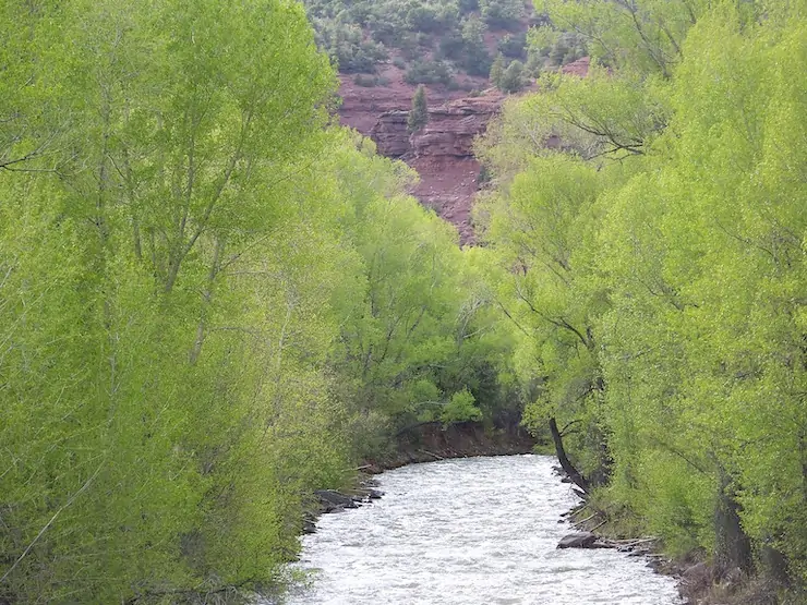
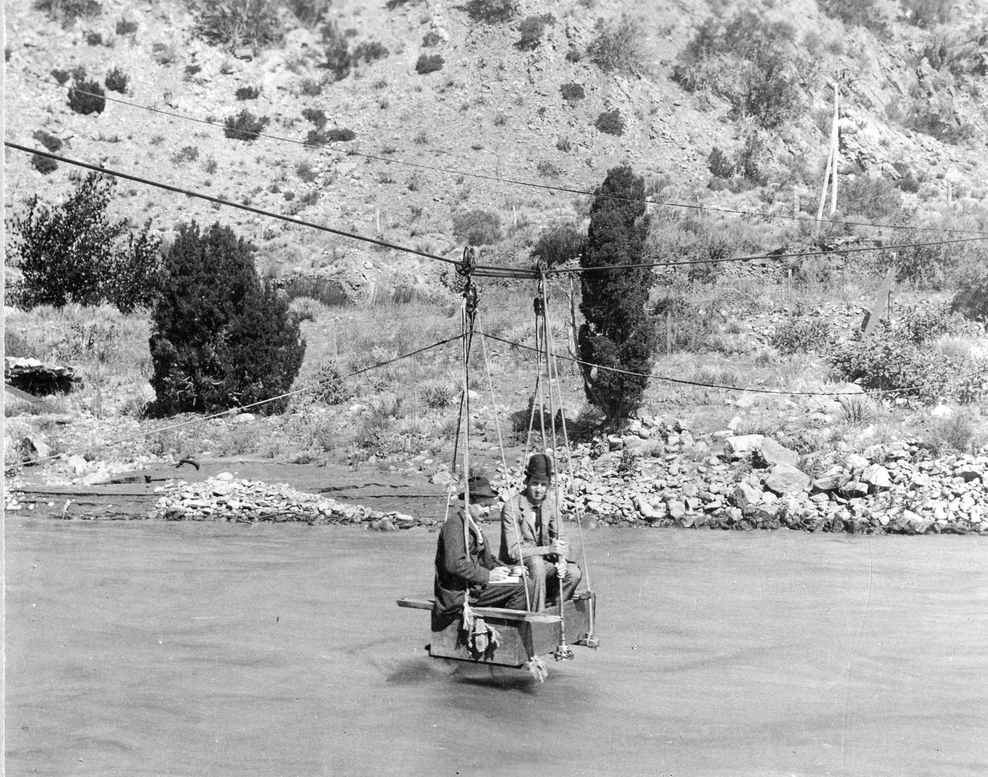
Since 1962, people in Colorado’s Lower Arkansas Valley have heard talks of a pipeline that would bring them clean drinking water from Pueblo Reservoir upstream.

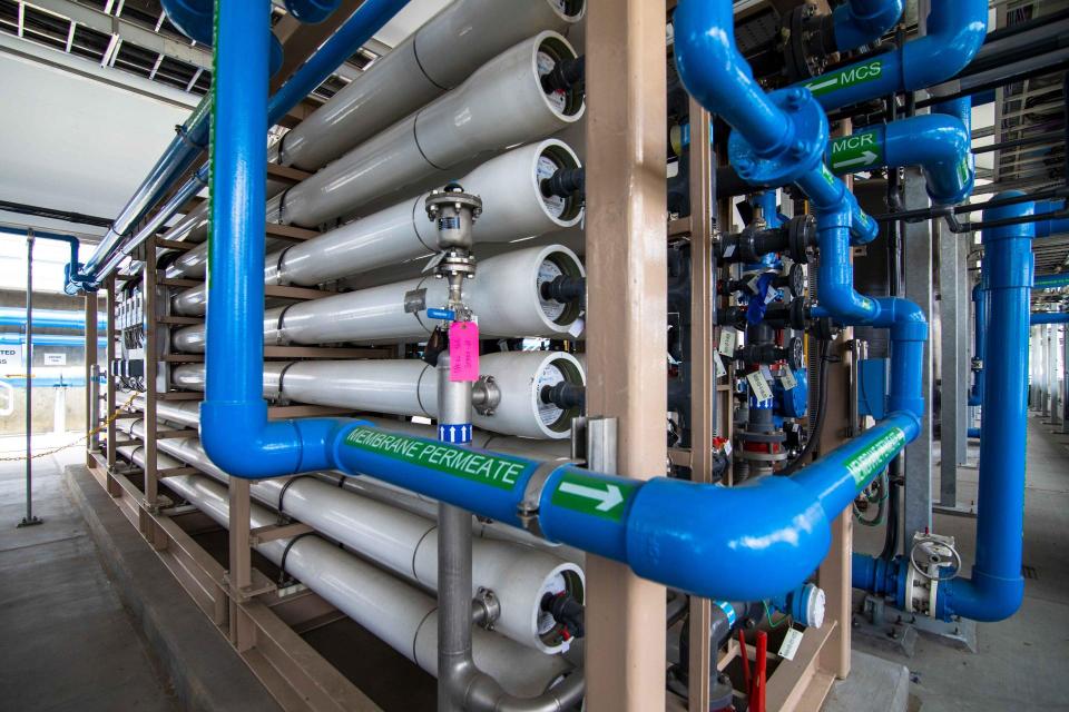
The 103-mile Arkansas Valley Conduit promises to be a long-term source of clean water for the region, where many people rely on poor-tasting and contaminated well water. The project was planned as part of the Fryingpan-Arkansas Project, but for decades, the pipeline was too expensive for the small towns to afford, $600 million by today’s estimates.

If the project stays on schedule, the pipeline will reach its easternmost destination, the town of Lamar, Colorado, in 2035.

But with $60 million in new funding from the Bipartisan Infrastructure Law, officials are hoping to cut the project’s remaining 13-year timeline in half — and ensure steady access to clean water for more than 50,000 people living east of Pueblo along the Arkansas River.

“People have waited 60 years to build this,” says Chris Woodka, a spokesperson for the Southeastern Colorado Water Conservancy District. “The Bipartisan Infrastructure Law has made it entirely feasible that we could do this in a much shorter time.”

Also known as the Infrastructure, Investment and Jobs Act, the 2021 law authorizes more than $550 billion in new investment that will be spread across the nation, including more than $50 billion for clean water programs and another $8.5 billion for Western water needs. The historic federal investment comes as Colorado and other Western states face growing pressures from climate change, drought and a regional crisis along the Colorado River.

Colorado windfall?

Colorado could receive between $800 million and $1.2 billion for water projects alone, according to an early estimate from Gov. Jared Polis’ budget office. A companion bill that passed in August 2022, the Inflation Reduction Act, dedicates another $4 billion for drought resiliency in Western states.

The funding won’t resolve the drought. But the law is an opportunity to fund critical repairs on neglected water systems, many of which were built at the turn of the century.

Amy Moyer, director of strategic partnerships at the Colorado River District, hopes it will inspire water managers and public servants, who are used to engineering workarounds and funding projects piecemeal, to be more ambitious.

“It’s really giving [people] the license to think big,” Moyer says. The river district is giving grants to entities in its 15-county area to conduct studies and develop competitive applications for the federal money. “Projects that were previously unachievable because of a huge financial cost might be back on the table.”

How much money Colorado ultimately gets, however, will depend on efforts by state agencies, regional boards and advocacy groups to help communities, especially small and rural areas, navigate funding programs and pull together competitive applications. Entities eligible for funds include cities and towns, special districts, tribes, water suppliers, and nonprofit cooperative associations like mutual ditch companies.

“We have so many small water users and water providers that are maxed out by just trying to keep their systems running,” says Moyer, whose team has been helping people wade through federal programs to match their projects to the right opportunity.

Largest investment ever

The $1.2 trillion Bipartisan Infrastructure Law is the largest single federal investment in the nation’s water infrastructure ever, with billions available for programs aimed at improving clean water access, fixing century-old facilities and dams, and investing in the health of watersheds and forests.

Most of the one-time dollars will flow through longstanding programs. The U.S. Bureau of Reclamation’s WaterSMART program, which invests in projects that improve water efficiency, will get $400 million through the BIL. Another Reclamation program for Water Storage, Groundwater Storage and Conveyance Projects will get $1.15 billion, almost twice the total that the program received between 2016 and 2021.

The U.S. Environmental Protection Agency, meanwhile, will receive $50.4 billion for drinking water, wastewater and stormwater infrastructure improvements, including $15 billion to replace lead service lines. States will receive those dollars through their state revolving funds, programs that provide low-interest loans and use the money that borrowers pay back, through interest and principal, to provide additional future funding.

Colorado’s revolving funds — administered jointly by the Colorado Department of Public Health and Environment, the Colorado Department of Local Affairs, and the Colorado Water Resources and Power Development Authority — will get $680 million over the next five years, or nearly three times usual annual funding levels.

The money won’t make up for decades of neglect of the country’s water infrastructure; a 2020 report by the American Society of Civil Engineers, for example, estimated that the U.S. needs to invest $109 billion each year over the next two decades to catch up. The EPA’s own estimate calls for more than $744 billion in capital investments over that time period to bring communities into compliance with federal water quality and safety standards.

It’s still a “tremendous opportunity” for utilities to make a serious dent in their deferred infrastructure needs, says Tommy Holmes, legislative director for the American Water Works Association.

“We’ve got to use this money effectively if we want to see any future federal investments on a big scale,” says Holmes.

Finally, cash

Other programs are getting funded for the very first time. Reclamation’s aging infrastructure account, created in 2009 to help fund operations and maintenance work at Reclamation facilities, has until now never received any money. Most of the agency’s facilities are between 60 and 100 years old. BIL allocates $3.2 billion to that account, or 39% of Reclamation’s total funding under the law.

The law also sets aside $1 billion for water initiatives in rural communities nationwide.

Tribal communities will receive $3.5 billion through the Indian Health Service, a recognition of the historical dearth of funding for tribal water infrastructure. Nearly 48% of tribal homes do not have access to clean drinking water or basic sanitation, according to a 2021 report from the Water and Tribes Initiative, with Native American families 19 times more likely than white households to lack indoor plumbing.

The Southern Ute Indian Tribe has been awarded more than $1.1 million in BIL dollars for two wastewater projects, including a project to repair damaged sewage pipes and improve service to more than 1,000 homes. Another $1 million will help improve drinking water service and water pressure to more than 152 homes in Towaoc, the headquarters of the Ute Mountain Ute Tribe in southern Colorado.

The $3.5 billion represents the entire construction funding gap identified by IHS to bring tribal communities to federal standards and tackle a backlog of critical clean water projects.

“This is the first time in history that gap has been filled with funding,” says water policy expert Anne Castle, who is co-leader of Universal Access to Clean Water for Tribal Communities, a project of the Water and Tribes Initiative. “I don’t want to suggest it is a complete eradication of the problem of lack of access to water and sanitation in Indian country, but it is a huge forward step.”

Pressure to act

Groups will need to act relatively quickly to pull together applications for the federal funding opportunity, which can take months to years to prepare.

At the Uncompahgre Valley Water Users Association, general manager Steve Pope is used to navigating federal requirements. The association manages a federally owned system that diverts water from the Gunnison Basin to over 76,000 acres of land in Montrose and Delta counties.

The association hired a consultant to write a grant for a $6 million project to line a one-mile section of canal. Planning on any of its bigger pursuits, which range from $25 to $30 million, are still eight or nine months away from the grant-writing stage, a process that can cost tens of thousands of dollars, Pope says.

“We’re probably going to get one crack at it,” says Pope. “You really have to have your ducks in a row.”

Small organizations with limited capacity may decide it’s not worth the work, says Sonja Chavez, general manager of the Upper Gunnison River Water Conservancy District. Many projects need engineering work or a feasibility study to make their application competitive. To go after federal dollars, groups also need to secure state and local matching funds.

“For me to put in the effort to go after federal funds, I probably wouldn’t do it unless I had a significant project to go after,” says Chavez.

The advantage will go to “shovel-ready” projects that have already been studied and planned. Colorado’s revolving funds, for example, have so far awarded BIL-funded loans to four projects, all of which have been in development for years.

“There’s a lot of pressure to get this money out the door as quickly as possible,” says Alex Funk, director of water and senior counsel for the Theodore Roosevelt Conservation Partnership, which is convening policy groups to strategize and support environmentally sustainable projects funded by the law.

A slow roll-out

Although the legislation was passed in November 2021, the money has been slow to roll out. Reclamation and state revolving funds will award funding on a rolling basis over the next five years, meaning organizations that aren’t yet ready to apply can try for a later round. Many programs have not released any funds, while some new programs have yet to release the criteria for applications.

Unlike the 2021 American Rescue Plan Act, which requires public agencies to spend all of their dollars by the end of 2026, there’s no uniform deadline for when organizations must spend their BIL funds.

The state revolving funds have one year to obligate the BIL dollars they receive each year and another two years to spend them, says Keith McLaughlin, executive director of the Colorado Water Resources and Power Development Authority (CWRPDA), which serves as the banker for Colorado’s revolving funds.

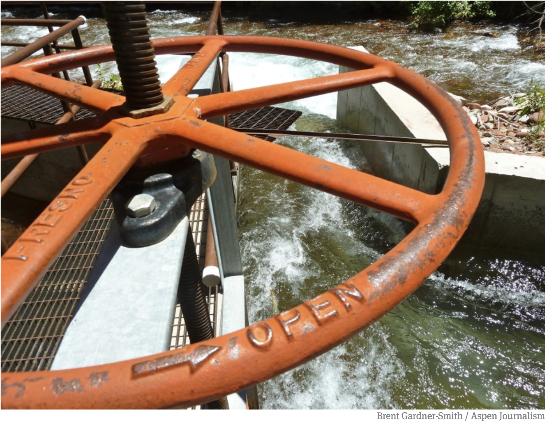
In Northwest Colorado, the 126-year-old Maybell Ditch still delivers water from the Yampa River to 18 agricultural producers. Adjusting the headgates – which were built in the 1960s and are now broken – requires a one-mile hike into the canyon and the effort of a few people, says Mike Camblin, a rancher and volunteer manager of the Maybell Irrigation District.

Now with a $1.92 million BIL grant, the district hopes to begin construction next year on a project to build an access road, replace the headgates with an automated system, and to reconstruct portions of the ditch to address low-flow areas and large debris that make it impassable for boaters and too shallow and warm for fish.

The district and its partners worked for nearly five years to raise money for the project, get support in the community and from the Moffatt County Board of County Commissioners, and secure a grant from the Colorado Water Conservation Board.

All that helped the project’s application to Reclamation’s WaterSMART Grants program, says Diana Lane, sustainable food and water program director at The Nature Conservancy, the project’s fiscal partner. The application criteria awards points for projects that build on state or local planning efforts.

Finding workers

Amid a nationwide labor shortage, finding the skilled workers and planners to move projects forward expediently will be challenging.

Many state and local governments are still trying to fill positions that opened up months ago. And while a large water utility or municipality has staff dedicated to grant writing or to support project development, smaller organizations often need to hire a consultant to write a grant, conduct a study, or do engineering work.

That kind of expertise can be hard to come by, especially in rural Colorado communities.

At the Colorado Agricultural Water Alliance, executive director Greg Peterson is focused on a watershed program under the Natural Resources Conservation Service, which received $918 million in BIL funding, that could help irrigators and agricultural users address issues like soil erosion and flood mitigation. Local entities only have to put up a quarter of the costs of a project and can receive up to $25 million.

Peterson is working with eight different communities on applications for the program. He struggled to find a Colorado expert with experience applying to the fund and ended up reaching out to a group in Oregon for help.

“If we didn’t have them, we wouldn’t go after [the money] at all, probably,” he says.

State, regional groups step up

Early rounds of BIL grants went to states like Arizona and California that had more “shovel-ready” projects to put forward, says Moyer.

This year, officials are hoping money set aside by state lawmakers will give Colorado a competitive edge and help communities that don’t have the capacity to go after grants on their own.

“We’ve been really impressed with Colorado leadership in terms of recognizing that you have to work for these funds,” says Funk. “I think Colorado is actually a big competitor for this funding and could be a model for other states.”

The governor’s office estimates that Colorado needs $1 billion in local or state matching funds to successfully secure $4.1 to $7.1 billion in federal infrastructure dollars. Most federal programs require a local funding contribution, with some as high as 75%.

In addition to the $80 million in state matching funds set aside by state lawmakers, the state legislature also set aside $5 million for the Colorado Water Conservation Board (CWCB) to provide technical assistance for groups going after the dollars. Half of that will be available as direct grants for agencies to hire their own contractors, while the other half will pay for in-house contractors at CWCB who will provide assistance.

State agencies are also staffing up to conduct outreach about opportunities under the BIL. The Department of Local Affairs and Office of Recovery are hosting roundtables and webinars to answer questions from prospective applicants. Each of the state’s regional councils of government will receive funding to hire a coordinator to help local groups navigate federal and state programs. 

“We want to make sure communities have the opportunity to say yes or no to these funding opportunities – we don’t want a community to say, ‘I wasn’t aware,’” says Meredith Marshall, infrastructure coordinator at the Colorado Office of Economic Development and International Trade.

This article first appeared in Water Education Colorado’s Fall 2022 issue of Headwaters Magazine.

Fresh Water News is an independent, nonpartisan news initiative of Water Education Colorado. WEco is funded by multiple donors. Our editorial policy and donor list can be viewed at wateredco.org.

Thy Anh Vo is a freelance journalist based in Colorado. She’s passionate about journalism that shows people how government works and how to hold it accountable. Thy has reported for The Colorado Sun, ProPublica, The Mercury News in San Jose, and Voice of OC. 

New report, Nature-Based Solutions, published for the National #Climate Task Force — NOAA #ActOnClimate

Cover of the NBS report, released at COP27. Credit: White House

Click the link to read the article on the NOAA website (Genie Bey):

At COP27 in Egypt, the Biden-Harris Administration released the Nature-Based Solutions Roadmap, an outline of strategic recommendations to put America on a path that will unlock the full potential of nature-based solutions to address climate change, nature loss, and inequity. This marks the first time the U.S. has developed a strategy to scale up nature-based solutions. The report was developed in response to President Biden’s Executive Order 14072, which recognizes the importance of forests and other nature-based solutions to tackle the climate crisis and strengthen communities and local economies. Led by the Council on Environmental Quality, the Office of Science and Technology Policy, and the National Climate Advisor, the report was developed in consultation with numerous agencies, and identifies key opportunities for greater deployment of nature-based solutions across the Federal government. 

The Roadmap calls on expanding the use of nature-based solutions and outlines five strategic areas of focus for the federal government: (1) updating policies, (2) unlocking funding, (3) leading with federal facilities and assets, (4) training the nature-based solutions workforce, and (5) prioritizing research, innovation, knowledge, and adaptive learning that will advance nature-based solutions. Genie Bey, Zac Cannizzo, Chelsea Combest-Friedman, Bhaskar Submaranian, and Lisa Vaughan represented NOAA’s Climate Program Office as contributors to this report and the accompanying resource guide.

Access the White House Fact Sheet here » 

Access the NBS Roadmap Report here »

Access the NBS Resource Guide here »

Read more about nature-based solutions at COP27 here »

For more information, contact Genie Bey.

Crop residue November 4, 2021. Photo credit: Joel Schneekloth

Opinion: Why you should attend the West Slope Water Summit — The #Montrose Daily Press #GunnisonRiver #ColoradoRiver #COriver #aridification

Register here. Click the link to read the guest column on The Montrose Daily Press website (Sue Hansen). Here’s an excerpt:

What we need now is your help; I invite you to join us for the West Slope Water Summit on Nov. 10 at the Montrose County Event Center. Even though we are a small community on the western slope, arming our community members with knowledge, encouraging conservation, and researching potential solutions is a role that we all play in the Colorado River system. In its fourth year, the West Slope Water Summit’s theme is “troubled waters” featuring an impressive number of prominent water and conservation experts.

The program begins with Andy Mueller, Executive Director of the Colorado River District, who will address adapting the 1922 Compact to today’s reality. Next, Don Day, Meteorologist Day Weather Inc., is presenting on the State of the Weather: the good, the bad, and the ugly.

Before the free lunch, our local Uncompahgre Valley Water Users Association Manager Steve Pope will provide an update to the Colorado River Basin Drought Response as part of a panel of water user board members.

Spots are still available — we recently moved from the conference room to the arena to accommodate a larger crowd. Register at westslopewatersummit.com

River Bottom Park Uncompahgre River. Photo credit: PhilipScheetzPhoto via the City of Montrose

The Water in the West Symposium (November 2-3, 2022) will bring together global experts in #water — #ColoradoState University

South Platte River near CSU Spur. Photo credit: Colorado State University

Register here. Click the link to read the release on the Colorado State University website (Anthony Lane):

This year’s CSU Spur Water in the West Symposium, to be held Nov. 2-3 in downtown Denver, will bring together policymakers, researchers, and experts from the business, nonprofit, and agriculture sectors to look globally for lessons and strategies with the potential to inform how Colorado and other western states respond to the region’s water challenges.  

The event’s theme, “Global Water: Successes and Solutions,” underlies a program that includes panel discussions and keynote speeches aimed at starting conversations about how communities and the entire region can respond and adapt to the pressures created by a growing population within a changing environment.   

“Water in the West, now in its fifth year, has always focused on creating opportunities for speakers and audience members to connect while exploring solutions from unexpected places and sectors,” said Jocelyn Hittle, the CSU System’s associate vice chancellor for CSU Spur and special projects. “This year, we are bringing speakers with wide-ranging expertise — from ag to business to investing — together from across the world to present solutions that might be useful here in the American West. We hope the CSU community and others from across the West will join us for a stellar speaker line-up, a solutions-oriented approach, and a chance to build new, and perhaps unexpected, connections.”

Speakers and panel discussions 

Among the speakers at the 2022 Symposium is Jay Famiglietti, a water researcher who leads the Global Institute for Water Security at the University of Saskatchewan. Panel discussions on cities, agriculture, and innovation opportunities will seek to inform western water discussions by drawing on the experiences of experts from government agencies, private industry, and municipalities as far away as Portugal and Cape Town, South Africa.  

Two additional panel discussions will examine lessons and opportunities related to international water agreements. One will focus on the Columbia River Treaty, which the United States and Canada signed in 1961 and governs the construction and operation of dams on a river that begins in the mountains of British Columbia, flows south through eastern Washington, and then turns west, defining the border between Oregon and Washington on its way to the Pacific. The other will explore solutions involving the United States and Mexico, both of which rely on water from two rivers, the Colorado and Rio Grande, that have their headwaters in Colorado. 

In the future, the Water in the West Symposium will be held at the CSU Spur Hydro building, which opens in January 2023.

The Symposium switched to a virtual format in 2020 and 2021 because of COVID precautions. This year, attendees have the option of attending in-person sessions at the Seawell Ballroom or participating virtually. A combined reception at CSU Spur the evening of Wednesday, Nov. 2, will bring Symposium participants together with the ranchers, farmers, conservationists, land managers, scientists, and others attending Regenerate 2022, an annual conference focused on sharing knowledge and building a culture of resilience. 

The event will take place just weeks before the Spur campus’s third building, Hydro, opens in January. In coming years, Hydro will house the Water in the West Symposium and a range of programs and initiatives focused on water research, conservation, and education. Among these will be Denver Water’s new water quality lab, which will serve to inform the public while providing capacity for more than 200,000 tests each year to monitor the quality of water before treatment and after it is prepared for distribution to customers across the metropolitan area.   

Program details and registration information for the 2022 Water in the West Symposium are available at csuspur.org/witw/ 

The new Water Cycle map is now available: See how humans affect the water cycle — USGS #ActOnClimate

Diagram credit: USGS

Click the link to read about the water cycle on the USGS website:

The water cycle describes where water is on Earth and how it moves. Human water use, land use, and climate change all impact the water cycle. By understanding these impacts, we can work toward using water sustainably. 

What is the water cycle?

The water cycle describes where water is on Earth and how it moves. Water is stored in the atmosphere, on the land surface, and below the ground. It can be a liquid, a solid, or a gas. Liquid water can be fresh or saline (salty). Water moves between the places it is stored. Water moves at large scales, through watersheds, the atmosphere, and below the Earth’s surface. Water moves at very small scales too. It is in us, plants, and other organisms. Human activities impact the water cycle, affecting where water is stored, how it moves, and how clean it is.

Pools store water 

Oceans store 96% of all water on Earth. Ocean water is saline, meaning it’s salty. On land, saline water is stored in saline lakes. The rest of the water on Earth is fresh water. Fresh water is stored in liquid form in freshwater lakes, artificial reservoirs, rivers, and wetlands. Water is stored in solid, frozen form in ice sheets and glaciers, and in snowpack at high elevations or near Earth’s poles. Water vapor is a gas and is stored as atmospheric moisture over the ocean and land. In the soil, frozen water is stored as permafrost and liquid water is stored as soil moisture. Deeper below ground, liquid water is stored as groundwater in aquifers. Water in groundwater aquifers is found within cracks and pores in the rock. 

Fluxes move water between pools 

As it moves, water can change form between liquid, solid, and gas. Circulation mixes water in the oceans and transports water vapor in the atmosphere. Water moves between the atmosphere and the surface through evaporationevapotranspiration, and precipitation. Water moves across the surface through snowmeltrunoff, and streamflow. Water moves into the ground through infiltration and groundwater recharge. Underground, groundwater flows within aquifers. Groundwater can return to the surface through natural discharge into rivers, the ocean, and from springs

A high desert thunderstorm lights up the sky behind Glen Canyon Dam — Photo USBR

What drives the water cycle? 

Water moves naturally and because of human actions. Energy from the sun and the force of gravity drive the continual movement of water between pools. The sun’s energy causes liquid water to evaporate into water vapor. Evapotranspiration is the main way water moves into the atmosphere from the land surface and oceans. Gravity causes water to flow downward on land. It causes rain, snow, and hail to fall from clouds. 

Greeley Irrigation Ditch No. 3 construction via Greeley Water

Humans alter the water cycle 

In addition to natural processes, human water use affects where water is stored and how water moves. We redirect rivers. We build dams to store water. We drain water from wetlands for development. We use water from rivers, lakes, reservoirs, and groundwater aquifers. We use that water to supply our homes and communities. We use it for agricultural irrigation and grazing livestock. We use it in industrial activities like thermoelectric power generationmining, and aquaculture

We also affect water quality. In agricultural and urban areas, irrigation and precipitation wash fertilizers and pesticides into rivers and groundwater. Power plants and factories return heated and contaminated water to rivers. Runoff carries chemicals, sediment, and sewage into rivers and lakes. Downstream from these sources, contaminated water can cause harmful algal blooms, spread diseases, and harm habitats for wildlife. 

The water cycle and climate change 

Climate change is actively affecting the water cycle. It is impacting water quantity and timing. Precipitation patterns are changing. The frequency, intensity, and length of extreme weather events, like floods or droughts, are also changing. Ocean sea levels are rising, leading to coastal flooding. Climate change is also impacting water quality. It is causing ocean acidification which damages the shells and skeletons of many marine organisms. Climate change increases the likelihood and intensity of wildfires, which introduces unwanted pollutants from soot and ash into nearby lakes and streams.

What determines water availability? 

Humans and other organisms rely on water for life. The amount of water that is available depends on how much water there is in each pool (water quantity). Water availability also depends on when and how fast water moves (water timing) through the water cycle. Finally, water availability depends on how clean the water is (water quality). By understanding human impacts on the water cycle, we can work toward using water sustainably. 

Read more about the components of the water cycle in more detail: 

Atmosphere  ·  Condensation  ·  Evaporation  ·  Evapotranspiration  ·  Freshwater lakes and rivers  ·  Groundwater flow  ·  Groundwater storage  ·  Ice and snow  ·  Infiltration  ·  Oceans  ·  Precipitation  ·  Snowmelt  ·  Springs  ·  Streamflow  ·  Sublimation  ·  Surface runoff 

#Colorado OKs drinking treated #wastewater; now to convince the public it’s a good idea — @WaterEdCO

Filtration pipes at Metropolitan Water District of Southern California’s wastewater recycling demonstration plant. (Source: Metropolitan Water District of Southern California)

Click the link to read the article on the Water Education Colorado website (Jerd Smith):

Colorado regulators, after years of study, negotiations and testing, approved a new rule that clears the way for drinking treated wastewater this week, one of only a handful of states in the country to do so.

The action came in a unanimous vote of the Colorado Water Quality Control Commission Oct. 11.

Direct potable reuse (DPR) involves sophisticated filtering and disinfection of sewage water for drinking water purposes, with no environmental buffer, such as a wetland or river, between the wastewater treatment plant and drinking water treatment plant. That water is then sent out through the city’s drinking water system.

Colorado joins Ohio, South Carolina and New Mexico in setting up a regulated DPR system, with California, Florida and Arizona working to develop a similar regulatory scheme, according to Laura Belanger, a water reuse specialist and policy advisor at Western Resource Advocates.

Ron Falco, safe drinking water program manager for the Colorado Department of Public Health and Environment (CDPHE), said the new regulation would provide communities across the state important access to a new, safe source of drinking water, a critical factor in a water-short state.

“This is going to be a need in Colorado and we want to be prepared,” he said. “Can DPR be done safely? Our answer to that is yes.”

Aurora has had a reuse system in place for more than a decade that also uses treated wastewater. But Aurora’s water is treated and released from the wastewater treatment plant into the South Platte River, where it flows through the river’s alluvial aquifer, before Aurora pumps it out through groundwater wells. Aurora then mixes it with raw mountain water before treating it and distributing it to customers. That practice is known as indirect potable reuse — there’s an environmental buffer between the wastewater plant and the drinking water plant, in Aurora’s case, that’s the river. Indirect potable reuse is used by several big cities nationwide, including San Diego.

Graphic by Chas Chamberlin, Source: Western Resource Advocates

Under Colorado’s new regulation, water providers will be required to show they have the technical, managerial and financial resources needed to successfully treat wastewater.

Communities will also be required to show how they will remove contaminants in their watersheds before the water reaches rivers and streams.

Wastewater intended for drinking will require extensive disinfection and filtration, among other techniques, all of which are intended to eliminate pathogens like viruses and bacteria, and remove drugs and chemicals to safe and/or non-detectable levels, according to CDPHE.

And any community that seeks to add treated wastewater to its drinking water system will have to set up extensive public communication programs to show the public its process and to help educate residents about this new water source.

Communities will also have to collect a year’s worth of wastewater samples and prove that they can be successfully treated to meet the new standards.

Western Resource Advocates’ Belanger, who has long advocated for the use of DPR, said the approval has been a long time coming and is cause for celebration.

“We believe DPR is a very important water supply for our communities now and into the future. We feel [this new regulation] is robust and protective of public health.”

But key to tapping the new water source will be helping the public get over the “ick factor,” officials said.

Jason Rogers, vice chair of the Water Quality Control Commission who is also Commerce City’s director of community development, said public outreach should be carefully monitored to ensure it is actually reaching people in all communities and that it is being well-received.

“When thinking about that public meeting, where does it occur? People in some of these communities may have a high reliance on multi-modal transportation, it may not allow for that meaningful engagement,” Rogers said. “And if it isn’t being well received, we need to have them go out and do more public engagement.”

With a mega drought continuing to grip the Colorado River Basin and other Western regions, Colorado’s multi-year process to develop a sturdy new drinking water regulation drew widespread attention, said Tyson Ingels, the head drinking water engineer at the state’s Water Quality Control Division.

Ingels said Utah and Arizona participated in Colorado’s work sessions, demonstrating the interest in what could become an important new water source in the West. Arizona is just now kicking off its own rulemaking process, Ingels said, and Utah, while not yet regulating DPR, has seen a handful of communities proposing to use DPR.

Colorado’s rulemaking process, which dates back to 2015, was at times fractious, with water providers and wastewater operators concerned that the proposed regulation would interfere with what they’re doing already and could add burdensome costs to efforts to develop new water sources.

Ingels said the addition of a third-party facilitator was essential to resolving everyone’s concerns.

Jeni Arndt, a former lawmaker who also serves on the water quality commission, said finalizing the groundbreaking new regulation signaled an important step forward in navigating difficult public policy issues. [Editor’s note: Arndt is a former board member of Water Education Colorado, which sponsors Fresh Water News.]

“Gone are the days when we were struggling to come to agreement,” Arndt said. “I’m very excited to move forward into a new era.”

On Tuesday, several water utilities spoke in favor of the new regulation, including the Cherokee Metropolitan District, Castle Rock, and the City of Aurora.

Matt Benak, Castle Rock’s water resources manager, said the regulation will give his town the certainty it needs to move forward developing new water supplies. “DPR is a critical tool for sustainable water resources. Creating this regulation will allow water providers like us to plan and to potentially implement DPR,” he said.

Tuesday’s approval was contingent on fixing minor clerical errors in the regulation. Commissioners will give final formal approval of the regulation at its November meeting.

Jerd Smith is editor of Fresh Water News. She can be reached at 720-398-6474, via email at jerd@wateredco.org or @jerd_smith.

Prairie Waters schematic via Aurora Water.

Inaugural #ColoradoRiver Water Leaders class releases recommendations for post 2026 river operating guidelines — Water Education Foundation #COriver #aridification

Water Education Foundation Inaugural ColoradoRiver Water Leaders class with their suggested 2026 operating guidelines for the river basin. Photo credit: The Water Education Foundation

Click the link to read the announcement from the Water Education Foundation website:

Our inaugural 2022 Colorado River Water Leaders class completed its six-month program with a report outlining key policy recommendations for managing the Colorado River after existing operating guidelines expire in 2026.

The class of 13 up-and-coming leaders included engineers, lawyers, resource specialists, scientists and others working for public, private and nongovernmental organizations from across the river’s basin. The class had full editorial control to choose its recommendations.

Class members presented their recommendations at the Foundation’s biennial Colorado River Symposium, an invitation-only event in Santa Fe, N.M., whose audience included key water managers, state and federal officials, tribal leaders and other interested groups from throughout the Colorado River Basin.

The biennial Colorado River Water Leaders program is modeled after our California Water Leaders program, which allows participants to deepen their knowledge on water, enhance individual leadership skills and prepare participants to take an active, cooperative approach to decision-making about water resource issues. Leading experts and top policymakers served as mentors to class members. Our next Colorado River Water Leaders class will be in 2024.

Among the Colorado River Water Leaders’ key recommendations:

– Improve the planning process through increased frequency, communication and engagement with water interests

Brad Udall: Here’s the latest version of my 4-Panel plot thru Water Year (Oct-Sep) of 2021 of the Colorado River big reservoirs, natural flows, precipitation, and temperature. Data (PRISM) goes back or 1906 (or 1935 for reservoirs.) This updates previous work with @GreatLakesPeck. Credit: Brad Udall via Twitter

– Establish a more holistic approach to systems management that balances water use with available supply and inflows that provides flexibility and allows the system to recover and build resilience.

Colorado River Allocations: Credit: The Congressional Research Service

– Leverage the political power of the Colorado River Basin to push Congress for large-scale, predictable federal investment.

Colorado River “Beginnings”. Photo: Brent Gardner-Smith/Aspen Journalism

– Incorporate the environment in the next round of Colorado River operating guidelines.