
Map showing where the January-August 2026 temperature ranks when compared to all January-August periods since 1895. It's as if something has changed. 🤔
— Climatologist49 (@climatologist49.bsky.social) 2026-09-02T00:16:35.750Z
Situation: #ColoradoRiver Water Crisis — Real-time intelligence platform delivers key data and information as #LakePowell and #LakeMead hit combined record-low water levels, putting at risk agriculture, industry, and a $1.4 trillion regional economy #COriver #aridification
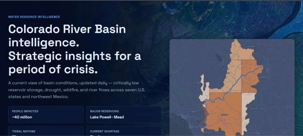
Click the link to read the release on the Circle of Blue website (J. Carl Gantner):
August 27, 2026
Circle of Blue and True Elements Launch Situation: Colorado River from Stockholm World Water Week
- Colorado River faces a “collective nightmare.”
- New platform delivers a shared view to help inform decisions and collaboration.
- Situation: Colorado River is part of Designing Water’s Future, the initiative to create “a new operating system for the world’s fresh water” — aligning across finance, policy, media, and innovation.
STOCKHOLM (August 27, 2026) — As some 2,000 experts gather for World Water Week to address global water challenges and solutions, Circle of Blue and True Elements today launch a new, live data, information and context platform for the Colorado River basin, which faces unprecedented stress as the river and its reservoirs set record lows that are forcing a dramatic reset of water use across the American West. The river supports approximately $1.4 trillion in annual economic activity and 16 million jobs across seven basin states, 30 Tribal Nations, and northwestern Mexico.
Situation: Colorado River begins with real-time and historical data collected into a strategic, user-friendly dashboard. In the face of increasing stress on the basin, the team, which includes reporters from Circle of Blue, will add on-the-ground context to deliver critical insights for policymakers, negotiators, journalists, businesses, and the public.
The core data is assembled from True Elements’ TrueQi system — an advanced and comprehensive resources platform that includes satellite observations and river gauges as well as drought indicators, wildfire detections, and reservoir measurements.
The platform arrives at an inflection point for the American West as Lake Mead and Lake Powell reach record low levels amid a warming climate. The combined storage of the two reservoirs is now lower than at any point since 1957 — before Glen Canyon Dam existed. Ninety-five percent of the basin remains in drought.
“The basin’s assumptions are being reset in real time, and everyone — federal, state, Tribal, corporate, business, communities — needs a trusted, shared view of what is actually happening,” said J. Carl Ganter, co-founder and managing director of Circle of Blue, the international nonprofit reporting on fresh water and its “nexus” intersections with food, energy, infrastructure, and health.
The TrueQi platform from True Elements collects real-time and historical federal, state, satellite, and sensor data across the Colorado River basin, the broader American West and globally. As it expands, Situation: Colorado River layers Circle of Blue’s journalism, along with reporting from network partners, on top of key data points, with additional context from academic and research collaborators.
“Real-time and cross-sector data is the foundation while the context makes it real and relevant,” said Kim Kobza, CEO of True Elements. “TrueQi already delivers the most granular water intelligence in the field. Pairing it with Circle of Blue’s award-winning reporting turns raw numbers into shared guidance.”
“Situation: Colorado River pulls the data together and makes it accessible to everyone making decisions under the pressure of declining water supplies. We do this with a sense of urgency, humility and collaboration in the face of increasing water crises globally,” Ganter said. It is part of Designing Water’s Future, Circle of Blue’s international initiative to better inform and align action across finance, policy, media, innovation, and the public.
The situation is forcing a reckoning for farmers, developers, cities, and industries, including silicon chip manufacturers and data centers. “We have a colossal failure to act in the face of an inevitable collective nightmare — and all the predictions are coming true faster than we thought,” Felicia Marcus, past chair of the California State Water Resources Control Board, told Circle of Blue.
As the basin’s operating assumptions are tested, Situation: Colorado River asks a core question:
What data points and contexts are necessary to inform the most important decisions across the Colorado River basin, and how can new data and intelligence approaches be applied across the U.S. and globally?
The initiative launches with a call for public and expert input at an historic moment. Submit thoughts, questions, suggestions and corrections to coloradoriver@circleofblue.org. This will shape the initiative’s next iterations of data selection and analysis, editorial focus and priority coverage.
Also available now is Water Savvy 3.0, a free mobile app from True Elements available on the Apple App Store that puts real-time water quality data, alerts and reporting into the hands of the public and students.
The platform is live online today from Stockholm. It is free and designed to be a trusted source for newsrooms, businesses, policymakers, academic researchers, students and the public. A more comprehensive enterprise insights system is available to businesses, agencies, and governments. Circle of Blue original content publishes under a Creative Commons Attribution-NonCommercial-NoDerivatives 4.0 International (CC BY-NC-ND 4.0) license.

#Durango receives little rain in August — The Durango Herald #AnimasRiver
Click the link to read the article on The Durango Herald website (Gabrielle Wallace). Here’s an excerpt:
September 2, 2026
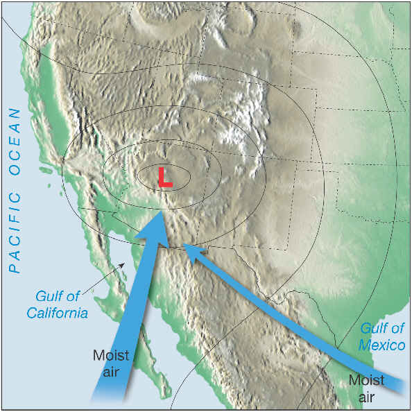
Durango experienced a drier-than-normal August…The month of August accumulated 0.28 inches of precipitation, 0.12 inches of which occurred Monday. Monday was the highest precipitation day of August, Gillian Felton, a National Weather Service meteorologist in the Grand Junction office, said. August traditionally averages closer to 1.3 inches of rain, according to the weather service, and precipitation this August was down about an inch comparatively. A plethora of reasons contributed to the dry spell, said Brooke Scholtens, a meteorologist with the National Weather Service office in Grand Junction.
“For the earlier parts of the summer, we were experiencing those drought-like conditions,” she said. “So that makes things incredibly difficult, especially since the pushes that we did see of the monsoon, most of the time, we had dry air in the way that was kind of preventing moisture from entering the region.”
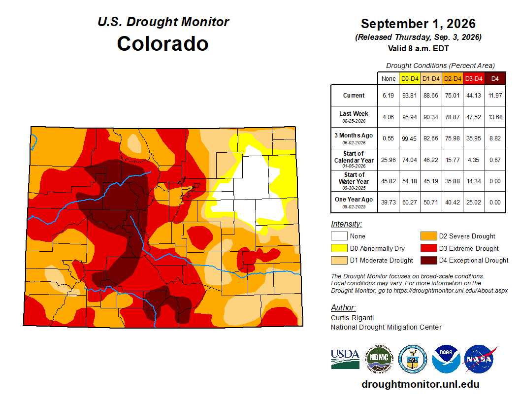
This monsoon has been drier than traditional years, Scholtens said. She added that the weather service measures moisture at Durango-La Plata County Airport, so some areas around Durango may have differing precipitation levels…Monsoons don’t have a specific end date, but it usually wraps up mid- to late-September, Scholtens said…According to the National Integrated Drought Information System, 91.6% of La Plata County is in a severe drought and 8.4% of the county is in an extreme drought. Durango has been in Stage One water restrictions since early April as part of the city of Durango’s Drought Management Plan.
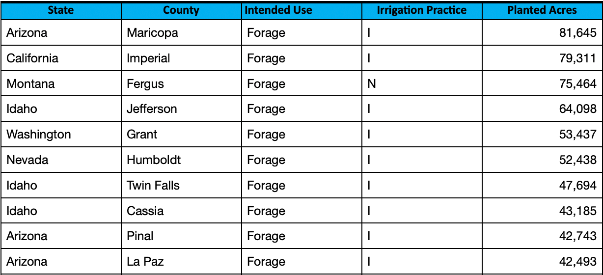
Absurdity of the Colorado River crisis: Nearly half the river’s water goes to growing livestock feed and low-value exports — Daniel M. Frey (BigPivots.com) #ColoradoRiver #COriver #aridification
Click the link to read the article on the Big Pivots website (Daniel M. Frey):
August 30, 2026
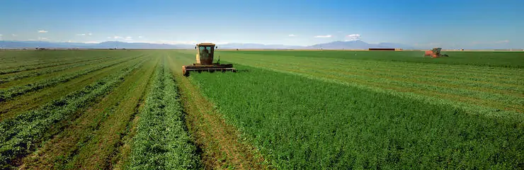
Forty million people depend on the Colorado River. Some of its largest cities are facing real shortages. Yet nearly half of the water put to human use in the basin goes to growing feed crops such as alfalfa, hay and silage for cattle, with a meaningful share exported overseas.
This is not a hydrology problem. It is a political one.
The misuse of water
Growing alfalfa and hay to feed livestock consumes roughly 46% of all the water put to human use in the basin—more than every city and industry combined, and more than any other single use of the river. In the Imperial Valley, a material portion of alfalfa is exported. Foreign agribusinesses, including Saudi Arabia’s Fondomonte and the UAE’s Al Dahra, have leased Southwestern land to grow water-intensive feed and ship it home to countries that have banned the same crop domestically to protect their own water. Arizona’s governor already canceled state land leases with one of these companies over exactly this issue. We are draining a river that 40 million Americans depend on to grow low-value cattle feed.
This is not even a true market outcome. Between 2017 and 2023, the federal Crop Insurance Program paid $5.6 billion to farmers in the seven Colorado River states for drought-related losses, including more than $2 billion to alfalfa and hay growers alone. Separately, the federal government has committed $1.2 billion over three years under the 2023 Lower Basin conservation agreement to pay some of those same farmers to leave water in the river instead — and under “use it or lose it” water law, that money does not necessarily translate into lasting reduced consumption once the payments end. We are subsidizing the least essential, most water-intensive use of the river while barely funding a lasting transition away from it. These policies ignore urgent human needs and support the continued subsidized irrigation of low-value crops.
Because so much of this crop is exported, converting these acres would not meaningfully affect the U.S. or global food supply. Foreign and domestic buyers would simply source feed from places where water is not scarce. What we would lose is a low-value export that is consuming precious water.
Nobody needs Southwestern agriculture to disappear. Israel farms one of the driest landscapes on Earth and still exports produce because it rebuilt its water use around efficiency instead of volume.
Drip irrigation, which Israel pioneered in the 1960s, delivers water at 70% to 90% efficiency, compared with roughly 40% to 60% for the flood irrigation still common in the Colorado River Basin.
Israel recycles 85% to 90% of its municipal wastewater, supplying more than half its total agricultural demand. Israeli farming also shifted deliberately from low-value, high-water fodder crops to higher-value, lower-water produce such as tomatoes, peppers, dates and avocados. None of this is exotic or new.
Why the status quo persists
So why has nothing changed here? Under prior appropriation law, the oldest agricultural water rights, some dating to the 1800s, are legally senior to every city built afterward, including Phoenix, Las Vegas and Los Angeles. That seniority is the leverage in every negotiation.
The Imperial Irrigation District alone holds senior rights to roughly 3.1 million acre-feet a year — nearly a fifth of the river’s average flow, and on its own equal to Arizona’s and Nevada’s entire combined state allocations. That gives a handful of districts a permanent seat at every basin-wide deal because the law guarantees it. When $4 billion in federal conservation funding was distributed through the Inflation Reduction Act, much of it paid agricultural districts to conserve water they were under no legal obligation to relinquish, thanks to their senior water rights.
This is organized and specific, not a vague farm lobby. The Family Farm Alliance, representing irrigated agriculture across 16 Western states, has testified before Congress repeatedly over the past two decades and led a 2025 push for at least $2 billion in near-term drought funding to sustain current agricultural use, not reduce it.
What should change
None of this is an argument against private property or against farmers and ranchers as people. Water rights in the West are real property, built into land value, farm equity and family inheritance. Any transition worth pursuing must compensate people fairly for what the law actually gave them. Conservation is not agriculture’s job alone. Cities owe real cuts too, through tiered pricing, continued investment in water reuse, limits on ornamental turf and honest accounting of growth in already stressed areas.
But fairness among water users does not mean treating every use as equally necessary. Water for people—for drinking, sanitation and food—comes before subsidized hay exports. That ranking is not radical. It is what “beneficial use” was always supposed to mean before the term became a shield for the status quo.
The technical plan is not the missing piece; versions of it have circulated for years. What is missing is the political will to say, plainly and before the next crisis, that human need outranks irrigated hay, even when the institutions built to avoid that choice are loud, organized and well funded. The reservoirs will not wait for a more comfortable moment. Neither should we.
The 40 million people who depend on the Colorado River should demand that political and business leaders protect their most precious, life-sustaining resource.
Daniel Frey is a Boulder resident, non-practicing CPA and Certified Energy Manager (CEM). He researches and writes on energy and sustainability issues.
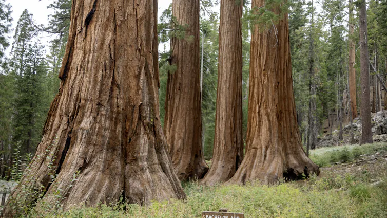
Yosemite, again in corporate crosshairs, embodies the long war over US national park privatization — Michael Childers (TheConversation.com)
Michael Childers, Colorado State University
Reports that the Trump administration is working to transfer part of Yosemite National Park to a private land developer have heightened concerns among park advocates and the public about privatization of public land.
The proposed deal, which a government spokesperson said has not been finalized, would involve a land swap: The government would give the developer a small area of the park’s land on which to build a private access road between a proposed resort and the park itself. In exchange, the developer would buy land of similar value near the park, or elsewhere in California, and transfer that land to federal ownership.
Environmental advocates and park staff have worried for more than a year that the administration’s cuts to the National Park Service’s budget and staffing would lead to further privatization of the national parks’ land and business operations.
The nation has a long history of similar efforts, including a wildly unpopular 1980 attempt by Reagan administration Interior Secretary James Watt to promote development and expand private concessions in the parks. But debate over using public national park land for private profit dates back more than a century before that.
As I explain in my book, “The Mountains Are Calling: Tourists and the Unmaking of Yosemite National Park,” no park has played a more central role in that debate than Yosemite, in California.
Early concerns
In early 1864, Central American Steamship Transit Company representative Israel Ward Raymond wrote a letter to John Conness, a U.S. senator from California, urging the government to move swiftly to preserve the Yosemite Valley and the Mariposa Grove of giant sequoia trees to prevent them from falling into private hands. Five months later, President Abraham Lincoln signed the Yosemite Grant Act, ceding the valley and the grove to the state of California, “upon the express conditions that the premises shall be held for public use, resort, and recreation.” This was years before Yellowstone became the first federal land designated a national park in 1872.

Controversy arose quickly at Yosemite. Two men – James Lamon and James Hutchings – had claimed land in the valley before the federal government gave it to California. Both began commercial operations, Lamon growing cash crops and Hutchings operating a hotel.
California said their businesses threatened the state’s ability to develop roads and trails in Yosemite by competing for tourist dollars. A legal battle ensued and was not resolved until an 1872 U.S. Supreme Court ruling found that the men’s land claims had not been fully validated according to the procedures of the time. The California legislature paid both men compensation for their land, and both left the park.
In 1890, neighboring parts of the Yosemite area became America’s third national park – and in 1906, the federal government again took possession of the Yosemite Valley itself and the Mariposa Grove, specifically to incorporate them into an expansion of the national park.
Development rights
Yet, as my research has found, the role of private interests in the park remained unsolved. Private companies under contract to the National Park Service have long provided needed amenities such as lodging and food within the national parks. But questions over what is acceptable in national parks in the pursuit of profit have shaped Yosemite’s history for generations.
In 1925, I found, the question centered on the right to build the first gas station inside the park, in Yosemite Valley. Two private businesses, the Curry Camping Company and the Yosemite National Park Company, had long competed for tourist dollars within the park. Each wanted to build a gas station to boost profits.

Frustrated over the need to decide, National Park Service Director Horace Albright ordered the rival firms to simplify management of the park’s concessions. The companies merged, and the newly formed Yosemite Park and Curry Company was granted the exclusive rights to run lodges, restaurants and other facilities within the park, including the new gas station.
But as I found in my research, the park service and the concessions company did not always see eye to eye on the purpose of the park. The conflict between profit and preservation is perhaps most clearly illustrated by the construction of a ski area within the park in the early 1930s. The park service initially opposed the development of Badger Pass Ski Area as not conducive to the national park ideal, but the Yosemite Park and Curry Company insisted it was key to boosting winter use of the park.
In 1973, the Music Corporation of America, an entertainment conglomerate, bought the Yosemite Park and Curry Company. The company already had a tourist attraction operating near Hollywood, where visitors could pay to tour movie sets, but had not yet changed its name to Universal Studios or launched major theme parks in Florida and California. Its purchase of the park’s concessions set off a firestorm of controversy over fears of turning Yosemite into a theme park.
That didn’t happen, but annual park visitor numbers climbed from 2.5 million to 3.8 million over the 20 years MCA ran the concessions, which sparked concerns about development and overcrowding in the park. Conservationists argued the park service had allowed the corporate giant to promote and develop the park in ways that threatened the very aspects of the park most people came to enjoy.
With three restaurants, two service stations with a total of 15 gas pumps, two cafeterias, two grocery stores, seven souvenir shops, a delicatessen, a bank, a skating rink, three swimming pools, a golf course, two tennis courts, kennels, a barbershop, a beauty shop, Badger Pass Ski Area and three lodges, the Yosemite Valley was a busy commercial district. Critics argued that such development contradicted the park service’s mandate to leave national parks unimpaired for the enjoyment of future generations.

Who owns the names?
Falling profits and consolidation within the music industry led MCA to sell its concessions rights in Yosemite in 1993. The Delaware North Companies, a global hospitality corporation, took over and ran the park’s concessions until 2016, when it sold the rights to Aramark.
But in that sale, the question of public resources and private profits arose again. Delaware North demanded $51 million in compensation for Aramark continuing to use the names of several historic properties within the park, such as the Ahwahnee, a hotel, and Curry Village, another group of visitor accommodations. The company claimed those names were a part of its assets under its contract with the park service.
The park service rejected the claim, saying the names, which dated back more than a century, belonged to the American people. But to avoid legal problems during the transition, the agency temporarily renamed several sites, including calling the Ahwahnee the Majestic Yosemite Hotel and changing Curry Village to Half Dome Village. Public outrage erupted, denouncing the claim by Delaware North as commercial overreach that threatened to distort Yosemite’s heritage. In 2019, the park service and Aramark agreed to pay Delaware North a total of $12 million to settle the dispute, and the original names were restored. https://www.youtube.com/embed/LXfnTKLw8Qg?wmode=transparent&start=0 Protesters unfurl an upside-down U.S. flag from the top of El Capitan in Yosemite National Park in February 2025, protesting Trump administration changes to the National Park Service.
Renewed interest in commercial efforts
In June 2025, Yosemite again took center stage in the dispute over the role of federal funding versus private interests at the start of the second Trump administration when a group of climbers unfurled an American flag upside down off El Capitan in protest of the administration’s cuts in personnel and slashing of the park service’s budget.
Conservationists, including former National Park Service Director Jonathan Jarvis, argued that by defunding the park service and laying off as much as a quarter of its workforce, the Trump administration was “laying the groundwork to privatize” the national parks by allowing corporate interests more access to public lands. Those concerns echo ones raised during the first Trump administration, when the White House argued privatization would better serve the American public by improving visitor experiences and saving federal dollars.
Members of Congress and former park service officials say the reported effort in 2026 to turn over park land to a private owner would be a major blow to federal efforts to protect parks and conserve land.
Whichever side prevails in the short term, the debate over the role of private interests within national parks like Yosemite will undoubtedly continue.
This article contains material previously published July 31, 2025.
Michael Childers, Associate Professor of History, Colorado State University
This article is republished from The Conversation under a Creative Commons license. Read the original article.
Water districts move forward on water right diligence applications — The #PagosaSprings Sun #SanJuanRiver

Click the link to read the article on the Pagosa Springs Sun website (Josh Pike). Here’s an excerpt:
September 2, 2026
At recent meetings, the San Juan Water Conservancy District (SJWCD) and the Pagosa Water and Sanitation District (PAWSD) boards of directors approved applications for findings of reasonable diligence for several water rights held by the districts…At an Aug. 13 meeting, the PAWSD Board of Directors unanimously approved applications for findings of reasonable diligence for three sets of water rights, including rights for the San Juan River intake, a group of rights associated with the Dry Gulch Reservoir project that the SJWCD leads development on, and a second enlargement on a water right in Dutton Ditch. The Dry Gulch and Dutton Ditch water rights are held by both PAWSD and the SJWCD, while the San Juan right is exclusive to PAWSD. PAWSD board member Bill Hudson pointed out that these water rights are not rights PAWSD is currently using, but are rights that could be developed in the future if the district needs them…At an Aug. 17 meeting, the SJWCD Board of Directors also unanimously approved diligence filings for the Dry Gulch and Dutton Ditch water rights. SJWCD legal counsel Jeffrey Kane explained to the board that he would file the joint application for the Dry Gulch water rights, while PAWSD’s legal counsel would file the application for the Dutton Ditch water rights.
The Colorado River Water Supply Crisis in a Few Graphs: Part 2 — Agricultural Water Use in the Lower Basin — The Traveling Wilburys of the #ColoradoRiver #COriver #aridification

Click the link to read the report on the University of New Mexico Digital Repository website (Jack Schmidt1, Anne Castle2, Eric Kuhn3, Kathryn Sorensen4, Katherine Tara5):
September 2, 2026
KEY POINTS
- Reductions in Lower Basin water use during the last four years, including forecast use in 2026, are similar to the initial targets for Lower Basin shortages described in the Final Environmental Impact Statement for Post-2026 Operational Guidelines and Strategies for Lake Powell and Lake Mead (FEIS) and the accompanying Record of Decision (ROD). 6 Lower Basin consumptive use in 2023, 2024, and 2025, and forecast for 2026 has been the smallest for the entire 2010-2026 period. These four years of smallest use are between 1.4 and 1.7 million acre feet/year (maf/yr) less than the 7.50 maf/yr amount generally recognized as the Lower Basin’s mainstem allocation.
- Reductions in Lower Basin use have been achieved by large reductions implemented by Central Arizona Project (CAP) contractors and subcontractors, the Imperial Irrigation District (IID), and non-CAP water users in Arizona. The reductions in use in the IID have been in summer water use and have not affected consumptive use in winter when garden crops, such ass lettuce, onions, carrots, and broccoli, are grown.
- There is no historical analogy for implementing Lower Basin shortages of 3 maf/yr that would reduce annual consumptive water use to 4.5 maf/yr. We identified the lowest use in each month between 2010 and 2026 in each Lower Basin state and summed those monthly values, even when those months did not occur in the same year. The annual total of the summed lowest monthly uses yielded a minimum total Lower Basin use of 5.03 maf/yr. Thus, implementation of 3 maf/yr shortages would require reductions in monthly use greater than the sum of the smallest monthly uses during the past 17 years.
INTRODUCTION
This paper is part of a series, The Colorado River Water Supply Crisis in a Few Graphs, whose goal is to provide readers with summary information about the natural water supply, reservoir storage, and consumptive uses and losses in the Basin so that readers can better understand and consider the current water crisis. The long-term fate of the water supply provided by the Colorado River depends on many complex and interconnected factors: the natural flow of the river, the amount of water stored in the Basin’s reservoirs, the consumptive uses of that water, the losses caused by reservoir evaporation, and the losses associated with water flowing through natural channels (i.e., transmission losses).
In 2024, approximately 60% of all uses and losses of Colorado River water in the United States occurred in the Lower Basin (Table 1).⁷ In this paper, we summarize water use in the Lower Basin since 2010, primarily focusing on consumption by the Imperial Irrigation District (IID), the largest user in the entire Colorado River Basin, and on the aggregate consumption by Arizona users not served by the Central Arizona Project (CAP). We focus on these agricultural users, because agriculture makes up approximately 60% of consumptive uses in the Lower Basin,⁸ and the agricultural sector will play a significant role in future reductions in water use in the Lower Basin.
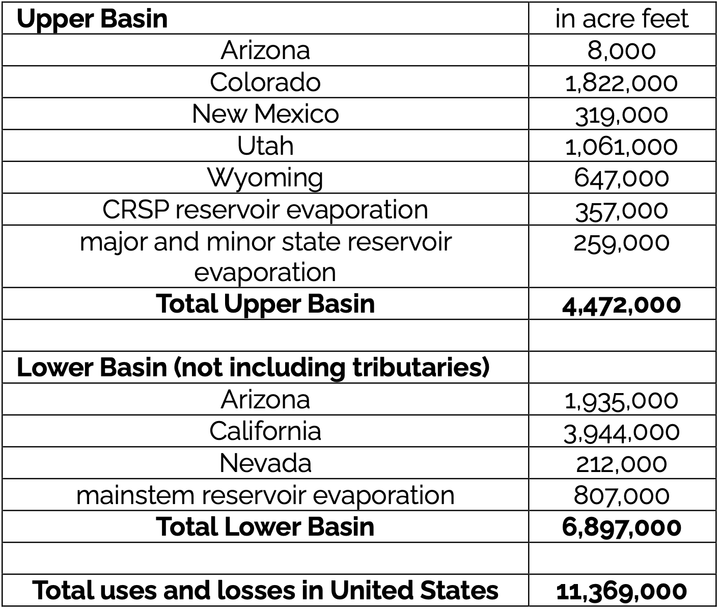
This paper provides historical context in which to consider the magnitude of recent reductions in Lower Basin water use by comparing current water use with typical rates of use since 2010. We also provide historical context for the shortage goals described in the recently released ROD and Operating Guidelines for 2027 and 2028. 10 The ROD lists a potential maximum Lower Basin reduction of 3.0 maf/yr but also includes language that seems to allow for even greater reductions, after consultation, in extraordinary circumstances.
We analyze the Lower Basin water use data summarized by the Bureau of Reclamation in annual decree accounting reports formally titled Colorado River Accounting and Water Use Report: Arizona, California, and Nevada.¹¹ These reports are issued each May and summarize monthly water use by every Lower Basin user. Reclamation also provides monthly provisional data on the current year’s water use, and the agency provides forecasts of annual use for the current year.¹² Similarly extensive and precise data describing Upper Basin use are not readily available.
Lake Mead and Lake Powell are the largest reservoirs in the United States and essentially are one gigantic reservoir separated into two parts by the Grand Canyon.¹³ Inflow to this gigantic reservoir primarily is snowmelt from the Rocky Mountains, and a significant amount of that runoff is put to beneficial use by Upper Basin users before it reaches Lake Powell. A small amount of additional inflow occurs within the Grand Canyon, and there are occasional inflows to Lake Mead from the Virgin River. Southern Nevada Water Authority directly withdraws water from Lake Mead, and other Lower Basin users divert stream flow after it is released from Lake Mead.
RECENT LOWER BASIN WATER USE
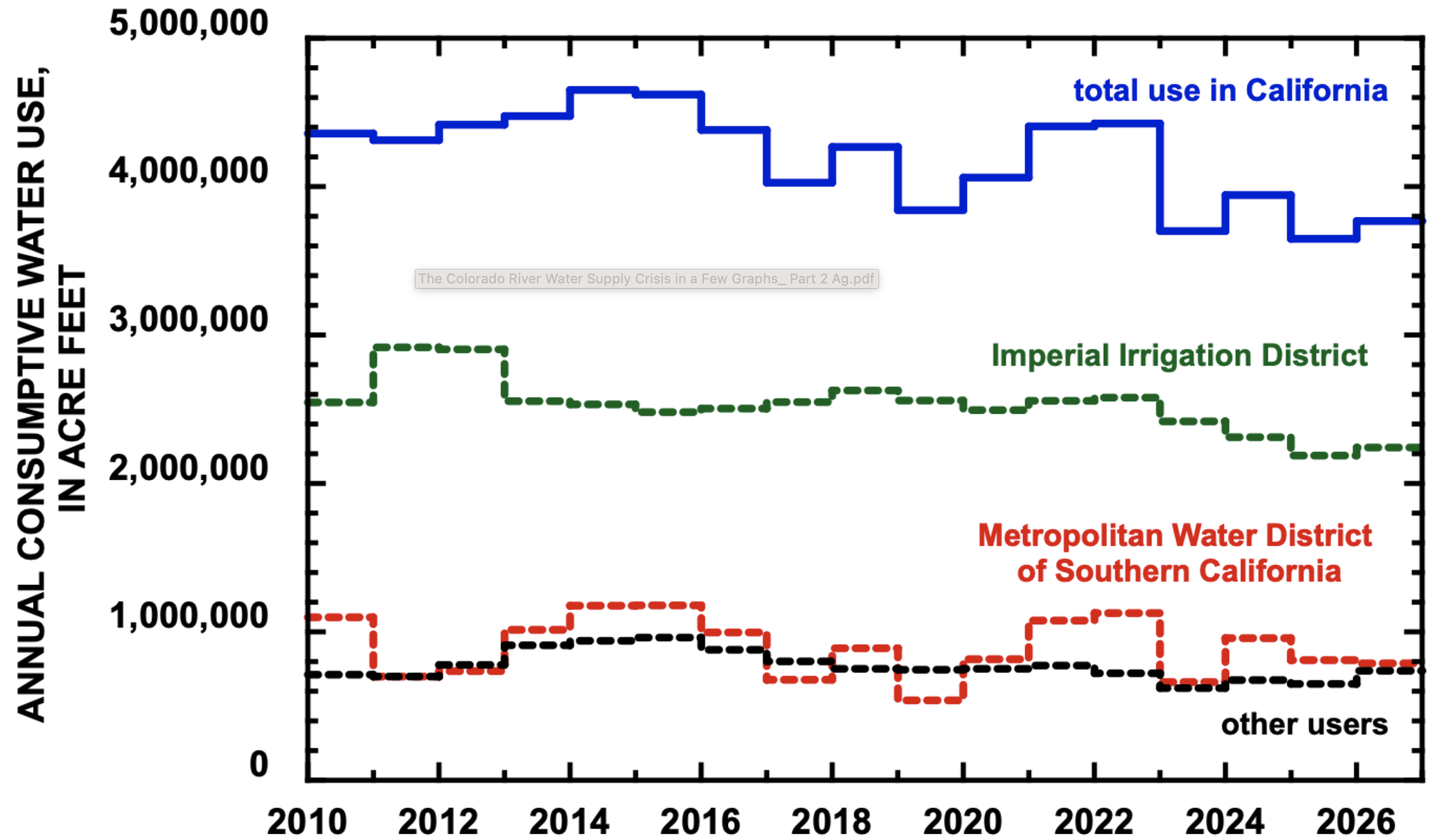
In 2025, total consumptive use in the three Lower Basin states was 5.755 maf, the smallest annual total use since at least 2010 (Fig. 1) and 17% less than the average for 2010-2025.14 This small amount resulted from the lowest annual use in California (3.647 maf) since at least 2010 and the second lowest annual use since 2010 in Arizona (1.911 maf). Lower Basin use in 2026, 5.961 maf, is forecast to be slightly more than in 2025.15
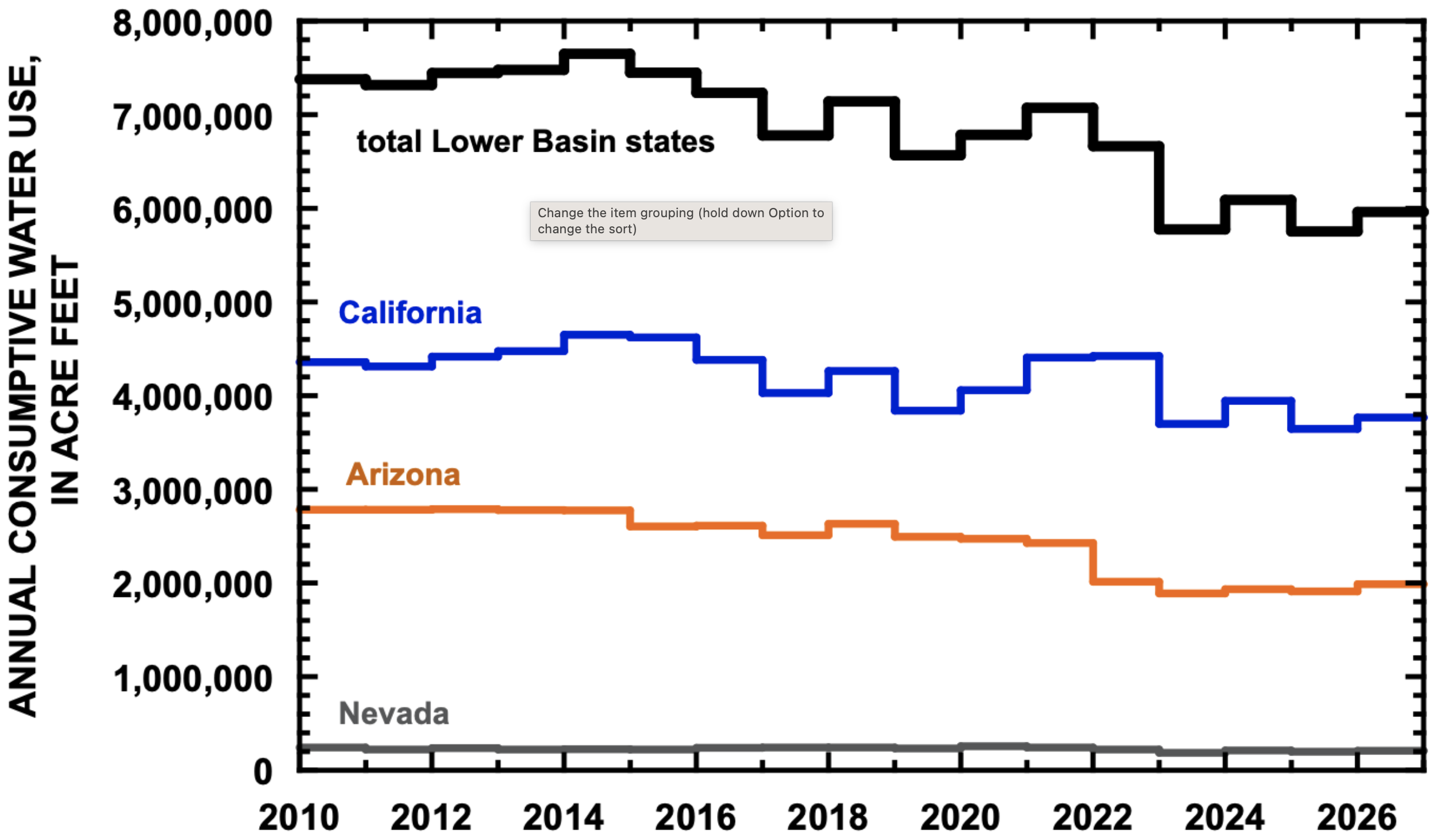
Water use in California since 2023, including forecast use in 2026, has been 13% less than between 2010 and 2022.16 Decreased use in California in those years has been primarily due to reductions in use by IID (Fig. 2). IID’s consumptive use of 2.187 maf in 2025 was the lowest since 2010 and forecast use in 2026 of 2.242 maf is also very low. Average use by IID between 2023 and 2026 will be 12% less than average use between 2010 and 2022.17 Annual consumptive use by the Metropolitan Water District of Southern California (MWD) between 2023 and 2026 will be 13% less than between 2010 and 2022, although the savings are not as great because MWD uses less water than does IID.18
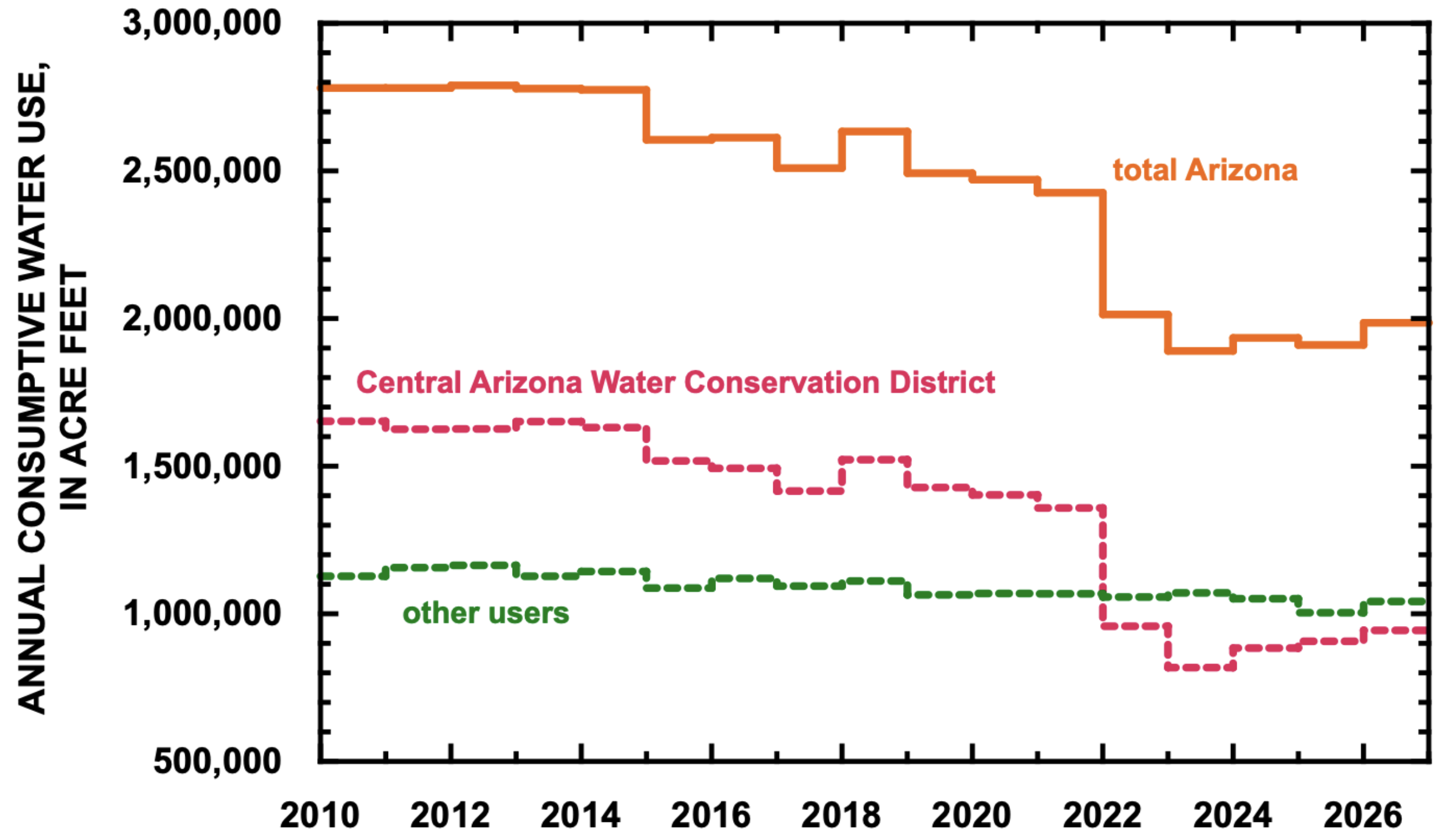
The proportionate reductions in water use in Arizona have been much larger than in California. Average statewide water use between 2023 and 2026 will be 25% less than between 2010 and 2022.19 CAP has reduced its uses by 40% between those two time periods, while non-CAP users have reduced consumption by 6%. The smallest use by Arizona was 1.890 maf in 2023 (Fig. 3). Use in 2025 by non-CAP customers, 1.004 maf, was the lowest since at least 2010. Non-CAP use has exceeded CAP use since 2022.
LOWER BASIN AGRICULTURAL WATER USE
Imperial Irrigation District
IID is the largest individual user of mainstem Colorado River water in the Colorado River Basin, exceeding use by any state in the Basin except California itself. Much of California’s ongoing reductions in use are due to decreased use by IID resulting from various compensated agreements. Future reductions by IID have the potential to significantly affect the Basin’s effort to balance consumptive use with declining supply.
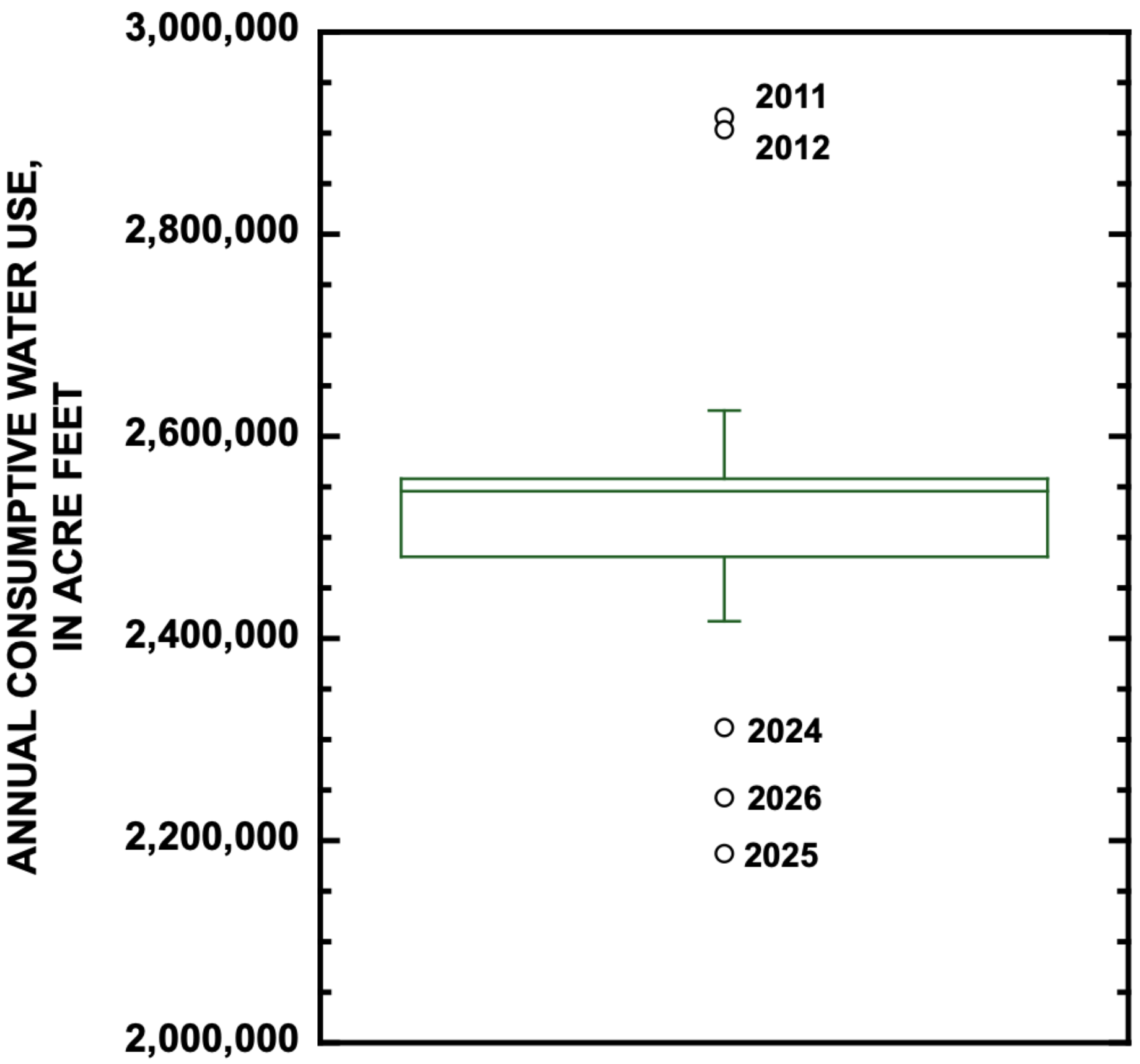
In comparison to typical annual use since 2010, IID’s use in 2024 and 2025, as well as forecast use in 2026, has been notably reduced, as represented in a box-and-whisker plot (Fig. 4).20 The box in Figure 4 encloses 50% of the years since 2010, and the length of this box is called the Inter Quartile Range (IQR), bounded by the 25th and 75th percentile of the 17 years of data, including forecast use in 2026. The line through the middle of the box is the median value for this period. Lines extending up and down from the box (i.e., whiskers) extend from the box to values within an acceptable range. Values that are greater than 1.5 times the IQR above the 75th percentile or below the 25th percentile are beyond the acceptable range and are outliers and individually plotted. Thus, 2024, 2025, and forecast use in 2026 are outliers, indicating that use in those years has been significantly less that typical use during the entire period since 2010.
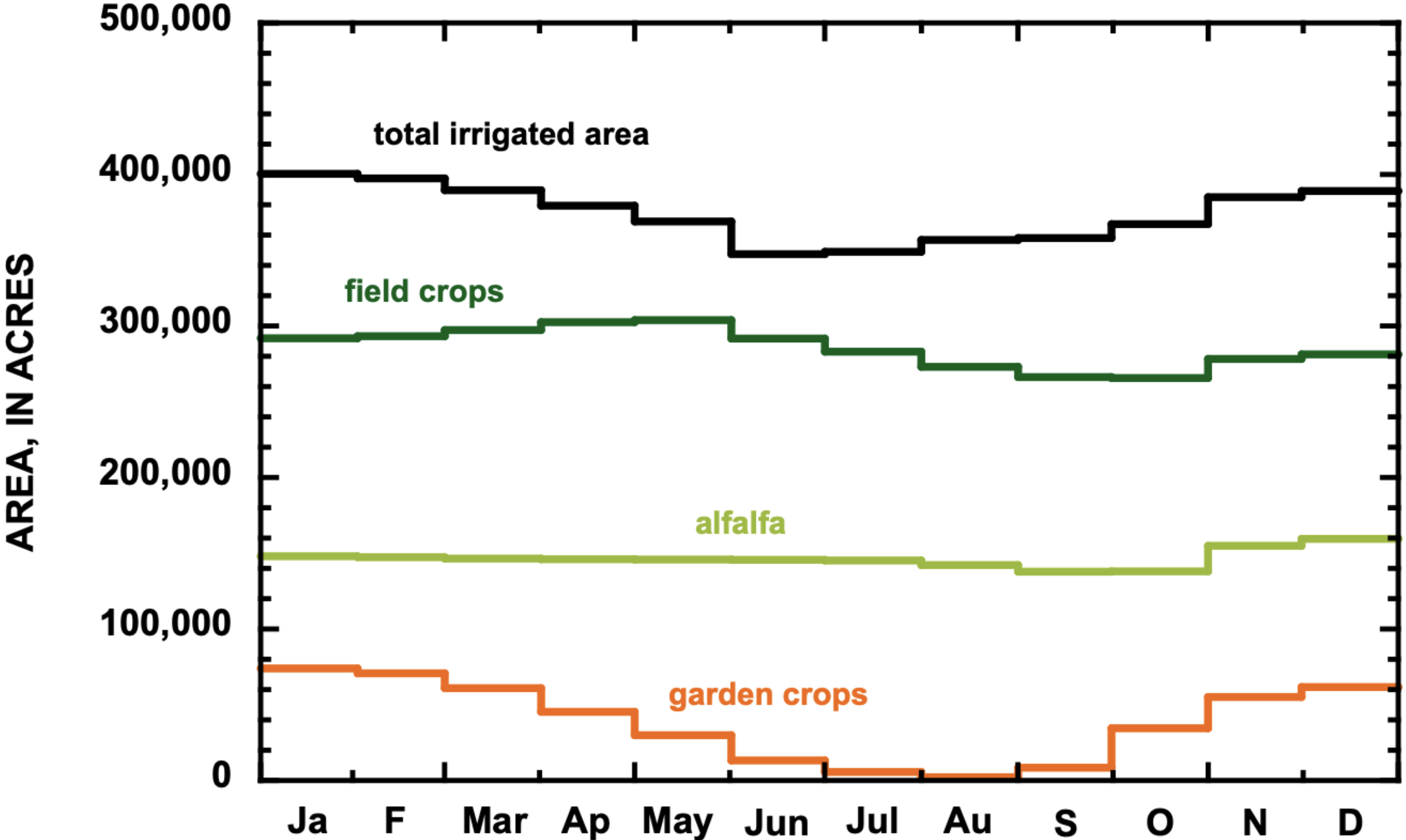
The largest proportion of irrigated land in IID is devoted to field crop production, the largest proportion of which is devoted to alfalfa (Fig. 5).²¹ The area devoted to alfalfa production changes little from year to year and during the year and was approximately 150,000 acres in 2025.²² In 2025, other significant field crops were Bermuda grass and kleingrass, whose average irrigated area was 80,000 and 20,000 acres, respectively. The area devoted to garden crop production changes greatly throughout the year and is largest between November and March. Little land area is devoted to garden crop production in the heat of summer. The most significant garden crops are lettuce, onions, carrots, and broccoli.
Water use by IID is typically lowest between November and February when garden crops are grown (Fig. 6). Water use increases greatly in March and remains high through October when field crops are the primary focus of production (see Appendix).
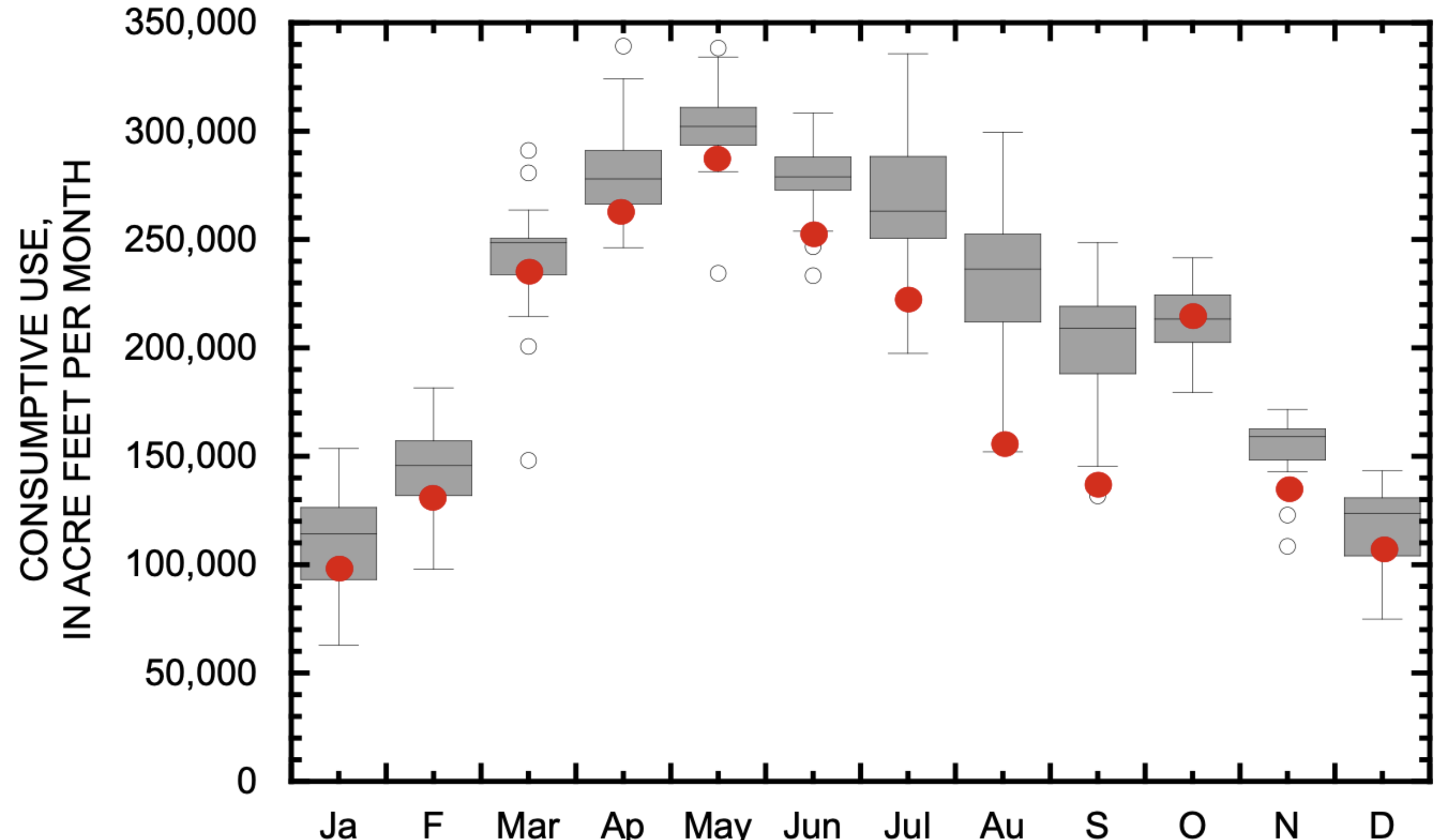
Reductions in consumption during the past few years have been accomplished primarily by reduced water use between June and September when alfalfa and grass hay are the primary crops. These reductions are reflected in Figure 5 where red dots are the average monthly water use since 2024. Red dots plot below the grey boxes of the IQR in June, July, August, and September, demonstrating that recent water use in these months has been significantly less than typical since 2010. In contrast, recent water use between December and May has been within or slightly less than the IQR.
Agricultural use of mainstem Colorado River water in Arizona
We estimated agricultural use of mainstem Colorado River water in Arizona by subtracting the total diverted by the CAP from the total use in Arizona. This remainder includes all the agricultural uses along the Colorado River as well as a small amount used by the City of Yuma, other towns along the river, and military bases.²³
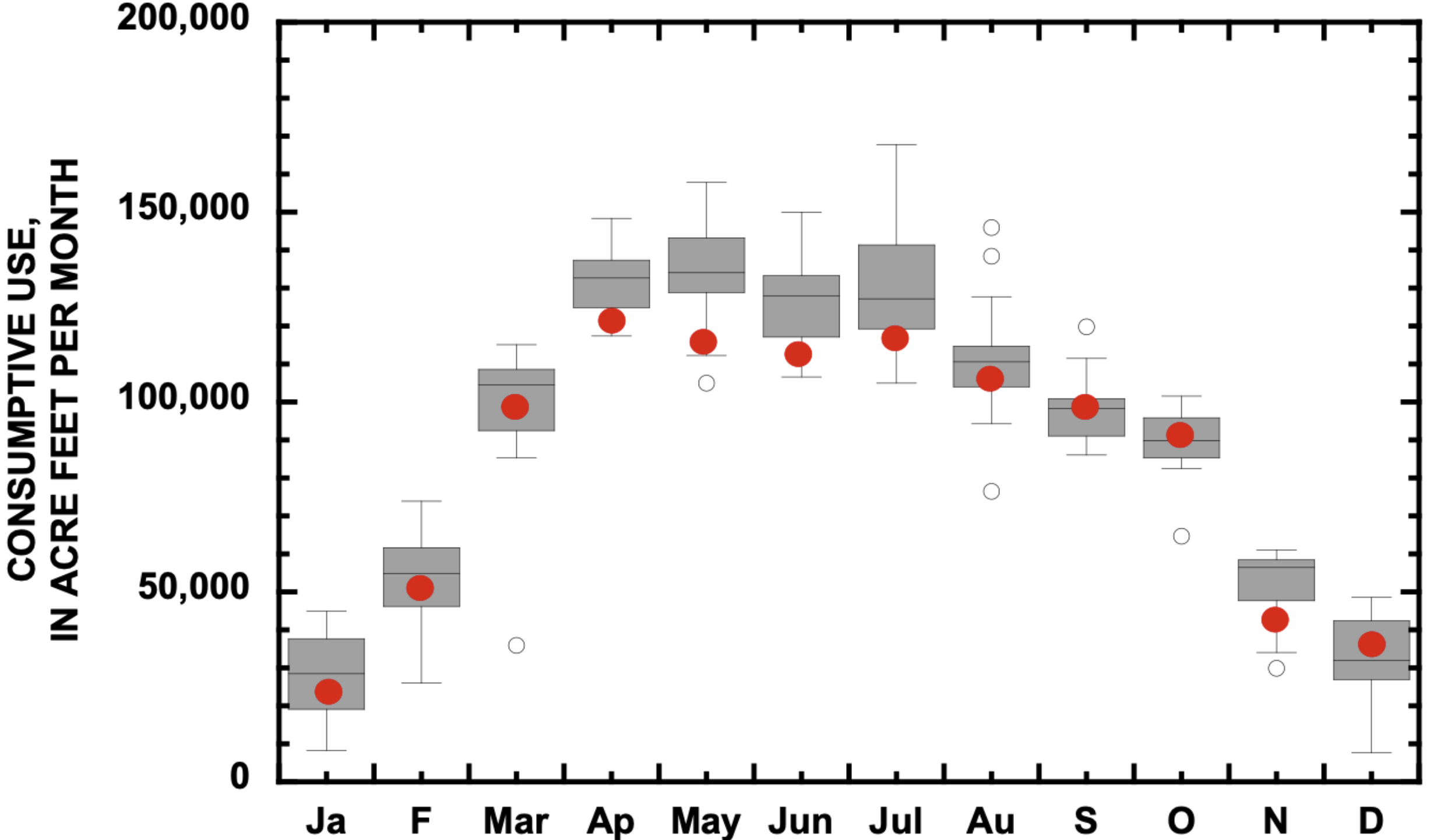
The monthly pattern of water use is similar to the monthly pattern by the IID. The smallest uses are between November and February (Fig. 7). Consumptive use increases in March and is highest between April and August.
Reductions in water use by these Arizona growers have been more modest than by IID. Recent average use has been somewhat less than the typical range between April and July and has been within the typical range in other months, except for November when there was significant precipitation near Yuma in 2025.
Management and Policy Implications
Consumptive water use of mainstem water in the Lower Basin has been less than 7.5 maf/yr in every year but one since 2010. Since 2023 including forecast use in 2026, this reduction ranged between 1.4 and 1.7 maf/yr. The Lower Basin states have reduced water use comparable to the initial targets for Lower Basin shortages described in the recently released ROD24 and Operating Guidelines for 2027 and 2028.25 Thus, the good news is that the initial shortage goals of the FEIS have been achieved in recent years.
These savings have been achieved by large reductions in use by the CAP (Fig. 3) and by reduced agricultural water use in summer by IID (Fig. 6) and non-CAP water users in Arizona (Fig. 7). These reductions in agricultural water use have not resulted in changes of the amount of water consumed in winter when garden crops are grown.
The ROD allows for potentially large Lower Basin shortages of up to 3 maf/yr and potentially more in the event that Basin runoff continues to be low and reservoir live storage drops to critical levels. We placed these potential shortages in perspective by summing the smallest monthly use in each Lower Basin state since 2010 even though these months of smallest use did not occur in the same year. In some cases, the smallest water use was not due to significant water conservation but to unusually rainy conditions when demand for supplemental irrigation water was low, such as in November 2025. In other words, there is no historical experience with implementing the annual sum of these smallest monthly uses, because the smallest monthly uses did not occur in the same year.
Nevertheless, summing the lowest monthly use in each state provides perspective to the magnitude of the proposed 3 maf/yr shortages. The summed value of smallest monthly uses yields a potential minimum annual Lower Basin use of 5.03 maf/yr for the three Lower Basin states (Table 2). Although many of the months of smallest use occurred between 2022 and 2026, some were unique months of very low use in the 2010s. There is no historical analogy for imposition of the largest Lower Basin shortages envisioned by the recently released ROD and 2027-28 Operating Guidelines. [ed. emphasis mine]

CONCLUSION
The analyses summarized in this paper demonstrate that agricultural water use that supports winter garden crop production has not changed despite recent reductions in annual water use by IID or by non-CAP water users in Arizona. To date, water use by IID and by non-CAP water users in Arizona has been reduced in summer when garden crops are not grown. In times of acute water shortage, it is likely that continued and additional water savings can be achieved by reductions in irrigation of field crops in summer, without causing shortages to garden crop irrigation in the winter.
It is notable, however, that summing the lowest monthly water use in each state since 2010 results in a theoretical reduction from the Lower Basin allocation of 7.5 maf/yr of approximately 2.5 maf/yr, less than the maximum potential Lower Basin shortage envisioned in the recently released ROD. Our calculation of a theoretical shortage is based on summing the smallest use in each month between 2010 and 2026, and these months are not all in the same year. In some cases, the lowest use resulted from unusually large precipitation that reduced irrigation demand, rather than explicit conservation efforts.
The Priority Shortage Allocation Model utilized in the FEIS distributes shortages among the Lower Basin states in a much different manner than the way shortages have been achieved in the past.26 Tabulating the historical minimum monthly uses demonstrates that achieving the 3 maf/yr reductions described in the FEIS and ROD would be very difficult and is without historical precedent. Implementation of such large shortages would likely require new management policies, including compensated fallowing, permanent retirement of irrigated acreage and corresponding water rights, and unprecedented investment in increased irrigation efficiency.
We recognize that our theoretical comparison of minimum monthly uses since 2010 in no way captures the economic dislocation and secondary impacts that might result from implementing such shortages now. A full economic analysis of the impacts of the largest potential Lower Basin reductions described in the FEIS and the ROD is critical for understanding the consequences of significant reductions in water use in the Lower Basin. That type of analysis is beyond our expertise. Nevertheless, we recognize the importance of such an analysis, and we recognize the real-world distress that such large reductions of use might cause.
1 Center for Colorado River Studies, Utah State University, former Chief, Grand Canyon Monitoring and Research Center.
2 Getches-Wilkinson Center, Univ. of Colorado Law School, former US Commissioner, Upper Colorado River Commission, former Assistant Secretary for Water and Science, US Dept. of the Interior.
3 Retired General Manager, Colorado River Water Conservation District.
4 Kyl Center for Water Policy, Arizona State University, former Director, Phoenix Water Services.
5 Staff Attorney, Utton Transboundary Resources Center, University of New Mexico.
6 FEIS is available at https://www.usbr.gov/ColoradoRiverBasin/post2026/final-eis/index.html. ROD is available at https://www.usbr.gov/ColoradoRiverBasin/post2026/decision-doc/P26_RecordofDecision_Final.pdf.
7 All annual data in this paper are calendar year. 2024 is the most recent year that consumptive uses and losses data are available for the entire Basin.
8 Richter et al., 2024, New water accounting reveals why the Colorado River no longer reaches the sea. Communications Earth & Environment 5:134. available at https://www.nature.com/articles/s43247-024-01291
⁹ Upper Basin state uses in Table 1 do not include state reservoir evaporation. Total major and minor state reservoir evaporation is listed separately in Table 1. Colorado River Storage Project (CRSP) reservoir evaporation is evaporation from Blue Mesa, Morrow Point, Flaming Gorge, and Lake Powell reservoirs. Source of Upper Basin data: J. Prairie, Upper Colorado Basin Research and Modeling Group Chief, Bureau of Reclamation. Source of Lower Basin state uses: Reclamation. 2025. Water use report: Arizona, California, Nevada, calendar year 2024. Source of mainstem reservoir evaporation (Mead, Mohave, Havasu) data: S. Tighi, Hydrologist, Reclamation, Lower Colorado Region. Evaporation at Senator Wash and diversion dams estimated at 28,000 af.
10 Department of the Interior, August 2026, Operating Guidelines: Colorado River Guidelines for Coordinated Operations of Lake Powell and Lake Mead, Operating Years 2027 and 2028 (2027-28 Operating Guidelines), available at https://www.usbr.gov/ColoradoRiverBasin/post2026/decision-doc/2027-2028OperatingGuidelines_Final.pdf. We note that these Operating Guidelines provide for 1.25 maf/yr of shortage, allocated among the Lower Basin states as previously proposed: 760,000 af/yr in Arizona, 440,000 af/yr in California, and 50,000 af/yr in Nevada, The distribution of shortages greater than 1.25 maf/yr is not specified but would presumably be subject to consultation. See 2027-28 Operating Guidelines at 5.3.A. The ROD allows for the development of different methods of shortage allocation. See ROD at 5.
¹¹ Colorado River Water Accounting and Water Use Report: Arizona, California, and Nevada, available at https://www.usbr.gov/lc/region/g4000/wtracct.html.
¹² Lower Colorado River Water Accounting – Actual Water Use and Official Water Use Forecast, both available at https://www.usbr.gov/lc/region/g4000/wtracct.html. Throughout this paper, we refer to the forecast for 2026 that was made on September 1, 2026. The forecast is frequently revised.
¹³ There is no significant water use in the Grand Canyon.
14 Average Lower Basin consumptive use between 2010 and 2025 was 6.880 maf/yr.
15 Reclamation, Lower Colorado River Basin, available at https://www.usbr.gov/lc/region/g4000/hourly/forecast.pdf.
16 Average use between 2010 and 2022 was 4.326 maf/yr. Average use between 2023 and (forecasted) 2026 will be 3.764 maf/yr.
17 Average use between 2010 and 2022 was 2.600 maf/yr. Average use between 2023 and (forecasted) 2026 will be 2.290 maf/yr.
18 Average use between 2010 and 2022 was 925,000 af/yr. Average use between 2023 and (forecasted) 2026 will be 804,000 af/yr.
19 Average use between 2010 and 2022 was 2.590 maf/yr. Average use between 2023 and (forecasted) 2026 will be 1.930 maf/yr.
20 IID used 2.187 maf in 2025, 2.312 maf in 2024, and is forecast to use 2.242 maf in 2026. Median use between 2010 and 2026 was 2.546 and use in 50% of the years of that period was between 2.481 and 2.558 maf/yr.
21 Imperial Irrigation District, 2025, written communication, Monthly crop acreage summary, 2011-2025.
22 Total net area of crops in 2025 was approximately 350,000 acres.
23 Forecast use in 2026 for Bullhead City, Lake Havasu City, Parker, Yuma, U.S. Army Yuma Proving Grounds, and the U.S. Marine Corps Air Station Yuma is 35,000 af.
24 Department of the Interior, August 2026, Record of Decision, Decision Framework for Colorado River Guidelines: Coordinated Operations of Lake Powell and Lake Mead (2027-2036), available at https://www.usbr.gov/ColoradoRiverBasin/post2026/decision-doc/P26_RecordofDecision_Final.pdf.
25 Department of the Interior, August 2026, Operating Guidelines: Colorado River Guidelines for Coordinated Operations of Lake Powell and Lake Mead, Operating Years 2027 and 2028 (2027-28 Operating Guidelines), available at https://www.usbr.gov/ColoradoRiverBasin/post2026/decision-doc/2027-2028OperatingGuidelines_Final.pdf. We note that these Operating Guidelines provide for 1.25 maf of shortage in each year, allocated among the Lower Basin states as previously proposed: 760,000 af in Arizona, 440,000 af in California, and 50,000 af in Nevada. The distribution of shortage greater than 1.25 maf/yr is not specified but would presumably be the subject of consultation. See 2027-28 Operating Guidelines at 5.3.A. The ROD allows for the development of different methods of shortage allocation. See ROD at 5.
26 See FEIS Appendix C, Shortage Allocation Model and Alternative Distribution Model Documentation, at C.4.2. However, the ROD specifies that other methods of shortage allocation may be developed. ROD at 5.

What Super #ElNiño Means for #Colorado — Peter Goble (Colorado #Climate Center) #ENSO
Click the link to read the article on the Colorado Climate Center website (Peter Goble):
September 3, 2026
You have likely heard news about El Niño recently. The National Weather Service reports that El Niño officially began in June. Observations from the International Research Institute show that it continues to strengthen. There is a greater than 90% chance of this becoming a “super” El Niño, and a greater than 50% chance of it becoming the strongest event since modern record-keeping began in 1950. Here is a look at what El Niño is and why it matters for Colorado.
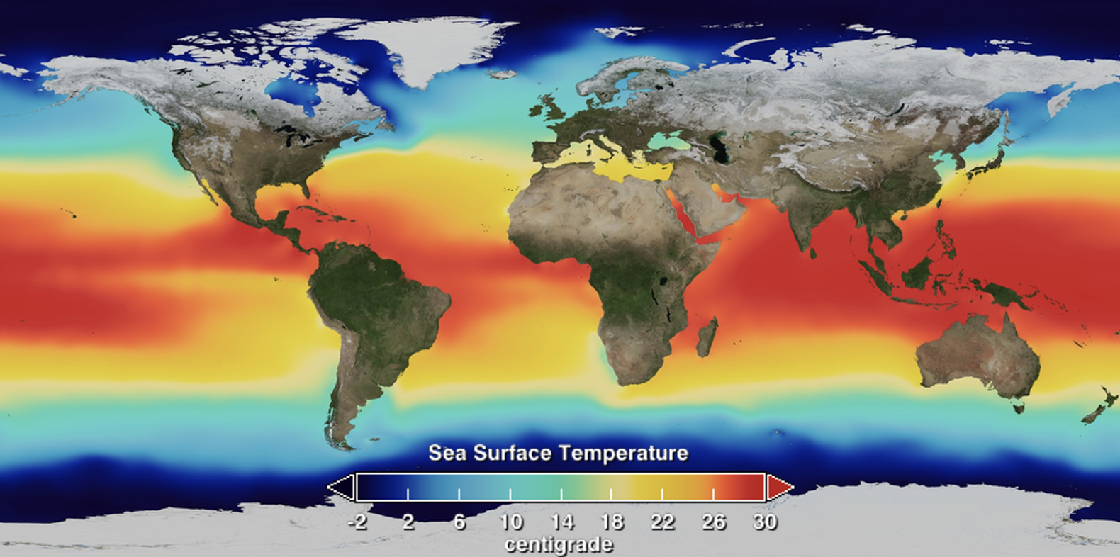
El Niño refers to a climate pattern characterized by unusually warm sea surface temperatures in the eastern tropical Pacific Ocean (image 1). Normally, waters in the eastern Pacific (off the coast of South America) are much cooler than those in the western Pacific (near Indonesia and Papua New Guinea) (image 2). Earth’s rotation drives tropical trade winds from east to west, pushing warm surface water westward and pulling cool, deep ocean water to the surface along the coast of South America. During El Niño, these trade winds weaken, allowing warm water to spread east and suppressing the normal upwelling of cold water.
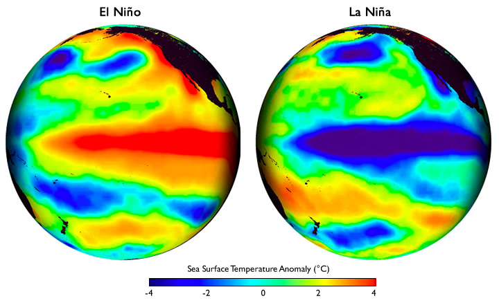
El Niño conditions typically peak during northern hemisphere winter. Peruvian fishermenoriginally named the phenomenon (Spanish for “little boy,” or “Christ child”) after noticing coastal waters warmed around Christmas. While this meant less productive fishing in South America, El Niño also alters global oceanic and atmospheric circulation. Its most predictable weather impacts include warmer, wetter weather in the eastern Pacific, drier conditions across the Amazon, and warm, dry weather in Indonesia (image 3). These circulation shifts ripple into natural and human systems—for instance, El Niño correlates with higher mosquito-borne mortality in South America.
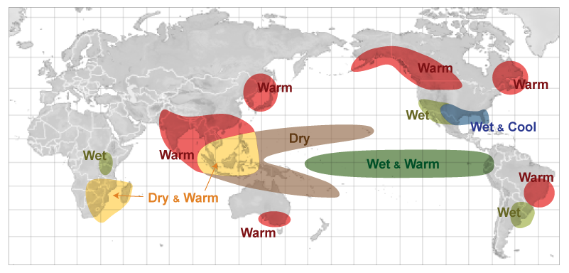
North America is impacted by El Niño as well. In response to weaker tropical trade winds, the northern hemisphere polar jet stream tends to weaken, and split with a more active southern flank. This raises the odds of cooler, wetter conditions across the U.S. Sunbelt, drier weather to the Ohio River Valley, and warmer conditions to the Pacific Northwest, north-central U.S., and a wide swath of Canada, and Alaska (image 4).

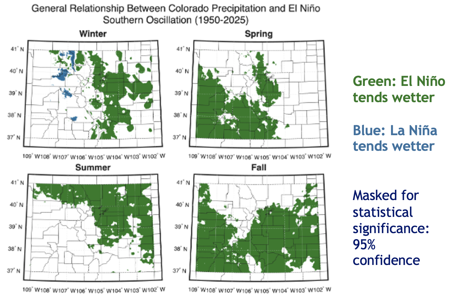
Historical correlation analysis shows El Niño is also linked to changes in Colorado weather, where conditions are generally wetter during El Niño years (image 5). This is especially true in fall and spring, when much of the state averages higher precipitation. Furthermore, the Front Range and Eastern Plains are more prone to large spring snowstorms and experience fewer dry and windy spring days (though such days remain frequent regardless). Unfortunately, the link between the El Niño–Southern Oscillation (ENSO) and peak seasonal snowpack levels in Colorado is weak. Southern river basins, such as the San Juan and Rio Grande, show a loose positive correlation between El Niño and snowpack (image 6).

Does a stronger El Niño guarantee more intense impacts? Not necessarily. Linear correlation models assume stronger events yield stronger outcomes, but real-world evidence is limited. Modern records include only three “super” El Niños (sea surface temperature anomalies of +2.0 °C or higher): 1982/83, 1997/98, and 2015/16. While 1982/83 delivered huge snowfall to Colorado, the latter two yielded roughly average conditions. Drawing firm conclusions from three events is unreliable, and our physical understanding of Earth’s climate system offers no clear threshold where impacts suddenly scale. On the positive side, dynamical seasonal climate models and the Climate Prediction Center both indicate elevated odds of above-normal precipitation across most of Colorado through spring.
Climate change complicates our understanding of what we can expect from a strong El Niño. Earth’s climate system has changed since the super El Niño and major snow year of 1982/83. Colorado is warming, and average precipitation is likely decreasing in western Colorado. The correlation analyses shown above do not account for these shifting baselines. A wet year is not guaranteed. Even if the storms do come, less of the precipitation may fall as snow than in a typical year, especially at lower elevations. Colorado continues to suffer from severe droughtlargely driven by snowpack deficits last winter and record warm temperatures. There is a strong appetite among people for moisture. The brewing super El Niño may offer some hope, but a wide array of outcomes are possible this winter. It is a bit like playing a game of poker with a few extra aces and kings in the deck. The deck may be stacked in our favor, but we could still draw a crummy hand.
#Nevada preached peace on the #ColoradoRiver. Now it’s suing to protect its water. The state’s lawsuit claims the federal government’s plan for the river could strip Las Vegas of two-thirds of its water supply — Austin Corona (Grist.org) #COriver #aridification

Click the link to read the article on the Grist website (Austin Corona):
August 28, 2026
Nevada officials have long presented themselves as a voice for compromise and conservation in debates over the Colorado River. The Las Vegas area, home to two-thirds of the state’s population and most of its economy, has become a model of urban water conservation. As the river has declined from overuse and a decades-long drought exacerbated by climate change, southern Nevada water planners built extensive water reuse facilities and implemented tight restrictions on new turf and fountains, dropping the region’s per capita water use by 58 percent in roughly 20 years. Meanwhile, in interstate negotiations over the management of the Colorado River, state representatives have positioned themselves as bridge-builders, sometimes referring to themselves as the “middle basin” between the river’s divided upper and lower basin states.
When the federal government’s new management plan for the river was announced earlier this month, most observers thought Arizona, which stands to take the largest immediate cuts, would launch the first lawsuit over the plan’s implications for its water supplies. So it came as a surprise to many Colorado River experts when Nevada became the first to sue the federal government over the plan this week.
“I expected that there would be litigation, but it was surprising to me that Nevada fired the first shot,” said Anne Castle, former chair of the Upper Colorado River Commission.
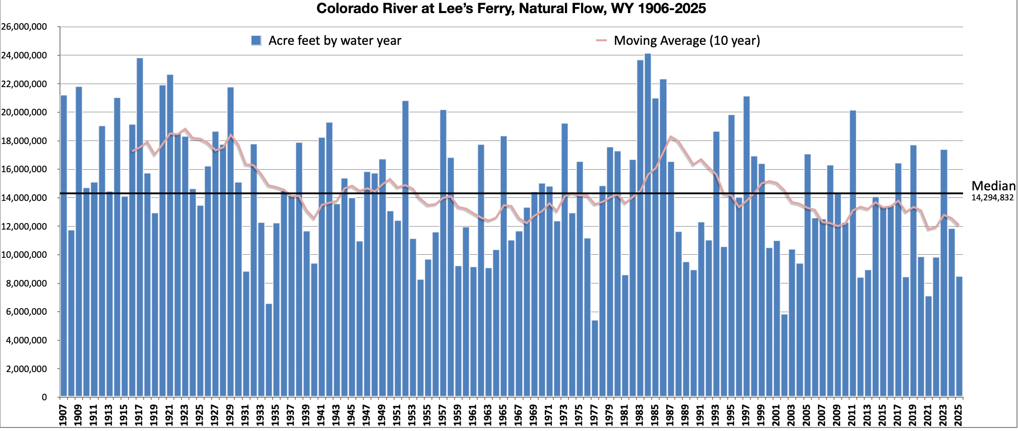
Nevada’s lawsuit comes after more than two years of negotiations among the seven Colorado River states and the federal government over how to reduce water use on the declining river. The states failed to reach a long-term agreement before the river’s current management procedures expire in October, leaving the Interior Department to impose its own plan. The federal government’s plan largely relies on cuts to water use among the Lower Basin states — Arizona, Nevada, and California — to prop up water levels in the river’s largest reservoirs. Those reservoirs have been draining so quickly that the dwindling water depth could threaten hydropower and dam operations within months without intervention.
Nevada argues that the federal government’s plan illegally forces it to take too much of those cuts. In a worst-case scenario, the plan could allow for a 71 percent cut to the Las Vegas area’s water supply, the state argued, calling it an unacceptable risk to the state’s largest population center and economic hub. Nevada believes this outcome results from a misreading of the law and also claims the government didn’t consider important alternatives to such drastic cuts.
This worst-case scenario, which experts say is an interpretation of the plan’s implications by Nevada, would become possible if reservoir levels continue to drop and if Nevada couldn’t reach an agreement with Arizona and California to help it absorb more of those cuts. Those three states already have such an agreement, which is incorporated into the federal plan and meant to last through 2028, at which point the plan allows the states to update the operations with a new agreement. Without an agreement, the federal government will implement cuts based on preexisting water rights and agreements, cutting the most from Arizona and leaning increasingly on Nevada and California as potential shortages increase. The plan was created through a decision-making process required under the National Environmental Policy Act, or NEPA, which mandates that federal agencies gather public input and consider environmental and socioeconomic impacts of major decisions.
#Denver announces $50 million cleanup plan at Sloan’s Lake to help prevent algae blooms and dead fish: Funding plan includes call for DURA to add the lake to nearby tax-increment financing district — The #Denver Post

Click the link to read the article on The Denver Post website (Elliott Wenzler). Here’s an excerpt:
September 2, 2026
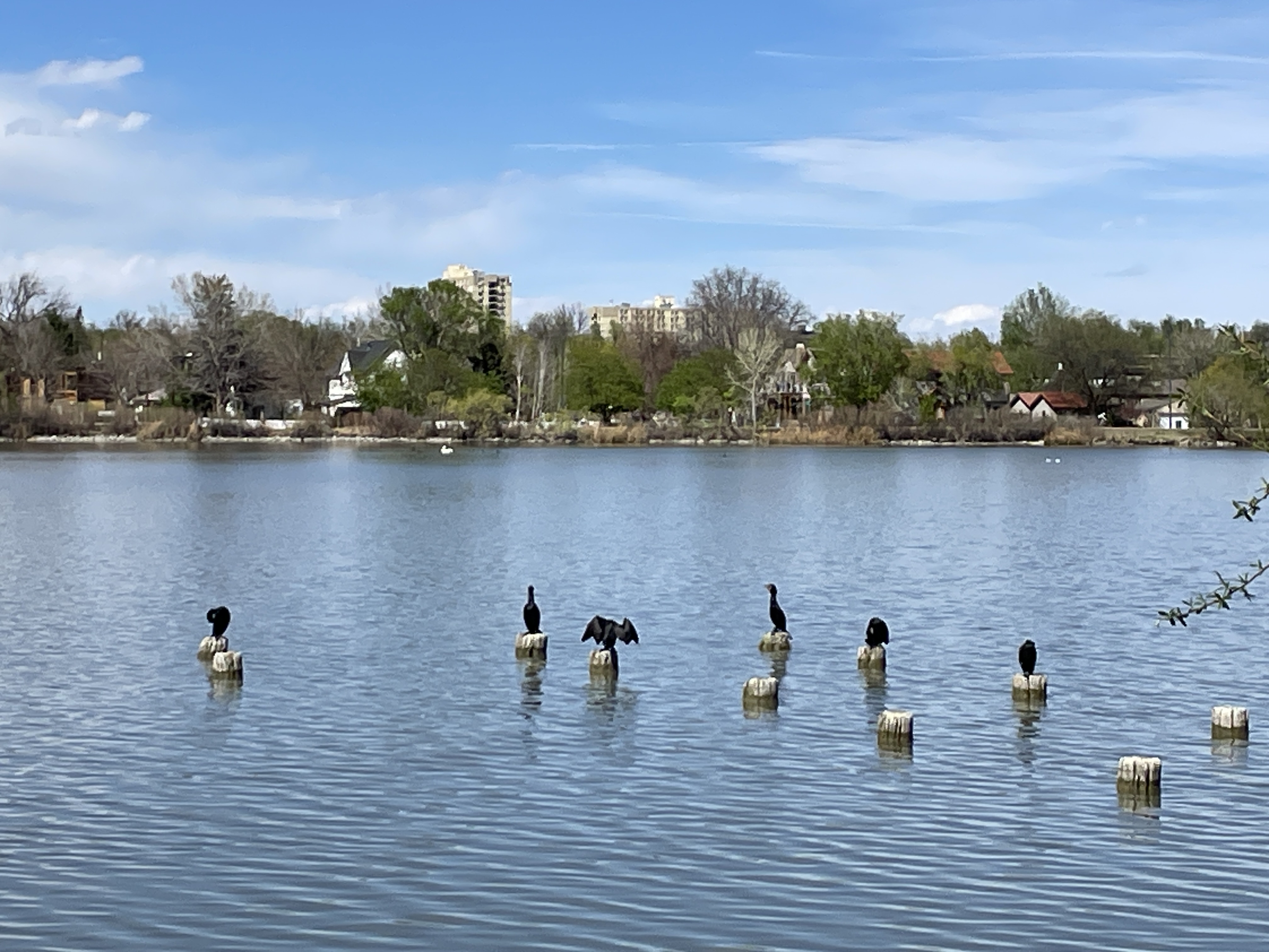
On its surface, Sloan’s Lake is a beautiful oasis that offers a refuge from city life. Part of one of the largest parks in Denver, it features glistening water, mountain views and plenty of paved paths to walk a dog, catch up with a friend or train for a race. But just beneath its gentle waves is a murky, sometimes smelly truth. The [North] Denver lake is slowly filling in with stormwater sludge. The surprisingly shallow water is often quite warm, making it a difficult environment for fish to survive and an easy place for dangerous algae blooms to thrive. If the accumulating muck isn’t addressed soon, the lake is at risk of becoming fully stagnant and bereft of life. On Wednesday, Denver Mayor Mike Johnston stood alongside members of the City Council and advocates for the lake’s future to announce a plan to invest tens of millions of dollars to prevent that from happening.
“A lake that used to be 12 feet deep is in some places only 4 feet deep. It affects the lake’s health. It affects algae blooms. It affects our most beloved events,” Johnston said from the lake’s shore. “We think there’s nothing more important for the long-term health of this neighborhood than to support the long-term health of this lake.”
To raise more money for the cleanup effort, Johnston’s administration will ask the Denver Urban Renewal Authority to add the lake to a nearby urban renewal district south of the park. That would allow it to benefit from money raised through an already-approved tax incentive in the area…The 177-acre lake, which plays host to the annual Colorado Dragon Boat Festival, is only 3 feet deep on average…Swaths of neighborhoods in Denver, Edgewater, Lakewood and Wheat Ridge drain into the lake, bringing sand, sediment and street crud. Over time, that has built up and begun filling in the bottom of the lake. The cleanup project will include dredging sediment out of the bottom of the lake and disposing of it. Crews will also work on ways to prevent more sediment from building up in the lake. Kurt Weaver, the executive director of the Sloan’s Lake Park Foundation, asked the community to keep advocating for the project throughout the entire construction process to ensure it’s completed.
“To be able to have an opportunity to write a new future for the lake is massive for us, the community around it and everyone who spends time here at the lake,” he said.
#Colorado Water Congress: Watch the Recordings from the 2026 Summer Conference

From email from the Colorado Water Congress:
September 4, 2026
Thank you so much for attending the 2026 Summer Conference! We enjoyed hosting you, and we hope to see you at our Annual Convention in January.
Recordings from the Conference are now available on our website! These recordings are only for conference attendees, so please do not share this information.
Recording Page: https://www.cowatercongress.org/2026-summer-conference-recordings/
Password: SC26Videos
If you have any questions about accessing the page or Summer 2026 content, reach out to blair@cowatercongress.org.

Municipal Water Recycling in Six Western Cities
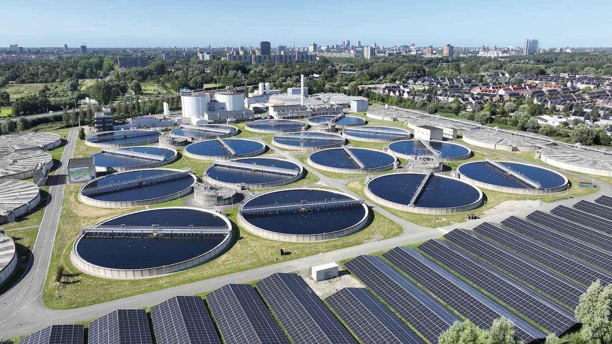
by Robert Marcos
Cities in the Western United States are deploying advanced municipal water recycling technologies to combat chronic drought and to establish local, climate-resilient water supplies. By combining multi-barrier purification, natural filtration, and direct or indirect potable reuse, these municipalities are pioneering sustainable water management.
Los Angeles, California
Los Angeles relies on a multi-tiered water recycling system that treats municipal wastewater to fit-for-purpose standards. At a minimum, the city utilizes tertiary treatment involving screening, biological neutralization, chemical coagulation, and filtration. This water is distributed via an extensive network to over 400 commercial facilities for landscape irrigation and cooling towers. For its ambitious Pure Water Los Angeles and Groundwater Replenishment initiatives, LA applies advanced treatment—including micro-filtration, reverse osmosis, and ultraviolet light disinfection with hydrogen peroxide. This highly purified water is injected into local aquifers for groundwater recharge, creating a sustainable, drought-resilient local supply. 1
Phoenix, Arizona
Phoenix maximizes its treated wastewater through a combination of non-potable distribution and advanced purification planning. Currently, the city treats municipal wastewater to Class A+ standards, delivering it to regional partners for agricultural use, park irrigation, and tech sector demands like data center and industrial cooling towers. To secure long-term water sustainability, Phoenix is constructing dedicated advanced water purification facilities under the Pure Water Phoenix initiative. This system will subject pre-treated recycled water to multi-barrier technologies—specifically ozonation, membrane ultrafiltration, reverse osmosis, and ultraviolet advanced oxidation—safely transforming reclaimed wastewater into high-quality drinking water distributed directly to thousands of area homes. 2
San Diego, California
San Diego is in the process of implementing its multi-phase program to drastically reduce its heavy reliance on imported water. The city utilizes a rigorous five-step advanced purification process to clean municipal wastewater at its demonstration and upcoming production sites. Secondary effluent undergoes ozonation, biologically active carbon filtration, membrane filtration, reverse osmosis, and high-intensity ultraviolet disinfection. While Phase One routes this purified water into the Miramar Reservoir for an environmental buffer and further blending, Phase Two adapts to updated California regulations. This allows the San Diego Pure Water Project to utilize direct potable reuse, piping the ultra-pure water directly into the drinking water distribution system after remineralization. 3
Orange County, California
Orange County operates the Orange County GWRS, the world’s largest advanced water purification facility for indirect potable reuse. The system takes secondary-treated municipal wastewater that would otherwise be discharged into the Pacific Ocean and subjects it to a rigorous three-step purification process. This advanced flow includes microfiltration to remove solids, reverse osmosis to eliminate dissolved salts, pharmaceuticals, and viruses, and ultraviolet light combined with hydrogen peroxide advanced oxidation to destroy remaining trace organic compounds. The near-distilled quality water is then pumped to inland basins to naturally percolate into the groundwater basin, serving as a primary drinking source. 4
Aurora, Colorado
Aurora utilizes the innovative Aurora Prairie Waters project, a pioneering potable reuse system designed to maximize its fully consumable water rights. After municipal wastewater is treated and discharged into the South Platte River, Aurora recaptures the water downstream using a natural-technical hybrid method. First, riverbank filtration wells pull water through hundreds of feet of sand and gravel. Next, an aquifer recharge and recovery process allows the water to percolate through additional natural filters. Finally, the water is piped uphill to an advanced purification facility for state-of-the-art technical polishing before blending with mountain snowmelt for public consumption. 5
El Paso, Texas
El Paso is building the Pure Water Center, which will be the nation’s first direct-to-distribution water reuse facility that sends purified wastewater straight into the city’s drinking water system. Currently the city’s Fred Hervey plant treats municipal wastewater and injects it into the underground Hueco Bolson aquifer to recharge drinking supplies. The City’s Pure Water Center will take secondary effluent and subject it to multi-stage membrane filtration, advanced oxidation, and disinfection. Instead of utilizing an environmental buffer, this purified water will flow directly into the municipal drinking water system, after being blended with treated brackish groundwater. 6
#GunnisonRiver anglers question feds’ plan to reduce #BlueMesa Dam releases: Flows in Gunnison Gorge could drop as low as 200 cfs in effort to maintain #hydropower and rebuild storage — Heather Sackett (AspenJournalism.org)
Click the link to read the article on the Aspen Journalism website (Heather Sackett):
September 3, 2026
As this year’s historic drought drags on, conflicts over how to share and manage water are bubbling over. Gunnison River anglers and boaters say federal water-management decisions are causing increased water temperatures, prompting fishing closures, and creating serious economic impacts to outfitters and businesses.
An Aug. 26 letter from Drew Peternell, Colorado state director of Trout Unlimited, to U.S. Bureau of Reclamation Area Manager Bart Deming, asks the federal agency to change its approach to drought management. The river conservation nonprofit organization asked Reclamation to increase streamflows in the Black Canyon and Gunnison Gorge to alleviate damage to the fishery; to evaluate water use by downstream irrigators; and to better understand the drivers of storage depletion.
“We acknowledge that the extraordinary drought conditions of the current water year present significant operational challenges,” the letter reads. “Nevertheless, the decision to reduce flows in the Gunnison River has exerted a toll on a vital and cherished natural resource.”
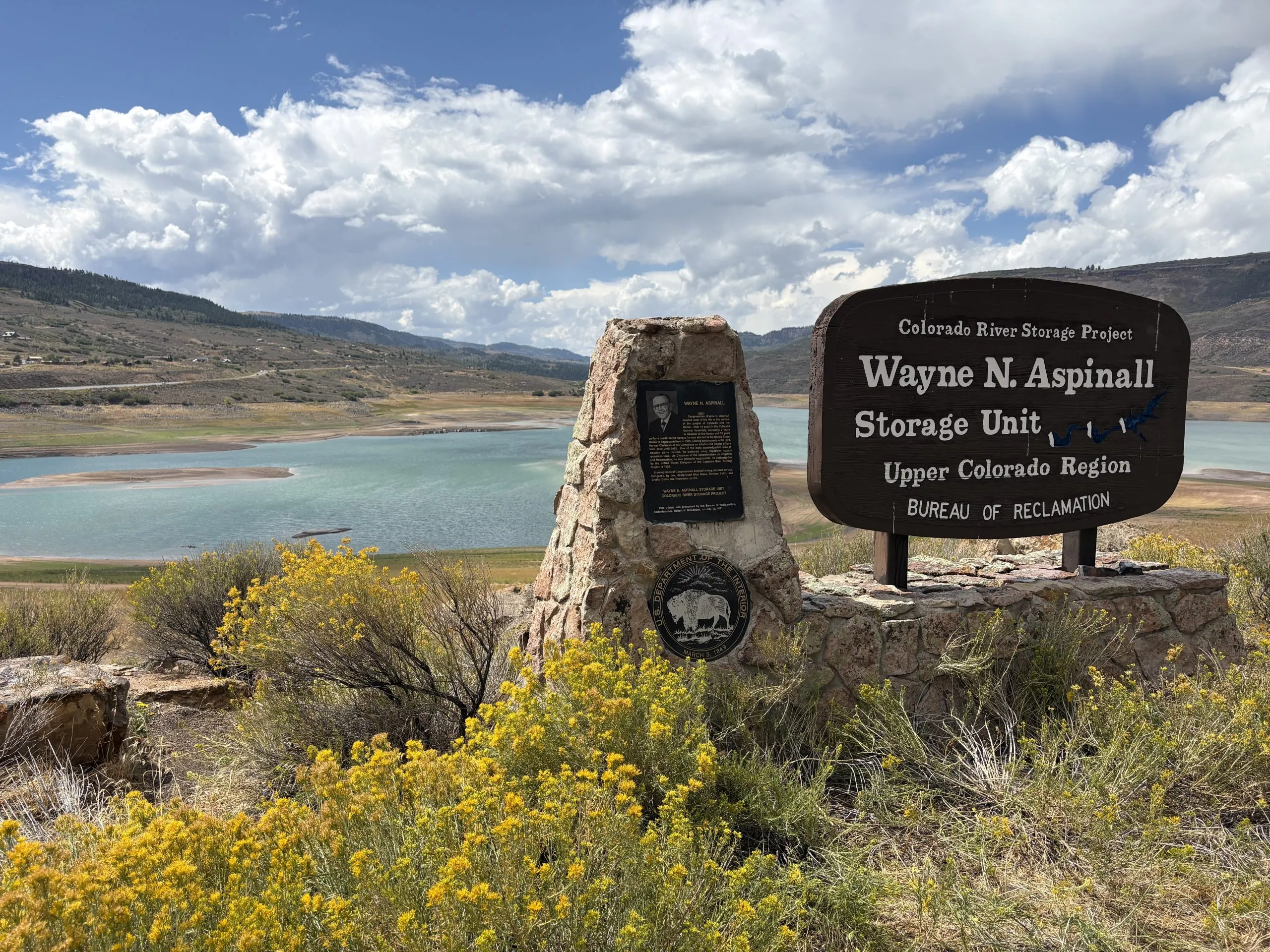
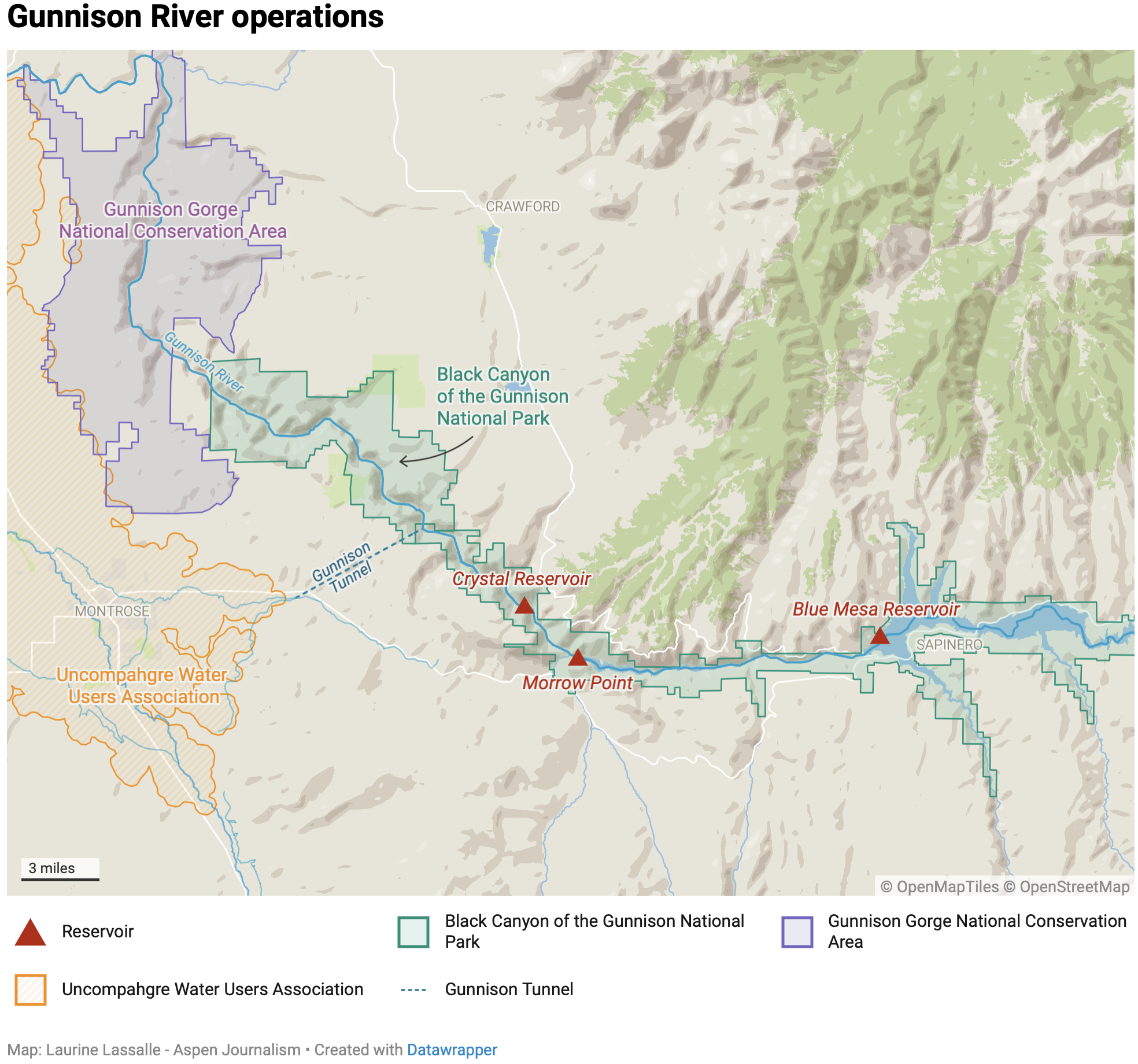
At a public Aug. 27 operations meeting in Grand Junction, Reclamation officials said they plan to reduce flows out of Blue Mesa Reservoir to as low as 200 cubic feet per second through February, in an effort to recover some storage in the reservoir, which is depleted after this year’s record-breaking drought and hot temperatures. Flows so far this month have hovered around 245 cfs.
Peternell said Trout Unlimited would like to see flows of at least 300 cfs in the Gunnison River, the minimum threshold for a healthy environment set by a federal reserve water right. The Black Canyon and Gunnison Gorge are home to a 27-mile-long Gold Medal trout fishery and are downstream of the federally operated Aspinall Unit, which is made up of Blue Mesa, Morrow Point and Crystal reservoirs.
“It’s been a tough year for everyone and there’s not enough water to go around, unfortunately, so we appreciate that Reclamation is in a tough spot,” Peternell said in an interview with Aspen Journalism. “But 300 cfs is a minimum flow target for the Black Canyon and it’s the minimum amount of water the fishery really needs to survive down there, and we’re below that. We’re down to 250 or 240, and that’s hard on the fish, it’s hard on the people who make a living off that fishery.”
Federal water managers control how much water flows out of the Aspinall Unit in the highly engineered Gunnison River system, which is the largest tributary of the Colorado River in the state. Reclamation officials project storage in Colorado’s largest reservoir could fall to just 128,000 acre-feet, or 15% full, by the end of the year under the most probable scenario.
At the Aug. 27 meeting, officials presented modeling that showed releasing water at a rate of 300 cfs could cause Blue Mesa to fall below the level needed to make hydropower, but 200 cfs will allow storage to build back up slightly over the winter. Reclamation officials presented modeling projections that showed if they don’t reduce releases now, the amount of water coming out of Blue Mesa may need to be dialed back to just 150 cfs this winter to preserve the ability to make hydropower.
“If we didn’t act, this slide right here is a plane going down and we pull up at the last second,” said Reece Carpenter, a Reclamation staffer with the Resources Management Division at the Western Area Office in Grand Junction. “So it’s very important for Reclamation and all of our partners to have that coordination to make some decisions.”
This management decision rests on a sentence in the Record of Decision for the Aspinall Unit’s environmental impact statement, designed to protect endangered fish, that says “the minimum downstream flow through the Black Canyon of the Gunnison National Park and Gunnison Gorge National Conservation Area is 300 cfs, except in severe drought when the flow may decrease.” And the Colorado River Basin is experiencing the most severe drought in recorded history.

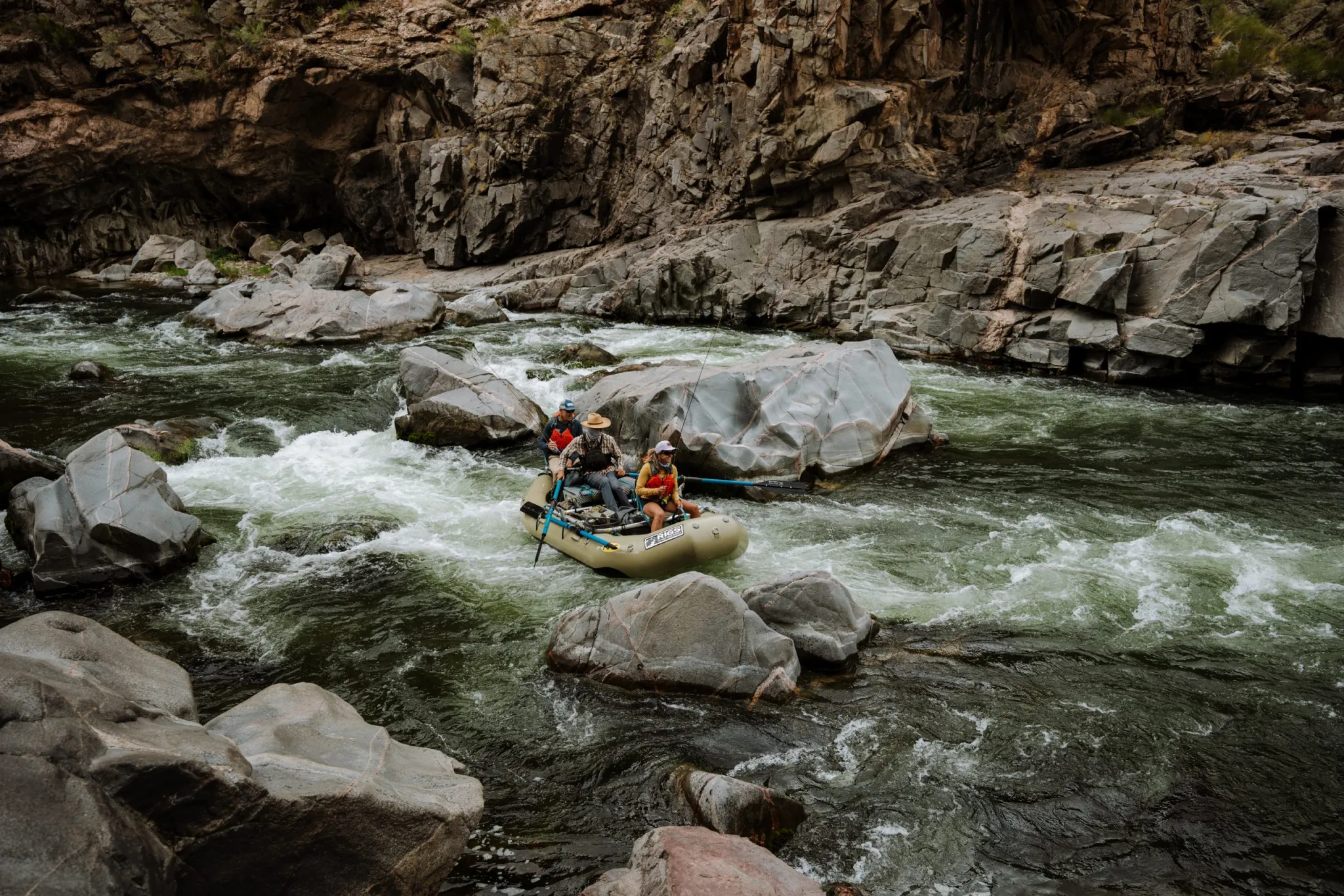
Tim Patterson, owner of RIGS Fly Shop & Guide Service in Ridgway and who has been guiding for more than 30 years, said Gunnison Gorge trips represent more than half of his company’s guiding and outfitting business, and that flows of 200 cfs are a deal breaker. Low flows contribute to higher water temperatures, which can lead to fishing closures, and make navigating some rapids difficult, if not impossible.
Patterson would like more advance notice from federal water managers when flows will be dropping, and real-time temperature and flow monitoring. Patterson said he has already canceled a handful of trips this year and may have to cancel more if flows stay below about 250 cfs.
“The Gunnison Gorge National Conservation Area, as far as a guided fly-fishing trip, is a bucket-list trip known around the world and a must-do,” Patterson said. “So people have planned for over a year in advance for this experience, and it just puts us in a real tough spot.”
Farmers facing ‘immeasurable hardship’
While flows in the river decline, downstream irrigators are still taking nearly their entire allocation of water. The Uncompahgre Valley Water Users Association is still diverting just more than 1,000 cfs through the Gunnison Tunnel. The association is a vast expanse of farmland that extends from just south of Montrose to Delta, and is the largest water user in the Upper Colorado River Basin. Water from the Gunnison River transforms the arid high desert into lush green fields of corn, pinto beans, onions and alfalfa.
The association normally gets half of its water supply from the Uncompahgre River. But this basin saw some of the worst snowpack in the state at just 14% of median. That means farmers in this area are experiencing deep water cuts this year. And some growers made the tough decision to leave fields dry and unplanted this year.
“I’ve got a senior water right, and I got 50% of my system that’s fallowed right now,” Uncompahgre Valley Water Users Association General Manager Steve Pope said at the Aug. 27 meeting.
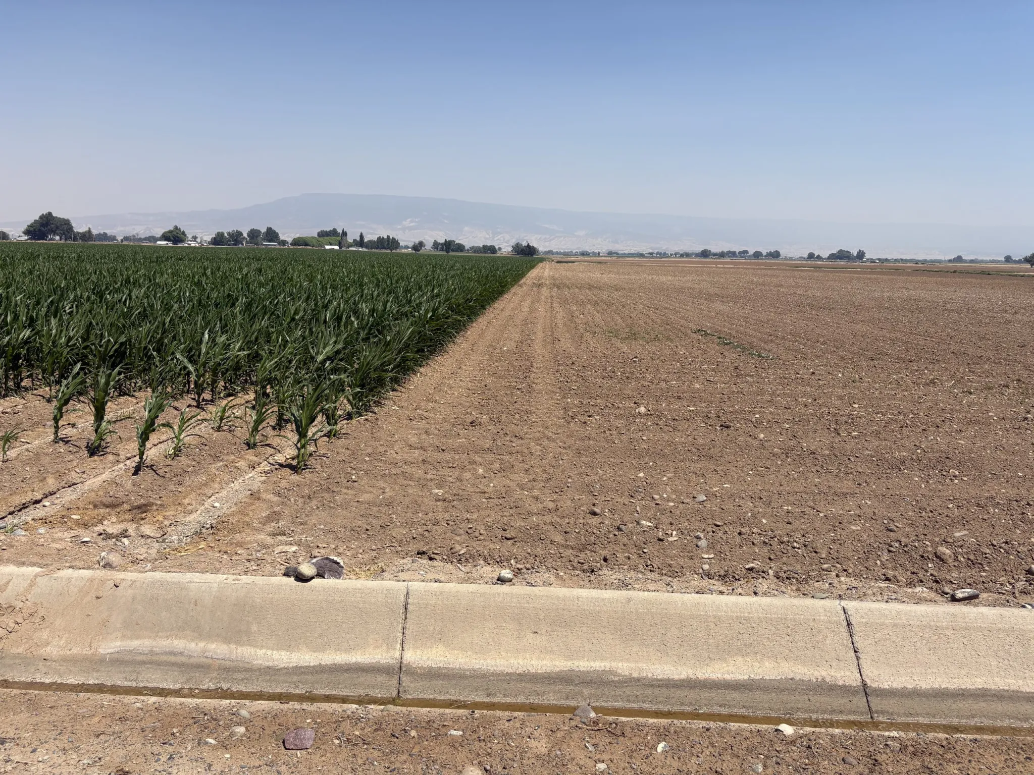
This year’s conditions on the Gunnison River highlight how tensions are exacerbated among water-user groups — especially in times of extreme drought. Colorado’s prior appropriation system of water law says the oldest water rights have first use of the river, which almost always means agricultural water users get their water first.
The state didn’t begin to grant water rights for the environment until the 1970s and for recreation until around the early 2000s. Although a large part of the Western Slope’s economy, culture and identity is now centered around outdoor recreation, keeping enough water in rivers for boating and fish is often the last priority.
The letter from Trout Unlimited asks Reclamation to evaluate power contracts with the Uncompahgre Water Users Association, which has several hydropower generating stations on its system of canals, and implement clear efficiency standards for water use. The letter lists reasons that suggest more water is being diverted from the Gunnison River than is necessary for irrigation.
Pope called their concerns “absolutely ridiculous.”
“These farmers have suffered immeasurable hardships this year, and for someone to say, ‘We think you should further reduce to maintain water temperatures and fish flows in the Black Canyon,’” Pope said. “They don’t bring a water right to the table; they don’t bring anything but a demand, and I don’t agree with it. Irrigation and agriculture is the senior priority, and it’s going to be used.”
Pope said he plans to dial back Gunnison River diversions to about 700 cfs by mid-September, but the river won’t see a bump in flows because of Reclamation’s plan to keep dam releases low to build back storage.
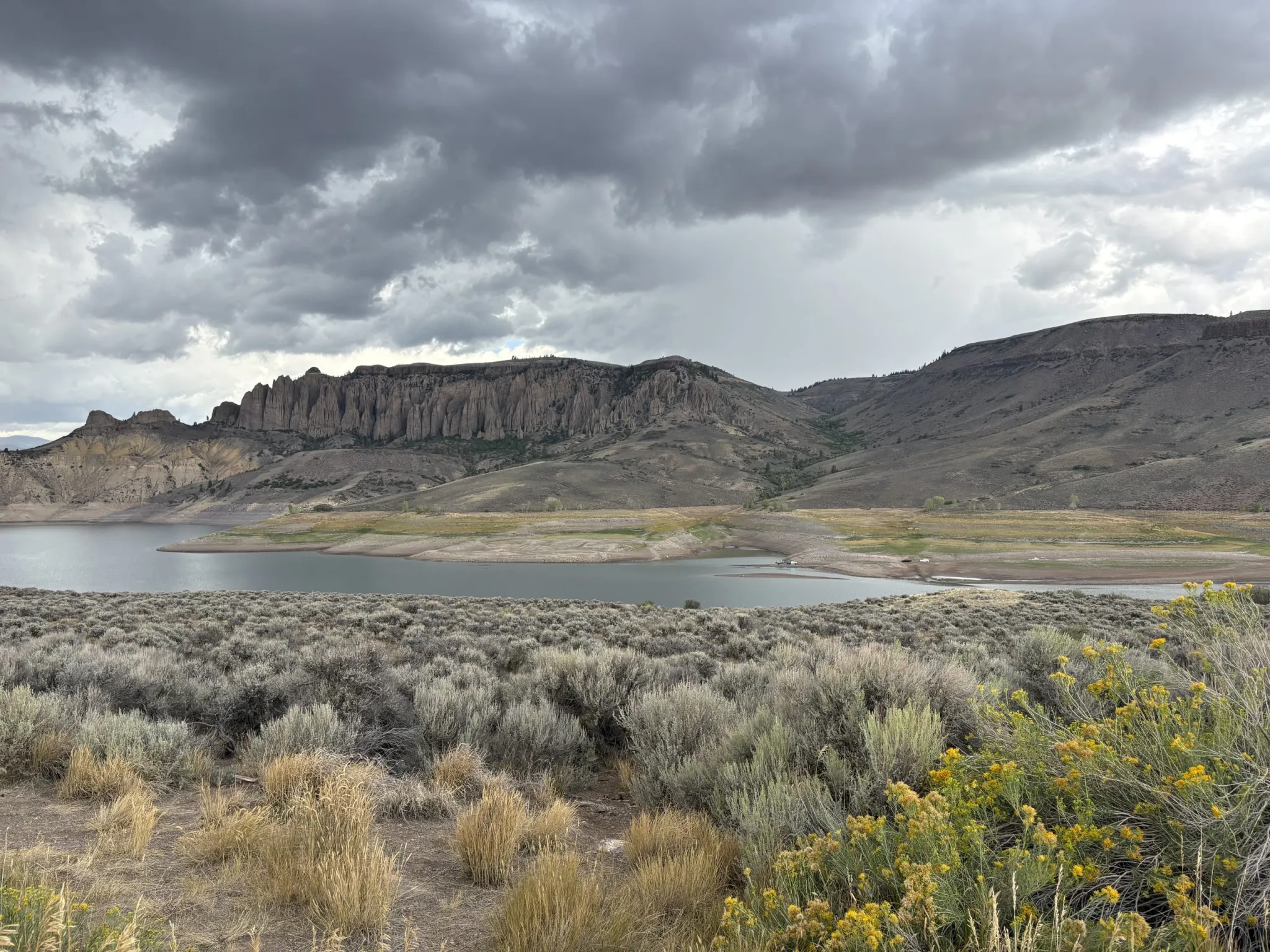
Patterson is hoping his business can get through September — which is the busiest month for multiday trips through the gorge — relatively unscathed. He would like to see more collaboration and communication between water managers and water users, and he wants anglers to have a seat at the table.
Patterson framed the issue not as a fight among water users, but as an unevenly built safety net in times of shortage. For now, river recreation remains largely at the mercy of upstream decision-makers.
“We’re seeing it all over the Colorado drainage,” Patterson said. “You can’t demand water that isn’t there. But passing it through a special place like this and working with us on times of years to minimize water temperature issues and things like that is a great step. I think it starts with acknowledging that this place is special and important and deserves to be protected.”

A first in the 110-plus-year history of this canal — Allen Best (BigPivots.com) #ColoradoRiver #COriver #aridification
Click the link to read the article on the Big Pivots website (Allen Best):
September 3, 2026
Farmers served by the Government Highline Canal as of today will get no water, a result of last winter’s dismal snowpack and low levels in Green Mountain Reservoir
The Government Highline Canal has delivered water to farms in Colorado’s Grand Valley during irrigation season for more than 110 years.
Thursday will be a first in that long history. No water will be available in that canal to farmers, even though the growing season has not ended.
“This will be the first time since around 1914 the Government Highline Canal has been at undeliverable levels during the irrigation season, which usually runs until Nov. 1 (and sometimes later),” said Tina Bergonzini, general manager of the Grand Valley Water Users Association.
Water supplied by reservoirs upstream in the Colorado River headwaters has essentially run out.
The predicament on the Colorado River had become apparent by April. Record-breaking heat of March made it extremely likely that runoff would be anemic. It got a bit better in May, but not much.
This was clearly evident at Green Mountain Reservoir, between Silverthorne and Kremmling. The dam had been built between 1938 and 1943, as part of a quid pro quo. Farmers in northeastern Colorado, particularly in the Fort Collins-Longmont-Greeley triangle, wanted to divert water from the Colorado River headwaters.
Western Slope representatives objected. They worried that they would lose irrigation water they needed after spring runoff subsided in June and July. The federally financed dam was the answer. It can hold nearly 154,745 acre-feet of water. Of that, 66,000 is marked for delivery to downstream irrigators, most in the Grand Junction area.
Green Mountain was the quid for the quo of the Colorado Big-Thompson Project annual diversion of between 200,000 and 230,000 acre-feet through the Continental Divide.
It worked — until this year.
In April, the low levels in the reservoir made it clear that the farmers would not get the full amount of water they had come to expect. The Glenwood Springs-based Colorado River District created a plan to ease the shortage.
The district — which had been created to look out after Western Slope interests in the 1930s — looked into how it could tap various pools of water, getting a thimbleful here, a cupful there. Irrigators wouldn’t become whole, but they would get help, said Andy Mueller, the general manager of the River District at the board’s April meeting.

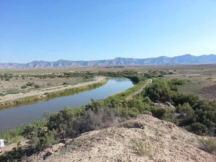
Water for the Grand Valley Canal is diverted from the Colorado River at what is called the Roller Dam on the Colorado River just east of Palisade. It continues 55 miles down the valley, mostly north of I-70, ending near Mack, 10 miles from the Utah border.
The canal is called the “government” for a good reason. It was built with federal money via the U.S. Bureau of Reclamation, an agency created in 1902 to help turn arid places like the Grand Valley into gardens and orchards. Accounts vary about when the water began flowing in the canal. Some say 1913, others 1914 or 1915. Regardless, the water has always flowed since before the United States entered World War I.
Until this year.
Early in the irrigation season, irrigators benefitting from the canal agreed to curtail their water use in exchange for getting water from reservoirs near the Colorado River headwaters later in the season.
That sounds simple enough. The mechanics are complicated. Crucial to understand is the seniority of the “Cameo call” at the Roller Dam, where water is diverted. Upstream users have to honor that very senior call.
The call is for 1,950 cubic feet per second. Grand Valley’s Bergonzini said her district lowered the target by 300 cfs and then another 200 cfs, or 1,450 cfs. That left a little more water in Green Mountain. Altogether, the reduced water diverted from the Colorado — combined with the two storms during May — brought the amount of water available in Green Mountain up to 50% of the allotment for the Grand Valley farmers.
This story has endless details. The essential story is that those with rights to water on the Colorado River within Colorado — including a transmountain diverter, Northern Water — have worked with the irrigation district to ensure the farmers in the Grand Valley had some water during the growing days of summer. Water officials stress what Bergonzini calls “teamwork and collaboration between entities.”
Upstream reservoirs tapped included Wolford and Wiliams Fork, both near Kremmling, and Ruedi, near Basalt. An additional 5,000 came from Granby Reservoir late in the season.
Helping out were appropriations of $450,000 from the River District in April and then, in May, $585,000 from the Colorado Water Conservation Board.
Still, farmers dependent upon the ditch only got 50% of the water they normally would from Green Mountain.
Some of the teamwork involves Orchard Mesa Irrigation District. The Grand Valley and Orchard Mesa districts have an agreement to share shortages.

Orchard Mesa pumps water uphill from near Palisade to the mesa, site of many of the peaches for which Palisade is famous. Farther down on the Government Highline Canal, other farms grow alfalfa, wheat, and usually corn. This year, however, little corn was grown, yielding to Sudan grass, triticale, and barley, as they are shorter season and can be grown with less water, said Grand Valley’s Bergonzini.
Both peach and grape orchards on Orchard Mesa have done quite well, said Rob Talbott, president of the irrigation district’s board of directors.
The fundamental story, he said, is that “everybody is doing whatever they can to share their water.”
The sharing continues. The peach orchards need water now if they will be productive next year.
“The peach trees (primarily on Orchard Mesa) need water right now to get ready for hibernation whereas my growers (served by Government Highline Canal) can wait for a bit to water in winter wheat and hay. They crop switched earlier this year to shorter season crops, so we have different needs,” explained Bergonzini.
The canal is designed for flows of 730 cfs, not for the 100 cfs now available. As such, she said, it’s better to let the peach trees have the water now.
“Then, IF THE RIVER HAS RISEN SOME,” said Bergonzini, using all-caps for emphasis in her e-mail, Grand Valley will take Orchard Mesa’s irrigation water and augment it with what is available in the river to get some crops watered along the 55-mile canal.
That could happen at the end of September.
“We are planning on running late — perhaps the middle of November if the weather allows without freezing, to assure our growers get good moisture on their fall crops,” she said.
As for Green Mountain Reservoir, according to the Bureau of Reclamation, yesterday it was 14.8% full.

#Monsoon madness and Mormon Marxism(?) — Jonathan P. Thompson (LandDesk.org)

Click the link to read the article on The Land Desk website (Jonathan P. Thompson):
September 1, 2026
⛈️ Wacky Weather Watch⚡️
Wow. Just wow. Huge flash floods in the Grand Canyon this past weekend, with the biggest damage along Bright Angel Creek and Phantom Ranch. Bridges were washed away, dozens of people were evacuated, the Trans Canyon Waterline was destroyed (forcing the closure of rim hotels), and there was so much debris in the river that National Park Service officials had to shut down the river to rafting — though it is now reopened. As of Tuesday morning, two fatalities had been confirmed and one person were still missing.
The storm cells plowed across the Colorado Plateau during the waning days of August, and of meteorological summer, dumping large volumes of rain in short periods of time, leading to hot-chocolate-hued waterfalls cascading off of cliffs and down canyons. In some cases, wildfire burn scars from last year or earlier this summer exacerbated the impacts. In the Grand Canyon it’s likely that the Dragon Bravo Fire scar contributed to the severity of the flooding.
The storms tended to be isolated, pounding one area, while leaving others just miles away virtually dry, as can be seen in wildly varying streamflows.
- Video from the Grand Canyon shows that the storm and its impacts were widespread, but certainly the most significant flooding was on Bright Angel Creek, which joins the river at Phantom Ranch. The normally clear and burbling brook was flowing at about 14 cubic feet per second at 11:20 on the morning of August 29; at 12:50 p.m. the gage showed a flow of 347 cfs; then the readings vanished as the gage was overwhelmed by a torrent, disabling the gage. Witness accounts and videos show a wall of water that sounded like a freight train slamming into the Phantom Ranch area.
- Always wanted to float one of those classic, usually un-runnable desert rivers but could never get big enough flows? Now’s the time to hit at least one of them, if you dare. The San Rafael River’s USGS gage near Green River was reading 800 cfs as of early Tuesday morning, which is runnable for the intrepid and skillful folks out there. But you’d better hurry: The forecast is calling for clear skies starting Wednesday. Meanwhile, flows on the Escalante River near Escalante, the Paria River near Kanab, and the Dirty Devil exceeded 2,000 cfs on Monday afternoon. But for these one’s it’s probably best just to sit on the canyon rim and watch the show, since American Whitewater recommends against running any of these rivers at these levels. But maybe this is just the dramatic ushering in of more gentle, widespread rains, and the flows will level out in the low-200s, making them quite floatable indeed.
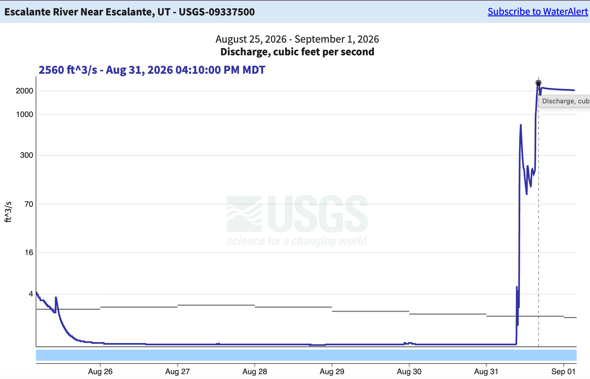
- The Big flows on three of the above mentioned rivers will give a bit of a boost to Lake Powell inflows, while the Paria will supplement the waters moving past Lee Ferry from the Colorado River’s Upper Basin to its Lower Basin. So far, however, the storms are too isolated and short-lived to significantly slow Lake Powell’s decline. The reservoir’s surface level is currently at about 3,517.6 feet.
- Speaking of classic desert rivers, the sorrowful Lower Dolores River got a little bit of life back over the last few days as the storms moved into Western Colorado, pushing streamflows near its confluence with the Colorado above 600 cfs (after running below 30 cfs for the previous week). That’s good enough to float the lowest section of the river, which includes Stateline rapid, but the flows dropped back down below 100 cfs pretty quickly, which would leave anything but a SUP high and dry. What the rain gave to the river, it took from the roads: Highway 141 between Gateway and Whitewater was shut down Monday due to multiple debris flows; it had reopened as of Tuesday morning, according to the CDOT website.
- Zion National Park was hit by the same wave of storms, leading to flash flooding and big water in the Virgin River. Rockslides shut down the Zion Mount Carmel Highway.
Note: I wrote the following essay for the Utah Monthly, an insightful newsletter that provides an inside look at the sometimes maddening, always spectacular, and often confounding state.
This historical piece jumps off from a feature story I wrote for High Country News back in 2012. The thesis behind that story was that even as Utah and the Mormon Church moved rightward politically with a full-throttle embrace of capitalism, they paradoxically held onto slivers of the collectivism espoused by Brigham Young. Since then, Utah has continued its rightward slide, and the Church of Jesus Christ of Latter Day Saints has continued to grow its corporate empire.
Reporting from Bloomberg shows the Church and its real estate arms own some 2.4 million acres in the U.S. worth more than $20 billion, and that they are ramping up efforts to develop some of that land. Tributary is a planned community under development in Aurora, Colorado, south of Denver International Airport and adjacent to I-70. It covers about 960 acres of former farmland along a creek, and it is designed to eventually house some 12,000 people.
Where will the water come from? Given that this will be in Aurora, I’m guessing it will be from Aurora water, which is currently under stage 1 drought restrictions.
Anyway, on to a bit of Western history …
Mormonism’s Collectivist Roots
And what remains of it in our era of financialized capitalismThe curiously named community of Orderville sits in a narrow valley in southern Utah on the banks of the East Fork of the Virgin River. It is propitiously placed along the highway between Bryce Canyon and Zion National Parks, yet it wasn’t until the last decade or so that businesses—a couple coffee shops, food trucks, and upscale glamping and vacation rentals—popped up to capitalize on the thousands of visitors passing through. But this isn’t just a modest farming community now taking up tourism. It was once the stronghold of the United Order communalist system, perhaps the most audacious economic experiment ever undertaken in the American West. Orderville, wrote historian Dean L. May, was for the Latter-day Saints a “near-successful effort to build the City of God on Earth.”
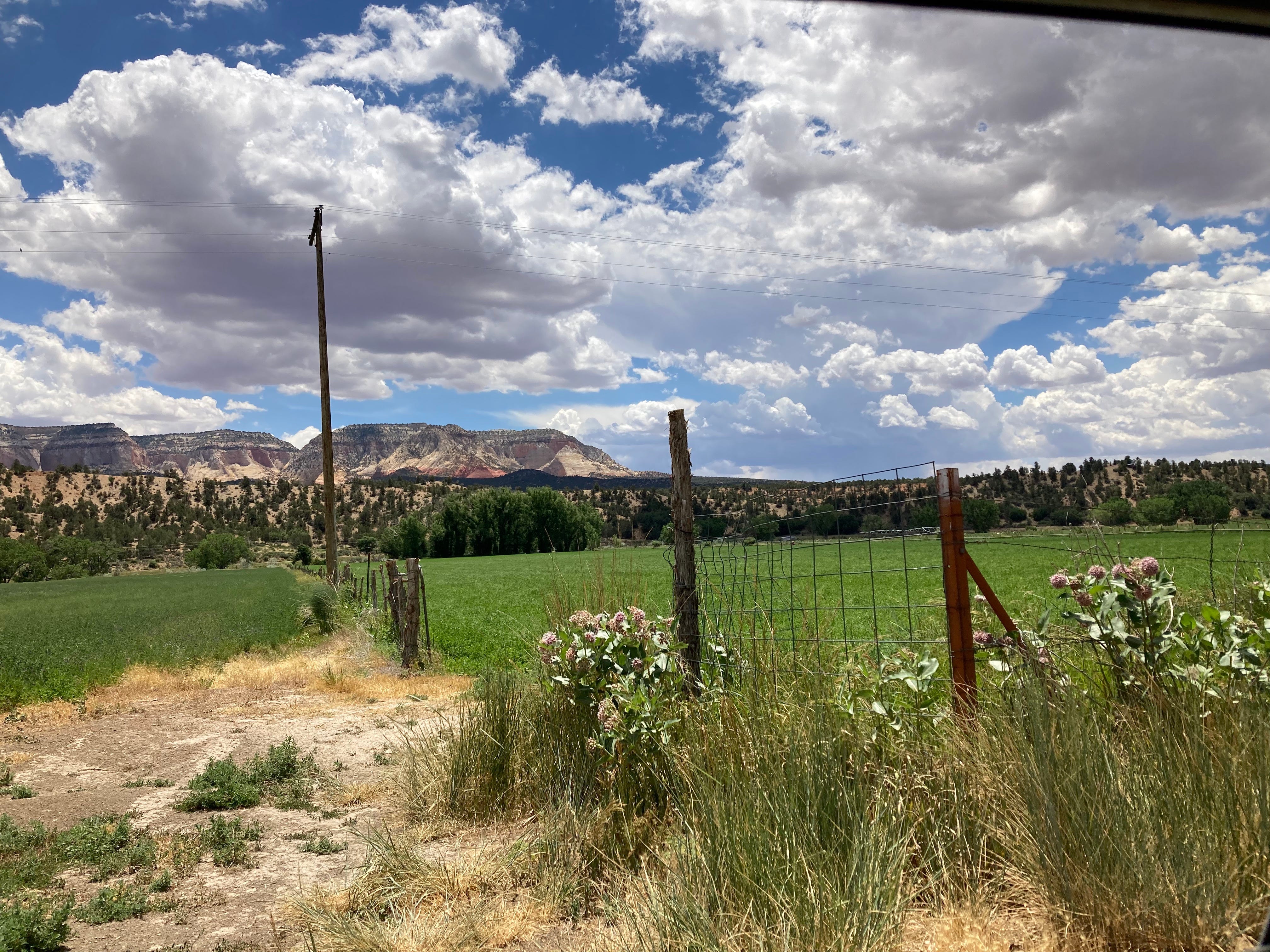
Over the last half-century, the Church of Jesus Christ of Latter-day Saints has wholeheartedly embraced free-market capitalism, and not only in ideological terms. The church is decidedly corporate, and owns Utah’s second-biggest newspaper, a book publisher, dozens of radio stations, financial companies, hotels, and restaurants. It spearheaded the $2 billion redevelopment of its land comprising a major portion of downtown Salt Lake City, and is one of the nation’s largest landowners, with about 2 million acres of agricultural, residential, and commercial properties across the United States. Up until McCarthyism and the Red Scare of the 1950s, however, the church leaned strongly in the opposite direction, favoring a communal, even socialist approach to economics.
When Brigham Young led his followers into present-day Utah in 1847 to build a homeland, he championed industriousness combined with cooperation and central planning over the frontier individualism commonly associated with the western frontier at the time. The Mormons began with a cooperative effort to build an irrigation system that belonged to everyone, and then laid out the towns. “The towns and villages were not established inadvertently or by individual initiative … they were a result of very definite plans,” wrote Hamilton Gardner in Cooperation Among the Mormons in 1917.
This relatively loose-knit system worked to build communities, but it wasn’t clear that it could protect them from the Gentiles pouring into the region in search of land and wealth. In the 1860s, as the transcontinental railroad approached Utah from both sides, bringing with it an orgy of capitalism and greed, financed with credit that the banks handed out like lollypops, Young buckled down in an effort to protect his holy land from the invaders.
He formed the School of Prophets, which, writes Leonard J. Arrington, the late LDS church historian, “countered an energetic and powerful laissez-faire capitalism with a vigorous, well-organized, socially minded and theocratically directed program of economic action.”
That program included creating an organization to build the section of railroad that came closest to the capital, to keep out the riffraff that might otherwise do the work. It funded the creation of cooperative furniture and wool manufacturing along with other businesses, to reduce reliance on eastern imports. The School created the Zion’s Cooperative Mercantile Institution and instituted uniform pricing controls to minimize competition among Mormon merchants.
The Utah Territory successfully resisted becoming a mineral colony for the eastern industrialists, and the School disbanded in 1872. But Young, whose collectivist leanings grew as he aged, wanted yet more.
A chance for radical change emerged in September of 1873, when the Jay Cooke & Co. bank—one of the big railroad backers—collapsed. Other banks toppled like dominoes, foreclosures were rampant, and the Panic of 1873 swept the nation and the world, leading to one of the worst depressions in history.
Utah’s mining towns were hit hard. But Brigham City, a settlement of about 1,500 people, actually thrived. It had organized a mercantile cooperative in the pre-railroad days, and, by the time the panic hit, it had expanded into a major manufacturing enterprise mostly owned by the worker/shareholders. It built houses for the poor and widows and provided labor for jobless drifters, and its leaders instituted central economic and land-use planning and zoning, dictating where houses and factories and public transit should be built. Novelist Edward Bellamy, who visited Brigham City after the panic, reportedly drew inspiration for Looking Backward, his 1888 utopian novel set in a socialist Boston in the year 2000, when greed and capitalism are no more.
Young didn’t need to wait another century for utopia to arrive. In the aftermath of the 1873 panic, he set about spreading the Brigham City model—combined with an element of Joseph Smith’s Order of Enoch wealth-redistribution plan—across Deseret. He started in St. George and worked his way northward, converting communities to the order as he went.
Each adopted the order in its own way, but the core principals were the same: communalism, cooperation, and equal distribution of wealth. That this occurred just after the Communist Manifesto, by Karl Marx and Friedrich Engles, had been published in America bears noting, if nothing else. The language in the St. George United Order Constitution gives a sense of what Young was trying to do, mentioning the struggle between capital and labor, bemoaning the “oppression of monied monopolies” and railing against “a growing … spirit for extravagant speculation and over-reaching the legitimate bounds of the credit system; resulting in financial panic and bankruptcies.”
“It was clear to all that the United Order,” writes Arrington, in Great Basin Kingdom, “was an attempt to retard, and, if possible, to prevent the development of a market-oriented economy dependent on extensive importation and exportation.” About 200 communities implemented the Order. Some, like Brigham City, took a moderate approach. Others were quite radical.
Orderville fits into the latter category. The community was founded in the spring of 1875 by twenty-five families who had broken off from the Mount Carmel community a few miles down valley. The Orderville citizens pitched in to build houses surrounding a central plaza and common dining hall. All property was turned over to the community corporation, including land, livestock, and machinery. Decision-making was centralized. The population grew to 600, with around 200 acres of communal fields. The citizens built a sawmill, cabinet shop, woolen mill, shoe shop and tannery. Wealth was distributed evenly. Everyone ate together and wore locally made uniforms.
Orderville thrived in its collective state even as other southern Utah communities abandoned all or parts of the United Order. The community gained population and was able to quadruple its communal assets over just several years’ time.
Orderville’s successes, however, only highlighted the failures of the predominant, free-market system in use everywhere else, drawing resentment from the outside world. The timing wasn’t so great, either: In 1882, in a direct affront to the Utah Territory and the church, Congress passed the Edmunds Act, banning polygamy. A few years later, the feds rounded up and jailed hundreds of suspected polygamists, including in Orderville, leaving many communities leaderless. Church leaders, looking to remove yet another source of negative outside attention, urged Orderville to abandon its communal ways. The town’s leaders eventually complied—the central dining hall had been wiped out by a flood a few years earlier anyway—but kept the industries under communal ownership for another couple of decades.
By the early 1900s, the United Order had died in practice. For its part, the church continued to start its own businesses and to invest in other firms—sometimes to its own detriment. The aim, for the most part, was not to turn a profit, but to provide resources for its members. Still, the communalist spirit lived on, permeating the politics and the economics of the church for years afterward.
One of the embodiments of this spirit came in the form of a Utah Mormon banker and conservative Republican named Marriner S. Eccles. Eccles had long believed that hard work and thrift were all one needed to be successful. His father, David Eccles, had built up an empire on those principles, most famously owning the Utah Construction Company, one of six firms that built Hoover Dam and the largest company of its kind in the nation. The senior Eccles died in 1912, leaving everything to his children from two wives, one in Logan, one in Ogden. Though Marriner was in the lesser-endowed Logan branch, he ended up in Ogden, rose to the top of the bunch with his business acumen, and became president of Utah Construction Company, First Security Corporation, and several other interests. Then the Depression hit. Though Eccles’s wealth insulated him and his businesses, he noticed all around him people who had toiled and saved their whole lives, and who were now ruined, unemployed, even homeless.
“It is a national disgrace that such suffering should be permitted in this, the wealthiest country in the world,” he said. “The present condition is not the fault of the unemployed, but that of our business, financial, and political leadership.”
In 1933, Eccles and forty-five other citizens addressed Congress on ways to stop or slow the downward economic spiral. Most witnesses suggested that extravagance, nature, or God had caused the crash, and that balancing the federal budget was the only solution. Not Eccles. He said the root cause was maldistribution of wealth. There was plenty of money out there, it had just all ended up in the hands of a small group of the ultra-rich—the 1 percent, if you will—leaving the other 99 percent broke. That left the bulk of Americans not only hungry, but also without any of the purchasing power necessary to fuel the economy, and that’s what led to the crash.
How to fix the problem? The federal government had to raise taxes on the rich, forget balancing the budget, and spend like crazy in order to redistribute the wealth. Eccles’s five-point plan included allocating $500 million for unemployment and poverty relief, increasing funding to state and local governments for public works and infrastructure projects, and refinancing farm mortgages.
The approach was both compassionate and coldly rational. It would feed the hungry with direct handouts. And it would push a little bit of the wealth back into the hands of the working class, restoring the purchasing power of the masses. That, in turn, would revive consumption and jump-start industry, creating more jobs and more wealth. For as Eccles often said, “Labor is our only source of wealth.” Meanwhile, it would bolster the infrastructure of the nation, providing a foundation for future economic growth.
Trickle-down economics simply wouldn’t work. “The orthodox capitalistic system of uncontrolled individualism … will no longer serve our purpose,” Eccles said, echoing Brigham Young and presaging John Maynard Keynes’s 1936 work, The General Theory of Employment, Interest and Money—the basis for one of the principal schools of modern economic thought. “We must think in terms of the scientific, technological, interdependent machine age, which can only survive and function under a modified capitalistic system controlled and regulated from the top by government.”
Eccles, who was not a church leader but whose family remains powerful in Utah, became the chairman of the Federal Reserve, and his theories provided the seeds of the New Deal. In 1936, around the same time that the federal government was launching its wealth redistribution effort, the church created its Welfare Program, which today spans the globe, providing food, shelter, medical help, and emergency aid to those in need.
The church adhered to the collectivist values of Smith, Young, and Young’s successor, John Taylor (also a strong proponent of wealth redistribution) for the next couple of decades. But when McCarthyism infected the nation in the 1950s, the Church’s communalist ways once again put them at odds with the nation’s mainstream. Then, maybe fearing more persecution, church leaders started an effort—perhaps concerted, perhaps not—to change their public image from borderline theocratic communists to full-on capitalists.
The ideological leader of this new, free-market, staunchly conservative Mormonism was Ezra Taft Benson, whom the church named to the Quorum of the Twelve Apostles in 1943. He served as President Dwight D. Eisenhower’s secretary of agriculture from 1953 until 1961, during which he became more and more rabidly anti-communist. In 1961, he told the church’s general conference: “No true Latter-day Saint and no true American can be a socialist or a communist or support programs leading in that direction.”
Benson was a contemporary, friend, and ideological twin of W. Cleon Skousen, the ultra-conservative political theorist whose teachings would influence the Sagebrush Rebellion of the 1970s, the Wise Use and Patriot movements of the 1990s, and the violent right-wing uprisings of the mid-2010s, including the armed occupation led by Ammon and Ryan Bundy of the Malheur National Wildlife Refuge in Oregon in 2016. Benson and Skousen both were strong supporters of the John Birch Society, which was considered extreme even by the likes of hardcore conservatives such as Barry Goldwater. The society’s founder, Robert Welch, derided Eisenhower as a communist and Benson concurred. And in 1963 Benson predicted that within the decade the United States would be ruled by a communist dictatorship, which would include military occupation, concentration camps, and the like.
Many church leaders considered Benson’s beliefs not only to be too radical, but also blatantly racist, and at times he was chided for being too political and too extreme—though his status as apostle was never threatened. Still, his beliefs trickled down into more tempered elements of the church. In 1966, Apostle Marion G. Romney, former Sen. Mitt Romney’s father’s cousin, felt compelled to use his entire speech to the annual LDS general conference to outline the differences between socialism and the United Order (distillation: the United Order has God, socialism doesn’t). And in 1999, Phillip J. Bryson, a professor at Brigham Young University, wrote a paper called “In Defense of Capitalism” to counter some LDS scholars’ anti-capitalist leanings.
These efforts served gradually to pull the church rightward politically, and in 1985, Benson was named the church’s thirteenth president, a position he held until his death in 1994.
Utah’s politics have long been dominated by the church—nearly 90% of the state’s legislature identify as practicing Mormons. As a result, the state’s politics tend to reflect the church’s. Prior to 1980, for example, the state’s voters were as likely to elect a Democratic governor or federal or state lawmaker as they were a Republican one. But during the Reagan era and, for that matter, the Ezra Taft Benson era, the state has become bright red, only electing Democrats to represent isolated liberal strongholds such as Salt Lake City.
During the same time-frame, the church shifted economically, as well. In 1960, a Canadian oil company executive named N. Eldon Tanner was appointed by then–church president David O. McKay as an assistant to the twelve; two years later he became an apostle. He introduced corporate financing to the church and pointed it to not only achieve solvency, but to become a full-on business empire within a few decades.
It’s the latter, capitalist version of Mormon history that the modern media has glommed onto. And it’s not inaccurate—under Young’s leadership, the church had its hands in a number of business enterprises, just like today—but it’s also not complete. There still is a faint undercurrent of the old United Order beliefs. The church’s welfare program and Deseret Industries continue to be a significant part of its larger workings, providing humanitarian assistance across the globe as well as food and clothing and jobs to people closer to home. And it’s safe to say that the church’s current capitalist successes are rooted in, and wouldn’t be possible without, Brigham Young’s collectivist, quasi-communist experiment from the late 1800s that played out in a tiny town called Orderville.
📸 Parting Shot 🎞️
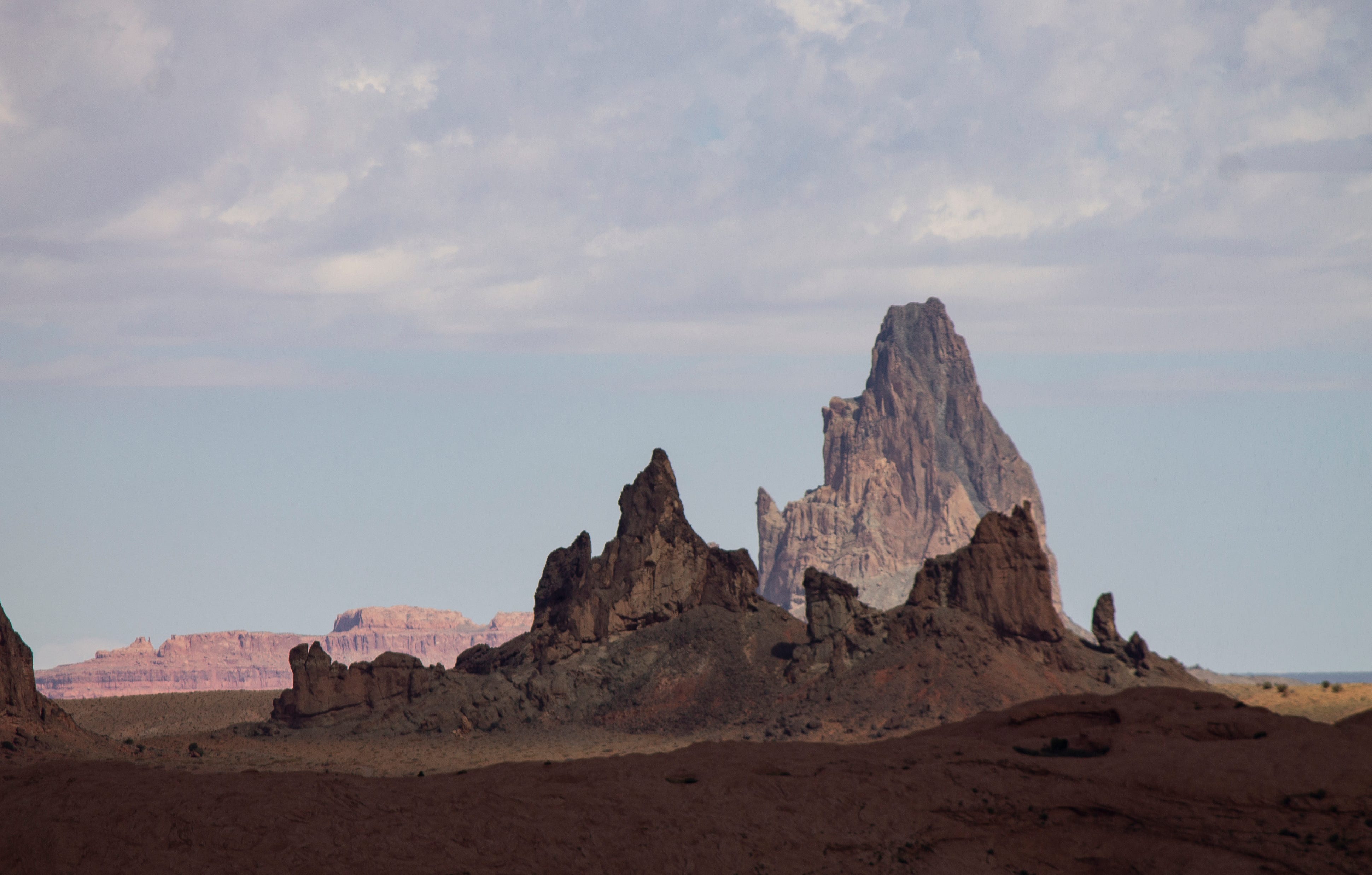
Amid the y’alls, two themes at the Colorado Water Congress conference — Allen Best (BigPivots.com) #CWCSC2026

Click the link to read the article on the Big Pivots website (Allen Best):
August 31, 2026
Many political office-seekers spoke at the annual summer conference in Steamboat. Some ‘y’alled to the attendees. Others not so much. Most called for more water storage and “forest resilience.”
“God bless, y’all,” said Victor Marx, the Republican candidate for governor in Colorado in wrapping up his allotted 15 minutes at the podium at the Colorado Water Congress summer conference in Steamboat Springs.
Lauren Boebert, who represents the Fourth Congressional District in Colorado, followed him on the agenda. “It is wonderful to be back with y’all at Water Congress,” said Boebert, a Republican seeking her fourth term in Congress.
Y’alls were common during her quarter-hour on stage. It being a water conference, one of them had to do with water. “So y’all better get real good at that xero-scaping for your lawns and everything you’re building out there because your cactus, your cacti might do just fine, but we’re taking it back,” she said of Arizona.
Dwayne Romero, the Democratic candidate in Boebert’s former Third Congressional District, who preceded them, used none.
What this says exactly, I’m not sure. Y’all is a Southern locution that has become somewhat more common across the United States. I do note that Romero grew up in southeast Texas while Marx was reared in Louisiana, both of those places thick with y’alls and drawls. As for Boebert, she came to Colorado from Florida at the age of four.
Water Congress’s twice-annual conferences always have elected officials as well as water leaders from across Colorado. This being election season in 2026, the time devoted to the pols was greater than normal.
Like Marx, some are seeking statewide offices, while others, including Boebert and Romero, are running for Congress in districts with more rural areas.
That makes sense, as the Water Congress has a strong rural constituency. Denver Water is well represented, but so is Logan County. I also noted that Rod Lenz, the chair of the Republican River Water Conservation District’s board of directors, managed to get to the conference by Wednesday morning after a meeting in Holyoke that lasted long into the previous afternoon. That’s a good five-hour trip by car.
As for the y’alls, I have no idea whether Jeff Hurd, the Third Congressional District incumbent, Phil Weiser, the Democratic nominee for governor, drawled y’alls. I suspect not. I have heard both speak several times. Neither is a y’all guy. Both are also attorneys.
Perhaps not surprisingly, Romero and Boebert started out on much the same note in their remarks about the Colorado River. Romero mentioned “decades of lower-basin use” and urged solidarity with Colorado’s negotiating team on “protecting Colorado’s compact entitlements.” Boebert struck the same tone but with more pugilistic language. “We’re fighting for what belongs to us and for our future generations.”
Beyond those obligatory remarks, the two candidates differed greatly. Boebert talked about what she has done for her constituents regarding water and mentioned her work on the Arkansas Valley Conduit Project. “Even though my dear great president may have vetoed that, we are still working to get that over the line for Southeast Colorado.”
Boebert was typical Boebert, saucy and sort of interesting in how she played to her base. She wore blue jeans, as that seems to be her style when making the rounds in Colorado. In what may be more revealing, she also tried to talk about her bi-partisan work. I also noticed she did so when running in a tight race in her former congressional district, the third, in 2022. She won that race by a mere 546 votes, precipitating her move across the Continental Divide.
Maybe it’s because she is in what appears to be a tougher contest with the Democratic candidate, Eileen Laubacher, a retired Navy rear admiral, in a district that in the past has been unflinchingly Republican. Laubacher’s resume, money and growing institutional support could, noted Axios in a story last week, “make Boebert sweat.” Laubacher also spoke at the conference. But again, I was elsewhere.
Themes
Two themes were evident in remarks made by the office-seekers and others at the conference. One was the need for more storage, the other for more “watershed restoration” via Proposition 137, the proposal on the November ballot to divert sales tax revenues from sporting goods to do work in the forests and expand funding for parks.
The discussions in a general way crossed party lines but the storage case was cited more prominently by Republican speakers. Absent, though, was the sort of specifics I thirsted for.
Politicians rarely get into the details when on the stump, of course. And 15 minutes isn’t much time. Boebert’s comments will likely be echoed in the next two months.
“Forest management is not optional anymore. It never was, and for anyone to come up and present policy that is more reactive then proactive is failing you and each and every one of us — is failing future generations,” said Boebert. “Healthy forests hold snow longer, release water cleaner, and protect our watersheds from catastrophic fires that turn drinking water into ash.”
Boebert then took aim at clean energy.
“We hear all the environmental claims about carbon emissions, but these wildfires that are too quickly growing out of control, burning down our beautiful state, neighboring states in the West, with more than 6 billion standing dead trees that no one will allow us to harvest or not harvest enough of, unfortunately even taking lives of first responders…”
Boebert attributed to NASA a statistic: A wildfire produces more greenhouse gas emissions than all of the cars fueled by fossil fuels in a year.
“So EVs aren’t the answer. Sending your money to DC for wind and solar isn’t the answer. It’s being good stewards of our land, managing our forests.”
The storage theme also got lots of attention. It was bipartisan. Little of the conversation went very deep. Some of it was almost insultingly oversimplified.
Consider what Marx had to say: “We can’t make it snow. We can’t make it rain. But we can decide whether we’re prepared for when the water comes. So I believe we should store water in good years. Lord, please send it.”
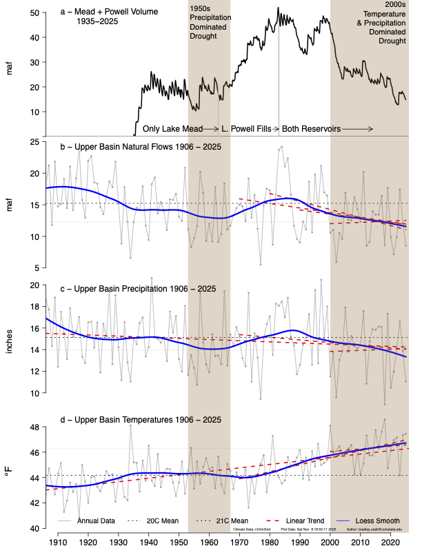
It sounds good, being “prepared adequately.” But that statement assumes good years will come. Examining the science, Colorado State University’s Brad Udall has suggested there may not be any good years, let alone enough to fill all the [reservoirs] already built.
Consider that we have two giant reservoirs on the Colorado River sitting 75% empty. And in the headwaters, Green Mountain Reservoir is 15.1% full, as of Sunday, according to the Bureau of Reclamation. Blue Mesa Reservoir was only marginally better. Navajo, on the Colorado-New Mexico border, is doing better at 40% to 45%.
Romero’s call for partnership
Of the three office-seekers I heard, Romero was most interesting. It was obvious to me he had taken the time to study the Colorado River issues. As for Marx, he rambled.
Romero’s comments were calculated, of course. He was making a case for stability after the chaos of the Trump presidency.
“We have to restore Congress and our federal agencies as institutions that work. Congress has to legislate. It has to authorize projects. It has to appropriate money. It has to conduct oversight. Those are all the rules that were stipulated in the Constitution for our Congress,” he said.
I suspect Jeff Hurd would agree with at least parts of that statement.
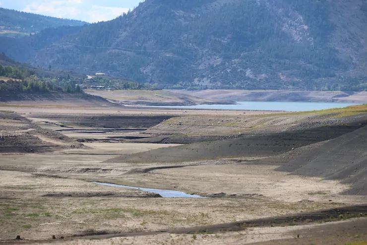
He later talked about what this meant on the ground. “A rancher can’t make long-term conservation investments around a pilot program that could disappear with the next administration,” he said.
What must be restored, he continued, is a federal partnership with the state, “where federal dollars turn local grit into lasting resilience. So here’s the heart of it: We have the right people, we have the expertise, we have the will. Now we need to bring real, sustained funding and solutions and resources to bear, enough to help us build resilience for the next 50 years of demand. And we need genuine, reliable partners.”
As for resilience, said Romero, it comes from many projects. “It’s a modernized diversion that lets a farmer grow more with less. It’s a storage that gives a community room to breathe in a drought. It’s a treated watershed that doesn’t burn catastrophically. And it’s securing an historic right like Shoshone, so it benefits Colorado permanently.”
Shoshone, of course, is the hydroelectric plant in Glenwood Canyon, and the Colorado River District is nearing success in its multi-year effort to make sure that the very senior water rights continue to ensure water flows downstream. It’s complicated, of course.
“These things take money. The federal government has helped build the water structure that made this modern American West possible. It is their responsibility to be a reliable partner with us, adapting that infrastructure and those institutions to the 21st century. They need to stay with us for capital and capital improvements.”
Romero wrapped up his speech with this observation: “Our hardest moments are often when we find our common ground.” That means, he said, “creating solutions that last beyond the next drought, the next negotiations, or the next administration, but for generations to come.”
Sounds good – but where does additional storage make sense that allows communities to breathe?
As for forest resilience, it sounds good — but what exactly is being proposed? Most environmental organizations seem to support Proposition 137, as do Denver Water and Northern Water. Western Resource Advocates and other environmental organizations are pushing it.
I still have major questions about the mechanics even after sitting through an hour-long press conference on Monday morning. Sometimes I can be fuzzy in my thinking, but in this case I think there’s some fuzziness about what is being proposed.
#Drought news September 3, 2026: Locally heavy rains from the #Monsoon fell in parts of the Rocky Mountains in Colorado, parts of W. #Colorado to the west of the Front Range saw conditions improve given recent rainfall
Click on a thumbnail graphic to view a gallery of drought data from the US Drought Monitor website.
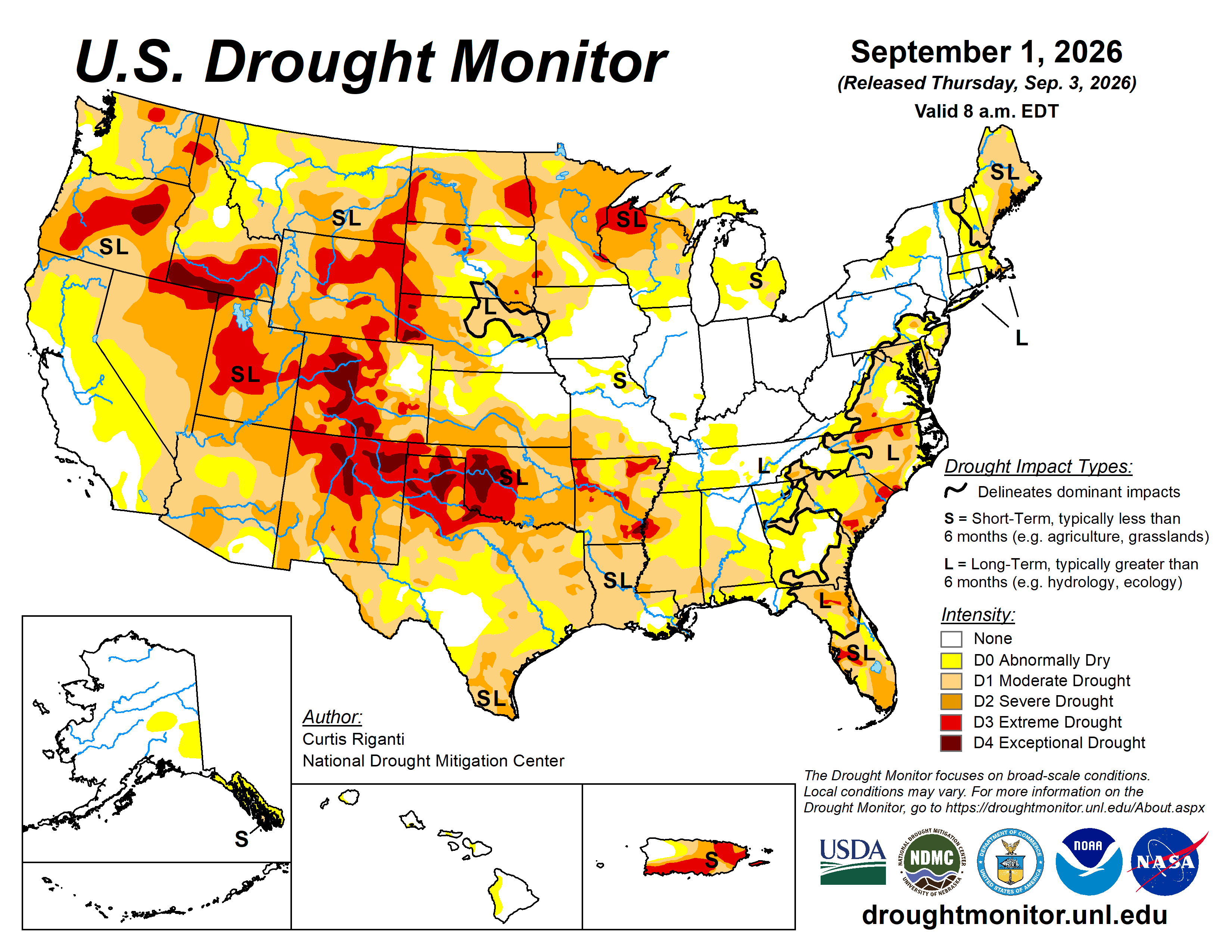
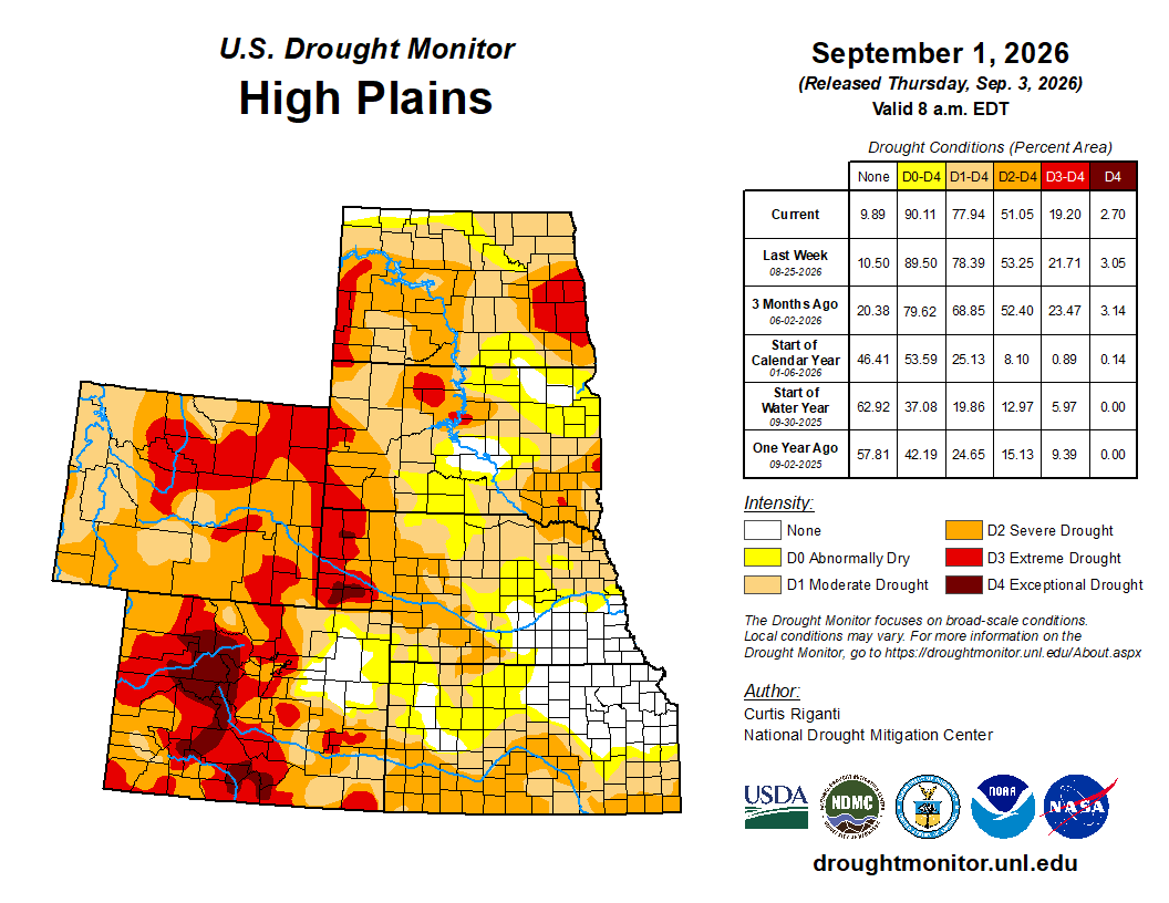
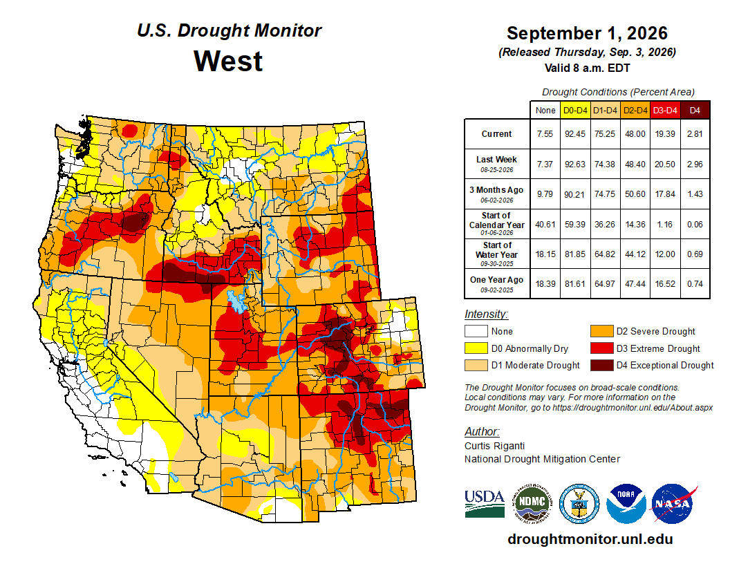
Click the link to go to the US Drought Monitor website. Here’s an excerpt:
This Week’s Drought Summary
Dry weather continued this week across much of the central U.S., especially from the southern Great Plains to the Mississippi River Valley and Corn Belt. Flash drought conditions were occurring across a large area spanning from Texas northeastward to Oklahoma and southern Kansas, southern Missouri, Arkansas, northern Mississippi and portions of far western Tennessee. Due to the drier- and warmer-than-normal weather in most of these areas, drought and abnormal dryness expanded and intensified in many areas, as widespread adverse impacts to agriculture continued and fire danger continued to grow in some areas. Widespread showers and thunderstorms, some locally heavy, dotted parts of the Northeast and Southeast regions, leading to localized improvements to ongoing drought or abnormal dryness. Some areas that missed out on the rains saw conditions worsen. Hot and dry weather continued near the borders of the Dakotas with Minnesota, leading to worsening drought conditions. Widespread improvements occurred in some areas from Wyoming and the plains of eastern Colorado northeast into the Nebraska Sandhills and southern South Dakota, where either heavy rainfall this week improved conditions or conditions were reassessed following recent heavier rains. Recent hot and dry weather, combined with a lack of winter snowpack, led to the expansion of moderate drought in northern California. Heavy rainfall associated with the remnants of Tropical Storm Dolly in eastern Puerto Rico led to a few improvements there, though widespread severe and extreme drought continued across much of Puerto Rico. Recent rainfall led to the removal of short-term moderate drought from Alaska’s Central Interior…
High Plains
A swath of 0.5-2 inches of rain fell from parts of western Nebraska and western Kansas into portions of Colorado and Wyoming. Scattered similar rain amounts also fell in portions of east-central and northern South Dakota, as well as in parts of central and western North Dakota. The impacts of recent rainfall in southern South Dakota and the Nebraska Sandhills were re-evaluated this week, and widespread improvements were made as soil moisture and streamflow locally improved, while short-term rainfall deficits were alleviated. Long-term precipitation deficits and their impacts continued across much of this region, and abnormal dryness and long-term moderate drought remained. Scattered improvements to drought also occurred from southern and eastern Wyoming into the western Dakotas and much of eastern Colorado. Short-term precipitation deficits improved in these areas, with some improvement in soil moisture and streamflow, leading to improvements in drought conditions. Streamflow still remains low across portions of the western High Plains region given the poor high elevation snows and warm temperatures during the water year. Temperatures across the region were hotter than normal, especially in Kansas, where temperatures ranged mostly from 6-10 degrees above normal, resulting in high atmospheric demand for moisture in southeast Kansas…
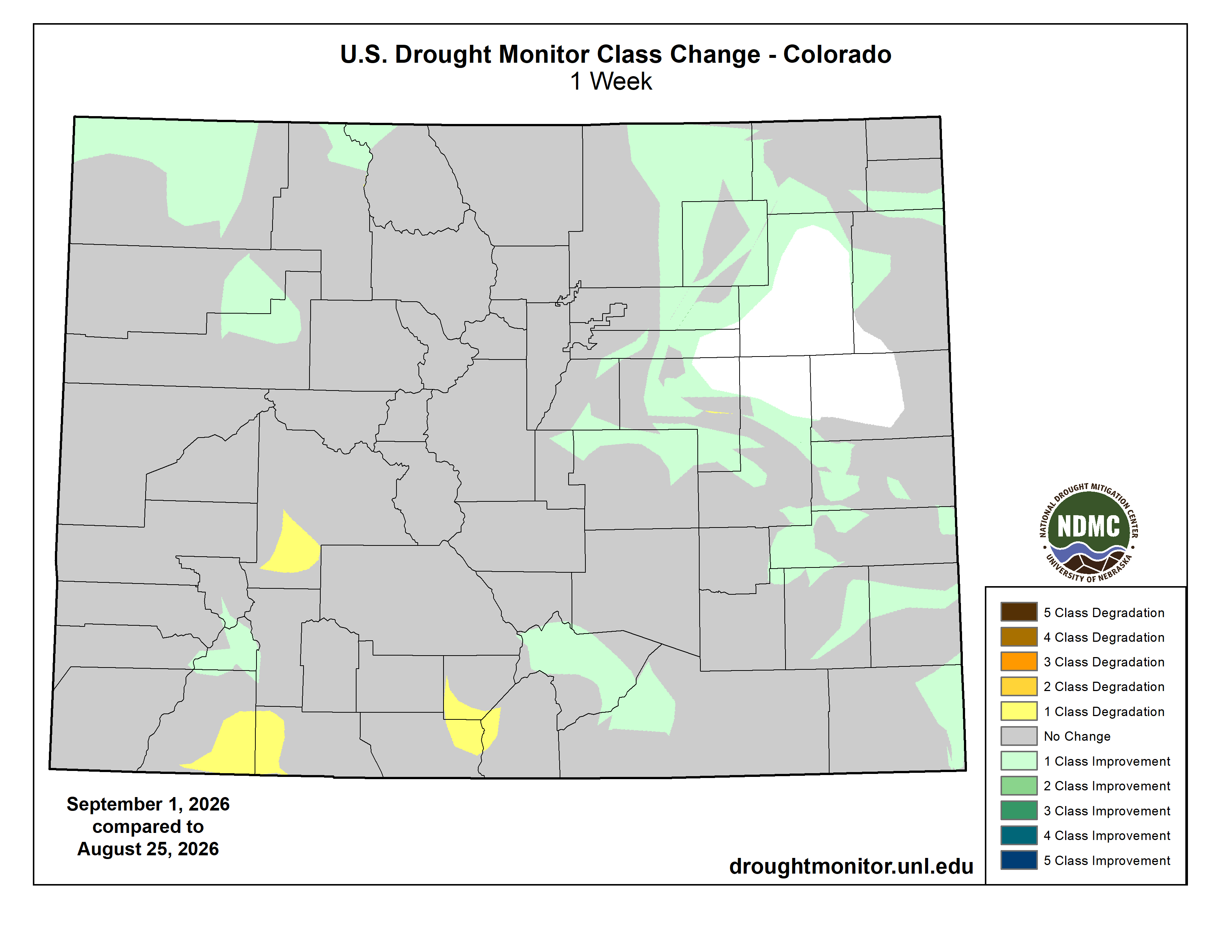
West
Locally heavy rains from the North American Monsoon fell in parts of Arizona, Utah and the Rocky Mountains in Colorado. Parts of Colorado to the west of the Front Range saw conditions improve given recent rainfall, though widespread short- and long-term drought remained across central and western Colorado. In a few areas in south-central and southwest Colorado that missed out on heavier rains, long-term precipitation deficits grew even worse. Temperatures from 4–6 degrees above normal also kept atmospheric thirst high, and extreme and exceptional drought locally expanded. Short-term precipitation deficits and poor streamflow in some areas led to drought degradation in parts of the Idaho Panhandle, the Spokane, Wash., area, and nearby northwest Montana. Short-term dryness and warmth in northern California led to the expansion of moderate drought there. Moderate drought locally expanded in north-central Montana where short-term rainfall deficits grew and soil moisture declined in a few areas. Recent precipitation in southwest Montana led to improvements in mid- to long-term precipitation deficits and overall conditions, and moderate drought coverage decreased. Recent precipitation in western Utah helped to lessen long-term precipitation deficits, and extreme drought coverage lessened slightly. Temperatures were warmer than normal across much of the West, excluding areas from western Nevada and far northern California through Oregon and Washington. In the rest of the region, temperatures were mostly at least 2-4 degrees above normal, with many areas 4-10 degrees warmer than normal…
South
Widespread expansion or worsening of ongoing drought or abnormal dryness occurred across the South, especially in parts of Mississippi, Texas, eastern Oklahoma and portions of Arkansas. Heavier rains, locally over 2 inches, fell in southeast Louisiana and southwest Mississippi. Otherwise, weather conditions were mostly drier, with many areas receiving less than a half inch of rainfall and some receiving none at all. Temperatures were warmer than normal across most of the region, especially in Oklahoma and the northern half of Texas, where temperatures were 6-10 degrees hotter than normal. This continued a very hot August across much of Oklahoma. Degradations in drought conditions were especially prevalent in southwestern and northern Texas, deep south Texas, northern Mississippi and eastern Oklahoma, as ongoing hot and dry weather worsened conditions in areas already suffering a myriad of drought impacts. Burn bans were enacted across much of western Oklahoma, while Oxford, Miss., residents were asked to conserve water due to high water demand and recent extreme heat. Streamflow across much of central and western Oklahoma and northern Texas was quite low, along with low soil moisture and intense short-term precipitation deficits…
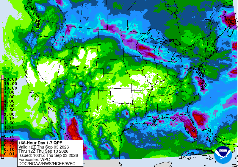
Looking Ahead
Through the evening of Monday, Sept. 7, the National Weather Service Weather Prediction Center is forecasting dry weather to continue across much of the central and south-central U.S., especially from southeast Nebraska through Oklahoma, Arkansas and western north Texas into southwest Texas and eastern New Mexico and Colorado. Heavier precipitation amounts through Monday evening will likely be confined to parts of the southeastern and northern Lower 48. Heavy rain is forecasted, or occurring on Wednesday afternoon, in east-central and southeast Texas, while the remnants of Tropical Storm Edouard pass through. Heavier rain is also forecast across the central and eastern Gulf Coast and Florida Peninsula. Rain amounts from southern Louisiana to near Panama City may approach 1-2 inches, while heavier rain amounts, locally 2-3 inches or more, are forecast in the Florida Peninsula. Heavier precipitation amounts, mostly in the 0.75-2 inch range, are also forecast in parts of the Pacific Northwest, northern Idaho, northern parts of Montana and North Dakota, and from Minnesota southeastward across Wisconsin and the lower Great Lakes into Pennsylvania and New York.
The National Weather Service Climate Prediction Center’s 6-10 day outlooks, covering Sept. 8-12, favors warmer-than-normal temperatures across much of the central and eastern U.S. The highest confidence for above-normal temperatures is centered around Kansas City and the mid-lower Missouri River Valley southward to the central and western Gulf Coast. Near-normal temperatures are favored in the western half of the West, with below-normal temperatures slightly favored in western Nevada and adjacent parts of California and Oregon. Near- or below-normal temperatures are also favored in central and northern New England. Above-normal precipitation is favored across much of the Great Plains and western U.S., especially from the Continental Divide into the Great Basin and in northern Minnesota and environs. Above-normal precipitation is also slightly favored in east-central Florida. The forecast favors drier-than-normal weather in the Tennessee and Ohio River Valleys and from Lake Erie to southern parts of the Northeast.
In Hawaii, both precipitation and temperatures are expected to be above normal for Sept. 8–12. Above-normal precipitation is also favored across large parts of Alaska, except for the northwest portion of the state and the central Aleutian Islands. Above-normal temperatures are favored in southeast and central Alaska and in the central Aleutian Islands, while near-normal temperatures are favored in northeast and southwest Alaska and the eastern Aleutian Islands.
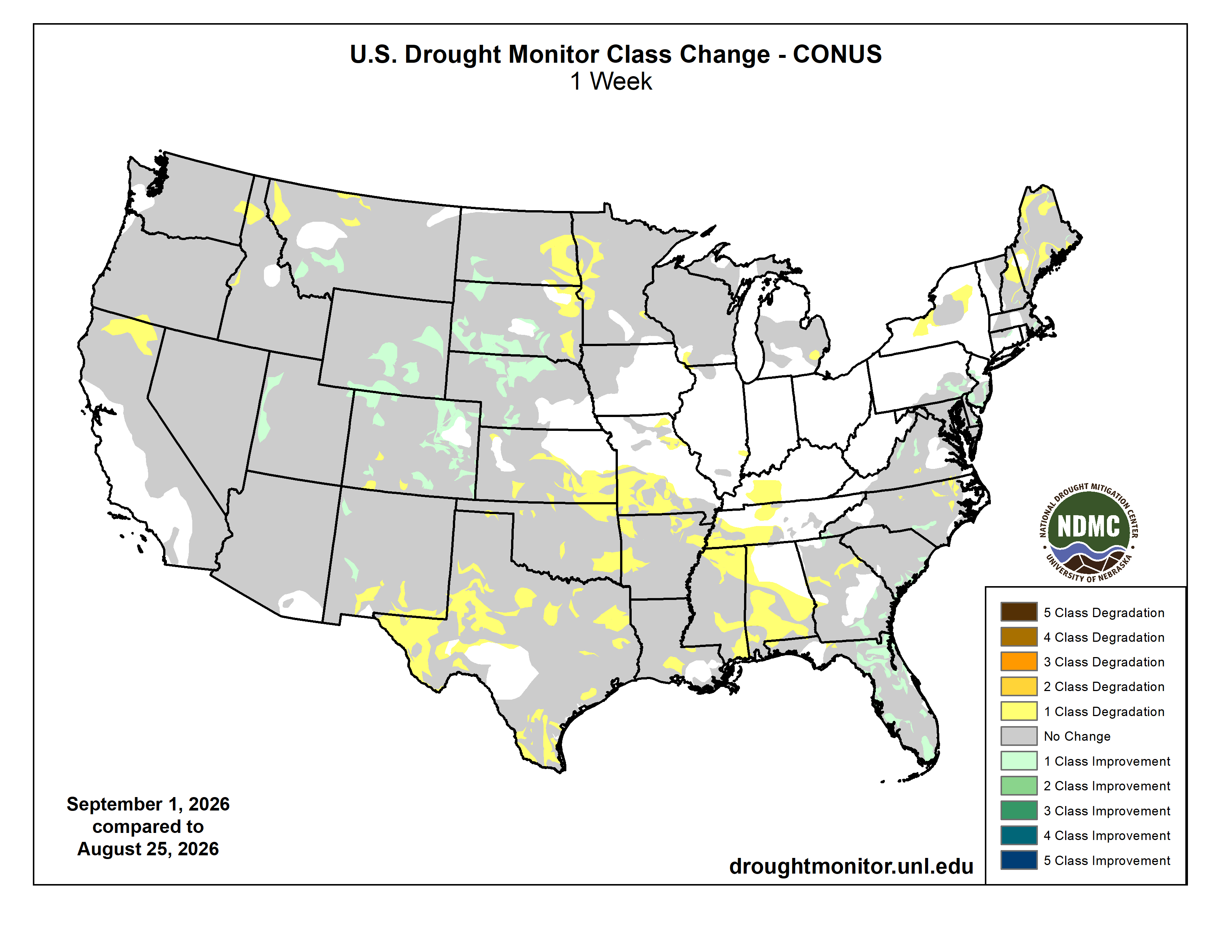
Just for grins, here’s a slideshow of early September US Drought Monitor maps for the past few years.
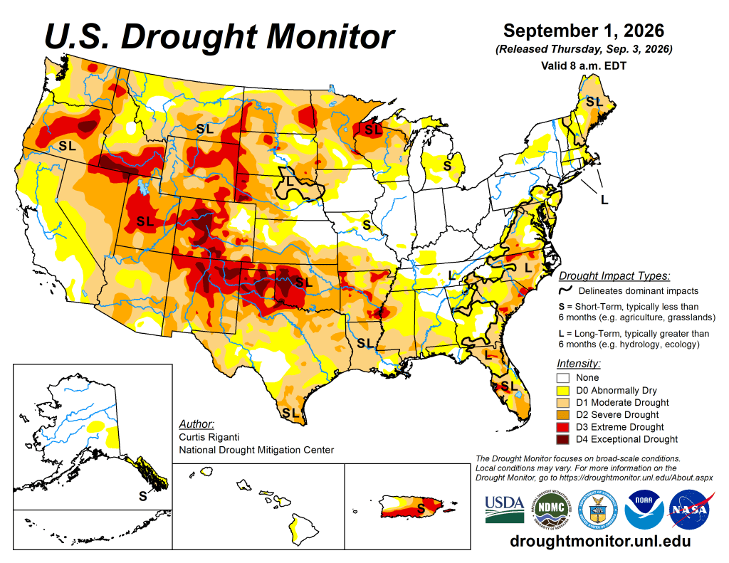
US Drought Monitor map September 1, 2026. 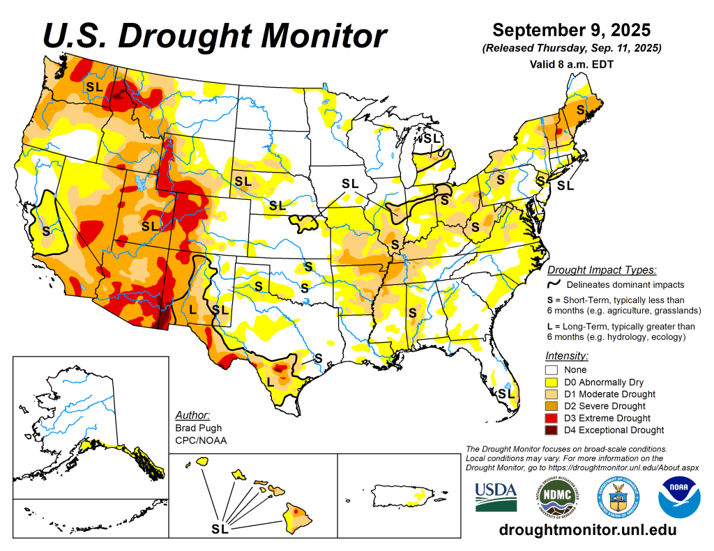
US Drought Monitor map September 9, 2025. 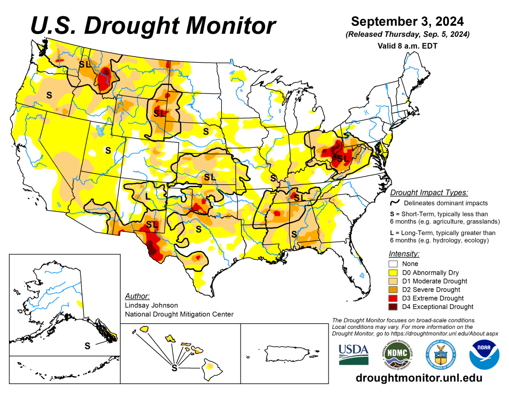
US Drought Monitor map September 3, 2024. 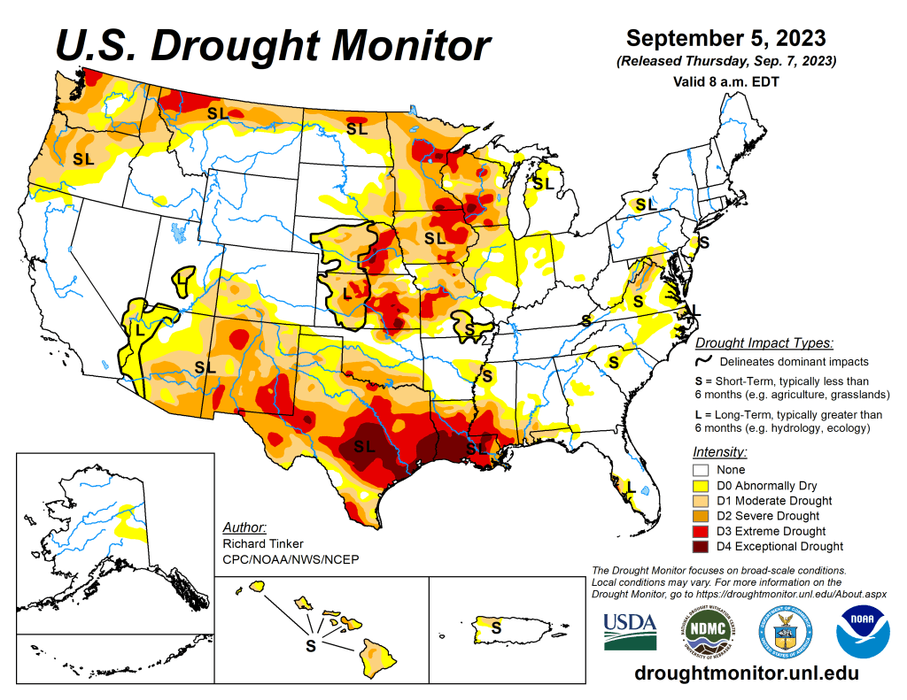
US Drought Monitor map September 5, 2023. 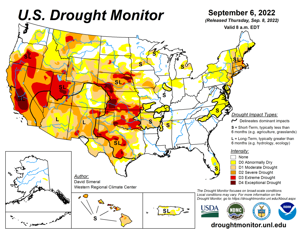
US Drought Monitor map September 6, 2022. 
US Drought Monitor map September 7, 2021. 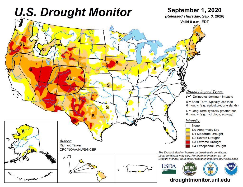
US Drought Monitor September 1, 2020. 
US Drought Monitor September 3, 2019. 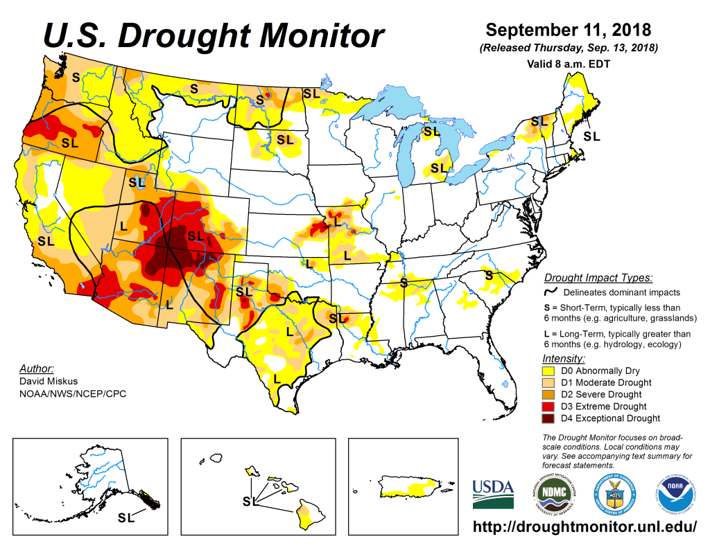
US Drought Monitor September 11, 2018. 
US Drought Monitor September 5, 2017. 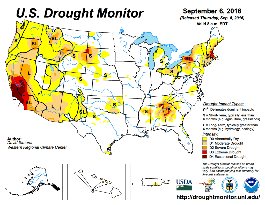
US Drought Monitor September 6, 2016. 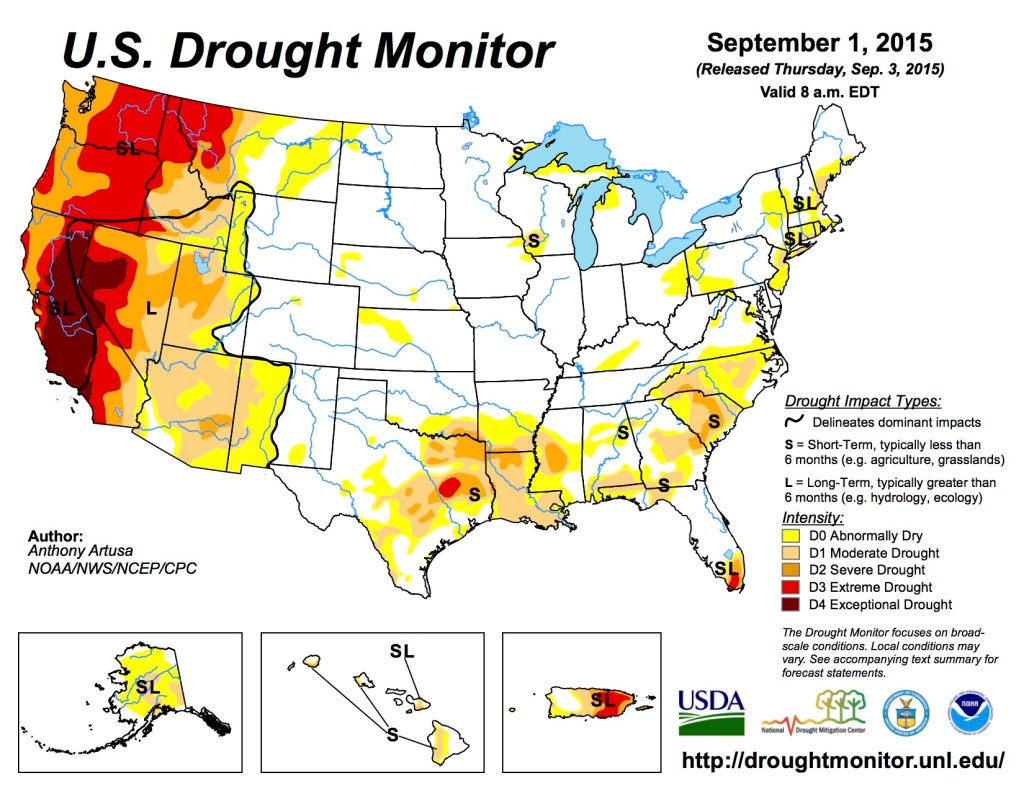
US Drought Monitor September 1, 2015 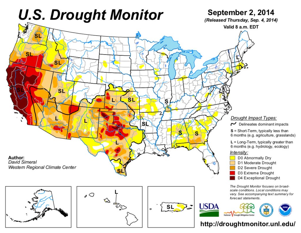
US Drought Monitor September 2, 2014 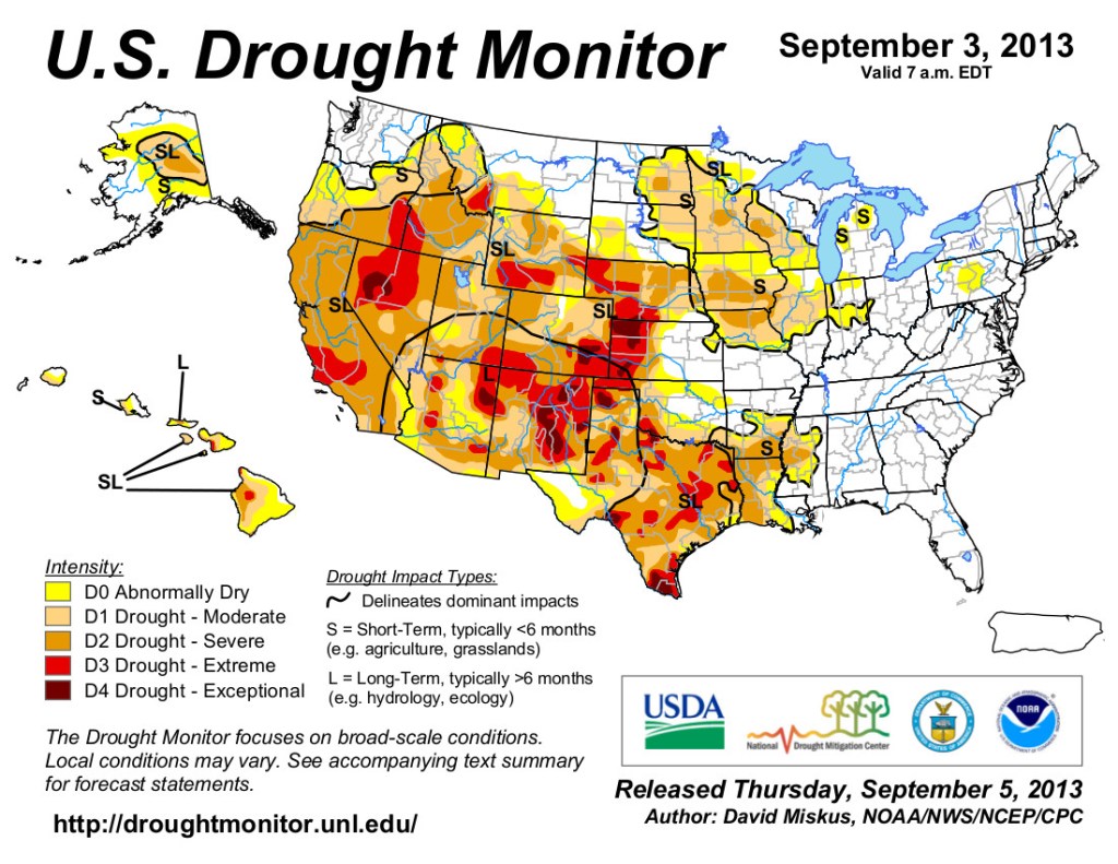
US Drought Monitor map September 3, 2013. 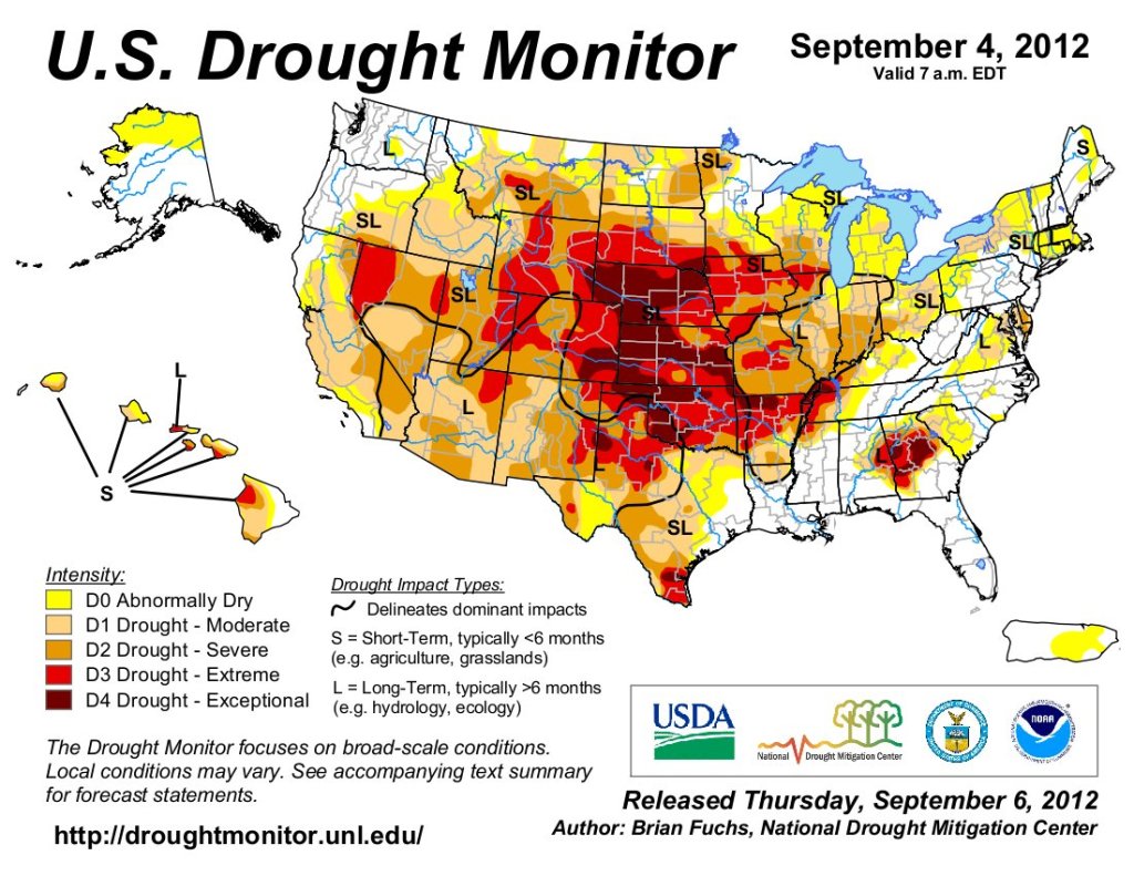
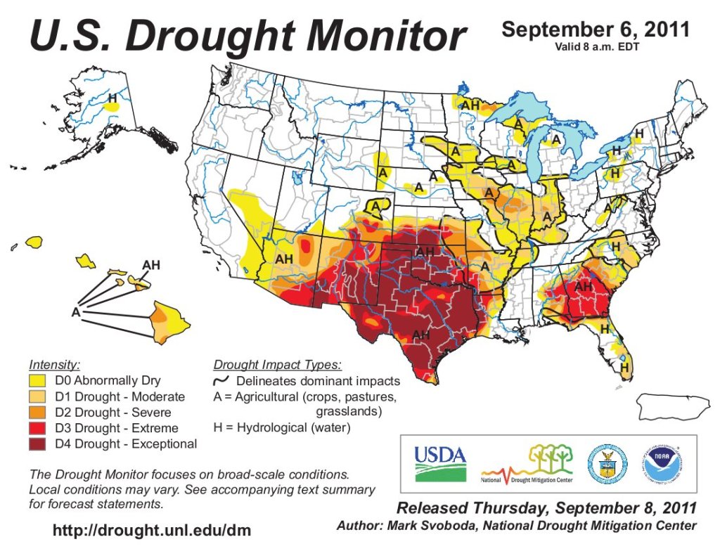
US Drought Monitor map September 6, 2011. 
US Drought Monitor map September 14, 2010.
The #MissouriRiver: A Long History, A Hopeful Future: The “Big Muddy” deserves a healthy future — American Rivers #MissouriRiver #aridification

Click the link to read the article on the American Rivers website (Michael Sertle):
August 26, 2026
From its start as a pure snowflake in the Rocky Mountains of Montana to its clouded, churning confluence with the Mississippi River in St. Louis, the “Big Muddy” has for centuries been incrediby impactful to the communities that call it home. Native Americans were first to recognize the importance of the Missouri River, with twenty-nine Tribal Nations recognized to hold cultural, economic, or water rights to this current day. Followed by Lewis and Clark on their historic “Corps of Discovery Expedition”, the river opened up a new horizon for the newly established United States of America to expand.

As time moved on, the Missouri and its floodplain became more developed, heavily farmed, tightly constricted, and eventually dammed. The Pick-Sloan Flood Control Act of 1944 changed the wild and free Big Muddy like never before; building massive dams and reservoirs, and thousands of miles of levees to facilitate flood control, farm irrigation, commercial navigation, and hydropower generation. While it can be debated as to the successes of Pick-Sloan, one thing is certain, a new wave of threats to the health and function of the river itself was set in motion and continues to grow today.
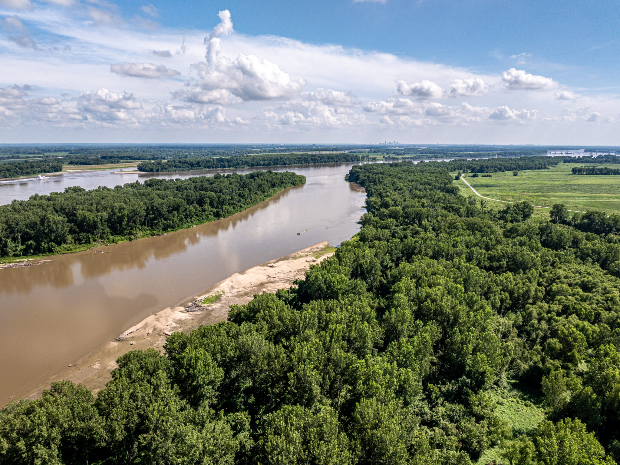
One of the first major rivers that was a focus of conservation efforts by American Rivers, we pushed for the endangered species listing of the pallid sturgeon, piping plover, and interior least tern. Changes in the river connectivity, historic hydrology, and natural sandbar creation severely impacted these species’ ability to survive. We were also a primary advocate in the subsequent actions for the Congressional creation of the U.S. Army Corps of Engineers’ (USACE) Missouri River Recovery Program (MRRP).

The MRRP is focused on:
- (1) avoiding actions that jeopardize federally listed species, and
- (2) the Bank Stabilization and Navigation Project Fish & Wildlife Mitigation Project (BSNP).
While advances have been made, including the de-listing of the interior least tern and the slow completion of levee-setbacks to establish floodplain re-connection, there is still over halfway to go to complete the total 166,750 acres of Missouri River floodplains that were approved to be acquired and restored as part of the BSNP.
A drought-tolerant grain could help #Colorado farmers save water. First, they need customers — Colorado Public Radio #SanLuisValley #groundwater
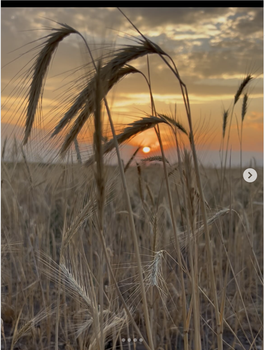
Click the link to read the article on the Colorado Public Radio website (Hayley Sanchez). Here’s an excerpt:
August 18, 2026
The San Luis Valley is searching for ways to use less water without shrinking agriculture. [The Rye Resurgence Project] effort believes rye could help. But turning the grain into part of the valley’s future will require more than convincing farmers to plant it.
“The situation is urgent, and we have to take action to reduce water use,” said Heather Dutton, manager of the San Luis Valley Water Conservancy District…
For years, groundwater has been pumped from the valley’s aquifer faster than nature can replenish it. If that continues, Dutton said, state regulators could eventually require irrigation wells to shut down. One option would be farming fewer acres. But Dutton said that would come at a steep cost.
“It wrecks our economy. It wrecks the fabric of our society of having people employed in agriculture and the heritage of this place,” she said. “That’s why it’s so important that we figure out other alternatives and ways that we can remain in farming, but use less water.”
[…]
The effort, launched by Dutton and Hooper farmer Sarah Jones, is exploring whether rye can help farmers reduce water use without taking more land out of production.
“This is a rye field that’s being used strictly for grazing and green manure,” project manager Morgan Neely said while walking along the perimeter of a lush green field in the San Luis Valley. Cows were cornered off to a section of the field.
Rye requires less than 12 inches of water each year — roughly one-third to one-half as much as many traditional valley crops, Neely said. Its living roots help hold down topsoil during the valley’s powerful spring winds, and it can be grazed by cattle, incorporated into the soil or harvested for grain.
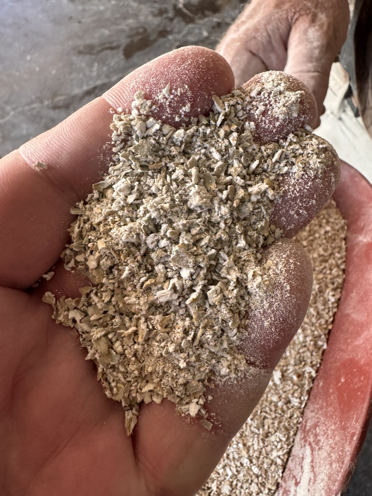
#Climate ‘Overshoot’ Is Coming—Are We Ready?: If global warming remains above 1.5 degrees Celsius, a new U.N. report says “there are no good outcomes” — Bob Berwyn (InsideClimateNews.org)
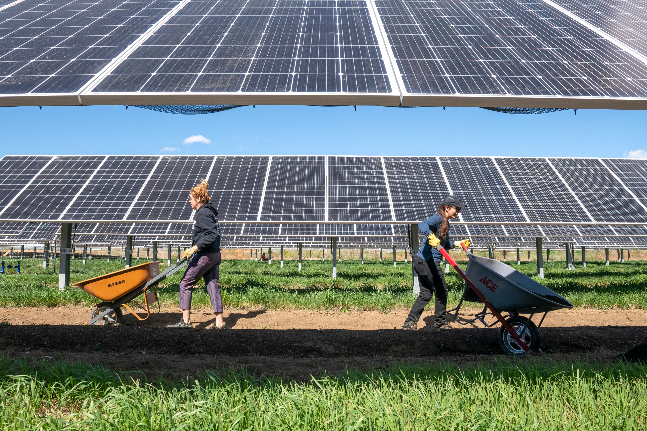
Click the link to read the article on the Inside Climate News website (Bob Berwyn):
September 2, 2026
Fossil fuel emissions are pushing Earth’s climate toward a dangerous new phase of climate “overshoot,” scientists warned Wednesday in a new report from the United Nations Environmental Programme.
The report, Limiting Overshoot, projects that global temperatures will exceed the 1.5-degree Celsius (2.7 degrees Fahrenheit) warming threshold identified in the Paris Agreement within a few years, intensifying deadly climate impacts. It says the best chance of restoring a safe climate is to begin cutting greenhouse gas emissions immediately, halve them by 2035, and figure out ways to remove billions of tons of carbon dioxide from the atmosphere before the end of the century.
The 1.5 degrees of warming identified in the report and the Paris pact refers to the increase in global temperatures since the preindustrial period of 1850 to 1900, before humans altered the atmosphere and climate with billions of tons of fossil fuel emissions and other industrial and agricultural pollution.
Under the 2015 agreement, more than 190 countries pledged to keep the global temperature below that level because they knew warming above that would mean even greater intensification of extreme weather events, ecosystem losses and the potential submersion of small island countries.
Multiple scientific studies, including global assessments from the Intergovernmental Panel on Climate Change, project that warming of more than 1.5 degrees Celsius will cause severe damage to human health, food and water supplies, as well as infrastructure and economies.
Scientists have calculated that at the current pace of emissions, warming could reach a catastrophic 2.7 to 3 degrees Celsius by 2100. If all the measures promised by governments under the Paris Agreement are implemented, warming could be limited to about 1.7 or 1.8 degrees Celsius, which would make it easier to return below the 1.5-degree Celsius threshold.
If Earth’s fever stays in the ‘overshoot’ zone too long, it could push ice sheets and key heat-carrying ocean currents past tipping points “that become difficult or impossible to reverse on human timescales,” the report concludes.
“We must make the overshoot as small and short as possible, limiting how high
temperatures rise and how long they remain above 1.5 degrees Celsius,” said United Nations Secretary-General António Guterres.
The new report, he added, identifies a triple play of climate action: accelerating the phaseout of fossil fuels and the transition to renewable energy, slashing methane pollution and protecting climate allies, such as lands, forests and oceans, that take heat-trapping carbon dioxide out of the atmosphere.
“We’ve failed to act on the options that were available 15 or 20 years ago to reduce emissions rapidly,” said report co-author Joeri Rogelj, a climate scientist at the International Institute for Applied Systems Analysis in Austria and a professor at Imperial College London. “The reality is that we have failed in that endeavor, and it needs to be acknowledged.”
The new report does just that, and it is alarming because the climate impacts projected for warming above 1.5 degrees Celsius are “unacceptable or unbearable for at least the poorest and the most vulnerable communities around the world,” he said. This summer, with heatwaves that killed thousands in Europe and burned parts of towns in North America, showed that developed countries in the Global North are not immune, he added.
“We need to face the consequences of this failure by dealing with the unavoidable impact,” he said. He added that there is a wide gap between doing nothing by allowing warming to continue for the rest of the century, and acting now to limit the peak temperature and the length of time the global temperatures remain above the threshold.
Co-author Carl-Friedrich Schleussner, another climate researcher at IIASA, said the report doesn’t just document the state of the global climate. Given the climate impacts happening at about 1.4 degrees Celsius warming, he said the report is “more about what it means for us here now, and what the response needs to look like.”
As warming heats the planet at the rate of half a degree Celsius every 20 years, he said “extreme events and climate-driven natural disasters are increasingly exceeding the capacities of ecosystems and of human systems.”
This summer’s extremes show this happening now, not in the distant future, he said, with extreme heat in Europe hitting places where it’s been rare and overwhelming the adaptive capacity of hospitals, schools and retirement homes. Extreme heat contributed to about 15,000 heat-related deaths in Germany, one of the most developed countries in the world.
“We are seeing what it entails to adapt to climate change, and we are seeing that we have an enormous gap,” Schleussner said. “We are really lagging behind. We are not prepared for what’s coming.”
UN Environment Program: World set to cross 1.5°C global warming, but can still limit, adapt to and return from higher temperatures
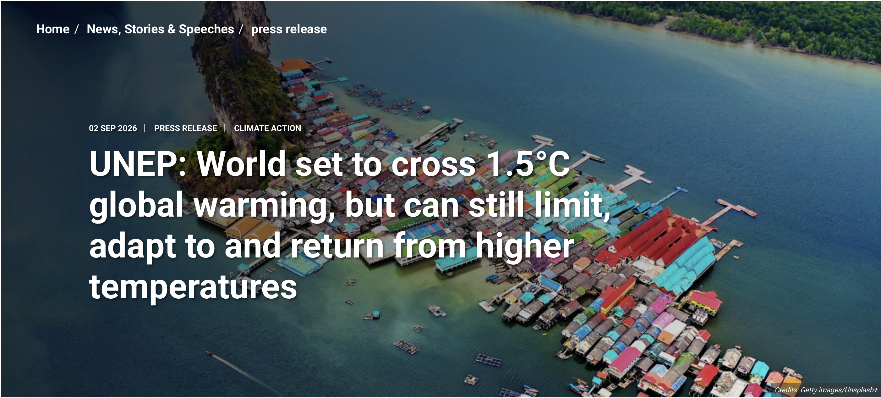
Click the link to read the release on the UNEP website:
- Report puts best-case scenario peak temperature rise at 1.8°C; others suggest over 2°C
- Above 1.5°C, climate impacts and risks of tipping points intensify with every fraction of a degree
- ‘Overshoot, peak and decline’ pathway best remaining option to help vulnerable nations and communities cope and return to below 1.5°C
Nairobi, 2 September 2026 – Global temperature rise is set to cross 1.5°C, likely within the next few years, pushing climate risks and impacts to increasingly dangerous heights, but it is still possible to bring temperatures down and achieve global goals in the Paris Agreement, according to a new UN Environment Programme (UNEP) report.
The report, Limiting Overshoot, identifies an ‘overshoot, peak, and decline’ pathway as the best remaining option to minimize the magnitude and duration of this overshoot and try to return to below 1.5°C as soon as possible.
“This summer’s scorching heat, raging wildfires and deadly floods are a warning of what lies ahead. We must make the overshoot above 1.5 degrees as small and short as possible. That demands an overshoot of ambition” said UN Secretary-General Antőnio Guterres.
This pathway would minimize peak temperature rise through immediate and sustained cuts to greenhouse gas emissions, including methane, on the road to net-zero, and bring down temperatures through long-term net-negative emissions, with carefully governed Carbon Dioxide Removal (CDR) – the process of removing carbon from the air and storing it through afforestation or other means – an essential part of the mix.
At the same time, following this pathway would involve adaptation actions that reduce vulnerability to the current, expected and unexpected impacts of climate change on societies, communities and economies – although there will likely be limits to adaptation and irreversible impacts, especially if peak temperatures are not minimized. The report stresses such a pathway would reduce risks and impacts, make adaptation less difficult and expensive, and increase the chances of lowering temperatures.
“There are no good outcomes if we remain above 1.5°C. Across the globe, extreme heatwaves are already proving that climate impacts will strike faster, hit harder, and last longer – costing more lives and causing deeper disruption,” said Inger Andersen, Executive Director of UNEP. “Now is the time we must double down on climate action. We can – and must – get on the right path. By cutting greenhouse gas emissions, strengthening resilience and adaptation, and ensuring exceedance of 1.5°C is as small and short as possible.”
Devastating impacts
The most optimistic scenario will see temperature rise peak at 1.8°C above pre-industrial levels, above the goal of limiting warming to 1.5°C set by the Paris Agreement. Most other scenarios predict higher peaks.
Above 1.5°C, risks and impacts will intensify with every extra fraction of a degree and every year. Anticipated impacts include intensified extreme weather, ecosystem loss, and submersion of Small Island Developing States and low-lying coastal cities. Severe damage to human health, food security, water supplies, nature, cities, infrastructure, and economies is expected.
The report warns that the likelihood of crossing irreversible tipping points increases with the magnitude and duration of higher temperatures. These include the destabilization of major ice sheets, degradation of the Amazon rainforest and disruption of the Atlantic Meridional Overturning Circulation (the system of currents that moves warm surface water north and cold deep water south, playing a key role in regulating the climate). Some impacts may emerge abruptly, while others will accumulate over time.
Considering the scale of the risks and the co-benefits of climate interventions such as a rapid transition away from fossil fuels to renewable energy – improving air quality and public health, lowering energy costs and increasing access to electricity – the report urges accelerated, collective and global action to get on an overshoot, peak and decline pathway. How quickly and strongly this action happens will define the shape and trajectory of the pathway.
Conditions for success
Strong political will and multilateralism, effective policies, inclusive governance, and finance are all important enabling conditions for action – and equity and justice must underpin all responses. Countries with greater responsibility for climate change should act the fastest with the greatest ambition.
The report also finds that mitigation and adaptation, which are mutually reinforcing, must advance together, while being responsive to emerging risks. Interventions that achieve both mitigation and adaptation goals – such as nature-based cooling – should be prioritized.
Adaptation set up now forms the foundation for efforts to come, but it must become transformational and responsive to evolving non-linear and abruptly arising risks – including those that will harm mitigation efforts.
The report emphasizes that net-zero is a milestone towards net-negative, with CDR needed in addition to, not instead of, sustained reductions in greenhouse gas emissions. However, CDR can only contribute credibly to a return below 1.5°C if peak warming remains well below 2°C and all residual emissions are reduced. Strong governance frameworks for CDR will be critical to allow responsible deployment and manage implications for environmental integrity, equity, scale.
Responding to a changed future
Years of inaction mean that even if a return to below 1.5°C is secured, irreversible losses and permanently changed conditions are certain. Many communities may be forced to relocate or change livelihoods, while societies will face the challenge of re-adjustment. This raises issues of justice, power, and political legitimacy, which will require new, inclusive governance arrangements to resolve difficult issues.
This report is a reminder that an overshoot, peak and decline pathway is a next generation climate frontier, but one which cannot be left unattended to for the next generation to tackle. Immediate action is required for such a pathway to remain possible.
Additional Quotes
“Every fraction of a degree of warming above 1.5 leads to increasing and increasingly severe climate impacts, with our Pacific family standing on the frontlines. While we know the challenge is growing, so too is momentum. The recent energy crisis has reminded the world of the need to reduce our dependence on fossil fuels, accelerate the transition to renewable energy and bolster climate cooperation. COP31 is an opportunity to turn our ambition into action — with Türkiye, Australia and the Pacific delivering a practical, solutions-focused COP.” – Chris Bowen, Australian Minister for Climate Change and Energy, and President of Negotiations for COP31.
“Every fraction of a degree matters, and every year spent in overshoot increases climate risks and the potential for irreversible losses. The Overshoot Report makes clear that exceeding 1.5°C should not be seen as a new destination, but as a pathway we must urgently work to minimize and reverse. This requires rapid and sustained emissions reductions, alongside ambitious adaptation to protect people, communities and ecosystems.
COP31 must turn this urgency into concrete action. We need to accelerate global electrification, reduce methane emissions from waste, strengthen the climate resilience of cities, and enhance the resilience of marine and coastal ecosystems. At the same time, mitigation and adaptation should advance together. The choices we make today will determine how high temperatures peak, how long they remain there, and how safely we can return to 1.5°C.” – H.E. Murat Kurum, COP31 President-Designate
Water Deal Could Upend the Narrative About Agriculture — Joanna Allhands (#Arizona Farm Bureau) #ColoradoRiver #COriver #aridification
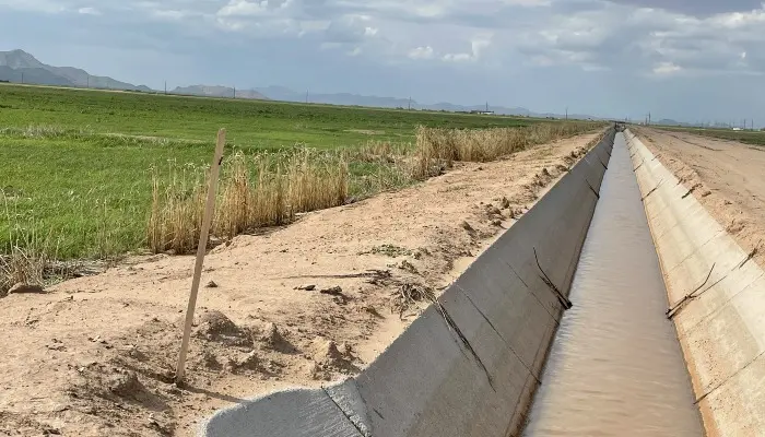
Click the link to read the article on the Arizona Farm Bureau website (Joanna Allhands):
August 28, 2026
Central Arizona Irrigation and Drainage District (CAIDD) is formally considering a deal to import water from California.
Take a second to let that sink in — because it’s counter to what most folks think about agriculture.
The assumption has long been that water augmentation is only for major cities, those that can pay the higher cost that new water sources require.
But farmers are leading the way on this conversation.
And that could impact a lot more than the Pinal County fields they irrigate.
CAIDD lost water years ago
CAIDD already knows the deep pain of Colorado River cuts.
It was among the first to see its lower-priority water eliminated in the 2019 Drought Contingency Plan.
The Eloy irrigation district secured state and federal aid to resume pumping groundwater, but those wells only produce a fraction of the water that the Central Arizona Project once delivered.
In a gravity-fed system like CAIDD’s, less water in canals means less momentum to push water to every customer.
“Some laterals are better than others,” said district president Dan Shedd, who irrigated 2,200 acres when Colorado River water was still flowing.
That’s down to about 600 acres now.
“My neighbor can’t farm as much as I can because of where the wells are situated. Most of us are less than 50%.”
Farms need extra in summer
Farmers across the district have adapted to this new reality.
Most have fallowed land. Some have sold or leased parcels to solar projects to help make ends meet.
Many remaining fields have been reconfigured into smaller plots, so lower-pressure water can move uniformly across them.
And farmers are diversifying what they grow.
“Normally, I’d have 1,600 acres in cotton,” Shedd, an Arizona Farm Bureau member, said.
“But now I’m growing wheat and garbanzo beans in the winter when there’s more water. It’s just a break-even deal.”
Summer is a different story.
Though more profitable alfalfa, cotton, corn and Bermuda grass can be grown then, it can be a struggle to pump enough water when the heat’s on and everyone needs irrigation at once.
In past years, the irrigation district has secured extra supplies from nearby providers to supplement when needs are highest.
But that water is growing scarce as others across Arizona now face cuts.
CAIDD knows it needs to do more.
Cadiz has groundwater to sell
Meanwhile, a California company called Cadiz is looking for interested parties to sell its groundwater, which it says would otherwise be lost to evaporation in a dry lakebed.
The water and land management company has secured rights to pump up to 75,000 acre-feet of water a year from an aquifer roughly the size of Lake Mead.
Its Mojave Groundwater Bank, located about two hours west of Lake Havasu City in Arizona, is neither new nor universally welcomed in California.
Opponents have tried to stop the project multiple times over 30 years.
But Cadiz recently secured the last federal permit it needs to begin converting a natural gas line to transport its water north and west.
The idea, at least initially, is to exchange that water with users who receive supplies from the State Water Project.
That water would flow to Los Angeles, in an agreement that has yet to be cemented, where users there would agree to conserve a commensurate amount of Colorado River water.

And then, in other agreements that still must be negotiated, 10,000 acre-feet of that water would flow to CAIDD through the Central Arizona Project canal.
Effort now is to lower the price
If this sounds complicated, it is.
Finalizing complex agreements to move water every year for at least five decades is one thing.
Lowering the price for CAIDD to officially bite on this deal is another.
“We can’t pass the cost onto food,” Cadiz CEO Susan Kennedy said, particularly when farmers already operate on slim margins.
Kennedy — a long-time California political operative — is rustling the bushes for private investment and an 80% federal funding match.
She is also working with the Bureau of Reclamation to develop a model exchange agreement that could be used to expedite other interstate water transfers.
This could change the narrative
Ten thousand acre-feet is a drop in the bucket for CAIDD, which even at diminished capacity delivered about 160,000 acre-feet last year.
It’s not enough water to restore fields that have been taken out of production.
But it is enough to provide more long-term certainty for those that remain.
If the deal comes together, it could prove to other irrigation districts that new supplies aren’t necessarily out of reach, and that agriculture has a more secure future in Arizona, despite its current water challenges.
And even if it doesn’t, district leaders contend, the conversation could open doors to other ideas and opportunities.
“This could bring water to Arizona, whether or not we can utilize it,” said Ron McEachern, CAIDD’s former general manager.
“That’s worth something.”
Prop 137 to invest in protecting and conserving water and land, preventing wildfires, coming to #Colorado voters this fall
Click the link to read the release on the Yes on Prop 137 website:
August 31, 2026
Yes on Prop 137 campaign to protect Colorado’s land and water and prevent wildfires officially launches
Supporters of Proposition 137 today officially launched their statewide campaign for the November ballot initiative to invest in preventing severe wildfires and protecting the state’s rivers, drinking water, and landscapes.
Without increasing taxes, Prop 137 would invest an estimated $175 million annually to reduce wildfire risk, protect and conserve water and land, strengthen watershed and forest health, expand access to the outdoors, and sustain Colorado’s outdoor economy.
“Your vote of ‘yes’ on Proposition 137 supports local, regional, and state-level change that prepares our communities for wildfires and keeps our homes, lands, and waters protected. Wildfire preparedness is generational; community-based solutions and state-led funding are key,” said Jennifer Mueller, CEO of The Ember Alliance . “If you want to ensure that our kids and future generations can also enjoy the places we love as Coloradans today, then a ‘yes’ on Prop 137 is a priority.”
Prop 137 would redirect money from the state’s existing sales tax on sporting goods and outdoor equipment, and dedicate those funds to protect drinking water, prevent catastrophic wildfires, and preserve Colorado’s forests, lands, and open spaces.
“Colorado’s lands and water are foundational to our communities, economy, and way of life,” said Robyn Paulekas, executive director of Keep It Colorado . “We have a unique opportunity to make smart, long-term investments that conserve working lands, protect water resources, expand access to the outdoors, and reduce wildfire risk. Prop 137 would provide dedicated, year-after-year funding to help meet those goals without raising taxes.”
Colorado is running out of time to protect the lands, water, and forests that define our state. As temperatures rise and drought places increasing pressure on rivers and water supplies, and wildfires intensify, this initiative will safeguard water for all.
“Denver Water is responsible for delivering clean water to more than one and a half million Coloradans. Our drinking water starts as snowpack and rainfall in the mountains, filters through our forests and flows into the rivers that supply our communities,” said Alan Salazar, CEO of Denver Water . “But bigger, more intense wildfires are increasingly damaging our forested watersheds and degrading our source water supplies. Proposition 137 would provide crucial funding to restore our forests and make them more resilient against the threat of catastrophic wildfire, helping ensure the high-quality water supply that Coloradans depend on.”
A broad and growing coalition of water and wildfire experts, outdoor recreation leaders and small businesses, community advocates, and conservation organizations from across Colorado has endorsed the measure, which would support:
- Watershed protection projects that safeguard drinking water supplies
- Work to help prevent severe wildfires and restore forests in fire-prone watersheds
- Conservation protection of working lands and ranches
- Trail and park improvements and new state parks and open space
- Wildlife corridor, habitat restoration projects, and invasive species removal
- Support for Colorado’s growing outdoor recreation economy and gateway communities
- Enhanced outdoor recreation opportunities across the state
“Colorado’s outdoors are the foundation of our recreation economy and a defining part of what makes our state such a special place to live, work, and play. As someone who has spent a career helping people experience these landscapes firsthand, I know how important it is to invest in protecting them for future generations,” said Bill Gamber, co-founder of Big Agnes , a Steamboat Springs-based outdoor gear company. “Funding from Proposition 137 would enable us to conserve our land and water and expand outdoor recreation opportunities, all without increasing taxes. That’s a win for our communities, our economy, and for Coloradans now and in the years to come.”
The campaign has received dozens of endorsements to date from groups that include: American Rivers, Backcountry Hunters and Anglers, Colorado State Grange, Community Agriculture Alliance, Conservation Colorado, Denver Water, Ducks Unlimited, Eagle Valley Land Trust, The Ember Alliance, Environmental Defense Fund, Great Outdoors Colorado, Keep It Colorado, Mountain Towns 2030, National Wildlife Federation, Wildfire Mitigation Council, Rural Is Rad PBC, The Conservation Fund, The Greenway Foundation, The Nature Conservancy, Pikes Peak Outdoors, Routt County Wildfire Mitigation Council, San Luis Valley Great Outdoors, Theodore Roosevelt Conservation Partnership, Tri-State Generation and Transmission Association, Trust for Public Land, Western Resource Advocates, and The Wilderness Society.
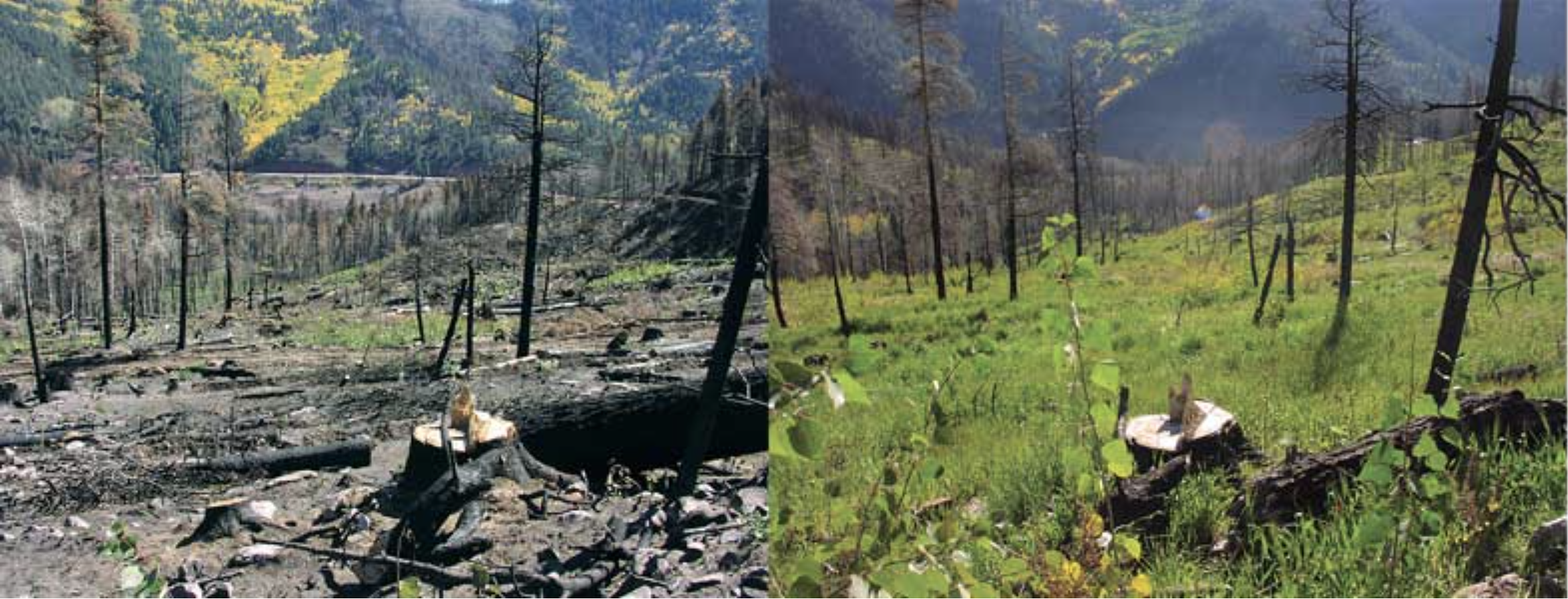
A 4.2-million-gallon sewage spill in #Colorado’s #ArkansasRiver was expected to reach John Martin Reservoir, August 31, 2026 — 9News.com
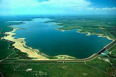
Click the link to read the article on the 9News website (Alexander Kirk). Here’s an excerpt:
September 1, 2026
Colorado Parks and Wildlife (CPW) said the sewage has been moving downstream in the Arkansas River and was expected to reach John Martin Reservoir near Las Animas beginning Monday. The City of Pueblo Wastewater Department said that state and city stormwater officials were notified of the discharge issue early Thursday morning, and said the discharge was halted by approximately 11:45 a.m. According to the wastewater department, a pipe inside of the stormwater pipe had a hole cut in the top many years ago. That hole was patched with concrete, and over time the concrete slipped from the hole. The pressure of the sanitary sewer pipe to keep the bypass pumps running caused untreated wastewater to come out of the hole and flow into the stormwater pipe, which flows into the Arkansas River.

Denver man arrested on charges of tampering with Front Range water supply systems, diverting ditch — The #Denver Post
Click the link to read the article on The Denver Post website (Elise Schmelzer). Here’s an excerpt:
August 28, 2026
The Colorado Attorney General’s Office and the 14th District Attorney’s Office this week charged Fabrizio Lorenzin, 65, with four felonies in connection with repeated sabotage of the Berthoud Pass Watershed Ditch and its security cameras over several years. The remote ditch system begins at 11,200 feet high on its namesake pass in the mountains and helps funnel water to Northglenn and Golden. The ditch’s water is stored…in Standley Lake in Adams County. Lorenzin allegedly forced open headgates on the system’s ditches, damaging the infrastructure and diverting millions of dollars’ worth of drinking water from its intended destination downstream. Prosecutors allege that he also stole cameras meant to watch the district’s property…
Law enforcement first began investigating the possible tampering with the headgates in August 2019, according to an arrest affidavit documenting the investigation. That’s when four of the gates that control the direction of the flow of water were vandalized, diverting water worth approximately $1.3 million, the affidavit says…Headgates were damaged again in 2022, diverting $4.3 million in water, the affidavit says. Trail cameras again photographed the same man with the same backpack. Another headgate was damaged in 2023 when it was forced open and propped up with rocks. This time, the trail cameras were also stolen. In 2024, the affidavit says, federal investigators with the U.S. Environmental Protection Agency installed three cameras with Apple AirTags attached. More images from the area showed the same man with the same backpack. In August 2024, the AirTags on the stolen cameras pinged from inside Lorenzin’s home, the affidavit says, and investigators searched it on two occasions, finding the disassembled EPA cameras and a laptop that contained images from other stolen cameras. A review of the search history on the laptop found multiple searches for information related to sabotage on the Berthoud Pass system as well as information about trail cameras and headgates, the documents says.
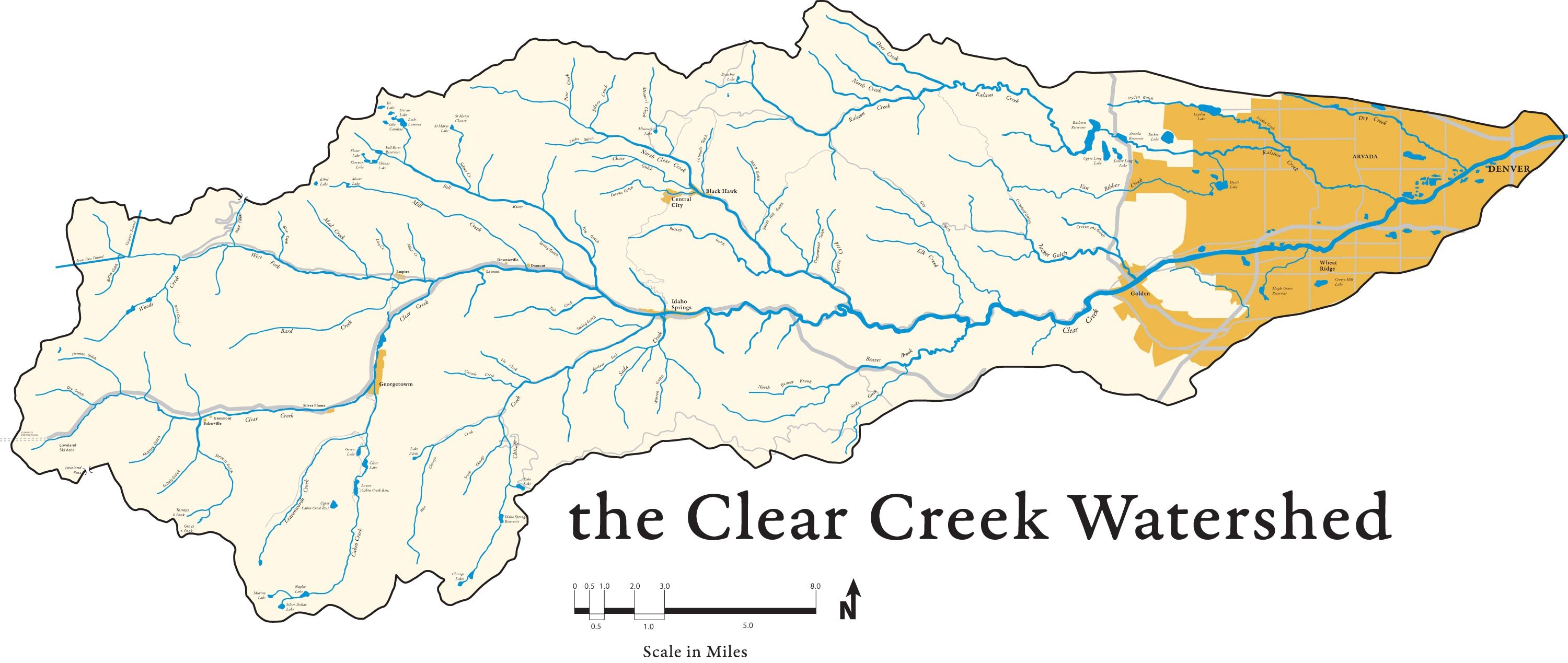
Amid exceptional drought in Eagle County, #Colorado Division of Water Resources places call on #EagleRiver — #Vail Daily
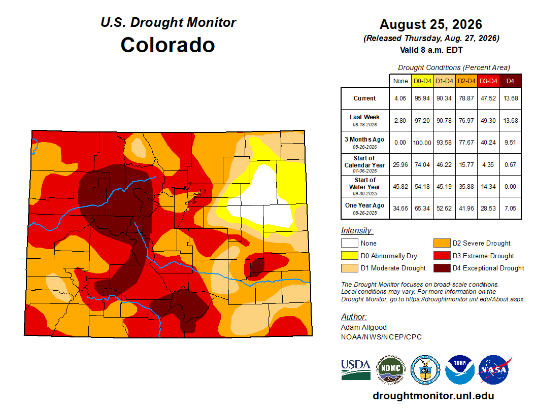
Click the link to read the article on the Vail Daily website (John LaConte). Here’s an excerpt:
August 28, 2026
Upper Eagle Regional Water Authority now required to replace diversions with more water
On Aug. 14, the Colorado Division of Water Resources placed what’s known as a “call” on the Eagle River, meaning that any water user with junior water rights is now required to stop diverting, or replace their diversions with augmentation water. The call came as no surprise to water managers, and is not uncommon in drought years when the Eagle River between Gore Creek and Lake Creek reaches an average flow that is less than 85 cubic feet per second between May 1 and Sept. 30. That minimum average threshold was set in a court decree issued Oct. 7, 1981, which said that minimum streamflow is “required to preserve the natural environment to a reasonable degree on the Eagle River.” What is uncommon, said Tim Friday, director of water & utility resources for the Eagle River Water & Sanitation District, is the fact that the Colorado Division of Water Resources consulted with the district before placing the call on the Eagle River. The call could have been placed a month earlier, as the average minimum flow had dropped below 85 cfs back in July, but the Division of Water Resources stalled it a month in case flows came back up…The Eagle River Water & Sanitation District isn’t as affected by the call, as many of the water rights in the district are senior to the 1981 court decree, but the Upper Eagle Regional Water Authority, which also supplies water to many properties in Eagle County, has water rights that are junior to the 1981 decree…For more information about the instream flow rights on the Eagle River, visit Colorado’s Decision Support Systems website.
The #ColoradoRiver District concerned legal tools for #conservation program could favor some regions over others: — Heather Sackett (AspenJournalism.org) #CWCSC2026 #COriver #aridification
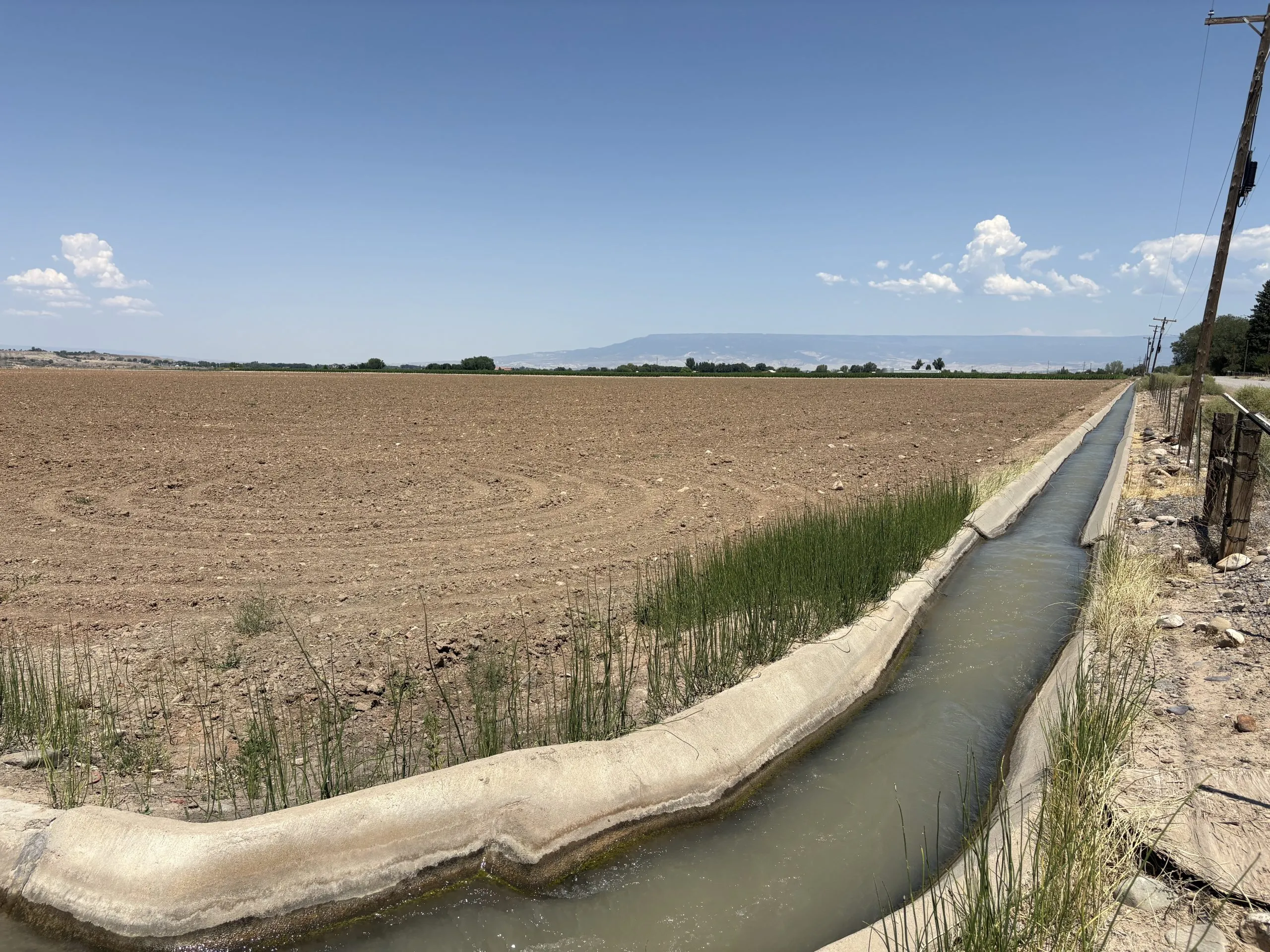
Click the link to read the article on the Aspen Journalism website (Heather Sackett):
August 28, 2026
Colorado could most easily wring water from Grand, Uncompahgre, Upper Gunnison valleys
Western Slope water managers are raising concerns that the legal tools used under Colorado’s new conservation program could cause negative impacts to local communities and the state’s agricultural industry.
In a letter to the state water board, the Glenwood Springs-based Colorado River Water Conservation District said it is concerned that the legal mechanisms state officials plan to use to move conserved water into downstream reservoirs may mean certain geographic areas are more likely to give up water. The River District also says the program’s framework should be set by lawmakers – with a significant stakeholder process – during the 2027 session, instead of by the Colorado Water Conservation Board and state Division of Water Resources officials.
At its July meeting, River District staff presented a map of the river basins in its 15-county region, showing which areas were most likely to participate in a conservation program. The Uncompahgre River basin; Dolores River basin; Colorado River in the Grand Valley; White River near Rangely; and Green River, Little Snake; and the Yampa in the Maybell/ Lily Park area were the most likely regions to see participation in a new state conservation program.
“What it shows is the potential for the disparate impacts,” River District General Manager Andy Mueller said at the July board meeting. “And because it’s so easy to pay someone in the Grand Valley for a full [growing] season, that’s going to be the inclination. That’s the easy thing.”
In July, officials from the CWCB and Division of Water Resources unveiled what they are calling a “near-term contribution program,” designed to pay water users in the Upper Colorado River Basin (Colorado, New Mexico, Utah and Wyoming) to voluntarily cut back for the next two years. The state of Colorado will run its own program, alongside similar programs in Utah and Wyoming, using $100 million in promised funding from the U.S. Bureau of Reclamation.
“We have this federal funding available to us and to bring those funds into Colorado, we need to hit the ground running and start the application window,” Amy Ostdiek, interstate section chief at the CWCB, said in an interview with Aspen Journalism. “So we are looking at doing this with the tools we have available under the law as it exists today. And that’s just kind of the reality of the timing of it.”
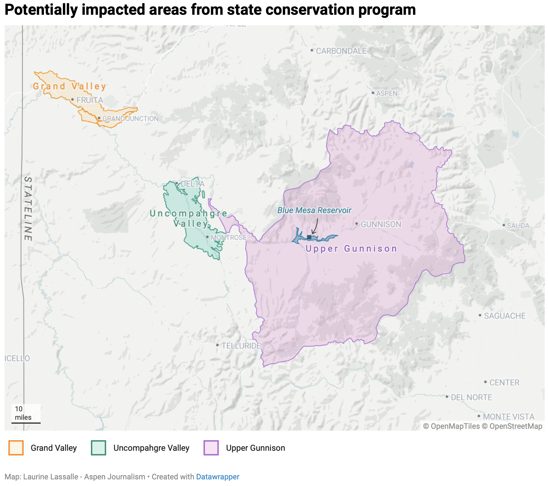
Shepherding vs. existing authorities
One of the complications of setting up a contribution program are the legal tools used to move water saved upstream to either Lake Powell or Blue Mesa Reservoir, where the state can then get credit from Reclamation for the stored water. One of the criticisms of past pilot conservation programs was that the water was not tracked to Lake Powell nor measured to see how much ended up there.
State lawmakers would need to pass a law to ensure that conserved water is protected as it moves through the river system so that it reaches a specified downstream reservoir without being taken by other water users along the way, a process known as “shepherding.” State officials believe they have the legal authority to shepherd water across the state line only in the case of a call from the Lower Basin states (California, Arizona and Nevada). And so far, the Lower Basin has never placed a compact call.
That means the most straightforward places to wring water from the state are the Grand Valley, the Uncompahgre Valley and the Upper Gunnison Valley. The irrigation districts of the Grand and Uncompahgre valleys are close to the state line and the Upper Gunnison Valley is just above Blue Mesa, so the majority of water conserved in these locations will get to where it needs to go without the state Division of Water Resources having to actively shepherd it.
The River District has long warned that these types of programs, if not done carefully, could cause negative economic impacts by removing water from the Western Slope’s rural agricultural communities.
“Without shepherding, you end up with the potential that there are certain areas that are targeted and can produce water in this program and other areas that cannot,” Mueller said. “Therefore, you end up with these disproportionate impacts that we’ve been concerned about.”
Sonia Chavez is the general manager of the Upper Gunnison River Water Conservancy District, one of the areas that could be singled out. The 59,000 irrigated acres of agricultural land in the district produces mostly hay and is above the state’s largest reservoir, Blue Mesa, where state officials plan to store water conserved under the program.
“That has not been lost on us that we are the only community sitting above a federal reservoir in the state of Colorado,” Chavez said.
State officials say they intend to use their “existing authorities” for this new program, without the change in state law needed to allow shepherding. But the precise definition of existing authorities is still unclear. Officials said it could include loans of conserved water to the state’s instream flow program or releasing water from Blue Mesa Reservoir at times of year when downstream users won’t pick it up, so the water is nearly guaranteed to get to the state line.
The River District’s letter asks the CWCB for more clarity on the definition of existing authorities and how they would be used as part of a contribution program.
Lawmaker involvement
The creation of a conservation program for Colorado comes at a critical time for the basin, which remains locked in the grip of a historic drought, combined with a management crisis. With the seven states that share the river still unable to find agreement on a new framework after more than two years of failed negotiations, the federal government has stepped in with its own two-year operating plan. That plan, which was released last week and includes cuts to water use in the Lower Basin, immediately triggered a lawsuit from the state of Nevada.
While the Lower Basin states are subject to mandatory cuts under the federal plan, the Upper Basin is not. But the four Upper Basin states have offered to voluntarily contribute 100,000 acre-feet of water over the next two years, when conditions allow, which would be set forth in a parallel agreement with Reclamation separate from the federal management plan. Colorado’s conservation program is an effort to make good on that promise.
“We’re in the post-2026 world, and I think that acting now and doing what we can with the authorities that we have shows Colorado’s commitment and demonstrates that we are at the table in a meaningful way,” Ostdiek said. “We think it’s important, for various reasons, to move forward with this now.”
In its letter, the River District also asks for the state to limit the criteria it uses to approve participation to a one-year, temporary program so lawmakers can use the 2027 session to use a stakeholder process to come up with a framework for a future program beginning in 2028.
“The Colorado River District has long advocated that any government action that facilitates a Colorado River conserved consumptive use program inside the State of Colorado – or directs the Colorado State Engineer to shepherd conserved water to the state line, whether done under existing authorities or otherwise – must only be done through legislation enacted by the Colorado General Assembly,” the River District’s letter reads.
At a June hearing of the state’s Water Resources and Agriculture Review Committee, lawmakers told state officials that the legislature should be involved in the creation of a conservation program.
But putting the conservation issue – which remains controversial – before stakeholders and lawmakers hasn’t yielded results in the past. In 2023, a 17-member, state-wide drought task force, was supposed to make recommendations to lawmakers about what a conservation program should look like. The group could not agree and did not advance any recommendations on that topic, with some members saying a state conservation program was premature.
And at an August 2025 meeting of the Water Resources and Agricultural Review Committee, some Delta County ranchers asked lawmakers to consider a bill to allow shepherding during the 2026 session. They did not.
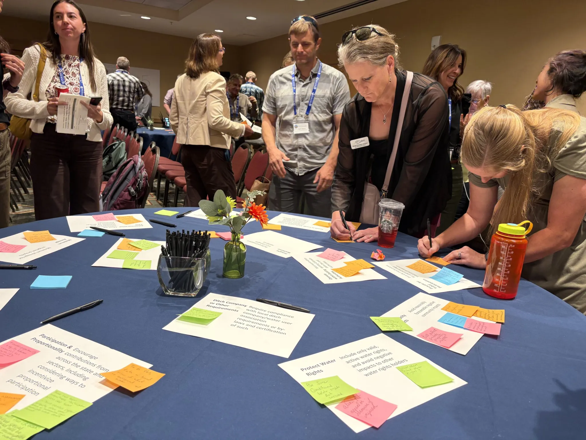
CWCB taking feedback
CWCB officials are currently taking comments and feedback on the contribution program. They held a well-attended workshop for water users on August 19, 2026 at Colorado Water Congress in Steamboat Springs. Attendees had many of the same lingering concerns that have been voiced for years, including how to protect water rights and how to encourage participation across the state.
State officials plan to offer different amounts of compensation to participating water users to account for the difference in the value of relatively cheap water on the Western Slope versus more expensive water on the Front Range. So far, in previous pilot conservation programs, every participant has been a Western Slope water user.
Western Slope agricultural water users have long said that if they don’t see comparable cuts being taken by Front Range municipalities, which collectively draw about 500,000 acre-feet from the headwaters of the Colorado River each year, that they won’t want to participate. They don’t want Front Range urban growth to be fueled by water cuts west of the Continental Divide.
At the workshop, Northern Water’s Director of Engineering Kyle Whitaker tried to put that fear to rest, saying the water provider, which supplies water to farms and communities on the Front Range like Fort Collins, Boulder and Longmont through its Colorado-Big Thompson project, would participate in future conservation programs.
“As transmountain diverters to the east, I only speak for Northern Water, and we will participate from here going forward,” Whitaker said. “We’ve been working on things to be a part of this for a number of years now, and those are finally in place.”
The CWCB is set to consider the criteria for program participation at its September meeting.
SNWA filing against #ColoradoRiver Record of Decision in District court this morning [August 24, 2026] #COriver #aridification — Ed Millard
South Platte River Basin #climate for the week ending August 31, 2026 #SouthPlatteRiver
Below is the Precipitation Accumulation in South Platte graph from the NRCS for August 31, 2026. This morning precipitation, at the SNOTEL stations, is at 75% of the median (no change one week), and 71% of the water year median (up 2% one week). There are 30 days left in the water year.
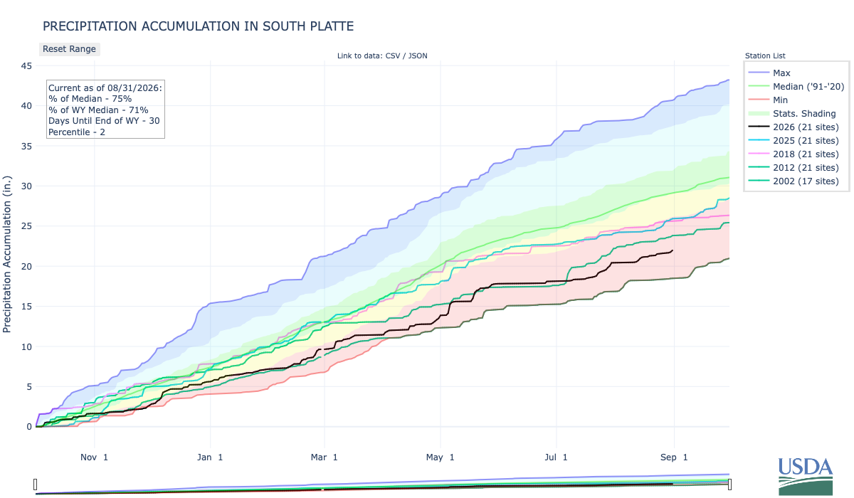
Showers are likely today, there is a chance for thunderstorms Friday, and a chance for showers and thunderstorms Saturday in the central mountains. Showers a likely today, with a slight chance for thunderstorms Friday, and a chance for showers/thunderstorms Sunday in the northern mountains. Showers are likely today, with a slight chance for showers Friday, and a slight chance for showers and thunderstorms on Saturday and Sunday, down here about 6.0 miles from the U.S. Mint where The ‘Wildest Gun Battle in Denver History’ Was Also the First Successful Mint Holdup in the U.S. Here’s an excerpt from Law Week Colorado:
1920s Denver is often associated with bootlegging, booming population growth and tumultuous governmental control as powerful legislative and executive seats were taken by members of the Ku Klux Klan. 1922 is also when the Denver Mint was robbed by a gang of bandits, culminating in the “wildest gun battle in Denver history,” according to the Craig Courier in December 1922. “Four bandits held up a federal reserve bank automobile in front of the United States mint here, and after a terrific gun battle with mint employees, made their escape with $200,000 in $5 bills,” reported the Cheyenne Wells Record in December 1922. The Cheyenne Wells Record went on to note the robbery was the first successful mint holdup in U.S. history and that the robbery was also the largest in Denver history to date…A month after the robbery, the Jefferson County Republican reported that after the robbery, the bandits made their way to a garage at 1651 Gilpin Street in Denver, which they had rented a few days before, with a mortally wounded companion, later identified as J.C. Sloan where “they left the dead body of Sloan crumpled up.” The Jefferson County Republican reported Sloan was believed to be the leader of the gang. The discovery of Sloan led investigators to other leads in the case including a trunk filled with firearms and ammunition and photographs and letters. Three months after the robbery, the Longmont Ledger reported an arrest was made in Albuquerque. J.W. Morgan and Pearl Ward were arrested in March 1923 in connection with the robbery, but neither would divulge more information to investigators about the Mint robbery…“No one was ever charged with the robbery, despite Denver Police Chief A.T. Clark’s announcement 12 years later that the robbery team had been identified. The suspects that were identified were already in prison on unrelated charges or had died,” reported K5 News in 2014.
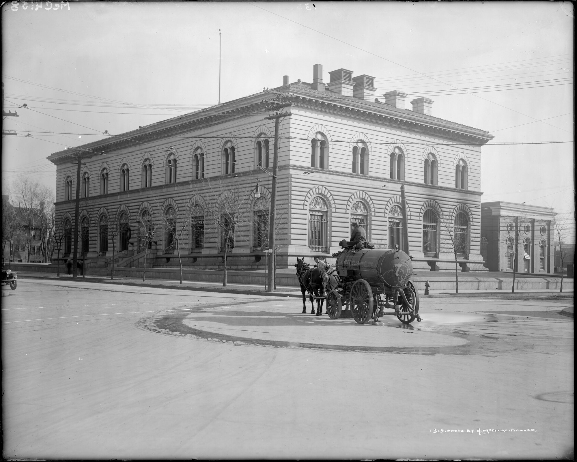
Here’s a look at the 7-Day Colorado precipitation map through August 30, 2026 from the High Plains Regional Climate Center. Precipitation in the South Platte Basin along the Continental Divide of the Americas ranged from 0.10” to 0.30”.
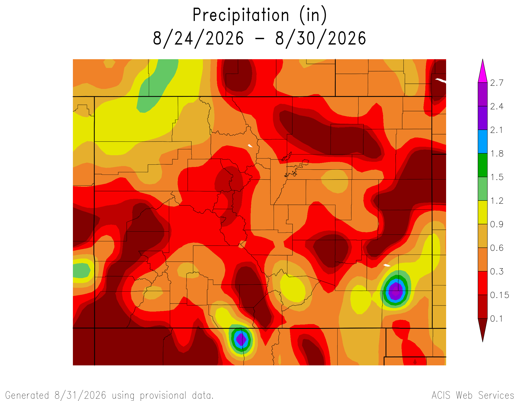
Here’s the 7-Day percent of normal precipitation map through August 30, 2026 from the High Plains Regional Climate Center. Precipitation in the South Platte River Basin along the Continental Divide of the Americas was 5% to 125% of normal.
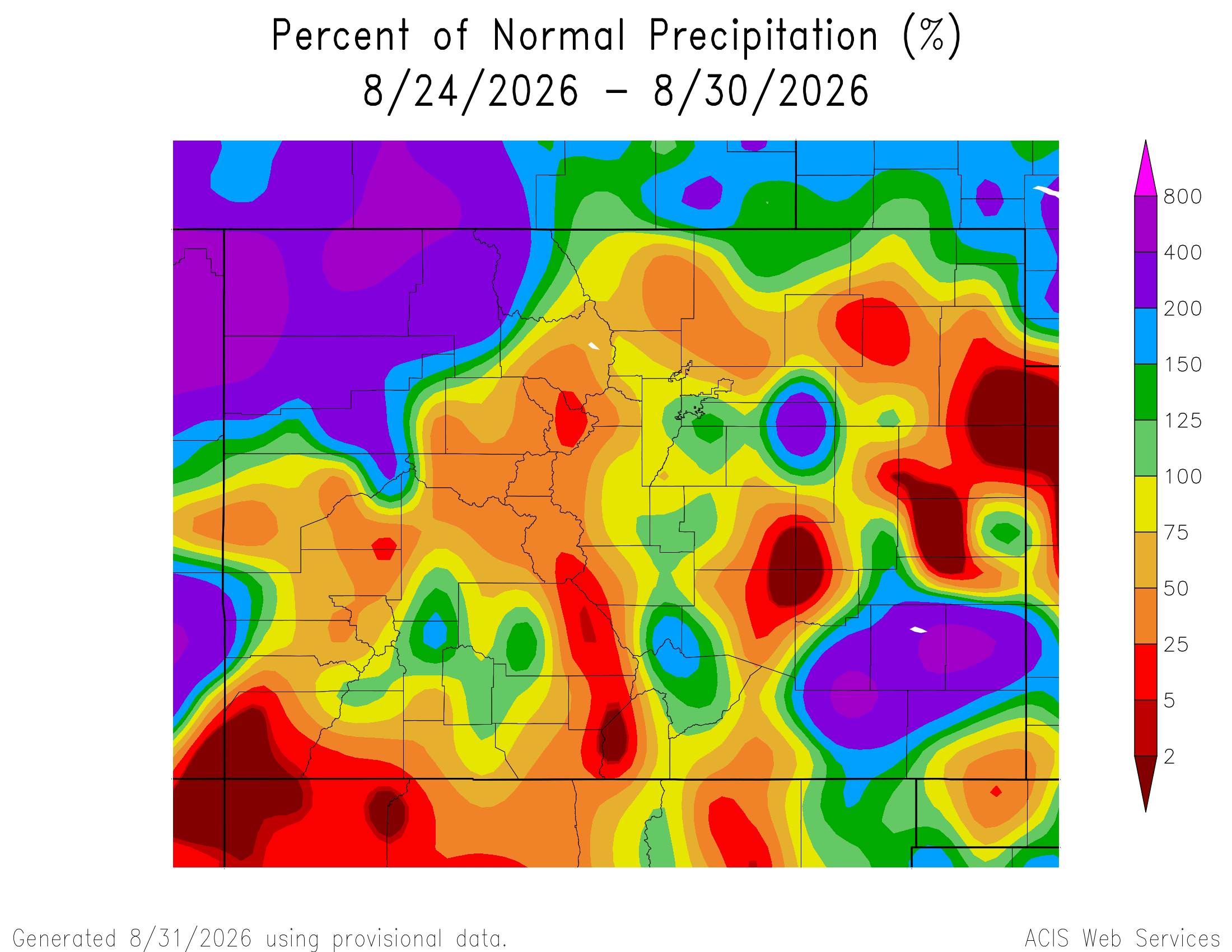
Below is the 7-day Quantitative Precipitation Forecast for the week of August 31, 2026. Precipitation is anticipated for the mountains of the South Platte River Basin and may total up to 0.50″.
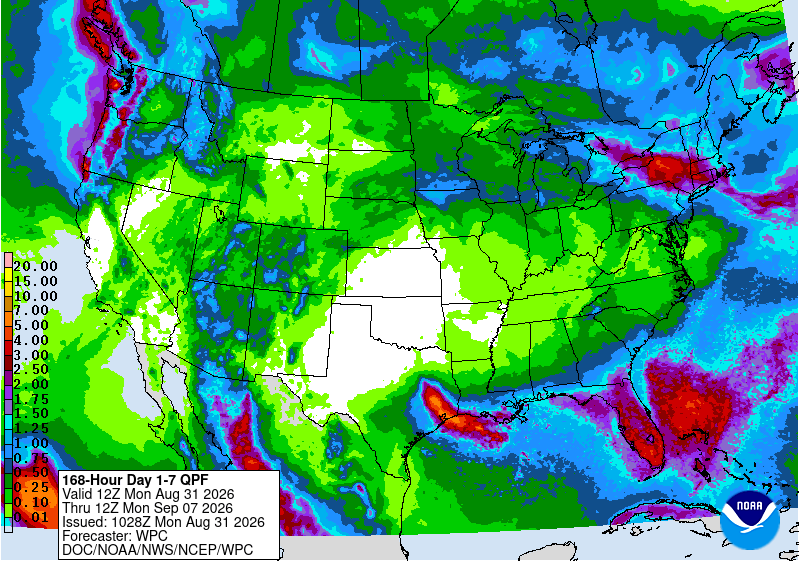
Below are the 8-14 day outlooks from the Climate Prediction Center, issued August 30, 2026, for temperature and precipitation, for the week starting September 7, 2026. The CPC expects above normal temperatures and above normal precipitation for the mountains of the South Platte River Basin.
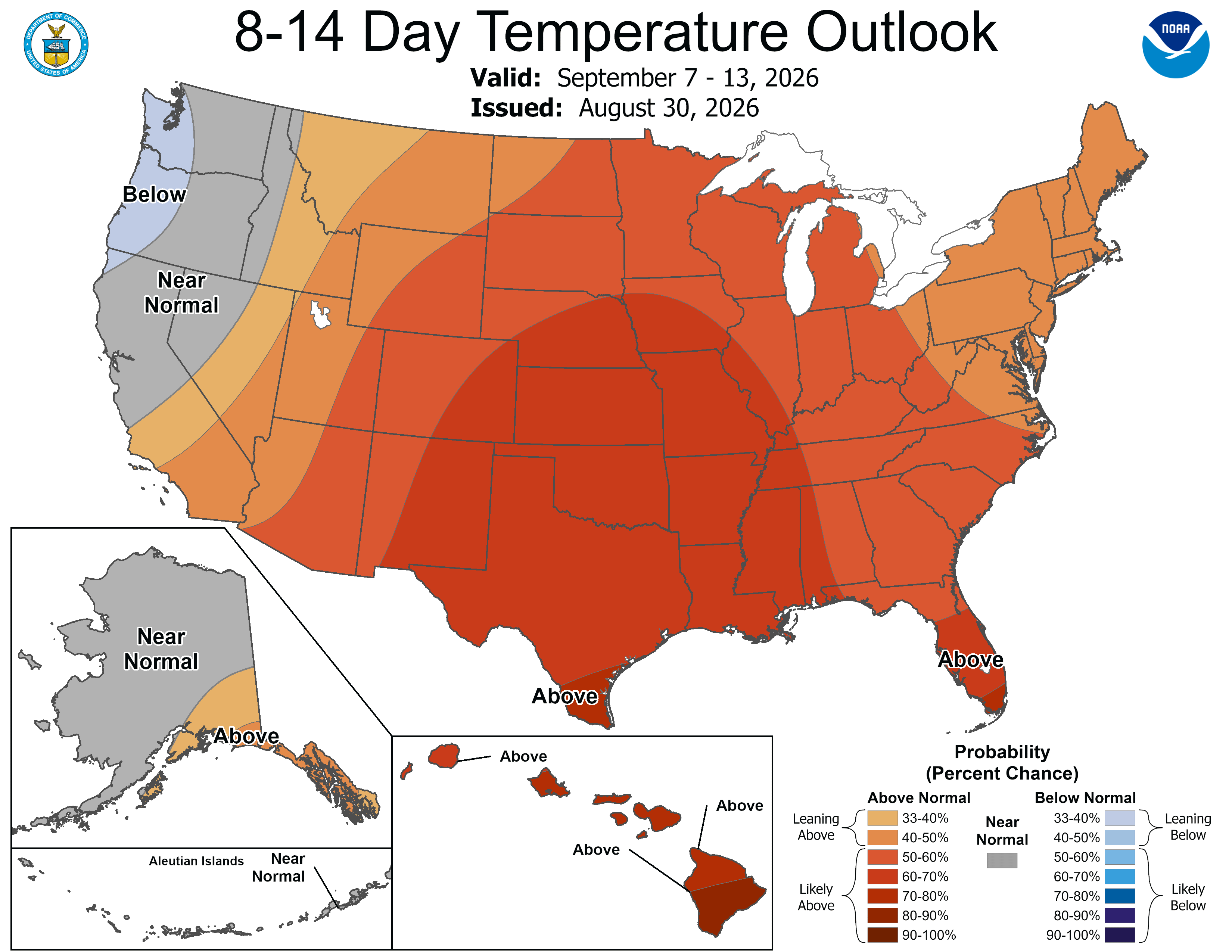

Below is the Colorado Drought Monitor map from August 25, 2026. There were one class improvements in Park, Weld, and Morgan counties. Drought and abnormal dryness covers 95.94% of Colorado. The South Platte Basin is experiencing Abnormally Dry, Moderate, Severe, Extreme, and Exceptional drought conditions.
Below is the Colorado Drought Monitor one week change map ending August 25, 2026.
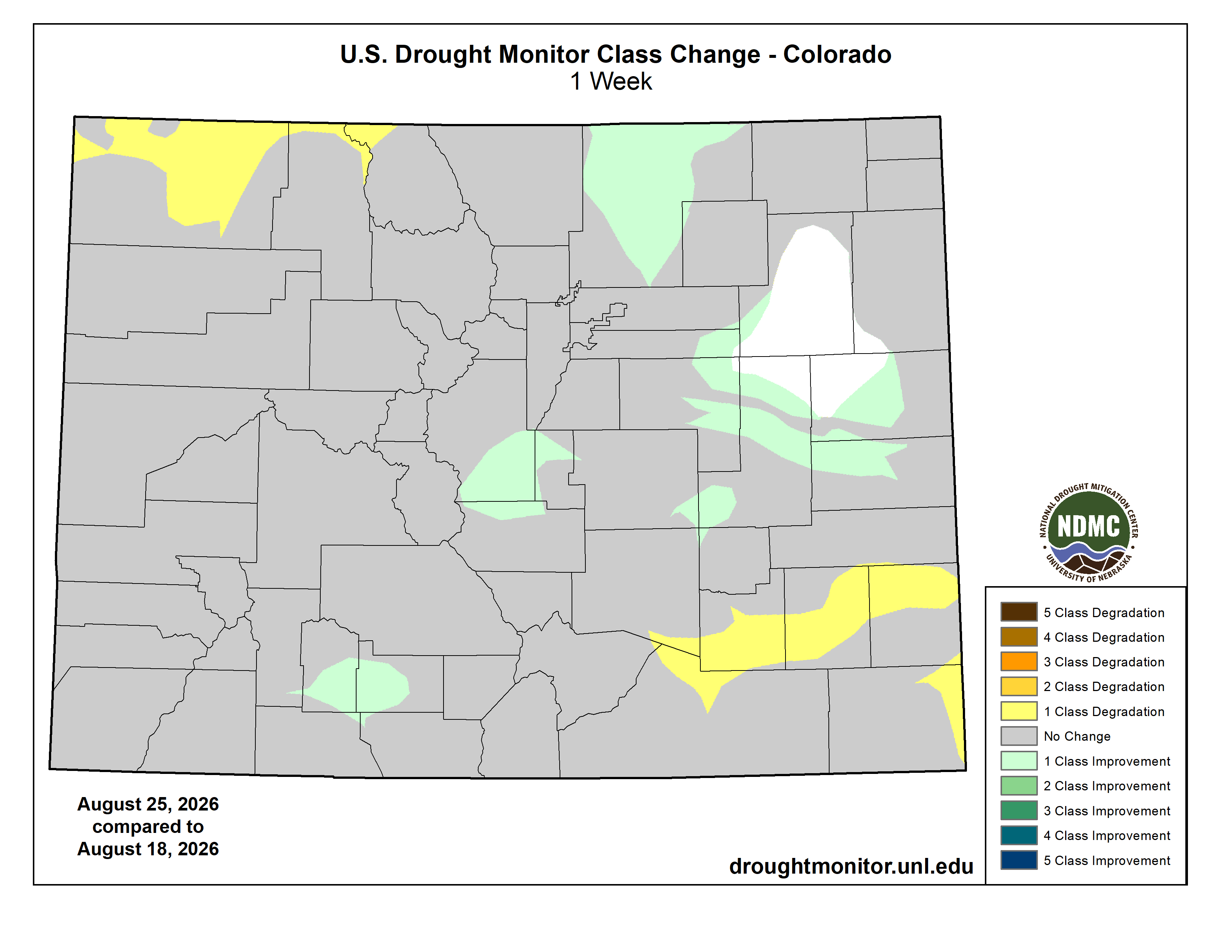
Here’s the US Drought Monitor Map from last week along with the one week U.S. change map.
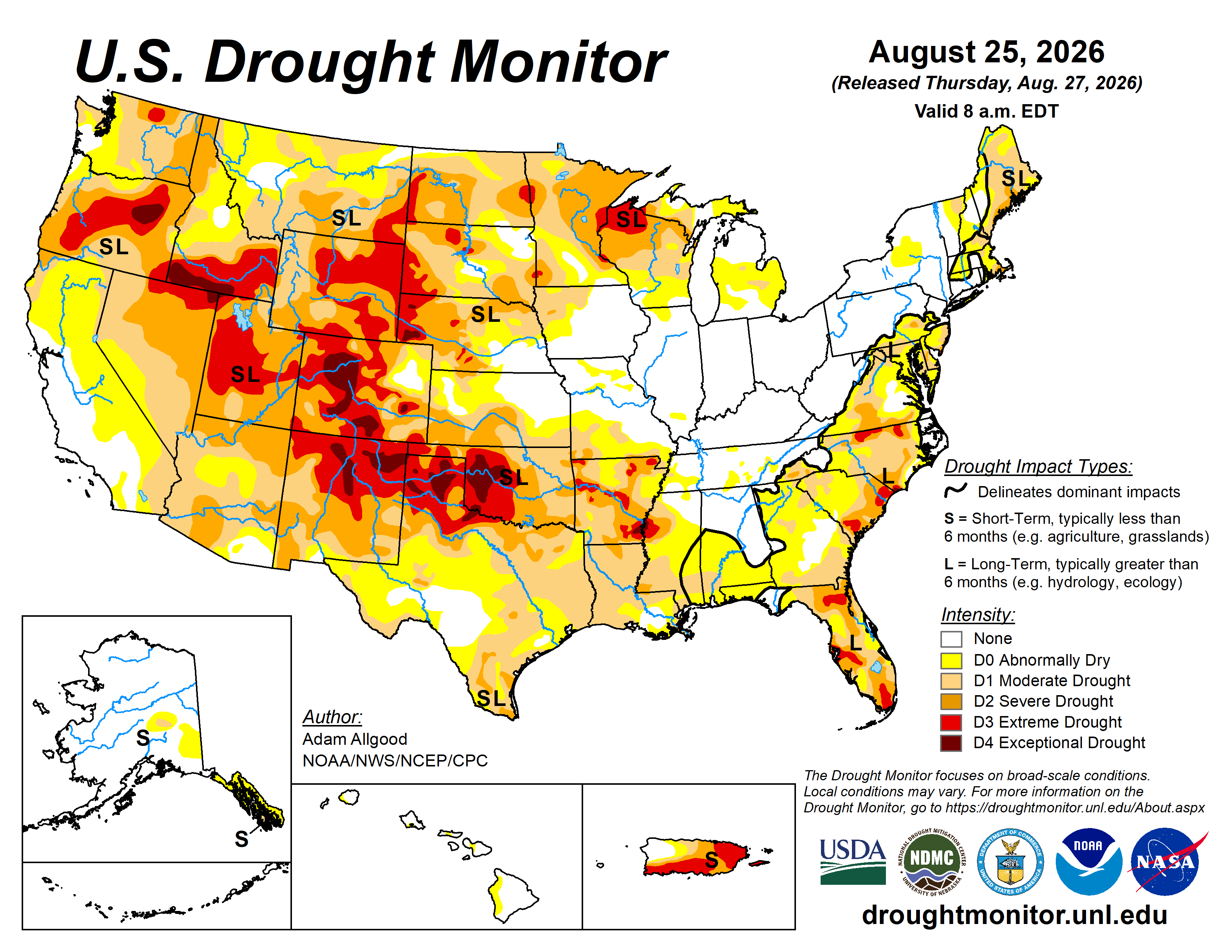
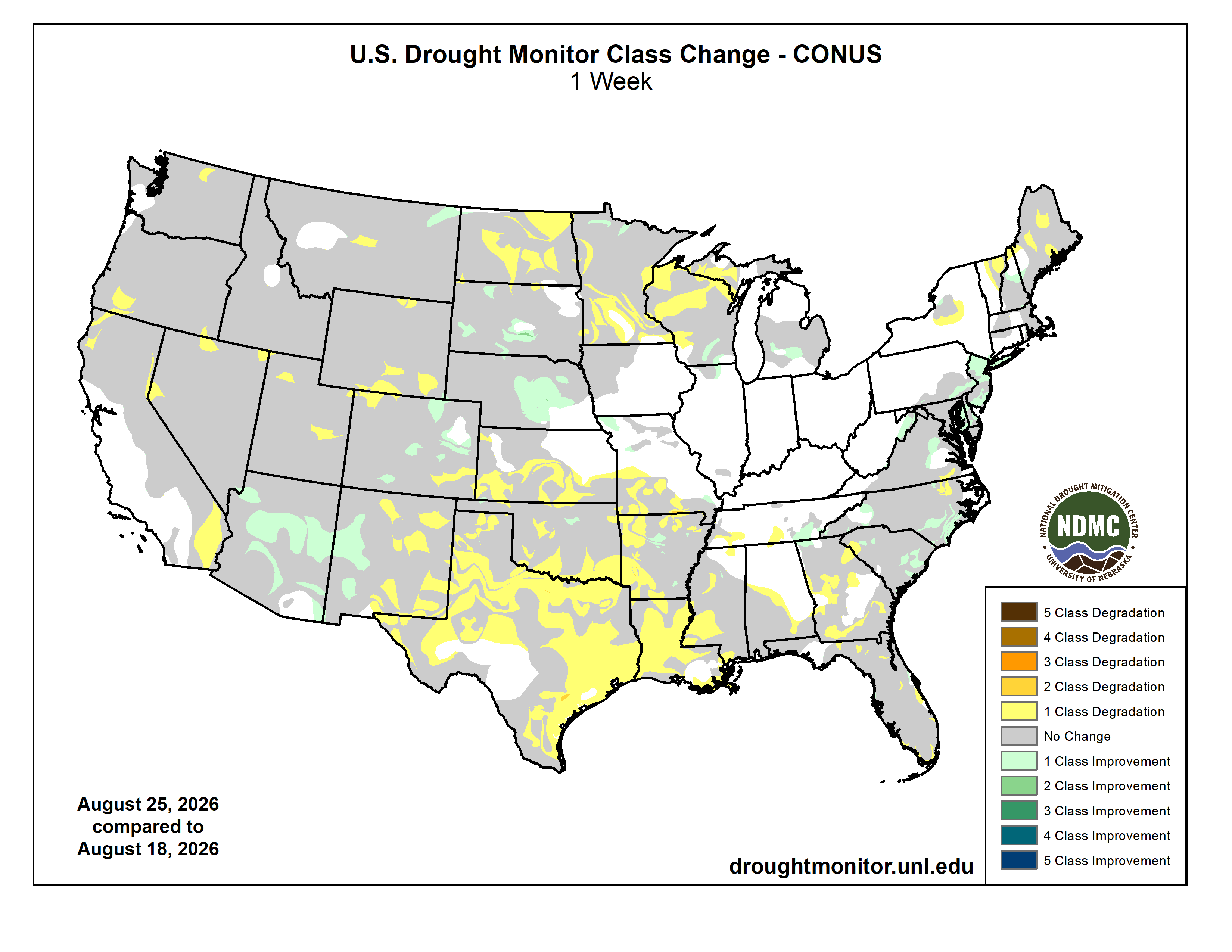
Finally, here’s the Topsoil Moisture Percent Short to Very Short map for the week ending August 23, 2026 from the USDA:
49% of the Lower 48 is short/very short, a 1% increase from last week. Highest short/very topsoil spans parts of the West, Plains, South, and Northeast, led by NM at 90%; VT at 87%; OR, WY, and TX at 86%; and LA and OK at 81%
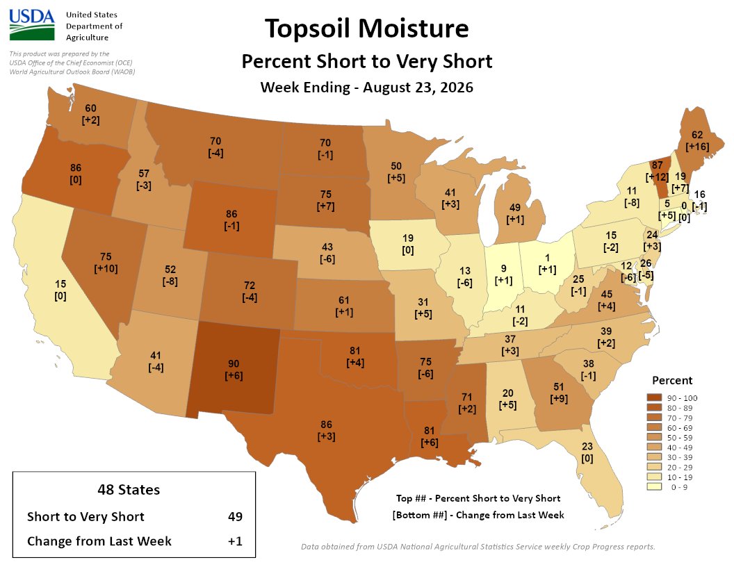
Say hello to Hydrohistorian: the whole #Colorado water record, and what was actually in priority yesterday — John Crawford
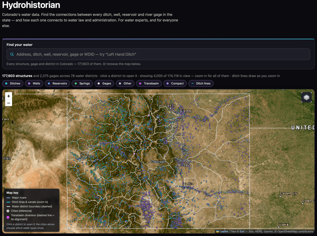
From email from John Crawford:
August 29, 2026
John,
We have met briefly at at least one Colorado water conference (but it’s been a while). I was the Water Resources Analyst at Northglenn for a while, and now am the Water Resources Manager at Consolidated Mutual. But, on my own time, I’ve built something for Colorado water records that may be useful to you or your readers, and I’d rather you see it early. I would appreciate feedback and hopefully some exposure from your organization.
It’s called Hydrohistorian — https://hydrohistorian.com — and it’s free to use while it’s in beta.
It’s the whole state in one place: all 177,301 decreed structures, 2,271 stream gages, diversion records, water court history, and the calls that administer them, across all seven divisions. Type an address and it shows you the ditches and rights around it. Open any ditch and you get its decrees, what it actually diverted year by year, and where it sits in line. Open a district and you get a straight-line diagram of who takes what, and where.
The piece I’m proudest of went live this week: for any structure, on any day, how much of its decree was actually in priority. Not whether a call was on — how many cfs of that particular ditch’s decree was in priority, counted by the hour, running back through the call record to 1950. I don’t know of anywhere else you can get that without building it yourself.
And it shows its work. Where DWR publishes its own day-by-day out-of-priority analysis, the page scores itself against DWR live, on the page: 98.7% agreement across about 86,000 structure-days, and it lands on DWR’s exact percent-of-day 90.9% of the time. Every page also states plainly what it can’t tell you. I’d rather your readers see the error bars than trust me.
A few things a reader could do with it in five minutes: find out whose ditch runs behind their house; see how many days their ditch was out of priority in the 2002 and 2012 droughts; or watch a senior downstream call reach up a tributary and shut off juniors sixty miles away.
I’d genuinely value your eye on it, and if you think it’s worth a mention to your readers, that would mean a lot. Happy to give you a walkthrough, or to run a specific question against the data if it would make a better post.
— John Crawford
(Water Resources Manager, Consolidated Mutual Water Company), but working independently on this project
hydrohistorian.com.

On “simple solutions” to the Western water problem: Spoiler, there’s no such thing — Jonathan P. Thompson (LandDesk.org) #ColoradoRiver #COriver #aridification
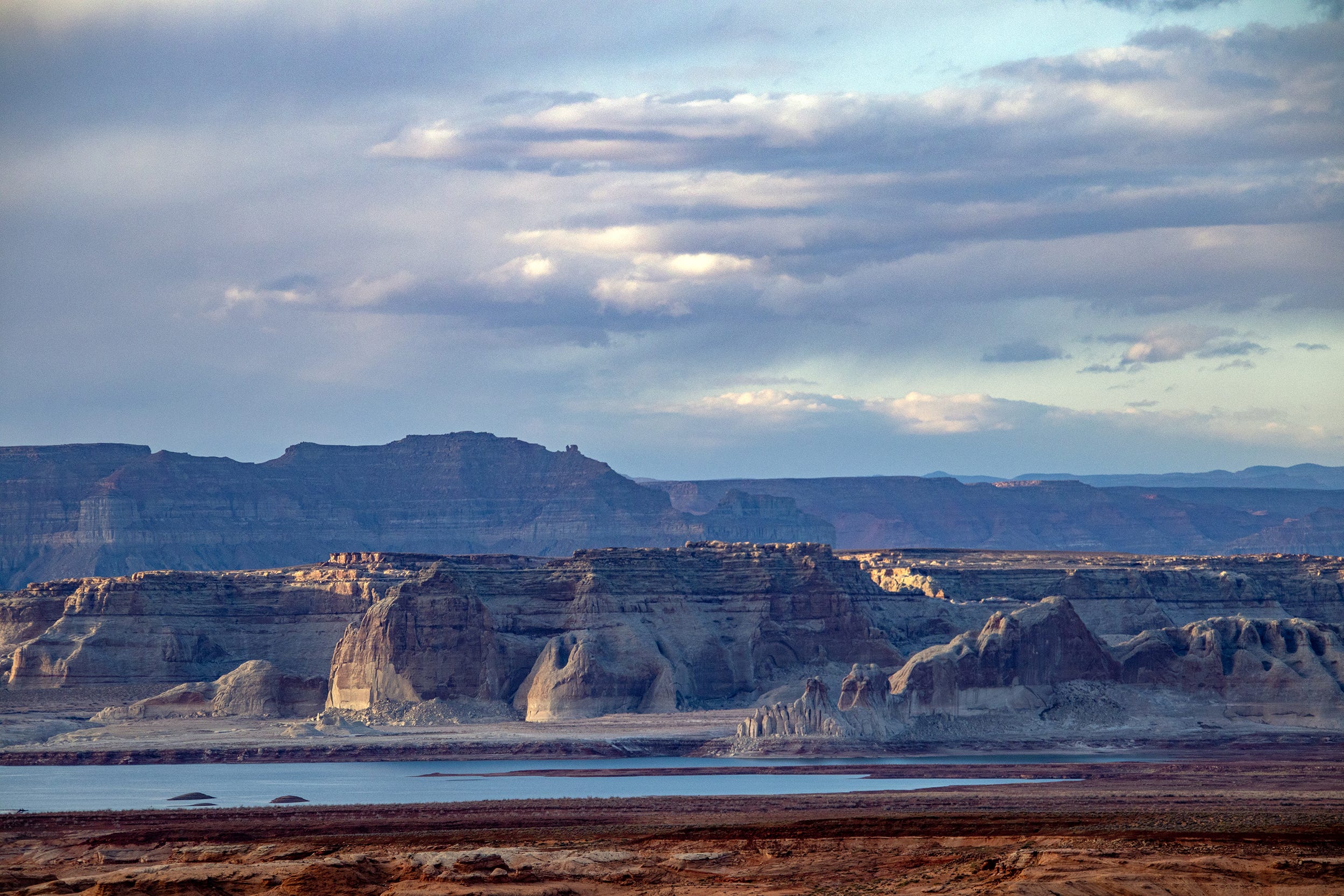
Click the link to read the article on The Land Desk website (Jonathan P. Thompson):
August 28, 2026
It seems like every time the Colorado River and other Western water woes make national headlines, some pundit — usually from the East Coast — weighs in with their “simple” or “obvious” solution. And I get mad and start throwing things around the room, then type out some blistering rant riddled with epithets and insults.
Well, the Colorado River is in the news again, and with it have come the usual swarm of oversimplified hot-takes. The one that really got my goat this time is from Matthew Yglesias, who wrote a piece headlined: The Western water crisis has a simple solution: Stop giving the majority of the water away to farmers for almost nothing!
These things piss me off so much not because they’re wrong, but because there is no “simple” solution to the Western water crisis. That’s because the crisis itself isn’t simple, and saying that it has simple fixes implies that the folks who have spent a lot of time trying to solve the problem are a bunch of idiots, since they hadn’t come up with this solution already. It seems as if Yglesias and his ilk assume that the West is not only monolithic, but that we Westerners are a bunch of backwoods bumpkins who don’t understand the region’s own problems.
Who cares what these bozos believe, right? Right. But judging by the comments on Yglesias’ social media posts, a lot of other people are similarly deluded. So I figured his piece provides a nice opportunity to clear some things up.
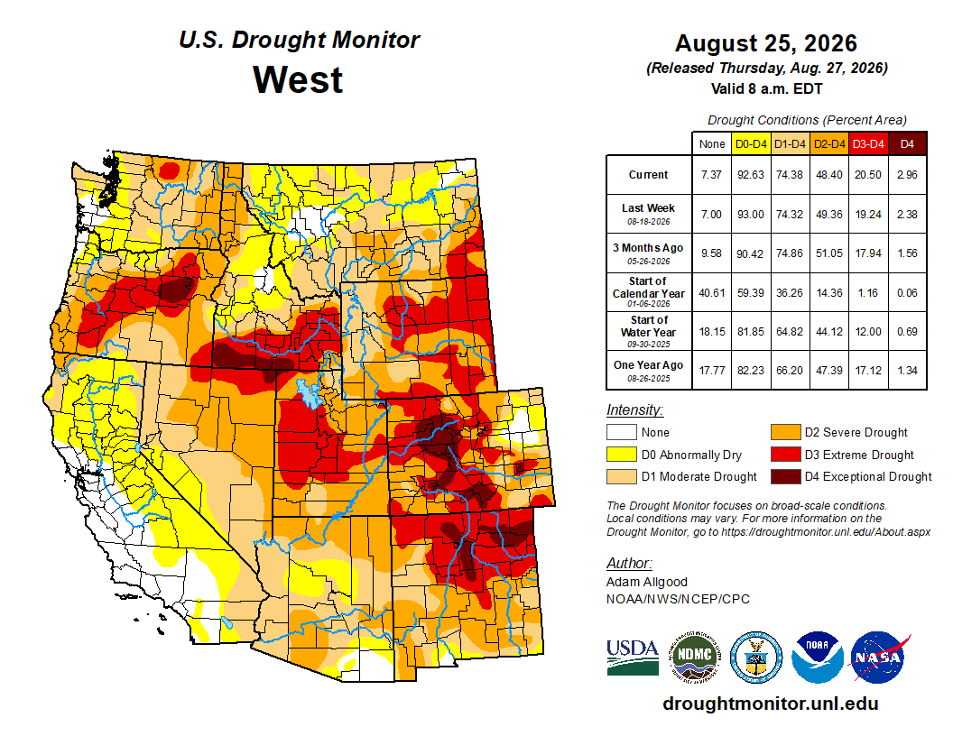
In fact, there is no single “Western water crisis.” The West is huge and is geographically, hydrographically, and ecologically diverse. While most, but not all, of the Western U.S. is in some stage of drought currently, not all of those places are experiencing a water crisis, per se. There is a Colorado River water crisis and a Rio Grande water crisis and a San Joaquin Valley water crisis, but those crises are not all the same.
The Colorado River crisis is multifaceted and manifests in different ways in different places and on different levels. The river itself is in crisis, in that stretches of the mainstem and its tributaries virtually dry up during summers like this one. Its users are facing a potential crisis, i.e. looming shortages, as in some of them are getting less water from the river than they did in the past. And the vast and complex plumbing system and legal framework that has been built up to harness and govern the river is perhaps facing the most immediate crisis: It is collapsing under its own weight and in many ways has become obsolete. Each of these is a distinct calamity, with its own twists, turns, causes, and bevy of potential solutions.
From his perch in the Northeast, however, Yglesias sees just one dimension, writing in the “nut graf” of his piece:

Uh, not quite.
Yes, irrigated agriculture is by far the dominant consumer of Colorado River water, accounting for 52% of overall consumption and 74% of direct human consumption. And yes, agricultural users typically and notoriously pay less for the water than municipal users. No, this is not dictated by federal law.
Agricultural users were among the first entities in the colonial-settler era to put large quantities of water to beneficial use, giving them the most senior rights to the largest quantities of water. The Imperial Irrigation District, for example, has senior rights to about 3 million acre-feet of Colorado River water, most of which is used for agriculture.
These water rights holders have a legal right to use a set amount of water each year. They are not leasing or purchasing the water from the federal government or anyone else. It’s essentially theirs, for free, as long as they are able to divert it from the river and put it to beneficial use.
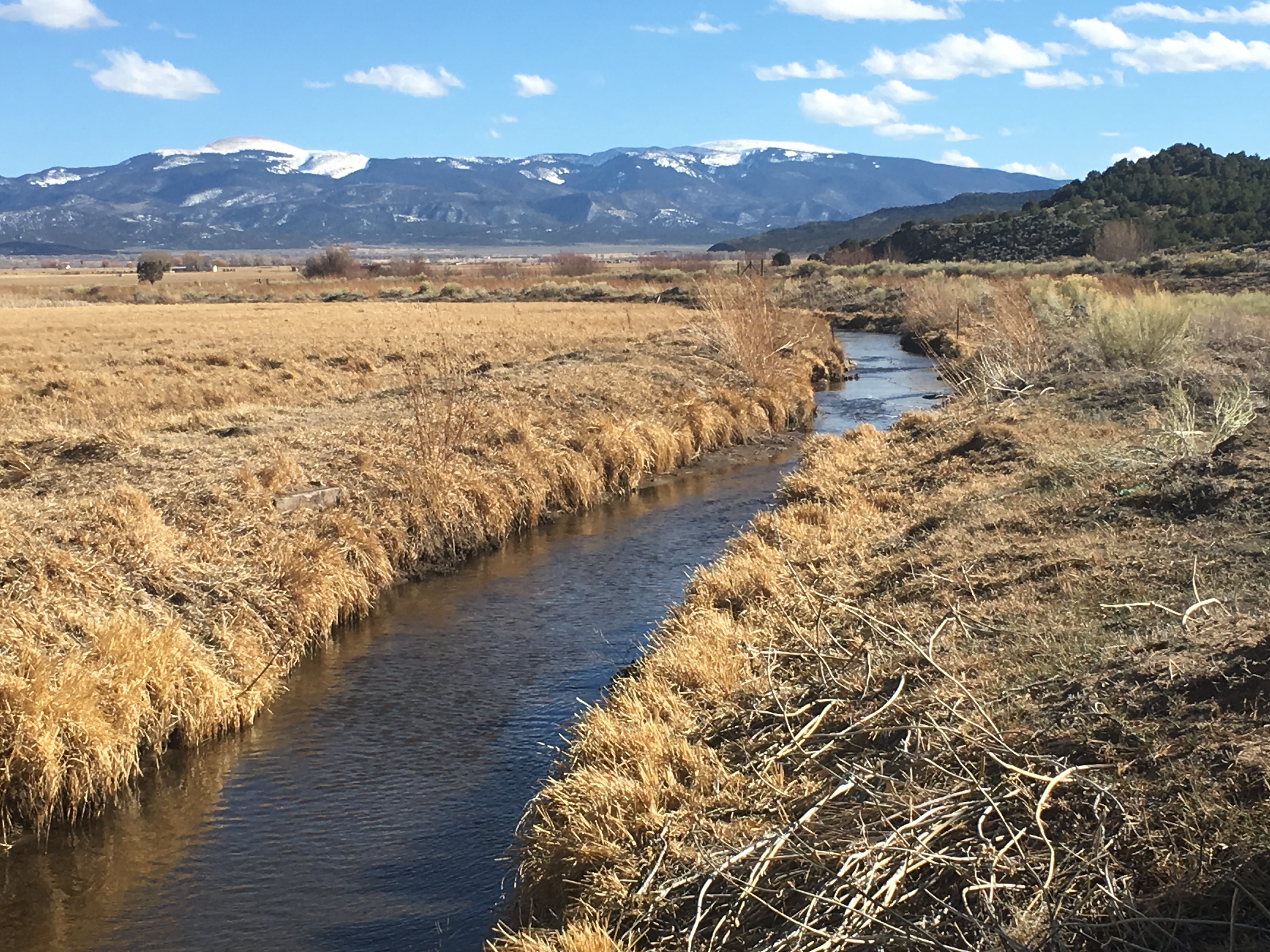
Usually the water rights are held by irrigation districts, ditch companies, municipalities, corporations, or, in some cases, very large individual landholders. In the late 1800s, these entities built their own diversions, canals, and delivery systems. Construction was often financed by private investors and the individual irrigators, who held stocks, or shares, in the ditch company. Each share would entitle its holder to a set amount of water from the canal. The shareholder would pay an annual fee for each share to cover construction, maintenance, and operating costs.
The Bureau of Reclamation was established in 1902 to build larger scale dams, diversions, and canals to deliver water to users and to spur agricultural development in the arid West. Call it the nationalized version of an irrigation district, but on steroids. The federal government paid for the projects, but the irrigation districts and municipal water utilities they served were expected to pay back the costs over time. The taxpayers supposedly wouldn’t have to pay a dime. Yet as the years went by, and as the budgets of the projects skyrocketed, the terms of the paybacks were relaxed, especially for agricultural users. This effectively subsidized water delivery, which in turn lowered farmers’ costs.
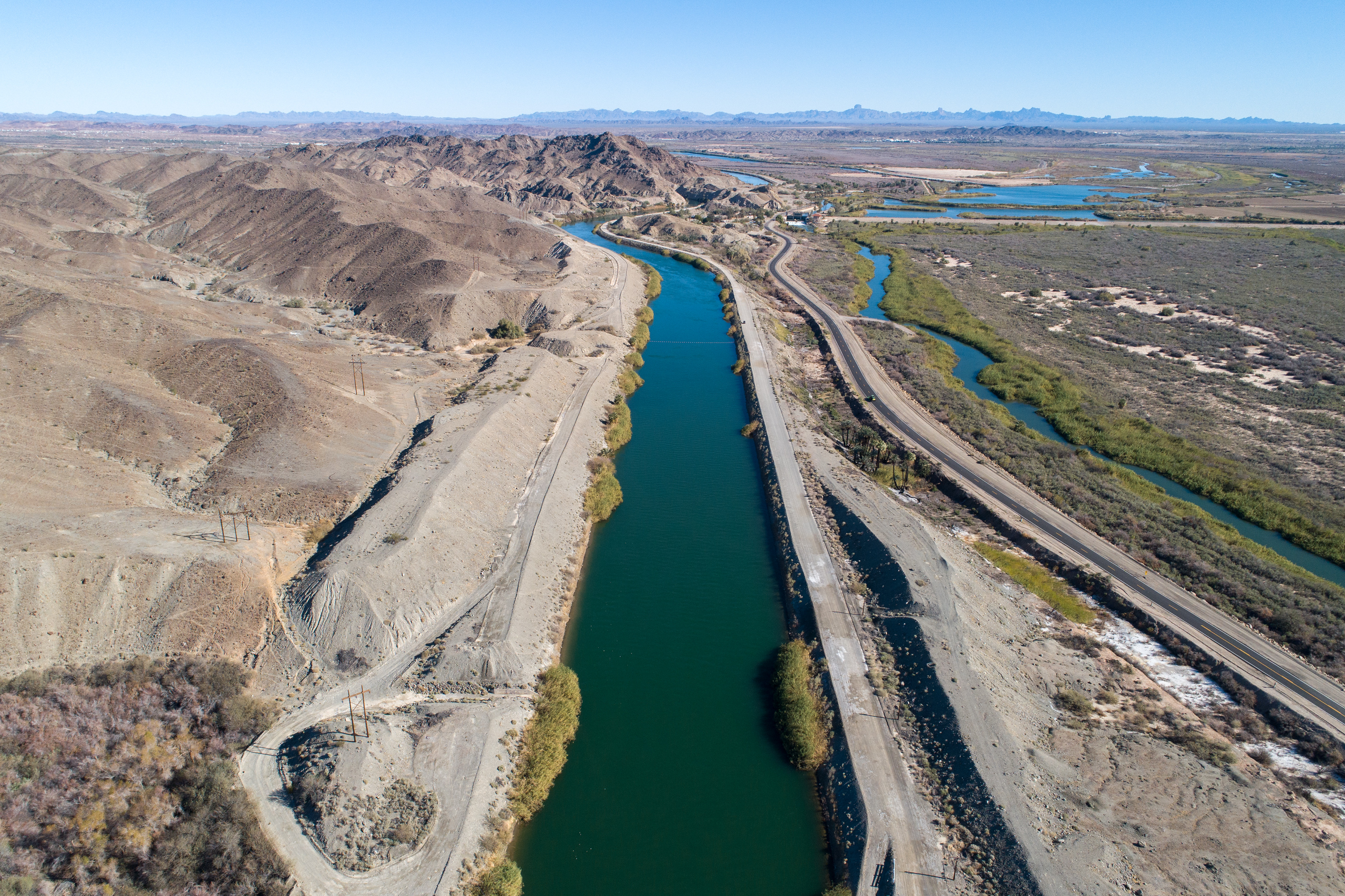
One of the Bureau’s big projects was the 80-mile-long All-American Canal, built in the 1930s to ferry Colorado River water to the Imperial Irrigation District and other users. The IID entered into a 50-year payback contract, which ended in 1994. The Bureau still owns the canal, but the IID operates and maintains it and other infrastructure that delivers Colorado River water to nine cities and some 500,000 acres of farmland.
The IID pays nothing for the Colorado River water itself. It does pay to operate and maintain its vast water delivery system, and offsets those costs by charging agricultural and municipal users just $20 per acre-foot for water it delivers, a bargain basement rate. In other words, Imperial Valley farmers do get cheap water, but so do Imperial Valley cities and even industry (which pays $85/af, also relatively affordable). IID also brings in about $160 million annually by selling water to the San Diego County Water Authority. The operating costs for the All-American Canal system are lower than, say, the Central Arizona Project’s, because the All-American Canal is gravity fed, whereas the CAP uses huge amounts of electricity to pump water uphill.
Similar setups exist across the Colorado River Basin. But each system is distinct, and each has its own mix of federal and private funding and operational scenarios and rates.
And here’s one of the main flaws of Yglesias’s argument: He assumes that there’s some all powerful actor out there that sets rates and standards for water from the Colorado River, although he himself clearly doesn’t know who or what that actor is (he always uses the passive voice, or the all-encompassing “you” in these cases). That’s because that entity doesn’t exist. While the feds could stop subsidizing agriculture, and should not build any more water projects, they don’t have the authority to step in and adjust water rates. States probably could set rates for groundwater, but they can’t charge the IID for exercising their water rights on the Colorado River.
Next, Yglesias pivots to pillorying alfalfa, because that’s in vogue these days. I’m not going to get into that too much, because I’ve written about it so many times here before, but this little bit is pretty funny:

Now, I’m no alfalfa apologist (nor am I an alfalfaphobe), but I feel like I should point out that most of the alfalfa grown with Colorado River water is used to feed dairy cows, which in turn produce milk and cheese and ice cream. Unless Yglesias is a vegan, he might want to consider that. He then argues that since alfalfa is relatively low-value (money wise) compared to Las Vegas casinos, Phoenix microchip factories, or housing, the water should be going to casinos, factories, and housing, not farms, which would presumably happen if farmers had to pay more for water (i.e. they’d go broke and be forced to sell).
Alfalfaphobia? — Jonathan P. Thompson
He continues:
First off, there is nothing novel or groundbreaking about this idea. Sprawl has been gobbling up farmland, and water rights, for decades in the West. Phoenix didn’t just grow into the desert, it also grew into citrus orchards and alfalfa fields, and will probably continue to build housing and data centers on what ag land remains. A different version of this concept, where a city or developer purchases a farmer’s water rights, but uses them somewhere else — a practice known as buy and dry — is also not uncommon.
This does not solve the water crisis. Instead of cutting consumption, which is what’s needed, it merely shifts the consumption from one use — agriculture — to other ones, such as housing and golf courses and chip manufacturing and data centers. This may wring more cash out of each acre-foot of water, but it doesn’t lower consumption. An acre-foot is an acre-foot, whether it’s going to alfalfa, a golf course, a neighborhood’s lawns, a data center or a swimming pool.
Besides, transitioning land out of agriculture comes with its own problems. We can argue forever about whether farming alfalfa or any other crop in the desert is appropriate, or of adequately high value, or whatever. We can argue that the Bureau of Reclamation should never have existed, and that irrigating the arid West should have been left to private entities operating in a free market. But the fact is, there is farming in the desert, those projects did end up subsidizing the agriculture industry, and communities, economies, cultures, and even new landscapes have emerged from and formed around those farms.
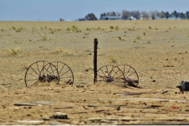
Taking vast swaths of land out of farming, whether to build houses or solar panels or to buy the water rights and use them somewhere else, has myriad consequences, many of them negative. Fields can become noxious-weed-clogged dust pits, the wildlife and ecosystems that have come to rely on irrigation runoff dry up, farm workers and families and the businesses that rely on them are displaced, communities’ economies are upended. As Madeline Wilson, an agricultural systems specialist for Colorado State University’s extension office pointed out at a 2024 panel on dust-on-snow, every field fallowed in the San Luis Valley for conservation purposes also represents a family. “We’re not just talking about drying up lands,” she said, “but the drying up of our economy.”
In no way does this mean that farms should be immune from curtailment. Indeed, because agriculture is the biggest user of Colorado River water, it will have to take the largest cuts in consumption. There is simply nowhere else from which the 4 million acre-feet or more of reductions per year needed to bring demand into line with dwindling supplies can come. But forcing farmers into bankruptcy by jacking up water rates (if there was a mechanism to do so), or prescribing “incredibly simple” policy solutions that don’t consider the complexities of the situation and its myriad moving parts or the on-the-ground impacts, isn’t the way to do it.
The “root cause” of the Colorado River crises is not alfalfa or pecans or cotton or cattle, it’s not the prior appropriation doctrine or the low price of water, it’s not overpopulation, it’s not data centers or golf courses or lawns or bad forest management or lack of or too many reservoirs. The root cause is twofold. First, there’s scarcity. The Southwest is an arid place, and climate change-exacerbated warming is drying it out more: there is less precipitation; the precipitation we do get is falling as rain, not snow; the snow we get is melting faster; and evapotranspiration is happening at a higher rate. This all leads to less water in the streams, reservoirs, rivers, and even aquifers. Secondly, there’s the chronic and long-term failure to acknowledge the scarcity, and the stubborn refusal to adapt to it and adjust consumption accordingly.

There has been progress. Over the last two decades some of the biggest water users on the river have slashed their water use considerably, sometimes because they had no choice, in some cases because they were incentivized to do so, and in other cases they did it to get ahead of future cuts. Last year, for example, the Imperial Irrigation District used 900,000 acre-feet less than it did in 1999. By its count, it has conserved over 9 million acre-feet since 2003 by fallowing fields and deploying various efficiency measures. And yet they’ve done so while continuing to grow nearly $240 million worth of alfalfa annually. It will need to do more; everyone will. But it’s a pretty big start.
There is one simple solution to the Colorado River crises: Everyone on the river has to use less water. Period. This won’t come from pithy policy prescriptions or one-dimensional solutions. It will require the tribal nations, the states, and all of the water users in the basin to come together and find a new way to approach and think about and revere the lifeline of the Southwest.
Western water: Where values, math, and the “Law of the River” collide, Part I — Jonathan P. Thompson
🗒️ Land Desk News Feed 📝
Coming in September: The Land Desk News Feed! This will be a once-a-week roundup of the West’s most important headlines, journalism, and commentary, curated and summarized by yours truly. I’m thinking it will probably drop on Wednesdays, but haven’t settled on anything, yet. Most weeks it will come in addition to the regular two Land Desk dispatches, but some weeks it may take one of the others’ place (meaning you’d only get two newsletters that week so as to not clog up your inbox all the time!).
All paid and free subscribers should expect the first edition on Sept. 9.
📸 Parting Shot 🎞️

The #ColoradoRiver Compact is a dead parrot — Karl Flessa (InkStain.net) #COriver #aridification

Click the link to read the article on the InkStain website (Karl Flessa):
August 20, 2026
In the classic Monty Python sketch, a customer returns to the pet shop where, just 30 minutes ago, he purchased a parrot. He complains that the parrot is dead. The shopkeeper tries to convince the customer the parrot is only resting or is stunned.
In the ensuing argument, the customer uses no fewer than eighteen euphemisms: “This parrot is definitely deceased…demised…passed on…no more…ceased to be…expired…gone to meet his maker…a stiff…bereft of life…rests in peace…pushing up the daisies…metabolic processes are now history…off the twig…kicked the bucket…shuffled off his mortal coil…run down the curtain…joined the bleedin’ choir invisible.”
Indeed, the parrot was nailed to its perch, already dead when the customer bought it.
The Compact and its subsequent agreements are as dead as that parrot.
- The Compact is dead because it is founded on a false premise: a river that can produce the prescribed amount of water.
- The Compact is dead because it is unjust: neither the Tribes nor nature participate in negotiations.
- The Compact is dead because it doesn’t work. The Basin States are locked in battle; the Federal government tinkers and dithers.
In the longer version of the sketch, the shopkeeper goes to the back in search of a live replacement, returning to report “…we’re right out of parrots.”
So are we.
We need a new Compact.
Proposals are not lacking: proportional allocations, Tribal standing, a whole-basin approach, adjustments based on actual flows, a basin authority, nature’s fair share, interstate trading… .
What’s lacking is the courage to change. [ed. emphasis mine]
The Compact is a dead parrot.
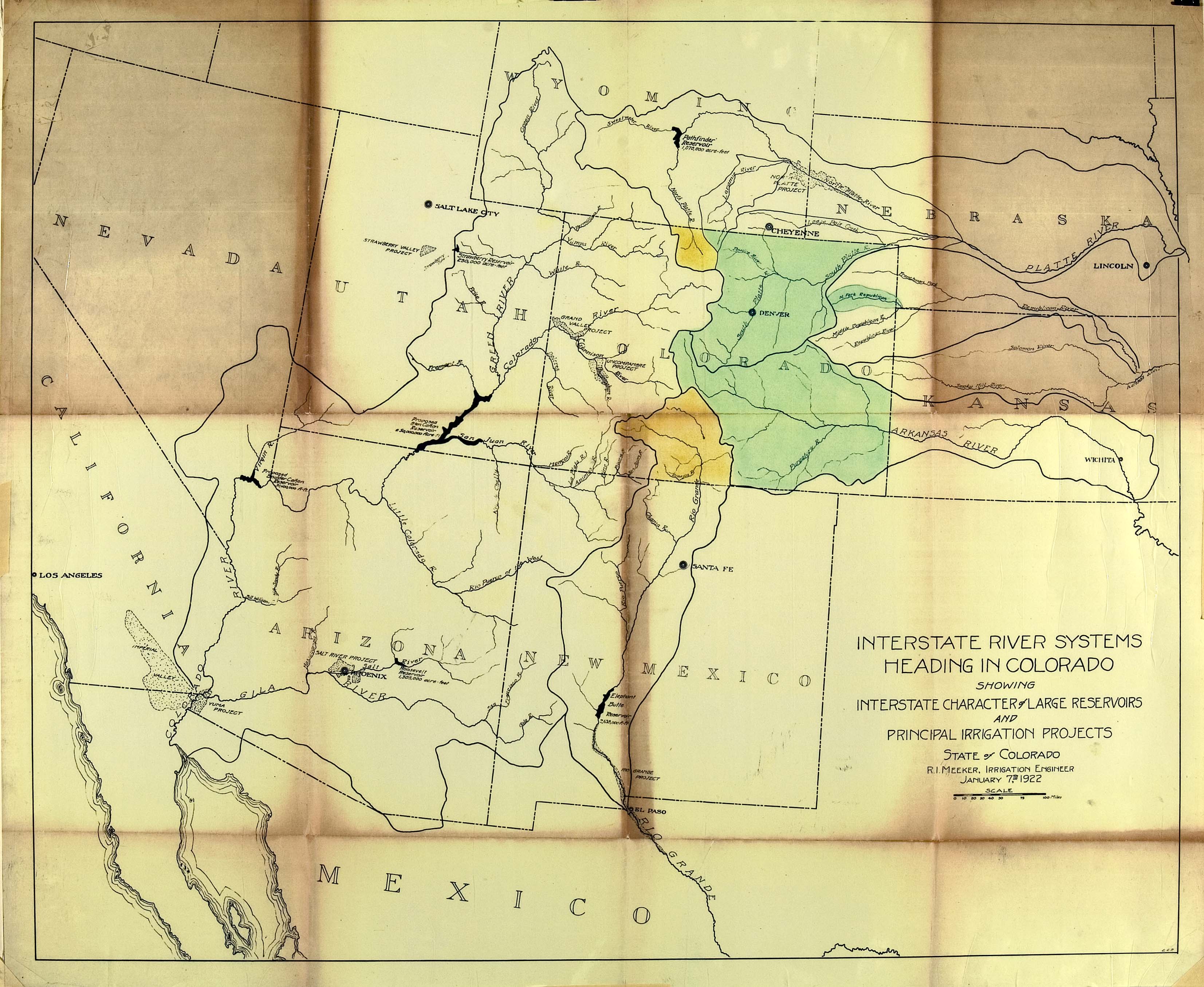
The San Juan Water Conservancy District approves water demand study contract — The #PagosaSprings Sun #SanJuanRiver
Click the link to read the article on the Pagosa Springs Sun website (Josh Pike). Here’s an excerpt:
August 28, 2026
At its Aug. 17 meeting, the San Juan Water Conservancy District (SJWCD) Board of Directors moved forward with contracting engineering firm RJH Consultants to perform a water demand study for the district’s reservoir project. SJWCD board president Randy Cooper opened discussion of the study by summarizing the history of the study, which the board delayed approving at its last meeting since board treasurer Joe Tedder was not at the meeting and had not had an opportunity to review the contract. He explained that the $147,400 cost of the study would be split between 2026 and 2027, which RJH had agreed to. In response to a question from Tedder, Cooper stated that RJH would be ready to start work on the study immediately upon board approval…The board agreed that RJH should provide monthly updates on the project to ensure that the project adapts to any changing circumstances or barriers the district encounters, which Jones raised concerns about.
“Hatcher is absolutely the top priority, keep that lake as full as possible, and thank goodness for the bit of rains we’ve been getting” — Andrew Connor via The #PagosaSprings Sun #SanJuanRiver
Click the link to read the article on the Pagosa Springs Sun website (Josh Pike). Here’s an excerpt:
August 28, 2026
The Pagosa Area Water and Sanitation District (PAWSD) Board of Directors heard an update on drought conditions and continued discussions of violation enforcement at its Aug. 13 meeting…PAWSD is currently in drought stage two of its four-stage drought management plan. PAWSD District Manager Andrew Connor stated that PAWSD currently has “really good compliance” and saw a drop in water sales in July, meaning that public education is working, even if revenues for the district also decreased…PAWSD board member Glenn Walsh asked if the revenue decrease from lowered water use in July was compensated for by surcharges for high water use, which staff confirmed. PAWSD board member Alex Boehmer commented that, since the district is getting compliance with its regulations, he did not think implementing violation letters and fines is necessary. He added that he would also like to authorize Connor to move the district in and out of drought stages when necessary. Tautges commented that he would only want this authorization for reducing the drought stage and not for increasing it, which should require a board vote.
The sadness of a river running dry — Jacob Richards (writersontherange.org) #GunnisonRiver #aridification
Click the link to read the article on the Writers on the Range website (Jacob Richards):
August 24, 2026
I drove to the bluff overlooking the “Gunny” to process the sad news — news that hasn’t yet been made official — that by October a big portion of the lower Gunnison River in western Colorado will be dry. The official term is “fully dewatered.”
Monsoons were supposed to be heavy this year. As I looked down at the river in late August, clouds in the distance appeared almost monsoonal. Wisps of rain streamed out, but they evaporated before reaching the parched ground. It just about made me cry.
Below me, the North Fork of the Gunnison unceremoniously trickled into the Gunnison River at a place known as Pleasure Park, a weather-beaten outpost of civilization that’s one of the last best-kept secrets in Colorado.
The Gunnison River starts high in the Elk Mountains and flows into Colorado’s largest body of water, Blue Mesa reservoir, though currently it is only the second largest because of drought. Then it flows free through Black Canyon National Park, but only after most of its water gets diverted to irrigate farmland surrounding the towns of Delta and Montrose. The park is a gem, albeit one of the least visited in the nation. From above there’s not much to do except walk to outlooks to stare at sheer, colorful rock walls on the other side and the thin ribbon of river 2,000 feet below.
The “Gunny” then flows through the remote yet accessible Gunnison Gorge Wilderness. In this thin crack of the earth, I’ve spent the past 12 summers working as a wilderness fly-fishing river guide.
Accessible is a relative term. The hearty few that run this remote wild river get to the water by hiking a rough 1.2-mile-long mule trail that drops steeply for almost 600 vertical feet. Even getting to the trailhead takes an hour and a half from the nearest town, and it’s on a four-wheel-drive road that’s been the death knell of many a low-clearance vehicle. Rocky on a good day, it can become impassable when wet.
For those with the dough, a mule packer can be hired to transport boat and gear to the river. Those with the youth, knees, and determination can backpack down rafts, frames, oars, fishing and camping gear. Even elite guests, including former presidents who book fly-fishing trips with commercial guide services, carry their personal gear down to the river.
World-class fishing is why anybody makes the effort, 14 miles of wilderness Gold Medal water, the action peaking in June when large hungry trout key in on an epic salmon-fly hatch.
This stretch of river may be navigable, but it features 18 named technical rapids, and any one of them can humble experienced river runners. Rapids called “Improvise,” “Boulder Garden,” and “Squeeze” can feel more like rock than water, and almost every rapid has ruined a trip at some point. The river is littered with rocks that also earned names because they have strong personalities: “Queen of Hearts,” “The Table and Tombstone,” and “Dicky Do.” Others carry the monikers of unlucky guides.
All these barriers have kept crowds at bay though now there’s a new constraint — 90-to-100-degree temperatures for days on end. The Gorge can remain runnable in 14-foot rafts down to about 300 cubic feet per second, but even then it’s tight. Today it’s running well below that, and the water is too warm for the fish. Most commercial trips have been canceled.
Looking upriver into the Gorge, I don’t see any boats fishing their way out of the wilderness, and it doesn’t take much to imagine the riverbed — a sad meander of dry cobbles bleached white, punctuated by stagnant pools full of belly-up trout.
This place, with its rugged remoteness, wild rapids and world-class trout fishing, has carved its way into my soul. I mourn for future generations who will probably know a much different river.
I feel bad for the salty guides out both trips and tips. I mourn too for the bugs that fattened the fish that paid my bills, for the mergansers, ring-tail cats and desert bighorn sheep. All need a river that’s wet.
Jacob Richards is a contributor to Writers on the Range, an independent nonprofit dedicated to spurring lively conversation about the West. He is a writer about Western environmental issues and sometime outdoor guide. He lives in Fruita in western Colorado.
As drought conditions worsen, #Denver Board of Water Commissioners declares formal end to lawn watering season October 1, 2026: Resolution orders sprinkler shut-downs, end to lawn watering; hand-watering for trees and gardens still allowed — DenverWater.org
Click the link to read the article on the Denver Water website:
August 26, 2026
Denver Water’s collection and service areas continue to face severe drought conditions, with historically high temperatures, low streamflows and reservoir storage far below normal. As a result, at its meeting today, the Denver Board of Water Commissioners amended its Stage 1 drought resolution to prohibit lawn watering as of Oct. 1.
Until that time, Denver Water customers are still required to follow mandatory watering restrictions of two assigned days per week through Sept. 30, per the current Stage 1 drought restrictions that remain in place.
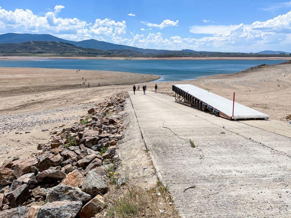
“The drought afflicting the Denver region and its water supply system has only worsened over the course of the summer, making it clear that we need to take additional steps in response,” said Tyrone Gant, president of the Denver Board of Water Commissioners. “Formally ending lawn watering Oct. 1 will help stretch our supplies, as we will be entering next spring with storage levels far below normal.”
While the board’s Stage 1 drought declaration set a target for system-wide reduction of 20% below the five-year average in water consumption, prolonged hot and dry conditions have led to many customers using more water during their permitted irrigation days to keep trees, shrubs and landscapes alive, making the conservation target difficult to achieve. With drought conditions ongoing, Denver Water staff project storage supplies could drop to 60% before the 2027 runoff season.
“Despite the blistering conditions, customers overall have reduced their water use this summer. But with a lack of precipitation and the hottest first seven months in the Denver region we’ve recorded, we must take this additional step,” said Denver Water CEO/Manager Alan Salazar. “It’s critical that our customers turn sprinklers off Oct. 1, so that we can extend our water supply.”
The resolution includes additional details outlining the kind of watering still permitted after the shutdown date.
- High-traffic, active-use grass areas, such as parks and school fields, may only be watered after Sept. 30, under a Denver Water-approved water budget or variance. Additionally, recycled water users can continue to irrigate any day of the week, following the standard watering rules, as they are relying on reused water supply.
- Trees, shrubs and perennials may be watered any day with a hand-held hose with a shutoff nozzle or low-volume, non-spray irrigation (such as a drip system). They may not be watered by spray irrigation.
- Annuals and vegetables may be watered any day with a hand-held hose with a shutoff nozzle or low-volume, non-spray irrigation, until the first frost. They may not be watered by spray irrigation.
- Grass establishment is not allowed after Sept. 30, except under special circumstances outlined under an approved variance.
- An irrigation system may be operated for installation, repair or reasonable maintenance, so long as the system is attended throughout the period of operation and water waste does not occur.
Conditions in Denver Water’s service and collection areas continue to worsen. The amended resolution outlines specific factors driving the additional board action.
- Denver Water’s water collection system watersheds remain in various levels of drought as defined by the U.S. Drought Monitor.
- Natural streamflow in the areas that flow into Denver Water’s storage reservoirs for the period of April to July was 95,000 acre-feet, which is 22% of normal and marks the lowest level observed since recordkeeping began 110 years ago.
- The Denver metro area is experiencing the hottest year on record (through July) with average daily high temperatures five degrees above normal and four inches below normal precipitation.
- As of Aug. 24, 2026, storage in Denver Water’s supply reservoirs is at 72% full, which is significantly lower than the historic median of 94% full for this time of year.
“If you are the only one on your block with a lush green lawn, you might want to revisit your watering practices, as your overuse is compounding the impacts of this historic drought on our water storage supplies,” said Greg Fisher, Denver Water’s manager of demand planning.
“We’re asking everyone to care more and water less, so we don’t have to take more drastic steps in the future, which could create more damaging impacts to our landscapes.”
Watering season typically runs from May 1 to Oct.1, during which Denver Water’s annual watering rules are in place. In a non-drought year, the start and end dates are general guidance for customers to turn on and off their irrigation systems. With this amendment to its March 25 drought resolution, the board has made the Oct. 1 date mandatory this year, prohibiting lawn watering as of that date.
In addition, the lawn watering ban remains in effect until the board determines how and when lawn watering can resume. That means sprinklers need to remain off in spring of 2027, pending an official resolution from the Board of Water Commissioners. [ed. emphasis mine]

Coyote Gulch’s excellent new (to me) EV

Australia has proven that water markets can work
by Robert Marcos
In a nutshell, the American West’s water crisis is not just a climate or a supply problem, it’s also a governance and an allocation problem. Nature has provided us with a finite supply of water, but our laws and our historical systems are directing that water to be used in inefficient ways. 1 There’s no more glaring example than Imperial Valley farmers who pay a base rate of $20 per acre foot for raw Colorado River water that they use to flood irrigate thousands of acres of forage, to feed cattle.2 Meanwhile just 100 miles away, water districts in San Diego pay $1,579 per acre foot for the same untreated water. 3
The Core Concept: Unbundling Water from Land
In the American West, water rights are legally tied to the land. If you sell the land, you sell the water; if you don’t use the water on that land, you lose it. Australia solved this in the 1980s and 1990s through “unbundling”. They legally separated water rights from land ownership.4 Because water is unbundled, it can be bought, sold, or leased on an open, transparent exchange—completely independent of the land. 5
• Water Entitlements: Treat water like shares in a company. A farmer owns a permanent right to a specific percentage of whatever water is available in the river system that year.
• Water Allocations: The actual volume of water credited to that share each season, fluctuating based on rain and dam levels. 6
How This Fixes the West’s Inefficiencies
If the Imperial Valley operated under the Australian system, the economic landscape would shift immediately:
• Eliminates “Use It or Lose It”: An alfalfa farmer wouldn’t have to flood their fields just to protect their legal rights. If a drought hits, they can choose to leave their fields fallow and sell their seasonal water allocation on the exchange to a desperate city or a high-value orchard. 7
• Puts a Clear Price on Water: Right now, Western water is artificially cheap for senior holders. A market creates a real-time price signal. When water is expensive, growing a low-value, thirsty crop like alfalfa in the desert can be financially foolish compared to selling the water itself. 8
J.H. Cullum Clark – a fellow at the George W. Bush Institute, said, “The simple case for allocating essential commodities like water through market mechanisms is that freely fluctuating prices bring supply and demand into equilibrium. If the amount of a commodity demanded by users exceeds the available supply, higher prices signal to suppliers that they should bring more supply online and to users that they should conserve”. 9
What #climate science tells us about the causes of the #ColoradoRiver crisis: Researchers have grown increasingly confident in global warming’s role in post-2000 ‘megadrought’ — Chase Woodruff (ColoradoNewsline.com) #CWCSC2026 #COriver #aridification

Click the link to read the article on the Colorado Newsline website (by Chase Woodruff):
August 26, 2026
Elected officials from across Colorado’s political spectrum continued a 68-year-old tradition last week when they took to the stage at the annual summer conference of the Colorado Water Congress in Steamboat Springs.
Connecting the news in Colorado to the big picture. First convened by Gov. Steve McNichols in 1958, the Water Congress brings together experts, policymakers, agricultural producers and other interest groups to negotiate and strategize in a state where water has always been a scarce and carefully managed resource.
That’s never been more true than it is today, at a time of extreme drought and escalating political conflict over the future of the Colorado River. The river’s cumulative flow at Cameo, just upstream of Palisade and Grand Junction, is at a record low this year, and Colorado and six other states that depend on its water are likely headed for an extended, high-stakes court battle over how to apportion the cuts forced on them by more than two decades of persistently dry conditions.
Addressing the Water Congress, Colorado leaders said the way forward for water users is through, as Attorney General Phil Weiser, the Democratic nominee for governor, put it, “collaboration and innovation.” They talked about storage and diversion projects, conservation measures and drought-resistant crops. They promised to defend farmers and ranchers from so-called “buy and dry” purchases of their water rights by municipal utilities, and to fight off efforts by the Lower Basin states of Arizona, California and Nevada to force mandatory cuts on upstream users in Colorado.
Notably absent, however, from the event’s three days of speeches on water policy — from politicians on both sides of the aisle — was the predominant reason why the situation on the Colorado River is bad and getting worse: human-caused climate change. Neither Weiser nor Victor Marx, the Republican candidate for governor, made any mention of the threat posed to Western water supplies by rising global temperatures. It was missing, too, from speeches by both GOP U.S. Rep. Lauren Boebert, a longtime fossil-fuel industry booster, and Democratic U.S. Rep. Joe Neguse, a former member of the House Select Committee on the Climate Crisis. [ed. emphasis mine]
Dwayne Romero, the Democratic nominee in Colorado’s drought-ravaged 3rd Congressional District, went so far as to say that “the climate is putting new pressure on” water management issues, but no further.
The lack of acknowledgment of the causes of the Colorado River Basin’s post-2000 megadrought comes as Colorado Republicans largely continue to ignore or deny the science of climate change — and as Democrats have been pressured by some party consultants to deemphasize the issue in the wake of their defeat in the 2024 election.
But even as this “climate hushing,” as Rhode Island Sen. Sheldon Whitehouse dubbed it earlier this year, appears to have taken hold in the Democratic Party, hydrologists and climatologists have grown increasingly confident in identifying human emissions, rather than natural variability, as the overwhelming factor driving the West’s water woes.
Whether or not it’s politically expedient for either party to say so, the scientific consensus is that rising levels of greenhouse gases in the Earth’s atmosphere — mostly the result of burning oil, gas and coal — have pushed the Colorado River system to the brink, and that drought conditions are likely to continue to worsen as long as those emissions continue to push global temperatures higher.
‘Hot drought’ and beyond
As of 2024, average global temperatures had risen by more than 2.3 degrees Fahrenheit over pre-industrial levels, according to NOAA data, and climate scientists have concluded that virtually all of that observed warming is due to greenhouse gas emissions from human activity. Parts of Colorado, including much of the Western Slope, are among the areas in the U.S. where average temperature increases have been most severe.
As litigation looms and drought takes its toll, state officials defiant over Colorado River’s future — Chase Woodruff (Colorado Newsline)
Even in the absence of any other changes to global climate patterns, this higher heat alone can lead to drier conditions on the ground, by increasing the rate at which moisture evaporates — sometimes called evaporative demand, a measure of the atmosphere’s “thirst.” In a 2024 report for the Colorado Water Conservation Board, state climatologists found that evaporative demand had risen by 5% statewide between 1980 and 2022, and was projected to increase by 8% to 17% by 2050.
Within about a decade of the onset of the Colorado River megadrought in the 2000s, researchers began to conclude that rising temperatures were a major factor, making the drought more severe than it otherwise would’ve been. In an influential paper published in 2017, hydrologists Brad Udall and Jonathan Overpeck used the term “hot drought” to describe the basin’s current conditions, distinguishing it it from previous 20th-century “dry droughts,” caused largely by lower precipitation.
Further research has only solidified those conclusions. Using historical soil-moisture data and tree-ring records, one 2022 study found that the current megadrought is the worst dry spell the Southwest has experienced in at least 1,200 years. Studies generally agree that about 40% to 50% of the Colorado River’s declining flows can be attributed to higher temperatures alone.

Still, scientists were cautious about the other half of the hydrological equation — whether, and to what extent, climate change was influencing rainfall and snowfall, too. Modeling global warming’s precise impacts on precipitation patterns proved more complicated than identifying what state climatologists called the “basic physical relationship” between heat and evaporation.
“Compared to the 20th century, the 21st century has indeed been drier, but only by about 2.5%,” hydrologists with the Colorado River Research Group wrote in 2016. “Whether or not this is the leading edge of a trend, or merely a part of normal variability, is unknown.”
In just the last two years, however, new research has begun to dispel that uncertainty — and the findings, wrote Udall and Overpeck last year, “translate to mostly bad news.”
It’s precipitation, too
Overall precipitation in the Upper Colorado River Basin has continued to decline since 2000, with multi-year averages about 7% lower than previous levels as of 2025. Colorado was one of nine states in the West to have experienced their warmest winter on record in 2025-26, and statewide snowpack fell to its lowest level in more than 40 years, setting the stage for this summer’s extreme conditions.
Researchers at the University of Colorado Boulder found last year that global warming is reducing precipitation in the West by stalling a key oceanic climate cycle known as the Pacific decadal oscillation, indicating that the region’s persistently dry conditions are being driven by human emissions “more intensely — and more directly — than previously understood.” Another 2025 paper by a different group of researchers echoed their findings.
“What’s important here is that we’re showing that rainfall has also been influenced by humans, in addition to just evaporation,” Pedro DiNezio, one of the CU Boulder study’s co-authors, told Newsline last year. “Both contribute to drought.”
A final key takeaway from climatological research on the Colorado River is that the higher global temperatures get, the worse things will be for river flows, which are not likely to ever return to their previous “normal.” Udall and others have encouraged the use of the term “aridification,” rather than drought or megadrought, to more accurately describe what’s happening to the river basin. But it’s also why he and Overpeck wrote last year that there’s a “silver lining” to the better understanding of river’s hydrology that researchers have gained over the last decade.
“We can say with confidence that human-caused emissions of greenhouse gases are having an increasingly negative impact on the flows of the Colorado River,” they wrote. “This climate change impact will continue to worsen, but because humans cause it, humans can halt it.”
The Trendline offers analysis on public policy in Colorado. Articles explore ways to think about the news based on research, history and other important context, helping Coloradans connect the headlines to the big picture.
Colorado Newsline is part of States Newsroom, a nonprofit news network supported by grants and a coalition of donors as a 501c(3) public charity. Colorado Newsline maintains editorial independence. Contact Editor Quentin Young for questions: info@coloradonewsline.com.

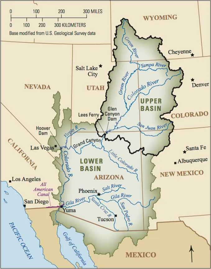
Stage Four begins for the IID to protect its rights to #ColoradoRiver water — Brian McNeece (TheDesertReview.com) #COriver #aridification
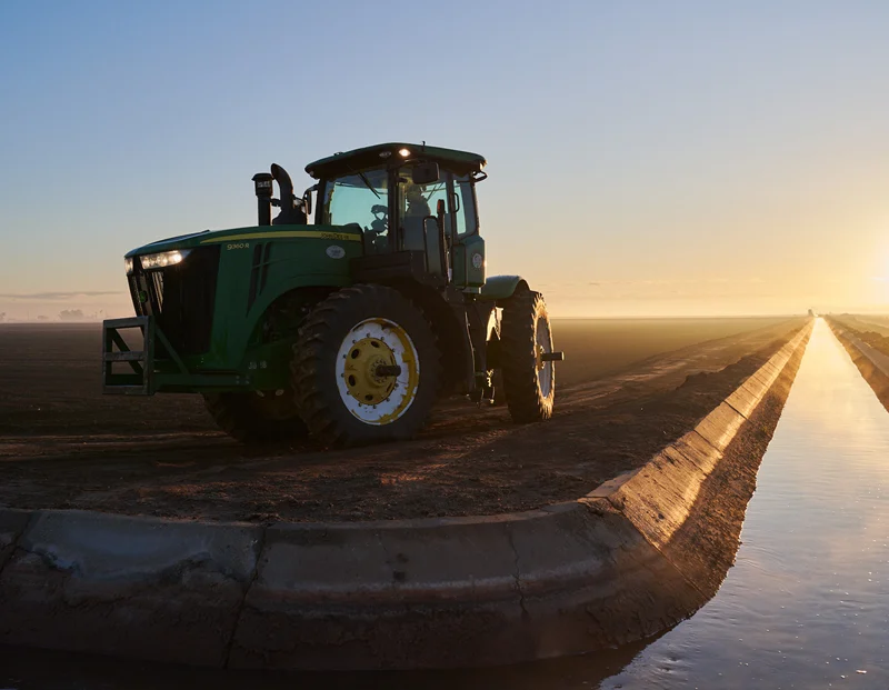
Click the link to read the guest column on The Desert Review website (Brian McNeece):
August 26, 2026
We can divide the Imperial Valley’s relationship with the Colorado River into four stages. Stage four is accelerating, and it may be our toughest challenge yet.
Water from the Colorado River first arrived via a canal through Baja California June 1, 1901. That started a forty year period of agricultural expansion, floods, shortages, and an accumulation of huge amounts of debt. It was a time of constant uncertainty.

In 1935 Hoover Dam eliminated the danger of floods. The All-American Canal in 1940 finally gave the IID independence from Mexico. The stage of uncertainty was over. The age of prosperity had begun.
From 1940 to 1980, the IID and the valley expanded and refined the system that the pioneers had so sublimely designed. By gravity alone, a network of canals irrigated half a million acres of farmland. The Colorado River supplied all the water we could use.
There was so much water that the IID and Imperial Valley farmers allowed tailwater and drain water to raise the Salton Sea. Tropical storms in 1976 and 1977 added even more water to the Salton Sea. Land near the Salton Sea was flooded. In 1980, farmer John Elmore of Brawley understandably sued the IID for ruining his land there.
Elmore won. IID lost. The courts ruled that the IID was using Colorado River water wastefully and was in violation of the Law of the River.
One might have expected that in 1980 the IID would—like in its early years—ask the farmers and townsfolk to support the massive investment needed to modernize its water control system by taxing themselves.
Instead, the IID accepted the Metropolitan Water District’s offer to pay for efficiency improvements in the IID system. In return, MWD would get 104,000 acre-feet of water every year for a small annual fee. Stage two was over.
Thus began stage three in the history of IID: the age of water transfers and a creeping reduction in water supplies. Midway in this forty year period—in 2003—the IID signed the Quantification Settlement Agreement, which capped the state of California’s allocation at 4.4 million acre-feet and consolidated the MWD transfer agreement with others, including an annual transfer of 200,000 acre-feet to the San Diego County Water Authority.
At the same time, a long drought meant that Lower Basin states of California, Nevada, and Arizona kept drawing down Lake Mead, despite six separate agreements to build elevation. Today, both Lake Mead and Lake Powell are at their lowest elevations of all time.
A new stage is upon us. We can say that it began around 2020, forty years after the Elmore suit in 1980. For now, it’s a return to uncertainty—the prospect of legal challenges to IID’s senior water rights
Stage four incubated for six years as the seven states along the river regularly scrummed to find an arrangement to share plunging water supplies. The problem being so vast and complicated, they left it to the Bureau of Reclamation to find the answer. Just a few days ago, the Bureau released its plan—over a thousand pages—that essentially laid the burden of cutbacks on the Lower Basin states of California, Arizona, and Nevada.
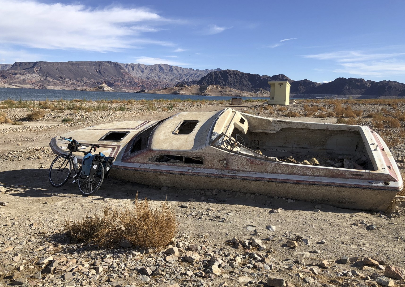
As the two giant reservoirs of Lake Powell and Lake Mead have receded, relics of the past reappear: boats, airplanes, the ruins of flooded towns. A forgotten concept has reappeared too: Water evaporates in transit down the river.
It has become clear to all in the Lower Basin that evaporation and uptake by plants along the river can no longer be ignored.
Through some poor thinking decades ago, the Bureau of Reclamation promised to deliver the same amount of water at Imperial Dam for the IID and at Yuma for Mexico that was released at Lee’s Ferry 600 miles upstream. But because about 13% is lost to evaporation, the Bureau had to rob Lake Mead every year to fulfill its promises. It can’t continue.
That’s why the cuts the Lower Basin states and Mexico have taken since 2020 haven’t been enough. And without a miracle winter, the new cuts they have offered—1.50 million acre feet, somewhat more than the evaporation losses—won’t be enough. This is the simple fact.
It gets worse. Instead of releasing its Colorado River Compact obligation of 8.23 maf, the Upper Basin states will release only 6 or 7 maf next year. Therefore, the more likely cuts will be in the neighborhood of 2.5-3 million acre-feet.
Three days after the Bureau of Reclamation plan was released, Nevada sued, alleging that the proposed cuts to Nevada will devastate its economy and that the Bureau (representing the Department of the Interior) did not properly follow the law.
Thus, we’re off and running to the courts, which all the states repeatedly stated they wanted to avoid. For the IID, it’s stage four of its history with the Colorado River. The only certainty at this point is that the IID will be embroiled in tough legal challenges to protect its senior water rights as heavy cuts hit users of Colorado River water. Let’s hope it doesn’t last forty years.
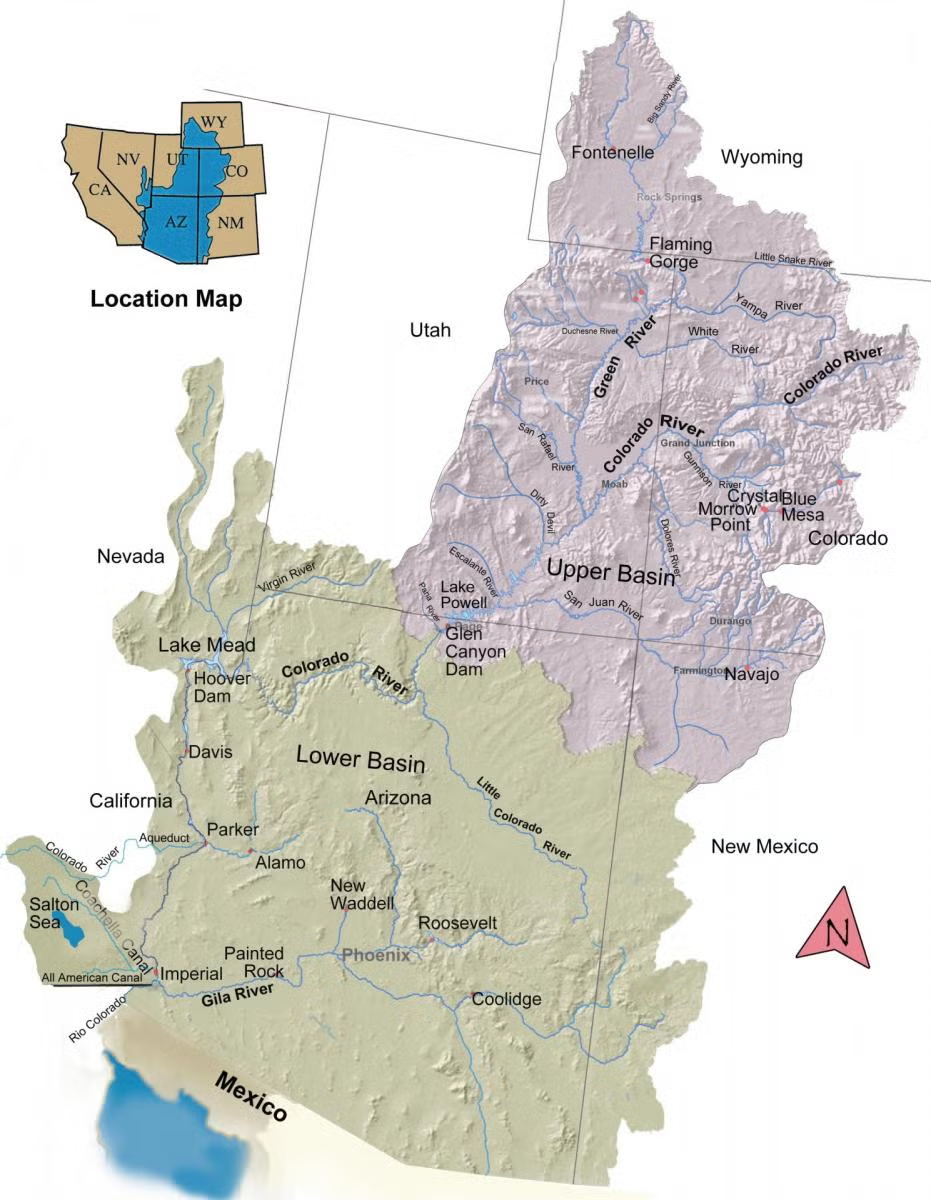
Topsoil Moisture % Short/Very Short by @usda_oce. 49% of the Lower 48 is short/very short, a 1% increase from last week. Highest short/very topsoil spans parts of the West, Plains, South, and Northeast, led by NM at 90%; VT at 87%; OR, WY, and TX at 86%; and LA and OK at 81%
“Why don’t we just build a pipeline from the #MississippiRiver, the Great Lakes or somewhere else with plenty of water and send it to #LakeMead?” — The Southern #Nevada Water Authority

From SNWA Youtube page:
Why don’t we just build a pipeline from the Mississippi River, Great Lakes, or another major water source and pump that water to Lake Mead? Simple, right?
It’s one of the most common suggestions we hear to solve drought in the West. In this episode of Tap the Truth, we explore what it would actually take to move water across the country and why these projects are more complicated than they might seem.
Importing water is not as simple as laying pipe across a map. Interstate agreements, water rights, environmental impacts, water quality concerns, permitting challenges, and costs all need to be considered.
We also discuss why communities throughout the country are facing their own water challenges and why conservation remains one of the most reliable and cost effective tools available today.
Want to make a personal impact on Southern Nevada’s water future? Visit SNWA.com to learn about water saving programs, rebates, and conservation tips.
Watch more Tap the Truth episodes for straightforward answers to common questions about water, Lake Mead, the Colorado River, and Southern Nevada’s water supply.
Rare #YampaRiver call curtails junior water rights amid historic #drought: More than 300 upstream diversions could be affected as low flows, reservoir releases and worsening drought strain water supplies across the basin — Steamboat Pilot & Today
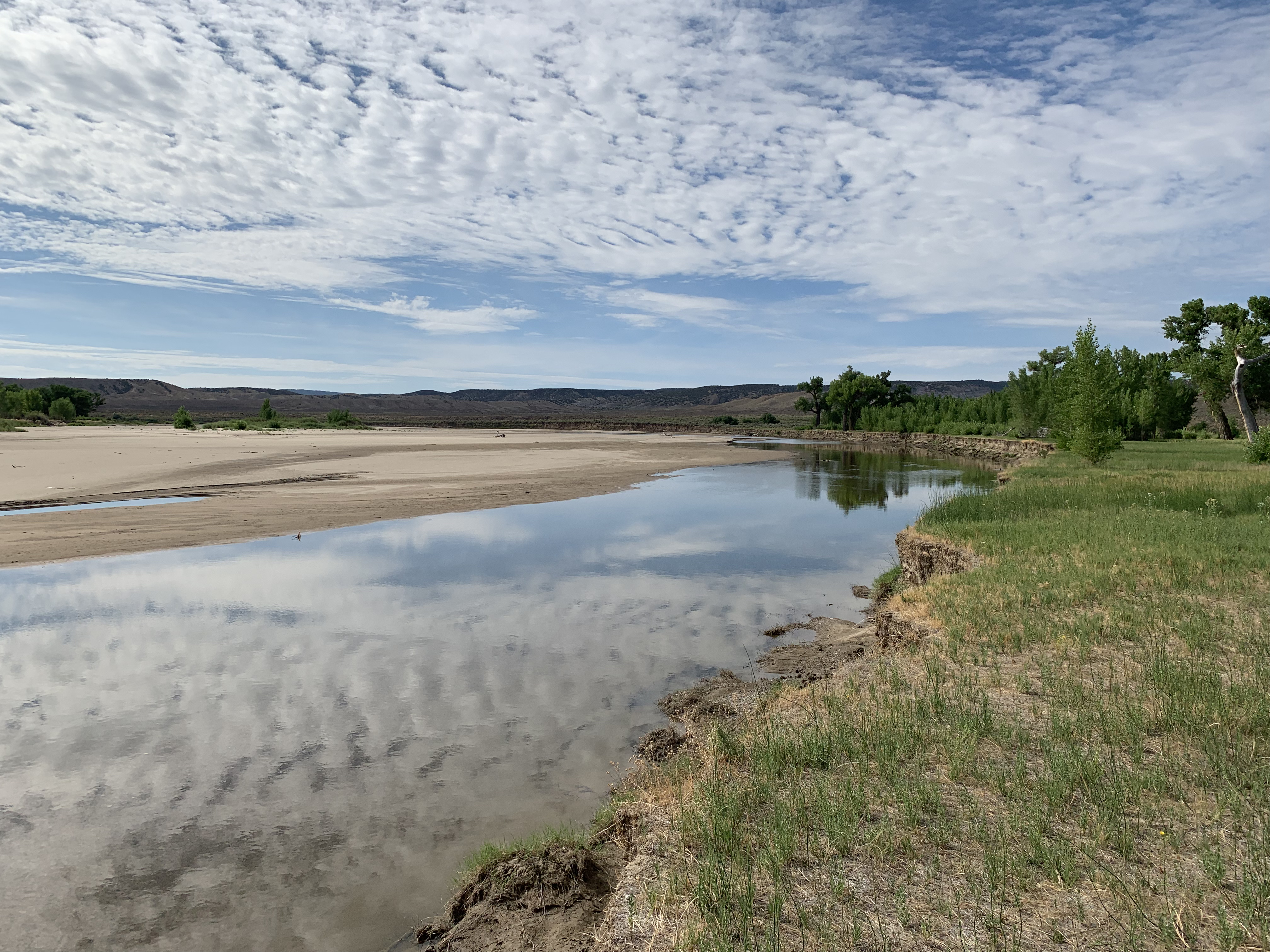
Click the link to read the article on the Steamboat Pilot & Today website (John Camponeschi). Here’s an excerpt:
August 26, 2026
A rare call has been placed on the main stem of the Yampa River as historic drought conditions continue to strain water supplies across Northwest Colorado, potentially curtailing more than 300 upstream diversions and prompting water managers to urge residents to conserve wherever possible. The call was placed Aug. 19 at the Lily Park Ditch No. 1, Pump Station No. 1, near the confluence of the Little Snake and Yampa rivers. The agricultural water right carries a priority date of May 28, 1923…Holly Kirkpatrick, public affairs manager for the Upper Yampa Water Conservancy District, said the call is only the fifth to occur on the main stem of the Yampa River below Stagecoach Reservoir…Kirkpatrick said well over 300 diversions upstream of the calling point could be subject to curtailment if they have priority dates junior to May 28, 1923. The call also applies to tributaries upstream of the Little Snake and Yampa river confluence. Some of those tributaries, however, may already have little or no natural streamflow available because of the severity of this year’s drought, she said. The Upper Yampa Water Conservancy District reported Aug. 20 that baseflows in tributaries across the basin remained below the 10th percentile, an indication of unusually low water levels. The district’s report showed the Yampa River below Craig flowing at 94 cubic feet per second, compared with a historical mean of 156 cfs for the date. In Steamboat Springs, the river was flowing at 58 cfs compared with a historical mean of 96 cfs. Reservoir releases are now supplying much of the water moving through the Yampa River, Kirkpatrick said.

Colorado remains ‘epicenter’ of worst #drought conditions in the West, as heat records pile up: The 2026 water year has seen drought persist across the Western Slope, ranking among the hottest and driest for some regions of #Colorado — Steamboat Pilot & Today
Click the link to read the article on the Steamboat Pilot & Today website (Ali Longwell). Here’s an excerpt:
August 26, 2026
As Colorado nears the final month of the 2026 water year, extreme drought is persisting across the state as many regions, including the Western Slope, continue to rack up records when it comes to heat as well as precipitation — and the lack thereof.
“We continue to be way above anything that we’ve seen in the data record for Colorado; we’re about 2 degrees warmer than the previous hottest water year to date on record — that was 1934 — and over 4 degrees warmer than the 1991 through 2020 average,” said Allie Mazurek, engagement climatologist at the Colorado Climate Center, at the Aug. 25 Water Conditions Monitoring meeting of the Colorado Water Conservation Board.
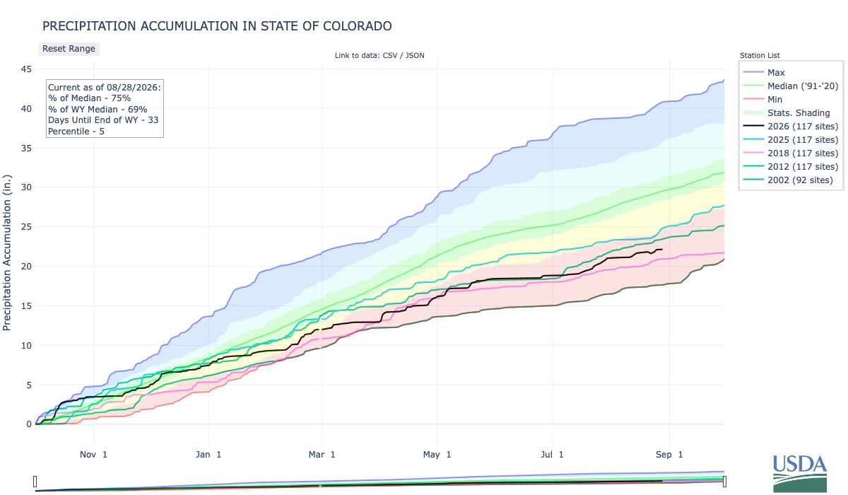
“The dryness has not been quite as remarkable as the warmth, but again, we have ranked as the sixth driest on record through the end of July, and are still among some of the driest water years that we’ve seen,” she added…
The first 10 months of the water year — which kicked off Oct. 1, 2025 — have seen three months rank as the hottest on record and six months fall among the top 10 hottest. While not over, August has already seen above-average temperatures, with many areas averaging 4-6 degrees hotter than normal, including west of the Continental Divide, which Mazurek said has experienced “the most notable warmth compared to average.”…While July and August are not the first months this water year to set these kinds of records — March, for example, saw statewide temperatures nearly 10 degrees above the 30-year average — Mazurek said it does ring a different kind of alarm bell…All in all, Mazurek described the water year so far as “very, very warm,” sitting 4.5 degrees above the average temperatures from 1981 to 2020.
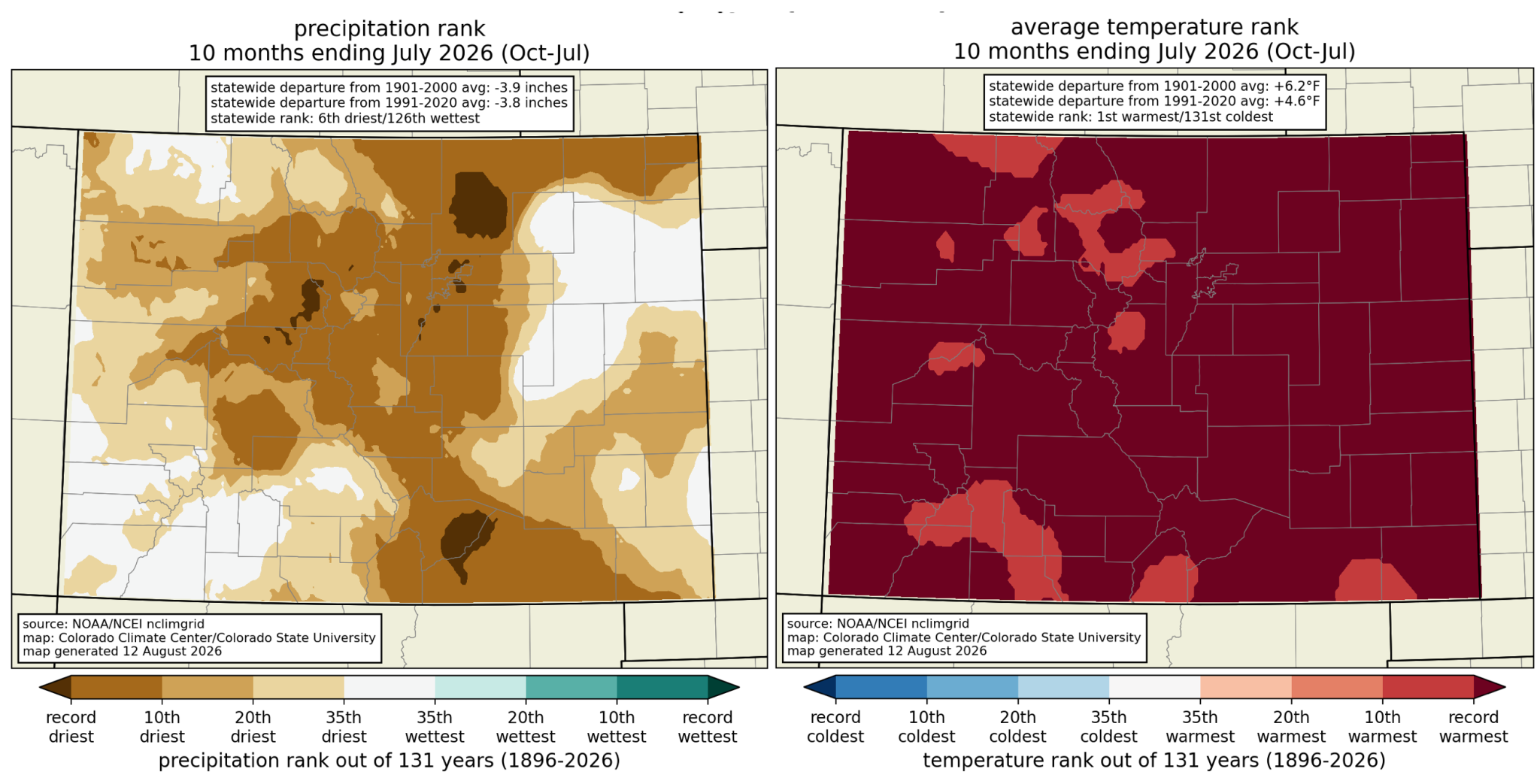
Upper Basin on verge of first-ever #ColoradoRiver Compact breach, Central #Arizona Project president Terry Goddard warns: Lawsuit may be on the table — KTAR.com
Click the link to read the article on the KTAR website (Heidi Hommel). Here’s an excerpt:
August 26, 2026
The Upper Basin is on the verge of violating the Colorado River Compact for the first time in the agreement’s 104-year history, failing to send enough water downstream to the Lower Basin, Central Arizona Project President Terry Goddard told KTAR News 92.3 FM on Monday…Goddard said the new framework from the U.S. Bureau of Reclamation that will guide operations through 2036 could make it worse…
“We have a violation of the compact either today or within the next month,” Goddard said.
The compact requires the Upper Basin to deliver 75 million acre-feet to the Lower Basin over any rolling 10-year period, averaging 7.5 million acre-feet a year. Goddard said the Upper Basin is falling short of that obligation for the first time in the compact’s history, releasing only 6 million acre-feet this year and running right at the 10-year threshold. [ed. As Ed Millard says, the action is not from the Upper Basin but from Reclamation]
Feds release two-year #ColoradoRiver plan, #Nevada sues: Suit says plan could cause devastating environmental, socioeconomic, and health and human safety impacts — Jonathan P. Thompson (LandDesk.org)
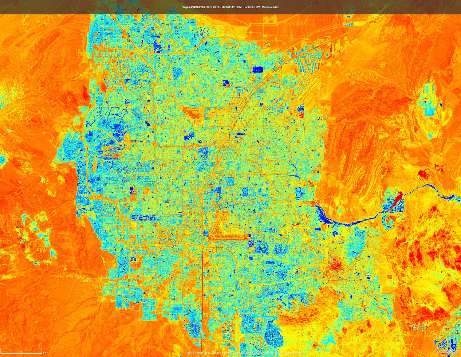
Click the link to read the article on The Land Desk website (Jonathan P. Thompson):
August 25, 2026
THE NEWS: The U.S. Interior Department on Friday handed down the operating guidelines for the Colorado River for the next two years, while also finalizing the 10-year decision framework that will guide these plans. And on Monday, Nevada filed a lawsuit challenging both the framework and operating plan, saying that potential shortages required by the plan could cause “cause devastating environmental, socioeconomic, and health and human safety impacts to southern Nevada and its citizens.”
THE CONTEXT: Interior, i.e. the Bureau of Reclamation, did two things. The first was to hand down a record of decision on the framework that will guide operating plans for the next decade, which I wrote about here, so I’ll skip the details this time.
Feds release Colorado River plan, and no one’s very happy about it — Jonathan P. Thompson
They also released a more specific plan for the 2027 and 2028 operating years. In the new plan, the feds affirm their commitment to “defending” minimum power pool in Lake Powell, or a reservoir surface elevation of 3,490 feet. When the water falls below this level, water can no longer be released via the penstocks and hydropower turbines, so it must all go through the lower river outlet works, which weren’t designed for sustained use.
Notably, Reclamation plans to do this by “initially seeking to maintain a minimum elevation of 3,510 feet. This provides an operational buffer and provides additional flexibility in recognition of the operational risks associated with sustained operations below elevation 3,490 feet … .”
The current elevation is 3,518 feet, meaning it could reach that upper buffer zone of 3,510 feet in October if current levels of decline continue.
To prevent it from falling any further, Reclamation would cut back releases from Glen Canyon Dam, which in turn would cut flows through the Grand Canyon and into Lake Mead, which would pull down Mead’s levels and trigger mandatory cuts for the Lower Basin users. Under the new operating plan so far, these cuts aren’t as onerous as many feared, and actually match up with what the Lower Basin had proposed to do voluntarily. The deets:
- The Lower Basin would receive 6.25 million acre-feet from the Colorado River, or 1.25 MAF below the Colorado River Compact’s allotment of 7.5 MAF.
- Arizona would receive 2.04 MAF; California 3.96 MAF; and Nevada 250,000 AF.
- This means Arizona would take a 760,000 AF cut; Nevada a 50,000 AF cut; and California a 440,000 AF cut.
Arizona takes the largest cut by percentage and volume because the Central Arizona Project, which delivers most of the state’s Colorado River water, has junior water rights to other big users on the river.
But if reservoir levels continue to drop, then Reclamation could impose further cuts on the Lower Basin, potentially slashing Nevada’s water deliveries by as much as 213,556 acre-feet, or about 71% of its total entitlement of 300,000 acre-feet. This would be truly disastrous for the Las Vegas metro area, which relies on the Colorado River for about 90% of its water. And it’s not like there are a bunch of alfalfa fields the city could “buy and dry” for the water rights.
The Southern Nevada Water Authority has managed to cut overall water consumptionover the last three decades, even as the population has soared, through system-wide efficiencies, incentives, tearing up ornamental grass, water recycling, and extra fees for water gluttons. Las Vegas still has room to conserve, but as Western water scholar John Fleck put it, there “is an absurdity to a plan that would require Las Vegas to cut 71%. That’s existential.”
Even more astonishing than the fact that the federal government is considering virtually drying up one of the Southwest’s major metropolises is their justification for doing so: To protect Glen Canyon Dam and keep it producing hydropower, even at greatly diminished levels, and — though it’s not stated — to keep lake-based recreation somewhat viable.
Glen Canyon Dam hydropower: What’s it good for? — Jonathan P. Thompson
You have to remember that when the feds vow to defend the 3,500-foot level at Lake Powell, and when they refuse to even consider re-engineering Glen Canyon Dam to allow for releases at lower levels, either by rebuilding the outlet tubes or tunneling a bypass around the dam, they are also saying they are going to trap more than 4 million acre-feet of water behind the dam that could otherwise flow downstream into the Grand Canyon and Lake Mead. That’s enough water to fill Nevada’s entire allotment for more than 13 years that, instead, will be sitting in the reservoir and slowly evaporating.
Nevada’s lawsuit — which is against the federal government, not the Upper Basin states — alleges that the feds’ plan violates the Law of the River. It slams the plan for not explicitly calling for releasing more water from Upper Basin reservoirs to prop up Powell, does not require Upper Basin states to make any cuts, and fails to consider a long-term alternative or engineered solution alternative to address Glen Canyon’s infrastructure limitations. The plan also does not account for its potential impacts on hydropower production at Hoover Dam, which drops off steeply as reservoir levels decline (meaning that preserving power output at Glen Canyon could lead to a net reduction in combined output from the two dams).
Save the Colorado, a river advocacy group, came out in support of Nevada’s lawsuit in a written statement. “Las Vegas has one of the best water conservation programs in the entire U.S.,” said Gary Wockner, the group’s executive director. “Penalizing Las Vegas for water use is like penalizing an obese person who lost a lot of weight taking GLP1s.”
A Colorado River glossary and primer — Jonathan P. Thompson
🌵 Public Lands 🌲
Rough Times at the national parks these days. In Bryce Canyon, a sudden thunderstorm left visitors stranded on trails and requiring rescue, with two of them transported to a hospital for hypothermia. It also unleashed some serious flash flooding. In Zion National Park, a rockslide narrowly missed a shuttle bus and forced the closure of a portion of the Zion Canyon Scenic Drive. And in Canyonlands, officials were searching for a missing individual in Horseshoe Canyon, a remote area north of the park’s Maze district. Temperatures in the area were in the 90s. In Death Valley, a French tourist died after his car got stuck in the mud on a remote road in 116° F heat.
The video below shows flooding near Tropic, Utah, downstream from Bryce Canyon National Park. Source: Garfield County Sheriff.
In May, I wrote about how climate change and aridification and a shrinking Lake Powell were coming for the Bullfrog Marina, on the northwest side of the reservoir. The water was simply getting too low for the marina to remain viable, so they were planning on moving it across the reservoir to Halls Crossing Marina.
At the time, it was not yet clear how lower water levels and the marina’s removal might affect visitation to the remote area. Now preliminary numbers are in:
- 67,277: Total recreation visitors to the Bullfrog District of Glen Canyon National Recreation Area, January through July 2025
- 44,206: Total recreation visitors to the Bullfrog District, January through July 2026.
That’s a decrease of over 23,000 visits, or a 34% drop. Even more dramatic is the drop in overnight stays in July, from over 47,000 in 2025 to just 17,000 in 2026. Then did folks make the long drive over to Halls Crossing, instead? It appears that some of them may have once the marina was moved, but overall this year visitation is also down on the northeast side of the reservoir.
- 18,023: Total recreation visitors to the Halls Crossing District of Glen Canyon National Recreation Area, January through July 2025.
- 15,099: Total recreation visitors to the Halls Crossing District, January through July 2026.
That’s a decrease of 2,944 visits, or a 19% drop. This may not all be related directly to the dropping lake levels. Horseshoe Bend, which is in Glen Canyon National Recreation Area but downstream from the reservoir, has also seen a significant drop off in visitors this spring and summer. In a future dispatch I’ll take a closer look at tourism numbers in general to get a better sense of how widespread the declines are.
Climate change comes for a Lake Powell marina — Jonathan P. Thompson
And now for the images showing Bullfrog with the marina, and without. The first image is from August 2024, when the reservoir’s surface elevation was at about 3,580 feet. The marina was still there, and the boat ramps still made it all the way to the water. The second image is from August 2026, with a surface level of just over 3,518 feet. Look closely and you’ll see the marina is gone, and the ramps are high and dry.

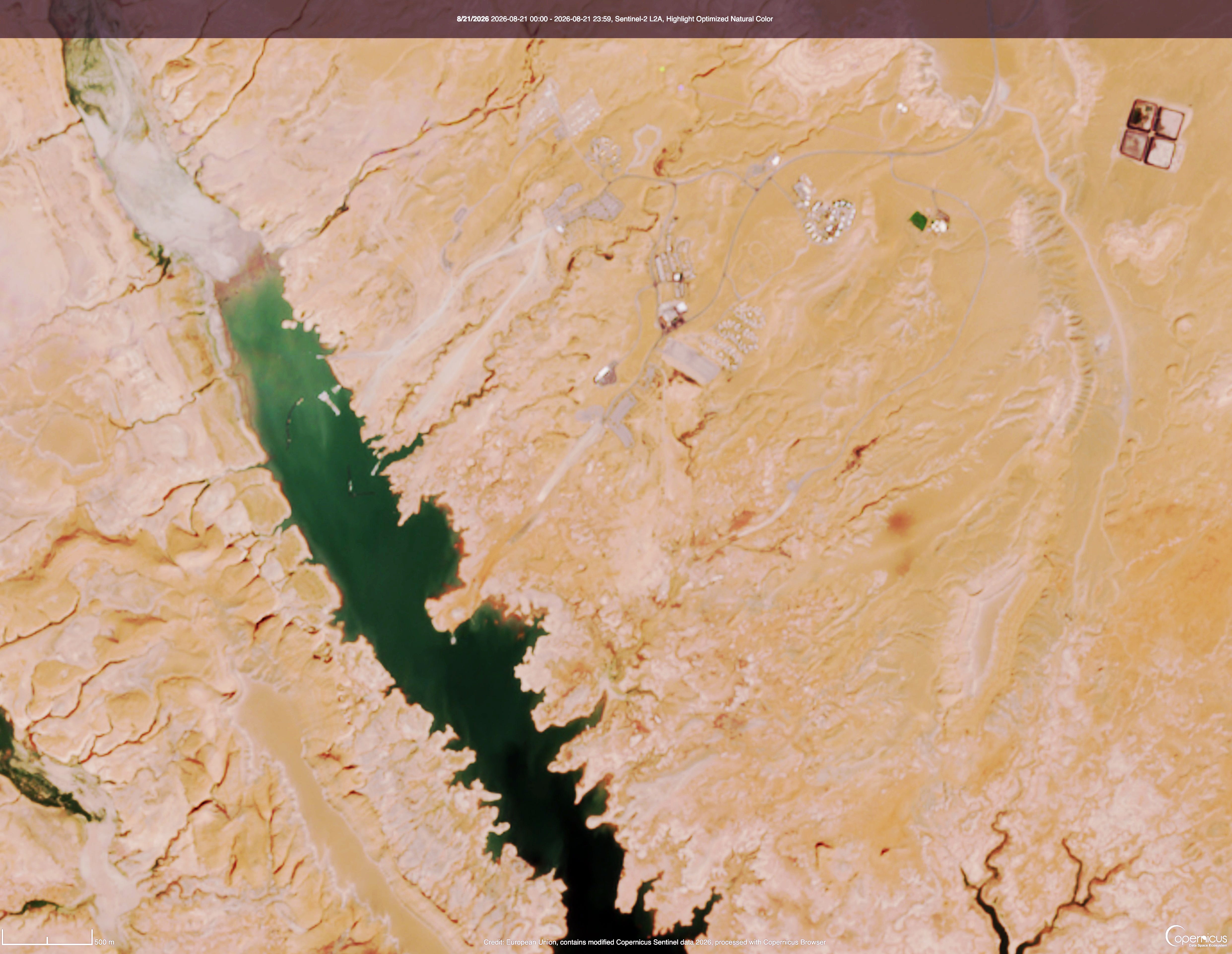
#Drought news August 27, 2026: Rapid drought deterioration continued across southern #Kansas and S.E. #Colorado, widespread convection brought drought relief east of the Front Range across E. Colorado
Click on a thumbnail graphic to view a gallery of drought data from the US Drought Monitor website.
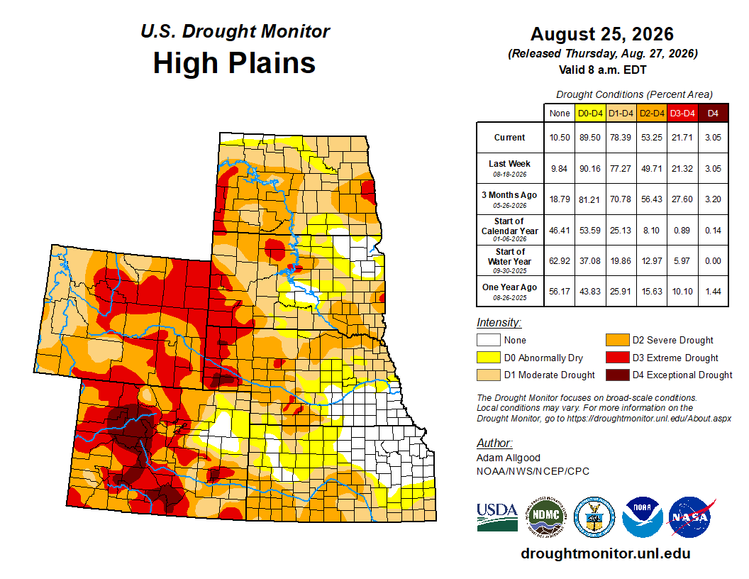
Click on the link to go to the US Drought Monitor website. Here’s an excerpt:
This Week’s Drought Summary
During the early part of last week, an amplified ridge-trough pattern over North America brought widespread late summer heat to the West and south-central US, with milder temperatures overspreading the Corn Belt and gradually shifting to the Northeast and mid-Atlantic states. The north side of the mean ridge provided a focus for convective activity, with narrow swaths of locally heavy rainfall extending across Nebraska and Missouri, while shortwave troughs brought several rounds of storms to the eastern Corn Belt and parts of the mid-Atlantic and southern New England. Underneath the ridge, dry weather combined with excessive heat continued to promote rapid onset drought across much of the South region. Across the Southeast, summer convection competed with enhanced evapotranspirative demand due to hot temperatures, causing some degradation in areas that missed out on thunderstorm activity. Across the West, an active monsoon pattern continued to bring localized relief to parts of Arizona and New Mexico, while excessive heat and drier conditions promoted drought expansion across eastern New Mexico and portions of the Intermountain West, Great Basin, and the Northwest.
Across Alaska, improved rainfall eased drought conditions over the central interior, while drier weather sparked some degradation over the southeast. Across Hawaii, following widespread heavy rainfall from Hurricane Lala in the previous week, Tropical Storm Moke passed well south of the state, bringing enhanced flow and precipitation to the windward sides of the islands. Across the Caribbean, a suppressed convective regime continued to promote gradual drought expansion across Puerto Rico…
High Plains
The High Plains saw a mixture of drought degradation and localized improvement. Rapid drought deterioration continued across southern Kansas and southeastern Colorado, where dry conditions and excessive heat aggravated agricultural impacts. Further north, widespread convection brought drought relief east of the Front Range across eastern Colorado, though some deterioration occurred in the Rockies of Colorado and Wyoming where water storage impacts from last spring’s limited snow cover are beginning to mount. Organized convection along the northern periphery of the ridge promoted drought reduction in central Nebraska. Showers mostly maintained a status-quo depiction across South Dakota, save for small areas of degradation along its respective borders with North Dakota and Minnesota. More widespread drought degradation was noted across North Dakota, where precipitation was sparser outside of a single, narrow convective event that tracked across the northeastern corner of the state…
West
Seasonal dryness continued across the Pacific Coast states and much of the Great Basin, where persistent above-normal temperatures drove high demand on water resources and led to localized degradation. Extreme Drought (D3) expanded slightly across southern Oregon and northern Washington, where soil moisture and groundwater levels remained critically poor. Extreme to Exceptional (D4) drought also expanded into northeastern Idaho, with degradation noted in small portions of Utah and the southern California deserts. Elsewhere, ongoing monsoonal convection promoted drought relief across much of Arizona and western New Mexico, though persistent heat and dry conditions drove drought expansion across eastern New Mexico…
South
Under a persistent heat dome ridge maintaining mostly dry conditions and unrelenting heat, widespread rapid drought expansion continued for another week across the South region. Weekly maximum temperatures exceeded 100 degrees F across nearly the entire region – with the exception of Tennessee – and peaked above 110 degrees along the Texas-Oklahoma border. Condition Monitoring Observer Reports (CMOR) submitted to the National Drought Mitigation Center highlighted rapidly worsening impacts, including dry stock ponds, wilting trees, dust storms, and elevated wildfire activity. Drought expansion and intensification were most pronounced across Texas, Oklahoma, Louisiana, and Arkansas, while conditions also began to noticeably deteriorate across Mississippi. Small-scale convection provided only highly localized, brief relief to isolated portions of central Oklahoma and Arkansas…
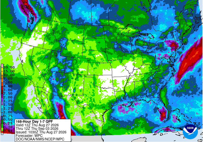
Looking Ahead
Over the next 7 days, upper-level ridging centered over the western U.S. is forecast to progress eastward, shifting hotter conditions to the East while bringing a potential reprieve from extreme temperatures to the West. Excessive heat will persist across the south-central U.S., which may continue to fuel rapid drought expansion and intensification. Enhanced monsoonal convection is favored across Arizona, with moisture extending northward into Utah and parts of the northern Rockies, while light, early-season precipitation may overspread southern California. Forecast precipitation amounts across the South region would be insufficient to offset ongoing moisture deficits. Across the Midwest, light to locally moderate precipitation is expected. Seasonal convection will linger across the Southeast early in the period before drier conditions move in by the end of the period. Along the Eastern Seaboard, initial storminess will give way to drier conditions, though unsettled weather may return to the Northeast by late week.
For the 8-to-14-day period, below-normal temperatures are favored across the Northwest, while elevated odds for above-normal temperatures extend across much of the remainder of the CONUS. The highest probabilities for excessive heat remain anchored over the south-central and southeastern U.S., maintaining heavy evapotranspirative demand in regions experiencing rapid drought degradation. Above-normal temperatures are also favored across Hawaii and the Alaska Panhandle and southeastern Alaska, while below-normal temperatures are more likely across the rest of Mainland Alaska. The precipitation outlook exhibits a weaker signal for the CONUS, with slightly enhanced chances for above-normal precipitation across the western U.S. and New England, while near-normal precipitation is favored elsewhere. High probabilities for above-normal precipitation extend across Hawaii, with enhanced odds for above-normal rainfall exist across most of Alaska except for the Panhandle.
#Colorado now has more than 200,000 EVs on the road and over 7,500 public charging ports statewide, the new Colorado Byways EV Charging Guide from EV CO (evco.colorado.gov): Electric Vehicles Colorado highlights charging stops along some of Colorado’s most memorable drives #EV
Click the link to go the State of Colorado website to access the guide.

#ColoradoRiver plan orders cuts in the Lower Basin, while relying on voluntary conservation upstream — Stephanie Daniel (KUNC.org) #COriver #aridification #CWCSC2026
Click the link to read the article on the KUNC website (Stephanie Daniel):
August 24, 2026
This story was produced by the Mountain West News Bureau, a collaboration between Boise State Public Radio, Wyoming Public Media, Nevada Public Radio, KUNR in Nevada, KUNC in Northern Colorado, KANW in New Mexico, Colorado Public Radio and KJZZ in Arizona as well as NPR, with support from affiliate newsrooms across the region. Funding for the Mountain West News Bureau is provided in part by the Corporation for Public Broadcasting and Eric and Wendy Schmidt.
Three states are being required to cut their water use under a final plan for managing the Colorado River over the next two years, while the four upstream states are being asked to voluntarily conserve water.
The U.S. Department of the Interior released the Record of Decision for managing the river over the next decade and laying out more specific rules for the next two years. The plan is intended to protect Lake Powell and Lake Mead, which have fallen to historically low levels after years of drought.
Arizona, California and Nevada will have to collectively reduce their water use by 1.25 million acre-feet per year over the next two years, with additional restrictions possible if conditions worsen, according to the plan.
Nevada was the first state to sue the Interior Department over the plan Monday, asking a court to block it.
Colorado, Utah, New Mexico and Wyoming are not subject to mandatory reductions; instead, those states are setting up programs to voluntarily conserve water.
“Under the proposed plan issued by the Department of the Interior, southern Nevada could lose more than 70 percent of its already meager Colorado River allocation while the Upper Basin states of Colorado, Utah, New Mexico, and Wyoming are not required to contribute a drop,” Nevada Governor Joe Lombardo said in a news release on Monday.
Upper Basin officials say their water users already face reductions when drought leaves less water available and that the federal government doesn’t have authority to impose mandatory cuts in their states. But they say the Upper Basin is willing to contribute voluntarily.
“Not because we have to, or that we feel like we legally have to,” Colorado’s river negotiator Becky Mitchell said at a conference last week in Steamboat Springs, “but because the importance of this system and the survival of this system is a responsibility for everyone.”
The federal framework envisions up to 200,000 acre-feet of water per year in Upper Basin contributions when conditions allow. The federal government is dedicating $100 million to the Upper Basin to compensate farmers, cities or other water users to use less. Colorado, Wyoming and Utah are also setting up their own state programs to facilitate participation.
Colorado officials expect applications could open this fall and projects could start next year.
“Our position has been and continues to be that we’re going to be part of the solution,” said Amy Ostdiek, section chief for the Colorado Water Conservation Board at the Steamboat conference. “We’re going to do it in the ways that we can, at the times that we can, but we can’t provide water certainty for our neighbors downstream that we don’t have ourselves.”
Criteria for selecting projects, how water users will be compensated and how the Upper Basin gains credit for conserved water are still being worked out.
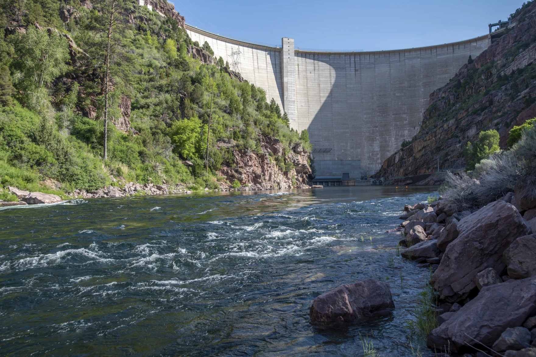
The federal plan also creates a potential “conservation pool” in Lake Powell, allowing the Upper Basin states to store a certain amount of conserved water.
John Berggren, a water policy analyst with the nonprofit Western Resource Advocates, has advocated for a conservation pool and said its inclusion in the federal framework is promising. However, exactly how it would work is not clear.
“How that pool operates, how the water is used, when it’s moved, if it’s moved, who decides that – all that is going to depend on future agreements,” he said.
Some key questions, he said, have to do with what the conserved water is credited towards, such as whether it’s used to offset shortages in the Lower Basin or help the Upper Basin fulfill their legal obligations to deliver water downstream.
The new framework also allows the Upper Basin to come to an agreement with the Interior Department to draw down a few reservoirs when Lake Powell nears getting too low for hydropower. That started happening this year, with water released from Flaming Gorge Reservoir in Wyoming.

Summer samplings uncover no new zebra mussels in #ColoradoRiver system, but the battle wages on: Six Western Slope waters remain infested with the invasive species, as Colorado Parks and Wildlife focuses on containment and education — The #Aspen Times #COriver #aridification

Click the link to read the article on The Aspen Times website (Ali Longwell). Here’s an excerpt:
August 25, 2026
After 2025 saw a flurry of zebra mussel detections in the Colorado River system, Colorado Parks and Wildlife’s weekly sampling this summer has led to zero new discoveries of the invasive species. This does not mean, however, that zebra mussels — notorious for their prolific reproduction and destruction of ecosystems and infrastructure — are gone from the basin or that the battle to curb their spread is over. When zebra mussels establish a presence in a body of water, they multiply quickly. A single zebra mussel can produce up to 30,000 veligers — their microscopic, free-floating larvae — in one spawning event and up to one million in a year. As they root and attach to hard surfaces — like docks, rocks and pipes — and their density increases, they can cause significant damage and clogging to water infrastructure…
This summer, Parks and Wildlife has continued weekly sampling in the Colorado River from its headwaters near Granby to the Colorado-Utah state line, according to Robert Walters, Colorado Parks and Wildlife’s invasive species program manager…Walters said the agency has taken over 500 plankton tow samples since May, not only in the Colorado River, but in its major tributaries including the Gunnison, Roaring Fork and Eagle rivers…Despite the lack of discoveries, the Colorado River, from its confluence with the Eagle River to the state border with Utah, remains one of six bodies of water that are considered infested with the highly invasive zebra mussels. A body of water is considered “infested” when adult and veliger zebra mussels have been found in it. In Colorado, for a body to no longer be considered infested, it must have five consecutive years without detections of that species, according to Walters. The five-year clock resets at each detection.