
Click on a thumbnail graphic to view a gallery of drought data from the US Drought Monitor website.
Click the link to go to the US Drought Monitor website. Here’s an excerpt:
This Week’s Drought Summary
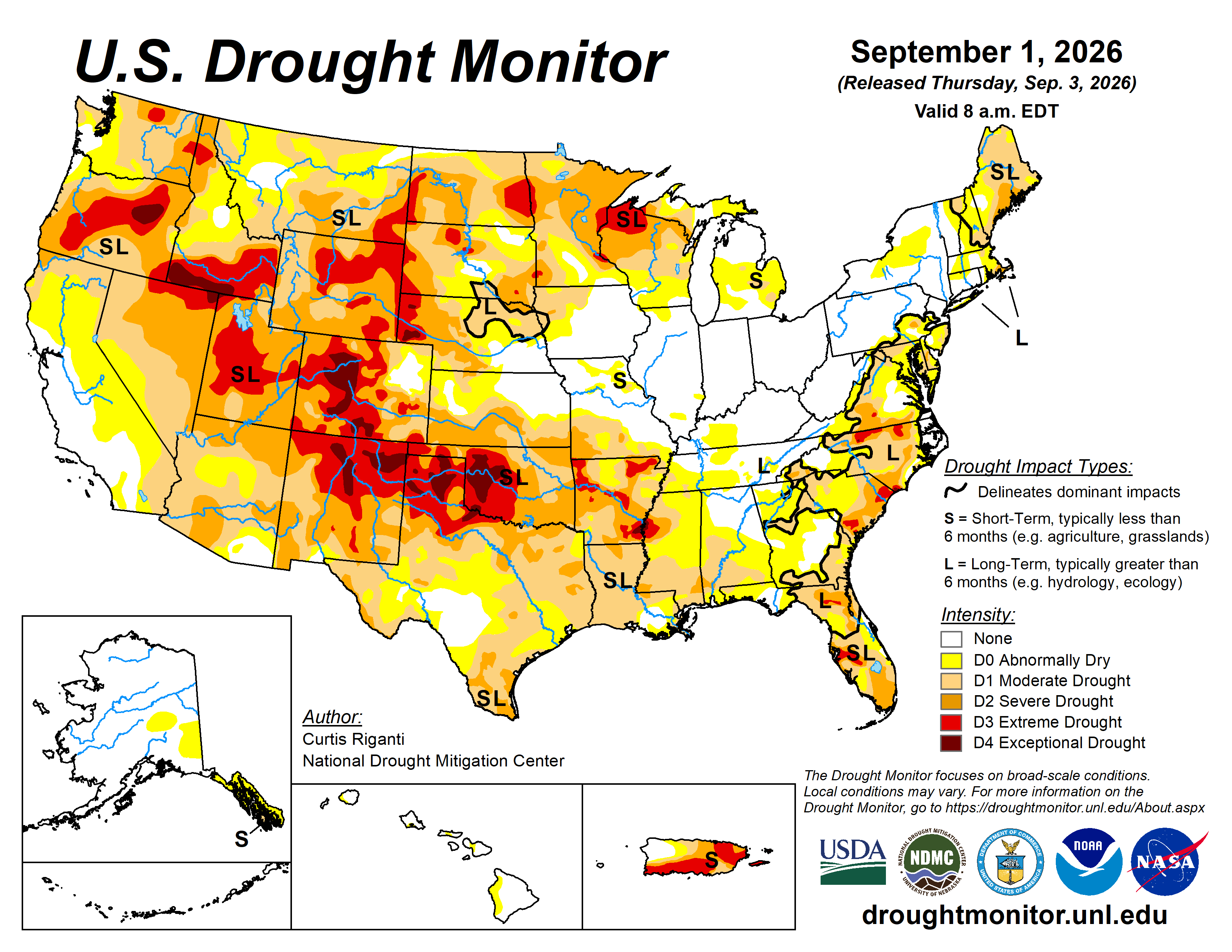
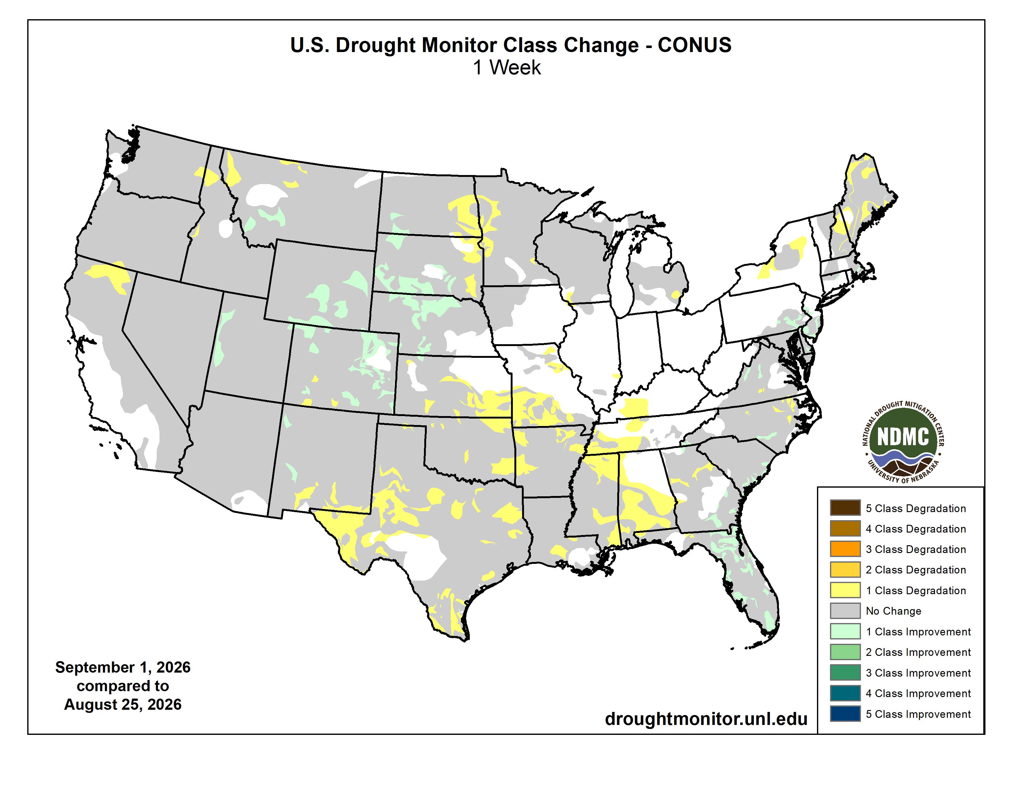
Dry weather continued this week across much of the central U.S., especially from the southern Great Plains to the Mississippi River Valley and Corn Belt. Flash drought conditions were occurring across a large area spanning from Texas northeastward to Oklahoma and southern Kansas, southern Missouri, Arkansas, northern Mississippi and portions of far western Tennessee. Due to the drier- and warmer-than-normal weather in most of these areas, drought and abnormal dryness expanded and intensified in many areas, as widespread adverse impacts to agriculture continued and fire danger continued to grow in some areas. Widespread showers and thunderstorms, some locally heavy, dotted parts of the Northeast and Southeast regions, leading to localized improvements to ongoing drought or abnormal dryness. Some areas that missed out on the rains saw conditions worsen. Hot and dry weather continued near the borders of the Dakotas with Minnesota, leading to worsening drought conditions. Widespread improvements occurred in some areas from Wyoming and the plains of eastern Colorado northeast into the Nebraska Sandhills and southern South Dakota, where either heavy rainfall this week improved conditions or conditions were reassessed following recent heavier rains. Recent hot and dry weather, combined with a lack of winter snowpack, led to the expansion of moderate drought in northern California. Heavy rainfall associated with the remnants of Tropical Storm Dolly in eastern Puerto Rico led to a few improvements there, though widespread severe and extreme drought continued across much of Puerto Rico. Recent rainfall led to the removal of short-term moderate drought from Alaska’s Central Interior…
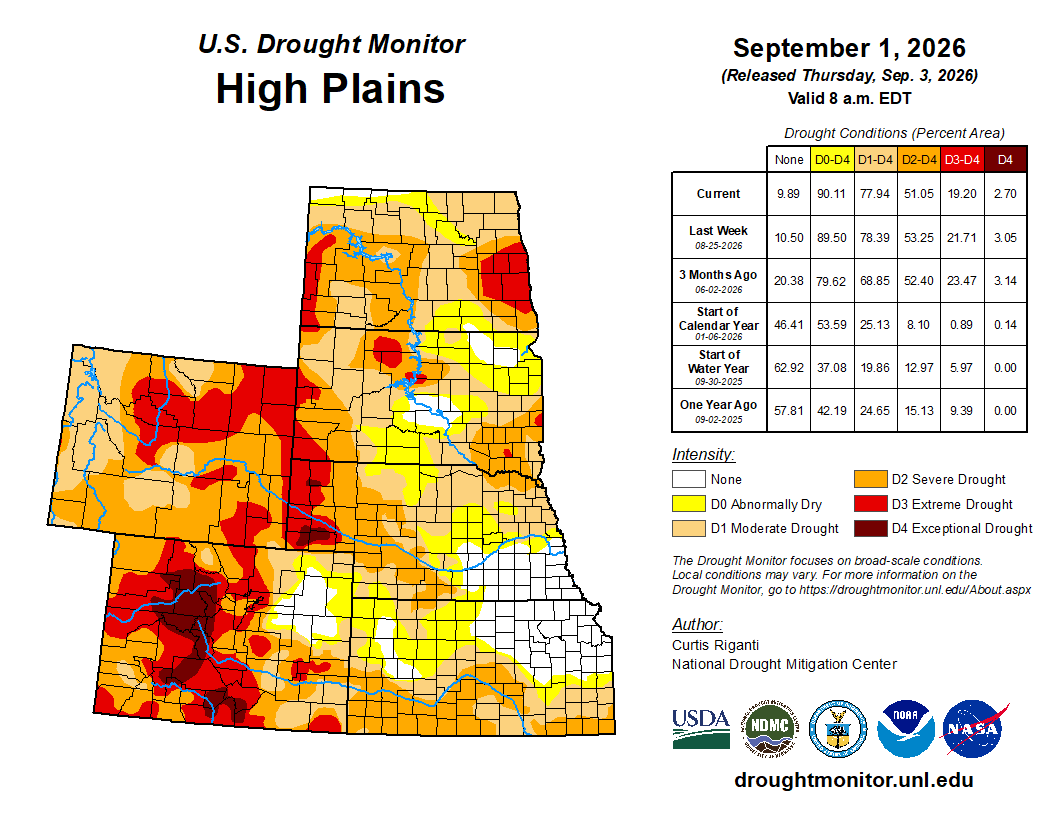
High Plains
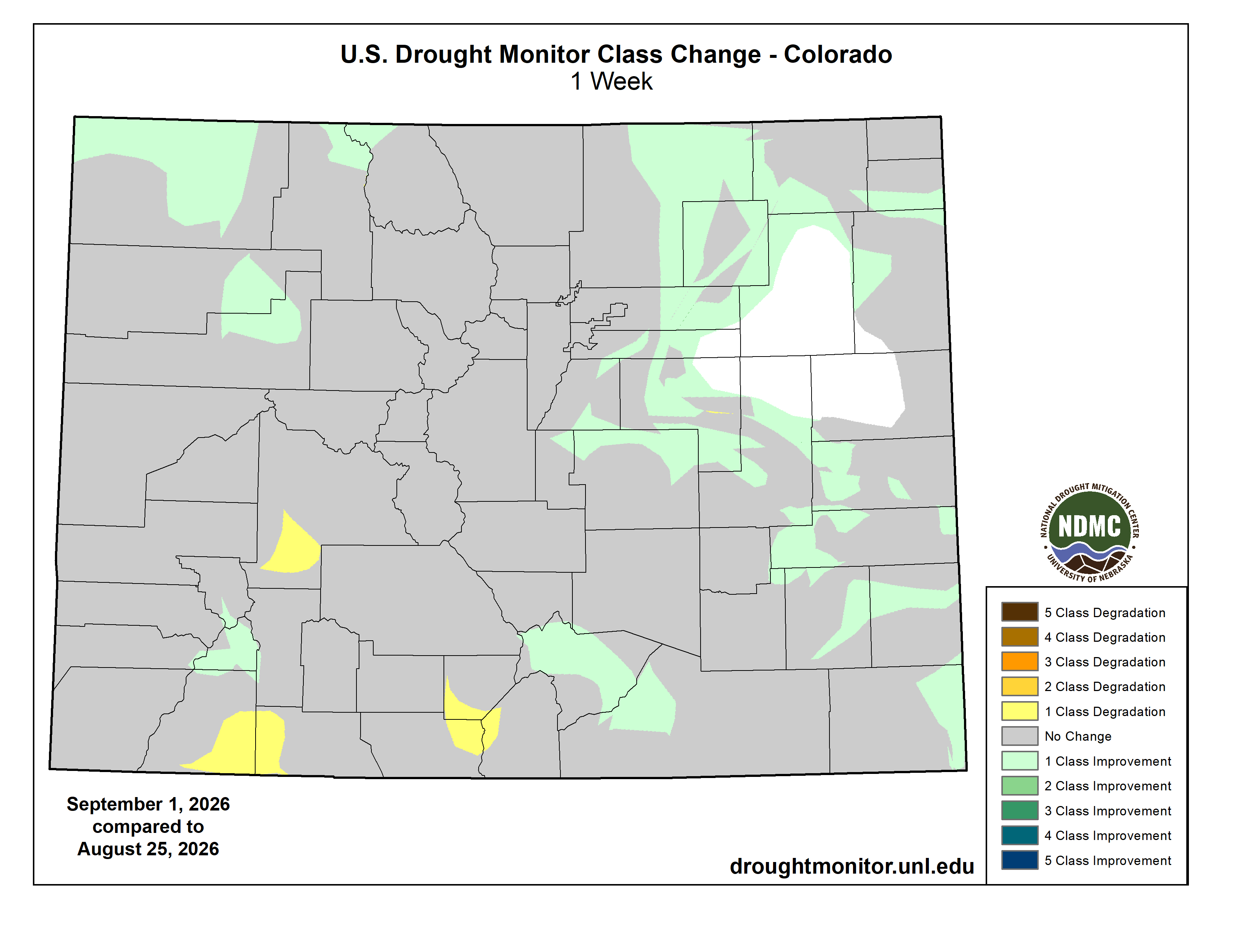
A swath of 0.5-2 inches of rain fell from parts of western Nebraska and western Kansas into portions of Colorado and Wyoming. Scattered similar rain amounts also fell in portions of east-central and northern South Dakota, as well as in parts of central and western North Dakota. The impacts of recent rainfall in southern South Dakota and the Nebraska Sandhills were re-evaluated this week, and widespread improvements were made as soil moisture and streamflow locally improved, while short-term rainfall deficits were alleviated. Long-term precipitation deficits and their impacts continued across much of this region, and abnormal dryness and long-term moderate drought remained. Scattered improvements to drought also occurred from southern and eastern Wyoming into the western Dakotas and much of eastern Colorado. Short-term precipitation deficits improved in these areas, with some improvement in soil moisture and streamflow, leading to improvements in drought conditions. Streamflow still remains low across portions of the western High Plains region given the poor high elevation snows and warm temperatures during the water year. Temperatures across the region were hotter than normal, especially in Kansas, where temperatures ranged mostly from 6-10 degrees above normal, resulting in high atmospheric demand for moisture in southeast Kansas…
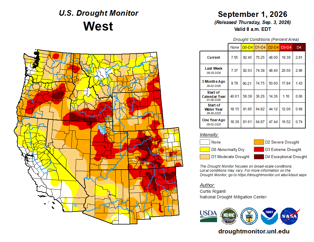
West
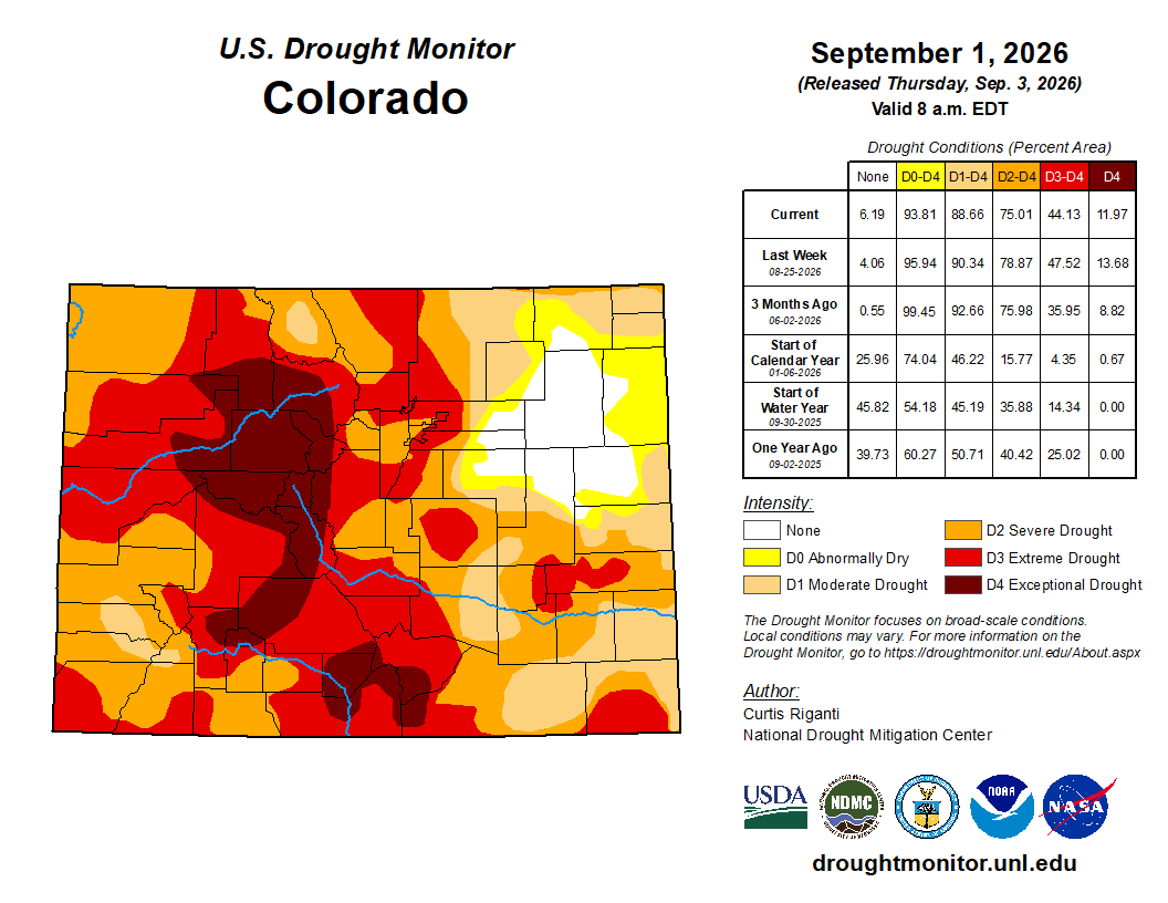
Locally heavy rains from the North American Monsoon fell in parts of Arizona, Utah and the Rocky Mountains in Colorado. Parts of Colorado to the west of the Front Range saw conditions improve given recent rainfall, though widespread short- and long-term drought remained across central and western Colorado. In a few areas in south-central and southwest Colorado that missed out on heavier rains, long-term precipitation deficits grew even worse. Temperatures from 4–6 degrees above normal also kept atmospheric thirst high, and extreme and exceptional drought locally expanded. Short-term precipitation deficits and poor streamflow in some areas led to drought degradation in parts of the Idaho Panhandle, the Spokane, Wash., area, and nearby northwest Montana. Short-term dryness and warmth in northern California led to the expansion of moderate drought there. Moderate drought locally expanded in north-central Montana where short-term rainfall deficits grew and soil moisture declined in a few areas. Recent precipitation in southwest Montana led to improvements in mid- to long-term precipitation deficits and overall conditions, and moderate drought coverage decreased. Recent precipitation in western Utah helped to lessen long-term precipitation deficits, and extreme drought coverage lessened slightly. Temperatures were warmer than normal across much of the West, excluding areas from western Nevada and far northern California through Oregon and Washington. In the rest of the region, temperatures were mostly at least 2-4 degrees above normal, with many areas 4-10 degrees warmer than normal…
South
Widespread expansion or worsening of ongoing drought or abnormal dryness occurred across the South, especially in parts of Mississippi, Texas, eastern Oklahoma and portions of Arkansas. Heavier rains, locally over 2 inches, fell in southeast Louisiana and southwest Mississippi. Otherwise, weather conditions were mostly drier, with many areas receiving less than a half inch of rainfall and some receiving none at all. Temperatures were warmer than normal across most of the region, especially in Oklahoma and the northern half of Texas, where temperatures were 6-10 degrees hotter than normal. This continued a very hot August across much of Oklahoma. Degradations in drought conditions were especially prevalent in southwestern and northern Texas, deep south Texas, northern Mississippi and eastern Oklahoma, as ongoing hot and dry weather worsened conditions in areas already suffering a myriad of drought impacts. Burn bans were enacted across much of western Oklahoma, while Oxford, Miss., residents were asked to conserve water due to high water demand and recent extreme heat. Streamflow across much of central and western Oklahoma and northern Texas was quite low, along with low soil moisture and intense short-term precipitation deficits…
Looking Ahead
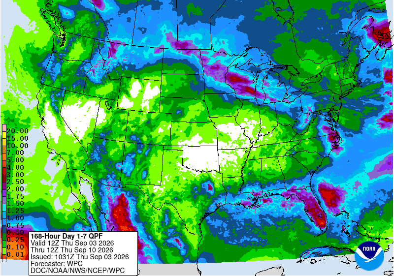
Through the evening of Monday, Sept. 7, the National Weather Service Weather Prediction Center is forecasting dry weather to continue across much of the central and south-central U.S., especially from southeast Nebraska through Oklahoma, Arkansas and western north Texas into southwest Texas and eastern New Mexico and Colorado. Heavier precipitation amounts through Monday evening will likely be confined to parts of the southeastern and northern Lower 48. Heavy rain is forecasted, or occurring on Wednesday afternoon, in east-central and southeast Texas, while the remnants of Tropical Storm Edouard pass through. Heavier rain is also forecast across the central and eastern Gulf Coast and Florida Peninsula. Rain amounts from southern Louisiana to near Panama City may approach 1-2 inches, while heavier rain amounts, locally 2-3 inches or more, are forecast in the Florida Peninsula. Heavier precipitation amounts, mostly in the 0.75-2 inch range, are also forecast in parts of the Pacific Northwest, northern Idaho, northern parts of Montana and North Dakota, and from Minnesota southeastward across Wisconsin and the lower Great Lakes into Pennsylvania and New York.
The National Weather Service Climate Prediction Center’s 6-10 day outlooks, covering Sept. 8-12, favors warmer-than-normal temperatures across much of the central and eastern U.S. The highest confidence for above-normal temperatures is centered around Kansas City and the mid-lower Missouri River Valley southward to the central and western Gulf Coast. Near-normal temperatures are favored in the western half of the West, with below-normal temperatures slightly favored in western Nevada and adjacent parts of California and Oregon. Near- or below-normal temperatures are also favored in central and northern New England. Above-normal precipitation is favored across much of the Great Plains and western U.S., especially from the Continental Divide into the Great Basin and in northern Minnesota and environs. Above-normal precipitation is also slightly favored in east-central Florida. The forecast favors drier-than-normal weather in the Tennessee and Ohio River Valleys and from Lake Erie to southern parts of the Northeast.
In Hawaii, both precipitation and temperatures are expected to be above normal for Sept. 8–12. Above-normal precipitation is also favored across large parts of Alaska, except for the northwest portion of the state and the central Aleutian Islands. Above-normal temperatures are favored in southeast and central Alaska and in the central Aleutian Islands, while near-normal temperatures are favored in northeast and southwest Alaska and the eastern Aleutian Islands.
Just for grins, here’s a slideshow of early September US Drought Monitor maps for the past few years.
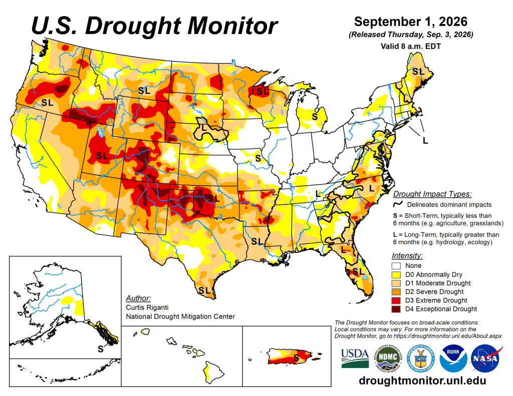
US Drought Monitor map September 1, 2026. 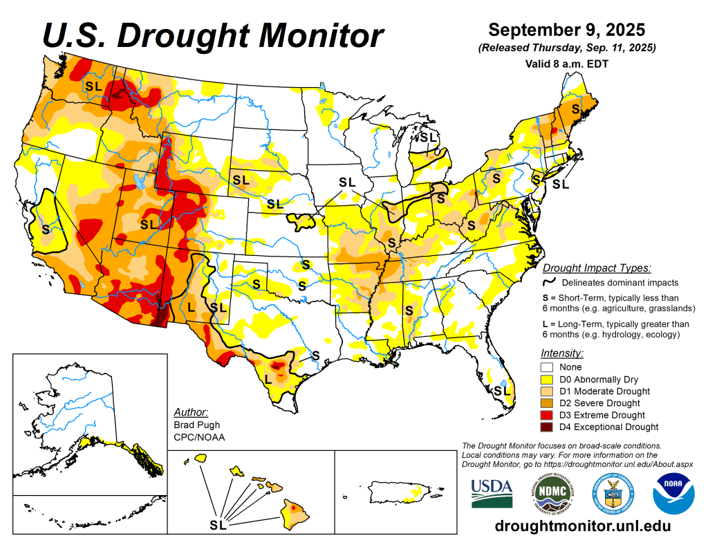
US Drought Monitor map September 9, 2025. 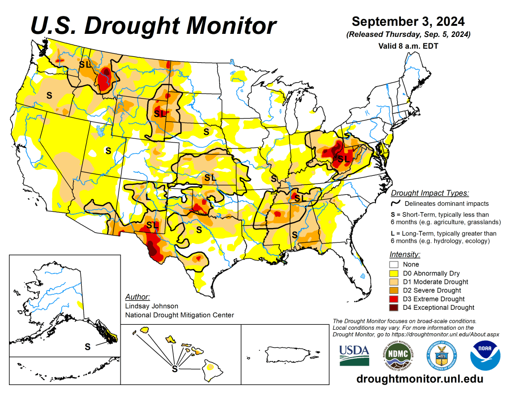
US Drought Monitor map September 3, 2024. 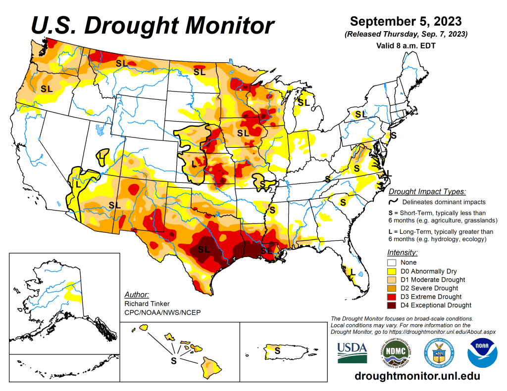
US Drought Monitor map September 5, 2023. 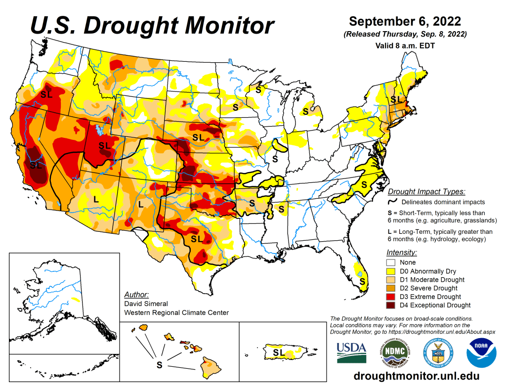
US Drought Monitor map September 6, 2022. 
US Drought Monitor map September 7, 2021. 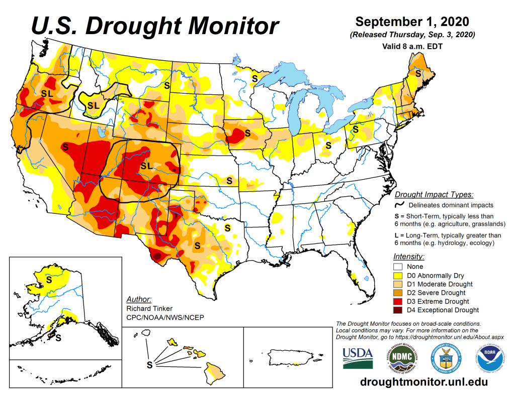
US Drought Monitor September 1, 2020. 
US Drought Monitor September 3, 2019. 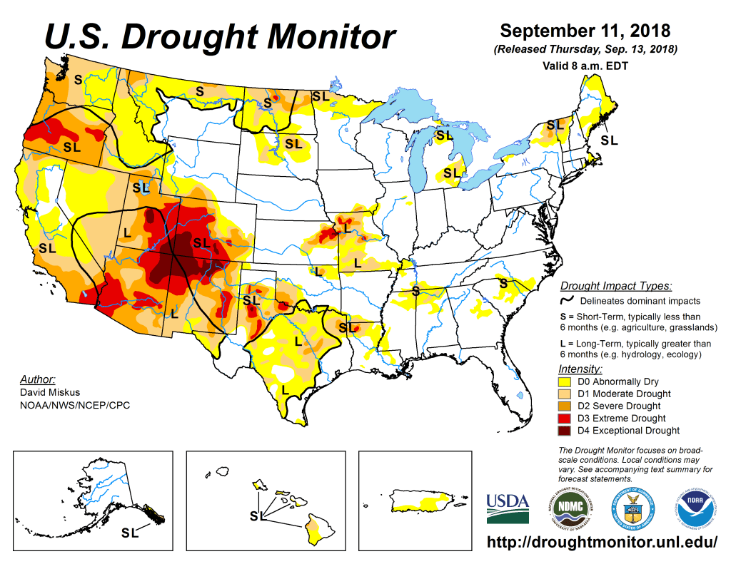
US Drought Monitor September 11, 2018. 
US Drought Monitor September 5, 2017. 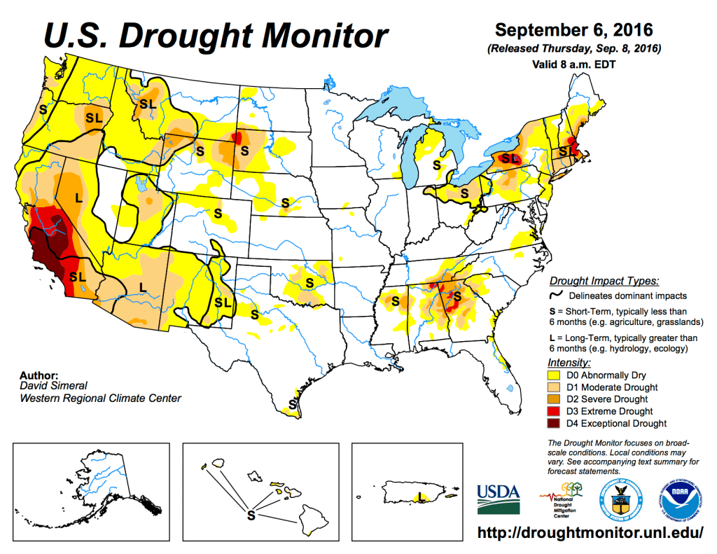
US Drought Monitor September 6, 2016. 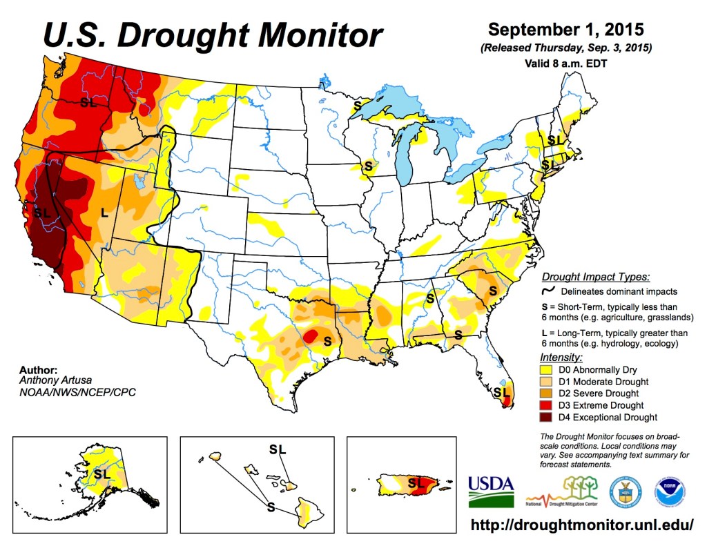
US Drought Monitor September 1, 2015 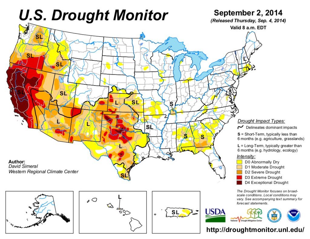
US Drought Monitor September 2, 2014 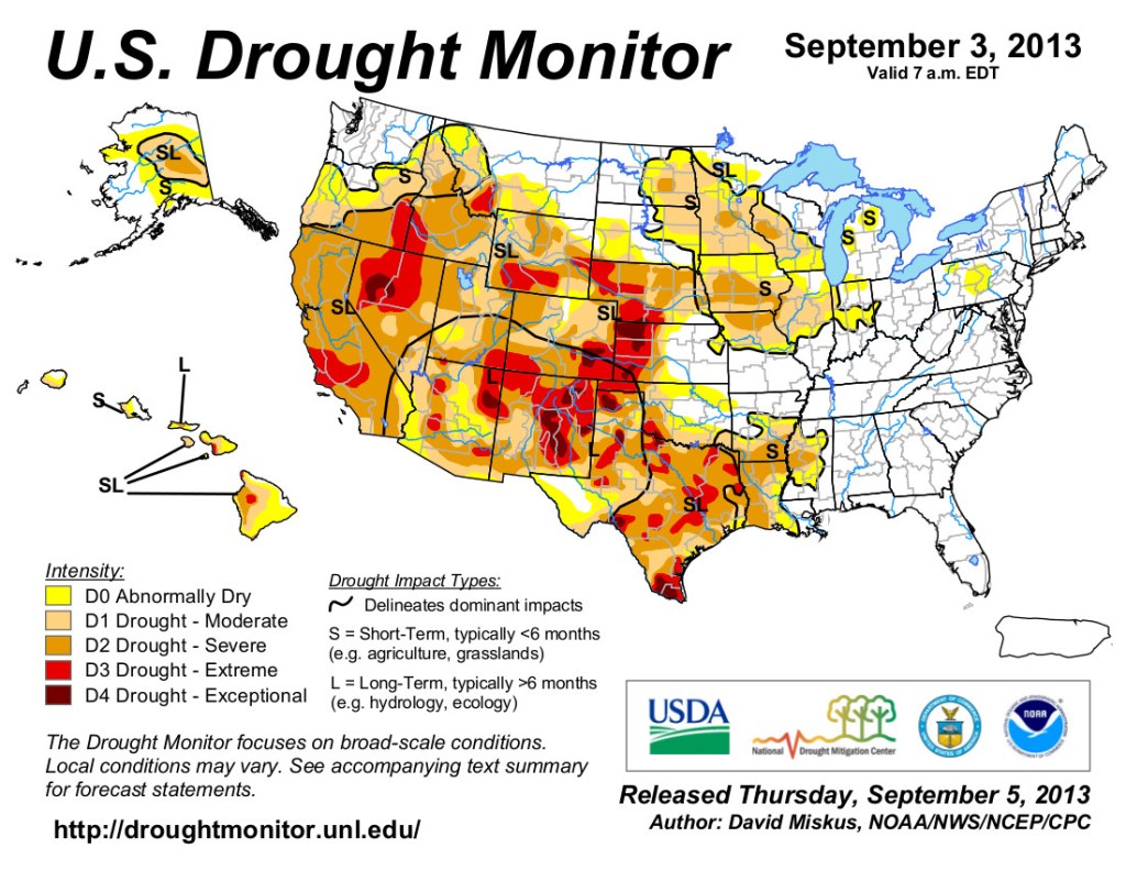
US Drought Monitor map September 3, 2013. 
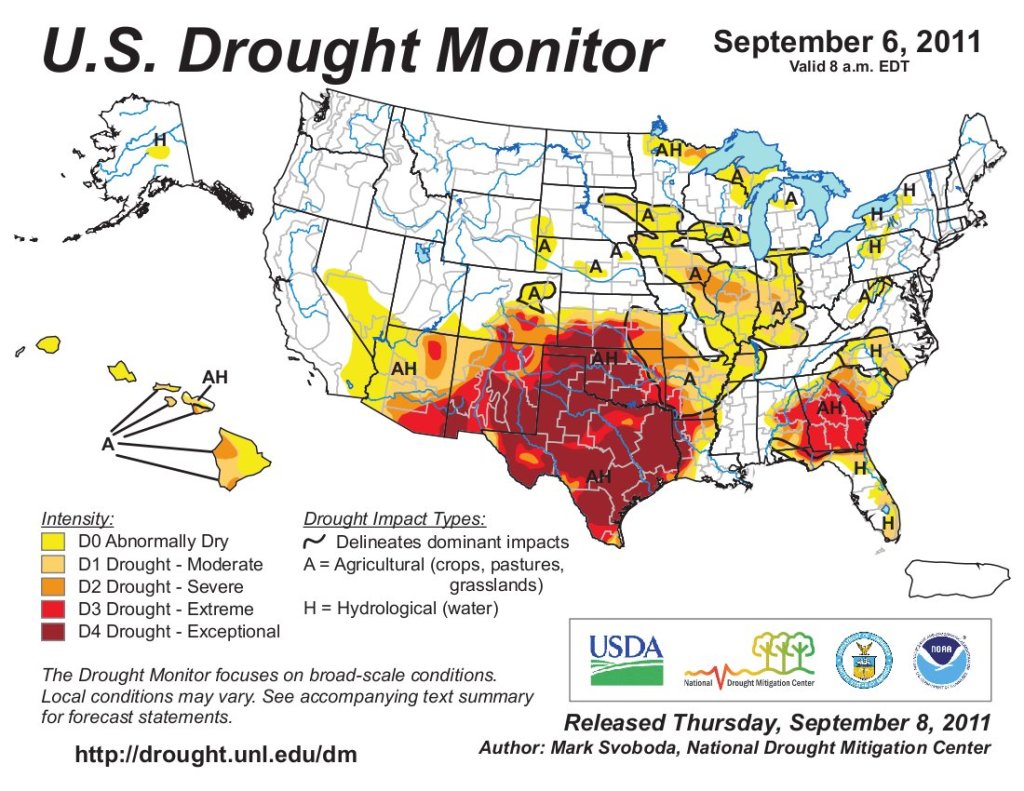
US Drought Monitor map September 6, 2011. 
US Drought Monitor map September 14, 2010.