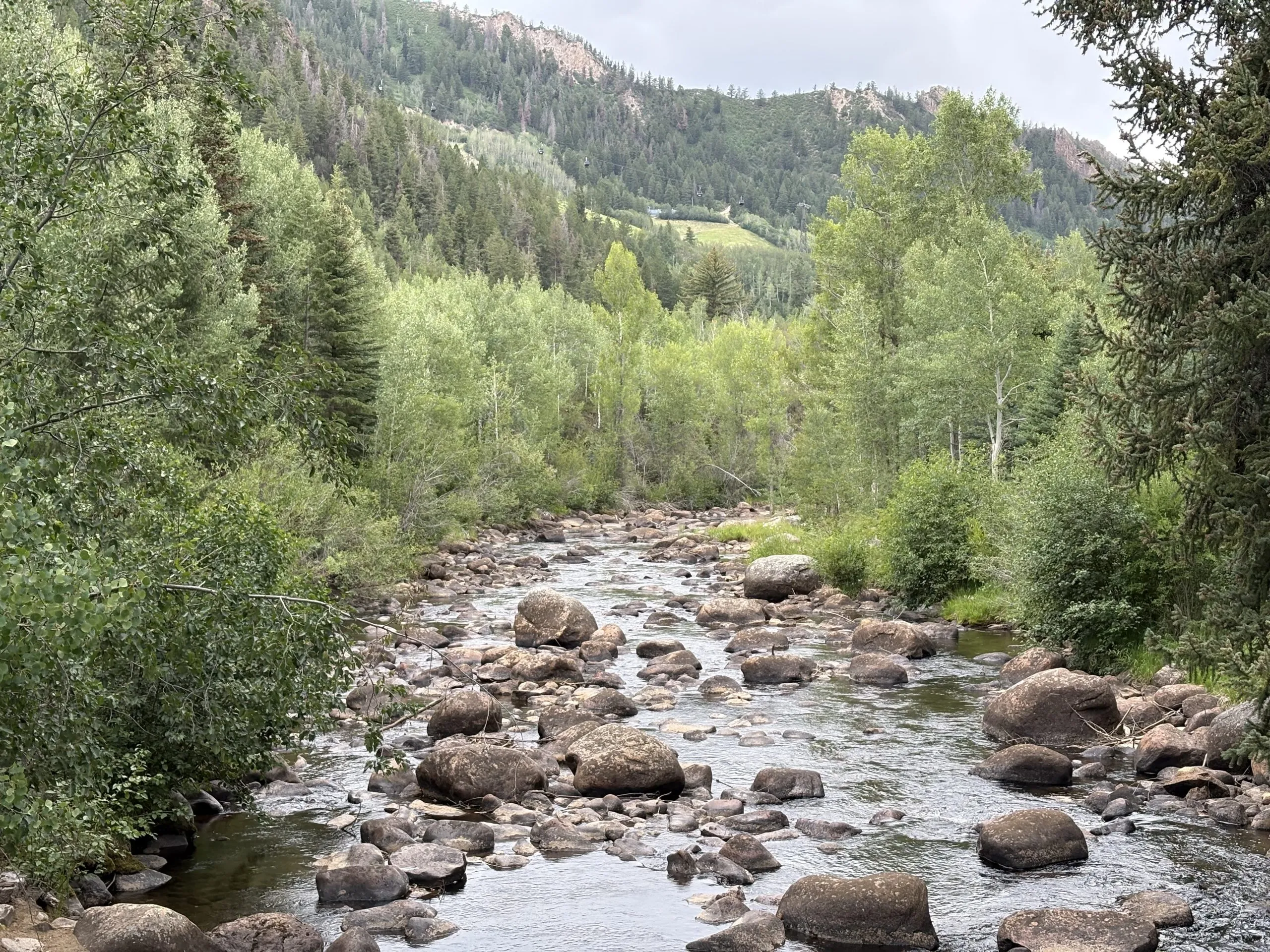
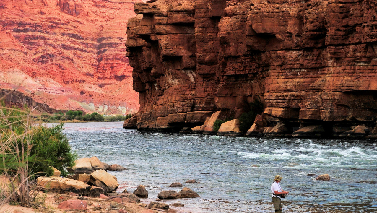
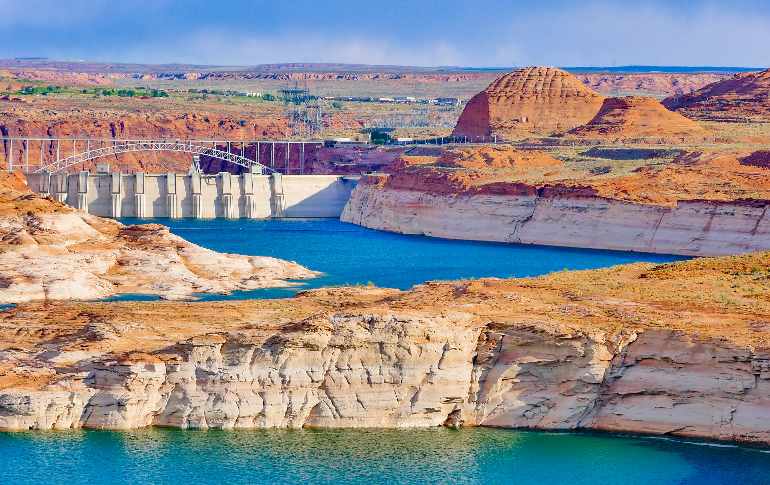
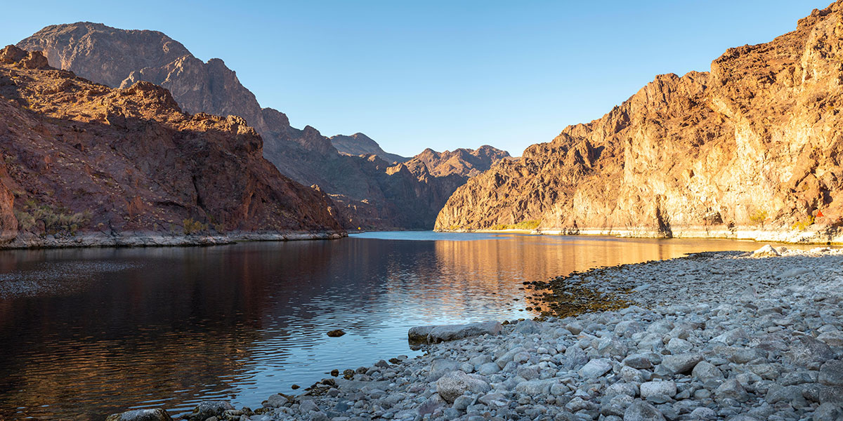
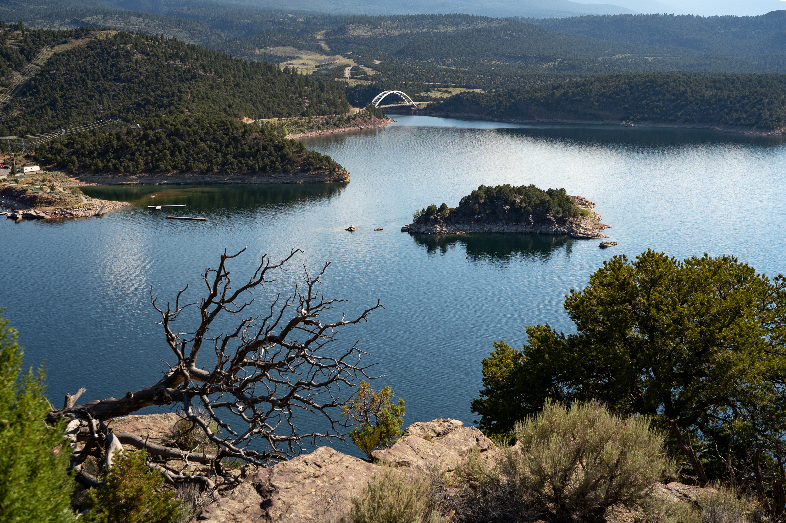
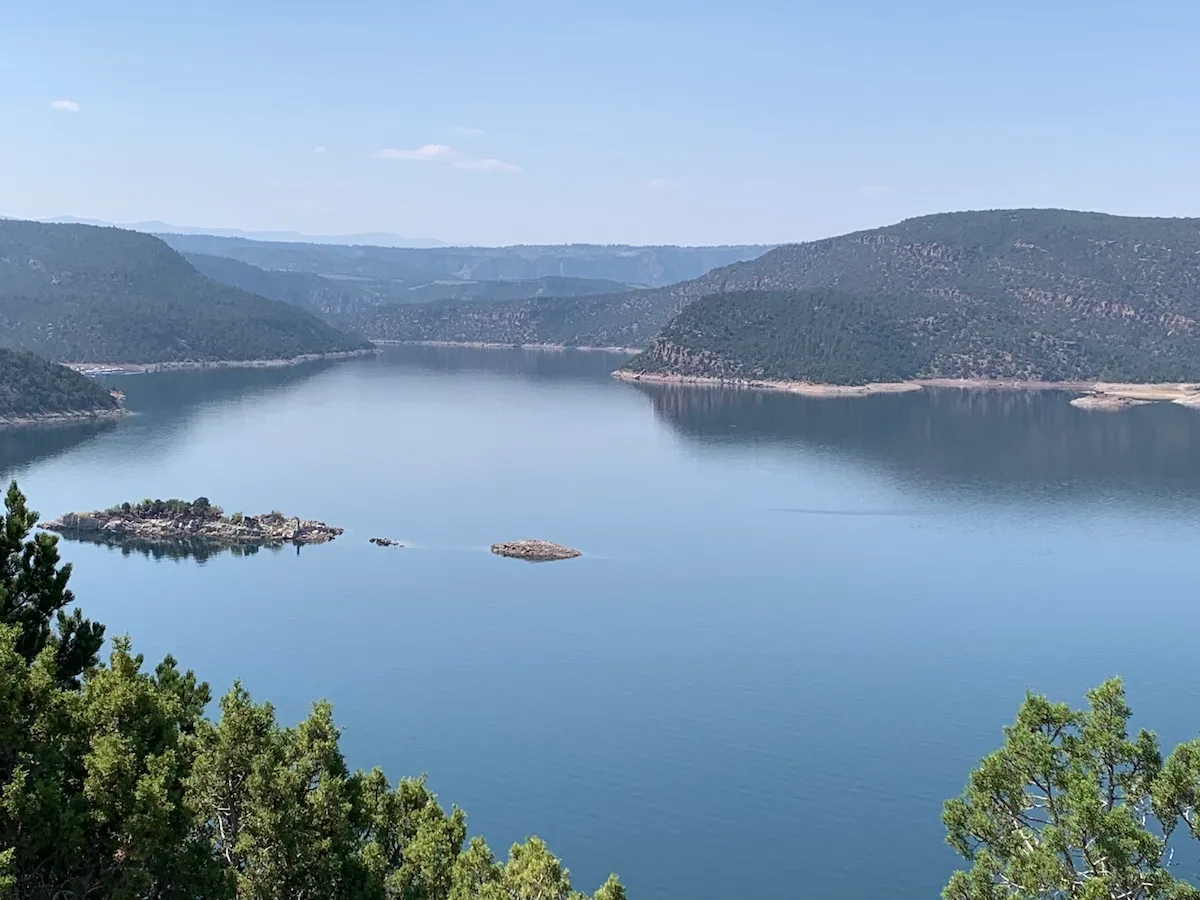
The Roaring Fork River in Aspen on July 8. Pitkin County Commissioners gave initial approval to buying more shares of Twin Lakes water to boost low flows on the Fork. CREDIT: HEATHER SACKETT/ASPEN JOURNALISM
Against the recommendation of an advisory board, Pitkin County commissioners on Wednesday gave preliminary approval to buy more water to boost flows in the often-depleted Roaring Fork River.
Commissioners approved on first reading a resolution and ordinance to spend $442,500 to buy 4.68 shares from the Twin Lakes Reservoir & Canal Co., which is about 3.5 acre-feet of water, according to a staff memo. The deal is in addition to the $6.5 million Pitkin County already agreed to spend earlier this year for about 71 acre-feet from Twin Lakes and another ditch company.
Twin Lakes collection system
The water is currently taken across the Continental Divide to the Arkansas River basin to be used by entities on the Front Range. The deal would allow the water to be released out of Grizzly Reservoir to Lincoln Creek and could help boost the Roaring Fork through Aspen and upstream, which suffers from low flows in dry years.
“I think it’s really critical that we purchase water rights when we can, and this is an opportunity that we can, and we should,” District 1 Commissioner Patti Clapper said.
Pitkin County has long had a goal of increasing the amount of water in the Roaring Fork, a river that has about 40% of its headwaters diverted to the eastern side of the state through the Independence Pass Transmountain Diversion System to be used by Colorado Springs, Pueblo and Aurora. These diversions can often contribute to the depletion of the Roaring Fork through Aspen, and purchasing Twin Lakes water represents a rare opportunity to return water to the Western Slope.
Commissioner Greg Poschman said he supports acquiring the water shares.
“I think it’s great that we are doing this,” he said. “I know it’s expensive; there are some raised eyebrows about that, but I think this is something we have to do.”
Poschman added that he was concerned that the Healthy Rivers board members recommended against buying more water and said he would like to fully understand their reasons. County staff said they were trying to schedule a joint meeting with the Board of County Commissioners and the Healthy Rivers board in August.
Members of the county’s Healthy Rivers board, which advises the BOCC, are concerned that the water will have a small impact on river health but a big impact on the program’s budget. The board held a special meeting June 25 to consider acquiring the shares and approved a motion saying the water yield would potentially be only 1 additional cubic feet per second for two days.
“Additionally, the deleterious effects of the purchase price on the long-term fund balance of the Healthy Rivers Fund will reduce the Healthy Rivers Program’s ability to support programs to address other ballot measure mandates, including water quality, ecological health, recreation opportunities, wildlife and riparian habitat, and promoting water conservation,” the motion reads.
The motion goes on to say that in the future, the county should implement a framework for evaluating the true value of water shares to the Roaring Fork.
At Wednesday’s meeting, County Budget Director Connie Baker told the BOCC that the Healthy Rivers board will have to trim or reallocate about $500,000 from next year’s budget to account for the combined impact of this year’s two water purchases.
Healthy Rivers board member Ned Andrews said he is against the purchase, citing the impact that it will have on the program’s budget.
“None of the analysis or details that would justify such a purchase or a strategy going forward has been done,” Andrews told Aspen Journalism. “I think before you commit essentially a quarter of your budget for the next 15 years, you’d want to have an analysis that shows you what could be accomplished. My gut feeling is that it wouldn’t really accomplish much.”
Andrews also opposed the earlier, larger water share purchase, although the rest of the Healthy Rivers board was supportive.
At their regular June meeting, Healthy Rivers board members went through the budget line by line and considered where they could trim, although those cuts have not yet been finalized.
Spending big bucks in an effort to rescue rivers is not new for Pitkin County, which has spent at least $3.5 million on the Roaring Fork River Park in Basalt, including a water court battle to secure the water right for recreation, several redesigns of problematic waves, and improvements to the riverbank and boat launch.
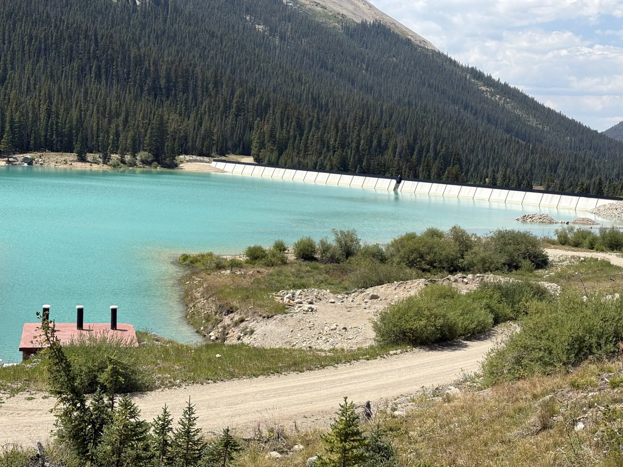
Grizzly Reservoir, a forebay that collects water to send through the Twin Lakes Tunnel to the Front Range, sits in the middle of the Lincoln Creek watershed and connects water users on both sides of the Continental Divide. Pitkin County commissioners gave initial approval to a deal that would allow more water to be released from Grizzly for the benefit of the Roaring Fork. CREDIT: HEATHER SACKETT/ASPEN JOURNALISM
Bond for original purchase approved
The BOCC at Wednesday’s meeting also approved issuing a bond for the original purchase of Twin Lakes shares. That deal cost the county $6.5 million, although only 45 of those acre-feet represent Western Slope water that is currently diverted to the Front Range. The county plans to sell or trade the other 26 acre-feet, which is owned by the Fountain Mutual Ditch Co. in El Paso County and decreed for use on the east side of the divide.
The 45 acre-feet of water can be released down the Roaring Fork during the irrigation season when flows are low, and it must be used by a downstream water user on the Colorado River before the town of DeBeque. Instream flow for the benefit of the environment is not a decreed use of the water.
This year, according to Colorado Water Resources Division 5 Engineer Tyler Benton, at least some of Pitkin County’s Twin Lakes water was released as part of the Colorado River Water Conservation District’s emergency substitute water supply plan, which the district enacted in response to this year’s historic drought. Benton said he expects the River District to provide a full accounting of how much Pitkin County water has been released Friday.
Grizzly Reservoir is currently drained for dam maintenance, which may have affected how much water could be released under the River District’s plan.
At a time when drought impacts are being acutely felt across the state and climate change continues to rob rivers of their flows, for some, the unique opportunity to put water back into a depleted stream is worth the cost.
“This is expensive water, but it’s the only water you can get up at the headwaters of the Roaring Fork,” said Pitkin County Deputy Attorney Anne Marie McPhee. “So that scarcity makes it more valuable.”
The issue is scheduled for a public hearing and second reading July 22.
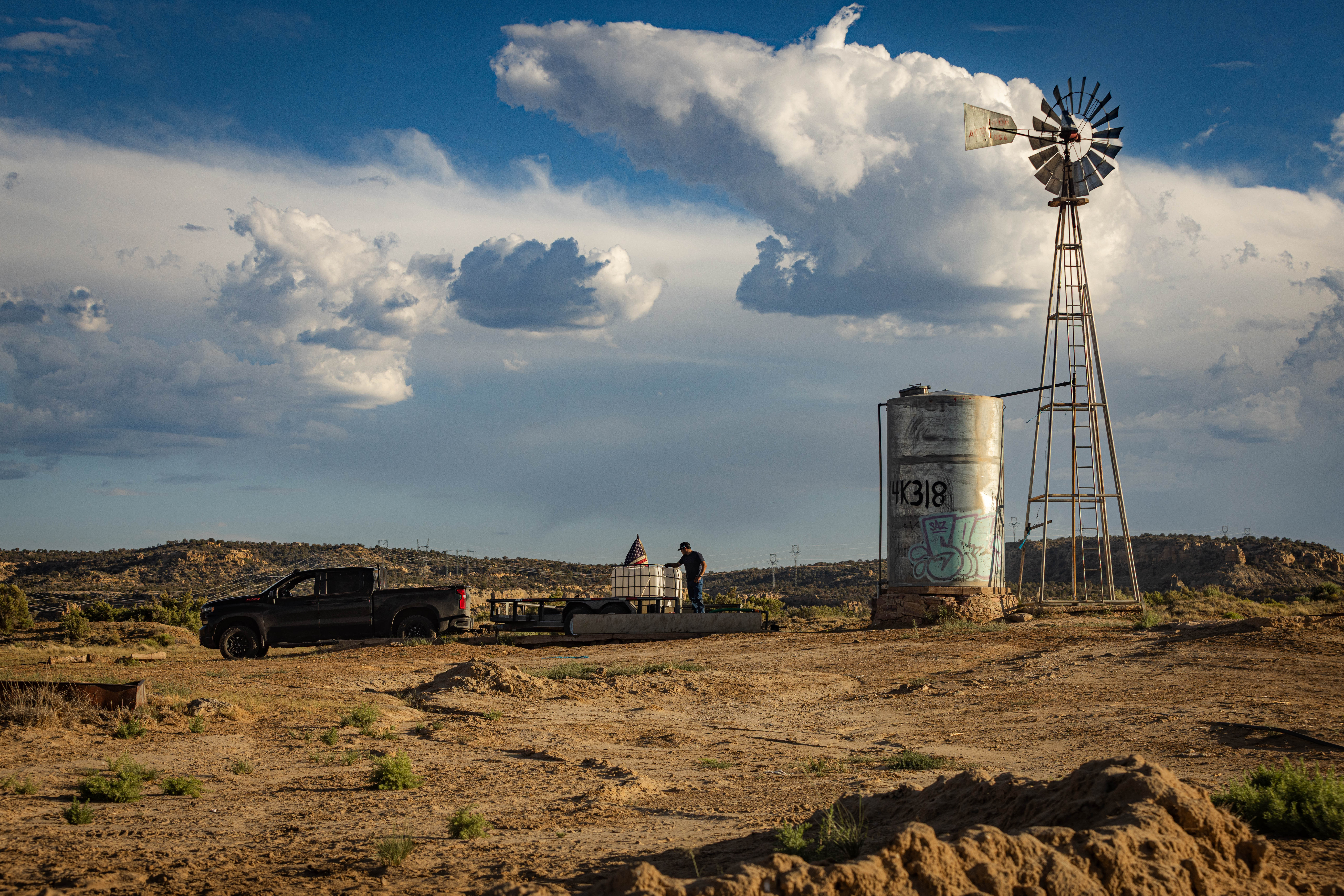
A man fills his water tank at a well a few miles from the Hopi village of Mishongnovi, on the tribe’s northern Arizona reservation.
Click the link to read the article on the Pro-Publica website (Mark Olalde and Alex Hager):
June 29, 2026
ProPublica is a nonprofit newsroom that investigates abuses of power. Sign up for Dispatches, a newsletter that spotlights wrongdoing around the country, to receive our stories in your inbox every week. This story was co-published with KJZZ News-Phoenix.
Reporting Highlights
Certainty on the River: Tribes have negotiated a settlement to resolve the largest outstanding claim to the Colorado River, while providing billions of dollars for water infrastructure.
Upper Hand: Colorado, New Mexico, Utah and Wyoming — the Upper Basin states — are resisting the deal because it allows the Navajo and Hopi to lease water outside their reservations.
Unfulfilled Promise: It has been 118 years since the Supreme Court ruled that the federal government owes tribes water, but many are still fighting to resolve their rights.
These highlights were written by the reporters and editors who worked on this story.
A deal to bring Colorado River water to Native American communities in northern Arizona, where a third of homes lack running water, is being blocked by neighboring states, caught up in a broader battle over how to divide the dwindling river.
The largest tribal water rights settlement in U.S. history — the product of decades of negotiations to secure water for the Navajo Nation, Hopi Tribe and San Juan Southern Paiute Tribe — was on the verge of being realized before Colorado, New Mexico, Utah and Wyoming stepped in to oppose it being codified by Congress.
Those four states, known collectively as the Upper Basin, are at a stalemate with the Lower Basin states of Arizona, California and Nevada over new rules governing how they share the Colorado River, a key water source for nearly 40 million people. Congress and the White House, under both Democratic and Republican leadership, have declined to approve the settlement until all parties reach an agreement.
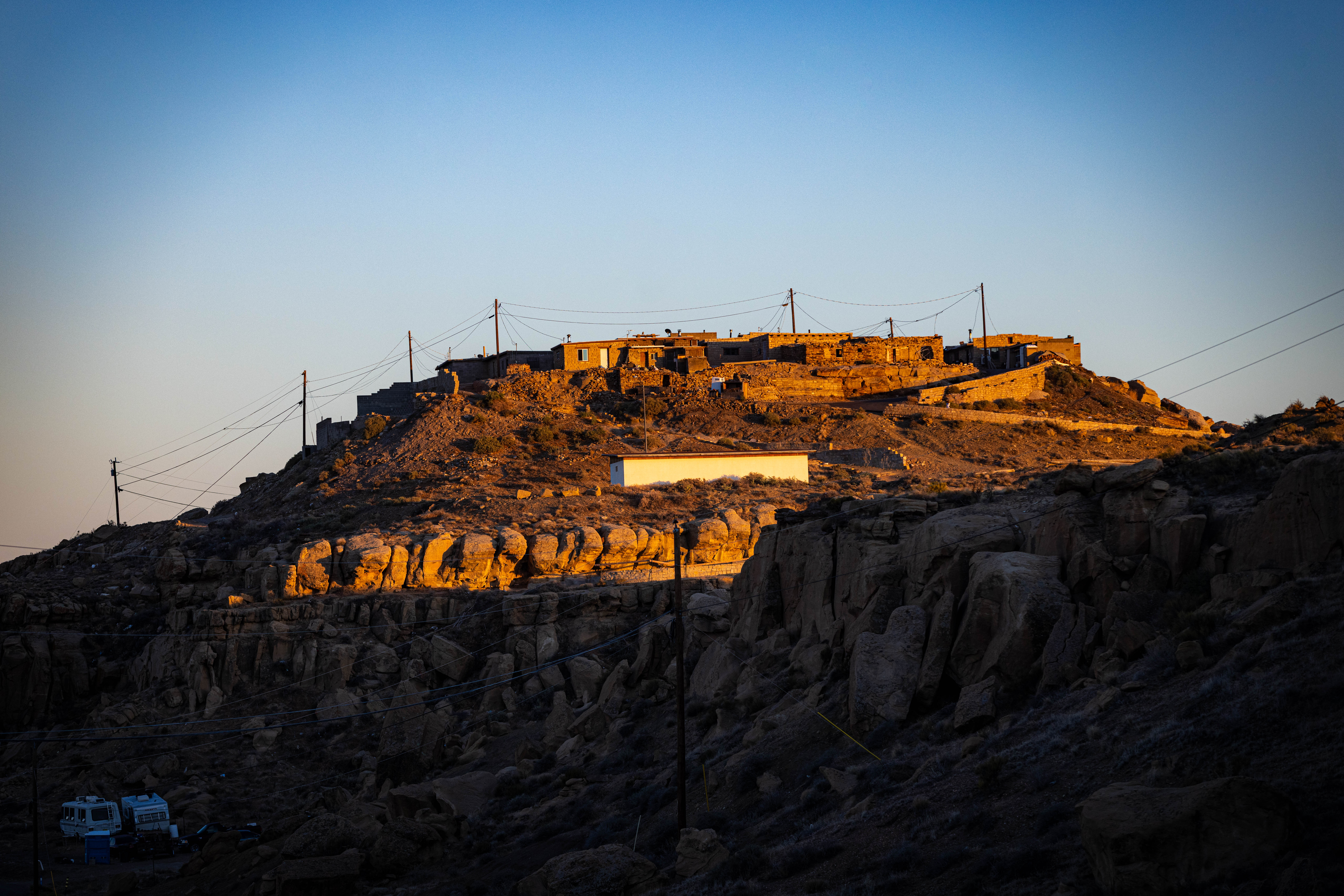
For 83-year-old Marilyn Tewa, the stalemate means her family will continue to go without running water. Tewa serves on the Hopi Tribal Council, where her duties include working on the water rights agreement, but her village of Mishongnovi, on the tribe’s northern Arizona reservation, lacks indoor plumbing.
Every other day, she loads 5-gallon buckets into her pickup and drives 5 miles to a windmill originally built for livestock that draws untreated water from underground.
“That’s what keeps us alive,” Tewa said, tapping the spigot on a May afternoon.
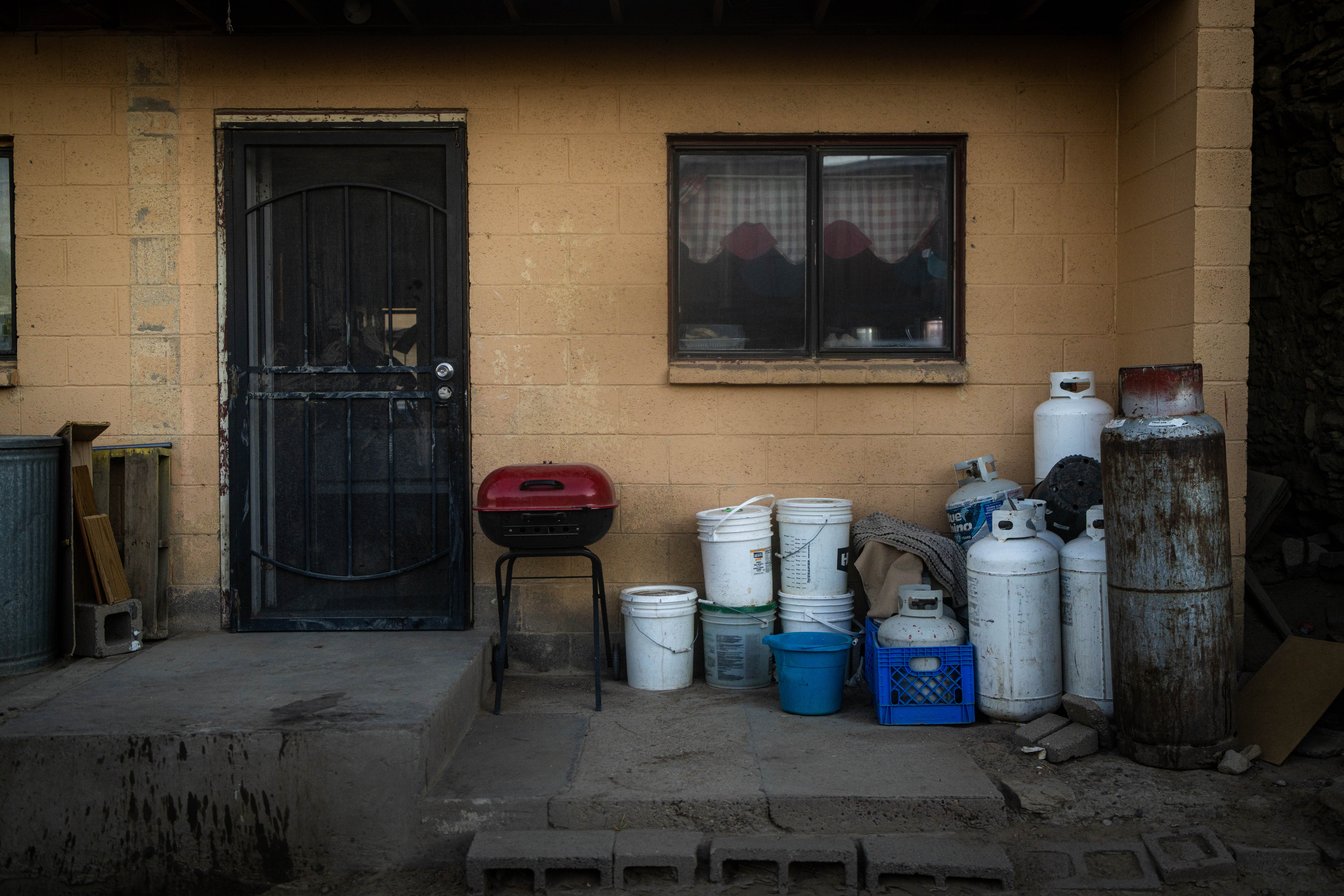
Back home, Tewa bustled about her kitchen while her daughter kneaded dough for dinner. There’s no faucet in the kitchen, which is decorated with a framed American flag and a painting of a katsina, a figure with spiritual significance in Hopi culture. Instead, the family stores water in large plastic containers. Because of the lack of indoor plumbing, the Tewa family and its neighbors use portable toilets that stand among the houses.
If passed into law, the Northeastern Arizona Indian Water Rights Settlement Actwould resolve the largest outstanding claim on the Colorado River while providing about $5 billion in federal funding to build infrastructure to transport the water across the reservations. The legislation would also go beyond water rights, creating a reservation for the San Juan Southern Paiute. The tribe’s effort to secure a permanent homeland was added to the settlement due to their difficulty getting it through Congress independently.
“That’s my prayer,” Tewa said, “that we get this settlement through for all three tribes.”
Marilyn Tewamain sits in her chair inside her home Saturday afternoon. Photo credit: Sharon Chischilly
The tribes need pipes, pumps and treatment plants to use the water secured through the settlement. To defray the cost beyond the federal government’s expected contribution, the Navajo and Hopi plan to lease some of their water rights, almost certainly to growing towns around Phoenix. The towns would pay to use the tribes’ water for a set number of years.
While the Lower Basin states support the settlement, the Upper Basin states have latched onto this provision in particular as they stand in the way of the settlement.
The Colorado River’s upper and lower basins don’t precisely follow state borders. Some states have portions in both sections, and the line dividing the two basins cuts across northeastern Arizona and directly through the Navajo reservation. If water moves across that line, they argue, the rules governing the river give them veto power over the settlement. (It’s an open legal question whether approval from all seven states is necessary.)
The Upper Basin states fear that, in the future, water they currently control might be leased on an open market. They view any monetary transaction that moves water downstream as setting a precedent that could allow the highest bidder — possibly thirsty cities with money such as Los Angeles, Phoenix and Las Vegas — to buy vast quantities of their water.
In an effort to assuage that concern and close the deal, the Navajo and Hopi made major concessions over the volume of water and length of time they could lease. The tribes also offered to leave some of their water in one of the river’s drought-depleted reservoirs to help keep water levels high enough that it could continue flowing downstream. But the Upper Basin has not wavered in its opposition.
Tewa’s family travels 5 miles each way to haul water in 5-gallon plastic buckets from a well initially drilled for livestock. Photo credit: Sharon Chischilly
ProPublica and KJZZ News-Phoenix reached out to the governor, senators and lead negotiator from every Upper Basin state for comment. Utah’s and Wyoming’s lead negotiators deferred to the letter they co-signed. A spokesperson for New Mexico Gov. Michelle Lujan Grisham said in a statement that the tribes addressed most of the state’s concerns but that questions remain as to whether the water that the tribes would lease to Arizona cities could be counted as part of what the Upper Basin states are legally required to send to the Lower Basin. “New Mexico remains committed to finding a workable solution,” the spokesperson said.
A spokesperson for Colorado Gov. Jared Polis also said the state is “committed to finding a path forward” and pointed to the letter that Becky Mitchell, the state’s lead river negotiator, submitted to Congress. Mitchell wrote that the settlement’s leasing provisions violate laws governing the river and that the state was concerned about what the sale of water across the basin would mean for “the security and certainty” of Colorado’s share of the river.
Heather Tanana is an assistant professor at the University of Denver’s law school, where she focuses on federal Indian law. She is also a citizen of the Navajo Nation and said the Upper Basin is “trying to hide behind” how the river has traditionally been managed rather than find a way to give the tribes access to a resource that is rightfully theirs and one that they need to survive.
“It’s a fundamental human rights issue,” she said.
While negotiations drag on, the three tribes continue waiting for water they say will help them to build more housing, grow sustainable economies, better protect public health and preserve cultural practices.
The Hopi believe their ancestors return as clouds to bring the rain that nourishes their corn, but drought is wracking the region. An overreliance on groundwater has dried up springs that have been used for ceremonies and agriculture for centuries. When the settlement brings more water to the reservation, Tewa said, aquifers will have a chance to recharge, restoring the springs.
“I’m speaking on behalf of my children, my grandchildren and their children that haven’t come yet,” she said. “I hope, in the future, that they will have water.”
The village of Mishongnovi, which Tewa represents on the Hopi Tribal Council, sits atop a rocky mesa. Photo credit: Sharon Chischilly
Tewa washes her hands with untreated water she hauled from a well. Photo credit: Sharon Chischilly
Fighting for Water Since Elvis Was on TV
That the settlement even reached Congress seemed like a small miracle to those involved.
If the tribes were to use every drop to which they are entitled, the system of sharing the river that supports more than $1 trillion in annual economic output would collapse.
“Everybody’s getting free Navajo, Hopi and San Juan Southern Paiute water right now. The seven basin states are all benefiting in the absence of a settlement,” said Ethel Branch, a former Navajo attorney general who was involved in the negotiations, adding that the water had been “stolen for over a century.”
In 1908, the Supreme Court ruled that, if the federal government confined tribes to reservations, then it owed them enough water to sustain an agrarian economy on that land. But securing that promised water, referred to as “Winters rights,”has proven arduous.
Tribes were excluded from the compacts that apportioned the river. The Navajo in particular were barred from joining a seminal case quantifying other users’ rights, and members of the tribe themselves rejected a proposed settlement in 2012 when they viewed the deal as unfair. So the tribe went back to the Supreme Court, asking that the justices force the federal government to quickly settle the claims. The Navajo once again lost, with the court’s majority deciding that their treaty with the U.S. didn’t require the government to take any “affirmative steps” to deliver the water it owed the tribe.
“At each turn, they have received the same answer: ‘Try again,’” Justice Neil Gorsuch wrote of the Navajo in his dissent. “When this routine first began in earnest, Elvis was still making his rounds on The Ed Sullivan Show.”
Arizona politicians and tribal leaders have since concluded that they needed to combine all three tribes’ claims to finally settle their rights.
That was no simple feat. The Navajo and Hopi have long had a contentious relationship. Underlining their thorny partnership, leaders of various tribes around the region have accused Navajo, the largest tribal nation in the U.S., of flexing their political strength to the detriment of other tribes.
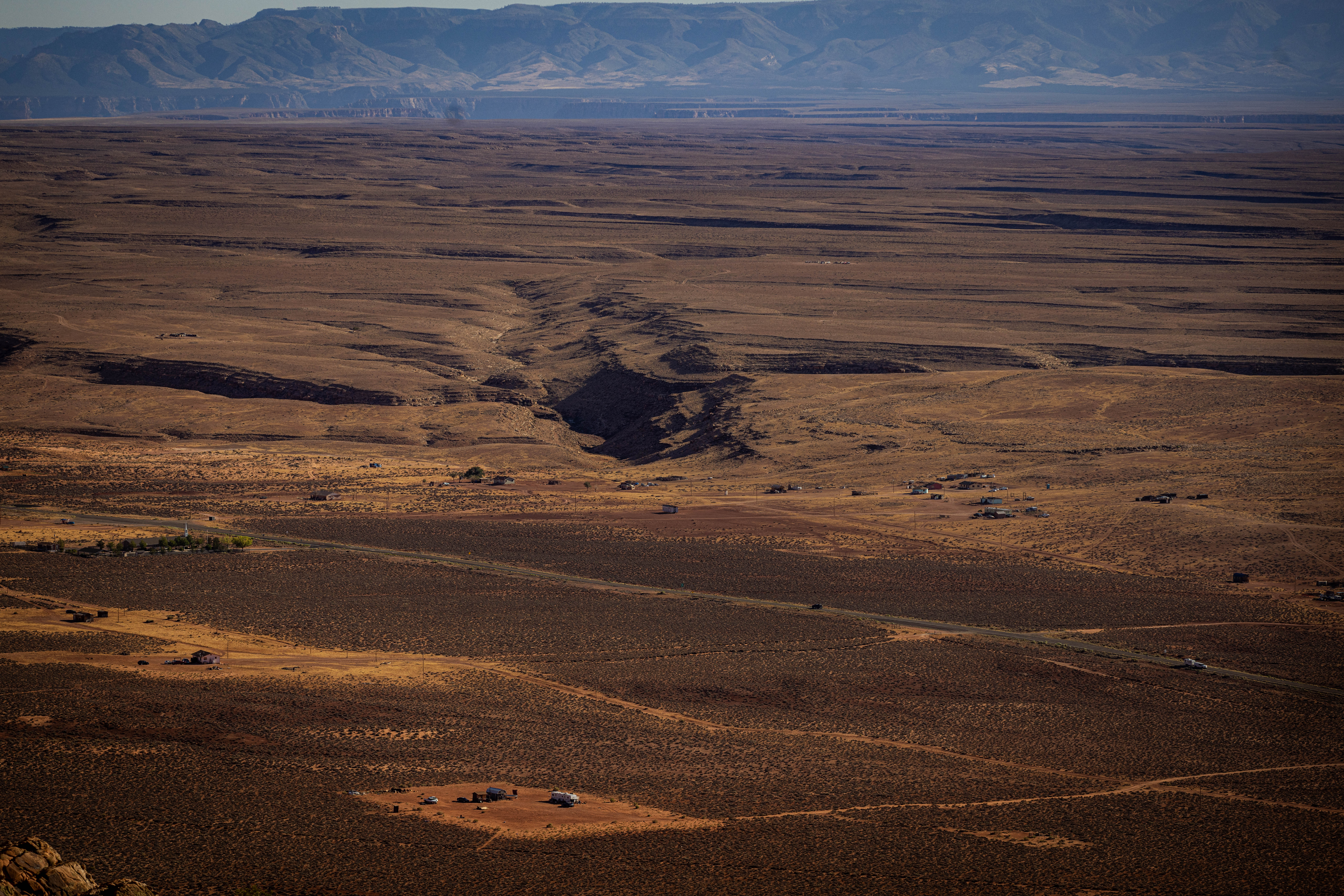
About a third of homes on the Navajo Nation lack the pipes and other infrastructure necessary to deliver running water, including near Page, Arizona, close to a large reservoir on the Colorado River. Photo credit: Sharon Chischilly
But Navajo and Hopi struck a deal, and Arizona moved off its bargaining position. Now in lockstep, the settlement’s supporters turned to Congress, only to hit more roadblocks: The House of Representatives balked at the spiraling price tag to fund the deals; presidential administrations were unwilling to expend political capital on such settlements; and more than a dozen settlements are in the works, clogging the system. (No settlement has been enacted since 2022.)
“Partisanship has gone to a new low in this country, and Indian water settlements have gotten swept up into that,” said Pam Williams, who spent about two decades as director of the Secretary’s Indian Water Rights Office in the Department of the Interior before she retired last year.
In November 2024, as President Donald Trump prepared for his return to the White House, the tribes believed they had an opening to get their settlement through Congress while President Joe Biden was still in office.
Navajo leadership had supported the Democratic presidential ticket and feared the incoming administration would be vindictive toward them.
Every basin state’s lead negotiator, tribes’ staff and a federal representative descended upon the Arizona Department of Water Resources’ offices in Phoenix for what several attendees described as a “Hail Mary.” At the meeting, the Navajo offered a major compromise: limiting how much water they could lease and for how long they could lease it.
But the Upper Basin states showed up with a list of grievances, multiple attendees told ProPublica and KJZZ News-Phoenix, and weren’t interested in negotiating over the Navajo leasing concessions.
“It’s difficult for the Upper Basin to wrap their heads around this settlement,” said Tom Buschatzke, Arizona’s Colorado River lead.
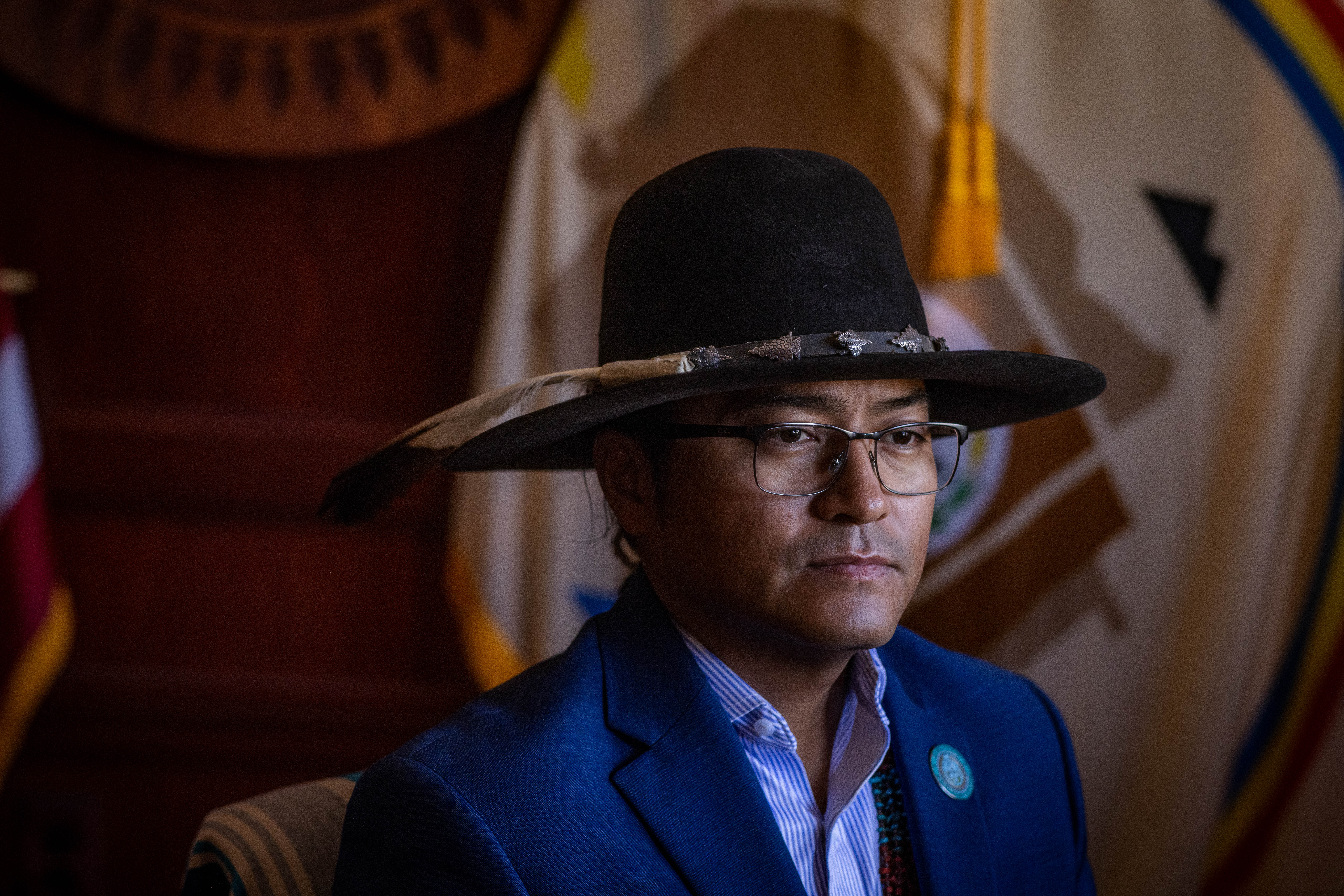
Navajo President Buu Nygren says the fact that his tribe’s reservation straddles the upper and lower divisions of the Colorado River Basin should not be held against the tribe as it negotiates for water. Photo credit: Sharon Chischilly
In March 2026, leaders from the tribes traveled to Washington for a Senate hearing where they made an impassioned plea for Congress to pass a version of the bill that now included the concessions they had offered in the Hail Mary meeting. Sen. Lisa Murkowski, the Alaska Republican who ran the hearing, expressed support for the settlement but worried its $5 billion price tag was too high, a concern echoed by an Interior Department official who testified. (The tribes and department are currently negotiating to shrink that cost.)
All four Upper Basin states submitted comments opposing the settlement. Their main concerns were about the ability to lease across the basin and whether the water for the settlement would be counted against the upper or lower division of the river.
Leasing would last only as long as it’s needed to pay for infrastructure to distribute their newly acquired water, said Navajo President Buu Nygren. It would not set a precedent, he said, because no other tribe straddles both basins.
“We shouldn’t be punished for being in two basins,” Nygren said, “because other tribal nations, other settlements have been able to lease water.”
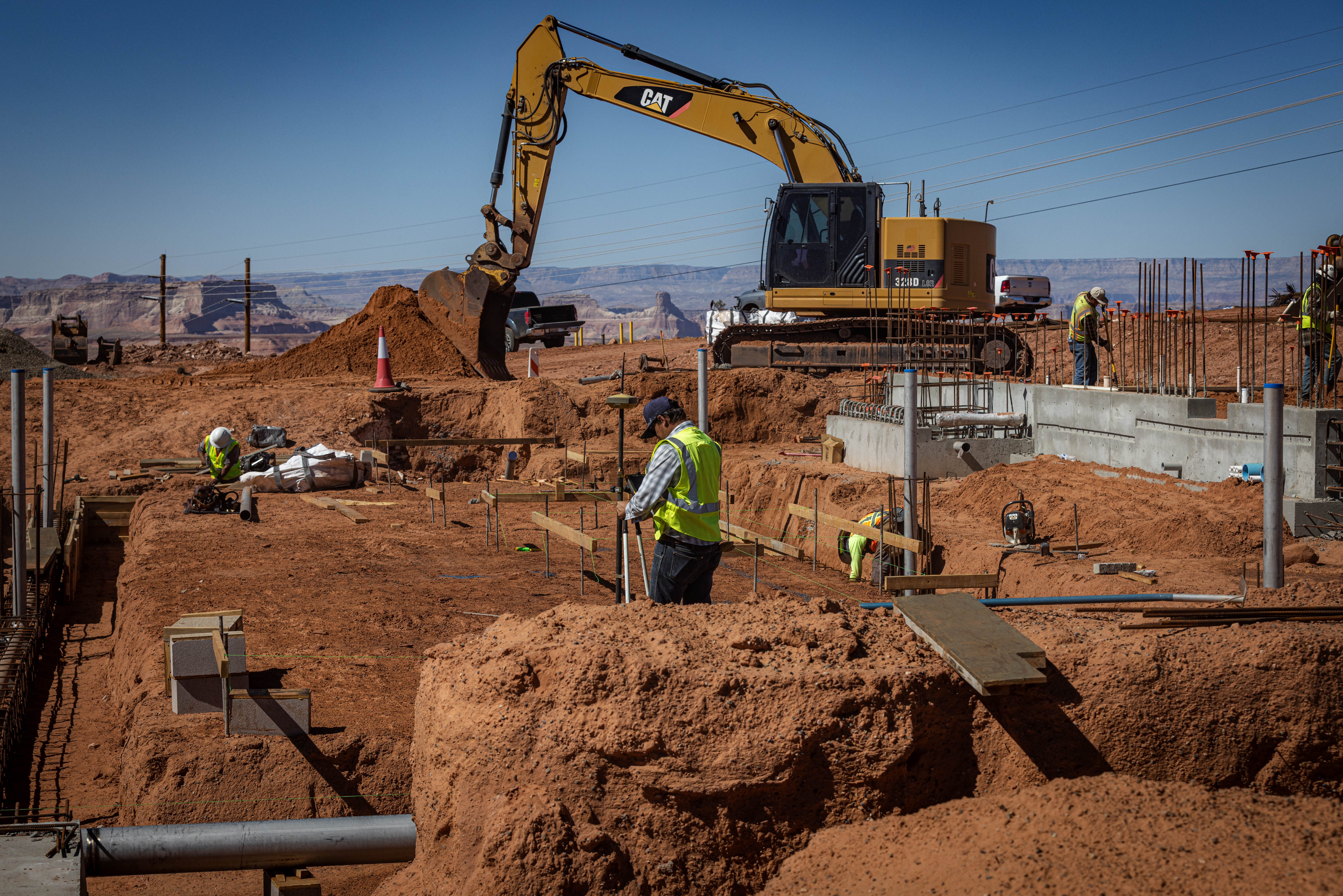
A construction crew installs pipes at the new LeChee Water Treatment Plant near Lake Powell, along the Arizona-Utah border. Photo credit: Sharon Chischilly
The former Navajo Generating Station’s intakes, which drew water from Lake Powell to cool the coal power plant, sit unused, awaiting funding from the stalled settlement. Photo credit: Sharon Chischilly
“How Precious Water Is to Us”
During the decades that the tribes fought to access their water, they helped quench the thirst of growing cities in the Colorado River Basin.
A water intake plant on Navajo land drew from Lake Powell to cool the nearby Navajo Generating Station. The coal plant powered pumps for the Central Arizona Project, the 336-mile series of canals that sends Colorado River water to Phoenix and Tucson.
The power station shut down in 2019, and the intake plant was handed over to the Navajo for the iiná bá-paa tuwaqat’si pipeline, which means “for life” in Diné and “water is life” in Hopi, to deliver water to the three tribes. But for now, the massive pumps remain mothballed, the building sitting musty and dark like a tomb, and the pipeline remains an engineering schematic, waiting for funding from the stalled settlement.
The irony is not lost on tribal leaders, they told ProPublica and KJZZ News-Phoenix: After helping deliver water beyond their lands, they are now blocked from using that same water and infrastructure to sustain their communities. The insult is compounded, they said, by the fact that water use is drastically lower on reservations.
“It’s not about green-grass lawns or golf courses or swimming pools,” said Crystalyne Curley, speaker of the Navajo Nation Council. “It’s just basically turning on the faucet and getting water to boil eggs for your children or turning on a faucet to wipe and clean the table or washing your hands after butchering a sheep.”
San Juan Southern Paiute Vice President Johnny Lehi Jr. is fighting for the settlement because it would finally ratify a treaty with the Navajo that would create a reservation for his tribe. Photo credit: Sharon Chischilly
For the San Juan Southern Paiute, the settlement is also about having a permanent homeland. They have no reservation but struck a deal with Navajo in 2000 to transfer some of its land. Since the tribes already reached an agreement, it’s an uncontroversial proposition. But, without political clout to get Congress to take it up, the land transfer was pulled into the water settlement.
“During the COVID era, it took a lot of the tribal elders, and there are only a handful that saw the treaty signed and are really wanting to see this before their time is up,” said San Juan Southern Paiute Vice President Johnny Lehi Jr., whose father signed the 2000 agreement. Finally securing a reservation, he said, means the ability to build housing and develop an economy for a tribe that currently rents its government building.
Nearby, on the Hopi reservation, Councilmember Marilyn Fredericks grabbed a pair of hiking poles, donned a hat with a roadrunner pin on it and set out from her village on a recent spring afternoon. To stay fit as she grows older, she walks up and down the hand-carved steps of a terraced garden that used to produce food for her community.
Seven natural springs once fed the garden, but only two still flow. Ponds that stored their excess sit dry, stains on the rock now just a memory of the water. It’s been six years since there was enough to plant.
The settlement would fund a pipeline that would be “our umbilical cord,” Fredericks said. Future generations of Hopi have a right to clean, reliable water, she said. “This is evidence of how precious water is to us.”
Native America in the Colorado River Basin. Credit: USBR
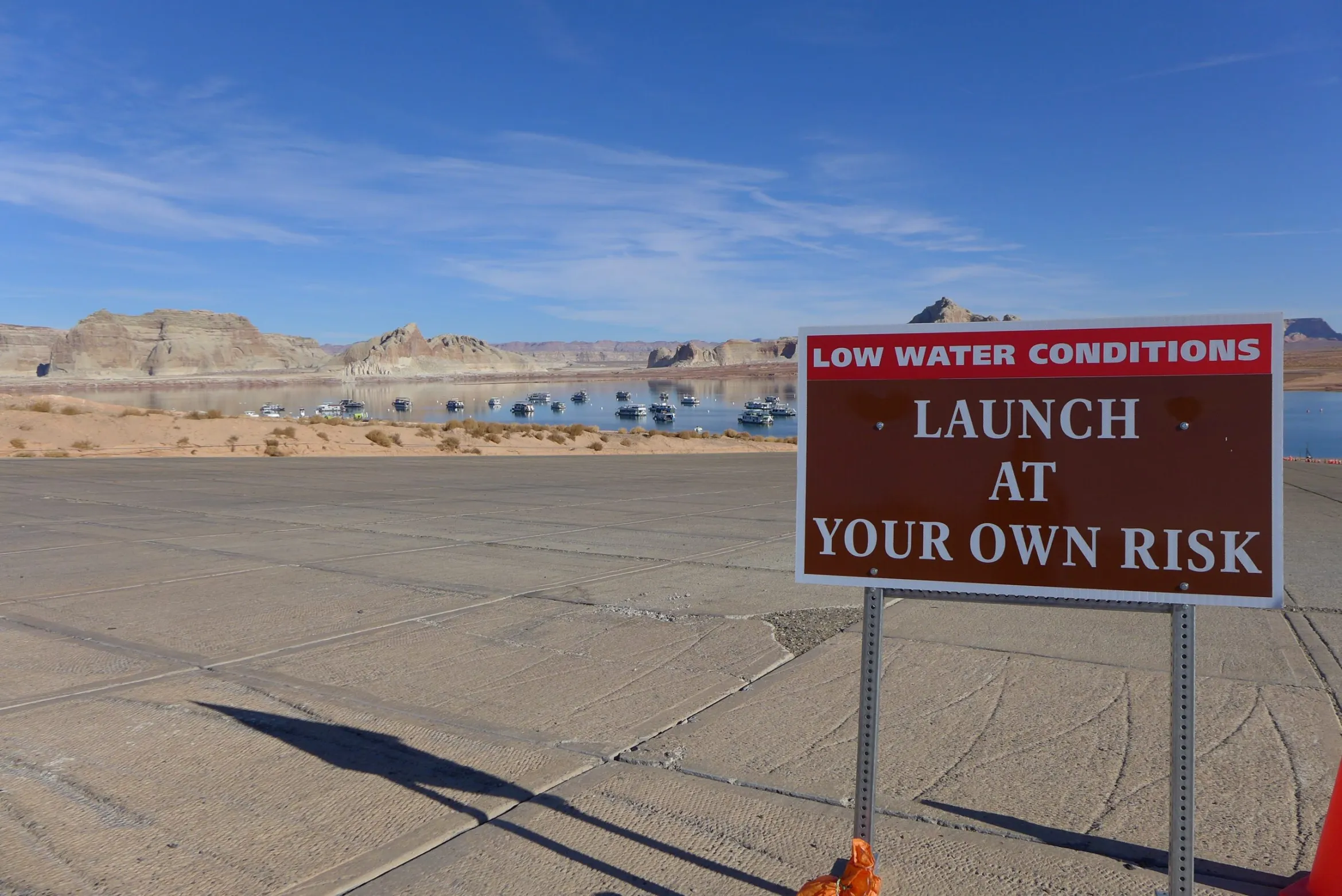
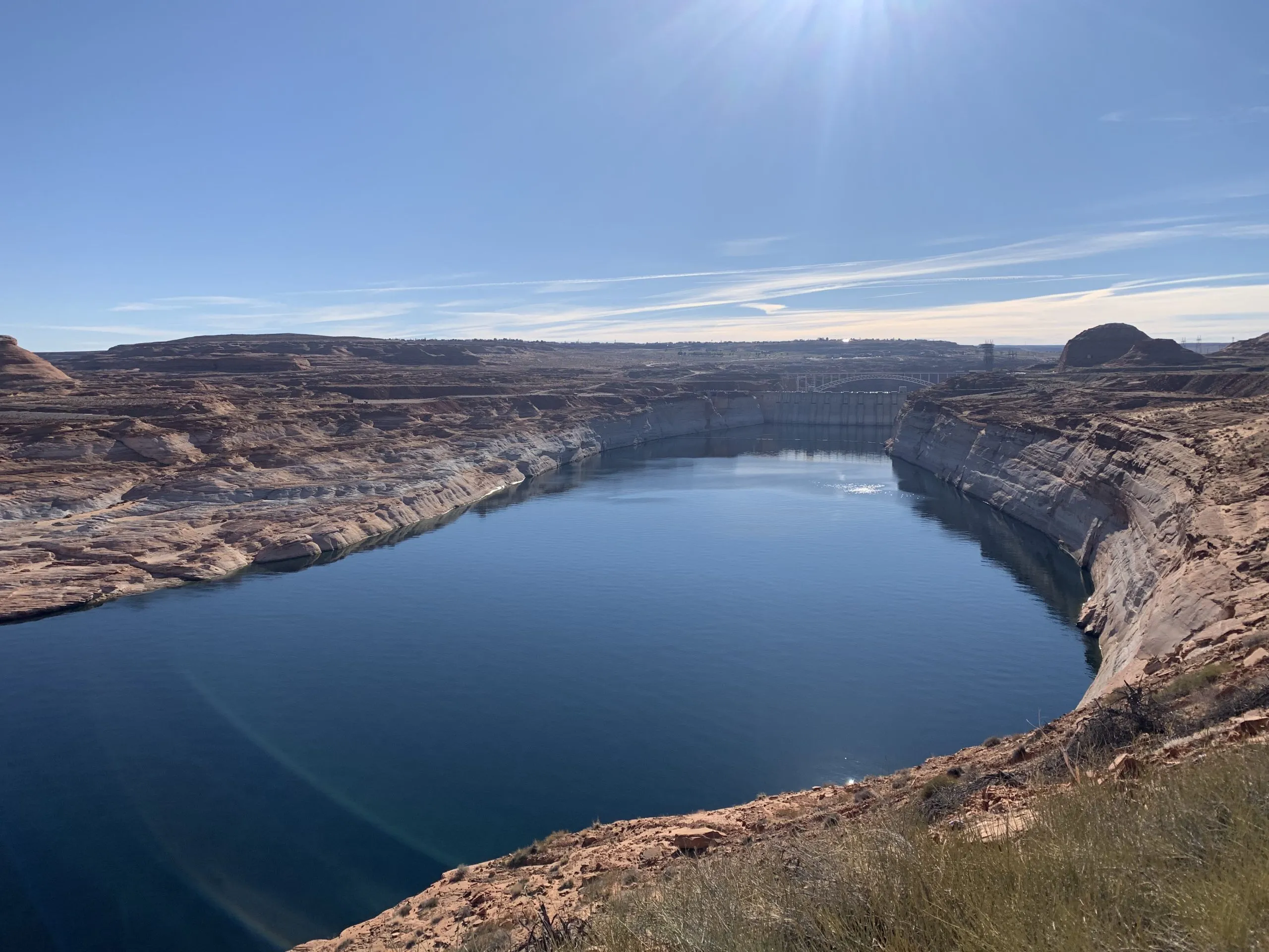
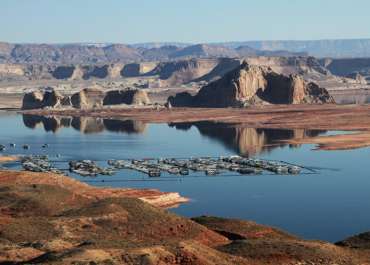
The main boat ramp at Wahweap Marina was unusable due to low water levels in Lake Powell in December 2021. Water levels are projected to soon fall even lower than this at the nation’s second-largest reservoir. CREDIT: HEATHER SACKETT/ASPEN JOURNALISM
Western Slope lawmakers had harsh words for water managers at a state committee hearing last week, questioning whether Colorado has done enough to avoid a lawsuit with its downstream neighbors.
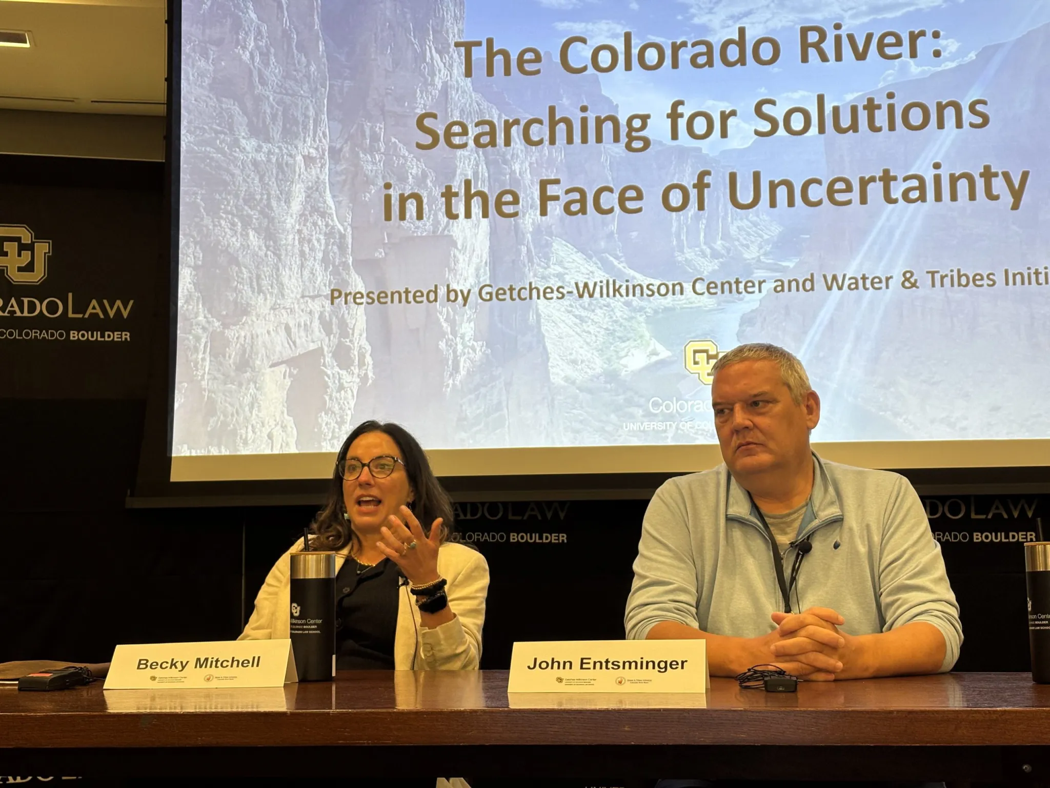
Colorado Sen. Dylan Roberts, a District 8 Democrat who represents several Western Slope counties, including Eagle, Grand, Garfield, Routt and Summit, asked Colorado’s lead negotiator, Becky Mitchell, whether the people of Colorado should have confidence that negotiations among the seven states that share the Colorado River have put the state in the best possible position. The states have been at an impasse for more than two years without a deal for future management as reservoirs continue to decline to record-low levels.
“My constituents just see fighting and intransigence,” Roberts said. “And it’s concerning to me, especially as a Western Slope lawmaker … that the strategy is just ‘Let’s hire more lawyers; we’re going to court no matter what.’ That doesn’t give me confidence, because I don’t think Colorado fares well when we go to court against Arizona and California and Nevada, throwing our fate to the nine justices on the U.S. Supreme Court.”
The remarks came at Thursday’s meeting of the state Water Resources and Agriculture Review Committee in Denver. Along with Mitchell, in the hot seat were state engineer Jason Ullmann and Amy Ostdiek, interstate section chief at the Colorado Water Conservation Board. The three are employees of the state Department of Natural Resources and have the backing of the Attorney General’s office in negotiations.
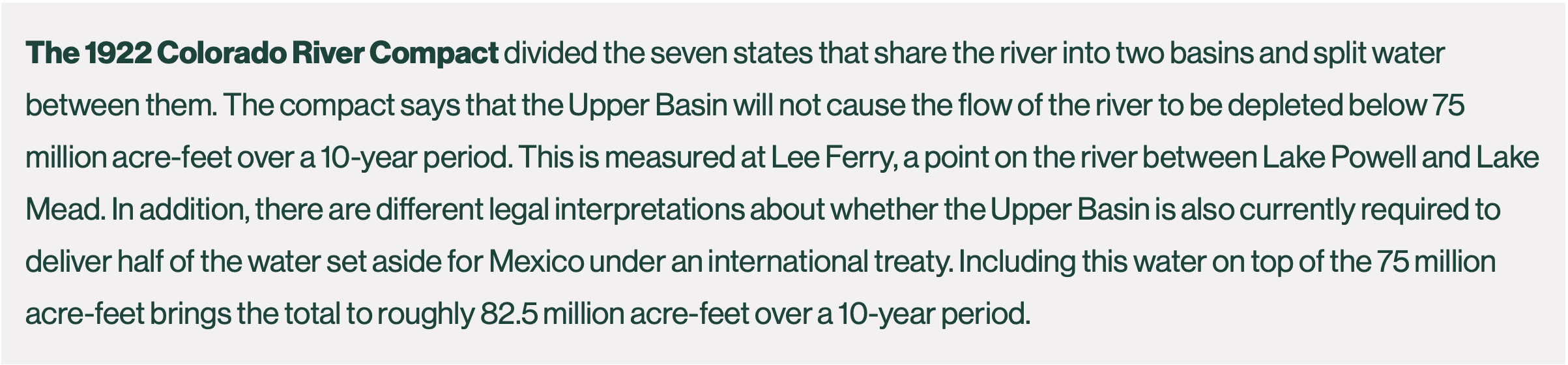
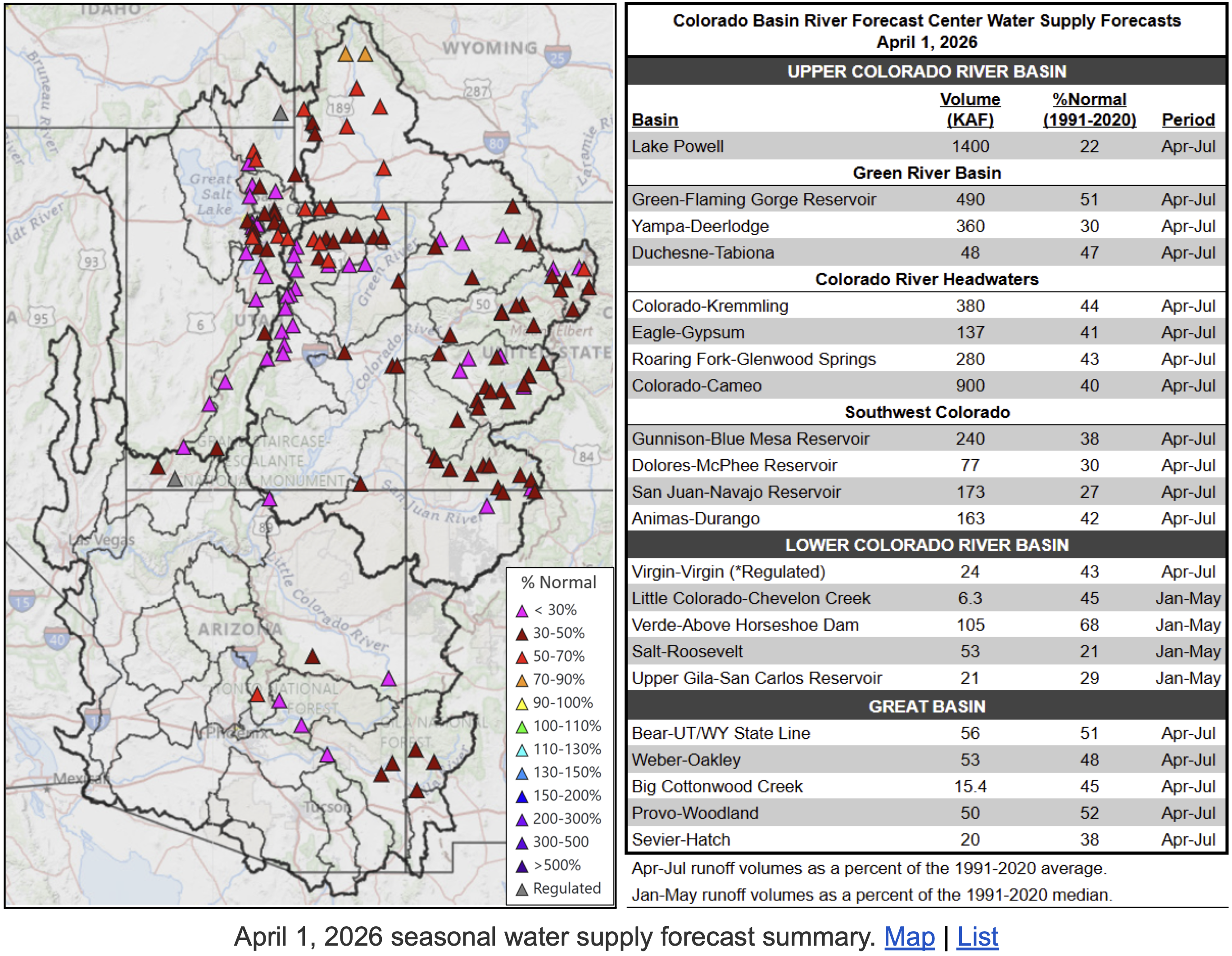
Roberts’ line of questioning seemed prompted by recent projections that show river flows dipping below a threshold that could trigger litigation. The Lower Basin states (Arizona, California and Nevada) believe that the Upper Basin states (Colorado, New Mexico, Utah and Wyoming) are bound by the 1922 Colorado River Compact to deliver 82.5 million acre-feet of water over a 10-year rolling average. According to the Upper Colorado River Commission, the 10-year average will dip later this year to about 81.3 million acre-feet because of persistent drought.
Some experts believe that this amounts to a “tripwire” that could trigger a lawsuit from the Lower Basin states (Arizona, in particular, has been openly preparing for litigation) that could result in mandatory cuts in water use for the Upper Basin. Upper Basin water managers don’t subscribe to this interpretation, saying their states are only required not to deplete the river’s flows by more than 75 million acre-feet over 10 years.
Mitchell was reluctant to share details of Colorado’s legal strategy in a public forum, but she answered “absolutely” that her team’s work was putting Colorado in the best position. She said cutting back prematurely just to satisfy the Lower Basin’s interpretation of the century-old agreement would be bad for the state.
“If we initiate curtailment now, that is worse for Coloradans,” Mitchell said. “I think that is an important thing to remember.”
Wracked by drought, climate change and a management crisis, the situation on the river has never been more dire. The current management guidelines expire this year, and in the absence of a seven-state deal to share shortages and operate the nation’s two largest reservoirs, Lake Powell and Lake Mead, the feds are poised to step in. The U.S. Bureau of Reclamation plans to release a more detailed, short-term plan to manage the river for the next two years by mid-to-late summer.
State Rep. Julie McCluskie, a District 13 Democrat, said communities in her district have been living with the incredible angst, anxiety and pain of no snow and low reservoirs.
“The frustration I hear in my community is that we have missed multiple deadlines; they are becoming a funny joke,” McCluskie said. “There is such a fear about the lengthy litigation process, the fear of an outcome that is far worse for Colorado than a compromise that we have some control over.”
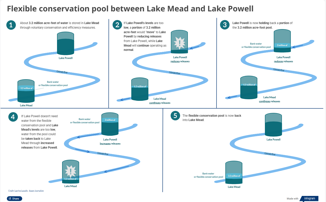
Lake Powell is formed by Glen Canyon Dam. In a concept pitched by a conservation organization, a flexible pool of water could be moved between Upper Basin reservoirs to wherever it’s needed most. CREDIT: HEATHER SACKETT/ASPEN JOURNALISM
Conservation conversation is the ‘bare minimum’
Lawmakers also had strong words for state officials regarding conservation, saying legislators must be involved in the creation of any program.
Colorado has dabbled with pilot conservation programs in the past, but traditional programs that pay farmers and ranchers to temporarily cut back on water use remain controversial. This is especially true on the Western Slope, which has long been the target for these types of programs, and where some worry that they could harm rural communities if not done carefully. After two years of exploring how the state could set up a temporary, voluntary and compensated conservation program, officials shelved the idea in favor of focusing on drought-resilience initiatives.
“Other states out of the seven have very clear and actionable roles for their general assemblies, their legislatures,” McCluskie said. “We have less so, and yet the stakes are so high. So I beg of you, decision-makers, that it is essential that we be a part of those next steps.”
Julie McCluskie. Photo credit: Colorado General Assembly
Ostdiek said that any program would need to start slow and make sure it incorporates input from people throughout the state.
“I think that we can continue to assess as we go what we might need from you all, and what a program like that might look like,” Ostdiek said. “I think what we can certainly commit to is continuing this dialogue and continuing the discussion about what we might need to make this a success.”
In 2023, Colorado lawmakers tried to force stakeholders to come up with recommendations on conservation programs by creating a statewide task force, which met 10 times over six months. But the group failed to find a consensus, with some saying it was “premature” to create a conservation program.
As part of a post-2026 framework, the Upper Basin states plan to create a “contribution” pool in Lake Powell, which could be used to help stabilize the system, keeping water levels above critical thresholds to protect hydropower at Glen Canyon Dam and acting as an insurance pool against forced cutbacks. In a May 22 letter to federal officials, the Upper Basin states said they have a goal of saving 100,000 acre-feet by the end of water year 2028, but only if sufficient federal funding is available and hydrologic conditions allow.
Three Upper Basin states have different methods for contributing to this pool: Utah has its own demand management program; Wyoming lawmakers passed a law this year allowing for a conservation program; and New Mexico plans to release water from Navajo Reservoir.
But precisely how — and how much — Colorado would contribute to this pool is unclear. The state’s share of the Upper Basin’s allocation is 51.75%, meaning Colorado could be on the hook for 51,750 acre-feet.
And ensuring that saved water actually gets into a pool in Lake Powell remains part of the problem. Currently, conserved water that stays in the river can just be picked up by a downstream user, with no net gain to Lake Powell. Colorado officials say they do not have the authority to “shepherd” water past other water users to the state line unless it is specifically for compact compliance. [ed. emphasis mine]
Last year, some Delta County ranchers asked lawmakers to take up the issue and pass a law that would address this issue, allowing water users to conserve and get credit for contributing water to a Lake Powell pool. But legislators did not take up a bill in the 2026 session.
Colorado officials told lawmakers they were continuing to explore what a program might look like and whether legislation would be needed.
Roberts said conversations with the legislature should be the bare minimum if Colorado is going to have a conservation program.
“If the department or any agency of the state were to pursue a conserved consumptive use program or demand management program that used state tax dollars to pay for it and did not go through the legislature in a formal process, I imagine that all of us on this panel and many of our colleagues would raise holy hell about the unilateral decision-making coming from Denver about programs impacting all parts of the state,” Roberts said. “So, please, let’s just cut that off at my recommendation. Let’s work together on this.”
Officials opened the hearing by highlighting the impacts of this year’s severe drought on Colorado’s farmers and ranchers, noting how even some of the most senior water users will experience shortages as streamflows dwindle. Orchards in the North Fork Valley and row crops in the Uncompahgre River Valley already have unprecedented shortages.
In response to Roberts’ concerns about the failure to find a compromise among the seven states, Mitchell posed a high-stakes rhetorical question: “I would ask, ‘What else do you think we can give?’”
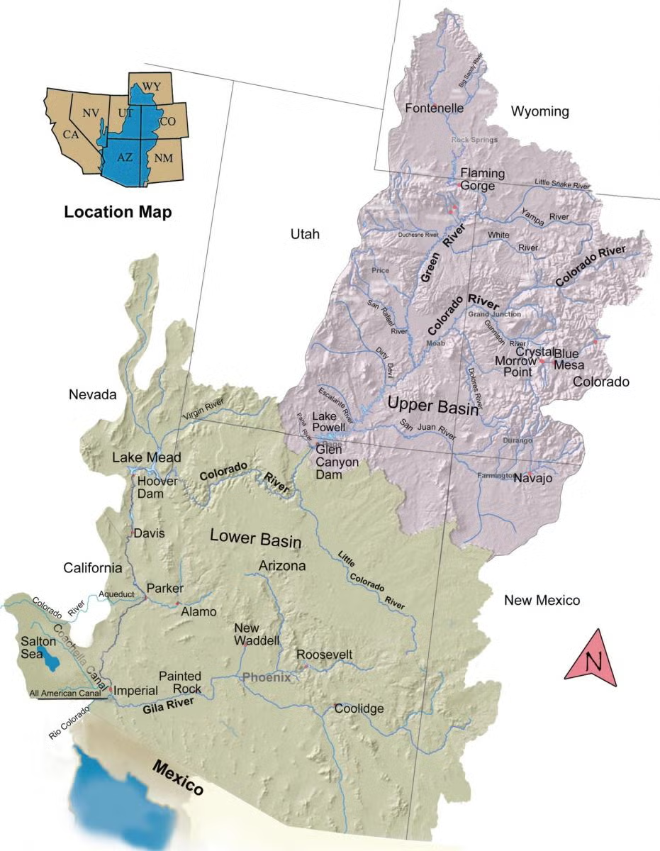
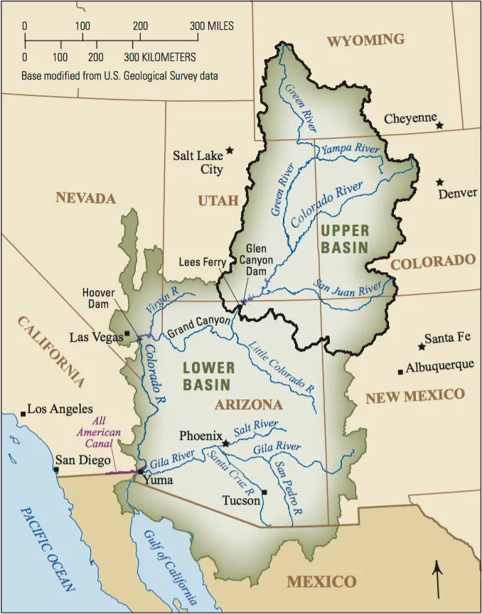
The Colorado River Basin spans seven U.S. states and is divided into Upper and Lower Basins. Lake Powell, upstream from the Grand Canyon, and Lake Mead, near Las Vegas, are the two principal reservoirs in the Colorado River water-supply system. (Bureau of Reclamation)
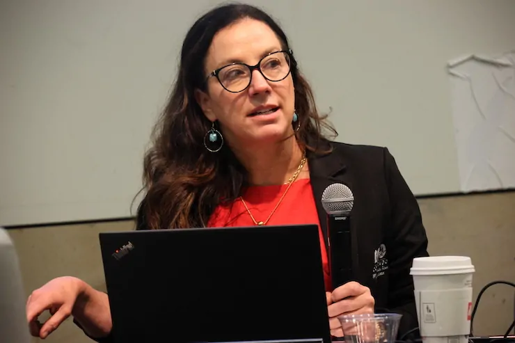
Becky Mitchell. Photo credit: Allen Best/Big Pivots
Click the link to read the article on the Big Pivots website (Allen Best):
June 25, 2026
In haggling with their down-river states about sharing the rapidly shrinking Colorado River, the headwater states have delivered a consistent message.
We don’t have two big reservoirs named Mead and Powell sitting upstream from us, they say. Mostly we must make do with what the sky delivers.
At the Upper Colorado River Commission meeting in Denver this week, the states reiterated this message, offering ample evidence from places like Emery, Utah, and Kemmerer, Wyo.
Lest anybody miss the message, Chuck Cullom, the director of the upper-basin commission, showed aerial images of farming areas in Colorado and the other upper-basin states. Far less green was evident in the Montrose area and on the Ute Mountain Ute Reservation during June than in 2024.
This exceptional year for drought and heat was described by several speakers in Denver as dire. “I want you all to recognize the significance and severity of the things we’re dealing with,” said the Utah representative, Gene Shawcroft. “Totally unprecedented.”
In western Colorado, a Meeker rancher used the same word to describe withered streams. “The situation here has gone from bad to dire.”
Upper-basin states have been in a tug-of-war for the last three years with lower-basin states about how to share this diminished river. As Becky Mitchell (above), Colorado’s representative, says repeatedly, we have a math problem. It’s impossible to continue releasing more water from reservoirs than flow into them. Upper-basin states, she says, “live within the means of the river.”
Udall/Overpeck 4-panel Figure Colorado River temperature/precipitation/natural flows with trend. Lake Mead and Lake Powell storage. Updated through Water Year 2025. Note the tiny points on the annual data so that you can flyspeck the individual years. Credit: Brad Udall
In crafting the Colorado River Compact in 1922, delegates assumed annual flows of roughly 17 to 18 million acre-feet annually at Lee Ferry, the legal division point separating the upper and lower basins. The 20th century delivered naturalized flows of 15.2 million on average.
In this century, flows have slackened even more. Since 2019 they have averaged 10.2 million acre-feet. This year less than 1 million acre-feet is expected to flow into Lake Powell other than releases from upstream reservoirs.
The compact pledged 7.5 million acre-feet to each of the two basins. The lower-basin states for many years over-used their allocation. Upper-basin states topped out at about 4.5 million acre-feet, using 3.5 million acre-feet in drier years.
Colorado and other basins states insist upon the right to use more water — if it’s there. Pre-compact rights of all Native American tribes have yet to be realized. All this creates a different math problem.
When the four upper basin states adopted their own compact in 1948, they wisely chose to use a percentage not an absolute number. That would make sense for the Colorado River Basin altogether — if the two basins could agree upon it. Tensions have elevated. Outwardly this marriage looks very rocky.
Might there be another way? Tanya Trujillo, New Mexico’s new representative, offered an intriguing statement at the Denver meeting.
“I think we need to think differently about some things,” she said. “In New Mexico, we’re going to be taking a fresh look at some of the issues that we are facing and really try to look for a collaborative process going forward.”
In time of crisis, she added, it’s important to “project calm, knowledgeable reassurance and try to be part of the solution, not part of the problem.”
For whom was that message intended? It was not clear. However, even in Colorado, some have suggested upper-basin states have overstated their case.
What cannot be contested is Mitchell’s assertion that demands cannot exceed supplies. This year, we’re robbing Peter to pay Paul. Water is being taken from Flaming Gorge and other federal upstream reservoirs to keep water in Powell. Blue Mesa Reservoir near Gunnison may have too little water to release any downstream, a condition called dead pool. The Bureau of Reclamation similarly sees that possibility for Navajo, the reservoir on the Colorado-New Mexico border.
The Bureau intends to release six million acre-feet from Powell for the lower-basin, leaving Powell 80% empty. The agency’s “most probable” projections see reservoir levels at Glen Canyon Dam early next year being too low to generate electricity.
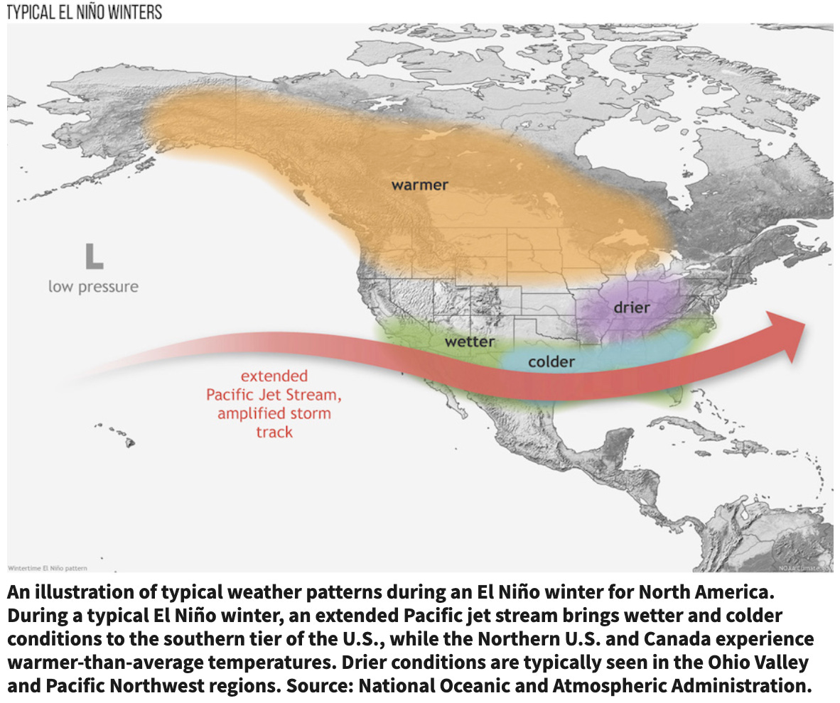
In Grand Junction this week, people stood in the rain with sheer delight. It was a feel-good moment. But will El Niño save us from calamity? Maybe, but don’t bet on it. The warming climate seems to be rewriting the rules about how much water from the Pacific Ocean arrives on our mountains.
hat was the takeaway from a recent presentation by Brad Udall, a scientist scholar affiliated with Colorado State University. El Niños in the past have produced big water years. One was in 1983, the year that flood waters nearly broke Glen Canyon Dam. Often, though, an El Niño produces no more moisture than a La Niña.
“The real question” said Shawcroft, the Utah representative, “is what happens if next year looks like this?”
Map of the Colorado River drainage basin, created using USGS data. By Shannon1 Creative Commons Attribution-Share Alike 4.0
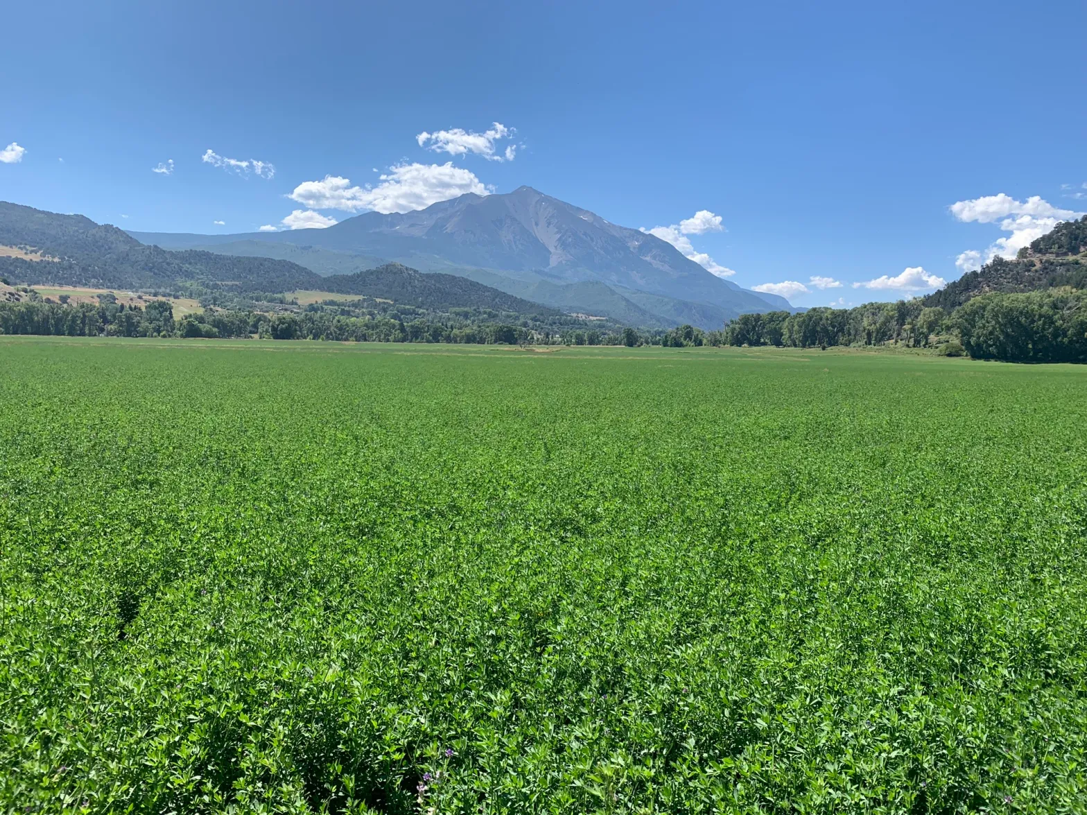
This field of alfalfa near Carbondale is grown with water from the Crystal River. Some Colorado River experts are advocating for a permanent reduction in the use of water by agriculture. CREDIT: HEATHER SACKETT/ASPEN JOURNALISM
Some Colorado River experts are floating a concept to address the basin’s water woes that is both radical and mundane: permanently reducing the amount of water used by agriculture.
Many cities have already reduced their water use in recent decades while adding residents, proving that population growth doesn’t have to be tied to an increase in water use. A 2024 study by Colorado River scientists found that agriculture is responsible for about 74% of water used by people in the basin, meaning urban conservation alone cannot solve the crisis.
“I think we need to have permanent reductions in use on the table and agriculture will have to be part of that,” said Anne Castle, a Colorado River expert and a former federal representative to the Upper Colorado River Commission.
Castle was the lead author on a June 1 paper that urgently called on the entire basin to permanently decrease consumptive uses to avoid the worst impacts to reservoirs and water users. Castle and the paper’s other authors are Colorado River experts and academics, and are the brain trust of the basin sometimes referred to as the Traveling Wilburys, a joking reference to the rock music supergroup. But their message is anything but humorous.
The latest paper says another dry winter would deplete remaining storage and result in devastating consequences like run-of-the-river operations where the nation’s two largest reservoirs can only release downstream the same amount of water that flows into them. It’s the last stop before deadpool, when levels are too low to release water. The authors urge water managers to act immediately to reduce use and avoid a system crash.
But permanently cutting the amount of water that goes to agriculture remains a controversial topic, and water managers from both the Upper and Lower basins say drying up land is not a solution for their basin. Most conservation programs up until now either have been temporary or have allowed the saved water to be used elsewhere. Castle said the problem is especially difficult when people’s livelihoods are on the line.
“The folks who are vulnerable to those kinds of permanent reductions are understandably resistant,” Castle said. “But there’s not enough water. The river won’t allow us to use the same amount of water that we’ve been accustomed to using in the past.”
The seven states that share the Colorado River are under increasing pressure to cut water use as one of the worst droughts on record threatens the water supply for millions of people. On the heels of one of the hottest and driest winters since measuring began, spring flows into Lake Powell this year are projected to be the lowest on record.
Much of the $4 billion from the Inflation Reduction Act earmarked for drought mitigation has gone toward short-term conservation. Water users in the Lower Basin states (California, Arizona and Nevada) were paid to temporarily leave water in Lake Mead. And in the Upper Basin (Colorado, New Mexico, Utah and Wyoming), the feds paid irrigators $45 million to leave fields dry during a two-year reboot of a pilot conservation program.
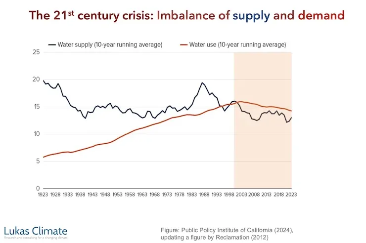
But in the midst of a climate change-fueled megadrought that has already robbed the river of at least 20% of its flows, experts say temporary measures no longer cut it. Water managers are reckoning with the reality that the river will probably never again deliver what was promised a century ago by the Colorado River Compact. The demand for water now far outstrips the dwindling supply.
“Are we going to continue to spend hundreds of millions of dollars a year and not have a permanent solution?” said author and Colorado River expert Eric Kuhn. “I think, at some point, it just makes economic sense to go ahead and say, ‘Let’s buy out the existing demand.’” [ed. emphasis mine]
These hay bales stand ready to be collected on a ranch outside of Carbondale. Credit: Heather Sackett/Aspen Journalism
Buying out demand
Against this backdrop, some in the academic community are advocating for the federal government to either set up a voluntary program to buy and retire lands that use a lot of water or pay landowners who agree to permanent restrictions on water use.
A paper released last year and authored by Kathryn Sorensen and Sarah Porter, who are Colorado River experts at the Kyl Center for Water Policy at Arizona State, lays out how this could be done. Eligible land would have to meet certain characteristics, including being in an area where the economic impacts of not using water are least painful and where impacted crops could be feasibly grown outside of the Colorado River basin, among others.
According to Porter, the federal government should be the entity that buys down demand. The large infrastructure projects funded by the feds in the 20th century are what created booming irrigated agriculture in the West to begin with. And the other entities in the basin that have the ability to buy agricultural water want to use it themselves, not keep it in the system.
“A reset in the Colorado River basin really is needed,” Porter said. “We have a lot of agriculture that’s really a legacy of how the United States was settled… . And now we’re grappling with overallocation and shortage and struggling to figure out a way to manage the Colorado River.”
The proposal is different from the much-derided “buy-and-dry” which usually involves an opportunistic transferring of water from agriculture to cities, not an overall reduction in water use. Still, the potential negative impacts to rural communities have to be considered.
“You have to have a provision for what happens to the land when you remove agriculture and what happens to the local economy when you remove agriculture,” Porter said.
And experts say there is a precedent for the type of federal buyouts that could help the drought-stricken river: the Bankhead-Jones Tenant Farm Act from 1937. This New Deal piece of legislation was a response to the Dust Bowl and allowed the federal government to buy and retire badly eroded or economically unproductive farmland.
The paper says a Colorado River program could start not with those that grow valuable vegetables in winter but, rather, with lands that use a lot of water but have low economic output. The paper says retired agricultural lands could be used for alternative purposes that support local economies such as recreational opportunities or low water-use industries.
Figuring out how to implement conservation programs without harming rural agricultural communities has been a main focus in recent years of the Colorado River Water Conservation District, which works to keep water on the Western Slope. River District General Manager Andy Mueller said that agriculture has a role to play in reducing water consumption, but that permanently retiring agricultural land is a misguided approach that will put the country in danger of not being able to feed itself. Programs should remain temporary, and focus on efficiency improvements and growing less-thirsty crops, he said.
“If it’s temporary, if it’s well-designed in a way that respects local communities, traditions and practices, is custom-built for each community in a way that really tries to do as little economic damage as possible — potentially even bringing some benefits to those farming families that participate — there are ways to do it,” Mueller said.
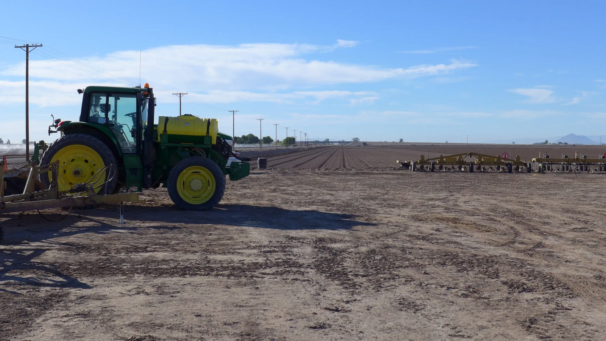
A tractor on a farm in California’s Imperial Irrigation District, the largest user of agricultural water in the Colorado River basin. A California representative says there is no interest in drying up ag land because it’s so extremely productive. CREDIT: HEATHER SACKETT/ASPEN JOURNALISM
On the fringe
Although certain academics and experts are talking about permanently drying up agricultural lands as a means of saving water, the concept remains on the fringe of Colorado River politics. It’s both the third rail and the elephant in the room.
“It’s going to pull away from the fringe really quickly when you’ve got to really justify continuing to pay on an annual basis forever,” Kuhn said. “We’re just trying to get the discussion out there, make it acceptable to have the discussion.”
On top of the abysmal hydrologic conditions, the basin is also in the midst of a management crisis. After two years of negotiating, the Upper Basin and Lower Basin states have failed to reach a consensus on how they will share future cuts and have blown past deadlines to come up with a plan. The responsibility for river management now falls to the federal government, which is scheduled to release this summer a short-term operating plan for Lake Powell and Lake Mead.
Part of what makes the problem so tricky is that water managers are still guided by the Colorado River Compact, a century-old agreement that splits the river’s flows evenly between the two basins. Upper Basin water managers still cling to the notion that because their states are already living within the 7.5 million acre-feet of water allotted to them annually, cutbacks are the responsibility of the Lower Basin, which they say uses more than its fair share.
Becky Mitchell, Colorado’s lead negotiator in talks among the seven states, said that permanent dry-up of agriculture in the Upper Basin isn’t necessary because the Upper Basin states already send more than 8 million acre-feet — more than legally required — of water downstream per year. Dry-up may be part of the overall solution, she said, but each state should take its own individual approach to making cuts.
“Those durable reductions are going to be required (for the Lower Basin) to first get in line with their apportionment, but then getting in line with the available supplies is a whole ’nother conversation,” Mitchell said.
California’s representative, JB Hamby, said permanent fallowing doesn’t have a place in reducing the state’s demand either. California is home to the biggest urban and agricultural water districts, as well as the largest allocation of Colorado River water of any of the seven states that share the river.
“In the case of California, there’s no real discussion or interest whatsoever in the retirement of ag lands,” Hamby said. “Land in Southern California that receives Colorado River water is so extremely productive. There is a year-round growing season where every single day of the year there are things being grown.”
Past water savings in Southern California have mostly come from efficiency improvements on farms and in delivery systems, and from deficit irrigation programs in which water is temporarily taken off fields for part of a season. In the absence of a seven-state deal, the Lower Basin states have offered up 700,000 acre-feet of cuts per year through 2028, which is on top of an initial 1.5 million acre-feet in cuts. Most estimates say the basin needs to cut water use by 2 million to 4 million acre-feet.
“There’s full agreement that water should be reduced,” he said. “There’s not agreement in how or where it should be reduced. So the Lower Basin is moving forward, doing our thing, making reductions.”
Cowgirls wrangle a calf at a Delta County ranch. Farming and ranching are an important part of the heritage of the American West, which makes permanently reducing water for agriculture a tricky issue. CREDIT: HEATHER SACKETT/ASPEN JOURNALISM
Ultimately, discussions about permanently reducing the amount of water that goes to farmlands in the basin remain difficult, in part because agricultural water rights are some of the biggest, oldest and most politically powerful in the basin. But there is also an attachment to the American West’s farming and ranching heritage.
“We love agriculture; it’s part of our roots,” Porter said. “We don’t like to think about losing agricultural production. I think we are generally hesitant to have that conversation, and we really haven’t had it as a basin.”
Map of the Colorado River drainage basin, created using USGS data. By Shannon1 Creative Commons Attribution-Share Alike 4.0
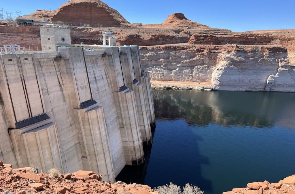
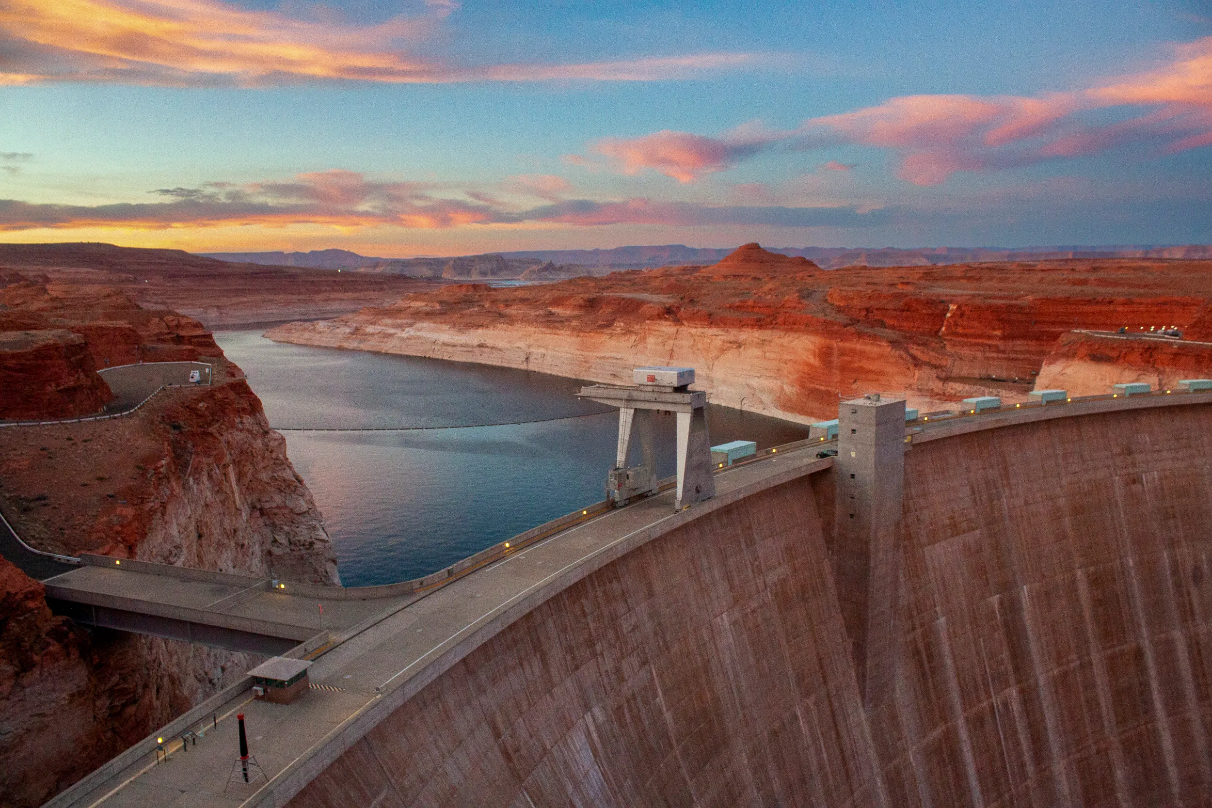
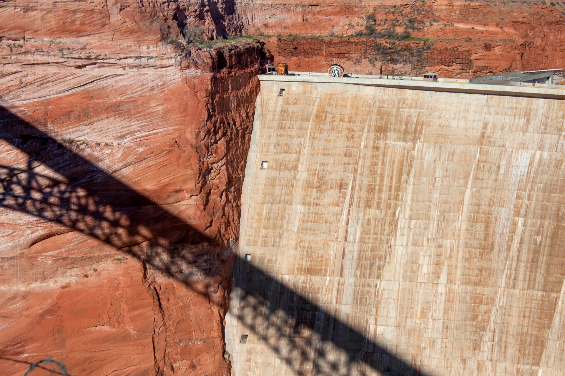
Glen Canyon Dam and Lake Powell, one of the nation’s largest-capacity reservoirs whose operation has been a point of contention between the Upper and Lower Basins of the Colorado River. (Alexander Heilner, The Water Desk)
Western Water In-depth: A ‘wild idea’ to defuse the colorado river compact’s legal time bomb has been kept alive by seasoned observers who believe it could still save the river
For the past 20 years, the Colorado River has been operated under a set of guidelines negotiated between the seven states that depend on the river. Those guidelines expire this year, and after five years of grinding negotiations over a new agreement, the upstream states of Colorado, Wyoming, Utah and New Mexico remain deadlocked against the downstream states of California, Arizona and Nevada.
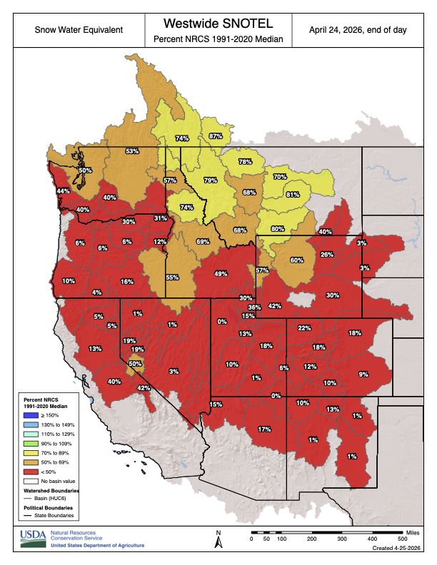
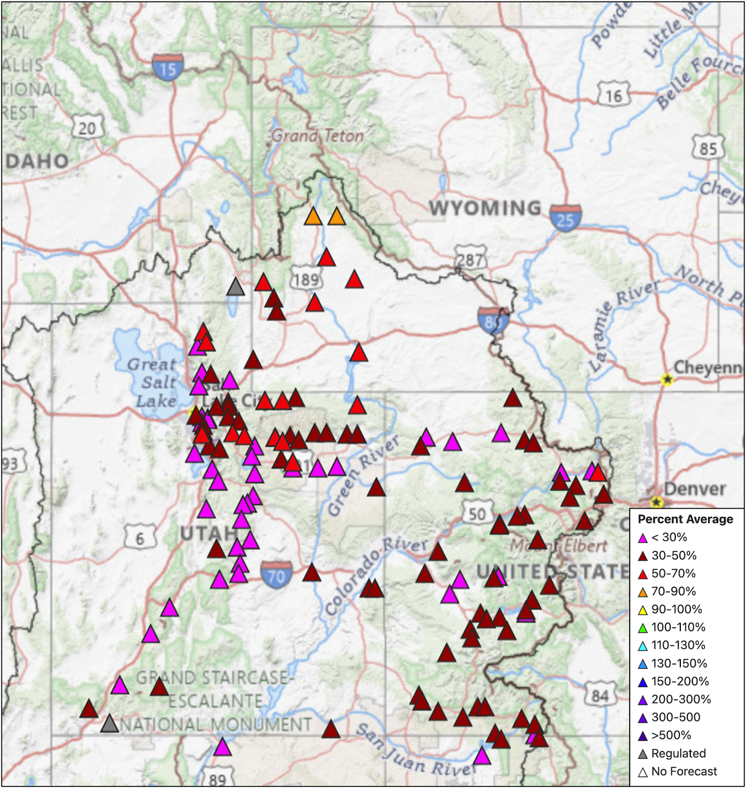
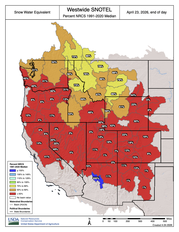
Some 40 million people and 5.5 million acres of farmland depend on the river’s water. But after the states failed to meet two federal deadlines in three months, the river is in a moment of unprecedented crisis. A dire snowpack has left flows just 15 percent of normal, many farms without water and several cities scrambling to secure water supplies as they gird themselves for shortages.
That has set up a showdown over a legal time bomb that’s been ticking away at the heart of the Colorado River Compact since the river’s guiding document was signed more than 100 years ago. The Lower Basin states believe the Compact promised them a minimum delivery of water sent down the river from the Upper Basin. The Upper Basin states believe the Compact promised them a fixed amount of water that they could rely on to meet future growth. As the river’s flows have dwindled, those two supposed guarantees are proving to be irreconcilable.
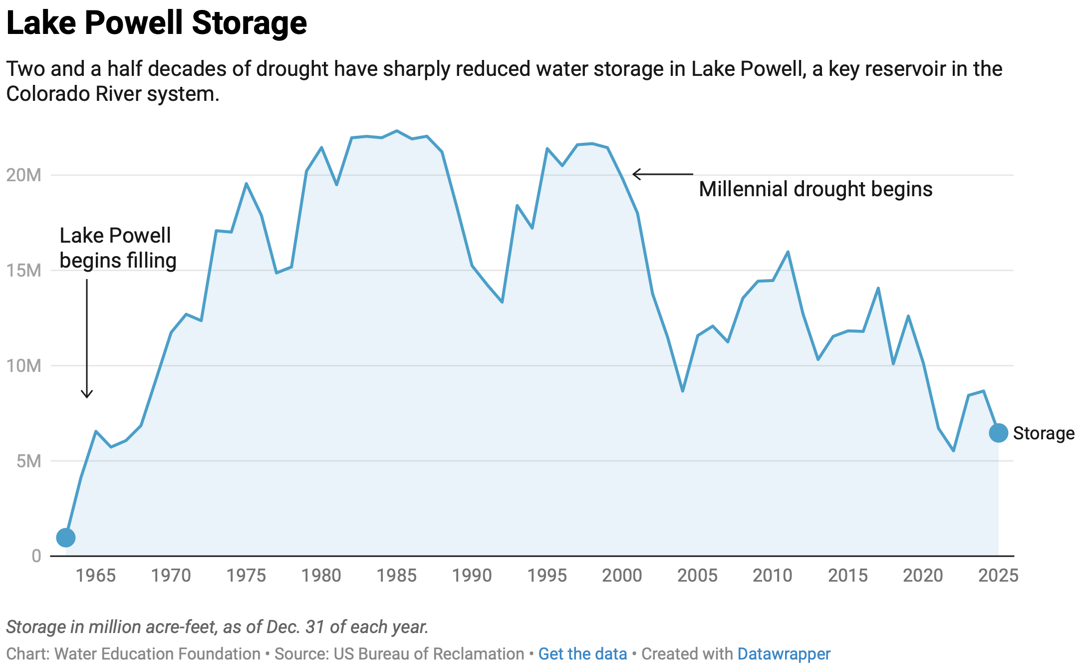
Experts have seen the showdown coming for a long time, but climate change has accelerated the day of reckoning. In 2000, a drought sunk its teeth into the river and hasn’t let up. Dubbed the Millennium Drought, it is now recognized as one of the worst droughts on the river in more than 1,200 years — and may actually be the beginning of a long-term shift to a drier reality.
Despite near-endless negotiations to find a way to keep the river’s massive reservoir system from crashing — an effort that began over two decades ago — the drought may have finally pushed the Colorado River Compact to its limit. Now, the system is nearly empty and runoff from this winter’s snowpack, the source of any water that might offer even a small hope of relief, will be among the lowest since Glen Canyon Dam was built near the Arizona-Utah border, creating Lake Powell, more than 60 years ago. Flows in the river are perilously close to hitting the primary legal “tripwire” in the Compact. Once that’s crossed, the Lower Basin states would likely try to force the Upper Basin to deliver their water apportionment downstream — a prospect long considered unthinkable.
“All those negotiations helped push the day of reckoning back further, and helped delay the inevitable,” says Doug Kenney, who heads the University of Colorado’s Western Water Policy Program. “But at some point, you just have to acknowledge the fact that the numbers don’t add up and you’re going to have to deal with it. We’re at that point.”
Two obvious paths now lie ahead. One is a courtroom fight, either against the U.S. Secretary of the Interior or a challenge between two states under the terms of the Colorado River Compact, which would go directly before the Supreme Court. A high court case would be a doomsday scenario, a messy and protracted legal battle that, until now, the seven states desperately sought to avoid. The other potential path is a stopgap fix, a short-term interim plan negotiated between the states or imposed by the Interior secretary. That could, at least temporarily, forestall a trip to court, but it wouldn’t resolve the fundamental conflict.
For more than two decades, however, the possibility of a third path has stubbornly persisted in the background: A “grand bargain,” an idea first proposed in 2005 by Colorado’s negotiating team early in the effort to grapple with the worsening drought. The concept was an unorthodox bid to defuse the ticking time bomb — but it would require each basin to trade away its most cherished claim on the river.
‘A WILD IDEA’
Roughly 90 percent of the Colorado River’s flow originates as snowpack in the Rocky Mountains. One of the principal goals of the 1922 Compact, which is essentially a seven-state treaty, was to avoid future legal battles by creating an “equitable division and apportionment” of water between the Upper Basin states in the river’s headwaters and the faster-growing Lower Basin. The Compact apportioned 7.5 million acre-feet a year from the mainstem of the river to each basin. (An acre-foot is 325,851 gallons, enough to supply the average annual needs of roughly 3 households, depending on their location and climate.)
The Colorado River Basin spans seven U.S. states and is divided into Upper and Lower Basins. Lake Powell, upstream from the Grand Canyon, and Lake Mead, near Las Vegas, are the two principal reservoirs in the Colorado River water-supply system. (Bureau of Reclamation)
The Compact also contains a requirement that the headwaters states not deplete the flow of the river below 75 million acre-feet, plus another roughly 7.5 million acre-feet (half of the apportionment earmarked for Mexico), on a 10-year running average. Those provisions were intended to provide surety to the downstream Lower Basin states that they would receive their 7.5 million-acre-foot annual apportionment and that the basins would share equally in the Mexican obligation. If the 10-year running average requirement is violated, the Lower Basin states could — at least in theory — initiate a Compact “call” against the Upper Basin in an attempt to force the headwaters states to deliver more water downstream.
For roughly 80 years after the Compact was signed, the prospect of a Compact call was purely theoretical. Then the Millennium Drought set in. By 2005, the two flagship reservoirs on the Colorado River — Lakes Mead and Powell — were half empty.
The drought was pushing the river’s flows closer to a Compact violation trigger, making the risk of a call by the Lower Basin a growing probability. The Lower Basin, particularly Arizona, was insisting on guaranteed releases of water from Lake Powell. And because Colorado has the biggest share of the river within the Upper Basin and uses a greater portion of its apportionment than the other upstream states, it is most at risk. It began searching for a way to slip out of the legal noose of a Compact call.
In September 2005, the seven states’ top negotiators met in Albuquerque, New Mexico. During a lunch break, Colorado’s team made its pitch. The state’s negotiators proposed that the Lower Basin waive its right to force a downstream delivery through a Compact call. In exchange, the Upper Basin states would limit their water use to less than what’s strictly apportioned in the Compact, thereby reducing potential demand in the headwaters of Colorado and Wyoming that supply nearly the entirety of the river’s flow.
The offer was essentially a simplification and reframing of a dizzying array of technical disagreements over various provisions of the Compact — an attempt to throw spaghetti at the wall to see if it would stick.
Jim Lochhead, who had previously been Colorado’s top negotiator and in 2005 was serving as a legal advisor on the state’s team.
“My recollection was that it was a pretty spontaneous proposal,” says Jim Lochhead, who had previously been Colorado’s top negotiator and in 2005 was continuing to serve as a legal advisor on the state’s team. “We weren’t making any progress, and it was pitched as, ‘If you really want to cut through all of this and get to the bottom, here’s a wild idea.’”
The proposal sparked discussion among all the parties at the negotiating table but also raised difficult issues.
“It was a great concept on paper,” says Pat Mulroy, who was the head of the Southern Nevada Water Authority and Nevada’s principal negotiator at the time. “Whether it was politically doable or not is a whole other ball game.”
In large part, that’s because a grand bargain would have forced both basins to give up assurances in the Compact that they consider sacrosanct.
“I’m not sure the Upper Basin would ever have agreed to limiting their ability to fully develop their 7.5. It’s like giving up your birthright — I’m not sure they could have sold that at home,” says Mulroy. Conversely, she says, “giving up that call provision is really the only weapon the Lower Basin has.”
And, indeed, following its spontaneous birth in Albuquerque, the proposal ran into stiff political headwinds back home in Colorado, where it failed to get then-governor Bill Owens’ blessing.
“I wasn’t directly representing the state of Colorado at that time; I was representing Colorado water users,” Lochhead says. “And when I brought the idea back to the state, it pretty quickly got shot down: ‘No, we can’t agree to anything that would not keep the dream alive of 7.5 million acre-feet being developed in the Upper Basin.’”
The prospect of a grand bargain itself faded from discussion. And yet, in ways that aren’t often acknowledged, it continued to shape the broad contours of the negotiations that unfolded over the next two decades.
The quest to escape the noose of a Compact call has remained central to Colorado’s bargaining position.
“The concept of a waiver of a Compact call is alive and well,” says Anne Castle, a former assistant Interior secretary who is now a senior fellow at the University of Colorado. “The quid pro quo for that waiver has taken different forms.”
To a large extent, the details of the various offers the Lower Basin has made in exchange for a possible waiver — which have sometimes been characterized within the negotiations as “mini grand bargains” — have never become public. What is clear is that the two basins have consistently failed to cut a deal.
Instead, the seven states adopted a more incremental approach, negotiating a series of drought-protection agreements based on smaller, more politically palatable deals. While that’s been a safer path for everyone politically, it has brought other kinds of risk.
“It just added layer upon layer of Gorilla Glue and Band-Aids that’s made it much more complicated to try to unwind or develop new agreements,” Lochhead says, “and has obviously proven to be inadequate in protecting the system.”
A SECOND LIFE
While the concept of a grand bargain led a short life at the negotiating table, it has gone on to live a remarkable second life. The idea was picked up and revived by a loose-knit group of seasoned observers of Colorado River issues who, for years, have called for more durable alternatives to the patchwork of ideas [ed. “The Law of the River”] in play among negotiators.
Eric Kuhn was a member of Colorado’s negotiating team when the grand bargain was proposed in 2005. At the time, he was the general manager of the Colorado River Water Conservation District based in Glenwood Springs and he has written thoughtfully and voluminously about the river’s problems. After his retirement in 2018, he partnered with John Fleck, a former journalist who is now author-in-residence at the University of New Mexico’s Utton Center, to write Science Be Dammed: How Ignoring Inconvenient Science Drained the Colorado River.
Kuhn and Fleck concluded the book by observing that “there is not enough water in the Colorado River for all the lawyers to be right,” and suggested the grand bargain as a way to avoid the courtroom.
“The basic idea of a grand bargain is, in lieu of litigation, we’re going to agree to something that both sides want,” says Kuhn.
He and Fleck weren’t the only ones who pushed for more serious consideration of the idea. Doug Kenney at the University of Colorado also has championed the concept. In 2012, he enlisted Kevin Wheeler, a widely respected engineer and fellow at Oxford University, to undertake modeling analysis of the kinds of trade-offs a grand bargain might require.
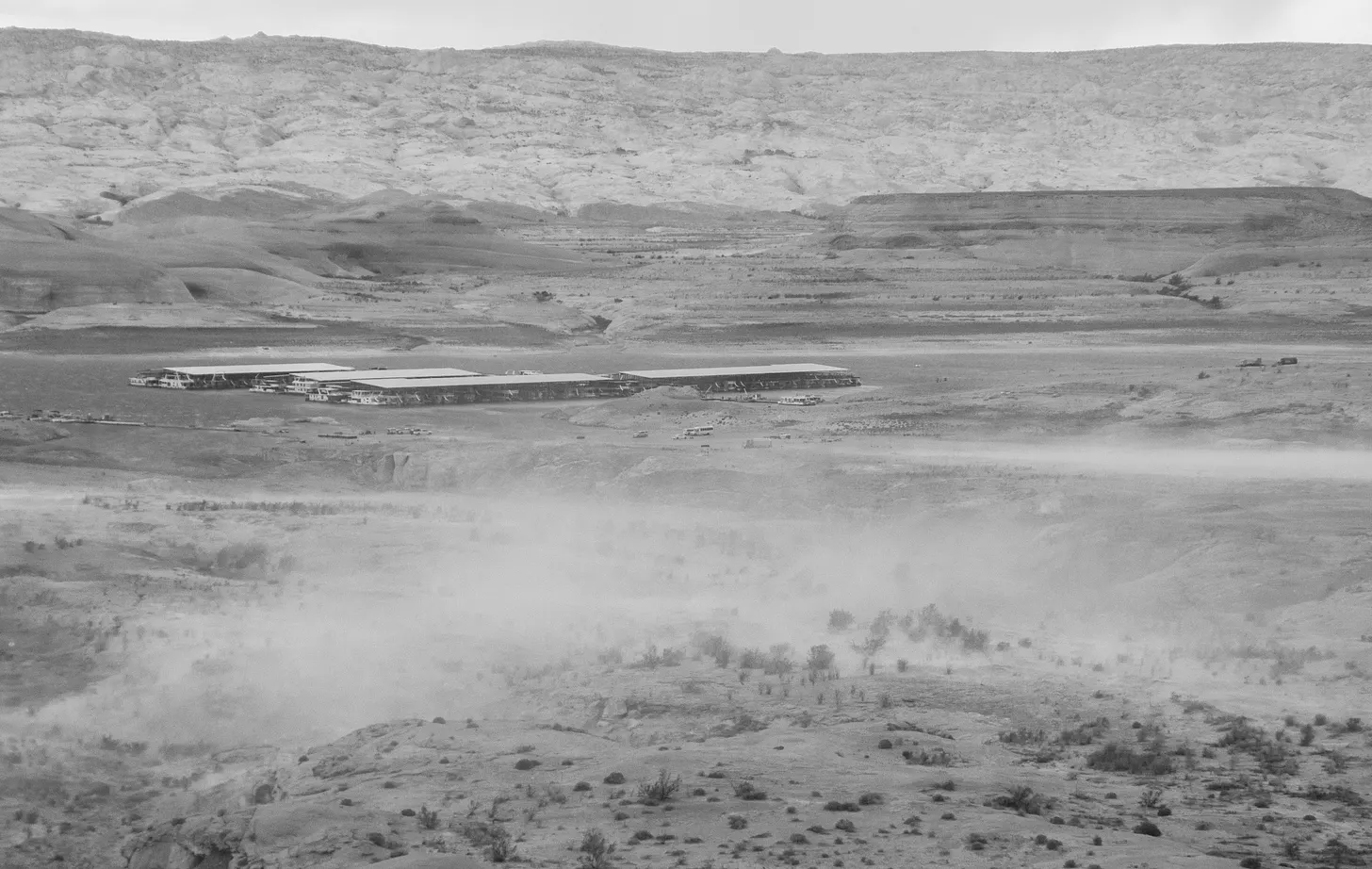
Persistent drought has lowered Lake Powell’s water level and exposed land that was once submerged at Wahweap Marina, as seen in this 2022 photo. (Bureau of Reclamation)
In 2021, Wheeler — together with a group of collaborators including Kuhn, climate scientist Brad Udall and Jack Schmidt, the director of Utah State’s Center for Colorado River Studies — published a white paper called “Alternative Management Paradigms for the Future of the Colorado and Green Rivers.” It was a comprehensive assessment of more ambitious strategies for weathering the drought and climate change than had emerged from now-perpetual negotiations between the states.
“New approaches that are responsive to significantly drier climate conditions and changing patterns of consumptive uses may require bolder policy initiatives that exceed the incremental approach of modern management,” the group wrote. “It is critical to explore alternative water management strategies that may extend beyond the framework of the Law of the River as presently interpreted.”
The following year, the team published a paper in the journal Science titled “What Will it Take to Stabilize the Colorado River?” And, it turned out, stabilizing the system would take something that looked a lot like a grand bargain.
Assuming the drought persists as it has since 2000, Wheeler and his partners identified two scenarios that would stabilize the river, both of which assumed the Lower Basin had waived its ability to make a Compact call. In one, the Lower Basin would need to decrease its water use by about 2 million acre-feet a year when Lake Mead and Lake Powell reach low levels. That would assure it of about 78 percent of its apportionment — an amount roughly in line with cuts it has already committed to taking. In exchange, the Upper Basin would have to cap its water use at 4 million acre-feet. But that’s only slightly more than half of its 7.5 million-acre-foot Compact apportionment, and roughly 300,000 acre-feet less than what it currently uses.
The second scenario — call it the “near-parity scenario” for simplicity — more equally distributed the Upper and Lower Basins’ relative cuts in apportionment. In it, the Upper Basin would cap its use at 4.5 million acre-feet, leaving it with 60 percent of its Compact apportionment. The Lower Basin would be able to use about 67 percent of its Compact apportionment when reservoirs are low, just slightly more percentage-wise than the Upper Basin. But it would have to cut its uses by 3 million acre-feet below its apportionment.
That would stabilize the system — or at least go a long way toward doing so — while largely meeting existing water demands in both basins. The Upper Basin currently uses about 4.3 million acre-feet per year. The Lower Basin, after ramping up an aggressive water conservation effort since 2007, has driven its annual use down to about 6 million acre-feet per year, and has signaled that it could likely reduce demand further.
But it would leave practically no leeway for future growth, at least without reshaping the socioeconomic landscape across the entire Basin. In particular, any future urban growth could come only by shifting significant amounts of water from farms to cities.
HARD MATH
Today, there is a simple, hard reality on the Colorado River: The available water supply is already maxed out. Water use throughout the basin needs to be reduced by roughly 25 percent just to make the numbers work now — to say nothing of the future, which is likely to be significantly drier.
In Colorado, that has raised hard questions about fairness, the “equitable division and apportionment” provision of the Compact, and the assurance the state thought it had that its water would be there to develop when it’s finally ready.
“Everyone agrees that there should be an equitable division of water, and the word ‘equity’ is one that everyone will rally around,” says Kenney. “But does equitable mean equal? That’s the crux of the issue.”
Over the past several years, Colorado’s attorney general, Phil Weiser, has been building his office’s staff of water lawyers. This January, Weiser, who is currently running for governor, appeared before a joint hearing of the state legislature’s judiciary committees.
“If we can’t get a deal — and I’m committed to not getting a bad deal just to get a deal — we’ll be in litigation. We’re ready for it,” he said. “If and when we can get a reasonable deal based in reality, I’m for it. But if we can’t, then we will be falling back on our rights under (the) 1922 Compact.”
Because of the peculiarities of the water-rights hierarchy in the Lower Basin, Arizona is arguably most at risk there. In March, that state — whose governor, Katie Hobbs, is running for re-election — retained the high-powered law firm Sullivan & Cromwell to represent it in potential Colorado River litigation. At the time, a spokesman for the governor said, “it’s critical that Arizona be prepared to defend ourselves in court if an agreement cannot be reached or the Law of the River is violated.”
Anne Castle, a veteran of Colorado River issues. Former U.S. Commissioner, Upper Colorado River Commission • Former Assistant Secretary for Water and Science, U.S. Department of the Interior. (Source: Water Education Foundation)
“It is very difficult for a political figure — and they’re all political figures, even if they’re not elected — to agree to reduce the water use of their constituents and keep their career alive,” says Anne Castle. “They have to be able to tell their constituents, ‘I’m fighting for your water. I’m doing everything I can to keep your water secure, and it’s the other guy’s fault.’ The political incentives are directly at odds with the kind of compromise that’s needed in this type of hydrologic situation.”
Following the breakdown in negotiations between the Colorado River states, the federal government has announced its intention to step in. In May, the Bureau of Reclamation, on behalf of the Department of the Interior, revealed that it is preparing the first of what could be a series of five two-year interim plans for the river.
The final details are expected to be released this summer. But the federal government has indicated that the Interior secretary could cut water deliveries to the Lower Basin states by up to 3 million acre-feet — 40 percent of their Compact apportionment. During a briefing for Arizona water users in May, Brenda Burman, the head of the Central Arizona Project, presented modeling analysis of the proposed reductions and noted that, given the diminished releases from Lake Powell, the Upper Basin is “in a definite breach of the Compact by Sept. 30 of 2026.”
Owing to some quirks of river history, the secretary debatably has less authority in the Upper Basin, and so Reclamation has proposed no cuts there. But as climate change continues to eat away at snowpack and river flows, the Upper Basin states will likely be forced to cut back their uses anyway. Regardless of what the Compact says the Upper Basin gets, the water simply won’t be there.
And so now the seven states are facing a situation eerily similar to those in the near-parity scenario Wheeler and his colleagues laid out in their Science paper four years ago — but without a bargain.
COMING FULL CIRCLE?
In many ways, the prospects have never been worse for something like a grand bargain. Yet the fundamental problems the grand bargain was intended to solve have only grown sharper in the 20 years since it was first proposed.
“The grand bargain has gotten a bad name,” Kuhn says. “But if these issues aren’t resolved through a grand bargain, they’re going to be resolved through litigation.” In 2007, he says, the river’s reservoirs still had ample water to work with. “With empty reservoirs, you cannot finesse these issues.”
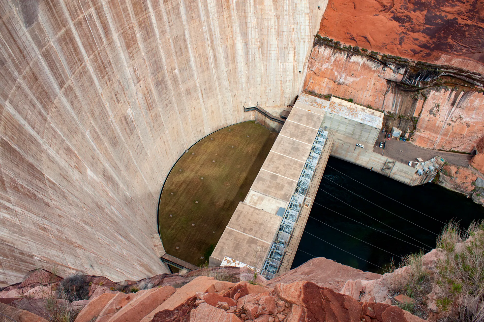
Glen Canyon Dam creates water storage on the Colorado River in Lake Powell. Credit: U.S. Bureau of Reclamation
Litigation could come as soon as August, when Reclamation will likely release a record of decision for its proposed new operating plan. Legal action could take one of several paths. The one with the highest stakes would be direct enforcement of the Compact, likely in the form of a Compact call brought by Arizona and the other Lower Basin states against the Upper Basin states. Because the Compact is essentially a treaty between multiple states, that would go directly before the Supreme Court. But such cases are often grindingly long: Arizona’s 1952 lawsuit against California over Colorado River rights took a dozen years to resolve. A case in the Supreme Court could put the river in protracted litigation during a time of profound crisis.
Other, more limited challenges are possible, most likely against the Bureau of Reclamation or the secretary of the Interior for failure to comply with the Compact or violating environmental laws. But they, too, are not without risk.
“I have a hard time believing you could keep litigation contained, once that genie’s out of the bottle,” says Kenney. “I just have to believe that inevitably blows up into a full-fledged interstate litigation and it bumping right up to the Supreme Court.”
As the odds rise of a legal challenge to the Compact that could ultimately wind up before the highest court in the land, the fundamental tension the grand bargain was intended to resolve will likely be front and center before the justices. And, paradoxically, that could force the states themselves to finally make the really tough sacrifices they’ve been trying to avoid.
“I think that a road to a grand bargain runs through litigation,” says Kuhn.
That’s because in past interstate fights over shared rivers, the Supreme Court has typically appointed a water-law expert known as a special master to referee such cases. The most recent example is the dispute between Texas, New Mexico and Colorado over the Rio Grande. In that case, Kuhn notes, “the special master said, ‘You don’t want me or the court to decide this; get in a room and negotiate it.’ The special master kept the pressure on the states to negotiate.”
This May, the Supreme Court approved a settlement between those three states. Still, even that resolution only came a full 13 years after the case was initially filed, and it involves relatively small reductions in overall water use.
On the Colorado River, both water and time are in far shorter supply.
Western Water, our flagship publication by Foundation journalists, is available online. Check out our latest articles. Reach writer Matt Jenkins at mjenkins@watereducation.org.
Know someone who wants to stay connected to water in the West? Encourage them to sign up for Western Water and follow us on LinkedInand Instagram.
Colorado River “Beginnings”. Photo: Brent Gardner-Smith/Aspen Journalism
Click the link to read the article on The Denver Post website (Elise Schmelzer). Here’s an excerpt:
June 21, 2026
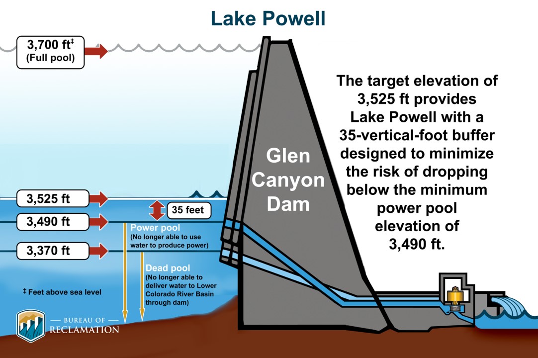
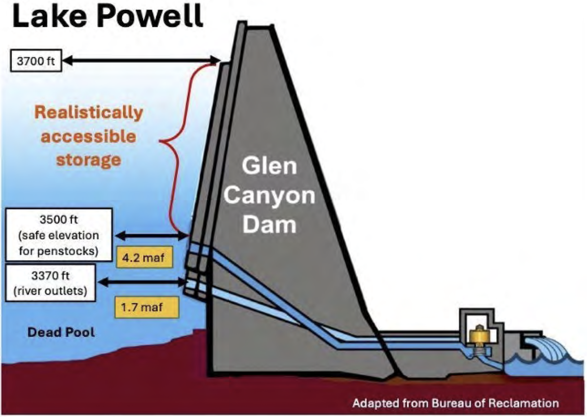
The two major reservoirs on the Colorado River face dire outlooks that will likely spur federal officials to restrict the amount of water flowing downstream — and decrease hydropower generation — in the coming months, even after they ordered recent emergency measures. Projections released last week by the U.S. Bureau of Reclamation show that if dry conditions persist, Lake Powell’s water level could dip below a threshold called “minimum power pool” as soon as February. That’s the level below which water can no longer flow through the reservoir’s hydropower turbines. Without intervention, the projections say, the lake will remain below the critical elevation for the foreseeable future.
Lake Powell key elevations. Credit: Reclamation
The threat of Powell hitting that threshold — 3,490 feet in elevation — has hovered above federal water managers for months as the reservoir has continued to drop to record-low levels. In April, U.S. Bureau of Reclamation leaders announced that they would send up to 1 million acre-feet of water from the upstream Flaming Gorge Reservoir to Powell and reduce the amount of water released from Powell to keep the reservoir’s level at 3,500 feet above sea level — which includes a small buffer Reclamation officials want to maintain to stay above the power pool level. Powell’s water levels continue to drop as Colorado River leaders deal with two crises: one climatological and one political. Long-term drought fueled by climate change has shrunk the Colorado River’s flows as federal officials and water leaders in the seven basin states — including Colorado, home to its headwaters — struggle to agree on longer-term plans for the river’s management. So far, they’ve failed to find agreement on how to divvy up the usage cuts necessary to adapt to lower flows that reduce the water supply for farmers and residents in a region that’s home to 40 million people.
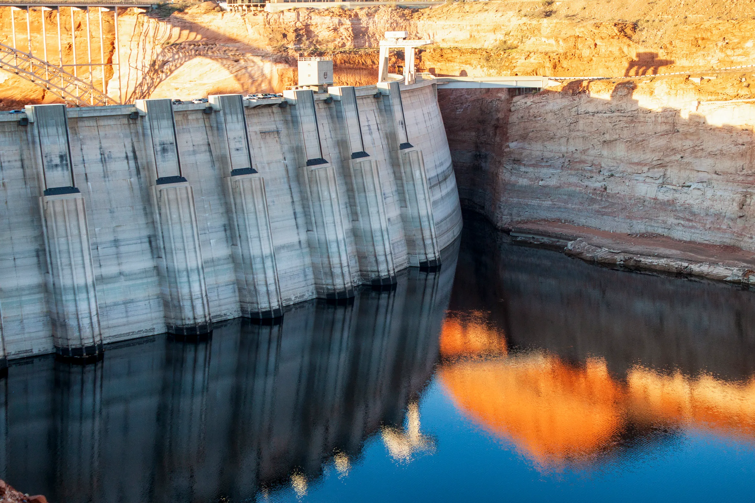
The back of Glen Canyon Dam circa 1964, not long after the reservoir had begun filling up. Here the water level is above dead pool, meaning water can be released via the river outlets, but it is below minimum power pool, so water cannot yet enter the penstocks to generate electricity. Bureau of Reclamation photo. Annotations: Jonathan P. Thompson
When Lake Powell’s levels fall below minimum power pool, that means water can no longer flow through the intake tubes for Glen Canyon Dam‘s hydropower facility, which is the primary method for moving water downstream from the reservoir in southern Utah. Instead, water can move only through much smaller bypass tubes that, for years, have been considered unsafe for long-term use — though Reclamation officials now say they can be operated safely with continuous maintenance. The bureau’s most recent projections, released Tuesday, show that the emergency measures taken this spring will only be a stopgap, unless extremely wet weather returns…If Lake Powell falls below minimum power pool, the only way to release water downstream is through four 8-foot-diameter tubes called the river outlet works. For years, Bureau of Reclamation officials have said the tubes were not designed for long-term use at low water levels, and such use could cause structural damage to the dam. But officials now say there’s a way to safely use the river outlet works, if needed…Recent studies of the river outlet works have shown that managers can operate the backup tubes continuously in a safe way, said Katrina Grantz, the deputy regional director for Reclamation’s Upper Colorado Region, at a conference in Boulder earlier this month. But the outlets require frequent inspections and maintenance when used continuously, which means that one of the four conduits will routinely be offline. Over the course of a year, the maintenance rotation will result in an effective capacity of about three and a half outlets operating continuously, bureau spokesman Peter Soeth wrote in an email in response to follow-up questions from The Denver Post.
“The river outlet works were never designed to serve as the primary or long‑term release pathway,” Soeth said. “Relying on them continuously would reduce operational flexibility and, over extended periods, could introduce wear that requires more intensive maintenance.”
Hite Marina and boat ramp on what once was the northern end of Lake Powell. Jonathan P. Thompson photo via The Land Desk.
Click the link to read the article on the Grist website (Jake Bittle):
June 23, 2026
Desalination. Pipelines. Cloud seeding. Those are just a few ideas for how the Trump administration should save the desiccated waterway.
The crisis on the Colorado River is simple: The seven Western states that border the essential waterway use more water than it contains. Chronic overuse [ed. allowed and caused by the “Law of the River”] has drained its two largest reservoirs, Lake Powell and Lake Mead, and a two-decade drought cycle has pushed them to the point of collapse.
The dream solution to this crisis is an agreement among all involved to use less water. Such a deal would decide who must reduce consumption, which means asking which cities would ban irrigating lawns and washing cars and which farmers would rip up their fields.
This has proven impossible. The states have been trying to work this out since the last dry spell, in 2022, but talks have ended in frustration and name-calling. The main sticking point is between the Upper Basin states, led by Colorado and Utah (along with Wyoming and New Mexico), and the Lower Basin states of Arizona, California, and Nevada. Each side believes the other has a legal and a moral responsibility to cut usage during dry years. The stalemate means the Trump administration must design a schedule of restrictions ahead of a crucial deadline in September. So far, Interior Secretary Doug Burgum has balked at resolving the quarrel.
Instead, the administration is turning to a far less controversial plan: Throw money at the problem. The Interior Department and Congress are pondering a slew of projects that could increase supply — a reversal of President Trump’s zeal for cutting federal grants. The seven state governors have sent Washington a “wish list” of over $50 billion, and several startups have their hands out as well.
Federal investment makes sense given the scale of the problem and the intractable impasse, said Jennifer Pitt, the Colorado River program director at the National Audubon Society and an expert on the governance of the river.
“It is something easier for people to agree on,” she said. “This is a slow moving crisis, but it is a crisis, and we do see the federal funding come in to address crises in other parts of the country. Just because this is a slow moving one doesn’t make it any less worthy.”
During a Senate committee hearing last week, the Interior Department’s top water official, Andrea Travnicek, said the agency has yet to vet the wish list. She didn’t offer a specific funding request, and urged lawmakers to be “thoughtful” about how they spend taxpayer money. But senators in both parties seemed to encourage new investments. “The basin should not be forced to choose between stabilizing the present and negotiating the future,” said Senator Martin Heinrich, a Democrat from New Mexico.
The possibility of new funding marks a return to the policy of Joe Biden’s administration. During the last extreme drought in 2022, the Interior Department paid farmers billions to leave their fields fallow, but that money, from the Inflation Reduction Act, has almost run dry.
The difference now is that the roster of proposals is far more ambitious, and some far less certain to bolster the basin’s water supply. They range from desalination plants and desert groundwater pipelines to forest ecosystem restoration.
Here are a few of the major solutions state officials and companies are proposing.
The Claude “Bud” Lewis Desalination Plant in Carlsbad, California. Photo by Robert Marcos
Desalination
As the Colorado River crisis has deepened, some cities in the Southwest have eyed desalination, which extracts salt from sea water. A company called Poseidon Water opened such a plant in San Diego in 2015 and tried for decades to open another in Los Angeles. The wish list to the Interior Department requests as much as $6 billion to build one across the border in the Mexican state of Baja California to supplement Arizona’s vanishing Colorado River supplies.
The Interior Department also signed an agreement in early June with San Diego’s water agency that explains how that plant would help. Rather than sending treated seawater inland, states would pay the city to take less from the Colorado River. Arizona stands to lose the most water during drought years, and it would be the most likely to participate in that exchange.
But desalination is expensive, requires enormous amounts of electricity, and state-of-the-art industrial technology. The Poseidon facility cost $1 billion, but San Diego has diversified its water portfolio so much that it no longer needs all the water it must purchase from the plant. Trading water could help it offset some of that cost.
Taming tech and power
Nevada uses less water than any state on the river and has cut usage in Las Vegas by replacing grass with artificial turf. It is now seeking money to slake some of its last thirsty industries: power plants and data centers. These facilities need a fraction of what agriculture requires, but they dominate usage in the Silver State.
The state’s wish list includes $300 million to retrofit its largest natural gas plant and reduce water consumption by an amount equivalent to more than 3,000 average homes. It also seeks $650 million to install zero-water cooling systems in airports, schools, and industrial facilities. These closed-loop systems, which recirculate the same cooled water or, in the case of data centers, blast hot servers with cold air, have become more popular in Western states amid concerns about the tech boom’s growing thirst.
A cloud seeding generator is located in Grand Mesa. The Colorado Water Conservation Board administers the state’s weather modification program, which permits cloud seeding operations. Colorado Water Conservation Board/Courtesy photo
Squeezing rain from the clouds
Whereas Lower Basin states like Arizona and California can draw from the Colorado River’s big reservoirs on demand, northern states at its headwaters only receive the rain and snow that feed it.
These Upper Basin states have been trying for decades to engineer more precipitation, with support from Washington, D.C. It sounds futuristic, but cloud seeding — spraying salt or silver iodide into clouds, forcing them to release water they might otherwise retain — has proven fairly effective on a small scale. Utah spends a few million dollars each year doing this, and officials say it could boost annual snowpack by as much as 10 percent.
In addition, a few startups are pitching cheaper and more scalable versions of this technology. Rain Enhancement, a Florida-based outfit, says it has brought about 15,000 homes’ worth of rain to a river tributary in Utah this year; another, Rainmaker, says it can produce 1,000 times that much by 2031. That’s enough to close the supply gap on the river. That promise is fanciful, but these companies could secure federal funding from an administration that loves the tech industry.
Mining a hoard of desert groundwater
The West teems with companies that have promised miracles, from building a 300-mile pipeline to tapping a hoard of groundwater in Nevada. But perhaps no project has had a longer and more turbulent history than Cadiz, a proposal, almost 30 years old, to export groundwater from an aquifer in the Mojave Desert.
This has drawn vicious opposition from environmentalists and the late California Senator Dianne Feinstein, who called it a “grave threat” to the desert. Cadiz experienced several setbacks during the Biden administration: It lost a federal permit, California ended its pipeline lease, Arizona declined to support it, and its stock price fell to almost zero. But Susan Kennedy, its CEO, says Cadiz is flowing again with a funding agreement from the Interior Department to study exchanges between Cadiz and the Colorado River.
The company still needs to finish two pipelines, one to the Central Valley and another to the aqueduct that carries Colorado River water to California. It also must build a plant to remove contaminants in the water, but Kennedy believes she can have the tap running by 2028.
“This isn’t a competition; it’s an all-of-the-above situation,” she said of the situation on the river. That may be so, but the seven states did not include Cadiz on the wish list sent the Interior Department.
Map of the Colorado River drainage basin, created using USGS data. By Shannon1 Creative Commons Attribution-Share Alike 4.0
The new conveyor system moved concrete across the gap where the spillway channel will be to the far side of the dam. Photo credit: Denver Water.
Click the link to read the article on The Denver Post website (Elise Schmelzer). Here’s an excerpt:
June 14, 2026
…it remains unclear whether Denver Water will ever be able to fill the reservoir to its new full capacity as a yearslong court battle lumbers on between the utility and environmentalists. Months of mediation between the parties have failed. Denver Water is now asking a federal appeals court to reverse a lower court judge’s 2025 order barring the utility from filling the expanded reservoir and ordering the yearslong federal permitting process to be redone. A panel of three judges for the 10th U.S. Circuit Court of Appeals is scheduled to hear arguments in the case on July 31 in Santa Fe…
U.S. District Court Judge Christine Arguello in 2024 found that federal regulators violated environmental protection laws when they failed to properly analyze the environmental impact of the project or consider reasonable alternatives to the dam expansion that would be less harmful. She later issued the order against filling the reservoir. Environmental groups argued in court, and in their filings, that regulators failed to evaluate how siphoning more water from the drought-stricken Colorado River would impact the basin as a whole. And the groups charged that they failed to weigh other project options that wouldn’t require the clear-cutting of a half-million trees or risk damage to wetlands. The case has drawn the attention of other Front Range water providers, lawyers from across the county and the U.S. Chamber of Commerce — all of which have filed briefs in the appeals case…
While the dam structure itself is complete, at least a year of work remains to fully finish the project, Martin said. Construction crews must finish the spillway and place the final topper foot of concrete on the completed dam structure. Divers will place a gate between the reservoir’s water and the dam’s intake tubes. But the crews on site will diminish in the coming months, from up to 500 workers a day to closer to 100. On the morning of June 3, crane operators already worked to remove from the dam crest the heavy machinery that was necessary to build the main structure.
Roller-compacted concrete will be placed on top of the existing dam to raise it to a new height of 471 feet. A total of 118 new steps will make up the new dam. Image credit: Denver Water.
Glen Canyon Dam forms Lake Powell on the Colorado River near Page, Ariz. Officials from the U.S. Bureau of Reclamation are holding back water and releasing water from an upstream reservoir to prop up levels in Lake Powell. CREDIT: HEATHER SACKETT/ASPEN JOURNALISM
Federal officials announced on Thursday that they plan on using a shorter-term framework for future Colorado River management so they can be more responsive to changing conditions and reservoir levels.
Acting Commissioner of the U.S. Bureau of Reclamation Scott Cameron said at an annual conference on water policy that the agency will be using a 10-year framework, issuing new operational guidelines every two years. In the absence of a seven-state deal for sharing shortages and managing reservoirs, river management now falls to the federal government — an outcome nearly everyone had hoped to avoid.
“We would love to have a 20-year deal or a 30-year deal but, frankly, we haven’t even been able to get the seven states to agree on what a two-year deal would look like,” Cameron said. “Given the highly unusual hydrological situation in the basin … we think it makes sense to take a second look at decision making every couple of years.”
As part of the required process under the National Environmental Policy Act, Cameron said Reclamation will release a final Environmental Impact Statement with its “preferred alternative,” in mid-to-late summer. It will lay out a more detailed 10-year operations plan for the nation’s two largest reservoirs, Lake Powell and Lake Mead, and will include short-term operational guidelines for 2027 and 2028. He said the plan provides a stable, transparent and adaptable framework for river management.
Scott Cameron is the acting commissioner of the U.S. Bureau of Reclamation. He announced Thursday the federal agency is planning to release a river management plan in mid-to-late summer that includes a 10-year framework, with new operational guidelines every two years. CREDIT: U.S. BUREAU OF RECLAMATION
“We want to pay more attention to what’s actually happening in the river and what’s happening in terms of the elevation of the reservoirs,” Cameron said. “We want to manage conservatively during low inflow periods and hopefully be able to transition to recovery as conditions improve across the basin to keep the system stable and resilient.”
Cameron left the door open for a return to future management by the states and added that if they eventually come to an agreement, it could supplant the federal plan.
Cameron’s update came at the Colorado Law Conference on Natural Resources at the University of Colorado Boulder, hosted by the Getches-Wilkinson Center and the Water & Tribes Initiative. Water managers from around the basin gathered at the Wolf Law School in the midst of one of the worst droughts on record that threatens the water supply for about 40 million people in the American Southwest. Record hot temperatures and one of the worst snowpacks since measuring began resulted in streamflows that peaked much lower than normal and, in some reaches, a month early. Reclamation’s most recent projections put spring runoff into Lake Powell at just 800,000 acre-feet, which would be 13% percent of normal and the lowest on record.
On top of the abysmal hydrologic conditions, the basin is also in the midst of a management crisis. The Upper Basin states (Colorado, New Mexico, Utah and Wyoming) and Lower Basin states (California, Arizona and Nevada) after two years of negotiating have failed to reach a consensus on how they will share future cuts and have blown past deadlines to come up with a plan. The current guidelines, which have determined shortages and releases since 2007, expire at the end of the year. But for all intents and purposes, water managers need a new plan in place by the start of the new water year on Oct. 1.
Some of the problem still centers around the 1922 Colorado River Compact, which allocated half of the river’s flows (7.5 million acre-feet a year) to each basin. But this framework no longer applies under 21st century conditions, which has seen flows decline by 20% due to climate change. Despite indications a year ago that the states were moving to a supply-driven model based on each year’s snowpack and available water — rather than a fixed allocation of water — a new management framework the states can agree on has remained out of reach.
Colorado representative Becky Mitchell and Nevada representative John Entsminger speak at a conference on Colorado River policy in Boulder on Friday, June 5, 2026. The federal government is set to release a plan for future river management in mid-to-late summer. CREDIT: HEATHER SACKETT/ASPEN JOURNALISM
Beyond the band-aid
The feds’ operating plan for the first two years may be based on a proposal submitted by the Lower Basin states in early May, in which they propose to cut another 700,000 acre-feet of water per year through 2028, on top of the 1.5 million acre-feet they had already promised. California and Arizona will each take another 300,000 acre-feet of cuts and Nevada will take a cut of 100,000 acre-feet. The proposal does not include any mandatory conservation from the Upper Basin.
Federal officials responded in a May 28 letter with adjustments to make the proposal feasible, including the requirement that the Lower Basin states help pay for the 700,000 acre-feet of conservation. In the past, conservation programs have depended heavily on federal funding.
Becky Mitchell, who represents Colorado in the negotiations among the states, said during a Friday panel that the feds’ plan was a starting point but raises some concerns. Constantly renegotiating an operating plan every two years would be hard to fathom, she said.
“How do we fund and finance if we’re constantly renegotiating?” Mitchell said. “And how do we create the certainty that the 40 million people deserve?”
The feds have already stepped in this spring to prevent the worst consequences of the exceptionally dry winter and keep water levels at Lake Powell from falling below the threshold for making hydropower at Glen Canyon Dam. They are releasing up to 1 million acre-feet from Flaming Gorge Reservoir to prop up Powell and holding back Powell releases by about 1.5 million acre-feet. Cameron conceded, however, that these are temporary, stop-gap measures meant to address a critical situation.
“I think we succeeded in making everybody unhappy and everybody mad, which maybe means we’re doing the right thing in terms of Lake Powell,” Cameron said.
The Upper Basin states, including Colorado, are exploring ways to contribute water to a pool in Lake Powell as a means of maintaining higher water levels and an insurance policy against drastic cuts. But officials have not budged from their position that the Upper Basin is limited in what it can do and that cutting Lower Basin overuse is the primary solution to the Colorado River crisis.
Brad Udall, a water and climate scientist at Colorado State University whose presentation kicked off the conference, asked water managers not to waste this unique opportunity to redo 100 years of law and policy around how to manage a critical resource. And he directed a plea at the Upper Basin, saying that they, too, are part of the problem.
“We need everybody with a shoulder to this wheel,” Udall said. “We understand that the Upper Basin is different. We understand that they don’t have (large upstream) reservoirs and that every year people suffer. But we need you to help. Please help us.”
Udall/Overpeck 4-panel Figure Colorado River temperature/precipitation/natural flows with trend. Lake Mead and Lake Powell storage. Updated through Water Year 2025. Note the tiny points on the annual data so that you can flyspeck the individual years. Credit: Brad Udall
Map of the Colorado River drainage basin, created using USGS data. By Shannon1 Creative Commons Attribution-Share Alike 4.0
Click the link to read the article on the InkStain website (John Fleck):
June 1, 2026
I’ve been on a “Colorado River sabbatical” of late, but I took a peek last week at Reclamation’s latest 24-month study. Holy moly things have gotten bad since the last time I looked!
Those not on sabbatical already know all of this, but to keep Lake Powell above a surface elevation of 3,500 feet, Reclamation is:
increasing releases out of Flaming Gorge on the Wyoming-Utah border
dropping releases out of Lake Powell to 6 million acre feet this year
Even with those two “hail Mary” moves, Lake Mead is projected in the “most probable” scenario to drop to elevation 1,020 by summer 2027. Under the “minimum probable” forecast, Mead drops all the way to elevation 1,008 in 2027.
We are on the brink, as a group of my colleagues explains in a new analysis out this morning (Monday June 1, 2026), of a system crash:
Even a wet year, my friends conclude, would only provide a short reprieve from the need to significantly reduce consumptive use.
Building on a similar analysis done last September (I was a co-author on that one), the authors attempt to overcome one of the shortcomings of the traditional Colorado River accounting systems, which is to treat any water above “dead pool” as usable storage. This is not the case, with clear do-not-cross lines in the reservoirs that are maintained for technical reasons well above the bottom, defined by my colleagues as…
One of the reasons for my “sabbatical” is, frankly, an agonized frustration with the abject failure of Colorado River governance at the basin scale, and a desire to turn my attention to the local level, which is where the problem solving responsibility seems to rest right now. Each community needs to be having a serious conversation right now about the specifics of its Colorado River water supply, and how it intends to go about using less. Blaming other people for using too much isn’t particularly useful at this point, we seem to have chosen to hand that set of questions (the rule-based part of “who is entitled to how much”) over to the courts, and who knows what that process holds. We know the answer for everyone is “use less water”, and each community needs to be getting on with that conversation.
Doug Kenney at the Getches-Wilkinson Center 2026 Conference on the Colorado River June 5, 2026. Photo credit: Allen Best
Click the link to read the article on the Big Pivots website (Allen Best):
June 7, 2026
Doug Kenney, principal organizer of annual gathering in Boulder, talks about how the growing tensions among basin states pose challenges in setting the agenda
The Colorado River has always had a magnetic appeal to the public consciousness. John Wesley Powell and his crew were instant national heroes after they emerged from the Grand Canyon in 1869.
That interest continues to this day. Bathtub rings are an absorbing visual, an easy way to communicate declines in the two biggest reservoirs in the basin, Mead and Powell. The river is being hammered by a warming climate and archaic governance of the shared resource.
This provides much to chew on, and that discussion continued again on June 4-5 at the Colorado River Conference hosted by the Getches-Wilkinson Center at the University of Colorado Law School. Organizers reported 373 people were registered to attend in person and another 132 remotely, a record for both. This surpasses a record set last year.
Afterward, Big Pivots sat down with Doug Kenney, the principal organizer of the conference, to take stock of what had just transpired. He directs the Western Water Policy Program and chairs the Colorado River Research Group.
What year did this conference begin? What was the thinking that gave birth to it?
I believe 1983 was the first one. This was mostly a creation of Larry MacDonnell, (the first director of the Natural Resources Law Center, a position he held from 1983 to 1994).
Larry pursued a dual mandate of researching key issues but also of trying to involve the public and other constituencies. A conference was a natural thing to do. We are an educational institution.
I’ve done the last 30 or so of them, but Larry got it started,
It seems like two or three, maybe three years ago, the tribes became a major presence in attendance and on the agenda. How did this come about?
Mostly through our professional networks. We knew people who were associated with the (Colorado River Basin) Water and Tribes Initiative. They wanted to broaden their reach and their influence. At the same time, we’ve here always wanted to involve tribal interests in what we do, going back to the work of David Getches and Charles Wilkinson.
We decided we’d try co-hosting a conference. It’s a partnership, and like all partnerships, it grows over time. But it’s working pretty well, I think.
Am I wrong? Was I missing something? I didn’t notice much of tribal presence in the agenda or participation until just a few years ago.
We’d usually maybe have one tribal speaker sprinkled in the program somewhere, but it was pretty hit and miss, in part I think because you kind of need a critical mass of involvement from the tribal community for other tribes to feel like this is a place that they’d be taken seriously and that they’d be welcomed. It wasn’t a slow linear growth to where we’re at today. There was a pretty dramatic shift four or five years ago.
How new is the Water Tribal Initiative?
They’ve been around I think for about a decade. They’re co-managed by Matt McKinney, who wasn’t here, and Daryl Vigil.
Native America in the Colorado River Basin. Credit: USBR
It’s not a national thing, but the Colorado Basin has 30 different tribes. That’s a pretty big number of tribes to keep track of. It’s a network as much as it is anything, and every so often they try to get together. They consider this conference their big convening. They also get to get together at CRWUA (Colorado River Water Users Association, which holds an annual conference during December in Las Vegas).
They have also produced a few research reports. This week they talked about their report on tribal sovereignty. And they have particular initiatives within the Water and Tribes Initiative, such as universal access to clean water. They are pushing, mostly through federal legislation, to provide assurances that all tribes have access to clean water.
Do they have a strong benefactor?
I don’t think so, but they have a very broad base of funders and supporters. A lot of water agencies, a lot of people, and a lot of organizations that know tribes have been treated poorly and that tribes have legitimate interests in the basin but (know) that many tribes just don’t have the resources to do this without some assistance.
As I’ve attended most years since 2002, I have noticed some ebbs and flows. There were some empty seats this afternoon, but the seats were mostly occupied through the first day and a half, and that’s somewhat different than, say, 10 years ago. What explains the ebb and flow?
I attribute that mostly to two things: one is this partnership with the Water and Tribes Initiative. The other thing is the fact that we’re talking about the Colorado River, which by every measure is in a crisis. It’s easier to get people’s attention when you’re talking about a crisis than when you’re talking about something that’s still not that serious. That’s part of it.
We used to be in another building. This is clearly a better facility for audience and speakers alike. That helps us attract a larger audience. We’ve had good foundation support, good funders. It takes a lot of money to do this, but we’ve had funders that see value in it. That has allowed us to make this a bigger event.
The conference is always the first week of June, so when do you begin rough-drafting the agenda?
Usually January. In some years it’s easier than others. This year was the most difficult. It was the easiest year in terms of attracting an audience. The hardest year in terms of putting the program together.
Everyone’s mad at each other, and everyone is — I can’t tell you all the back stories. Becky Mitchell said something today about how it’s hard to negotiate and prepare for litigation at the same time. She’s right. And I was thinking to myself, it’s hard to bring people together to talk at a conference while acknowledging the fact that they’re all mad at each other, and some of them are about to sue each other, and some can’t be in the same room with each other because they’re that angry, and some will be deeply offended if someone else is there.
It’s one of these years that there’s just so many delicate issues and angry folks — and angry for legitimate reasons; I’m not discounting that. But it’s been a really challenging year.
Your answer anticipates my next question, but I’ll ask it nonetheless. If memory serves me, a few years ago you had representatives of all seven basin states at the same table. This year you had two. I guess it’s fair to say that agenda setting has become more politically sensitive.
Every year for the last four or five years we’ve given all seven principals, all seven states, an opportunity to sit at the same table and have a discussion. In every passing year it becomes more difficult to do that.
Commissioner to the Upper Colorado River Commission Becky Mitchell, center, speaks on a panel with representatives of each of the seven basin states at the annual Colorado River Water Users Association conference in Las Vegas Thursday, December 15, 2022. CREDIT: HEATHER SACKETT/ASPEN JOURNALISM
You have seen this at CRWUA as well. Some years they had to divide into two sessions, upper and lower basin sessions. For awhile we were thinking of just having a lower basin session. The lower basin folks were happy to do that, but the upper basin folks weren’t as comfortable. We (also) thought about a different part of the session or a different location.
Ultimately we came to the conclusion that everyone could agree if it would be a conversation, not a posturing or confrontational thing. (Having) one upper basin person and one lower basin person, that was a format that could work. That’s what we did (with Becky Mitchell from Colorado and John Entsminger of Nevada). Anything more elaborate than that I don’t think was viable this year. It’s a really delicate time.
In terms of conferences devoted to the Colorado River do you have rivals for what you’re doing? Are there other places in Arizona or California, for example, that are kind of like must-go sessions?
There are two must-attend Colorado River conferences each year, and this is one of them. CRWUA (in Las Vegas) is the other one.
We specifically try to be different than CRWUA. We’re the opposite end of the calendar, roughly six months away. CRWUA is in many respects much more of a social event. We try to be more academic and about policy, with serious talk about serious issues. CRWUA, just like us, ebbs and flows from year to year in terms of what it looks like. But we try to be a little more hard-hitting and less of a, you know, take-the-family-and-have-a-vacation sort of event. I don’t mean to sound like I’m negative on CRWUA. I think we’re the perfect compliment.
Aside from that, there are some meetings such as CLE, Continuing Legal Education. It always has a Colorado River event. This year was quite good. Many other years, it’s not as strong. For practicing attorneys, that’s something that they want to go to every year, because they can get some credits there.
Still another one in New Mexico that’s held each year kind of commemorates the signing of the compact.
How do you measure success? I’m sure you constantly ask that question of yourself.
You understand the challenge of it all. We can measure success by the size of the crowd and that they mostly seemed to have a good time. In that sense, that’s success.
The other side of that is that we’ve been focused just on the Colorado River issues for the last five or six of these, and things have only gotten worse on the river. Obviously, we don’t think we’re to blame for that. But clearly, there’s no great success story that we can lay credit to either.
So I think we’re successful in that we promote conversation and the exchange of ideas, and we shine a light on new and innovative ideas, and we give a voice to people who sometimes don’t have a voice. This is where the tribes come into play again.
Some elements I think are successful, but in the very big scope of things, the issues that we’ve been addressing in our conference aren’t getting any better. It does force me to think about (and question) whether there is a better way for us to make a difference. I don’t know what that would be, but I do think about that a lot.
Map of the Colorado River drainage basin, created using USGS data. By Shannon1 Creative Commons Attribution-Share Alike 4.0
A reservoir built to serve nearly a million Northern Coloradans started filling this spring. But Chimney Hollow’s future is still murky weeks after the initial fill. Chimney Hollow will eventually pull water from the Colorado River near its headwaters in Grand County to serve a dozen fast growing cities on the Front Range from Broomfield to Greeley…Chimney Hollow is holding just 2% of its total volume today because there’s a problem. Northern Water discovered that some of the rocks it used to build the massive dam at the reservoir contained radioactive uranium. It was naturally occurring, but it set the project back at least a year. Northern Water is still coming up with a mitigation plan.
“Really, the best way to kind of move that uranium out is to draw down the water and force that out,” spokesperson Rachel Stevens said. “But before we make any of those decisions, we really want to see what the levels of uranium are.”
So every week, crews are taking water samples from the small pool and sending it to a lab to see how much radioactive material is really in the water. The results are expected soon. Northern Water has only been able to test how uranium leaches out of the rocks in a laboratory setting. Filling the reservoir just slightly will help reveal the extent of the problem.
Map from Northern Water via the Fort Collins Coloradan.
Click the link to read the article on the Associated Press website (Susan Montoya Bryan). Here’s an excerpt:
May 27, 2026
In a brief order Tuesday, the court accepted the recommendation of a special master to move forward with agreements first proposed last year by New Mexico, Texas and Colorado. The settlement calls for reducing groundwater pumping along the dwindling river and retiring water rights from irrigated farmland in southern New Mexico. The states held up the proposal as a promise to restore order to an elaborate system of storing and sharing water between two vast irrigation districts in southern New Mexico and western Texas.
“We’re very excited to be redirecting resources from costly and lengthy litigation to solutions on the ground,” Hanna Riseley-White, director of the Interstate Stream Commission, said Wednesday…
Those solutions will include everything from long-term fallowing programs and more efficient irrigation infrastructure to developing new sources of water, like tapping brackish supplies or importing water, and improving stormwater management so more runoff can be captured and stored.
Green Mountain Reservoir is owned by the U.S. Bureau of Reclamation and located in Summit County north of Silverthorne along the Blue River. Photo credit: Denver Water.
The state and the Colorado River Water Conservation District, a public water policy and planning agency on the Western Slope, have a new plan to protect mountain towns from losing their water supply during an unprecedented drought this summer. The District’s proposed emergency water supply plan was approved at the Colorado Water Conservation Board meeting on Wednesday, May 20, 2026…The emergency plan would protect certain water users on the main stem of the Colorado River by replacing water that would have historically come from Green Mountain Reservoir. This year forecasts say it won’t fill up for the first time in history…A portion of the reservoir is reserved for what’s called the “historic users pool,” which holds 66,000 acre-feet of water…It’s an important emergency water supply plan that protects approximately 250 municipal and domestic water entities across the Colorado River Basin from being called out due to senior water rights claims. It was created as part of the Colorado Big Thompson project, a massive water engineering project that created reservoirs and redirected Colorado River water to Front Range cities…After a drought in 1977, water managers set aside the historic user pool for agricultural and domestic users. It’s historically always been filled and available to protect those water rights from being usurped by more senior users…Every year, a group of agricultural and utility entities in the Grand Valley near Grand Junction makes what’s called the “Cameo call” to use water from it. It’s the largest and most senior call on the main stem of the river and demands that they get enough water for their needs. That includes the Grand Valley Water Users Association, Grand Valley Irrigation Company, Orchard Mesa Irrigation District, Palisade Irrigation District, and Mesa County Irrigation District. The call is made annually, generally between June and August. This year, the fear is that if that water demand is called early, there won’t be enough water for upstream towns and municipalities, including Silverthorne, Eagle River, and Grand, Garfield and Mesa counties…
The River District plans to borrow water from other reservoirs — the nearby Wolford Mountain and Ruedi reservoirs — to replace the water that would have come from Green Mountain and to prevent the Cameo call from being made…At the meeting, the board committed to support the move with $585,000, in addition to $342,000 the District committed last month.
“Instead of having to turn off all of these cities’ water rights up here and the farms and ranches up above the Grand Valley, the Green Mountain historic user pool would release water to meet the Cameo call and protect the West Slope users. It is a really appropriate use of that water,” Mueller told CPR News.
Colorado-Big Thompson Project map. Courtesy of Northern Water.
A mini-sandstorm partially obscures the Bullfrog Marina on Lake Powell. Dropping reservoir levels are forcing officials to move the marina to a deeper part of the lake. Jonathan P. Thompson photo.
Maybe sitting next to the wall of plate glass windows was not the smartest move, I thought, as a sienna-colored cloud of sand lifted up from the lakeside and made its way in my direction. I had just tucked into my $16 grilled chicken sandwich at the Anasazi Restaurant at Bullfrog Marina on Lake Powell when the wind kicked up, sandblasting the windows and causing a sizable milk crate to slide back and forth along the railings of the patio outside. It was an eerie scene. Had this been an apocalyptic cli-fi film set in a calamitously aridified West, this would have been the moment when a pterodactyl-like creature smashed through the window and plopped down all bloody and sandy in my plate of fries, an omen of the horrors to come.
It was not, however, a film. The dystopian scene was real as was the aridification, though it did not include any prehistoric creatures — only a handful of staff and other diners who, much to my dismay, seemed utterly unperturbed by the sandstorm and the havoc it was wreaking on a set of outdoor furniture. And, outside, a few ravens who seemed delighted to frolic in the gusts’ updrafts.
When we think of climate change’s effects, we might imagine communities inundated by rising seas, unhoused folks exposed to ever more severe heat waves, or entire towns wiped out by megafires. I was here at Bullfrog to see how a warmer and drier climate is affecting the communities, infrastructure, and economies that rose up around and depend upon Lake Powell-based recreation.
Bullfrog is the largest and most extensive marina on Lake Powell’s northern end. It has a 48-room hotel, the aforementioned restaurant, a gas station and convenience store, an RV park, and other lodging, along with its own school, which this year had four students in grades K-6. The population of some 50 to 100 consists mostly of employees of the National Park Service and Aramark, the private concessionaire that runs the reservoir’s marinas and other facilities. Nearby Ticaboo, which lies outside Glen Canyon National Recreation Area but also relies on Lake Powell recreation, has another 50 to 100 residents. The nearest incorporated town is Hanksville, some 67 miles to the north.
Bullfrog Creek along the southern end of the Burr Trail and Bullfrog Bay on Lake Powell in the distance. Jonathan P. Thompson photo.
Bullfrog lies at the end of the road on a bay at the mouth of Bullfrog Creek, where the water is shallower than on the main channel of the Colorado River, making the marina and its facilities more vulnerable to dropping water levels. While the main boat ramp is still being used, it will likely become unusable later this summer as the reservoir’s surface levels falls toward 3,500 feet. In coming weeks, the entire floating marina will be towed across the reservoir to deeper water adjacent to Halls Crossing Marina; Bullfrog’s fuel and boat rental docks have already been moved. The ferry between Bullfrog and Halls Crossing isn’t functional at low water levels, so is expected to be out of commission for the rest of this year, making for a 145-mile car trip between the facilities at Bullfrog and the boat ramps and marina at Halls Crossing.
I visited Bullfrog on a Sunday in mid-May. Because I needed to do some internet-related work early on Monday morning, I stayed in the hotel. I initially regretted not staying in the campground, since it was mostly empty and had a strong cell phone signal, but when the tent-shredding winds and skin blasting sands kicked up I was happy to be ensconced in more secure lodging, especially given the relatively reasonable price.
It was the high tourist season elsewhere in Canyon Country. The trailhead parking lots at Capitol Reef National Park were all full or overflowing that morning as I drove through, and Torrey had been busy during my stay there for a writing conference. As I slowly made my way down the Notom Road and Burr Trail, stopping frequently to gaze at the curves and crevices in the Waterpocket Fold and for a quick bike ride, I saw maybe a half-dozen other vehicles.
Waterpocket Fold. Jonathan P. Thompson photo.
Waterpocket Fold detail. Jonathan P. Thompson photo.
Bullfrog, meanwhile, was decidedly quiet. The hotel was nearly empty. Only a few sites in the RV park were occupied, and I later saw that most of the sites were out of order and closed. A couple of dozen cars, at the very most, were parked on the only operable boat ramp. The shelves on the little convenience store were sparsely stocked, and a box of Triscuits was going for $7.50 — though there was no cheese to accompany them — and gas was selling for $5.17. In May of 2000, the Bullfrog District received 33,000 visits, according to National Park Service statistics; in May 2025 only 10,886 visitors passed through the entrance gate. Current numbers aren’t yet available, but I imagine this year’s visitation will be far lower. And once the boat ramp ceases to function, I imagine the numbers will plummet further.
Boats, redrock, and snowy Henry Mountains at Bullfrog Marina. Jonathan P. Thompson photo.
The National Park Service is planning to build a new, deeper-water boat launch at Stanton Creek, a couple of miles from central Bullfrog, where the marina can be moved permanently. The project is expected to cost some $73 million, and won’t be completed this year. It’s a type of climate adaptation, I suppose, though one can’t help wonder how long the fix will last if the reservoir’s levels keep dropping.
Meanwhile, Bullfrog’s future is in doubt. A series of especially snowy winters in the high country might be enough to bring Bullfrog back from the edge of obsolescence. Maybe they won’t even need the Stanton Creek site. On the other hand, just one more below-average snowpack year could doom Lake Powell altogether. If Colorado River flows don’t increase substantially in the next year or two, the Bureau of Reclamation will have little choice but to build tunnels to bypass Glen Canyon Dam and effectively drain the reservoir in order to keep water running into the Grand Canyon and on to Lake Mead.
The question then would be whether Bullfrog could (or would even want to) adapt to a different sort of tourism.
The place might try to cater to hikers and small-watercraft users looking to check out newly revealed parts of Glen Canyon that have been inundated for the last several decades. And it could lure travelers exploring the greater region’s backcountry, though it’s not clear that type of visitor is going to be interested in the type of accommodations and services Bullfrog currently offers. Maybe it will just become a destination for disaster-tourist voyeurs looking to see the effects of climate change in real-time. Or, perhaps Bullfrog will become another Hite Marina, which the shrinking reservoir has left high and dry, its boat ramp separated from the lake by some six miles, the store and campground permanently shuttered and gated off.
Sightseers at Hite Overlook gazing down at the “Dominy Formation” of silt left behind by the receding waters of Lake Powell. Jonathan P. Thompson photo.
Hite Marina and boat ramp on what once was the northern end of Lake Powell. Jonathan P. Thompson photo.
The last time I visited Bullfrog was in the late 1980s. My dad, my brother, and I camped at Halls Crossing, then woke up and rode the ferry across the lake. From there we made an epic loop around and over the Henry Mountains along the then-unimproved Burr Trail and another gnarly road in our 1967 Pontiac Catalina. It took at least eight hours and involved some extensive road-building to keep the boat-like vehicle from bottoming out. Anyway, I remember Bullfrog as being a bustling resort with a sort of spring break party vibe, relative to the more bare-bones Halls Crossing. Of course, those were the glory days for Lake Powell, when the reservoir was full, and at the end of a bone-jarring drive across the desert one could stop at the Hite Marina for refreshments.
That night I listened to the sand batter the sliding glass door of my hotel room. The next morning, the reservoir’s placid waters reflected dawn’s first light, and the distant sandstone dunes seemed to glow from within. And to the north, a fresh coating of snow covered the craggy slopes of the Henry Mountains, promising a little bit of relief from these dry and trying times.
Henry Mountains. Jonathan P. Thompson photo.
📸 Parting Shots 🎞️
Early light, the Colorado River canyon, and the Henry Mountains from the White Canyon drainage. Jonathan P. Thompson photo.
Apache Plume and canyon in Utah. Jonathan P. Thompson photo.
Click the link to read the article on the Big Pivots website (Allen Best):
May 26, 2026
Dissonance exists between life-close-to-normal policies regarding urban water use and the growing crisis on the river
Casually surveying the urban landscapes in much of Colorado’s Front Range, you’d never know that the Colorado River — the source for roughly half the water of the cities — has deteriorated to its most pitiful shape of perhaps the last century.
Oh, yes, some utilities — notably Denver Water and Aurora Water, which together serve 1.9 million residents — have imposed rigorous stage-one drought watering restrictions. Outdoor irrigation is allowed twice per week and never during the heat of day. Other water utilities that tap Colorado River water, however, have asked only for voluntary cutbacks, if any at all.
Jeff Lukas via the Western Water Assessment.
Jeff Lukas, a water consultant with several decades invested in climate change work, says this seeming aloofness of some cities will not persist indefinitely. That is certainly true if the record heat and abnormal dryness of the past winter continues into 2027. They may have no choice.
“I think Front Range cities will be asked, whether nicely or not, to reduce their Colorado River diversions,” said Lukas in a May 11 webinar. “The mechanism for that is unclear, but I think it’s going to happen.”
Water rights of the Front Range cities — and many of those on the Western Slope, too — are junior to the Colorado River Compact. It was negotiated in 1922, making diversions more recent than that junior.
Problems in the basin were becoming apparent in the 1990s. The warming climate in this century has provoked changes. By all accounts, they have not been enough.
Lukas, as a dendrochronologist at the Institute of Alpine and Arctic Research in Boulder 20 years ago, was teasing out evidence from tree rings to understand the climates of the Colorado River Basin during the last 1,200 years.
Later, as a scientist with the Western Water Assessment, Lukas co-authored (with Liz Peyton) a 2020 report called Colorado River Basin Climate and Hydrology: State of the Science. That 500-page report integrated more than 800peer-reviewed studies to help water managers understand physical processes, climate risks, and forecasting tools across the basin.
In 2024, with the state climatologist, Russ Schumacher, and several others, Lukas turned out the 100-page volume called “Climate Change in Colorado.”
Based in Lafayette, Lukas now works as a consultant. At Lukas Climate Research and Consulting, he specializes in the overlapping areas of climate hazards, water resources, and ecosystems.
Lukas, in a presentation he titled “Running dry on the Colorado River: The roots of the crisis & its implications for the Front Range,” explained the big picture and Colorado’s Front Range part in it.
Defined by the Continental Divide, Colorado has an inverse relationship between its eastern and western slopes. About 90% of the state’s residents live to the east, nearly all at the foot of the Rocky Mountains, whereas 80% of the state’s precipitation originates on the west side, in the headwaters of the Colorado River and its tributaries.
Snow from the Gore Range and other “islands” of precipitation in Colorado provide 50% to 60% of the water in the Colorado River. Photo credit: Allen Best/Big Pivots
Colorado itself provides 50% to 60% of the water in the entire Colorado River, depending upon the year. This year has been a terrible year everywhere in the basin, Colorado included.
Lukas explained that “islands of moisture” provide nearly all the water in this 244,000-square-mile basin. The high mountains constitute these islands. Some places deliver more than others. Buffalo Pass, near Steamboat, famously has had prodigious volumes of snow. This snow, when melted, can produce 50 inches of water.
It takes 20 inches or more of precipitation in these mountain islands to produce meaningful runoff. Even then, it doesn’t all end up in the Colorado River. In Colorado and the three upper-basin states, he said, 16% of the rain and snow that falls becomes water in the Colorado River. In the hotter lower basin, the figure is 3%.
“The atmosphere takes back most of what it giveth, even in the wetter upper basin,” he said.
Evaporation and transpiration are the pickpockets of this water. Heat produces evaporation, and we’ve had plenty of that this year.
Temperatures during November through April were the warmest on record in Colorado for that span of months. March heat was exceptional. This produced runoff in the rivers that in most cases may surpass that of May or June, the traditional times for peak runoff. Peak runoff has been trending earlier by several weeks during the last few decades, but this was a leap of about two months.
Runoff for April through July — a time that normally accounts for 70% to 80% of annual streamflows — this year will likely deliver no better than 20% to 40%. In its May report, the Bureau of Reclamation said April flows into Lake Powell were 40% of the average during the last 30 years and it expects flows in May to sink to 9% of that average.
Can it get any worse? Count on it, said Lukas.
“We should expect not every year to look like 2026 from here on out, but more years in the future will look like 2026. And somewhere down the pipe, not as far in the future as we would like, there will be a year worse than 2026 for the Colorado River.”
Members of the Colorado River Commission, in Santa Fe in 1922, after signing the Colorado River Compact. From left, W. S. Norviel (Arizona), Delph E. Carpenter (Colorado), Herbert Hoover (Secretary of Commerce and Chairman of Commission), R. E. Caldwell (Utah), Clarence C. Stetson (Executive Secretary of Commission), Stephen B. Davis, Jr. (New Mexico), Frank C. Emerson (Wyoming), W. F. McClure (California), and James G. Scrugham (Nevada) CREDIT: COLORADO STATE UNIVERSITY WATER RESOURCES ARCHIVE via Aspen Journalism
This is so very different from what was assumed by the delegates from the seven basin states who gathered in 1922 in Santa Fe to apportion the Colorado River.
The role of reservoirs
Taking the big, long-term view, Lukas pointed out that the overall story of the Colorado River is one of modifications needed to suit human uses. “It’s all about smoothing out the natural variability in the availability of water over space and over time.”
Reservoirs are the primary means by which humans have been able to “smooth out the natural variability.”
The Colorado River Basin has 60 million acre-feet of storage. That’s four times the annual flow. Five-sixths of the storage capacity is found in the desert in two vessels: lakes Mead and Powell. The headwaters have many reservoirs but they are relatively small. The total storage capacity is 2,000 times more than the volume of Dillon Reservoir.
Illustration from the report, “Antique Plumbing & Leadership Postponed” from the Utah Rivers Council, Glen Canyon Institute and the Great Basin Water Network. Courtesy of Utah Rivers Council
Since 2000, stored water in those two big buckets, Mead and Powell, has declined from 49 million acre-feet to 16 million acre-feet as of May. Of that, 9 million lies at elevations below the lowest outlets. These are called dead pools.
Those delegates in 1922 who crafted the Colorado River Compact, the legal document that provided the basis for nearly all these dams and aqueducts subsequently built, assumed annual flows of 17 million to 18 million acre-feet. They were overly optimistic. The 20th century average was 15.2 million acre-feet.
Now comes the 21st century, and the average at Lee Ferry has dipped to 12.2 million acre-feet. This has implications for the Front Range cities but also farms. If Colorado must reduce its diversions to accord with the compact, those rights dated before 1922 will be exempt from reductions. The giant transmountain diversions have come more recently, as have many of the diversions for towns and cities on the Western Slope.
Accumulating evidence fingers human-caused climate change with large amounts of responsibility for declined flows. Lukas said his rule of thumb is that the role of greenhouse gases overall are responsible for two-thirds of lower flows.
Colorado statewide annual temperature anomaly (°F) with respect to the 1901-2000 average. Graphic credit: Colorado Climate Center
As for the mechanics of this shift, rising heat is one important “knob,” said Lukas. As the atmosphere warms, it reduces “runoff efficiency” even more, sending water into the atmosphere instead of into streams and then rivers. Accumulating evidence fingers human-caused climate change with responsibility for most and possibly all of increased temperatures.
Precipitation has declined about 5% since 2000, with a larger reduction in spring, an important time of year to get moisture. Here, the link to the warming climate is less clear. “It seems increasingly likely that climate change is changing the dynamics of storm tracks and the persistence of, say, high-pressure systems over the interior West,” said Lukas. “That is, at least in part, responsible for why we’ve had less precipitation since 2000.”
The Colorado River, though, had problems even before the warming climate began throwing sharp elbows in water volumes. The reservoirs of the Colorado River Basin were 92% full in 1999, a wet decade overall. Even then, however, the Colorado River had ceased to reach the Pacific Ocean. There were too many straws inserted.
Less than 12% of the river’s flow goes to urbanized and industrial uses. Lukas pointed out that cities have become more efficient in their use of water. The rule of thumb for Denver and other Western cities is that one acre-feet of water meets the needs of a three households on an annual basis. That compares with two households a few decades ago.
Mining of fossil fuels and minerals uses a small amount. Evaporation from reservoirs and rivers and other “system losses” accounts for about 15%.
That takes us to agriculture. It uses 75% of the river’s water in the Colorado River for irrigation on 5 million acres. Some of that land lies outside the basin itself. That includes the South Platte and Arkansas River valleys of eastern Colorado.
Over half of that water — about 9 million acre-feet — gets used to grow feed for livestock, mainly alfalfa and pasture grass.
Might cities want to cut deals with farmers to “share” the water? This discussion has been underway for at least 15 to 20 years. Some pilot projects in Colorado and elsewhere have been launched to see what this might look like. A strong proponent has been James Eklund, a water attorney in Denver. Others question how this is done and, for that matter, whether we want to do it. But certainly, water for urban uses has higher monetary value than growing hay to feed cattle.
Why the restraint of cities?
As for the Front Range cities, the big question is whether they are planning for a river that produces even less than it does now.
In 2024, Andy Mueller, the general manager of the Colorado River Water Conservation District, suggested the need to start planning for a river that may deliver less than 10 million acre-feet in coming decades. Some thought then that the state engineer, Jason Ullman, needed to start sorting through this matter of junior vs. senior rights. Jim Lochhead, a former water attorney on the Western Slope and later CEO of Denver Water, pushed back, saying it was premature given the huge amount of work that would be required. See: “Heading for the Colorado River Cliff,” Big Pivots, Oct. 20, 2024.
At the Zoom session on May 11, I asked Lukas about the modest watering restrictions by Front Range water providers. He had previously described mixed signals from the water utilities. If 2027 is dry again, expect more uniformity around drought restrictions. “But it’s pretty weird right now,” he said.
With the attention to the Colorado River in the news media, it seemed like a perfect opportunity for the water utilities to mount more aggressive campaigns. Any idea why they had not, I wondered.
The utilities, he said, are reluctant to deliver regulations that produce discomfort around outdoor water-use restrictions. They don’t want to do this unless absolutely necessary.
Part of this is because of experiences during the covid epidemic. A lesson to public servants during that time made them more reluctant to push the public to do things they don’t want to do. “You only want to exercise that authority, that public legal authority, sparingly and only when it’s clear that is what is really necessary.”
Revenue was another consideration. Water infrastructure is expensive, and the money to pay for it comes from charges for water use. By imposing limits, you reduce revenue and hence must charge more for water. The conundrum is that reducing use doesn’t necessarily mean you pay less. In some cases, less water may require more infrastructure. This is a hard message to convey.
“What you’re seeing is a dissonance between the circumstances and what’s happening, at least this year,” he said.
Or at least right now. We have had rainy weather in May. Some meteorologists think we may end up with healthy rainfall this summer. If instead the summer is like the winter, very hot and dry, I expect the utilities might pick up their game.
The cover of a new book I’ve just published, Storm in My Head, a collection of poetry written over the 60 years I’ve been living in the headwaters of the Colorado River, since 1966 — George Sibley
This is the cover of a new book I’ve just published, Storm in My Head, a collection of poetry written over the 60 years I’ve been living in the headwaters of the Colorado River, since 1966. My 60-year celebration. Those of you who prefer your literature in sprints and strolls over the marathon essays I impose on you might enjoy this book. I’m in the process of getting it distributed, and it may eventually be in a bookstore near you or on Amazon; but for the time being, if you are interested, an email to me, george@gard-sibley.org, will initiate a response on how to get a little money to me (10 bucks plus shipping) to get an inscribed copy wending its way to you.
End of advertisement – back to the river….
Romancing the River – Elephants in the River
The Colorado River situation is moving toward replacing the existing ‘Interim Guidelines’ for managing the river system with a new set of interim guidelines for managing the river system. This new set is devised mostly by the Bureau of Reclamation, which is growing a little desperate to avoid the embarrassment of having its river system cause the flow of the river to stop – ‘dead pool’ – behind one or another of its big dams, in a river management system built for a considerably larger Colorado River – now as mythic a river as the biblical four that flowed out of the Garden of Eden.
All this makes me think I’ll briefly abandon my historical update of Frederick Dellenbaugh’s Romance of the Colorado River, and try to sort through what has been happening recently in the present, most of which we’ve been reading or hearing about in the media.
Reports on the river’s flow after the Weirdest Winter Ever (at least in recorded time) have just gotten worse and worse; now the anticipated inflow to Powell Reservoir is 13 percent of the thirty-year average, from tributary runoffs that peaked as much as two months earlier than the usual early June. The Bureau of Reclamation’s 24-month projection indicates that, if last year’s releases from Powell were replicated this year, they might have to stop generating power by late summer to protect the power turbines – which in effect declares the remaining quarter of the reservoir’s potential storage ‘dead pool,’ since the only other way past Glen Canyon Dam is through four outflow tubes of questionable viability that the Bureau would like to use as little as possible.
The Bureau will address this with two emergency measures: first, by bringing a large quantity of stored water down the Green River from Flaming Gorge Reservoir, and second, by cutting releases from Powell Reservoir by close to two million acre-feet (maf) – which in turn will leave Mead Reservoir lower and diminish its power generation. This is an emergency plan that can nowise be considered long-range planning.
The Lower Basin states in turn have bumped up their willingness to take more shortages for the next couple years by roughly doubling shortages they have already agreed to accept – if the feds will pay them something for not using water that is not there. Their earlier cuts were basically just enough to finally start taking out of their individual allotments the system losses (mostly evaporation) they have been dismissing, with Bureau cooperation, as being met through ‘surplus flows’ that effectively disappeared when the Central Arizona Project came online in the 1990s.
The four Upper Basin states have responded by suggested that it might be time to bring in a facilitator or mediator to conduct the seven-state negotiations on future management planning. This launched an episode of fussing between the Lower and Upper Basins as to who first had that idea, with the other basin objecting to it. But no one seems to be totally opposed to the idea at this point, and it might happen.
Udall/Overpeck 4-panel Figure Colorado River temperature/precipitation/natural flows with trend. Lake Mead and Lake Powell storage. Updated through Water Year 2025. Note the tiny points on the annual data so that you can flyspeck the individual years. Credit: Brad Udall
But basically it all seems to be in reaction to an ‘emergency’ water year, with no advance on more long-range planning – and there is no reason to believe that this year in just a one-shot emergency like the 1977 water year. It is just the most extreme year in an extreme period – the past quarter century – that is probably the shape of the future in the Colorado River region, and there are no more Flaming Gorge reservoirs to draw down for the next emergency year….
It’s probably important to remember a distinction: there is a river, the Colorado River, and we have overlaid on that river a management systemfor managing the river’s water for its human uses, a system whose parts either store water or distribute stored water to users. But we do not directly ‘manage’ the river itself, which runs according larger ‘operators’ – to global climate factors that we can inadvertently change but do not directly control, to what is happening to precipitation that falls in the river’s watersheds, and to how much what lives on the land (including us) interacts with the flow both on and below the land surface.
That last point – the water ‘on and below the land surface’ – strikes me as very important but largely ignored in the stalemated negotiations. You remember the metaphor of ‘the elephant in the room’: a big thing that everyone in the room is trying to ignore because to acknowledge it is to open a can of worms? (Sorry, mixing metaphors here.)
Well, we have ‘elephants in the river’ – or rather maybe in the ‘box’ containing the sacred Law of the River, through which we try to manage to the river. That’s the box that we’re all supposed to be ‘thinking outside of.’ Beginning to work ‘outside the box’ on anything will open a can of worms, but… are we going to have any choice, further down the road when it will be even harder if the elephants in the river continue to be ignored?
Trying to think in an integrated way of the water under the land as well as that on the land is one of our elephants in the river. We need to keep in mind the distribution of the freshwater all land-based life depends on (basically a solar-distilled three percent of the ocean’s water). In our times more than half of the freshwater on the planet is ‘banked’ in mountain glaciers and the ice sheets of the polar regions and Greenland – although this fraction is gradually diminishing under the changing climate. Of the remaining 35-40 percent, most of it is groundwater – water that soaks into the land, nurturing nearly all of the plant life that is the foundational food, fuel and housing supply for the animal kingdom (including us). This leaves only a small fraction of the water on the surface – lakes, wetlands, streams and rivers – and this is also a diminishing fraction, as the warming climate increases sublimation and evaporation from all waters exposed to the sun’s increasing power.
Typical water well
Yet that is also the fraction of freshwater over which nearly all the human squabbling is happening. For a long time, until the last century-plus, that was all the water that most of the animal kingdom could access, but now we have – and use, not wisely – pumps that make the groundwater accessible too.
We also know that most of that small fraction of surface water is pretty intimately connected to the groundwater. A river is not just a drain for water that failed to soak into the ground; as a river runs through its low-elevation course in a watershed, it constantly interacts with the groundwater, gaining water when the land is wet and the ground is full of water, and giving water to the land, as gravity permits, when the land is dry.
Healthy mountain meadows and wetlands are characteristic of healthy headwater systems and provide a variety of ecosystem services, or benefits that humans, wildlife, rivers and surrounding ecosystems rely on. The complex of wetlands and connected floodplains found in intact headwater systems can slow runoff and attenuate flood flows, creating better downstream conditions, trapping sediment to improve downstream water quality, and allowing groundwater recharge. These systems can also serve as a fire break and refuge during wildfire, can sequester carbon in the floodplain, and provide essential habitat for wildlife. Graphic by Restoration Design Group, courtesy of American Rivers
This knowledge ought to drive us toward thinking of groundwater and surface water as a single water source – not just our awareness that pumping the land dry will also diminish the river, but also our awareness that irrigating the chronically dry lands from the streams and rivers not only grows more plants and animal foods that the dry land could – but some of that irrigation water also sinks below the root zone to recharge the groundwater. The city of Gunnison, where I live, bought a ranch adjacent to the city because the city leaders knew enough about alluvial water to know that their groundwater supply (several relatively shallow wells) depended on keeping that ranch under irrigation from the river — water mostly cleaned by the ground it passes through.
But back to the Colorado River, the fraction of the water that does not soak into the land is a larger fraction than you would find in gentler lands primarily because most of the water falls on mountains in winter as snow, which melts in a relatively short time period as the weather warms, too fast for all of it to sink into land that is often too steep or too rocky for absorbing it anyway. But even in that ‘runoff period,’ scientists are learning that a lot of the water in the stream in the ‘spring flood’ season is groundwater flowing in from saturated lands.
Despite knowing all this, however, we persist in fighting over the fraction of freshwater that flows in the river’s watersheds through the year in the Colorado River region (natural basin plus out-of-basin extensions), and pay little in a basin-wide way to the use and abuse of groundwater. Only Colorado – to the best of my knowledge – has tried statewide to legally integrate the use of surface waters and groundwater: since 1969 all groundwater users had to acquire water rights, in the same priority system with surface water users. And – before there was easy access to computers and spreadsheets – all groundwater uses going back almost a century were also integrated into that priority system, a massive ‘can of worms’ to negotiate.
What’s been happening in Colorado for 35 years then is the beginning of the intelligent management of an integrated surface-and-groundwater supply – apparently far too intelligent for the Trumpish agri-industrialists of the two largest Colorado River water users, Southern California and Arizona. Arizona was forced to develop a groundwater management plan (1970) for the areas of Arizona that would be served by the federal Central Arizona Project, in order to get Congress to pass the project; but the rest of the state has been pumping groundwater at prodigious rates, with surface subsidence as evidence of collapsing emptied aquifers that are lost forever. Most of California’s groundwater overpumping is up in the Central Valley, not ‘served’ by the Colorado River, but as Colorado River flows inexorably diminish in a warming world, there will be growing temptations to pump in the Imperial and Coachella Valleys.
I have not found figures for the amount of unregulated groundwater ‘mining’ that goes on in the Colorado river region, but the number and volume of aquifers that have collapsed and been lost due to water-mining would probably go a long way toward filling Mead and Powell Reservoirs. And if you pause for a second and think about it, storing water underground is probably better than storing it in open reservoirs under a desert sun.
That is not the only elephant in the Colorado River – and most of them lead back, one way or another to the Colorado River Compact. The ‘temporary’ two-basin division that has clearly become toxic. Acknowledgement that the compact commission’s original goal of a seven-state division is not just possible now, but has been realized, to everyone’s discontent, making the two-basin division nothing but a battleground. Acceptance of the fact that the diminished river will continue to diminish so long as we continue to put greenhouse gases into the atmosphere faster than the planet can absorb them. Acknowledgment of the fact that as the planet warms, surface storage in big desert reservoirs is a bad idea that will get worse. Acceptance of the fact that the reconvening of a compact commission is overdue, to formalize the seven-state division and its appropriative consequences. And maybe the biggest worm-can of all: are some reasonable, even moral, limits on the appropriation doctrine possible?
We’ll look at some of these other elephants in future posts here – which I think is where the ‘romance of the Colorado River’ is today. I also think we will never have a workable resolution to our current river-system problems until we take on the elephants and bump our own consciousness of water in the arid regions up a notch from the naive ‘conquest of the desert.’
Map of the Colorado River drainage basin, created using USGS data. By Shannon1 Creative Commons Attribution-Share Alike 4.0
Udall/Overpeck 4-panel Figure Colorado River temperature/precipitation/natural flows with trend. Lake Mead and Lake Powell storage. Updated through Water Year 2025. Note the tiny points on the annual data so that you can flyspeck the individual years. Credit: Brad Udall
Click the link to read the article on the KVNF website (Brody Wilson). Here’s an excerpt:
May 19, 2026
A special mid-year West Slope Water Summit brought together water managers and community leaders to address a dire water year. Projected inflows into Lake Powell are expected to be well below half of normal — and negotiations over the river’s future remain unresolved.
A special mid-year West Slope Water Summit convened this week in Montrose — called early because the situation couldn’t wait until November. Montrose County Commissioner Sue Hansen organized the gathering after attending the Colorado River District’s State of the River address. She told attendees it was time to step up the urgency.
“This year is the first year that I am not optimistic,” Hansen said. “This is unprecedented and perhaps sobering for all of us.”
[…]
“The Lower Basin has put out, maybe you guys have heard of this, bridge proposal a couple weeks ago that in my opinion is a joke,” she said.
Her frustration centers on the math. The proposal calls for reducing water use by 3 million acre-feet over two years. But Flinker says that’s nowhere near enough — the river needs cuts of at least that much every single year. At the heart of the standoff is a hard reality. There is currently much less water in the river than we have been using, and no one anticipates that changing any time soon.
As Flinker puts it, “Well, I can speak for myself and you probably have the same opinion. Who wants to reduce their water usage? Right? No one. And the Lower Basin has used over 10 million, close to 11 million, acre-feet out of this river every year, much above their allocation. They don’t want to use less – especially when it’s not a little less – it’s like half, right?”
Lake Powell is formed by Glen Canyon Dam. In a concept pitched by a conservation organization, a flexible pool of water could be moved between Upper Basin reservoirs to wherever it’s needed most. CREDIT: HEATHER SACKETT/ASPEN JOURNALISM
An environmental organization is floating a concept that could help the Colorado River system during extremely dry years like this one and keep the nation’s two largest reservoirs above critical thresholds.
Boulder-based Western Resource Advocates has released a concept paper that explores the idea of a flexible pool of water that can be moved wherever it’s needed most among the basin’s biggest reservoirs.
Water users in the Lower Basin states — California, Arizona and Nevada — currently have about 3.2 million acre-feet stored in Lake Mead through voluntary conservation and efficiency measures. Water users bank water in this pool, known as the Intentionally Created Surplus, and can take this water back out again to use under certain circumstances.
The paper’s authors — John Berggren, a regional policy manager with Western Resource Advocates, and Kevin Wheeler, principal and engineer with Water Balance Consulting — used the ICS pool as an example to explore how the idea would work. They say that if the ICS pool could be moved from Lake Mead to Lake Powell, the U.S. Bureau of Reclamation could have a buffer to more easily protect Glen Canyon Dam infrastructure, minimize the need for large releases from upstream reservoirs and reduce the risk of litigation among the seven basin states that share the Colorado River.
“If you took a million or two million acre-feet out of Mead in the form of a conservation pool and moved it to Powell, then you could protect Powell without having to do all the DROA and the 6e releases,” Berggren said. “This is a perfect year where we would like to have the flexibility to move this water wherever it’s needed most, in this case in Powell.”
Berggren is referring to the actions that the federal government is taking this year: releasing up to 1 million acre-feet from Flaming Gorge Reservoir to prop up Powell, as well as reducing releases down to just 6 million acre-feet from Powell instead of the originally expected 7.48 million acre-feet. Projections from Reclamation show the reservoir falling below 3,500 feet by this summer if these actions aren’t taken, jeopardizing the ability to make hydropower at Glen Canyon Dam.
This is a pivotal moment for the Colorado River Basin’s 40 million water users, with a historically bad snowpack and streamflows pushing reservoir levels to new lows and management into crisis mode. The seven states that share the river have not been able to reach an agreement for how reservoirs will be operated and shortages will be shared after the current framework expires this year. The feds are poised to step in with their own management rules, but the actions they are allowed to legally take may not go far enough to keep the system from crashing.
Graphic credit: Aspen Journalism
An invisible pool
Berggren’s paper lays out a surplus pool that would be flexible and “operationally neutral,” and would be separate from the rest of the stored water in both reservoirs. That means it wouldn’t count toward calculations of how much water is in Lake Powell or Lake Mead for the purpose of determining how water shortages would be shared.
There isn’t a way to physically move water upstream, but according to WRA, water could be transferred between reservoirs through adjustments to dam releases and careful accounting. A pool could be “moved” from Mead to Powell by holding back water in Powell. It could be moved back to Mead by increasing releases from Powell.
The concept paper does not advocate for taking such actions this year, presenting them as a potential strategy to be used under a new river management framework that is being hashed out between the states that share the river and the federal government.
“There are a lot of concerns about operational neutrality, but we’re trying to show that it’s actually not that scary and can provide benefit with less risk than the current options,” Berggren said.
Reservoir levels in Mead currently determine how deep cuts to the Lower Basin states are; as Mead is drawn down, it triggers deeper cuts. Some water experts have said the ICS pool allows Lower Basin water users to game the system. By leaving their water in the ICS pool, it keeps reservoir levels artificially high and lets water users avoid taking deeper cuts. If the ICS pool had remained separate from the rest of Lake Mead, shortage triggers and mandatory conservation would have happened earlier.
Making this pool “operationally neutral,” or invisible to reservoir operations, fixes this issue.
In a proposal submitted to the federal government May 1, the Lower Basin states expressed support for this concept, but they did not lay out a plan to implement it.
“The goal is to achieve operational neutrality of ICS,” the submittal reads. “The Lower Division States will continue to determine when and how to convert ICS to operational neutrality at higher elevations in Lake Mead.”
They also said the long-term goal is to create an operationally neutral common pool of new water savings to be strategically deployed at low elevations to help delay and offset additional reductions to the Lower Basin.
Some experts say there are concerns and unanswered questions about these types of pools. The dividing line where water delivery is measured from the Upper Basin (Colorado, New Mexico, Utah and Wyoming) to the Lower Basin is Lee Ferry, just downstream of Lake Powell. Water measured at this location determines whether the Upper Basin remains in compliance with the 1922 Colorado River Compact. Moving water between reservoirs would have to deal with this issue.
“You would just have to agree on the rules of when is it considered a delivery at Lee Ferry and when isn’t it a delivery at Lee Ferry,” said Colorado River expert and author Eric Kuhn.
Another problem is that removing the ICS pool from reservoir accounting would leave a 3.2-million-acre-foot hole in Lake Mead that would need to be filled.
“It’s hard to get there because there isn’t a way to make ICS operationally neutral unless you impose the shortages that would occur if the ICS weren’t there,” said Kathryn Sorensen, director of research and professor of practice at the Kyl Center for Water Policy at Arizona State University. “I don’t know how else you can do it. You have to pay the piper.”
The infamous bathtub ring around Lake Mead can be seen in this photo of the intakes at Hoover Dam in December 2021. A conservation organization says flexible pools could be used to “move” water from Lake Mead to Lake Powell, where water levels could be critically low this year. CREDIT: HEATHER SACKETT/ASPEN JOURNALISM
Lower Basin proposal
Last week, the Lower Basin states submitted a proposal to Reclamation to operate the reservoirs through 2028 that includes more conservation. This short-term deal could provide a temporary fix while states continue to hammer out a long-term strategy to share the river.
The Lower Basin states are proposing to cut another 700,000 acre-feet of water per year through 2028, on top of the 1.5 million acre-feet they had already promised. California and Arizona will each take another 300,000 acre-feet of cuts and Nevada will take a cut of 100,000 acre-feet. The proposal does not include any mandatory conservation from the Upper Basin.
“It was a monumental undertaking in a very short time frame to come up with all of this,” said JB Hamby, California’s lead negotiator. “We need a bridge to the future, and we welcome and look forward to an opportunity for a full seven-state deal where all states are part of the solution.”
The Lower Basin proposal also says that this year’s release from Flaming Gorge to prop up Powell should be as close to the maximum amount of Reclamation’s rangeof 1 million acre-feet as possible. The proposal also calls for increasing releases from Lake Powell if hydrology and projected reservoir levels improve.
“The intent under improved hydrology is to share the benefits of improved hydrology between both basins,” the proposal reads.
Colorado’s negotiator, Becky Mitchell, said in a prepared statement that the Lower Basin’s proposal for water-use reductions is a good first step but they still call for too much water to be released out of Lake Powell and other Upper Basin reservoirs.
“The Lower Division States’ proposal would also drain the Upstream Initial Units with limited opportunities for recovery,” Mitchell’s statement reads. “Lake Powell should properly be viewed as a savings account for the Lower Basin: The Lower Basin’s own resiliency depends upon it. The entire Basin should support sustainable, supply-driven operations at Lake Powell that rebuild storage.”
Upper Basin officials have proposed a mediator to help move the needle on talks about future management to try to get to a seven-state deal.
Berggren said that although the concept of a flexible, floating pool doesn’t solve the basic supply-and-demand problem on the Colorado River, it’s still an important tool for future management.
“There are a bunch of other things needed, including Lower Basin users and Upper Basin users using less water overall,” Berggren said. “This is just one component. But it helps provide some benefit in dry years like this one.”
Udall/Overpeck 4-panel Figure Colorado River temperature/precipitation/natural flows with trend. Lake Mead and Lake Powell storage. Updated through Water Year 2025. Note the tiny points on the annual data so that you can flyspeck the individual years. Credit: Brad Udall
Click the link to read the article on the AZCentral website (Brandon Loomis). Here’s an excerpt:
May 14, 2026
Key Points
The U.S. Bureau of Reclamation is now seeking a 10-year water-sharing plan for the Colorado River states, adjusting cutbacks every two years.
A worst-case scenario being modeled could slash water shares for Arizona, California and Nevada by 40%.
The Lower Basin states have proposed their own conservation plan, which could cover the first two years of the new federal framework.
Unable to get Colorado River states to hash out a new 20-year deal to share in worsening water shortages, the U.S. Bureau of Reclamation has told them it’s now aiming for a 10-year plan with prescribed cutbacks to be reassessed every two years. Federal officials informed the seven states of their new preference late last week, and Arizona’s lead negotiator made it public on Wednesday, May 13, during a meeting of a committee representing the cities, tribes and other water users who meet to develop a unified state position.
The shift to what could effectively become five two-year plans carries both opportunities and risks for Arizona. On the one hand, state Water Resources Director Tom Buschatzke said, it means a proposal that the Lower Basin states — Arizona, California and Nevada — recently submitted to boost their conservation through 2028 could cover the first two-year term if federal officials agree. That would keep water moving through the Central Arizona Project Canal, an economic lifeline that is at risk under some other scenarios. On the other hand, a move to bite-size plans “has us in a room negotiating for the next 10 years,” Buschatzke said at a meeting of the Arizona Reconsultation Committee. “That’s not something that creates the certainty that we’ve heard some people desire.”
[…]
New rules are necessary because the shortage-sharing guidelines that covered the last 20 years expire this fall — and because the river keeps shrinking along with a paltry snowpack in the Rocky Mountains. A deepening shortage has increased the stakes, keeping a consensus deal out of reach…In pitching their new 10-year “framework,” federal officials also informed the states that they intend to at least model the potential effects of a 3 million acre-foot annual reduction to what the three Lower Basin states could pull from Lake Mead. That worst-case scenario would slash 40% from what the century-old Colorado River Compact promised those Lower Basin states, and it could dry up the CAP Canal. It’s nearly twice the reduction that those states offered in their recent proposal…A 10-year program with a broad menu of potential guidelines that update every two years allows flexibility to adapt to both the changing hydrology and the potential for a political breakthrough on a consensus deal, [Alex] Smith said.
Map of the Colorado River drainage basin, created using USGS data. By Shannon1 Creative Commons Attribution-Share Alike 4.0
In this special episode, SNWA General Manager John Entsminger joins City Cast Las Vegas Podcast host Jesse Merrick to discuss how the aging Law of the River is colliding with a modern climate. 🎧: https://t.co/uTIfvvnCKbpic.twitter.com/n6Jio3BBFD
— Southern Nevada Water Authority (@SNWA_H2O) May 13, 2026
A new concept paper from experts at Western Resource Advocates and Water Balance Consulting shows that flexible water conservation pools can help get the Colorado River through dry years like this one.
The Colorado River’s two major reservoirs are approaching historic lows, threatening the infrastructure that delivers water and hydropower to communities across the West. The current tools to address the problem are limited.
The guidelines for managing the river expire this year. There are several management alternatives being considered that incorporate new flexible conservation pools.
A new concept paper shows how these pools can protect the Colorado River Basin and minimize conflict in critically dry years.
Imagine that you’re about to overdraw your checking account. Would you transfer money from your savings to avoid overdraft fees? Cut back on your spending?
Water managers on the Colorado River are faced with a similar problem, and few people are happy with the options available.
The Colorado River Basin just experienced its warmest winter on record. Snow water equivalent, or the amount of water in snowpack, is on track to be one of the lowest on record. An unprecedented March heat wave quickly melted much of what little snow was available to feed the river. And the West is projected to continue getting hotter and drier in the coming years.
The Colorado River Basin isn’t dealing with a temporary water shortage, it’s bankrupt.
The river’s two major reservoirs — Lake Powell and Lake Mead — were constructed with a much bigger river in mind. Today, these reservoirs are approaching historic lows, threatening the infrastructure that delivers water and power to communities across the West. The Bureau of Reclamation forecasted that Lake Powell could drop below 3,500 feet, or the level needed to protect hydropower production, this summer if no actions were taken.
We are about to overdraw the account, resulting in significant consequences for the West.
Figure 2. Diagram showing schematic of Glen Canyon Dam elevations at which Lake Powell’s waters can be released downstream, and the volumes of water defined by these elevations. Active storage between 3370 and 3500 ft is not realistically accessible for continuous downstream release without risk to engineering infrastructure at the dam and powerplant. Hydroelectricity cannot be produced below 3490 ft, and 3500 ft has been established as a minimum safe level for intake through the penstocks.
Under current management guidelines, Reclamation only has two options to put more water in Lake Powell, and both come with drawbacks. The first is to release water from upstream reservoirs into Lake Powell. This is a stopgap measure — like drawing on your savings account to cover an unexpected expense. There are limits to how much water can be moved and how often. Upstream reservoirs must be allowed to refill after the water is transferred to Lake Powell.
The second option is to reduce Lake Powell releases. However, holding too much water in Lake Powell could trigger litigation from the Lower Basin states as soon as this fall, claiming that the Upper Basin is violating the Colorado River Compact.
Reclamation announced in late April that it will be using both options simultaneously keep water levels in Lake Powell from dropping below 3,500 feet. The agency plans to release between 660,000 and 1 million acre-feet of water from an upstream reservoir while reducing Lake Powell releases by 1.48 million acre-feet. While Reclamation is trying to protect the river with limited tools, the Basin states are not thrilled with the plan. The Upper Basin was quick to point out that increased releases from upstream reservoirs will have significant impacts on local economies and is not an action that can be taken year after year. Meanwhile, the Lower Basin says withholding additional water in Lake Powell could lead to the Upper Basin violating the Colorado River Compact.
The plan also might not work. It is expected to keep Lake Powell just above 3,500 feet — dangerously close to the hydropower intakes. This could potentially draw air into the intakes, damaging equipment and resulting in a complete loss of hydropower production.
The river’s current management guidelines are clearly no match for climate change. We are drawing down our savings in the hope of just barely making ends meet. It might not be enough, and it’s not something we can afford to do every year.
A NEW WAY FORWARD
The river is undergoing dramatic changes. What if we had a new management tool that allowed us to change with it?
WRA worked with Kevin Wheeler at Water Balance Consulting to find out.
We found that flexible water conservation pools can help maintain critical reservoir elevations and minimize the need to release large volumes of water from upstream reservoirs, while also not exasperating compact compliance issues.
We looked at the Intentionally Created Surplus (ICS) program — an existing water conservation program in the Lower Basin — to explore how this might work.
Currently, the ICS program allows water users in the Lower Basin to save water and store it in Lake Mead through actions like increasing irrigation efficiency or fallowing farmland. There is a little over 3 million acre-feet of ICS water currently being stored in Lake Mead.
This water has the potential to provide enormous benefit to Lake Powell as well, but there are institutional barriers to moving it. The water level in Lake Mead is currently used to determine how much water is released to the Lower Basin. Under the current guidelines, moving ICS water out of the reservoir would lower Lake Mead and impact Lower Basin shortages.
The key to solving this problem is creating a conservation pool that is “operationally neutral,” allowing saved water to be moved between reservoirs without impacting Lower Basin shortages or affecting compact compliance. This would allow ICS water to be stored in Lake Mead or Lake Powell — wherever it is needed to protect infrastructure and river health.
There is no infrastructure on the Colorado River to physically move water upstream; however, water can be transferred between reservoirs through adjustments to dam releases and careful accounting. For example, reservoir releases from Lake Powell could be physically reduced by 1 million acre-feet to “move” 1 million acre-feet of ICS water upstream from Lake Mead to Lake Powell. Releases from Lake Powell could later be increased by 1 million acre-feet to physically transfer the water downstream back to Lake Mead.
Because this water is operationally neutral, it would not be considered when calculating Lake Mead water levels and so moving it would not affect Lower Basin shortages. It also would not affect the 10-year Lee Ferry average. On paper, it would be as though there was no reduction in Lake Powell releases to “move” water upstream. This avoids exasperating compact compliance issues. This is in contrast to the operations Reclamation is undertaking this year, which will result in actual decreased Lake Powell releases, affect the 10-year Lee Ferry average, and bring compact implications as a result.
Our analysis shows that if a flexible conservation pool had been available this year, it could have significantly reduced the need to pull additional water from upstream reservoirs — helping to address concerns raised by the Upper Basin states. It also would have minimized compact compliance implications — helping to address issues raised by the Lower Basin.
The guidelines for managing the river expire this year, and there are several new management alternatives on the tablethat incorporate flexible conservation pools. Our analysis shows how these pools could work to protect the river and our communities in critically hot and dry years like this one.
Drawing down our savings isn’t going to work in the long term. We need sustainable solutions to ensure the infrastructure that delivers water and power to the West can function in dry years.
A person looks out over the Colorado River near Page, Arizona on November 2, 2022. The seven states that use its water are caught in a standoff about how to share the shrinking supply. They say they want to avoid a court battle, but some states are quietly preparing for that outcome. Alex Hager/KUNC
Click the link to read the article on the KUNC website (Scott Franz):
May 8, 2026
This story is part of ongoing coverage of the Colorado River, produced by KUNC in Colorado and supported by the Walton Family Foundation. KUNC is solely responsible for its editorial coverage.
A federal hydrologist appeared to be momentarily at a loss for words Thursday as he described how dire the latest forecast has gotten for how much water will flow through the Colorado River Basin this summer.
“Really no good news this winter,” Cody Moser with the Colorado Basin River Forecast Center said before taking a long pause on a webinar.
Moser went on to describe how just 800,000 acre-feet of water is projected to flow into Lake Powell, the upper basin’s largest reservoir, through July. That’s 13% of its average supply. It would also be the lowest summer inflow in the reservoir’s history. The projected flows into Powell have dramatically decreased over the last two months.
The worsening outlook is driven by record-low snowpack around the west and a March heat wave.
“We did see a cool down and a wetter April, but it pales in comparison to this five, six month stretch of just record warm and dry weather that we’ve seen,” he said.
Falling water levels at Lake Powell recently prompted the Interior Department to take emergency measures to prop it up. The goal is to stop it from getting so low that it can no longer produce hydroelectricity for several states in the west. Some forecasts have it reaching that level as soon as this summer.
The rescue plan involves taking a massive amount of water from the Flaming Gorge reservoir on the Wyoming-Utah border upstream and sending it down to Powell.
Meanwhile, there’s been some recent activity in the stalled negotiations involving how the water should be shared and conserved among the seven states depending on it.
The upper basin states have been at an impasse with the lower basin states over how much each basin should have to cut back its use.
Last week, Nevada, California and Arizona made a new short-term pitch for how to avert an ongoing crisis in water shortages.
The states said they would conserve as much as an additional one-million acre feet of water per year through 2028.
Colorado’s water negotiator gave the new pitch a tepid response Monday.
Becky Mitchell said in a statement that the proposal is a “good first step,” but it would be “unsustainable.”
“While the lower division states have made progress, more is needed to protect the Colorado River system now and into the future,” she said. “These differences highlight the urgent need to come back together with the help of a mediator.”
Map of the Colorado River drainage basin, created using USGS data. By Shannon1 Creative Commons Attribution-Share Alike 4.0
The western stretch of the Arkansas River, which flows from its headwaters in the Rocky Mountains across the plains of southeastern Colorado, is in trouble. That trouble is compounded by uncertainty about what, exactly, is polluting and drying the river, and how such problems can be fixed.
Overshadowed by the ongoing political brawl over the Colorado River, the Arkansas River Valley rarely appears in national news. But since Dec. 30, when President Donald Trump vetoed a bipartisan bill that would have secured favorable terms for funding to complete a $1.39 billion, 130-mile water pipeline, the region has become the stage for yet more drama about water in the Western U.S.
Arkansas Valley Conduit map via the Southeastern Colorado Water Conservancy District (Chris Woodka) June 2021.
The Arkansas Valley Conduit is part of a decades-long effort to replace the dwindling, contaminated water in this stretch of the Arkansas Valley with clean water from Colorado’s Western Slope and the Pueblo Reservoir. If completed, it will supply water to roughly 50,000 valley residents, many of whom can no longer count on municipal supplies for safe drinking water.
Pundits portrayed Trump’s veto as retaliation against Colorado politicians: Republican Rep. Lauren Boebert, who helped force the November vote for the release of the Epstein files, and Democratic Gov. Jared Polis, who has resisted pressure to pardon Tina Peters, a county clerk in western Colorado convicted of tampering with voting machines during the 2020 election. Sens. Michael Bennet and John Hickenlooper, both Democrats, condemned the administration for “putting personal and political grievances ahead of Americans.” The Salida-based Ark Valley Voice declared a “Reign of Retribution Punishing Deep Red Southeastern Colorado.” The New York Times, emphasizing the same irony, observed that “A Trump Veto Leaves Republicans in Colorado Parched and Bewildered.”
For those managing the project, the veto is a setback but not a showstopper. The first dozen miles of the conduit have already been completed, and enough capital is on hand for at least three more years of construction. “Some (coverage) has been saying it’s the end of the project, which is totally false,” said Chris Woodka, senior policy and issues manager of the Southeastern Colorado Water Conservancy District. “It’s still being built; the veto was not for any reason that had anything to do with the project, and we’re working in every way we can to make this affordable.”
For valley residents, the issue is personal. This rural region is more culturally aligned with western Kansas than with Front Range cities. Like people throughout the Great Plains, the local residents are grappling with eroding social services and the rising cost of living. The scarcity of safe water magnifies uncertainty. “If you don’t have clean water,” said Jack Goble, general manager of the Lower Arkansas Valley Water Conservancy District and a sixth-generation rancher, “you really don’t have anything.”
“HOW EASY IT IS,” wrote William Mills in his 1988 book The Arkansas, “to take a river for granted.”
The Arkansas Valley of Colorado is the ancestral homelands of the Plains Apache, Comanche, Kiowa, Cheyenne and Arapaho peoples. A geographical corridor across the Southern Plains, it was a route for incursions and ethnic cleansing by non-Native fur trappers, traders, military expeditions, hide hunters, railroad developers and settlers. Those settlers include my ancestors; I grew up in southwest Kansas, where generations of my family farmed and ranched along the dry Cimarron River. The Arkansas Valley, with its dwindling water and flatlands, feels like home.
Straight line diagram of the Lower Arkansas Valley ditches via Headwaters Magazine
By 1900, settlers had diverted the Arkansas into a maze of ditches. Irrigation and migrant labor supported sugar beet factories, vegetable cultivation and Rocky Ford’s famous melons. Such practices remade the riverbed, increased salinity, and reduced flow. As with the Colorado River, water rights were assigned partly on wishful thinking. Today, the Arkansas Valley is one of the region’s most over-appropriated basins, and the river’s annual flow has dramatically declined. A short distance past the Kansas line, the river is entirely dry.
The Arkansas is being drained in new ways. Climate change and a record-breaking snow drought are intensifying the scarcity. Over the last half-century, growing Front Range cities have purchased water rights from farmers in the valley. Exchange agreements allow cities to swap these rights for ones farther upstream, leaving the downstream flow diminished and dirtier. Between 1978 and 2022, nearly 44% of the irrigated farmland in the Lower Arkansas Valley Water Conservancy District was taken out of production.
Rocky Ford Melon Day 1893 via the Colorado Historical Society
Critics call it “buy-and-dry.” They say the removal of water has disastrous consequences for an agricultural region. “If you take all of that water out of an economy that completely depends on it,” Goble said, “it just breaks a community.” Faced with the prospect of litigation from local water districts, cities like Aurora claim to be developing more sustainable arrangements.
THE ARKANSAS’ WATER is changing, too. The river is diverted into dozens of canals and fields. What doesn’t evaporate or get absorbed returns as runoff or sinks through the alluvial gravels that connect to the riverbed. Each time a drop of water returns, it carries more dissolved minerals. As the river’s volume lessens, the concentration increases in what is left. By the time the river reaches the Kansas border, the water regularly contains 4,000 milligrams or more per liter — making it about eight times saltier than a typical sports drink and unsuitable for growing many crops.
Minerals are not the only problem. The river basin and alluvial gravels are also contaminated with radium and uranium. Last year, a study by the Colorado Geological Survey found that the levels of radioactivity in more than 60% of the private wells sampled in the valley exceeded federal standards.
The radionuclides are called “naturally occurring.” But natural uranium usually stays locked in rock. In the valley, irrigated agriculture sets it into motion. Uranium is mobilized by complex interactions between oxygen, sediments, water, microbes and nitrate. Nitrate is a common fertilizer. One study found that valley farmers had over-applied it for decades. This pulls out radionuclides, turns them loose, and flushes them into the river’s shallow aquifer. Levels rise as the river moves east through agricultural lands.
Contamination is not news in the valley. People have worked on cooperative solutions for decades. To meet safe water standards while the conduit is under construction, the towns of La Junta and Las Animas installed filtration systems. But cleaning the water creates hyper-contaminated wastewater, which is currently diluted and poured back into the river. “The only true solution,” said Bill Long, president of the Southeastern Colorado Water Conservancy District board, “is a new source.”
Aerial Photo of AVC Construction. Credit: Southeastern Colorado Water Conservancy District
THE CONDUIT WOULD PROVIDE safe water to a region too often disregarded. But the project also raises questions about what can truly be bypassed and what cannot, and about the fate of the river itself.
Lincoln Park/Cotter Mill superfund site via the Environmental Protection Agency
Near Cañon City, upstream from the conduit, the Lincoln Park/Cotter Superfund site contains a former uranium mill, millions of tons of radioactive waste, coal mineworks and tailing ponds. The site sits less than two miles from the Arkansas River. It is known to be contaminated with the same compounds — radionuclides, selenium, sulfates — that affect communities downstream.
Local residents have worked for decades to raise awareness and hold a revolving cast of agencies, regulators and owners accountable for the pollution. “It has taken us a lifetime,” said Jeri Fry, co-chair of Colorado Citizens Against Toxic Waste. “As the years have gone by, we have been the ones holding the memory.”
Without memory, they say, contamination is normalized as background, treated as an isolated issue, or denied. “We’ve been stonewalled on many of our legitimate concerns,” said Carol Dunn, vice-chairperson of the Lincoln Park/Cotter Community Advisory Group. She believes state regulators avoid testing for fear of uncovering inconvenient facts.
The most inconvenient would suggest connections between contamination in the valley and industrial pollution upstream, which affects not only Cañon City but the communities of Leadville, Pueblo and Fountain Creek. For Fry, all of the known and unknown pressures on the river point to the same fundamental problem. “We are not treating our water as though it is a sacred thing,” she said. “And it is. It’s got to be.”
Arizona is preparing for a legal battle over its rights to Colorado River water.
Following an extraordinarily dry winter along the river basin and what’s expected to be an exceptionally hot and dry spring across the West, where high temperatures in March have already blown past records, the pressure to maintain access to the state’s fair share of river water is growing.
The Colorado River is a vital source of drinking water for 40 million people in the seven basin states, Mexico and 30 Native American tribes, and provides water for farming operations and hydroelectricity.
Reaching a water usage agreement is imperative to the basin states as the river’s water supply continues to decline, as it has done for the past 25 years due to a persistent drought spurred on by climate change.
On Monday, the Arizona Governor’s Office announced that it had retained the law firm Sullivan & Cromwell to represent the state in possible litigation among the Colorado River Basin states and the federal government.
Sullivan & Cromwell is an international firm based in New York City that has represented big names like Microsoft, BP, Goldman Sachs and JPMorgan Chase. The state is using some of the $3 million it put into its Colorado River legal defense fund last year to retain the law firm.
The Governor’s Office doesn’t expect to take any legal action until June at the earliest, but wants to be prepared for the possibility, especially if the dispute ends up before the U.S. Supreme Court.
The Lower Basin states — Arizona, Nevada and California — and the Upper Basin states — Colorado, New Mexico, Utah, and Wyoming — have been negotiating an updated water usage agreement for more than two years.
But so far the states have blown past two deadlines to do so — one in November and one in February — and are quickly approaching October, when the existing usage agreement expires.
If the states can’t reach an agreement before that, the federal government will implement one of its draft plans, all of which would place an outsized burden on the Grand Canyon State.
That’s because the Central Arizona Project, a series of canals that supplies Colorado River water to the Valley and the Tucson area, is one of the newest users of the river water, making it legally one of the first to be cut.
But so far, the Upper Basin states have refused to agree to any federally mandated water usage cuts of their own. While the Lower Basin states insist that every state take their fair share, Upper Basin states have argued that they’ve never used their full allotment and already face regular cuts and shortages based on physical availability of water.
Arizona has offered to reduce its Colorado River allocation by 27%, California by 10%, and Nevada by nearly 17%.
Negotiators for Arizona also insist that the Upper Basin states be held to the original 1922 Colorado River Compact that requires them to release a 10-year rolling average of at least 75 million acre-feet of water to the Lower Basin, in addition to one-half of the annual allotment owed to Mexico, for a total of about 80.2 million acre-feet.
An acre-foot of water represents enough to cover an acre of land to a depth of one foot, or about 325,851 gallons. That’s enough to provide three homes in Arizona a year of water, on average.
So far, the Upper Basin states have held to the original release agreement. But as water levels in the two major reservoirs on the river, Lake Mead and Lake Powell, continue to decline, it’s expected that the Upper Basin states will be unable to meet that requirement as early as 2027.
When the states entered into the original Colorado River Compact in 1922, they allocated 7.5 million acre-feet of water each year to be shared by the Upper Basin states and another 7.5 million to be used among the Lower Basin states.
Since then, the states have updated their water usage guidelines several times, even though the apportionments remain the same. But Lower Basin states face cuts mandated by the federal government during times of drought and Upper Basin states do not. In 2025, for the fifth year in a row, the federal government imposed drought-based cuts, and Arizona’s amounted to a loss of 512,000 acre-feet of water for the year.
Under current allocations, Arizona has rights to 2.8 million acre feet of water per year, and has implemented 800,000 acre feet in reductions per year. In contrast, Colorado has rights to 3.8 million acre feet a year, although it uses an average of 1.9 million acre feet, annually.
However, Colorado doesn’t always get that full allotment, because it relies mostly on melted snowpack for its water, which varies from year to year. This year’s snowpack levels are historically low, forcing water providers in the Upper Basin to place restrictions on usage based on availability and state law.
Upper Basin states argue that they regularly deal with annual shortages based on physical availability and the state laws that govern how the Upper Basin water is shared, with average annual shortages of about 1.3 million acre feet.
The Lower Basin states have undertaken significant conservation efforts for Colorado River water since 2014 and have reduced their consumption from 7.4 million acre-feet in 2015 to just over 6 million in 2024.
The Upper Basin states have increased their usage in the past five years, from 3.9 million acre-feet in 2021 to 4.4 million in 2024. The federal government’s draft plans allow for the Upper Basin states to use even more water.
Gov. Katie Hobbs’s proposed budget for this year would put another $1 million toward the Colorado River Legal Defense fund, and lawmakers earlier this month gave preliminary approval to doing just that.
Even as Arizona prepares for a legal battle, the state plans to continue attempting to reach an agreement with the other river basin states, according to the Governor’s Office.
“Governor Hobbs is committed to working with the federal government and other Colorado River states to deliver a negotiated settlement that protects Arizona’s fair share of water and stabilizes the system,” spokesman for Hobbs Christian Slater said. “However, it’s critical that Arizona be prepared to defend ourselves in court if an agreement cannot be reached or the Law of the River is violated.”
Map of the Colorado River drainage basin, created using USGS data. By Shannon1 Creative Commons Attribution-Share Alike 4.0
From left, J.B. Hamby, chair of the Colorado River Board of California, Tom Buschatzke, Arizona Department of Water Resources; Becky Mitchell, Colorado representative to the Upper Colorado River Commission. Hamby and Buschatzke acknowledged during this panel at the Colorado River Water Users Association annual conference that the lower basin must own the structural deficit, something the upper basin has been pushing for for years. CREDIT: TOM YULSMAN/WATER DESK, UNIVERSITY OF COLORADO, BOULDER
Click the link to read the article on the Tucson.com website (Tony Davis). Here’s an excerpt:
May 5, 2026
The federal government has agreed to pump more than $450 million into programs to carry out additional Colorado River water conservation, Arizona Department of Water Resources chief Tom Buschatzke said Monday. The spending is necessary to make the new proposal from Arizona, Nevada and California work, Buschatzke and other water officials said Friday in releasing their offer to save 700,000 to 1 million acre-feet of river water through 2028. A million acre-feet is the equivalent of approximately 10 years’ worth of Colorado River deliveries to Tucson Water. The U.S. Interior Department proposed that the money be spent, and the U.S. Office of Management and Budget, which must sign off on all federal expenditures, approved it, Buschatze said at a news briefing Monday afternoon on the new plan from the three Lower Colorado River Basin states…J.B. Hamby, California’s Colorado River commissioner, said later Monday that what Buschatzke said is also his understanding of the federal government’s position. The federal funding offer would require the Lower Basin states to engage in a cost-sharing effort to contribute money to the water-saving scheme, Buschatzke said.
The Hoover Dam is a powerhouse! With an impressive output of about 3 billion kilowatt-hours of electricity annually, it provides enough energy to light up about 1 million households in Nevada, Arizona, and California, ensuring the lights stay on un the Southwest. Photo credit: USBR
Click the link to read the article on The Havasu News website (Alan Halaly). Here’s an excerpt:
May 1, 2026
In a Thursday joint statement, the Upper Colorado River Basin states of Colorado, Utah, New Mexico and Wyoming called for “immediate mediation” in the yearslong deadlock with the Lower Colorado River Basin states of Nevada, California and Arizona. They offered no details about who could fill that role or which entity would pay for the costs.
“Time is short, but structured negotiations through mediation offer a new path for authentic discussions,” New Mexico’s Upper Colorado River Commissioner Estevan López said in a statement. “Even at this late stage, we should pursue every opportunity to reach a workable agreement.”
[…]
Asked about how a mediator could differ from the federal government’s intervention or the appointment of a so-called “water master” at the U.S. Supreme Court, Entsminger said states are unlikely to view a mediator’s decision-making as binding.
“It’s certainly not litigation; it’s not even arbitration,” Entsminger said. “It’s more of a marriage counselor.”
[…]
Colorado River Board of California Chairman JB Hamby said in a Tuesday statement that his state proposed a mediation process last year. California officials see the need for both long- and short-term solutions, and mediation could push the Upper Basin toward “verifiable water contributions,” Hamby added.
“Effective mediation requires common ground, and the system cannot wait,” Hamby said. “Current conditions require immediate, measurable water reductions from every state.”
Map of the Colorado River drainage basin, created using USGS data. By Shannon1 Creative Commons Attribution-Share Alike 4.0
If someone were to be dropped from another planet into the North Fork Valley in western Colorado today, they would be forgiven for assuming there is not a water crisis. A thick carpet of green covers the valley floor, the irrigation canals are filled to the brim, trees are leafing out, the river is running and Paonia Reservoir is almost full, and the mountains are still graced with snow.
I didn’t even come from outer space — I think — and I find the contrast between the news reports of water shortages and restrictions and the on-the-ground situation here to be quite jarring. Is it possible that April precipitation has averted the calamity?
A green hay field on a mesa in the North Fork Valley in western Colorado. Jonathan P. Thompson photo.
Yes, a series of storms, some quite abundant, have moved through the Upper Colorado River Basin, boosting snowpack and soothing the desiccated earth. It has certainly felt cooler and wetter than normal, but that was mostly an illusion brought on by the abnormally dry winter and the searing March heatwave. And it hasn’t been nearly enough to offset the warm winter and the lack of snow, as the graphs below indicate.
As for the full ditches, I guess you could attribute that to a “make hay while the water is available” sort of ethos. You might as well douse the fields and fill ponds while spring runoff is in full swing and the river still runs, knowing that it may not last beyond June. Meanwhile, Paonia Reservoir’s relatively healthy levels are the result of the Fire Mountain irrigation canal — which relies on reservoir water — being shut down for emergency repairs.
Meanwhile, there is a conspicuous absence here in this agricultural hotspot: There are no blossoms or fruit on apple, cherry, peach, or pear trees. The March heatwave sparked a spectacular orchard super-bloom. That was followed by a devastating freeze that killed all of the fruit, even in orchards where extreme preventative measures were taken, and even “burned” the leaves on some trees. Wacky weather indeed.
The North Fork of the Gunnison’s May 1 snowpack this year is tied for the lowest on record with 2012.
The Animas River watershed did get enough of a boost to bring snowpack levels back up above 2002’s for this date. Source: NRCS.
Even with the recent storms, the Upper Colorado River Basin snowpack remained at record-low levels as of May 1. The previous low year (from 40 years of SNOTEL records) was 2012, with 2002 and 2018 not far behind. Source: NRCS.
🐟 Colorado River Chronicles 💧
Phil Lyman, the former and hopeful Utah politician, recently posted this on Facebook:
Just to sum it up: He’s knocking a federal program that pays willing farmers to voluntarily cut off irrigation to their fields in order to conserve water in an effort to balance Colorado River demand with the shrinking supplies. And he’s blaming it all on California.
Lyman’s general sentiment is not new, nor is it uncommon among water users in the Upper Basin states. In fact, it’s basically a cliché. Since I was a kid I’ve heard folks saying something along the lines of: If we don’t use the water, it’ll just run on down to California, where those L.A. folks will guzzle it up to fill their swimming pools and water their golf courses. It’s a rather simplistic view, and one that doesn’t account for the realities of water law or the way the Colorado River system works. In other words, it’s just plain wrong, and a candidate for Congress — as Lyman is — should know better.
Udall/Overpeck 4-panel Figure Colorado River temperature/precipitation/natural flows with trend. Lake Mead and Lake Powell storage. Updated through Water Year 2025. Note the tiny points on the annual data so that you can flyspeck the individual years. Credit: Brad Udall
The Colorado River and its users have a problem: Demand for the water exceeds supply, and the supply is continually shrinking. Since boosting supply is not a feasible option, demand — i.e. consumptive use — must be reduced significantly. While everyone must make cuts, agriculture is the river’s largest water user by far, meaning that sector is going to have to make the largest cuts, by volume. This isn’t about demonizing farmers or alfalfa, it’s not about whether Californians or Utahns are more deserving of the water. It’s simple math.
The farm fallowing program is one way to cut consumption quickly by paying willing farmers to voluntarily forego irrigating some or all of their fields on a year-by-year basis. It’s not ideal, but it is legal, voluntary, and can save junior water rights holders, including cities and towns throughout the watershed, from being forced to shut off their water intakes. And in no way is farm fallowing exclusive to Utah. It’s occurring all over the place.
Let’s do a little fact-check of Lyman’s other points:
Farm fallowing in Utah is being done to benefit California, which “demolished its water storage infrastructure.” No and no. The goal here is to leave a little more water in the river, to keep the whole system from collapsing. Any amount conserved in one place will potentially benefit all other river users, as well as the river itself. Foregoing irrigation on a Utah farm, for example, could help keep the taps on in St. George or some other Utah community that relies on the river. Dams have been removed in California, most significantly four structures on the Lower Klamath River. But those were primarily for hydropower production, not irrigation or water storage, and they are far removed from the Colorado River or any associated water storage.
“Paying farmers not to feed us to bail out California’s failures …” Actually, the feds and state and other programs mostly are paying farmers not to grow alfalfa or hay, which feed cattle, and it has nothing to do with California’s “failures.” Indeed, California grows a lot of alfalfa, too, but it also grows all kinds of vegetables — far more than in Utah.
If the water saved in Utah does make it to the Lower Basin and California, then the biggest beneficiary would be … farmers. Most of the water in the Lower Basin goes to the Imperial Irrigation District, where it is used for farming. Those farmers have also been part of the federal fallowing program, and have managed collectively to reduced their Colorado River water consumption by about nearly 1 million acre-feet since 2003.
Lyman calls for eliminating or restructuring federal farm fallowing programs. I’m curious if he’s talked to the farmers about this, especially the ones who may lose their water and be forced to fallow anyway. Isn’t it better to get paid not to grow something than to not get paid for it?
“… fight to end federal policies that separate water from the people who depend on it. Water rights are property rights.” We all depend on water; the California farmers depend on water just as much as Utah farmers do. Furthermore, the California farmers also own their land, they have some of the most senior water rights on the Colorado River, and according to the “Law of the River,” they could likely go to court to force many Utah farmers to stop irrigating altogether, without compensation. The farm fallowing program does not separate water from the farmers, it simply pays them to temporarily forego irrigation.
“… end the war on farm water.” Look, there is not enough water in the Colorado River for everyone. Everyone will have to take cuts, but irrigated agriculture is the biggest user by far, and therefore will have to make cuts in order to balance supply and demand. It’s simple math: All of Las Vegas and southern Nevada use less than one-tenth of the water that goes to the farms in the Imperial Irrigation District.
“… propose that the federal government build and operate desalination plants in California to free up Colorado River water for Utah …” Desalination will likely be a part of the West’s water future, especially for coastal urban areas. But building the plants, and processing and transporting these kinds of volumes of water, would be outrageously expensive and energy-intensive, which would be especially harmful to farmers, who rely on cheap water.
***
The Bureau of Reclamation recently decreased Glen Canyon Dam releases from about 8,200 cfs to a steady 7,000 cfs (without the usual nighttime reductions). This appears to be the lowest sustained releases since the dam was built, and if continued throughout the entire year would lead to only 5 million acre-feet of annual releases, which would make the Lower Basin states even more grumpy and litigation-happy than they already are.
But not to worry, the feds are still on course to release 6 MAF for the water year, because they released about 10,000 cfs during January and February. Still, it’s going to change the complexion of rafting in the Grand Canyon, for sure, and it is certainly pushing the boundaries of the Grand Canyon Protection Act.
📸 Parting Shot 🎞️
Snow falls on the Abajo Mountains in southeastern Utah as seen from near Dove Creek, Colorado. Jonathan P. Thompson photo.
Udall/Overpeck 4-panel Figure Colorado River temperature/precipitation/natural flows with trend. Lake Mead and Lake Powell storage. Updated through Water Year 2025. Note the tiny points on the annual data so that you can flyspeck the individual years. Credit: Brad Udall
The Lower Basin States of Arizona, California, and Nevada today advanced a plan to stabilize the Colorado River through 2028, responding to declining reservoir levels, record low inflows to Lake Powell, and increasing risk of reaching critical elevations at both Lake Powell and Lake Mead.
Earlier in the post-2026 process, the Lower Basin took a significant step by proposing 1.25 million acre-feet in annual reductions, with an additional 250,000 acre-feet from Mexico, totaling approximately 1.5 million acre-feet per year.
This proposal builds on that foundation with an expanded system conservation program across the Lower Basin with an estimated contribution of at least 700,000 acre-feet. In total, the plan identifies up to 3.2 million acre-feet of water savings to the system through 2028.
The proposal is an integrated package addressing Lake Powell releases, Upper Initial Unit operations, Lower Basin reductions, additional conservation, use of Intentionally Created Surplus, and system infrastructure improvements. Lower Basin contributions are contingent on these coordinated operations to ensure system stability as well as appropriate funding.
“With this proposal, the Lower Basin is putting forth real action to stabilize water supply along the Colorado River. We’re putting forward additional measurable water contributions for the system. Without that, the system will continue to decline,” said JB Hamby
“This proposal is about moving from ideas to implementation,” said John Entsminger. “It pairs real measurable water contributions with sensible dry-condition operations at Lake Powell and across the Upper Initial Units. Now is the time for every water user in the Basin to double down on water conservation as we face historically dry hydrology.”
“This proposal reflects the creativity and commitment of water users across the Lower Basin who continue to step forward with solutions that support the river,” said Tom Buschatzke. “We have shown that collaborative, voluntary efforts and reductions that are certain can produce meaningful water savings.”
The Lower Basin states recognize the Upper Basin’s call for mediation and are open to that process. However, current conditions require immediate, measurable water reductions from every state. The Lower Basin states stand ready to engage in a meaningful process for long-term solutions while encouraging the Upper Basin to step forward now with verifiable water contributions to help stabilize the system and support a near-term, seven-state bridge.
The Lower Basin states confirmed that the proposal preserves legal accountability under the Colorado River Compact, including Upper Basin delivery obligations, while maintaining a clear path toward a broader agreement among all seven Basin States.
The plan has been advanced to the federal government for consideration as part of the ongoing post-2026 planning process and is intended to provide a near-term bridge through 2028 while long-term operating guidelines are finalized.
Implementation of key elements of the proposal, including expanded system conservation, will require federal partnership. The proposal remains subject to approval by the Arizona Legislature and relevant California and Nevada water agency governing boards.
Colorado River. Photo credit: Central Arizona Project
May 1, 2026
The situation on the Colorado River is dire. Flows have reached historic lows and water saved in major storage reservoirs is approaching critical elevations. To date, solutions to the crisis have been elusive, with lengthy litigation looming as the seven states that share the river have been unable to agree on an appropriate remedy to the situation. That is why today’s announcement that the Lower Division States of Arizona, California and Nevada have come together to announce a bridge proposal that will support the entire Colorado River system through 2028 represents a welcome lifeline and cause for hope. This three-state proposal is a two-year, comprehensive package that will commit a minimum of 3.2 million acre-feet of Lower Division water savings in Lake Mead by 2028
The proposal is a bridge, a pathway to future operations that extend beyond the expiration of the existing river operating guidelines at the end of 2026. However, this massive sacrifice by the Lower Division States is only possible by implementing the entire proposal, which requires a series of critical actions by the federal government. The federal government must commit the remainder of Colorado River drought funding to offset impacts to Lower Division users, create a tribal pool to meet federal responsibilities to tribal communities, and use the reservoirs upstream of Lake Mead for their foundational purpose — meeting water delivery obligations to the Lower Division. Congress built those upstream dams for the purpose of releasing water and meeting minimum obligations to the Lower Division under the Colorado River Compact during an extended drought like the one we face today and now, the dams must be used as mandated by Congress.
Today’s announcement is the latest in a series of actions by the Lower Division States to preserve the stability of the Colorado River system. Lake Mead would be in the mud if not for Lower Division water users leaving water in the lake to protect the system, and every drop that has been left in Lake Mead is benefiting Lake Powell and the Upper Division by allowing for less water to be released downstream.
But Lower Division actions alone cannot protect the entire system from extraordinarily dry years. This year is an example where, despite the Lower Division’s ongoing reductions and contributions, Lake Powell needed additional emergency action.
While this new Lower Division bridge requires no action from the Upper Division states, it is well past time that the Upper Division States agree to be part of the solution by committing to verifiably conserve water and end their out-of-touch demand that the Upper Division be allowed to increase their total uses from a shrinking system.
The Central Arizona Project applauds the Lower Division States for developing the proposal and urges the federal government to speedily approve this emergency effort to bridge the river system through 2028.
This story was produced by Circle of Blue, in partnership with The Water Desk at the University of Colorado Boulder’s Center for Environmental Journalism.
KEY POINTS
Glen Canyon Dam, completed in 1963, was not designed to be operated at extremely low water levels in Lake Powell.
The decline of Lake Powell is putting hydropower generation and downstream water deliveries at risk.
The Bureau of Reclamation, the federal water manager, is studying options for retrofitting Glen Canyon Dam.
In the span of U.S. history certain years are turning points, milestones in the nation’s story. 1776. 1865. 1929. 1968. Circumstance and consequence conspire to make it so.
For the Colorado River and those who rely on it, 2026 is on the verge of similar prominence. Circumstances in the basin today are that urgent.
Udall/Overpeck 4-panel Figure Colorado River temperature/precipitation/natural flows with trend. Lake Mead and Lake Powell storage. Updated through Water Year 2025. Note the tiny points on the annual data so that you can flyspeck the individual years. Credit: Brad Udall
A slow-developing water supply calamity, decades in the making, has boiled over, like a cold war turning hot. Extreme heat in March – triple-digit temperatures never witnessed that early in the year – obliterated a meager snowpack. The basin’s big reservoirs, the supposed buffers against short-term drought, were already uncomfortably low after a quarter-century of declining river flows. They will drop even lower. The amount of water flowing this summer into Lake Powell, the nation’s second-largest reservoir, will be one of the smallest ever measured, barely a trickle.
“This is unprecedented, but it’s not unpredicted,” said Eric Balken, executive director of the Glen Canyon Institute. “I like to say that this is the most predicted disaster of all time.”
Lake Powell is formed by Glen Canyon Dam, a striking 710-ft tall concrete arch braced against ruddy sandstone walls. It plugs the Colorado just after the river enters Arizona. Meant to ensure water deliveries to the lower basin states of Arizona, California, and Nevada, Glen Canyon Dam was finished in 1963 to complement the Colorado River’s audacious engineering that distributes water through mountains and uphill to the largest cities in the Southwest and to the region’s most productive farmland. When full, Lake Powell holds enough water to flood the entire state of Virginia to the depth of one foot.
Climate change and water demand that still exceeds supply have flipped the engineering script. Lake Powell is less than 25 percent full today. Glen Canyon Dam, instead of being a guarantor of water, is now the most significant water chokepoint in the basin. The hard-won asset has become a glaring liability.
The back of Glen Canyon Dam circa 1964, not long after the reservoir had begun filling up. Here the water level is above dead pool, meaning water can be released via the river outlets, but it is below minimum power pool, so water cannot yet enter the penstocks to generate electricity. Bureau of Reclamation photo. Annotations: Jonathan P. Thompson
The reversal of fortune is because of how Glen Canyon Dam was designed. The dam was never meant to be operated at the extremely low water levels that Lake Powell is rapidly approaching. Doing so for extended periods of time could damage the pipes that move water through the dam, according to the Bureau of Reclamation, the federal agency that manages the structure.
Reclamation is now studying its options for retrofitting Glen Canyon Dam to accommodate a lower Lake Powell. It expects to release those findings later this year or in early 2027. As any home remodeler knows, renovating an aging structure is neither quick nor cheap, especially when failure could have disastrous consequences.
In the short term, Reclamation is relying on operational band-aids for Glen Canyon Dam and Lake Powell. With the consent of the seven states in the basin – Arizona, California, Colorado, Nevada, New Mexico, Utah, and Wyoming – the agency took unprecedented action this month to prop up the reservoir. Releasing more water from upstream reservoirs and holding back more in Powell will delay Glen Canyon’s infrastructure reckoning. But that day will soon come, and Reclamation’s answer to the dam’s engineering problems will have far-reaching implications – not only for the reliability of the basin’s water supply, but also for its power customers, ecology, and recreation economy.
An Assessment Deferred
Dams are difficult to manage under any circumstance. Management is even more troublesome when operators must balance multiple, conflicting objectives. In Glen Canyon’s case those objectives are water supply, flood control, hydropower generation, and releasing water to protect the ecology downstream in the Grand Canyon – namely, beach-building and threatened native fish like the humpback chub. This is in addition to ensuring the safe operation of the dam itself.
How to operate Glen Canyon Dam and Hoover Dam, its larger downstream sibling, is what the seven basin states and Reclamation are attempting to figure out right now. The current agreement covers operations through 2026. Reclamation published a draft environmental impact statement, or EIS, in January that would impose severe cuts on water users in the lower basin, particularly Arizona, in part to protect Glen Canyon Dam’s fragile infrastructure.
For that reason, water users in the lower basin and elsewhere support an engineering fix for Glen Canyon Dam. Many were incredulous that Reclamation did not include an assessment of dam modifications in its draft environmental analysis.
“This EIS could have been a great avenue to look at real changes at Glen Canyon Dam that could solve the water delivery problem and some of the ecological problems, too,” Balken said.
Patrick Dent is the assistant general manager for water policy at the Central Arizona Project (CAP), which delivers Colorado River water to the densely populated center of the state. He said that CAP does not favor any particular fix – only one that provides dam managers with more flexibility.
“Our primary interest is that they could release water at a lower lake level,” Dent said.
The Gila River Indian Community, which receives Colorado River water through CAP, told Reclamation that the agency has a duty to safeguard the tribe’s water rights, which are at risk if the dam cannot release enough water. “The United States must take action to fix Glen Canyon Dam,” Gov. Stephen Roe Lewis wrote in a March 2026 letter.
The Colorado Water Conservation Board, which represents that state’s water interests, said it supports a reevaluation of Glen Canyon Dam, but “in a separate action” from the EIS.
Becki Bryant, a Reclamation spokesperson, said the agency will release an appraisal study assessing three dam modification alternatives at the end of this year or in early 2027. Any action beyond the study, she said, requires congressional authorization and funding.
Illustration from the report, “Antique Plumbing & Leadership Postponed” from the Utah Rivers Council, Glen Canyon Institute and the Great Basin Water Network. Courtesy of Utah Rivers Council
‘Antiquated Plumbing’
The tool for managing the dam’s multiple objectives, which are a legislative requirement as well as a practical necessity, is the water held in Lake Powell, said David Wegner, a scientist who has worked on Glen Canyon policy for more than four decades. But even water has limits when the engineering is inadequate. “Sadly, these dams were not built for multiple objectives,” Wegner said. And Glen Canyon was certainly not built for extremely low water, he added.
The problem with Glen Canyon is what a coalition of environmental groups calls the dam’s “antiquated plumbing.” The groups – Glen Canyon Institute, Great Basin Water Network, and Utah Rivers Council – published a report in August 2022 that outlined these engineering deficiencies.
Water can exit Glen Canyon in only three ways. One is the spillways, a pressure-release valve for flooding, which are located at elevation 3,648 feet, near the top of the dam. They are irrelevant today. Lake Powell rests 122 feet below them.
The main exit point is through the eight penstocks, the 15-foot diameter tubes that move water through the turbines to generate hydroelectricity. The penstocks are incapacitated when Powell drops below 3,490 feet. (The lake today is 36 feet higher than that level.) If the lake falls below what is known as minimum power pool, hydropower generation also ceases.
If that happens, water must be released through four 8-foot diameter pipes called the river outlet works. Smaller than the penstocks, the river outlet works are located at elevation 3,370. Below that elevation water cannot be released from Powell, a status known ominously as “dead pool.” (Functionally, the river outlet works may be useless at elevation 3,394, Reclamation says.)
The environmental groups identified two limitations with the river outlet works. One is that they were not designed to be operated full-time. They are a role player, not the star. The other is that their smaller size means less water can pass through them. That’s a problem because the upper basin states of Colorado, New Mexico, Utah, and Wyoming are required to send a set amount of water downstream to the lower basin, according to the 1922 Colorado River Compact that divided the river.
The flow restrictions imposed by the river outlet works, if they had to be used full time, means that the upper basin could violate the compact, which could mean water cutbacks imposed by the lower basin.
“It’s just so counterintuitive that the tool that was designed to meet this delivery obligation” – the construction of Glen Canyon Dam – “is now going to be the roadblock that may prevent the delivery obligation from being met,” said Balken of the Glen Canyon Institute.
The engineering problems are not a new discovery. Wegner, who was with the Bureau of Reclamation at the time as its Grand Canyon environmental studies manager, helped lead a 1987 National Academies report on Glen Canyon. The report recommended that the Interior Department consider the “installation and operation of multiple outlet structures” at Glen Canyon, which would give dam managers more flexibility with water releases.
Glen Canyon’s structural problems were substantiated in 2023, when Reclamation used the river outlet works during an experimental “high-flow” release of water to flush sediment downstream and rebuild eroding Grand Canyon beaches.
The high-volume release caused pitting, or cavitation, within the river outlet works, a risk that was heightened due to the physics of water when Lake Powell is low. Reclamation coated the pipes with epoxy as a temporary fix to prevent more damage, a process that took several months. The agency has since used two small-scale physical models at its Technical Service Center in Denver to test dam operations at low water levels and the effect on infrastructure.
Reclamation acknowledged the limitations of the river outlet works in a technical memopublished in March 2024 by Richard Lafond, director of the agency’s Technical Service Center. The memo’s conclusions were endorsed by the top decision-makers in Reclamation’s Upper Colorado River Office.
“Long term operation of the river outlet works will result in accelerating regular operation and maintenance tasks,” LaFond wrote. Reclamation should “not rely on the river outlet works as the sole means for releasing water from Glen Canyon Dam.”
Wegner put it in starker terms. If the river outlet works had to be relied upon and the pipes began to erode again, then Reclamation could potentially lose control of water flows.
“Potentially that could fail,” Wegner said, meaning an inability to control water releases through the dam if the pipes are structurally compromised. “And if that fails, now you have a catastrophe on your hand and you have limited options to manage that catastrophe.”
In other words, there would be no way to release water downstream into the Grand Canyon and into the lower basin.
Neither Quick Nor Easy
What fixes are possible? Reclamation received $2 million from Congress in the fiscal year 2022 budget for an appraisal study.
Reclamation outlined three engineering possibilities in a 2023 presentation, most of which centered on preserving hydropower generation as Lake Powell declines.
One possibility is a new, lower intake that uses the existing power generation turbines. An intake located deeper in the reservoir would allow Glen Canyon to pass water in what is currently dead pool. But it would entail “increased risk from penetration through the dam.”
The second would connect new power generation equipment to the river outlet works.
The third option is tunneling through the canyon wall and installing a new underground power station. This would also provide more flexibility for water releases.
Reclamation also included three operational or policy changes for power production, including investing in wind and solar to offset hydropower declines.
Other ideas that seemed kooky and fringe just a few years ago – draining Lake Powell and filling Lake Mead first; changing the basin’s water accounting system – are now being discussed throughout the basin with more seriousness and candor.
Beyond that presentation, Reclamation has not said much publicly about dam modification. The agency declined an interview request to discuss Glen Canyon Dam’s engineering problems.
Whatever direction Reclamation chooses – an option outlined above or something new – the process will not be quick or easy. Any change to Glen Canyon must go through an environmental analysis and public comment period. Congress will have to authorize actions and appropriate the funds. Construction alone will take years.
Wegner, who was the staff director for the House Natural Resources Water and Power Subcommittee from 2008 to 2014, knows the difficulty and sees a lack of leadership. “There’s nobody in Washington who has been willing to lead the charge trying to get Congress to provide authorized funding to do this sort of work.”
‘Reservoir Triage’
Because Reclamation is not confident it can operate the river outlet works for an extended run, the agency is focused on keeping Powell above elevation 3,500 feet.
Protecting 3,500 feet comes with all sorts of baggage. It preserves hydropower generation, which power customers appreciate. But in effect the redline at that elevation strands some 4.4 million acre-feet in Lake Powell. (Only 3.7 million acre-feet is technically accessible with the current plumbing.) Some have called this elevation a “de facto” dead pool. Thus, the agitation in the lower basin for a plumbing system within the dam that provides access to this water.
Balken said that downstream water deliveries, not preserving hydropower, should be Reclamation’s biggest concern.
“When these decision makers are talking about Glen Canyon Dam from only a hydropower perspective, I think it’s missing the larger point, which is the dam is about to become the biggest roadblock of water deliveries that the basin has ever seen,” Balken said.
Flaming Gorge Reservoir, on the Green River, straddles the Wyoming-Utah border south of Rock Springs. The Flaming Gorge dam, on the Utah side, was completed in 1964 and is a critical component of the Colorado River water storage system. The Green River, the chief tributary to the Colorado River, originates in the Wind River Range, flows to Flaming Gorge Reservoir, then connects with the Colorado River in Canyonlands National Park in Utah.
To avoid the infrastructure risks of dropping below 3,500 feet, Reclamation has started to take extraordinary action. The agency has two emergency levers it is pulling. One is to hold more water back in Lake Powell. Reclamation cut water releases to the legal minimum this year, something it has never done. The other is releasing more water from Flaming Gorge, a reservoir upstream that is in better shape.
As Balken describes it, “This is reservoir triage.”
These emergency actions have serious side-effects. Upstream, Flaming Gorge is expected to lose 35 feet of elevation by next spring, once the extra water has been released. That will hurt the recreation economy of northeastern Utah and southwestern Wyoming – fewer boat ramps in the water, less fishing access.
These upstream releases have limited utility, Wegner said. “You can do that once or twice. But you got to then depend upon Mother Nature refilling those reservoirs upstream.”
Hoover Dam at low water. Jonathan P. Thompson photo.
Downstream, Lake Mead will drop quickly and it too will approach a level in which hydropower generation at Hoover Dam severely drops. Algal blooms in a warmer, shallower lake could be a problem. “They’re going to be robbing Mead to pay Powell,” Balken said.
Trying Not to Hit Bottom
The idea of dead pool – when Lake Powell can no longer release water – was almost inconceivable when the reservoir was designed and filled. The official device for measuring Lake Powell’s elevation ends at the top of the penstocks, at elevation 3,477.5 feet. According to Reclamation’s 2024 technical memo, “This is an indication that reservoir elevations below minimum power pool” – 3,490 feet – “were not anticipated.”
Cavitation at the Glen Canyon Dam, the cause of the emergency in 1983 via Flow Science.
Reclamation finished filling the reservoir in 1980. Three years later, after an intense El Niño winter, the dam’s upper limits were tested. Floodwaters in the summer of 1983 nearly broke the dam. Such volumes are almost inconceivable now.
In a typical year, Lake Powell would be rising in late April, flush with the deposits of snowmelt from headwater basins in the Rocky Mountains. Not this year. The snowpack peaked in many basins in late February or early March. What little snow there was has already melted. As of April 28, Lake Powell inflows are projected to be just 16 percent of average. Lake level forecasts from mid-April showed a long downward slope for the next 12 months. Those projections were what triggered the emergency release of water from Flaming Gorge and the reduction in Lake Powell releases.
Scientists have been warning about circumstances like this for years. In a defining period for the basin, all the predictions of water supply shocks in the Colorado River from the past two decades are coming to pass.
“We should have been prepared for this,” Balken said.
Map of the Colorado River drainage basin, created using USGS data. By Shannon1 Creative Commons Attribution-Share Alike 4.0
Click the link to read the article on the Tucson.com website (Tony Davis). Here’s an excerpt:
April 26, 2026
It’s time to bring in a mediator to handle the prolonged dispute over managing the Colorado River between the Upper and Lower Colorado River Basin states, representatives of the four Upper Basin states say.
“The proposal for mediation attempts to address the current deadlock between Upper Basin and Lower Basin approaches and begin to deal with the basin’s dire hydrologic conditions.” said the Upper Colorado River Commission, which represents Colorado, New Mexico, Utah and Wyoming.
“The commissioners believe a structured mediation process can support authentic negotiations and collective action to address the Basin’s operational challenges,” the commission said in a news release last week.
The request for a mediator to handle this dispute follows about two years of fruitless negotiations among the various state representatives. There have been several major sources of dispute, but the biggest one has been over how the two basins should split the cuts in river water use that would be needed to bring human demand in line with shrinking supply…The Upper Basin states’ request comes not long before the U.S. Bureau of Reclamation is supposed to announce its plan for managing the river, in the absence of an agreement among the basin states. A new plan is necessary because the river’s current operating guidelines expire Sept. 30…
The request for mediation also comes as the river’s condition continues to deteriorate. Hot, dry weather has held down water flows in the river for most of the year, and there’s a risk that spring-summer runoff into Lake Powell will be the lowest on record since Lake Powell started filling in the 1960s.
Click the link to read the article on the Summit Daily website (Ali Longwell). Here’s an excerpt:
April 20, 2026
With a historic drought hitting the Colorado River basin, the U.S. Bureau of Reclamation is making preparations to slow releases from the river’s largest reservoir while increasing withdrawals from an Upper Basin reservoir.
“Given the severity of the risks facing the Colorado River system, it is imperative that we take action quickly to protect a resource that supplies water to 40 million people and supports vital agricultural, hydropower production, tribal, wildlife and recreational uses across the region,” said Andrea Travnice, the Bureau of Reclamation’s assistant secretary of water and science in a Friday, April 17 news release…
As a result, the Bureau of Reclamation is anticipating that inflow to Lake Powell will be 29% of the historical average, which it reports is one of the lowest on record. If water levels fall below a certain elevation — below 3,490 feet or roughly 15% of its capacity — it can impact operations, regional power and water supplies as well as reduce hydroelectric power generation. The Bureau is projecting it could hit this minimum power pool level by August. As of April 19, Lake Powell and Lake Mead were 24% and 32% full, respectively.
View below Flaming Gorge Dam from the Green River, eastern Utah. Photo credit: USGS
Water starts to fill Chimney Hollow Reservoir in Larimer County on Tuesday, April 21. Scott Franz/KUNC
Click the link to read the article on the KUNC website (Scott Franz):
April 22, 2026
At 8 a.m. Tuesday, there was only silence and the occasional crunch of rocks as a dozen people in orange vests waited in a moonlike landscape beneath a 350-foot-tall dam near Loveland.
“Ninetey seconds,” a worker called out.
Moments later, it sounded like a waterfall suddenly roared to life as Northern Water started filling Colorado’s newest reservoir, Chimney Hollow.
“It’s pretty cool, I mean it’s something we’ve been working on for a long time, so just to see it for real, it’s pretty cool,” Chris Manley, a water quality specialist with Northern Water, said as he watched water gush from a 40-foot-tall concrete tower at the bottom of the reservoir.
By the end of the week, the initial release of 1,500-acre feet of water will rise about 30 feet above the spot Manley and a gaggle of journalists were standing on Tuesday morning.
Engineers will make sure the pipes that will funnel Colorado River water to the reservoir are functioning correctly. It will also give Northern Water a chance to study an issue with the water supply.
The reservoir’s future became murky last year after officials announced that naturally occurring uranium was found in the rock used to build the dam for the reservoir.
Manley said the uranium discovery has set the project back roughly a year. But he said it is an issue Northern Water can manage long term.
Water from Chimney Hollow Reservoir is projected to serve almost a million people on the Front Range. Scott Franz/KUNC
“But we’ve got to really understand the situation a lot better before we can move forward,” he said.
This week’s initial fill will provide Northern Water with a real-world test of the water quality that was only previously done in laboratories.
None of the water coming into the reservoir will be released to taps at this point. The reservoir is only being filled to about 2% of its total capacity in the coming days.
“We’ll be measuring it actually pretty frequently, to see just what is (the water) picking up as it goes up and touches the dam and starts to move some of the sediments around here,” Northern Water spokesperson Jeff Stahla said.
Northern Water officials could not provide a timeline for when water will begin reaching the dozen water suppliers who have signed up to receive it.
Map from Northern Water
The reservoir project cost an estimated $500 million and has been in the planning stages for more than two decades.
Conservation groups have raised concerns about the reservoir.
“You can have a bunch of buckets, and you can build more buckets to put water on the front range,” Pelz said. “But the reality is, if the projected climate change impacts come to fruition — which all indications are, they’re coming to fruition quicker than we even thought — there’s going to be no water to fill those buckets.”
The reservoir is seeing its initial fill during historic drought conditions in the Colorado River basin.
“It’s definitely very ironic that we’re filling the reservoir in these historic drought conditions, but we’re fortunate that we had a little bit of supply left from last year,” Northern Water Operations Director Jerry Gibbens said. “It really showcases why storage is so important for our region.
Northern Water officials say the reservoir is a way to boost water security on the Front Range.
“As we’ve seen this year, water storage is such a key element of our overall water supply in northern Colorado, and this just adds another increment of that supply to a region where our water demands continue to grow,” Stahla said.
The South Platte River Basin is shaded in yellow. Source: Tom Cech, One World One Water Center, Metropolitan State University of Denver.
The Colorado River carves through mud left behind from Lake Powell when the reservoir was at full pool, near Hite, Utah in October 2022. (Alexander Heilner/The Water Desk with aerial support from LightHawk)
This year’s historic winter of low snow might feel novel. But recent years give some insight into just how dry the West’s most important river system can get. This season’s scant snowpack is melting rapidly, and turning up memories of other notably dry years.
Prolonged drought conditions and warming temperatures since 2000 have produced severe single-year droughts in 2002, 2012, 2018 and 2020 in the river’s headwaters states of Colorado, Wyoming and Utah. As severe drought years continue to put the Southwest’s water infrastructure to the test, communities in the region are grappling with how best to understand and adapt to a changing climate.
2002 stands as the worst drought on record for the Colorado River, measured as the flow into one of its biggest reservoirs, Lake Powell on the Utah-Arizona border. It’s possible 2026 could break that record. Back then the year acted as a wake-up call to the region’s water leaders, spurred important policy changes, and reshaped attitudes around conservation.
We asked Colorado River experts Eric Kuhn, Jeff Lukas and Jim Lochhead to share five important takeaways from the 2002 drought, and what to know as we enter the warmer, drier months of 2026.
1. Reservoirs have memory
Reservoirs act as batteries for water availability, charged by inputs such as snowmelt, streams, rivers and precipitation.
“What you did two or three years ago can affect your water supply now,” said Eric Kuhn, former general manager for the Colorado River Water Conservation District. “So in a good year, if you are conserving, you are actually helping the system out for the next drought.”
The 2002 drought prompted municipal utilities to rethink their reservoir usage.
“Water managers and agencies have absorbed several lessons from 2002, including holding something back. They’re operating the reservoirs a little differently,” said Jeff Lukas, an independent climate and water researcher who has lived on Colorado’s Front Range for 40 years.
By conserving reservoir water, municipal utilities can maintain water storage for less abundant water years of the future. But as dry conditions have dogged the entire Colorado River basin for more than a quarter-century, the system’s buffer is gone.
“The biggest issue is that Lake Powell and Lake Mead were relatively full in 2002,” Kuhn said. Now, both Lake Powell and Lake Mead are at critically low levels, and the water scarcity is increasing the likelihood of multi-state litigation.
In 2002, drought was dealt with on a local level; water utilities were not thinking about drought in terms of the entire river system, but instead how to regulate municipal water use. This year’s dry conditions are pushing the whole region to the brink.
2. Conservation can make a big difference, if it is mandatory
Individual contributions to water conservation, adhering to local outdoor watering restrictions for example, can make a difference. Prompted by the 2002 drought, a 2004 University of Colorado study aimed to measure the effectiveness of water restrictions put in place by water providers on the state’s populated Front Range.
The study followed municipal water providers Thornton, Aurora, Westminster, Fort Collins, Boulder, Louisville, Lafayette and Denver Water, comparing 2002 usage to average water usage in 2000 and 2001. Researchers determined that water restrictions are most effective when mandatory. Mandatory restrictions in Lafayette reduced water usage by as much as 53%, according to the study.
The same study found that under mandatory restrictions, savings of expected water use per capita was as successful as 56%, while voluntary restrictions only measured up to 12%.
Outdoor watering represents a big slice of a city’s water budget, and 2002 showed utilities that in times of crisis people can rein in their use.
“Everyone should realize that they can make a small contribution to the solution,” Kuhn said. “Even though their individual contribution might be miniscule, when you add up all their neighbors and other people, it’s not miniscule. It’s very, very big.”
Watering a lawn once or twice a week, and not during peak hours, is a practical way to conserve water while keeping grass alive.
3. This is not a one-off year
It’s easy to shrug off a dry year and hope for wet weather’s return. But the long-term trends are concerning.
“This is really the 26th year of extreme drought,” said former Denver Water CEO Jim Lochhead. On a larger scale, the seven Colorado River basin states—Arizona, California, Colorado, Nevada, New Mexico, Utah and Wyoming—have been preparing for worsening drought conditions since the shock of 2002. But river policy hasn’t kept pace with the aridification, leaving the region’s largest reservoirs at near record lows.
The Colorado River flows through canyons in northern Arizona in October 2020. (Ross Rice/The Water Desk & LightHawk)
“This has been a slow moving train that I think the states have known was coming, and they have frankly failed to do anything about it,” said Lochhead, who also represented the state of Colorado amid interstate Colorado River negotiations in the 1990s and early 2000s.
The Colorado Climate Center anticipates droughts to increase in severity and frequency, a trend that is only expected to continue in Colorado and across the Southwest as warming temperatures upend the water cycle.
“We should be managing and thinking about water, using water, as though it were always a drought,” Lukas said.
4. Communities have more practice dealing with drought, but still struggle
Drought conditions in 2002 led some municipal water utilities to organize and create incentives for conservation, and transformed the urban landscape, swapping grass for more drought-tolerant plants. Those water restrictions allowed municipal water providers to curb water demand while steadily growing in size. However, there is still room for improvement in disproportionately affected communities.
According to Lochhead, urban areas need to prioritize heat reduction in neighborhoods that have fewer trees in order to lessen the impacts of drought and warming temperatures. Using scarce water supplies to encourage tree-planting and increase shade should remain a priority.
“I think we need to work with those communities to enhance some landscaping,” Lochhead said. “Whether it’s the homeless population, whether it’s just kids that are out, whatever it may be, those areas are where they’re pretty hard hit by heat.”
Farmers and ranchers are used to riding the highs and lows of western weather. But extremely dry years like 2002, and now 2026, can push their operations to the limits.
“This is going to be a really tough year,” Lukas said. “You’re going to have a lot of people selling off their herds and taking insurance out because of low crop yields.”
The majority of Colorado’s annual water supply is used for irrigation, so any proposed restrictions can be costly for the agricultural community. “There are going to be a lot of farms and ranches that just can’t operate because they don’t have any water,” Lochhead said. “There are going to be some significant economic consequences.”
5. Stay aware, even if things seem bleak
For Lukas, this year and its predecessors test our expectations about what nature can provide.
Even in periods of prolonged drought, there are wet years. “Judging from history, that tends to put everyone back on their heels, a little complacent,” Lukas said, but maintaining water storage relies on year-to-year vigilance, not complacency.
Another primary concern during drought years is wildfire. With less moisture in the soil, dry vegetation acts as fuel for wildfire, which becomes harder to contain under hot and dry conditions.
“I worry a lot less about municipal water supply than I do about wildfire,” Lukas said. Many of Colorado’s notably dry years have also recorded severe and destructive wildfires.
It comes at no surprise that worsening drought falls in line with worsening wildfires. “Climate change is delivered to people through changes in the hydrologic cycle,” Kuhn said, so being aware of water usage now is just as, if not more important as it was in 2002.
This story was produced and distributed by The Water Desk at the University of Colorado Boulder’s Center for Environmental Journalism.
The federal government ordered Flaming Gorge water released and cuts to Lake Powell releases, to prevent collapse.
Last week, the federal government ordered emergency measures to prevent water levels at Lake Powell from falling so low that Glen Canyon Dam, which created the reservoir, could no longer generate power or deliver water downstream. Without this intervention, models showed that the reservoir could drop below safe operating levels in August, meaning that the river would not have a reliable way to flow past the dam. This would threaten water and power supplies for millions of people across the Southwest, as well as the flow of water through the Grand Canyon.
Westwide SNOTEL basin-filled map April 24, 2026.
Across the Colorado River Basin, an extremely low snowpack combined with a record-shattering March heat wave, have left water managers with few other options. The region’s reservoirs were already depleted from years of relying on wet winters to balance the growing demand with the ongoing drought.
Flaming Gorge Reservoir, on the Green River, straddles the Wyoming-Utah border south of Rock Springs. The Flaming Gorge dam, on the Utah side, was completed in 1964 and is a critical component of the Colorado River water storage system. The Green River, the chief tributary to the Colorado River, originates in the Wind River Range, flows to Flaming Gorge Reservoir, then connects with the Colorado River in Canyonlands National Park in Utah.
“This is a short-term solution,” said Jenny Dumas, water attorney for the Jicarilla Apache Nation, which sits near the border of Colorado and New Mexico. “It’s going to take time to recover these reservoirs before we can do this again. So while we can exhaust our reserves to avoid system collapse this year, it means reserves won’t be there next year.”
This is not the first time water managers have turned to Flaming Gorge to stabilize the larger river system. In 2022, the federal government ordered the reservoir to release 550,000 acre-feet to stabilize the downstream river system, which disrupted recreation and rattled upstream communities. This time, Reclamation has authorized releases of up to 1 million acre-feet. Over the next year, a third of the reservoir’s storage is expected to be gradually released. By September, water levels are projected to drop about 12 feet.
Flaming Gorge Reservoir stores water from the Green River in Wyoming, and is shared by Wyoming and Utah. Ted Wood/The Water Desk
“This is an unprecedented release volume — more than double the last time,” said Amy Haas, executive director of the Colorado River Authority of Utah, who briefed communities bracing for the releases at Flaming Gorge Reservoir. “We really just don’t know the actual impacts of these releases to surrounding communities, and our water users are struggling. My goodness, we are on target to become one of the worst water years on record. The forecasts are stunning to all of us.
The amount of water projected to flow into the river from snowmelt is rapidly declining. Over the first two weeks of April, forecasts for Lake Powell fell by 500,000 acre-feet. The spring forecast is shifting so quickly, some experts believe the releases from Flaming Gorge may need to increase.
“I think it’s a target, and they’re going to have to revise it,” said veteran water manager and researcher Eric Kuhn, who co-authored a paper last September predicting this kind of shortage and calling for action. “It’s many river miles from Flaming Gorge to Lake Powell. What are the transit losses?”
“Also, when March looked like June, what are June and July going to look like?” he added. “I could easily see that 1 million becomes 1.5 million acre-feet by March of 2027.”
Kuhn sees the emergency actions as a sign of broader failure to address the underlying issues that led to the current situation. “The Department of Interior no longer acknowledges that the fundamental problem is climate change. We’re dealing with the symptoms of the disease. We’re not dealing with the underlying problem,” he said. “The law of the river was written for a river that no longer exists from a hydrologic standpoint.”
In a meeting Tuesday, Upper Basin state commissioners acknowledged the need for emergency action but warned that this was not a long-term solution.
“I want to make darn sure people understand … the incredibly difficult, heartbreaking decisions that are having to be made with the lives of generations of cattle production, and farming communities in the Upper Basin states,” particularly in Utah, said Gene Shawcroft, Utah’s Colorado River commissioner.
Wyoming Commissioner Brandon Gebhardt reported that 13,000 acres of agricultural land in the South Piney drainage on the eastern slopes of the Wyoming Range had been cut off from water, adding that even some of the state’s oldest and most senior water rights — some dating to 1898 — will likely be impacted.
“We expect three of the five Flaming Gorge boat ramps in Wyoming will be rendered unusable, and low reservoir levels will have long-lasting negative impacts on reservoir fisheries,” said Gebhardt. “We recognize what we are approving today will have significant negative impacts on our water resources, local economies and recreation.”
Map of the San Juan River, a tributary of the Colorado River, in Arizona, Colorado, New Mexico and Utah, USA. Made using USGS National Map data. By Shannon1 – Own work, CC BY-SA 4.0, https://commons.wikimedia.org/w/index.php?curid=47456307
Shortage is affecting more than agriculture and recreation. The Ute Mountain Ute Tribe, for example, reported its sacred springs going dry, affecting ceremonies, and the tribal farm will have to operate with just 14% of its normal water supply. Meanwhile, the Jicarilla Apache Nation said it received just 25% to 35% of its contracted water allocation, leaving tribal leaders uncertain about whether they can divert enough water from the Navajo River to meet the community’s domestic needs.
With no sign of long-term agreement on how to manage the river past September, legal tensions among the basin states remain high.
Arizona’s Department of Water Resources released a statement agreeing with plans to order upstream releases to stabilize Lake Powell but also warning that the revised downstream releases were “substantially less than required under the 1922 Colorado River Compact,” referencing the foundational legal document dividing the river. “Failure to comply,” the release stated, “is itself a serious development that Arizona will assess and respond to accordingly.”
Upper Basin state commissioners plan to hold a special meeting to revisit the issue and vote on whether to continue emergency actions past August after assessing water levels and determining whether or not the releases are working.
Regardless of the possible legal battles, the reduced water in the river, infrastructure limits and political gridlock have left basin communities feeling uncertain about their future water security. After the planned releases from Flaming Gorge, if next winter brings another dry year, it is unlikely that upstream reservoirs will have enough water to stabilize Lake Powell.
The basin needs more than emergency actions, Dumas said. “We really want to emphasize the need for serious and permanent changes in how we use and manage the river to adjust to current and future hydrology.”
This story was produced by High Country News, in partnership with The Water Deskat the University of Colorado Boulder’s Center for Environmental Journalism.
Illustration from the report, “Antique Plumbing & Leadership Postponed” from the Utah Rivers Council, Glen Canyon Institute and the Great Basin Water Network. Courtesy of Utah Rivers Council
Click the link to read the article on the Aspen Public Radio website (Caroline Llanes). Here’s an excerpt:
April 21, 2026
The agency announced on April 17 that it would release between 600-thousand and one million acre feet of water from Flaming Gorge Reservoir on the Wyoming-Utah state line over the course of the next year. In addition, Reclamation will reduce the amount of water it sends from Lake Powell through Glen Canyon Dam, decreasing flows downstream through the Grand Canyon and into Lake Mead. Through September 2026, the agency will reduce its annual release volume from about 7.5 million acre feet of water to just 6 million acre feet.
Westwide SNOTEL basin-filled map April 23, 2026.
The drought contingency actions come in response to a water year that has been incredibly dire for the Western United States and the Colorado River Basin. Snowpack has been at record lows for much of the winter, which is bad news for a region that relies on snowmelt for much of its water use. The forecast for runoff into Lake Powell from the entire Upper Basin is forecast to be just 23% of normal. The agency estimates that these combined actions will boost Lake Powell’s elevation by 54 feet over the course of the year, bringing it to 3,500 feet in April 2027. Currently, Lake Powell’s elevation is about 3,528 feet. 3,490 feet is the elevation at which hydropower can no longer be produced at Glen Canyon Dam. Any lower, and water will not be able to enter the hydroelectric turbines. Instead, the water has to go through what’s called “river outlet works,” which are tunnels that bypass the turbines to get the water downstream to the Colorado River.
The back of Glen Canyon Dam circa 1964, not long after the reservoir had begun filling up. Here the water level is above dead pool, meaning water can be released via the river outlets, but it is below minimum power pool, so water cannot yet enter the penstocks to generate electricity. Bureau of Reclamation photo. Annotations: Jonathan P. Thompson
Seth Arens, a hydrologist at the Western Water Assessment, said Glen Canyon Dam was not designed to have the river outlet works as the primary way to get water out of the reservoir.
“When the Bureau of Reclamation has used those river outlet tubes, most of the times they’ve used them, there’ve been some damage to those tubes,” he said. “They’ve had to repair damages after relatively short uses, you know, a scale of weeks dumping water out of those.”
Environmental attorney Chris Winter said it’s clear Reclamation has to take emergency actions to protect its own infrastructure. But, he said the plan leaves a lot of uncertainty and unanswered questions.
“We’re not going to be able to release a whole bunch of water from Flaming Gorge Reservoir (next year) because that water will have been released this year, and it’s not going to refill if we get another dry year,” he said. “Releases of water from Upper Basin storage units, that’s like a one-time thing, unless we happen to get some wet years in the future.”
View below Flaming Gorge Dam from the Green River, eastern Utah. Photo credit: USGS
Flaming Gorge is currently about 82% full. Reclamation estimates that its plan will bring the reservoir down to about 59% of its full capacity over the next year. Other Upper Basin reservoirs are not part of the plan at the moment, due to poor forecasted inflows and low water levels. Blue Mesa Reservoir in Western Colorado is currently 47% full and Navajo Lake on the Colorado-New Mexico state line is 63% full. Winter said reducing flows out of Glen Canyon Dam could also lead to legal issues. The Upper Basin states of Colorado, Utah, Wyoming, and New Mexico have not reached a deal with the Lower Basin states of Arizona, California, and Nevada on how to allocate water—and take cuts to usage in the midst of a changing climate—over the next 20 years. On top of that, reducing flows this year would mark a fulcrum point: the first year that the amount of water at Lees Ferry, just below Glen Canyon Dam, falls below the averages set by the Colorado River Compact of 1922.
The Grand Canyon survey party at Lees Ferry. Left to right: Leigh Lint, boatman; H.E. Blake, boatman; Frank Word, cook; C.H. Birdseye, expedition leader; R.C. Moore, geologist; R.W. Burchard, topographer; E.C. LaRue, hydraulic engineer; Lewis Freeman, boatman, and Emery Kolb, head boatman. Boatman Leigh Lint, “a beefy athlete who could tear the rowlocks off a boat…absolutely fearless,” later went to college and became an engineer for the USGS. The Grand Canyon survey party at Lees Ferry in 1923. (Public domain.)
It’s been a record dry winter across the West — and it’s making an already bad situation on the Colorado River even worse. If water levels get any lower, Lake Powell and the dam that holds it back could be in dire straits. So now, the federal government is stepping in to prop up water levels. But, as KJZZ’s Alex Hager reports, it could be a Band-Aid solution to a much bigger problem. Hager joined The Show to explain.
LAUREN GILGER: Good to have you. So, what’s the situation on Lake Powell right now after this really dry winter? Kind of a worst-case scenario almost.
ALEX HAGER: Well, right now water levels there are forecast to drop to dangerously low levels as soon as this summer. And when I say dangerous, that means we would start to see some of the infrastructure in Glen Canyon Dam, which is up in Page, Arizona, start to fail. So water levels are on track right now to drop below the intakes for the hydropower turbines that sit inside the dam. That means it would become difficult or impossible to spin them and make electricity for 5 million people across seven states. If water drops a little bit further than that, it might not be able to pass through the dam at all. We are already looking at — you know, if it falls below that hydropower intake, it could only travel through this little-used set of backup pipes. We don’t know that it could carry enough water through. You start to have all of these problems. So we are seeing some actions to prevent that from happening now.
LAUREN GILGER: OK. So tell us about those actions. This is the federal government sort of taking control of at least this aspect of it. What are they going to do?
ALEX HAGER: That’s right. The federal government is stepping in. It is kicking into action something of an emergency backup plan. It’s been done before, but it is definitely a backup plan. And they’re going to shuffle some water around. There is another big reservoir up in Utah and Wyoming called Flaming Gorge, and they’re going to release extra water from Flaming Gorge, send it down the Colorado River to help fill up Lake Powell. At the same time, they’re going to start tightening the tap on Lake Powell, meaning that less water comes out of it. That water will — less of it will flow into the Grand Canyon downstream to Lake Mead and downstream to us.
Map of the Colorado River drainage basin, created using USGS data. By Shannon1 Creative Commons Attribution-Share Alike 4.0
The back of Glen Canyon Dam circa 1964, not long after the reservoir had begun filling up. Here the water level is above dead pool, meaning water can be released via the river outlets, but it is below minimum power pool, so water cannot yet enter the penstocks to generate electricity. Bureau of Reclamation photo. Annotations: Jonathan P. Thompson
A bad year in the Colorado River Basin – barring a truly miraculous spring, probably the worst in recorded history. It is bad enough so the Bureau may have to stop creating power from the Glen Canyon powerplant by this coming fall. At that point, the only way to get water downriver from Glen Canyon Dam will be dribbling it through four outlet tubes that the Bureau is now wishing it had built differently (better) 65 years ago. And praying for enough precip to push the level back above the danger point for the turbines.
Meanwhile the negotiations between the seven basin states about the future distribution of the water remained at an impasse. One might think that a really bad year might generate some new thinking, but the two Basins are still debating Compact numbers like 7.5 million acre-feet for the Lower Basin with a river that might produce less than 5 maf this year, and maybe not much more than that more frequently in the future.
It should be obvious by now that any further negotiation between the states needs to have an independent facilitator guiding the discussion, pushing both factions to disassemble their own non-negotiables. A hard-ass facilitator speaking on behalf of river reality. [ed. emphasis mine]
It seems likely that we will go into the 2027 water year this fall with some new ‘interim plan’ for operating the river system for the water year that begins in October – probably some mix-and-match from the Bureau’s five alternatives proposed last year and ‘EISed’ while the seven states fiddled. The real purpose of the new interim plan will be to keep the infrastructure of the river system viable – dancing with the dead pool. This will probably impose serious delivery shortages on those below the Powell and Mead Reservoirs (meaning the Lower Basin), and also drop the Upper Basin’s rolling 10-year total closer to the 75 million acre-feet (maf) that will cause the ‘compact call’ threat to rear its ugly head.
Year-to-year might be the most honest approach now, anyway, getting a habit of feeling our way forward carefully, with our eyes wide open – woke, one might say. The managerial ‘need for certainty’ in projections may not be part of the future we’ve imposed on ourselves.
But that’s a good place to let the present sit and settle, and go back to the unfolding saga of the ‘Era of Conquest’ in this update of Fred Dellenbaugh’s Romance of the Colorado River. You may remember that in the last post here, I related that the Bureau of Reclamation, feeling much loved for the Boulder Canyon Project that watered, fed and powered a massive regional development in Southern California, came out of World War II ready to do the same for the Compact’s Upper Basin, in response to a mandate in the Boulder Canyon Project Act that a plan be developed for the development of the rest of the river.
There was, however, already quite a lot of development going on in the Upper Basin – at least in the state of Colorado, beginning in the 1930s, simultaneous with the Boulder Canyon Project.
Udall/Overpeck 4-panel Figure Colorado River temperature/precipitation/natural flows with trend. Lake Mead and Lake Powell storage. Updated through Water Year 2025. Note the tiny points on the annual data so that you can flyspeck the individual years. Credit: Brad Udall
To establish context – the whole Colorado River Basin was experiencing its first serious modern-times drought, even as the Great Depression was settling over the whole nation. After the ‘pluvial’ of water abundance in the first three decades of the 20th century, which convinced the water mavens that the river would deliver a dependable-enough flow of nearly 18 maf, the basin experienced its first 5 maf flow in 1933; by the end of the 1930s, there was reason to doubt that the river would ever again average 18 maf.
But Colorado had a special problem to resolve about Colorado River water distribution: the transdivide situation. I will not bore you again with my opinion of the imperial arrogance in randomly laying down straight line state boundaries in a region of great geographic and geological diversity. But what this created in the irrelevant rectangle called Colorado was like a blanket laid over a fence – the fence being the Continental Divide. West of the Divide, precipitation that fell (mostly snow in the winter) all ran off toward the Pacific Ocean in the Colorado River tributaries. East of the Divide, it all ran off toward the Atlantic in the Platte, Arkansas and Rio Grande Rivers. Because the weather mostly rode in on the prevailing westerlies, considerably more precipitation fell on the West Slope than fell on the East Slope. But the vagaries of cultural and economic development put most of the population and economic growth on the East Slope – ‘80 percent-20 percent’ is the rough ratio frequently used to describe the imbalance between water and population in the blanket dropped over the fence.
The distribution of water on both sides of the ‘blanket’ was governed by the appropriation doctrine as stated in the Colorado Constitution: all the water in the state belongs to the people of the state, subject to appropriation for individual use, and the right to divert ‘shall never be denied’ – with seniority among users determining the right to use the water in times of shortage. And by the turn of the century, challenges in water court had established the right to divert water from one basin to another.
As the drought of the 1930s settled in, farmers on the East Slope began to experience serious pressures on the water supply. And consistent with the optimism and technological advances of the early 20th century, this was not regarded as a fact of life to be acknowledged and adapted to, but as a problem to be addressed – in this situation, by moving water from the West Slope. A major task – but Franklin Roosevelt’s ‘New Deal’ efforts to alleviate the Great Depression offered the possibility of some help, through new agencies like the Reconstruction Finance Corporation and the Public Works Administration.
So when the Colorado General Assembly gathered early in 1933, two water project bills were in the hopper: one to divert an unspecified quantity from the Upper Colorado River in the Grand Lake area to the South Platte River basin, and one to divert an unspecified quantity from the Gunnison River to the Arkansas River basin.
Inhabitants of the West Slope, however, knew nothing about this until they read about it in the newspapers. And they were even more surprised that summer when construction actually began on two transdivide projects: the Denver Water Board began constructing a system of small canals high in the Fraser River headwaters (Upper Colorado tributary) to bring water to the Moffat railroad tunnel pilot bore, which the Water Board had leased from the railroad – an unused but already dug ‘pipe’ to the northern Denver area. And the sugar-beet industry led by Great Western Sugar was doing the same collection system in the headwaters of the Roaring Fork River above Aspen for diversion into a small tunnel to the Arkansas River basin. Both of those enterprises were self-funded.
All of this precipitated a regional West Slope meeting in Grand Junction of ‘water people’ – county commissioners and attorneys who were also all ranchers or farmers – at which a ‘Western Colorado Protective Association’ (WCPA) was formed, and a letter was drafted to the state engineer expressing concern that the proposed and in-process projects threatened the future development of the West Slope, and requesting inclusion in all future discussion of them.
The situation as the West Slope people saw it was not a ‘water grab.’ The leadership in the WCPA knew that the East Slope irrigators and city-builders were exercising a constitutional right in appropriating ‘the people’s water’ on the West Slope. They also knew that most of the Colorado River water left the state’s West Slope in an unmanageable snowmelt flood anyway, and it might as well go through a tunnel to the Front Range as through Grand Junction and on to – well, soon, on to enviable storage behind the great dam being built far downstream rather than its historical destiny of flowing on into the salty sea unused.
Storage! That was the key to the West Slope’s chief water problem, which was water available throughout the growing season for finishing as well as starting crops. West Slope engineers had been drafting up a number of reservoir-and-irrigation projects to present to the Bureau of Reclamation, but dams are expensive, and all of the proposed reservoirs served mountain-valley populations too small to pass the Bureau’s cost-benefit analyses.
So the concept of ‘compensatory storage’ for water lost through transdivide diversions became the WCPA’s central focus. And despite their small population, the WCPA had two good cards to play. One was the fact that New Deal federal funding distributed to the states had to be for projects approved by the entire state; the transdivide diversions that needed federal assistance needed for the basin of origin to be as happy as the basin of destination.
A image shows a guest column by Rep. Edward Taylor that appeared from the Steamboat Pilot in 1921. Graphic credit: Northern Water
The other card was a congressional representative, Edward Taylor, whom they had returned to Congress for 12 terms by 1933, and who had over that quarter-century ascended to chairmanship of the subcommittee that controlled the Interior Department budget in the powerful House Appropriation Committee. Congressman Taylor launched the WCPA’s ‘defensive offensive’ by saying that any project seeking federal assistance for a transdivide diversion would have to provide, as part of their project, an acre-foot of compensatory storage for the West Slope for every acre-foot to be diverted.
That was a large and very expensive demand. Taylor exempted Denver and its Moffat project from the mandate – because, he said, we all want to see ‘our capital city’ grow unrestricted. More likely, he knew that Denver could fund its own project and would at best just ignore him; he was not their congressman, and the Denver Water Board at that point was coming under the domination by their attorney, Glenn Saunders, a city-builder who envisioned a water supply for a ‘thousand-year city,’ most of which he thought would have to come from the West Slope. He just wanted the hicks to stay out of his way. (Not an exaggeration at all.)
Taylor could, however, impose his acre-foot-for-every-acre-foot demand on those seeking federal Public Works Administration funds or Bureau of Reclamation assistance. And that set up what is really an interesting story of people working out difficult problems they’ve imposed on themselves in draping a blanket over a fence and calling it a state, then adopting a wide-open appropriations doctrine for the distribution of a limited resource statewide. It’s a story with many moving parts that we don’t really have time for here in depth; I will note, however, that the whole story is told in my Water Wranglers book, the story of the development of Colorado’s share of the Colorado River. (Out of print, but copies supposedly in all Colorado libraries.)
The principal players in the story were the Western Colorado Protective Association (WCPA), led by Frank Delaney, a lawyer-rancher, and D.W. Aupperle, a Grand Junction lawyer and fruit grower; the South Platte Water Users Association (SPWUA), led by Charles Hansen, a newspaper editor in farm country and a couple lawyer-farmers; and of course the Bureau which wanted to do a big transdivide diversion to the South Platte River. And what turned out to be the ‘wild card,’ Congressman Taylor.
A seemingly endless series of meetings began between the WCPA and the SPWUA with the Bureau in attendance. There was fundamental agreement that, first, the East Slope had legal right to appropriate West Slope water, and second, that the East Slope owed the West Slope some compensation for diverting part of the West Slope’s base for future development. The challenge was arriving at the amount of compensation. The SPWUA wanted to divert more than 300,000 acre-feet from the Colorado River, for what became the Colorado-Big Thompson Project, but they did not see how (even if they could get some New Deal PWA financing) they could afford to also create that much West Slope storage. But the WCPA felt bound to support their congressman – without whom they really had no card to keep them in the game. Frustration and ire grew on both sides – compounded by having to travel back and forth either on the slow trains or drive on roads that were really ‘country’ (a major West Slope chronic complaint).
Finally, in the spring of 1936, Frank Delaney of the WCPA suggested a compromise. If the Bureau and SPWUA wanted to rush into construction, it would have to be Taylor’s acre-foot-for-an-acre-foot mandate. But if they could delay their project until the Bureau did a thorough study of what the loss of 300,000 af of free-flowing water (most of it annually leaving the state unused anyway) would be to the West Slope, and how much storage would actually compensate the West Slope users for that loss of spring runoff, the West Slope would accept that number (and work on getting Cong. Taylor to accept it).
The ‘Delaney Resolution’ broke the stalemate. The Bureau men spent months poring over existing rights and land maps (long before computers and spreadsheets), and came up with a need for 152,000 acre-feet of compensatory storage: 52,000 af to make sure that the Shoshone power plant water right above Glenwood Springs could be met year round (which would also ensure enough late season water for the Grand Valley farms and orchards), and 100,000 af for future irrigation and domestic water development.
That cut Taylor’s demand in two – and the Bureau planned to add a powerplant to the dam that would significantly reduce what the SPWUA would have to pay back. During this period, Taylor – an old man – was actually too sick to participate, and the Delaney Resolution was adopted for the Colorado-Big Thompson Project. (Taylor would die in office in 1941 – still believing that an acre-foot-for-every-acre-foot was what should be adhered to.)
Graphic credit: RogerWendell.com
The compromise process was codified as ‘Senate Document 80,’ part of the Colorado-Big Thompson Project Act passed in 1937. Senate Doc. 80 became part of all subsequent transdivide project planning – except where Denver was concerned; it wasn’t until the veto of Denver Water’s Two Forks Project half a century later that Denver Water finally conceded to take West Slope needs into account in its transdivide projects.
That process of working through a significant challenge to mutual benefit stands, in at least my mind, as one of the highlights of the Era of Conquest in the Colorado River region – a period not without occasional efforts measuring up to the often naive but high-minded vision driving the developers’ ‘romancing of the river’ – to bring deserts into bloom, to reshape unfriendly environments to accommodate individuals and their families willing to work at it. It is too easy to condemn that from this side where we reap the harvest of all the mistakes involved that they didn’t know about until they had made them.
Next post, we’ll look at what happened to that carefully forged intrastate resolution when serious Colorado River planning came to the Compact’s Upper Basin. Meanwhile – pray for monsoons, or just a good rainy spell.
Colorado transmountain diversions via the University of Colorado
Difficult decisions for the Colorado River are starting to be made.
In what will be a defining year for the struggling watershed, the federal agency that manages the basin’s dams took unprecedented actions on Friday to store more water in Lake Powell in order to preserve hydropower generation and protect water-delivery infrastructure at Glen Canyon Dam that the agency says is at risk of damage due to low reservoir levels.
The April 17 announcement from the Bureau of Reclamation will also set in motion events that could result in first-ever lawsuits from Arizona, California, or Nevada against their upstream neighbors over water supply from the shrinking Colorado River.
The Central Arizona Project, which delivers Colorado River water to Phoenix and Tucson, called Reclamation’s actions “a band-aid” and urged the agency to release even more water from upstream reservoirs into Powell. CAP, because it has lowest water-rights priority in the lower basin, is the most vulnerable to proposed water cuts that would attempt to align water supply with demand.
“There is no time to delay,” Patrick Dent, CAP’s assistant general manager for water policy, told Circle of Blue two days before the announcement.
The Bureau of Reclamation will make two moves to support Lake Powell, the huge reservoir formed by Glen Canyon Dam that is less than 25 percent full and shrinking.
Utah, Colorado, Wyoming and New Mexico are asking the federal government to pause some releases from Flaming Gorge Reservoir, which straddles the border between Wyoming and Utah. The reservoir, pictured here in 2021, is the third-largest in the Colorado River system.
Reclamation’s first move is to release more water from Flaming Gorge, an upstream reservoir that is 82 percent full. With the consent of the four upper basin states, between 660,000 acre-feet and 1 million acre-feet will flow from Flaming Gorge into Powell over the next 12 months.
Reclamation previously used upstream reservoirs to prop up Powell in 2022-23, when some 463,000 acre-feet were released. These extra releases are supposed to be recovered if water supply conditions turn favorable. If more dry years are ahead, then the upstream releases will have been a one-shot intervention.
The agency’s second move is to hold back more water in Powell. Using authority granted in a 2024 decision, the agency will cut Powell’s water releases from 7.48 million acre-feet to 6 million acre-feet. This is the first time that Reclamation has invoked its Section 6(E) authority.
Water supply conditions in the basin worsened each month this year as hot, dry weather drained a meager snowpack that is on a downward trend due to manmade climate change. A heat wave in late March was the most extreme on record in the Southwest for that time of year. Inflows into Lake Powell this year are projected to be the lowest ever measured, breaking a record set in 2002.
The water elevation at Powell currently sits at 3,526 feet. Reclamation has stated that it will do what it can to prevent the reservoir from dropping below 3,500 feet. Hydropower generation stops at 3,490 feet. Without Reclamation’s announced interventions, that level is expected to be breached by August.
With the two interventions, Powell is projected, with average weather conditions, to remain above 3,500 feet by April 2027, but just barely. If the next 12 months continue to be hot and dry, more emergency actions might be necessary.
The back of Glen Canyon Dam circa 1964, not long after the reservoir had begun filling up. Here the water level is above dead pool, meaning water can be released via the river outlets, but it is below minimum power pool, so water cannot yet enter the penstocks to generate electricity. Bureau of Reclamation photo. Annotations: Jonathan P. Thompson
If Powell were to drop below 3,490 feet, water would have to be released through a smaller set of pipes called the river outlet works. Reclamation has said that using these pipes for extended periods of time is untested and risks damaging them.
Reducing outflows from Powell will have two effects. One is that Lake Mead, located downstream, will shrink more quickly, as will its hydropower output. Boating access will be more difficult.
The other consequence is the specter of litigation. The 1922 Colorado River Compact requires the four upper basin states – Colorado, New Mexico, Utah, and Wyoming – to deliver 75 million acre-feet over 10 years. Add in the upper basin’s share of the water required for Mexico and the figure rises to roughly 82.5 million.
Cutting Powell outflows this year to 6 million acre-feet will likely push the 10-year total below the required threshold.
Reclamation is not focusing on the legal implications, says James Eklund, a partner at Taft Law.
“Reclamation is essentially telling the basin states, ‘We are going to protect our billions of dollars’ worth of infrastructure, including Glen Canyon Dam, and if you believe that violates your compact entitlement, you know where the courthouse is’,” Eklund, a former Colorado River commissioner for Colorado, wrote to Circle of Blue.
States in both upper and lower basins have already set aside money for potential litigation or are considering it.
Still, a legal right does not necessarily mean the water is available, Eklund cautions. “No court can conjure acre-feet that aren’t in the reservoir.”
Udall/Overpeck 4-panel Figure Colorado River temperature/precipitation/natural flows with trend. Lake Mead and Lake Powell storage. Updated through Water Year 2025. Note the tiny points on the annual data so that you can flyspeck the individual years. Credit: Brad Udall
Click the link to read the article on The Denver Post website (Elise Schmelzer). Here’s an excerpt:
April 19. 2026
The multitude of water managers tasked with overseeing the drying Colorado River systemstand at a dire crossroads. As a years long stalemate in negotiations persists between the seven states that share the river, it’s become increasingly likely that the federal government will impose its own long-term plan, choosing from a range of proposals officials have outlined in recent months. But experts and water managers across the 250,000-square-mile Colorado River basin are raising the alarm about the five plans, questioning if any of them hold up under the new climate reality. They say the federal plans won’t keep the system from crashing in critically dry years — which are becoming more frequent — and could wreak chaos on the pivotal lifeline for 40 million people in the American Southwest.
“In every one of those alternatives, under what they call critically dry hydrology, the system is failing,” said Andy Mueller, the general manager of the Colorado River District, a taxpayer-funded agency based in Glenwood Springs that works to protect Western Slope water. “And critically dry hydrology is what we have continued to see consistently in the basin in the last 25 years and what we should expect going forward.”
[…]
In extremely dry years, the longer-term plans under consideration by Reclamation would allow the water levels of the system’s two main reservoirs to repeatedly fall below minimum power pool. Federal officials then would be forced to make recurring emergency cuts to the water supplies of the three states downstream of the reservoirs, creating uncertainty for millions of people and a massive agricultural industry…Letters from a number of Colorado entities — including the Northwest Colorado Council of Governments, irrigation districts, the Western Slope’s Club 20 and county commissions from a vast swath of the state — urged federal officials to present at least one plan that would hold up in extremely dry years.
“Sound science dictates that Colorado River management must evolve to handle a permanently drier future,” Tina Bergonzini, the general manager of the Grand Valley Water Users Association, wrote in her comments to the bureau. “The current federal preference for predictability is an atmospheric impossibility given that studies indicate rising temperatures have already slashed river flows by a fifth.”
[…]
The conflict on the Colorado is likely one of the world’s first major water policy overhauls to grapple with the reality of climate change, said Brad Udall, a senior water and climate research scholar at Colorado State University’s Colorado Water Center. In the past, Colorado River managers made operational tweaks and short-term deals to address drought. This time, it’s different.
“We’re not looking at an incremental step here,” Udall said. “We’re looking at a complete redo of how we operate this resource that affects 40 million people.”
Map of the Colorado River drainage basin, created using USGS data. By Shannon1 Creative Commons Attribution-Share Alike 4.0
Sometimes it feels like there are two parallel Southwestern United States out there.
One is naturally arid, is getting hotter and hotter by the year and is gripped by the most severe drought of the last millennium or more. Its water lifeline, the Colorado River system, is on the brink of collapse, and communities and farmers from Wyoming to Calexico are facing painful mandatory water cutbacks this summer.
And then there’s the other one, a sort of fantasy world, or maybe just an oblivious one, in which new water diversion projects like the Lake Powell Pipeline remain on the table, state leaders prepare to go to legal war to protect their states’ profligate water consumption, and a developer is breaking ground on a 2,300-acre “city within a city” called Halo Vista in North Phoenix.
Halo Vista’s developers are billing it as a companion development to TSMC’s $165 billion semiconductor fabrication facility complex. It will wrap around the industrial campus (thus the “halo” in the name), and plans call for some 30 million square feet of industrial, retail, office, research, and healthcare spaces along with 9,000 or more residential units.
“You have to think about all the people at full build-out who’ll work in this area — about 60 to 80,000 people,” Greater Phoenix Economic Council President Christine Mackay told AZFamily. “They’ll work in the Halo Vista science and technology park. They need restaurants, hotels, places to live — and places to shop for what they need.”
Historically, Arizona’s economy was said to run on five Cs: copper, cotton, citrus, cattle, and climate. Copper is still going fairly strong, most of the citrus groves have given way to housing developments, alfalfa has surpassed cotton, and the beef-cattle have been replaced by dairy factories. Now another C — computer chips — is being added to the mix, as the Phoenix-area experiences a semiconductor manufacturing boom and a coinciding data-center buildup.
The tech industry’s expansion is adding economic diversity, making the city somewhat less vulnerable to 2008-like financial breakdowns. But as Halo Vista demonstrates, it is also feeding Phoenix’s dominant economic force, the Growth Machine. And both the Growth Machine and the data center/semiconductor boom need water, and quite a lot of it. This, in turn, increases Phoenix’s exposure to future water shortages, which seem more and more likely with each passing day.
According to TSMC’s draft environmental assessment, the first phase of its Phoenix fabrication plants will initially use about 4.75 million gallons of water per day, or 5,320 acre-feet per year, which would jump to about 19,400 acre-feet yearly if and when all three phases are built out. But the company says it will eventually install a recycling system that will bring that number down considerably. The 9,000 residential units in Halo Vista would use about 2,800 acre-feet per year (based on Phoenix’s current per-capita water consumption multiplied by a rough estimate of 20,000 people occupying those residences). Halo Vista’s other industrial and commercial properties will consume an unknown additional amount of water.
So let’s say the whole development, including the “fabs,” will use about 25,000 acre-feet per year — less if the water efficiencies are realized, more if Halo Vista’s tech district includes data centers or other water-intensive industries.
That’s a lot of water, or a drop in the bucket, depending on how you look at it.
On the one hand it is equal to about one-fourth of Nevada’s total consumptive use from the Colorado River. Yes, the city of sin and excess only uses about four times more water than the TSMC/Halo Vista “city” will use.
On the other, it’s far less than the alfalfa farms in Maricopa County — in which Halo Vista is located — use for irrigation each year, which totals something like 500,000 acre-feet.1 And yet, Halo Vista/TSMC, once all built out in 20 years or so, will have a significantly larger economic output than a bunch of hay fields (which isn’t the only measure of value or even the most important one, and yet, well, water does flow uphill to money).
So yes, it is possible to sidestep water concerns by pulling out the “what about alfalfa” comparison. But it’s also not all that productive.
Halo Vista, which is being built on a plot of uncultivated state land in the desert, is not displacing an alfalfa farm’s water use. Rather, it represents a new water use piled on top of existing consumption. The water will come out of Phoenix’s municipal system, and therefore officially has an “assured and adequate” 100-year water supply, which is necessary in Arizona for this sort of development.
Yet there’s nothing assured about Arizona’s water future. Phoenix’s water comes primarily from high priority rights on the Salt and Verde Rivers, and from the Colorado River via the Central Arizona Project. But those rights will hardly matter if the rivers dry up: This year’s Salt River Basin meagre snowpack had vanished by March 1, spring runoff peaked weeks ago, and flows are rapidly falling. Meanwhile, the Central Arizona Project has relatively low priority rights, meaning it will be the first to take cuts as the river shrinks.
In other words, aridification and the Colorado River crisis pose an existential threat to Phoenix’s tech boom and, well, Phoenix, itself, which is one of the reasons Arizona Gov. Katie Hobbs is preparing for a bitter legal fight with the feds and the Upper Basin states over the Colorado River.
The good news for the developers and the semiconductor makers is that agriculture continues to use a lot of water in Arizona. And where there is large consumptive use, there is also more room for increased efficiencies and, if it comes to it, “buying and drying” the farms for their water — which has its own negative consequences. The bad news is that the shortages to come may very well exceed the amount that could be wrung out of the existing farms.
Halo Vista, which is on a 20-year buildout schedule, is far from the only major water- and energy-guzzling development on slate for the increasingly arid West. And maybe it’s not realistic to expect all such development to come to a screeching halt simply because the water may run out sometime in the future. After all, climate change could cause more precipitation; maybe in 20 years we’ll be worrying more about flooding than desiccation.
But you would think that planners and policymakers and the developers would at least act in line with our current reality, where resources, especially water, are limited. Halo Vista-esque projects should be required not just to certify an “assured” 100-year supply, but they also should have to offset new consumption with cuts somewhere else, whether it’s paying for farmers to install drip irrigation or funding treated wastewater recycling projects.
Continuing to consume water at current rates is one thing. Adding new uses on top of our current overconsumption is quite another.
***
And so it begins. It looks like residents of the small Arizona community of Kearney may lose their water altogether later this summer, making developments like Halo Vista look even more surreal.
The town sent this emergency memo out to residents in April:
Kearney sits in Arizona’s “Copper Triangle” along the banks of Gila River and in the proverbial shadow of the Hayden copper smelter smokestack. The town was established by the Kennecott Mining Company in 1958 to house residents displaced from Ray, Sonora, and Barcelona as the mine’s gaping Ray mine pit gobbled up the communities. Resolution Copper’s proposed Oak Flat mine is also nearby, as is Faraday’s proposed Copper Creek project.
Kearney has a maximum allotment of 610 acre-feet of water from the Gila River. This year, however, extreme drought conditions have brought the allotment down to just .76 acre-feet, forcing the town to impose severe restrictions on use to try to make it last until the monsoon arrives.
As for all the mines surrounding Kearney? I’m guessing their dealing with their own water issues, but I’d also wager that they’re allowed a heck of a lot more than three-fourths of an acre-foot.
Condors perched on steel girders some 450 feet above the Colorado River. Jonathan P. Thompson photo.
🐟 Colorado River Chronicles 💧
In the comment section on the last Land Desk dispatch, reader wkarls reported on the Colorado River’s flows during a recent raft trip on the Grand Canyon. It got me to thinking about how low those flows might go and what that could mean.
I’ve only boated down the Grand Canyon once, back in October and November of 1995 with a group of slightly crazy Salida rafting folks. It was a beautiful, terrifying, sublime — if somewhat debauched — experience. During the trip, releases from Glen Canyon Dam — which make up about 95% of the flow in the Grand Canyon — fluctuated between 11,000 and 16,000 cubic feet per second, a number that was bolstered downstream after a good rainstorm moved through, turning the river that intimidating blood-and-chocolate-milk color. That seemed like plenty of water to me; it was certainly enough to generate waves big enough to toss our little rafts about like toys (did I mention it was scary as hell?).
Somewhat surprisingly, the releases were about the same in September of last year, bouncing between 10,000 and 16,000 cfs, which appears to have been an effort to get the annual flows past Lees Ferry up to about 7.5 million acre-feet to keep the Upper Basin in compliance with the Colorado River Compact’s non-depletion obligation. Then, on Oct. 1, the beginning of the 2026 water year, releases plummeted. This spring they’ve been in that 7,000 to 9,000 cfs range that wkarls mentioned.
That’s in line with the Bureau of Reclamation’s plan to release just 6 million acre-feet from the dam this water year: 6 million acre-feet per year averages out to about 8,200 cfs. That’s also right in line with the Grand Canyon Protection Act’s operating criteria, which set a minimum allowable release during the day (between 7 a.m. and 7 p.m.) at 8,000 cfs, while the minimum nighttime release is 5,000 cfs.
So, given all of that, we can assume that the flows shouldn’t drop much below current levels this summer. Of course, if conditions are worse than expected, then the reservoir could drop to 3,500 feet earlier than anticipated, which could force dam operators to further curtail releases to “defend” minimum power pool. If so, then you might see nighttime releases drop as low as 5,000 cfs. If that’s not enough, then I suppose dam operators would have to go to a run-of-the-river scenario, where flows could plummet to 2,000 or 3,000 cfs, which would make rafting quite interesting.
📸 Parting Shot 🎞️
Colorado River at/around Lees Ferry in autumn 2024, when Glen Canyon Dam releases were around 8,000 cfs.
Colorado River at/around Lees Ferry in autumn 2024, when Glen Canyon Dam releases were around 8,000 cfs.
Colorado River at/around Lees Ferry in autumn 2024, when Glen Canyon Dam releases were around 8,000 cfs.
The Central Arizona Project canal, which carries Colorado River water to Phoenix and Tucson, as it runs past fields in the desert (that are irrigated with groundwater, not CAP water). The CAP is not likely to see new cuts this year beyond the levels already imposed. Source: Google Earth.
With each passing April day without major snowfall, we gain more clarity on the Colorado River situation and what things might look like this summer, which is, in a word, grim. Or, as Arizona’s top water officials put it: “The winter and spring snowpack and runoff projections in the upper basin are abysmal.”
The Colorado River Basin Forecast Center is putting a number to that term by predicting that the Colorado River system will deliver about 1.4 million acre-feet1 of water to Lake Powell from April 1 through July 31. That’s about 23% of the median for the spring runoff season, which is when flows are most abundant, and just over half of last year’s not so great figure of 2.6 MAF.
This year’s Upper Colorado Basin spring runoff is forecast to be about 1.4 million acre-feet. That isn’t as low as 2002, which was just below 1 million acre-feet, but if conditions don’t improve it could fall even lower than that. Source: Colorado River Basin Forecast Center.
Believe it or not, that figure — the official 50% forecast, made by an actual person — may be optimistic. Over the last two weeks, the Ensemble Streamflow Prediction model (which is a constantly updating automated forecast) has come up with an even more dire outlook, downgrading the forecast to 1.16 MAF during that same time period.
Abysmal, indeed.
We’re also getting a little more information as to how the feds plan to address the crisis, at least in the near-term. Most significantly, they tentatively plan to “defend” minimum power pool at Glen Canyon Dam, which is to say they will do what it takes to keep the surface level of Lake Powell at or above 3,500 feet in elevation to avoid relying on the lower river outlets, which are not engineered for sustained use. The weapons they will use for this defense include:
Reducing Lake Powell releases from the planned 7.48 million acre-feet to 6 million acre-feet.
Releasing up to 1 MAF from the “Upper Initial Units,” which includes Flaming Gorge, Blue Mesa, and Navajo Reservoirs. Hydrology may make this impossible, however, meaning that these releases could be as low as 650 MAF .65 MAF (or 650,000 acre-feet).
For now, Interior is not asking for larger cuts from the Lower Basin (beyond the 1.5 MAF cuts they’ve already taken), which presumably means the feds will not reduce Lake Mead releases through Hoover Dam.
But will it be enough to avoid dipping below what I call de facto deadpool at Lake Powell? We won’t really know until later this summer, but a fairly simple calculation can help predict that future. Keep in mind that I’m no hydrologist, I’m just working with the numbers that are available to see whether potential inputs (Lake Powell inflows) are at least equal to planned outputs (Glen Canyon Dam releases).
I put together this little diagram to help visualize things. I know the text is tough to read in the email version, and especially if you’re reading this on your phone. So I’d suggest clicking on the image (or the headline of this post) and viewing it in the web version.
Simplified diagram of Glen Canyon Dam with inputs (on the right) and outputs (on the left). *Fish pool is the surface level scientists have deemed necessary for minimizing the potential of non-native bass escaping through the dam and propagating downstream, where they can compete with endangered native fish. Infographic by Land Desk using data from Bureau of Reclamation and the Colorado River Basin Forecast Center.
Here are the figures for the equation.
Inflows:
1.5 MAF: Lake Powell Storage available above 3,500 feet.
1.1 MAF to 1.4 MAF: Forecast Lake Powell inflows April-July
.65 MAF to 1 MAF: Planned releases from upper basin reservoirs.
TOTAL INFLOWS: 3.25 to 3.9 MAF
Outflows:
2.9 MAF: April 1 – Oct. 1 releases to reach 6 MAF for the water year (3.13 MAF has already been released)
.3 MAF: Rough estimate of evaporation from Lake Powell for the remainder of the water year.
TOTAL OUTFLOWS: 3.2 MAF
That gives us a whopping .05 to .7 million acre-feet to spare. That is cutting it close, folks; a hot, dry summer could drive evaporation levels up, and/or bring inflows down, shaving off the sliver of breathing room this affords. But unless the outlook dims considerably, the BoR should be able to avoid a run-of-the-river situation this year, which is good news. And, since Arizona likely will not be required to take more cuts this year, the state will probably hold off on doing a compact call and dragging the Upper Basin to court.
These measures, however, will have a variety of consequences, including:
The Upper Basin reservoirs (Flaming Gorge, Navajo, Blue Mesa) are also likely to see record low inflows this year. That, combined with up to 1 million acre-feet of additional releases to benefit Lake Powell, will draw them down considerably, affecting hydropower production, irrigation, and, especially, recreation.
Non-native smallmouth bass are abundant in Lake Powell, but since they are warmer-water fish, they tend to stay near the surface of the reservoir, meaning under normal conditions they stay well above the penstocks, or the outlets in the dam that lead to the hydropower turbines. However, as the surface drops closer to the penstock openings, so do the fish, allowing them to get flushed through the dam into the Colorado River. And because the water released from the dam is warmer (since it’s nearer to the surface), that warms the river downstream, allowing the bass to thrive and compete with the endangered native fish downstream. This is likely to be exacerbated as the surface level nears 3,500 feet.
This year’s 6 MAF release from Glen Canyon Dam will bring the ten-year aggregate flows at Lees Ferry down to about 79 million acre-feet. This potentially puts the Upper Basin in violation of Article III of the Colorado River Compact, which mandates that the Upper Basin “not cause the flow of the river at Lee Ferry to be depleted below an aggregate of 75 million acre-feet” for any 10-year period. A 1944 treaty added another 7.5 million acre-feet to this figure to cover half of Mexico’s allotment, making for a total of 82.5 MAF over ten years. Note: The interpretation of this provision is in dispute.
The diminished reservoir levels, combined with the reduced releases, will lead to lower hydropower output from the dam. That will force tribes, communities, and utilities that buy the relatively cheap power to purchase it on the open market. And it will also cut into power-sale revenues, which help fund endangered fish recovery programs.
Reduced dam releases will mean lower flows, on average, through the Grand Canyon, affecting riparian ecosystems and boating.
Reduced dam releases equate to lower flows into Lake Mead. Since the BoR apparently does not plan to cut releases from Hoover Dam, that reservoir will likely see its levels drop considerably, diminishing hydropower output and affecting recreation. My rough calculation suggests Lake Mead’s surface level will drop from the current 1,060 feet to about 1,030 feet, which would be lower eventhan in 2022. The BoR has suggested it will “defend” a level of 1,000 feet. That would almost certainly lead to Lower Basin shortages.
It’s still a long ways out, but for now the NOAA is calling for above average precipitation in the Southwest later this summer.
A super El Niño appears to be forming, but the effects in the Upper Colorado River Basin are especially hard to predict because it sits right in between the “warmer, drier” and the “wetter, colder” zones, meaning it could go either way. Source: NOAA.
There is potentially good news on the horizon. Conditions are ripening up for a “super” El Niño to begin forming this summer. It’s difficult to predict how that will affect the Upper Colorado River Basin, but for now, forecasts are calling for a strong monsoon in the Southwest, beginning in July. That probably would not do much to bring up Lake Powell’s levels, but it would provide relief to the many farmers who are almost certain to lose irrigation relatively early this summer and may help keep late-summer megafires at bay. And, you never know, El Niño might just bring a monster winter just when we need it most.
1 *The forecasts are for the “unregulated flow,” which means that it is an estimate of what the flow would be without upstream dams holding water back. This is not the same as “natural flow” which is a calculation of what the flow would be without upstream human consumptive use, dams, or diversions. In this case, actual inflow and unregulated inflow are almost the same.
Map of the Colorado River drainage basin, created using USGS data. By Shannon1 Creative Commons Attribution-Share Alike 4.0
Denver Water’s collection and service areas continue to face severe drought conditions, with historically low snowpack and concerns about the diminished spring runoff that will be available to meet customer’s water needs in the future.
As a result, at its meeting today, the Denver Board of Water Commissioners adopted a resolution approving the implementation of temporary drought pricing on outdoor water use. The drought pricing will apply starting with May water use (reflected in June bills) and will be in effect through April 30, 2027, or until further action by the board.
Under the temporary drought pricing, residential customers will see a drought charge on Tier 2 water use of $1.10 per 1,000 gallons. Tier 3 will have a drought charge of $2.20 per 1,000 gallons. The temporary drought charges will be added on top of the customer’s existing 2026 water rates.
Tier 1, which covers essential indoor water use, is exempt from drought pricing.
“Implementing temporary drought pricing is not a step we take lightly. It is one of many tools Denver Water has available — when needed — to respond to drought conditions, encourage customers to conserve our water supply, and ensure our ongoing ability to operate and maintain the system that delivers clean, safe water to 1.5 million people,” said Alan Salazar, Denver Water’s CEO/Manager.
“Drought charges signal to our customers the premium value of water in a drought, while exempting essential indoor water use. We haven’t needed to use this tool in more than 20 years — since the historic drought of 2002-04 — and conditions surrounding this year’s snowpack and potential runoff are shaping up to rival, and possibly be worse than, those years,” Salazar said.
Please keep sprinklers OFF until mid-to-late May, or later if it rains, to help stretch the water supplies we have. Hand water trees and shrubs if needed. It’s a drought. Use Only What You Need. Photo credit: Denver Water.
Under the temporary drought pricing approved by the board, for Denver Water residential customers in Denver and the suburbs:
e first tier will be exempt from the temporary drought charge. This tier is charged at the lowest rate and covers essential indoor water use for bathing, cooking and flushing toilets. Each customer has their individual first tier determined by the average of their monthly water use as listed on bills that arrive in January, February and March — when there is very little or no outdoor watering.
The second tier will have a temporary drought charge of $1.10 per 1,000 gallons added on top of their 2026 water rates. This tier is for water consumption, typically used for outdoor watering, that is above the customer’s first tier and up to 15,000 gallons of water per month. Water use in this tier is considered to be an efficient use of water outdoors.
The third tier will have a temporary drought charge of $2.20 per 1,000 gallons of water added on top of their 2026 water rates. Tier 3 is for water use above the second tier each month. It is priced at the highest level to signal potentially excessive water use and encourage conservation efforts by larger-lot customers.
The board’s decision to impose temporary drought charges on outdoor water use follows its March 25 declaration of Stage 1 drought. The declaration seeks a 20% reduction in water use effective immediately, with the goal of preserving water supplies and to help avoid the need for Denver Water to take further actions later this summer if conditions don’t improve. Read the March 25, 2026, drought declaration.
The snowpack, which supplies the water Denver Water captures, stores, treats and delivers to customers, is at historically low levels despite recent storms that brought some much-needed precipitation to the mountains and city last week.
It’s a drought. Image credit: Denver Water.
“We welcome the storms that do come, while knowing that this year’s snowpack is at historically low levels and hopes for a Miracle May snowstorm are dimming. And Denver Water has made a number of tools available to help customers reduce their water use — whether it’s a normal year or a drought year. We encourage our customers to take steps to conserve water for this drought and be better prepared to manage through future dry times,” Greg Fisher, Denver Water’s manager of demand planning and efficiency.
Denver Water’s temporary drought pricing charges a premium for outdoor water use and covers several classes of customers, including residential, large irrigation, wholesale and raw water customers. (See the chart at the bottom of this story for additional information on nonresidential customers.)
An individual residential customer’s monthly water bill will vary depending on where they live in Denver Water’s service area (in Denver or in one of the utility’s suburban distributor districts) and how much water they use. Drought charges are expected to incentivize customers to reduce outdoor water use.
The following two charts illustrate the potential impact of the temporary drought charges on an annual water bill for residential customers living inside the city of Denver and, below that, in a Total Service suburban distributor district.
Examples of the impact of temporary drought charges on an annual water bill for Denver Water customers living inside Denver. In this example, “super conservers” will see their bills increase by roughly $7 annually. High users who do not conserve will see their bills increase by roughly $76 in one year. Individual bills will vary. Image credit: Denver Water.
In these charts, the categories are:
“Super conserver”: A customer who has very little outdoor water use, maybe only watering trees and shrubs throughout the year.
“Good conserver”: An average customer who reduces their annual water use by 20%, from 104,000 gallons (the average use by residential customers in an average year) to 82,000 gallons.
“Non-conserver”: An average Denver Water residential customer who uses 104,000 gallons of water over the course of the year (the average use by residential customers in an average year) and doesn’t respond to Denver Water’s call to reduce water use by 20%.
“High user”: A customer in the top 25% of residential water users.
The following chart illustrates temporary drought charges impacts for residential customers who live in one of Denver Water’s Total Service distributor districts in the suburbs. (Learn more about Denver Water’s suburban customers.)
Examples of the impact of the temporary drought charges on an annual water bill for Denver Water customers living in one of Denver Water’s Total Service suburban distributor districts. “Super conservers” will see their bills increase by roughly $8 annually. High users who do not conserve will see their bills increase by roughly $76 in one year. Individual bills will vary. Image credit: Denver Water.
“This is not Denver Water’s first drought. We know our customers strive to be efficient in their water use, and we know we are asking them to use less to stretch the water supplies we have in this drought. We also know that success in reducing water use will result in reduced revenue for our organization. We have tools to address reduced revenue and ensure the organization maintains its financial foundation for when this drought is over,” said Angela Bricmont, Denver Water’s chief financial officer.
If customers comply with Denver Water’s request to reduce water use by 20%, the utility estimates 2026 revenue to fall by a commensurate amount. While drought pricing can offset a portion of that reduction, the utility will rely on cash reserves and budget reductions to cover the majority of the gap.
Denver Water has proactively reduced its spending, taking steps that include enacting a hiring freeze and reviewing maintenance and other projects to see which ones could be deferred.
Now is the time to replace non-native plants with with drought-tolerant plants. Photo credit: Denver Water
To help customers Use Only What They Need indoors and outdoors, Denver Water offers a range of tools, including:
Phoenix had native water, but expansive growth, among the fastest in the nation, has been enabled by imported Colorado River water since the 1990s. Photo/Allen Best
Click the link to read the article on the KJZZ website (Alex Hager). Here’s an excerpt:
April 13, 2025
A new article by an Arizona State University water expert argues that existing conservation measures are a step in the right direction, but may not be effective enough in the face of climate change. Dave White, director of ASU’s Global Institute of Sustainability and Innovation, says city leaders around the Colorado River basin need to think bigger to plan for a future in which the river has less water to go around.
“We have to think about a reset, a recalibration,” White told KJZZ, “to have an economy and a lifestyle in the southwest that lives within the means of the new normal of water availability in the Colorado River.”
White, alongside The Pennsylvania State University’s Renee Obringer, wrote that cities such as Phoenix, Denver and Las Vegas have made major strides in saving water among homes and businesses. In Phoenix, conservation programs led to a 20% reduction in water use over 20 years, while the population grew by about 40%…Even under aggressive conservation measures, though, the new report explains that demand management practices “won’t be able to keep up” with the kind of hot, dry conditions that fueled the current 26-year megadrought and will likely continue for years in the future…New technologies will likely be a big part of cities’ drought response going forward. White pointed to the need for water reuse programs, desalination facilities and reductions to the amount of water consumed for electricity generation. While Central Arizona cities are already looking to some of those technologies, White said changes may be needed sooner than they can be deployed.
Udall/Overpeck 4-panel Figure Colorado River temperature/precipitation/natural flows with trend. Lake Mead and Lake Powell storage. Updated through Water Year 2025. Note the tiny points on the annual data so that you can flyspeck the individual years. Credit: Brad Udall
A tourist visits the lower reaches of Flaming Gorge Reservoir in Utah in September 2021. (Dustin Bleizeffer/WyoFile)
Click the link to read the article on the Wyofile website (Dustin Bleizeffer):
April 10, 2026
The outlook for the Colorado River, and Lake Powell in particular, continues to worsen due to an historically warm winter and dismal snowpack.
Projections show that Lake Powell on the Utah-Arizona border could drop low enough this year that it stops producing hydroelectric power at the Glen Canyon Dam. If it drops even lower, the dam is in danger of structural failure.
Wyoming relies on some of that hydroelectric power, according to state officials. The state will also play a major, legally obligated role in trying to help prevent such a catastrophe. Primarily, the Bureau of Reclamation will release extra water from Flaming Gorge Reservoir — potentially 1 million acre feet, which is more than a quarter of its storage capacity of about 3.8 million acre-feet.
In addition to recreation and economic impacts at Flaming Gorge on the Wyoming-Utah border — boat ramps may be rendered inoperable — Wyoming officials worry about potential mandatory water use reductions in the southwest corner of the state, as well as potential legal entanglements over a seven-state negotiation that has so far failed to resolve how stakeholders will share the pain of a declining Colorado River.
Buckboard Marina owner Tony Valdez, seen here Sept. 26, 2022, says he’s made continual adjustments to boat docks to keep up with lowering water levels at Flaming Gorge Reservoir. (Dustin Bleizeffer/WyoFile)
Adding to frustrations and fears, the water crisis is so severe and crashing so rapidly that stakeholders can’t even track — with confidence — its extent.
“Even though these projections are painting an incredibly dire picture for us, we need to be mindful that runoff might even be worse than what’s being projected,” Wyoming Senior Assistant Attorney General Chris Brown said Friday, adding that dry soil throughout the region is a wildcard in water calculations. “It’s bad. It’s incredibly bad what we’re seeing in the Upper [Colorado River] Basin right now.”
Brown joined Wyoming State Engineer Brandon Gebhart Friday at a Wyoming Colorado River Advisory Committee meeting to provide an update on the crisis (click here to see a slidedeck presented at the meeting).
“The information we’re getting is evolving just about as quickly as the hydrology is declining, so we’re trying to react to what we’re seeing in almost real time,” Brown said. “We don’t know what’s actually going to happen.”
This graphic depicts the “probable” water year for the Colorado River Basin in 2026. (Bureau of Reclamation)
An extra release from Flaming Gorge, which will begin on or before May 1, is a certainty, according to Wyoming water officials. That’s because the reservoir was specifically built to serve as a sort of water bank to ensure legally obliged deliveries to downstream states Nevada, Arizona and California. Among four storage reservoirs in the upper basin, Flaming Gorge has the most — and the most legally unrestricted – water to send downstream to Lake Powell.
“It’s the low-hanging fruit,” Brown said. “It’s the biggest, by far, and it’s got the most available water.”
But this year, even considering decreased releases from Lake Powell to help maintain Glen Canyon dam’s functionality, “anything we do as far as upstream [extra water] releases is not going to be enough,” Brown said.
Flaming Gorge Reservoir on the Utah side near the dam in September 2021. (Dustin Bleizeffer/WyoFile)
Banks of Lake Powell, Arizona in March 2026 | Page Buono
Click the link to read the article on the American Rivers website (Page Buono and Sinjin Eberle):
March 18, 2026
The situation is clear: the precipitation outlook in the Colorado River Basin is dire, the river cannot sustain the demands placed on it, and this year we’re likely to face unprecedented management decisions with potentially catastrophic consequences.
Despite decades of warnings and years of negotiations, there remains no clear blueprint for how the West can live with less water. That future is no longer hypothetical—it is already here.
Lake Powell’s drastically low water levels are evident in the discoloration of ancient cliffs that were submerged for decades, often referred to as “the bathtub ring” in March 2026 | Page Buono
We often talk about the Colorado River and drought in ways that can feel removed, impersonal, abstract, and buried in jargon. But beneath the stories, there are real lives, livelihoods, ecosystems, and traditions that make the region what it is, and that are very much at stake.
West Drought Monitor map April 7, 2026.
On March 3, for example, the US Drought Monitor released their latest report, revealing that “snow water equivalent” is less than 70% of normal across the Central Rockies, and less than 50% in the Four Corners.
But it isn’t just one fire in one year – throughout the Southwest and in California, regions are experiencing some of the largest, most catastrophic wildfires in history, and they’re occurring much more frequently.
Map of the Colorado River drainage basin, created using USGS data. By Shannon1 Creative Commons Attribution-Share Alike 4.0
Today, Governors Jared Polis (D-Colo.), Mark Gordon (R-Wyo.), Michelle Lujan Grisham (D-N.M.) and Spencer Cox (R-Utah) released a statement on the proposed draw down of Flaming Gorge and other upper basin reservoirs:
“This is an unprecedented year on the Colorado River, and likely will be one of the worst on record. A dry year like this reminds us of why it is critical that all who rely on this resource learn to live within its means and adapt our uses accordingly.
The Upper Division States of Colorado, New Mexico, Utah, and Wyoming, are actively and strictly regulating water uses. Because of such diminished runoff, existing state laws in the Upper Division States require water users to face cuts to water rights dating back to the 1800s – these cuts are mandatory, uncompensated, and will have significant impacts on water users, including Upper Basin Tribes, and local economies.
It is critical that any releases made by the federal government from Flaming Gorge and other upstream reservoirs are in compliance with existing agreements, particularly the 2019 Drought Response Operations Agreement between the Bureau of Reclamation and the Upper Division States and governing law and done for the purpose of protecting Lake Powell. We must have a clear understanding of how these proposed releases will effectively protect elevations at Lake Powell. Once the releases conclude, we expect that all water released from Flaming Gorge and other upstream reservoirs will be fully recovered.
Further, any releases must be appropriately sized. Years like this one remind us that appropriate water storage helps us survive the dry years, and that we must be prepared not only for this year but future dry years, as well as average years.
As we continue to comply with commitments to our water users and the Law of River, we recognize the impacts of water shortages and water releases from Upper Basin reservoirs on local communities – not only related to future water supply availability, but also how they affect jobs and local recreational and other economies. We recognize the need to live within the available supply and expect other communities to do so as well.”
The Colorado River flows near Hite, Utah on July 4, 2022. The river’s water supply is shrinking, and states are caught in a standoff about how to cut back on demand. Alex Hager/KUNC
Click the link to read the article on the KUNC website (Scott Franz):
April 8, 2026
This story is part of ongoing coverage of the Colorado River, produced by KUNC in Colorado and supported by the Walton Family Foundation. KUNC is solely responsible for its editorial coverage.
Last month’s record breaking heat across the Mountain West led to the worst snowpack on record in Colorado and Utah, along with a significantly downgraded forecast for the upcoming supply of Colorado River water.
Cody Moser with the federal Colorado Basin River Forecast Center said in a monthly briefing Tuesday [April 7, 2026] that just 1.4 million acre feet of Colorado River water is expected to reach Lake Powell through July. That’s less than a quarter of what’s considered normal.
It’s also much lower than the 2.3 million acre feet Moser’s office projected a month ago, before the heat wave in the West melted away an already meager supply of snowpack.
“With record low snow pack, we have well below normal water supply forecasts,“ he said. “In many cases, our April through July (water) volume forecasts rank in the lowest five on record when compared to historical observations.”
The forecast for how much water will reach Flaming Gorge Reservoir also dropped more than 20% since the last monthly projection. Flows for the Yampa River are also projected to be near the record low.
Moser added it’s likely some rivers and streams in western Colorado have already reached their peak runoff for the year.
He said the water supply forecasts could improve if wet conditions arrive, or decline even further if the West remains dry.
The worsening river forecasts arrive as the seven states that use the waterway remain at an impasse this spring over how to share and conserve the water in the future.
If states can’t reach a deal, the Interior Department is expected to identify its preferred option for how to manage Lake Powell and Lake Mead after the current operating guidelines expire this fall.
Interior Secretary Doug Burgum told Arizona radio station KTAR News this week that the worsening spring runoff conditions are going to “require everybody to dig in and take bigger cuts than they want, and we haven’t reached that spot yet.”
Map of the Colorado River drainage basin, created using USGS data. By Shannon1 Creative Commons Attribution-Share Alike 4.0