Bennet Celebrates Coloradans For Leading By Example on Water Conservation; Vows to Be A Voice for Upper Basin in Washington, D.C.
Video of the Speech is Available HERE
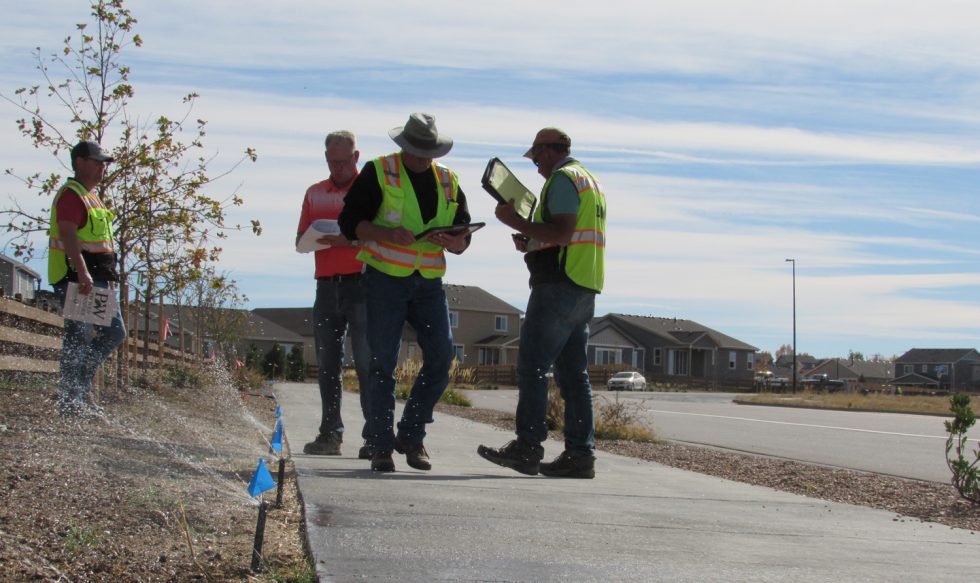
Denver — Amid critical Colorado River negotiations, Colorado U.S. Senator Michael Bennet today addressed the Colorado Water Congress about the urgent work ahead to secure the future of the Colorado River Basin. Bennet called on the audience to define a new vision for the Colorado River, celebrated Colorado’s example on water conservation, and vowed to champion the interests of the Upper Basin in Washington, D.C. He also urged Coloradans to tell their stories to help the American people understand the urgency of addressing the Western water crisis.
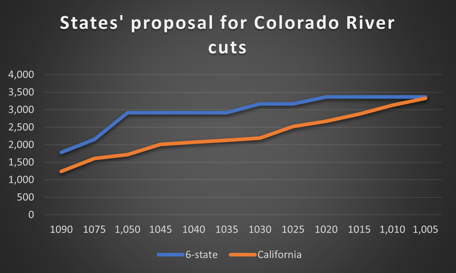
“I strongly encourage the seven states to come to a joint proposal on the cuts that are needed. If the states can’t find a way to work this out, we will be handing this decision to the Department of the Interior. No one wants that. Let’s resolve this right here at home, in the West,” said Bennet. “We have to live within what the river can provide, and that’s what we’ve done – what we have always done — in Colorado.”
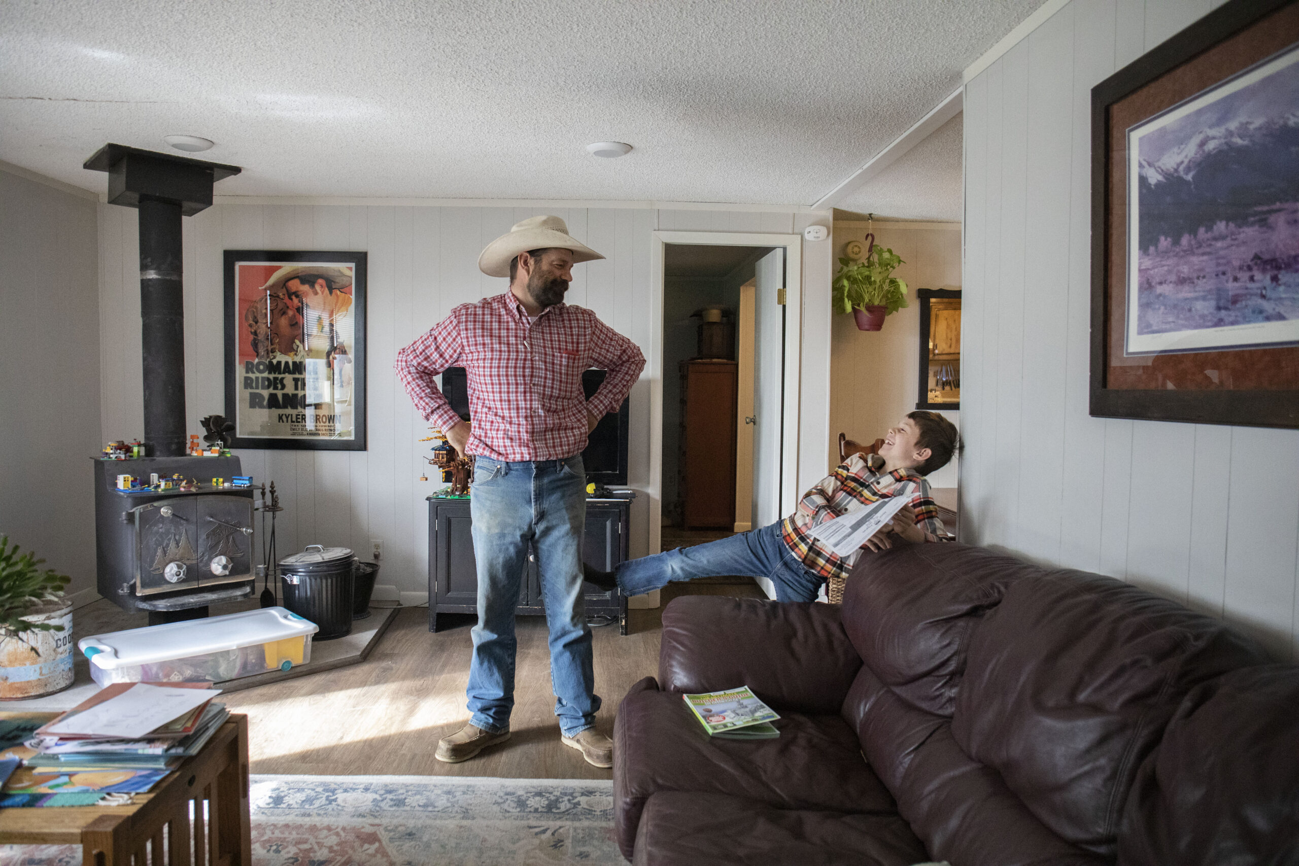
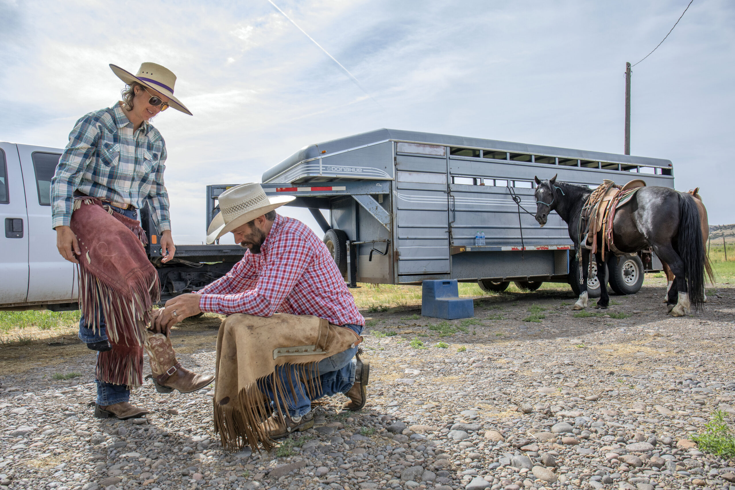
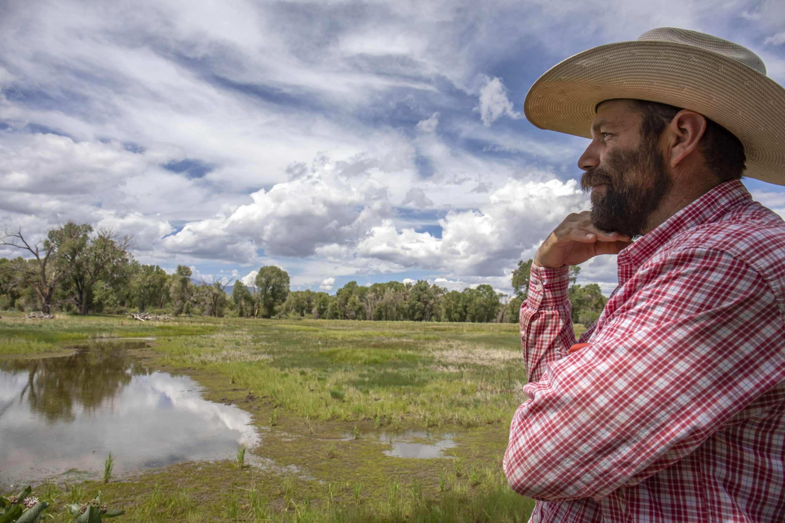
In his remarks, Bennet highlighted examples of Colorado ranchers and farmers, local governments, and Tribes who have changed their practices to adapt to the worst drought conditions in 1,200 years. Using stories from across Colorado, Bennet demonstrated how Coloradans are leading, adapting, and innovating to meet these challenges, and urged others to follow their example.
As the Chair of the Senate Agriculture Subcommittee on Conservation, Climate, Forestry, and Natural Resources, Bennet plans to use this year’s Farm Bill to address the Western water crisis and make new investments in conservation, forests, and watersheds. Last year, Bennet secured $4 billion to address Western drought in the Inflation Reduction Act. In his remarks, Bennet called this funding a “good start” and urged the federal government to do more to address the situation in the Colorado River Basin.
“2023 may be the most important year for Western water since the Colorado River Compact came together a century ago. The choices we make this year will shape the Basin for the next 100 years,” Bennet noted. “We have the opportunity to lead… and to tell this story, and to define the future of the Colorado River – not based on fear about the future, or bitterness over the past – but on creativity, collaboration, and a commitment to leaving the Basin in better shape than we found it.”
Senator Bennet’s speech as delivered is available below.
Thank you, good morning everybody. Thanks, Travis.
I just got back late last night from D.C. Senator Hickenlooper and I went over to the Pentagon, actually, for lunch with the Secretary of Defense to […] tell him that they’re not going to let them steal Space Command from Colorado. That’s the conversation we had yesterday. By the way, if you ever have the opportunity to be Secretary of Defense, I would recommend it—you get a very nice dining room there at the Pentagon.
Travis, again, thank you for the introduction. We were last together four months ago in Steamboat. And I can tell you that it’s been my experience that nobody has ever wanted me to come back within four months of when I’ve given a talk to them before, so I appreciate the invitation even more for that.
And I just want to start by thanking everybody in this room for your leadership on Western water issues. As Travis said, money can’t solve everything. It helps, but it’s meaningless without the leadership of the people in this room. I’ve lost count the number of times over the years, I’ve turned to the people in this room – not just Christine, but often Christine – for guidance and expertise, and I can’t thank you enough. It’s meant the world to me, particularly as I’ve served on the Agriculture Committee from the day that I got to the Senate.
And I know that the people in this room, and the people that you come after, have forgotten more about water than I’ll ever know.
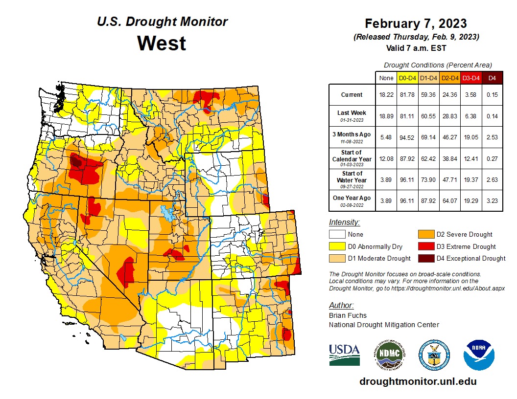
But you don’t have to be a water expert to know that we’re in a five-alarm crisis in the West and the Rocky Mountain West.
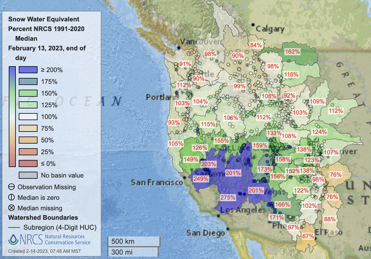
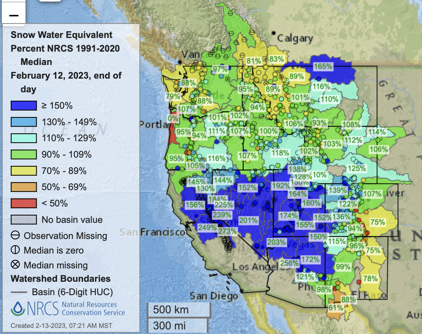
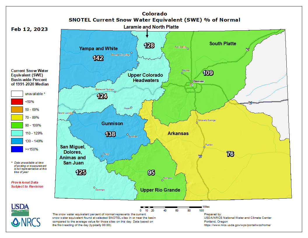
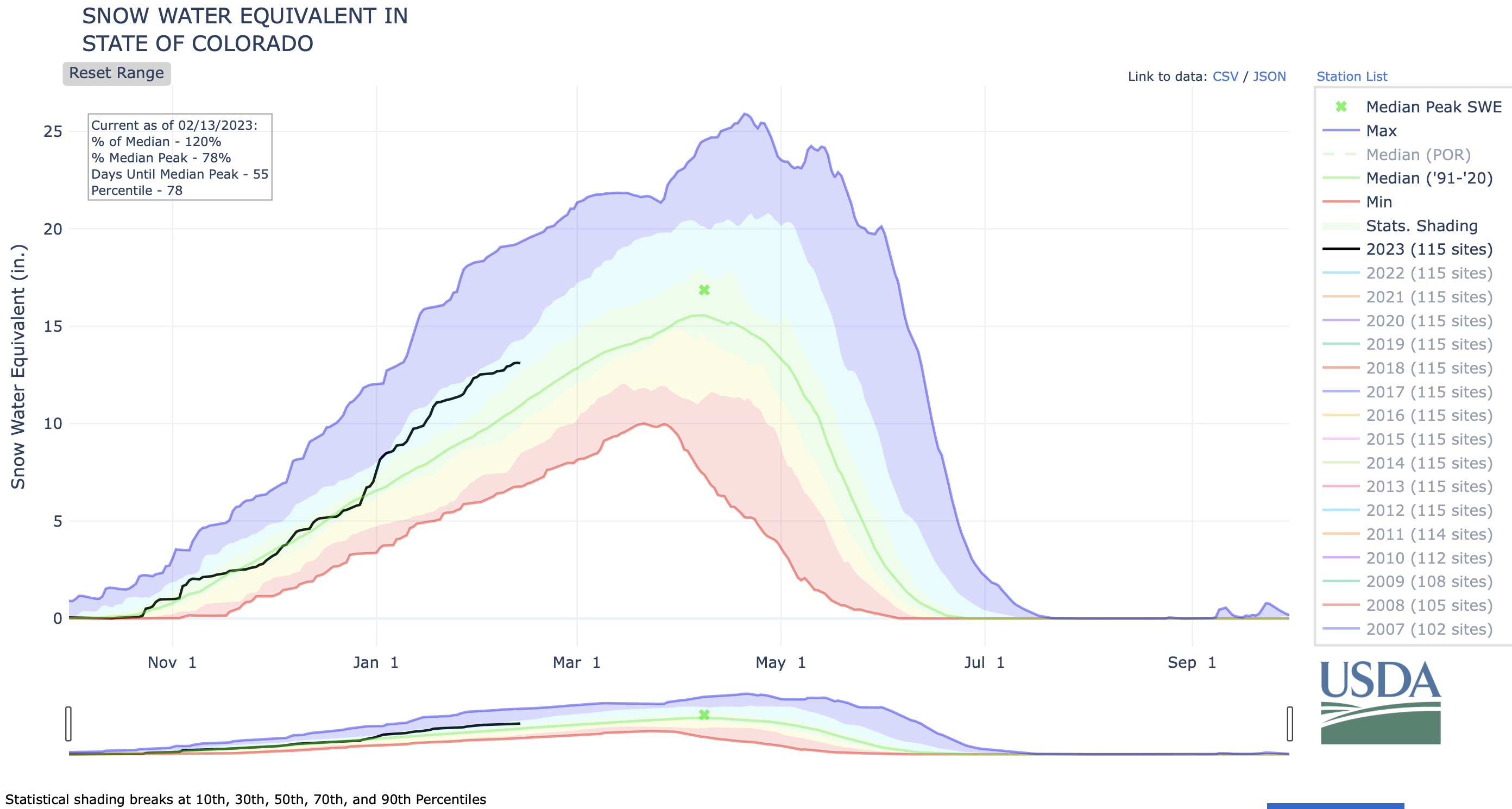
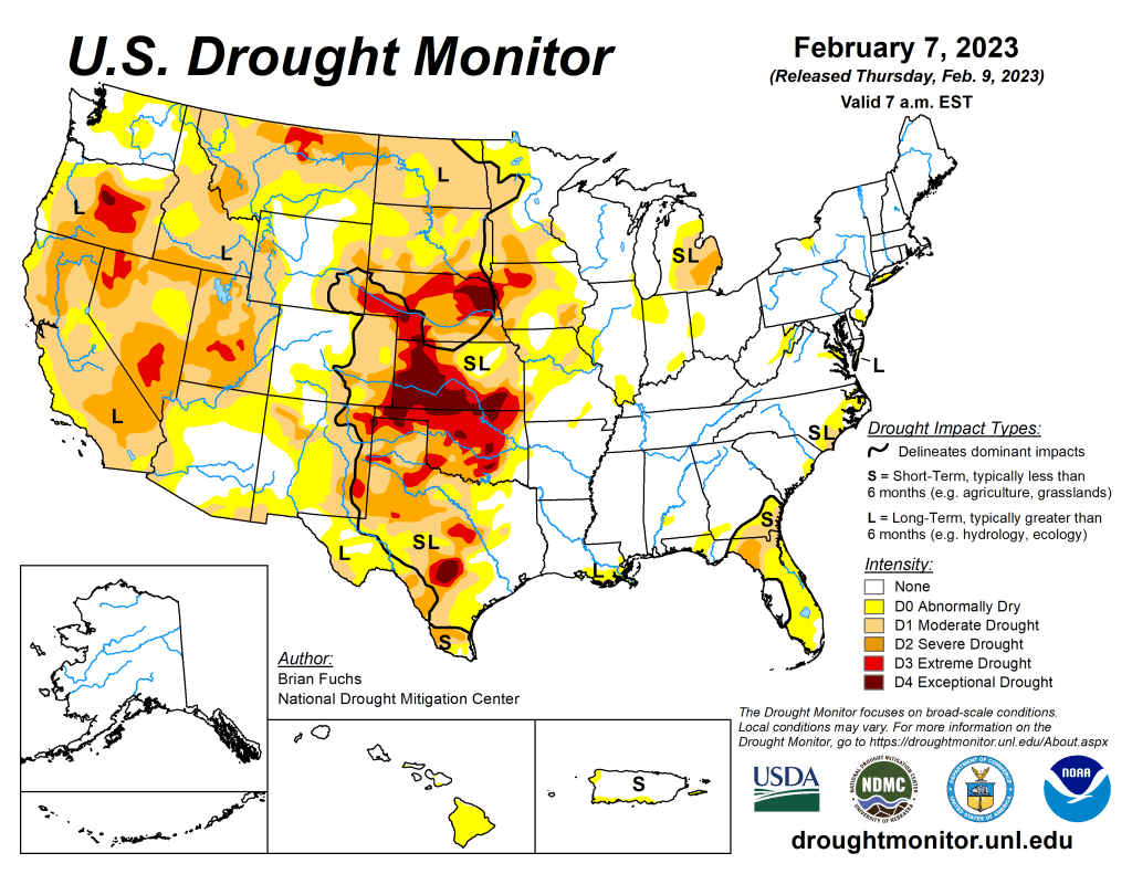
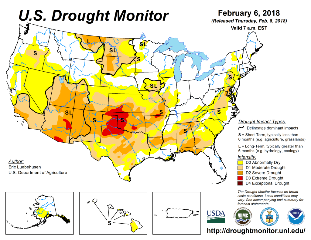
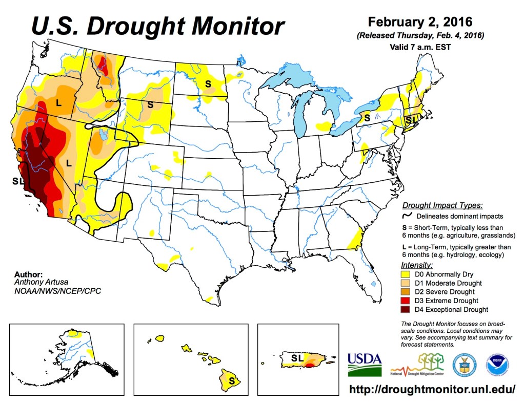
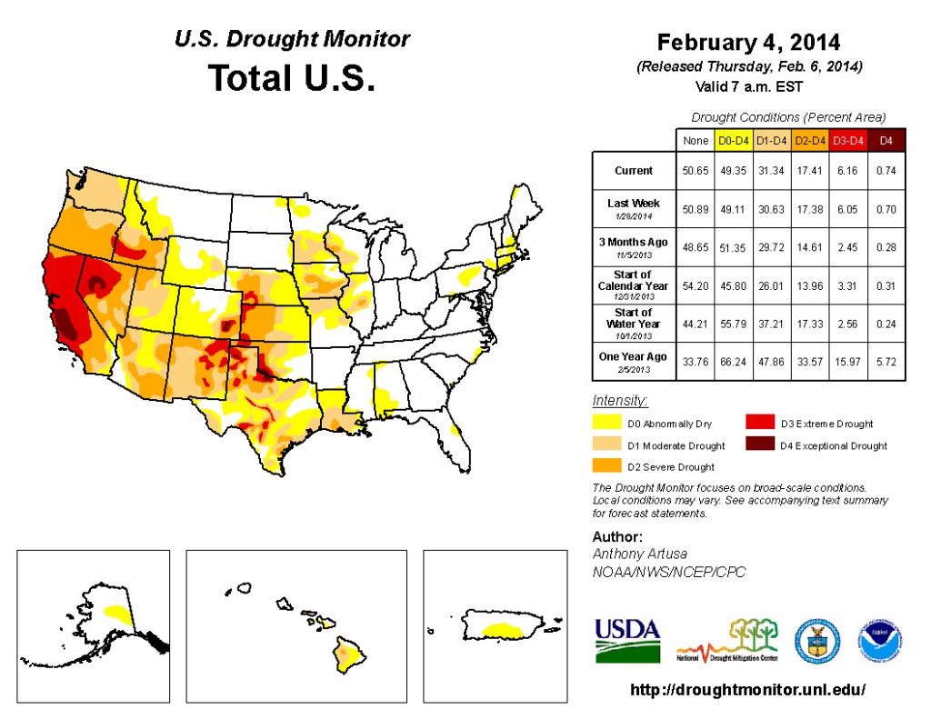
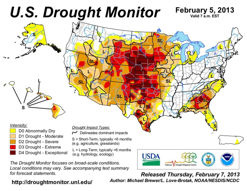
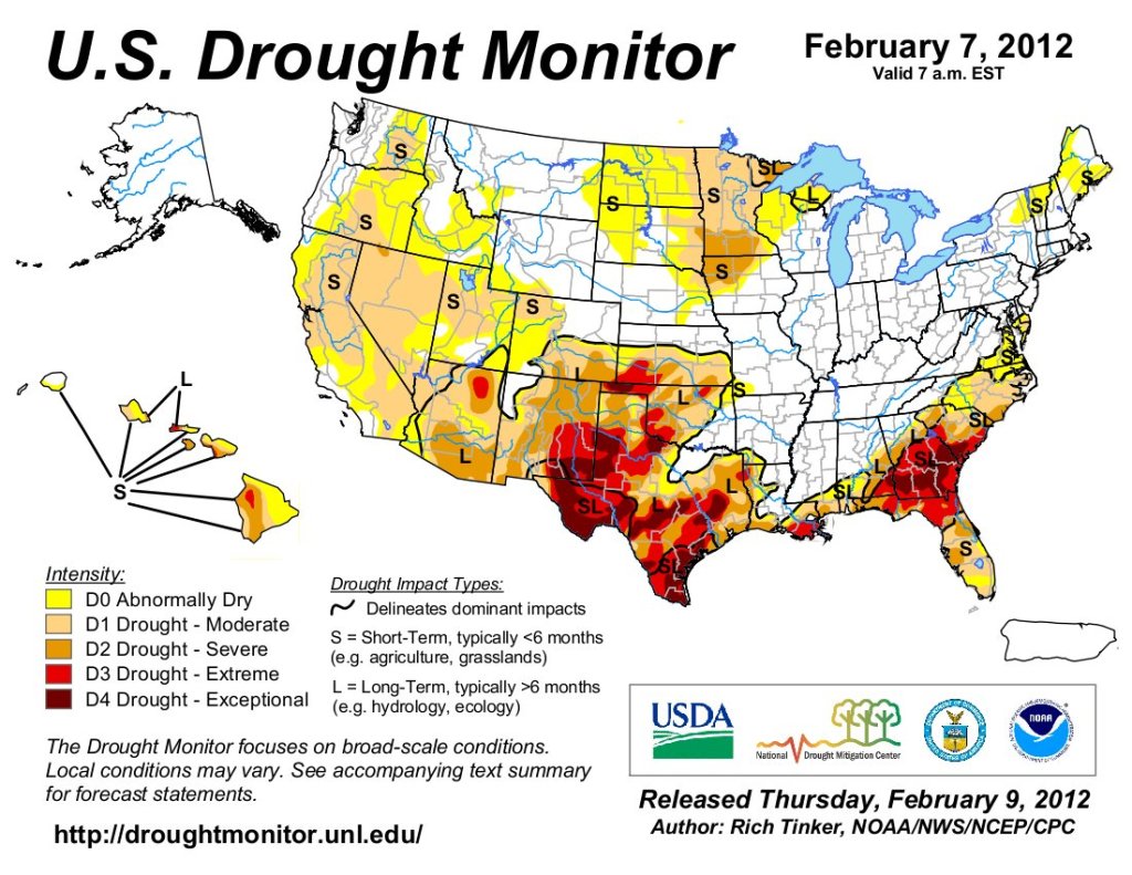
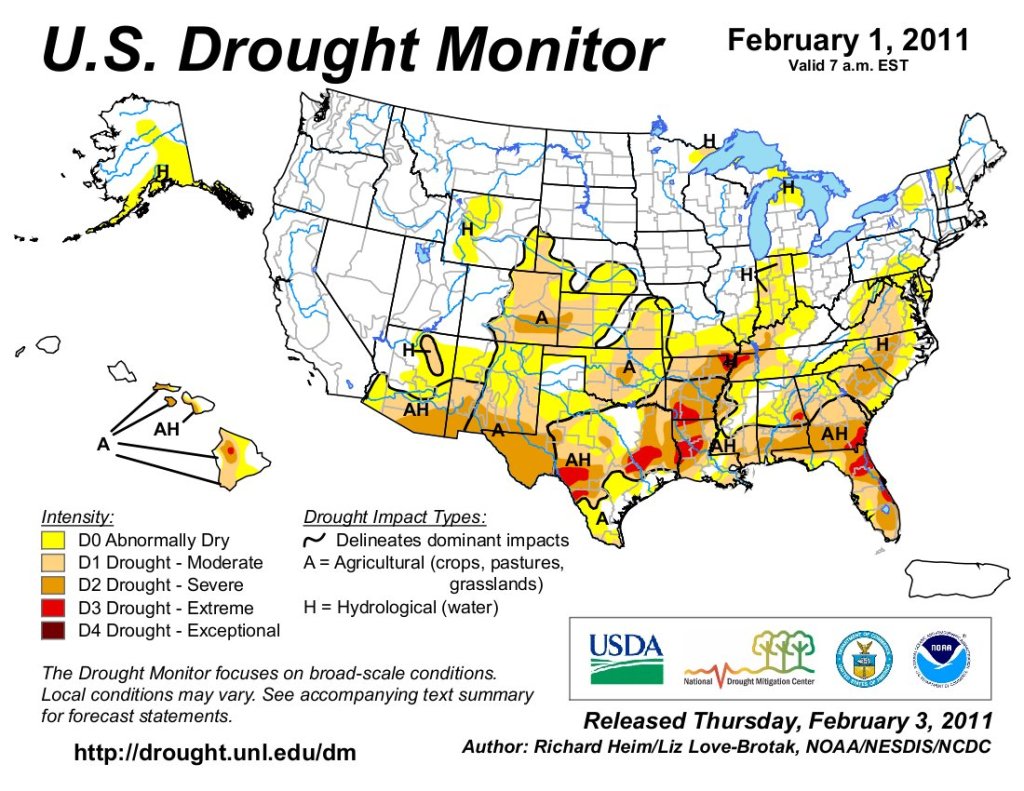
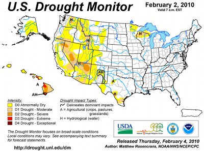
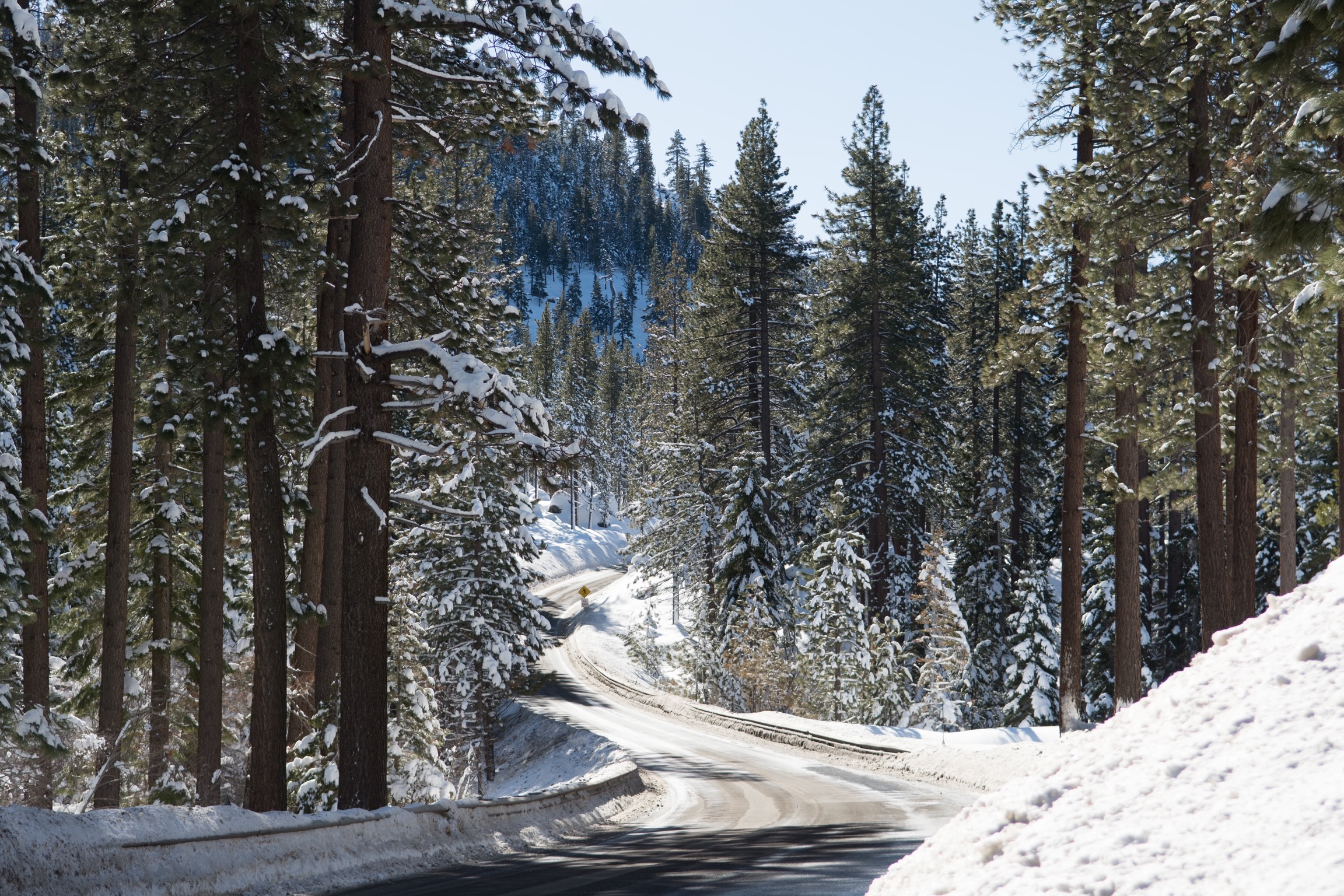
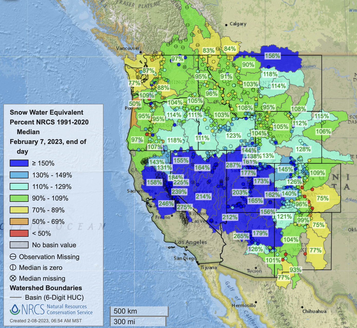
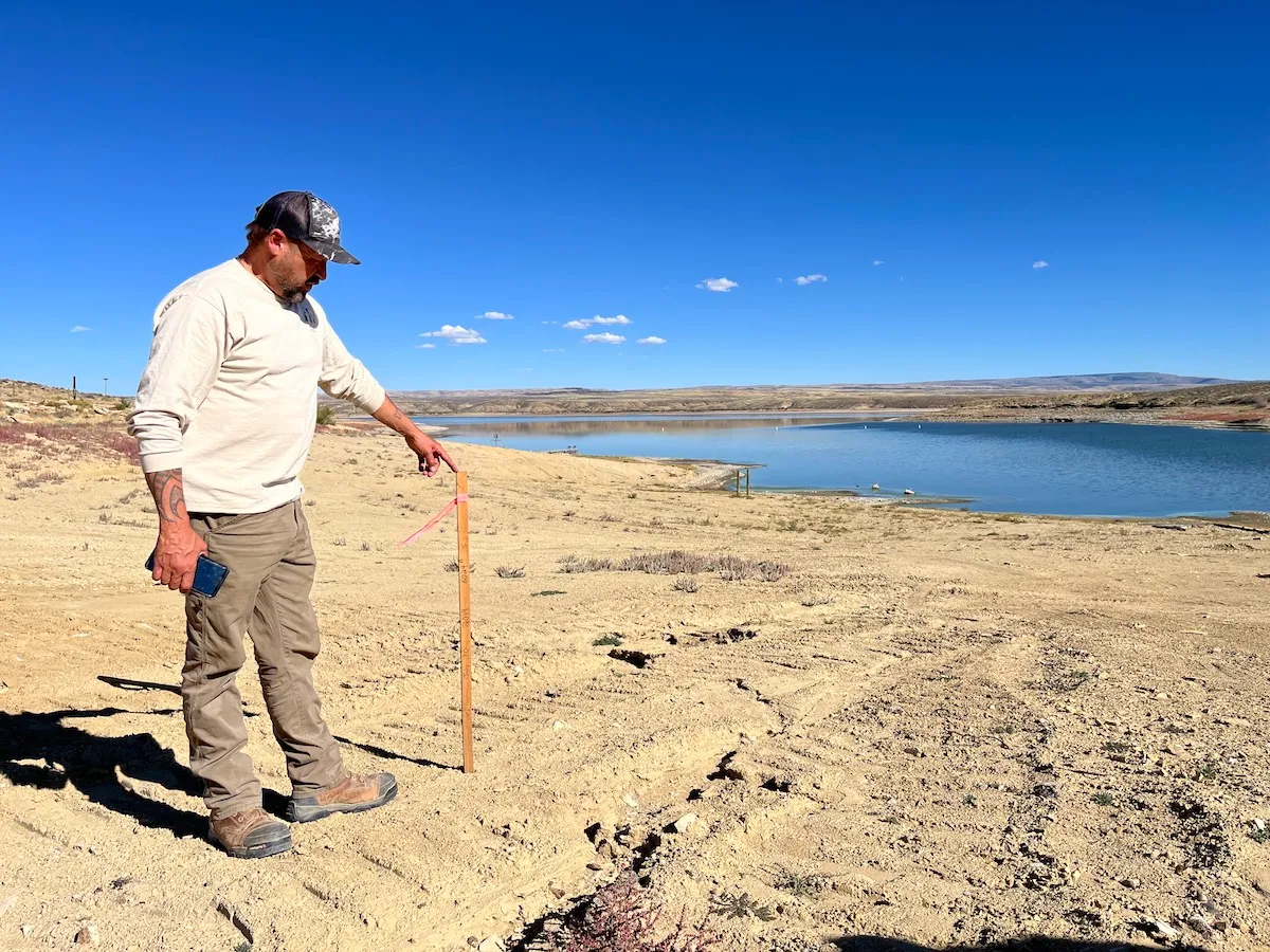
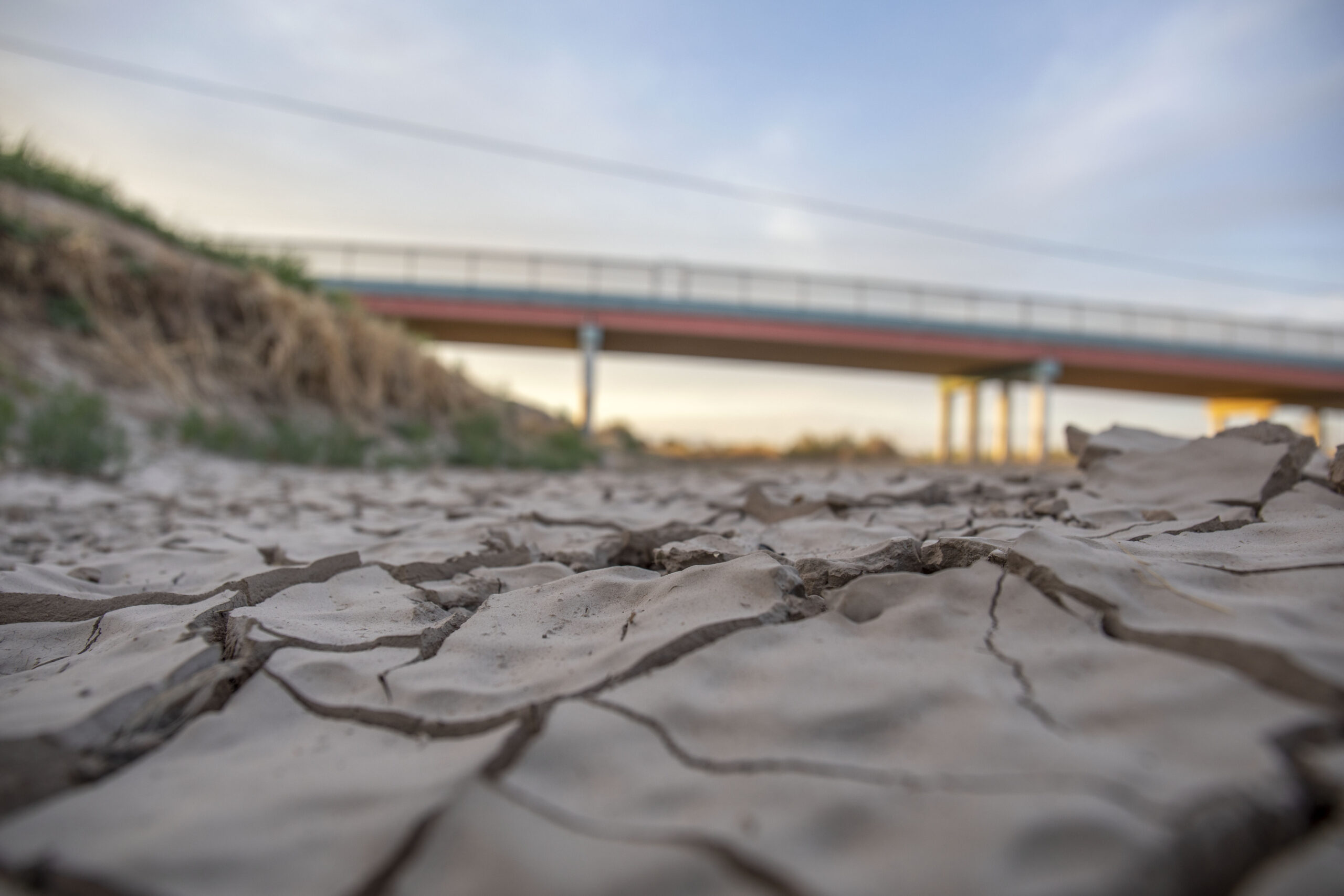
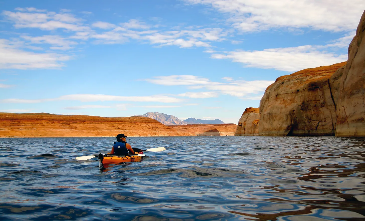
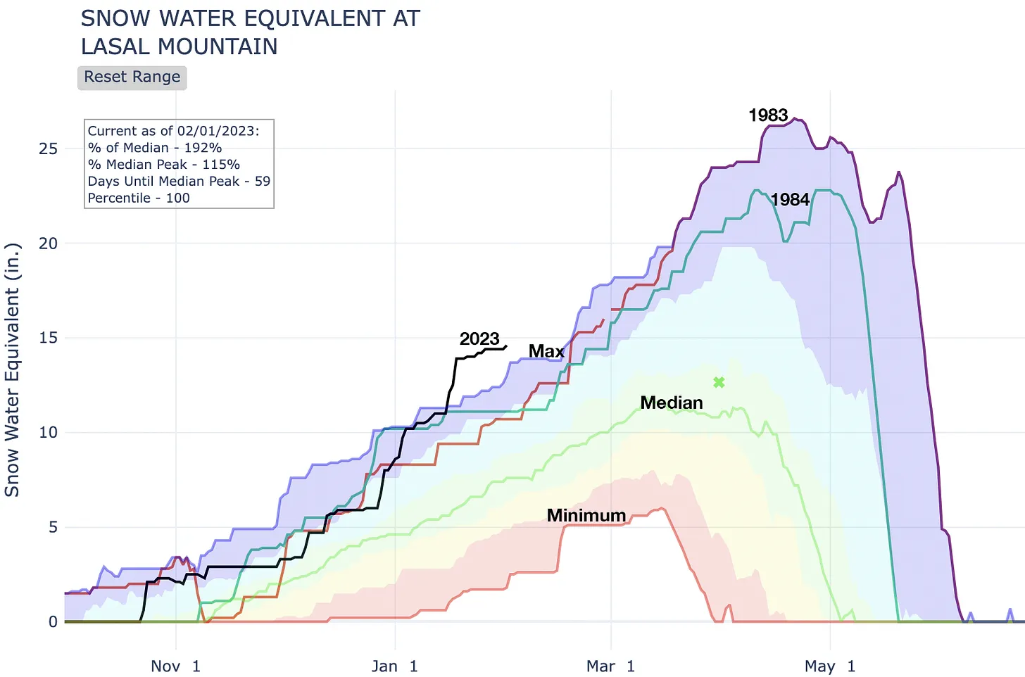
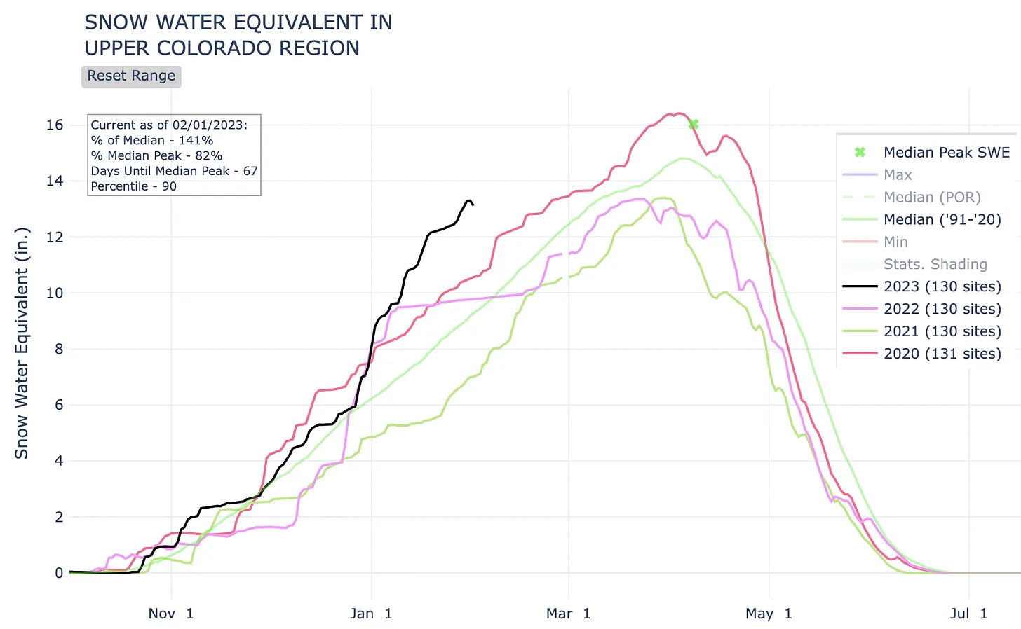
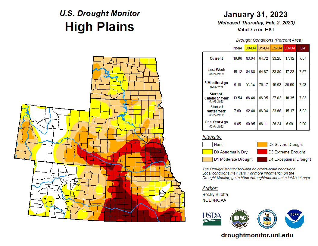
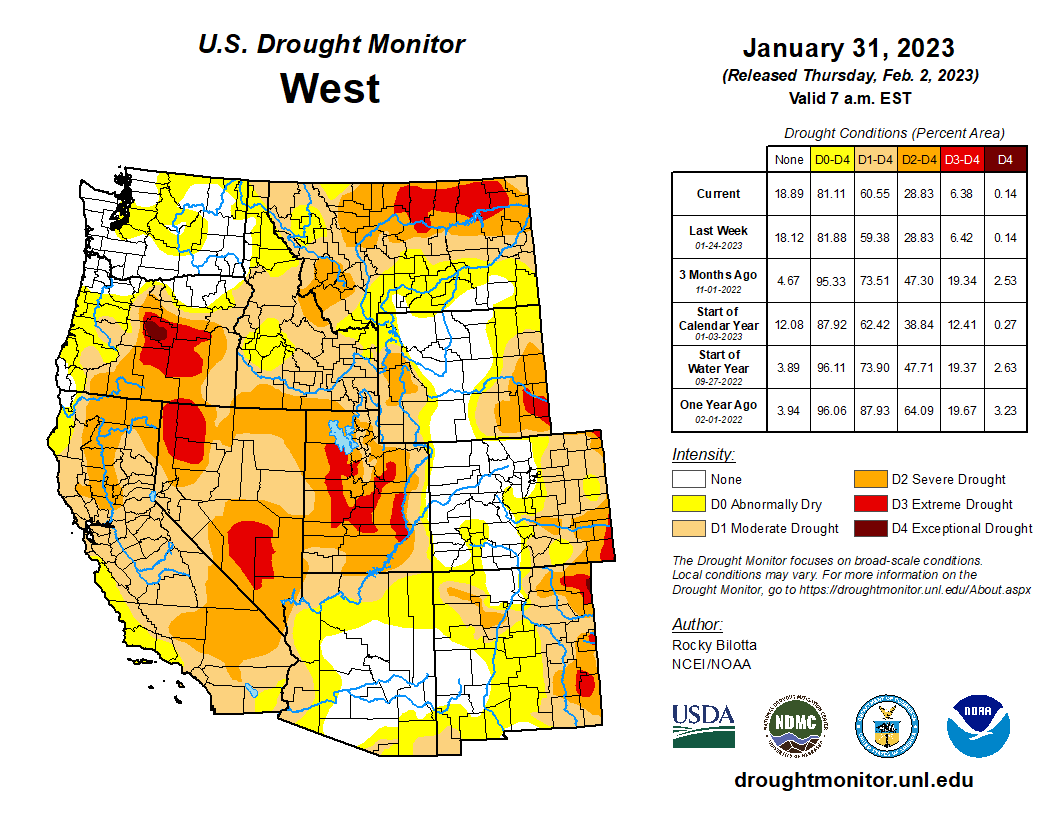
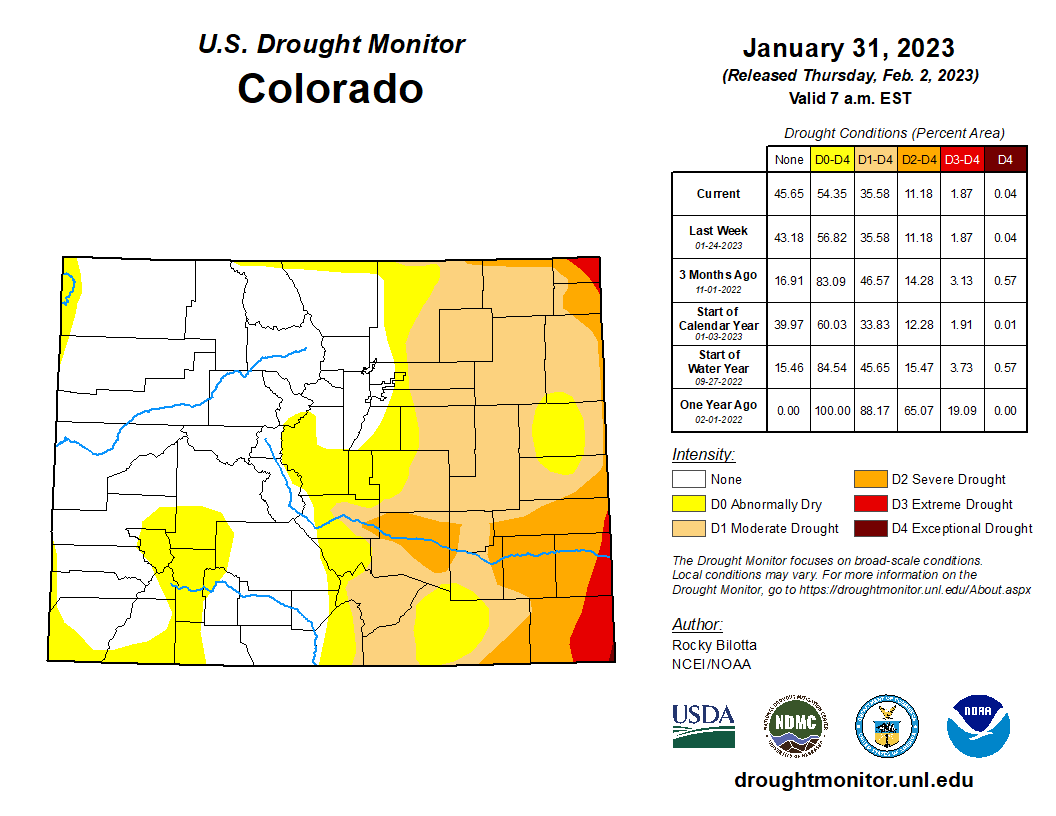
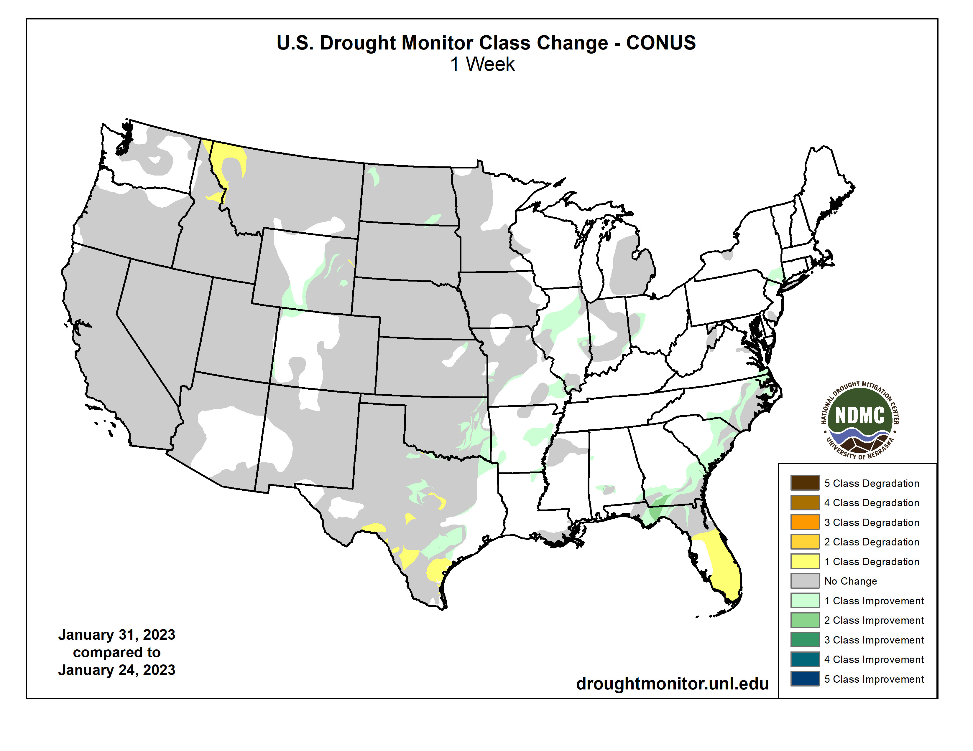
The West hasn’t been this dry in 1,200 years.
That’s when Vikings were marauding throughout Europe from one end to another – and even beyond that.
And in 2023, these conditions have created profound challenges for Colorado and for the Rocky Mountain West.
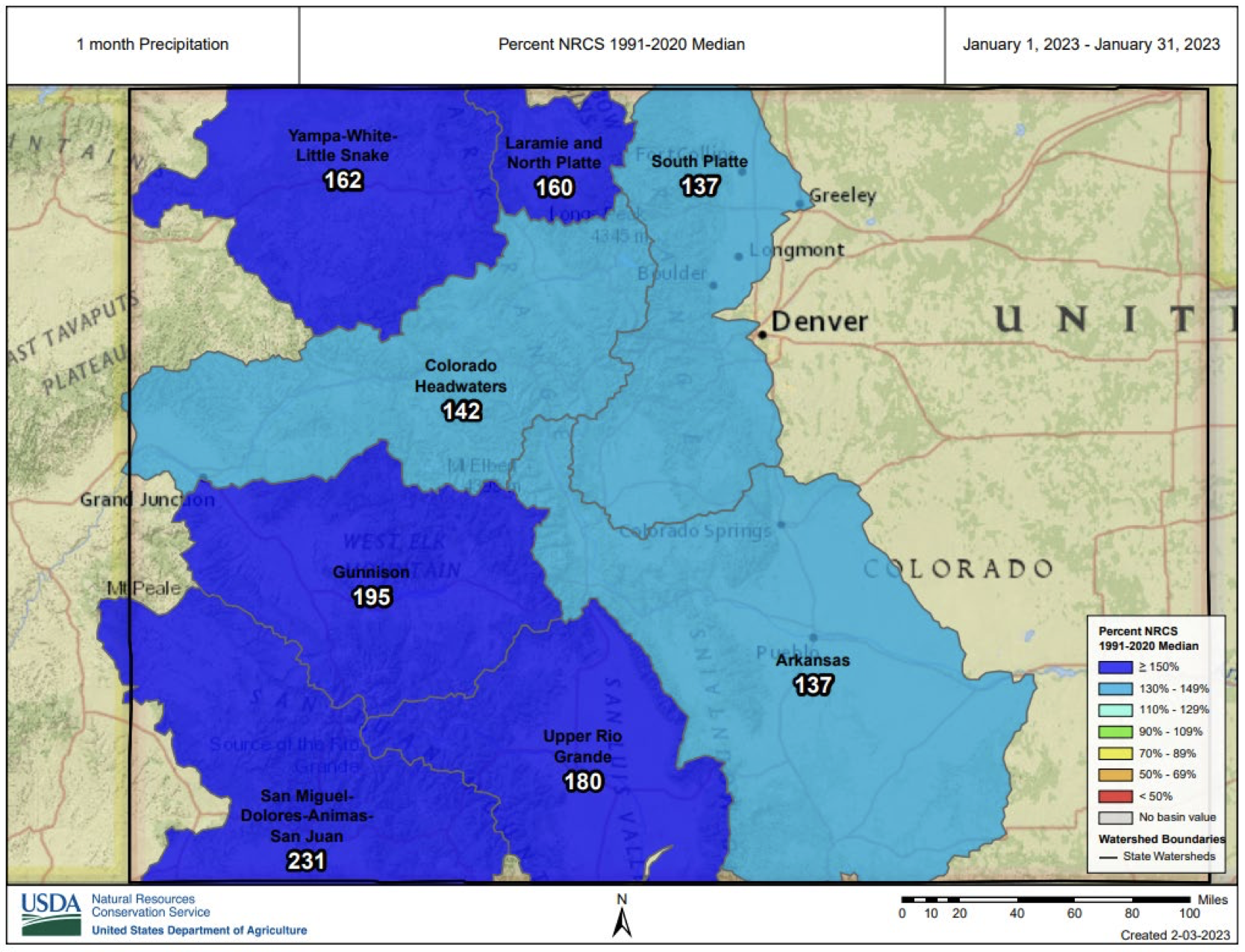
Last summer, we saw parts of the Rio Grande Basin dry up for the first time in 40 years.
Nebraska is saying they might build a canal to divert precious water from the South Platte, threatening farmers on the High Plains of Colorado.
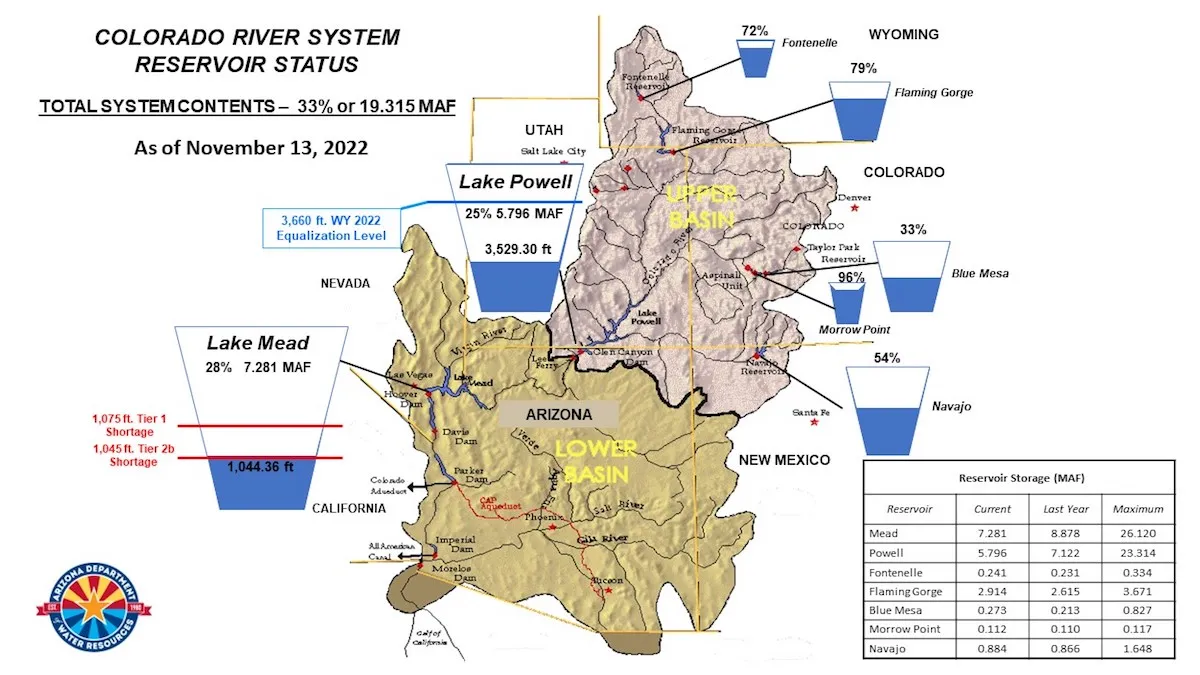
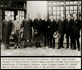
And we’ve got a Colorado River in peril, governed by a century-old Compact that no longer reflects reality.
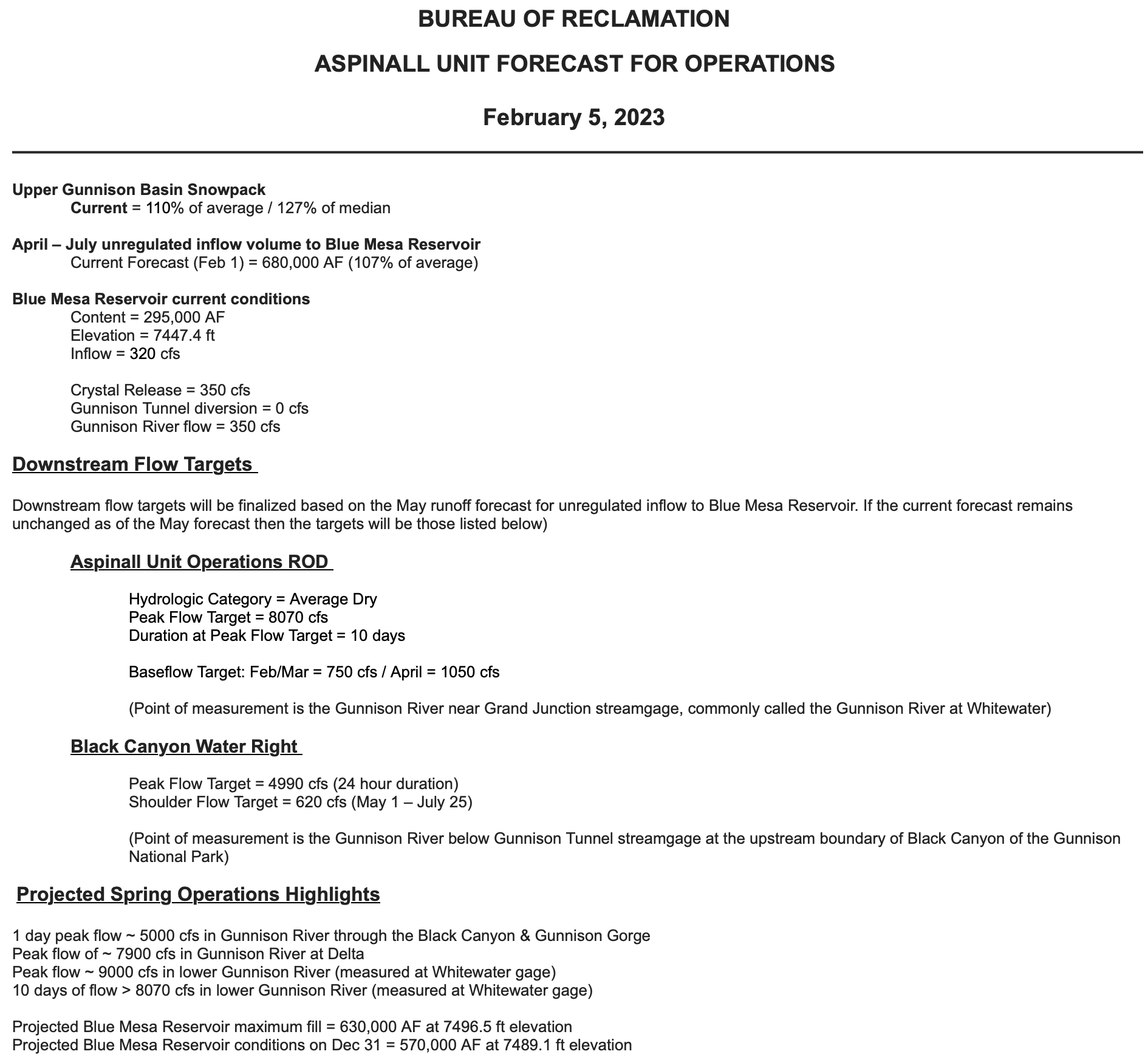
And here is the reality: As everybody in this room knows, the water allocated on paper has never matched the actual water in the River.
The Compact allocates 16.5 million acre-feet of water. I had the chance in the last couple weeks to spend ten days in the Middle East with [Senator] Mark Kelly from Arizona, and we had a lot of conversations about the Compact, and the way in which the estimates have been off from the very beginning – and we know the average flow is closer to 12.5 million.
And while the Upper Basin has acted responsibly, always, and taken less than its 7.5 million share, the Lower Basin has taken far more, year in and year out.
In 2022, the entire Upper Basin used only 3.5 million acre-feet — less than half of our legal allocation.
We actually cut our use by a million acre-feet over the previous year.
And at the same time, the Lower Basin increased its use by 600,000 acre-feet, putting them well over their allocation, while we were trying to do the right thing.
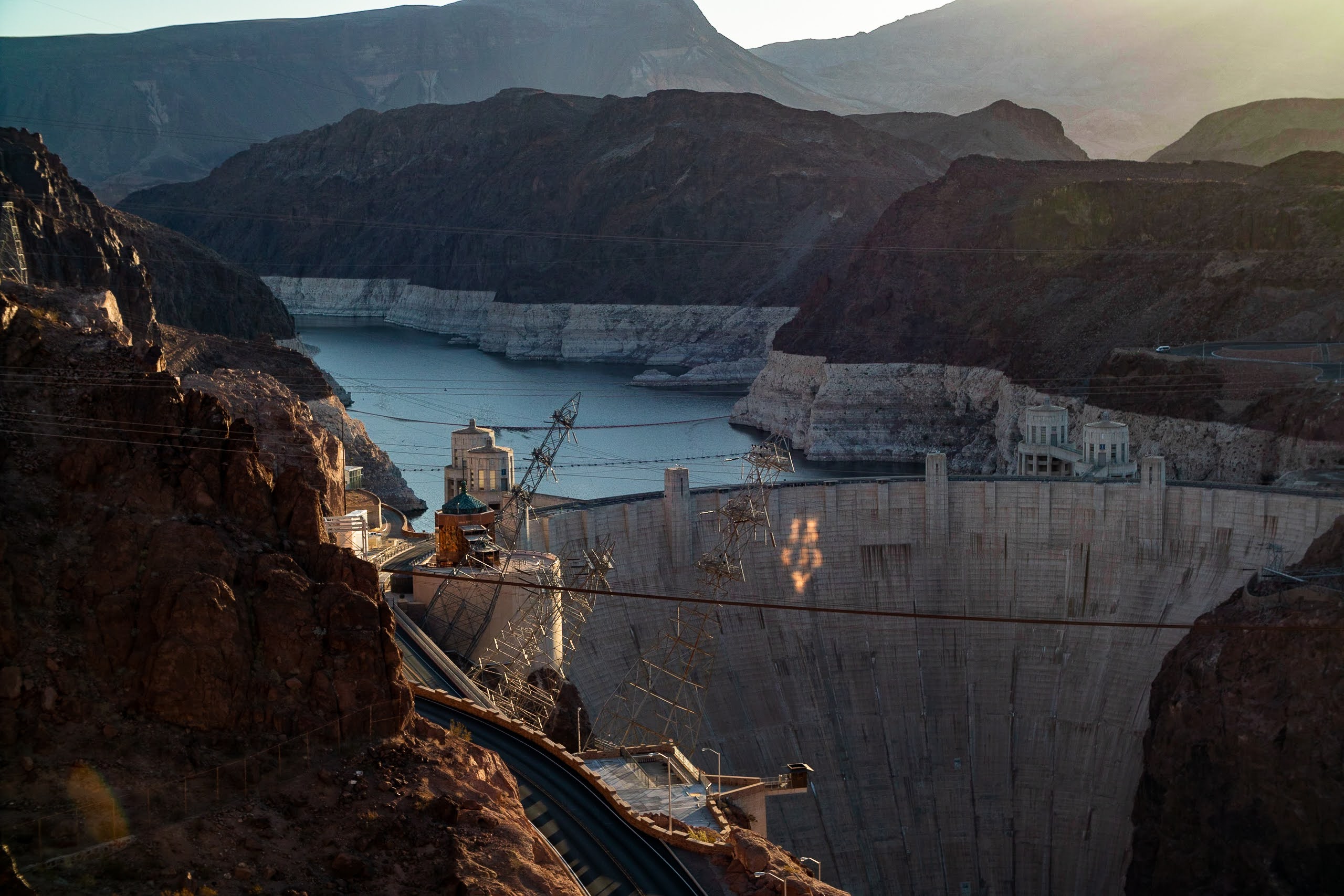
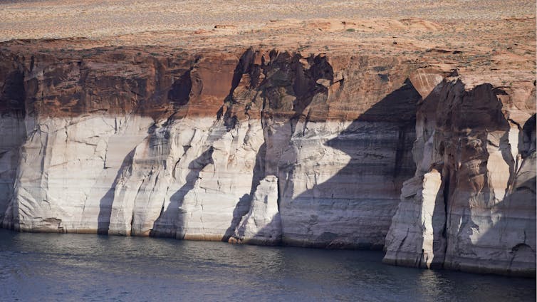
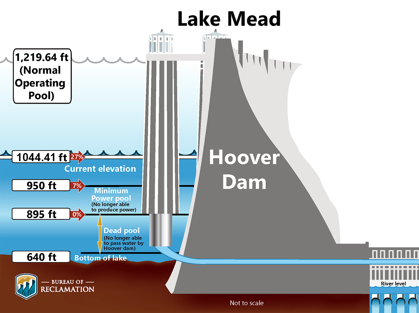
And, as you know, they’re doing that by draining Lake Powell and Lake Mead to their lowest levels since we filled those reservoirs 50 years ago.
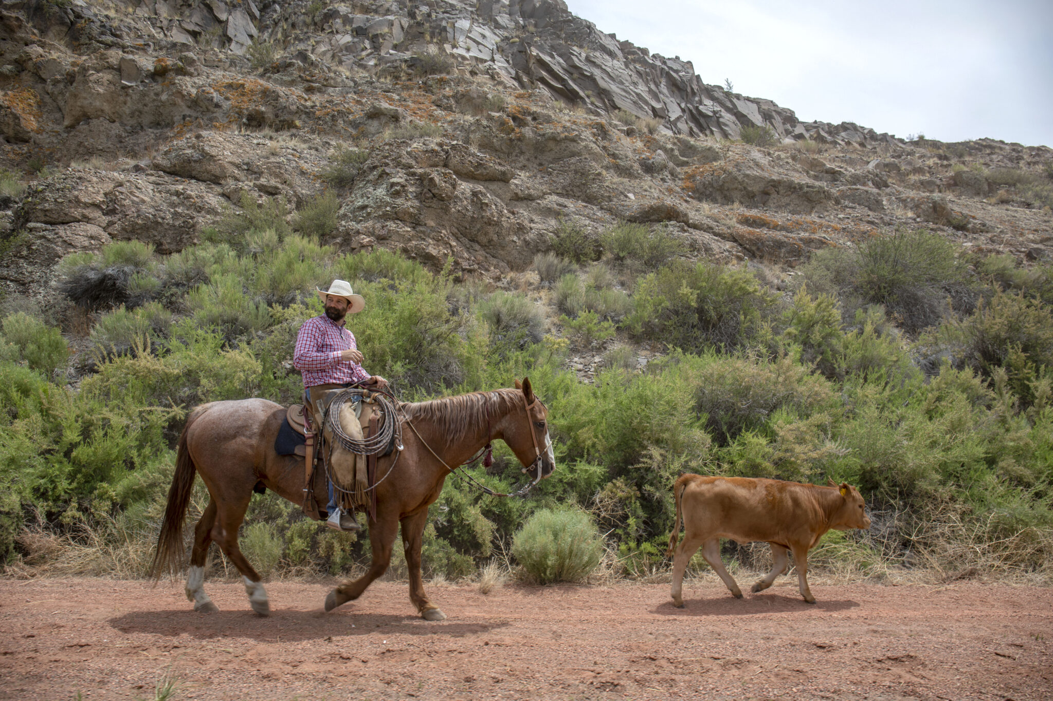
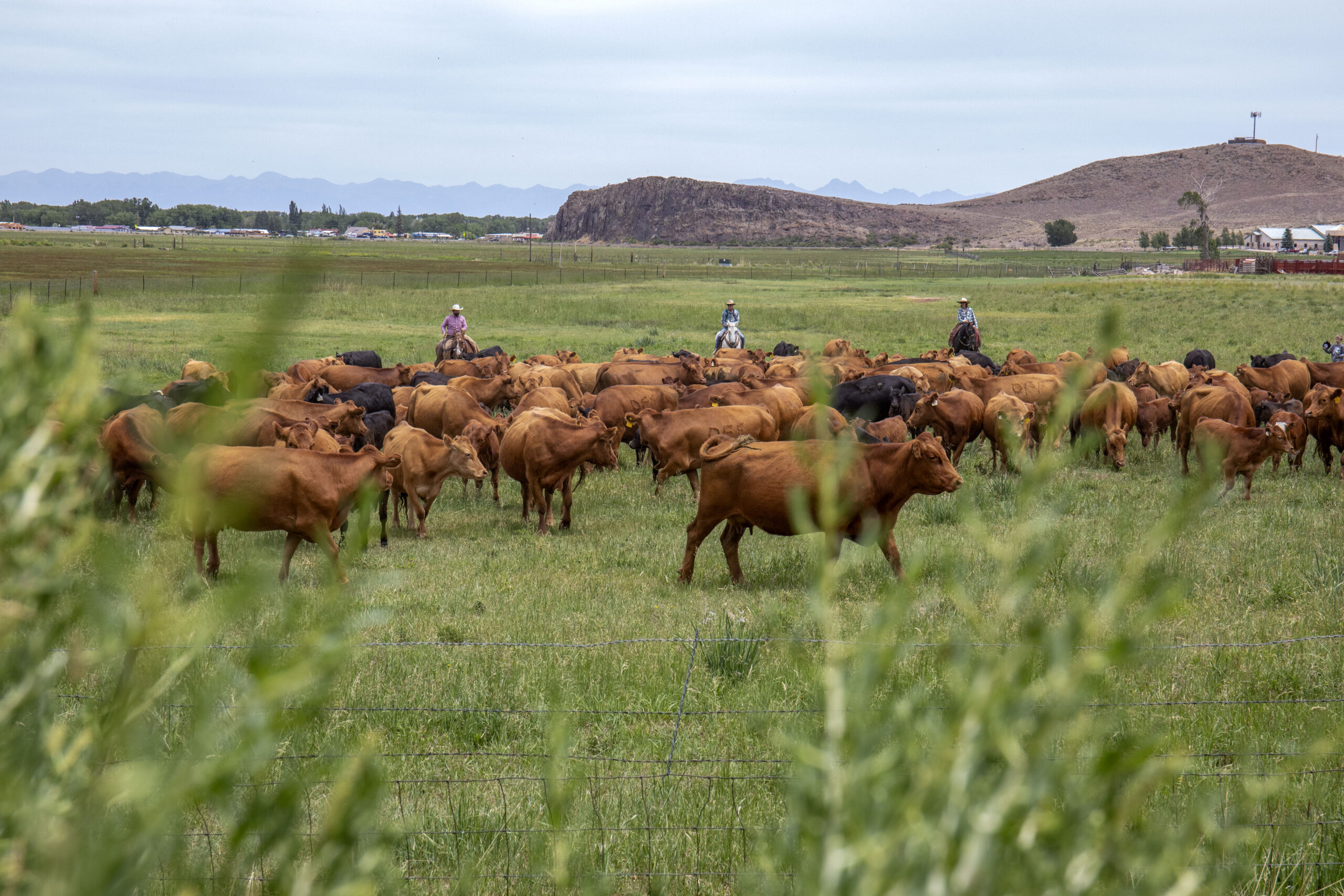
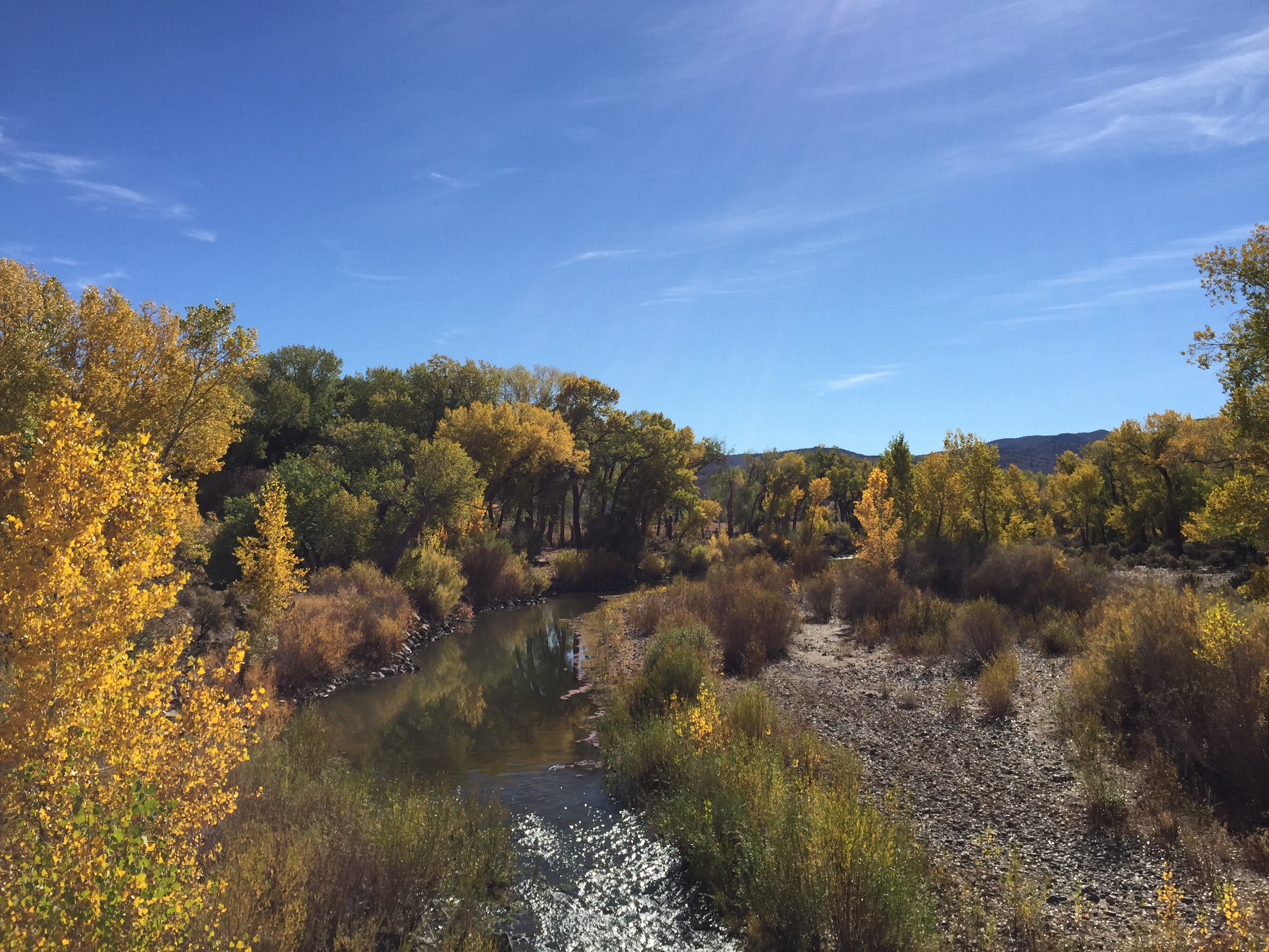
That is deeply unfair to our farmers and to our ranchers, to people like Harrison Topp, a peach farmer in the North Fork Valley who’s trying to keep his orchard alive with a lot less water.
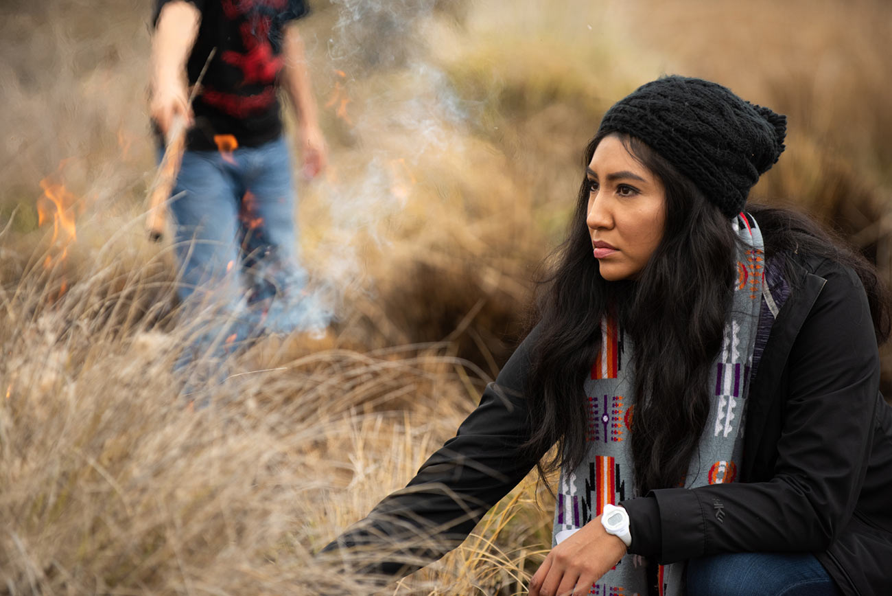
Or the Ute Mountain Ute Tribe, which has had to dramatically cut back on farming because there is no water.
I could go on. Every example is a reminder that we can’t accept the status quo. We have to define a new vision for the River.
So as the seven states continue their negotiation, we have to reach a decision, because none of us wants the Department of Interior to impose one instead.
And that means everyone in the Basin has to make hard choices to live with what the River provides, which is what we’ve always done – we have always done — in Colorado. And frankly, what Tribes have done for centuries on this landscape.
I know the Upper Basin is prepared to make tough choices, and we’ll have to see if the Lower Basin can do the same, is willing to do the same.
Because even if we do everything humanly possible, it still won’t be enough without real changes from the Lower Basin that will make a material difference over the long term.
You know, I’m not overly optimistic about this; we shouldn’t be pollyannaish about this. Reaching an agreement won’t be easy, everybody knows that because we haven’t reached an agreement yet. But everybody here in this room, and the people you represent, have a central role to play.
In the months ahead, the entire Basin is gonna look to all of you for leadership and for examples of how to do more with less.
The example of Paul Bruchez, who I know is here today, I just saw him outside.
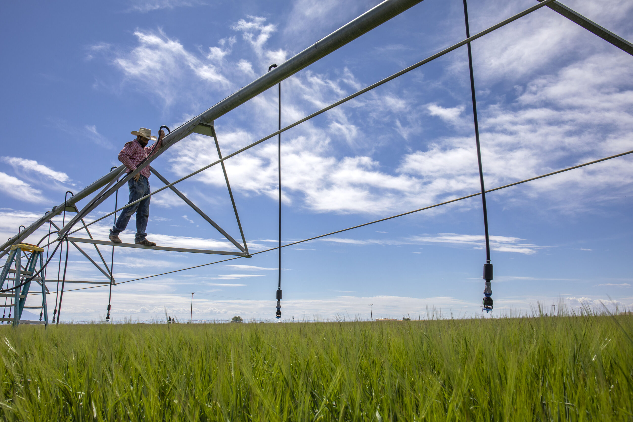
He’s got ranches in Grand County, where he’s experimenting with new crops that could use up to 30% less water.
Or Lowell King in Fruita who abandoned conventional farming to try regenerative agriculture. Now, he’s using less water, growing more crops, and setting an example for the entire West.
We can all learn from them.
We can point to the tough choices of leaders like Mayor Coffman in Aurora, where they just passed restrictions on new golf courses and developments with lawns that need too much water.
There are stories like this all across our state, and it’s our job to go and share them with the country.
The people in this room may understand the Western water crisis, I know you do. But I can assure you, no one else does.
Most Americans have no understanding about how important this River is. How it works. What it means to 40 million people in this Basin. And what the implications for its survival are – not just for the West, but for the entire United States of America.
We have to tell them. We have to tell them.
And it’s not enough to keep talking to each other about it. We need everybody here to reach out and talk to national publications. Talk to members of the Senate and the House. Talk to the Administration. Go on the news at night.
And our team stands ready to help. We’re prepared to do everything in our power to draw attention to this crisis back in Washington.
I know my staff, Rosy, was here yesterday talking about the Farm Bill. And I think in the short term, we have an opportunity with the upcoming Farm Bill — not only to educate the public, but to make new investments in conservation, forests, and watersheds, on top of the ones Travis mentioned earlier.
So if you have ideas, if you’ve got concerns, or you’ve got criticisms about how the Farm Bill works or how it could work better – we want to hear them.
But over the long term, we need the federal government to backstop whatever the states decide with the Bureau of Reclamation.
I don’t want the federal government to tell us what to do. Nobody in this room does. But if we can come to a consensus, the federal government is going to have to help backstop that consensus.
The $4 billion that we secured in the Inflation Reduction Act is a good start, but it’s only a down payment.
And this year is a historic opportunity to build on that progress.
2023 may be the most important year for Western water since the Colorado River Compact came together a century ago.
The choices we make this year could shape the Basin for the next 100 years.
I guarantee you if we don’t make these choices, it’ll shape the Basin for the next 100 years.
We have the opportunity to lead, I think, and to tell this story, and to define the future of the Colorado River – not based on fear about the future, or bitterness over the past – but on creativity, collaboration, and a commitment to leave the Basin in better shape than we found it.
And I know Water Congress is up to that challenge, and I want you to know that I’m going to be with you in this fight every single step of the way.
Thank you for having me this morning.


,_Narew_River,_Poland.jpg#/media/File:Castor_fiber_04(js),_Narew_River,_Poland.jpg)