#Climate, conflagrations, and calamities: Plus: A little meditation on the water-energy-ag nexus — Jonathan P. Thompson (LandDesk.org)

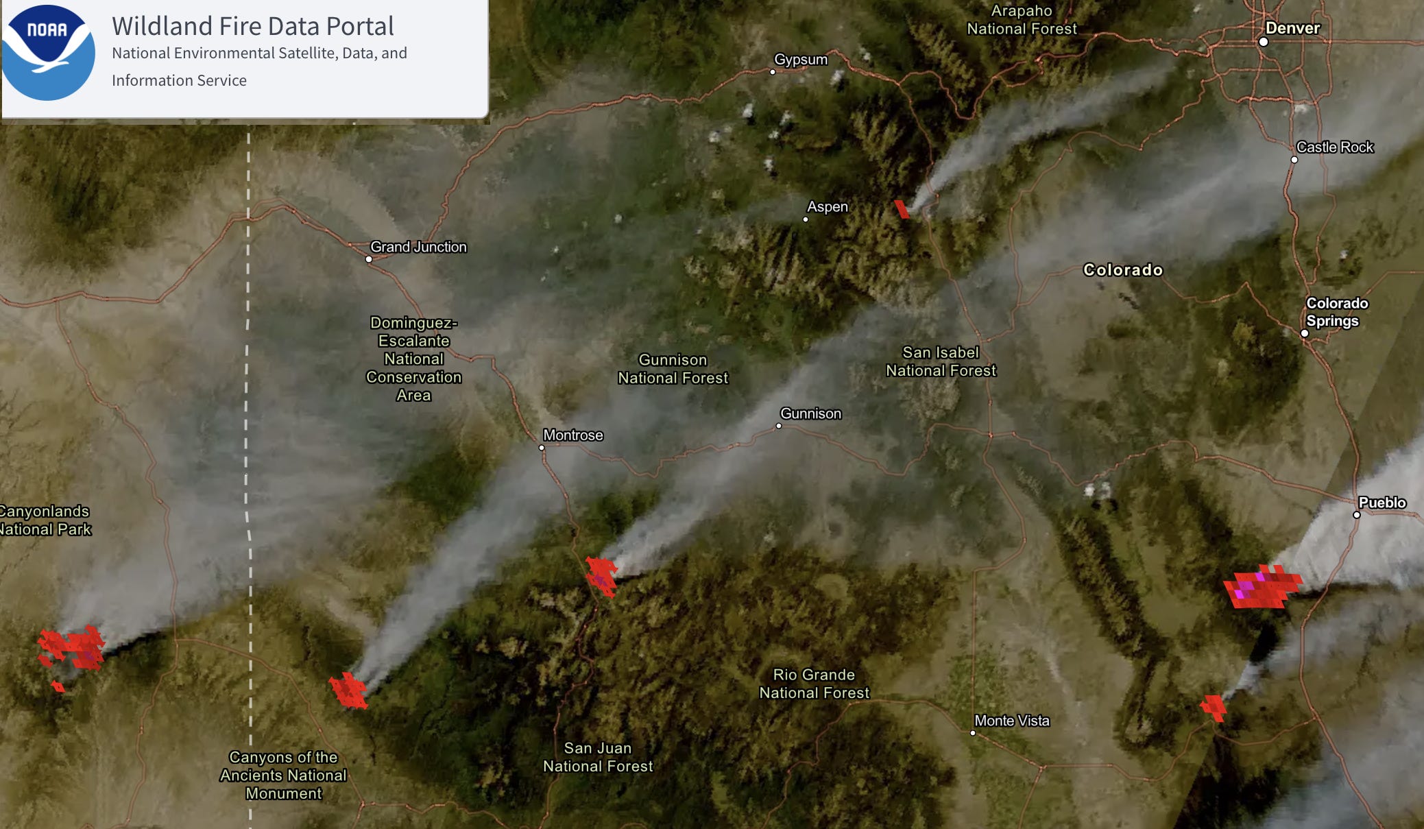
Satellite imagery of some of the major fires burning on the afternoon of June 29, 2026. Source: NOAA Wildland Fire Data Portal.

Click the link to read the article on The Land Desk website (Jonathan P. Thompson):

June 30, 2026

🥵 Aridification Watch 🐫

Three federal firefighters were killed and two seriously injured when the Knowles and Gore fires overtook them southwest of Grand Junction near the Utah-Colorado line. The fires joined with others to become the Snyder Fire, which had grown to 30,000 acres as of Monday.

The fatalities were the tragic result of what has become a downright terrifying wildfire situation in the Interior West, with more than a dozen 1,000-acre-plus blazes tearing through forests in Utah, Colorado, Arizona, and New Mexico during the last days of June. Without substantial and soaking rainfall soon, it’s likely to get even worse.

The fury of these conflagrations is evident in their rapid rate of growth.

The Babylon Fire within Bears Ears National Monument, for example, was first reported on the afternoon of June 26 on Elk Ridge north of the Bears Ears Buttes. By the evening of June 29 it was mapped at over 48,000 acres and was spreading northward. The National Park Service closed the Needles District of Canyonlands National Park as a result and the Manti-La Sal National Forest shut down the entire Elk Ridge area.

Further east, in Colorado, the Ferris Fire was first reported late on June 27 just north of the Dolores River along the Dolores and Montezuma county line. It quickly tore through piñon and juniper, then scrub oak and ponderosa forest toward the Disappointment Valley, and had reached about 20,600 acres as of Monday night.


The Gold Mountain Fire, apparently ignited when a tree fell on a powerline, was first reported Saturday afternoon near the Bachelor Syracuse Mine Tour north of Ouray. By Monday night it was over 8,300 acres and had forced evacuations and the closure of Highway 550.
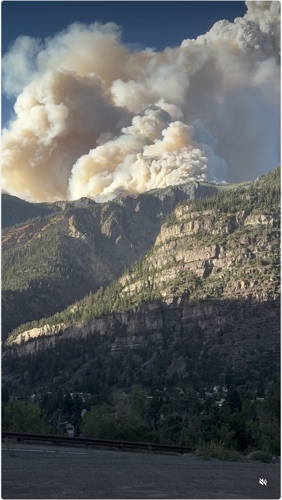
Instagram video here: https://www.instagram.com/reels/DaKFedwOcXQ

On the eastern side of the Divide the Aspen Acres Fire grew to 23,000 acres in less than 24 hours, driven through a parched landscape by 100-mile-per-hour winds, and was threatening the towns of Beulah and Rye. The Willow Fire in Lake County is at a relatively small 1,900 acres, but is perilously close to Leadville.

Many factors contribute to the intensity, size, and frequency of the fires, from decades of fire suppression, to human encroachment in forests, to flammable noxious weed infestations. But the biggest driver of this regional calamity is clearly the hot, dry weather, which has been exacerbated by human-caused climate change.

Winter was an utter dud as far as the snowpack was concerned, in large part because of the unusually high temperatures. The hot, dry weather continued into the spring — with July-like temps at the end of March — sucking moisture from the soil and vegetation, and pushing huge swaths of the Interior West into severe to extreme drought conditions. Throw in gusty wind and a June heat wave — nearly 1,000 daily high temperature records were tied or broken in the West this month — and you’ve got a recipe for disaster.

There have been hot and dry years in the past, along with catastrophic wildfires: In 1879 the Lime Creek Burn charred 26,000 high-country acres south of Silverton, burning through what later became known as the “asbestos forest” due to its apparent blaze-resistance.

Back then, however, 1879-like dry and warm years were anomalous, as were mega fires. The Lime Creek Burn stood as the state’s largest blaze until 2002; now it’s not even in the top 20 for acreage burned. This year, while relatively extreme, is no outlier. The West’s temperatures have been trending upward since reliable record-keeping began some 130 years ago, and the Southwest is suffering through year 26 of an ongoing megadrought, the most severe in at least 1,200 years.

Nor is the phenomenon isolated to the arid West. A heat dome is on its way to the Midwest and East Coast. And a record-breaking heat wave has gripped much of western Europe. France has recorded over 1,000 heat-related fatalities in recent days, and was forced to shut down nuclear reactors because the rivers from which they pull their cooling waters are too warm (and the discharged water is even warmer, threatening river ecosystems).

So it’s utterly surreal to, on the one hand, breathe in the blanket of smoke that’s settling into the West’s valleys, to observe new flame icons popping up on the Watch Duty map, and see satellite imagery smoke plumes stretch across the region, and on the other to hear U.S. Energy Secretary Chris Wright downplay the deaths in Europe. Unlike his boss, President Trump, Wright acknowledges that human-related greenhouse gas emissions are heating the planet, but he says it’s not a crisis and that its effects are “manageable.”

Wright’s disrespect for the victims, including the injured and killed firefighters in Colorado, is dumbfounding. And his willful ignorance of the science and reality on the ground in order to perpetuate Trump’s drill-baby-drill agenda and bolster oil company profits is simply sickening. The same goes for Trump’s Interior Secretary Doug Burgum. His department now oversees the nation’s wildland firefighting force. And yet he is also leading the charge to deregulate the oil and gas industry and allow them to spew more planet-warming methane in order to spur more oil and gas drilling on public lands — ultimately leading to more fossil fuel burning, carbon emissions, warmer global temperatures, and more severe fires.

It reminds me a little bit of the story of the California firefighter who admitted setting dozens of fires as a job-creation scheme, allowing him and his colleagues to earn overtime pay. The difference here is that Burgum is not only playing his dangerous game with the lives of the firefighters under his command, but also with the planet as a whole.


Climate change’s coal-smudged fingerprints — Jonathan P. Thompson
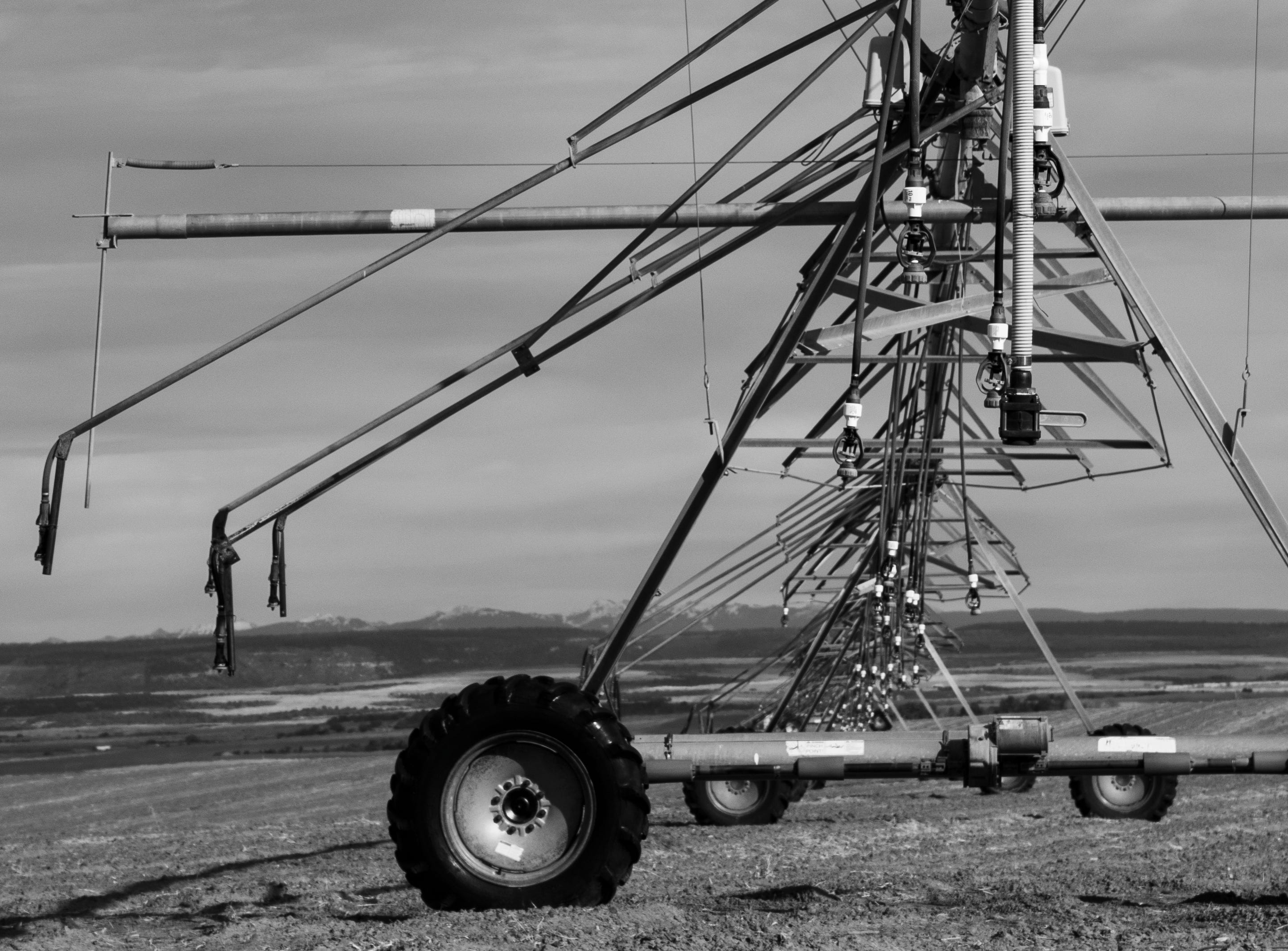

Sprinklers on the Great Sage Plain in southwestern Colorado. Jonathan P. Thompson photo.

One of the many things I’m interested in is the water-energy nexus: The way a coal plant requires vast amounts of water to make steam to turn turbines to generate electricity to run the pumps on the Central Arizona Project canals, for example. Now, with dry times in full-swing and electricity prices on the rise almost everywhere, the spotlight is on the water-energy-agriculture/food nexus.

In the arid West, most agriculture is of the irrigated kind. In many cases, this means relying on pumps to move the water across the land, to bring groundwater up from a well, and to pressurize sprinkler systems. And pumps require energy, in the form of electricity from the grid, from distributed solar or wind systems, or from diesel or gasoline motors or generators.

During a dry year like this one, farmers need to start irrigating earlier in the season, meaning their pumps run more often and consume more energy, which costs more money. That’s the situation Wyoming farmers and ranchers Tim Teichert and Jason Thornock are up against this year, according to a June 11 WyoFile report by Dustin Bleizeffer. These guys fork out up to $150,000 annually for electricity, the drought is pushing that bill higher, and now Rocky Mountain Power — a subsidiary of Berkshire Hathaway — is looking for a 37.7% rate increase on irrigators. Ouch.

Here’s where the nexus comes in: If the rate hike goes through, it will make it prohibitively expensive for other farmers to switch from flood irrigation to more efficient sprinkler systems. While this would seem to be the perfect opportunity for farmers to go solar, that’s not so easy in Wyoming, either. State law caps the size of solar arrays eligible for net metering, or the system by which the utility credits a customer for exporting excess power into the grid, at 25 kilowatts, which is far smaller than most farmers would need to power their pumps.

Down in Arizona the stakes are even higher, according to a study by Andrew Berry and Mikhail V. Chester published in 2017 in Environmental Research Letters. They highlighted the fact that in Arizona, most irrigation is powered by electricity.

The Central Arizona Project’s 15 pumping stations guzzle 2.8 gigawatt-hours of electricity annually to move water more than 300 miles from the Colorado River to the middle of the state, with a total vertical climb of about 3,000 feet. Then the farmers have to pump it from the canal to their fields and rely on pumps to power sprinkler systems. Arizona farmers that don’t rely on the canals use groundwater, which also requires pumping.

When temperatures go up or precipitation decreases, the farmers need more water, which means they also use more energy, putting more strain on the electrical grid. And even without all of those irrigation pumps churning away, heat stresses the grid in other ways, primarily because power demand surges in the afternoons, when everyone cranks up their air conditioners. Also, hot power lines are less efficient, wildfires can take out transmission lines and other electricity infrastructure, smoke diminishes solar output, and low streamflows can deplete hydropower generation.

All of this has the potential to take down the power grid, which would cause the irrigation and water-movement systems to shut down, which would affect crops and food supplies.

Over the last century and a half, especially in the years following World War II, the federal and state governments, utilities, and private interests have created huge networks for generating and moving power and for diverting, storing, and delivering water. Research and stories like the ones mentioned here just go to show how inextricably intertwined the two systems have become, how important they both are to Western communities, and how fragile they can be. Climate change — along with increasing demand — is raising the risk of a catastrophic, cascading failure in these systems, which would be calamitous for the entire region.


Explainer: Warming planet, failing grid — Jonathan P. Thompson

Oregon wildfire knocks out power line — Jonathan P. Thompson
Video: Conference on the #ColoradoRiver, “Climate & Hydrology” Day 1 — Brad Udall and Katrina Grants (Getches-Wilkinson Center) #COriver #aridification

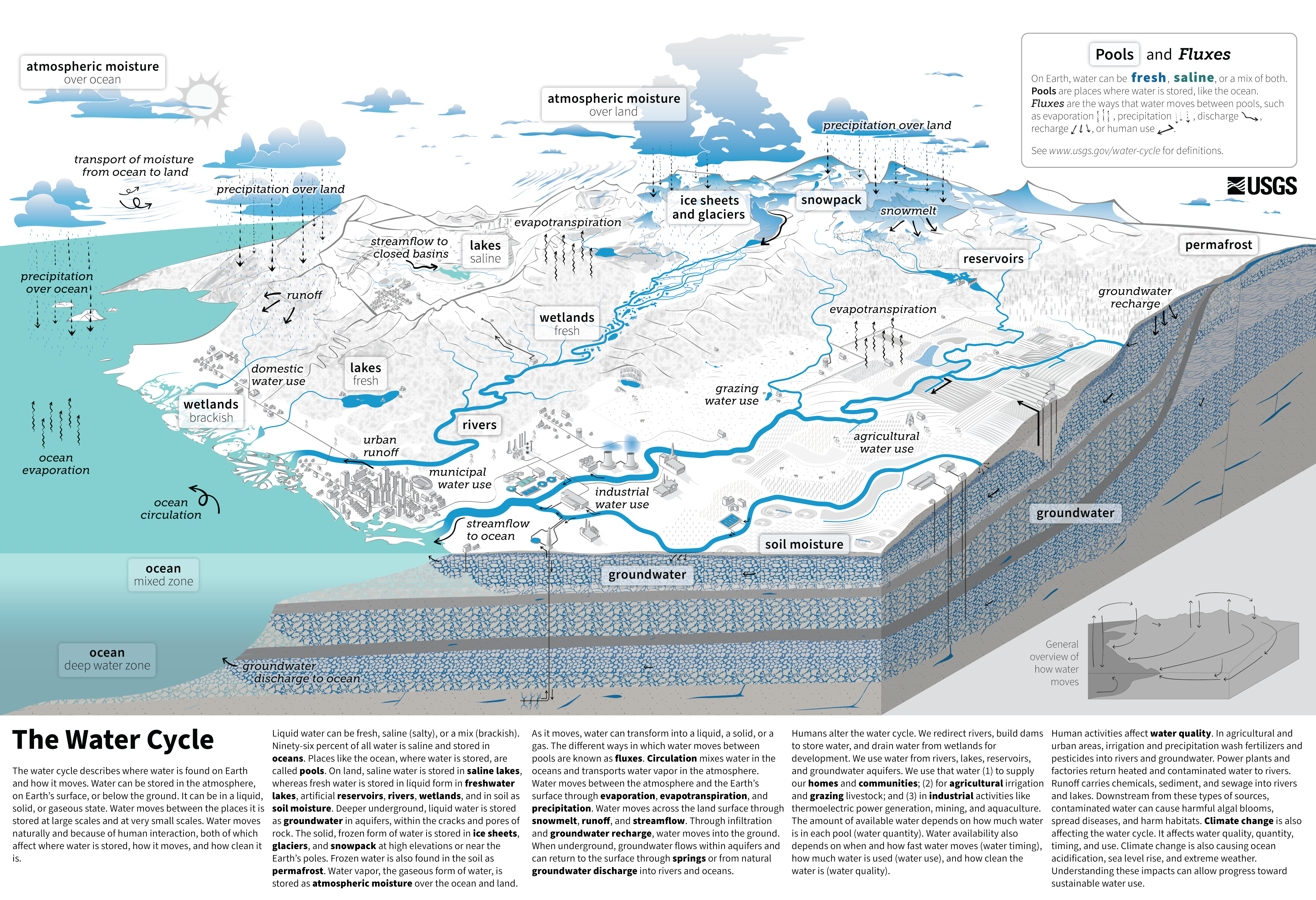
The Water Cycle. Credit: USGS

Brad Udall always lays out the hydrology and climate in an easy to understand, and often frightening, way. This YouTube video is well worth your time, particularly if you are a climate skeptic. Our political leadership needs to start paying attention to the scientists, the Colorado River Basin is a bellwether for the future. If you add energy to a system it responds and we are adding energy (heat) to the Water Cycle. As Brad has said, “Climate Change is water change.”

Glen Canyon Dam has four bypass tubes, also referred to as river outlet works (ROWs).

In the video above Katrina Grants from Reclamation explained how her agency is planning operations of Glen Canyon Dam for the next few years and emphasized that they can operate safely with just the outlet tubes, with increased maintenance activity. The planning shows the river hydrology is the primary driver of releases rather than limitations from the tube design. “We can release the water if it is there,” she said.

The back of Glen Canyon Dam circa 1964, not long after the reservoir had begun filling up. Here the water level is above dead pool, meaning water can be released via the river outlets, but it is below minimum power pool, so water cannot yet enter the penstocks to generate electricity. Bureau of Reclamation photo. Annotations: Jonathan P. Thompson

Last year the agency coated the tubes with Epoxy primer – applied directly to the blasted steel for corrosion protection and adhesion and Polysiloxane topcoat – a highly durable finish that provides abrasion resistance, chemical resistance, and long-term protection in a submerged environment. The coating was applied using a robotic sprayer after robotic abrasive blasting removed the old lining. Grants said that every six months one tube will need to be taken offline for a while for inspection and repair while using the other 3 tubes for releases. So, Reclamation does not believe that modifications to the dam are necessary at this time.

Colorado River “Beginnings”. Photo: Brent Gardner-Smith/Aspen Journalism

#Colorado’s glittering, lush resort towns are facing severe water shortages this summer — Jerd Smith (Fresh Water News) #drought #runoff

Green Mountain Reservoir is owned by the U.S. Bureau of Reclamation and located in Summit County north of Silverthorne along the Blue River. Photo credit: Denver Water.

Click the link to read the article on the Water Education Colorado website (Jerd Smith):

June 30, 2026

Historic water shortages are drying out the scenic mountains that lie at the heart of Colorado’s tourist economy, prompting the state to issue emergency orders earlier this month allowing water to be shifted to the towns and ranches most likely to run dry.

The Colorado River District, which represents 15 Western Slope counties, is running the emergency response effort and with financial support from the Colorado Water Conservation Board has anted up nearly $1 million to make sure even towns that can’t afford it, will have access to drinking water should it be needed. 

To make the plan work, the river district opted not to lease portions of the water it normally holds in two high country reservoirs, Ruedi in the Roaring Fork Basin and Wolford Mountain, near Kremmling, on a first-come, first-served basis, as it normally does. Instead, the water is being doled out based on community need, with people and food production getting the water first, according to Andy Mueller, manager of the river district.

“We had a number of requests to lease that water out, but a lot of it would have gone to wealthy gentlemen rancher … but it wouldn’t have been for the common good,” he said.

Under Colorado law, water can only be diverted, stored and used for a designated purpose, such as city drinking water, farm irrigation, environmental streamflows, and industrial uses. Water rights are also tied to seasons, with some available only in the winter or summer.

But this spring, the river district, seeking more flexibility than the laws typically allow, went to Colorado State Engineer Jason Ullmann and asked for emergency authorization to use its water supplies differently. The state agreed, giving the district until the end of August to conduct emergency releases.

At the same time, large agricultural water users in the Grand Valley agreed to cut their water use in an effort to lessen strain on the Colorado River, and protect some of the small towns and ranchers who would have been cut off otherwise.

At issue is a special pool of water that lies within Green Mountain Reservoir, near Heeney, known as the historic users pool, or the HUP. The water is meant as a backup source that allows towns to pump wells and divert from streams even when their water rights are not in priority on the giant mainstem of the Colorado River.

But this year, because of the drought, Green Mountain’s HUP isn’t projected to fill, something that hasn’t occurred since the 1960s when the pool was created to protect mountain water users who had junior water rights, according to Ullmann. The emergency order means that even without the backup from Green Mountain, these communities and ranches will be unlikely to have their water supplies cut off. 

The Eagle River Water and Sanitation District, which serves Vail and other small towns in Eagle County, has water in the HUP. 

Working in the shadow of a nearly snowless winter, the Eagle River District moved early to enact watering restrictions, limiting outdoor use to just two days a week back in April, after March saw temperatures soar to 80 degrees and the patchy snow cover evaporate months earlier than normal.

“The writing was on the wall,” said Siri Roman, CEO of the Eagle River Water and Sanitation District. “This is a benefit of being in the headwaters and being a resort,” she said referring to the headwaters of the Colorado River. “Our whole community is so connected to snowpack and snow-water equivalencies and what that means. By February we knew there wasn’t enough snow to change the picture for us. We wanted to get to the decision-makers early and say the red lights are flashing. We need to prepare for a water shortage this summer.”

Today a banner sign on its website warns that the risk of water shortages this summer “is very high.”

Eagle residents took conservation messages seriously

In Eagle, Tom Gosiorowski, the utilities manager, was standing in Brush Creek shooting videos for the town’s Facebook page, letting its 10,000 water customers know that the stream was the community’s only source of water and it wasn’t looking good. Eagle also relies on the HUP for some of its backup supplies.

“We are really wholly dependent on the streamflow and the water that is in the creek. It’s different from the big Front Range utilities” that have reservoirs, he said.

The district is limiting outdoor water use to two days a week and is sharply limiting the filling of hot tubs and swimming pools. Gosiorowski said he expects golf courses to be restricted as well as the summer wears on.

“We could get to a point where they can only irrigate tees and greens on the golf course,” he said. “We’ve never had to reduce use, but this is so extreme that I think there will be some.”

Gosiorowski said the town was still working on worst-case scenario planning for the end of summer, when streams are normally at their driest. “It’s hard to know exactly what’s going to happen. We’ve never experienced a drought to this degree in recorded history.”

Aspen has also enacted two-day-a-week watering and is prohibiting the filling of pools and hot tubs.

Grand Lake, another community that could be impacted by the shortages at Green Mountain, is not showing signs of strain yet, though officials there are concerned about lake levels.

Grand Lake, the deepest natural lake in Colorado, is linked to two other reservoirs, Shadow Mountain and Lake Granby. All three are part of Northern Water’s Colorado-Big Thompson Project. The C-BT delivers water from the Colorado River to 1 million customers and hundreds of farms on the northern Front Range.

Mike Cassio is a citizen activist who tracks Grand Lake’s health and works with a coalition of community groups and water agencies to help manage the system. Cassio said he’s worried about late summer water levels falling.

“We know Mother Nature controls everything,” Cassio said. If levels in Lake Granby and Shadow Mountain fall too low, water quality will suffer and that “will be the biggest issue.”

Kathy Chandler-Henry sits on the river district’s board and is a former Eagle County commissioner. She said the brown hillsides and dusty streambeds are unnerving.

“Before it was never a question,” she said. “There was always snowfall, there was always water. … Nothing like this year, when it was 80 degrees in March in Vail.”

Back in the 1980s, she said she participated in some regional planning efforts to help the Western Slope learn how to manage its growth. That there could be a winter without snow was unthinkable, if not downright funny.

“One planning consultant in the workshop asked folks what it would be like without snow,” she said. “And everyone just laughed.”

Despite this summer’s deep dry spell, water users say they are encouraged by recent light rains and cool weather. Just weeks ago, the HUP was projected to barely fill at all, but now the 66,000 acre-foot pool is rising again. It recently topped 33,000 acre-feet and is expected to move higher, providing some relief.

But Mueller, of the river district, said this summer is a dress rehearsal for what lies ahead as climate change and warmer temperatures continue to hamper mountain snows and spring stream levels.

“We are just beginning to grapple with the impacts of climate change. Science indicates that 30 years from now, this year may be on the wetter side.”

More by Jerd Smith

Map of the Blue River drainage basin in Colorado, USA. Made using USGS data. By Shannon1 – Own work, CC BY-SA 4.0, https://commons.wikimedia.org/w/index.php?curid=69327693

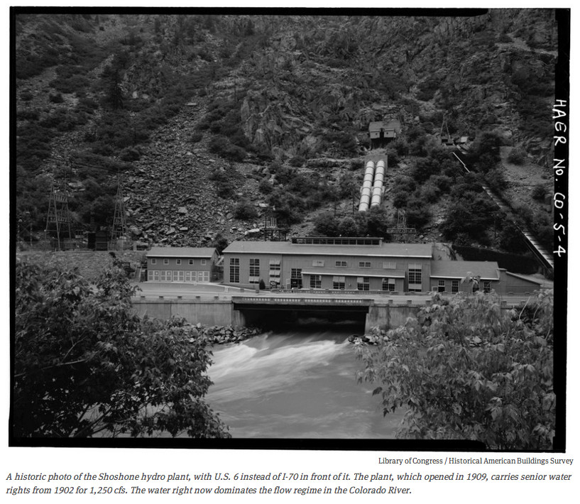
Shoshone flows: A treasured heirloom for the Western Slope — The #GrandJunction Daily Sentinel #ColordoRiver #COriver #aridification

Shoshone Hydroelectric Plant back in the days before I-70 via Aspen Journalism

Click the link to read the guest column on The Grand Junction Daily Sentinel website (Marc Caitlin). Here’s an excerpt:

July 1, 2026

Last month, leaders from across Colorado’s Western Slope celebrated the release of $40 million in federal funding for the Shoshone Water Rights Preservation Project. At a time when Colorado is celebrating its 150th anniversary and our nation approaches its 250th birthday, this investment represents more than a funding milestone; it marks one of the most significant water preservation achievements our state has seen in generations. It also would not have happened without the determination of our congressional representative, Jeff Hurd, who made this project a priority and worked tirelessly to deliver results for the communities he serves. What Rep. Hurd understands is the same thing that has united more than 100 local, state, and federal elected officials and leaders in support of preserving these critical senior water rights: the future of the Western Slope is inseparable from the future of the Shoshone water rights. Protecting these rights protects the flows of the Colorado River, sustains our agricultural heritage, strengthens our recreation- and tourism-based economies, and helps preserve the rural communities that make this part of Colorado unique…

I believe that 150 years from now, our grandchildren’s grandchildren will look back on the Shoshone Water Rights project as a turning point. They will see a generation of leaders who understood what was at stake and chose to act. They will see communities that put aside differences, came together, and made a long-term investment in the future of the Colorado River. History will remember the Shoshone project as a major milestone in the stewardship of our most precious resources. From Western Slope ditch companies and water conservancy districts to local governments, state leaders, and members of Congress, countless individuals are still working together to turn this vision into reality. The lesson is an important one. On the Western Slope, progress happens when we pull in the same direction. It takes communities working in harness together to move mountains and sometimes to move water. And it takes elected leaders like Jeff Hurd who are willing to put their shoulders into that work. The Shoshone project demonstrates what is possible when rural Colorado speaks with one voice about protecting its water, its economy, and its future.

Western Slope lawmakers take #ColoradoRiver managers to task: Missed deadlines, threat of litigation, conservation program prompt questions — Heather Sackett (AspenJounalism.org) #COriver #aridification

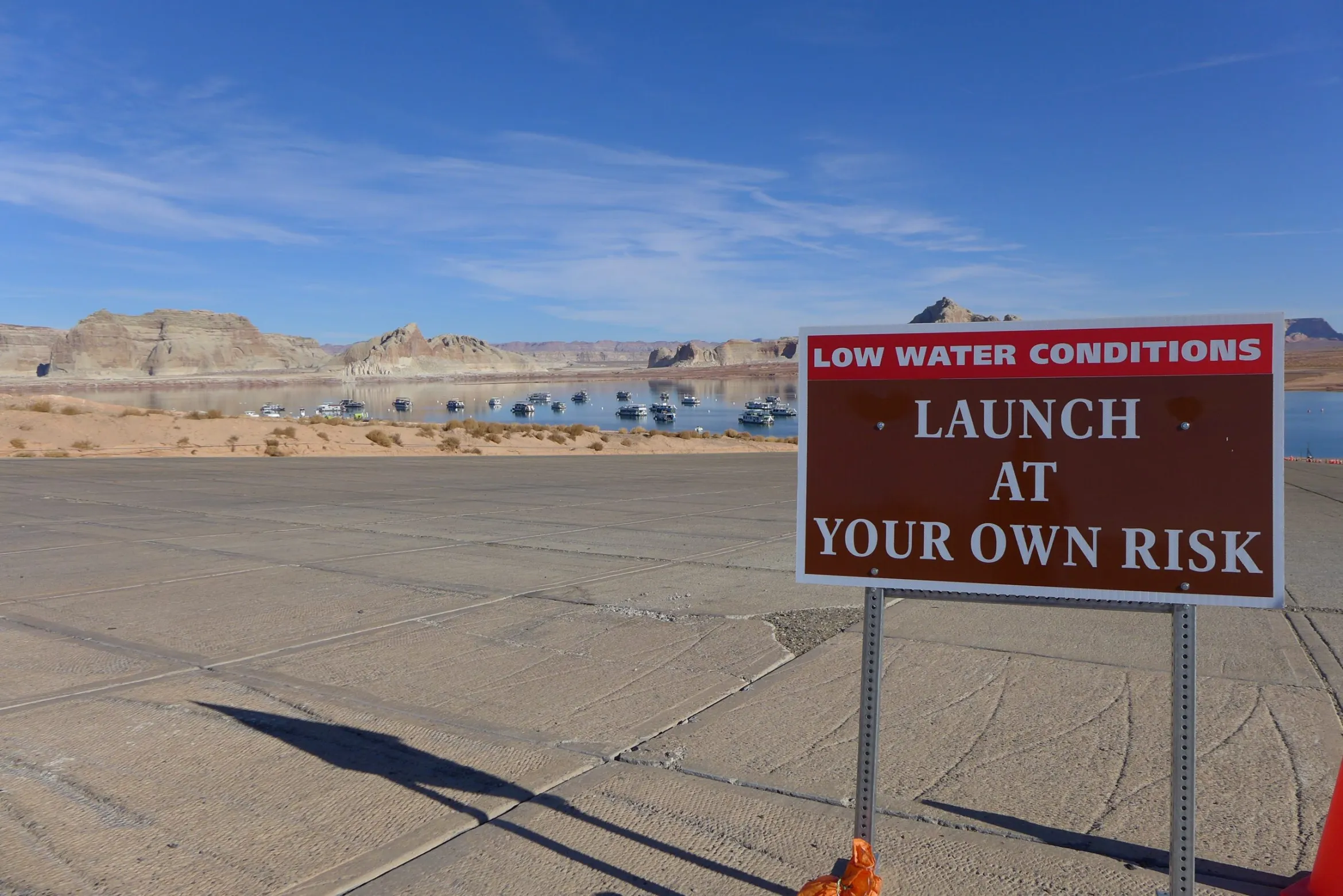
The main boat ramp at Wahweap Marina was unusable due to low water levels in Lake Powell in December 2021. Water levels are projected to soon fall even lower than this at the nation’s second-largest reservoir. CREDIT: HEATHER SACKETT/ASPEN JOURNALISM

Click the link to read the article on the Aspen Journalism website (Heather Sackett):

June 30, 2026

Western Slope lawmakers had harsh words for water managers at a state committee hearing last week, questioning whether Colorado has done enough to avoid a lawsuit with its downstream neighbors.

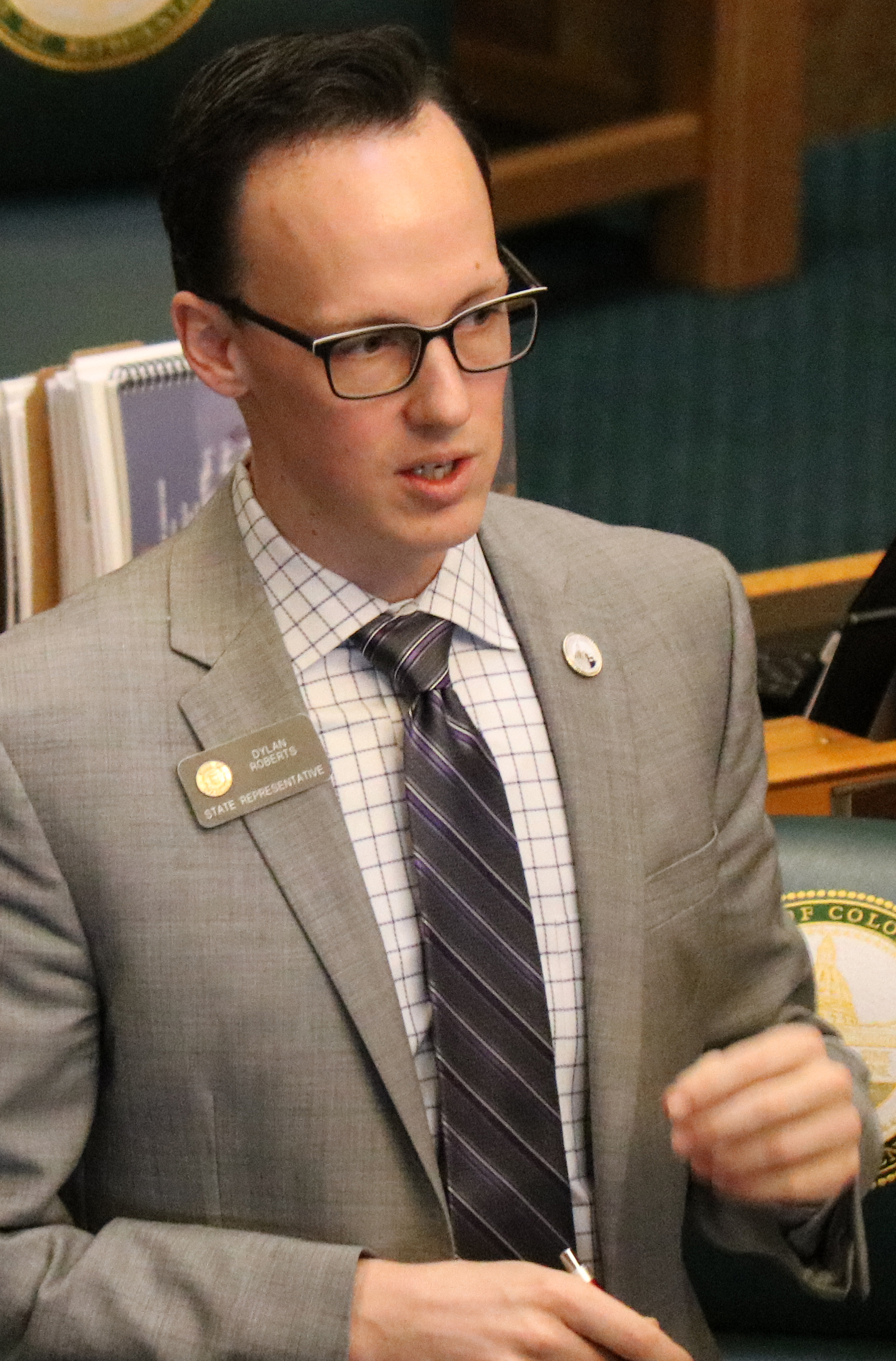
Colorado Sen. Dylan Roberts, a District 8 Democrat who represents several Western Slope counties, including Eagle, Grand, Garfield, Routt and Summit, asked Colorado’s lead negotiator, Becky Mitchell, whether the people of Colorado should have confidence that negotiations among the seven states that share the Colorado River have put the state in the best possible position. The states have been at an impasse for more than two years without a deal for future management as reservoirs continue to decline to record-low levels.

“My constituents just see fighting and intransigence,” Roberts said. “And it’s concerning to me, especially as a Western Slope lawmaker … that the strategy is just ‘Let’s hire more lawyers; we’re going to court no matter what.’ That doesn’t give me confidence, because I don’t think Colorado fares well when we go to court against Arizona and California and Nevada, throwing our fate to the nine justices on the U.S. Supreme Court.”

The remarks came at Thursday’s meeting of the state Water Resources and Agriculture Review Committee in Denver. Along with Mitchell, in the hot seat were state engineer Jason Ullmann and Amy Ostdiek, interstate section chief at the Colorado Water Conservation Board. The three are employees of the state Department of Natural Resources and have the backing of the Attorney General’s office in negotiations.

Dylan Roberts, a west slope lawmaker from Colorado. By Jeffrey Beall – Own work, CC BY 4.0, https://commons.wikimedia.org/w/index.php?curid=87044416

Roberts’ line of questioning seemed prompted by recent projections that show river flows dipping below a threshold that could trigger litigation. The Lower Basin states (Arizona, California and Nevada) believe that the Upper Basin states (Colorado, New Mexico, Utah and Wyoming) are bound by the 1922 Colorado River Compact to deliver 82.5 million acre-feet of water over a 10-year rolling average. According to the Upper Colorado River Commission, the 10-year average will dip later this year to about 81.3 million acre-feet because of persistent drought. 

Some experts believe that this amounts to a “tripwire” that could trigger a lawsuit from the Lower Basin states (Arizona, in particular, has been openly preparing for litigation) that could result in mandatory cuts in water use for the Upper Basin. Upper Basin water managers don’t subscribe to this interpretation, saying their states are only required not to deplete the river’s flows by more than 75 million acre-feet over 10 years.

Mitchell was reluctant to share details of Colorado’s legal strategy in a public forum, but she answered “absolutely” that her team’s work was putting Colorado in the best position. She said cutting back prematurely just to satisfy the Lower Basin’s interpretation of the century-old agreement would be bad for the state.

“If we initiate curtailment now, that is worse for Coloradans,” Mitchell said. “I think that is an important thing to remember.”

Wracked by drought, climate change and a management crisis, the situation on the river has never been more dire. The current management guidelines expire this year, and in the absence of a seven-state deal to share shortages and operate the nation’s two largest reservoirs, Lake Powell and Lake Mead, the feds are poised to step in. The U.S. Bureau of Reclamation plans to release a more detailed, short-term plan to manage the river for the next two years by mid-to-late summer.

State Rep. Julie McCluskie, a District 13 Democrat, said communities in her district have been living with the incredible angst, anxiety and pain of no snow and low reservoirs. 

“The frustration I hear in my community is that we have missed multiple deadlines; they are becoming a funny joke,” McCluskie said. “There is such a fear about the lengthy litigation process, the fear of an outcome that is far worse for Colorado than a compromise that we have some control over.”

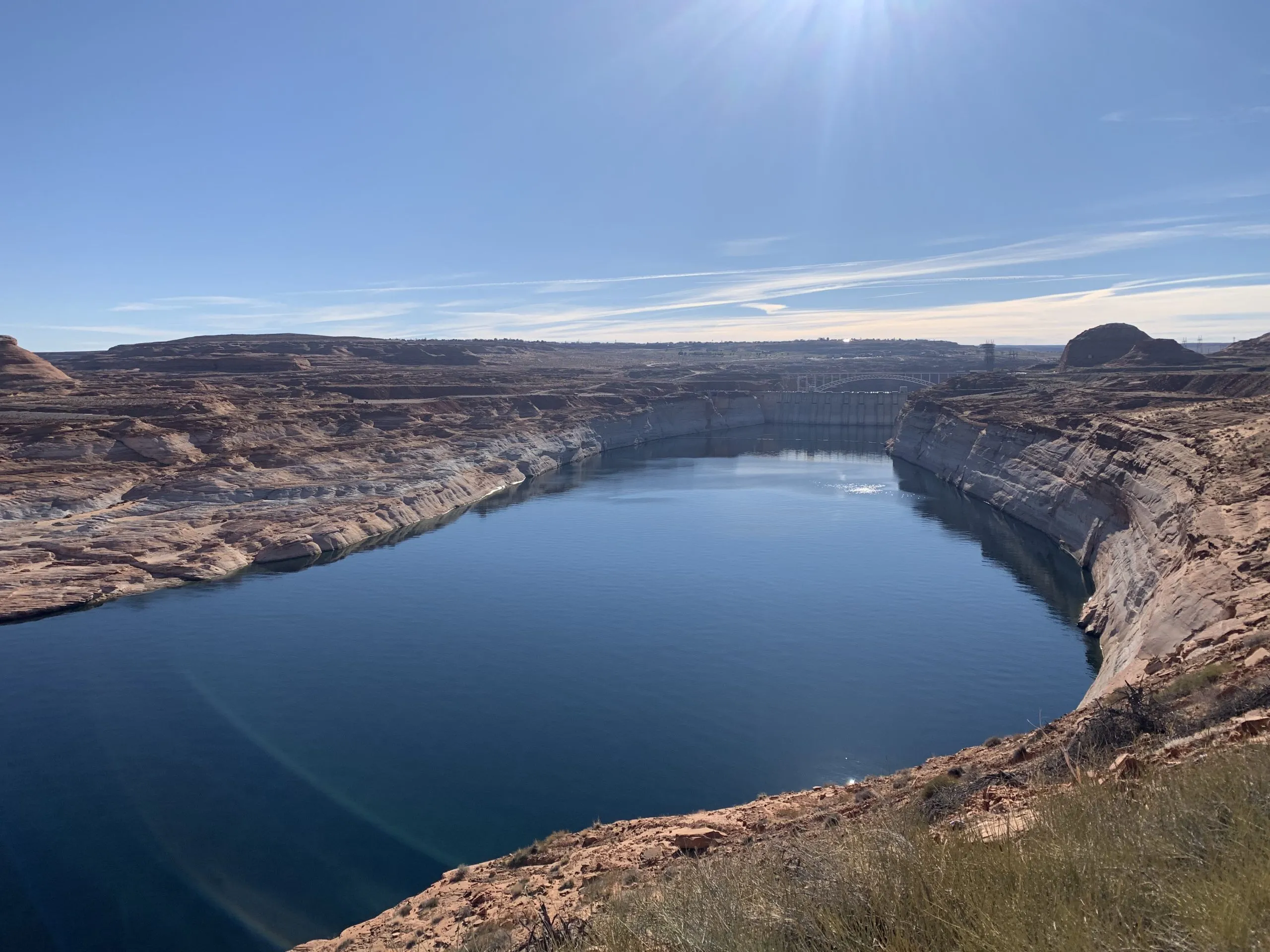
Lake Powell is formed by Glen Canyon Dam. In a concept pitched by a conservation organization, a flexible pool of water could be moved between Upper Basin reservoirs to wherever it’s needed most. CREDIT: HEATHER SACKETT/ASPEN JOURNALISM

Conservation conversation is the ‘bare minimum’

Lawmakers also had strong words for state officials regarding conservation, saying legislators must be involved in the creation of any program. 

Colorado has dabbled with pilot conservation programs in the past, but traditional programs that pay farmers and ranchers to temporarily cut back on water use remain controversial. This is especially true on the Western Slope, which has long been the target for these types of programs, and where some worry that they could harm rural communities if not done carefully. After two years of exploring how the state could set up a temporary, voluntary and compensated conservation program, officials shelved the idea in favor of focusing on drought-resilience initiatives.

“Other states out of the seven have very clear and actionable roles for their general assemblies, their legislatures,” McCluskie said. “We have less so, and yet the stakes are so high. So I beg of you, decision-makers, that it is essential that we be a part of those next steps.”

Julie McCluskie. Photo credit: Colorado General Assembly

Ostdiek said that any program would need to start slow and make sure it incorporates input from people throughout the state.

“I think that we can continue to assess as we go what we might need from you all, and what a program like that might look like,” Ostdiek said. “I think what we can certainly commit to is continuing this dialogue and continuing the discussion about what we might need to make this a success.”

In 2023, Colorado lawmakers tried to force stakeholders to come up with recommendations on conservation programs by creating a statewide task force, which met 10 times over six months. But the group failed to find a consensus, with some saying it was “premature” to create a conservation program.

As part of a post-2026 framework, the Upper Basin states plan to create a “contribution” pool in Lake Powell, which could be used to help stabilize the system, keeping water levels above critical thresholds to protect hydropower at Glen Canyon Dam and acting as an insurance pool against forced cutbacks. In a May 22 letter to federal officials, the Upper Basin states said they have a goal of saving 100,000 acre-feet by the end of water year 2028, but only if sufficient federal funding is available and hydrologic conditions allow.

Three Upper Basin states have different methods for contributing to this pool: Utah has its own demand management program; Wyoming lawmakers passed a law this year allowing for a conservation program; and New Mexico plans to release water from Navajo Reservoir. 

But precisely how — and how much — Colorado would contribute to this pool is unclear. The state’s share of the Upper Basin’s allocation is 51.75%, meaning Colorado could be on the hook for 51,750 acre-feet. 

And ensuring that saved water actually gets into a pool in Lake Powell remains part of the problem. Currently, conserved water that stays in the river can just be picked up by a downstream user, with no net gain to Lake Powell. Colorado officials say they do not have the authority to “shepherd” water past other water users to the state line unless it is specifically for compact compliance. [ed. emphasis mine]

Last year, some Delta County ranchers asked lawmakers to take up the issue and pass a law that would address this issue, allowing water users to conserve and get credit for contributing water to a Lake Powell pool. But legislators did not take up a bill in the 2026 session.

Colorado officials told lawmakers they were continuing to explore what a program might look like and whether legislation would be needed.

Roberts said conversations with the legislature should be the bare minimum if Colorado is going to have a conservation program. 

“If the department or any agency of the state were to pursue a conserved consumptive use program or demand management program that used state tax dollars to pay for it and did not go through the legislature in a formal process, I imagine that all of us on this panel and many of our colleagues would raise holy hell about the unilateral decision-making coming from Denver about programs impacting all parts of the state,” Roberts said. “So, please, let’s just cut that off at my recommendation. Let’s work together on this.”

Officials opened the hearing by highlighting the impacts of this year’s severe drought on Colorado’s farmers and ranchers, noting how even some of the most senior water users will experience shortages as streamflows dwindle. Orchards in the North Fork Valley and row crops in the Uncompahgre River Valley already have unprecedented shortages. 

In response to Roberts’ concerns about the failure to find a compromise among the seven states, Mitchell posed a high-stakes rhetorical question: “I would ask, ‘What else do you think we can give?’”

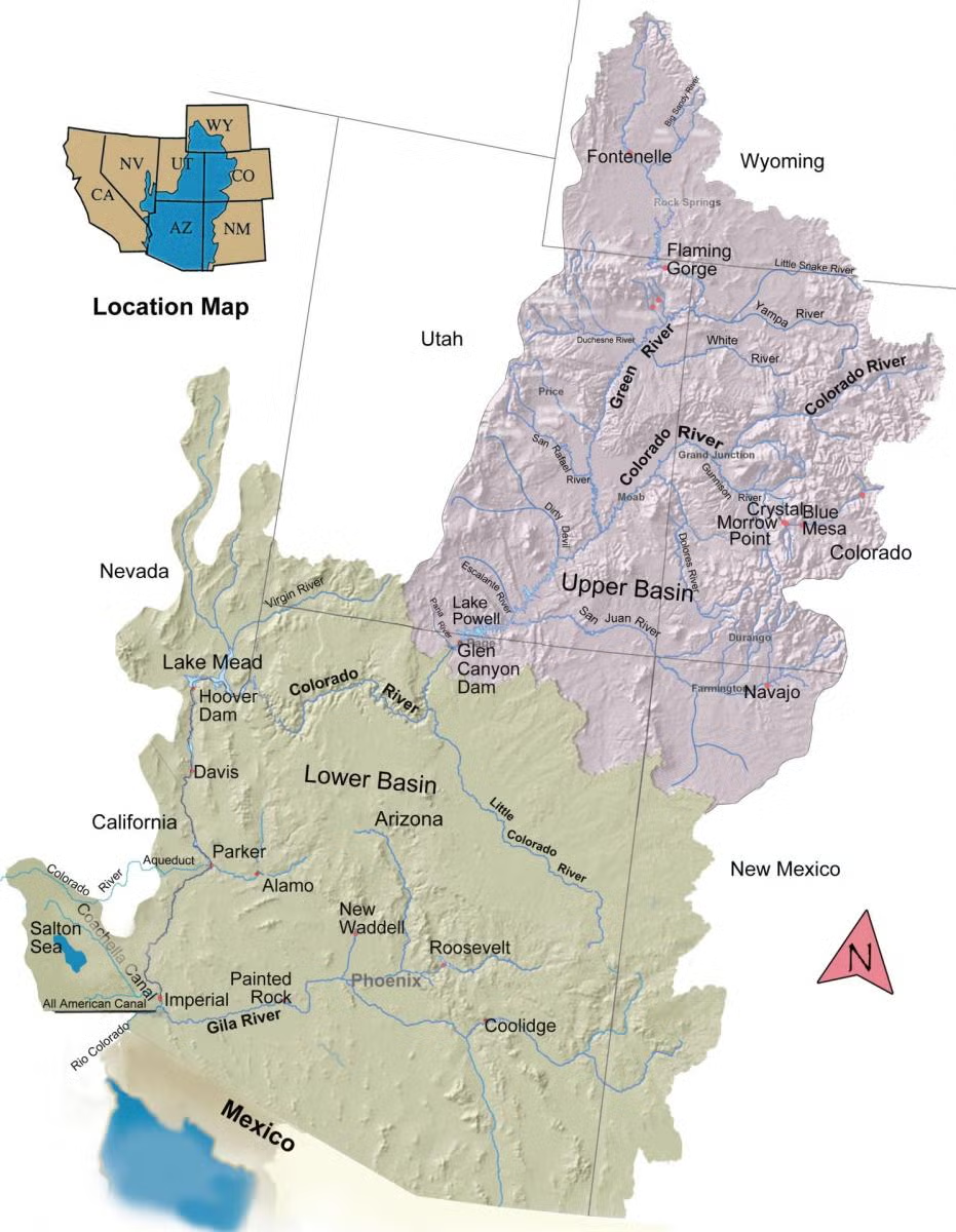
The Colorado River Basin spans seven U.S. states and is divided into Upper and Lower Basins. Lake Powell, upstream from the Grand Canyon, and Lake Mead, near Las Vegas, are the two principal reservoirs in the Colorado River water-supply system. (Bureau of Reclamation)

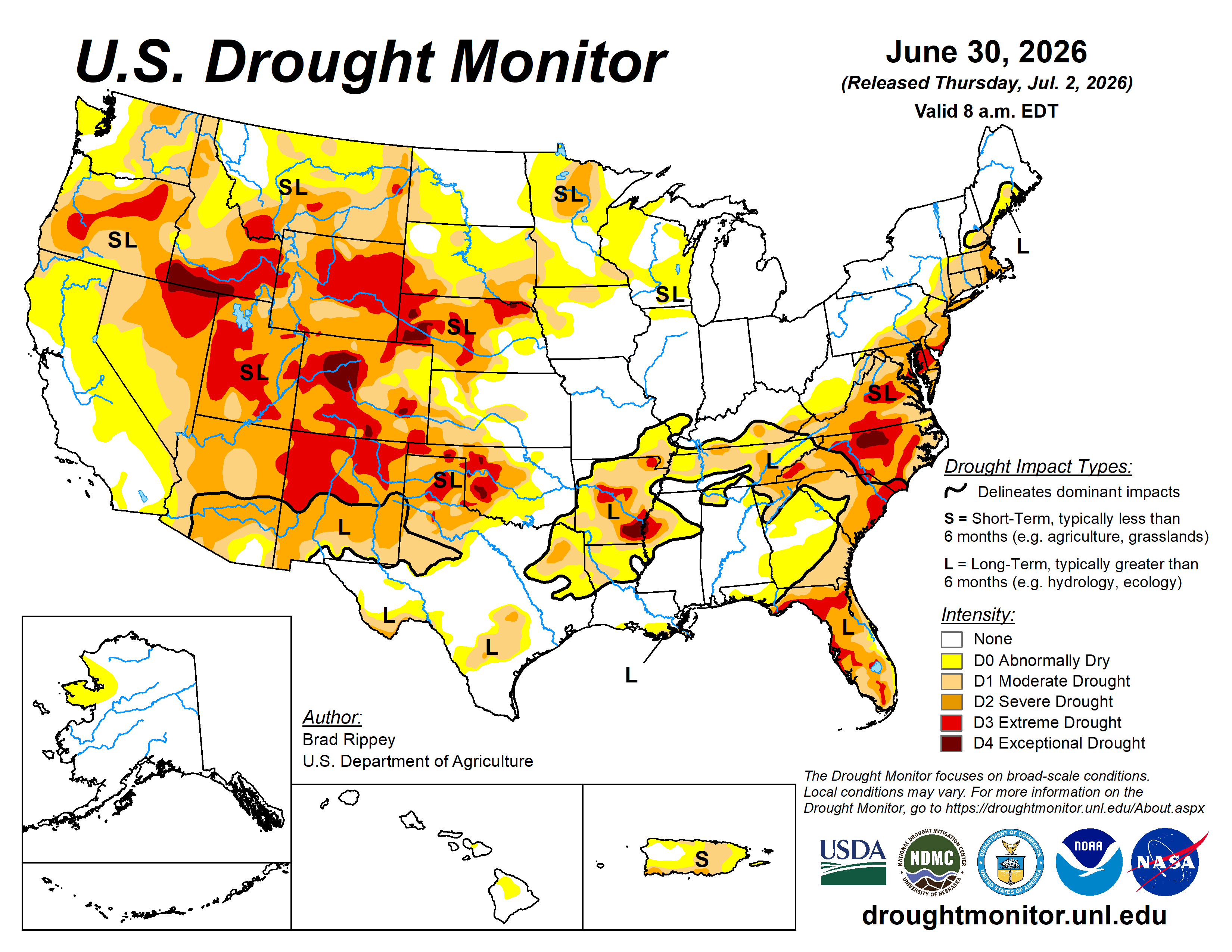
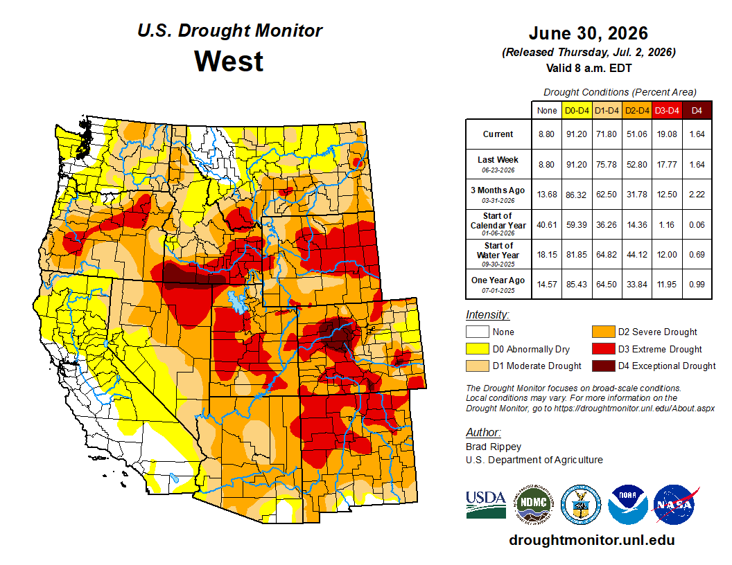
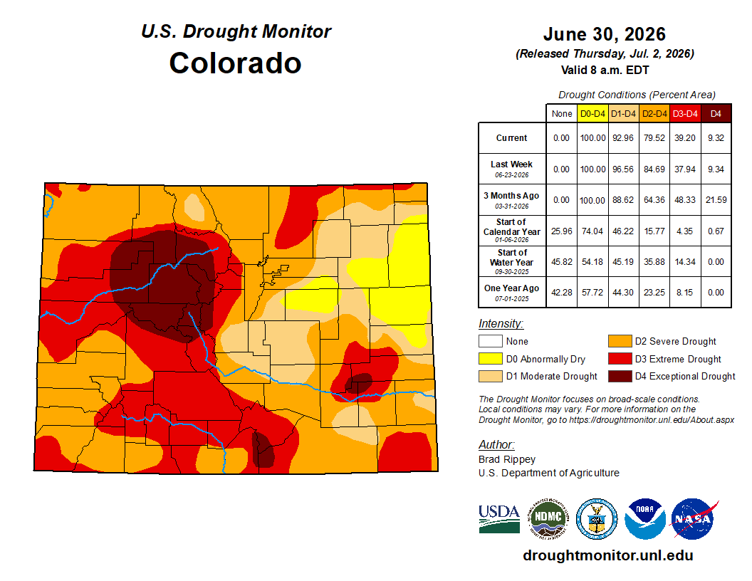
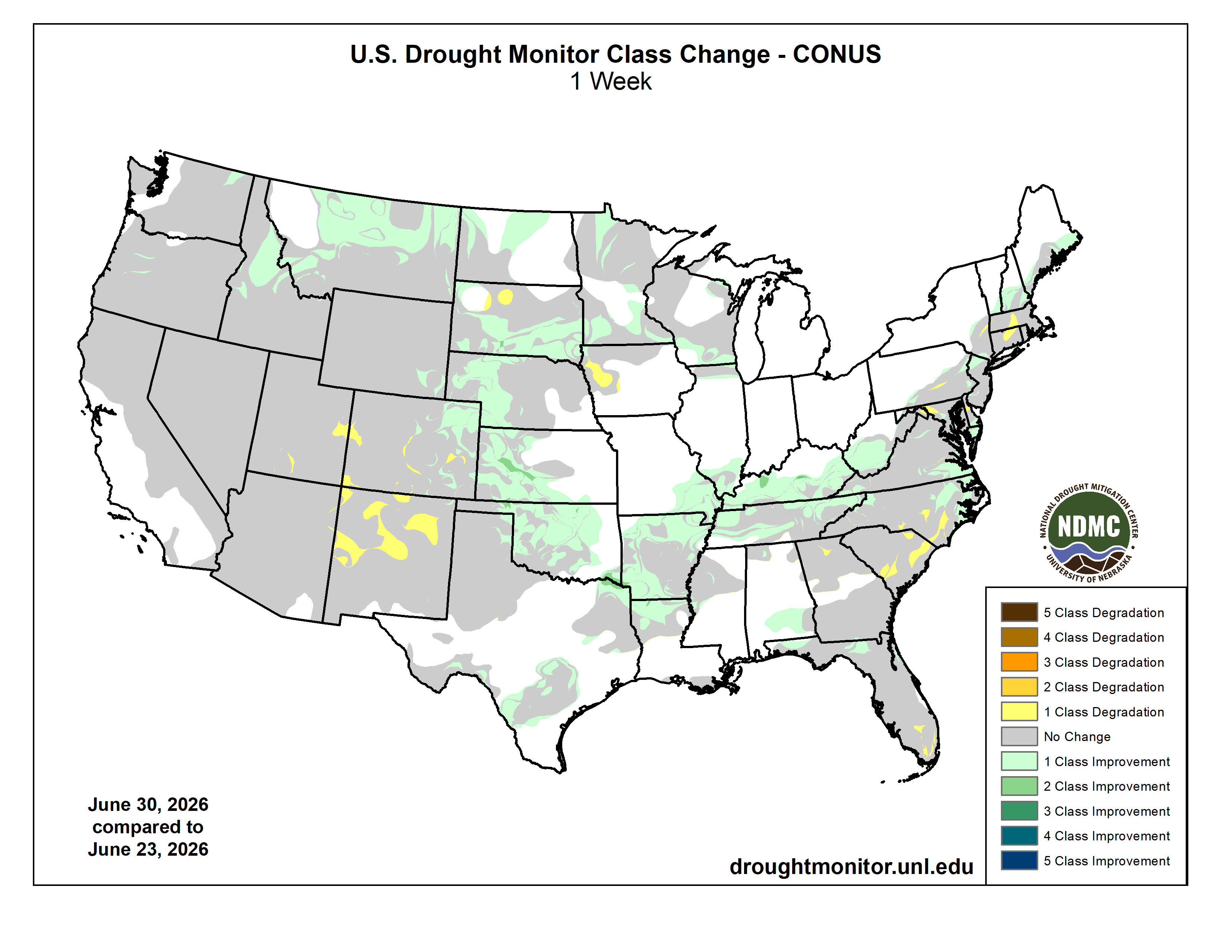
#Drought news July 2, 2026: Pockets of worsening drought were observed in the Four Corners States, including a notable expansion of extreme drought (D3) across the northern half of #NewMexico

Click on a thumbnail graphic to view a gallery of drought data from the US Drought Monitor website.

Click the link to go to the US Drought Monitor website. Here’s an excerpt:

This Week’s Drought Summary

Active weather delivered heavy showers and locally severe thunderstorms east of the Rockies, with a few exceptions. Some of the heaviest rain, locally 4 to 8 inches or more, fell from portions of the central and southern Plains into the Ohio and Tennessee Valleys, leading to pockets of flash flooding and lowland flooding. At least five flood-related fatalities were reported in Kentucky and Tennessee. Exceptions to the wet pattern included the western Gulf Coast region, parts of the Southeast, and an area stretching from the east-central Plains into the lower Great Lakes region. At the start of the drought-monitoring period, hot, dry weather dominated the West. However, a pattern change soon delivered cooler weather across the western U.S., along with widespread Northwestern precipitation. Wet snow blanketed some high-elevation sites in the northern Rockies. During the transition from hot to cool weather, gusty winds and low humidity levels favored wildfire ignition and rapid expansion, especially in portions of the eastern Great Basin and Four Corners States. At the end of June, more than a dozen active Western wildfires had scorched more than 10,000 acres of vegetation apiece, with the largest being the 94,000-acre Cottonwood Fire near Beaver, Utah. On June 28, three federal firefighters perished in the Knowles Fire, west of Grand Junction, Colorado…

High Plains

Like other areas in the central and eastern U.S., a patchwork quilt of showers provided drought relief in some areas. Some of the heaviest rain, occasionally accompanied by thunderstorm-driven high winds and large hail, fell in portions of all six states in the region. However, southeastern Nebraska was one area that missed all the rain. One of the most impressive outbreaks of severe weather occurred on the night of June 28-29, when a swath of wind damage stretched from northwestern Nebraska into southeastern North Dakota and beyond. An unofficial wind gust to 131 mph was clocked in Hyde County, South Dakota, while a gust to 112 mph was recorded at a mesonet station near Ree Heights in Hand County, South Dakota. Despite all the rain, the U.S. Department of Agriculture reported that rangeland and pastures continued to struggle. On June 28, statewide rangeland and pastures were rated 66% very poor in Nebraska, along with 63% in Colorado…

Colorado Drought Monitor one week change map ending June 30, 2026.

West

During the transition from hot weather to cooler conditions, gusty winds fanned recently ignited wildfires across portions of the eastern Great Basin and the Four Corners States. Fire ignition and spread was also abetted by dry thunderstorms, low humidity levels, and near-record to record-setting dry fuels. Pockets of worsening drought were observed in the Four Corners States, including a notable expansion of extreme drought (D3) across the northern half of New Mexico. In the Northwest, however, heavy precipitation—including high-elevation snow—eased drought from central Idaho into western and northern Montana. Less significant precipitation fell in the Pacific Northwest. According to the U.S. Department of Agriculture on June 28, Western States reporting rangeland and pastures rated at least one-half very poor to poor included Arizona (70%) and Colorado (63%), while states with topsoil moisture more than one-half very short to short were Colorado (89%), Wyoming (81%), Utah (69%), New Mexico (68%), Nevada (65%), and Oregon (62%)…

South

The South experienced a second consecutive week of widespread reductions in drought coverage. In fact, flash flooding and lowland flooding plagued some of the hardest-hit areas, including the Arklatex and the southeastern corner of Oklahoma, where 2-week rainfall totals locally exceeded 10 inches. Much of the northern tier of the region, from Oklahoma to Tennessee, also received multiple rounds of heavy rain. Although mostly dry weather prevailed in south-central Texas, some additional improvements were introduced, as impacts of recent downpours on long-term drought became more apparent. By June 28, the U.S. Department of Agriculture indicated that statewide topsoil moisture in agricultural regions was 28% surplus in Louisiana…

Looking Ahead

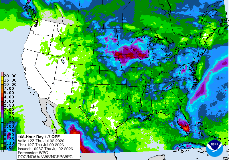
Hot, humid weather will persist through the Independence Day weekend in most areas along and east of a line from the southern High Plains into the upper Midwest. Some of the most extreme heat will affect the middle Atlantic States, parts of which will experience multiple days with triple-digit (100-degree) heat. Although the Midwest will remain hot, temperatures in most areas will barely reach stressful thresholds (95°F of higher) for corn and soybeans entering the weather-sensitive reproductive stage of development. Furthermore, many Midwestern crops are progressing through the hot spell with adequate to locally surplus soil moisture. Meaningful precipitation during the next 5 days should be limited to parts of Florida’s peninsula and the upper Midwest; both areas could see 1 to 4 inches, with locally higher totals. Other areas of the central and eastern U.S. should receive spotty thunderstorms, while little or no rain will accompany a Western warming trend.

The NWS 6- to 10-day outlook for July 7 – 11 calls for the likelihood of hotter-than-normal weather nationwide, except for near-normal temperatures along and near the Pacific Coast, extending as far south as central California. Meanwhile, odds will be tilted toward near- or above-normal rainfall across most of the country, with drier-than-normal conditions expected to be limited to the Great Basin and environs.

US Drought Monitor one week change map ending June 30, 2026.

Utah’s legal bid to kill Bears Ears National Monument and Grand Staircase-Escalante National Monument lives on; BLM looks to open #Utah land to motorheads; and Hoback water woes — Jonathan P. Thompson (LandDesk.org)

Late light on Comb Ridge in Bears Ears National Monument. Jonathan P. Thompson photo.

Click the link to read the article on The Land Desk website (Jonathan P. Thompson):

June 26, 2026

While the Trump administration 2.0 has so far rexfrained from trying to shrink or eliminate national monuments, its non-executive-branch proxies just keep on trying.This week the 10th Circuit federal appeals court issued a decision keeping alive Utah’s lawsuit challenging Joe Biden’s 2021 re-establishment of Grand Staircase-Escalante and Bears Ears national monuments following Trump 1.0’s shrinkage of the same.

The state and Garfield and Kane counties filed one lawsuit in 2022, with the Blue Ribbon Coalition and other parties filing their own suit. In 2023, a federal court dismissed both lawsuits; that ruling was appealed.

This week’s decision confirmed the dismissal of the Blue Ribbon suit. But it also determined that presidential national monument designations under the Antiquities Act are subject to federal judicial review, and sent Utah’s case back to the district court. 

***

Photo credit: Jonathan P. Thompson/The Land Desk

The Bureau of Land Management is moving forward with three travel management plans in Utah that will determine which roads, trails, and areas of the respective field offices’ jurisdiction are open to motorized vehicles. Given that the stated aim is to bring the plans in line with Trump’s recent executive order rescinding restrictions on motorized vehicles on public lands, we can assume that the idea here is to expand motorized access to some remote areas. The plans include:

  • The Moab Field Office has released preliminary alternatives for the Dolores River Travel Management Plan on about 127,000 acres in Grand County, Utah, east of Moab and abutting the Colorado border. This would include roads along the Utah section of the Lower Dolores River, and on mesas and in canyons on either side of it. Maps of the alternatives can be found here. This one is not yet open to public comment.
  • The Kanab Field Office has released a draft environmental assessment for its Trail Canyon Travel Management Plan on nearly 330,000 acres in Kane County. It is open to public input.
  • And the Vernal Field Office has also released a draft review for the Dinosaur North Travel Management PlanThe public comment period is open.

***

I typically stay away from electoral politics, especially the horse-race part of it and polls and such. But sometimes a particular contest or candidate can provide a lens on bigger trends or phenomena, and so are worth looking into.

The latest race that has caught my interest is the one to replace Sen. Cynthia Lummis, the Wyoming Republican who is retiring at the end of this term. Since it’s Wyoming in 2026, it’s safe to assume the winner will be a Republican (though this wasn’t always the case), meaning the primary is the contest that matters. The front-runner, I suppose, is Rep. Harriet Hageman, the Trump sycophant and MAGA extremist who unseated Liz Cheney back in 2022 after Cheney failed to show adequate fealty to Trump.

But it’s one of her challengers that I’m interested in: Sam Mead. Mead is a fifth-generation Wyoming rancher, comes from a long line of Republican Wyoming politicians, and is the nephew of former governor Matt Mead. Mead is young (36), charismatic, has strong conservative credentials on fiscal issues and gun-rights, and a background in engineering and business, having run a whiskey distillery in Kirby. But what really distinguishes him from his opponents is his willingness to speak out against some of Trump’s policies, and his priority on protecting public lands and keeping them in the public’s hands.

Mead, in other words, appears to be an old-school, pre-MAGA Western Republican. He reminds me a bit of Wyoming Gov. Mark Gordon, back before extreme polarization pulled him more and more rightward and into MAGA land. Wyoming’s primary is on Aug. 18.


The death of the pragmatic Western Republican — Jonathan P. Thompson

Meanwhile, Utah just held its primaries, with some surprising results. Utah State Senate President Stuart Adams, a Republican, was defeated by challenger Stephanie Hollist. Adams was a strong supporter of the controversial proposed Stratos Project data center complex on the north shore of the Great Salt Lake. Also, incumbent Rep. Celeste Maloy trounced challenger Phil Lyman in the GOP primary for the 3rd Congressional District, with about 70% of the vote.

While Maloy was endorsed by Trump, and has plenty of extreme views, Lyman is the more MAGA of the two. And Trump pardoned Lyman after his conviction for leading an OHV rally down Recapture Canyon in the southeastern part of the state. Political consultant Taylor Morgan told the Utah News Dispatch that Lyman’s resounding defeat showed that his “very angry, very conspiracy-based, populist, toxic form of Republicanism (is) frankly wearing very thin, especially here in Utah.” Let’s hope he’s right!

Pumpjack in the Aneth oil field. Jonathan P. Thompson photo.
I wrote Tuesday about how the Trump administration is eviscerating Biden-era oil and gas rules aimed at reducing methane emissions and ensuring companies clean up their own messes rather than foisting them onto the taxpayers. Now the changes are open for public comment.

Comment on the waste prevention rule changes here.

Comment on the oil and gas leasing changes here.

Here are a few of the changes Trump and co. are proposing:

  • Bring back pre-Biden reclamation bond rates, which amount to just over $2,000 per well, which is insane, since the cost to reclaim and plug a single well easily can exceed $100,000. These numbers incentivized petroleum companies to walk away, forsake the bond, and abandon the well, leaving the tab for the taxpayers.
  • Reduce the current $10 minimum per-acre bid for leasing public land to $2, restore noncompetitive leasing, and slash royalties and filing fees for oil and gas companies.
  • Implement a new fee for protesting leases. And they plan to cut the 90-day public input period to just 10 days. In other words, they’re trying to cut out the public from decisions regarding public lands.
  • Gut the waste prevention rule (they wanted to roll it back altogether, but chose to revise it instead because it wasn’t clear which rule would replace it) by removing limits on royalty-free flaring and killing requirements that companies develop leak detection and repair plans.
  • Trump’s changes to the waste prevention rule will turn back the regulatory clock to the days when oil and gas operations on federal and tribal land vented and flared an average of 44.2 billion cubic feet annually of methane, which is usually accompanied by nasty volatile organic compounds and other dangerous compounds. That’s as bad for the climate as burning around 9 million tons of coal. But it also amounts to lighting money — your money — on fire and throwing it away. That vented methane is basically the same stuff you pay for to run your furnace, or to generate much of the electricity running through the grid. And since operators don’t pay royalties on gas they throw away, that cost American taxpayers some $166 million in lost revenue over a decade.

The result of all of this (and more) will be to rob taxpayers and sacrifice public lands and the climate to subsidize the same energy corporations that are raking in obscene profits thanks to Trump’s disastrous war on Iran. The administration argues that their proposed changes will save petroleum corporations operating on federal lands $17 million annually in compliance costs.

That sounds like a lot of money, until you realize that high oil prices have driven corporation’s profits to absurd highs. During the first quarter of 2026 alone, ExxonMobil raked in $8.8 billion in underlying, adjusted profits. Somehow, I don’t think several million in compliance costs is going to deter them from drilling.

🐟 Colorado River Chronicles 💧

Many of the West’s streams have entered their summer low-flow phase, a period that falls between the end of snowmelt and the beginning of the monsoon, while irrigation diversions are in full-swing. One of the most dramatic cases of this is, perhaps, the Colorado River itself as it flows through Grand Junction. This morning, the river was running at just 366 cubic feet per second near Palisade, which as reader Dave Grossman pointed out is low enough to allow someone to walk across the sprawling river bed.

Some other notably low flows:

  • Animas River in Farmington, NM: 104 cfs.
  • Dolores River at Bedrock, CO: .76 cfs (effectively dry)
  • White River near Watson, UT: 76.4 cfs
  • Green River above Flaming Gorge: 551 cfs
  • Green River below Flaming Gorge: 1,590 cfs
  • San Juan River near Caracas, CO (above Navajo Reservoir): 85 cfs
  • Colorado River near Hite, UT: 4,300 cfs

This has reduced daily average inflows into Lake Powell to about 4,800 cfs and dropping. It would be much lower than that, except that flows are being bolstered by upstream reservoir releases. Either way, inflows are far less than Glen Canyon Dam releases, which are averaging about 8,500 cfs daily (approx. 6,500 cfs at night and 10,600 cfs during the day). This disparity, exacerbated by reservoir evaporation, is lowering Lake Powell’s surface level, which currently sits at about 3,526.75 feet. Without substantial upstream rain, it will likely drop to 3,520 feet by early August.

📖 Reading (and watching) Room 🧐

Matt Jenkins wrote an excellent overview for the Water Education Foundation of the potential “Grand Bargain” on the Colorado River, which would require both the Upper and Lower basins to give up some of their Colorado River Compact claims not only to keep the system from collapsing, but also to avoid litigation.

The piece lays out the fact that the Compact is not only outdated, but also internally conflicted, in that it apportions the Upper Basin 7.5 million acre-feet of water per year, while also obligating it to allow the same amount of water to flow to the Lower Basin annually. That’s just not possible these days, given that there’s far less than 15 MAF in the river.

Read it here.

⛏️ Mining Monitor ⛏️

Southeastern Utah is known mostly as a mining hotspot for uranium, copper, with lithium emerging more recently. But it also hosts a potash extraction industry, and at least one company is looking to expand the potash footprint. Sage Potash says it has secured permits from Utah and San Juan County to begin drilling at is Sage Plain Potash project.

While this is only exploratory drilling, it’s notable in that it’s not occurring in the Lisbon Valley or near existing potash sites near Moab. Rather it is on the Great Sage Plain southeast of Monticello, in the archaeologically rich zone north of Hovenweep National Monument.

***

Prior to mining, snowmelt and rain seep into natural cracks and fractures, eventually emerging as a freshwater spring (usually). Graphic credit: Jonathan Thompson

Yet another reason to worry about spewing more carbon dioxide into the atmosphere via fossil fuel burning: It can exacerbate acid mine drainage, the phenomenon that leads to toxic heavy metal loading in streams and other waterways. That’s the conclusion of a peer-reviewed study published in Communications Earth & Environment this April.

Acid mine drainage occurs when a mine excavation exposes once-buried sulfide-bearing rocks such as iron pyrite (FeS2) to oxygen and water. The hydrogen, sulfide, and oxygen come together to form sulfuric acid (H2SO4). Thus, the water becomes acidic, or its pH drops. The acidity dissolves heavy metals and the water picks them up. As the pH level of the water drops below 4.8, acidophilic bacteria begin feeding off the metals, releasing more acid into the solution and causing metal loading to occur up to 1 million times faster than in water with higher pH. Metal loading is bad for fish and other aquatic life.

The study found that elevated atmospheric carbon dioxide levels enhance the acidophilic bacterial activity, which accelerates iron and sulfur oxidation, acid formation, and metal loading. Zinc and cadmium, both of which are harmful to aquatic life, are more sensitive than other metals to rising carbon dioxide levels. Zinc loading is especially problematic in the Upper Animas watershed in southwestern Colorado.

***

Okay, I really don’t care that Anfield bought its first underground haul truck for its Velvet-Wood uranium mine in the Lisbon Valley of southeastern Utah. But I found this press release interesting for another tidbit: The haul truck was built by Young’s Machine Company, located in Monticello, Utah. I never knew Monticello had this sort of manufacturing industry. I gotta say, it’s kind of cool.

The Hoback River joins the Snake River following a landslide upstream on June 18, 2026. Robert Frodeman photo.

🚣🏽 Water Watch 🌊

Water Quality in the Greater Yellowstone

A Guest Post by Robert Frodeman

Four million people visit Teton County, Wyoming, each year. They come to hike, float, and ski, snap pictures under the elk antler arches, and to partake in the myths of the American West. As the sign at the top of Teton Pass says, “Welcome Stranger. Yonder is Jackson Hole, the Last of the Old West.” Visitors expect to find a pristine environment. They don’t expect water quality problems reminiscent of a developing nation.

Teton County has some of the best drinking water in the country. Or most of Teton County does: Hoback, in the southern part of the County, has a nitrate problem. Nitrate is a health risk — most acutely to infants under six months, in whom nitrate is converted to nitrite by gut bacteria, interfering with oxygen transport in the blood and causing methemoglobinemia (blue baby syndrome). Many of the water systems in Hoback are on their last legs: two weeks ago, I had no running water and then a boil order at my home.

Jackson is the town, Jackson Hole is the valley that runs north of town in front of the Tetons. (‘Hole’ was what mountain men called a valley.) If you drill 20,000 feet into the valley floor you will hit the same sandstone layer that sits on top of the Tetons. This implies that the Tetons have risen some 25,000 feet over the last 10 million years.

Of course, mountains come down as they go up: the Tetons have been shedding sediment across all that time, piling up thousands of feet of gravel on the valley floor. Still more gravel was brought by the glaciers that flowed down from the Yellowstone Plateau. The Snake River meanders in front of the Tetons, but much of the river passes unseen below the surface, forming what is known as the Snake River Aquifer.

In effect, Jackson and Jackson Hole sit on top of a huge bathtub filled with gravel and water. This provides an abundant source of high-quality water for the town. But the bathtub only extends so far. The southern rim of the tub comes up at Munger Mountain five miles south of town. This is where the Yellowstone glacier stopped, and where the Snake River Canyon begins, which runs for 30 miles to Alpine and the Mormon communities of Star Valley.

Hoback lies four miles south of Munger Mountain — beyond the reach of the aquifer. Local residents must drill for their water. Local wells reach 200 feet down to the Bear River Formation. The water isn’t ideal – it’s brackish and can have a distinct sulfur smell (as do some of the local hot springs). The groundwater is also contaminated from horse farms and pig farms and (mainly) septic tanks and leach fields. Septic tanks can leak, and there is not enough biotic activity at this elevation and latitude for leach fields to function well. The result is nitrate levels in our drinking water which sometimes exceed EPA daily maximums.

Hoback is distinctive not only because of its geology. The billionaires live elsewhere in the County. There are two trailer parks nearby. Historically, local politicians have directed their attention to the Town of Jackson, Wilson, and the ski resort of Teton Village. But this has changed in recent years. Carlin Gerard of the Teton Conservation District formed a Hoback Stakeholders Group in 2019 to highlight drinking water problems. Covid disrupted that effort, but then a local non-profit called Protect Our Water Jackson Hole brought its energy and resources to southern Teton County.

In 2023 Hoback residents formed a water and sewer district. The district has now raised $7 million from the County and the State to build a municipal drinking water system. Water will be drawn from the Snake River just above the confluence with the Hoback. Construction should begin this fall and be done in a year or two depending on the weather.

At first it will only serve 125 residents: the district was made small out of fear of opposition. Teton County is solid blue, but past attempts had failed because of Hoback’s history of Red State, don’t-tread-on-me politics. In any case, it turned out that the demographic transition had already occurred: when the election was held the vote was 36-0 in favor. And there are now plans to annex a new affordable housing development that Teton County hopes will help address the local housing shortage.

Of course, the new system will only isolate residents from the nitrate problem. The environment will remain polluted, and people outside the district will still be on wells. The district has begun to price out a wastewater system, which is liable to be quite expensive. But you’d hope for nothing less for the Greater Yellowstone Ecosystem – and officials would hate to see an article in the New York Times about Teton County’s leaky septic systems.

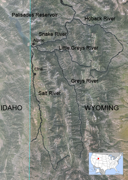
Map of Greys River in Wyoming, United States. By Feydey – Nasa World Wind 1.3.5 public domain NLT Landsat 7 satellite photo, layered with PD vmap0 vector data. Image:Map_of_USA_highlighting_Wyoming.png was used for the smaller image., CC BY-SA 3.0, https://commons.wikimedia.org/w/index.php?curid=1589723