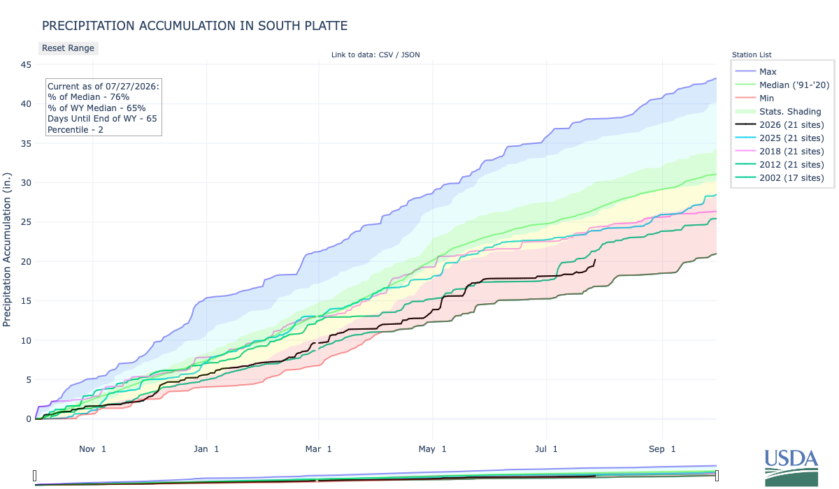
Below is the Precipitation Accumulation in South Platte graph from the NRCS for July 27, 2026. This morning precipitation is at 76% of the median (up 4% one week), and 65% of the water year median (up 5% one week). There are 65 days left in the water year.
Thunderstorrms are likely today through Wednesday, there is a chance for thunderstorms Thursday, a slight chance for thunderstorms Friday, with a chance for showers/thunderstorms Saturday and Sunday, in the central mountains. Light rain is currently falling and thunderstorms are likely today, there is a slight chance for showers then thunderstorms are likely Tuesday and Wednesday, with a chance for thunderstorms Thursday and Friday, and a slight chance for showers/thunderstorms Friday and Saturday in the northern mountains. There is a chance for thunderstorms today, thunderstorms are likely Tuesday and Wednesday, with a slight chance for thunderstorms Thursday and Friday, and a slight chance for showers/thunderstorms Sunday, down here, about 12 miles from Golden, where the Colorado Central Railroad was chartered February 9, 1865. From Wikipedia:
The railroad was chartered as the Colorado and Clear Creek Railroad Company on February 9, 1865, by Loveland and other entrepreneurs in the town of Golden, then the capital of the Colorado Territory. Loveland and his partners desired to build a 4 ft 8+1⁄2 in (1,435 mm) standard gauge railroad up Clear Creek Canyon to Central City and other mining centers, and to connect to nearby Denver and Boulder. During the three years before construction on the line began the company underwent several reorganizations. On January 20, 1866, the name of the railroad was changed to the Colorado Central & Pacific Railroad. The following year, in June 1867, the company was reorganized; Union Pacific investors were in control, but provided no funds for construction. That year, the seat of territorial government for Colorado was relocated from Golden to Denver…In May 1871 local interests regained control of the railroad from Union Pacific investors. By the following September, 150 men were at work in the mountains west of Golden to extend the line to the mining communities. In the spring of 1872 the company acquired critical right-of-way along Clear Creek to extend its line. West of Golden, the line built as 3 ft (914 mm) narrow gauge. In late August, the company took delivery of its first two locomotives (both 0-4-0T), the General Sherman, No. 2, followed a week later by General Sheridan, No. 1. On September 1, the track was completed 13.3 miles to Forks Creek. By mid-December, the line had been extended 7.7 miles further to Black Hawk. By February 24, 1873, a second line from Forks Creek had been extended 3.3 miles to Floyd Hill. In September, the company’s shop in Golden produced the first passenger car in Colorado. On May 11, 1874, the company took delivery of an 18-ton Mogul locomotive from Dawson & Baily. The new locomotive replaced the “Sheridan” as the #1 locomotive.

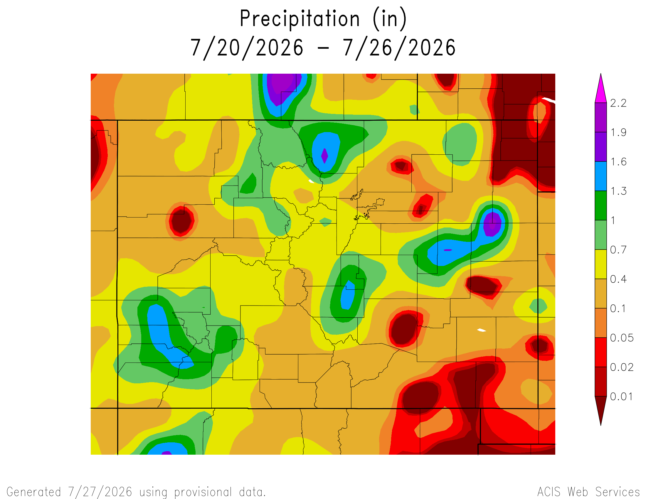
Here’s a look at the 7-Day Colorado precipitation map through July 26, 2026 from the High Plains Regional Climate Center. Precipitation in the South Platte Basin along the Continental Divide of the Americas ranged from 0.10” to 1.90”.
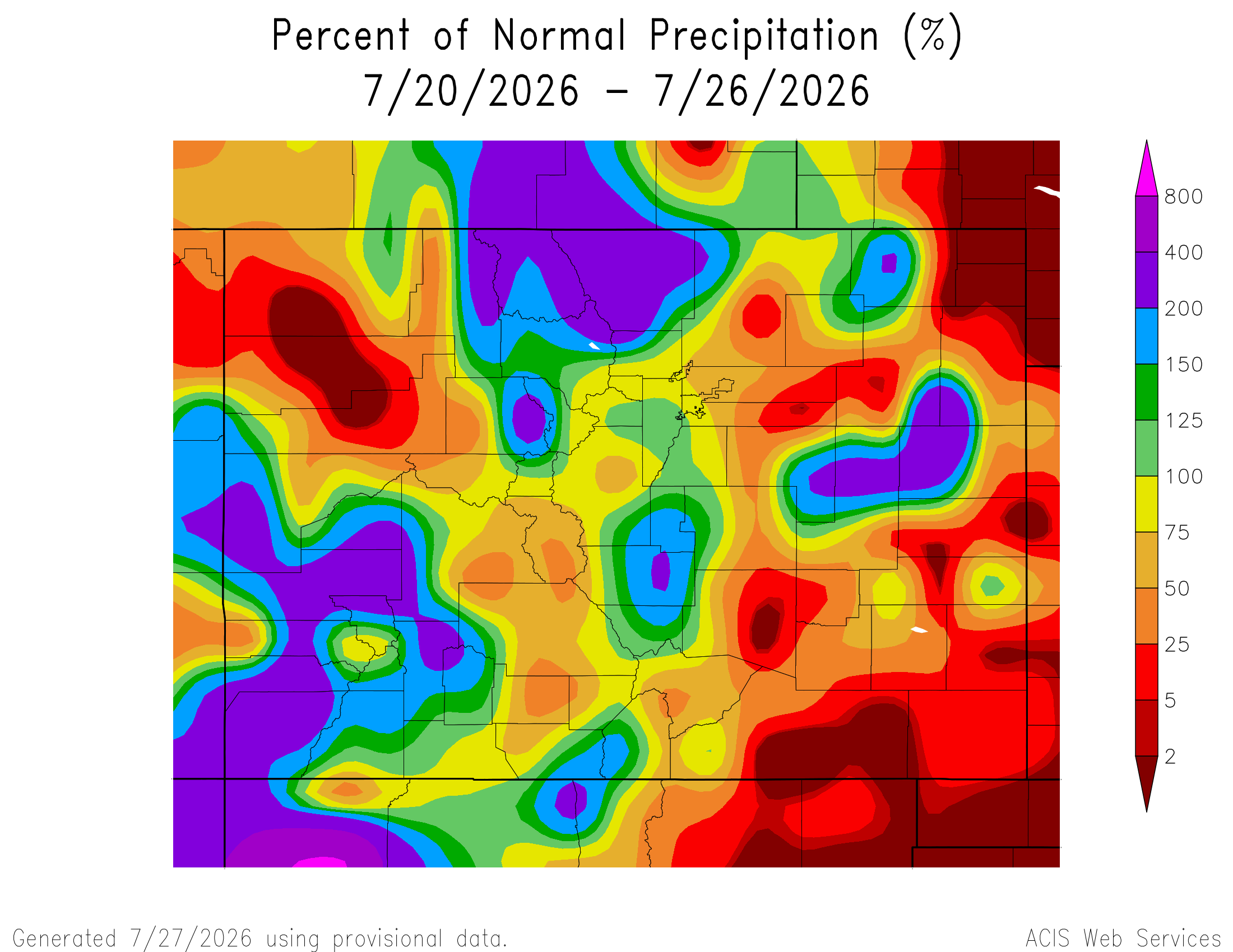
Here’s the 7-Day percent of normal precipitation map through July 26, 2026 from the High Plains Regional Climate Center. Precipitation in the South Platte River Basin along the Continental Divide of the Americas ranged from 50% to 400% of normal.
Below is the 7-day Quantitative Precipitation Forecast for the week of July 27, 2026. Precipitation is anticipated for the mountains of the South Platte River Basin and may total up to 1.50″.

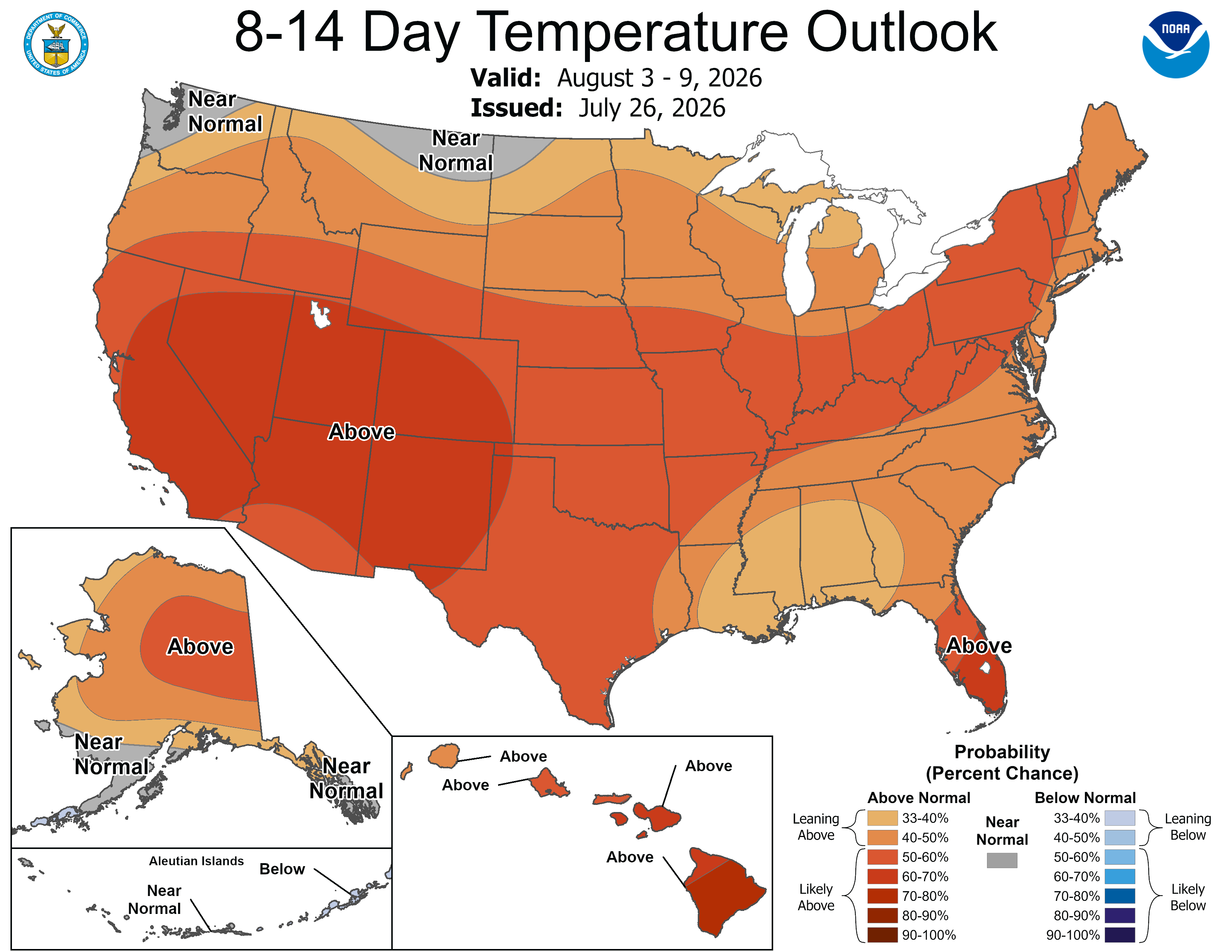
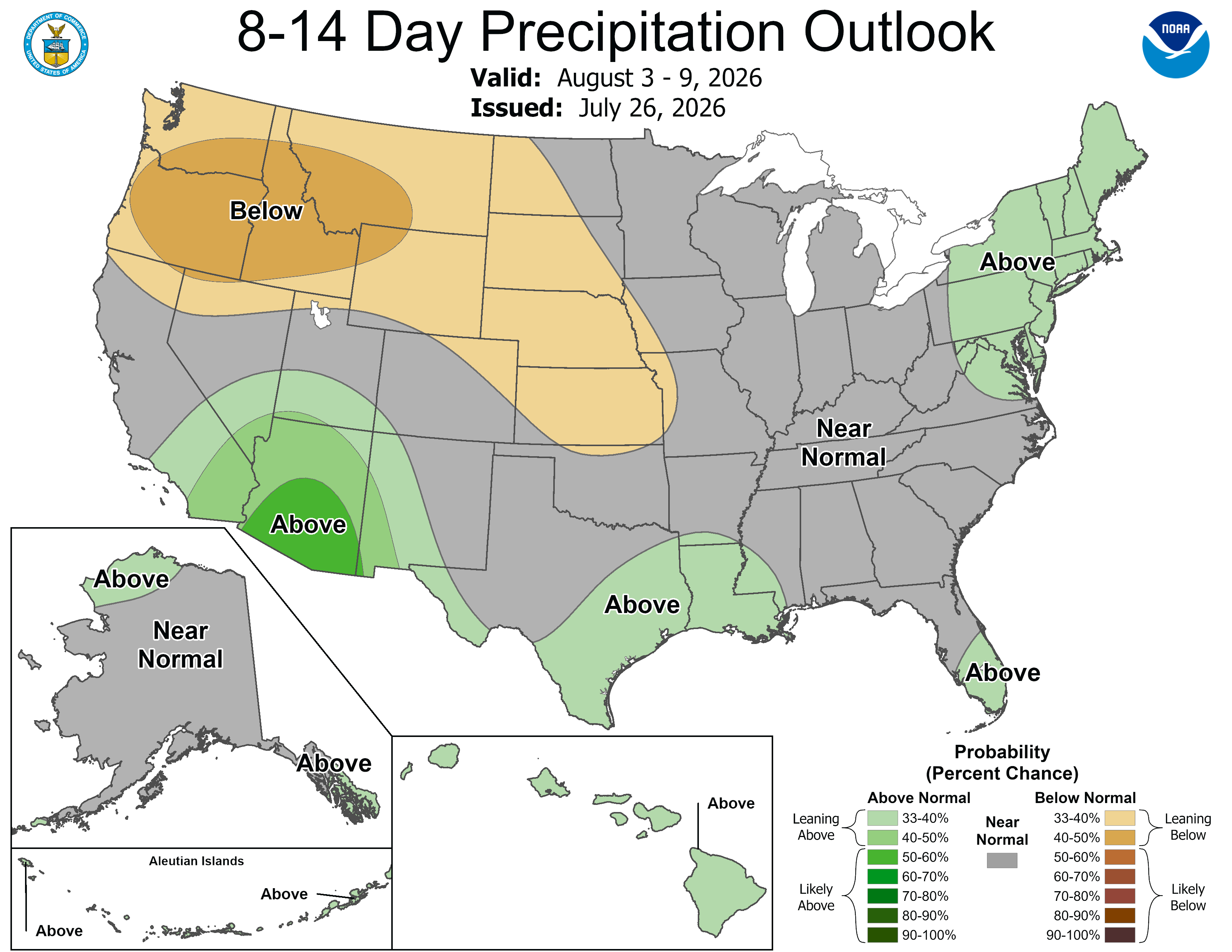
Below are the 8-14 day outlooks from the Climate Prediction Center, issued July 26, 2026, for temperature and precipitation, for the week starting July 27, 2026. The CPC expects above normal temperatures and near normal to below normal precipitation for the mountains of the South Platte River Basin.
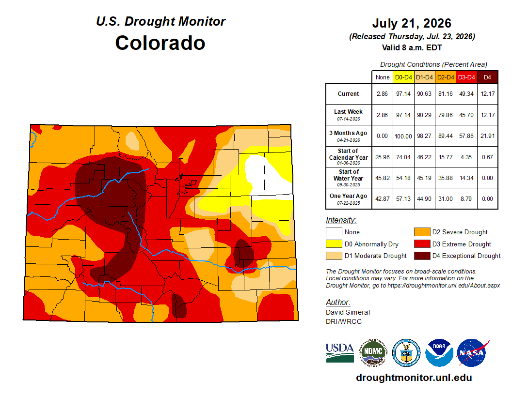
Below is the Colorado Drought Monitor map from June 21, 2026. There were one class degradations in Douglas, Elbert, Arapahoe, Adams, Denver, Jefferson, Clear Creek, Gilpin, Boulder, Weld, Morgan, and Larimer counties, in the South Platte River Basin. Drought and abnormal dryness covers 97.14% of Colorado. The South Platte Basin is experiencing Abnormally Dry, Moderate, Severe, Extreme, and Exceptional drought conditions.
Below is the Colorado Drought Monitor one week change map ending July 21, 2026.
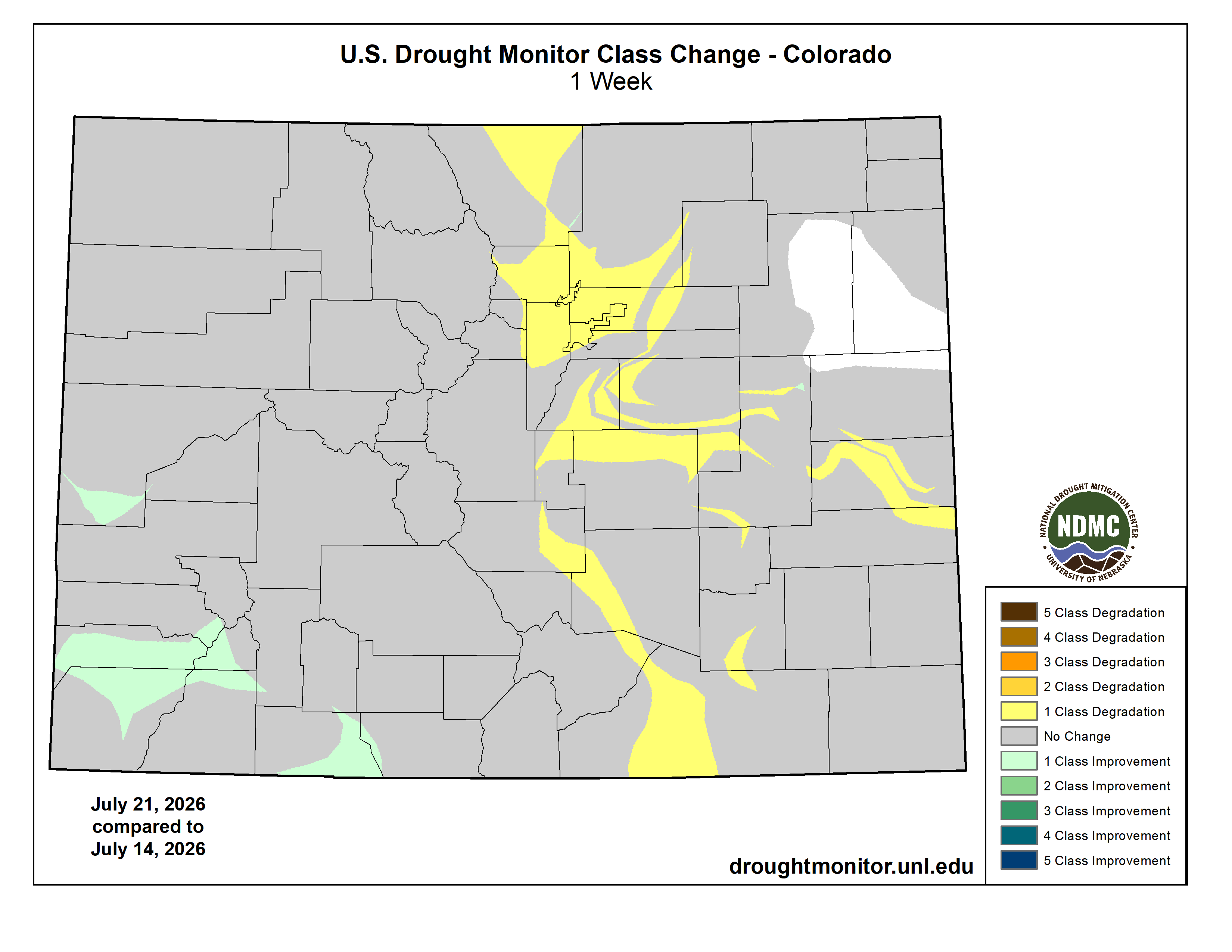
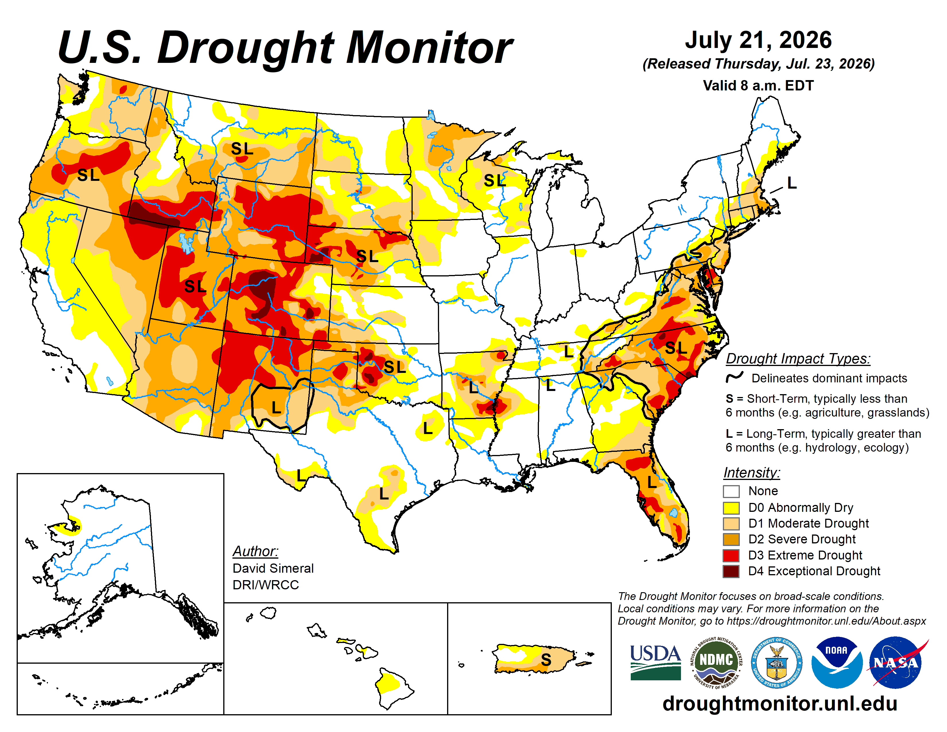
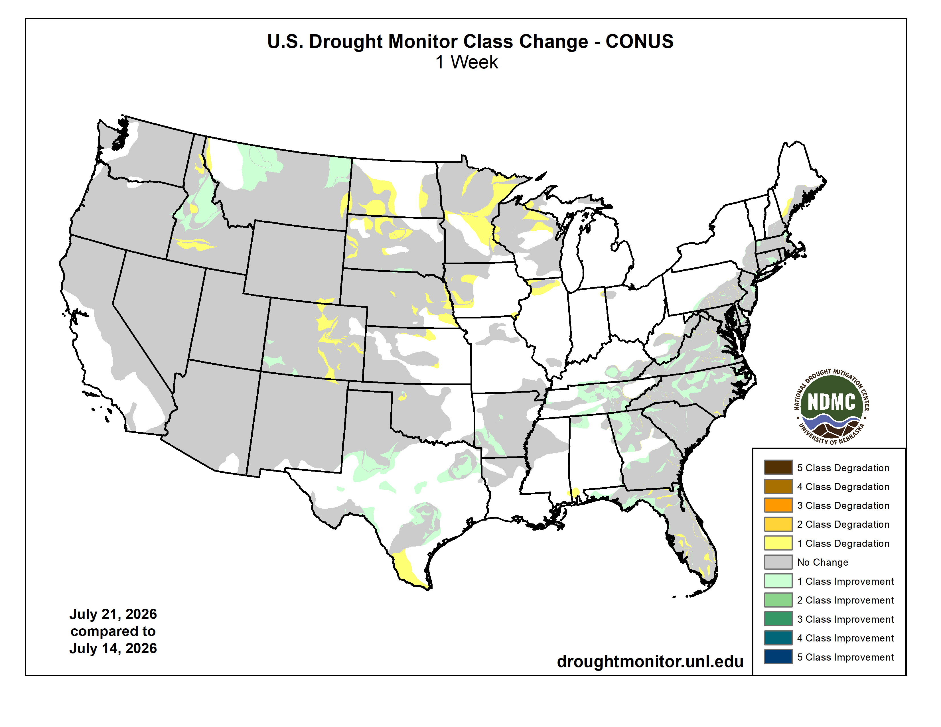
Here’s the US Drought Monitor Map from last week along with the one week U.S. change map.
Finally, last week PNAS.org released a Brief Report titled The 2026 western US snow drought was about four times more likely due to climate change. Here’s the abstract:
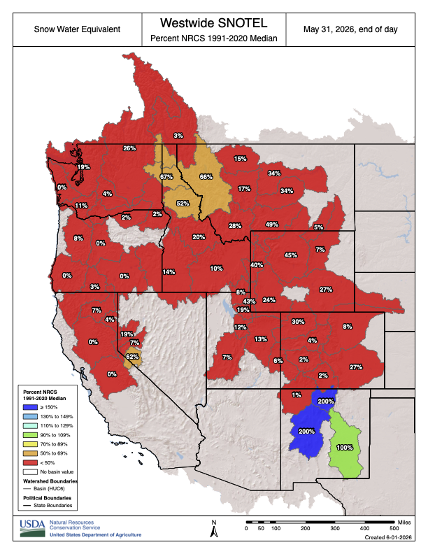
In the spring of 2026, anomalously low snow conditions in the western United States threatened winter recreation and water supplies. Here, we investigate: to what extent was this snow drought attributable to the climate change that has occurred since the pre-industrial period? We find that a snow drought this severe across the western United States was approximately 4.4 [95% CI: 2.6, 9.4] times more likely in the current climate than in the preindustrial period. In the Upper Colorado River Basin, the snow drought was approximately 14 times more likely [0.09, 4,300]. Given a projected increase in the frequency of snow droughts at least this severe in a moderately high emissions warming scenario, the lived experience of this event may help scientists, resource managers, and the public consider what western US snow might look like if greenhouse gas emissions are not aggressively reduced.