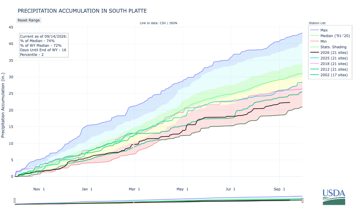
Below is the Precipitation Accumulation in South Platte graph from the NRCS for September 14, 2026. This morning precipitation, at the SNOTEL stations, is at 74% of the median (down 2% one week), and 72% of the water year median (no change one week). There are 16 days left in the water year.
There’s a chance for showers/thunderstorms today, showers are likely Tuesday, Wednesday, and Thursday, with a chance for thunderstorms Friday, and a chance for showers/thunderstorms Saturday and Sunday in the central mountains. There’s a slight chance for showers/thunderstorms today, a chance for showers are Tuesday, a chance for thunderstorms Wednesday, showers are likely Thursday, Friday, and Saturday, then a chance for a chance for showers/thunderstorms Sunday in the northern mountains. There’s a slight chance for showers/thunderstorms today and Tuesday, a chance for showers Wednesday, showers are likely Thursday, with a chance for thunderstorms Friday, and a chance for showers and thunderstorms Saturday with a slight chance for showers and thunderstorms Sunday, down here, about 350 miles from the La Plata River and Cherry Creek Ditch. From Wikipedia:
Hinderlider v. La Plata River & Cherry Creek Ditch Co., 304 U.S. 92 (1938), is a US Supreme Court case…The Court emphasized that the La Plata River is an interstate stream, and its water must be equitably apportioned between Colorado and New Mexico. The 1898 Colorado decree could not grant the Ditch Company rights exceeding Colorado’s equitable share of the river’s water. The Compact, as a legislative agreement between the states with Congressional approval, was a valid mechanism for apportioning the river’s water and binding on all water claimants, including those with pre-existing rights. The Court rejected the argument that the Compact violated the Ditch Company’s vested rights, noting that the Compact’s provisions, including the rotation of water flow, were designed to maximize the beneficial use of the river’s water. The Court found no evidence of procedural infirmities or inequities in the negotiation, ratification, or implementation of the Compact.
The United States Supreme Court reversed the judgment of the Supreme Court of Colorado. The Court held that the La Plata River Compact was valid and binding, and the actions of the State Engineer in administering the Compact were lawful. The Ditch Company’s rights under the 1898 decree were limited to Colorado’s equitable share of the river’s water, as determined by the Compact.
An archetypical example of such federal common law is that relating to disputes between states of the United States, Hinderlider was the first case to reaffirm the existence of federal common law for other purposes, specifically here, the interpretation of an interstate compact governing water rights between states.
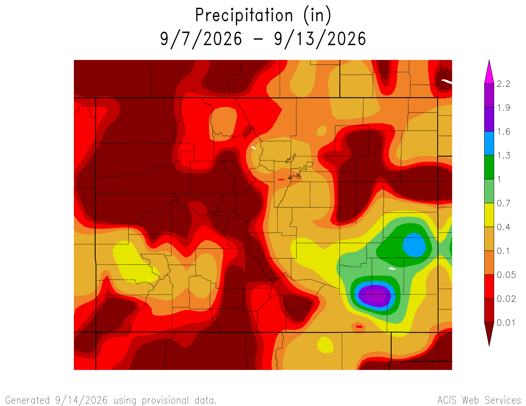
Here’s a look at the 7-Day Colorado precipitation map through September 13, 2026 from the High Plains Regional Climate Center. Precipitation in the South Platte Basin along the Continental Divide of the Americas ranged from 0.00” to 0.40”.
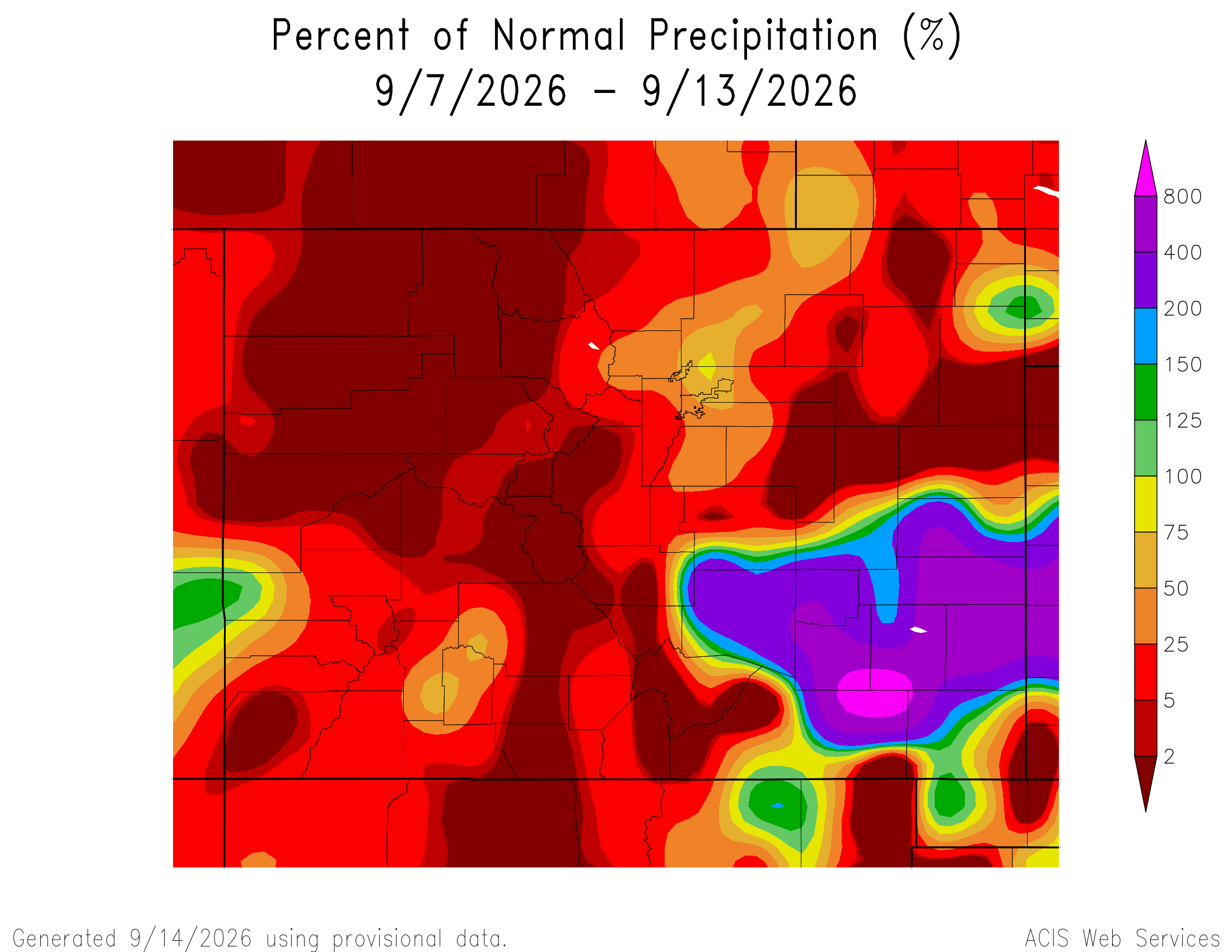
Here’s the 7-Day percent of normal precipitation map through September 13, 2026 from the High Plains Regional Climate Center. Precipitation in the South Platte River Basin along the Continental Divide of the Americas was 0% to 75% of normal.
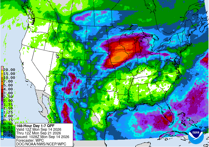
Below is the 7-day Quantitative Precipitation Forecast for the week of September 14, 2026. Precipitation is anticipated for the mountains of the South Platte River Basin and may total up to 1.50″.
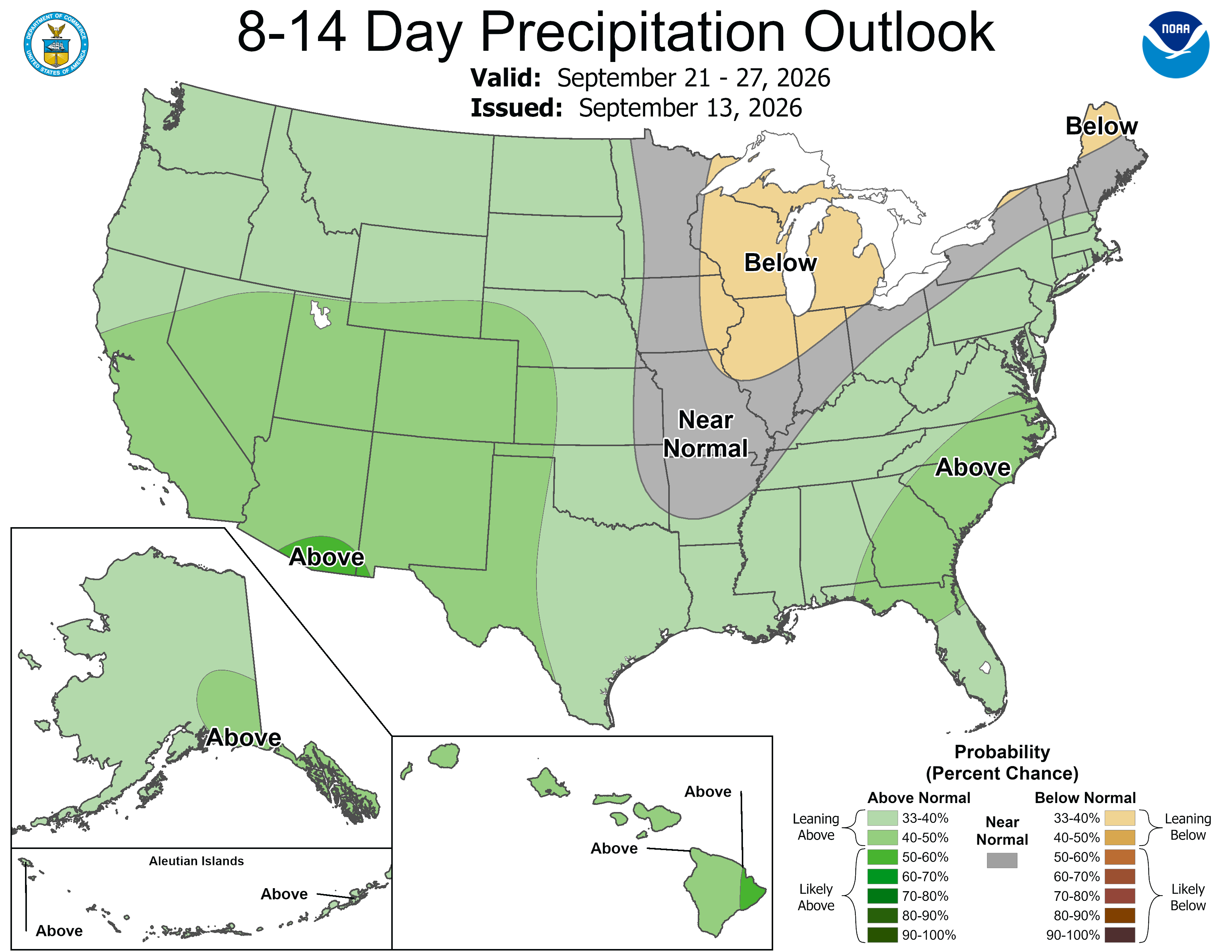
Below are the 8-14 day outlooks from the Climate Prediction Center, issued September 13, 2026, for temperature and precipitation, for the week starting September 21, 2026. The CPC expects above normal temperatures and above normal precipitation for the mountains of the South Platte River Basin.

Below is the Colorado Drought Monitor map from September 8, 2026. There were one class improvements in Weld, Logan, and Sedgwick counties. Drought and abnormal dryness covers 93.81% of Colorado. The South Platte Basin is experiencing Abnormally Dry, Moderate, Severe, Extreme, and Exceptional drought conditions.

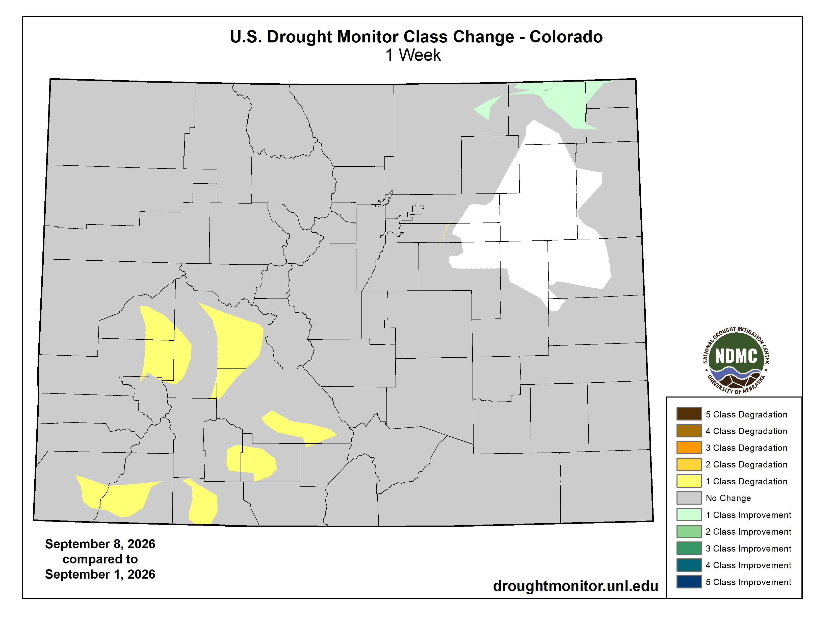
Below is the Colorado Drought Monitor one week change map ending September 8, 2026.
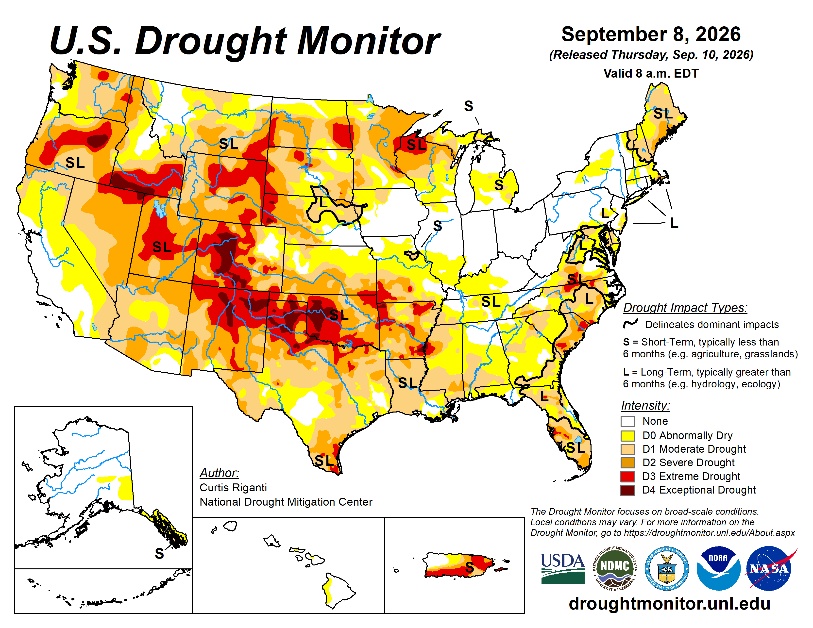
Here’s the US Drought Monitor Map from last week along with the one week U.S. change map.

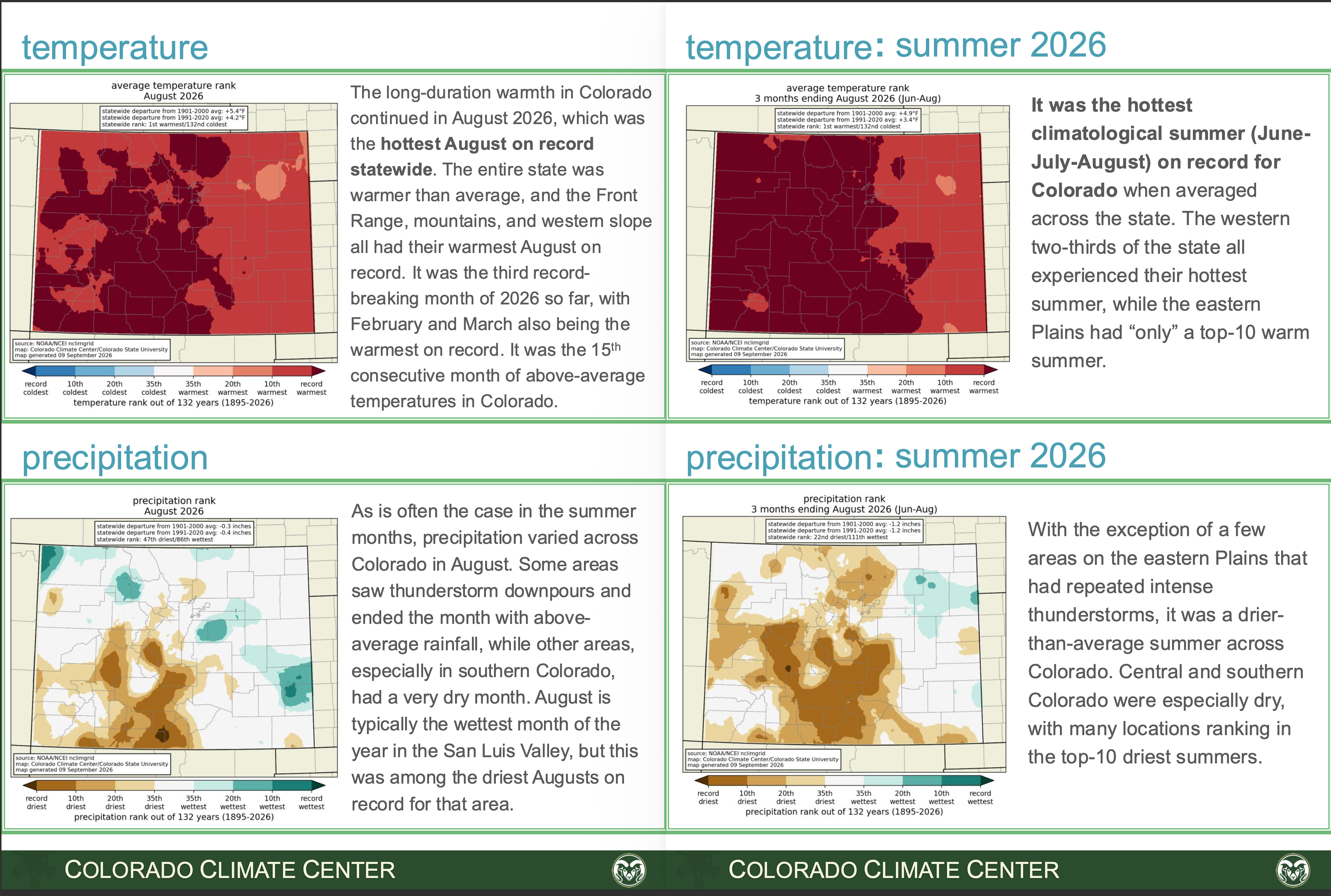
Finally, the Colorado Climate Center released their monthly wrap-up of Colorado climate recently. From the summary:
August was another record-warm month for Colorado, the 3rd in calendar year 2026 and the 4th in Water Year 2026. August also ended the warmest climatological summer on record for Colorado. There were three more heat waves in August and several of the warmest August days the state has experienced in at least 75 years. Precipitation was varied across the state, with some locations getting intense thunderstorm rainfall and hazardous flash flooding, and other spots seeing very little rain and worsening drought. Water Year 2026 continues to be the warmest on record by a large margin, and the 6th driest. Calendar year 2026 through August is also the warmest on record.