Click on a thumbnail graphic to view a gallery of drought data from the US Drought Monitor website.


Click the link to go to the US Drought Monitor website. Here’s an excerpt:
This Week’s Drought Summary
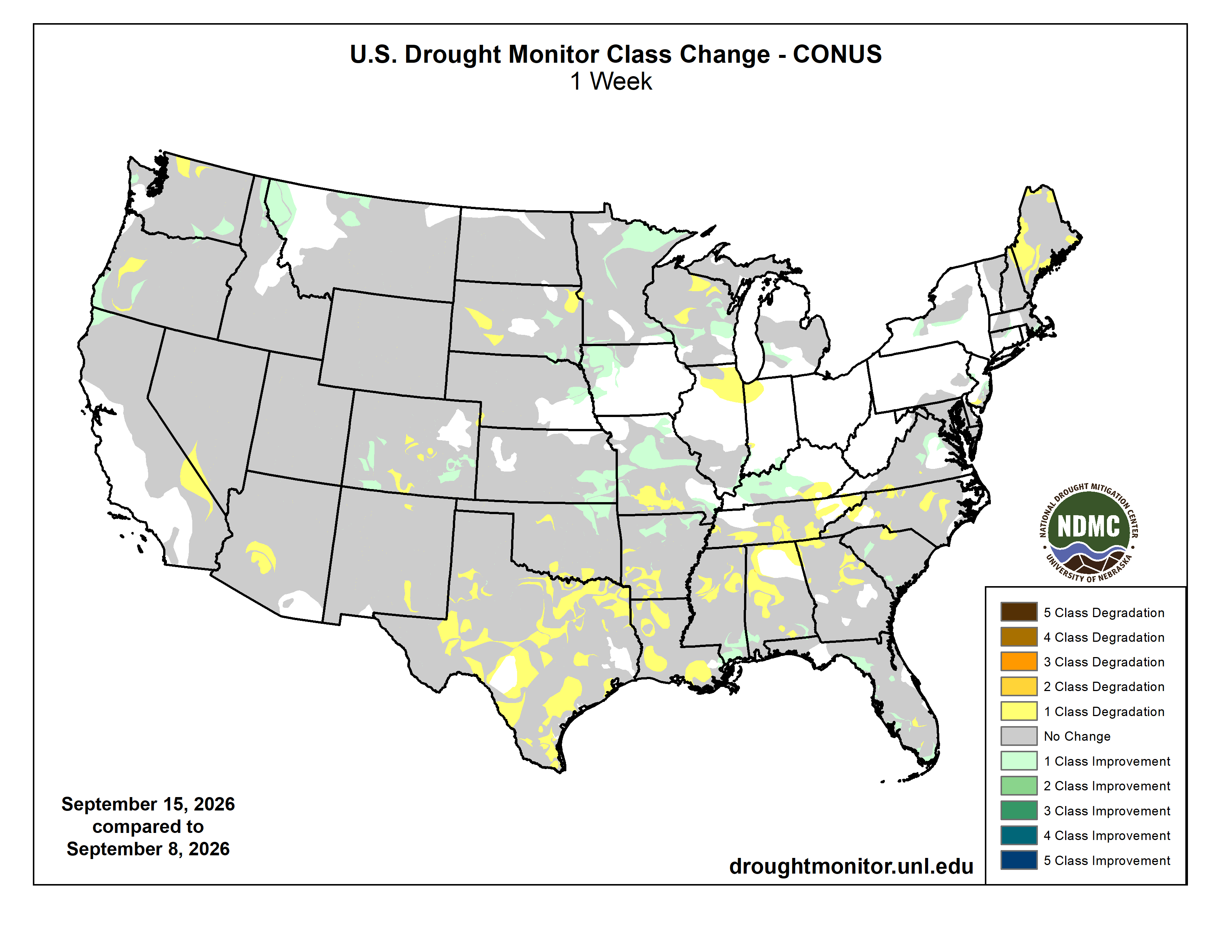
Last week, there were several areas that had significant rainfall amounts. One area was over Iowa, eastern Nebraska and Kansas, and northwest Missouri, where more than 4 inches fell in central Iowa and southeastern Kansas. Another area was centered over Ohio, West Virginia, and western Pennsylvania, where conditions were already wet. Much of Florida and the Gulf Coast received 2 to 4 inches of precipitation in the past week. Most of the southwest U.S. received little rain, with exceptions of scattered monsoonal precipitation along the New Mexico-Arizona border. Most of Texas and Oklahoma continued to be dry, as was the majority of the western Great Plains.
Temperatures in the southern Great Plains and lower Mississippi valley continued to be very warm, in some locations over 10F above normal. Most of the rest of the continental U.S. was also above normal. The only areas with below normal temperatures for the past week were in northern New England as well as most of the northwest states…
High Plains
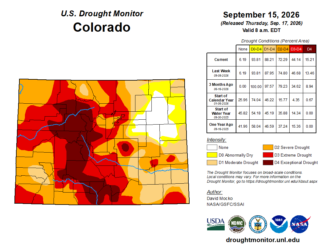
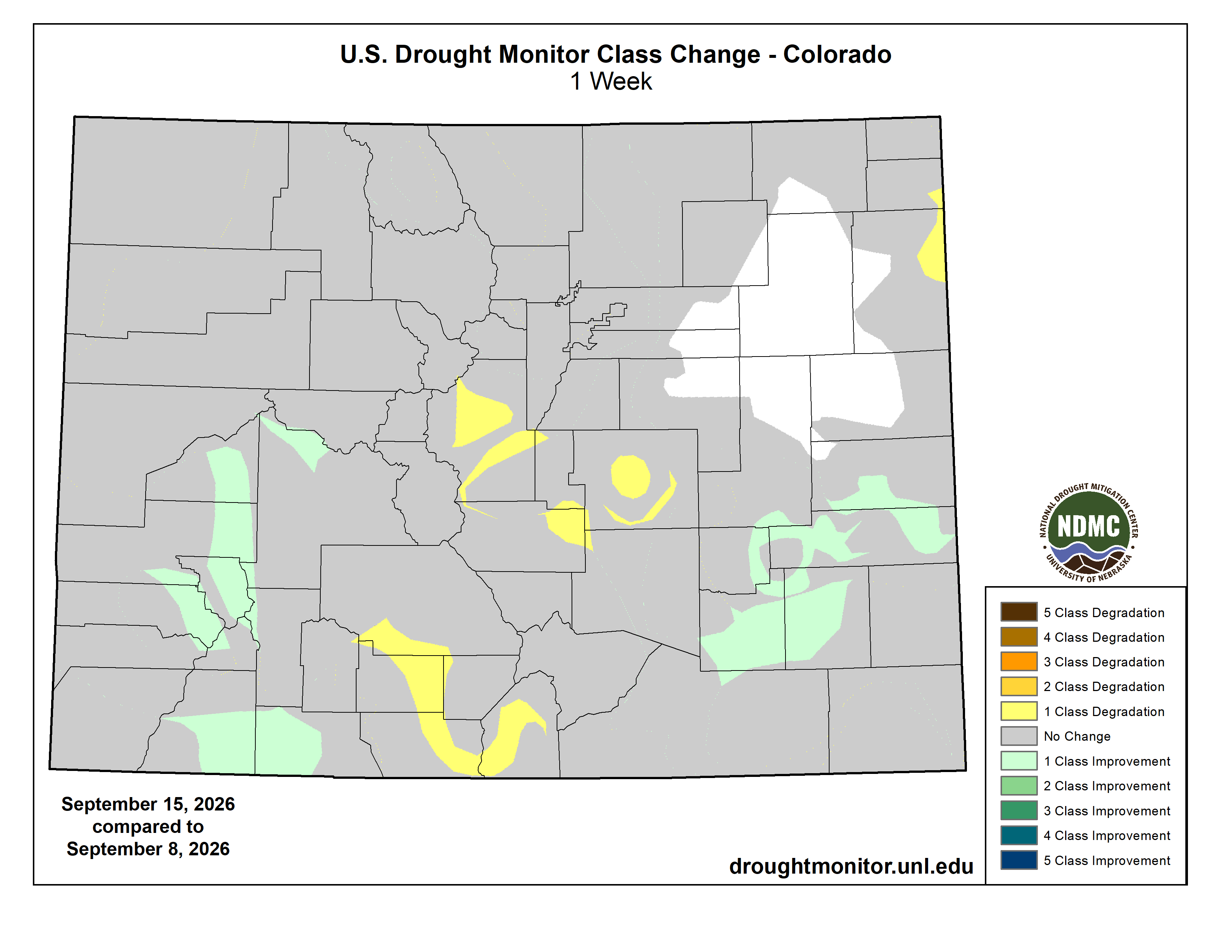
Eastern Kansas had above normal precipitation over the past week; this led to improvement in drought conditions in this area. Eastern Nebraska and eastern South Dakota also had decent rainfall and resulting improvement to drought. Other areas of South Dakota that missed out on the rain had drought degradation. Colorado had drought degradations in the center part of the state, with drought improvements in both the southwest and southeast parts. Extreme drought continues over much of Colorado and Wyoming, western Nebraska and the Dakotas, and in eastern North Dakota. Exceptional drought is observed over much of central Colorado as well as two localized areas in far western Nebraska…
West
An area from southwestern Oregon to central Washington into northern Idaho and Montana received some welcome rainfall during the week. The rain resulted in regional improvements in drought conditions. One location that just missed out was in northwest Washington on the Canadian border, resulting in a drought degradation, where continued low streamflows were observed. There were also areas on the California-Nevada border and central Arizona with drought degradation that also received little-to-no rainfall. Extreme drought is shown over much of central Oregon, central Utah, southern Idaho down into northern Nevada, and small areas in northern Washington and southern Arizona. Exceptional drought continues in southern Idaho, northern Nevada, and northeastern Oregon…
South
Extremely above normal temperatures continued in this region over the past week. Nearly all locations had drought deterioration, with the exceptions of northern Arkansas, northeastern Oklahoma, and coastal Mississippi. Much of Texas and into the Ark-La-Tex area experienced flash drought conditions. In addition to the heat, these areas received little rainfall in the week. Extreme to exceptional drought conditions are noted in far south Texas, most of northern Texas into western and southern Oklahoma, northwestern and northeastern Arkansas, and along the Arkansas-Mississippi border…
Looking Ahead
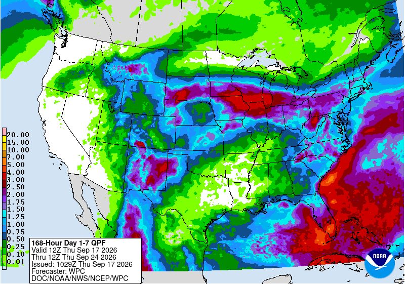
Over the next five days leading up to next Tuesday, above normal rainfall is forecast in south Florida as well as a large area in southern Wisconsin and Minnesota into eastern Iowa and northern Illinois. The latter area of forecasted rainfall continues to the east through central Michigan, the southern Great Lakes, Pennsylvania, New York, and much of central and southern New England. Other locations with rainfall in the forecast this week are in the Appalachian Mountains, the western Great Plains, and the Four Corners states. Unfortunately, most of Texas, Oklahoma, Arkansas, Louisiana, Mississippi, and Alabama are forecast to receive little rainfall. Dry conditions are also forecast in California, Nevada, and Washington. Much above normal temperatures are forecast to continue this week in the central and southern U.S.
The 6- to 10-day outlook (September 22-26, 2026) favors above normal temperatures continuing over nearly all of the continental United States. Areas most likely to be above normal are again the south into the southeast, plus the far north. Hawaii is also likely to be above normal. For precipitation, the Eastern Seaboard is likely to have above normal rainfall as is the Southwest. The central U.S. into the upper Midwest is likely to have below normal rainfall. Hawaii and Alaska are both likely to have above normal rain during this period.