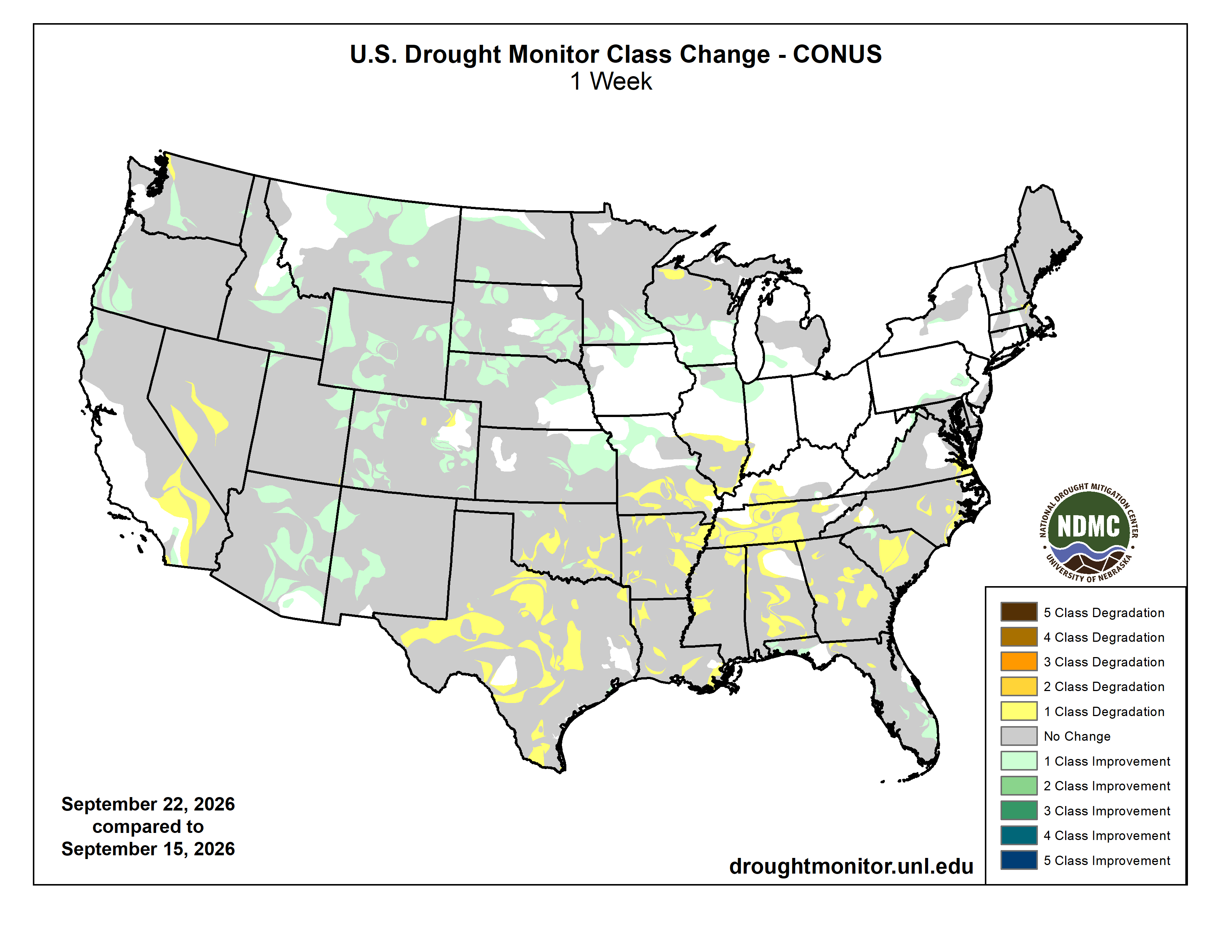
Click on a thumbnail graphic to view a gallery of drought data from the US Drought Monitor website.
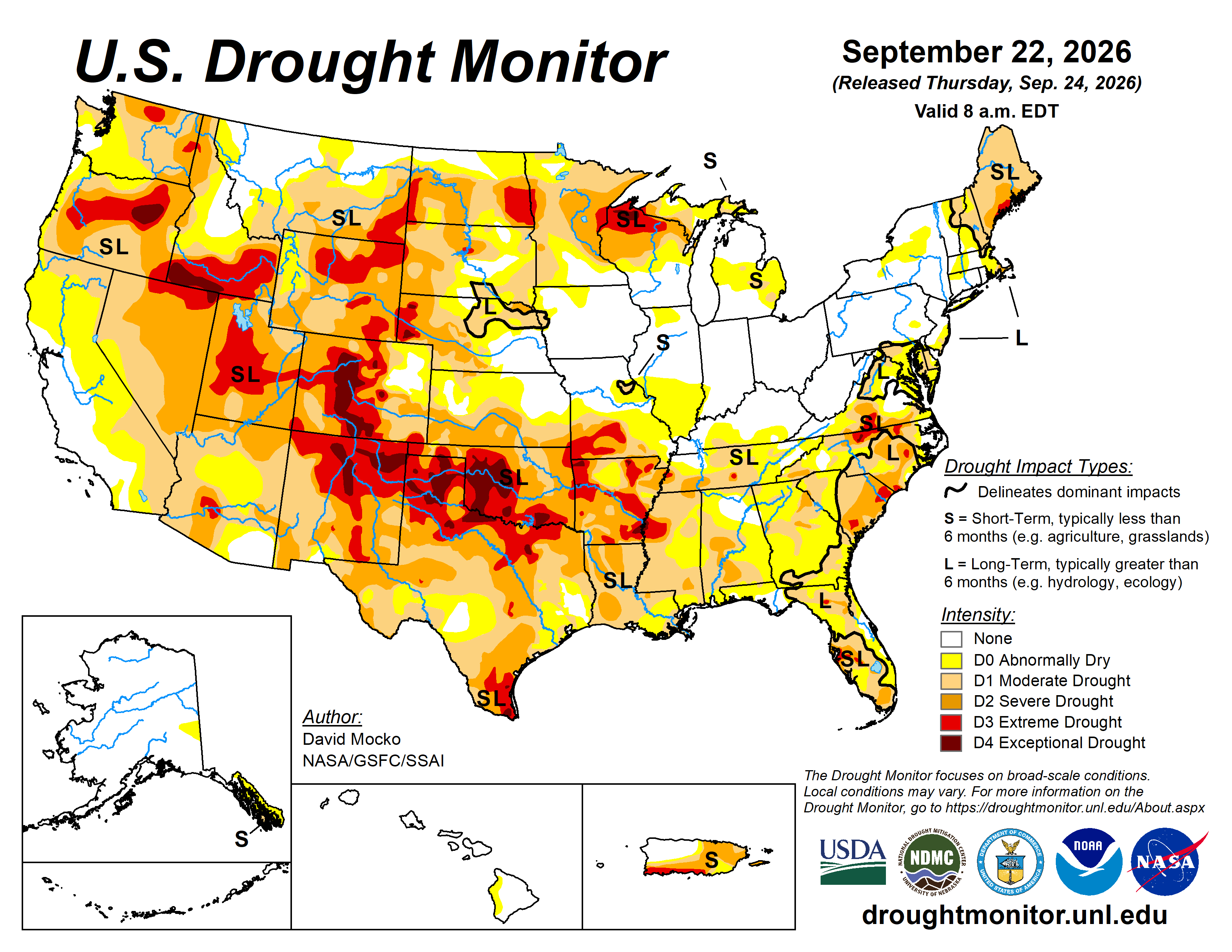


Click the link to go to the US Drought Monitor website. Here’s an excerpt:
This Week’s Drought Summary
The pattern of hot and dry in the south with heavy rainfall to the north of the high-pressure system continued over this past week. The highest precipitation amounts were from eastern Iowa and southeastern Minnesota to the east through southern Wisconsin, northern Illinois, to Ohio and West Virginia. Localized areas in this region received 6 to 8 inches of rainfall. Northeastern Kansas and northern Missouri received 3 to 5 inches, with western Nebraska to southeastern Montana picking up 2 to 3 inches. Monsoonal rain also fell in eastern Arizona to central New Mexico. Southern Florida also received several inches of rain over the week. Precipitation was very spotty and generally light, however, in Texas, Oklahoma, Louisiana, Arkansas, southern Missouri, and western Tennessee and Kentucky. Most of the west coast states had little rain.
Most of the south was again 5 to 10F above normal last week, peaking at over 15F above normal in parts of southern Missouri. Several states are setting records for continued warmth during this late summer to early fall period. The rest of the continental U.S. had generally near-normal temperatures…
High Plains
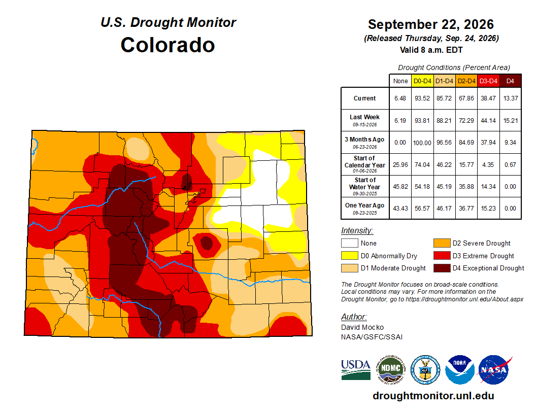
Most of the High Plains received beneficial rainfall, resulting in improvement to drought categories over parts of all states in the region. More precipitation will be needed, however, to ameliorate the continued extreme drought over much of Colorado and Wyoming as well as parts of Montana, North and South Dakota, and western Nebraska. Areas of exceptional drought are still shown in much of central Colorado and western Nebraska…

West
Eastern Arizona to central New Mexico experienced monsoonal storms causing localized flooding and some drought improvement. Southern California and southern Nevada continued to be dry, leading to degradation of dry categories. Central Utah, central Oregon, southern Idaho, and northern New Mexico continue to be the largest areas of extreme to exceptional drought in this region, with smaller areas of extreme drought in a few other states…
South
The continued heat and dry conditions resulted in large areas of degradations the past week. Extreme drought can be found in every state in this region, with exceptional drought over much of northern Texas, western to southern Oklahoma, and parts of Arkansas. Both short-term and long-term drought are contributing to the conditions in this region. Over the last year, west-central Oklahoma is the driest on record, while in southwest Oklahoma it has been the second driest…
Looking Ahead
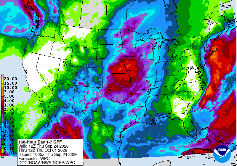
The next five days are forecast to be wet along the northeastern coast from a nor’easter. The northwest is also predicted to receive needed precipitation. Remnants of a tropical system will provide significant moisture into the Four Corners states and the western Great Plains with heavy rainfall in the forecast. Parts of the northern Great Plains are also forecast to receive welcome precipitation. Areas with little rain in the forecast over the next five days are much of Texas and Louisiana, around the Great Lakes, and California and Nevada. The south and southwest should continue to have above normal temperatures, with cooler temperatures in the northeast and the northwest.
The 6- to 10-day outlook (September 29 to October 3) favors above normal temperatures over the southern half of the continental U.S. as well as the northeast. Hawaii is also likely to have above normal temperatures. The Great Basin area could have below normal rainfall, while above normal is possible over much of the central U.S. Both Hawaii and eastern Alaska are also favored to have above normal precipitation during this period.