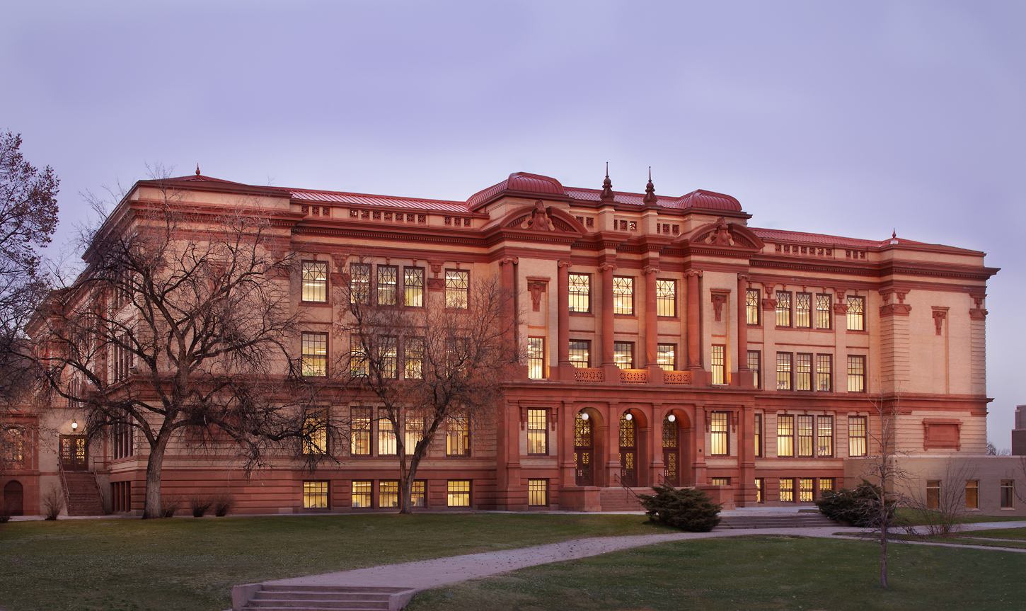
Image created by Google Gemini, May 6th, 2026, from the prompt: “generate a funny picture of a skeleton wearing a beach hat in the desert”.
by Robert Marcos, photojournalist
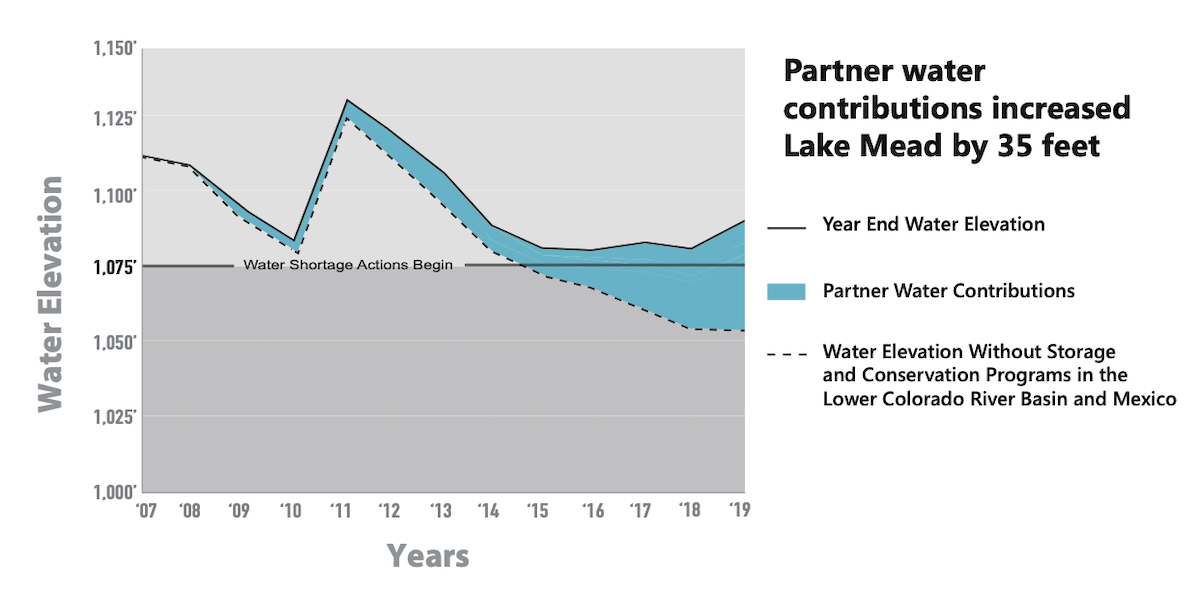
Water that’s banked in Lake Mead is officially called “Intentionally Created Surplus“, or ICS. The ICS allows major water users in the lower basin to store conserved or unused Colorado River water in the reservoir for their future use.
As of May 2026, Lake Mead’s water volume was 8.3 million acre-feet – or roughly a third of its total capacity. But after publishing this article we were made aware that we should subtract Lake Mead’s 2.3 MAF deadpool from that amount, which brings it down to about 6 MAF. Currently the ICS holds about 2.3 million acre feet of that water, which represents about 38% of Lake Mead’s available water.
Here’s a list of the water agencies and the estimated amount of water that each of them have currently banked in Lake Mead –
Arizona: According to official tracking from the USBR and the CAP, the state of Arizona’s total balance of accumulated Intentionally Created Surplus water stored in Lake Mead as of May 15th is approximately 310,000 to 350,000 acre-feet.
California: As of May 2026, California has roughly 1.2 to 1.4 million acre-feet of water banked in Lake Mead through the ICS and other conservation programs. Major participants include the Metropolitan Water District of Southern California, the Imperial Irrigation District, and the Palo Verde Irrigation District.4
Nevada: As of May 2026, Nevada has approximately 479,184 acre-feet of water banked in Lake Mead through the ICS program. This total represents a major portion of Nevada’s overall “water savings account,” which includes several different banking locations and programs.5
Mexico: As of May 2026, Mexico has approximately 200,000 acre feet of water banked in Lake Mead through the ICS program and related binational agreements. Mexico was granted the right to store water in Lake Mead following a 2010 earthquake that damaged its irrigation infrastructure. By 2026, these stored volumes have stabilized at around 200,000 acre-feet as Mexico uses the lake as a buffer against shortages.7
Click the link to read the article on the USDA website (Ciji Taylor):
April 27, 2026
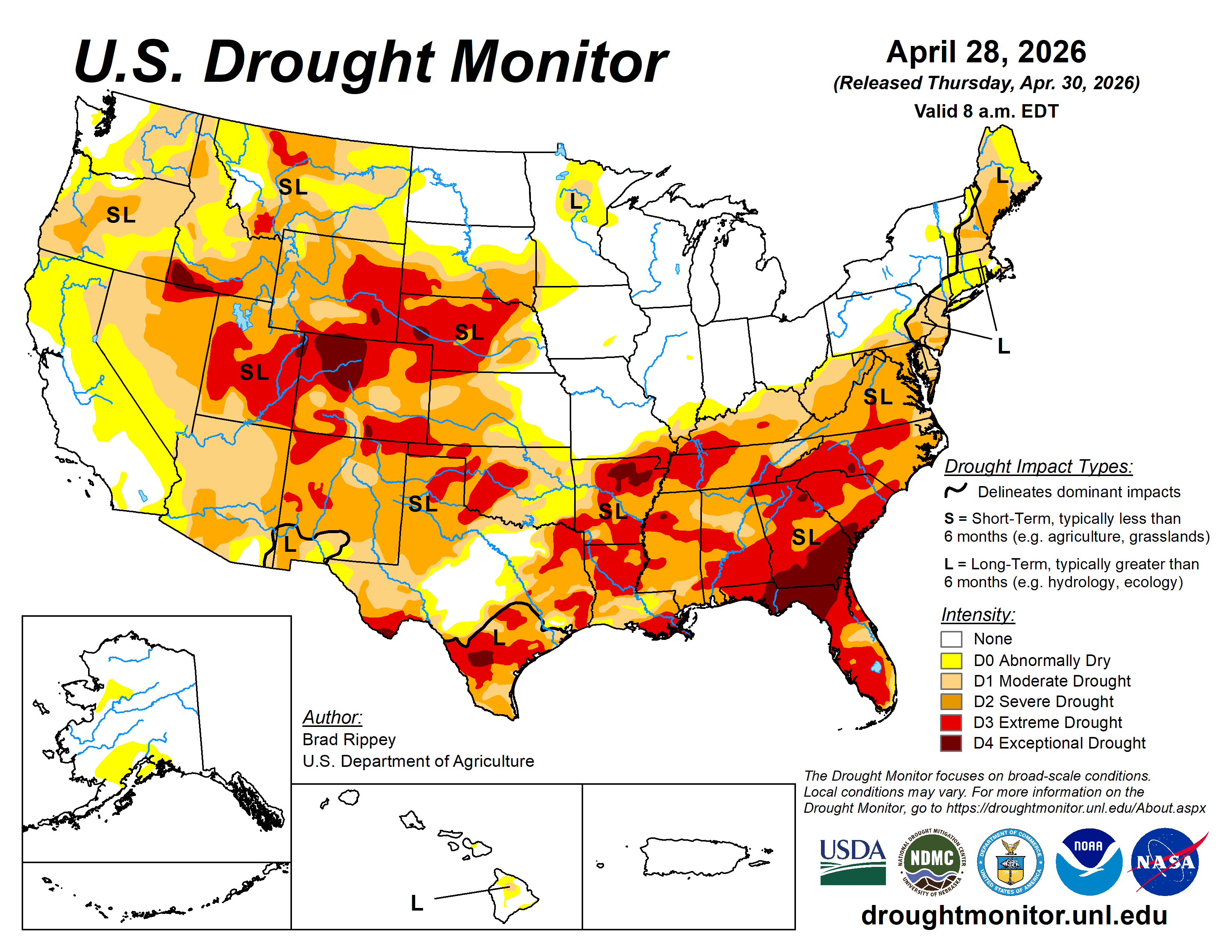
This is likely no surprise to you, but drought persists across the U.S. and is intensifying in some areas. No geographic area is immune to the potential of drought at any given time. The U.S. Drought Monitor provides a weekly drought assessment, and it plays an important role in USDA programs that help farmers and ranchers recover from drought.
The Facts
Fact #1 – Numerous agencies use the Drought Monitor to inform drought-related decisions.
The map identifies areas of drought and labels them by intensity on a weekly basis. It categorizes the entire country as being in one of six levels of drought. The first two, None and Abnormally Dry (D0), are not considered to be drought. The next four describe increasing levels of drought: Moderate (D1), Severe (D2), Extreme (D3) and Exceptional (D4).
Fact #2 – U.S. Drought Monitor is made with more than precipitation data.
When you think about drought, you probably think about water, or the lack of it. Precipitation plays a major role in the creation of the Drought Monitor, but the map’s author considers numerous indicators, including drought impacts and local insight from over 450 expert observers around the country. Authors use several dozen indicators to assess drought, including precipitation, streamflow, reservoir levels, temperature and evaporative demand, soil moisture and vegetation health. Because the drought monitor depicts both short and long‐term drought conditions, the authors must look at data for multiple timeframes. The final map produced each week represents a summary of the story being told by all the pieces of data. To help tell that story, authors don’t just look at data. They converse over the course of the map-making week with experts across the country and draw information about drought impacts from media reports and private citizens.
Fact #3 – A real person, using real data, updates the map.
Each week’s map author, not a computer, processes and analyzes data to update the drought monitor. The map authors are trained meteorologists from the National Drought Mitigation Center at the University of Nebraska-Lincoln (the academic partner and website host of the Drought Monitor), the National Oceanic and Atmospheric Administration, the National Aeronautics and Space Administration, and USDA. The author’s job is to do what a computer can’t – use their expertise to reconcile the sometimes-conflicting stories told by each stream of data into a single assessment.
Fact #4 – The Drought Monitor provides a current snapshot, not a forecast.
The Drought Monitor is a “snapshot” of conditions observed during the most recent week and builds off the previous week’s map. The map is released on Thursdays and depicts conditions based on data for the week that ended the preceding Tuesday. Rain that falls on the Wednesday just before the USDM’s release won’t be reflected until the next map is published. This provides a consistent, week‐to‐week product and gives the author a window to assess the data and come up with a final map.
Fact #5 – Your input can be part of the drought-monitoring process.
State observers in the drought monitoring network relay on-the-ground information from numerous sources to the US Drought monitor author each week. That can include information that you contribute.
The Drought Monitor serves as a trigger for multiple forms of federal disaster relief for agricultural producers, and sometimes producers contact the author to suggest that drought conditions in their area are worse than what the latest drought monitor shows. When the author gets a call like that, it prompts them to look closely at all available data for that area, to see whether measurements of precipitation, temperature, soil moisture and other indicators corroborate producer-submitted reports. This is the process that authors follow whether they receive one report or one hundred reports, although reports from more points may help state officials and others know where to look for impacts.
There are multiple ways to contribute your observations:
There are multiple ways to contribute your observations:
Submit CMOR reports – Use the Condition Monitoring Observer Report (CMOR) system to provide information and photos about how drought is affecting your area. Your report will appear immediately on an interactive map and will help Drought Monitor authors and others interpret weather data.
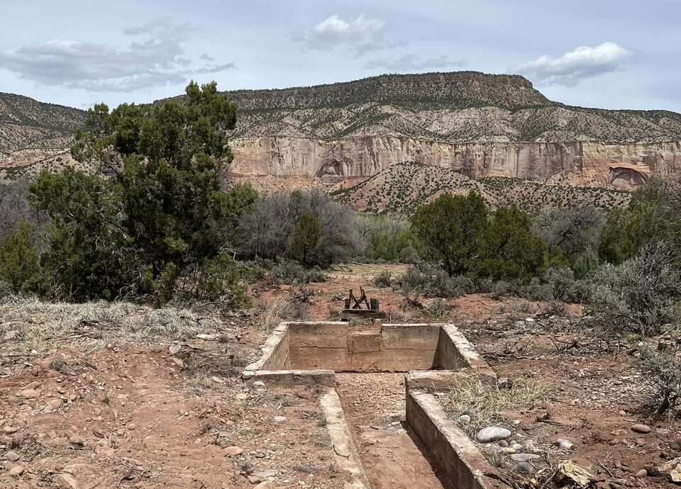
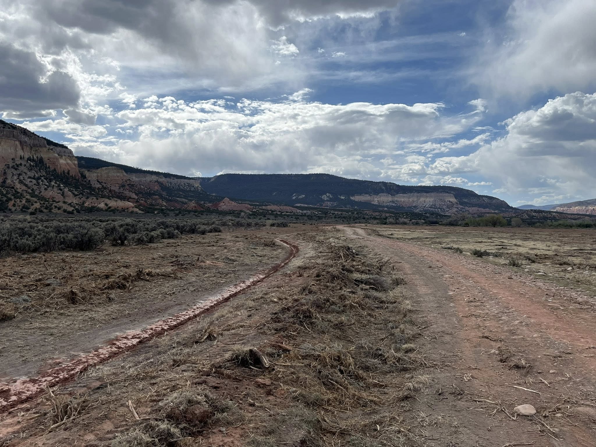
The dusty Acequia Madre de Cañon de Chama, pictured above April 28, 2026, will soon divert Rio Chama water toward historic orchards the San Joaquín del Rio de Chama Land Grant first planted more than 200 years ago, thanks to a new agreement between the land grant and the Santa Fe National Forest. (Photo courtesy Leonard Martinez)
Click the link to read the article on the Source NM website (Patrick Lohman):
May 5, 2026
A dusty acequia in northern New Mexico, which more than 200 years ago diverted water from the Rio Chama, will soon spring to life again, nourishing freshly planted orchards of plums, apples and apricots.
That’s the idyllic scene envisioned through a new agreement between the Santa Fe National Forest and heirs of the San Joaquín del Rio de Chama Land Grant. The parties say the “memorandum of understanding” they signed in late March marks the potential thawing of more than a century of tension between New Mexico land grants and the federal government.
The agreement, which the Santa Fe National Forest Service provided to Source NM through a public records request, identifies the acequia restoration as a “project of mutual interest.” It also recognizes the land grant as a consulting partner to the Forest Service and provides it greater input into the land’s future use.
Leonard Martinez, president of the land grant, told Source NM that the nine-page agreement is a “historic document,” one that marks the first such formal agreement between land grants and the Forest Service. He said he’s spent nearly every day since the agreement was signed clearing the historic irrigation canal and working to reconnect it to the Rio Chama.
San Joaquin de Chama President Leonard Martinez said he has spent most every day since signing the memorandum of agreement digging out the old path of the acequia in the Cañon de Chama. (Photo courtesy Leonard Martinez)
If all goes well, he will open the headgates of the Acequia Madre de Cañon de Chama later this summer, sending Chama River water to irrigate a cover crop of alfalfa. Within five years, he hopes to replant historic orchards.
When that happens, he said, he hopes the “heirs who have left us,” many of them still buried in a cemetery near the headgates, will approve of his efforts.
“That’s the key here,” he said. “We want to put our orchards and our fields back in.”
Santa Fe National Forest spokesperson Claudia Brookshire told Source NM that the agreement resulted from trust established through informal talks and individual projects.
“The Forest Service has long been willing to work with land grants,” Brookshire said in an email. “But the lack of a formal framework, combined with trust barriers, made it difficult to begin projects on national forest system lands.”
The Santa Fe National Forest is in early discussions to develop similar agreements with two other land grants, Brookshire said.
In 1806, Spanish Governor Joaquín del Real Alencaster charged 44 families with stewardship of a 470,000-acre swath of what was then the New Mexico Territory. By 1860, according to the land grant, more than 800 residents established roots there, cultivating land within the river valleys, pasturing livestock and gathering resources from the surrounding common lands, known as the “ejido.”
But after multiple lawsuits and land re-surveys over the ensuing decades, the federal government and land speculators acquired the land and evicted the residents. By 1905, the federal government recognized only about 1,500 acres of land along the Rio Chama as belonging to the land grant, but even that parcel ended up in the hands of the Rio Arriba Land and Cattle Company.
The parcel west of Abiquíu, known as the Cañon de Chama, remained the company’s property for decades before the federal government ultimately acquired it, as well. Today, all of the original San Joaquín del Rio de Chama Land Grant belongs to the Santa Fe National Forest or Carson National Forest.
Land grant heirs like Martinez have fought for more than a century to reassert their rights over the land, including seeking Forest Service permission to visit and care for the cemetery where their ancestors are buried.
The heirs ultimately received a Forest Service easement in 2013 to access the cemetery. Since then, Martinez and other land grant leaders have continued to pressure the Forest Service for more access, particularly to the Cañon de Chama, which heirs describe as culturally and historically significant.
Martinez told Source NM that the agreement is a result of trust built through the cemetery easement, he said, as well as guidance from the New Mexico Department of Justice’s Treaty of Guadalupe Hidalgo Division.
The NMDOJ created the division in 2003 to oversee and address concerns related to the provisions of the 1848 Treaty of Guadalupe Hidalgo, which ushered in the United States’ government’s problematic land title confirmation process and stripped the San Joaquin land grant heirs of hundreds of thousands of acres of communal land.
New Mexico Rep. Miguel Garcia (D-Albuquerque) has spent much of his 30 years in office advocating for land grant heirs, including seeking recurring state funding and greater recognition of the historical injustice of the federal government’s land seizure.
While he said the new agreement represents a “great leap forward” and commended Martinez and others for their efforts, he said his ultimate goal remains for the Forest Service to return land it now controls to the land grants.”
“These land grants that lost these common lands have not ceded their right to that land,” he said. “They have not given up that hope.”
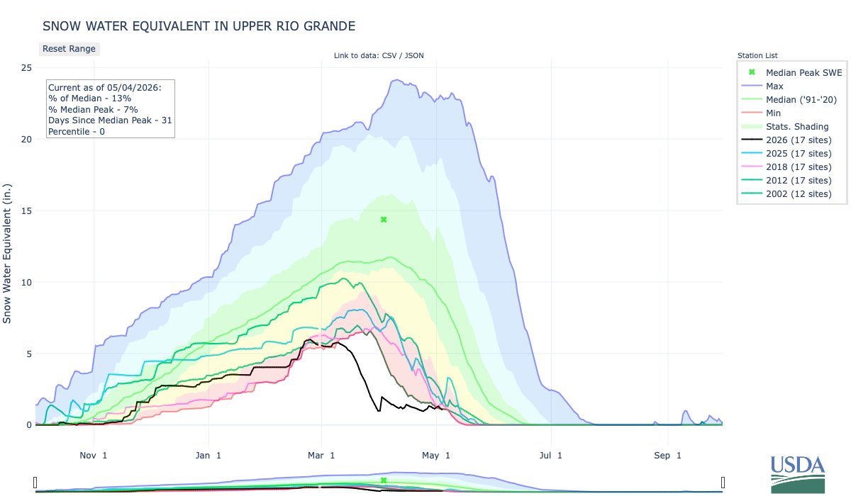
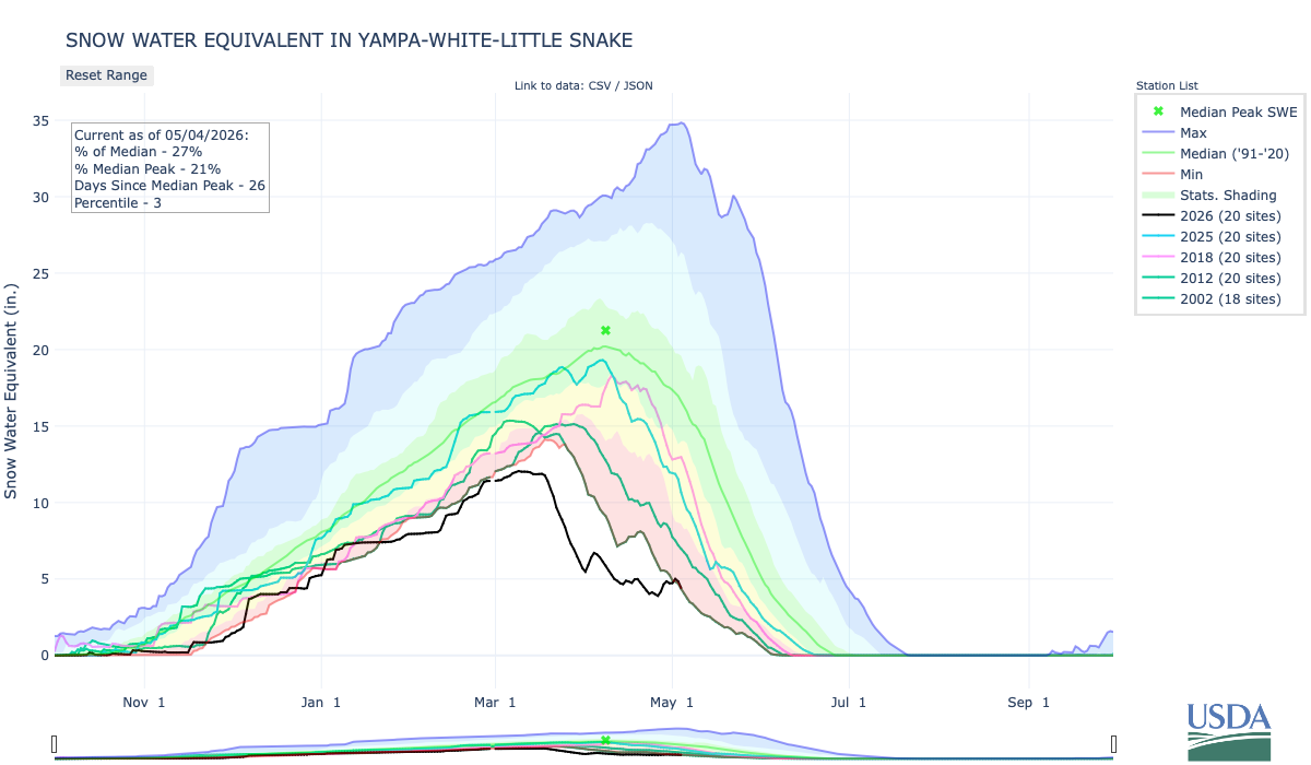
To get to the river and listen, there is an intricate web of management issues, antiquated infrastructure, and century-old legal disputes to thrash through. Unless you’ve gone outside in the Southwest lately. A 26-year drought is sucking the river dry, and unprecedented heat is rapidly evaporating this year’s record-low snowpack.
These two conditions are leading to low water levels at Lake Powell and Lake Mead, the nation’s two largest reservoirs. That, in turn, jeopardizes critical water infrastructure for a large swath of the West.
Reporting on this issue from the front lines, the growing margins of Lake Powell returning to Glen Canyon, made this reality strikingly clear. The river’s returning are only a portion of this watershed story. There are major questions about how the Colorado River will make it past Glen Canyon Dam in a rapidly drying future. Whether you love or hate Lake Powell, this is not an issue of recreation; it is about water equity for millions of people, desert ecosystems, and wildlife.
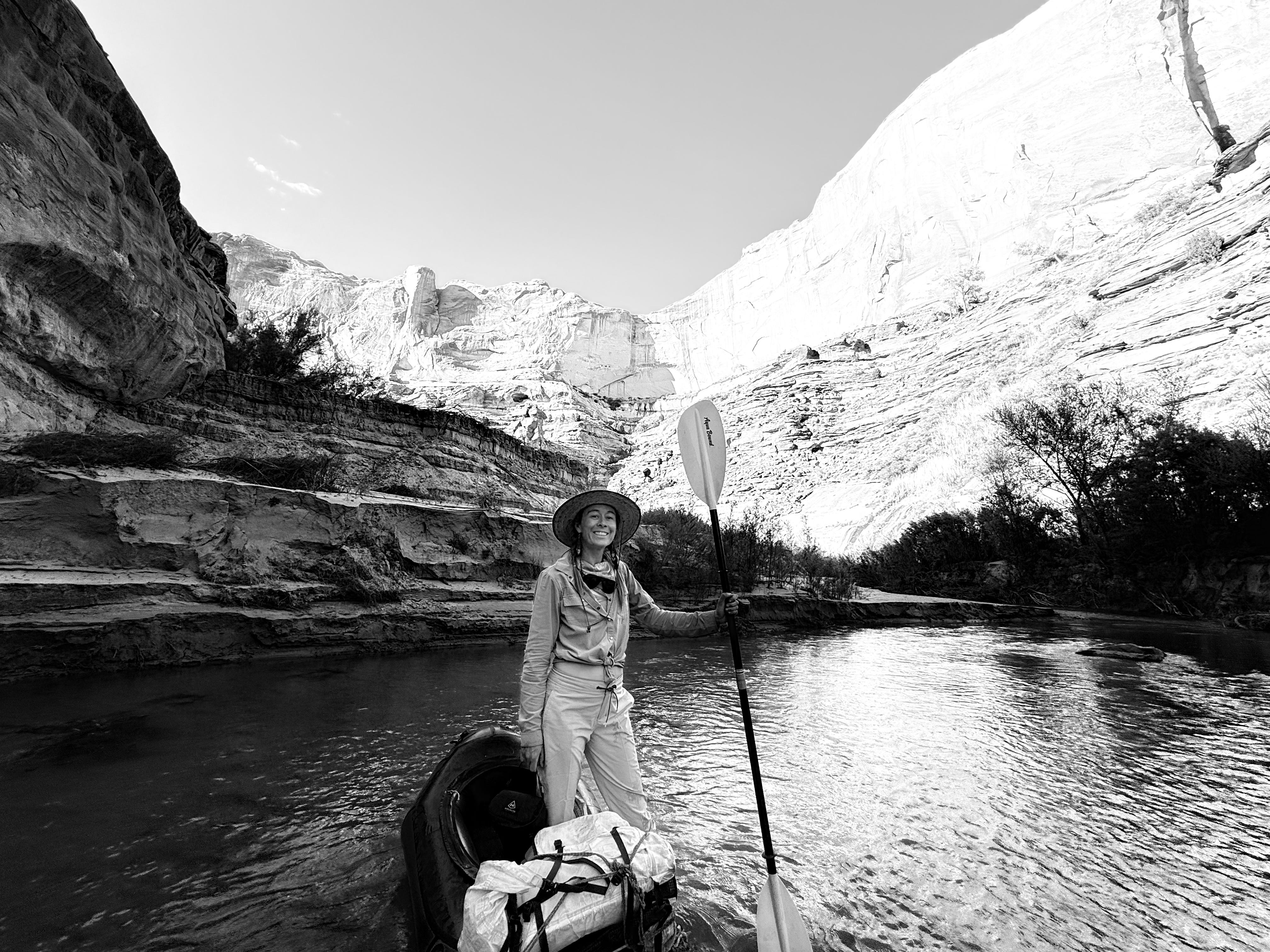
A 1,500-word story is painfully insufficient to explain the breadth of this issue that threatens an entire watershed. Writing a book is starting to feel sane! Of course, I do not make this easy for myself, always crawling around in the desert and floating around the watershed. But there is good reason to take the long view. As I write Riverside (Torrey House Press 2027), my life will continue its pulse between the river and writing flash floods. My PFD is on tight. Thanks for hopping aboard.
Here are some photos taken throughout the watershed as I reported on the Colorado River for Sierra.
Low tide on Powell Reservoir. Photo credit: Morgan Sjogren
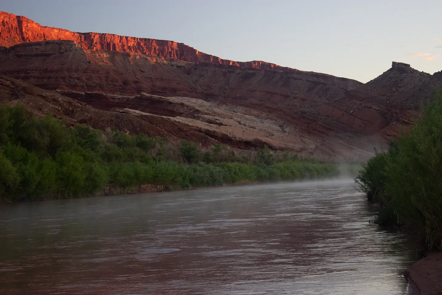
A river returns. Almost 50 miles of the San Juan, once inundated by Powell Reservoir, are flowing free. Photo credit: Morgan Sjogren
The humpback chub have inhabited the Colorado River watershed for 5 million years. The next 12-months might be their most critical to survival. Photo credit: Morgan Sjogren
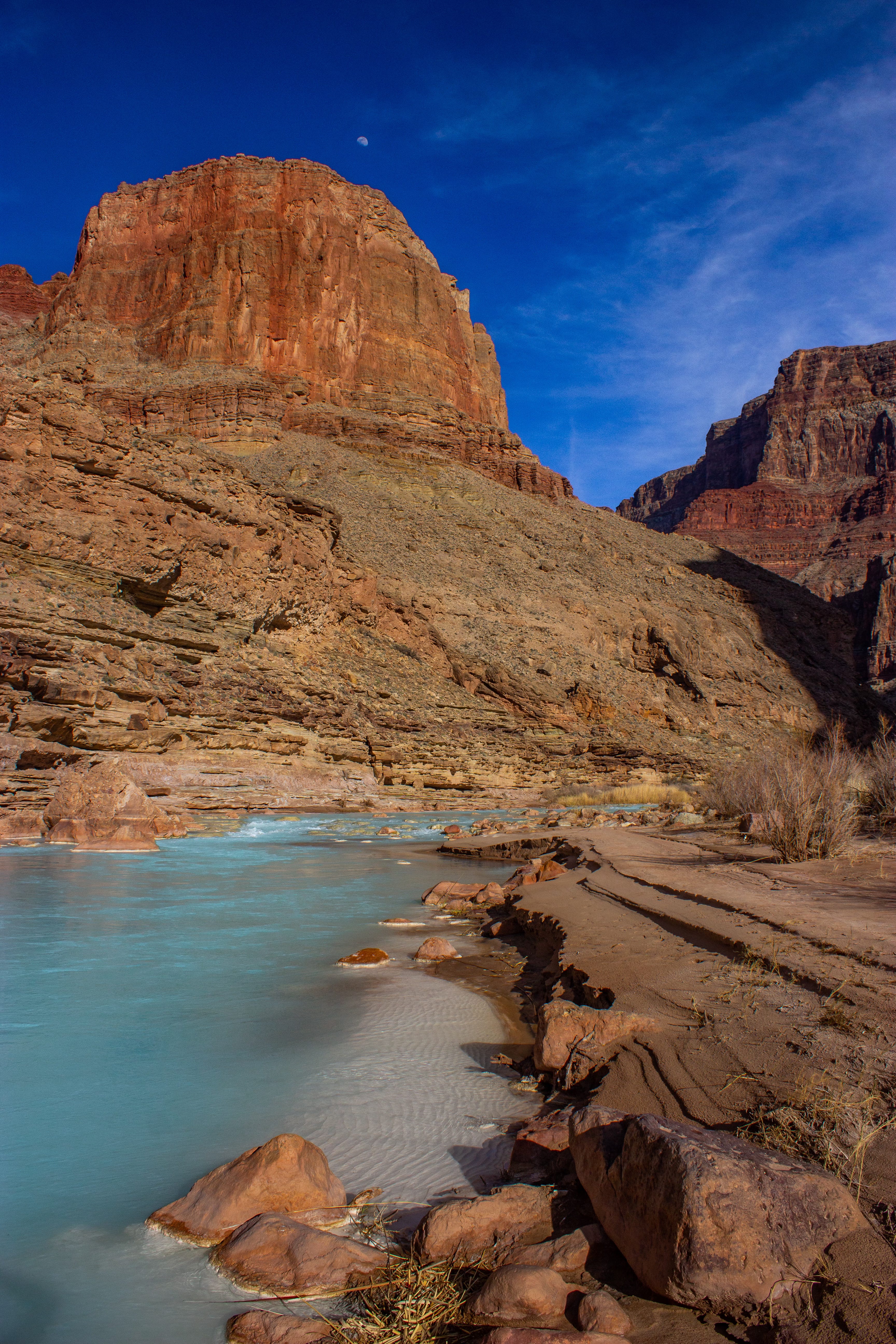
The Little Colorado River, a Grand Canyon tributary, is a critical stronghold for the humpback chub. Photo credit: Morgan Sjogren
With such low flows, the Colorado River Basin will likely turn to pumping groundwater. The threat to springs affects the river’s baseflows, which are significantly supported by groundwater and springs.
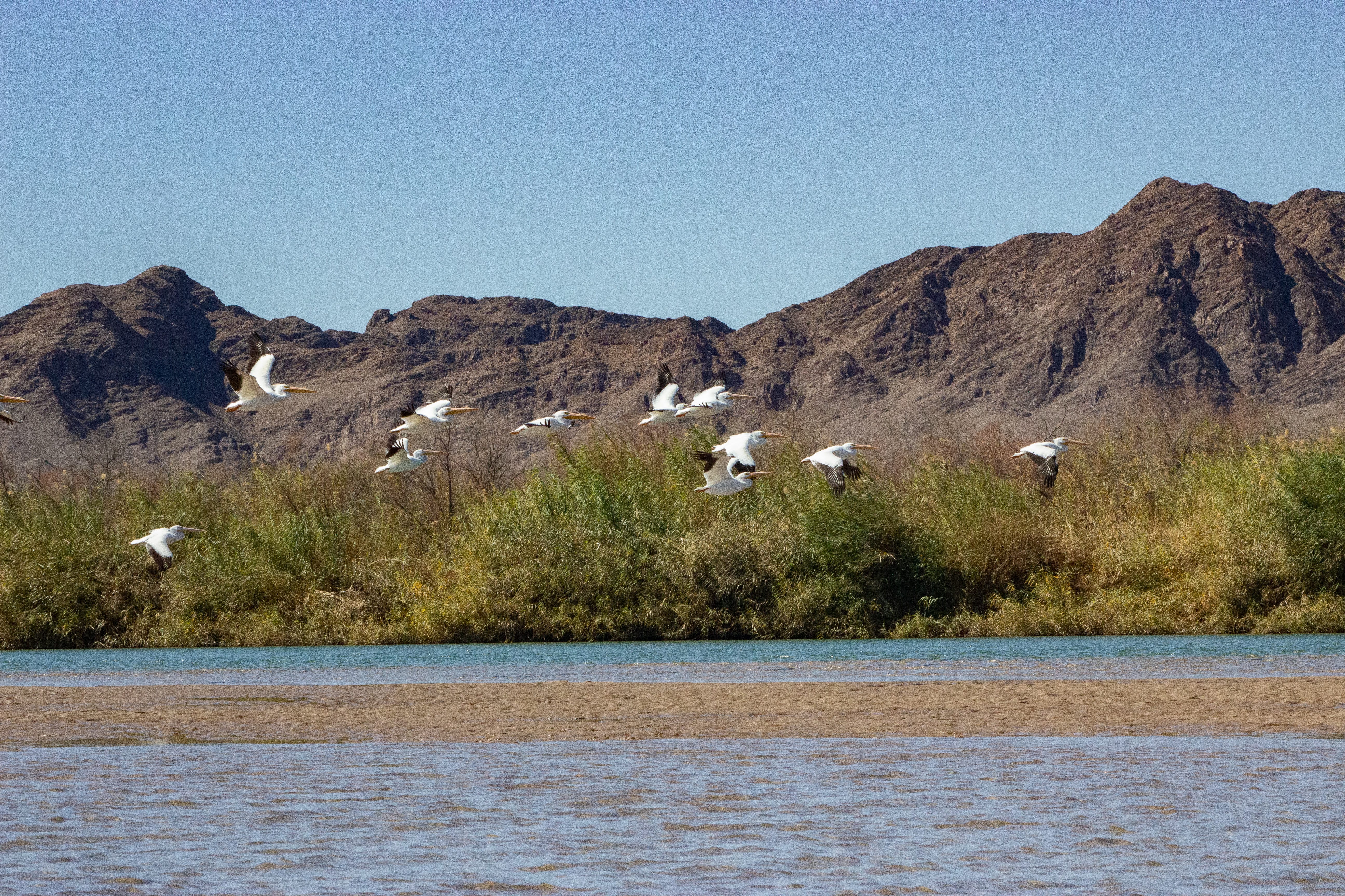
“There’s not economic adjustments that the birds can make. A payout doesn’t help the birds that use those habitats.”––Jennifer Pitt, Colorado River program director for Audubon. Photo credit: Morgan Sjogren
Last year, Colorado River Indian Tribes (CRIT) granted the Colorado River legal personhood under tribal law. Photo credit: Morgan Sjogren
“The final words of any story are transmitted from a laptop, but the writing process all happens out here, with the watershed.” — Morgan Sjogren
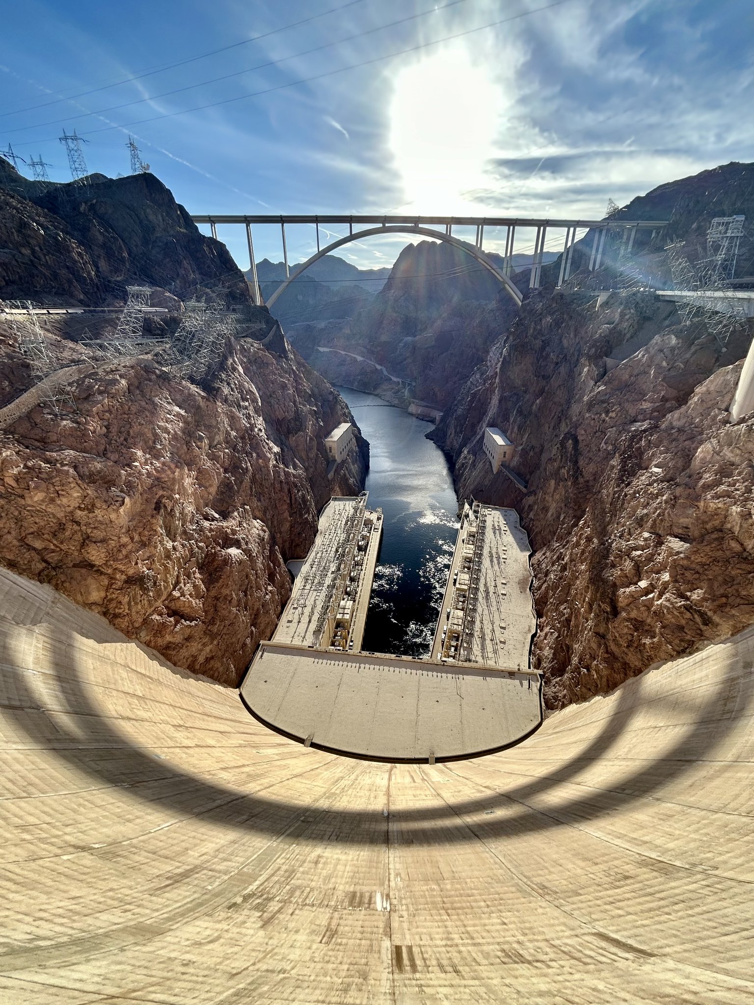
The Hoover Dam is a powerhouse! With an impressive output of about 3 billion kilowatt-hours of electricity annually, it provides enough energy to light up about 1 million households in Nevada, Arizona, and California, ensuring the lights stay on un the Southwest. Photo credit: USBR
Click the link to read the article on The Havasu News website (Alan Halaly). Here’s an excerpt:
May 1, 2026
In a Thursday joint statement, the Upper Colorado River Basin states of Colorado, Utah, New Mexico and Wyoming called for “immediate mediation” in the yearslong deadlock with the Lower Colorado River Basin states of Nevada, California and Arizona. They offered no details about who could fill that role or which entity would pay for the costs.
“Time is short, but structured negotiations through mediation offer a new path for authentic discussions,” New Mexico’s Upper Colorado River Commissioner Estevan López said in a statement. “Even at this late stage, we should pursue every opportunity to reach a workable agreement.”
[…]
Asked about how a mediator could differ from the federal government’s intervention or the appointment of a so-called “water master” at the U.S. Supreme Court, Entsminger said states are unlikely to view a mediator’s decision-making as binding.
“It’s certainly not litigation; it’s not even arbitration,” Entsminger said. “It’s more of a marriage counselor.”
[…]
Colorado River Board of California Chairman JB Hamby said in a Tuesday statement that his state proposed a mediation process last year. California officials see the need for both long- and short-term solutions, and mediation could push the Upper Basin toward “verifiable water contributions,” Hamby added.
“Effective mediation requires common ground, and the system cannot wait,” Hamby said. “Current conditions require immediate, measurable water reductions from every state.”
Map of the Colorado River drainage basin, created using USGS data. By Shannon1 Creative Commons Attribution-Share Alike 4.0
The initial fill of Chimney Hollow Reservoir has concluded, and the reservoir currently has about 1,500 acre-feet of water—less than 2 percent of the reservoir's full capacity of 90,000 acre-feet. Read more about the initial fill at https://t.co/WaxdbfiFWz. pic.twitter.com/ndlN3Y6zoV
— Chimney Hollow Reservoir (@ChimneyHollow) May 5, 2026
Tomatos being sorted by a farmer in the Mexicali Valley. Photo from Storyblocks
by Robert Marcos
Last week the lower basin states of Arizona, California, and Nevada, along with tribal leaders, offered to leave somewhere between 700,000 to a million acre-feet of water in the Colorado River system through 2027–2028. The states described it as more than 3.2 million acre-feet of savings by 2028 and a way to stabilize Lake Mead and Lake Powell while longer-term negotiations continue.1
What caught my eye about this story is that Mexico – which by law had received 1.5 million acre feet of Colorado River water annually, was already conserving some of that water due to a previous agreement that promised to conserve 400,000 acre-feet between 2023–2026.2
Reportedly, farmers south of the border are unhappy with these arrangements. Farmers in Mexicali Valley said they feel frustrated with the mandatory Colorado River water conservation, and they reported that they’ve been “cheated” out of resources they desperately need to survive. While Mexico agreed to specific water reductions as part of a binational plan with the U.S., many farmers in the Valle de Mexicali have reached a breaking point due to unpaid compensation.3
The prevailing sentiment of farmers in Mexicali Valley is characterized by the following:
Financial Betrayal: Many farmers in Northern Baja’s district 14 agreed to leave thousands of acres of land fallowed in order to conserve Colorado River water – in exchange for $4.5 million dollars in direct payments. However, they claim the Mexican government failed to pay them, which has left these farmers without any income whatsoever.4
Opposition to New Water Laws: Recent sweeping changes to Mexico’s national water law have stripped long-held water rights away from farmers, consolidating control in the hands of the federal government. Farmers view this as a move to prioritize urban centers like Tijuana and Ensenada over agricultural needs.
Sovereignty Concerns: There is a strong feeling that the Mexican government is surrendering national sovereignty by complying with U.S. water demands while its own agricultural sector suffers from “death” through deprivation.
Escalating Resistance: Farmers have responded with aggressive protests, including blockading major trade routes at the U.S.-Mexico border with semi-trucks and seizing control of critical dams. Some have even threatened to “spill” their water or return to farming—even if unprofitable—just to prevent the government from redirecting it elsewhere.5
Frisco’s town manager can now implement water conservation measures outside of the standard triggers outlined in the town’s water code after an ordinance under consideration officially passed. Frisco Town Council approved Ordinance 26-10 on first reading at its April 14 meeting and adopted it on second reading at its April 28 meeting. The ordinance amends Article V of Chapter 171 in the town code to add the ability for the town to implement levels of its water restrictions if it’s determined that “significantly below-average snowpack” or “significantly above average temperatures” or a combination of these factors, both existing or anticipated, pose a risk to the town’s ability to provide water.
Prior to the amendment, the code used certain streamflow and water well storage levels to trigger levels of the water restrictions…A town meeting recap stated that “as of March 31, the North Ten Mile Creek watershed, which provides Frisco with much of its water,” had only roughly 7.3 inches of snow-water equivalent, which is about half as much liquid water stored in the snow compared to the five-year average.
“The 2025–2026 winter season produced historically low snowfall across the Rocky Mountain region, resulting in well-below-average snowpack levels that are critical to the Town of Frisco’s municipal water supply. Above-average spring temperatures have further exacerbated these conditions by accelerating snowmelt, increasing evapotranspiration, and driving higher wildfire conditions. These combined factors are significantly reducing available water supply at a time when seasonal demand will be increasing the Town’s daily water production by over 100%. Dillon Reservoir remains below historical storage levels, underscoring the vulnerability of the Town’s water resources and providing a real time visual reminder of just how limited the local hydrologic cycle is this year.”
Due to the historically low snowfall, which has led to the most severe drought designation by the U.S. Drought Monitor, town staff recommended moving from the current Phase 1 voluntary measures to Phase 3 mandatory restrictions, which limits “non-essential outdoor irrigation to two days per week in addition to other restrictions,” according to the town recap. Staff explained it’s possible that North Ten Mile Creek may run dry due to the current conditions and forecasts, which would require the town to rely on its wells, “which have been resilient even when the reservoir has been very low.”
While some major fossil fuel producers keep pushing for expanded oil and gas use, which is linked to warfare, economic shocks and ecological damage, more than 50 countries at the first Conference on Transitioning Away From Fossil Fuels began developing plans to shift toward renewable energy systems designed for stability and abundance rather than scarcity and conflict.
At the end of the conference, France, where fossil fuels still power about 60 percent of the world’s seventh-largest economy, unveiled a pilot roadmapto phase out coal by 2030, oil by 2045 and gas by 2050, and to electrify sectors such as heating and transport. Colombia’s draft roadmap to largely ditch fossil fuels by 2050 emphasizes that transitioning to renewables could deliver $280 billion for the country in economic benefits.
The countries represented in Santa Marta, Colombia, generate about one-third of global economic activity. They broadly agreed to align their trade and finance policies with their transition plans, potentially creating significant economic momentum toward the faster decarbonization needed to avoid overcooking the planet with greenhouse gases.
The conference can be seen as a climate diplomacy track running parallel with the United Nations Framework Convention on Climate Change, but on a faster train with friendlier passengers, said Ralph Regenvanu, Vanuatu’s minister for climate change adaptation and a leader in efforts to accelerate climate action.
“It’s very heartening to have the Global North and the Global South in the same room, countries willing to talk about transitioning away from fossil fuels,” he said.
Participants and observers described the meeting as a space where fossil fuels themselves, and not just their emissions, were discussed as the root cause of overlapping crises, from conflict and displacement to economic instability. At past UNFCCC climate talks, those connections were often downplayed, especially in official documents.
The conference was convened by the Netherlands and Colombia during the closing days of COP30 in Belém, Brazil, late last year, as frustration grew over a small number of countries blocking any detailed discussions of phasing out fossil fuels. A follow-up meeting is set for early 2027 in Tuvalu, in the Pacific.
Organizers of the Santa Marta meeting also said the work of a special science panel associated with the conference is critical because media ecosystems are overloaded with climate and energy disinformation. Beyond policy details, discussions at the conference also revealed a shift in how energy is understood, shaped by lived experience and generational memory as much as by economics or technology.
Avoiding Past Mistakes
Until a few decades ago, coal miners were celebrated as heroes of prosperity, while kids grew up with “Put a Tiger in Your Tank” ads promising open-road freedom. Fossil fuels were synonymous with progress; many of the people now shaping energy policy came of age in that world, and the story wasn’t necessarily wrong for that time. But in a more crowded, connected world, that same system is now driving instability and climate degradation, and resisting the transition away from fossil fuels seems like longing for horse-and-buggy transport.
For the countries in Santa Marta, it’s not a question of whether to change, it’s how to change without repeating past mistakes. Veteran policy makers shared space with a younger cohort of advocates and negotiators for whom renewable energy systems are a baseline assumption, not an aspirational goal. Many are from developing countries and experience the risks of fossil fuels as immediate rather than as theoretical, and they challenge the fossil fuel industry’s misleading narrative that their products are needed to alleviate poverty.
“War right now is one of the largest contributors to the climate crisis,” said Faotu Jeng, founder of Clean Earth Gambia, a nonprofit group that has sparked environmental progress. Jeng noted that military emissions are not accurately accounted for under the Paris Agreement, which aims to limit global warming.
What will Xcel propose for Pueblo as it makes plans for the retirement of the last of the Comanche coal-burning units in 2030? Photo credit: Allen Best/Big Pivots
The Bureau of Reclamation has adjusted the release schedule from Navajo Dam due to downstream maintenance activities. On Tuesday, May 5th at 4:00 AM, the release will increase from 450 to 500 cubic feet per second (cfs). A further increase to 550 cfs is planned for Thursday, May 7th at 4:00 AM.
Releases are made for the authorized purposes of the Navajo Unit, and to attempt to maintain a target base flow through the endangered fish critical habitat reach of the San Juan River (Farmington to Lake Powell). The San Juan River Basin Recovery Implementation Program recommends a target base flow of between 500 cfs and 1,000 cfs through the critical habitat area. The target base flow is calculated as the weekly average of gaged flows throughout the critical habitat area from Farmington to Lake Powell.
This scheduled release change is subject to changes in river flows and weather conditions. If you have any questions, please contact Conor Felletter (cfelletter@usbr.gov or 970-637-1985), or visit Reclamation’s Navajo Dam website at https://www.usbr.gov/uc/water/crsp/cs/nvd.html
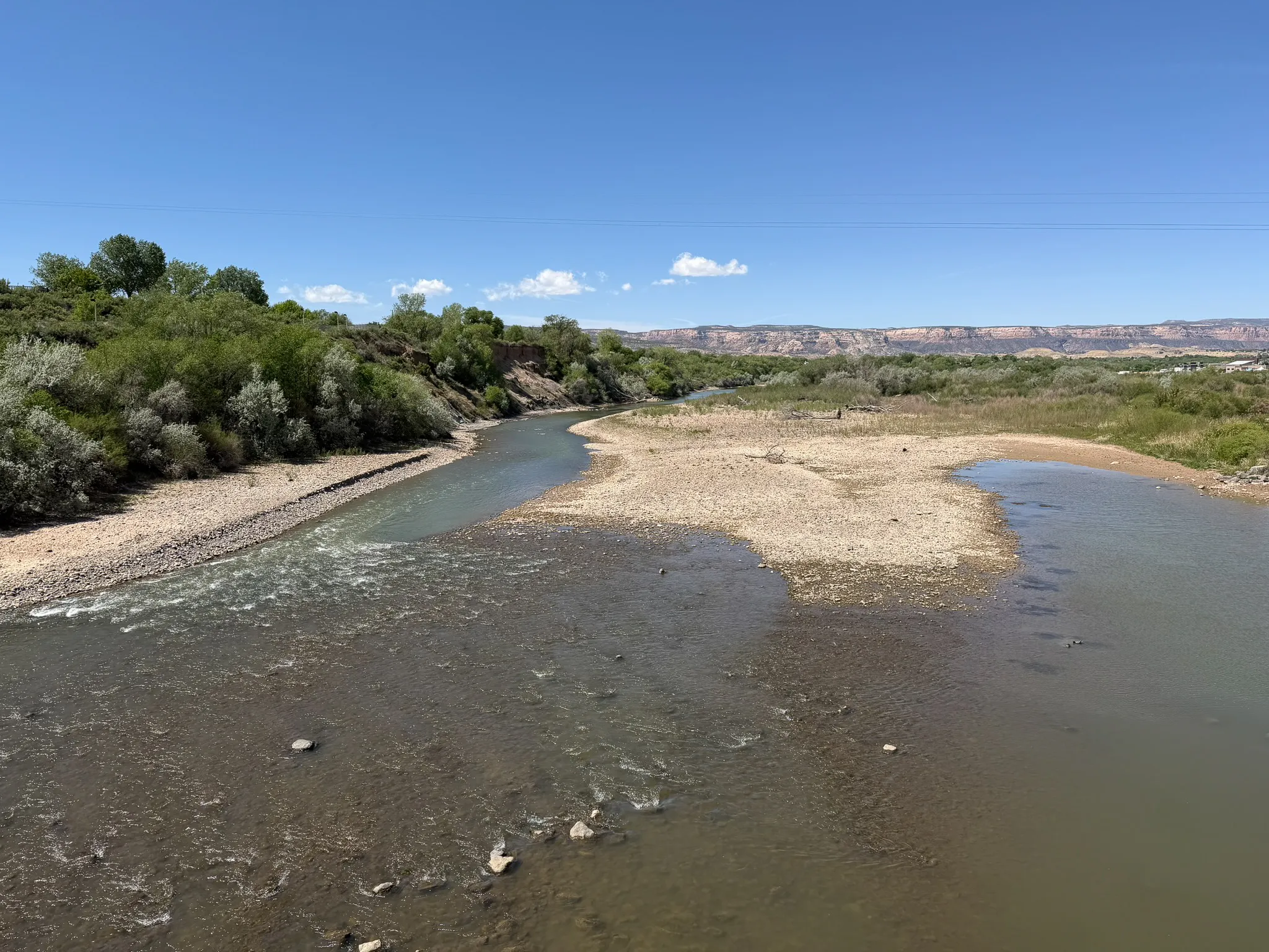
The Colorado River flows through Las Colonias Park in Grand Junction, Colo. on April 22, 2026. The river reached an extremely low level due to heavy diversion upstream and record low snowpack. CREDIT: LUKE RUNYON/THE WATER DESK
With drought and high temperatures putting unprecedented pressure on water users throughout Colorado, from cities to agriculture, there’s one segment that can be affected first — and maybe worst — when it comes to a lack of water: rivers themselves and the ecosystems that depend on them.
As cities enact water restrictions and farmers and ranchers prepare for the worst, impacts of the water shortage are readily apparent in a chronically dry stretch of the Colorado River between Palisade and the confluence of the Gunnison River that is critical habitat for endangered fish, known as the 15-mile reach.
The Upper Colorado River Endangered Fish Recovery Program works to return water to this stretch of river in the Grand Valley, but because of this year’s historically dry conditions, the program could have only 16,000 acre-feet, half its typical amount of water for fish.
Beyond that guaranteed amount, the program mostly uses water-sharing agreements that can secure additional acre-feet to boost flows — but only when other users don’t need the water and can voluntarily loan it. This year finds nearly everyone who depends on the Colorado River and its tributaries in dire straits.
Ruedi Reservoir, above Basalt, on the Fryingpan River, April 22, 2026. Photo: Brent Gardner-Smith
There won’t be any surplus water for fish in the Historic Users Pool, which is stored in Green Mountain Reservoir and is the largest source of water to potentially augment fish flows. A pool of water in Ruedi Reservoir that is available in four out of five years isn’t there, and the program could get only about 340 acre-feet from a pool in Wolford Reservoir upstream of Kremmling that typically has up to 6,000 acre-feet.
“It is really clear to me that we do not have enough tools in our toolbox to be able to manage for conditions like we have this year in the 15-mile reach,” said Julie Stahli, recovery program director. “We are so far outside the bounds of what we have ever seen before, that it’s really just hard to be able to make any good decisions.”
Stahli said she anticipates the program can contribute about 75 cubic feet per second through mid-July, at which point they will drop it down to 50 cfs, a bare-bones amount that is just enough to keep the riverbed wet.
This map shows the 15-mile reach of the Colorado River near Grand Junction, home to four species of endangered fish. Map credit: CWCB
“That is what we are anticipating being able to have for the entirety of the season in the 15-mile reach,” she said.
Side channels on the Colorado River ran dry early during spring runoff on April 22, 2026. Cobble bars and muddy banks emerged as the river receded near Dos Rios Park in Grand Junction, Colo. CREDIT: LUKE RUNYON/THE WATER DESK
As flows plummet, fish could become stranded in pools that are disconnected from the rest of the river, and program managers say they will try to prevent fish from using that stretch of river during times when flows are predicted to be at their lowest. Crews could use netting to keep fish out of the reach or close the flow of water that returns fish to the river after they accidentally enter an irrigation canal, which would keep them in the stretch of river above the diversion that has more water.
“Our main goal at this point is just to keep fish out of that reach,” Stahli said. “There is not a whole lot of attractive habitat in there right now for fish. Flows dropped so early in the season. We’re already seeing some pretty dire conditions in April.”
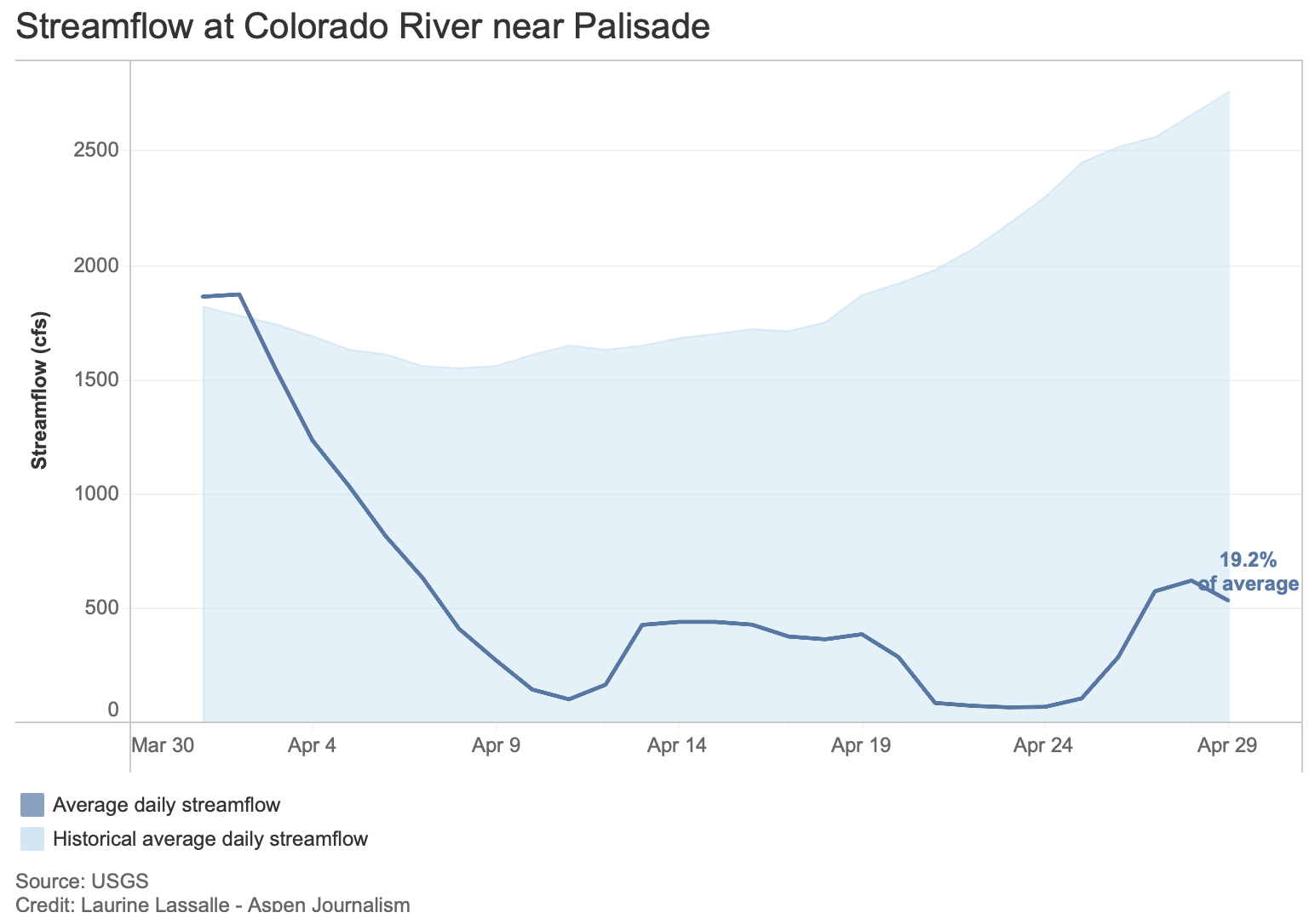
For several days in April, flows fell to just over 50 cfs, among the lowest levels in recorded history and far below the recovery program’s target flow for April in a dry year of 1,240 cfs. According to Stahli, the river’s flow at that low point could be solely attributed to recovery-program water that it had released from upstream reservoirs.
The goal of the recovery program when it was created in 1988 was to protect the humpback chub, razorback sucker, bonytail and Colorado pikeminnow, while also allowing the seemingly opposing goal of developing more water. An aim of the program was to allow farms and cities to continue using water and even expand their use without violating the Endangered Species Act.
Credit: The Land Desk
And the program has had some success, with one of the four species — the humpback chub — being downlisted from endangered to threatened in 2021. (The U.S. Fish and Wildlife Service has also proposed downlisting the razorback sucker.) These fish evolved over millions of years and are only found in the Colorado River basin. In today’s highly engineered and managed river ecosystem, they live mostly in just a few key locations in the Upper Basin, including the 15-mile reach, and in parts of the Yampa and Green rivers. Grand Junction’s minor league baseball team has adopted the charismatic fish as its team name and mascot; last year it was the humpback chubs, and now it’s the razorback suckers.
But the program has had trouble meeting target minimum flows in the 15-mile reach, even though upstream water development has not kept pace the way it was expected to. A main culprit is climate change, which has robbed the river of about 20% of its flows during the 21stcentury.
“We just don’t have the tools as a society to be able to handle what’s happening right now in any cohesive way,” Stahli said. “This isn’t an endangered fish problem; this is an everyone problem.”
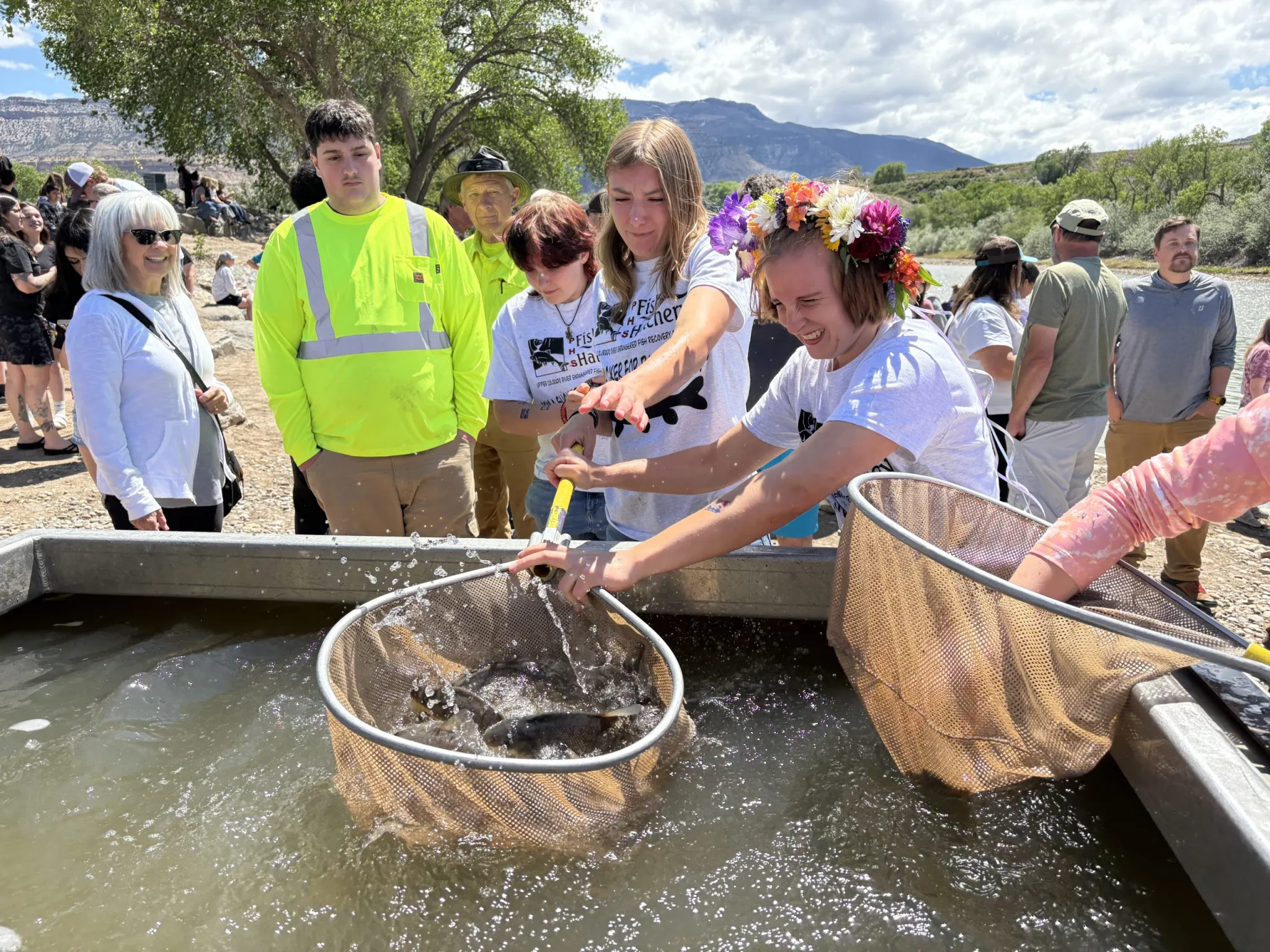
Palisade High School students released razorback suckers and bonytails they helped raise into the Colorado River on Friday, May 1. The two species live only in the Colorado River Basin and are endangered. CREDIT: HEATHER SACKETT/ASPEN JOURNALISM
Why is the river dry?
The reach is just downstream of large Grand Valley agricultural diversions, which are used to grow crops such as corn, alfalfa and the famous Palisade peaches, and which can take a combined 1,950 cfs from the river. At certain times of year, there can be more water in the Grand Valley’s canals than there is in the nearby Colorado River. Collectively, they are the biggest agricultural diversion from the Colorado River on the Western Slope.
“There has been so much diversion and damming of the river farther upstream,” said Bart Miller, healthy rivers director at environmental group Western Resource Advocates. “There are a lot of uses right there, and you’re seeing the impacts of all the Front Range diversions. [The 15-mile reach] is a pinch point in the system based on all the water development we’ve done.”
Water rights for the environment and recreation were latecomers to the legal system. It wasn’t until the 1970s — nearly 100 years after the most-senior agricultural rights on the Western Slope were established — that Colorado began protecting the value of water in streams with its instream flow program. Under Colorado’s system of water law, those who use water by taking it out of the river — including farmers, cities and industry — usually have the oldest rights, giving them first use of the resource. There’s nothing illegal about drying up a river.
“It’s like you’re running in a race and it’s four laps around the track,” Miller said. “The folks with the instream, recreational, environmental values are there at the starting line, but they’re held back for the first two or three laps. Everyone else is already running. And that’s why the environment often ends up in a really bad place.”
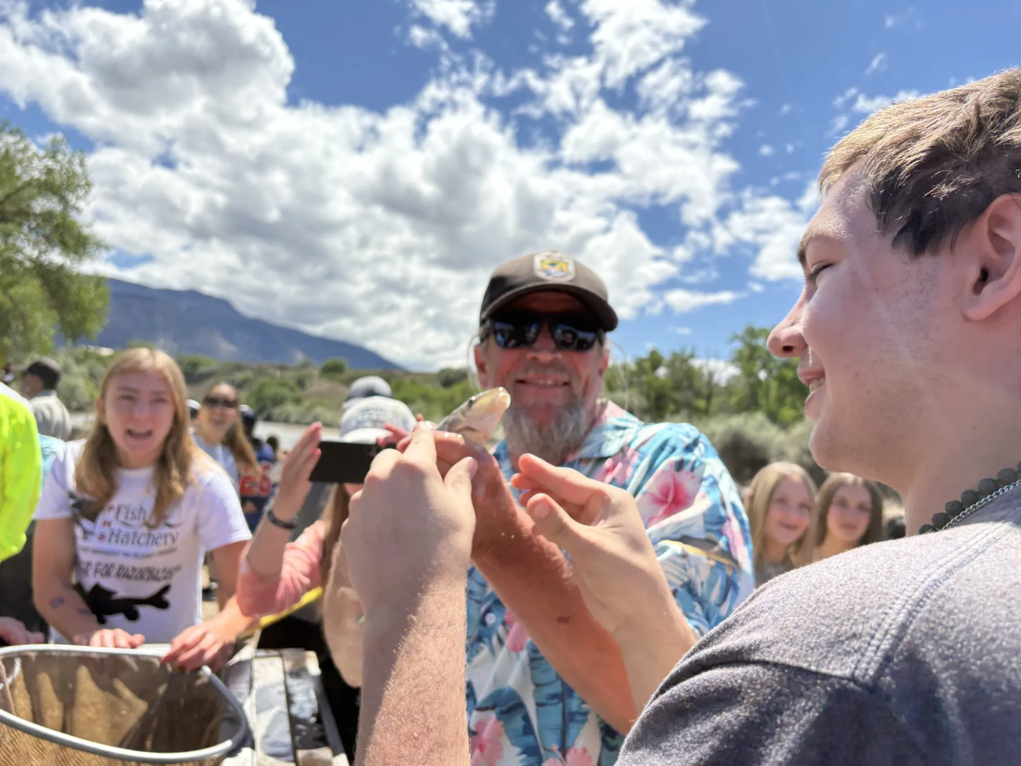
A Palisade High School student puckers up and prepares to kiss a fish goodbye on Friday, May 1 at Riverbend Park in Palisade. About 1,500 juvenile razorback suckers and bonytail, two species of endangered fish that students helped raise in a hatchery, were released into the 15-mile reach of the Colorado River. CREDIT: HEATHER SACKETT/ASPEN JOURNALISM
‘April hole’?
It’s not totally unheard of to have a small window of diminished streamflows in April. In a phenomenon known as the “April hole,” irrigation demands in the Grand Valley ramp up, while the needed water remains frozen solid as high-country snowpack. This problem remedies itself within a couple weeks as the snow begins melting. But this year, little snowpack remained by April and water managers think spring runoff at Cameo, where the big Grand Valley diversions are located, peaked during the March heatwave.
Kate Ryan is executive director of the Colorado Water Trust, which works to put water back into streams through temporary water sharing agreements with agricultural, municipal and industrial water users. Although the Water Trust is still finalizing contracts for this year, Ryan said she expects the Water Trust to add about 4,700 acre-feet of water to the 15-mile reach by leasing water from Ruedi Reservoir owned by the town of Palisade, and oil-and-gas company QB Energy.
In past years, water from this project has been released between the end of July and beginning of October. But that timing may change if the recovery program is trying to keep fish out of the reach.
“We will make sure that we deliver water at a point that complements the work of the recovery program,” Ryan said.
The Water Trust has also used the Colorado River Water Conservation District’s water marketing program — where acre-feet are available for purchase — to restore water to streams. But the River District board at its April meeting voted to freeze all new contracts, which are usually doled out first come, first served, while staff figures out the best use of the limited water supply.
The move was part of a series of drought mitigation actions aimed at easing shortages for water users. The board last month also approved a system for prioritizing water sectors, with keeping water in rivers at the bottom of the list: municipal and domestic water needs over agricultural and industrial needs; and agricultural and industrial needs over in-channel uses such as those that benefit the environment, endangered fish and recreation.
The Water Trust this week sent a letter to some water managers recognizing the historic drought and acknowledging that many of its temporary water sharing agreements, which pay water rights holders to leave water in streams, may not operate this year because their agricultural partners may not have enough water for their own use. Projects are voluntary and happen only in years when participants have enough water to share and it can benefit a stream.
But the letter also said there may be others who are interested in using their water rights to help prop up a stream this year.
“There is just so much uncertainty right now that we are trying to be as flexible and responsive as possible,” Ryan said.
Palisade High School students released two species of endangered fish into the Colorado River on Friday, May 1, 2026. Target flows for these fish in the 15-mile reach are often not met. CREDIT: HEATHER SACKETT/ASPEN JOURNALISM
Recovery-program officials said this year they will double down on other actions that benefit endangered fish, including removing nonnative predator species such as smallmouth bass and stocking the river with hatchery-raised fish. On Friday, students at Palisade High School released 1,500 young razorback suckers and bonytails that they helped raise into the Colorado River at Riverbend Park in Palisade.
Recovery-program staff said managing the 15-mile reach this year is about preventing the worst impacts and seeing what lessons can be learned from one of the driest years on record.
“It is just new terrain,” said David Graf, instream flow coordinator for the recovery program. “I think we are just flying by the seat of our pants in a lot of ways trying to do triage management as opposed to really adapt.”
For now, one of the few ways to add water back to a depleted river remains borrowing it from other, more senior users.
“I think until our water suppliers and state government hear from people that the environment really is a priority, not just the recovery program and need to support endangered species, but also for communities and local economies across the board, it’s going to stay that way,” Ryan said.
Bicycling the Colorado National Monument, Grand Valley in the distance via Colorado.com
If someone were to be dropped from another planet into the North Fork Valley in western Colorado today, they would be forgiven for assuming there is not a water crisis. A thick carpet of green covers the valley floor, the irrigation canals are filled to the brim, trees are leafing out, the river is running and Paonia Reservoir is almost full, and the mountains are still graced with snow.
I didn’t even come from outer space — I think — and I find the contrast between the news reports of water shortages and restrictions and the on-the-ground situation here to be quite jarring. Is it possible that April precipitation has averted the calamity?
A green hay field on a mesa in the North Fork Valley in western Colorado. Jonathan P. Thompson photo.
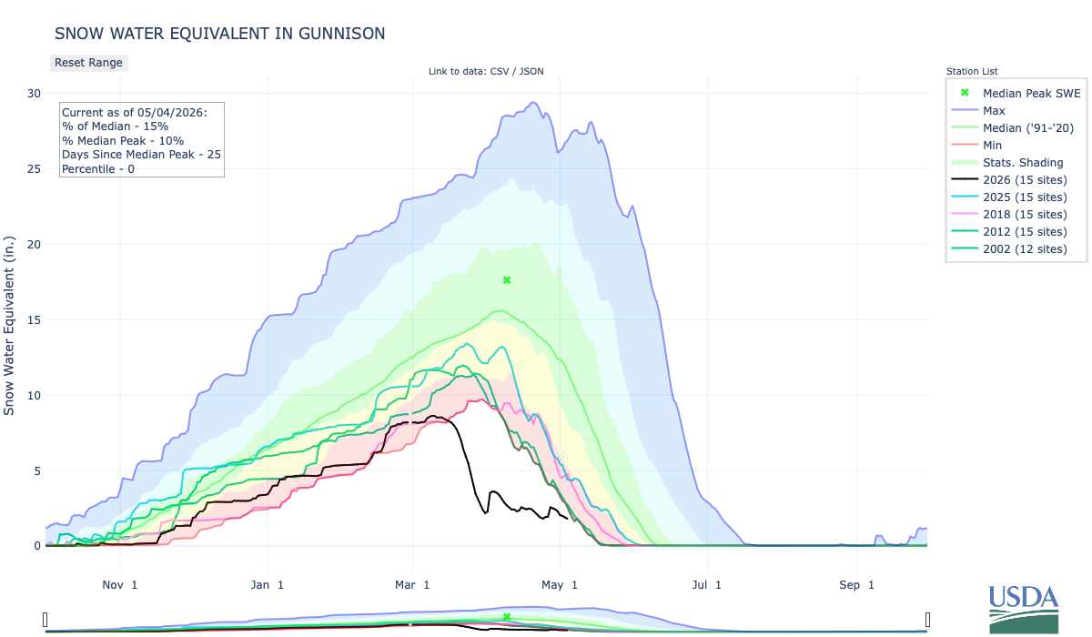
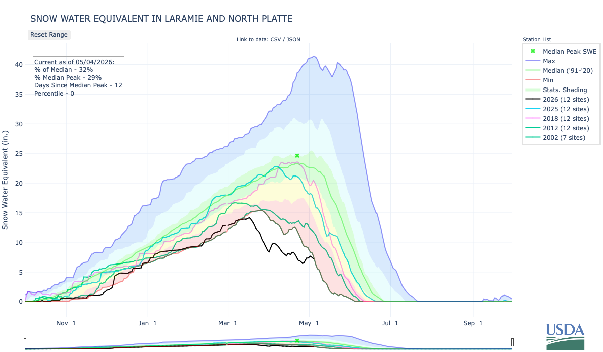
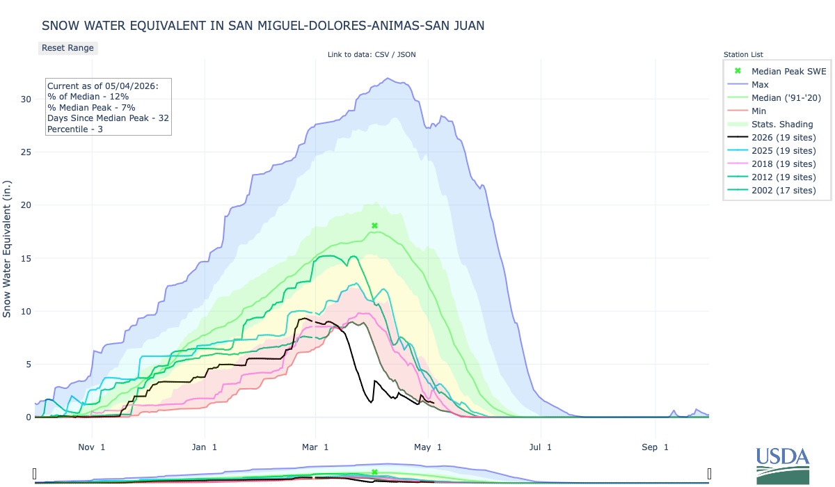
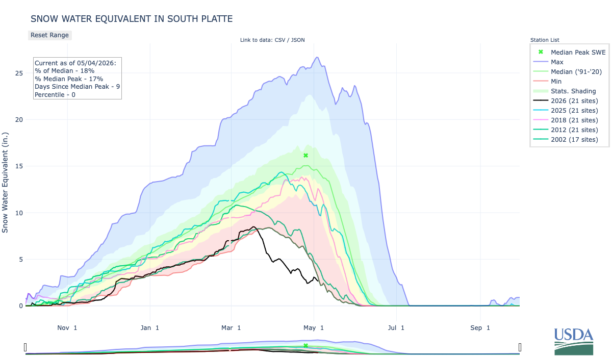
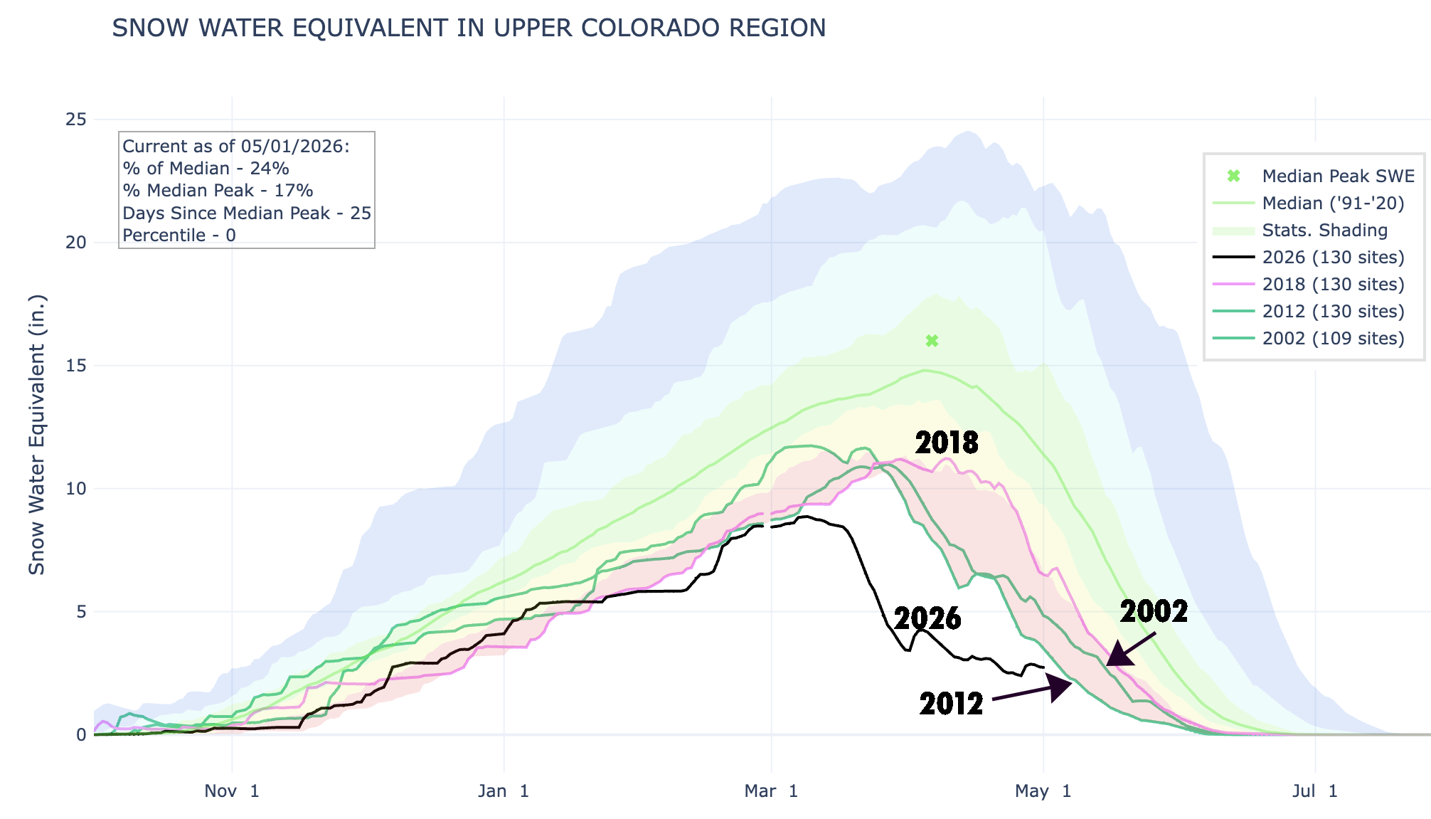
Yes, a series of storms, some quite abundant, have moved through the Upper Colorado River Basin, boosting snowpack and soothing the desiccated earth. It has certainly felt cooler and wetter than normal, but that was mostly an illusion brought on by the abnormally dry winter and the searing March heatwave. And it hasn’t been nearly enough to offset the warm winter and the lack of snow, as the graphs below indicate.
As for the full ditches, I guess you could attribute that to a “make hay while the water is available” sort of ethos. You might as well douse the fields and fill ponds while spring runoff is in full swing and the river still runs, knowing that it may not last beyond June. Meanwhile, Paonia Reservoir’s relatively healthy levels are the result of the Fire Mountain irrigation canal — which relies on reservoir water — being shut down for emergency repairs.
Meanwhile, there is a conspicuous absence here in this agricultural hotspot: There are no blossoms or fruit on apple, cherry, peach, or pear trees. The March heatwave sparked a spectacular orchard super-bloom. That was followed by a devastating freeze that killed all of the fruit, even in orchards where extreme preventative measures were taken, and even “burned” the leaves on some trees. Wacky weather indeed.
The North Fork of the Gunnison’s May 1 snowpack this year is tied for the lowest on record with 2012.
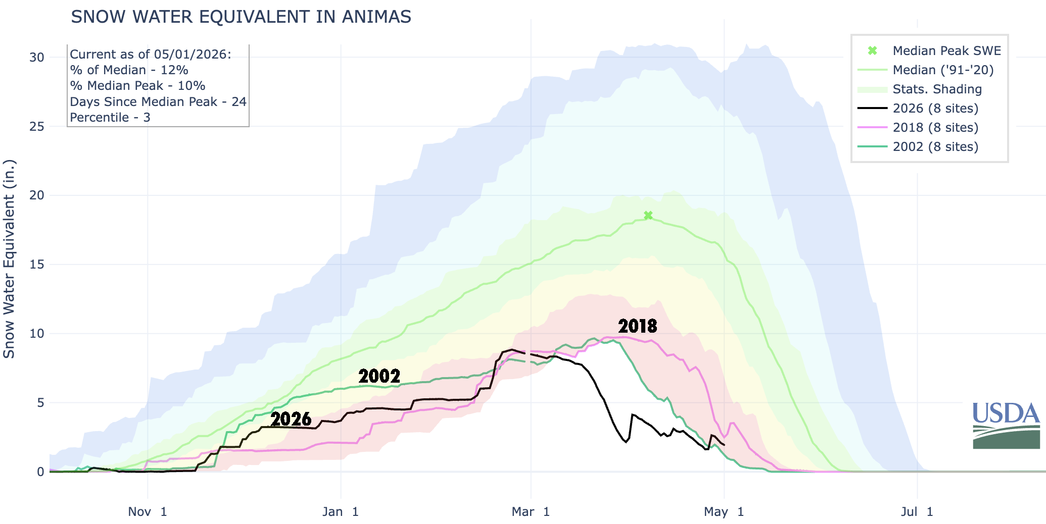
The Animas River watershed did get enough of a boost to bring snowpack levels back up above 2002’s for this date. Source: NRCS.
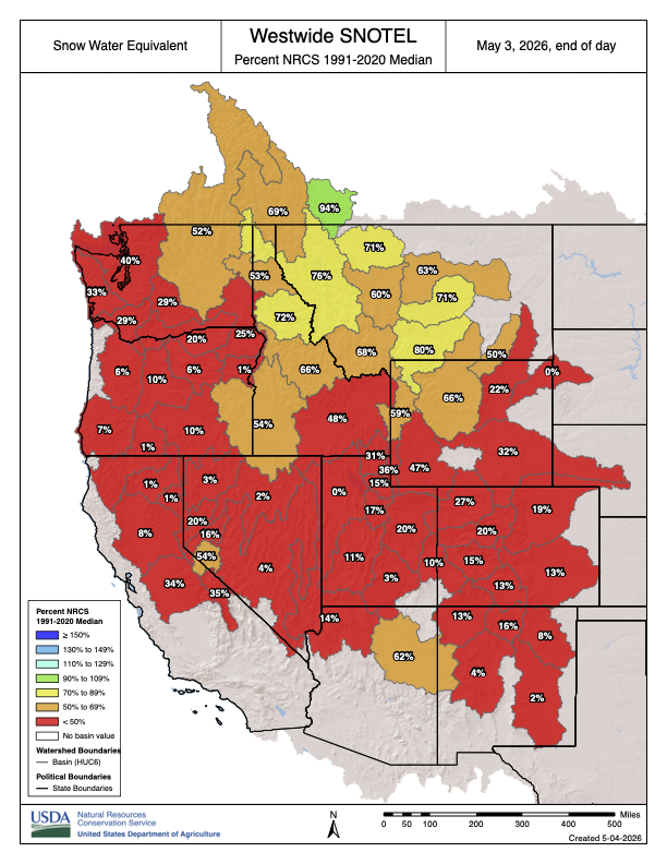
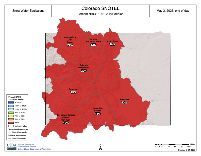
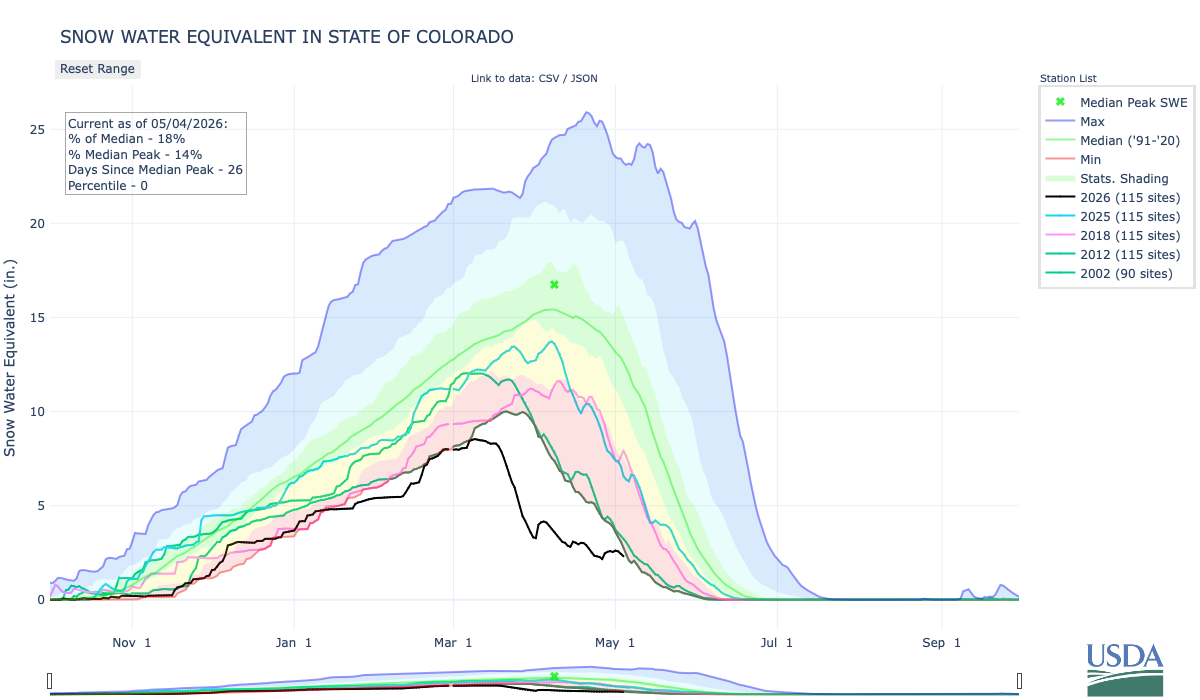
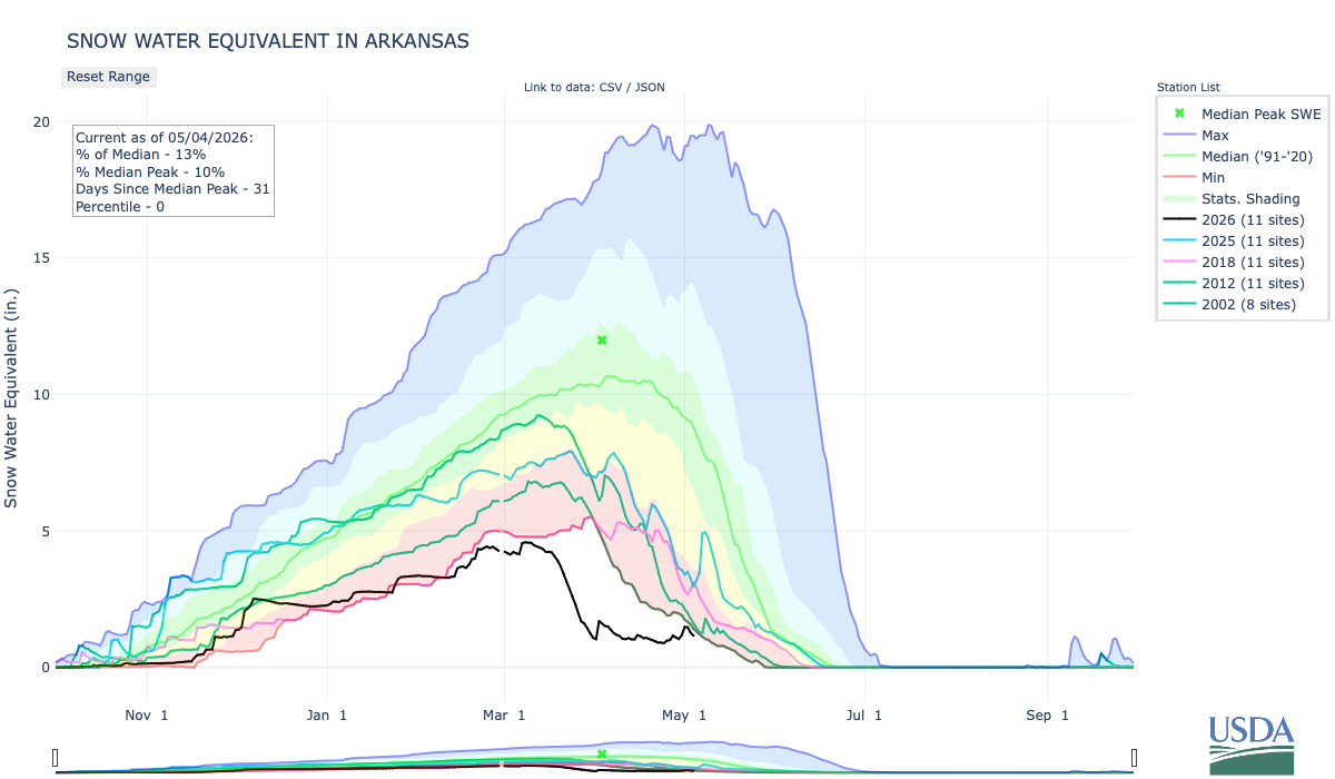
Even with the recent storms, the Upper Colorado River Basin snowpack remained at record-low levels as of May 1. The previous low year (from 40 years of SNOTEL records) was 2012, with 2002 and 2018 not far behind. Source: NRCS.
🐟 Colorado River Chronicles 💧
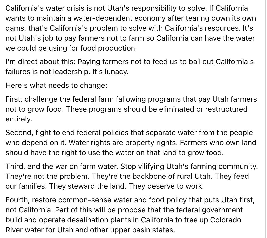
Phil Lyman, the former and hopeful Utah politician, recently posted this on Facebook:
Just to sum it up: He’s knocking a federal program that pays willing farmers to voluntarily cut off irrigation to their fields in order to conserve water in an effort to balance Colorado River demand with the shrinking supplies. And he’s blaming it all on California.
Lyman’s general sentiment is not new, nor is it uncommon among water users in the Upper Basin states. In fact, it’s basically a cliché. Since I was a kid I’ve heard folks saying something along the lines of: If we don’t use the water, it’ll just run on down to California, where those L.A. folks will guzzle it up to fill their swimming pools and water their golf courses. It’s a rather simplistic view, and one that doesn’t account for the realities of water law or the way the Colorado River system works. In other words, it’s just plain wrong, and a candidate for Congress — as Lyman is — should know better.
Udall/Overpeck 4-panel Figure Colorado River temperature/precipitation/natural flows with trend. Lake Mead and Lake Powell storage. Updated through Water Year 2025. Note the tiny points on the annual data so that you can flyspeck the individual years. Credit: Brad Udall
The Colorado River and its users have a problem: Demand for the water exceeds supply, and the supply is continually shrinking. Since boosting supply is not a feasible option, demand — i.e. consumptive use — must be reduced significantly. While everyone must make cuts, agriculture is the river’s largest water user by far, meaning that sector is going to have to make the largest cuts, by volume. This isn’t about demonizing farmers or alfalfa, it’s not about whether Californians or Utahns are more deserving of the water. It’s simple math.
The farm fallowing program is one way to cut consumption quickly by paying willing farmers to voluntarily forego irrigating some or all of their fields on a year-by-year basis. It’s not ideal, but it is legal, voluntary, and can save junior water rights holders, including cities and towns throughout the watershed, from being forced to shut off their water intakes. And in no way is farm fallowing exclusive to Utah. It’s occurring all over the place.
Let’s do a little fact-check of Lyman’s other points:
Farm fallowing in Utah is being done to benefit California, which “demolished its water storage infrastructure.” No and no. The goal here is to leave a little more water in the river, to keep the whole system from collapsing. Any amount conserved in one place will potentially benefit all other river users, as well as the river itself. Foregoing irrigation on a Utah farm, for example, could help keep the taps on in St. George or some other Utah community that relies on the river. Dams have been removed in California, most significantly four structures on the Lower Klamath River. But those were primarily for hydropower production, not irrigation or water storage, and they are far removed from the Colorado River or any associated water storage.
“Paying farmers not to feed us to bail out California’s failures …” Actually, the feds and state and other programs mostly are paying farmers not to grow alfalfa or hay, which feed cattle, and it has nothing to do with California’s “failures.” Indeed, California grows a lot of alfalfa, too, but it also grows all kinds of vegetables — far more than in Utah.
If the water saved in Utah does make it to the Lower Basin and California, then the biggest beneficiary would be … farmers. Most of the water in the Lower Basin goes to the Imperial Irrigation District, where it is used for farming. Those farmers have also been part of the federal fallowing program, and have managed collectively to reduced their Colorado River water consumption by about nearly 1 million acre-feet since 2003.
Lyman calls for eliminating or restructuring federal farm fallowing programs. I’m curious if he’s talked to the farmers about this, especially the ones who may lose their water and be forced to fallow anyway. Isn’t it better to get paid not to grow something than to not get paid for it?
“… fight to end federal policies that separate water from the people who depend on it. Water rights are property rights.” We all depend on water; the California farmers depend on water just as much as Utah farmers do. Furthermore, the California farmers also own their land, they have some of the most senior water rights on the Colorado River, and according to the “Law of the River,” they could likely go to court to force many Utah farmers to stop irrigating altogether, without compensation. The farm fallowing program does not separate water from the farmers, it simply pays them to temporarily forego irrigation.
“… end the war on farm water.” Look, there is not enough water in the Colorado River for everyone. Everyone will have to take cuts, but irrigated agriculture is the biggest user by far, and therefore will have to make cuts in order to balance supply and demand. It’s simple math: All of Las Vegas and southern Nevada use less than one-tenth of the water that goes to the farms in the Imperial Irrigation District.
“… propose that the federal government build and operate desalination plants in California to free up Colorado River water for Utah …” Desalination will likely be a part of the West’s water future, especially for coastal urban areas. But building the plants, and processing and transporting these kinds of volumes of water, would be outrageously expensive and energy-intensive, which would be especially harmful to farmers, who rely on cheap water.
***
The Bureau of Reclamation recently decreased Glen Canyon Dam releases from about 8,200 cfs to a steady 7,000 cfs (without the usual nighttime reductions). This appears to be the lowest sustained releases since the dam was built, and if continued throughout the entire year would lead to only 5 million acre-feet of annual releases, which would make the Lower Basin states even more grumpy and litigation-happy than they already are.
But not to worry, the feds are still on course to release 6 MAF for the water year, because they released about 10,000 cfs during January and February. Still, it’s going to change the complexion of rafting in the Grand Canyon, for sure, and it is certainly pushing the boundaries of the Grand Canyon Protection Act.
📸 Parting Shot 🎞️
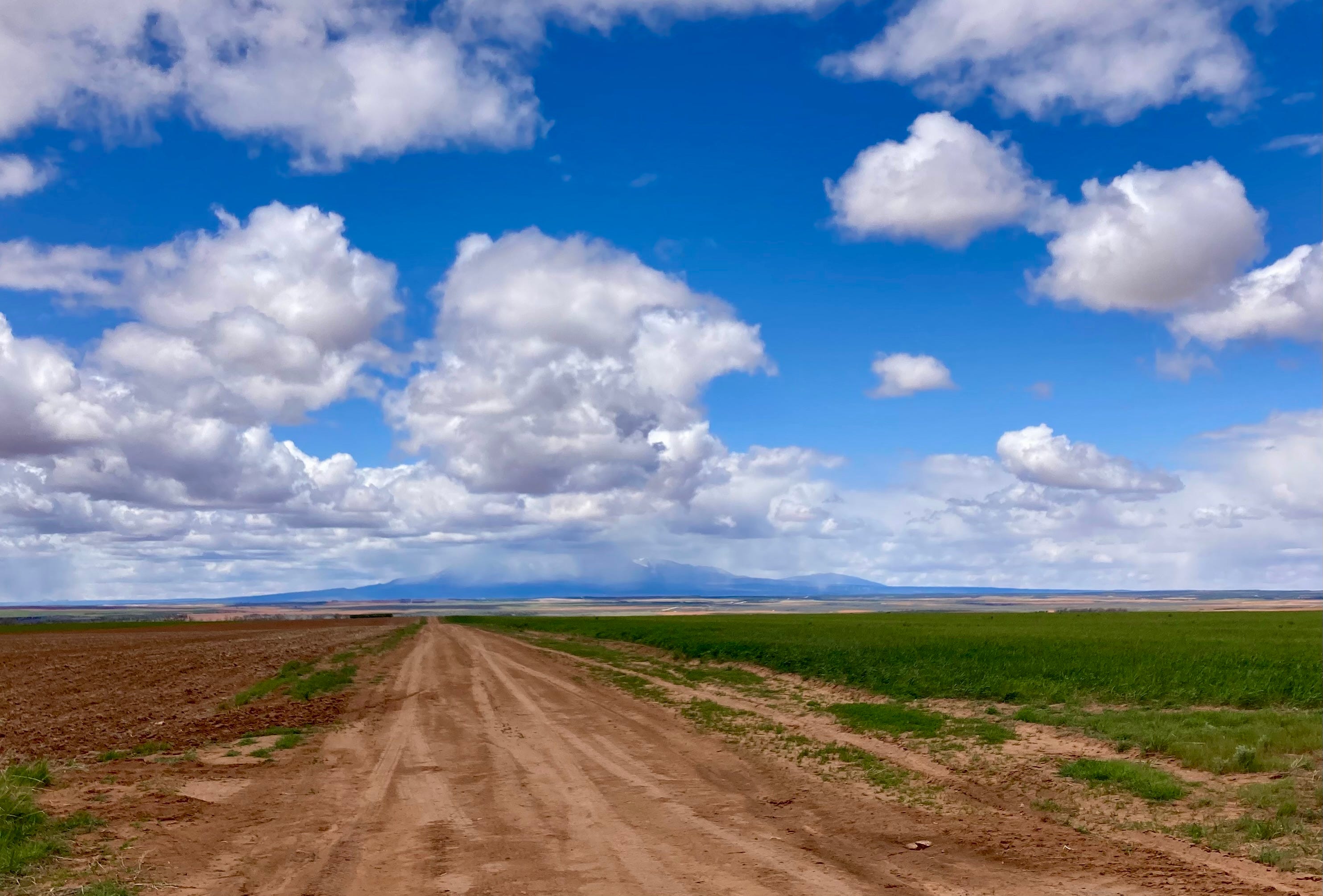
Snow falls on the Abajo Mountains in southeastern Utah as seen from near Dove Creek, Colorado. Jonathan P. Thompson photo.
The Colorado Water Conservation Board is funneling $40 million to dozens of water projects statewide as communities grapple with a drought emergency that is making saving water more important than ever before.
Among the 136 projects receiving state support this fiscal year, which ends June 30, is a $2.3 million grant that will pay nearly half the cost to install new, automated irrigation control systems across 105 Denver Public School system sites. Another grant, for $227,225, will help the city of Trinidad with early studies on repairing and potentially enlarging Monument Lake Reservoir.
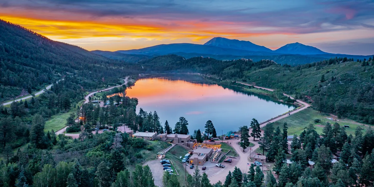
Photo credit: Monument Lake Resort
Still another grant, for $111,855, will help pay to train and certify metro area teens in becoming turf replacement specialists. Operated by the Neighborhood Resilience Corps, the initiative will replace 23,000 acres of grass at sites that include the Governor’s Mansion and other state facilities.
The grant awards come as Colorado faces a stunning drought year in which winter mountain snows were historically low and a spring heat wave melted those snows early, slashing water available for cities, industries and farms to use.
Aurora, for instance, is expecting just 10% of its normal water supplies this year, according to Tim York, manager of water conservation for Aurora Water, and its reservoirs stand at 57% full.
As cities broadcast the need to cut back water use to preserve water stored in reservoirs, homeowners and businesses have flooded cities like Aurora with requests for help to design drought-proof landscapes and replace thirsty bluegrasses with lawns that need much less water.
“Our approved applications have doubled over what they were last year, so that is pretty good,” York said, referring to applications for Aurora’s landscape conversion program. “Our free design program is similar. We have a waitlist.”
He said the CWCB grants, coupled with Aurora’s aggressive water conservation initiatives, are critical to helping the state cope with the drought emergency and create more sustainable water systems.
Aurora is a supporter of the Neighborhood Resilience Corps’ youth training effort. York said the opportunity to train young people is important.
“Anytime we can do that with young adults who are interested, it’s always a great idea,” he said. “We might do the conversions, but if we can get that benefit and inspire and teach young adults, why not.” York was referring to the city’s programs that remove thirsty lawns and replace them with drought tolerant landscapes.”
Boulder-based Resource Central, another agency that has partnered with the CWCB on statewide conservation efforts, said it is seeing an unprecedented number of requests for its services.
“Demand for conservation programs is off the charts,” said Neal Lurie, president of the nonprofit agency. “We’ve seen more interest in the first three weeks of this spring season than we did all of last year.
“To me that says the message is resonating with people that they have an important role to play,” he said. “That’s good news.”
Yesterday was May Day! Flowering plants evolved ~130 Ma (recent in Earth’s history!). They appeared suddenly in the Cretaceous and diversified quickly. Florissant Fossil Beds NM preserves many fossil flowers from the Eocene. pic.twitter.com/Yk6hcbU8v1
— Colorado Geological Survey (@COGeolSurvey) May 2, 2026
Udall/Overpeck 4-panel Figure Colorado River temperature/precipitation/natural flows with trend. Lake Mead and Lake Powell storage. Updated through Water Year 2025. Note the tiny points on the annual data so that you can flyspeck the individual years. Credit: Brad Udall
The Lower Basin States of Arizona, California, and Nevada today advanced a plan to stabilize the Colorado River through 2028, responding to declining reservoir levels, record low inflows to Lake Powell, and increasing risk of reaching critical elevations at both Lake Powell and Lake Mead.
Earlier in the post-2026 process, the Lower Basin took a significant step by proposing 1.25 million acre-feet in annual reductions, with an additional 250,000 acre-feet from Mexico, totaling approximately 1.5 million acre-feet per year.
This proposal builds on that foundation with an expanded system conservation program across the Lower Basin with an estimated contribution of at least 700,000 acre-feet. In total, the plan identifies up to 3.2 million acre-feet of water savings to the system through 2028.
The proposal is an integrated package addressing Lake Powell releases, Upper Initial Unit operations, Lower Basin reductions, additional conservation, use of Intentionally Created Surplus, and system infrastructure improvements. Lower Basin contributions are contingent on these coordinated operations to ensure system stability as well as appropriate funding.
“With this proposal, the Lower Basin is putting forth real action to stabilize water supply along the Colorado River. We’re putting forward additional measurable water contributions for the system. Without that, the system will continue to decline,” said JB Hamby
“This proposal is about moving from ideas to implementation,” said John Entsminger. “It pairs real measurable water contributions with sensible dry-condition operations at Lake Powell and across the Upper Initial Units. Now is the time for every water user in the Basin to double down on water conservation as we face historically dry hydrology.”
“This proposal reflects the creativity and commitment of water users across the Lower Basin who continue to step forward with solutions that support the river,” said Tom Buschatzke. “We have shown that collaborative, voluntary efforts and reductions that are certain can produce meaningful water savings.”
The Lower Basin states recognize the Upper Basin’s call for mediation and are open to that process. However, current conditions require immediate, measurable water reductions from every state. The Lower Basin states stand ready to engage in a meaningful process for long-term solutions while encouraging the Upper Basin to step forward now with verifiable water contributions to help stabilize the system and support a near-term, seven-state bridge.
The Lower Basin states confirmed that the proposal preserves legal accountability under the Colorado River Compact, including Upper Basin delivery obligations, while maintaining a clear path toward a broader agreement among all seven Basin States.
The plan has been advanced to the federal government for consideration as part of the ongoing post-2026 planning process and is intended to provide a near-term bridge through 2028 while long-term operating guidelines are finalized.
Implementation of key elements of the proposal, including expanded system conservation, will require federal partnership. The proposal remains subject to approval by the Arizona Legislature and relevant California and Nevada water agency governing boards.
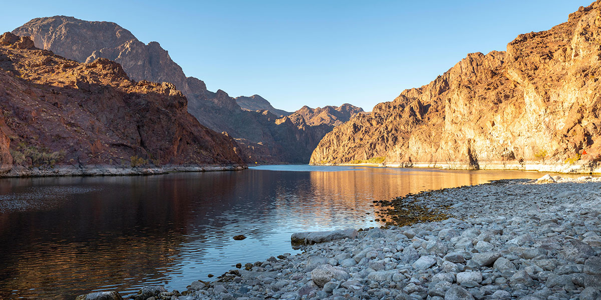
Colorado River. Photo credit: Central Arizona Project
May 1, 2026
The situation on the Colorado River is dire. Flows have reached historic lows and water saved in major storage reservoirs is approaching critical elevations. To date, solutions to the crisis have been elusive, with lengthy litigation looming as the seven states that share the river have been unable to agree on an appropriate remedy to the situation. That is why today’s announcement that the Lower Division States of Arizona, California and Nevada have come together to announce a bridge proposal that will support the entire Colorado River system through 2028 represents a welcome lifeline and cause for hope. This three-state proposal is a two-year, comprehensive package that will commit a minimum of 3.2 million acre-feet of Lower Division water savings in Lake Mead by 2028
The proposal is a bridge, a pathway to future operations that extend beyond the expiration of the existing river operating guidelines at the end of 2026. However, this massive sacrifice by the Lower Division States is only possible by implementing the entire proposal, which requires a series of critical actions by the federal government. The federal government must commit the remainder of Colorado River drought funding to offset impacts to Lower Division users, create a tribal pool to meet federal responsibilities to tribal communities, and use the reservoirs upstream of Lake Mead for their foundational purpose — meeting water delivery obligations to the Lower Division. Congress built those upstream dams for the purpose of releasing water and meeting minimum obligations to the Lower Division under the Colorado River Compact during an extended drought like the one we face today and now, the dams must be used as mandated by Congress.
Today’s announcement is the latest in a series of actions by the Lower Division States to preserve the stability of the Colorado River system. Lake Mead would be in the mud if not for Lower Division water users leaving water in the lake to protect the system, and every drop that has been left in Lake Mead is benefiting Lake Powell and the Upper Division by allowing for less water to be released downstream.
But Lower Division actions alone cannot protect the entire system from extraordinarily dry years. This year is an example where, despite the Lower Division’s ongoing reductions and contributions, Lake Powell needed additional emergency action.
While this new Lower Division bridge requires no action from the Upper Division states, it is well past time that the Upper Division States agree to be part of the solution by committing to verifiably conserve water and end their out-of-touch demand that the Upper Division be allowed to increase their total uses from a shrinking system.
The Central Arizona Project applauds the Lower Division States for developing the proposal and urges the federal government to speedily approve this emergency effort to bridge the river system through 2028.
The Center for Biological Diversity, the San Carlos Apache Tribe and the Lower San Pedro Watershed Alliance today filed a notice of their intent to sue the U.S. Bureau of Land Management and the U.S. Fish and Wildlife Service over the Copper Creek Exploration Project near Mammoth, Arizona. The groups say the agencies violated the Endangered Species Act by allowing mining exploration drilling that threatens Mexican spotted owls and other imperiled wildlife.
“Federal officials were warned that Mexican spotted owls are in the area but pushed this mining project ahead anyway and skipped steps required by law,” said Russ McSpadden, a Southwest conservation advocate at the Center for Biological Diversity. “The Endangered Species Act is supposed to protect imperiled wildlife before damage is done, not after agencies brush aside the evidence and greenlight industrial drilling. This mining project is clearly illegal and it must be stopped.”
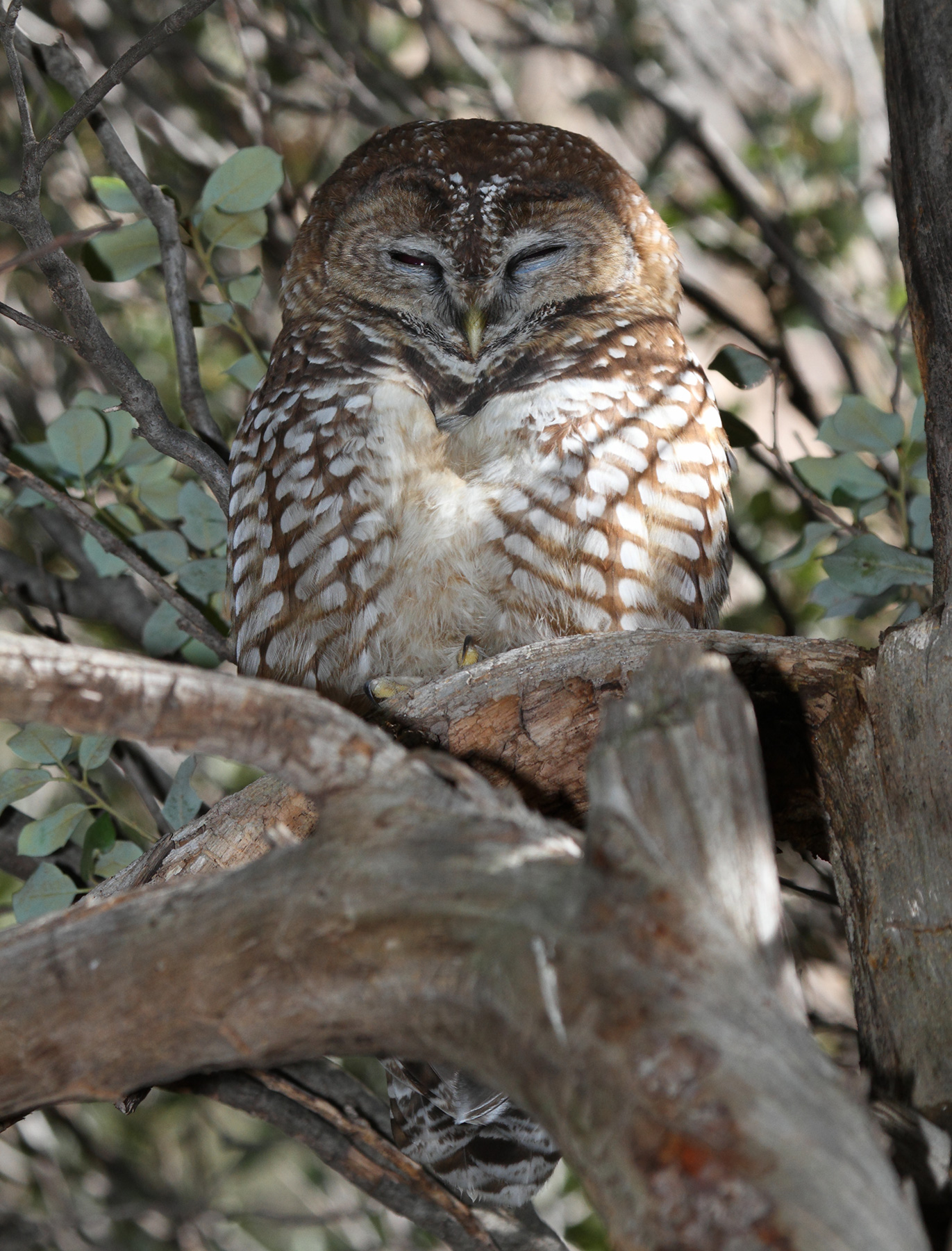
Today’s notice focuses on Mexican spotted owls, rare birds who depend on the rugged canyon and forest habitat of the Southwest. Federal data estimates there are roughly 1,300 known owl territories in the U.S., representing only a few thousand birds in small, fragmented and declining populations. Mexican spotted owls have been protected as threatened under the Endangered Species Act since 1993.
“The Lower San Pedro watershed is one of Arizona’s most important wildlife corridors, and this exploration project is pushing industrial disturbance into a landscape that is already under pressure,” said Melissa Crytzer Fry, chair for the Lower San Pedro Watershed Alliance. “When agencies ignore clear evidence and fail to follow the law, local communities are left to defend the river, the habitat and the species that make this place irreplaceable. We shared trail camera images with the BLM showing Mexican spotted owls in the area and were utterly ignored.”
The groups say the BLM approved the drilling project last summer despite receiving photographs showing Mexican spotted owls in the area. The agency still concluded the species was “not present” and failed to initiate consultation with the Fish and Wildlife Service, as required by the Endangered Species Act.
The Copper Creek project is already underway, bringing industrial drilling, bright lights, heavy noise, truck traffic, surface disturbance and groundwater pumping into sensitive habitat in and around Copper Creek Canyon, an important tributary of the Lower San Pedro River. These public lands and waterways support significant wildlife resources, including habitat for one of the Southwest’s most vulnerable owl species, and require management based on the best available science.
The notice letter also challenges the agencies’ analysis of harms to the threatened yellow-billed cuckoo, saying they failed to adequately assess how exploration-related groundwater pumping and noise could affect the bird’s habitat in the Lower San Pedro watershed. Cuckoo rely on healthy streams for habitat and prey during their nesting season.
The agencies failed to analyze how extensive helicopter surveying of the project area may harm both Mexican spotted owls and yellow-billed cuckoos. Aerial surveillance requires helicopters to fly extremely close to the ground, causing loud noise and surface disturbance that can be disruptive to wildlife.
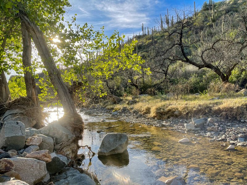
Copper Creek Canyon. Photo credit: Russ McSpadden/Center for Biological Diversity
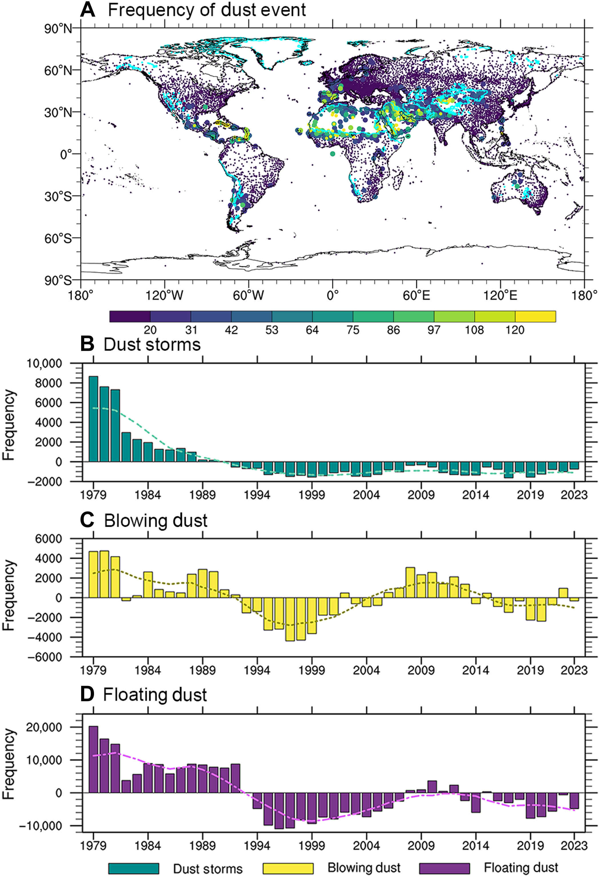
Fig. 1. Spatial and temporal patterns of global dust events. (A) Global average frequency of dust events (including dust storms, blowing dust, and floating dust) from 1979 to 2023. The cyan lines in (A) delineate the boundaries between dust source regions and transport regions. The largest markers indicate stations where dust storms are the dominant type of dust events, medium-sized markers represent blowing dust, and the smallest markers denote floating dust. (B), (C), and (D) present the global frequency anomaly time series for dust storms, blowing dust, and floating dust, respectively, over the same period. The curves in [(B), (C), and (D)] are smoothed using a nine-point moving average.
Click the link to access the research article on the Science Advances website (Yuzhi Liu, Weiqi Tang, Tianbin Shao, Run Luo, Ziyuan Tan, Dan Li, and Jianping Huang). Here’s the abstract:
April 29, 2026
Dust storms, while often seen as harmful, can play an unexpected role in enhancing rainfall. Global observations show that 7-day accumulated precipitation after dust storms exceeds dust-free conditions by up to 9.6 millimeters. Numerical simulations further confirm that dust particles act as ice nuclei, thereby promoting cloud formation and increasing rainfall through the ice crystal effect. Moreover, in regions with rising anthropogenic aerosols, dusts determine precipitation patterns. While elevated levels of anthropogenic aerosols alone tend to boost weak rainfall, the presence of dust aerosols reduces light precipitation and enhances heavier precipitation. Collectively, these findings reveal a dual role of dust storms in shaping global precipitation patterns while adversely affecting the human living environment. This research establishes a mechanistic framework for understanding how dust affects extreme precipitation at the global scale, advancing predictive capabilities for heavy precipitation.
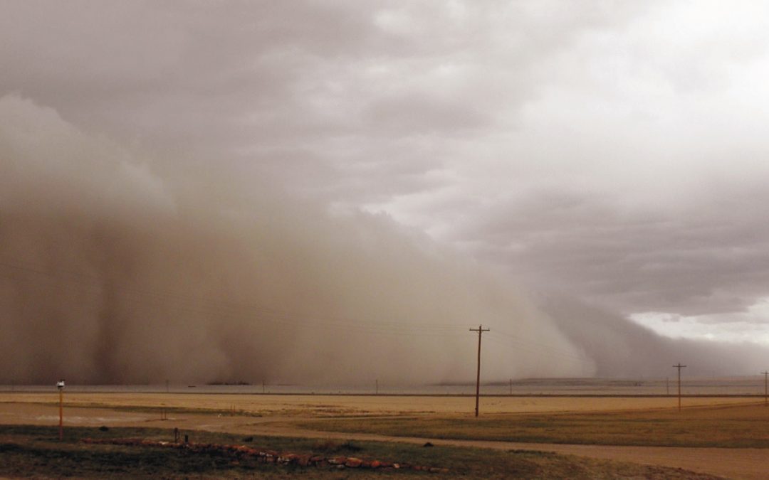
Dust clouds roll across drought-ridden fields near eastern Colorado’s Lamar in spring 2013. Credit: Jane Stulp via Water Education Colorado
“By taking voluntary measures now to reduce water use, Utilities customers can actively help lower the chance of mandatory water restrictions if conditions worsen,” the news release stated.
Fort Collins Utilities and East Larimer County Water District, or ELCO, which are two of the city’s three major water providers, are asking customers to:
Limit lawn watering to no more than two days per week.
Avoid watering between 10 a.m. and 6 p.m.
The West Fort Collins Water District is required to follow city-issued water rationing and restrictions, according to its website. Sunset Water District is managed by ELCO.
On Tuesday, April 21, the Colorado River District board of directors unanimously supported initial actions in response to extreme drought conditions on the western slope. The board’s actions allocated $450,000 from the District’s Community Funding Partnership for strategic water releases from District-owned, District Enterprise, or other storage pools across the western slope. The board also acted to suspend a previous water marketing policy that allowed contracts on a first-come, first-serve basis, instead taking staff recommendation to develop a cooperative approach that best uses available supplies to meet critical needs. The board delegated authority to its Water Supply Projects Committee to consider and approve subsequent contract water leases and funding allocations.
“This action alone won’t solve the drought, but it will help meet critical water needs in the short term,” said Hunter Causey, director of asset management and chief engineer for the Colorado River District. “Our reservoirs were built to help communities on the western slope weather exactly this kind of year. Maximizing the use of our available storage now is the responsible thing to do.”
“We were already bracing for a dry summer, but the low snowpack was absolutely flattened by extreme heat in March, leaving statewide water supplies facing unprecedented gaps,” said Colorado River District Board Vice President and Grand County rancher Mike Ritschard. “Irrigators and agriculture producers in Colorado are familiar with working within uncertainty, but when supplies are this limited, we know we have to be especially conscious of balancing our use with the health of the system as a whole.”
The Board also prioritized its contract water supplies to first support critical domestic and municipal needs, while striving to then address agricultural and industrial needs. Prioritizing these uses will also boost stream flows and reduce water temperatures through strategic releases. For domestic and municipal uses, the board directed staff to work with water suppliers and land use authorities to provide clear guidance that outdoor water use for lawns and ornamental applications be strictly limited.
“The reality is that in a year like this, any water that you put on your lawn is water that will not show up in the river,” said Andy Mueller, Colorado River District general manager. “This drives up water temperatures and negatively impacts the health of the river for everyone downstream, including our local farms and regional food production. We are asking all residential water users and municipalities to consider limiting outdoor water use to one or two days a week. This year, we all need to be asking if we value healthy rivers and local food production over green lawns.”
Over the next few weeks, Colorado River District staff will work with constituents and other partners to determine the best use of available supplies in a manner that meets critical needs of the residents of the River District and brings benefits to as many communities as possible.
Please refer to the staff memo, linked HERE, for more details on the initiative.
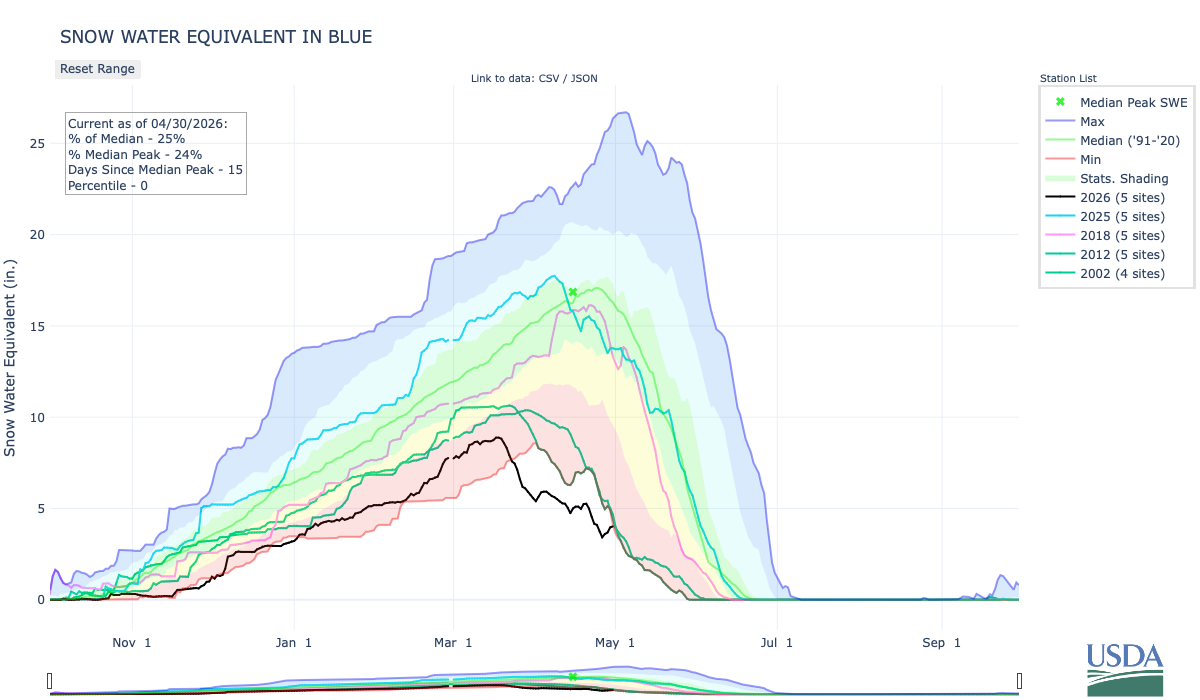
Breckenridge Town Council approved more stringent water restrictions, limiting outdoor watering to two days per week, as town officials respond to drought conditions and declining streamflows in the Blue River. The new Stage 2 restrictions come as the town faces a water shortage tied to this year’s historically low snowpack and reduced runoff into Goose Pasture Tarn, according to Shannon Cahill, town engineer. The restrictions officially take effect on Friday, May 1.
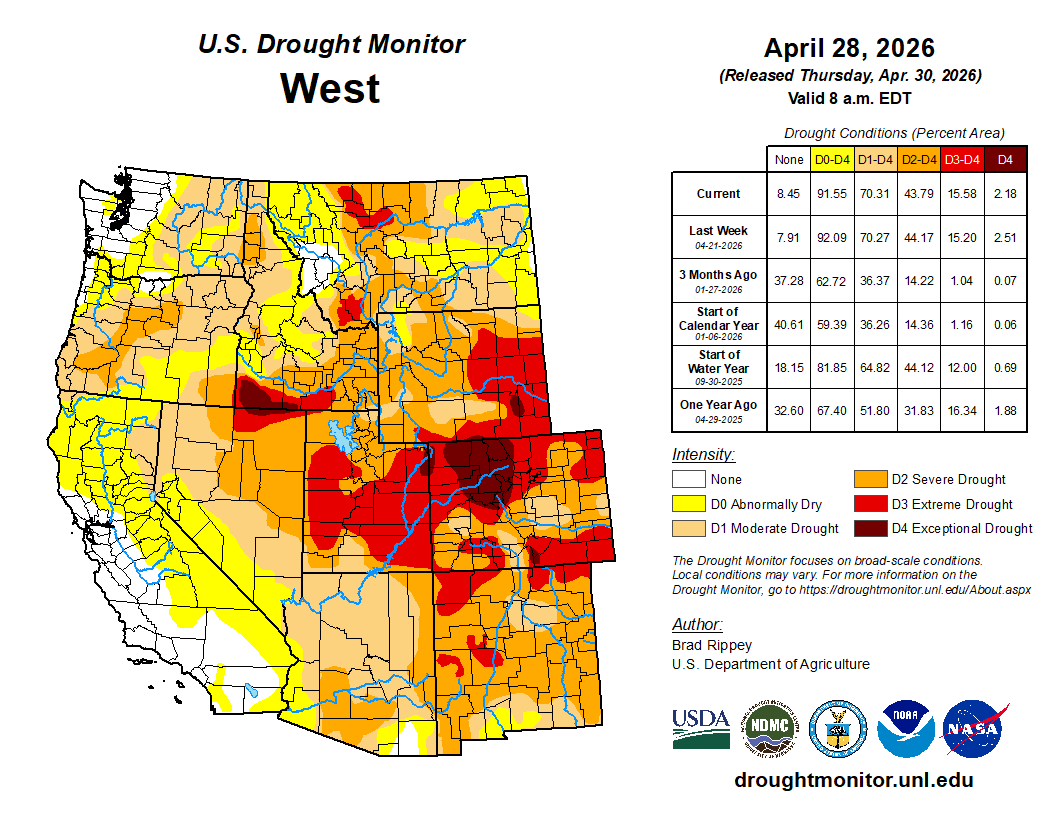
West Drought Monitor map April 28, 2026.
“We remain in a sphere of drought here in Summit County, throughout the state and the greater Western U.S.,” Cahill told council members at a meeting Tuesday, April 29. “The historically low snowpack has already directly impacted streamflow in the Blue River, and this subsequently affects the town’s ability to supply treated water to our customers.”
Until this week, Breckenridge allowed outdoor watering three days per week. The new temporary restrictions reduce that to two days in hopes of cutting outdoor water usage by roughly 30%. The town largely sources its drinking water from snowmelt (and other high-altitude surface water) collected in the Blue River Basin…The new restrictions exempt any newly installed landscaping, along with hand watering and drip irrigation for flowers and plants. Council member Dick Carleton clarified whether downtown businesses could continue watering flower baskets and using microsprayers.
…as the city gears up for an unprecedentedly dry summer, it will begin ramping up enforcement on water users who violate the stage 2 water restrictions. That will include issuing formal notices of violation and collecting fines for repeat violations.
“We are taking this year more seriously, given that it’s conditions we haven’t quite seen before,” Loughlin Molliconi said. “We want to make sure we can prioritize the most important uses of municipal water without having to degrade any environmental protections or streamflow.”
The city water department has issued 11 formal notices of water use violations in 2026, Loughlin Molliconi said. One notice was issued last week. Ten were issued on Wednesday. They were all first-time violations, which don’t come with fines…Aspen City Council declared a stage 2 water shortage last August after declaring a stage 1 water shortage in June. The declaration came after a lackluster monsoon season, and has remained in place because of unusually high winter temperatures that impacted snowfall accumulations and the snow water equivalent in the Roaring Fork watershed. Stage 2 water restrictions are mandatory. Watering of any lawn, garden, landscaped area, tree, shrub or other plant is prohibited from 9 a.m. to 6 p.m. Household watering schedules are also mandatory.