Why scientists still use a milk scale and antique aluminum tubes to track Colorado’s record-low #snowpack — #Colorado Public Radio #runoff

Denver Water crews use a special tube [Federal Sampler] to gather snow samples near Winter Park as part of pre-set snow courses. ASO uses these ground measurements to supplement data collected from the planes to determine how much water is in a watershed. Photo credit: Denver Water.

Click the link to read the article on the Colorado Public Radio website (Sam Brasch). Here’s an excerpt:

The old-school art of snow tracking

Metal signs mark the survey site in a patch of forest above the cabin. Once the team arrived, Mike Ardison, a hydrologic technician for the Colorado Snow Survey, unloaded a green trundle off his back, then unwrapped it to reveal sections of a hollow, aluminum tube. It extends to roughly eight feet long once he fits the pieces together…To measure the snow levels, Domonkos and Ardison work their way along the snow course, dropping the tube at a series of set points along the path. A column of snow captured inside reveals the height, then the pair hang the tube from a spring-powered milk scale to clock the weight. Digital scales might be more accurate, but Ardison said their batteries wouldn’t last long in normal winter temperatures…

Crouched over a notebook, [Brian] Domonkos punched a calculator to arrive at a figure for the site. He let out a sigh when he arrived at the final number: 2.2 inches of snow-water equivalent, less than half the previous record low measured on the same date in 1977…Other measurements taken at snow courses around April 1 were just as alarming. Out of the 64 sites in Colorado with at least 50 years of data, 60 reported either record-low snow levels or tied the lowest on record…Those results confirm 2026 as the worst year for Colorado snowpack in recorded history, said Russ Schumacher, a professor of atmospheric science at Colorado State University and Colorado’s state climatologist. A lack of historical precedent means it’s harder to fully predict the impact of such low water levels. Schumacher, however, expects reservoir levels to rapidly decline in the summer and fall. Fire risk is harder to predict, but he said major wildfires usually appear in years when the snowpack is lower and melts early. 

“We’re maybe in one of these liminal spaces where you can see what’s coming, but it’s not here yet,” Schumacher said. “And, yeah, that’s a challenging situation.” 

#Colorado Basin River Forecast Center: Water Supply Discussion April 1, 2026

Click the link to read the discussion on the USBR website:

The Colorado Basin River Forecast Center (CBRFC) geographic forecast area includes the Upper Colorado River Basin (UCRB), Lower Colorado River Basin (LCRB), and Eastern Great Basin (GB).

Water Supply Forecasts

April 1 water supply forecasts are well below normal and summarized in the figure and table below. Snowpack and soil moisture are the primary hydrologic conditions that impact the water supply outlook, while future weather is the primary source of forecast uncertainty.

Water Year Weather

The 2025–26 meteorological winter (December–Februrary) was the warmest winter on record for vast swaths of the CBRFC area. In March, an extraordinarily anomalous high pressure system — of a strength that is more typical of July — impacted the Southwest. This ridge brought summertime temperatures at a time when most mountainous areas are usually still building a snowpack.

Across the region in mid-to-late March, temperature records were smashed for several days on end. In Flagstaff, AZ, 11 days reached or surpassed the previous March high temperature record of 73°. Shockingly, on two days the mercury climbed to 83° and 84° , significantly surpassing the April high temperature record of 80° . At 8,710 feet above sea level in Alta, UT, where March high temperatures average in the 30s, temperatures reached at least 60° on eight days. Nine days of at least 100° were observed in Phoenix, AZ, including the earliest 100° day on record. The depth and duration of this heat wave was unprecedented in the period of record. It will likely go down as one of the most extreme weather events to ever impact the CBRFC area.

The same ridge of high pressure that brought searing temperatures to the low elevations and snowmelt across high elevations also resulted in very dry air and no precipitation. Numerous SNOTEL sites across the CBRFC area observed their driest March on record.

The water year as a whole tells a different story. In October, several rounds of heavy rain tied to decaying tropical storms brought record flooding to portions of AZ, southern UT, and southwest CO — making it one of the wettest Octobers on record. Water year-to-date (October–March) precipitation is highly variable, ranging from well below normal across much of Colorado and Utah’s mountains, to near/above normal in the Upper Green River Basin and portions of the LCRB. The figures and table below summarize March temperatures and water year 2026 precipitation.

Snowpack Conditions

Snow water equivalent (SWE) has been tracking at or near record low much of the season. An extremely dry March and significant snowmelt during the last half of the month led to historically low April 1 snow water equivalent conditions across the region. An NRCS-Utah Snow Survey Special Report states that “at no time since systematic snowpack measurements began around 1930 has April 1 snowpack been this low in the state of Utah, and 2026 SWE is roughly five times lower than the previous record low”. A similar analysis performed by the Colorado Climate Center concluded that “this has been the worst year for Colorado snowpack in recorded history, and most locations have less than half of the previous record low”.

UCRB and GB April 1 snow covered area is 25-30% of the 2001-2025 median, which is also the lowest on record for early April dating back to 2001. 1 April 1 CBRFC model SWE conditions are generally less than 30% of normal across the UCRB and GB. SWE conditions are summarized in the figure and table below.

Soil Moisture

CBRFC hydrologic model soil moisture conditions impact water supply forecasts. Basins with above average soil moisture conditions can be expected to experience more efficient runoff from rainfall or snowmelt while basins with below average soil moisture conditions can be expected to have lower runoff efficiency until soil moisture deficits are fulfilled. The timing and magnitude of spring runoff is impacted by snowpack conditions, spring weather, and soil moisture conditions.

Mid-November 2025 soil moisture conditions were below normal across most areas as a result of warmer and drier than normal weather during the 2025 water year. Higher elevation soil moisture/baseflow conditions typically don’t change much during winter months as snow is accumulating. However, this has not been the case this winter. Model soil moisture conditions as a percent of average have improved across most basins as a result of snowmelt and precipitation falling as rain instead of snow. CBRFC hydrologic model soil moisture conditions are shown in the figures below.

Upcoming Weather

Mild and unsettled weather is expected over the CBRFC area into the middle of April, with a few chances for rain showers and very high elevation snowfall. Above average temperatures will dominate the period. The 7-day precipitation forecast and the Climate Prediction Center (CPC) 8–14 day temperature and precipitation outlooks are shown in the figures below.

Climate Prediction Center precipitation and temperature probability forecasts for April 14–20, 2026.

A Drying #ColoradoRiver Threatens Imperial Valley’s Future: Declining flows and the warming climate imperil farms, green energy projects and the economy of one of #California’s poorest counties — Capitol & Main #COriver #aridification

The All American Canal, the largest diversion on the Colorado River, passes through Winterhaven, CA on its way to the Imperial Valley. The Colorado River is seen flowing next to it.

April 2, 2026

In the southeast corner of California, 300-foot-tall sand dunes rise from a sunbaked landscape dotted with ocotillo and creosote bushes. Summer temperatures here regularly exceed 110 degrees, and annual rainfall is comparable to that of the Sahara Desert. Despite its unforgiving terrain, more than 180,000 residents live in Imperial County, one of the country’s most productive agricultural regions and more recently a magnet for data center development and lithium extraction proposals. This has all been made possible by turn-of-the-20th century canals that carve up the region, supplying it with more than a million gallons of Colorado River water every minute. 

“We’ve often called it the lifeblood of Imperial Valley,” said Robert Schettler, a spokesperson for Imperial Irrigation District, the area’s public utility, which manages the region’s over 3,000 miles of drains and canals. “If something were to happen to that river, we would all have to pack up and leave.”

Something is happening to the Colorado River. Over the past century, its average water supply has fallen by nearly a third due to prolonged drought and climate change. Experts predict that decline will continue, threatening cities, tribes and farms that depend on the river’s flow, from Wyoming, Utah, Colorado and New Mexico to Arizona, Nevada and Northern Mexico.  Most of the Colorado River’s water starts as snowpack in the Rocky Mountains, but after the American West experienced the warmest winter ever recorded, snow levels are now at historic lows, prompting experts to warn that 2026 may be one of the river’s driest years yet. 

That could spell disaster for Imperial County, whose harsh desert landscape of windblown sand and rugged burnt-orange mountains was transformed more than a century ago into productive, gridded farmland dotted with small cities such as Brawley, El Centro and Calexico…Imperial Valley’s agricultural industry consumes by far the largest share of water in the region, about 97% of the 3.1 million acre-feet managed by the Imperial Irrigation District every year…Those ambitious and largely successful conservation efforts have come at a cost. Much of the water used by farmers historically flowed into the nearby Salton Sea, but as farmers have reduced their water use, less runoff has reached the man-made lake, accelerating an existing environmental crisis Over the last three decades, the Salton Sea has shrunk by more than 60 square miles, exposing a dry lakebed laden with pesticides, particulate matter and heavy metals. Those contaminants are carried as dust through the air into nearby communities, contributing to a childhood asthma rate triple that of the national average. Now, farmers such as Brian Strahm, whose family has been growing crops in the area for four generations, are concerned they may have to decrease their water use further. That may prove difficult since farmers have already put in place many efficiency measures, Strahm said…Farmers say cuts could seriously harm the area’s already struggling economy. In addition to being the county with the highest percentage of Latinos in California, Imperial has among the highest unemployment rates of any county in the country, at nearly 19%. For those who do find work, the agricultural industry offers a lifeline, accounting for one out of every six jobs in the region. 

Map of the Colorado River drainage basin, created using USGS data. By Shannon1 Creative Commons Attribution-Share Alike 4.0

Can data center developers help Xcel Energy drive down emissions? — Allen Best (BigPivots.com)

Photo credit: Allen Best/Big Pivots

Click the link to read the article on the Big Pivots website (Allen Best):

April 2, 2026

Utility depicts proposed large-load tariff as a way of teaming with developers to bring on innovation

Xcel Energy today filed a proposal with the Colorado Public Utilities Commission to create a large-load tariff applicable to developers of data centers that expect to need 50 megawatts of electricity or more.

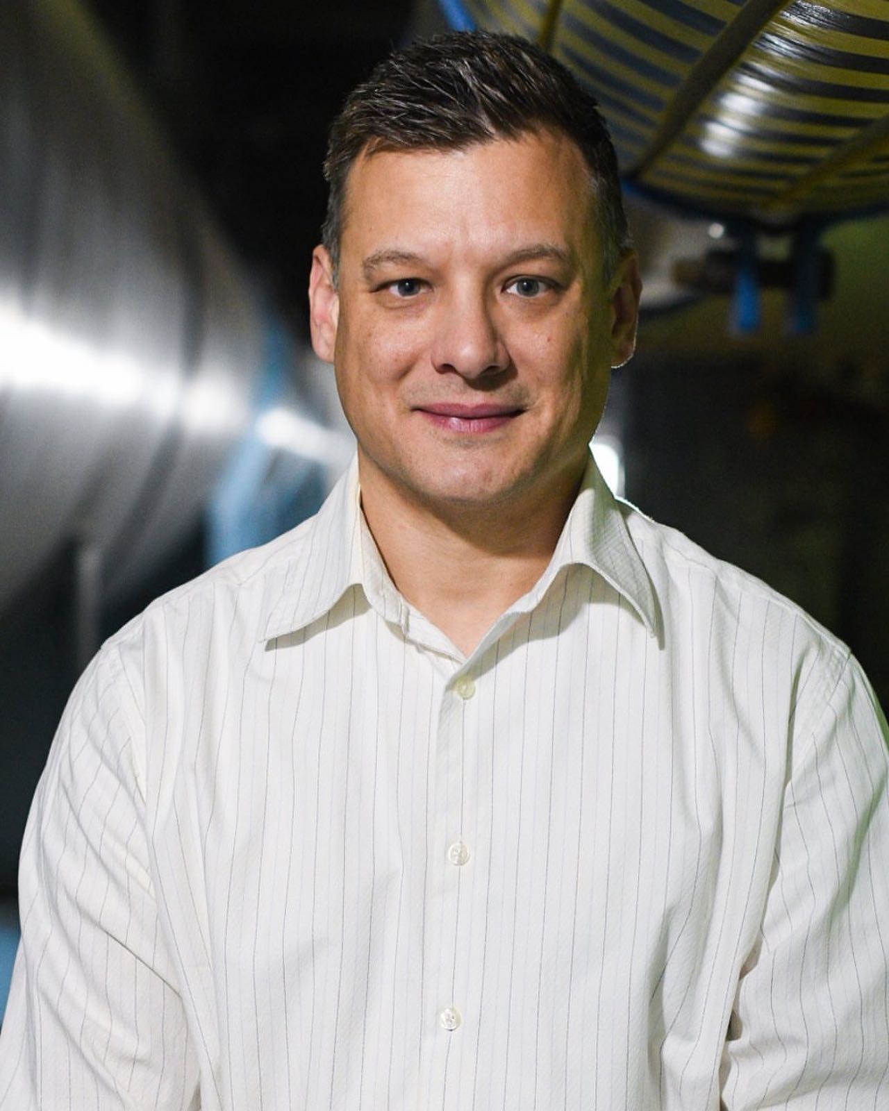
Xcel’s Jack Ihle, the company’s vice president for data centers and large loads, said the company believes it can meet its legal obligation to both reduce emissions 80% by 2030 and meet the needs of data center developers.

In the last 18 months, Xcel has expressed growing worries about whether it would have the electricity it needs to meet rising demands. This worry was expressed even before its newest and large coal-burning unit, Comanche 3, went down last August. That unit is now expected to return to service in August. Xcel in March suggested it may want to delay retirement of its two coal-burning units at Hayden until 2030. They are currently scheduled to be retired in 2027 and 2028.

Ihle said the company’s resource adequacy concerns pertain mostly to the near term. Longer term, when the tariff for large-load customers would have effect, the company believes it’s in good shape owing to actions already underway. For example, the PUC authorized a rushed near-term solicitation in September 2025 that allowed the company to take advantage of tax credits for clean energy that will expire because of the One Big Beautiful Bill Act passed by Congress last July.

See: “Elephant-sized plans for eastern Colorado,” Dec.8, 2025, Big Pivots.

Data center developers could be part of the solution, said Ihle. Xcel sees the data centers as potential partners in developing next-generation energy and storage technologies.

“We may able to partner with large-load customer hyperscalers, who have the risk appetite, and to explore some of the (possibilities) we have not been able to” as a company.

Most prominent of these next-generation technologies is enhanced geothermal. Gov. Jared Polis in 2024 said he believed that by 2040 Colorado may get 4 to 8% of its electricity from geothermal. Unlike geothermal for buildings, which rely upon heat found in the ground relatively close to the surface, enhanced geothermal involves heat thousands of feet underground.

One company has been exploring whether deep oil wells near Pierce, north of Greeley, could be adapted. Another company has plans near Durango.

More definitive is work underway by Fervo Energy in central-Utah. There, near Milford, it is developing a 400- to 500-megawatt enhanced geothermal system. Two weeks ago, Fervo announced $421 million in financing for the project.

Does Colorado have the same quality geothermal resources lying underfoot? Probably not. The larger question may be whether the technology can develop rapidly enough to be of value in Colorado in the next 15 years.

Ihle also cited the 100-hour storage pilot project using iron-air technology planned at Pueblo. It is, he said, the sort of innovative technology that could be pursued with data centers as partners.

In some places, data centers have started creating their own electrical generation. The concept is called behind the meter, and it’s not necessarily new. Hospitals famously have backup resources.

Ihle said developers of hyperscale data centers — often defined as being 50 megawatts or more — have told him that they would much rather deal with a utility than develop their own resources. In Colorado, for example, building a natural gas plant to provide power for a data center will still require getting permits from the state’s Air Pollution Control Division.

In Minnesota, home base for Xcel, the utility has an agreement with Google that illustrates what it hopes will happen in Colorado.

There, Google plans a data center that will support services that include Workspace, Search, YouTube and Maps. Xcel promises to deliver 1,400 megawatts of wind, 200 megawatts of solar and 300 megawatts of long-duration (100-hour) energy storage. In addition, Google’s agreement with Xcel will yield a $50 million investment toward an Xcel program that is intended to drive reliability on the grid.

Under the agreement, Google will also pay all costs for its new service in line with its typical practices and Minnesota’s regulatory and legislative requirement.

“That is the kind of thing we want in Colorado,” said Ihle.

Xcel stressed that this proposal would not hurt other customers financially. Large-load customers would pay for the power infrastructure needed to serve them. This includes covering electric transmission, substations and interconnection upgrades as well as paying for new electric generation.

The data center developer would need to make a long-term contractual commitment, typically 15 years or more. And what if the customer exits early? Termination charges will recover remaining costs of project-specific upgrades built, avoiding stranded costs for other customers.

In the filing this afternoon, Ihle said this: “Taken together, the Company’s proposal ensures that large load customers bear the costs they impose, protects existing customers from adverse impacts, and creates a structured pathway for responsible growth.

Xcel also stresses the economic potential for data centers in generating tax revenue for schools and other public needs. Xcel says data centers can, depending upon size and location, pay $2 million to $16 million in property taxes.

At a forum in Boulder on Wednesday morning, Lon Huber, senior vice president and chief planning officer for Xcel, described Xcel’s partnership with Google in Minnesota.

“Once you get to like 70 to 80% (emissions-free electricity), it’s really hard to squeeze the last remaining bit out,” said Huber. “So we need new tech. That’s where the partnership comes in.”

Will Toor, director of the Colorado Energy Office, spoke on the same panel.

“There’s a lot of potential benefits that to the extent that we can serve strategically located data centers in places where we don’t need, for instance, significant new transmission investments, where we can make use of curtailed renewables, where we can make use of infrastructure in energy transition communities,” he said.

This depends, he added, upon getting the rate structures right, so that data centers are paying for their incremental costs but are also helping to cover the fixed costs that we have on the system.

If that can be done, he said, it can be good for all ratepayers.

Chaco protections in the crosshairs; Chaco comment period ends April 7; USFS Headquarters to Salt Lake City — Jonathan P. Thompson (LandDesk.org)

Rubble and a cone-shaped butte at Pierre’s Site, a Chacoan great house about ten miles north of Chaco Culture National Historical Park. The area around the site would be re-opened to new oil and gas leases under the Trump administration’s proposal to revoke a Biden-era “buffer zone” around the park. Jonathan P. Thompson photo.

Click the link to read the article on The Land Desk website (Jonathan P. Thompson):

April 3, 2026

The News: The Trump administration is formally proposing to revoke the Biden-era ban on new oil and gas leases within the 10-mile buffer zone around Chaco Culture National Historical Park in northwestern New Mexico. The Bureau of Land Management is accepting public comments for just seven days, with the input period ending April 7.

The Context: When President Theodore Roosevelt wielded the brand new Antiquities Act in 1907 to create Chaco Canyon National Monument, he drew the boundaries around what is now known as “downtown Chaco,” a handful of structures including the 800-room Pueblo Bonito, constructed between the 9th and 12th centuries by ancestors of today’s Pueblo people.

That was merely the center of the Chacoan world, however, which extended over 100 miles outward into the Four Corners region. No one knows if this was a political empire, a religious or cultural society, or a school of architecture, but it is clear that the dozens of Chacoan outliers or “great houses,” along with thousands of smaller sites, shrines, and architectural features with unknown function, did not exist in isolation. They were part of a cultural tapestry woven into the natural landscape. The national monument, in other words, was vastly incomplete, which is especially concerning given that it lies in would become one of the nation’s most heavily drilled oil and gas fields.

Wall at Twin Angels Great House, a Chacoan outlier along the Great North Road with an oil and gas well pad and tanks visible in the background. This site is well outside the 10-mile Chaco buffer zone. Jonathan P. Thompson photo.

That’s not to say that Chacoan sites are devoid of protections. The park itself is off-limits to all oil and gas development. Pierre’s Site and several other outliers are part of the Chaco Culture Archaeological Protection Sites Program, and all sites on federal land are shielded by the Archaeological Resources Protection Act and Section 106 of the National Historic Preservation Act, which requires oil companies to conduct a cultural inventory of all land in the path of development. If the surveyors happen upon a “significant” site, the well pad or road or pipeline must be relocated, if possible, at least 50 to 100 feet away, a process known as “identify and avoid.” Tribes are supposed to be consulted in these cases, as well, though their concerns aren’t always considered.

But “identify and avoid” misses a great deal. 

“Even though agencies try to mitigate the impact, it isn’t enough because you’ve literally destroyed the context in which those things exist,” Theresa Pasqual told me several years ago when I was writing about Indigenous resistance to drilling around Chaco. She is the former director of Acoma Pueblo’s Historic Preservation Office, and a descendant of the Pueblo people who occupied the Four Corners region for thousands of years. “Most of our pueblos are still transmitting their migration history through oral means. So when you have development that begins to impact many of these sites — that range in size from the grandeur of Chaco Canyon or Mesa Verde to very small unknown sites that still remain un-surveyed and unknown to the public — they are literally destroying the pages of the history book of the Pueblo people.”

Pierre’s Site, a Chacoan great house about nine miles north of the park’s boundary, illustrates this concept. The site is made up of a collection of thick-walled stone structures built among and in harmony with distinctive shale and sandstone buttes and bluffs. That “page,” or the structures and their immediate surroundings, has been kept intact by the aforementioned protections. But a cluster of well pads, along with pumpjacks, tanks, and associated infrastructure sit less than a half-mile away, and they are visible — and their whir-pop-whir sounds audible — from the site. They not only affect the way one experiences Pierre’s, but also have surely erased some of the important context.

Rubble at Pierre’s Site. Jonathan P. Thompson photo

Pierre’s lies along the Great North Road—the most prominent and visible of several such “roads” in the region—an architectural feature that stretches directly north of Chaco Canyon for 30 miles or more. It may have been a symbolic path through time, connecting old worlds with new, or a reminder of the power Chaco-central wielded over its outliers, or a giant arrow pointing people to a holy place. Chaco scholar Paul Reed calls it “a landscape monument on a large scale.” Yet little effort has been made to protect it. Oil field roads and pipelines cross it in dozens of places, and workers have bulldozed well pads right on top of it, erasing the subtle signs that it was ever there. If something so significant can get plowed under, how many more subtle features—shrines, corn fields, plant-gathering sites, ceremonial areas, flint-knapping spots—have been destroyed indelibly?

It was with the greater context in mind that in 2023, after years of consideration, public meetings, and analysis, President Joe Biden signed Public Lands Order 7923, which withdrew about 336,000 acres of public land from oil and gas leasing for 20 years. Tribal nations with ties to the cultural landscape, environmental advocates, and archaeologists had sought the withdrawal to provide a buffer zone around the national historical park and to add a layer of protection to the associated sites within 10 miles of the park’s boundaries.

Map of the 10-mile buffer zone. Source: All Pueblo Council of Governors.

The withdrawal was incomplete, in that it still covered only a tiny slice of the greater Chaco landscape. Several significant outliers, along with about 20 miles of the Great North Road, remained unprotected. Chaco is also in the middle of what’s known as the Checkerboard, a hodgepodge of land ownership and jurisdictions, which complicates the withdrawal, since it only applies to BLM land. The Checkerboard lies within the Navajo Nation’s borders, but it is not reservation land, and it includes Bureau of Land Management land, state lands, private lands, and Indian allotments, which exist in a sort of limbo between private, tribal, and federal land.

The Navajo Nation initially supported the withdrawal, but when tribal leadership changed, so did its stance. In response to pressure from allotment owners within the buffer zone, who worried that their royalties from drilling would be threatened, the Buu Nygren administration turned against the buffer. While leasing is still allowed on those allotments within the withdrawal area, an oil and gas company is less likely to drill there because they can’t “pool” the allotment resources with those of neighboring federal parcels.

Pumpjack and Haystack Mountain as seen from the “Acropolis” at Pierre’s Site, with “Downtown Chaco” in between (but out of view since it’s in a canyon). This view looks directly south down the Great North Road, which is aligned with the meridian stretching from Haystack Mountain to Mount Wilson in the San Juan Mountains in Colorado. Jonathan P. Thompson photo.

Project 2025, the right wing’s playbook for the Trump administration, directly called for the Chaco buffer zone’s elimination, and Interior Secretary Doug Burgum has been toying with the idea for the last year. Finally, on the last day of March, the administration opened a one-week public comment period, on the proposal to either revoke the buffer zone altogether, or to reduce it to a five-mile radius around the park, which would leave out Pierre’s and other significant sites.

The All Pueblo Council of Governors, Indigenous and environmental advocates, archaeology groups, and New Mexico’s congressional delegation all pushed back on the Trump administration’s move and called for the current buffer zone to be retained.

To give your two cents on the proposal, go to the BLM’s project page. [ed. emphasis mine]

***

The Trump administration announced it will move the U.S. Forest Service headquarters from Washington, D.C., to Salt Lake City as part of a “sweeping restructuring of the agency to move leadership closer to the forests and communities it serves.” The shake-up includes:

  • Moving about 260 employees from Washington HQ to Salt Lake City, and shuffling around another 2,600 staffers;
  • Eliminating its region-based organizing structure and shifting it to one centered around 15 state-level offices. This will include shuttering regional offices, some of which will be retained for other purposes;
  • Closing 57 research and development stations, while retaining 20, eight of which are in Western states;
  • As for firefighting, a Forest Service press release noted:

Administration officials say the overhaul is aimed at making the agency, which is a branch of the U.S. Agriculture Department, more nimble and efficient. Yet it has not provided an analysis of how such a vast restructuring would accomplish those goals, or how much money it would save. It comes about a year after the so-called “Department of Government Efficiency,” or DOGE, fired about 3,400 Forest Service employees, or more than 10% of the agency’s total workforce. 

It’s all part of a larger departmental overhaul designed to “bring the USDA closer to its customers,” according to a USDA memorandum from last year. Customers? Do they mean the extractive industries? The American people? Or what? Either way, it seems like strange terminology for a government agency to be using. 

In reality, as Christine Peterson reports in High Country News, the overhaul is doing little except sowing confusion and concern among agency staffers and observers.

These maps show where the new state offices will be after the reorganization is complete. Source: USDA.
Which research facilities will survive the overhaul (below). Source: USDA.

As I’ve written here before, I don’t see moving public land agencies out of Washington to be an unmitigated disaster in and of itself. And contrary to some takes, it won’t automatically lead to wholesale clearcutting of the West’s forests. Forest Service and BLM higher-ups don’t need to be close to Capitol Hill or the White House to do their jobs, especially in the Zoom age. And it wouldn’t hurt to get the Forest Service Chief or the BLM Director out on the landscapes they oversee a bit more often, where perhaps they can see the consequences of projects or policies they may sign off on. Utah may be a questionable location, given the state’s leaders hostility toward public land management, but Salt Lake City is a fairly progressive place, and the likes of Sen. Mike Lee will have just as much access to agency leaders in D.C. as they would in SLC.

That said, if such a move is not done correctly, it can be disastrous. Take Trump’s first-term relocation of the Bureau of Land Management’s headquarters to Grand Junction, Colorado, in 2019. That led to a de facto agency housecleaning; many senior staffers chose to resign or move to other agencies rather than uproot their lives and families and move across the country, and only a handful of workers ended up in the Colorado office, which shared a building with oil and gas companies. A vast storehouse of institutional knowledge and expertise was lost, and virtually nothing was accomplished.

We’re likely to see the same sort of dynamic playing out with this move, even though SLC is larger, more cosmopolitan, and has a bigger airport than GJC. Plus, the USFS overhaul is far more than a mere HQ move. Shuttering nearly 60 research and development facilities, many of which are tied to universities or colleges, will have a major impact, even if their functions and staff are moved elsewhere. Ditto with the regional-to-state office shuffle (the point of which is what, exactly?).

And, this is all happening as the administration makes a push to return the Forest Service to its timber plantation era, which ran from the 1950s through the ’80s. During that time, logging companies harvested 10 billion to 12 billion board-feet per year from federal forests, while for the last 25 years, the annual number has hovered below 3 billion board-feet. Now, Trump, via his Immediate Expansion of American Timber Production order, plans to crank up the annual cut to 4 billion board-feet by 2028. How? By declaring an “emergency” that allows the agency and logging companies to bypass environmental laws. Never mind that the infrastructure and demand don’t necessarily exist to carry out this plan.

Rollins issued a memo last year declaring that the threat of wildfires, insects and disease, invasive species, overgrown forests, the growing number of homes in the wildland-urban interface, and more than a century of rigorous fire suppression have contributed to what is now “a full-blown wildfire and forest health crisis.” And she expanded the “emergency situation” acreage from 67 million acres under Biden, to almost 113 million acres, or 59% of all Forest Service lands, opening it up to streamlined forest “management,” aka timber operations.


🥵 Aridification Watch 🐫

I’m calling it: The Dolores River in Dolores reached peak spring runoff of 1,090 cubic feet per second on March 26. If this holds (and, yes, there is a chance that April showers will bring big May flows), then it will be the earliest peak on record by far. This is more an indication of how intense and unusual the end-of-March heat wave was than of how scant the snowpack was. It was the fourth lowest peak flow on record, behind 2002, 1977, and 2018.

The good news: The April 1 storm gave the snowpack a big boost. The bad news: In most places the snow water equivalent remains below that of the same date in 2002, which had been the worst snow year on record. The same pattern is evident in other San Juan Mountain river basins, but the picture looks a little better at higher elevation SNOTEL stations. Source: USDA NRCS.

Silverton, Colorado’s weather watcher Fred Canfield reports on a welcome burst of moisture at the high country burg in early April, writing:


Parting Cheeseburger Query

Four years ago, I asked you kind readers (or at least the ones that were around back then), for your recommendations on the best independent bookstores and green chile cheeseburgers in the West so I could add them to the Land Desk Green Chile Atlas. I know, it’s kind of weird to combine the two, and I apologize to all vegan booksellers that this pairing may offend (but I will add that vegan burgers are included, too). 

Now I figured I’d come back and not only remind you that the Atlas exists, but also ask for updates, new book or green chile-related finds. So fire away!

#Snowpack news April 6, 2026 #runoff

Westwide SNOTEL basin-filled map April 5, 2026.
Colorado SNOTEL basin-filled map April 5, 2026.

#Colorado Must Adapt Its Water Rules for a Hotter, Drier Future — David Leach #ColoradoRiver #COriver #aridification

Colorado River “Beginnings”. Photo: Brent Gardner-Smith/Aspen Journalism

April 5, 2026

by David Leach

Coloradans often hear that the Colorado River crisis is happening somewhere else. Headlines focus on Lake Mead, Lake Powell, and the Lower Basin, while Colorado is portrayed as a responsible headwaters state doing its part. Yet that narrative misses a deeper truth. The Colorado River crisis is not only about drought or downstream shortages. It is also about how the river is managed. In that sense, Colorado shares responsibility with every basin state.

Colorado’s water system is built on ‘prior appropriation’. The rule is simple: “first in time, first in right.” The earliest water users receive priority when supplies run low. This framework helped farmers, cities, and industries expand across the West during the nineteenth and twentieth centuries, creating stability in a region where water determines survival.

However, the system was designed for a different climate and a by-gone West. It also encouraged states and water users to claim more water than the river could supply, contributing to the overallocation of the Colorado River. Legal analyses of the Law of the River show that the basin was effectively overburdened by water claims decades before climate change began reducing flows.

Today, climate change is altering the river itself. Scientists estimate that warming temperatures have already reduced Colorado River flows by roughly 20 percent. Federal water managers warn that declines could continue as temperatures rise. In a river system that is already legally overcommitted, treating water rights as fixed privileges can deepen instability rather than prevent it.

Colorado sits at the center of this challenge. As the largest contributor of water in the Upper Basin, the state must balance many competing demands. Front Range cities continue to grow. Western Slope agriculture depends on reliable irrigation. Rivers and aquatic ecosystems are under stress. Yet much of Colorado’s water policy still assumes shortages are temporary and that legal priority alone will determine who receives water. That mindset often encourages defensive politics rather than shared problem-solving.

Conflicts between upstream and downstream states are often described as unavoidable. In reality, much of the tension stems from the priorities of management. Upper Basin states emphasize uncertainty about future river flows, while Lower Basin states focus on delivery obligations and infrastructure investments, according to recent reports on Colorado River governance. Each group is acting logically within the current system. The problem is that the system frequently rewards delay and legal conflict rather than cooperation, as researchers studying collaborative governance in the basin have found.

Colorado has an opportunity to change that pattern. One promising approach is collaborative adaptive management. This framework begins with a simple idea: uncertainty is normal in complex systems. Instead of assuming managers already know the right solution, adaptive management relies on monitoring conditions, learning from outcomes, and adjusting policies over time. With collaboration of states, tribes, farmers, cities, and environmental groups conflict can be reduced and management decisions can improve.

Some elements of this approach already exist in Colorado, including experimental reservoir operations and voluntary conservation programs. However, research on collaborative drought science planning in the Colorado River Basin shows that these efforts remain limited and politically fragile.

Equity must also be part of Colorado’s leadership. For decades, Tribal nations and many rural communities have carried the environmental costs of water development while urban growth captured much of the benefit, a pattern highlighted in research on environmental justice and Indigenous governance. Tribal nations, many of which hold some of the most senior water rights in the basin, remain underrepresented in major water decisions. Adaptive governance recognizes that whose knowledge it is that counts, matters. Incorporating Indigenous knowledge, local experience, and community-based monitoring can strengthen decisions and build trust in governance. Research shows that when affected communities help shape policies, those policies are more likely to be trusted, followed, and sustained over time.

Importantly, collaborative management does not mean abandoning Colorado water law or taking away private rights. Instead, it means updating water governance so users can share risk and adapt together as conditions change. The alternative – waiting for wetter years or relying on courts to resolve disputes – ignores both climate science and political reality. Climate projections from the Intergovernmental Panel on Climate Change indicate that the American Southwest will likely remain hotter and drier for decades. Planning for a return to twentieth-century river flows is increasingly unrealistic.

Critics argue that collaboration takes too long when the crisis is already severe. Colorado has already tried temporary agreements, emergency negotiations, and federal pressure. Those approaches have not produced lasting solutions. Short-term deals may stabilize reservoirs for a season, but they do little to address the deeper management problems driving the crisis. Without stronger cooperation, the basin risks repeating the same cycle of shortage and conflict.

Colorado has long prided itself on practical problem-solving and environmental leadership. The state now has an opportunity to apply those values to its most important river. Policymakers should strengthen collaborative water governance, ensure meaningful Tribal participation, and support conservation policies that reward flexibility rather than litigation.

Coloradans also have a role to play. Public participation in basin planning, engagement with watershed organizations, and pressure on elected officials can help shift water policy toward long-term climate adaptation rather than short-term crisis response.

The Colorado River begins in our mountains. Leadership today means recognizing that rules built for a wetter past may no longer work in a hotter future – and choosing cooperation before the river forces the decision for us.


References

Anderson, Patrick J., Jeanne E. Godaire, Daniel K. Jones, William J. Andrews, Alicia A. Torregrosa, Meghan T. Bell, JoAnn M. Holloway, et al. 2025. “Collaborative Drought Science Planning in the Colorado River Basin.” U.S. Geological Survey Open-File Report 2025-1041https://doi.org/10.3133/ofr20251041.

Birnbaum, Simon. 2016. “Environmental Co-governance, Legitimacy, and the Quest for Compliance: When and Why Is Stakeholder Participation Desirable?”. Journal of Environmental Policy & Planning, 18, no. 3, 306–323.https://doi.org/10.1080/1523908X.2015.1077440

Ghaeminasab, Fateme. 2025. “The Legal Battle Over the Colorado River Compact: Revisiting Water Allocation Agreements.” Journal of Taxation and Regulatory Framework. https://lawjournals.celnet.in/index.php/jtrf/article/view/1735.

Hite, Kristen, Pervaze A. Sheikh, and Charles V. Stern. 2025. “Management of the Colorado River: Water Allocations, Drought, and the Federal Role”. Congressional Research Service Report R45546.https://www.congress.gov/crs-product/R45546

Holling, C. S. 1978. Adaptive Environmental Assessment and Management. New York: Wiley.

IPCC. 2023. AR6 Synthesis Report. Intergovernmental Panel on Climate Change.https://www.ipcc.ch/report/ar6/syr/downloads/report/IPCC_AR6_SYR_FullVolume.pdf.

Kuhn, Eric. 2024. “The Risks and Potential Impacts of a Colorado River Compact Curtailment on Colorado River In-Basin and Transmountain Water Rights Within Colorado.” Colorado Environmental Law Journal, 35.https://scholar.law.colorado.edu/celj/vol35/iss2/4.

Macdonnell, Lawrence. 2020. “Tribal Water Rights in the Colorado River Basin”. Colorado River Research Group.https://www.researchgate.net/publication/339080311_Tribal_Water_Rights_in_the_Colorado_River_Basin.

Slosson, Mary. 2024. “Force Majeure and the Law of the Colorado River: The Confluence of Climate Change, Contracts, and the Constitution.” University of Colorado Law Review, 95.https://lawreview.colorado.edu/print/volume-95/force-majeure-and-the-law-of-the-colorado-river-the-confluence-of-climate-change-contracts-and-the-constitution/.

Sullivan, Abigail, Dave D. White, and Michael Hanemann. 2019. “Designing Collaborative Governance: Insights from the Drought Contingency Planning Process for the Lower Colorado River Basin.” Environmental Science & Policy, 91: 39-49. https://doi.org/10.1016/j.envsci.2018.10.011.

Udall, Bradley and Overpeck, Jonathan. 2017. “The twenty-first century Colorado River hot drought and implications for the future”. Water Resources Research, 53, no. 3.https://agupubs.onlinelibrary.wiley.com/doi/full/10.1002/2016WR019638.

U.S. Bureau of Reclamation. 2023. Colorado River Basin Water Supply and Demand Study.https://www.fws.gov/project/colorado-river-basin-water-study.

Williams, Byron K., Robert C. Szaro, and Carl D. Shapiro. 2009. Adaptive Management Technical Guide.https://www.doi.gov/sites/doi.gov/files/migrated/ppa/upload/TechGuide.pdf.

Whyte, Kyle P. 2018. “Settler Colonialism, Ecology, and Environmental Injustice”. Ecology and Society, 23, no. 2.https://www.researchgate.net/publication/327455189_Settler_Colonialism_Ecology_and_Environmental_Injustice.


David Leach.

David is a Colorado Certified Water Professional and environmental scientist dedicated to protecting aquatic systems through rigorous data analysis, public service, and responsible resource management. He holds a bachelors degree in Biology from Western Colorado University and will graduate soon from the University of Denver with a Masters Degree in Environmental Policy and Management.

“The Situation is Dire”– Becky Mitchell, #Colorado’s Upper #ColoradoRiver Commissioner #COriver #aridification

Click the link to read the article on Ken’s Substack (Ken Neubecker):

March 27, 2026

The February 14 deadline for the seven Colorado River Basin States to come up with an agreement on future management of the river is long gone, and still no agreement in sight. The deadline for submitting comments on the Bureau of Reclamations Draft Environmental Impact Statement (DEIS) is also past. Reclamation didn’t have a “preferred alternative”, which is not normal. They were hoping the States would have an agreement so that could become the preferred alternative. So they are left with their suite of six alternatives. All six are fraught with what Reclamation calls “decision making under deep uncertainty” (DMDU, they love acronyms).

That is an understatement.

No one seems to be very happy with any single proposed alternative. Some are calling for a new DEIS, or at least a Supplemental DEIS. This would only push any deadline further down the road. Reclamation is caught between a rock and a hard place.

The only real alternatives that they can implement without full approval by the States are No Action and the Basic Coordination Alternative. Both would be disastrous. They would simply be going back to how things were done prior to the 2007 Interim Guidelines and even earlier policies, none of which reflect the needs of the Colorado River we have today.

Westwide SNOTEL basin-filled map April 4, 2026.

Adding to that is the very dry record low snowpack in the Rockies. This annual winter snowpack is the ultimate water storage reservoir for the entire basin, from Pinedale, Wyoming, to Yuma, Arizona. It is what puts water into the two great reservoirs, Lakes Powell and Mead, that the Lower Basin desert states of California, Arizona and Nevada depend on. It is the only real reservoir that the needs of the arid Upper Basin states, Colorado, Utah, New Mexico and Wyoming depend on. This year that snowpack reservoir is as low as it has ever been, even eclipsing the former record year of 2002 when all this mega-drought started. The recent heat dome setting up over the Four Corners area is melting and sublimating what little snowpack there is fast.

Lakes Powell and Mead are already at very low levels, and the 1.7 maf projected inflow from spring runoff is looking smaller every day. Reclamation predicts that the water level in Lake Powell will drop to a point where no hydropower can be generated, power pool, by as soon as late July or at least in December. That, in effect, could be dead pool, with very limited releases from the lower “river outlet” tunnels. In effect, the flows from Lake Powell will become run of the river, what comes in is what goes out. No more storage for expected water deliveries downstream except what they might risk in lowering Lake Mead even more.

Needless to say this has sparked a war of words between the Upper and Lower Basins, with the Lower Basin being particularly vitriolic. As the February 14 deadline passed, JB Hamby of California declared “The 1922 Colorado River Compact requires the Upper Basin to deliver an average of 8.25 million acre-feet (maf) annually to the Lower Basin and Mexico. That delivery obligation is fixed in law, even if the river produces less water.” Arizona has gone even further, declaring in TV ads that the water delivery is not only an obligation, but a “guarantee” for delivery.

Huh??? Fixed in law and a guarantee? The reality of the river disagrees. The requirements of the Compact are, yes, written in law. On paper. It is “paper water”, not real, or “wet” water. Colorado’s commissioner Becky Mitchell was more to the point, if less vitriolic, “We are being asked to solve a problem we didn’t create, with water we do not have.” At least someone understands the reality of the situation.

John Wesley Powell, the hero of the Colorado River was invited as the honored guest and keynote speaker at the second International Irrigation Congress, held in Los Angeles in 1893. He was held in high regard by the many boosters, speculators and people hoping to cash in with irrigated farms all across the Colorado River basin. After listening to what they were saying, Powell pocketed his prepared remarks and said,

“When all the rivers are used, when all the creeks in the ravines, when all the brooks, when all the springs are used, when all the canyon waters are taken up, when all the artesian waters are taken up, when all the wells are sunk or dug that can be dug in all this arid region, there is still not sufficient water to irrigate all this arid region.”

The delegates didn’t want to hear that. As they booed him off the stage he added,

“I tell you gentlemen that you are piling up a heritage of conflict and litigation over water rights for there is not sufficient water to supply the land.”

Powell was right, but the boosters didn’t listen. Many still aren’t listening. Agricultural dreams have faded and new dreams of housing developments and data centers are taking their place. The boosters, in both Basins, are still booing reality off the stage. Dreams continue to grow as the river continues to shrink.

I read of fears that the Upper Basin will take advantage of Lower Basin cuts by taking more themselves. Really? From where? That vast winter snowpack reservoir that is expected to “guarantee” so much water for the Lower Basin, to refill Powell and Mead, is the same shrinking reservoir that the Upper Basin depends on. Upper Basin diversions are being curtailed every year, not expanded. There isn’t enough water. The Upper Colorado River Commission’s “Amended 2016 Upper Division States Depletion Demand Schedule”, published in June 2022, was used in BOR’s modeling of Upper Basin demands, but the optimistic projections of that report have never born fruit. The report is a projection of potential future depletions from the Upper Colorado River, but they are just that, projections. And relatively modest ones at that. The report begins with a resolution of the Commission that states,

WHEREAS Depletion Demand Schedules issued by the Commission are not a prediction of future water use or depletions. The Depletion Demand Schedules are estimates that presume the continuation of the observed historically available supply and other demand drivers used for planning purposes and are useful for modeling purposes.

It is simply and estimate based on “observed historically available supply”. Observation and history have made some changes to any anticipated future depletions. The report cites 5.7 maf as the current historical use as of 2022, with potential for increased depletions up to 5.8 maf in 2020 and 6.6 maf by 2070. In reality the annual depletion has dropped to 4 maf or less. With continued aridification and dwindling snowpack Upper Basin depletions will likely stagnate, if not decline. That is just the reality.

Under Colorado law, and constitution, the right to divert water to a beneficial use “shall never be denied”. What that means, as I stated in the previous post, is that anyone can dig a ditch or throw a small pump into any stream and divert water. New applications for water rights are filed every month with the Water Courts, and their decrees will likely be granted. That is again, all on paper. The reality is they probably won’t get much if any water. When the river is flowing high in the spring it is a “free river”, meaning anyone can stick in their straw for a drink. But as soon as the first senior call is placed all that stops, and senior calls are happening earlier and earlier every year. And the local Water Commissioners, the ones who can shut down diversions, are getting busier.

The 1922 Compact has a fairly senior right on all streams and rivers in the Upper Basin. So far, the non-depletion requirement for flows averaging 75 maf over a ten year running average hasn’t been breached. Lake Powell will probably hit power pool or worse before then.

The difference between the demands, hopes, and fantasies of paper water and the hard reality of actual wet water are growing starker every winter and have been since the three giant reservoirs, Powell, Mead and the winter snowpack, have shrunk over the past 25 years. Nature doesn’t care much about paper, reports, lawyers or the dreams of boosters past and present. She always wins in the end.

And as Becky Mitchell, said, litigation won’t create any new water.

A correction/addition to my previous post about misunderstandings on the Colorado River

I need to make a correction on my previous post. The three large Upper Basin’s reservoirs, Flaming Gorge, Blue Mesa and Navajo do provide some water for Upper Basin use, especially Navajo, which provides water to the San Juan-Chama diversion to the Rio Grande basin and Albuquerque. It supplies on average 91 kaf of diverted water. It is expected that there will be no diversion this year. Navajo also provides water for Tribal use to the Navaho and Jicarilla Apachie. Downstream flows from Flaming Gorge, the largest of the three can provide smaller amounts for hay fields in Browns Park and the melons in Green River, but that’s pretty small too. Blue Mesa releases can benefit the Gunnison Tunnel diversions and Redlands downstream, but both are well senior to the Compact.

I knew better.

The main storage of the three reservoirs is still primarily as that Compact compliance savings account, and they will be called upon soon to bolster the levels of Lake Powell, where the inflow from runoff projection is dropping below 2 maf. If things keep going like this for another few weeks it will likely be lower.

Map of the Colorado River drainage basin, created using USGS data. By Shannon1 Creative Commons Attribution-Share Alike 4.0

Eco-nihilism surging among younger generations

Close-up of a young woman's face with a contemplative expression, focusing on her eyes and lips.
Image of a depressed young woman provided by Storyblocks

by Robert Marcos

The concept of eco-nihilism has emerged as a somber byproduct of the modern climate crisis, representing a shift from proactive environmentalism to a philosophy of futility. Unlike traditional environmentalism, which is rooted in the hope of preservation and restoration, eco-nihilism posits that the ecological collapse of the planet is already underway and ultimately irreversible. The growth of this movement is largely fueled by the persistent gap between scientific warnings and political action. This increase in nihilistic environmental beliefs has been driven by several factors:

The “Foregone Conclusion” mindset: Many people, especially Gen Z, view climate catastrophe as inevitable. This leads to a “who cares” or “carpe diem” attitude, where long-term dreams are abandoned in favor of living only for the moment because the future feels “canceled”.

Perceived Futility: Seeing a lack of significant action from governments and corporations can make individual efforts (like recycling or reducing carbon footprints) feel meaningless.

Betrayal Trauma: Psychologists note a sense of “moral injury” or betrayal among youth who feel that older generations and leaders have failed to protect the planet, leading them to lose trust in the world’s underlying order and meaning.

Large-scale studies highlight the depth of this existential distress –

Frightening Future: A landmark 2021 survey of 10,000 young people (ages 16–25) across 10 countries found that 75% believe the future is “frightening”:

Impact on Daily Life: Over 45% of respondents in that same study reported that their feelings about climate change negatively affect their daily functioning.

Choosing Not to Have Children: Nearly 40% of young people globally are hesitant to have children due to climate change.

“Optimism” Nihilism vs. “Doomism”

While “climate doomism” often leads to paralysis and inaction, some adopt a form of Optimistic Nihilism. They accept that the world as they know it might end, but use that realization to lower the pressure of societal expectations and focus on immediate, small-scale kindness and personal joy.

Many climate activists and psychologists warn that nihilism can be a “luxury” or a coping mechanism that leads to compliance with the status quo, whereas “therapeutic hope”—acting as if change is possible—is necessary for mental resilience and actual progress.

Hot, Dry Weather Continues in #Colorado Mountains and Plains — Northern Water #snowpack #runoff

Snowpack or lack thereof 2026. Photo credit: Northern Water

Click the link to read the release on the Northern Water website:

March 31, 2026

The record-breaking hot and dry winter and early spring has continued through March in Colorado’s mountains and plains. Snow gauges and weather stations throughout Northern Water’s collection and distribution areas have collected data showing the lack of precipitation in the region this year. 

On April 9, the Northern Water Board of Directors will use the data collected this year and more to determine the annual quota for allottees of Colorado-Big Thompson Project water. Unlike many irrigation systems, the C-BT Project is designed to provide water to supplement the native supplies available in a given year, using water collected in previous seasons. If there is a bright spot this season, it’s that C-BT Project reserves are above their average levels over the life of the project for this time of year. 

If you would like to provide comment on the quota send an email to quota@northernwater.org or offer a comment at the April 9 Board meeting. 

Colorado-Big Thompson Project map. Courtesy of Northern Water.

Clear Creek Reservoir boat ramp remains closed, camping pauses for dam improvements — Dean Miller (Colorado Parks and Wildlife)

Anglers are welcome at Clear Creek Reservoir State Wildlife Area, Chaffee County as Pueblo Water conducts improvements on the dam beginning April 6. Camping will pause as a safety precaution during maintenance activity and the boat ramp remains closed for a ramp extension project. CPW Photo/Zachary Baker

Click the link to read the release on the Colorado Parks and Wildlife website (Dean Miller):

April 3, 2026 GRANITE, Colo. – The Clear Creek Reservoir State Wildlife Area boat ramp remains closed through the 2026 season and the campground closes April 6 as dam improvements move forward. The reservoir remains open to anglers on shore and in hand-launched watercraft.Motorized boat launches are paused during the 2026 season as Pueblo Water lowers reservoir levels for work to take place. Colorado Parks and Wildlife is using the closure period to extend the boat ramp for improved low-water access and to complete campground maintenance and improvements.Heavy equipment is expected throughout the campground area, and with just one access road, the campground will close for public safety. Limited runoff and poor snowpack in the Upper Arkansas Basin also accelerated the repair timeline, prompting Pueblo Water to move forward with the project in 2026 rather than delay it. The boat ramp is anticipated to reopen for the full 2027 boating season.Hand-launched watercraft are permitted from shore but must comply with aquatic nuisance species requirements and cannot have motors of any kind. Anglers should expect changing shoreline conditions as reservoir levels drop for dam work. Mud and silt may make access difficult at times.“Clear Creek Reservoir is an important fishing destination in northern Chaffee County, and while dam improvements and low water conditions limit access this year, anglers still have opportunities to fish from shore or from hand-launched vessels,” said Zachary Baker, CPW assistant area wildlife manager. “The remaining water will continue to support the fishery and more than 20,000 tiger trout fingerlings were stocked there on Thursday.”Signs will alert visitors to the boat ramp closure and ramp access gates are locked. The Colorado Trail remains open west of the campground and a vault toilet remains open. The region offers additional boating, fishing and camping opportunities on nearby public lands.The wildlife area remains closed to non-hunting and non-fishing activities. Visitors ages 16 and older must have a valid hunting or fishing license or a State Wildlife Area pass.Pueblo Water owns Clear Creek Reservoir and the dam infrastructure, and CPW manages recreation and the campground through a lease.

###

Clear creek reservoir. Photo credit: Colorado Parks and Wildlife
Photo credit: Colorado Parks and Wildlife

The West’s unprecedented winter could fuel a summer of disaster — Tik Root (Grist.org)

Westwide SNOTEL basin-filled map April 2, 2026.

Click the link to read the article on the Grist website (Tik Root):

March 31, 2026

In Park City, Utah, skiers could find patches of grass poking through the slopes for much of the winter — a striking sign of a season that never really arrived. Now, after one of the warmest winters on record, much of the West is entering spring with snowpack at historic lows and an early heat wave that pushed temperatures into triple digits.

These woes could be straight out of a climate fiction novel. But the West’s no good, very bad winter was alarmingly real. And, experts say, a worrisome combination of low snowpack and a devastating heat wave could create a summer ripe for climate disasters. “There is no analog,” Marianne Cowherd, a climate scientist at Montana State University, said of what’s happening. “There isn’t a year in the historical record we can look to for information … This limits our ability to look to the past for insight.”

Much of that uncertainty stems from what’s happening to the region’s snowpack, a cornerstone of its water system. Snow accounts for 60 to 70 percent of the Northwest’s water supply and is especially critical to the ever-thirsty Colorado River Basin, which supplies seven states. But much of the region has experienced the warmest winter on record. That has meant a higher proportion of water arrived as rain, and the snow that did fall melted more quickly than usual. Snowpack is critically low, according to the federal Colorado River Basin Forecasting Center, which utilizes the federal government’s Snow Telemetry network of monitoring stations that go back half a century.

“The majority of them have record-low or near-record-low snowpack conditions,” said hydrologist Cody Moser at the center’s monthly briefing in early March. At that time, he said the upper Colorado River basin, which covers the watershed north of Lake Powell on the Colorado-Arizona border, had about 40 percent of normal snow cover. That has since dropped to 25 to 30 percent. 

While winter precipitation has actually been fairly average, how that water falls is important, too. Snow acts as a natural water-storage mechanism that spreads the delivery of water out over weeks or even months as it melts. This helps keep rivers and reservoirs flush for longer. Without snow, the moisture can be fleeting. “Even when we’re getting precipitation, we’re not storing it,” Cowherd said. “A lot of it actually just ends up evaporating or flowing out to the ocean, so it’s not necessarily in a place where we can still access it.” 

Cowherd will be watching the snowmelt closely. On one hand, the warmer temperatures are priming the snow to liquify more quickly than normal. But the solar angle — the sun’s maximum height — is lower now than it would be later in the spring, which could impede the melting trend. “I’m really interested to see how those balance,” she said, adding that the answer could be critical to the region’s water supply. “We don’t have the reservoir capacity behind human-built dams to hold the amount of water that we need.”

If snowpack problems weren’t enough, a mid-March heat wave also wreaked havoc in the West. A heat dome brought temperatures as much as 35 degrees above normal, according to the research group Climate Central. More than 1,500 daily records were set across 11 states. Several saw temperatures above 100 degrees Fahrenheit, and the U.S set a national March record of 112 in four cities.

An analysis by the World Weather Attribution Initiative found that this heat wave would have been “virtually impossible” without climate change. “The role of climate change is clear,” said Clair Barnes, a researcher at the Imperial College London’s Centre for Environmental Policy who was part of the team behind the report. She added that extreme temperatures this early in the year “tend to be more dangerous for people because your body is not yet acclimatized.” 

While the heat broke in many places after about a week, the impacts could last through the summer. July-like temperatures and dwindling snowpack jeopardize the West’s fragile water supply. The U.S. Bureau of Reclamation’s forecast shows that levels in Lake Powell could dip below the minimum needed to generate power as early as August, and most probably by December. Some Colorado residents are already facing the earliest restrictions on water use ever seen.

“This winter was unusually warm and did not deliver the snow we need,” Alan Salazar, CEO of Denver Water, the state’s largest water provider, said in a statement last week. The utility declared a Stage 1 emergency, which called for a 20 percent cut in usage and mandatory restrictions on outdoor watering. “This drought is also a reminder of the impacts of climate change on our water supply,” he said. 

Such conditions heighten the risk of wildfires. Excessive runoff and high heat foster early growth of vegetation that can fuel them, and unseasonably warm weather turns all that greenery to kindling. “Record heat over the previous weeks has put us into early ‘green up’ for the year,” August Isernhagen, a division chief in the Truckee Meadows Fire Protection District, told the University of Nevada, Reno. “This, coupled with many other human impacts on the landscape, has created potential for unprecedented conditions this fire season.”

If these risk trajectories pan out, the impacts could be catastrophic. Low water supplies could upend agricultural operations that feed people across the country. Wildfires could threaten lives, displace thousands, and cause billions of dollars in damage. Still, a lot could change over the next few months.

Barnes said an early heat wave doesn’t necessarily mean there will be more of them later in the year. The weather between heat events also matters, and could go in many directions. A looming El Nino climate pattern could, for example, help alleviate a potential drought. The snowpack problem could even rebound, too.

“We could have a huge snow storm tomorrow and it would be great,” Cowherd said. But based on the current weather forecasts, she cautioned, “I don’t think this is likely to happen.”


This article originally appeared in Grist at https://grist.org/climate/the-wests-unprecedented-winter-could-fuel-a-summer-of-disaster/.


Grist is a nonprofit, independent media organization dedicated to telling stories of climate solutions and a just future. Learn more at Grist.org

Governor Polis and Colorado Parks and Wildlife announce first investments from SB24-230 (Concerning support for statewide remediation services that positively impact the environment) for Wildlife and Land Protection Funds

Barr Lake State Park photo via Colorado Parks and Wildlife.

Click the link to read the release on the Colorado Parks and Wildlife website (Ally Sullivan and Travis Duncan):

April 3, 2026

Today, Governor Polis and Colorado Parks and Wildlife (CPW) announced the first round of wildlife and habitat projects funded through Senate Bill 24-230, which created new production fees on oil and gas development to mitigate the adverse impacts of oil and gas operations on wildlife and habitats.

CPW’s initial allocation of SB24-230 revenue will fund seven wildlife and habitat initiatives designed to address the impacts of habitat fragmentation, climate change and ecosystem degradation.

“Colorado is known for our iconic outdoor spaces, recreation, and wildlife viewing. Greenhouse gas emissions have a direct impact on our environment and all who call Colorado home. By investing in protecting habitats for Colorado’s wildlife, we are decreasing our carbon footprint, protecting native species, and keeping Colorado beautiful for generations to come,” said Governor Polis. 

“SB24-230 provides an important new tool to invest directly in the health of Colorado’s wildlife and habitat,” said CPW Director Laura Clellan. “These initial projects demonstrate how funding generated from oil and gas operations can help restore habitat, improve ecosystem resilience and support wildlife across the state.”

Senate Bill 24-230 established two fees on oil and gas production in Colorado. One fee is administered by the Clean Transit Enterprise, and the other by Colorado Parks and Wildlife to support wildlife and land remediation.

The legislation recognizes that oil and gas development is a significant source of greenhouse gas emissions and habitat degradation, and it directs new investments toward mitigating those impacts and strengthening wildlife and ecosystem resilience.

Under the law, the CPW Director is authorized to set production fees within statutory ranges based on quarterly oil and gas spot prices published by the Colorado Energy and Carbon Management Commission.

The initial CPW production fee was established in October 2025 and generated $5,477,765 in revenue from oil and gas production between July 1 and Sept. 30, 2025.

To put the new revenue to work immediately in order to mitigate the impacts of oil and gas operations, CPW’s Executive Management Team identified seven projects and programs for early investment during fiscal year 2026.

The first round of funding will support: 

  • Barr Lake State Park Habitat Enhancements ($1,500,000)
  • Beaver Restoration Program Implementation – Initial Phase ($1,174,111)
  • Operating Increase for Park Pollinator Gardens ($300,000)
  • Operating Increase for Wildlife Movement Coordination ($100,000)
  • Wildlife TRACKER Hosting and Maintenance ($125,000)
  • Columbian Sharp-tailed Grouse Translocation ($85,000)
  • Budget Increase for Water Acquisitions ($600,000)

Together, these projects provide remediation services, including habitat restoration, wildlife monitoring, species conservation and strategic land and water protection efforts across Colorado.

CPW will continue to work closely with industry partners, conservation organizations and local communities to ensure that funds generated through SB24-230 are invested in projects that deliver measurable remediation services that mitigate the impacts of oil and gas operations.

“As Coloradans, we all value the outdoors and the wildlife that makes our state so special. When responsible oil and natural gas production can help support these kinds of projects, protecting the wildlife and habitat we all care about, that’s a huge win for all of Colorado,” said Dan Haley, Executive Director, Coloradans for Responsible Energy Development.

“The science is clear that climate change is negatively impacting Colorado’s wildlife and the ecosystems on which they rely,” said Tarn Udall, senior attorney at Western Resource Advocates. “That’s why the state created the oil and gas production fee in 2024, requiring the industry to partially cover the cost of its emissions and impacts through habitat protection and restoration. It’s rewarding to see Colorado Parks and Wildlife put the first tranche of those dollars to good use, and the agency is just getting started.”

Additional projects funded through the program will be evaluated and announced as future revenue is collected.

American beaver, he was happily sitting back and munching on something. and munching, and munching. By Steve from washington, dc, usa – American Beaver, CC BY-SA 2.0, https://commons.wikimedia.org/w/index.php?curid=3963858

Proposed rates meant to make data centers pay own way, Xcel Energy says: Utility submits proposal to regulators for large data centers, other big users of electricity — The #Denver Post

A pronghorn hangs out among Wyoming wind turbines. Jonathan P. Thompson photo.

Click the link to read the article on The Denver Post website (Judith Kohler). Here’s an excerpt:

April 3, 2026

Xcel Energy is proposing a new rate class for data centers that the company says is intended to ensure that the energy-intensive facilities pay their way instead of passing along the costs to residential and small-business customers. Xcel filed the proposal Thursday with the Colorado Public Utilities Commission, or PUC. Under the proposal, data centers would have to sign 15-year contracts, provide financial assurance of cash or credit and pay substantial exit fees if they shut down early. Potential large customers would have to sign service and interconnection agreements before they’re included in the utility’s planning forecast. The provisions would apply to data centers and other facilities using at least 50 megawatts of electricity. The PUC will hold hearings and take input on Xcel’s plan in proceedings expected to take months. The commission will consider the rates, also called tariffs.

At the same time, the Colorado General Assembly is considering data center bills. One would provide sales and use tax incentives to encourage development of the centers. Another would impose regulations. Xcel, which is monitoring the legislation, wants to protect residential and other customers from any rate increases caused by data centers and other large users of electricity, said Jack Ihle, Xcel’s vice president of data centers and large loads…

Xcel’s proposal includes a clean transition tariff provision to encourage data centers to invest in carbon-free technologies. Companies would invest in those resources and receive a credit for the power the technology produces. An agreement between Minneapolis-based Xcel Energy and Google for a new data center in Minnesota calls for providing 1,400 megawatts of wind power, 200 megawatts of solar and 300 megawatts of storage.

May 6, 2023 – Volunteers with the National Renewable Energy Laboratory’s (NREL’s) ESCAPES (Education, Stewardship, and Community Action for Promoting Environmental Sustainability) program lend a hand to Jack’s Solar Garden in Longmont, Colo. Bethany Speer (left) goes back for more while Nancy Trejo distributes her wheelbarrow load to the agrivoltaic plots. (Photo by Bryan Bechtold / NREL)

Simple strategies to save water at home: From faulty flappers to shorter showers, every drop counts during #drought — Jay Adams (DenverWater.org)

March 24, 2026

Colorado is in a severe drought, and simple indoor water conservation measures can lead to big savings when everyone pitches in.

Free and easy

  • Turn the water off while brushing your teeth or washing your face.
  • Limit showers to 5 minutes (or try to shorten them by 1-2 minutes).
  • Only run your dishwasher and washing machine with a full load.
  • Turn off the kitchen faucet when handwashing dishes.

“A drought is a great time to teach kids, or anyone, about the importance of conserving water,” said Greg Fisher, Denver Water’s manager of demand planning. “Simple lifestyle changes can become lifelong habits.”

Fixing leaks

Across the U.S., Americans waste about 1 trillion gallons of water every year through water leaks and spend about 10% of their water bill on wasted water, according to the EPA.

The biggest water waster in the home is the toilet. The EPA reports that an average leaking toilet can waste about 200 gallons of water every day.

Learn more about finding and fixing toilet leaks.

This toilet has a small, almost undetectable leak through its pink, circular flapper on the bottom of the tank. Some leaks can be detected by listening to hear if water is coming into the tank after it’s done filling. Faulty flappers are a leading cause of toilet leaks. Photo credit: Denver Water. Photo credit: Denver Water.

In addition to checking for toilet leaks, inspect all water sources in your home, including faucets, showers, water supply lines for dishwashers, washing machines, swamp coolers and ice machines.

Small leaks can add up over days and weeks. A small leak of 10 drops per minute can waste 300 gallons of water per year. Not only can these leaks add to your water bill, but they can also damage your home.

Find out how to do a self-audit of your home’s plumbing to help find and fix leaks.

Denver Water also encourages customers to review their monthly water bills. Unusually high water usage could indicate you have a leak.

Toilet rebates for low-flush toilets

Older toilets are another big water waster.

Some older toilets can use anywhere from 3.5 gallons to 7 gallons per flush, while newer toilets on the market use as little as 0.6 gallons per flush.

A family of four using 3.5 gallons per flush can use 26,000 gallons of water per year, compared to 11,000 with a newer, efficient model.

If you are interested in replacing an older toilet with a more efficient one, check out Denver Water’s toilet rebate program.

Denver Water offers rebates to help customers replace old toilets with newer, more efficient models that can save thousands of gallons of water every year. Image credit: Denver Water.

Replace old fixtures and appliances

While many water-saving fixes are free or relatively inexpensive to do, the EPA says the average family can save 13,000 gallons of water by updating older washing machinesdishwashersshowerheadsfaucets, and aerators with more efficient models.

When buying new appliances and fixtures, purchase products that carry an Energy Star or WaterSense label, an indication that the product uses less energy or water compared to products that don’t carry those labels.

Replacing faucet aerators is an easy way to save water. New aerators slightly reduce the flow of water without impacting the performance of the faucet. Photo credit: Denver Water.

Mountain #snowpack should be peaking around now. This year, it’s almost gone — Russ Schumacher (#Colorado Climate Center) #runoff

Click the link to read the article on the Colorado Climate Center website (Russ Schumacher):

April 2, 2026

We’ve reached April 1, which is a key date in assessing where things stand with snow in the mountains, which then informs the likely water supply in streams and rivers later in the spring and summer. The peak in snowpack actually tends to arrive a bit later than April 1 at higher elevations and the northern part of the state, but April 1 is when manual snow course measurements have historically been made, so it serves as a useful point of long-term comparison. There’s no sugar-coating the data right now: after the record-smashing heat in March, the mountain snowpack is in historically bad shape for April 1.

First, a few updates on the March heat

As of our last blog post about the March heat wave, the statewide March temperature record had been tied, but not broken. It only took a couple more days for that to happen. The previous March record of 96°F from Holly in 1907 was broken with highs of 99°F at Burlington on the 25th and at Campo on the 26th. (Temperatures at Springfield and Walsh also exceeded the previous March record, reaching 98 and 97 respectively.)

Here’s one more way to look at how extreme and prolonged the heat was in March. This map shows that broad swaths of Colorado had more than 7 days with high temperatures warmer than any March temperature from 1951-2025. That’s right: a whole week’s worth of days that were warmer than any March day in the last 75 years. On the Eastern Plains, it was “only” 2-5 days warmer than previous March records. The one exception in this dataset is the highest elevations in the mountains. There’s not a lot of reliable temperature data up above treeline, so we’re not sure whether this is correct or not.

Map showing the number of days in March 2026 that had a high temperature warmer than any March high temperature during 1951-2025. Data source: NOAA/nClimGrid-daily

We’ll round up more of the records in our monthly summary that will go out next week. (If you’re subscribed to get these posts via email, you’ll get those summaries too. If you aren’t subscribed, the sign-up box is at the bottom of the page!) But there’s no question that this will go down as the warmest March on record for Colorado—around 3-4°F warmer than any other March in the last 132 years—once all the numbers are tallied.

We wish the snowpack numbers were an April fool’s joke

If you’ve read anything about the mountain snowpack this year, you might be sick of seeing this graph. But it’s worth another close look because of how incredible it is, and not in a good way.

Statewide snow water equivalent based on the SNOTEL network as of April 1, 2026. The black line shows statewide snow water equivalent for Water Year 2026 in comparison to all other years since 1987. From USDA/NRCS.

As of April 1, the snow water equivalent (the amount of liquid water stored in the snow) averaged across the 115 SNOTEL stations in Colorado was 3.3 inches, just 22% of the 30-year median. The previous low in the SNOTEL era (back to 1987) on April 1 was in 2012, which had 9.1″ on April 1. That means that we currently have less than 40% of the water in the snow than the previous lowest year.

Amid the record-shattering heat in the 2nd half of March, statewide snowpack declined by nearly 5 inches. Previously, the fastest decline in a 2-week period before April 1 was 2.3″ in 2012, one of the worst years for spring snowpack. Only two times has the SWE dropped by more than 5″ in two weeks before the end of April, in 1987 and 1989 which were both years with above-average peaks that started melting on the early side.

The peak SWE this year, again averaged across the SNOTEL stations in Colorado, was 8.55″ on March 9. That peak is just 51% of the median peak, nearly a month earlier than average, and is the lowest peak of the SNOTEL era.

As discussed in previous posts, the other key points of comparison for past snow droughts were 1977 and 1981, when SNOTEL stations either didn’t yet exist (1977) or were not as widely distributed as they are now (1981). In some of the southern mountain ranges, the peak SWE in early March this year may have been slightly higher than it was in those years. But in both of those years—like nearly every other year—the SWE increased substantially between March 1 and April 1. We know that’s not what happened this year. This year’s April 1 SWE was lower than those years almost everywhere in the state. It’s now safe to conclude that this has been the worst year for Colorado snowpack in recorded history.

Many of the April 1 snow course measurements are now in, and at 60 of the 64 sites with at least 50 years of data, the SWE in 2026 was the lowest or tied for the lowest on record.

Map showing the water year with the lowest April 1 snow water equivalent at snow course sites with more than 50 years of records. Asterisks indicate years where 2026 was tied with one or more other years for record low. Data obtained from USDA/NRCS. Shaded map background is elevation.

Perhaps more shocking is how much less SWE there was than in any previous years. The map below shows the percent of the previous record low at sites with more than 50 years of data. Most locations have less than half of the previous record low, and several locations that have never before had less than 5 or 6 inches of SWE on April 1 have no snow on the ground this year. Eighteen of the 64 snow course sites observed zero SWE this year and had never previously been snow-free on April 1st.

Map showing the percent of the previous record-low April 1 SWE that was observed on April 1, 2026. Locations where the previous record low was zero not shown. Data obtained from USDA/NRCS.
Five snow courses that had a previous record low of more than 4″ of SWE on April 1, and observed zero SWE on April 1, 2026. All of these sites have at least 64 years of observations (Middle Fork Campground has 90 years). Fourteen other sites also reported zero SWE this year and had never previously been snow-free on April 1.

The long-term measurement site at the Rocky Mountain Biological Laboratory in Gothic estimated that the spring snowpack in parts of the Gunnison Basin was unprecedented, with a return period of hundreds of years. The Colorado Dust on Snow program (CODOS) has numerous photos of the poor snowpack on their blog.

Drought conditions and what to expect in April

Now, it’s important to remember that not all of the water that was in the snow earlier in the winter has disappeared (though some of it did, to sublimation). That water is going into the soils and the rivers now. The rivers will therefore also be peaking very early: rivers that typically have peak flow in late May or early June will likely peak sometime in April. This means extremely low flows in summer are likely, unless there’s an unusually wet late spring.

This week’s US Drought Monitor summarizes the effects of the recent conditions across Colorado. Almost the entire northwestern quarter of the state is now in D4 (exceptional) drought, going back to a dry spring and summer in 2025 and a terrible winter and early spring this year. The D4 coverage of 21.59% is the largest since February 2021.

US Drought Monitor for March 31, 2026 for Colorado. The entire state has at least D0 (abnormally dry) conditions, with extreme to exceptional drought in most of western Colorado. From https://droughtmonitor.unl.edu/.

The one bit of good news is that April has started off like April, rather than whatever the March-June hybrid was that we just went through. Widespread precipitation fell in western Colorado, with snow in the mountains and rain at lower elevations. Some locations in southwestern Colorado that had zero precipitation in March, received well over an inch of precipitation between Tuesday and Wednesday. (Note that the Drought Monitor map shown above only includes data through early Tuesday morning, so the recent storm is not reflected.) Some of the mountain SNOTEL sites that had gone snow-free at the end of March have snow on the ground again!

This storm didn’t come anywhere near alleviating the snowpack and water deficits that have arisen in the last few months. But any water from the sky is very welcome at this point! The outlook for the rest of the month does appear to be April-like as well: probably warmer than average, but with more active weather than March had. This should help to slow down the melting of the little snow that remains, and perhaps give some temporary increases in snowpack that at the very least keep the situation from degrading as quickly as it has been.

Even if Coloradans slash water use, their bills will likely rise due to new drought fees — Jerd Smith (Fresh Water News)

Wastewater is aerated as it flows over steps at Aurora’s Prairie Waters Project, which treats wastewater to drinking water standards. Credit: Jerd Smith

Click the link to read the article on the Water Education Colorado website (Jerd Smith):

April 2, 2026

Colorado homeowners and businesses are already planning for a brutally dry summer. They should also be planning for an expensive one, as Denver and other cities prepare to impose drought fees to encourage conservation and to buffer their budgets against millions of dollars in lost water sales as customers cut back.

Denver Water, which announced Stage 1 drought restrictions last week, said its preliminary estimates suggest $30 million to $70 million may be lost as a result of restrictions. It has annual revenue of $488.5 million. Denver Water is Colorado’s largest water utility, serving more than 1.5 million people in the city of Denver and across the southern and western suburbs.

The agency said its surcharges will be designed to penalize high-volume outdoor water use, while keeping the price for drinking, cooking and bathing water unchanged.

ts surcharge prices, if approved by the board this month, will vary depending on how homeowners and businesses use water indoors and outside. A low surcharge for a conservation-minded homeowner who doesn’t do much, if any, outdoor watering might be just $7 per bill, according to the agency, but the drought fee could rise to $76 a month on a residential bill where outdoor water use is high.

Denver Water spokesperson Todd Hartman said via email that the agency will use a portion of its cash reserves to offset the lower water sales and other costs associated with the drought. It has also taken steps to reduce other costs, such as leaving job vacancies open longer.

Colorado experienced record-low mountain snows this year and a scorching hot spring, which has the thin snowpack melting sooner than normal. Reservoir storage is stable for this year, at roughly 80% of average across the state. But heavy water use could drain those reservoirs too quickly, potentially causing major shortages next year if this winter is as dry as last winter’s was, officials have said.

To protect reservoir storage, cities want customers to reduce water use by 10% to 20%. 

They’re hoping the surcharges will help them reach those goals.

Chris Goemans, a professor in the agricultural and resource economics department at Colorado State University, said the drought fees are an important tool in water conservation, and can have a lasting impact on water use if they go on for a long period of time.

For several years after the deep drought Colorado experienced in 2002, for instance, water providers saw a lingering “drought shadow” where users continued to tighten their spigots, even after the drought fees were removed, according to research by Goemans, and others.

“They can promote lasting change,” he said.

Not every city will use the fees. Colorado Springs has permanent three-day-per-week watering rules and does not plan to impose a surcharge, at least not this year, spokesperson Jennifer Jordan said. She said the city’s drought plan allows surcharges only when reservoir storage is below 1.5 years on April 1. Right now, the system has three years of storage available.

And Aurora has only used them once before, in 2023, but took them off almost immediately when big rains came, according to Aurora Water spokesperson Shonnie Cline.

Cline said the severity of this drought is forcing the city to gear up for unprecedented times.

“We always thought that 2002 was the worst possible year, but we are expecting something worse this year,” she said.

Castle Rock will impose surcharges, if its council approves them in the coming weeks, but it is taking a different approach because its customers live with a water system based on what are known as water budgets, according to Mark Marlowe, director of Castle Rock Water. 

Its customers already are limited every year in how much water they can use during the lawn-watering season, an amount that is based on home and lot size. A small home with a small yard is allocated less water each year and typically has a smaller bill than a large home with a large yard, which is given more water and pays a larger bill. 

This year, Castle Rock will reduce everyone’s water budget. If homeowners exceed those lower budgets, they will be hit with a higher fee than normal. 

To help offset that and keep its conservation message top of mind, Castle Rock envisions drought surcharges of $6.91 per thousand gallons initially and rising to $10.31 if the drought deepens, Marlowe said. 

Is there any good news here? Maybe. City officials said if customers cut back as much as they are being asked to, say 10% to 20%, their bills might not change at all because they are using less water.

More by Jerd Smith

Mrs. Gulch’s landscape August 6, 2025.

#Denver Water, Xcel enact plan to ease shortages: Shoshone call relaxation allows Front Range water provider to divert more until May 20 — Heather Sackett (AspenJournalism.org) #ColoradoRiver #COriver #aridification

An Xcel truck outside the Shoshone hydropower plant in Glenwood Canyon. Denver Water has enacted with water rights owner Xcel to implement a call reduction agreement, which lets the Front Range water provider divert more water for a limited time. CREDIT: BRENT GARDNER-SMITH/ASPEN JOURNALISM

Click the link to read the article on the Aspen Journalism website (Heather Sackett):

March 31, 2026

Facing an abysmal snowpack and spring runoff, the state’s largest Front Range water provider has enacted an agreement that lets it take more water from the Western Slope for a limited time.

On March 18, Denver Water put the Shoshone call reduction agreement into effect with water rights owner Xcel Energy, which allows Denver Water to divert more water from the headwaters of the Colorado River in an attempt to alleviate shortages. The agreement reduces the call at the Shoshone hydroelectric plant in Glenwood Canyon by half, from 1,408 cfs to 704 cfs. 

The call reduction can only be implemented when two drought conditions are met: an April to July streamflow forecast for the Colorado River measured at the Kremmling stream gauge must be at 85% or less than average and the forecasted storage for the 10 largest Denver Water reservoirs for July 1 must be at or below 80% full.  

The March water supply outlook from the National Resources Conservation Service for the Colorado headwaters from Kremmling to Glenwood Springs was 56% of normal. Experts expect conditions to have worsened when the April forecast comes out next week.

This winter is shaping up to be one of the worst on record and since water supplies depend on snowmelt, municipal water providers have been quick to implement cutbacks this spring. Last week, Denver Water declared a Stage 1 Drought and will impose two-day-a-week outdoor watering restrictions this summer.

“In the wake of the worst snowpack conditions in some 50 years of records at Denver Water, we began exercising the Shoshone Relaxation Agreement with Xcel Energy starting March 18,” Denver Water’s Media Relations Coordinator Todd Hartman said in an email. “We have taken this step only one other time under the 2007 agreement with Xcel (2013) and we don’t do so lightly.” 

According to the agreement, Denver Water will be able to divert additional water until May 20.

The water provider, which serves about 1.5 million people on the Front Range, gets roughly 50% of its supply from the Colorado River basin and brings it across the Continental Divide through a highly engineered system of tunnels and reservoirs that facilitate the so-called transmountain diversions. 

The Shoshone water rights, which date to 1902, are some of the largest and most powerful on the mainstem of the Colorado River in the state. They can command the river’s flows all the way to its headwaters, ensuring water keeps flowing downstream on the Western Slope. 

When the plant’s turbines are spinning, it can “call” for its full water right, effectively forcing upstream water users with junior rights – like Denver Water – to cut back. And because the water is returned to the river after it runs through the plant’s turbines, Shoshone benefits downstream cities, irrigators, recreators and the environment on the Western Slope.

Colorado River Basin in Colorado via the Colorado Geological Survey

How climate change is affecting coffee production

by Robert Marcos

Climate change is significantly disrupting global coffee production by altering the specific environmental conditions—mild temperatures and predictable rainfall—that coffee plants require to thrive. These shifts are leading to reduced yields, lower bean quality, and a dramatic decrease in land suitable for cultivation.

Close-up view of a variety of dark roasted coffee beans scattered on a surface.
Stock photograph of coffee beans provided by Storyblocks

Key Impacts on Coffee Production

Drastic Yield Reductions: Research indicates that for every increase in average air temperature, coffee production can decrease by approximately 14%. Top producers like Brazil, Vietnam, and Colombia have already experienced significant yield losses due to extreme heat and prolonged droughts.

Loss of Suitable Land: Projections suggest that up to 50% of the land currently used for coffee farming could become unproductive by 2050. This is forcing farmers to migrate to higher, cooler elevations, which is often limited by available terrain and can lead to further deforestation.

Accelerated Pest and Disease Spread: Warmer, wetter conditions are expanding the range of devastating threats like coffee leaf rust (a fungus) and the coffee berry borer (a beetle). These pests are now reaching higher altitudes that were previously too cool for them to survive, causing billions in damages.

Declining Bean Quality: Rising temperatures cause coffee cherries to ripen too quickly, resulting in smaller beans with less complex flavor profiles and lower acidity. This particularly threatens the specialty coffee market, which relies on the delicate Arabica variety.

#Drought news April 2, 2026: Out West, widespread degradations were centered across the Intermountain West, including #Colorado, #Utah, and #Wyoming, and to a lesser extent across portions of #Arizona, #NewMexico, and #Nevada

Click on a thumbnail graphic to view a gallery of drought data from the US Drought Monitor website.

Click the link to go to the US Drought Monitor website. Here’s an excerpt:

This Week’s Drought Summary

This U.S. Drought Monitor (USDM) week saw extensive degradations across areas of the West, Plains, South, and Southeast. Out West, widespread degradations were centered across the Intermountain West, including Colorado, Utah, Idaho, and Wyoming, and to a lesser extent across portions of Arizona, New Mexico, Nevada, and Montana. Continued degradations are expected in the coming weeks and months due to anomalous heat and record-low snowpack levels. In the Plains, drought expanded and intensified from Oklahoma to South Dakota. In the South and Southeast, dry conditions persisted this week, adding to significant longer-term (9- to 12+ month) precipitation deficits (ranging from 8 to 20+ inches), with the most severe drought conditions centered over portions of Texas, Arkansas, Georgia, and Florida. In the Northeast and Midwest, light-to-moderate rainfall (1 to 3 inches) during the past week led to targeted improvements in Illinois, Indiana, Ohio, Pennsylvania, and New York.

At the end of March, mountain snowpack conditions remain well below normal for the time of year, with record to near-record low levels observed across all western states. Additionally, many Natural Resources Conservation Service (NRCS) SNOw TELemetry (SNOTEL) network monitoring stations are reporting very shallow snow depths or no snow on the ground. Region-level (2-digit HUC) snow water equivalent (SWE) values (percent of median) are as follows: Pacific Northwest 55%, Missouri 56%, Upper Colorado 24%, Great Basin 18%, Lower Colorado 14%, Rio Grande 8%, and Arkansas-White-Red 8%. In California, statewide snowpack is 18% of normal (April 1), with the Southern Sierra at 32%, Central Sierra at 21%, and Northern Sierra at 6%. Despite poor snowpack conditions, California’s reservoirs remain at or above historical averages for the date (March 31), with Lake Shasta and Lake Oroville at 113% and 123% of average, respectively. In the Southwest, the U.S. Bureau of Reclamation (March 29) reports critically low levels at Lake Powell (24% full; 41% of average for the date) and Lake Mead (33% full; 52% of average for the date), with the total Colorado River system at 36% of capacity (compared to 41% at the same time last year)…

High Plains

On this week’s map, widespread changes were made across the region in response to below-normal precipitation (time scales from 1 to 6 months), declining soil moisture, scattered low streamflows, elevated evapotranspiration rates, and associated anomalously warm temperatures—not only in recent weeks, but moving through the entire cool season. In South Dakota, record to near-record low streamflows have been observed during the last 120-day period as well as below-normal soil moisture levels observed at the South Dakota Mesonet monitoring stations. Additionally, the NDMC’s CMOR map shows numerous ag-related impact reports from the Black Hills region in southwestern South Dakota. For the week, the region was very dry with warmer-than-normal temperatures (3 to 15+ °F above normal) observed across much of the region, with the greatest anomalies observed in Nebraska and Kansas. Looking at climatological rankings for the past 90-day period (January 1 to April 1), several locations ranked among their warmest on record, including Grand Island, NE (warmest on record; +9 °F departure from normal); North Platte, NE (warmest on record; +10 °F); Rapid City, SD (warmest on record; +9 °F departure from normal); Goodland, KS (warmest on record; +11 °F departure from normal); and Dodge City, KS (warmest on record; +8 °F departure from normal)…

Colorado Drought Monitor one week change map ending March 31, 2026.

West

Conditions deteriorated significantly on the map this week in response to the combination of record to near-record heat and very poor snowpack conditions. The recent heat wave accelerated snowmelt across the region over the past few weeks, with many NRCS SNOTEL stations reporting little to no snow on the ground or unseasonably low levels. Peak runoff is occurring earlier than normal—or has already passed in some locations—raising concerns about reduced inflows into reservoirs moving through spring and into the summer months. In the Upper Colorado River Basin, Lake Powell is 25% full, while upstream reservoirs show mixed conditions, including Flaming Gorge (82% full), Blue Mesa (50%), and Navajo Lake (62%). In Rio Grande Basin in New Mexico, Elephant Butte is 12% full and Caballo Reservoir is 7% full. In Arizona, the Salt River Project reports the Salt River system at 56% full, the Verde system at 63%, and the combined system at 63% (compared to 70% last year)…

South

On this week’s map, widespread degradations were made in drought-affected areas of Texas, Oklahoma, Louisiana, and Arkansas, while isolated areas of Mississippi and Tennessee saw degradations. During the past 30-day period, the National Drought Mitigation Center’s Conditions Monitoring Observer Reports (CMOR) tool showed numerous impact reports across the region. For the week, dry conditions prevailed across the region. Looking at climatological rankings for the past 90-day period (December 31 to March 31), several locations ranked among their driest on record, including Austin, TX (4th driest; -5.53 inches), Brownsville, TX (driest on record; -3.38 inches), Oklahoma City, OK (driest on record; -3.61 inches), Monticello, AR (driest on record; -8.95 inches), and Jackson, MS (driest on record; -7.4 inches). In Texas, Water for Texas (April 1) reports statewide reservoirs at 73.5% full, with eastern reservoirs in good condition while many western and southern reservoirs remain below normal, including Falcon Reservoir (19% full). Average temperatures for the week were above normal across the region (3 to 15+ °F) with dry conditions prevailing…

Looking Ahead

The NWS Weather Prediction Center 7-Day Quantitative Precipitation Forecast (QPF, liquid equivalent) calls for precipitation accumulations generally ranging from 2 to 4 inches across eastern portions of the Southern Plains, Midwest, and Northeast, with the heaviest totals along a corridor from eastern Texas through the Lower Mississippi Valley into portions of the Upper Mississippi Valley. In the Southeast and Mid-Atlantic, light-to-moderate liquid precipitation accumulations ranging from 0.5 to 2 inches are expected. Across the High Plains, light-to-moderate liquid precipitation accumulations ranging from 0.5 to 2 inches are expected, with the greatest totals across portions of the Dakotas. In the West, light-to-moderate liquid precipitation accumulations are expected across areas of the region, with the highest totals across portions of the Pacific Northwest, northern California, and southern Oregon. In the higher elevations, snow is expected across the Sierra Nevada, southern Cascades, northern Great Basin, and portions of the central and northern Rockies. Dry conditions are expected to prevail across much of the Southwest, including areas of southern California, southern Nevada, Arizona, and New Mexico.

The 6–10-day temperature outlook (valid April 7–11, 2026) calls for above-normal temperatures across much of the western U.S., Southern Plains, and areas of the South, with the highest probabilities centered over the California, Nevada, Utah, and Arizona. Below-normal temperatures are favored across the Northern Plains as well as the New England. Near-normal temperatures are expected across much of the eastern U.S., including the Mid-Atlantic and Southeast, as well as portions of Texas. In terms of precipitation, the 6–10-day outlook calls for above-normal precipitation across areas of the eastern half of the western U.S., Plains states, South, much of the Midwest, and Florida. Below-normal precipitation is favored across portions of the Mid-Atlantic and southern extent of New England. Near-normal precipitation is expected across areas outside of these regions, including portions of the western U.S. and Southeast.

US Drought Monitor one week change map ending March 31, 2026.

200- to-1,000-year Snow Anomaly Observed in #Colorado Mountains: New analysis by the Rocky Mountain Biological Laboratory reveals that the 2026 snow #drought is unprecedented in the recent historical record #snowpack #runoff #GunnisonRiver #ColoradoRiver #COriver #aridification

Graph created by RMBL Principal Research Scientist Ian Breckheimer, PhD, on March 23, 2026, courtesy of Ian Breckheimer

Click the link to read the article on the Rocky Mountain Biological Laboratory website:

GOTHIC, Colorado, April 1, 2026 — The Rocky Mountain Biological Laboratory (RMBL) reports that, as of late March, spring 2026 snowpack surrounding its Gothic, Colorado, campus was at its lowest level recorded in more than 50 years of observations. In the absence of recent climate change, these conditions likely would occur only once every 200 to 1,000 years.

This new analysis by RMBL Principal Research Scientist Ian Breckheimer, PhD, draws on long-term field datasets and 40 years of satellite imagery that track the seasonal disappearance of mountain snowpack — a vital water resource for the ecosystem and the primary source of water in the drought-stricken Colorado River.

According to Breckheimer’s findings, at most sites in the Gunnison Basin, the 2026 snowpack levels and timing of snowmelt are far outside the historic range of variability:

  • Gunnison Valley slopes and lower elevations: a 1-in-60- to 300-year event
  • Crested Butte valley bottoms: a 1-in-300- to 400-year event
  • Mid-slopes of Flat Top Mountain and surrounding areas: a 1-in-500- to 1,000-year event

When accounting for recent climate change, which has caused snowpack to melt 3 to 5 days earlier each decade since 1993 at many sites, the likelihood of this year’s low snowpack level increases. However, it is still rare, with an estimated chance of occurring just once in 25 to 50 years. Moreover, at mid-elevations (between 8,000 and 9,000 feet), low snowfall and warm temperatures have combined to completely melt the current year’s snowpack 35 to 50 days earlier than the historical average. Although storms this week are bringing significant new snow to the higher peaks in the Gunnison Basin, sites where snowpack has already disappeared (most sites below 9,000 feet elevation) will receive mostly rain from this event.

“This is not the new normal,” says Breckheimer, “but it is exactly the kind of extreme event that will test how prepared our ecosystems and communities are for increasing variability.”

The research underscores the importance of long-term ecological observation. RMBL, which sits at an elevation of nearly 10,000 feet in Gothic, Colorado, hosts one of the most well-studied mountain ecosystems in the world, with decades of continuous data on snowpack, hydrology, and ecological response. These datasets make it possible to place current conditions into historical context and estimate how common they might be with and without recent observed climate change.

The implications extend beyond the Gunnison Valley. Snowpack dynamics directly influence water availability, wildfire risk, ecosystem health, and agricultural systems across the western United States. Understanding when and how these extremes occur is critical for forecasting and planning.

“This kind of insight is only possible because of long-term, place-based science,” says RMBL Executive Director Jeni Blacklock. “What we are seeing this year highlights both the value of these datasets and the urgency of continuing to invest in them.”

The findings were first presented during RMBL’s public Après Science talk series, which connects scientists and the public around emerging research in mountain ecosystems. A video of the talk, held on March 25, as well as supporting materials, will be released in the coming weeks. Sign up at rmbl.org/newsletter-sign-up to receive updates delivered via RMBL’s monthly e-newsletter.

Still image of the upper East River Valley from billy barr’s webcam, taken March 30, 2026, courtesy of Ian Breckheimer

About the Rocky Mountain Biological Laboratory
Founded in 1928, RMBL is among the oldest and most respected field stations in the United States. Located in Gothic, Colorado, RMBL supports more than 200 scientists and students each summer and hosts one of the most extensive collections of long-term ecological data in the world.

Media notes:

  • Media contact: Suzanne Ennis, RMBL communications manager. Email: suzanne@rmbl.org
  • Additional slides and data visuals available upon request
  • Video of presentation available soon
  • Interviews available with Ian Breckheimer and RMBL leadership
L to R: Jennifer Rudgers, Stephanie Kivlin, Aimée Classen, and Lara Souza at the Rocky Mountain Biological Laboratory site in Colorado. Photo provided

Record Hot, Dry March Wipes Out #California #Snowpack, Leaving No Measurable Snow for April Survey — California Department of Water Resources

California Department or Water Resources staff conducting the fourth snow survey of the season at Phillips Station April 1, 2026. Photo credit: CADWR

Click the link to read the article on the California Department of Water Resources website (Jason Ince):

April 1, 2026

SACRAMENTO, Calif. – The Department of Water Resources (DWR) today conducted the critical April snow survey at Phillips Station and found no measurable snow, a stark indicator of how record‑hot March temperatures and high‑elevation rain have erased the Sierra Nevada snowpack months ahead of schedule. The combination of warm storms and unusually hot temperatures rapidly melted what remained of this year’s already sparse snowpack. Statewide, the snowpack is now just 18 percent of average for this date, according to the automated snow sensor network.

Today’s results are the second lowest April measurement on record for Phillips Station, largely because there was still some visible snow on the ground. By contrast, the lowest April reading occurred in 2015 when no snow was present at the site. Although DWR and its partners in the California Cooperative Snow Surveys Program are completing additional surveys across the Sierra Nevada, preliminary data indicates this year’s April 1 snowpack is the second lowest on record.

The April measurement is a critical marker for water managers across the state, as it is typically when the snowpack reaches its maximum volume and begins to melt. However, this year’s extremely hot and dry conditions throughout the month of March, along with a warm atmospheric river system in late February, initiated snowmelt several weeks ahead of schedule. According to automated sensors across the Sierra Nevada, this year’s statewide snowpack likely reached its peak on or near February 24.  

“It feels like we skipped spring this year and dropped straight into a summer heatwave,” said DWR Director Karla Nemeth. “What should be gradual snowmelt happened suddenly weeks ago. To me, this is another reminder that aging water systems need to be retrofit for more volatile precipitation patterns. We’re seeing fewer, warmer storms and shorter wet seasons. Future water supplies will depend upon our ability to capture water when it’s available and manage it more efficiently.”

DWR’s water supply forecasts use data from the April 1 snowpack to calculate how much snowmelt runoff will eventually make its way into California’s rivers and reservoirs. This information is critical for reservoir managers, who must balance flood control and water supply goals through the winter and depend on snowmelt to slowly refill reservoirs as demand increases during the dry season. 

Given the unprecedented heatwave across the West in March, DWR and its partners expanded monitoring efforts to better track this year’s rapid snowmelt, including 100 additional mid-month snow surveys across 18 critical watersheds. The California Cooperative Snow Surveys Program has also been working closely with partner agencies to monitor the snowmelt and ensure water managers have the information they need to make informed water management decisions.

DWR has focused efforts over the past five years to understand and track how snowpack accumulation and melt translates into water supply, which has aided efforts to forecast runoff in new extreme climate conditions. New snow hydrology modeling in key watersheds gives DWR better insights into the changing physical state of the snowpack. Expanding data collection efforts with Airborne Snow Observatories Inc. and academic research partners, including UC Berkeley’s Central Sierra Snow Lab, now also allow DWR to consider factors like changes in soil moisture and snowpack temperature in its runoff forecasts.

“What makes this year stand out is the disconnect between precipitation and snowpack,” said Andy Reising, manager of DWR’s Snow Surveys and Water Supply Forecasting Unit. “We received near-average precipitation in many parts of the state, but much of it fell as rain instead of snow. That led to one of the lowest April snowpacks on record and one of the earliest peaks we’ve seen in decades — conditions that make forecasting runoff more complex.” 

Although some additional snow is forecasted to arrive in the coming days, it is not likely to make up for the rapid snowmelt and hot, dry March. In the Northern Sierra Nevada, where the state’s largest water supply reservoirs are located, the snowpack is just 6 percent of average.  

Measuring California’s snowpack is a key component of water management. On average, California’s snowpack supplies about 30 percent of California’s water needs. Its natural ability to store water is why California’s snowpack is often referred to as California’s “frozen reservoir.”  

The data and measurements collected from DWR and its partners with the California Cooperative Snow Surveys Program help inform the water supply and snowmelt runoff forecasts, known as the Bulletin 120, that help water managers plan for how much water will eventually reach state reservoirs in the spring and summer. This information is also a key piece in calculating State Water Project allocation updates each month. Learn more about how snow melt makes its way into State Water Project reservoirs each spring.

DWR conducts four or five snow surveys at Phillips Station each winter near the first of each month, January through April and, if necessary, May. 

For California’s current hydrological conditions, visit https://cww.water.ca.gov

Additional Resources

California Rivers via Geology.com

Uranium mining in the Chama Valley? Also: Public lands for affordable housing in Las Vegas; Images of the Big Fat Melt Off — Jonathan P. Thompson (LandDesk.org)

Storefront, Tierra Amarilla, New Mexico, with slogans remembering the 1967 Tierra Amarilla Courthouse Raid by Reies Lopez Tijerina to protest the federal governments theft of Mexican land grants. Now a Canadian company is proposing to explore for uranium near Canjilon. Ian M. Thompson photo.

Click the link to read the article on The Land Desk website (Jonathan P. Thompson):

March 31, 2026

The so-called uranium mining renaissance mostly remains in the hype phase. There’s plenty of talk of acquisitions and exploratory drilling and purportedly spectacular finds, but — with a few exceptions — there’s very little action. Even existing mines that have been in “standby” mode for years, supposedly just waiting for market conditions to improve, still aren’t shipping any ore to the mill.

But that doesn’t dim the buzz any. Not only is it intensifying, but it’s spreading out geographically. Most of the drilling and speculative claim-staking is happening in the Lisbon Valley in southeastern Utah and surrounding areas, along with a handful of mining proposals in the Grants uranium belt in New Mexico. Now Gamma Resources is going a little further afield by collecting claims on U.S. Forest Service land in the Chama River watershed in northern New Mexico.

The Canadian firm’s 4,520-acre Mesa Arc Project lies about five miles south of the village of Canjilon. While this was never a uranium mining hot spot, the USGS mineral data system does include a uranium prospect here by the name of Horney Toad or Lucky Dog, though it doesn’t appear to have been a producer.

So far, the company has filed a notice of intent with the Carson National Forest proposing to drill 10 to 12 exploratory holes and construct drill pads and about 800 feet of new access road. But the forest has yet to formally launch the review process. Gamma also says it has hired SWCA Environmental Consultants to conduct an archaeological and cultural resources survey of the area.

Locals aren’t all that excited about the prospect of a uranium mine in their backyard. Source NM’s Patrick Lohmann reports that Moises Morales, a Rio Arriba County commissioner, Canjilon resident, and long-time land grant activist, is mobilizing opposition to the project.

It would behoove Gamma Resources to look into the history of the area to see what a formidable force they are up against. The Chama Valley is famous for its fierce resistance to outsiders trying to usurp their land — be it real estate developers, the federal government, or, I suppose, a mining company.

***

One company, Disa, is looking to produce uranium not by digging up ore, but by using something called high-pressure slurry ablation (HPSA) to extract the mineral from historic mine waste rock piles. Only it appears their attempts to get the novel technology off the ground is facing some hurdles.

In March, Aura Grit LLC filed an application with the BLM to use Disa’s HPSA process on the October pile, an abandoned mine located south of Gateway, Colorado, on a mesa above John Brown Canyon. But shortly after the agency began reviewing the proposal, Disa backed out, at least temporarily, and decided to make the technology’s debut at the smaller Mary Ann uranium mine waste pile in Montrose County. The plan of operations is not yet available.

The Nuclear Regulatory Commission’s environmental review of the Disa’s proposal to remediate abandoned mine dumps with HPSA describes the technology as involving …“… mobile units that use high-pressure water streams to remove source material from the mine waste, resulting in coarse material and fines concentrates. Disa expects that the coarse material would meet NRC requirements for release and would be reintegrated into the mine site soils. The fines concentrates would be transported to licensed low-level radioactive waste or uranium recovery facilities for disposal or recycling.”

Because the process is separating uranium and thorium fines from ore, it is considered a form of milling, not mining. And that’s an important distinction, because when you mill uranium ore, you leave behind mill tailings, which must be disposed of according to NRC and Environmental Protection Agency standards. Instead, the “coarse material,” as the waste is described, would be reintegrated into the mine site — even though it may contain radioactive and other harmful materials.

In its plan of operations for the October pile, Aura Grit said the process would require trucking in about 5,000 gallons of water per day (or 108,000 gallons per month) from a commercial well near Gateway.


If you’re looking to find these locations on a map, check out the Land Desk’s Mining Monitor Map, which is updated frequently. 

Also, for an interactive map of all kinds of uranium prospects, mines, and mills,there’s Land Desk’s Uranium Mining in the Four Corners Country map derived from USGS data.

The BLM is looking to sell a 19 acre parcel on Las Vegas’s southern fringe to the city of Henderson for affordable housing.

🌵 Public Lands 🌲

Over the last year or so, there have been some bad faith attempts — most orchestrated by Sen. Mike Lee, R-Utah — to take public lands out of the public hands and turn them over to developers. Amid all of the brouhaha over that, it can be easy to forget that a mechanism already exists for this sort of transfer, and it’s not always a terrible thing.

The Bureau of Land Management, for example, is looking to sell about 19 acres of land on the southern fringe of the Las Vegas metro area to the city of Henderson for affordable housing. The sale would occur under the Southern Nevada Public Land Management Act, which Congress passed in 1998 to allow the feds to dispose of isolated, hard-to-manage tracts within the urban area, and to acquire private inholdings. The idea was to give Las Vegas more room to grow, while also protecting more remote, environmentally sensitive lands by transferring them into the public’s hands.

The process makes a lot of sense in southern Nevada, generally speaking, because there are so many disparate chunks of BLM land scattered throughout the city’s streetscape. While they do provide a sort of open space, they also can exacerbate “leapfrog” sprawl and essentially end up being vast vacant lots sandwiched between housing developments. And every city, including greater Las Vegas, is gripped by an affordable housing shortage.

That said, I’m curious about the choice of this particular parcel, more from an urban planning perspective than a public-land-transfer one. This is not one of those tracts surrounded by suburbia, but lies on the suburban fringe. It’s not in an existing neighborhood or even all that close to one and is beyond the reach of the bus line. It’s across the street from Combat Zone Paintball and a huge RV sales center and just up the road from Dig This Vegas, a “heavy equipment playground.”

It seems like it will not only encourage more physical sprawl, but will also amplify the disconnection and lack of community that sprawl fosters. Kids would have to walk at least two miles, across a pedestrian-unfriendly landscape, to get to the nearest school. Workers will have a long walk to the bus, or traffic-heavy driving commutes. And the only local neighborhood will be the housing complex, itself.

My take is that this sale should go forward and Henderson should build a multi-family, affordable complex here. But in the future I would hope that they’d focus on parcels that are actually within the city’s existing footprint. Because the last thing southern Nevada needs is more sprawl.

For more information and directions for commenting go here.

🗺️ Messing with Maps 🧭

Last week I did the NASA Worldview satellite snowpack comparison, this time it’s Copernicus. The big difference is that you can zoom out more with Worldview, and zoom in for higher resolution looks with Copernicus. So here I went and found imagery from the San Juan Mountains in late February of this year, which is when snowpack levels peaked in the Animas River watershed, and another one from late March, following the big fat melt out.

Ice Lake Basin (just below center) and the South Mineral Creek drainage west of Silverton (which is just off the right side of the image) on Feb. 27, 2026. This was the peak of this winter’s snowpack in the Animas River watershed, about five weeks ahead of — and less than 50% of — the normal peak.
In this view, from March 29, 2026, south facing slopes are nearly completely melted out, and even Ice Lake Basin has lost most of its snow.
📸 Parting Shot 🎞️

And for another mind-blowing look at just how little snow there is, Land Desk reader and snow-guy Andy Gleason sent in some shots from Animas Forks, at 11,185 feet in elevation. That is some thin snow for late March. Heck, it’s thin snow for late May.

There is a little bit of good news, though. First off, take a close look at the satellite images above and the photos below. Notice that the snow is pretty white, and there’s not much visible dust. Usually the spring melt reveals layer after layer of dust on the snow’s surface, that then decreases the albedo — or reflectivity — and hastens the snow melt. There appears to be less dust this year, so far, meaning maybe what’s left of the snow won’t melt quite as fast. 

Oh, and also: Even though the snowpack is ultra-thin, at least it’s not gone at these high altitudes, providing a base for the snow that this week’s forecasted storm should bring. There may still be some powder skiing to be had this season after all! (Scroll down for a weather forecast).

Animas Forks, Colorado, March 30, 2026. Andy Gleason photo.

🚣🏽 Predict the Peak! 🌊

Don’t forget to submit your entry for the Predict the Peak spring runoff streamflow contest! The deadline for prize eligibility is April 3, so hurry up. Also, if you already submitted an entry, but you realized that your prediction might be thrown askew by this week’s snowy forecast? You have until April 3 to resubmit. Just keep in mind that only your most recent entry for each gauge will count.


Tell me about your yukigata and your runoff peak prediction! — Jonathan P. Thompson


As the West’s Scant #Snowpack Melts, Coloradans Brace for a Lean Water Year: Record-high spring temperatures are worrying skiers, ranchers and water managers — Annie MacKeigan (WaterDesk.org) #runoff

In early March 2026, bushes and vegetation stick out from under the snow under a lift at Arapahoe Basin. (Annie MacKeigan/The Water Desk)

Click the link to read the article on The Water Desk website (Annie MacKeigan):

March 24, 2026

Call it the winter that wasn’t.

Throughout Colorado a record-warm and dry winter has come to a close. Attention now pivots to spring and the potential for additional snow to allay increasing drought concerns. Though, there appears to be  little relief in sight. 

The Denver-metro area went months without measurable snowfall this winter. The city’s daytime temperatures often surpassed 60 degrees. Hikers and trail runners rejoiced over the warm weather while grumbling skiers lamented their underused season passes. 

In the state’s Rocky Mountains snow accumulation was sluggish, as warmer than normal temperatures led to midseason snowmelt, and caused more precipitation to fall as rain instead of snow. A persistent mid-March heatwave kicked off rapid snowmelt. Colorado’s snowpack, and in the broader Colorado River basin, set new record lows throughout winter. T-shirt weather wasn’t just confined to lower elevations either. The high country too experienced balmy days and nights. 

Spring snowmelt is underway near Red Mountain Pass in Colorado’s San Juan Mountains on March 14, 2026. (Mitch Tobin/The Water Desk)

The mild year has already led to lifestyle changes for Colorado residents, and threatens to do even more. Ski resorts are closing early, ranchers are worrying about the security of their irrigation supplies, and water managers are considering contingency plans if such conditions persist.  

This year, powder days that rev the state’s ski economy were replaced with sunshine. Recreation is not the only industry under threat from rising temperatures and low snowpack. The state’s agricultural economy hinges on access to snowmelt.

Marsha and John “Doc” Daughenbaugh call the Rocking C Bar Ranch near Steamboat Springs home. Marsha is a third generation rancher in the area, and the couple have passed the business off to their two children. They still worry that if such dry conditions continue, it would “seriously affect our ability to keep going,” Marsha said. 

Marsha and Doc Daughenbaugh of Rocking C Bar Ranch, west of Steamboat Springs, Colo., say dry winters call into question their ranch’s longterm viability. (Annie MacKeigan/The Water Desk)

A well-welcomed snow system worked its way through parts of the state in early March, providing the nearby Steamboat Ski Resort a self-reported 6 inches of new powder. But it quickly melted, and the Daughenbaughs were ankle deep in mud come midday. 

Doc has long made a habit of measuring inches of snowpack in the ranch’s meadow each year on March 20, right around the spring equinox. Few of his recordings—which began in 1989—noted no snow.

The most sobering of Doc’s notations is also the most recent. During a visit in early March, the entry read, “all snow gone by Feb. 26.” 

The Daughenbaughs have collected snow measurements on their ranch near Steamboat Springs since 1989. (Annie MacKeigan/The Water Desk)

The noticeably scant snow is not the only observation the Daughenbaughs have made this year. Robins, geese and sandhill cranes had already returned to the family’s ranch by early March, not usually due back until the first week of spring. 

Marsha, who has lived in Steamboat since 1953, recalled “three-wire winters,” when snow would build up to the third wire on the barbed-wire fences that surrounded their property. “They were really a common thing,” she said. 

Their main concern is that any snowpack that does accumulate this spring will travel down the mountains fast, due to warm temperatures and limited reserves, which means less water availability sooner in the year for high country ranchers like themselves. 

South of the Daughenbaughs, skiers and snowboarders in Summit County are seeing their seasons cut short.

At its summit, Arapahoe Basin is one of the county’s highest ski resorts in elevation. But instead of the high elevation benefitting the mountain, it has become somewhat of a disadvantage. According to Doug Petrick, a skier from Erie, Colo. who frequents Arapahoe Basin, the back side of the mountain was extremely icy because of its exposure to this year’s unseasonably high winds. 

In addition to Arapahoe Basin, Petrick also skis at Breckenridge, Keystone, Vail, Copper and Winter Park. Petrick has recorded 30 days of skiing this season which is on par for seasons past. However, the difference in conditions this year has been noticeable. 

“There has been a lot of exposure of rock and dirt. The snow is not enough to cover the mountain,” he said. “My skis have taken more of a beating due to the exposed rock and dirt.” 

While Arapahoe Basin benefits from high elevation terrain, other Colorado resorts struggled to stay viable. Powderhorn in Mesa County, Sunlight in Garfield County, and Ski Cooper near Leadville all shuttered before their scheduled closing days this spring. 

Because skiing is his favorite winter activity, Petrick is holding out hope for more snowfall and a better next season. “But if next year is the same or worse,” he posed, he may start to worry.

Runners, hikers and bikers recreated in t-shirts and tank tops on Foothills South Trail in Boulder, Colo., on March 4, 2026. The month is typically Colorado’s snowiest. (Annie MacKeigan/The Water Desk)

Petrick is not the only one holding out hope for the future. Colorado’s cities too look seasons ahead to ensure they have enough water to meet their needs. Matt Fater, senior director of infrastructure engineering for the City of Fort Collins’ water utility, is hopeful for more spring snow. Without it, the city may have to tap into existing water storage. 

“We’re not in a crisis mode yet,” Fater said. “We’re watching it closely. We do have short term and long range plans when it comes to drought planning.” 

The long range planning includes a policy that requires the city to be prepared for a 1-in-50 year drought. In the case of a severe drought, the city pulls water from different storage reserves that accumulate during particularly wet years. Fater reinforced the need for additional storage in the city, to “make sure we can meet the demand of our community.”

Snowpack that supplies the Cache La Poudre River has lagged well below average this year. The river is a main water source for the city of Fort Collins. (Annie MacKeigan/The Water Desk)

Other cities aren’t waiting. Denver Water has already let its customers know they’ll be restricted on their outdoor summer watering this year. In Erie, residents who flouted the town’s voluntary outdoor watering restrictions now face the potential of being cut off completely, according to CBS Colorado. And planning for the potentially hot and dry summer ahead has led Governor Jared Polis to activate a statewide drought task force too. 

Snowpack in the high country acts as a battery for water availability, Fater said. Without enough snowpack to “recharge” those additional storage sites, a future drought could result in limited water availability and potential restrictions in the city.

Ranchers, skiers and water users throughout the state were hopeful that March would bring a miracle, and the snowpack deficit would decrease after a few big storms. But with a warm winter transitioning to an even warmer spring, the hopes of a few high-powered snowstorms are fading.

This story was produced and distributed by The Water Desk at the University of Colorado Boulder’s Center for Environmental Journalism.

Westwide SNOTEL basin-filled map March 29, 2026.

#Colorado’s #snowpack takes ‘massive nosedive’ amid a ‘record-smashing’ heatwave — Summit Daily

Click the link to read the article on the Summit Daily website (Ryan Spencer). Here’s an excerpt:

March 30, 2026

As Colorado’s snowpack tracked near record-lows all winter long, state climatologists pointed to two previous winters that had potentially been worse than this year: the seasons of 1976-77 and 1980-81. Now, after an “unprecedented” spring heat wave, the Colorado Climate Center says the state is probably experiencing its worst snowpack on record for this time of year, worse even than those two historically bad seasons for snowfall…With Colorado’s snowpack already sitting near historical lows nearly all winter, Mazurek said the extended period of extremely hot temperatures this month has “exacerbated an already bad situation” as it has fueled a rapid melt off. On average, Colorado’s snowpack peaks on April 7, so the state should still be adding to its snowpack throughout the month of March, Mazurek said. But this year, she said that the state’s snowpack has probably already peaked and the heatwave has driven a “massive nosedive” in the state’s snowpack…Over the roughly two-week heatwave, the snow telemetry data shows that Colorado’s statewide snowpack has declined by more than 50%, losing just shy of 5 inches of snow-water equivalent, from a peak of 8.5 inches. Statewide, the snowpack for this time of year is just 24% of normal, according to the data.