Click the link to read the briefing on the Western Water Assessment website:
April 9, 2026 – CO, UT, WY
March weather conditions promoted rapid intensification of snow drought. Snowpack peaked three to nine weeks early and sits at record low levels at most locations in Colorado, Utah and much of Wyoming. Record low snowpack was driven by low March precipitation and record hot March temperatures. Consequently, drought conditions expanded to cover 93% of the region, and annual streamflow volume forecasts are much below normal with 22% of normal inflow forecasted for Lake Powell.
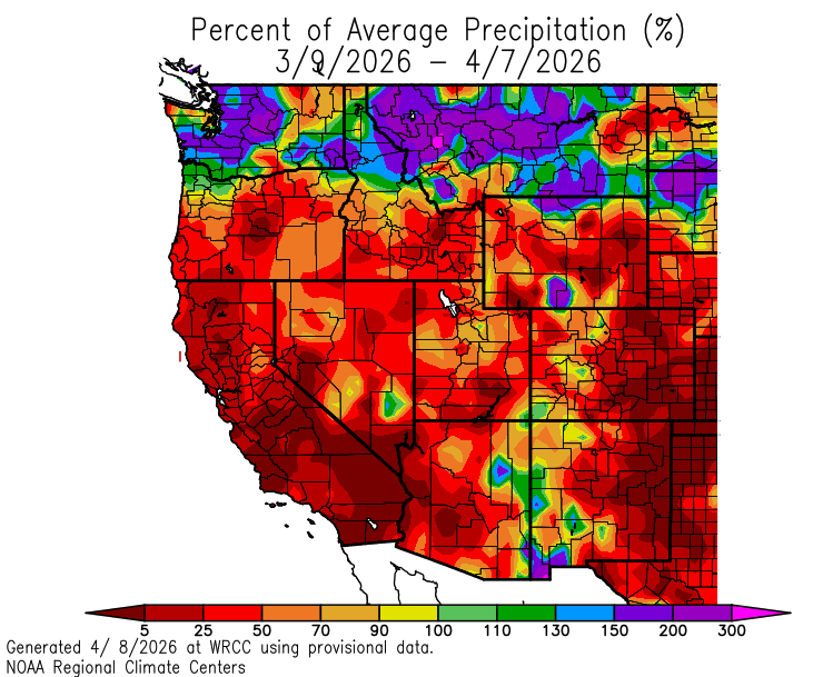
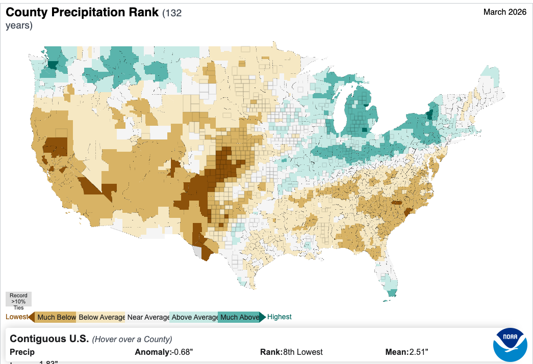
March precipitation was below average for nearly the entire region. Large areas of less than 50% of average March precipitation were observed in all three states with the least precipitation falling in eastern Colorado and eastern Wyoming. Record low March precipitation was observed in Baca, Bent, Gunnison, Hinsdale, Las Animas, Prowers, and San Juan Counties in Colorado. Water year precipitation varied with above average precipitation in northwestern Wyoming, southern Colorado and southern Utah, while much of the remainder of the region received 50-90% of average water year precipitation.

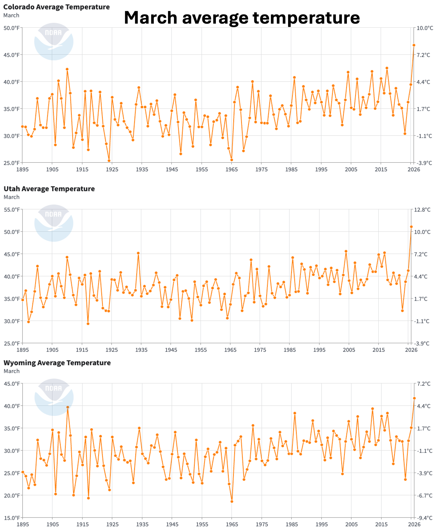
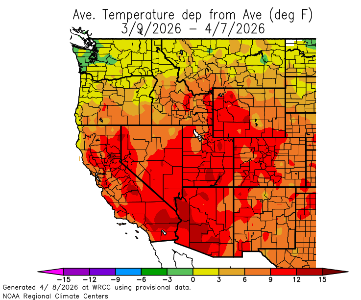
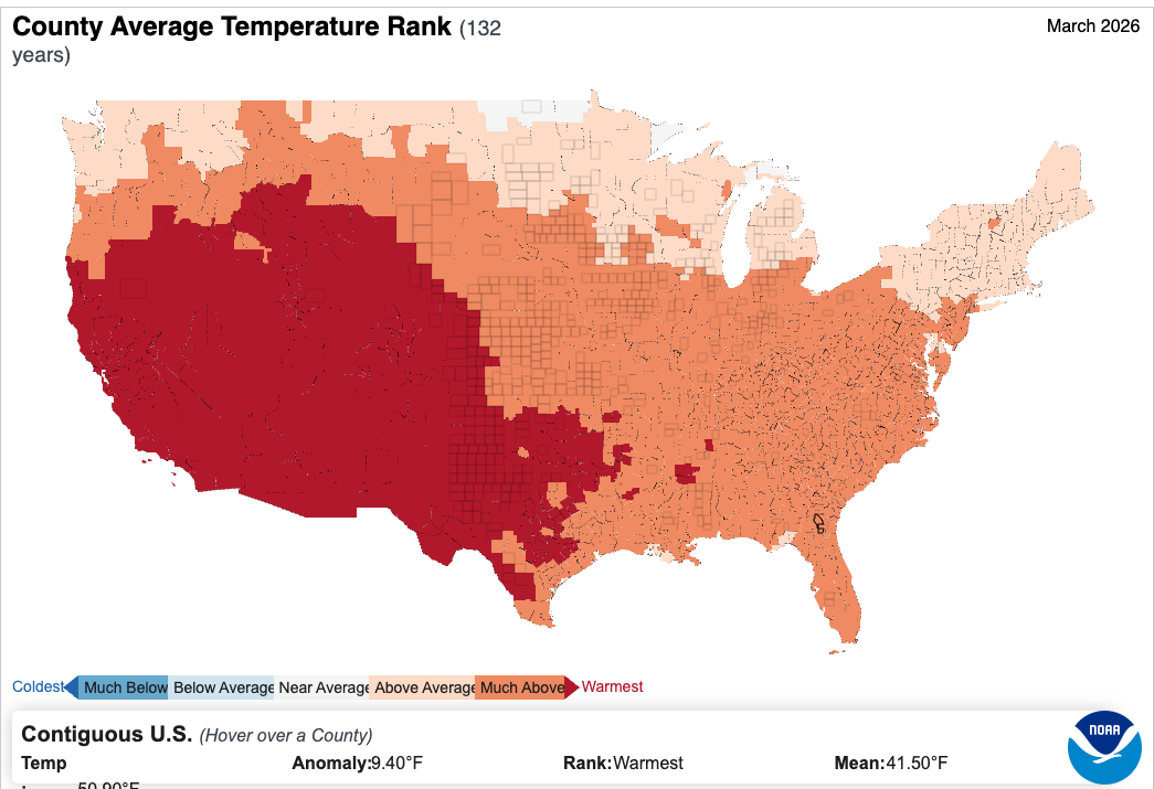
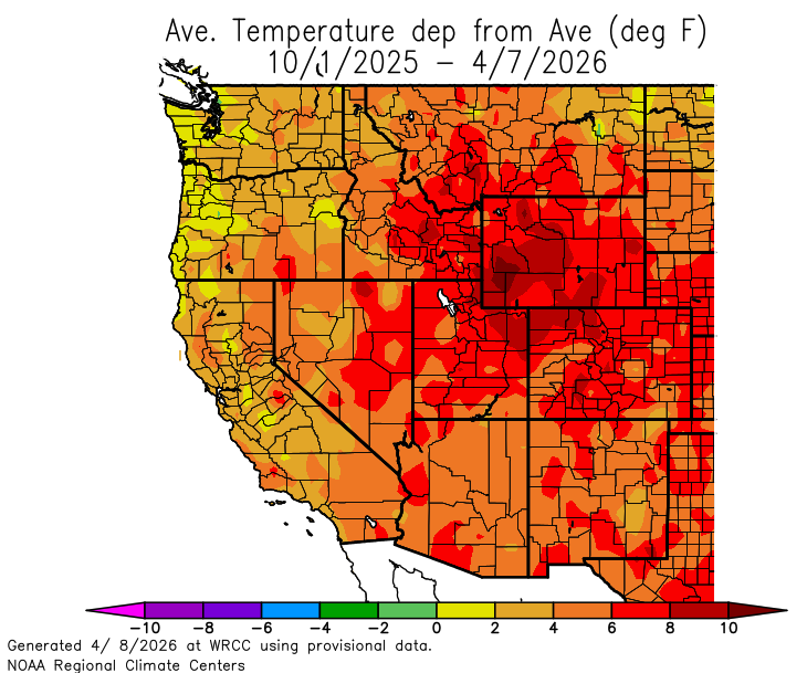
An extreme and widespread heat wave hit the region during March, and temperatures were 9-12 degrees above average for much of the region. Record high March temperatures were observed at the majority of locations in Colorado, Utah and Wyoming. All-time maximum March temperatures were set across the region with many locations recording higher temperatures than all-time April records.
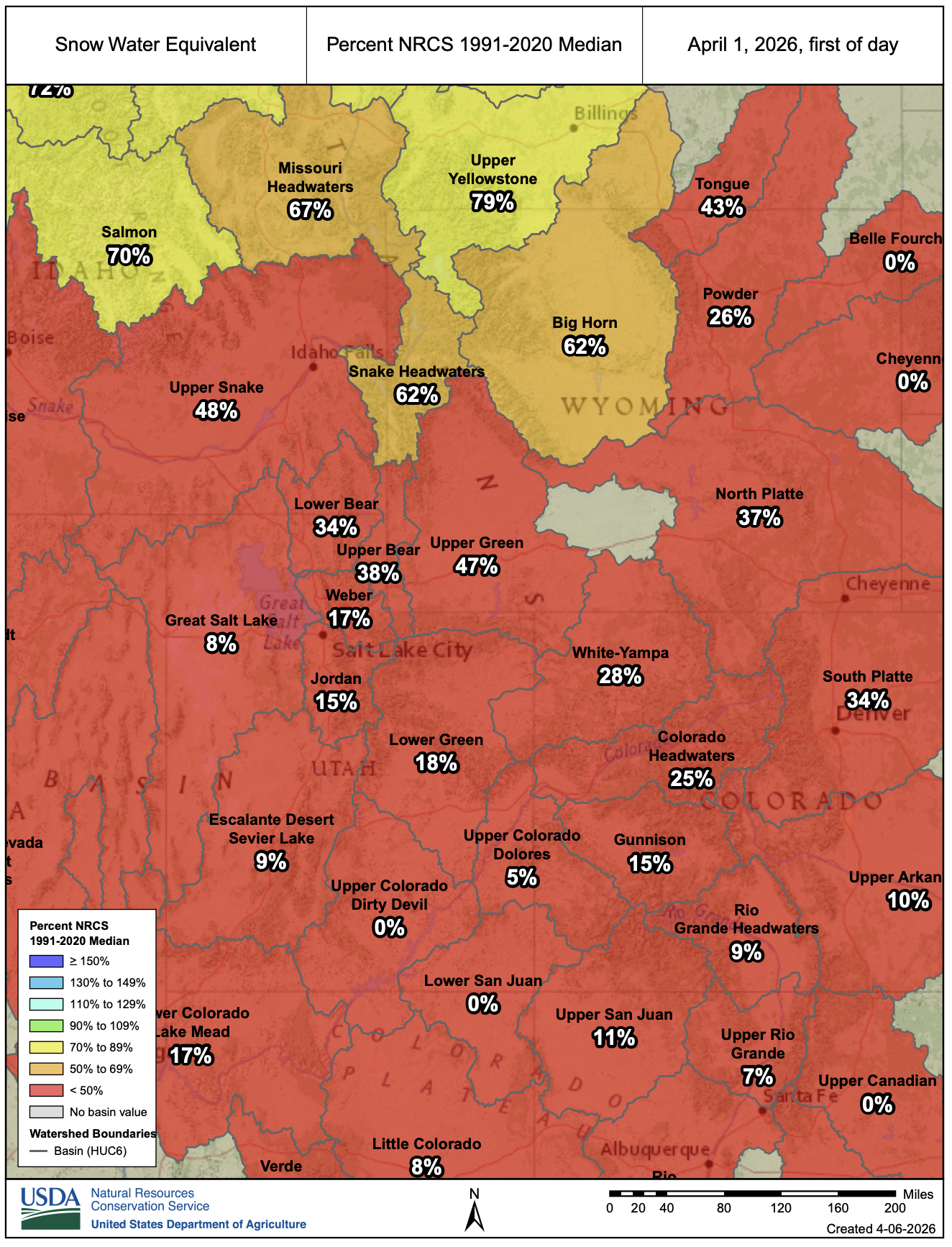
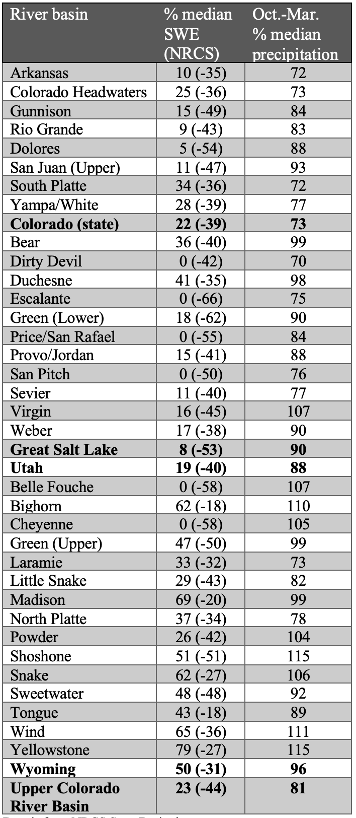
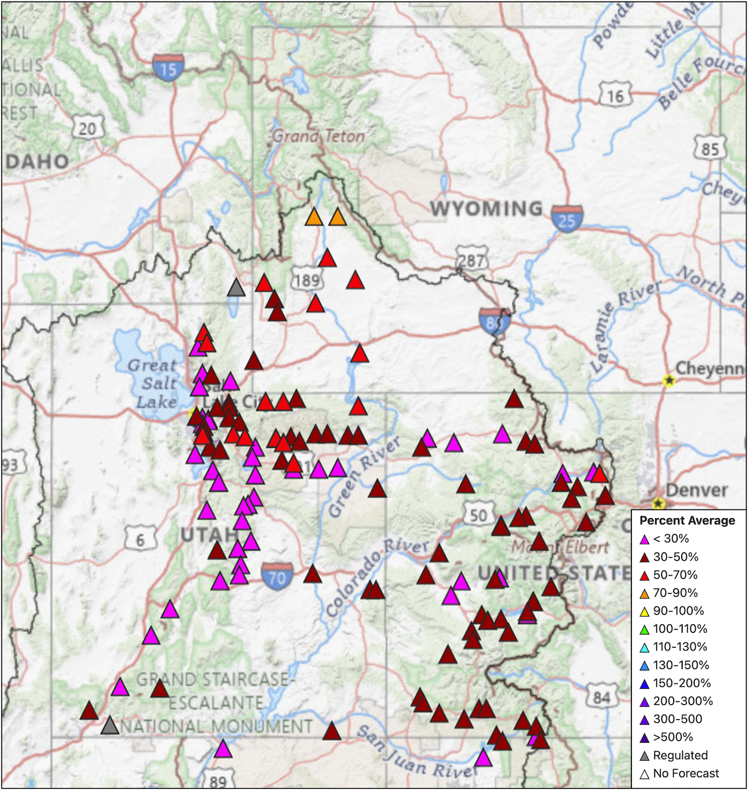
April 1 SWE conditions were record-low for all regional river basins, except those in northwestern Wyoming. On a statewide basis, record-low snowpack was observed in Colorado (24% median), Utah (22% median), and Wyoming (47% median). Snowpack in many southern Colorado and southern Utah watersheds has melted up to 65 days early, including the Upper Arkansas, Upper Dolores, and Upper Gunnison River basins in Colorado and the Dirty Devil, Escalante, Price, and San Pitch River basins in Utah. Record heat and low precipitation in March caused regional snowpack to peak nearly one month early. Typically, on April 1, only three of 213 Snotel sites in Colorado and two of 179 sites in Utah are melted out completely. On April 1, 2026, 36% of Snotel sites in Colorado, 60% of sites in Utah, and 28% of 196 sites in Wyoming were melted out. The snowpack in the Upper Colorado River basin peaked at a record low percent of median peak SWE and was 27% of median on April 1.
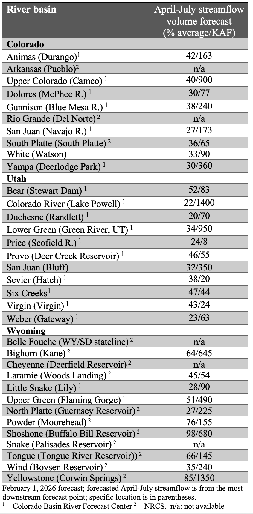
After low and early peak snowpack, annual streamflow volume forecasts were much below average on April 1. Annual streamflow volume forecasts ranged from 25-45% of average in Colorado, 20-55% of average in Utah and 25-100% of average in Wyoming. The inflow to Lake Powell is forecasted at 22% of average (1.4 million acre-feet). Regional streamflow forecasts were highest in the Snake and Missouri River basins of northern Wyoming where streamflow volume forecasts ranged from 65-100% of average.
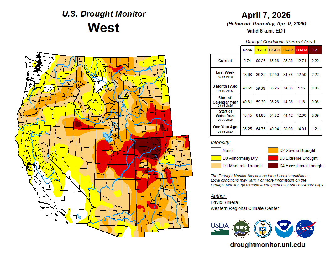
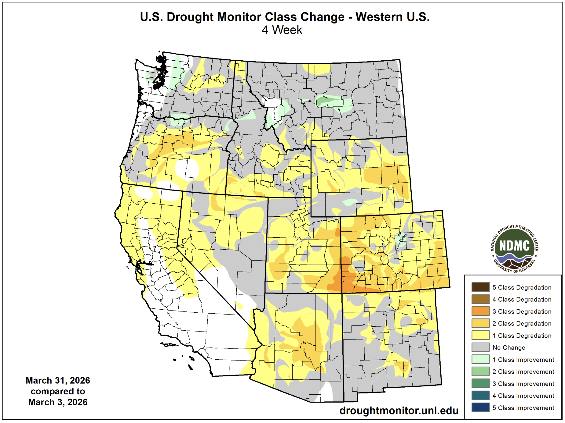
Regional drought intensified during March, and 93% of the region is experiencing severe drought conditions. Extreme drought conditions developed across a broad swath of Utah, western Colorado and southeastern Wyoming, and now cover 45% of the region. Drought in western Colorado worsened by two to three categories, and exceptional drought developed in northwestern Colorado where exceptional drought conditions coincided with the 137,000-acre Lee Fire in August 2025.
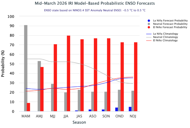
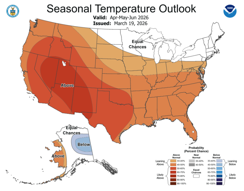
Pacific Ocean temperatures have warmed, and ENSO-neutral conditions (ocean temperatures are within 0.5ºC of average) now exist. Warming sea surface temperatures prompt an 80% probability of ENSO-neutral conditions during April-June, and NOAA issuing an El Niño Watch. ENSO forecasts predict a 60% chance of El Niño conditions developing by May-July and continuing through the end of 2026. There is a 25% chance of a very strong El Niño developing during the beginning of the 2027 water year. NOAA seasonal forecasts for April-June suggest an increased probability for below average precipitation and up to a 70% probability for above average temperatures.

Significant weather event: March heat wave. The heat wave during March 2026 was unprecedented in the western U.S. climate records since 1895. March 2026 average temperatures shattered records in Colorado (by 4.3ºF), Utah (by 5.5ºF), and Wyoming (by 2ºF). Amongst weather monitoring sites with at least 50 years of data, new March temperature records were set at 85% of sites in Colorado, 82% of sites in Utah and 60% of sites in Wyoming. In Utah, previous March temperature records were exceeded by 9.7ºF in Alta and 8.9ºF in Escalante. New all-time maximum March temperature records were set at 80-90% of weather sites in Colorado and Utah, and at 70% of sites in Wyoming. At many locations in Colorado and Utah, new March temperature records exceeded April maximum temperature records. Maximum March 2026 temperatures along the Front Range of Colorado reached the 90s with Burlington, CO recording 99ºF on March 26. Extremely high March temperatures were present across the majority of the West, and record statewide March temperatures were set in Arizona, California, Colorado, Idaho, Oklahoma, Nevada, New Mexico, Texas, Utah and Wyoming. A new record March temperature was also set for the contiguous U.S.